ROLE ICA VE KARTOGRAFIE.
|
|
|
- Barbra Holmes
- 5 years ago
- Views:
Transcription

1 ROLE ICA VE KARTOGRAFIE
2 Is Cartography s there is quite some confusion about the status, relevance and importance of Cartography w business debates amongst major software companies, in mass market applications related to new technologies such as mobile devices or in the mass media who are involved in making maps nowadays call themselves not a cartographer but rather something else to make growing amount of geodata and geoinformation accessible to human users means to package it in a way that it can be this was and is exactly the aim and contribution of cartography

3 Geovisualization (short for Geographic Visualization) isualization of spatial data refers to a set of tools and techniques supporting geospatial data analysis through the use of interactive visualization


4

5 Jack Dangermond: Geography is more important than ever Where it is cartography in geography?

6
7


8 Where is cartography in geography? in map making as fundament methods and media for coding geographic facts in map use as voluminous source of spatial information


9 production reading prototype analysis thinking interpretation

10 Georg Gartner Cartography is relevant Cartography is attractive Cartography is most contemporary


11 ICA survey on definitions: Q1. How should we call our domain? Q2. What characterises our domain? Q3. How would you define our domain? Q4. What keywords should be used in a definition of a map? Q5. Your own definition:
12 Q1. How should we call our domain? One keyword was requested the term cartography dominates (148 responses)

13 Q2. What characterises our domain? Three keywords were allowed The word map(s) dominates as the first keyword. Adding a second and a third keyword creates some nuance, but one could almost make out the short definition of cartography given above! Word cloud based on the first keyword first two keywords all three keywords
 word")
14 Q3. How would you define our domain? Responses correspond well with the third (right) word cloud from the Q2.

15 Q4. What keywords should be used in a definition of a map? Five keywords were allowed two word clouds were created Word cloud based on the first keyword Word cloud based on all five keywords

16 Q5. Your own definition: 120 definitions provided
17 Fieldsof Cartography 1. Science (including technology) the development of the scientific and technological basis of Cartography, GI science and geoinformatics 2. Education the development and promotion, through education at all levels 3. Professional Practice the provision of support for professionals: a) those who describe themselves as professionally active as their main occupation - in a specific area of Cartography and GI science b) those who use systems or procedures from Cartography and GI science as part of their professional activity, e.g. environmental managers, utility managers, planners 4. Society (social and organisational) the promoting applications of Cartography and GIScience in any area that can be beneficial to Society in general 5. Arts the aspects of design and aesthetics in cartographic artefacts


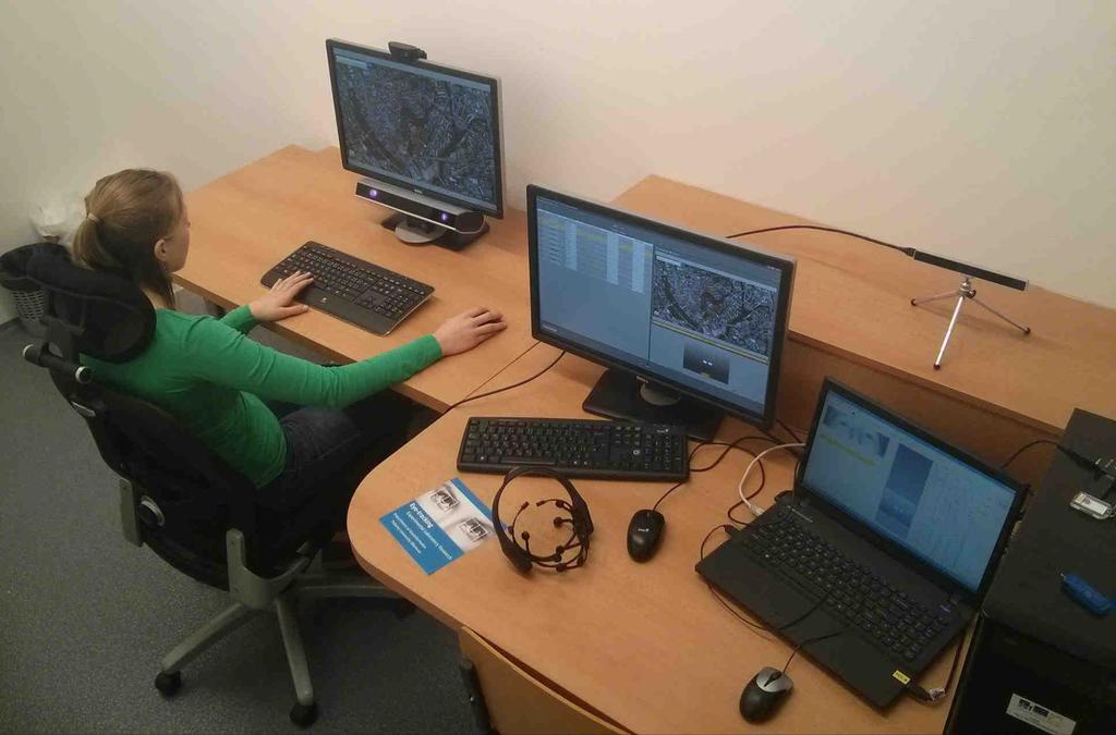
18


19
20 ICA commissions Art and Cartography Atlases Cartographic Heritage into the Digital Cartography and Children Cartography in Early Warning and Crisis Management Cognitive Visualization Education and Training Generalisation and Multiple Representations Geospatial Analysis and Modeling GI for Sustainability History of Cartography Location Based Services Map Design Map Production Map Projections Maps and Graphics for Blind Maps and the Internet Mountain Cartography Open Source GeoSpatial Technologies Planetary Cartography SDI and Standards Sensor-driven Mapping Topographic Mapping Toponymy Ubiquitous Mapping Use, User and Usability Issues Visual Analytics
21 EYE TRACKING

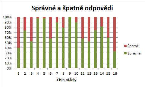
22 Eye- jedna z studies Pupil and Corneal reflexion - spektru
23 -trackingu Human Computer Interaction (HCI) Marketing Design Biometrika Lingvistika dyslexie, dysgrafie Zoologie


24


25
26 Eye- SMI RED 250 -tracker EyeTribe Tracker low-cost eye-tracker EEG Emotiv EPOC Logitech -


27


28 -tracking dat


29

30 Experiment Shading-Mapy.cz H2: Z hlediska vhodnosti budou respondenti v H3: Z hlediska estetiky budou respondenti v

31 Experiment Shading-Mapy.cz
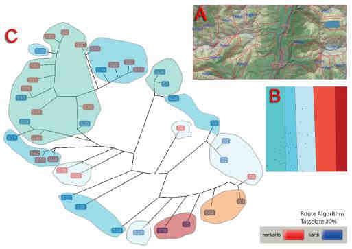
32 Experiment Shading-Mapy.cz Trial Duration Fixation Count Fixation Duration Scanpath Length Trial 1 0,069 0,058 0,650 0,014 Trial 2 0,039 0,031 0,004 0,019 Trial 3 0,022 0,028 0,080 0,019 Trial 4 0,029 0,037 0,357 0,024 Trial 5 0,879 0,922 0,330 0,837 Trial 6 <0,001 <0,001 0,078 <0,001

33 Experiment Shading-Mapy.cz : 13a - "Pelousek" 13b - "Horka" b - "Hubenice"

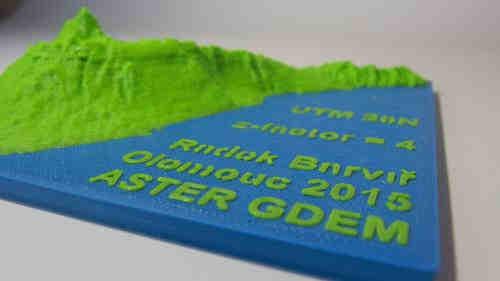
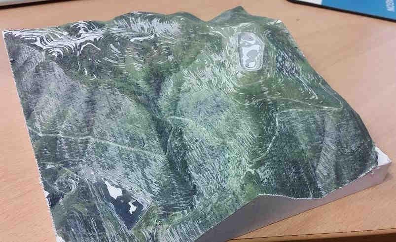
34 Experiment 3D Cities H1: Z hlediska estetiky budou respondenti v H2: Z hlediska vhodnosti budou respondenti v mapou


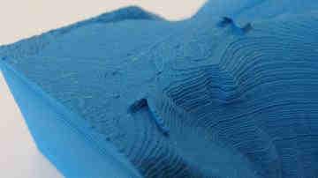
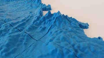
35

36 Experiment 3D Cities : v mapa, v


37
38
39

40 : Najdi trasu z bodu A do bodu B Kartodiagram FlowMap

41
42 3D TISK V KARTOGRAFII
43 3D tisk na KGI v utyflomap t 3D tisk tyflomap automatizace tvorby tyflomap ttyflomap kombinace DEM a tyflomap
 nebo 90 W (tisk ABS), kg")
44 cm 3 (200x200x200 mm) USB Velikost trysky 0,4 mm - PLA, ABS, PET, HIPS, Flex PP, Ninjaflex, Laywood, Laybrick, Nylon, Bamboofill, Bronzefill, ASA, T-Glase, filamenty s Velikost kroku v X/Y ose - 0,01 mm 50 W (tisk PLA) nebo 90 W (tisk ABS), kg tisk


45 tyflomap


46 Tenerife


47 POPISY NA MODELU


48


49 projektor dotyk interaktivity 49


50 TANGIBLE LANDSCAPES Microsoft KINECT k projektor GRASS GIS 50


51 MCOR IRIS jako 95% p t v1 milion barev v pro kartografii 51


52 52
The Relevance of Cartography. Dubai 2015, Georg Gartner
 The Relevance of Cartography Dubai 2015, Georg Gartner Where are we? Data! Data? We are not short of data Technologies! Technologies? We are not short of technologies Data-driven and technology-driven
Research Group Cartography
 Research Group Cartography Research Group Cartography Towards supporting wayfinding LBS components 1. Mobile devices 2. Communication Network 3. Positioning Component 4. Service and Application Provider
Web 2.0, map production & publishing and geospatial information dissemenation
 Web 2.0, map production & publishing and geospatial information dissemenation Professor William Cartwright President, International Cartographic Association William Cartwright 18th UNRCC for Asia and the
Maps and sustainability
 Maps and sustainability The International Map Year [ mapyear.org ] Menno-Jan Kraak Maps Cartography and maps A map is a visual representation of an environment maps tell stories maps invite maps show patterns
The 2010 Census Successful Because of GIS
 The 2010 Census Successful Because of GIS Timothy F. Trainor Chief, Geography Division, U.S. Census Bureau Vice President, International Cartographic Association Establishing the Framework of the Operation
Cartography and Children Commission: Proposals for the next 4 years
 International Cartographic Association Cartography and Children Commission: Proposals for the next 4 years José Jesús Reyes Nuñez Eötvös Loránd University Dept. of Cartography and Geoinformatics Budapest,
SCORE. INSPIRE-ing VOLUNTEERED GEOGRAPHIC INFORMATION: CASES FROM SOUTH EAST EUROPE. mashing up community and spatial technology
 mashing up community and spatial technology INSPIRE-ing VOLUNTEERED GEOGRAPHIC INFORMATION: CASES FROM SOUTH EAST EUROPE Spatial Consulting and Research Group integrating geospatial and organizational
3D MAPS SCALE, ACCURACY, LEVEL OF DETAIL
 26 th International Cartographic Conference August 25 30, 2013 Dresden, Germany 3D MAPS SCALE, ACCURACY, LEVEL OF DETAIL Prof. Dr. Temenoujka BANDROVA Eng. Stefan BONCHEV University of Architecture, Civil
GLOBAL SPATIAL DATA INFRASTRUCTURES and. International Cartographic Association.
 FIG-InterGeo, 11 October 2006 Munich, Germany GLOBAL SPATIAL DATA INFRASTRUCTURES and International Cartographic Association Milan KONECNY President; International Cartographic Association(ICA) Vice-President;
Basics of GIS reviewed
 Basics of GIS reviewed Martin Breunig Karlsruhe Institute of Technology martin.breunig@kit.edu GEODETIC INSTITUTE, DEPARTMENT OF CIVIL ENGINEERING, GEO AND ENVIRONMENTAL SCIENCES, CHAIR IN GEOINFORMATICS
USER PREFERENCES IN IMAGE MAP USING
 USER PREFERENCES IN IMAGE MAP USING A. Vondráková *, V. Vozenilek Department of Geoinformatics, Faculty of Science, Palacký University Olomouc, 17. listopadu 50, 771 46 Olomouc, Czech Republic alena.vondrakova@upol.cz,
Themes for Geomatics Conference. Geodesy Themes
 Themes for Geomatics Conference Geodesy Themes Geodynamics o Modeling the Deformation of the Earth s Crust o Recent Advances in Geometric Approaches to Deformation Analysis o Monitoring Systems (Sensors
Laboratory on Geoinformatics and Cartography
 Research on usability testing and cognitive issues of cartographic visualizations in the context of different groups of users Milan Konečný Čeněk Šašinka, Zbyněk Štěrba Masaryk University, Brno, CZ 19.
Future Proofing the Provision of Geoinformation: Emerging Technologies
 Future Proofing the Provision of Geoinformation: Emerging Technologies An Exchange Forum with the Geospatial Industry William Cartwright Chair JBGIS Second High Level Forum on Global Geospatial Information
What is GIS? G: Geographic, Geospatial, Geo
 GEOG 488/588: GIS I Introduction Instructor: Geoffrey Duh TA: David Graves What is GIS? G: Geographic, Geospatial, Geo Alternatives: Spatial Information Systems, Land Information Systems Geography diverse
geographic patterns and processes are captured and represented using computer technologies
 Proposed Certificate in Geographic Information Science Department of Geographical and Sustainability Sciences Submitted: November 9, 2016 Geographic information systems (GIS) capture the complex spatial
June 19 Huntsville, Alabama 1
 June 19 Huntsville, Alabama 1 Real-Time Geospatial Data: The Fusion of PI and ArcGIS Enabling Smarter Facilities Management OSIsoft and Esri Mapping and Location Analytics Platform Supporting Your Use
Cartographic and Geospatial Futures
 Cartographic and Geospatial Futures 1. Web Cartography, WebGIS, & Virtual Globes--New Roles for Maps, GIS, and GIS professionals 2. Map Mashups, the Neo Neo-geography Movement, & Crowd-sourcing Geospatial
Corporate. Information. Railway Infrastructure Administrator. Year indracompany.com
 geospatial and mobility Corporate Geographic Information System of ADIF Railway Infrastructure Administrator. Year 2009-2010 Corporate Geographic Information System of ADIF ADIF. Spanish Administrator
Maanmittauspäivät 2018 Helsinki Maanmittauspäivät 2018 The Danish initiatives regarding open and free basic data including effect studies
 Maanmittauspäivät 2018 The Danish initiatives regarding open and free basic data including effect studies 22.03.2018 Agenda 1. Intro overall frame / selfie 2. Data Infrastructure 3. The Danish Digital
Geog183: Cartographic Design and Geovisualization Spring Quarter 2017 Lecture 14: Visual analytics and data exploration
 Geog183: Cartographic Design and Geovisualization Spring Quarter 2017 Lecture 14: Visual analytics and data exploration Data exploration Inheritor of the statistical graphic heritage Focus on new methods
GIS at UCAR. The evolution of NCAR s GIS Initiative. Olga Wilhelmi ESIG-NCAR Unidata Workshop 24 June, 2003
 GIS at UCAR The evolution of NCAR s GIS Initiative Olga Wilhelmi ESIG-NCAR Unidata Workshop 24 June, 2003 Why GIS? z z z z More questions about various climatological, meteorological, hydrological and
Esri and GIS Education
 Esri and GIS Education Organizations Esri Users 1,200 National Government Agencies 11,500 States & Regional Agencies 30,800 Cities & Local Governments 32,000 Businesses 8,500 Utilities 12,600 NGOs 11,000
EuroSDR (European Spatial Data Research)
") EuroSDR (European Spatial Data Research) ROLLING RESEARCH PLAN 2015-2018 EuroSDR Secretariat Public Governance Institute KU Leuven Parkstraat 45 bus 3609 3000 Leuven Belgium Tel.: +32 16 32 31 80 Fax:
EuroSDR (European Spatial Data Research) ROLLING RESEARCH PLAN 2015-2018 EuroSDR Secretariat Public Governance Institute KU Leuven Parkstraat 45 bus 3609 3000 Leuven Belgium Tel.: +32 16 32 31 80 Fax:
GED 554 IT & GIS. Lecture 6 Exercise 5. May 10, 2013
 GED 554 IT & GIS Lecture 6 Exercise 5 May 10, 2013 Free GIS data sources ******************* Mapping numerical data & Symbolization ******************* Exercise: Making maps for presentation GIS DATA SOFTWARE
Specifying of Requirements for Spatio-Temporal Data in Map by Eye-Tracking and Space-Time-Cube
 Specifying of Requirements for Spatio-Temporal Data in Map by Eye-Tracking and Space-Time-Cube Stanislav Popelka, Vít Voženílek Palacký University, Olomouc, Czech Republic ABSTRACT One of the most objective
Welcome to GST 101: Introduction to Geospatial Technology. This course will introduce you to Geographic Information Systems (GIS), cartography,
, cartography,") Welcome to GST 101: Introduction to Geospatial Technology. This course will introduce you to Geographic Information Systems (GIS), cartography, remote sensing, and spatial analysis through a series of
Welcome to GST 101: Introduction to Geospatial Technology. This course will introduce you to Geographic Information Systems (GIS), cartography, remote sensing, and spatial analysis through a series of
1. Pass GE1101E Geographical Journeys: Exploring World Environments. This will be counted towards the Faculty Core or UE requirements.
 H Geography At the Department of Geography, students are encouraged to develop a deeper and more critical understanding of both physical and human environments. Students will acquire knowledge, skills
Exploring the Influence of Color Distance on the Map Legibility
 Exploring the Influence of Color Distance on the Map Legibility Alžběta Brychtová, Stanislav Popelka Department of Geoinformatics, Faculty of Science, Palacký University in Olomouc, Czech Republic Abstract.
Open Contextual Cartographic Visualization
 J. Kozel 223 Open Contextual Cartographic Visualization Jiří Kozel Laboratory on Geoinformatics and Cartography, Insitute of Geography, Faculty of Science, Masaryk University, Czech Republic jirikozel@centrum.cz
CARTOGRAPHY in a Web World
 CARTOGRAPHY in a Web World Nationale GI Minor BAREND KÖBBEN b.j.kobben@utwente.nl Agenda Short introduction to ITC and me Cartography: communicating spatial data Changing GIS & Cartography technology:
A decade of geoinformation sharing at ETH Zurich
 A decade of geoinformation sharing at ETH Zurich Ionuț Iosifescu-Enescu, Cristina Iosifescu-Enescu, Nadia H. Panchaud, Angeliki Tsorlini, Lorenz Hurni {iosifescu,ciosifescu,nadia.panchaud,atsorlini,lhurni}@ethz.ch
GEOMATICS. Shaping our world. A company of
 GEOMATICS Shaping our world A company of OUR EXPERTISE Geomatics Geomatics plays a mayor role in hydropower, land and water resources, urban development, transport & mobility, renewable energy, and infrastructure
CARTOGRAPHIC SOCIETY OF THE SLOVAK REPUBLIC ACTIVITIES National Report for the 14 th General Assembly of the ICA
 CARTOGRAPHIC SOCIETY OF THE SLOVAK REPUBLIC ACTIVITIES 2003-2006 National Report for the 14 th General Assembly of the ICA Bratislava 2007 CARTOGRAPHIC SOCIETY OF THE SLOVAK REPUBLIC CARTOGRAPHIC SOCIETY
Planning in a Geospatially Enabled Society. Michael F. Goodchild University of California Santa Barbara
 Planning in a Geospatially Enabled Society Michael F. Goodchild University of California Santa Barbara What is a geospatially enabled society? Knowing the locations of all points of interest and their
Your web browser (Safari 7) is out of date. For more security, comfort and. the best experience on this site: Update your browser Ignore
 is out of date. For more security, comfort and. the best experience on this site: Update your browser Ignore") Your web browser (Safari 7) is out of date. For more security, comfort and Activityengage the best experience on this site: Update your browser Ignore Introduction to GIS What is a geographic information
Your web browser (Safari 7) is out of date. For more security, comfort and Activityengage the best experience on this site: Update your browser Ignore Introduction to GIS What is a geographic information
Chris Rizos (IAG), Chair William Cartwright (ICA), immediate past Chair
, Chair William Cartwright (ICA), immediate past Chair") Chris Rizos (IAG), Chair William Cartwright (ICA), immediate past Chair Global Spatial Data Infrastructure (GSDI) Association IEEE Geoscience & Remote Sensing Society (IEEE-GRSS) International Association
Chris Rizos (IAG), Chair William Cartwright (ICA), immediate past Chair Global Spatial Data Infrastructure (GSDI) Association IEEE Geoscience & Remote Sensing Society (IEEE-GRSS) International Association
ArcGIS for Desktop. ArcGIS for Desktop is the primary authoring tool for the ArcGIS platform.
 ArcGIS for Desktop ArcGIS for Desktop ArcGIS for Desktop is the primary authoring tool for the ArcGIS platform. Beyond showing your data as points on a map, ArcGIS for Desktop gives you the power to manage
GRADUATE CERTIFICATE PROGRAM
 GRADUATE CERTIFICATE PROGRAM GEOGRAPHIC INFORMATION SCIENCES Department of Geography University of North Carolina Chapel Hill Conghe Song, Director csong @email.unc.edu 919-843-4764 (voice) 919-962-1537
METHODS FOR STATISTICS
 DYNAMIC CARTOGRAPHIC METHODS FOR VISUALIZATION OF HEALTH STATISTICS Radim Stampach M.Sc. Assoc. Prof. Milan Konecny Ph.D. Petr Kubicek Ph.D. Laboratory on Geoinformatics and Cartography, Department of
ArcGIS. for Server. Understanding our World
 ArcGIS for Server Understanding our World ArcGIS for Server Create, Distribute, and Manage GIS Services You can use ArcGIS for Server to create services from your mapping and geographic information system
Better Topographic Map Production Using ArcGIS. A Comprehensive Solution for Mapping Organizations
 Better Topographic Map Production Using ArcGIS A Comprehensive Solution for Mapping Organizations The World Is Always Changing As a member of a national mapping organization, you know this is true. You
From map use research to usability research in geo-information processing
 Corné van Elzakker From map use research to usability research in geo-information processing INTERNATIONAL INSTITUTE FOR GEO-INFORMATION SCIENCE AND EARTH OBSERVATION International Institute for Geo-Information
Cognitive Engineering for Geographic Information Science
 Cognitive Engineering for Geographic Information Science Martin Raubal Department of Geography, UCSB raubal@geog.ucsb.edu 21 Jan 2009 ThinkSpatial, UCSB 1 GIScience Motivation systematic study of all aspects
What is special about geospatial? or A discipline in constant transition
 What is special about geospatial? or A discipline in constant transition Marinos Kavouras NTUA Ensuring the Rapid Response to Change, Ensuring the Surveyor of Tomorrow FIG 2015 Several paradigm shifts
THE RESEARCH GOALS AND THE RESEARCH STRATEGY OF THE EuroSDR
 THE RESEARCH GOALS AND THE RESEARCH STRATEGY OF THE EuroSDR Martien Molenaar Vice President of EuroSDR International Institute for geo-information Science and Earth Observation (ITC) Enschede, The Netherlands
Creating a Geodatabase for Tourism Research in the Sultanate of Oman
 224 Creating a Geodatabase for Tourism Research in the Sultanate of Oman Marius HERRMANN 1 and Adrijana CAR 2 1 Dept. of Geography and Geology, University of Salzburg/Austria marius.herrmann@stud.sbg.ac.at
ADDING METADATA TO MAPS AND STYLED LAYERS TO IMPROVE MAP EFFICIENCY
 ADDING METADATA TO MAPS AND STYLED LAYERS TO IMPROVE MAP EFFICIENCY B. Bucher, S. Mustière, L. Jolivet, J. Renard IGN-COGIT, Saint Mandé, France Introduction Standard APIs to visualise geodata on information
XXIII CONGRESS OF ISPRS RESOLUTIONS
 XXIII CONGRESS OF ISPRS RESOLUTIONS General Resolutions Resolution 0: Thanks to the Czech Society commends: To congratulate The Czech Society, its president and the Congress Director Lena Halounová, the
Cartographic Workshop
 http://lazarus.elte.hu/cet/ Cartographic Workshop One of the roles of the ICA, Commission on Education and Training is to provide member nations with cartographic workshop experiences that enhance the
US National Spatial Data Infrastructure A Spatial Framework for Governance and Policy Development to Enable a Location-Based Digital Ecosystem
 GeoPlatform Workshop 7 Dec 2016, Department of the Interior Washington, D.C. US National Spatial Infrastructure A Spatial Framework for Governance and Policy Development to Enable a Location-Based Digital
The Third UN-GGIM-AP Plenary Meeting. ICA Report as Liaison Organization of UN-GGIM-AP. Bali Indonesia 10 November 2014
 The Third UN-GGIM-AP Plenary Meeting ICA Report as Liaison Organization of UN-GGIM-AP Bali Indonesia 10 November 2014 Sukendra Martha Vice President International Cartographic Association (ICA) Outline
Blind Mouse on Mars and on the Moon a Map Game for Disseminating Planetary Topographic Knowledge
 Blind Mouse on Mars and on the Moon a Map Game for Disseminating Planetary Topographic Knowledge http://terkeptar.elte.hu/em Mátyás Gede Henrik Hargitai Eszter Simonné Dombóvári Gede, Simonné Dombóvári,
Manual of Digital Earth
 V8.0 March 27, 2018 International Society for Digital Earth Manual of Digital Earth (Tentative Title) OUTLINE Foreword Chapter 1 Understanding Digital Earth 1.1 Origins and Precursors of Digital Earth
USING THE OPEN WEB PLATFORM FOR THEMATIC MAPPING IN A WEBSERVICE ENVIRONMENT. BAREND KÖBBEN
 USING THE OPEN WEB PLATFORM FOR THEMATIC MAPPING IN A WEBSERVICE ENVIRONMENT BAREND KÖBBEN kobben@itc.nl b.j.kobben@utwente.nl a story about different worlds... National GeoData Infrastructure National
CARTOGRAPHY in a Web World
 CARTOGRAPHY in a Web World SENSE Research Cluster XIII meeting: Concepts and tools for spatial data visualization BAREND KÖBBEN kobben@itc.nl b.j.kobben@utwente.nl Agenda Short introduction to ITC and
State and National Standard Correlations NGS, NCGIA, ESRI, MCHE
 GEOGRAPHIC INFORMATION SYSTEMS (GIS) COURSE DESCRIPTION SS000044 (1 st or 2 nd Sem.) GEOGRAPHIC INFORMATION SYSTEMS (11, 12) ½ Unit Prerequisite: None This course is an introduction to Geographic Information
Republic of Korea in Czech atlases and geography textbooks. Jan Ptacek, Kartografie Praha
 Republic of Korea in Czech atlases and geography textbooks Jan Ptacek, Kartografie Praha Schools in the Czech republic Primary schools 9 years (age 6 15) Geography from the age of 11, only one year of
PaikkaOppi - a Virtual Learning Environment on Geographic Information for Upper Secondary School
 PaikkaOppi - a Virtual Learning Environment on Geographic Information for Upper Secondary School Jaakko Kähkönen*, Lassi Lehto*, Juha Riihelä** * Finnish Geodetic Institute, PO Box 15, FI-02431 Masala,
Exploit your geodata to enable smart cities and countries
 Exploit your geodata to enable smart cities and countries Carsten Rönsdorf, Head of Advisory Services Middle East Practice Manager Future Cities, standards and 3D 24 November 2014 Importance of Standards
33 par&cipants 16 countries 5 sessions 16 presenta&ons
 33 par&cipants 16 countries 5 sessions 16 presenta&ons Collection development, facts, figures and trends DUTCH EXPERIENCES rich tradition of institutional map collecting, dating back already to the 16th
6th ICA Mountain Cartography Workshop Lenk/Switzerland. Cartographic Design Issues Utilizing Google Earth for Spatial Communication
 6th ICA Mountain Cartography Workshop Lenk/Switzerland Cartographic Design Issues Utilizing Google Earth for Spatial Communication Department of Geography and Regional Research Karel Kriz University Vienna,
GIS Building Communities beyond National Borders (Building Successful Spatial Data Infrastructures) Nick Land, ESRI Europe
 Nick Land, ESRI Europe") GIS Building Communities beyond National Borders (Building Successful Spatial Data Infrastructures) Nick Land, ESRI Europe UK worst flooding in the last 60 years 350,000 households without drinking water
GIS Building Communities beyond National Borders (Building Successful Spatial Data Infrastructures) Nick Land, ESRI Europe UK worst flooding in the last 60 years 350,000 households without drinking water
Remote Sensing and EO activities at the University of Turku
 Remote Sensing and EO activities at the University of Turku Niina Käyhkö Associate Professor Department of Geography and Geology GEO meeting/syke May 23rd, 2018 Geospatial competence at the University
2013 AND 2025 THE FUTURE OF GIS
 THE FUTURE OF GIS 2013 AND 2025 What is the state of geospatial computing today? What are the issues today? Unresolved problems What will geospatial computing be like in 2025? What issues will be of concern
Belfairs Academy GEOGRAPHY Fundamentals Map
 YEAR 12 Fundamentals Unit 1 Contemporary Urban Places Urbanisation Urbanisation and its importance in human affairs. Global patterns of urbanisation since 1945. Urbanisation, suburbanisation, counter-urbanisation,
Joanne N. Halls, PhD Dept. of Geography & Geology David Kirk Information Technology Services
 Joanne N. Halls, PhD Dept. of Geography & Geology David Kirk Information Technology Services Geographic Information Systems manage and analyze data to solve spatial problems. Real World Abstraction Analysis
GIS Applications on Environmental Education in Taiwan
 GIS Applications on Environmental Education in Taiwan Track: Education Authors: Yu-Chen Lai, Mei-Ling Yeh, Tien-Yin Chou Abstract GIS is a perfect vehicle to deliver environmental knowledge and spatial
Where to find the Young Ones. Paula Dijkstra
 Where to find the Young Ones Paula Dijkstra paula.dijkstra@kadaster.nl Cadastre, Land Registry and Mapping Agency Cables and pipelines 2 The young ones, Darling we're the young ones, And young ones shouldn't
Cartographical Challenges in Disaster Risk Reduction Efforts. Milan KONECNY ICA CCEW&CM Masaryk University, Brno, Czech Republic
 Cartographical Challenges in Disaster Risk Reduction Efforts Milan KONECNY ICA CCEW&CM Masaryk University, Brno, Czech Republic Selce, September 8 2017 CONTENT 1. Big and Smart Geospatial Data Concepts
Geospatial capacity-building, best applications and practices**
 23 May 2005 English only Eighth United Nations Regional Cartographic Conference for the Americas New York, 27 June-1 July 2005 Item 8 (d) of the provisional agenda* Reports on achievements in geographic
The Underutilization of GIS & How to Cure It. Adam Carnow Esri
 The Underutilization of GIS & How to Cure It Adam Carnow Esri What is GIS? A framework to organize, communicate, and understand the science of our world Business Intelligence (BI) is the set of
Pathways. Pathways through the Geography Major
 Pathways through the Major majors may structure their course selections around a sub-field of. Pathways are suggestions for classes in, in related disciplines, and skills training. Each pathway includes
The International Cartographic Association and EuroSDR. Menno-Jan Kraak
 The International Cartographic Association and EuroSDR Menno-Jan Kraak The International Cartographic Association and EuroSDR ICA as organization ICA at work: current focus Cooperation with EuroSDR Organization
AP Human Geography Chapter 1: Thinking Geographically Key Issue 1: How do Geographers describe where things are?
 AP Human Geography Chapter 1: Thinking Geographically Key Issue 1: How do Geographers describe where things are? Studying Human Geography Physical Geography Physical geography deals with Earth s natural
TRAITS to put you on the map
 TRAITS to put you on the map Know what s where See the big picture Connect the dots Get it right Use where to say WOW Look around Spread the word Make it yours Finding your way Location is associated with
EYE-TRACKING TESTING OF GIS INTERFACES
 Geoinformatics EYE-TRACKING TESTING OF GIS INTERFACES Bc. Vaclav Kudelka Ing. Zdena Dobesova, Ph.D. Department of Geoinformatics, Palacký University, Olomouc, Czech Republic ABSTRACT Eye-tracking is currently
Programme Study Plan
 Faculty of Social and Life Sciences Programme Study Plan Geographic Information Systems Programme Code: Programme Title: TGLIT Engineering: Surveying Technology and Geographical IT Credits: 180 Programme
Introducing Spatial IQ
 Introducing Spatial IQ TM A Managed Services Approach to Enterprise GIS Let AppGeo be your bridge to the future. The Magic of Location AppGeo believes that information plus geography changes how we work
Techniques for Science Teachers: Using GIS in Science Classrooms.
 Techniques for Science Teachers: Using GIS in Science Classrooms. After ESRI, 2008 GIS A Geographic Information System A collection of computer hardware, software, and geographic data used together for
AFYON KOCATEPE UNIVERSITY GRADUATE SCHOOL OF NATURAL AND APPLIED SCIENCES DEPARTMENT OF INTERNET AND INFORMATION TECHNOLOGY MANAGEMENT
 FIRST YEAR FIRST SEMESTER NAME CREDIT* INT-5501 DIRECTED FIELD STUDIES C 8 0 8 0 9 INT-5601 THESIS PREPARATION C 0 1 1 0 1 ELECTIVE E 3 0 3 3 5 ELECTIVE E 3 0 3 3 5 ELECTIVE E 3 0 3 3 5 ELECTIVE E 3 0
3D CARTOGRAPHY IN URBAN ENVIRONMENTS FOR MUNICIPAL ADMINISTRATIONS
 3D CARTOGRAPHY IN URBAN ENVIRONMENTS FOR MUNICIPAL ADMINISTRATIONS Andreea Calugaru Andreea Calugaru, Paula Florina Anca, Alexandru Vasile a.esri Romania 8 Roma, Bucharest, Romania 011774 0212339086, 0212339088,
COURSE INTRODUCTION & COURSE OVERVIEW
 week 1 COURSE INTRODUCTION & COURSE OVERVIEW topics of the week Instructor introduction Students introductions Course logistics Course objectives Definition of GIS The story of GIS introductions Who am
Towards Geographic Information Observatories
 Towards Geographic Information Observatories Krzysztof Janowicz 1, Benjamin Adams 2, Grant McKenzie 1, and Tomi Kauppinen 3,4 1 University of California, Santa Barbara, USA 2 The University of Auckland,
Land Use in the context of sustainable, smart and inclusive growth
 Land Use in the context of sustainable, smart and inclusive growth François Salgé Ministry of sustainable development France facilitator EUROGI vice president AFIGéO board member 1 Introduction e-content+
Current trends in visualisation of geospatial data with special reference to cartography (Invited Paper)
") Current trends in visualisation of geospatial data with special reference to cartography (Invited Paper) Menno-Jan Kraak ITC, Department of GeoInformation Processing PO Box 6, 7500 AA Enschede, the Netherlands
Current trends in visualisation of geospatial data with special reference to cartography (Invited Paper) Menno-Jan Kraak ITC, Department of GeoInformation Processing PO Box 6, 7500 AA Enschede, the Netherlands
Colin Bray, OSi CEO. Collaboration to develop a data platform for geospatial and statistical information in Ireland
 Colin Bray, OSi CEO Collaboration to develop a data platform for geospatial and statistical information in Ireland Organisations Ireland s National Mapping Agency Established in 1824 Operates under the
THE BRITISH CARTOGRAPHIC SOCIETY
 THE BRITISH CARTOGRAPHIC SOCIETY Prof. László Zentai, Head of Department Eotvos University Department of Cartography and Geoinformatics Pazmany Peter Setany 1/A H-1117 Budapest Hungary Secretary-General
Development and operation of GIS exercise materials for undergraduate students
 Development and operation of GIS exercise materials for undergraduate students Since around 2000, GIS researchers in Japan have collaborated to provide materials for GIS lecture classes for university
GOVERNMENT GIS BUILDING BASED ON THE THEORY OF INFORMATION ARCHITECTURE
 GOVERNMENT GIS BUILDING BASED ON THE THEORY OF INFORMATION ARCHITECTURE Abstract SHI Lihong 1 LI Haiyong 1,2 LIU Jiping 1 LI Bin 1 1 Chinese Academy Surveying and Mapping, Beijing, China, 100039 2 Liaoning
Provision of Web-Based Childcare Support Maps by Local Governments in Japan
 Provision of Web-Based Childcare Support Maps by Local Governments in Japan Mikoto Kukimoto*, Yoshiki Wakabayashi** * Nara Women s University ** Tokyo Metropolitan University Abstract. The aim of this
SPATIAL ANALYSIS OF POPULATION DATA BASED ON GEOGRAPHIC INFORMATION SYSTEM
 SPATIAL ANALYSIS OF POPULATION DATA BASED ON GEOGRAPHIC INFORMATION SYSTEM Liu, D. Chinese Academy of Surveying and Mapping, 16 Beitaiping Road, Beijing 100039, China. E-mail: liudq@casm.ac.cn ABSTRACT
CK107 BA in Geographical and Archaeological Sciences
 CK107 BA in Geographical and Archaeological Sciences CK107 BA in Geographical and Archaeological Science Geography and Archaeology are closely related disciplines, concerned with concepts of time and space
The Research Agenda of the Wisconsin Coastal Atlas
 The Research Agenda of the Wisconsin Coastal Atlas David Hart GIS Specialist University of Wisconsin Sea Grant Institute International Coastal Atlas Network Workshop 4 Trieste, Italy Tuesday, November
GIS = Geographic Information Systems;
 What is GIS GIS = Geographic Information Systems; What Information are we talking about? Information about anything that has a place (e.g. locations of features, address of people) on Earth s surface,
Compact guides GISCO. Geographic information system of the Commission
 Compact guides GISCO Geographic information system of the Commission What is GISCO? GISCO, the Geographic Information System of the COmmission, is a permanent service of Eurostat that fulfils the requirements
Geospatial capabilities, spatial data and services provided by Military Geographic Service
 Geospatial capabilities, spatial data and services provided by Military Geographic Service LtC Mariyan Markov PhD CONTENTS 1. INTRODUCTION - Workflow - Data sources remote sensing, direct field observation.
Ana Kuveždić Divjak. Faculty of Geodesy, University of Zagreb
 Designing Map Symbols for Efficient Visualization of Spatial Information and the Process of Cartographic Communication in Crisis Situations Initial Research, Requirements and Guidelines Ana Kuveždić Divjak
Walworth Primary School
 Walworth Primary School Date: April 2016 Revision Due: April 2017 Ref: L.Smith Geography Policy 1 Geography Policy Introduction A high quality geography education should inspire in pupils a curiosity and
Kenneth Melchert (Senior Statistician - Regional Liaison Officer)
") Sourcing Spatial Data from Local Government Getting the Data Right The Supplier s Perspective Presenter: Kenneth Melchert (Senior Statistician - Regional Liaison Officer) Information Products and Services
Sourcing Spatial Data from Local Government Getting the Data Right The Supplier s Perspective Presenter: Kenneth Melchert (Senior Statistician - Regional Liaison Officer) Information Products and Services