TWC Operations Challenges and Limitations
|
|
|
- Meredith Phelps
- 5 years ago
- Views:
Transcription
1 UNESCO IOC CTIC US NOAA ITIC Regional Training Workshop on Strengthening Tsunami Warning and Emergency Response Standard Operating Procedures and the Development of the ICG/CARIBE-EWS PTWC New Enhanced Products 1-5 April 2014, Mexico City, Mexico TWC Operations Challenges and Limitations Laura Kong UNESCO/IOC NOAA International Tsunami Information Center Charles McCreery Pacific Tsunami Warning Center

2 An Example of the Simulation for Tonankai Earthquake in 1944
 15m (The latest simulation by the Central Disaster Management Council)")
3 (Simulation) Japan Trench and Chishima Tranch EQ Honsyu 20m Hokkaido Tsunami Height Estimation (Tsunamis by the EQs in the vicinity of Japan Trench and Chishima Trench) 15m (The latest simulation by the Central Disaster Management Council) 52
4 General Categories of TWC Activities Seismic Analysis Rapid Recognition of Potential Tsunami Rapid Characterization of Tsunami Source Sea Level Data Analysis Detect/Confirm Tsunami Waves Refine Tsunami Source Tsunami Forecasting Predict Tsunami Hazard Where?, How Big? Message Creation and Dissemination Alert and Motivate End-to-End to Save Lives


 Tsunami")
5 Tsunami Forecast Operation for Tsunamis from nearby Origin JMA Seismic Network Tidal Network Tsunami Warning オホーツク海沿岸北海道日本海沿岸北部 Evaluation of Tsunami 北海道日本海沿岸南部 北海道太平洋沿岸西部 青森県日本海沿岸陸奥湾 北海道太平洋沿岸中部 青森県太平洋沿岸 北海道太平洋沿岸東部 岩手県 Major Tsunami Tsunami 8m 以上 Tsunami Attention 8m~2m 8m 以上 4m~2m 2m~1m 1m 以下 宮城県 8m~2m 4m~2m 2m~1m 1m 以下 データベース Tsunami Forecast Database 8m 以上 8m~2m 4m~2m 2m~1m 1m 以下 Quantitative Tsunami forecast (arrival time and Tsunami height) Tsunami warning for 66 regions
6 What we need for Tsunami Warning Generation of Tsunami Occurrence of Earthquake Detection of Seismic Wave of Magnitude and Hypocenter Components of tsunami warning system Network of seismographs Real time data transmission Real time data processing system Evaluation of Tsunami Criteria for Tsunami grade Detection of Tsunami Re-evaluation of Tsunami threat Issuance of Tsunami Warning Issuance of Tsunami Information Communication facility to disseminate Tsunami Warning Network of tide gauge to monitor tsunami
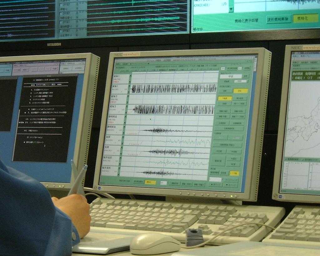
7

8

9
10
11
12 IRIS Focal mechanism & Seismic moment atch?v=momvokyddlo atch?v=hl3kgk5eqaw
13
14 Limitations of Seismic Analysis Speed of Initial Analysis Depends On Density of Seismic Network Type and Quality of Seismic Stations Speed of Data Transmission Speed of Seismic Processing Confidence in Result Elapsed Time to Initial EQ Parameters 5-10 min with Regional Network min with Global Network
15 Limitations of Seismic Analysis Accuracy of Hypocenter (Location / Depth) Bias - nearby stations only on one side Latitude, Longitude error not so critical But depth critical to tsunamigenesis Depth constraint poor (especially if shallow) Hypocenter is only the point of initial rupture Tsunamigenic earthquakes have large source
16 Limitations of Seismic Analysis Accuracy of Earthquake Magnitude Rapid methods underestimate great events Magnitude is a very limited representation of earthquake size No magic threshold for tsunamigenesis
17 Limitations of Seismic Analysis Anomalous Events Slow earthquakes Traditional magnitudes underestimate Enhanced tsunami potential Landslide tsunamis Smaller earthquake triggers landslide Landslide generates tsunami 1998 Papua New Guinea, Mw=7, >2000 casualties Splay faults Splay fault rupture accompanies main rupture Tsunami generated closer to shore

18 Splay Fault

19 September 1992 Nicaragua Tsunami Ms=7 earthquake off the coast of Nicaragua Very little shaking along the coast Little or no tsunami expected, but Large tsunami struck 116 lives lost Lessons Learned Slow Earthquake Use Mw, not Ms Not always shaking
20 Slow Earthquake: 2006 Java Tsunami Little apparent ground motion Large surf, so no clues in ocean behavior Death toll 730
21 Tsunami Earthquake Aleutian Mt: M estimated by observed tsunami heights Sanriku Tanioka 1996

22 New Guinea Tsunami - Jul 1998 Mw 7.1 earthquake no tsunami expected, but Large tsunami impact 2200 lives lost Probable cause was undersea landslide triggered by the earthquake Lessons Learned Tsunami possibility after any large earthquake Roar from the sea may be only real warning

23 Sumatra Tsunami - Dec 2004 Mw 9.2 earthquake size not known for 4 hours Rupture direction and extent only known later Unrecognized hazard nothing like this expected End-to-end alerting not possible Lessons Learned Use new methods to measure huge quakes Techniques to quickly gauge rupture area Expect 1000-yr event Use forecast models End-to-end alerts

24 Japan Tsunami Mar 2011 Mw 9.0 earthquake that big was not expected First alert in 3 min, but earthquake size and forecast tsunami impacts too small Human behavior some did not evacuate Lessons Learned Expect 1000-yr event Conservative first alert message Study/address how to motivate right actions
25 What to do. Prepare in advance. Have SOPs for your organisation Have SOPS across organisations Test SOPs against scenarios and across organisations Have good relationships with key people in all response organisations Know who needs fast notification Know who to call for help (scale up) Have a variety of sources for information Bookmark those sources
26 In Conclusion Every tsunami is unique and can provide new information to improve early warning The problem is dynamic technologies for detection, evaluation, forecasting, and alerting keep changing Coastal vulnerabilities change with increasing coastal populations and infrastructure Human behavior and how to affect it keeps changing (e.g., social media) We must continue to share our knowledge and experiences to improve the system.
27 Complementary Note Tsunami may arrive before residents receive tsunami warnings Share Understanding of the Limitation of Tsunami Forecast Technique and NOT Rely Only on Tsunami Warnings Build Up Public Awareness When a strong shake is felt, leave the seashore immediately and take shelter to the place of safety even if a tsunami warning is not issued
28 Thank You Masahiro Yamamoto UNESCO/IOC Laura Kong UNESCO/IOC NOAA International Tsunami Information Center Charles McCreery Pacific Tsunami Warning Center
29 Tsunami Travel Times from Small/Large Source
30 Limitations of Tsunami Forecasting Estimated Arrival Time Forecast Based on initial seismic analysis Point source or assumed finite fault Initial Threat Level Forecast Based only on initial seismic analysis Least accurate Sea Level Constrained Forecast Too late for local tsunami Deep ocean measurements best constraint More accurate
31 Limitations and Challenges Real-time forecasting is of limited use for local warning. Self-evacuation might be the only way to avoid the loss of lives. Real-time forecast is only the EQ parameters. Initial EQ mag off by 0.2 or more, resulting in factor of two difference in wave amplitude. Landslide model (currently simply slump model) Asteroid Tsunami Meteorological tsunamis
32 Limitations of Tsunami Forecasting Historical Comparisons Historical record is very short and incomplete in most areas No repeat events May be okay to identify coastal sensitivities
33 Limitations of Messages / Dissemination Message Content Should be simple and to the point Should contain key information Situation Evaluation and Summary Seismic Parameters Predicted Threat Level Estimated Tsunami Wave Arrival Times Key Tsunami Wave Measurements Recommended Actions Tied to SOPs and trigger SOP actions
34 What You Can Count On from a TWC Rapid Notification of a Potential Tsunami Threat Conservative Evaluation of Tsunami Threat Reasonably Rapid Stand-Down if No Tsunami Threat
35 What You Should Be Prepared For Over-Warning due to Conservative Criteria General Forecast of Threat with Few Specifics Potential for Error in ETAs
36 Limitations of Sea Level Data Analysis Sea Level Measurements are Critical for: Tsunami Detection (Yes or No) Tsunami Measurement (Arrival Time, Amplitude, Period, Duration) Tsunami Forecast
37 Limitations of Sea Level Data Analysis Speed of Sea Level Measurements Tsunami must travel to gauge Depends upon density of gauge network 15 min to >1 hr typical to first gauge Tsunami wave must pass gauge Wave periods are 5 to 60 min Need at least ¼ of wave Tsunami is a series of waves Maximum may not be first wave Gauge must transmit data Typically every 15 min
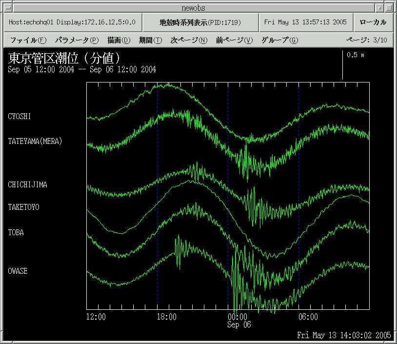
38
39
40
41
42
43 Limitations of Sea Level Data Analysis Type of Sea Level Measurements Coastal Gauge Most common Signal highly modified by coastal effects May be destroyed by large tsunami Deep Ocean Gauge Less common Most expensive Pure tsunami signal to constrain forecast Wet Sensor On land Less expensive Only indicate if flooding has occurred
44 Tsunami Monitoring Estimate tsunami travel time Continuous monitoring: tide gauge, deep sea pressure; in case M:6 class Monitor: all sea level stations NOT only your stations Re-evaluation using observed data Upgrading/Downgrading/Cancellation of tsunami warning
45 Taking Action What to do Timely Warnings from TWC How? Careful monitoring Need to act (fast) without confusion Have and Give clear instruction Quick analysis and evaluation Appropriate decision making needs clear criteria Delegated Authority - No time to get a highest level approval/instruction No hesitation to update Same quality at any time and every time
46 Training and Exercise Re-operation just after an urgent operation is completed; evaluation of urgent operation procedure, and UPDATE of SOP if necessary Waveform catalogue/hardcopy; common criteria/threshold (Seismic & Tsunami)

47 Tsunami and Earthquake Monitoring System Operation and maintenance 24 hours a day 7 days a week Battle against time Japan Meteorological Agency 2005/3/9
48 Thank You Masahiro Yamamoto UNESCO/IOC Laura Kong UNESCO/IOC NOAA International Tsunami Information Center Charles McCreery Pacific Tsunami Warning Center
49 PTWC General Processes and Procedures for Initial Tsunami Bulletins STEP 3 STEP 1 Own Seismic Network Cooperating Seismic Networks STEP 2 Data Ingest into Memory Ring(s) Automatic Arrival Detection and Association Automatic Hypocenter Automatic Magnitude STEP 4 Event Alarms STEP 7 Issue Initial Bulletin Compute Tsunami ETAs if a Warning YES Interactive Hypocenter Interactive Magnitude Operator Interactive Review and Refinement EQ Params meet Initial Bulletin Criteria? STEP 6 N STEP 5 W E S
50 PTWC General Processes and Procedures for Initial Tsunami Bulletins STEP 3 STEP 1 1 Own Seismic Network Own Cooperating Seismic Seismic Networks Cooperating Seismic Networks STEP 2 Data Ingest into Memory Ring(s) Automatic Arrival Detection and Association STEP 2 Automatic Hypocenter Automatic Magnitude Data Ingest into Memory Ring(s) Interactive Hypocenter Interactive Magnitude STEP 4 Event Alarms Operator Interactive Review and Refinement STEP 7 Issue Initial Bulletin Compute Tsunami ETAs if a Warning YES EQ Params meet Initial Bulletin Criteria? STEP 6 N STEP 5 W E S
51 STEP 3 PTWC General Processes and Procedures for Initial Tsunami Bulletins W N E STEP 1 Own Seismic Network Cooperating Seismic Networks STEP 2 STEP 2 Data Ingest into Memory Ring(s) Data Ingest into Memory Ring(s) STEP 3 Automatic Arrival Detection and Association Automatic Hypocenter Automatic Magnitude Interactive Hypocenter Interactive Magnitude STEP 5 Automatic Arrival Detection and STEP 4 Association Event Alarms Automatic Hypocenter Operator Interactive Review and Refinement Automatic Magnitude STEP 7 Issue Initial Bulletin Compute Tsunami ETAs if a Warning YES EQ Params meet Initial Bulletin Criteria? STEP 6 S
52 STEP 3 PTWC General Processes and Procedures for Initial Tsunami Bulletins W N E STEP 1 Own Seismic Network Cooperating Seismic Networks Automatic Arrival Detection and STEP 2 Association Data Ingest into Memory Ring(s) Automatic Hypocenter Automatic Magnitude STEP 3 Automatic Arrival Detection and Association Automatic Hypocenter Automatic Magnitude Interactive Hypocenter Interactive Magnitude STEP 5 STEP 4 STEP 4 Event Alarms Event Alarms Operator Interactive Review and Refinement STEP 7 Issue Initial Bulletin Compute Tsunami ETAs if a Warning YES EQ Params meet Initial Bulletin Criteria? STEP 6 S
53 PTWC General Processes and Procedures for Initial Tsunami Bulletins STEP 3 N STEP 1 Own Seismic Network Cooperating Seismic Networks Interactive STEP 2 Hypocenter Data Ingest into Memory Ring(s) Interactive Magnitude Automatic Arrival Detection and Association Automatic Hypocenter Automatic Magnitude Interactive Hypocenter Interactive Magnitude STEP 5 STEP 5 STEP 4 Event Alarms Operator Interactive Review and Refinement Operator Interactive Review and Refinement STEP 7 Issue Initial Bulletin Compute Tsunami ETAs if a Warning YES EQ Params meet Initial Bulletin Criteria? STEP 6 W E S
54 PTWC General Processes and Procedures for Initial Tsunami Bulletins STEP 3 N STEP 1 Own Seismic Network Cooperating Seismic Networks STEP 2 Data Ingest into Memory Ring(s) Automatic Arrival Detection and Association Automatic Hypocenter Automatic Magnitude Operator Interactive Interactive Hypocenter Review and Refinement Interactive Magnitude STEP 5 STEP 4 Event Alarms Operator Interactive Review and Refinement STEP 7 Issue Initial Bulletin Compute Tsunami ETAs if a Warning YES meet Initial EQ Params meet Initial Bulletin Criteria? STEP 6 YES EQ Params Bulletin Criteria? STEP 6 W E S
55 PTWC General Processes and Procedures for Initial Tsunami Bulletins STEP 3 STEP 7 STEP 1 Own Seismic Network Cooperating Seismic Networks STEP 2 Data Ingest into Memory Ring(s) Automatic Arrival Detection and Association Automatic Hypocenter Automatic Magnitude STEP 4 Event Alarms STEP 7 Issue Initial Issue Initial Bulletin Compute Tsunami ETAs if a Warning Interactive Hypocenter Interactive Magnitude Operator Interactive Review and Refinement Compute YES Tsunami ETAs if a Warning EQ Params meet Initial Bulletin Criteria? STEP 6 N STEP 5 W E YES S

56 Tsunami Observation System of JMA 66 stations float type and Huge tsunami gauge Since stations and Acoustic type 29 stations Huge tsunami gauge Huge tsunami gauge Huge tsunami gauge Is a water pressure gauge to measure a running height of so huge a tsunami as to swallow tidal stations. Minami Torishima island Pressure gauge for distant tsunami float type or Acoustic type 1967 Tidal data was started to be transmitted to the nearest observatory in real time and telegraphed to the tsunami warning center Acoustic type tsunami gauges and huge tsunami gauges were installed. Tidal data of another organizations is also transmitted to JMA in real time for tsunami observation.


57 Dissemination of Tsunami Warning to Residents satellite Local Governments Local Meteorological Observatory Polices,Fir e office Residents Dedicated telephone line TV JMA Tsunami Warning Center Government Radio Etc.
58 Limitations and Challenges (1) Real-time forecasting is of limited use for local warning. Self-evacuation might be the only way to avoid the loss of lives. Real-time forecast is only as good as the EQ parameters. Initial EQ mag can be easily off by 0.2 or more, resulting in factor of two difference in wave amplitude. Green s law amplitude can underestimate harbor resonances and overestimate for small islands. The extent of inundation/flooding cannot be determined from the RIFT forecast.
59 Limitations and Challenges (2) How to make accurate forecast for coastal regions with a wide continental shelf (Thailand, Australia, etc.). Ultra fine resolution might not be feasible in real time. Couple with inundation models or using nested grids to refine coastal forecast? Real-time DART inversion is not yet available for RIFT but it is desirable. Landslide model (currently simply slump model) Asteroid Tsunami Meteorological tsunamis
60 Limitations of Tsunami Forecasting Estimated Arrival Time Forecast Based on initial seismic analysis Point source or assumed finite fault Initial Threat Level Forecast Based only on initial seismic analysis and general geophysical/oceanographic contraints Least accurate Sea Level Constrained Forecast Too late for local tsunami Deep ocean measurements best constraint More accurate
61 Limitations of Seismic Analysis Finite Faults Fault rupture over large area Amount of slip varies along fault Depth of ruptured fault varies Tsunamigenesis varies Important near the earthquake Not so important for distant tsunami Finite fault analysis too slow for local warning
62 Why Is There Need to Know? Knowledge of TWC Limitations Helps Guide SOP Development Helps Foster Realistic Expectations Motivates Personal Responsibility
63 Tsunami Travel Times from Large Source
64 Parameter management and tuning Sensitivity of seismometer; correct magnitude estimation Tuning of trigger parameter; reduce the false alarm and shorten the detection of earthquake occurrence All staff need to recognize the importance of the parameters used in the system It takes a long time to find out the most appropriate parameters (KEY; Automatic solution).
Lessons Learned from Past Tsunamis Warning and Emergency Response
 UNESCO IOC CTIC US NOAA ITIC Regional Training Workshop on Strengthening Tsunami Warning and Emergency Response Standard Operating Procedures and the Development of the ICG/CARIBE-EWS PTWC New Enhanced
Tsunami Warning Center SOPs Concept of Operations, Overview of Routine and Event Operations, Flow Charts, Timelines and Checklists
 Tsunami Warning Center SOPs Concept of Operations, Overview of Routine and Event Operations, Flow Charts, Timelines and Checklists Masahiro Yamamoto UNESCO IOC Laura Kong Director International Tsunami
SOP of PTWC as a Regional Tsunami Service Provider
 UNESCO IOC CTIC US NOAA ITIC Regional Training Workshop on Strengthening Tsunami Warning and Emergency Response Standard Operating Procedures and the Development of the ICG/CARIBE-EWS PTWC New Enhanced
Establishment and Operation of a Regional Tsunami Warning Centre
 Establishment and Operation of a Regional Tsunami Warning Centre Dr. Charles McCreery, Director NOAA Richard H. Hagemeyer Pacific Tsunami Warning Center Ewa Beach, Hawaii USA Why A Regional Tsunami Warning
Indian Ocean Tsunami Warning System: Example from the 12 th September 2007 Tsunami
 Indian Ocean Tsunami Warning System: Example from the 12 th September 2007 Tsunami Charitha Pattiaratchi 1 Professor of Coastal Oceanography, The University of Western Australia Email: chari.pattiaratchi@uwa.edu.au
Lessons from the 2004 Sumatra earthquake and the Asian tsunami
 Lessons from the 2004 Sumatra earthquake and the Asian tsunami Kenji Satake National Institute of Advanced Industrial Science and Technology Outline 1. The largest earthquake in the last 40 years 2. Tsunami
Tsunami Response and the Enhance PTWC Alerts
 Tsunami Response and the Enhance PTWC Alerts Ken Gledhill GeoNet Project Director Chair, Intergovernmental Coordination Group, Pacific Tsunami Warning and Mitigation System (PTWS) Overview 1. Procedures
Disclaimer. This report was compiled by an ADRC visiting researcher (VR) from ADRC member countries.
 from ADRC member countries.") Disclaimer This report was compiled by an ADRC visiting researcher (VR) from ADRC member countries. The views expressed in the report do not necessarily reflect the views of the ADRC. The boundaries and
Disclaimer This report was compiled by an ADRC visiting researcher (VR) from ADRC member countries. The views expressed in the report do not necessarily reflect the views of the ADRC. The boundaries and
SCIENCE OF TSUNAMI HAZARDS
 SCIENCE OF TSUNAMI HAZARDS ISSN 8755-6839 Journal of Tsunami Society International Volume 29 Number 3 2010 POTENTIAL DEFICIENCIES IN EDUCATION, INSTRUMENTATION, AND WARNINGS FOR LOCALLY GENERATED TSUNAMIS
(energy loss is greater with longer wavelengths)
") GEOL 0820 Ramsey Natural Disasters Spring, 2018 LECTURE #9: Tsunami Monitoring & Mitigation Date: 8 February 2018 I. Characteristics (con t): shoaling: o process of wave height increase and breaking as
GEOL 0820 Ramsey Natural Disasters Spring, 2018 LECTURE #9: Tsunami Monitoring & Mitigation Date: 8 February 2018 I. Characteristics (con t): shoaling: o process of wave height increase and breaking as
Making the Original Earthquake Early Warning System including epicentral earthquake
 Making the Original Earthquake Early Warning System including epicentral earthquake Protecting your life and minimizing damage. TEL: 0742-53-7833 4F, Oshikuma-cho 557-7, Nara-City 631-0011, Japan URL http://www.jjjnet.com
Earthquakes and Tsunamis
 Earthquakes and Tsunamis Kenji Satake Earthquake Research Institute University of Tokyo 1 Part I 2011 Tohoku earthquake and tsunami 2 Fukushima Dai ichi NPP accident Earthquake ground motion Reactors automatically
METEOROLOGICAL WARNINGS STUDY GROUP (METWSG)
") METWSG/4-SN No. 6 12/3/12 METEOROLOGICAL WARNINGS STUDY GROUP (METWSG) FOURTH MEETING Montréal, 15 to 18 May 2012 Agenda Item 6: Wind shear, turbulence and tsunami warnings TSUNAMI INFORMATION (Presented
METWSG/4-SN No. 6 12/3/12 METEOROLOGICAL WARNINGS STUDY GROUP (METWSG) FOURTH MEETING Montréal, 15 to 18 May 2012 Agenda Item 6: Wind shear, turbulence and tsunami warnings TSUNAMI INFORMATION (Presented
JMA Tsunami Warning Services. Takeshi KOIZUMI Senior Coordinator for International Earthquake and Tsunami Information Japan Meteorological Agency
 JMA Tsunami Warning Services Takeshi KOIZUMI Senior Coordinator for International Earthquake and Tsunami Information Japan Meteorological Agency Tectonic Setting of Japan (Headquarters for Earthquake Research
JMA Tsunami Warning Services. Tomoaki OZAKI Senior Coordinator for Tsunami Forecast Modeling Japan Meteorological Agency
 JMA Tsunami Warning Services Tomoaki OZAKI Senior Coordinator for Tsunami Forecast Modeling Japan Meteorological Agency Organization Chart of the Government of Japan Cabinet Office Diet Ministry of Internal
STUDY ON TSUNAMIGENIC EARTHQUAKE CRITERIA FOR THE INDONESIAN TSUNAMI EARLY WARNING SYSTEM
 STUDY ON TSUNAMIGENIC EARTHQUAKE CRITERIA FOR THE INDONESIAN TSUNAMI EARLY WARNING SYSTEM Nanang T. Puspito 1 1 Geophysics Research Group, Faculty of Mining and Petroleum Engineering, Institute of Technology
The ITSU System in the Pacific Region and Future Upgrades
 The ITSU System in the Pacific Region and Future Upgrades Eddie Bernard Director, Pacific Marine Environmental Laboratory (PMEL) NOAA/USA Pacific Tsunami Warning Center OPERATIONAL ACTIVITIES SEISMIC DATA
DRAFT - Tsunami Response Plan Playbook Santa Cruz Harbor Maritime Community
 DRAFT - Tsunami Response Plan Playbook Santa Cruz Harbor Maritime Community Page 1 Best to display on 11X17 paper Purpose and Use of this Real-time Tsunami Response Plan Playbook PURPOSE: This product
Earthquake Hazards. Tsunami
 Earthquake Hazards Tsunami Measuring Earthquakes Two measurements that describe the power or strength of an earthquake are: Intensity a measure of the degree of earthquake shaking at a given locale based
- Information before strong ground motion -
 -Earthquake Early Warning - Information before strong ground motion - Mitsuyuki HOSHIBA Japan Meteorological Agency January 12, 2007 1 Distribution of Earthquakes Causing Tsunami (1896~2004) in Japan Distribution
JMA Service on Earthquake, Tsunami and Volcano
 JMA Service on Earthquake, Tsunami and Volcano Keiji DOI Seismological and Volcanological Department Japan Meteorological Agency Logo The South Hyogo Prefecture Earthquake in 1995 (January 17, 1995, M7.3)
Introduction to Environmental Geology, 5e Case History: Indonesian Tsunami Indonesian Tsunami (2) Introduction Historic Tsunamis
 Introduction Historic Tsunamis") 1 2 3 4 5 6 7 8 9 Introduction to Environmental Geology, 5e Chapter 7 Tsunami Case History: Indonesian Tsunami December 26, 2004, within a few hours, close to 250,000 people were killed With no warning
1 2 3 4 5 6 7 8 9 Introduction to Environmental Geology, 5e Chapter 7 Tsunami Case History: Indonesian Tsunami December 26, 2004, within a few hours, close to 250,000 people were killed With no warning
US Tsunami Services for PR and the VI: An Update from the NOAA NWS Caribbean Tsunami Warning Program
 U.S. National Oceanic and Atmospheric Administration National Weather Service Caribbean Tsunami Warning Program US Tsunami Services for PR and the VI: An Update from the NOAA NWS Caribbean Tsunami Warning
Mechanism of tsunami generation,propagation and runup -sharing experiences with Japanese
 Mechanism of tsunami generation,propagation and runup -sharing experiences with Japanese Mechanism of tsunami generation Predicting the propagation, runup and inundation of tsunamis Near and far-field
Earthquake Hazards. Tsunami
 Earthquake Hazards Tsunami Review: What is an earthquake? Earthquake is the vibration (shaking) and/or displacement of the ground produced by the sudden release of energy. The point inside the Earth where
DEVASTATING DAMAGE DUE TO THE 2004 INDIAN OCEAN TSUNAMI AND ITS LESSONS
 DEVASTATING DAMAGE DUE TO THE 2004 INDIAN OCEAN TSUNAMI AND ITS LESSONS Fumihiko Imamura 1 1 Professor, Tsunami Engineering, Disaster Control Research Center, Tohoku University, Japan Email: imamura@tsunami2.civil.tohoku.ac.jp
TEMPLATE FOR NATIONAL REPORTS. National Reports will be posted to the ICG/CARIBE EWS-XII web site without TWFP contact details
 IOC Circular Letter, 2661-1 TEMPLATE FOR NATIONAL REPORTS National Reports will be posted to the ICG/CARIBE EWS-XII web site without TWFP contact details BASIC INFORMATION PRELIMINAR NATIONAL REPORT Submitted
Introduction to Environmental Geology, 5e
 Lecture Presentation prepared by X. Mara Chen, Salisbury University Introduction to Environmental Geology, 5e Edward A. Keller Chapter 7 Tsunami Case History: Indonesian Tsunami December 26, 2004, within
KNOWLEDGE NOTE 5-1. Risk Assessment and Hazard Mapping. CLUSTER 5: Hazard and Risk Information and Decision Making. Public Disclosure Authorized
 Public Disclosure Authorized Public Disclosure Authorized Public Disclosure Authorized Public Disclosure Authorized KNOWLEDGE NOTE 5-1 CLUSTER 5: Hazard and Risk Information and Decision Making Risk Assessment
TSUNAMI CHARACTERISTICS OF OUTER-RISE EARTHQUAKES ALONG THE PACIFIC COAST OF NICARAGUA - A CASE STUDY FOR THE 2016 NICARAGUA EVENT-
 TSUNAMI CHARACTERISTICS OF OUTER-RISE EARTHQUAKES ALONG THE PACIFIC COAST OF NICARAGUA - A CASE STUDY FOR THE 2016 NICARAGUA EVENT- Amilcar Cabrera Supervisor: Yuichiro TANIOKA MEE16718 ABSTRACT Nicaragua
Linkage to the National Program
 Linkage to the National Program Frank González Pacific Marine Environmental Laboratory Seattle, WA Frank González, NOAA TIME Center, PMEL, Seattle, WA NOAA is about FORECASTS and WARNINGS -Hurricanes Sunspots
Enhancing Preparedness and Early Warning in Disaster Risk Reduction
 Enhancing Preparedness and Early Warning in Disaster Risk Reduction Fifth Technical Conference on Management of Meteorological and Hydrological Services in Regional Association V at PETALING JAYA, MALAYSIA
LOCAL TSUNAMIS: CHALLENGES FOR PREPAREDNESS AND EARLY WARNING
 LOCAL TSUNAMIS: CHALLENGES FOR PREPAREDNESS AND EARLY WARNING HARALD SPAHN 1 1 German Technical Cooperation International Services, Jakarta, Indonesia ABSTRACT: Due to the threat of local tsunamis warning
NUMERICAL SIMULATION AS GUIDANCE IN MAKING TSUNAMI HAZARD MAP FOR LABUAN ISLAND
 NUMERICAL SIMULATION AS GUIDANCE IN MAKING TSUNAMI HAZARD MAP FOR LABUAN ISLAND MOHD RIDZUAN bin Adam Supervisor: Fumihiko IMAMURA MEE09199 ABSTRACT At the northeast end of the South China Sea, tsunamis
Tsunami Research and Its Practical Use for Hazard Mitigation. Hiroo Kanamori Seismological Laboratory, California Institute of Technology
 Tsunami Research and Its Practical Use for Hazard Mitigation Hiroo Kanamori Seismological Laboratory, California Institute of Technology Cause of Tsunami Earthquakes Landslides Volcanic origin Impact (Dr.
Preparation for Future Earthquake and Tsunami Hazards: Lessons Learned from the 2004 Sumatra-Andaman Earthquake and the Asian Tsunami
 First International Conference of Aceh and Indian Ocean Studies Organized by Asia Research Institute, National University of Singapore & Rehabilitation and Construction Executing Agency for Aceh and Nias
JCOMM-CHy Coastal Inundation Forecasting Demonstration Project (CIFDP)
") WMO World Meteorological Organization Working together in weather, climate and water JCOMM-CHy Coastal Inundation Forecasting Demonstration Project (CIFDP) Coastal Flooding & Vulnerable Populations Coastal
WMO World Meteorological Organization Working together in weather, climate and water JCOMM-CHy Coastal Inundation Forecasting Demonstration Project (CIFDP) Coastal Flooding & Vulnerable Populations Coastal
Tsunami Physics and Preparedness. March 6, 2005 ICTP Public Information Office 1
 Tsunami Physics and Preparedness March 6, 2005 ICTP Public Information Office 1 What we do Provide world-class research facilities for scientists from developing world Foster advanced scientific research,
Earthquake Hazards. Tsunami
 Earthquake Hazards Tsunami Review: What is an earthquake? Earthquake is the vibration (shaking) and/or displacement of the ground produced by the sudden release of energy. The point inside the Earth where
Three Dimensional Simulations of Tsunami Generation and Propagation
 Chapter 1 Earth Science Three Dimensional Simulations of Tsunami Generation and Propagation Project Representative Takashi Furumura Authors Tatsuhiko Saito Takashi Furumura Earthquake Research Institute,
Coseismic slip model
 Figure 3 - Preliminary highly smoothed model of coseismic slip for the 11 March UCL Institute for Risk & Disaster Reduction Magnitude 9.0 (JMA scale) earthquake Occurred at 02:46:23 pm local time near
Magnitude 7.5 NEW BRITAIN REGION, PAPUA NEW GUINEA
 A magnitude 7.5 earthquake struck off the eastern coast of Papua New Guinea on Tuesday, approximately 130 km (81 mi) southsouthwest of Kokopo at a depth of 42 km (26.1 mi). There are reports of some structural
NUMERICAL SIMULATION OF TSUNAMI PROPAGATION AND INUNDATION ALONG THE RAKHINE COAST AREAS IN MYANMAR
 NUMERICAL SIMULATION OF TSUNAMI PROPAGATION AND INUNDATION ALONG THE RAKHINE COAST AREAS IN MYANMAR Su Hninn Htwe Supervisor: Bunichiro SHIBAZAKI MEE12619 Yushiro FUJII ABSTRACT This study aimed to assess
Cascadia Seismic Event Planning for the Maritime Community
 Cascadia Seismic Event Planning for the Maritime Community Jonathan Allan, Oregon Dept. of Geology and Mineral Industries Presentation to Annual Pacific Northwest Waterways Association Meeting (PNWA) October
NUMERICAL SIMULATIONS FOR TSUNAMI FORECASTING AT PADANG CITY USING OFFSHORE TSUNAMI SENSORS
 NUMERICAL SIMULATIONS FOR TSUNAMI FORECASTING AT PADANG CITY USING OFFSHORE TSUNAMI SENSORS Setyoajie Prayoedhie Supervisor: Yushiro FUJII MEE10518 Bunichiro SHIBAZAKI ABSTRACT We conducted numerical simulations
中村洋光 Hiromitsu Nakamura 防災科学技術研究所 National Research Institute for Earth Science and Disaster Prevention, Japan (NIED) Outline
 Outline") Earthquake Early Warning in Japan 中村洋光 Hiromitsu Nakamura 防災科学技術研究所 National Research Institute for Earth Science and Disaster Prevention, Japan (NIED) Outline Overview of the earthquake early warning
Earthquake Early Warning in Japan 中村洋光 Hiromitsu Nakamura 防災科学技術研究所 National Research Institute for Earth Science and Disaster Prevention, Japan (NIED) Outline Overview of the earthquake early warning
The great earthquakes that have shaped Japan 日本に大きな影響を与えた地震
 The great earthquakes that have shaped Japan 日本に大きな影響を与えた地震 Brian Kennett, Research School of Earth Sciences, ANU Takashi Furumura Earthquake Research Institute, University of Tokyo Japan tectonic plates
Tsunami Advisory and Warning Supporting Plan [SP 01/18]
![Tsunami Advisory and Warning Supporting Plan [SP 01/18]](/thumbs/93/112003983.jpg "Tsunami Advisory and Warning Supporting Plan [SP 01/18]") Tsunami Advisory and Warning Supporting Plan [SP 01/18] Revised October 2018 ISBN 978-0-478-43521-4 Published by the Ministry of Civil Defence & Emergency Management Authority This document has been issued
Tsunami Advisory and Warning Supporting Plan [SP 01/18] Revised October 2018 ISBN 978-0-478-43521-4 Published by the Ministry of Civil Defence & Emergency Management Authority This document has been issued
Takashi Furumura Tatsuhiko Saito ERI. Univ. Tokyo)
") CREST Workshop in 2007 An Integrated Simulation of Seismic Wave and Tsunami Propagation 古村孝志 齊藤竜彦 (東大地震研 Takashi Furumura Tatsuhiko Saito ERI. Univ. Tokyo) 2006 2007 Hokkaido -O Izu ough r T kai Nan ch
CREST Workshop in 2007 An Integrated Simulation of Seismic Wave and Tsunami Propagation 古村孝志 齊藤竜彦 (東大地震研 Takashi Furumura Tatsuhiko Saito ERI. Univ. Tokyo) 2006 2007 Hokkaido -O Izu ough r T kai Nan ch
Magnitude 7.7 QUEEN CHARLOTTE ISLANDS REGION
 A major 7.7 magnitude earthquake struck at 8:04 PM local time in western British Columbia, Canada. The epicenter is located on Moresby Island, the southern large island in the Queen Charlotte Islands region.
Evacuation Alarm Using the Improved Magnitude Method to Damage Caused by Typhoon 9918
 ICHE 2014, Hamburg - Lehfeldt & Kopmann (eds) - 2014 Bundesanstalt für Wasserbau ISBN 978-3-939230-32-8 Evacuation Alarm Using the Improved Magnitude Method to Damage Caused by Typhoon 9918 R. Hashimura
Tsunami Waveform Inversion based on Oceanographic Radar Data
 Research Institute for Applied Mechanics Workshop of Oceanographic Radar 12-13 December 2012 1 Tsunami Waveform Inversion based on Oceanographic Radar Data Ryotaro Fuji 1), Hirofumi Hinata 1), Tomoyuki
Tsunami Advisory and Warning Supporting Plan [SP 01/17]
![Tsunami Advisory and Warning Supporting Plan [SP 01/17]](/thumbs/75/71555255.jpg "Tsunami Advisory and Warning Supporting Plan [SP 01/17]") Tsunami Advisory and Warning Supporting Plan [SP 01/17] Revised November 2017 ISBN 978-0-478-43503-0 Published by the Ministry of Civil Defence & Emergency Management Authority This document has been issued
Tsunami Advisory and Warning Supporting Plan [SP 01/17] Revised November 2017 ISBN 978-0-478-43503-0 Published by the Ministry of Civil Defence & Emergency Management Authority This document has been issued
ShakeAlert Earthquake Early Warning
 ShakeAlert Earthquake Early Warning Doug Given USGS, Pasadena Earthquake Program, Early Warning Coordinator 10 seconds 50 seconds 90 seconds USGS Earthquake Hazard Responsibilities USGS has the lead federal
ACTIVITIES OF THE HEADQUARTERS FOR EARTHQUAKE RESEARCH PROMOTION
 Journal of Japan Association for Earthquake Engineering, Vol.4, No.3 (Special Issue), 2004 ACTIVITIES OF THE HEADQUARTERS FOR EARTHQUAKE RESEARCH PROMOTION Sadanori HIGASHI 1 1 Member of JAEE, Earthquake
Earthquake,Tsunami,Volcano Monitoring & Warning System in Korea. Jimin Lee Earthquake & Volcano Monitoring Division KMA
 Earthquake,Tsunami,Volcano Monitoring & Warning System in Korea Jimin Lee Earthquake & Volcano Monitoring Division KMA 1 2 Brief History & Vision of KMA Introduction of Services 3 Korea National Seismographic
Three Fs of earthquakes: forces, faults, and friction. Slow accumulation and rapid release of elastic energy.
 Earthquake Machine Stick-slip: Elastic Rebound Theory Jerky motions on faults produce EQs Three Fs of earthquakes: forces, faults, and friction. Slow accumulation and rapid release of elastic energy. Three
Magnitude 7.0 N of ANCHORAGE, ALASKA
 A magnitude 7.0 earthquake occurred just before 8:30 am local time 8 miles north of Anchorage at a depth of 40.9 km (25.4 miles). There are reports of major infrastructure damage and damage to many homes
Magnitude 7.9 SE of KODIAK, ALASKA
 A magnitude 7.9 earthquake occurred at 12:31 am local time 181 miles southeast of Kodiak at a depth of 25 km (15.5 miles). There are no immediate reports of damage or fatalities. Light shaking from this
Seismic signals from tsunamis in the Pacific Ocean
 GEOPHYSICAL RESEARCH LETTERS, VOL. 35, L03305, doi:10.1029/2007gl032601, 2008 Seismic signals from tsunamis in the Pacific Ocean Gordon Shields 1 and J. Roger Bowman 1 Received 8 November 2007; revised
Status after Six Years
 German-Indonesian Tsunami Early Warning System () Status after Six Years Joern Lauterjung and the -Team Challenge Indonesia Short Early Warning Time Tsunamis are generated at the trench (orange line) Traveltimes
Tsunami waves swept away houses and cars in northern Japan and pushed ships aground.
 Japan was struck by a magnitude 8.9 earthquake off its northeastern coast Friday. This is one of the largest earthquakes that Japan has ever experienced. In downtown Tokyo, large buildings shook violently
Source of the July 2006 West Java tsunami estimated from tide gauge records
 GEOPHYSICAL RESEARCH LETTERS, VOL. 33, L24317, doi:10.1029/2006gl028049, 2006 Source of the July 2006 West Java tsunami estimated from tide gauge records Yushiro Fujii 1 and Kenji Satake 2 Received 13
Seismic and Tsunami Observations of Indonesia
 (Indonesia, Mr. Fatchurochman Iman, 2010-2011S, Mr. Dwi Hartanto/Mr. Tatok Yatimantoro, 2011-2012T) Seismic and Tsunami Observations of Indonesia 1. Seismic Monitoring Agency for Meteorology, Climatology
Formulation of the Strategy for Disaster Risk Reduction and Emergency Preparedness and Response of the Asia-Pacific Region
 2008/SOM3/TFEP/SEM/006 Formulation of the Strategy for Disaster Risk Reduction and Emergency Preparedness and Response of the Asia-Pacific Region 2009-2015 Submitted by: Thailand Emergency Management CEOs
A GLOBAL SURGE OF GREAT EARTHQUAKES FROM AND IMPLICATIONS FOR CASCADIA. Thorne Lay, University of California Santa Cruz
 A GLOBAL SURGE OF GREAT EARTHQUAKES FROM 2004-2014 AND IMPLICATIONS FOR CASCADIA Thorne Lay, University of California Santa Cruz Last 10 yrs - 18 great earthquakes: rate 1.8/yr; rate over preceding century
IG-WRDRR, UNESCAP, UNESCO-IOC, WMO. Yukio Tamura Chairman, International. Group. Tuesday 10 May, , Room 13. for Disaster. Risk.
 Side Event: Saving of Lives and Improved Coastal Risk Management through Regional Cooperation in Ocean and Marine Related Early Warning Systems in Asia Tuesday 10 May, 13.15 14.15, Room 13 IG-WRDRR, UNESCAP,
Earthquakes 11/14/2014. Earthquakes Occur at All Boundaries. Earthquakes. Key Aspects of an Earthquake. Epicenter. Focus
 Earthquakes Earthquakes Caused by friction and movement between Earth s tectonic plates A release of force Often caused by a catch between two plates As plates slide by, they stick to each other When the
What is a tsunami? Capital Regional District Tsunami Frequently Asked Questions (FAQ s) Tsunami (soo-nah-mee)
 Tsunami (soo-nah-mee)") Tsunami (soo-nah-mee) Tsunamis (Japanese translation harbour wave ) are waves with a great distance between crests, and are caused by any widespread, sudden movement of large volumes of water. The tsunami
Tsunami (soo-nah-mee) Tsunamis (Japanese translation harbour wave ) are waves with a great distance between crests, and are caused by any widespread, sudden movement of large volumes of water. The tsunami
U.S. Tsunami Programs: A Brief Overview
 Peter Folger Specialist in Energy and Natural Resources Policy March 18, 2011 Congressional Research Service CRS Report for Congress Prepared for Members and Committees of Congress 7-5700 www.crs.gov R41686
Current tsunami research activities in the Philippines
 DOST PHIVOLCS Current tsunami research activities in the Philippines Graciano P. Yumul, Jr. 1,2, Carla B. Dimalanta 1 and Bart Bautista 3 1 National Institute of Geological Sciences, University of the
Deterministic and Non-deterministic Behavior of Earthquakes and Hazard Mitigation Strategy
 Deterministic and Non-deterministic Behavior of Earthquakes and Hazard Mitigation Strategy Hiroo Kanamori Seismological Laboratory, California Institute of Technology Earthquake Process Deterministic Non-deterministic
Coastal Inundation Forecasting Demonstration Project CIFDP. Flood Forecasting Initiative-Advisory Group (FFI-AG 3), Geneva, 5-7 Dec, 2017
, Geneva, 5-7 Dec, 2017") Coastal Inundation Forecasting Demonstration Project CIFDP Flood Forecasting Initiative-Advisory Group (FFI-AG 3), Geneva, 5-7 Dec, 2017 Coastal Flooding & Vulnerable Populations Coastal populations are
Coastal Inundation Forecasting Demonstration Project CIFDP Flood Forecasting Initiative-Advisory Group (FFI-AG 3), Geneva, 5-7 Dec, 2017 Coastal Flooding & Vulnerable Populations Coastal populations are
History of International Training in Seismology and Earthquake Engineering at IISEE
 History of International Training in Seismology and Earthquake Engineering at IISEE Activities of International Institute of Seismology and Earthquake Engineering (IISEE), BRI - Training for young researchers/engineers
Tsunami potential and modeling
 Tsunami potential and modeling GEORGE PRIEST OREGON DEPT. OF GEOLOGY AND MINERAL INDUSTRIES NEWPORT COASTAL FIELD OFFICE April 7, 2012 GeoPRISMS Cascadia Workshop, Portland, Oregon What creates most uncertainty
Monitoring and Warning Systems for Natural Phenomena The Mexican Experience
 Sistema Nacional de Protección Civil Monitoring and Warning Systems for Natural Phenomena The Mexican Experience Roberto Quaas W, Enrique Guevara O. O Mexican National Center for Disaster Prevention CENAPRED
DATA BASE DEVELOPMENT OF ETA (ESTIMATED TIME OF ARRIVAL) FOR TSUNAMI DISASTER MITIGATION AT SOUTHWESTERN CITIES OF ACEH, INDONESIA
 FOR TSUNAMI DISASTER MITIGATION AT SOUTHWESTERN CITIES OF ACEH, INDONESIA") 6 th South China Sea Tsunami Workshop Nanyang Technology University, Singapore, 6-8 November 2013 DATA BASE DEVELOPMENT OF ETA (ESTIMATED TIME OF ARRIVAL) FOR TSUNAMI DISASTER MITIGATION AT SOUTHWESTERN
6 th South China Sea Tsunami Workshop Nanyang Technology University, Singapore, 6-8 November 2013 DATA BASE DEVELOPMENT OF ETA (ESTIMATED TIME OF ARRIVAL) FOR TSUNAMI DISASTER MITIGATION AT SOUTHWESTERN
Meteorological instruments and observations methods: a key component of the Global Earth Observing System of Systems (GEOSS)
") GLOBAL OBSERVING SYSTEMS Instruments and Methods of Observation Programme Meteorological instruments and observations methods: a key component of the Global Earth Observing System of Systems (GEOSS) Dr.
GLOBAL OBSERVING SYSTEMS Instruments and Methods of Observation Programme Meteorological instruments and observations methods: a key component of the Global Earth Observing System of Systems (GEOSS) Dr.
Yev Kontar. Illinois State Geological Survey, University of Illinois at Urbana-Champaign
 Addressing Caribbean Geophysical Hazards through the Continuously Operating Caribbean GPS Observational Network (COCONet) and International Ocean Drilling Program (IODP) Yev Kontar Illinois State Geological
Progress Report. Flood Hazard Mapping in Thailand
 Progress Report Flood Hazard Mapping in Thailand Prepared By: Mr. PAITOON NAKTAE Chief of Safety Standard sub-beuro Disaster Prevention beuro Department of Disaster Prevention and Mitigation THAILAND E-mail:
Tsunami detection component: discussion about the existing network and real-time data processing. Begoña Pérez Gómez, Puertos del Estado, Spain
 Tsunami detection component: discussion about the existing network and real-time data processing Begoña Pérez Gómez, Puertos del Estado, Spain Outline Marine network: role within TWS s NEAMTWS overview
Application of a GIS for Earthquake Hazard Assessment and Risk Mitigation in Vietnam
 Application of a GIS for Earthquake Hazard Assessment and Risk Mitigation in Vietnam Nguyen Hong Phuong Earthquake Information and Tsunami Warning Centre, VAST OUTLINE Introduction Fault Source Model and
What is an Earthquake?
 Earthquakes What is an Earthquake? Earthquake - sometimes violent shaking of ground caused by movement of Earth s tectonic plates; creates seismic waves Often followed by smaller earthquakes (aftershocks);
Seismogeodesy for rapid earthquake and tsunami characterization
 Seismogeodesy for rapid earthquake and tsunami characterization Yehuda Bock Scripps Orbit and Permanent Array Center Scripps Institution of Oceanography READI & NOAA-NASA Tsunami Early Warning Projects
4-3-1 Earthquake and Tsunami Countermeasures of Tokyo s
 4-3-1 Earthquake and Tsunami Countermeasures of Tokyo s Sewerage Masahiro Hikino* and Gaku Sato** *Planning Section, Planning and Coordinating Division, Bureau of Sewerage, Tokyo Metropolitan Government
FROM SCIENCE TO ACTION: THE RISK ANALYST INTERMEDIARY
 FROM SCIENCE TO ACTION: THE RISK ANALYST INTERMEDIARY Gordon Woo Rome, 8 October, 2014 Many natural hazard stakeholders Civil protection, police and military authorities Infrastructure utility and transport
Wainui Beach Management Strategy (WBMS) Summary of Existing Documents. GNS Tsunami Reports
 Summary of Existing Documents. GNS Tsunami Reports") Wainui Beach Management Strategy (WBMS) Summary of Existing Documents GNS Tsunami Reports a) Review of Tsunami Hazard and Risk in New Zealand ( National Risk Report ) b) Review of New Zealand s Preparedness
Wainui Beach Management Strategy (WBMS) Summary of Existing Documents GNS Tsunami Reports a) Review of Tsunami Hazard and Risk in New Zealand ( National Risk Report ) b) Review of New Zealand s Preparedness
FEASIBILITY STUDY ON EARTHQUAKE EARLY WARNING SYSTEM FOR THE CITY OF LIMA, PERU, USING A NEWLY DEPLOYED STRONG-MOTION NETWORK
 FEASIBILITY STUDY ON EARTHQUAKE EARLY WARNING SYSTEM FOR THE CITY OF LIMA, PERU, USING A NEWLY DEPLOYED STRONG-MOTION NETWORK Cinthia CALDERON MEE1771 Supervisor: Takumi HAYASHIDA Toshiaki YOKOI ABSTRACT
Please give me the background details of the warning system the US had before and the new improvements now.
 ----- Original Message ----- From: VADM Conrad C. Lautenbacher Jr., USN (Ret.) To: Announcement@noaa.gov Sent: Friday, January 28, 2005 1:30 PM Subject: Message from the Under Secretary -- NOAA Tsunami
Final Presentation on Disaster Risk Management in Japan. Through ADRC V. R Programme. Main Findings and Action Plan:
 Final Presentation on Disaster Risk Management in Japan Through ADRC V. R Programme Main Findings and Action Plan: Problem/Hazard and Disaster in Japan Good Practiced on Disaster Risk Management in Japan
Publishable Summary. Summary Description of the project context and main objectives
 Publishable Summary Summary Description of the project context and main objectives Tsunamis are low frequency but high impact natural disasters. In 2004, the Boxing Day tsunami killed hundreds of thousands
What causes a tsunami?
 Listen: Have this page read to you [1] Have this page read to you [2] A tsunami is a series of waves in the sea caused by a movement on the sea floor. New Zealand is at risk from tsunami because it has
A PROTOTYPE OF WEB-APPLICATION FOR TSUNAMI DATABASE ALONG SOUTHERN JAVA ISLAND COASTLINE
 A PROTOTYPE OF WEB-APPLICATION FOR TSUNAMI DATABASE ALONG SOUTHERN JAVA ISLAND COASTLINE Ariska Rudyanto MEE07170 Supervisor: Yohei HASEGAWA Yosuke IGARASHI Yushiro FUJII ABSTRACT Development of tsunami
How to communicate Cascadia Subduction Zone earthquake hazards
 How to communicate Cascadia Subduction Zone earthquake hazards Tom Brocher Research Geophysicist Earthquake Science Center U.S. Geological Survey Menlo Park, California Seattle Post-Intelligencer Lessons
I. Locations of Earthquakes. Announcements. Earthquakes Ch. 5. video Northridge, California earthquake, lecture on Chapter 5 Earthquakes!
 51-100-21 Environmental Geology Summer 2006 Tuesday & Thursday 6-9:20 p.m. Dr. Beyer Earthquakes Ch. 5 I. Locations of Earthquakes II. Earthquake Processes III. Effects of Earthquakes IV. Earthquake Risk
Earthquakes Physical Geology 2017 Part 1: Exploring Earthquake distributions. Home butto California Earthquakes: 1) 2) 3) above
 2) 3) above") Earthquakes Physical Geology 2017 Adapted from a lab by Jennifer Wenner This lab is designed to give you experience exploring seismicity associated with different plate boundaries. You will examine seismograms
Earthquakes Physical Geology 2017 Adapted from a lab by Jennifer Wenner This lab is designed to give you experience exploring seismicity associated with different plate boundaries. You will examine seismograms
Seismic Activity and Crustal Deformation after the 2011 Off the Pacific Coast of Tohoku Earthquake
 J-RAPID Symposium March 6-7, 2013 Seismic Activity and Crustal Deformation after the 2011 Off the Pacific Coast of Tohoku Earthquake Y. Honkura Tokyo Institute of Technology Japan Science and Technology
DETERMINATION OF EARTHQUAKE PARAMETERS USING SINGLE STATION BROADBAND DATA IN SRI LANKA
 DETERMINATION OF EARTHQUAKE PARAMETERS USING SINGLE STATION BROADBAND DATA IN SRI LANKA S.W.M. SENEVIRATNE* MEE71 Supervisors: Yasuhiro YOSHIDA** Tatsuhiko HARA*** ABSTRACT We determined epicenters and
Earthquakes and Earthquake Hazards Earth - Chapter 11 Stan Hatfield Southwestern Illinois College
 Earthquakes and Earthquake Hazards Earth - Chapter 11 Stan Hatfield Southwestern Illinois College What Is an Earthquake? An earthquake is the vibration of Earth, produced by the rapid release of energy.
Japan Agency for Marine-Earth Science and Technology (JAMSTEC), 2-15 Natsushima-cho, Yokosuka, Kanagawa, , JAPAN
, 2-15 Natsushima-cho, Yokosuka, Kanagawa, , JAPAN") LARGE EARTHQUAKE AND ASSOCIATED PHENOMENA OBSERVED WITH SEAFLOOR CABLED OBSERVATORY NEAR EPICENTER - AN IMPLICATION FOR POSSIBLE ADDITIONAL MEASUREMENT WITH TELECOMMUNICATION NETWORKS FOR IDENTIFICATION
LARGE EARTHQUAKE AND ASSOCIATED PHENOMENA OBSERVED WITH SEAFLOOR CABLED OBSERVATORY NEAR EPICENTER - AN IMPLICATION FOR POSSIBLE ADDITIONAL MEASUREMENT WITH TELECOMMUNICATION NETWORKS FOR IDENTIFICATION