Digital Datasets Available from the Exploration & Mining Division. Dr. Wayne R. Cox, Senior Geologist, Exploration & Mining Division, DCENR.
|
|
|
- Marvin Palmer
- 6 years ago
- Views:
Transcription
1 Digital Datasets Available from the Exploration & Mining Division Dr. Wayne R. Cox, Senior Geologist, Exploration & Mining Division, DCENR.
2 Who Are EMD? Line Division of DCENR Small Unit (4 Geological Staff) Charged with: Regulating the exploration and mining sectors Development of minerals (and geothermal) policy and legislation. Rehabilitation of certain historic mine sites Promoting Ireland internationally as a favourable location to carry out mineral exploration
3 What Geological Information is Held by EMD & From Where is it Derived? Information submitted by exploration companies. Publicly available information includes: Thousands of company exploration reports Regional airborne geophysics datasets (>30% of Ireland) Various geospatial datasets (e.g. boreholes, PL Area boundaries, mineral deposits, historic mines, etc.) Administrative data on Prospecting Licence Areas All data is FREE and available in digital format.
4 Ireland s Regulatory System for Mineral Exploration Must obtain a Prospecting Licence (PL) from State. A PL gives the holder the right to explore for certain minerals in a specified Prospecting Licence Area (approx 35km 2 ). PL is initially issued for six years. Licensees must submit detailed work reports ( company exploration reports ) every two years.
5 Exploration Company Reports Work reports must contain details of ALL work carried out by the licensee and ALL results arising from their prospecting activities. Must be submitted in appropriate digital format (e.g. PDF, Word) A typical work report includes results of geological mapping, geochemical exploration, diamond drilling (logs and assays) & ground geophysics. Remain confidential for a period of 6 years or until the licence is surrendered (whatever is sooner).
6 Prospecting Licence Area Map of Ireland

7 P.L. Area Map (Detail)
8 Demonstration of EMD s Publicly Available Digital Datasets (1) 1. Exploration Company Reports & Administrative Data on P.L. Areas 2. Airborne Geophysics Data 3. Web Mapping Services

9
10
11 Enter into the text box, your PL Area number of interest to access relevant company reports and administrative data

12 Exploration Company Reports Interface: Gateway to EMD or GSI Back-Office Systems

13 EMD Back Office: Listing of Accessible Exploration Company Reports for PL Area 2103

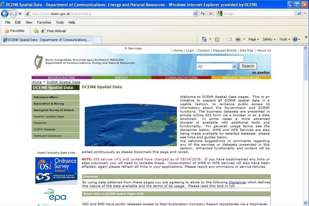
14 Administrative Data on PL Areas: Past & Present Licensees

15 Administrative Data on PL Areas: Environmental Constraints
16 Demonstration of EMD s Publicly Available Digital Datasets (2) 1. Exploration Company Reports & Administrative Data on P.L. Areas 2. Airborne Geophysics Data 3. Web Mapping Services

17 Available Airborne Geophysics Data (1) Approx. 40 surveys since 1985 Majority of surveys overflown Lower Carboniferous Most common surveys are magnetics and EM Must lodge all raw, processed and interpreted data with EMD

18 Available Airborne Geophysics Data (2) Data normally submitted in ASCII and Geosoft.gdb &.grd formats Held confidential for 4 years after lodgement date Datasets very large. Currently only available on CD.

19 Enhanced magnetics image with structural lineaments at Tynagh (Image courtesy of PGW Europe Ltd. and Navan Resources Plc )
20 Demonstration of EMD s Publicly Available Digital Datasets (3) 1. Exploration Company Reports & Administrative Data on P.L. Areas 2. Airborne Geophysics Data 3. Web Mapping Services
21 Access to EMD Web Mapping Services Can be accessed via the spatial data pages of the DCENR website at Also accessible from the mineralsireland.ie website at
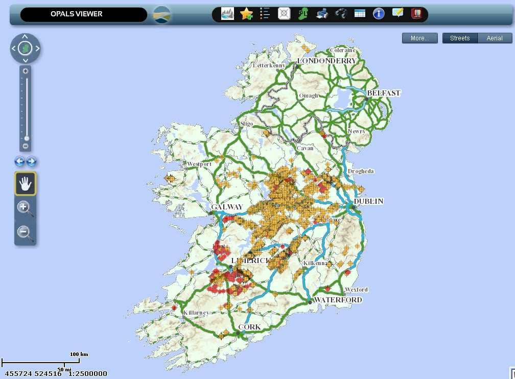
22 Number of different map viewers for visualizing EMD geospatial data. Simple viewer developed for novice GIS users Simple, intuitive interface Very limited tool set Provides access to limited number of basic datasets EMD Map Viewers Alternative map-based gateway to company exploration reports.
23 EMD Advanced Viewers Developed for more experienced GIS users Considerably richer in terms of GIS functionality More advanced tools (e.g. select, extract, annotation, measure & print tools) Three different Advanced viewers Exploration Viewer provides access to: Borehole data including logs Mineral deposit occurrences Geology maps Airborne geophysics survey areas Mining Viewer provides access to: Current and expired State Mining Facilities Historic mines Shafts and adits Environmental Constraints Viewer provides access to: National Parks NPWS Data (SAC, SPA and NHAs) Forestry areas National/Historic Monuments Advanced viewers currently offline.. Grrrr!

24 Data Downloads & Web Mapping Services Shapefiles of selected EMD data sets are available for download as Winzip files. WMS and WFS feeds also available. Allows users to access EMD geospatial data directly through their own desktop GIS.
25 The Simple Web Viewer

26 Simple Viewer: PLA Status

27 Simple Viewer: Returning Information on PL Areas

28 Simple Viewer: Access to Company Reports

29 Simple Viewer: Zoom in on PLA
30 Future EMD Web Mapping Developments EMD currently upgrading map viewers New viewer already developed for internal use; Hoped that public-facing version of viewer will be available in the New Year. Here s a sneak preview.
31

32 New Viewer: PL Areas and drillhole information, OSi map backdrop

33 New Viewer: Drillholes on geological backdrop

34 New Viewer: Environmental Constraint Data on OSi base maps

35 New Viewer: Environmental Constraint Data on aerial photos

36 New Viewer: Attribute Information on Drillholes


37 New Viewer: Access to drillhole logs

38 New Viewer: 3D Rendering Tools
39 Want more information? Contact: (or Or visit:
Administration of Mineral Rights
 Administration of Mineral Rights Deborah Archibald Industry, Tourism and Investment, GNWT Malcolm Robb Aboriginal Affairs and Northern Development Canada Business Today How applications are being treated
Outline Brief Overview MapPlace Website Data Delivery & Map Themes Digital Geology
 BRITISH COLUMBIA GEOLOGICAL SURVEY Kirk Hancock Pat Desjardins Nick Massey BRITISH COLUMBIA Ministry of Energy and Mines Ward Kilby acknowledged developer of MapPlace Outline Brief Overview MapPlace Website
SIXTH SCHEDULE REPUBLIC OF SOUTH SUDAN MINISTRY OF PETROLEUM, MINING THE MINING (MINERAL TITLE) REGULATIONS 2015
 REGULATIONS 2015") SIXTH SCHEDULE REPUBLIC OF SOUTH SUDAN MINISTRY OF PETROLEUM, MINING THE MINING ACT, 2012 THE MINING (MINERAL TITLE) REGULATIONS 2015 Guidelines should be prepared by the Directorate of Mineral Development
SIXTH SCHEDULE REPUBLIC OF SOUTH SUDAN MINISTRY OF PETROLEUM, MINING THE MINING ACT, 2012 THE MINING (MINERAL TITLE) REGULATIONS 2015 Guidelines should be prepared by the Directorate of Mineral Development
MINERAL OCCURRENCE DATA SYSTEM
 Current Research (2011) Newfoundland and Labrador Department of Natural Resources Geological Survey, Report 11-1, pages 341-345 MINERAL OCCURRENCE DATA SYSTEM G.J. Stapleton, J.L. Smith and H.M. Rafuse
Introduction to ArcGIS Maps for Office. Greg Ponto Scott Ball
 Introduction to ArcGIS Maps for Office Greg Ponto Scott Ball Agenda What is Maps for Office? Platform overview What are Apps for the Office? ArcGIS Maps for Office features - Visualization - Geoenrichment
ASX RELEASE REVIEW OF GLANDORE DATA TO DEFINE DRILL PROGRAM
 ASX RELEASE 4 April 2007 REVIEW OF GLANDORE DATA TO DEFINE DRILL PROGRAM The Directors of Hemisphere Resources Limited ( Hemisphere or the Company ) are pleased to announce that a review has been conducted
Mineral Exploration Using GIS
 King Fahad University of Petroleum and Minerals City and Regional Planning Department CRP 514: Introduction to GIS Term 112 Mineral Exploration Using GIS Term paper presentation By Mutasim Osman ID # g201105050
SoilView: Development of a Custom GIS Application for Publishing Soil Surveys
 SoilView: Development of a Custom GIS Application for Publishing Soil Surveys Allan Johnson and Mike Wigginton Abstract Currently, digital soils information can be obtained from many sources. Numerous
Guidelines for the Form of Reports and Illustrations
 Guidelines for the Form of Reports and Illustrations as Prescribed by the Minister as per Section 55(2) of The Consolidated Newfoundland and Labrador Regulation 1143/96 (As Amended) (Revised - December,
THE BHP AIRBORNE TEM AND MAGNETIC SURVEY (1997) OVER THE CARRICKMACROSS, NEWBRIDGE, SUMMERHILL, TULLAMORE WEST, TULLAMORE EAST AND LISHEEN AND NAVAN
 OVER THE CARRICKMACROSS, NEWBRIDGE, SUMMERHILL, TULLAMORE WEST, TULLAMORE EAST AND LISHEEN AND NAVAN") THE BHP AIRBORNE TEM AND MAGNETIC SURVEY (1997) OVER THE CARRICKMACROSS, NEWBRIDGE, SUMMERHILL, TULLAMORE WEST, TULLAMORE EAST AND LISHEEN AND NAVAN TEST AREAS December 2001 Department of the Marine and
THE BHP AIRBORNE TEM AND MAGNETIC SURVEY (1997) OVER THE CARRICKMACROSS, NEWBRIDGE, SUMMERHILL, TULLAMORE WEST, TULLAMORE EAST AND LISHEEN AND NAVAN TEST AREAS December 2001 Department of the Marine and
Utilization and Provision of Geographical Name Information on the Basic Map of Japan*
 UNITED NATIONS WORKING PAPER GROUP OF EXPERTS NO. 1/9 ON GEOGRAPHICAL NAMES Twenty-eight session 28 April 2 May 2014 Item 9 of the Provisional Agenda Activities relating to the Working Group on Toponymic
Outline. What is MapPlace? MapPlace Toolbar & PopUp Menu. Geology Themes 1:5M 1:1M BCGS 1:250,000. Terranes
 Outline BRITISH COLUMBIA Overview and Explore MapPlace Website Data Delivery & Map Themes Data Sources & Updates Feature Topics New Data & Maps New MINFILE Online Exploration Assistant with Image Analysis
IRDAT Fvg, evolving a regional Spatial Data Infrastructure according to INSPIRE
 IRDAT Fvg, evolving a regional Spatial Data Infrastructure according to INSPIRE Tutti i diritti riservati. Proprietà INSIEL SpA. A. Benvenuti, A. Chiarandini Insiel (Italy) M. Lunardis - Friuli Venezia
GIS: Introductory Guide to MapPlace. Workshop Agenda. How the Maps Work. Geographic Information Systems. -The MapPlace is a web GIS application
 1 Introductory Guide to MapPlace Workshop 2007 Larry Jones MapPlace & Geoscience Databases Pat Desjardins Corporate GIS Gib McArthur Manager, Resource Information Kirk Hancock MINFILE Geologist Ward Kilby
Licensed Science Officer Benchmark
 POSITION EVALUATION RATIONALE POSITION TITLE MINISTRY AND DIVISION Energy, Mines and Petroleum Resources: Geology Division BRANCH AND SECTION Mineral Resources Branch, Applied Geology Section UNIT OR PROGRAM
Spatial Statistical Information Services in KOSTAT
 Distr. GENERAL WP.30 12 April 2010 ENGLISH ONLY UNITED NATIONS ECONOMIC COMMISSION FOR EUROPE (UNECE) CONFERENCE OF EUROPEAN STATISTICIANS EUROPEAN COMMISSION STATISTICAL OFFICE OF THE EUROPEAN UNION (EUROSTAT)
Metallic Mineral Exploration in Minnesota: Typical Exploration Activities. Division of Lands and Minerals Minnesota Department of Natural Resources
 Metallic Mineral Exploration in Minnesota: Typical Exploration Activities Division of Lands and Minerals Minnesota Department of Natural Resources Metallic minerals can only be mined economically where
indigeo Consultants Pvt Ltd Geophysical Surveys Geological Surveys GIS & Data Solutions Image Processing indigeo Company Profile, Page 1
 indigeo Consultants Pvt Ltd Geophysical Surveys Geological Surveys GIS & Data Solutions Image Processing MM Corner, 3 rd Floor #58, Banaswadi Main Road Bangalore 560033 INDIA Ph: +91 80 41638310 Mob: +91
v WMS Tutorials GIS Module Importing, displaying, and converting shapefiles Required Components Time minutes
 v. 11.0 WMS 11.0 Tutorial Importing, displaying, and converting shapefiles Objectives This tutorial demonstrates how to import GIS data, visualize it, and convert it into WMS coverage data that could be
Mineral Resources Branch. Natural Resources
 Mineral Resources Branch Natural Resources ! Brian Fisher - Geologist / GIS Specialist - supervisor! Jeff Poole - Geologist / GIS Specialist - IMS specialist! John MacNeil - Geologist / GIS Specialist
Alba Mineral Resources plc ("Alba" or the "Company") Field Programme at Amitsoq Discovers Multiple New Graphite Beds
 Field Programme at Amitsoq Discovers Multiple New Graphite Beds") 18 July 2017 Alba Mineral Resources plc ("Alba" or the "Company") Field Programme at Amitsoq Discovers Multiple New Graphite Beds Alba Mineral Resources plc (AIM: ALBA) is pleased to announce that it has
18 July 2017 Alba Mineral Resources plc ("Alba" or the "Company") Field Programme at Amitsoq Discovers Multiple New Graphite Beds Alba Mineral Resources plc (AIM: ALBA) is pleased to announce that it has
Namibia Rare Earths Inc. Mobilizes for Airborne Survey Over Kunene Cobalt-Copper Project as Exploration Ramps Up
 Press Release Namibia Rare Earths Inc. Mobilizes for Airborne Survey Over Kunene Cobalt-Copper Project as Exploration Ramps Up Detailed airborne electromagnetic and magnetic survey comprising 3,700 line
THE NAVAN RESOURCES AIRBORNE MAGNETIC SURVEY (1998) OVER THE TYNAGH AREA. December Department of Communications, Marine and Natural Resources
 OVER THE TYNAGH AREA. December Department of Communications, Marine and Natural Resources") THE NAVAN RESOURCES AIRBORNE MAGNETIC SURVEY (1998) OVER THE TYNAGH AREA December 2003 Department of Communications, Marine and Natural Resources Department of Communications, Marine and Natural Resources
THE NAVAN RESOURCES AIRBORNE MAGNETIC SURVEY (1998) OVER THE TYNAGH AREA December 2003 Department of Communications, Marine and Natural Resources Department of Communications, Marine and Natural Resources
Global Geospatial Information Management Country Report Finland. Submitted by Director General Jarmo Ratia, National Land Survey
 Global Geospatial Information Management Country Report Finland Submitted by Director General Jarmo Ratia, National Land Survey Global Geospatial Information Management Country Report Finland Background
Table 1 - Checklist of Assessment and Reporting Criteria (The JORC Code, 2012 Edition)
") DINGO (PEARL CREEK) PROJECT JORC RESOURCE Table 1 - Checklist of Assessment and Reporting Criteria (The JORC Code, 2012 Edition) The following table provides a summary of important assessment and reporting
DINGO (PEARL CREEK) PROJECT JORC RESOURCE Table 1 - Checklist of Assessment and Reporting Criteria (The JORC Code, 2012 Edition) The following table provides a summary of important assessment and reporting
DENR s Oil and Gas Initiative. Legislative briefing March 7, 2011 by DENR s Geological Survey Program
 DENR s Oil and Gas Initiative Legislative briefing March 7, 2011 by DENR s Geological Survey Program South Dakota DOES have exploration for and production of oil and gas Taken from http://denr.sd.gov/des/og/producti.aspx
Developing a Spatial Data Infrastructure for Cultural Heritage
 Developing a Spatial Data Infrastructure for Cultural Heritage Peter M c Keague (RCAHMS) Anthony Corns and Robert Shaw (Discovery Programme) Developing a Spatial Data Infrastructure for Cultural Heritage
Earth Sciences Report Alberta Kimberlite-Indicator Mineral Geochemical Compilation
 Earth Sciences Report 2001-20 Alberta Kimberlite-Indicator Mineral Geochemical Compilation Alberta Kimberlite-Indicator Mineral Geochemical Compilation D.R. Eccles 1, M. Dufresne 2, D. Copeland 2, W. Csanyi
MRD 207 METADATA DETAIL PAGE
 MRD 207 METADATA DETAIL PAGE The following represents the Basic description of an information holding. To obtain more information about this holding, see the section named Contacts. GENERAL INFORMATION
Geoinformation as a basis for the sustainable use of the subsurface. (Northern Germany)
") Geoinformation as a basis for the sustainable use of the subsurface An approach from Lower Saxony (Northern Germany) Jörg Elbracht, Hans Joachim Heineke & Udo Müller Geologic Survey of Lower Saxony Dep.
Geoinformation as a basis for the sustainable use of the subsurface An approach from Lower Saxony (Northern Germany) Jörg Elbracht, Hans Joachim Heineke & Udo Müller Geologic Survey of Lower Saxony Dep.
When Map Quality Matters
 When Map Quality Matters 50% 25% Powerful geospatial mapping tools for Adobe Creative Cloud and offline map solutions for mobile devices 20% When Map Quality Matters 10% We re focused on creating powerful
GOULAMINA DRILLING AND GENERAL PROGRESS UPDATE
 21 November 2017 GOULAMINA DRILLING AND GENERAL PROGRESS UPDATE HIGHLIGHTS RC drilling at Danaya and Yando completed. RC drilling at Danaya intersects very wide (>117m) spodumene bearing pegmatite zone.
Providing Public Access to King County GIS Data. Presented by: Michael Jenkins King County GIS Center Seattle, WA
 Providing Public Access to King County GIS Data Presented by: Michael Jenkins King County GIS Center Seattle, WA King County, Washington Microsoft Boeing Amazon.Com Starbucks Port of Seattle Weyerhauser
Overview. Everywhere. Over everything.
 Cadenza Desktop Cadenza Web Cadenza Mobile Cadenza Overview. Everywhere. Over everything. The ultimate GIS and reporting suite. Provide, analyze and report data efficiently. For desktop, web and mobile.
One platform for desktop, web and mobile
 One platform for desktop, web and mobile Search and filter Get access to all data thematically filter data in context factually and spatially as well as display it dynamically. Export a selection or send
SUSTAINABLE GROWTH FROM GEOLOGY. gtk.fi
 SUSTAINABLE GROWTH FROM GEOLOGY gtk.fi Geological Survey of Finland The Geological Survey of Finland (GTK) is a leading European competence centre for the assessment and sustainable use of geological resources.
ERDAS ER Mapper Software
 ERDAS ER Mapper Software ER Mapper professional software is widely used in exploration industry and geologist worldwide for satellite image exploitation. It is known for its:- Powerful image processing
GEOPHYSICAL DATA SET (GDS) 1084B METADATA
 1084B METADATA") GEOPHYSICAL DATA SET (GDS) 1084B METADATA GENERAL INFORMATION Official Name of the Data Set or Information Holding: Ontario Airborne Geophysical Surveys, Magnetic Gradiometer and Gamma-Ray Spectrometric
GEOPHYSICAL DATA SET (GDS) 1084B METADATA GENERAL INFORMATION Official Name of the Data Set or Information Holding: Ontario Airborne Geophysical Surveys, Magnetic Gradiometer and Gamma-Ray Spectrometric
The Need for Regional Geological Datasets
 The Need for Regional Geological Datasets Dr. Eibhlín Doyle PGeo Geological Survey of Ireland Regional Data Why What Who Future 2006 Why? Place developments in context Land use decision making Assist policy
DISTRICTS, MINES, AND GEOCHEMISTRY DATABASES IN NEW MEXICO. Virginia T. McLemore and Maureen Wilks
 DISTRICTS, MINES, AND GEOCHEMISTRY DATABASES IN NEW MEXICO Virginia T. McLemore and Maureen Wilks ACKNOWLEDGEMENTS New Mexico Energy, Minerals and Natural Resource Department Company annual reports Personal
OPEN ACCESS GEOLOGY: USING THE INSTITUTIONAL REPOSITORY TO HOST STATE GEOLOGICAL SURVEY PUBLICATIONS
 OPEN ACCESS GEOLOGY: USING THE INSTITUTIONAL REPOSITORY TO HOST STATE GEOLOGICAL SURVEY PUBLICATIONS Lisa Johnston and Harvey Thorleifson Science and Engineering Library, University of Minnesota, 108 Walter
MPM Online Tool ArcSDM 5 Final Seminar May 4 th 2018, Rovaniemi
 http://gtkdata.gtk.fi/mpm/ ArcSDM 5 Final Seminar May 4 th 2018, Rovaniemi Funding 2 Vesa Nykänen/ArcSDM5 Seminar 4.5. 2018 http://gtkdata.gtk.fi/mpm/ 3 Vesa Nykänen/ArcSDM5 Seminar 4.5. 2018 http://gtkdata.gtk.fi/mpm/
Valuation Early Stage Exploration Projects
 Valuation Early Stage Exploration Projects Presented By: Tracey Laight Date: 20 January 2016 Location: AMA London SRK Exploration Services Ltd 2016. All rights reserved. Everything has a value Every project
Modular Web Framework for the BRANDENBURGVIEWER
 Modular Web Framework for the BRANDENBURGVIEWER Geoinformation System (GIS) 2 GIS = geo + information + system + + Survey of data Organization of data Processing and Analysis Presentation geodata infrastructure
Management of Public Geoscience Data
 Management of Public Geoscience Data A Guide to Australian Practice GIRAF Workshop Ian Satchwell September 2013 Management of Public Geoscience Data - A Guide to Australian Practice Based on a paper by
Geoíndex: a public data dissemination service from the IGC. Geoíndex IGC Team Reporter: Carme Puig
 Geoíndex: a public data dissemination service from the IGC Geoíndex IGC Team Reporter: Carme Puig 2 Brief IGC introduction The IGC was created through the Law 19/2005 of the Catalan Parliament. The IGC
For personal use only
 DIRECTORS Mr Martin Blakeman Executive Chairman Mr Winton Willesee Non-Executive Director Mr Eric de Mori Non-Executive Director COMPANY SECRETARY Mr Winton Willesee ASX Release 28 August 2012 Newera Commences
PROJECT 81 Lucas Gold Deposit 2018 Winter Drilling Program Assay Results
 TSX.V: NOB FWB: NB7 OTC.PK: NLPXF PROJECT 81 Lucas Gold Deposit 2018 Winter Drilling Program Assay Results Toronto, Ontario June 27, 2018 - Noble Mineral Exploration Inc. ( Noble or the "Company") (TSX-V:NOB,
Write a report (6-7 pages, double space) on some examples of Internet Applications. You can choose only ONE of the following application areas:
 on some examples of Internet Applications. You can choose only ONE of the following application areas:") UPR 6905 Internet GIS Homework 1 Yong Hong Guo September 9, 2008 Write a report (6-7 pages, double space) on some examples of Internet Applications. You can choose only ONE of the following application
UPR 6905 Internet GIS Homework 1 Yong Hong Guo September 9, 2008 Write a report (6-7 pages, double space) on some examples of Internet Applications. You can choose only ONE of the following application
1 Maximising Economic Recovery (MER) using GIS
 using GIS") www.ogauthority.co.uk @OGAuthority 1 Maximising Economic Recovery (MER) using GIS Open Data for the North Sea & Beyond John Seabourn Senior Mapping and GIS Manager Oil and Gas Authority Grahame Blakey
www.ogauthority.co.uk @OGAuthority 1 Maximising Economic Recovery (MER) using GIS Open Data for the North Sea & Beyond John Seabourn Senior Mapping and GIS Manager Oil and Gas Authority Grahame Blakey
Geodata flow TUKES GTK mineral exploration data - future prospecting capital!
 Geodata flow TUKES GTK mineral exploration data - future prospecting capital! Head of Unit, Regional Geodata and Interpretation Jouni Vuollo, GTK, 2016 Final report Six months Mineral exploration data
NSDI Policy Framework of Japan - Roles of the Private Sector in SDI -
 NSDI Policy Framework of Japan - Roles of the Private Sector in SDI - Hiroshi Murakami (GSI) Geospatial World Forum 2012 Amsterdam Background Survey Act (1949) mandates the (GSI) to develop and provide
GLY3160 / PHY3160 Introduction to Geophysics
 GLY3160 / PHY3160 Introduction to Geophysics What is geophysics? Comes in two* basic flavors *(your text says three) Pure (academic) geophysics Studying various Earth processes from a physics approach.
Enhance Security, Safety and Efficiency With Geospatial Visualization
 Areas within 10 minutes of an exit are emphasized on this map, to give an indication of how accessible neighborhoods are by highway. The colors represent 1, 3, 5 and 10 minute increments from the exits.
WHAT IS MINERAL EXPLORATION?
 INDABA PRESENTATION CAPE TOWN FEBRUARY 2017 AIM:SAV WHAT IS MINERAL EXPLORATION? AIM:SAV What is mineral exploration? 2 Exploration is the term used to describe a wide range of activities aimed at searching
McElroy Bryan Geological Services. Consulting Geologists since 1970 CORPORATE PROFILE
 McElroy Bryan Geological Services Consulting Geologists since 1970 CORPORATE PROFILE WHO WE ARE McElroy Bryan Geological Services (MBGS) is a group of professional geologists providing specialist consulting
Data Collection & Sample Storage
 Development, Implementation and Regulation of Exploration Programmes for Uranium Mineral Resources Data Collection & Sample Storage Regional Training Course: RAF 3007-2 Malawi, 24-28 May 2010 International
Management of Geological Information for Mining Sector Development and Investment Attraction Examples from Uganda and Tanzania
 Mineral Wealth Conference 2016 Kampala / Uganda Management of Geological Information for Mining Sector Development and Investment Attraction Examples from Uganda and Tanzania Andreas Barth 1, Andreas Knobloch
February 7, Jay Krafthefer, L.S.
 February 7, 2013 Jay Krafthefer, L.S. Introduction Background Web applications References Maps released on the Internet self-service not filed for record referenced by Commissioner s orders (Minn. Statute
UNICORN MINERAL RESOURCES LIMITED
 UNICORN MINERAL RESOURCES LIMITED IRISH MIDLANDS OREFIELD COPPER / LEAD / ZINC and SILVER EXPLORATION PROJECTS WWW.UNICORNMINERALRESOURCES.COM 1 Forward Looking Statements Disclaimer Certain information
For personal use only
 ASX ANNOUNCEMENT ACN 123 567 073 3 July 2014 NEW FRASER RANGE PROJECT AREA AT KITCHENER New 100%-owned exploration licence application covers 203km 2, situated on the Fraser Range Gravity High Enterprise
Spruce Ridge Resources Ltd Leslie Road West, Puslinch, ON N0B 2J0 Telephone: (519) , Fax: (519)
 , Fax: (519)") Spruce Ridge Resources Ltd. 7735 Leslie Road West, Puslinch, ON N0B 2J0 Telephone: (519) 822-5904, Fax: (519) 823-5090 PRESS RELEASE 2018-07 July 24, 2018 Spruce Ridge Resources Provides Update on the
Spruce Ridge Resources Ltd. 7735 Leslie Road West, Puslinch, ON N0B 2J0 Telephone: (519) 822-5904, Fax: (519) 823-5090 PRESS RELEASE 2018-07 July 24, 2018 Spruce Ridge Resources Provides Update on the
Victory plans gravity survey for Bonaparte after encouraging rock-chip results
 ASX ANNOUNCEMENT 18 September 2017 Victory plans gravity survey for Bonaparte after encouraging rock-chip results Highlights Rock-chip sampling program at Bonaparte Project returns highly encouraging results
MINERAL OCCURRENCE DATA SYSTEM
 Current Research (2008) Newfoundland and Labrador Department of Natural Resources Geological Survey, Report 08-1, pages 237-241 MINERAL OCCURRENCE DATA SYSTEM G.J. Stapleton, J.L. Smith and T. van Nostrand
NEW KIMBERLITE DISCOVERY THE RIACHAO DIAMOND PROJECT
 NEW KIMBERLITE DISCOVERY THE RIACHAO DIAMOND PROJECT TSX- V STAR Market Release 30 May 2017 FIVE STAR DIAMONDS LIMITED Av. Jornalista Ricardo Marinho, 360 Ed. Cosmopolitan - Sala 113, CEP 22631-350 Barra
GIS Building Communities beyond National Borders (Building Successful Spatial Data Infrastructures) Nick Land, ESRI Europe
 Nick Land, ESRI Europe") GIS Building Communities beyond National Borders (Building Successful Spatial Data Infrastructures) Nick Land, ESRI Europe UK worst flooding in the last 60 years 350,000 households without drinking water
GIS Building Communities beyond National Borders (Building Successful Spatial Data Infrastructures) Nick Land, ESRI Europe UK worst flooding in the last 60 years 350,000 households without drinking water
Harvey Thorleifson, Director, Minnesota Geological Survey. Status of geological mapping needed for groundwater protection in Minnesota
 Harvey Thorleifson, Director, Minnesota Geological Survey Status of geological mapping needed for groundwater protection in Minnesota Minnesota is located between the Dakotas and Wisconsin, north of Iowa,
GTK GeoKernel and Data Management. Material from Niina Ahtonen, Esa Kauniskangas and Tero Rönkkö
 GTK GeoKernel and Data Management Esa Kauniskangas 31.5.2010 Material from Niina Ahtonen, Esa Kauniskangas and Tero Rönkkö 1 GTK s operational areas Northern Finland Office Rovaniemi Western Finland Office
Project Development in Argentina. For Wind Energy and Minerals Using Spatial Data Modelling
 Project Development in Argentina For Wind Energy and Minerals Using Spatial Data Modelling Introduction Development of New Business Opportunities in Argentina Key Project for Kenex Since Mining 2010. Based
Houston Plat Tracker puts the GIS in Land Development
 Houston Plat Tracker puts the GIS in Land Development Abstract: The Plat Tracker supports Houston's land development approval process. This home grown web-based system includes GIS research tools and a
GIS ADMINISTRATOR / WEB DEVELOPER EVANSVILLE-VANDERBURGH COUNTY AREA PLAN COMMISSION
 GIS ADMINISTRATOR / WEB DEVELOPER EVANSVILLE-VANDERBURGH COUNTY AREA PLAN COMMISSION SALARY RANGE INITIATION $43,277 SIX MONTHS $45,367 POSITION GRADE PAT VI The Evansville-Vanderburgh County Area Plan
High Grade Gold Drill Results and Successful Soil Sample Programme
 Sula Iron & Gold plc / Index: AIM / Epic: SULA / Sector: Natural Resources 26 September 2017 Sula Iron & Gold plc ("Sula" or the "Company") High Grade Gold Drill Results and Successful Soil Sample Programme
MRD 281. Official Name of the Data Set or Information Holding: Northeastern Ontario Rhyolite Database
 MRD 281 GENERAL INFORMATION Official Name of the Data Set or Information Holding: Northeastern Ontario Rhyolite Database Acronyms are Used to Identify the Data Set or Information Holding: MRD281 Describe
REPORT ON INVESTMENTS
 REPORT ON INVESTMENTS D.T2.3.3 Investments for technical equipment for the implementation of Web-GIS platform in Mantova 1 Local support group designing Mantova Web-GIS platform. Picture by Maria Giulia
Aurion Provides Update on 2018 Drill Program and Reports High Grade Gold Results...
 Page 1 of 5 News 2018 Aurion Provides Update on 2018 Drill Program and Reports High Grade Gold Results at A2 and Aamurusko Northwest Aug 17, 2018 Aurion Resources Ltd. (TSX VENTURE:AU) ( Aurion Aurion
1 Complementary Access Tools
 ENERGY IHS AccuMap Shaped by industry and powered by IHS Markit information, AccuMap is a powerful and intuitive interpretation solution for the Canadian Energy Industry. 1 Complementary Access Tools AccuLogs
UPDATE ON HYDROCARBON LAW AND PROJECTIONS OF SHALE GAS RESOURCES
 UPDATE ON HYDROCARBON LAW AND PROJECTIONS OF SHALE GAS RESOURCES Marta Wagrodzka Department of Geology and Geological Concessions April 24 th, 2013 American-Polish Energy Roundtable Primary energy demand
ESRI GIS For Mining Seminar, 10 th August, 2016, Nairobi, Kenya. Spatial DATA Solutions for Mining
 ESRI GIS For Mining Seminar, 10 th August, 2016, Nairobi, Kenya Spatial DATA Solutions for Mining Spatial Data Solutions for Mining Spatial - Data that identifies the geographic location of features &
June 2017 Quarterly Report
 ASX ANNOUNCEMENT Date: 31 July 2017 June 2017 Quarterly Report Victory Mines Limited (ASX:VIC) ( Victory or the Company ) provides a review of its activities during the June 2017 quarter. Exploration Western
Introducing SIMON Sefton Interactive Maps ONline
 Cadcorp Local Government Conference Thursday 23 rd March 2017 Introducing SIMON Sefton Interactive Maps ONline www.sefton.gov.uk Introduction Chris Nelson - Technical Officer, Planning Services SIMON and
Our Services. What We Do. How We Can Help. Contact us today: January (0)
") Listening and Understanding to Optimize our Efficiency Our Experience and Knowledge to Work for You Tailor-made Solutions to Meet your Needs Our Challenge is You Success What We Do Our Services GeoViz
Listening and Understanding to Optimize our Efficiency Our Experience and Knowledge to Work for You Tailor-made Solutions to Meet your Needs Our Challenge is You Success What We Do Our Services GeoViz
GIS Resources for Local Governments
 ISSUE PAPER SERIES GIS Resources for Local Governments February 2018 NEW YORK STATE TUG HILL COMMISSION DULLES STATE OFFICE BUILDING 317 WASHINGTON STREET WATERTOWN, NY 13601 (315) 785-2380 WWW.TUGHILL.ORG
Digital Wetlands. Bringing the Field into the Office Through GIS
 Digital Wetlands Bringing the Field into the Office Through GIS Maryland Department of the Environment Wetlands and Waterways Program MDE's Wetlands and Waterways Program seeks to conserve valuable aquatic
The International Mining & Minerals Association. The new home for mining and minerals professionals in the UK and overseas
 The International Mining & Minerals Association The new home for mining and minerals professionals in the UK and overseas IMMa embraces all the professions within the minerals industries: Exploration,
The MapPlace Using Web-Based Mineral Exploration Data as an Environmental Tool
 The MapPlace Using Web-Based Mineral Exploration Data as an Environmental Tool David Tupper PGeo Pottinger Gaherty Environmental Consultants Ltd Ward Kilby PGeo Cal Data Ltd Larry Jones PGeo BC Ministry
Compiling historic YCGC data for lower Hunker Creek and reconstructing gold distribution. Sydney van Loon Yukon Geological Survey
 Compiling historic YCGC data for lower Hunker Creek and reconstructing gold distribution Sydney van Loon Yukon Consolidated Gold Corp. inventoried creeks for over four decades; operated up to 12 dredges
Adding value to Copernicus services with member states reference data
 www.eurogeographics.org Adding value to Copernicus services with member states reference data Neil Sutherland neil.sutherland@os.uk GIS in the EU 10 November 2016 Copyright 2016 EuroGeographics 61 member
DMT Consulting Limited Technical Memorandum
 DMT Consulting Limited International Mining Consultants From: To: Date: 4 th June 2018 Project Number: 2067 6813 Document Number DMT Consulting Limited Technical Memorandum Tim Horner Principal Geologist
TERMS OF REFERENCE FOR PROVIDING THE CONSULTANCY SERVICES OF
 1 Cartographic Database and TM100 Product Specifications TERMS OF REFERENCE FOR PROVIDING THE CONSULTANCY SERVICES OF Production and establishment of cartographic database for scale 1:100,000 and production
FAO GAEZ Data Portal
 FAO GAEZ Data Portal www.fao.org/nr/gaez Renato Cumani Environment Officer Land and Water Division Natural Resources Management and Environment Department Food and Agriculture Organization of the UN October
Updated Core & Drill Cutting Material Sampling Procedure. Holly Naysmith April 23, 2014
 Updated Core & Drill Cutting Material Sampling Procedure Holly Naysmith April 23, 2014 Agenda Background Location of data on AER website Test categories Overview of procedure document Material sampling
Data Aggregation with InfraWorks and ArcGIS for Visualization, Analysis, and Planning
 Data Aggregation with InfraWorks and ArcGIS for Visualization, Analysis, and Planning Stephen Brockwell President, Brockwell IT Consulting, Inc. Join the conversation #AU2017 KEYWORD Class Summary Silos
Spatial Data Infrastructure Concepts and Components. Douglas Nebert U.S. Federal Geographic Data Committee Secretariat
 Spatial Data Infrastructure Concepts and Components Douglas Nebert U.S. Federal Geographic Data Committee Secretariat August 2009 What is a Spatial Data Infrastructure (SDI)? The SDI provides a basis for
UNIT 4: USING ArcGIS. Instructor: Emmanuel K. Appiah-Adjei (PhD) Department of Geological Engineering KNUST, Kumasi
 Department of Geological Engineering KNUST, Kumasi") UNIT 4: USING ArcGIS Instructor: Emmanuel K. Appiah-Adjei (PhD) Department of Geological Engineering KNUST, Kumasi Getting to Know ArcGIS ArcGIS is an integrated collection of GIS software products ArcGIS
UNIT 4: USING ArcGIS Instructor: Emmanuel K. Appiah-Adjei (PhD) Department of Geological Engineering KNUST, Kumasi Getting to Know ArcGIS ArcGIS is an integrated collection of GIS software products ArcGIS
Demystifying ArcGIS Online. Karen Lizcano Esri
 Demystifying ArcGIS Online Karen Lizcano Esri An Integrated Web GIS Platform Desktop Web Device Powered by Services Managed via Portal Access from any Device Portal Server Online Content and Services ArcGIS
CHAPTER 7 PRODUCT USE AND AVAILABILITY
 CHAPTER 7 PRODUCT USE AND AVAILABILITY Julie Prior-Magee Photo from SWReGAP Training Site Image Library Recommended Citation Prior-Magee, J.S. 2007. Product use and availability. Chapter 7 in J.S. Prior-Magee,
******************* *******************
 This announcement lifts the trading halt requested by the Company on the 13 September 2012 Announcement to the Australian Securities Exchange Monday 17 September 2012 COMPANY UPDATE PARTIALLY UNDERWRITTEN
Standardisation and Archiving of Hong Kong Tunnel Logging Records
 Standardisation and Archiving of Hong Kong Tunnel Logging Records R.J. Sewell, D.L.K. Tang & K.J. Roberts Geotechnical Engineering Office Civil Engineering and Development Department Government of the
Maximising Gold Resources in Senegal
 ASX: BSR Maximising Gold Resources in Senegal Senegal International Mining Conference, Dakar 6-8 Disclaimer & Competent Persons Statement This presentation has been prepared by Bassari Resources Limited
Significant Copper-Gold JORC Exploration Target
 12 March 2013 Highlights: ASX & MEDIA ANNOUNCEMENT Significant Copper-Gold JORC Exploration Target ü JORC i Exploration Target 1 of 4.8-6.2Mt @ 2.00-2.78% Cu and 1.23-2.23g/t Au confirmed. ü Opportunity