The Niobrara Petroleum System, Rocky Mountain Region. Steve Sonnenberg & James Taylor Colorado School of Mines
|
|
|
- Marjory Wright
- 6 years ago
- Views:
Transcription
1 The Niobrara Petroleum System, Rocky Mountain Region Steve Sonnenberg & James Taylor Colorado School of Mines

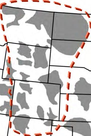
2 The Niobrara-Mancos Oil & Gas Play, Rocky Mountain Region
3 Niobrara and Mancos Production, Rocky Mountain Region
4 Unconventional, Continuous Tight Oil Accumulations Pervasive petroleum saturation Mature source rocks Abnormally pressured Generally lacks down-dip water Up-dip water saturation Low porosity and permeability reservoirs Fields have diffuse boundaries Enhanced by fracturing
5 Factors Related to Tight Oil Production Source beds Mature source rocks form continuous oil column (pervasive saturation) Reservoir - favorable facies and diagenetic history (matrix permeability) Favorable history of fracture development: folds, faults, solution of evaporites, high fluid pressures, regional stress field (fracture permeability) Mechanical stratigraphy

6 Western Interior Cretaceous Basin Late Cretaceous 85Ma

7 WIC Seaway Niobrara Time Clay & Sand %TOC Modified from Longman et al., 1998

8 Cretaceous Cross Section, Western Interior Basin Modified from Kauffman, 1977
9 Isopach Niobrara Location of Transcontinental Arch CI: 100 ft Modified from Longman et al., 1998; Weimer, 1978

10 Modified from Longman et al., 1998

11 Modified from Longman et al., 1998, after Barlow, 1986

12 2000 ft 5600 ft Modified from Lockridge and Pollastro, 1988
13 Requirements of Source Rock Deposition High organic productivity Sunlight Nutrients Absence of poisons (H 2 S) Low destruction rate of organic material Absence of O 2 and biologic consumers Lack of dilution by other constituents i.e., shale, sandstone, etc.
 heavy rain of organic material (predominantly marine phytoplankton) Modified from Meissner et al.")
14 Oil Source Rocks Sapropelic Deposition stratified water column minimum depth of 150 ft (below photic zone and wave action) heavy rain of organic material (predominantly marine phytoplankton) Modified from Meissner et al., 1984; Webster, 1984

15 Mudstone Deposition
16 Modified from Sonnenberg and Weimer, 1993

17 Modified from Pollastro, 1992

18 Berthoud # 4 Shale Calcareous Shale Marl Chalk A B C FH

19 Niobrara Petroleum System Events Chart
20 Origin of Fractures Folding and Faulting Tectonic, diapiric, slumping Wrench faults Geologic History of Fractures Recurrent movement on basement shear zones Solution of evaporites High Fluid Pressure Maturation of source rocks Compaction and dewatering Regional stress field (i.e., regional fractures) Regional epeirogenic uplift
21 Structures and Associated Fractures From Austin Chalk Outcrops Friedman et al., 1992

22 Compaction-Dewatering North Sea Overpressured Shale (Brown, 2004)

23 3-D Seismic Pierre Kn Grnhrn Graneros D SS

24 Faults and Salt Edge Svoboda, 1995
25 Regional Horizontal Stress Orientation Generalized stress map, western US. Arrows represent direction of either least (outward directed) or greatest (inward direction) principal horizontal stress (modified from Zoback and Zoback, 1980)
26 Overpressuring in Rockies Basins INCREASING THERMAL METAMORPHISM VOLUME OF GENERATED FLUID HYDROCARBONS VOLUME OF ORIGINAL UNMETAMORPHOSED MATERIAL (KEROGEN) VOLUME OF METAMORPHOSED ORGANIC MATERIAL ASSUMES GENERATED HYDROCARBONS ARE RETAINED IN SYSTEM & CONVERT TO STABLE SPECIES Modified from Spencer, 1987 and Meissner, 1980

27 Regional Uplift
28 Powder River Basin

29 Background Geology Pelagic carbonate in water depths of feet (Similar to Austin Chalk) Only Smoky Hill Mbr. present in PRB. Chalks, marls and calcareous shales. Upper contact: Pierre, Conformable. Lower contact: Sage Breaks member of Carlile Shale, Unconformable Matrix perm <.01 md Porosity ~ 8-10%. (Anna, 2009)
30 Stratigraphy Inexco 1-12 Federal, T32N, R69W, Sec. 12 Pierre Shale Top Niobrara A B C Sage Breaks Mbr. Three chalk facies separated by marls. Similar to the stratigraphy of the Denver Basin. No Fort Hays member. Incorporated into the underlying Sage Breaks Mbr. of the Carlile Shale. B and C benches seem most prospective. Regional Continuity Historical Production/Shows Thickness
31 N Basin Axis Area of scouring into Sage Breaks Westward thickening 12 miles Total Total Niobrara Niobrara Isopach Isopach Niobrara exhibits an overall westward thickening trend in the study area Unusually thick area in the northeastern portion of the study area C bench is drastically thicker due to scouring into the underlying Sage Breaks. Total Niobrara thickness approaches 500 ft. Figure: Structure contour map of the top Niobrara.

32 N Basin Axis Basin Axis Area of scouring into Sage Breaks 12 miles Niobrara C Isopach Niobrara C Isopach Infilling of scours into underlying Sage Breaks Member of the Carlile Shale. Abnormally thick Interpretations for erosional mechanism includes Fluvial Submarine Area of max fill Total NBRR package thickens up to 500 ft. Some areas, Sage Breaks is completely eroded. C bench directly overlies the Turner
33 Basin Axis Basin Axis 12 miles 12 miles Niobrara B Isopach. Niobrara B bench currently the most exploited horizontal drilling target. Southern portion of the basin Converse and Campbell Counties. Niobrara B Isopach Favorable reservoir conditions Cleaner chalk facies Aerially extensive, thick Shows an overall westward thickening trend


34 Inexco 1-12 JT Federal. T32N R69W Sec. 12 Mineralogy XRD Inexco Jt 1-12 Federal Pyrite Top Niobrara 100 Plagioclase feldspar A B Mineral % Kaolinite Mica/illite Quartz Calcite Sample Depths (ft.) Sampled Interval Sage Breaks C Sampled part of the marl between the A and B chalk. Higher clay percentages in the first sample. Decrease in clay percentages in samples taken only from the B chalk. Log showing the interval of XRD analysis.

35 Thermal Maturity Western PRB, Niobrara hydrocarbon generation started about 30 Ma. Depth 8,000 ft., %R o 0.60 Average 3 wt.% TOC Oil prone type II marine kerogen Niobrara enters hydrocarbon window %R o >.60 Burial history diagram of the western PRB (Modified from Anna, 2009).
36 Thermal Maturity Decreasing API gravity Niobrara Depth> 8,000 Ft. Thermal Maturity. Published works state that 8,000 ft is the cutoff for oil generation in the Niobrara in the Powder River Basin (Anna, 2009). Based on observed %Ro. Burial depths of 8,000 ft or greater correspond to %Ro values of 0.6 or greater. Posted Niobrara oil API gravity. (Modified from Anna, 2009)

37 Thermal Maturity Johnson N Basin Center Campbell Converse Data collected from 30 locations throughout the southern portion of the basin. USGS Core Research Center Denver, Colorado Both cuttings and core data used. Tmax values range from o C. Interpretations limited by availability of data Contour map of maximum Tmax values for the 30 wells in the southern portion of the basin.

38 Thermal Maturity N Basin Center Thermal Maturity. Data collected from 30 locations throughout the southern portion of the basin. USGS Core Research Center Denver, Colorado Max TOC% values range from wt% Analysis method: Rock-Eval 2 Data indicates the Niobrara is organic rich Contour map of maximum TOC% for the 30 sampled wells in the southern portion of the basin.

39 Fracturing Johnston Johnson Natrona Campbell Converse Weston Niobrara Natural fractures are crucial for economic production in shale-oil reservoirs. In the PRB, overpressuring is seen on a basin wide scale in the Cretaceous shale section. Initial investigations indicate that natural fractures are present in the Niobrara at this locality. Area of overpressuring (red outline) coincides with area where Niobrara depths greater than 8,000 ft, and in the oil window. Southern Powder River Basin showing the area overpressuring seen in Cretaceous strata (red), and the Niobrara thick freeway (green) (modified Parks and Gale, 1996).


40 Fracturing Table showing pre-drill predictions and the actual post-drill data for mudweights and fracture azimuth direction for five wells in the southern Powder River Basin. #: Number of fractures > than 1mm. M: Max aperture measured I: Average individual fracture spacing. S: Average fracture swarm spacing (modified Parks and Gale, 1996).
41 Fracturing Predicted fracture orientation (N65E) based on shear wave from seismic analysis (Parks and Gale, 1996). Natural Fractures. Previous workers have established that the fracture orientation in the southern portion of the basin is approximately N70E. Shear-wave seismic analysis Down hole analysis Wells with higher fracture density correspond to areas of increased pressure. Knowledge of fracture orientation is crucial for horizontal wellbore orientation.

42 Niobrara Drilling/Leasing N Devon Strachan Mack Energy Slawson Helis EOG Chesapeake Figure 1: Niobrara drilling and leasing activity in the southern Powder River Basin. Stars denote Niobrara activity (Courtesy of Tofer Lewis).
 Majority of activity still located in the deep, southern portion of the basin adjacent to the basin center.")
43 Niobrara Drilling/Leasing Inexco 1-12 Federal, T32N, R69W, Sec. 12 Pierre Shale Sage Breaks Mbr. Type log (modified from Weimer and Flexer, 1985) Majority of activity still located in the deep, southern portion of the basin adjacent to the basin center. Some activity out of the basin center, along the flanks. Prominent operators: Chesapeake, EOG, Devon Majority of the activity is located in the Southern PRB in Converse and Campbell Counties. Niobrara is in the oil window. Currently, not as active as Denver Basin. Activity is on the rise.
44 Conclusion The Niobrara is emerging as a significant resource play in the Rocky Mountain Region. Based on the presented information, promising reservoir conditions exist in the Niobrara in the southern Powder River Basin. Stratigraphy Favorable Mineralogy Thermal Maturity/Organic Richness Natural Fracturing More analysis is currently underway to evaluate the extent of these reservoir parameters throughout the southern portion of the basin.
45 Colorado School of Mines Niobrara Consortium For Information, Contact: Steve Sonnenberg
46
Geological Overview of the Niobrara Chalk Natural Gas Play
 Geological Overview of the Niobrara Chalk Natural Gas Play W. Lynn Watney Kansas Geological Survey KU Energy Research Center The University of Kansas Lawrence, KS Outline Geologic Setting Paleogeography
Sequence Stratigraphy of the Upper Cretaceous Niobrara Formation, A Bench, Wattenberg Field, Denver Julesburg Basin, Colorado*
 Sequence Stratigraphy of the Upper Cretaceous Niobrara Formation, A Bench, Wattenberg Field, Denver Julesburg Basin, Colorado* Lisa E. Remington LaChance 1 and Mark C. Robinson 1 Search and Discovery Article
New Reserves is An Old Field, The Niobrara Resource Play in the Wattenberg Field, Denver Basin, Colorado
 New Reserves is An Old Field, The Niobrara Resource Play in the Wattenberg Field, Denver Basin, Colorado Stephen A. Sonnenberg Colorado School of Mines Summary The Niobrara is one of seven horizons that
Wattenberg Field Area, A Near Miss & Lessons Learned After 35 Years of Development History. Stephen A. Sonnenberg Robert J. Weimer
 Wattenberg Field Area, A Near Miss & Lessons Learned After 35 Years of Development History Stephen A. Sonnenberg Robert J. Weimer Front Wattenberg Field DJ Basin WYOMING Pay PIERRE SHALE Typical Depth
Search and Discovery Article #10532 (2013)** Posted October 21, Abstract
** Posted October 21, Abstract") Utilizing the Delta Log R Method for Determining Total Organic Carbon of the Niobrara Formation, B Bench, Denver-Julesburg Basin, Colorado and Wyoming* Madeline K. Beitz 1, Robert Cunningham 2, and Lisa
Utilizing the Delta Log R Method for Determining Total Organic Carbon of the Niobrara Formation, B Bench, Denver-Julesburg Basin, Colorado and Wyoming* Madeline K. Beitz 1, Robert Cunningham 2, and Lisa
Overview of Selected Shale Plays in New Mexico*
 Overview of Selected Shale Plays in New Mexico* Ron Broadhead 1 Search and Discovery Article #10627 (2014)** Posted August 18, 2014 *Adapted from presentation at RMAG luncheon meeting, Denver, Colorado,
Petroleum Potential of the Application Area L12-4
 Petroleum Potential of the Application Area L12-4 The Application Area (L12-4) is underlain by the western Officer Basin, beneath the Gunbarrel Basin. The general basin architecture is outlined in Figure
2016 U.S. Geological Survey Assessment of Continuous Oil and Gas Resources in the Mancos Shale of the Piceance Basin
 2016 U.S. Geological Survey Assessment of Continuous Oil and Gas Resources in the Mancos Shale of the Piceance Basin U.S. Department of the Interior U.S. Geological Survey Uinta-Piceance Province Colorado
Steve Cumella 1. Search and Discovery Article # (2009) Posted July 30, Abstract
 Posted July 30, Abstract") AV Geology of the Piceance Basin Mesaverde Gas Accumulation* Steve Cumella 1 Search and Discovery Article #110106 (2009) Posted July 30, 2009 *Adapted from oral presentation at AAPG Annual Convention,
AV Geology of the Piceance Basin Mesaverde Gas Accumulation* Steve Cumella 1 Search and Discovery Article #110106 (2009) Posted July 30, 2009 *Adapted from oral presentation at AAPG Annual Convention,
The Giant Continuous Oil Accumulation in the Bakken Petroleum System, Williston Basin
 The Giant Continuous Oil Accumulation in the Bakken Petroleum System, Williston Basin Stephen A. Sonnenberg Department of Geology and Geological Engineering Colorado School of Mines Williston Basin Conference
Recap and Integrated Rock Mechanics and Natural Fracture Study in the Bakken Formation, Williston Basin
 Recap and Integrated Rock Mechanics and Natural Fracture Study in the Bakken Formation, Williston Basin EERC, 2011 Cosima Theloy PhD Candidate Department of Geology and Geological Engineering Colorado
AAPG HEDBERG RESEARCH CONFERENCE
 AAPG HEDBERG RESEARCH CONFERENCE Reservoir Scale Deformation - Characterization and Prediction June 22-28, 1997, Bryce, Utah Stratigraphic Controls on Fracture Distribution in the Austin Chalk: An Example
Core Technology for Evaluating the Bakken
 Core Technology for Evaluating the Bakken Fundamentals for Reservoir Quality Assessment and Completion Analysis John Kieschnick and Roberto Suarez-Rivera TerraTek 1 Topics Covered Core Technology Changes
The Shale Spectrum: Interdisciplinary understanding across oil shale, oil-bearing shale and gas shale plays
 The Center for Oil Shale Technology & Research & The Colorado School of Mines 31sᵗOil Shale Symposium October 17-21, 2011 at the Cecil H. & Ida Green Center, Colorado School of Mines, Golden, Colorado
NORTH AMERICAN ANALOGUES AND STRATEGIES FOR SUCCESS IN DEVELOPING SHALE GAS PLAYS IN EUROPE Unconventional Gas Shale in Poland: A Look at the Science
 NORTH AMERICAN ANALOGUES AND STRATEGIES FOR SUCCESS IN DEVELOPING SHALE GAS PLAYS IN EUROPE Unconventional Gas Shale in Poland: A Look at the Science Presented by Adam Collamore Co-authors: Martha Guidry,
FACIES MODELING USING 3D PRE-STACK SIMULTANEOUS SEISMIC INVERSION AND MULTI-ATTRIBUTE PROBABILITY NEURAL NETWORK TRANSFORM IN
 FACIES MODELING USING 3D PRE-STACK SIMULTANEOUS SEISMIC INVERSION AND MULTI-ATTRIBUTE PROBABILITY NEURAL NETWORK TRANSFORM IN THE WATTENBERG FIELD, COLORADO by Sheila Harryandi c Copyright by Sheila Harryandi,
Technology of Production from Shale
 Technology of Production from Shale Doug Bentley, European Unconventional, Schlumberger May 29 th, 2012 Johannesburg, South Africa What are Unconventional Reservoirs Shale both Gas & Oil Coal Bed Methane
Recap and Integrated Rock Mechanics and Natural Fracture Study on the Bakken Formation, Williston Basin Abstract Figure 1:
 Recap and Integrated Rock Mechanics and Natural Fracture Study on the Bakken Formation, Williston Basin Cosima Theloy, Department of Geology & Geological Engineering Abstract The late Devonian to early
NATURAL FRACTURES IN THE NIOBRARA FORMATION, BOULDER TO LYONS, COLORADO
 NATURAL FRACTURES IN THE NIOBRARA FORMATION, BOULDER TO LYONS, COLORADO by Michael Douglas Collins i ii ABSTRACT Naturally fractured reservoirs have become an important target for petroleum exploration,
North Dakota Geological Survey
 Review of Hydrocarbon Production from the Stonewall and lower Interlake Formations: western North Dakota Williston Basin Timothy O. Nesheim North Dakota Geological Survey North Dakota Geological Survey
BACKGROUND GEOLOGY. Hoaglund 1. Wichita Orogeny to the south (10k 15k uplift) Rapid erosion and deposition of uplifted granitic basement rock ~18,000
 Rapid erosion and deposition of uplifted granitic basement rock ~18,000") POST APPRAISAL OF THE MISSOURIAN HOGSHOOTER HYDROCARBON SYSTEM: IMPLICATIONS FOR FUTURE EXPLOITATION IN THE ANADARKO BASIN STEVE HOAGLUND (GEOLOGIST CHESAPEAKE ENERGY) BACKGROUND GEOLOGY Wichita Orogeny
POST APPRAISAL OF THE MISSOURIAN HOGSHOOTER HYDROCARBON SYSTEM: IMPLICATIONS FOR FUTURE EXPLOITATION IN THE ANADARKO BASIN STEVE HOAGLUND (GEOLOGIST CHESAPEAKE ENERGY) BACKGROUND GEOLOGY Wichita Orogeny
Search and Discovery Article #80341 (2013)** Posted November 25, 2013
** Posted November 25, 2013") Niobrara Source Rock Maturity in the Denver Basin: A Study of Differential Heating and Tectonics on Petroleum Prospectivity Using Programmed Pyrolysis* David J. Thul 1,2 and Steve Sonnenberg 2 Search and
Niobrara Source Rock Maturity in the Denver Basin: A Study of Differential Heating and Tectonics on Petroleum Prospectivity Using Programmed Pyrolysis* David J. Thul 1,2 and Steve Sonnenberg 2 Search and
OVERVIEW OF THE ROGERSVILLE SHALE IN WEST VIRGINIA. Philip Dinterman West Virginia Geological & Economic Survey May 11, 2017
 OVERVIEW OF THE ROGERSVILLE SHALE IN WEST VIRGINIA Philip Dinterman West Virginia Geological & Economic Survey May 11, 2017 ACKNOWLEDGEMENT Dave Harris, John Hickman, Kentucky Geological Survey DATA NOTE
An Analytic Approach to Sweetspot Mapping in the Eagle Ford Unconventional Play
 An Analytic Approach to Sweetspot Mapping in the Eagle Ford Unconventional Play Murray Roth*, Transform Software and Services, Denver, Colorado, Murray@transformsw.com Michael Roth, Transform Software
South Texas* Paul C. Hackley 1, Kristin Dennen 1, Rachel Gesserman 1, and Jennie L. Ridgley 2
 AV Preliminary Investigation of the Thermal Maturity of Pearsall Formation Shales in the Maverick Basin, South Texas* Paul C. Hackley 1, Kristin Dennen 1, Rachel Gesserman 1, and Jennie L. Ridgley 2 Search
Mesaverde Tight Gas Sandstone Sourcing from Underlying Mancos-Niobrara Shales*
 Mesaverde Tight Gas Sandstone Sourcing from Underlying Mancos-Niobrara Shales* Steve Cumella 1 and Jay Scheevel 2 Search and Discovery Article #10450 (2012)** Posted October 22, 2012 *Adapted from oral
Integrated 3D Geological Model of the Mississippian Devonian Bakken Formation, Elm Coulee, Williston Basin: Richland County, Montana
 Integrated 3D Geological Model of the Mississippian Devonian Bakken Formation, Elm Coulee, Williston Basin: Richland County, Montana Adrian Almanza Colorado School of Mines Outline Location Stratigraphy
Dakota Sandstone. of the Moxa Arch and Surrounding Green River Basin
 Dakota Sandstone of the Moxa Arch and Surrounding Green River Basin Dakota Sandstones of the Green River Basin Overview The Dakota sandstones of the Moxa Arch and surrounding Green River Basin remain attractive
Petroleum geology framework, West Coast offshore region
 Petroleum geology framework, West Coast offshore region James W. Haggart* Geological Survey of Canada, Vancouver, BC jhaggart@nrcan.gc.ca James R. Dietrich Geological Survey of Canada, Calgary, AB and
Hydrogen Index as a Maturity Proxy - Some Pitfalls and How to Overcome Them*
 Hydrogen Index as a Maturity Proxy - Some Pitfalls and How to Overcome Them* Mark H. Tobey 1 and Catherine E. Campbell 2 Search and Discovery Article #41964 (2016)** Posted December 12, 2016 *Adapted from
High-resolution Sequence Stratigraphy of the Glauconitic Sandstone, Upper Mannville C Pool, Cessford Field: a Record of Evolving Accommodation
 Page No. 069-1 High-resolution Sequence Stratigraphy of the Glauconitic Sandstone, Upper Mannville C Pool, Cessford Field: a Record of Evolving Accommodation Thérèse Lynch* and John Hopkins, Department
Lower Skinner Valley Fill Sandstones: Attractive Exploration Targets on the Northeast Oklahoma Platform*
 Lower Skinner Valley Fill Sandstones: Attractive Exploration Targets on the Northeast Oklahoma Platform* By Jim Puckette 1 Search and Discovery Article #10050 (2003) *Adapted from presentation to Tulsa
Licence P1368: Relinquishment Report (end of 2 nd term) Hurricane Exploration PLC
 Hurricane Exploration PLC") Licence P1368: Relinquishment Report (end of 2 nd term) Hurricane Exploration PLC March 2012 1. Header Licence Number: P1368 Licence Round: 23 rd Licence Type: Frontier Block Numbers: 202/4, 202/5, 204/30,
Licence P1368: Relinquishment Report (end of 2 nd term) Hurricane Exploration PLC March 2012 1. Header Licence Number: P1368 Licence Round: 23 rd Licence Type: Frontier Block Numbers: 202/4, 202/5, 204/30,
EAS 233 Geologic Structures and Maps Winter Miscellaneous practice map exercises. 1. Fault and separation:
 Miscellaneous practice map exercises 1. Fault and separation: With respect to Map 1, what are (a) the orientation of the fault, and (b) the orientation of bedding in the units cut by the fault. (c) Mark
P314 Anisotropic Elastic Modelling for Organic Shales
 P314 Anisotropic Elastic Modelling for Organic Shales X. Wu* (British Geological Survey), M. Chapman (British Geological Survey), X.Y. Li (British Geological Survey) & H. Dai (British Geological Survey)
Risk Factors in Reservoir Simulation
 Risk Factors in Reservoir Simulation Dr. Helmy Sayyouh Petroleum Engineering Cairo University 12/26/2017 1 Sources Of Data Petro-physical Data Water saturation may be estimated from log analysis, capillary
Drill Cuttings Analysis: How to Determine the Geology of a Formation and Reservoir
 Drill Cuttings Analysis: How to Determine the Geology of a Formation and Reservoir Chuck Stringer ASA Manager Southern Region 2015 TECH MKT_2014-BD-REG-1673 1 The one item that has lacked serious consideration
2003 GCSSEPM Foundation Ed Picou Fellowship Grant for Graduate Studies in the Earth Sciences Recipient
 2003 GCSSEPM Foundation Ed Picou Fellowship Grant for Graduate Studies in the Earth Sciences Recipient Tarek A. El Shayeb University of Texas at Austin Integrated reservoir characterization and 3-D diagenetic
Dr. Kenneth B. Taylor, P.G.
 North Carolina Forestry Association 2013 Annual Meeting October 3, 2013 Shale Gas 101: Natural Gas Exploration / Development: A North Carolina Perspective presented by Dr. Kenneth B. Taylor, P.G. State
MESOZOIC BASINS. North Carolina Geological Survey
 MESOZOIC BASINS North Carolina Geological Survey The 1823 organic act which created the North Carolina Geological Survey (NCGS) tasked us to examine, describe and map the geology, geologic hazards, and
Vail et al., 1977b. AAPG 1977 reprinted with permission of the AAPG whose permission is required for further use.
 Well 5 Well 4 Well 3 Well 2 Well 1 Vail et al., 1977b AAPG 1977 reprinted with permission of the AAPG whose permission is required for further use. Well 5 Well 4 Well 3 Well 2 Well 1 Vail et al., 1977b
Exploration / Appraisal of Shales. Petrophysics Technical Manager Unconventional Resources
 Exploration / Appraisal of Shales Rick Lewis Petrophysics Technical Manager Unconventional Resources Organic Shale Factors Controlling Gas Reservoir Quality Conventional sandstone Mineral framework Gas
Relinquishment Report. for. Licence P1605, Block 220/27
 Relinquishment Report for Licence P1605, Block 220/27 November 2013 Licence P.1605 Relinquishment Report August 2012 1 of 11 CONTENT 1 Introduction 2 - Exploration Summary 2.1 Exploration Activity 2.2
The Kingfisher Field, Uganda - A Bird in the Hand! S R Curd, R Downie, P C Logan, P Holley Heritage Oil plc *
 A Bird in the Hand! EXTENDED ABSTRACT The Kingfisher Field, Uganda - A Bird in the Hand! Heritage Oil plc * The Kingfisher Field lies on Uganda s western border beneath Lake Albert, situated in the western
Oil Shale Project in Thailand
 Oil Shale Project in Thailand Progress of Oil Shale Exploration in Thailand (Phase 2) The cooperation of Thai agencies between Department of Mineral Fuels (DMF) and Electricity Generating Authority of
Short Course. Petroleum Geochemistry & Basin Evaluation. Available to EGI Corporate Associate Members. Overview. Objectives.
 Short Course Instructor: David Thul, M.Sc. Manager of Petroleum Geochemistry Petroleum Geochemistry & Basin Evaluation Available to EGI Corporate Associate Members Course Structure Lectures, presentation
Evaluation of Neocomian Shale source rock In Komombo Basin, Upper Egypt
 Evaluation of Neocomian Shale source rock In Komombo Basin, Upper Egypt Abdelhady, A. 1, Darwish, M. 2, El Araby, A. 3 and Hassouba, A. 4 1 DEA Egypt, Cairo, Egypt 2 Geology Department, Faculty of Science,
Mudrock & Tight Oil Characterization Consortium (MUDTOC) Industry Consortium Proposal
 Industry Consortium Proposal") Mudrock & Tight Oil Characterization Consortium (MUDTOC) Industry Consortium Proposal Principal Investigator and Project Manager: Stephen A. Sonnenberg Professor, Department of Geology & Geological Engineering
Mudrock & Tight Oil Characterization Consortium (MUDTOC) Industry Consortium Proposal Principal Investigator and Project Manager: Stephen A. Sonnenberg Professor, Department of Geology & Geological Engineering
Subsurface Geology and Resource Exploration
 LAB 11. Subsurface Geology and Resource Exploration Locating earth resources such as aluminum, copper, gold and gemstones has been an important job for geologists for a long time. This lab deals with the
Colorado s New Oil Boom the Niobrara
 C OLORADO G EOLOGICAL S URVEY Volume 13, Number 1 Spring 2011 Colorado s New Oil Boom the Niobrara Introduction Niobrara shale oil is an exciting new hydrocarbon prospect for Colorado. Our resource-rich
Optimizing Vaca Muerta Development
 Optimizing Vaca Muerta Development What can be applied from seismic experiences in the Eagle Ford and other unconventional plays? Wednesday, September 19, 2012 4:50 PM Murray Roth, President Transform
Search and Discovery Article #10916 (2017)** Posted February 27, 2017
** Posted February 27, 2017") Unconventional Resource Play Potential of the Pennsylvanian Leo/Minnelusa Formations of the Powder River and Denver Basins: A Perspective via ntegrated Petroleum Systems Analysis* Michael Cheng 1, Tony
Unconventional Resource Play Potential of the Pennsylvanian Leo/Minnelusa Formations of the Powder River and Denver Basins: A Perspective via ntegrated Petroleum Systems Analysis* Michael Cheng 1, Tony
Pros and Cons against Reasonable Development of Unconventional Energy Resources
 Pros and Cons against Reasonable Development of Unconventional Energy Resources Associate Professor Shteryo LYOMOV, Ph.D. Presentation outline Energy resources; Conventional and Unconventional energy resources;
Unconventional Oil Plays Opportunity vs Risk
 Unconventional Oil Plays Opportunity vs Risk EnerCom s London Oil & Gas Conference 4 June 14, 2012 Sofitel London Danny D. Simmons 1000 BOPD - What a great well! 10,000 1,000 BOPD 100 10 12/2009 1/2010
A Regional Diagenetic and Petrophysical Model for the Montney Formation, Western Canada Sedimentary Basin*
 A Regional Diagenetic and Petrophysical Model for the Montney Formation, Western Canada Sedimentary Basin* Noga Vaisblat 1, Nicholas B. Harris 1, Vincent Crombez 2, Tristan Euzen 3, Marta Gasparrini 2,
Relationships of the Ordovician. Appalachian Basin. June 21, 2011
 Regional Stratigraphic and Facies Relationships of the Ordovician Utica/Point i t Pleasant Interval in the Appalachian Basin June 21, 2011 Ron Riley and Mark Baranoski Stratigraphic Correlation Chart Modified
RELINQUISHMENT REPORT. License P1546 Block April 2009
 RELINQUISHMENT REPORT License P1546 Block 110-01 14 April 2009 Sherritt International Oil and Gas Limited 2000, 425-1 st street S.W., Calgary, Alberta Canada T2P 3L8 Telephone (403) 260-2900 Fax (403)
Tim Carr - West Virginia University
 GEOGRAPHIC EXTENT OF PETROLEUM SYSTEM A Trap Trap Trap A STRATIGRAPHIC EXTENT OF PETROLEUM SYSTEM Petroleum accumulation Top of oil window Bottom of oil window Overburden Seal Reservoir Source Underburden
GLY 155 Introduction to Physical Geology, W. Altermann. Press & Siever, compressive forces. Compressive forces cause folding and faulting.
 Press & Siever, 1995 compressive forces Compressive forces cause folding and faulting. faults 1 Uplift is followed by erosion, which creates new horizontal surface. lava flows Volcanic eruptions cover
Evaluation of geological characteristics of the New Albany Shale as a potential liquids-from- shale play in the Illinois Basin
 2014 Eastern Unconventional Oil and Gas Symposium - November 5-7, 2014 in Lexington, Kentucky, USA http://www.euogs.org Evaluation of geological characteristics of the New Albany Shale as a potential liquids-fromshale
Subsurface Mapping 1 TYPES OF SUBSURFACE MAPS:- 1.1 Structural Maps and Sections: -
 Subsurface Mapping The purpose of subsurface mapping in the geology of petroleum Is to find traps that contain oil and gas pools and the information obtained from wells forms the heart of the data upon
Minnelusa Play: The impact of tectonics and an ancient dune field on production
 Minnelusa Play: The impact of tectonics and an ancient dune field on production Steven G. Fryberger ENHANCED OIL RECOVERY INSTITUTE Permian Tectonic Map of Wyoming 200 miles after Inden, et al, 1996 PermoPennsylvanian
ISSN Online: X ISSN Print: Shale Gas Potential in Pakistan: By comparison of Sembar formation and Barnett Shale Texas
 Journal of Electrical Power & Energy Systems, 2018, 2(9), 19-25 http://www.hillpublisher.com/journals/jepes/ ISSN Online: 2576-053X ISSN Print: 2576-0521 Shale Gas Potential in Pakistan: By comparison
Bulletin of Earth Sciences of Thailand. Evaluation of the Petroleum Systems in the Lanta-Similan Area, Northern Pattani Basin, Gulf of Thailand
 Evaluation of the Petroleum Systems in the Lanta-Similan Area, Northern Pattani Basin, Gulf of Thailand Sirajum Munira Petroleum Geoscience Program, Department of Geology, Faculty of Science, Chulalongkorn
Overview of Woodford Gas-Shale Play in Oklahoma, 2008 Update
 Oklahoma Gas Shales Conference October 22, 2008 Overview of Woodford Gas-Shale Play in Oklahoma, 2008 Update Brian J. Cardott Oklahoma Geological Survey Number of Wells 300 250 200 Oklahoma Shale-Gas Well
EARLY OBSERVATIONS FROM THE EAST BASIN: LOOKING FOR THE EDGE NOVEMBER 1, 2018
 EARLY OBSERVATIONS FROM THE EAST BASIN: LOOKING FOR THE EDGE NOVEMBER 1, 2018 Chad Lemke, P. Eng Vice President INTRODUCTION Quick overview of Geography High level comparison and contrast of East vs. West
Petroleum Systems (Part One) Source, Generation, and Migration
 Source, Generation, and Migration") Petroleum Systems (Part One) Source, Generation, and Migration GEOL 4233 Class January 2008 Petroleum Systems Elements Source Rock Migration Route Reservoir Rock Seal Rock Trap Processes Generation Migration
Petroleum Systems (Part One) Source, Generation, and Migration GEOL 4233 Class January 2008 Petroleum Systems Elements Source Rock Migration Route Reservoir Rock Seal Rock Trap Processes Generation Migration
Geosciences Career Pathways (Including Alternative Energy)
") Geosciences Career Pathways (Including Alternative Energy) Shale Carbonates Clastics Unconventionals Geology Characterization and Production Properties of Gas Shales Geomechanics in International Shale
Geosciences Career Pathways (Including Alternative Energy) Shale Carbonates Clastics Unconventionals Geology Characterization and Production Properties of Gas Shales Geomechanics in International Shale
PROSPECT EVALUATION OF UNCONVENTIONAL PLAYS IN RUSSIA EPUG 2014
 PROSPECT EVALUATION OF UNCONVENTIONAL PLAYS IN RUSSIA EPUG 2014 Main definitions AGENDA Shale/shale play definition - Organic matter content - Thermal maturity Potential for unconventionals development
FY 2013 Annual Technical Report for NCRDS State Cooperative Program
 FY 2013 Annual Technical Report for NCRDS State Cooperative Program SUBSURFACE GAS-SHALE SAMPLES OF THE UPPER DEVONIAN AND LOWER MISSISSIPPIAN WOODFORD SHALE, PERMIAN BASIN, WEST TEXAS AND SOUTHEASTERN
Summary. Simple model for kerogen maturity (Carcione, 2000)
") Malleswar Yenugu* and De-hua Han, University of Houston, USA Summary The conversion of kerogen to oil/gas will build up overpressure. Overpressure is caused by conversion of solid kerogen to fluid hydrocarbons
Malleswar Yenugu* and De-hua Han, University of Houston, USA Summary The conversion of kerogen to oil/gas will build up overpressure. Overpressure is caused by conversion of solid kerogen to fluid hydrocarbons
Integrating Geomechanics and Reservoir Characterization Examples from Canadian Shale Plays
 Integrating Geomechanics and Reservoir Characterization Examples from Canadian Shale Plays AAPG Geosciences Technology Workshops Geomechanics and Reservoir Characterization of Shale and Carbonates July
Summary. Introduction. Observations and Interpretations
 Lower McMurray Formation sinkholes and their fill fabrics: effects of salt dissolution collapse-subsidence across the northern Athabasca oil sands deposit Paul L. Broughton, Chevron Canada Resources, Calgary,
Calcite Cements in Middle Devonian Dunedin Formation:
 Geochemistry of the Fracture-Filling Dolomite and Calcite Cements in Middle Devonian Dunedin Formation: Implication for the Strata Dolomitization Model Sze-Shan Yip 1, Hairuo Qing 1 and Osman Salad Hersi
Osareni C. Ogiesoba 1. Search and Discovery Article #10601 (2014)** Posted May 31, 2014
** Posted May 31, 2014") Seismic Multiattribute Analysis for Shale Gas/Oil within the Austin Chalk and Eagle Ford Shale in a Submarine Volcanic Terrain, Maverick Basin, South Texas* Osareni C. Ogiesoba 1 Search and Discovery Article
Seismic Multiattribute Analysis for Shale Gas/Oil within the Austin Chalk and Eagle Ford Shale in a Submarine Volcanic Terrain, Maverick Basin, South Texas* Osareni C. Ogiesoba 1 Search and Discovery Article
Unconventional Shale Plays in MT
 Unconventional Shale Plays in MT A Look at the Geology & Development of the Bakken and Heath Formations Jay Gunderson Montana Bureau of Mines and Geology Why Shales? Traditional Source Rocks Mostly clays
Evan K. Franseen, Dustin Stolz, Robert H. Goldstein, KICC, Department of Geology, University of Kansas
 Reservoir Character of the Avalon Shale (Bone Spring Formation) of the Delaware Basin, West Texas and Southeast New Mexico: Effect of Carbonate-rich Sediment Gravity Flows Evan K. Franseen, Dustin Stolz,
Stephanie B. Gaswirth and Kristen R. Mara
 U.S. Geological Survey Assessment of Undiscovered Resources in the Bakken and Three Forks Formations, Williston Basin, North Dakota, Montana, and South Dakota, 2013 Stephanie B. Gaswirth and Kristen R.
By Steven Schamel 1. Search and Discovery Article # (2007 Posted September 13, Abstract
 AV Utah Shale Gas: A Developing Resource Play* By Steven Schamel 1 Search and Discovery Article #110067 (2007 Posted September 13, 2008 *Prepared for presentation at AAPG Annual Convention, San Antonio,
Kinetics of the Opal-A to Opal-CT Phase Transition in Low- and High-TOC Siliceous Shale Source Rocks*
 Kinetics of the Opal-A to Opal-CT Phase Transition in Low- and High-TOC Siliceous Shale Source Rocks* Danica Dralus 1, Michael D. Lewan 2, and Kenneth Peters 3 Search and Discovery Article #41708 (2015)**
Seismic stratigraphy, some examples from Indian Ocean, interpretation of reflection data in interactive mode
 Seismic stratigraphy, some examples from Indian Ocean, interpretation of reflection data in interactive mode K. S. Krishna National Institute of Oceanography, Dona Paula, Goa-403 004. krishna@nio.org Seismic
Seismic modeling evaluation of fault illumination in the Woodford Shale Sumit Verma*, Onur Mutlu, Kurt J. Marfurt, The University of Oklahoma
 Seismic modeling evaluation of fault illumination in the Woodford Shale Sumit Verma*, Onur Mutlu, Kurt J. Marfurt, The University of Oklahoma Summary The Woodford Shale is one of the more important resource
Ministry of Oil and Minerals Petroleum Exploration & Production Authority BLOCK 80 (WADI SARR)
") Ministry of Oil and Minerals Petroleum Exploration & Production Authority BLOCK 80 (WADI SARR) The Wadi Sarr Block (80) occupies an area of 1961 km 2 on the Sayun- Masilah Basin in the central Yemen. Block
Ministry of Oil and Minerals Petroleum Exploration & Production Authority BLOCK 80 (WADI SARR) The Wadi Sarr Block (80) occupies an area of 1961 km 2 on the Sayun- Masilah Basin in the central Yemen. Block
Tu E Understanding Net Pay in Tight Gas Sands - A Case Study from the Lower Saxony Basin, NW- Germany
 Tu E103 06 Understanding Net Pay in Tight Gas Sands - A Case Study from the Lower Saxony Basin, NW- Germany B. Koehrer* (Wintershall Holding GmbH), K. Wimmers (Wintershall Holding GmbH) & J. Strobel (Wintershall
Pyrolysis and TOC Identification of Tight Oil Sweet Spots TALK OUTLINE
 Pyrolysis and TOC Identification of Tight Oil Sweet Spots Albert Maende* and W. David Weldon, Wildcat Technologies, LLC, Humble, TX, United States. TALK OUTLINE Formation area of study Type of data, analytical
The McCully gas field in southern New Brunswick was discovered in the year 2000 on a joint drilling exploration venture by Corridor Resources Inc.
 1 The McCully gas field in southern New Brunswick was discovered in the year 2000 on a joint drilling exploration venture by Corridor Resources Inc. and Potash Corporation of Saskatchewan. Located about
Seismic Data and Drilling in Hancock Co., Kentucky February 21, 2008
 Seismic Data and Drilling in Hancock Co., Kentucky February 21, 2008 J.A. Drahovzal 2/21/08 1 Hancock County (H1) Information Provided at 2/7/08 Meeting Depth of Top (t) and Thickness (th) in feet t Kn
Fracture stratigraphy: Predicting fractures from small-scale lithologic and textural changes
 SCA2016-085 1/6 Fracture stratigraphy: Predicting fractures from small-scale lithologic and textural changes Laura Kennedy, Jack Beuthin, and Jaime Kostelnik; Weatherford Laboratories This paper was prepared
ANALYSIS OF STRESS AND GEOMECHANICAL PROPERTIES IN THE NIOBRARA FORMATION OF WATTENBERG FIELD, COLORADO, USA
 ANALYSIS OF STRESS AND GEOMECHANICAL PROPERTIES IN THE NIOBRARA FORMATION OF WATTENBERG FIELD, COLORADO, USA by Alexandra K. Grazulis c Copyright by Alexandra K. Grazulis, 2016 All Rights Reserved A thesis
Competent Person s Report on the Reserves Potential of the Lowry Bombing Range, Colorado, USA
 Competent Person s Report on the Reserves Potential of the Lowry Bombing Range, Colorado, USA On behalf of Highlands Natural Resources Plc Project Number: KRNACRR160769 Version: (Release) Date Submitted:
Case Study of the Structural and Depositional-Evolution Interpretation from Seismic Data*
 Case Study of the Structural and Depositional-Evolution Interpretation from Seismic Data* Yun Ling 1, Xiangyu Guo 1, Jixiang Lin 1, and Desheng Sun 1 Search and Discovery Article #20143 (2012) Posted April
Relinquishment Report
 Relinquishment Report Licence P1403 Block 13/22d Chevron North Sea Limited Korean National Oil Company Chevron North Sea Limited December 2009 1 SYNOPSIS... 3 2 INTRODUCTION. 3 2.1 Licence Terms.. 3 2.2
Ministry of Oil and Minerals Petroleum Exploration & Production Authority BLOCK 85 (Al Uqlah North)
") Ministry of Oil and Minerals Petroleum Exploration & Production Authority BLOCK 85 (Al Uqlah North) The Al Uqlah North Block (85) occupies an area of 597 km 2 in the Sabatayn Basin in the province of Shabwah
Ministry of Oil and Minerals Petroleum Exploration & Production Authority BLOCK 85 (Al Uqlah North) The Al Uqlah North Block (85) occupies an area of 597 km 2 in the Sabatayn Basin in the province of Shabwah
MIDDLE DEVONIAN PLAY MICHIGAN BASIN OF ONTARIO. Duncan Hamilton
 MIDDLE DEVONIAN PLAY MICHIGAN BASIN OF ONTARIO Duncan Hamilton 1 Middle Devonian Pools of the Michigan Basin 375+ Million Barrels Michigan 45+ million Barrels Ontario 2 Outline of Presentation History
Cretaceous Shale Gas Prospects of Southwestern Manitoba: Preliminary Results...
 Cretaceous Shale Gas Prospects of Southwestern Manitoba: Preliminary Results................... Michelle P.B. Nicolas and James D. Bamburak Manitoba Geological Survey Winnipeg, Manitoba Study Area SW Manitoba
Oil & Gas. From exploration to distribution. Week 1 V05 Origin of hydrocarbon resources part 1. Jean-Pierre Deflandre
 Oil & Gas From exploration to distribution Week 1 V05 Origin of hydrocarbon resources part 1 Jean-Pierre Deflandre W1V5 Origin of hydrocarbon resources1 p. 1 Introduction to hydrocarbon resources You will
Distinguished Lecturer David A. Ferrill. Sponsored by AAPG Foundation
 Distinguished Lecturer David A. Ferrill Sponsored by AAPG Foundation AAPG Membership Information Benefits: Monthly Receipt of AAPG Explorer & AAPG Bulletin Discounts on Books and Other Publications Registration
Demystifying Tight-gas Reservoirs using Multi-scale Seismic Data
 Demystifying Tight-gas Reservoirs using Multi-scale Seismic Data Overview Murray Roth* Transform Software and Services, Inc., Littleton, CO murray@transformsw.com Tom Davis Colorado School of Mines, Golden,
APPENDIX C GEOLOGICAL CHANCE OF SUCCESS RYDER SCOTT COMPANY PETROLEUM CONSULTANTS
 APPENDIX C GEOLOGICAL CHANCE OF SUCCESS Page 2 The Geological Chance of Success is intended to evaluate the probability that a functioning petroleum system is in place for each prospective reservoir. The
THE STRUCTURE AND THICKNESS OF THE CLINTON AND BEREA FORMATIONS IN THE VICINITY OF WOOSTER, OHIO
 THE STRUCTURE AND THICKNESS OF THE CLINTON AND BEREA FORMATIONS IN THE VICINITY OF WOOSTER, OHIO KARL VER STEEG College of Wooster INTRODUCTION AND ACKNOWLEDGMENTS The data used in the construction of