Strengthening Communities Through Neighborhood Data Baltimore Data Day 2015
|
|
|
- Brandon Wiggins
- 5 years ago
- Views:
Transcription
1 Strengthening Communities Through Neighborhood Data Baltimore Data Day 2015 #BaltimoreDataDay
 Taking the Pulse through continuous monitoring of Baltimore s neighborhoods Advanced information systems with integrated and recurrently updated information on neighborhood")
2 Role as Baltimore s Data Intermediary Democratization of Data Overcome the resistance of local public agencies to sharing data Established in 2000 as a project within Association of Baltimore Area Grantmakers (ABAG) Taking the Pulse through continuous monitoring of Baltimore s neighborhoods Advanced information systems with integrated and recurrently updated information on neighborhood conditions in their cities Baltimore one of the first partner-cities Now 36 partners 2 Moved to the Jacob France Institute in 2007


3 Schools Vital Statistics Library Police CitiStat postgresql postgis Geodatabase InfoUSA 3 3

4 Baltimore City CSAs Number - 55 Based on 2010 Census boundaries Aggregations of Census tracts (respectful of neighborhoods) 4
5 Vital Signs 13
6 Long Term Housing Trends in Baltimore Housing Indicator Trends in Baltimore City, $180,000 $160,000 $140,000 $120,000 $100,000 $80,000 $60,000 $40,000 $20,000 Percent of Residential Properties with Rehabilitation Permits Exceeding $5,000 Percent of Residential Properties Receiving a Mortgage Foreclosure Filing Median Price of Homes Sold ($) Sources: First American Real Estate Solutions (FARES), Baltimore Housing Tidemark Permit Data, Baltimore City Circuit Court, Maryland Judiciary Case Search System $0 6
7 7 Positive Measures for Baltimore s Youth
8 8 Positive Measures for Baltimore s Youth

9 New Indicators in Vital Signs 13 Sustainability: In 2013, there were 6,194 trees planted in Baltimore, which is helping the City reach its goal of 40% tree canopy. Five Highest CSAs Trees Planted: 1. Allendale/Irvington/S. Hilton 2. Loch Raven 3. Greater Charles Village/Barclay 4. Belair-Edison 5. Southwest Baltimore 9
10 Justice
11 11
 12")
12 Vacant & Abandoned Housing 8% of City residential properties have a vacant house notice Highest CSA: Oldtown/Middle East (35.2%) 12

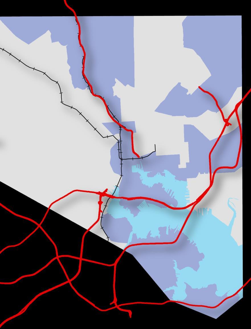
13 Map of Regional Housing Submarkets


14 Baltimore Regional Housing Submarkets High End, Exurban Fast Growing, Job/Activity Hub Recent Growth, Rural/Suburban Stable, Suburban/Urban Pivotal, Urban/Suburban Stressed, Urban

15 Distribution of Housing Choice Voucher Rates by Submarket The rate of housing voucher use is highest in the region s Stressed and Pivotal submarkets.

16 Opportunity Through Education Education opportunity scores steadily decrease from the High End to the Stressed submarkets.
17 The Right Investment? 17

18 New Indicators in Vital Signs 13 Workforce & Economic Development: In 2013 the percent of adult population under community supervision such as parole or probation was 5.3%; this indicator is highly correlated with the unemployment rate by neighborhood. 18 Five Highest Parole/Probation: 1. Madison/East End 2. Greenmount East Southwest Baltimore 3. Clifton-Berea 4. Sandtown-Winchester/Harlem Park
19 Equity

20 20

21 21
22 Accessibility 20.2% of City Residents commute more than 45+ minutes Highest CSA: Sandtown-Winchester/Harlem Park (35.2%) 22
23 Grow Baltimore What made you want to live where you live? 23 Source: Focus Group of Movers out of Baltimore 2014, Schaefer Center, University of Baltimore
24 Connecting People to Place

25 Culture, social wellbeing, and neighborhood change Mark J. Stern Social Impact of the Arts Project University of Pennsylvania July 2015
26 Two propositions Tracking arts and cultural resources is a critical element of a neighborhood s vital signs. It takes a neighborhood. Community groups, academic researchers, and advocates all have a role to play to discovering the community impacts of the arts and culture.

27 Why measure neighborhoods cultural assets? Often we have a one-sided view of low-asset communities. Not just an aggregation of a set of social problems. Community-based cultural providers offer a more balanced view of a neighborhood s assets and challenges. Neighborhood cultural resources are often hidden a cluster of small groups can have a big impact.

28 Placing the arts in space & place The cultural sector is not just individuals & organizations. The clustering of cultural resources what we call its cultural ecology has a strong influence on the internal structure of art worlds & their impact on neighborhoods & regions. Natural cultural districts are critical to the arts social impact. Legend Populated block groups Composition of cultural sector Complex Commercial dominant Nonprofit dominant Artist dominant Above average assets
 Commercial cultural firms Resident artists Cultural")
29 How SIAP measures cultural resources Four types of cultural resources: Nonprofit cultural programs (whether 501c3 orgs or not) Commercial cultural firms Resident artists Cultural participants

30 A right to culture: a public responsibility Although many neighborhoods with few cultural resources have high poverty rates, the fit between poverty and cultural resources is far from absolute.

31 The spill-over effect of natural cultural districts Philadelphia neighborhoods with concentrations of cultural resources including many lowincome areas enjoyed non-economic benefits including lower morbidity and better school outcomes. Developing cultural indicators for Baltimore would allow researchers to estimate their impact here.

32 Social displacement, population turnover, and the arts SIAP has been developing measures of social displacement. Education churn measures the extent to which residents with a high-school diploma or less are leaving a neighborhood and residents with at least a college degree are moving in.


33 It takes a community to integrate culture into vital signs. Until government takes on the task of documenting cultural engagement, it will require cooperation between: The arts and civic engagement: A field guide for practice, research, and policy community organizations researchers and regional funders Social Impact of the Arts Project July 2009 to develop evidence of equitable access and opportunity in the arts and culture and their role in building community and revitalizing neighborhoods.
34 Two approaches to community-based data development Organizational data gathering. Individual organizations can contribute to understanding the relationship of culture to community vitality by developing systems for tracking program participation and using qualitative methods to document the broader connection of culture and wellbeing. Regional database development. Once a system is in place to gather participant, artist, and institutional network data, a regional entity (a funder, arts council, government agency, or university) can develop a means of integrating these data into a unified database..
, this approach allows policymakers to link data on cultural engagement to other socioeconomic and")
35 From data to policy impact An integrated database provides the opportunity to examine the aggregate impact of cultural engagement on region-wide measures of social wellbeing. In addition, through the use of a geographic information system (GIS), this approach allows policymakers to link data on cultural engagement to other socioeconomic and neighborhood data
 Need incentive for sharing data at regional level List cooperative provides structure to bring many organizations")
36 Encouraging organizational-level data gathering Much participant data is already being collected (subscribers, student registration) Need incentive for sharing data at regional level List cooperative provides structure to bring many organizations data together
 into their procedures.")
37 It doesn t have to be fancy Free events (or small groups or embedded programs) could incorporate sign-in sheets (with address) into their procedures. Over time sign-in can provide important clues about who is involved and where they live.
.")
38 From dots to analysis For analysis, we aggregate individual observations to some standard geography (typically block group) to link to census and other data sources. Sometimes it s helpful to use slightly fancier procedures to reduce the noise in the data (above).

39 Tracking neighborhoods changing cultural ecology instead of individuals over time Although an ecological approach doesn t allow for longitudinal estimates at the individual level, it does provide stable estimates of how the geography of participation changes over time.

40 Institutional & artists networks We found that participation in a community arts initiative greatly expanded the range of organizations with which grantees interacted.

41 Artists serve as often-invisible connectors between community-based organizations We interviewed 60 artists about the places they worked during the previous year. The red dots represent artists and the blue and green dots their organizational contacts.
42 Bottom line Cultural resources are an important dimension of community assets. The arts provide opportunities for cultural and creative expression, stimulate social connection and community engagement, and build networks within and between neighborhoods. A combination of bottom-up and top-down efforts can develop the data needed to incorporate cultural assets into community policy and planning.
43 Data Users Survey
44 Assessing Data Use and Access Examine current successes in data usage Which indicators are most useful? How is the Vital Signs data being used? Gain a better understanding of gaps What data is needed but not currently accessible? What skills/resources are needed to better utilize data for community benefit? 44
45 Data User Survey Vote Code
46 Strengthening Communities Through Neighborhood Data Baltimore Data Day 2015 #BaltimoreDataDay
"Natural" Cultural Districts and Neighborhood Revitalization
 University of Pennsylvania ScholarlyCommons Culture and Community Revitalization: A Collaboration Social Impact of the Arts Project 6-2009 "Natural" Cultural Districts and Neighborhood Revitalization Mark
Cultural Data in Planning and Economic Development. Chris Dwyer, RMC Research Sponsor: Rockefeller Foundation
 Cultural Data in Planning and Economic Development Chris Dwyer, RMC Research Sponsor: Rockefeller Foundation A Decade of Attempts to Quantify Arts and Culture Economic impact studies Community indicators
Culture and Urban Revitalization
 University of Pennsylvania ScholarlyCommons Culture and Community Revitalization: A Collaboration Social Impact of the Arts Project 6-2007 Culture and Urban Revitalization Mark J. Stern University of Pennsylvania,
CRP 608 Winter 10 Class presentation February 04, Senior Research Associate Kirwan Institute for the Study of Race and Ethnicity
 CRP 608 Winter 10 Class presentation February 04, 2010 SAMIR GAMBHIR SAMIR GAMBHIR Senior Research Associate Kirwan Institute for the Study of Race and Ethnicity Background Kirwan Institute Our work Using
Proposed Scope of Work Village of Farmingdale Downtown Farmingdale BOA Step 2 BOA Nomination Study / Draft Generic Environmental Impact Statement
 Proposed Scope of Work Village of Farmingdale Downtown Farmingdale BOA Step 2 BOA Nomination Study / Draft Generic Environmental Impact Statement The scope of work that follows incorporates and covers
Planning for Economic and Job Growth
 Planning for Economic and Job Growth Mayors Innovation Project Winter 2012 Meeting January 21, 2012 Mary Kay Leonard Initiative for a Competitive Inner City AGENDA The Evolving Model for Urban Economic
Mapping Communities of Opportunity in New Orleans
 Mapping Communities of Opportunity in New Orleans December 11, 2009 Samir Gambhir Senior Research Associate Kirwan Institute for the study of Race and Ethnicity The Ohio State University Gambhir.2@osu.edu
Environmental Analysis, Chapter 4 Consequences, and Mitigation
 Environmental Analysis, Chapter 4 4.17 Environmental Justice This section summarizes the potential impacts described in Chapter 3, Transportation Impacts and Mitigation, and other sections of Chapter 4,
Jobs-Housing Fit: Linking Housing Affordability and Local Wages
 Jobs-Housing Fit: Linking Housing Affordability and Local Wages Alex Karner, PhD Assistant Professor School of City and Regional Planning Georgia Institute of Technology Chris Benner, PhD Dorothy E. Everett
Mapping and Health Equity Advocacy
 Mapping and Health Equity Advocacy Sarah Treuhaft PolicyLink November 7, 2008 About us PolicyLink National research and action institute that advances policies to achieve economic and social equity Center
United Growth s Revitalizing Neighborhoods Indicator Project
 United Growth s Revitalizing Neighborhoods Indicator Project Group Members: Prachi Kulkarni Mark O Neall Kent Harding Megan O Brien Paris Howard Blake Hamilton Kerry Hoo http://www.city-data.com/picfilesc/picc32475.php
Population Profiles
 U N D E R S T A N D I N G A N D E X P L O R I N G D E M O G R A P H I C C H A N G E MAPPING AMERICA S FUTURES, BRIEF 6 2000 2010 Population Profiles Atlanta, Las Vegas, Washington, DC, and Youngstown Allison
Developing Innovation Village, Baltimore
 Developing Innovation Village, Baltimore Rick Jenarine, Ridhima Mehrotra, Andrew Seguin, Claire Warner Under the supervision of Professor Chao Liu URSP688L: Planning Technologies The University of Maryland
The econ Planning Suite: CPD Maps and the Con Plan in IDIS for Consortia Grantees Session 1
 The econ Planning Suite: CPD Maps and the Con Plan in IDIS for Consortia Grantees Session 1 1 Training Objectives Use CPD Maps to analyze, assess, and compare levels of need in your community Use IDIS
PLANNING (PLAN) Planning (PLAN) 1
 Planning (PLAN) 1") Planning (PLAN) 1 PLANNING (PLAN) PLAN 500. Economics for Public Affairs Description: An introduction to basic economic concepts and their application to public affairs and urban planning. Note: Cross-listed
Planning (PLAN) 1 PLANNING (PLAN) PLAN 500. Economics for Public Affairs Description: An introduction to basic economic concepts and their application to public affairs and urban planning. Note: Cross-listed
GIS Geographical Information Systems. GIS Management
 GIS Geographical Information Systems GIS Management Difficulties on establishing a GIS Funding GIS Determining Project Standards Data Gathering Map Development Recruiting GIS Professionals Educating Staff
GOVERNMENT MAPPING WORKSHOP RECOVER Edmonton s Urban Wellness Plan Mapping Workshop December 4, 2017
 GOVERNMENT MAPPING WORKSHOP 12.4.17 RECOVER Edmonton s Urban Wellness Plan Mapping Workshop December 4, 2017 In July of 2017, City Council directed administration to develop RECOVER, Edmonton s Urban Wellness
The CRP stresses a number of factors that point to both our changing demographics and our future opportunities with recommendations for:
 Plan Overview The CRP represents the first broad planning initiative covering Lake, Porter and LaPorte counties. Unlike previous plans released by NIRPC, which focused primarily on transportation, the
Orien Ori t en a t tion a Webi W nar: ebi CPD Maps 2
 Orientation Webinar: CPD Maps 2 Agenda 1. Background - econ Planning Suite 2. Expanded Planning Data 3. CPD Maps Overview 4. Demonstration Guide Me Wizard Map Selection Identify Tool Printing and Saving
Together towards a Sustainable Urban Agenda
 Together towards a Sustainable Urban Agenda The City We (Youth) Want Preliminary findings from youth consultations Areas Issue Papers Policy Units 1.Social Cohesion and Equity - Livable Cities 2.Urban
An Assessment of People, Place and Business on Syracuse s Near Northside
 An Assessment of People, Place and Business on Syracuse s Near Northside May 2013 Report produced by Jon Glass, Kelly Montague and Mark Pawliw Edited by Jon Glass and Jonnell Robinson Syracuse Community
INSIDE. Metric Descriptions by Topic Area. Data Sources and Methodology by Topic Area. Technical Appendix
 As part of the Chicago Neighborhoods 2015 (CN2015) project, the Institute for Housing Studies at DePaul University collected data and built metrics to help The Chicago Community Trust and the City of Chicago
ASSESSING THE ARTS COMMUNITY: Mapping with GIS and Social Media Tools
 ASSESSING THE ARTS COMMUNITY: Mapping with GIS and Social Media Tools Gary Coutu Associate Professor Department of Geography and Planning West Chester University July 15, 2014 Mapping with GIS and Social
Geodatabase for Sustainable Urban Development. Presented By Rhonda Maronn Maurice Johns Daniel Ashney Jack Anliker
 Geodatabase for Sustainable Urban Development Presented By Rhonda Maronn Maurice Johns Daniel Ashney Jack Anliker Objective Build a Geodatabase that will enable urban planners to create and assess the
NEW YORK AND CONNECTICUT SUSTAINABLE COMMUNITIES. Fair Housing & Equity Assessment & Regional Planning Enhancement
 NEW YORK AND CONNECTICUT SUSTAINABLE COMMUNITIES Fair Housing & Equity Assessment & Regional Planning Enhancement November 19, 2013 White Plains Public Library Federal grant to improve regional planning
PALS: Neighborhood Identification, City of Frederick, Maryland. David Boston Razia Choudhry Chris Davis Under the supervision of Chao Liu
 PALS: Neighborhood Identification, City of Frederick, Maryland David Boston Razia Choudhry Chris Davis Under the supervision of Chao Liu University of Maryland School of Architecture, Planning & Preservation
RURAL-URBAN PARTNERSHIPS: AN INTEGRATED APPROACH TO ECONOMIC DEVELOPMENT
 RURAL-URBAN PARTNERSHIPS: AN INTEGRATED APPROACH TO ECONOMIC DEVELOPMENT William Tompson Head of the Urban Development Programme OECD Public Governance and Territorial Development Directorate JAHRESTAGUNG
Geospatial Analysis of Job-Housing Mismatch Using ArcGIS and Python
 Geospatial Analysis of Job-Housing Mismatch Using ArcGIS and Python 2016 ESRI User Conference June 29, 2016 San Diego, CA Jung Seo, Frank Wen, Simon Choi and Tom Vo, Research & Analysis Southern California
Applying Health Outcome Data to Improve Health Equity
 Applying Health Outcome Data to Improve Health Equity Devon Williford, MPH, Health GIS Specialist Lorraine Dixon-Jones, Policy Analyst CDPHE Health Equity and Environmental Justice Collaborative Mile High
UC Santa Barbara CSISS Classics
 UC Santa Barbara CSISS Classics Title Robert Park and Ernest Burgess, Urban Ecology Studies, 1925. CSISS Classics Permalink https://escholarship.org/uc/item/6f39q98d Author Brown, Nina Publication Date
Local Economic Activity Around Rapid Transit Stations
 Local Economic Activity Around Rapid Transit Stations The Case of Chicago s Orange Line Julie Cooper, MPP 2014 Harris School of Public Policy Transport Chicago June 6, 2014 Motivation Impacts of transit
Section 2. Indiana Geographic Information Council: Strategic Plan
 Section 2. Indiana Geographic Information Council: Strategic Plan Introduction A geographic information system (GIS) is an automated tool that allows the collection, modification, storage, analysis, and
Regional collaboration & sharing: pathway to sustainable, just & inclusive cities in Europe
 Berlin s Environmental Justice Map Regional collaboration & sharing: pathway to sustainable, just & inclusive cities in Europe Dr. Andrea I Frank Cardiff University School of Geography & Planning A. Sustainability:
Urban Climate Resilience
 Urban Climate Resilience in Southeast Asia Partnership Project Introduction Planning for climate change is a daunting challenge for governments in the Mekong Region. Limited capacity at the municipal level,
The Church Demographic Specialists
 The Church Demographic Specialists Easy-to-Use Features Map-driven, Web-based Software An Integrated Suite of Information and Query Tools Providing An Insightful Window into the Communities You Serve Key
The Role of Transitways in Our Region s Economic Competitiveness. The 23rd CTS Annual Research Conference St. Paul, MN May 23, 2012
 The Role of Transitways in Our Region s Economic Competitiveness The 23rd CTS Annual Research Conference St. Paul, MN May 23, 2012 1 2 Twin Cities Competitive Clusters 3 Competitive Clusters interconnected
An introduction to thee Urban Oases Site Selection Tool:
 An introduction to thee Urban Oases Site Selection Tool: Created by Audubon Connecticut with assistance from a GIS Consultant/Research Assistant at the Harvard Forest Essential input provided by the New
Natural Cultural Districts: A Three-City Study Report Summary
 University of Pennsylvania ScholarlyCommons "Natural" Cultural Districts: A Three-City Study Social Impact of the Arts Project 2-2013 Natural Cultural Districts: A Three-City Study Report Summary Mark
Neighborhood social characteristics and chronic disease outcomes: does the geographic scale of neighborhood matter? Malia Jones
 Neighborhood social characteristics and chronic disease outcomes: does the geographic scale of neighborhood matter? Malia Jones Prepared for consideration for PAA 2013 Short Abstract Empirical research
Speakers: Jeff Price, Federal Transit Administration Linda Young, Center for Neighborhood Technology Sofia Becker, Center for Neighborhood Technology
 Speakers: Jeff Price, Federal Transit Administration Linda Young, Center for Neighborhood Technology Sofia Becker, Center for Neighborhood Technology Peter Haas, Center for Neighborhood Technology Craig
CLAREMONT MASTER PLAN 2017: LAND USE COMMUNITY INPUT
 Planning and Development Department 14 North Street Claremont, New Hampshire 03743 Ph: (603) 542-7008 Fax: (603) 542-7033 Email: cityplanner@claremontnh.com www.claremontnh.com CLAREMONT MASTER PLAN 2017:
POTENTIAL COURSES FOR CEP STUDENTS AND THEIR AREAS OF INTERST
 POTENTIAL COURSES FOR CEP STUDENTS AND THEIR AREAS OF INTERST C ENV 110 Food & Environment CHSTU 320 Food Sovereignty in Mexico and the United States ANTH 361 Anthropology of Food ANTH 488 Agroecology
Empowering Local Health through GIS
 Empowering Local Health through GIS Mapping data from Washington s Immunization Information System (IIS). Presented to IACW October 16 th, 2013 by: Chris Halsell and Isaiah Berg Agenda IIS Overview Why
Land Use in the context of sustainable, smart and inclusive growth
 Land Use in the context of sustainable, smart and inclusive growth François Salgé Ministry of sustainable development France facilitator EUROGI vice president AFIGéO board member 1 Introduction e-content+
RETA 6422: Mainstreaming Environment for Poverty Reduction Category 2 Subproject
 RETA 6422: Mainstreaming Environment for Poverty Reduction Category 2 Subproject A. Basic Data 1. Subproject Title: Poverty-Environment Mapping to Support Decision Making 2. Country Director: Adrian Ruthenberg
Advancing Urban Models in the 21 st Century. Jeff Tayman Lecturer, Dept. of Economics University of California, San Diego
 Advancing Urban Models in the 21 st Century Jeff Tayman Lecturer, Dept. of Economics University of California, San Diego 1 Regional Decision System Better tools Better data Better access Better Decisions
Urban GIS for Health Metrics
 Urban GIS for Health Metrics Dajun Dai Department of Geosciences, Georgia State University Atlanta, Georgia, United States Presented at International Conference on Urban Health, March 5 th, 2014 People,
The role of community in urban regeneration: mixed use areas approach in USA
 The role of community in urban regeneration: mixed use areas approach in USA Outline 1. Thesis 2. Main topics 3. Urban regeneration and community 4. Community involvement methods 5. Policies: EU vs USA
GIS and Governing Anchorage. GIS Critical for Efficient, Transparent Government How is GIS Program Doing Where can GIS Program Take us
 GIS and Governing Anchorage GIS Critical for Efficient, Transparent Government How is GIS Program Doing Where can GIS Program Take us Municipality of Anchorage Office of Economic And Community Development
East Bay BRT. Planning for Bus Rapid Transit
 East Bay BRT Planning for Bus Rapid Transit Regional Vision Draper Prison The Bottleneck is a State-Level issue, Salt Lake County 2050 Population: 1.5M Draper Prison hopefully with some State-Level funding!
Central Baltic Programme
 Central Baltic Programme 2014-2020 About the Central Baltic Programme 2014-2020 Builds on the Central Baltic INTERREG IV A Programme 2007-2013 Cross-border cooperation projects in the central Baltic Sea
R E SEARCH HIGHLIGHTS
 Canada Research Chair in Urban Change and Adaptation R E SEARCH HIGHLIGHTS Research Highlight No.8 November 2006 THE IMPACT OF ECONOMIC RESTRUCTURING ON INNER CITY WINNIPEG Introduction This research highlight
An online data and consulting resource of THE UNIVERSITY OF TOLEDO THE JACK FORD URBAN AFFAIRS CENTER
 An online data and consulting resource of THE JACK FORD URBAN AFFAIRS CENTER THE CENTER FOR GEOGRAPHIC INFORMATION SCIENCE AND APPLIED GEOGRAPHICS DEPARTMENT OF GEOGRAPHY AND PLANNING THE UNIVERSITY OF
Policy Note 6. Measuring Unemployment by Location and Transport: StepSA s Access Envelope Technologies
 6 Measuring Unemployment by Location and Transport: StepSA s Access Envelope Technologies Introduction Increasing emphasis is coming onto spatial planning as government in South Africa moves to address
Regional Economic Competitiveness Local Comprehensive Planning. An End-of-year Update to the Metropolitan Council Community Development Committee
 Regional Economic Competitiveness Local Comprehensive Planning An End-of-year Update to the Metropolitan Council Community Development Committee 12/21/2015 Regional Economic Competitiveness The ability
ANGOLA: PARTICIPATORY MAPPING OF URBAN POVERTY. By Allan Cain, Development Workshop
 ANGOLA: PARTICIPATORY MAPPING OF URBAN POVERTY By Allan Cain, Development Workshop Angola: Participatory Mapping of Urban Poverty BY ALLAN CAIN, DEVELOPMENT WORKSHOP This paper explains a method for measuring
Rural Pennsylvania: Where Is It Anyway? A Compendium of the Definitions of Rural and Rationale for Their Use
 Rural Pennsylvania: Where Is It Anyway? A Compendium of the Definitions of Rural and Rationale for Their Use Pennsylvania Office of Rural Health 310 Nursing Sciences Building University Park, PA 16802
HSC Geography. Year 2013 Mark Pages 10 Published Jul 4, Urban Dynamics. By James (97.9 ATAR)
") HSC Geography Year 2013 Mark 92.00 Pages 10 Published Jul 4, 2017 Urban Dynamics By James (97.9 ATAR) Powered by TCPDF (www.tcpdf.org) Your notes author, James. James achieved an ATAR of 97.9 in 2013 while
HSC Geography Year 2013 Mark 92.00 Pages 10 Published Jul 4, 2017 Urban Dynamics By James (97.9 ATAR) Powered by TCPDF (www.tcpdf.org) Your notes author, James. James achieved an ATAR of 97.9 in 2013 while
Council Workshop on Neighbourhoods Thursday, October 4 th, :00 to 4:00 p.m. Burlington Performing Arts Centre
 Council Workshop on Neighbourhoods Thursday, October 4 th, 2012 1:00 to 4:00 p.m. Burlington Performing Arts Centre Agenda Introductions Warm-Up Exercise Presentation Exercise Neighbourhood Planning Break
TOWARDS A JUST CITY JAVIER MARTINEZ. URBAN STUDIES SYMPOSIUM: URBANIZATION FUTURES June
 TOWARDS A JUST CITY JAVIER MARTINEZ URBAN STUDIES SYMPOSIUM: URBANIZATION FUTURES June 14 2018 THE JUST CITY - BACKGROUND 1970s mainstream in planing was stimulating growth and the functional city The
Edexcel Geography Advanced Paper 2
 Edexcel Geography Advanced Paper 2 SECTION B: SHAPING PLACES Assessment objectives AO1 Demonstrate knowledge and understanding of places, environments, concepts, processes, interactions and change, at
A Framework for Cultural Sustainability in Protected and Natural Areas
 A Framework for Cultural Sustainability in Protected and Natural Areas Blanca Camargo, Katy Lane and Dr. Tazim Jamal Texas A&M University 2007 George Wright Society Conference The San Francisco Peaks -
Asia Protected Areas Charter
 資料 3-1 Asia Protected Areas Charter The Asia Challenge Asia is the world s most rapidly growing region as well as one of the most bio-diverse. This dynamic development has led to unprecedented growth,
Urban Policy and Public Planning (UPPP)
") Urban Policy and Public Planning (UPPP) 1 Urban Policy and Public Planning (UPPP) Courses UPPP 4. Introduction to Urban Studies. 4 Units. Introduces the substantive areas, concepts, and tools in the field
Urban Policy and Public Planning (UPPP) 1 Urban Policy and Public Planning (UPPP) Courses UPPP 4. Introduction to Urban Studies. 4 Units. Introduces the substantive areas, concepts, and tools in the field
North Carolina Essential Standards Kindergarten Social Studies
 North Carolina s Kindergarten Social Studies Kindergarten through second grade students are introduced to an integrative approach of Social Studies by exploring aspects of self, others, families and communities
The National Spatial Strategy
 Purpose of this Consultation Paper This paper seeks the views of a wide range of bodies, interests and members of the public on the issues which the National Spatial Strategy should address. These views
This report details analyses and methodologies used to examine and visualize the spatial and nonspatial
 Analysis Summary: Acute Myocardial Infarction and Social Determinants of Health Acute Myocardial Infarction Study Summary March 2014 Project Summary :: Purpose This report details analyses and methodologies
A GIS Analysis of Charter Schools and Community-based Organizations in New York City. by Charisse Gulosino Teachers College Columbia University
 A GIS Analysis of Charter Schools and Community-based Organizations in New York City by Charisse Gulosino Teachers College Columbia University Paper EDUC1638 Abstract The exploratory analysis of charter
Ecological Land Cover Classification For a Natural Resources Inventory in the Kansas City Region, USA
 Ecological Land Cover Classification For a Natural Resources Inventory in the Kansas City Region, USA by Applied Ecological Services, Inc. In cooperation with the Mid-America Regional Council 600 Broadway,
Regional Performance Measures
 G Performance Measures Regional Performance Measures Introduction This appendix highlights the performance of the MTP/SCS for 2035. The performance of the Revenue Constrained network also is compared to
Archaeology & Digital Humanities
 WAYNE STATE UNIVERSITY Archaeology & Digital Humanities The D.I.R.T. on Big Data STRENGTHENING THE BIG DATA & ANALYTICS ECOSYSTEM WAYNE STATE UNIVERSITY Krysta Ryzewski Associate Professor of Anthropology
MODULE 1 INTRODUCING THE TOWNSHIP RENEWAL CHALLENGE
 MODULE 1 INTRODUCING THE TOWNSHIP RENEWAL CHALLENGE FOCUS OF THE MODULE Township renewal challenges and developmental outcomes covered in this module: Historical origins of townships and the inherited
compass.durhamnc.gov Building Community by Illustrating Community Durham s Neighborhood Compass
 Building Community by Illustrating Community Durham s Neighborhood Compass A presentation by John Killeen Rob Cushman Tyler Waring Neighborhood Improvement Services & Technology Solutions City of Durham,
Tracey Farrigan Research Geographer USDA-Economic Research Service
 Rural Poverty Symposium Federal Reserve Bank of Atlanta December 2-3, 2013 Tracey Farrigan Research Geographer USDA-Economic Research Service Justification Increasing demand for sub-county analysis Policy
GIS Needs Assessment. for. The City of East Lansing
 GIS Needs Assessment for The City of East Lansing Prepared by: Jessica Moy and Richard Groop Center for Remote Sensing and GIS, Michigan State University February 24, 2000 Executive Summary At the request
Initial Findings from Regional Initiatives Planning Enhancement Fair Housing & Equity Assessment
 NEW YORK AND CONNECTICUT SUSTAINABLE COMMUNITIES Initial Findings from Regional Initiatives Planning Enhancement Fair Housing & Equity Assessment July 30, 2013 White Plains Library Federal grant to improve
Conurbano s Atlas MALENA HOPP M A L H OO.COM. AR
 Conurbano s Atlas MALENA HOPP M A L ENAHOPP@YA H OO.COM. AR R ESEARCH GRO UP IN LIVING CONDITIONS IN BUENOS A I R ES CONURBANO. UNIVERSI DAD N ACIONAL DE AV E L L A N E DA Conurbano, an heterogeneous region
STATE GEOGRAPHIC INFORMATION DATABASE
 STATE GEOGRAPHIC INFORMATION DATABASE Data Information and Knowledge Management STATE GEOGRAPHIC INFORMATION DATABASE EXECUTIVE SUMMARY Utah has developed one of the most comprehensive statewide GIS resources
USER PARTICIPATION IN HOUSING REGENERATION PROJECTS
 USER PARTICIPATION IN HOUSING REGENERATION PROJECTS Dr. Hatice Sadıkoğlu Bahçeşehir University, Faculty of Architecture and Design Prof. Dr. Ahsen Özsoy Istanbul Technical University, Faculty of Architecture
Related Core Content for Assessment
 Big Idea: Government and Civics First Quarter Academic Expectations 2.14 Students understand the democratic principles of justice, equality, responsibility, and freedom and apply them to real-life situations.
SOCIO-DEMOGRAPHIC INDICATORS FOR REGIONAL POPULATION POLICIES
 SOCIO-DEMOGRAPHIC INDICATORS FOR REGIONAL POPULATION POLICIES A CANADIAN PERSPECTIVE Marc Termote Université de Montréal Potsdam, DART Conference, September 3, 2012 3 STEPS 1. Defining the problem 2. Identifying
Developing Quality of Life and Urban- Rural Interactions in BSR
 Developing Quality of Life and Urban- Rural Interactions in BSR Sakari Saarinen Union of the Baltic Cities, Commission on Environment Seminar on Quality of Life in Small Communities, 27 May 2010, Kärdla,
Using GIS to Explore the Relationship between Socioeconomic Status and Demographic Variables and Crime in Pittsburgh, Pennsylvania
 Using GIS to Explore the Relationship between Socioeconomic Status and Demographic Variables and Crime in Pittsburgh, Pennsylvania Stephen E. Mitchell Department of Resource Analysis, Saint Mary s University
3D - Boulder Valley Comprehensive Plan. Lesli Ellis Comprehensive Planning Manager City of Boulder
 3D - Boulder Valley Comprehensive Plan Lesli Ellis Comprehensive Planning Manager City of Boulder Presentation Boulder s use of 3D GIS and other tools in Comprehensive Planning (e.g., story maps, CityEngine,
The Role of Urban Planning and Local SDI Development in a Spatially Enabled Government. Faisal Qureishi
 The Role of Urban Planning and Local SDI Development in a Spatially Enabled Government Faisal Qureishi 1 Introduction A continuous increase in world population combined with limited resources has lead
HORIZON 2030: Land Use & Transportation November 2005
 PROJECTS Land Use An important component of the Horizon transportation planning process involved reviewing the area s comprehensive land use plans to ensure consistency between them and the longrange transportation
Does city structure cause unemployment?
 The World Bank Urban Research Symposium, December 15-17, 2003 Does city structure cause unemployment? The case study of Cape Town Presented by Harris Selod (INRA and CREST, France) Co-authored with Sandrine
Disaster Management & Recovery Framework: The Surveyors Response
 Disaster Management & Recovery Framework: The Surveyors Response Greg Scott Inter-Regional Advisor Global Geospatial Information Management United Nations Statistics Division Department of Economic and
Mapping Maine s Working Waterfront: for Our Heritage and Economy
 Mapping Maine s Working Waterfront: for Our Heritage and Economy Abstract Mapping Maine s Working Waterfronts is a collaborative project led by the Island Institute that inventories the state s current
The geography of domestic energy consumption
 The geography of domestic energy consumption Anastasia Ushakova PhD student at CDRC UCL Ellen Talbot PhD student at CDRC Liverpool Some important research questions How can we classify energy consumption
Minnesota Transportation Museum
 Minnesota Transportation Museum Minnesota Social Studies s Alignment Second Grade 1 Code Benchmark 1. Citizenship and Government 1. Civic Skills. Civic Values and Principles of Democracy 4. Governmental
HOW DO LOW-INCOME HOUSING TAX CREDIT PROJECTS TRIGGER REVITALIZATION IN SHRINKING CITIES? A CASE OF ST. LOUIS, MO WOO-LACK KIM THESIS
 HOW DO LOW-INCOME HOUSING TAX CREDIT PROJECTS TRIGGER REVITALIZATION IN SHRINKING CITIES? A CASE OF ST. LOUIS, MO BY WOO-LACK KIM THESIS Submitted in partial fulfillment of the requirements for the degree
This article is the second in a
 Neighborhood Planning and GIS: Case Studies from the Minneapolis Neighborhood Information System by Jeffrey K. Matson This article is the second in a three-part series on the Minneapolis Neighborhood Information
Community participation in sustainable tourism - A case study of two indigenous communities
 Po-Hsin Lai Department of Park, Recreation, and Tourism Sciences Texas A&M University Community participation in sustainable tourism - A case study of two indigenous communities Community participation
GIS AND COMMUNITY ENGAGEMENT: SOCIOSPATIAL APPROACHES TO RESEARCH AND POLICY
 GIS AND COMMUNITY ENGAGEMENT: SOCIOSPATIAL APPROACHES TO RESEARCH AND POLICY DR. SHEILA LAKSHMI STEINBERG BRANDMAN UNIVERSITY CHAPMAN UNIVERSITY SYSTEM GIS DAY PRESENTATION-UNIVERSITY OF KANSAS, NOVEMBER
geographic patterns and processes are captured and represented using computer technologies
 Proposed Certificate in Geographic Information Science Department of Geographical and Sustainability Sciences Submitted: November 9, 2016 Geographic information systems (GIS) capture the complex spatial
COUNCIL OF THE EUROPEAN UNION. Brussels, 2 May /14 CULT 68
 COUNCIL OF THE EUROPEAN UNION Brussels, 2 May 2014 9129/14 CULT 68 NOTE from: General Secretariat of the Council to: Permanent Representatives Committee (Part 1) / Council No. prev. doc.: 8892/14 CULT
Size matters: issues and challenges of local development with a special focus on small and medium sized towns in Czechia
 Size matters: issues and challenges of local development with a special focus on small and medium sized towns in Czechia Luděk Sýkora Charles University, Faculty of Science Dept. of Social Geography and
The 3V Approach. Transforming the Urban Space through Transit Oriented Development. Gerald Ollivier Transport Cluster Leader World Bank Hub Singapore
 Transforming the Urban Space through Transit Oriented Development The 3V Approach Gerald Ollivier Transport Cluster Leader World Bank Hub Singapore MDTF on Sustainable Urbanization The China-World Bank
REPORT ON INVESTMENTS
 REPORT ON INVESTMENTS D.T2.3.3 Investments for technical equipment for the implementation of Web-GIS platform in Mantova 1 Local support group designing Mantova Web-GIS platform. Picture by Maria Giulia