Tidal Resource Characterization. Profilers
|
|
|
- Ernest Leonard
- 5 years ago
- Views:
Transcription
1 Tidal Resource Characterization from Acoustic Doppler Current Profilers Jeffrey Epler Masters Thesis Defense May 28 th, 2010
2 Outline Motivation & Background Stationary Acoustic Doppler Current Profiler Analysis Shipboard Acoustic Doppler Current Profiler Analysis Conclusion


3 Why Tidal Energy? Washington State Net Electricity Generation, Feb % 9% Natural Gas Coal 10% Nuclear Hydro Other Renewables 11% 66% * WA State t Initiative 937

4 Tides and Currents Gravitational interactions of Earth, Moon, & Sun system Spring / Neap Tidal Cycle: days Source: May 1, 2010
5 Tides and Currents Source:
6 U.S. Tidal Current Resources Source:
7 Puget Sound & Admiralty Inlet Port Townsend Admiralty Inlet Seattle Objective: How do we characterize the strongest tidal currents for device siting?
8 OpenHydro Tidal Turbine Kinetic Power Density P Source:
 300 khz ADCP")
 Materials Testing VEMCO")

9 Data Collection Acoustic Release & Buoy (2) 300 khz ADCP (velocity) T-POD (porpoise clicks) Materials Testing VEMCO (tagged fish) Hydrophone (noise) CTDO (conductivity, temperature, depth, oxygen)

10 ADCP Basics Teledyne RDI Workhorse Monitor- 300 khz Source: web.vims.edu/physical/research/tctutorial/currentmeasure_files/image002.gif Source: Gordon, Acoustic Doppler Current Profiler: Principles of Operation A Practical Primer
11 ADCP Deployments Depth (m)


12 ADCP Deployments Depth (m)
13 Outline Motivation & Background Stationary Acoustic Doppler Current Profiler Analysis Shipboard Acoustic Doppler Current Profiler Analysis Conclusion
14 Stationary ADCP Analysis- Overview Harmonic Analysis (H.A.) of Acoustic Doppler Current Profiler resolving the data as a superposition of sine waves due to tidal constituents u( t) A i cos( i t i ) Godin (1972) Foreman (1977) Foreman (1978) Pawlowicz (2002) Finds the least-squares fit to the current velocity data Generate tidal current predictions
15 Tidal Constituents Representations of the periodic variations of the Earth-Moon-Sun system 45 Astronomical Constituents 343 Shallow Water Constituents Constituent Name Period M2 Main Lunar Semidiurnal hours S2 Main Solar Semidiurnal hours N2 Larger Lunar Elliptical Semidiurnal hours K1 Lunar-Solar Declinational Diurnal hours O1 Lunar Declinational Diurnal hours
16 Rayleigh Criterion A methodology developed by Foreman (1977) to determine which tidal constituents can be resolved with harmonic analysis 2 1 TT R
17 Rayleigh Criterion Ex. Resolving the K1 vs. P1 Tidal Constituents K1, Lunar-solar declinational diurnal const., = cyc / hr P1, Solar diurnal constituent, = cyc / hr K1 P 1 T 1 T 182 days For T < 182 days, K1 contains P1 information
18 Inference Inclusion of constituents which are important to the location but left out by the Rayleigh Criterion Tidal Height Long records from the specific location Long records from a nearby location Tidal Potential Theory Tidal Current Long records from the specific location Long records from a nearby location
19 Current Velocity Representations Progressive Vector- 2D Principal Axis Current- 1 D Signed Speed ( + Flood & - Ebb)- 1 D 9/18/2009, 10:30-22:40


- 1 D August")
20 Current Velocity Representations Progressive Vector- 2D Principal Axis Current- 1 D Signed Speed ( + Flood & - Ebb)- 1 D August November 2009, P.A.V. = 97.4 %
21 Current Velocity Representations Progressive Vector- 2D Principal Axis Current- 1 D Signed Speed ( + Flood & - Ebb)- 1 D
22 H. A. - Determining Inference Record Length 172 days Distance 140 m Water Depth 63 m Parameters Rayleigh Criterion < 1 Allowed resolving of tidal constituents: Aug.-Nov Nov.-Feb P1 from K m 62.7 m K2 from S days 72.6 days
23 Feb Sea Spider Deployment
24 Inference Results
25 Harmonic Analysis w/ Inference Apply inference to from a long term record analysis to improve shorter nearby records Apply Inference from Aug. 09 Fb10 Feb. combined record to individual records: Aug. Nov. 09 & Nov. 09 Fb10 Feb. Comparison of velocity representations at water depth 10 m (OpenHydro hub height)
26 Harmonic Analysis Goodness of Fit Coefficient of Multiple Determination yˆ i y i 2 i R 2 yi y i 2 y i 1 i y - velocity data point in time series ŷ - harmonic fit to each data point in time series - mean velocity of the time series ADCP Stationary Deployment Principal Axis Current Prog. Vector- 2D Signed Speed R-squared August-November November-February R-squared above cut-in speed of 1 m / s August-November November-February b
27 Data vs. Harmonic Analysis Raw Data- Aug-Nov 09 Speed (m/s) Harmonic Fit- Signed Speed Analysis Speed (m/s s)

28 Data vs. Harmonic Analysis *Inference used for P1 and K2 constituents, t water depth (10 m)
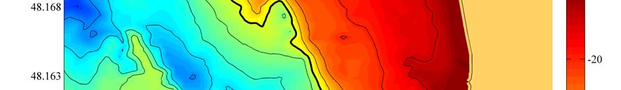
29 M2- Amplitude Map Depth (m)
30 M2- Phase Map Depth (m)
31 Outline Motivation & Background Stationary Acoustic Doppler Current Profiler Analysis Shipboard Acoustic Doppler Current Profiler Analysis Conclusion
32 Design of Survey Track Ebb Survey- August 2009 Depth (m)
33 August 2009 Ebb Survey Volumetric Binning: 100m x 100m x 5m
34 Volumetric Averaging 34 ADCP Velocity Profiles
35 Velocity PDF Mean = 1.95 m/s Max = 3.21 m/s Min=124m/s 1.24 Data Std. Dev. = 0.33 m/s ADCP Std. Dev. = 0.2 m/s Ensemble Size = 167
36 Sinusoidal Fit to Averaged Data u t 2 t t Asin T Amplitude = 2.10 m / s Period / 2 = 6.54 hours R 2 = 0.99
37 Ebb Survey Amplitude Variation Normalized Peak Amplitude
38 Ebb Survey Phase Variation Minutes
39 Flood Survey Amplitude Variation Normalized Peak Amplitude
40 Flood Survey Phase Variation Minutes
41 Outline Motivation & Background Stationary Acoustic Doppler Current Profiler Analysis Shipboard Acoustic Doppler Current Profiler Analysis Conclusion
42 Future Work Use ¼ Sine Wave Fits for Shipboard Analysis
43 Future Work Survey Ebb Flood Transition (Slack Water)
44 Conclusions Stationary ADCP analysis Identification of spatial variation Harmonic analysis residual Shipboard ADCP analysis Efficient i spatial characterization i Quantitative use of shipboard ADCP surveys Integration of stationary analysis with shipboard surveys
45 Acknowledgements Dr. Brian Polagye Dr. Jim Thomson Dr. Phil Malte Joe Talbert Captain Andy Reay-Ellers Dr. Roy Martin Snohomish County PUD & DOE My family & friends
46 Questions?
Tidal Resource Characterization from Acoustic Doppler Current Profilers. Jeffrey Epler. A thesis. submitted in partial fulfillment of the
 Tidal Resource Characterization from Acoustic Doppler Current Profilers Jeffrey Epler A thesis submitted in partial fulfillment of the requirements for the degree of Master of Science in Mechanical Engineering
Resolving Spatial Resource Gradients at Tidal Energy Sites
 Resolving Spatial Resource Gradients at Tidal Energy Sites Michael T. Palodichuk A thesis submitted in partial fulfillment of the requirements for the degree of Master of Science in Mechanical Engineering
Reference Model #1 Tidal Energy: Resource
 Northwest National Marine Renewable Energy Center niversity of Washington, Seattle, WA 9895 Reference Model # Tidal Energy: Resource Technical Report: W 20 02 December 20 Dr. Brian Polagye, Department
Resource Mapping at Tidal Energy Sites
 IEEE JOURNAL OF OCEANIC ENGINEERING, VOL. 38, NO. 3, JULY 2013 433 Resource Mapping at Tidal Energy Sites Michael Palodichuk, Brian Polagye, and Jim Thomson Abstract Station keeping, a vessel-based spatial
Tidal stream atlases Reprinted by PC Maritime with kind permission of Proudman Laboratory
 The generation of UK tidal stream atlases from regularly gridded hydrodynamic modelled data by Colin Bell and Lisa Carlin Proudman Oceanographic Laboratory http://www.pol.ac.uk http://www.pcmaritime.co.uk
Red Sea - Dead Sea Water Conveyance Study Program Additional Studies
 Red Sea - Dead Sea Water Conveyance Study Program Additional Studies Red Sea Study Final Report Annex 1 Field and laboratory activities carried out during the study and their results July 213 TABLE OF
Tidal energy resource characterization: methodology and field study in Admiralty Inlet, Puget Sound, US
 Manuscript Tidal energy resource characterization: methodology and field study in Admiralty Inlet, Puget Sound, US Polagye, B. 1 and Thomson, J. 2 1 Northwest National Marine Renewable Energy Center, Department
A Comparison of Predicted Along-channel Eulerian Flows at Cross- Channel Transects from an EFDC-based Model to ADCP Data in South Puget Sound
 A Comparison of Predicted Along-channel Eulerian Flows at Cross- Channel Transects from an EFDC-based Model to ADCP Data in South Puget Sound Skip Albertson, J. A. Newton and N. Larson Washington State
8.1 SPATIAL VARIABILITY OF TIDAL CURRENTS IN PUGET SOUND, WASHINGTON. Gregory Dusek, Christina Pico, Christopher Paternostro and Paul Fanelli,
 Presented at the 96 th AMS Annual Meeting, New Orleans, LA, January 10-14, 2016 8.1 SPATIAL VARIABILITY OF TIDAL CURRENTS IN PUGET SOUND, WASHINGTON Gregory Dusek, Christina Pico, Christopher Paternostro
Chapter 10 Tides. Introductory Oceanography 10 th Edition
 Chapter 10 Tides Introductory Oceanography 10 th Edition Most ocean waves are wind-generated The medium itself (solid, liquid, gas) does NOT actually travel in the direction of energy Figure 8-2 What causes
Measurements of Turbulence at Two Tidal Energy Sites in Puget Sound, WA
 IEEE JOURNAL OF OCEANIC ENGINEERING, VOL. 37, NO. 3, JULY 2012 363 Measurements of Turbulence at Two Tidal Energy Sites in Puget Sound, WA Jim Thomson, Brian Polagye, Vibhav Durgesh, and Marshall C. Richmond
The Parameterisation of Turbulence in the Marine Environment
 This is an Accepted Manuscript of an article published by Taylor & Francis in Journal of marine engineering and technology on 14/12/2016, available online: http://www.tandfonline.com/doi/full/10.1080/20464177.2016.1260892
Tides Supplement. Brian Arbic
 Tides Supplement Brian Arbic OVERVIEW QUESTIONS What causes the tides? How is a lunar day different from a solar day? Which body creates a larger tidal influence on Earth: the Moon or the Sun? How do the
TIDE PREDICTION FOR THE DOWNSTREAM BOUNDARY CONDITION OF THE CHAO- PHRAYA RIVER MODEL USING HARMONIC ANALYSIS
 TIDE PREDICTION FOR THE DOWNSTREAM BOUNDARY CONDITION OF THE CHAO- PHRAYA RIVER MODEL USING HARMONIC ANALYSIS Supatchaya Chuanpongpanich Dr-Ing. Phatcharasak Arlai Prof. Manfred Koch PAssoc. Prof. Keni
Chapter 10: Tides. Tides: 1. Understanding the Earth-Moon system
 Chapter 10: Tides Remember that tides are waves that are caused by the gravitational attraction of moon and sun. Tidal waves are the longest of all waves, L can be up to half the Earth s circumference.
Tides The Largest Waves in the Ocean
 Tides Tides The Largest Waves in the Ocean Understanding Tides Understanding Tides You will study several topics: Why Earth has tides Why tides vary daily Why tides vary monthly Tide Generation Tide Generation
MS 20 Tides Exercise
 MS 20 Tides Exercise Name Time class meets Introduction Tides are the cyclical rise and fall of sea level caused by the gravitational attraction of the moon and, to a lesser extent, by the sun. Gravitational
Performance of the Nortek Aquadopp Z-Cell Profiler on a NOAA Surface Buoy
 Performance of the Nortek Aquadopp Z-Cell Profiler on a NOAA Surface Buoy Eric Siegel NortekUSA Annapolis, USA Rodney Riley & Karen Grissom NOAA National Data Buoy Center Stennis Space Center, USA Abstract-Observations
Extreme Value Analysis of Tidal Stream Velocity Perturbations
 Extreme Value Analysis of Tidal Stream Velocity Perturbations Samuel Harding, Jim Thomson, Brian Polagye, Marshall Richmond, Vibhav Durgesh and Ian Bryden School of Engineering, The University of Edinburgh,
HARMONIC CONSTANTS Product Specification
 HARMONIC CONSTANTS Product Specification Edition 1.0 Edition 1 November 2006 1 Contents 1. Introduction 1.1 General 1.2 Definitions 2. General Information 2.1 Observation of the Tide 2.2 Harmonic Analysis
TURBULENCE MEASUREMENTS FROM 5-BEAM ACOUSTIC DOPPLER CURRENT PROFILERS
 1 TURBULENCE MEASUREMENTS FROM 5-BEAM ACOUSTIC 2 DOPPLER CURRENT PROFILERS 3 Maricarmen Guerra Paris and Jim Thomson 4 Applied Physics Laboratory, University of Washington, Seattle, Washington 5 6 7 Corresponding
Quantifying Turbulence for Tidal Power Applications
 Quantifying Turbulence for Tidal Power Applications Jim Thomson and Brian Polagye Northwest National Marine Renewable Energy Center University of Washington, Seattle, WA 98105 Email: jthomson@apl.washington.edu
Tides ( gravity waves ): this is what we see. (bay of Fundy, CAN)
: this is what we see. (bay of Fundy, CAN)") Tides ( gravity waves ): this is what we see (bay of Fundy, CAN) Which of the following are correct? A. Coastlines experience two high tides each day. B. Tides are 12 hours apart. C. High tide occurs simultaneously
Tides ( gravity waves ): this is what we see (bay of Fundy, CAN) Which of the following are correct? A. Coastlines experience two high tides each day. B. Tides are 12 hours apart. C. High tide occurs simultaneously
Alma Mater Studiorum Università di Bologna Laurea Magistrale in Fisica del Sistema Terra Corso: Oceanografia Costiera
 Alma Mater Studiorum Università di Bologna Laurea Magistrale in Fisica del Sistema Terra Corso: Oceanografia Costiera Marco.Zavatarelli@unibo.it Tides (Part 1) Main references Open University: Waves tides
The international project on Ocean CO 2 sequestration
 The international project on Ocean CO sequestration Measuring Ocean currents using ADCP and Acoustic Modem, Keahole Point, Hawaii, 7-31 October, Preface The report presents current measurements made near
The Tides: Consider Moon s Gravity
 The Tides: Consider Moon s Gravity Pulls all points on Earth toward Moon s center of mass. near side of Earth is attracted more than far side because force of gravity decreases with increasing distance.
Which of the following are correct?
 The Tides: Consider Moon s Gravity Pulls all points on earth toward Moon s center of mass. near side of Earth is attracted more than far side because force of gravity decreases with increasing distance.
Analysis of Physical Oceanographic Data from Bonne Bay, September 2002 September 2004
 Physics and Physical Oceanography Data Report -1 Analysis of Physical Oceanographic Data from Bonne Bay, September September Clark Richards and Brad deyoung Nov. 9 Department of Physics and Physical Oceanography
SOUTH AFRICAN TIDE TABLES
 SAN HO-2 2018 SOUTH AFRICAN TIDE TABLES PUBLISHED BY THE HYDROGRAPHER SOUTH AFRICAN NAVY PRIVATE BAG X1 TOKAI, 7966 COPYRIGHT RESERVED ISBN 978-0-9869717-9-2 CONTENTS Preface.... (iii) Tidal Levels......(iv)
TIDAL TURBULENCE SPECTRA FROM A COMPLIANT MOORING
 Proceedings of the 1 st Marine Energy Technology Symposium METS2013 April 10-11, 2013, Washington, D.C. TIDAL TURBULENCE SPECTRA FROM A COMPLIANT MOORING Jim Thomson Levi Kilcher Marshall Richmond Joe
SOUTH AFRICAN TIDE TABLES
 SAN HO-2 2019 SOUTH AFRICAN TIDE TABLES PUBLISHED BY THE HYDROGRAPHER SOUTH AFRICAN NAVY PRIVATE BAG X1 TOKAI, 7966 COPYRIGHT RESERVED ISBN 978-0-9947002-0-9 Intentionally left blank CONTENTS Preface....
CALCULATION OF THE SPEEDS OF SOME TIDAL HARMONIC CONSTITUENTS
 Vol-3 Issue- 07 IJARIIE-ISSN(O)-395-396 CALCULATION OF THE SPEEDS OF SOME TIDAL HARMONIC CONSTITUENTS Md. Towhiduzzaman, A. Z. M Asaduzzaman d. Amanat Ullah 3 Lecturer in Mathematics, Department of Electrical
MIKE 21. Tidal Analysis and Prediction Module. Scientific Documentation. DHI Software DHI Water & Environment
 MIKE 1 Tidal Analysis and Prediction Module Scientific Documentation DHI Software 007 Agern Allé 5 DK-970 Hørsholm Denmark Tel: +45 4516 900 Fax: +45 4516 99 E-mail: dhi@dhigroup.com Web: www.dhigroup.com
THE OPEN UNIVERSITY OF SRI LANKA
 THE OPEN UNIVERSITY OF SRI LANKA Extended Abstracts Open University Research Sessions (OURS 2017) 16 th & 17 th November, 2017 The Open University of Sri Lanka - 2017 All rights reserved. No part of this
Sea Level Variability in the East Coast of Male, Maldives
 Sea Level Variability in the East Coast of Male, Maldives K.W. Indika 1 *, E.M.S. Wijerathne 2, G. W. A. R. Fernando 3, S.S.L.Hettiarachchi 4 1 National Aquatics Resources Research and Development Agency,
TIDAL POWER!
 Tide Notes terms: spring tide, neap tide, flood tide,ebb tide, slack tide, mean low water, mean high water, sea level, diurnal tides, semidiurnal tides http://www.iit.edu/~johnsonp/smart00/lesson4.htm#highest
Detection of Marine Mammals and Effects Monitoring at the NSPI (OpenHydro) Turbine Site in the Minas Passage during 2010
 Turbine Site in the Minas Passage during 2010") Detection of Marine Mammals and Effects Monitoring at the NSPI (OpenHydro) Turbine Site in the Minas Passage during 2010 FINAL REPORT prepared by Dominic Tollit 1, Jason Wood 1, Jeremy Broome 2 and Anna
Detection of Marine Mammals and Effects Monitoring at the NSPI (OpenHydro) Turbine Site in the Minas Passage during 2010 FINAL REPORT prepared by Dominic Tollit 1, Jason Wood 1, Jeremy Broome 2 and Anna
Tides: this is what we see
 Last time Wind generated waves and Tsunami These are wind and earthquake generated waves Today: Tides These are Gravity waves How are they generated What are their intersting complexities? Low tide (decrease
Inference of Turbulence Parameters from a ROMS Simulation using the k-ε Closure Scheme
 Inference of Turbulence Parameters from a ROMS Simulation using the k-ε Closure Scheme Kristen M. Thyng a,1,, James J. Riley a, Jim Thomson b a University of Washington, Mechanical Engineering, Stevens
UC Berkeley Technical Completion Reports
 UC Berkeley Technical Completion Reports Title Hydrodynamics of shallow water habitats in the Sacramento-San Joaquin Delta Permalink https://escholarship.org/uc/item/3j77h7t6 Author Stacey, Mark T Publication
The SMILE Program August Teachers Workshop, 2004 Tracking Tides Tracking the Tides
 Tracking the Tides Tides are the periodic rise and fall of the ocean waters. They are caused by the gravitational pulls of the moon and (to a lesser extent) sun, as well as the rotation of the Earth. The
Tides. Tides are the slow, periodic vertical rise and fall of the ocean surface.
 PART 2 Tides Tides are the slow, periodic vertical rise and fall of the ocean surface. Tide is a giant wave caused by gravitational pull of the Moon and Sun on the rotating Earth. The gravitational pull
CHAPTER 35 TIDES AND TIDAL CURRENTS
 CHAPTER 35 TIDES AND TIDAL CURRENTS ORIGINS OF TIDES 3500. Introduction Tides are the periodic motion of the waters of the sea due to changes in the attractive forces of the Moon and Sun upon the rotating
CHAPTER 9 TIDES AND TIDAL CURRENTS
 CHAPTER 9 TIDES AND TIDAL CURRENTS ORIGINS OF TIDES 900. Introduction Tides are the periodic motion of the waters of the sea due to changes in the attractive forces of the moon and sun upon the rotating
because you asked for it just one more set of MOON REVIEW questions
 because you asked for it just one more set of MOON REVIEW questions 1. The diagram below shows the Moon as it revolves around Earth. The numbered locations represent different positions of the Moon in
ADCP Data Quality Control
 ADCP Data Quality Control Juliane Wihsgott 06/12/2011 Table of Contents Introduction... 3 Liverpool Bay ADCP Measurements... 3 Aim... 3 ADCP (Acoustic Doppler Current Profiler)... 3 Quality control method...
Characterization of Flow Rates in an In-Water Algal Harvesting Flume
 COLLEGE OF WILLIAM AND MARY PHYSICS DEPARTMENT Characterization of Flow Rates in an In-Water Algal Harvesting Flume By Kristin Rhodes Advisor: Dr. William Cooke May 2012 A report submitted in partial fulfillment
Homeroom: OBJECTIVES: By the end of today s lesson, you will be able to. SWBAT explain how the gravity of the moon causes tides in Earth s oceans.
 7 th Grade Science Unit: Earth, Sun, and Moon Lesson: ESM 9_ Tides 1 Name: Date: Thursday, October 27, 2016 Homeroom: OBJECTIVES: By the end of today s lesson, you will be able to SWBAT explain how the
DISCLAIMER FOR FRONT PAGE OF MATERIALS TO BE MADE AVAILABLE VIA ETI INTERNET SITE
 DISCLAIMER FOR FRONT PAGE OF MATERIALS TO BE MADE AVAILABLE VIA ETI INTERNET SITE This document and its contents are made available to you via the ETI s Internet Site as is without any representations,
OCEANOGRAPHY II NOTES
 TIDES OCEANOGRAPHY II NOTES MRS. BURKEY EARTH SPACE SCIENCE CY CREEK HS THE RISE AND FALL IN SEA LEVEL IS CALLED A TIDE. CAUSED BY A GIANT WAVE. AVERAGE LOW-TIDE/HIGH-TIDE CYCLE TAKES ABOUT 12 HRS AND
Tides at Carrie Bow Cay, Belize
 Tides at Carrie Bow Cay, Belize Bjorn Kjerfve, Klaus Riitzler, and George H. Kierspe ABSTRACT The tide at Carrie Bow Cay, Belize, is microtidal (mean range of 15 cm) and is of the mixed semidiurnal type.
Figure 1 Different gravity force of the moon on different places on earth
 TIDES How the Sun and Moon cause tides. Spring tides, neap tides, and the three patterns of tides on earth caused by the rotation of Earth and local topographical features: Diurnal, Semi-Diurnal and Mixed
Current Patterns in the Inner Sound (Pentland Firth) from Underway ADCP Data*
 from Underway ADCP Data*") 96 J O U R N A L O F A T M O S P H E R I C A N D O C E A N I C T E C H N O L O G Y VOLUME 30 Current Patterns in the Inner Sound (Pentland Firth) from Underway ADCP Data* LONNEKE GODDIJN-MURPHY, DAVID
96 J O U R N A L O F A T M O S P H E R I C A N D O C E A N I C T E C H N O L O G Y VOLUME 30 Current Patterns in the Inner Sound (Pentland Firth) from Underway ADCP Data* LONNEKE GODDIJN-MURPHY, DAVID
Thoughts on Sun-Synchronous* Altimetry
 Thoughts on Sun-Synchronous* Altimetry R. D. Ray NASA Goddard Space Flight Center 14 March 2007 * Yes, a sun-synchronous wide swath is still sun-synch! Whatʼs so bad about sun-synchronous altimetry? For
MORPHODYNAMIC PROCESSES IN ESTUARIES COMPARISON OF MARINE AND LIMNIC TIDAL FLATS
 MORPHODYNAMIC PROCESSES IN ESTUARIES COMPARISON OF MARINE AND LIMNIC TIDAL FLATS Thorsten Albers 1, Dagmar Much 2, Nino Ohle 2, Nicole von Lieberman 1, Eva Falke 1 Tidal flat areas in estuaries are affected
Delineating the migrating solar and lunar semidiurnal atmospheric tides in general circulation models
 Delineating the migrating solar and lunar semidiurnal atmospheric tides in general circulation models Eryn Cangi, University of Oregon Dr. Astrid Maute, High Altitude Observatory LASP REU 27 July 2016
CHAPTER 5 WATER LEVELS AND FLOW
 253 CHAPTER 5 WATER LEVELS AND FLOW 1. INTRODUCTION The purpose of this chapter is to provide the hydrographer and technical reader the fundamental information required to understand and apply water levels,
Internal Tides in the Western Gulf of Maine
 SMAST Technical Report SMAST 05-0801 Internal Tides in the Western ulf of Maine W. S. Brown School for Marine Science and Technology University of Massachusetts Dartmouth New Bedford, MA 02744 Abstract
Uncertainties in Estimates of Reynolds Stress and TKE Production Rate Using the ADCP Variance Method
 FEBRUARY 004 WILLIAMS AND SIMPSON 347 Uncertainties in Estimates of Reynolds Stress and TKE Production Rate Using the ADCP Variance Method EIRWEN WILLIAMS AND JOHN H. SIMPSON School of Ocean Sciences,
Testing a free-stream turbine a in real turbulent tidal flow
 Testing a free-stream turbine a in real turbulent tidal flow A. Sentchev *1, M.Thiébaut *2, François G.Schmitt 3, *Laboratoire d Océanologie et de Géosciences (UMR 8187), Université du Littoral - Côte
TIDAL DISTORTION AS PERTAINS TO HYDROKINETIC TURBINE SELECTION AND RESOURCE ASSESSMENT
 Proceedings of the 2 nd Marine Energy Technology Symposium METS2014 April 15-18, 2014, Seattle, WA TIDAL DISTORTION AS PERTAINS TO HYDROKINETIC TURBINE SELECTION AND RESOURCE ASSESSMENT Brittany Bruder
7 th Grade Science. Name: Date: Friday, November 4, Unit: Earth, Sun, and Moon. Homeroom: Lesson: ESM 14_ Tides Review
 7 th Grade Science Unit: Earth, Sun, and Moon Lesson: ESM 14_ Tides Review Name: Date: Friday, November 4, 2016 Homeroom: OBJECTIVES: By the end of today s lesson, you will be able to SWBAT demonstrate
Scarborough Tide Gauge
 Tide Gauge Location OS: 504898E 488622N WGS84: Latitude: 54 16' 56.990"N Longitude: 00 23' 25.0279"W Instrument Valeport 740 (Druck Pressure Transducer) Benchmarks Benchmark Description TGBM = 4.18m above
TEACHER Worksheet: Phases of the Moon and Tides
 TEACHER Worksheet: Phases of the Moon and Tides Subject: Physics & Astronomy Grades levels: 6-8 Description: Data pattern recognition exercise where students compare the two daily datasets (for one month)
This file is part of the following reference: Access to this file is available from:
 This file is part of the following reference: Page, Geoff () Mass Transport Evaluation using consolidated VHF Radar and Acoustic Doppler Current Profiler data. Masters (Research) thesis, James Cook University.
TIDES. n What are tides? The periodic rise and fall of the sea level under the gravitational pull of the moon. n Tides are one of the most
 Tides TIDES What are tides? The periodic rise and fall of the sea level under the gravitational pull of the moon Tides are one of the most reliable phenomena in the world. As the sun rises in the east
Guided Notes Astronomy. Earth s Moon Formation Orbit Craters Motions Phases Tides Eclipses
 Guided Notes Astronomy Earth s Moon Formation Orbit Craters Motions Phases Tides Eclipses K. Coder 2015 1. What is the Moon? The Moon: the Earth's only natural satellite. See ESRT page 15 for data on Earth
3. Equilibrium tidal theory
 3. Equilibrium tidal theory 3.1 Definition and development of equilibrium tidal theory The equilibrium tidal theory is based on the assumption that pressure and gravitation forces are always in full balance.
1. The diagram below represents Earth and the Moon as viewed from above the North Pole. Points A, B, C, and D are locations on Earth's surface.
 1. The diagram below represents Earth and the Moon as viewed from above the North Pole. Points A, B, C, and D are locations on Earth's surface. 2. The graph below shows the change in tide heights of the
Tidal Reference Frame For Queensland
 Tidal Reference Frame For Queensland G. J (John) Broadbent Maritime Safety Queensland, Mineral House, George Street Brisbane 4001 Australia Tel: +61 7 3224 8802, Fax: +61 7 3404 3089, Email: tides@msq.qld.gov.au
Exemplar for Internal Achievement Standard Science Level 1. Demonstrate understanding of the effects of astronomical cycles on planet Earth.
 Exemplar for Internal Achievement Standard Science Level 1 This exemplar supports assessment against: Achievement Standard 90954 Demonstrate understanding of the effects of astronomical cycles on planet
The near-bottom current regime and the role of the benthic. nepheloid layer in transport and accumulation of particulate matter
 The near-bottom current regime and the role of the benthic nepheloid layer in transport and accumulation of particulate matter in Puget Sound, Washington Shannon K. Maynor University of Washington School
Signature 55 Long Range Current Profiler Data from a Short Deployment Lee Gordon Doppler Ltd. January 7, 2015 This report presents
 Signature 55 Long Range Current Profiler Data from a Short Deployment Lee Gordon Doppler Ltd. lee@dopplerltd.com January 7, 215 This report presents and evaluates data collected by a Nortek Signature 55
Sediment-generated noise and bed stress in a tidal channel
 JOURNAL OF GEOPHYSICAL RESEARCH: OCEANS, VOL. 118, 1 17, doi:10.1002/jgrc.20169, 2013 Sediment-generated noise and bed stress in a tidal channel Christopher Bassett, 1 Jim Thomson, 2 and Brian Polagye
Term Info Picture. A celestial body that orbits a bigger celestial body (a moon) Earth s only natural satellite. It causes all of the tides.
 Earth s only natural satellite. It causes all of the tides.") Astronomy (Earth, Moon and Sun) S6E2. Obtain, evaluate, and communicate information about the effets of the relative positions of the sun, Earth and moon. A. Develop and use a model to demonstrate the
Astronomy (Earth, Moon and Sun) S6E2. Obtain, evaluate, and communicate information about the effets of the relative positions of the sun, Earth and moon. A. Develop and use a model to demonstrate the
P2.10 DEVELOPMENT OF A TIDAL MODEL FOR CENTRAL CALIFORNIA
 P2.1 DEVELOPMENT OF A TIDAL MODEL FOR CENTRAL CALIFORNIA Leslie Rosenfeld 1*, Igor Shulman 2, Michael Cook 1, Lev Shulman 1, and Jeff Paduan 1 1 Naval Postgraduate School, Monterey, California 2 Naval
Records of the tsunami induced by the 2010 Chilean earthquake from Xiaoqushan seafloor observatory in the East China Sea
 Article Oceanology September 2011 Vol.56 No.27: 2957 2965 doi: 10.1007/s11434-011-4624-7 SPECIAL TOPICS: Records of the tsunami induced by the 2010 Chilean earthquake from Xiaoqushan seafloor observatory
Circulation Through the Narrows of St. John s Harbour: Summer and Fall 1999
 Physics and Physical Oceanography Technical Report 2000-1 Circulation Through the Narrows of St. John s Harbour: Summer and Fall 1999 Brad deyoung, Douglas J. Schillinger, Len Zedel and Jack Foley 2000
In this module we will be looking at the factors which cause the tides and how to calculate their effects. At first
 LESSON 5.1 Tides and How To Allow for Them In this module we will be looking at the factors which cause the tides and how to calculate their effects. At first this subject might seem a little daunting,
Location. Datum. Survey. information. Etrometa. Step Gauge. Description. relative to Herne Bay is -2.72m. The site new level.
 Tide Gauge Location OS: 616895E 169377N WGS84: Latitude: 51 o 22.919196 N Longitude: 01 o 6.9335907 E Instrument Type Etrometa Step Gauge Benchmarks Benchmark TGBM = 5.524m above Ordnance Datum Newlyn
Overview: In this activity, students will learn how the moon affects ocean tides and also will create and interpret graphs of regional tide data.
 Tides & Lunar Cycles Overview: In this activity, students will learn how the moon affects ocean tides and also will create and interpret graphs of regional tide data. Episode Connection: Tides At the conclusion
Arun Platform Tide Gauge
 Arun Platform Tide Gauge Location OS: 506423E 97778N WGS84: Latitude: 50 46 11.39042"N Longitude: 00 29 31.73595"W Instrument Valeport 730 (Druck Pressure Transducer) TGBM Benchmarks Benchmark Description
Mediterranean Sea Level Changes over the Period
 Mediterranean Sea Level Changes over the Period 1961-2 Boris SHIRMAN and Yossi MELZER, Israel Key words: Sea level monitoring, Tide gauge operation, Tide gauge Bench Marks. ABSTRACT The mean value of the
Location. Datum. Survey. information. Etrometa. Step Gauge. Description. relative to Herne Bay is -2.72m. The site new level.
 Tide Gauge Location OS: 616895E 169377N WGS84: Latitude: 51 o 22.919196 N Longitude: 01 o 6.9335907 E Instrument Type Etrometa Step Gauge Benchmarks Benchmark TGBM = 5.524m above Ordnance Datum Newlyn
Oceanography II Notes
 Oceanography II Notes Tides The rise and fall in sea level is called a tide. Caused by a giant wave and the gravitational pull of the moon and sun on the ocean One low-tide/high-tide cycle takes about
Oscillations. Simple Harmonic Motion (SHM) Position, Velocity, Acceleration SHM Forces SHM Energy Period of oscillation Damping and Resonance
 Position, Velocity, Acceleration SHM Forces SHM Energy Period of oscillation Damping and Resonance") Oscillations Simple Harmonic Motion (SHM) Position, Velocity, Acceleration SHM Forces SHM Energy Period of oscillation Damping and Resonance 1 Revision problem Please try problem #31 on page 480 A pendulum
Oscillations Simple Harmonic Motion (SHM) Position, Velocity, Acceleration SHM Forces SHM Energy Period of oscillation Damping and Resonance 1 Revision problem Please try problem #31 on page 480 A pendulum
By combining moored measurements at 26N with satellite derived winds
 I work for the Rapid MOC project and basically manage the mooring array in terms of where instruments are going etc Responsible for the mooring designs we use Why giving talk? 1 Opportunity to test current
[ 1 + α (1 + r/λ) e -r/λ ]
![[ 1 + α (1 + r/λ) e -r/λ ]](/thumbs/93/112998651.jpg "[ 1 + α (1 + r/λ) e -r/λ ]") Alexandra Cunliffe alexandra.cunliffe@gmail.com Physics REU Summer 2008 University of Washington Seattle How I Spent My Summer Vacation Searching for gravitational force violations and a theoretical fifth
Alexandra Cunliffe alexandra.cunliffe@gmail.com Physics REU Summer 2008 University of Washington Seattle How I Spent My Summer Vacation Searching for gravitational force violations and a theoretical fifth
8.1 Attachment 1: Ambient Weather Conditions at Jervoise Bay, Cockburn Sound
 8.1 Attachment 1: Ambient Weather Conditions at Jervoise Bay, Cockburn Sound Cockburn Sound is 20km south of the Perth-Fremantle area and has two features that are unique along Perth s metropolitan coast
A Planned Course Statement for. Oceanography. Course # 410 Grade(s) 9, 10, 11, 12. Length of Period (mins.) 40 Total Clock Hours: 60
 9, 10, 11, 12. Length of Period (mins.) 40 Total Clock Hours: 60") East Penn School District Secondary Curriculum A Planned Course Statement for Oceanography Course # 410 Grade(s) 9, 10, 11, 12 Department: Science ength of Period (mins.) 40 Total Clock Hours: 60 Periods
East Penn School District Secondary Curriculum A Planned Course Statement for Oceanography Course # 410 Grade(s) 9, 10, 11, 12 Department: Science ength of Period (mins.) 40 Total Clock Hours: 60 Periods
Geoduck Floating Nursery Monitoring Plan, Quarterly Reporting
 December 23, 2014 Mason County Department of Community Development Attn: Grace Miller, Senior Planner 411 N. Fifth Street PO Box 279 Shelton, WA 98584 Re: Geoduck Floating Nursery Monitoring Plan, Quarterly
Canadian Data Report of Hydrography and Ocean Sciences 194
 Canadian Data Report of Hydrography and Ocean Sciences 194 214 MOORED INSTRUMENT AND CTD OBSERVATIONS FROM BARROW STRAIT, 29-21 by Roger Pettipas and Jim Hamilton Ocean and Ecosystem Sciences Division,
SEDIMENT TRANSPORT IN RIVER MOUTH ESTUARY
 SEDIMENT TRANSPORT IN RIVER MOUTH ESTUARY Katsuhide YOKOYAMA, Dr.Eng. dredge Assistant Professor Department of Civil Engineering Tokyo Metropolitan University 1-1 Minami-Osawa Osawa, Hachioji,, Tokyo,
Tidal current turbine demonstration farm in Paimpol-Bréhat (Brittany): tidal characterisation and energy yield evaluation with Telemac
: tidal characterisation and energy yield evaluation with Telemac") Tidal current turbine demonstration farm in Paimpol-Bréhat (Brittany): tidal characterisation and energy yield evaluation with Telemac Chi-Tuân Pham 1 and Vanessa A. Martin 1 EDF Research and Development,
Tidal current turbine demonstration farm in Paimpol-Bréhat (Brittany): tidal characterisation and energy yield evaluation with Telemac Chi-Tuân Pham 1 and Vanessa A. Martin 1 EDF Research and Development,
A cross channel survey of southern Rosario Strait, Puget Sound, Washington during a flood tide using ADCP/CTD methods
 A cross channel survey of southern Rosario Strait, Puget Sound, Washington during a flood tide using ADCP/CTD methods Chet Harrison University of Washington School of Oceanography, PO Box 357940 Seattle,
TIDE PREDICTIONS USING SATELLITE CONSTITUENTS
 International Hydrographie Review, Monaco, LXII (2), July 1985 TIDE PREDICTIONS USING SATELLITE CONSTITUENTS by B.D. ZETLER'*», E.E. LONG'** and L.F. K U (***» ABSTRACT Conventional harmonie tide predictions
Tidal currents in the St. Lawrence Island region
 JOURNAL OF GEOPHYSICAL RESEARCH, VOL. 110,, doi:10.1029/2004jc002463, 2005 Tidal currents in the St. Lawrence Island region Seth Danielson and Zygmunt Kowalik Institute of Marine Science, University of
2013 Tide Newsletter and occasionally by much more. What's more,
 The Official Newsletter for the Nor easters Metal Detecting Club! Tide s Ed it io n HTTP://WWW.NOR EASTER S.NET Year ly Ti des for 2013 The Metal Detecting Creed By Jessie Thompson We are Metal Detectorists.
Modulation of shallow water tides in an inlet-basin system with a mixed tidal regime
 JOURNAL OF GEOPHYSICAL RESEARCH, VOL. 110,, doi:10.1029/2003jc001865, 2005 Modulation of shallow water tides in an inlet-asin system with a mixed tidal regime Juan A. Dworak Manejo de Zona Costera, Instituto
The Giant Tides of Fundy What are tides?
 The Giant Tides of Fundy What are tides? The tide is the natural change in elevation of water over time and can easily be observed along any ocean coastline. Some areas of the world have one high tide