ARCHAEOLOGICAL DESK BASED ASSESSMENT
|
|
|
- Sheryl Merritt
- 5 years ago
- Views:
Transcription
1 ARCHAEOLOGICAL DESK BASED ASSESSMENT Land at Brede Lane Sedlescombe East Sussex TN33 0PS Planning Heritage Specialist & Independent Advisors to the Property Industry December 2013
2 Local Planning Authority: Rother District Council Site centred at: TQ Author: Duncan Hawkins BA (Hons) MSc FSA MIfA Report Status: FINAL Issue Date: December 2013 CgMs Ref: DH/KB/16190 CgMs Limited No part of this report is to be copied in any way without prior written consent. Every effort is made to provide detailed and accurate information, however, CgMs Limited cannot be held responsible for errors or inaccuracies within this report. Ordnance Survey maps reproduced with the sanction of the controller of HM Stationery Office. Licence No: AL
3 Archaeological Desk Based Assessment Land at Brede Lane, Sedlescombe, East Sussex TN33 0PS CONTENTS Executive Summary 1.0 Introduction and Scope of Study 2.0 Development Plan Framework 3.0 Geology and Topography 4.0 Archaeological and Historical Background 5.0 Site Conditions and the Proposed Development 6.0 Conclusions and Recommendations APPENDIX 1: HER Plot LIST OF ILLUSTRATIONS Fig. 1 Site location Fig. 2 Gardner and Gream, 1795 Fig. 3 Ordnance Survey, 1808 Fig. 4 C & J Greenwood, 1825 Fig. 5 Tithe Map, 1841 Fig. 6 Ordnance Survey, 1872 Fig. 7 Ordnance Survey, 1898 Fig. 8 Ordnance Survey, 1909 Fig. 9 Ordnance Survey, 1939 Fig. 10 Ordnance Survey, 1961 Fig. 11 Ordnance Survey, 1977 Fig. 12 Ordnance Survey, 2013 Fig. 13 Google Earth, 2013 CgMs Ltd 1 DH/KB/16190
4 Archaeological Desk Based Assessment Land at Brede Lane, Sedlescombe, East Sussex TN33 0PS EXECUTIVE SUMMARY The proposed development is assessed as being unlikely to have either a significant or widespread archaeological impact. On the basis of all the available evidence, we would suggest that if the Local Planning Authority requires any further archaeological mitigation measures, these could follow planning consent secured by an appropriately worded planning condition. CgMs Ltd 2 DH/KB/16190
5 Archaeological Desk Based Assessment Land at Brede Lane, Sedlescombe, East Sussex TN33 0PS 1.0 INTRODUCTION AND SCOPE OF STUDY 1.1 This archaeological desk-based assessment has been prepared by Duncan Hawkins BA (Hons) MSc FSA MIfA, of CgMs Consulting on behalf of MJH Executive Homes Limited 1.2 The subject of this assessment, also referred to as the study site, is land at Brede Lane, Sedlescombe, East Sussex TN33 0PS. The study site is centred on grid reference TQ (Fig. 1). 1.3 In accordance with government policy on archaeology and heritage (NPPF), and Rother District Council s planning policies, MJH Executive Homes Ltd have commissioned this archaeological desk-based assessment in order to establish the archaeological interest of the site, the extent of any past impacts, and to assess the potential archaeological impact of the proposed development. 1.4 As a result, this desk-based assessment enables relevant parties to assess the extent of any archaeological survivals across the site, the potential archaeological impact of the proposed development and the need or otherwise for archaeological mitigation measures. CgMs Ltd 3 DH/KB/16190
6 Archaeological Desk Based Assessment Land at Brede Lane, Sedlescombe, East Sussex TN33 0PS 2.0 PLANNING BACKGROUND AND DEVELOPMENT PLAN FRAMEWORK 2.1 In March 2012, the government published the National Planning Policy Framework (NPPF), which replaces national policy relating to heritage and archaeology (PPS5: Planning Policy Statement 5: Planning for the Historic Environment) Section 12 of the NPPF, entitled Conserving and Enhancing the Historic Environment provides guidance for planning authorities, property owners, developers and others on the conservation and investigation of heritage assets. Overall, the objectives of Section 12 of the NPPF can be summarised as seeking the: Delivery of sustainable development Understanding the wider social, cultural, economic and environmental benefits brought by the conservation of the historic environment Conservation of England's heritage assets in a manner appropriate to their significance, and Recognition of the contribution that heritage assets make to our understanding of the past Section 12 of the NPPF recognises that intelligently managed change may sometimes be necessary if heritage assets are to be maintained for the long term. Paragraph 128 states that planning decisions should be based on the significance of the heritage asset, and that the level of detail supplied by an applicant should be proportionate to the importance of the asset and should be no more than sufficient to review the potential impact of the proposal upon the significance of that asset Heritage Assets are defined in Annex 2 of the NPPF as: a building, monument, site, place, area or landscape positively identified as having a degree of significance meriting consideration in planning decisions. They include designated heritage assets (as defined in the NPPF) and assets identified by the local planning authority during the process of decision-making or through the plan-making process Annex 2 also defines Archaeological Interest as a heritage asset which holds or potentially could hold evidence of past human activity worthy of expert investigation at some point. Heritage assets with archaeological interest are the primary source of evidence about the substance and evolution of places, and of the people and cultures that made them. CgMs Ltd 4 DH/KB/16190
7 Archaeological Desk Based Assessment Land at Brede Lane, Sedlescombe, East Sussex TN33 0PS A Designated Heritage Asset comprises a: World Heritage Site, Scheduled Monument, Listed Building, Protected Wreck Site, Registered Park and Garden, Registered Battlefield or Conservation Area Significance is defined as: The value of a heritage asset to this and future generations because of its heritage interest. This interest may be archaeological, architectural, artistic or historic. Significance derives not only from a heritage asset s physical presence, but also from its setting In short, government policy provides a framework which: Protects nationally important designated Heritage Assets (which include World Heritage Sites, Scheduled Ancient Monuments, Listed Buildings, Protected Wreck Sites, Registered Parks and Gardens, Registered Battlefields or Conservation Areas) Protects the settings of such designations In appropriate circumstances seeks adequate information (from desk based assessment and field evaluation where necessary) to enable informed decisions Provides for the excavation and investigation of sites not significant enough to merit in-situ preservation. 2.2 In considering any planning application for development, the planning authority will be mindful of the framework set by government policy, in this instance the NPPF, by current Development Plan Policy and by other material considerations. 2.3 The Local Plan Framework is provided by the Rother District Local Plan which was adopted in 2006 and contains the following relevant policy: POLICY GD1 ALL DEVELOPMENT SHOULD MEET THE FOLLOWING CRITERIA: VIII) IT DOES NOT PREJUDICE THE CHARACTER, APPEARANCE OR SETTING OF HERITAGE FEATURES, NOTABLY SCHEDULED ANCIENT MONUMENTS AND SITES OF ARCHAEOLOGICAL IMPORTANCE, LISTED BUILDINGS, CONSERVATION AREAS, REGISTERED HISTORIC PARKS AND GARDENS, THE REGISTERED BATTLEFIELD AT BATTLE, OR OTHER BUILDINGS AND SPACES OF HISTORIC IMPORTANCE; CgMs Ltd 5 DH/KB/16190
8 Archaeological Desk Based Assessment Land at Brede Lane, Sedlescombe, East Sussex TN33 0PS 3.0 GEOLOGY AND TOPOGRAPHY Geology 3.1 The underlying Bedrock geology consists of Ashdown Formation Sandstone, Siltstone and Mudstone. 3.2 Superficial deposits of Head comprising clay, silt, sand and gravel may be present on the extreme west and south of the site. Topography 3.3 The site slopes down from north to south from around 38.5m AOD to around 25m AOD. South of the site ground level continues to fall to the River Brede. A number of springs feeding miniature tributaries of the Brede are present to the south of the site. CgMs Ltd 6 DH/KB/16190
9 Archaeological Desk Based Assessment Land at Brede Lane, Sedlescombe, East Sussex TN33 0PS 4.0 ARCHAEOLOGICAL AND HISTORICAL BACKGROUND Timescales used in this report. Prehistoric Palaeolithic 450,000-12,000 BC Mesolithic 12,000-4,000 BC Neolithic 4,000-2,200 BC Bronze Age 2, BC Iron Age AD 43 Historic Roman AD Saxon/Early Medieval AD Medieval AD Post Medieval AD Modern AD Present 4.1 Prehistoric Despite numerous small scale archaeological interventions within a 1km radius of the study site, no clear evidence for Prehistoric activity has been identified. The Roman iron working site at Footlands, Whatlington has however been suggested to have Iron Age origins (HER Ref: DES 9373; TQ ) Overall the archaeological potential of the study site for the Roman period must be defined as low. 4.2 Roman The Roman Road linking Rochester, Maidstone and Hastings runs through Sedlescombe (HER Ref: MES 2461, TQ ). A possible branch Roman Road to the Ironworks at Footlands is also recorded (HER Ref: ME 2408; TQ ) Sedlescombe appears to have been a focus of the Roman iron industry. An extensive Roman iron works and bloomeries are recorded in Oaklands Park (HER Ref: MES 2572; TQ , also MES 21620; TQ ). CgMs Ltd 7 DH/KB/16190
10 Archaeological Desk Based Assessment Land at Brede Lane, Sedlescombe, East Sussex TN33 0PS The numerous small scale archaeological interventions carried out in Sedlescombe in recent years have revealed no clear evidence for local intensive settlement and activity in this period Overall the archaeological potential of the study site for this period can reasonably be defined as low though evidence for land division and agricultural activity may be represented. 4.3 Anglo Saxon and Early Medieval The Domesday Book of 1086 records a number of entries for Sedlescombe. Walter son of Lambert holds Sedlescombe from the Count. Leofsi held it from Countess Goda. It answered fro 1 hide and 3 virgates outside the Rape; now for 1 hide. Land for 4 ploughs. In Lordship 1. 6 villagers (villeins) with 2 smallholders have 5 ploughs. Meadow, 7 acres; woodland, 6 pigs; a small church (value) before 1066, 60s; later 20s, now 40s and In Sedlescombe Walter Son of Lambert holds 1 virgate it never paid tax; it was always outside the Rape, land for 1 plough. It is there in lordship. Meadow 3 acres; woodland, 1 pig (value) then and later 10s; now 20s and There also Canon Geoffrey holds ½ hide. It lay in Sedlescombe (lands). It answered for ½ hide, 2 smallholders with 1 plough. Woodland, 3 pigs value 10s; it was waste (Domesday Book, Sussex ed. John Morris 9, 122, 125, 127, 1976) The place name Sedlescombe is thought to mean valley of the residence (HER Ref: MES 19357; TQ ). There is very unlikely to have been a village at Sedlescombe at this time and it is more likely that there were a dozen or so farms scattered throughout the parish (HER Ref: MES 19356; TQ ) A very large Anglo Saxon coin hoard is recorded from Sedlescombe in 1876 (HER Ref: MES 2411; TQ ). Around two to three thousand coins were recovered CgMs Ltd 8 DH/KB/16190
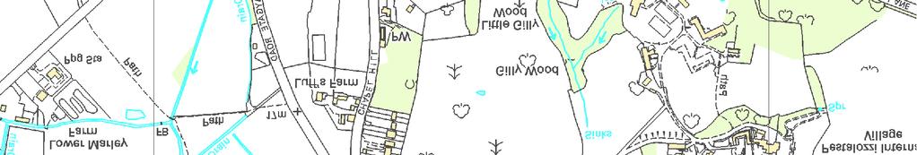
11 Archaeological Desk Based Assessment Land at Brede Lane, Sedlescombe, East Sussex TN33 0PS and these are thought to have been part of the bullion reserve of the Hastings Mint hidden at the time of the Norman invasion During these periods the study site is likely to have lain in agricultural land and overall it is reasonable to identify a low archaeological potential for these periods. 4.4 Late Medieval, Post Medieval and Modern Although there are a large number of late Medieval, post Medieval and Modern entries for Sedlescombe on the East Sussex Sites and Monuments record, none of these actually has any relevance for the study sites archaeological potential Gardner and Gream s map of 1795 (Fig. 2), the 1806 Ordnance Survey (Fig. 3) and the Greenwood map of 1825 (Fig. 4) all show the study site in agricultural land The Sedlescombe Tithe Map of 1841 (Fig. 5) records the study site as divided between: Gate Field - Arable Mill Field - Arable Broomfield - Arable Bath Meadow - Meadow Subsequent maps show numerous changes to the field boundaries within the site until the present when the site essentially comprises one large field on the south and one small field on the north (Figs. 6 to 13) Overall the study site can reasonably be defined as having a low archaeological potential for this period. CgMs Ltd 9 DH/KB/16190
12 Archaeological Desk Based Assessment Land at Brede Lane, Sedlescombe, East Sussex TN33 0PS 5.0 SITE CONDITIONS AND THE PROPOSED DEVELOPMENT Site Conditions 5.1 The site consists of agricultural pasture land between the core of the settlement of Sedlescombe to the west and the settlement extension around East View Terrace to the east. 5.2 Map evidence indicates the study site has consisted of agricultural land since at least the eighteenth century. Past archaeological impacts will relate to past ploughing and moderate but widespread impacts can be anticipated. Proposed Development 5.3 The development proposal would see the extreme east of the site only developed, to the rear of existing properties on Brede Lane. 5.4 On the basis of all the available evidence, the proposed development would be unlikely to have a significant or widespread archaeological impact. CgMs Ltd 10 DH/KB/16190
13 Archaeological Desk Based Assessment Land at Brede Lane, Sedlescombe, East Sussex TN33 0PS 6.0 CONCLUSIONS AND RECOMMENDATIONS 6.1 Land at Brede Lane, Sedlescombe, East Sussex TN33 0PS has been assessed for its archaeological potential. 6.2 The study site can reasonably be assessed as having a low archaeological potential for all past periods. 6.3 The proposed development is assessed as being unlikely to have either a significant or widespread archaeological impact. 6.4 On the basis of all the available evidence, we would suggest that if the Local Planning Authority requires any further archaeological mitigation measures, these could follow planning consent secured by an appropriately worded planning condition. CgMs Ltd 11 DH/KB/16190
14 Archaeological Desk Based Assessment Land at Brede Lane, Sedlescombe, East Sussex TN33 0PS SOURCES CONSULTED British Library Domesday Book, Sussex ed. John Morris 9, 122, 125, 127, 1976 East Sussex County Record Office East Sussex Historic Environment Record CARTOGRAPHIC Gardner and Gream, 1795 Ordnance Survey, 1808 C & J Greenwood, 1825 Tithe Map, 1841 Ordnance Survey, 1872 Ordnance Survey, 1898 Ordnance Survey, 1909 Ordnance Survey, 1939 Ordnance Survey, 1961 Ordnance Survey, 1977 Ordnance Survey, 2013 CgMs Ltd 12 DH/KB/16190


15 N:\ \ Sedlescombe\Figures\Mapping\GIS\Projects\A4 Figure 1 Landscape.mxd Kent East Sussex Staplecross A28 John's Cross Cripp's Corner ROTHER DISTRICT Sedlescombe A28 Whatlington BATTLE MB / Planning Heritage Site Boundary ± Scale at A4: 1:10, m Battle Telham Westfield Figure 1: Site Location HASTINGS DISTRICT Ordnance Survey maps reproduced with the sanction of the controller of HM Stationery Office. Licence No: AL Contains Ordnance Survey data Crown copyright and database right [2013] A

16 N:\ \ Sedlescombe\Figures\Mapping\CAD\01 current\drawing1.dwg MB / C O N S U L T I N G Planning Heritage Approximate Site Boundary N Not to Scale: Illustrative Only Figure 2: Gardner and Gream, 1795 Ordnance Survey maps reproduced with the sanction of the controller of HM Stationery Office Licence No: AL

17 N:\ \ Sedlescombe\Figures\Mapping\CAD\01 current\drawing1.dwg MB / C O N S U L T I N G Planning Heritage Approximate Site Boundary N Not to Scale: Illustrative Only Figure 3: Ordnance Survey, 1808 Ordnance Survey maps reproduced with the sanction of the controller of HM Stationery Office Licence No: AL

18 N:\ \ Sedlescombe\Figures\Mapping\CAD\01 current\drawing1.dwg MB / C O N S U L T I N G Planning Heritage Approximate Site Boundary N Not to Scale: Illustrative Only Figure 4: C & J Greenwood, 1825 Ordnance Survey maps reproduced with the sanction of the controller of HM Stationery Office Licence No: AL

19 N:\ \ Sedlescombe\Figures\Mapping\CAD\01 current\drawing1.dwg MB / C O N S U L T I N G Planning Heritage Site Boundary N Not to Scale: Illustrative Only Figure 5: Tithe Map, 1841 Ordnance Survey maps reproduced with the sanction of the controller of HM Stationery Office Licence No: AL
20 N:\ \ Sedlescombe\Figures\Mapping\CAD\01 current\drawing1.dwg MB / C O N S U L T I N G Planning Heritage Site Boundary N Not to Scale: Illustrative Only Figure 6: Ordnance Survey, 1872 Ordnance Survey maps reproduced with the sanction of the controller of HM Stationery Office Licence No: AL
21 N:\ \ Sedlescombe\Figures\Mapping\CAD\01 current\drawing1.dwg MB / C O N S U L T I N G Planning Heritage Site Boundary N Not to Scale: Illustrative Only Figure 7: Ordnance Survey, 1898 Ordnance Survey maps reproduced with the sanction of the controller of HM Stationery Office Licence No: AL
22 N:\ \ Sedlescombe\Figures\Mapping\CAD\01 current\drawing1.dwg MB / C O N S U L T I N G Planning Heritage Site Boundary N Not to Scale: Illustrative Only Figure 8: Ordnance Survey, 1909 Ordnance Survey maps reproduced with the sanction of the controller of HM Stationery Office Licence No: AL

23 N:\ \ Sedlescombe\Figures\Mapping\CAD\01 current\drawing1.dwg MB / C O N S U L T I N G Planning Heritage Site Boundary N Not to Scale: Illustrative Only Figure 9: Ordnance Survey, 1939 Ordnance Survey maps reproduced with the sanction of the controller of HM Stationery Office Licence No: AL

24 N:\ \ Sedlescombe\Figures\Mapping\CAD\01 current\drawing1.dwg MB / C O N S U L T I N G Planning Heritage Site Boundary N Not to Scale: Illustrative Only Figure 10: Ordnance Survey, 1961 Ordnance Survey maps reproduced with the sanction of the controller of HM Stationery Office Licence No: AL

25 N:\ \ Sedlescombe\Figures\Mapping\CAD\01 current\drawing1.dwg MB / C O N S U L T I N G Planning Heritage Site Boundary N Not to Scale: Illustrative Only Figure 11: Ordnance Survey, 1977 Ordnance Survey maps reproduced with the sanction of the controller of HM Stationery Office Licence No: AL

26 N:\ \ Sedlescombe\Figures\Mapping\CAD\01 current\drawing1.dwg MB / C O N S U L T I N G Planning Heritage Site Boundary N Not to Scale: Illustrative Only Figure 12: Ordnance Survey, 2013 Ordnance Survey maps reproduced with the sanction of the controller of HM Stationery Office Licence No: AL

27 N:\ \ Sedlescombe\Figures\Mapping\CAD\01 current\drawing1.dwg MB / C O N S U L T I N G Planning Heritage Site Boundary N Not to Scale: Illustrative Only Figure 13: Google Earth, 2013 Ordnance Survey maps reproduced with the sanction of the controller of HM Stationery Office Licence No: AL
28 Archaeological Desk Based Assessment Land at Brede Lane, Sedlescombe, East Sussex TN33 0PS APPENDIX 1: HER Plot CgMs Ltd 13 DH/KB/16190
29 N:\ \ Sedlescombe\Figures\Mapping\GIS\Projects\HER Seddlescombe.mxd MB / MES19357 Sedlescombe Conservation Area Ordnance Survey maps reproduced with the sanction of the controller of HM Stationery Office. Licence No: AL MES2408 MES2461 EES14459 EES14419 EES14776 ") EES15041 EES14449 MES2411 MES2415 EES14842 EES15196 ") ") ") EES14774 ") ") MES19356!( ") ") EES14736 EES14676 ") EES15322 ") EES14776 GF ") ") ") ") ") ") ")!( ") ") GF ") ")!(!( MES2417 MES16408 MES19356 MES2455 MES19356 EES14776 MES21094 EES15189!( MES2463!( MES19346 EES14776 EES14565 ") ")!( EES14289 MES22420!( MES17144 EES14491 EES14847 EES14864 EES14483 EES14639 EES14423 MES8484 MES2456 MES2443 ") EES14774 EES15146 ")!( MES ") ") ") EES15147!( MES2572 ") EES14679 Planning Heritage Scale at A3: Site Boundary Search Area (1km radius) Designated Heritage Assets: Listed Building Conservation Area Non-Designated Heritage Assets:!( Monument Point GF Findspot Historic Building Monument Line Monument Area Archaeological Notification Area Previous Archaeological Work: ") Event Point Event Line Event Area ± 1:8, m Appendix 1: HER Plot

30
ARCHAEOLOGICAL DESK BASED ASSESSMENT LAND AT STOKE ROAD HOO ST WERBURGH MEDWAY KENT
 ARCHAEOLOGICAL DESK BASED ASSESSMENT LAND AT STOKE ROAD HOO ST WERBURGH KENT November 2017 Local Planning Authority: Medway Council Site centred at: TQ 78680 72736 Author: James Archer BA (Hons) ACIfA
ARCHAEOLOGICAL S E R V I C E S. 1 Beechmount Road, Southampton, Hampshire. Archaeological Watching Brief. by David Platt. Site Code: SOU1649
 T H A M E S V A L L E Y ARCHAEOLOGICAL S E R V I C E S 1 Beechmount Road, Southampton, Hampshire Archaeological Watching Brief by David Platt Site Code: SOU1649 (SU 4188 1616) 1 Beechmount Road, Southampton,
Land at Model Farm Cottages, Bath Road, Sonning, Berkshire
 Land at Model Farm Cottages, Bath Road, Sonning, Berkshire An Archaeological Evaluation for The Keen Partnership by Andy Taylor Thames Valley Archaeological Services Ltd Site Code BRS 04/55 June 2004 Summary
Archaeological Evaluation and Assessment of Land at Roselands, Sedlescombe, East Sussex
 Archaeological Evaluation and Assessment of Land at Roselands, Sedlescombe, East Sussex NGR: TQ 78013 18096 Site Code: ROSE/EV/16 (Planning Application: RR/2015/2248/P) SWAT Archaeology The Office, School
ARCHAEOLOGICAL S E R V I C E S. 6a Old Mill Way, Shirley, Southampton, Hampshire. Archaeological Evaluation. by Daniel Bray. Site Code: SOU 1640
 T H A M E S V A L L E Y ARCHAEOLOGICAL S E R V I C E S 6a Old Mill Way, Shirley, Southampton, Hampshire Archaeological Evaluation by Daniel Bray Site Code: SOU 1640 (SU 3934 1442) 6a Old Mill Way, Shirley,
Archaeological Evaluation of Land off Hubbards Lane, Boughton Monchelsea, Kent
 Archaeological Evaluation of Land off Hubbards Lane, Boughton Monchelsea, Kent NGR: 576190 151300 Site Code: HUB/EV/16 (Planning Application: 16/500014/OUT/MA) SWAT Archaeology The Office, School Farm
Land at Larchwood Farm, Whitehorse Lane Finchampstead, Berkshire
 Land at Larchwood Farm, Whitehorse Lane Finchampstead, Berkshire An Archaeological Evaluation for Mr. John Westbrook by James McNicoll-Norbury Thames Valley Archaeological Services Ltd Site Code LFF08/103
S E R V I C E S. The Vicarage, Victoria Square, Lee-on-the-Solent, Hampshire. Archaeological Watching Brief. by Ellen McManus-Fry. Site Code: VVL16/97
 T H A M E S V A L L E Y ARCHAEOLOGICAL S E R V I C E S The Vicarage, Victoria Square, Lee-on-the-Solent, Hampshire Archaeological Watching Brief by Ellen McManus-Fry Site Code: VVL16/97 (SU 5618 0093)
Bramley Grange, Horsham Road, Bramley, Surrey
 Bramley Grange, Horsham Road, Bramley, Surrey An Archaeological Evaluation for English Villages Housing Association by Stephen Hammond Thames Valley Archaeological Services Ltd Site Code BGB 03/95 October
Charlmont Road, Tooting, London Borough of Wandsworth
 123-125 Charlmont Road, Tooting, London Borough of Wandsworth An Archaeological Evaluation For Eramo Developments Limited by Andrew Weale and Andrew Taylor Thames Valley Archaeological Services Ltd Site
Land adjacent to 103 Pound Lane, Sonning, Berkshire
 Land adjacent to 103 Pound Lane, Sonning, Berkshire An Archaeological Evaluation for Hicks Development Ltd by James McNicoll-Norbury Thames Valley Archaeological Services Ltd Site Code PLS 09/50 June 2009
T H A M E S V A L L E Y S E R V I C E S. Land between 138 and 142 Southcote Lane, Reading, Berkshire. Archaeological Evaluation
 T H A M E S V A L L E Y ARCHAEOLOGICAL S E R V I C E S Land between 138 and 142 Southcote Lane, Reading, Berkshire Archaeological Evaluation by James McNicoll-Norbury Site Code: SLR09/121 (SU 6935 7215)
ARCHAEOLOGICAL S E R V I C E S. Kingsley Academy, Prince Regent Road, Hounslow, London Borough of Hounslow. Archaeological Evaluation
 T H A M E S V A L L E Y ARCHAEOLOGICAL S E R V I C E S Kingsley Academy, Prince Regent Road, Hounslow, London Borough of Hounslow Archaeological Evaluation by James McNicoll-Norbury Site Code: CCL15/173
Archaeological Monitoring of Land at Seacrest, Cliff Drive, Warden, Isle of Sheppey, Kent
 Archaeological Monitoring of Land at Seacrest, Cliff Drive, Warden, Isle of Sheppey, Kent Site Code SEA/WB/15 Report for Kevin & Lesley O Brian Date of report 14/10/2015 SWAT ARCHAEOLOGY Swale and Thames
Diddenham Court, Grazeley, Reading, Berkshire, Phase 2
 Diddenham Court, Grazeley, Reading, Berkshire, Phase 2 An Archaeological Watching Brief For Fenchurch Estates (Diddenham) Ltd by Steve Hammond and Simon Cass Thames Valley Archaeological Services Ltd Site
30 Broad Street, Wokingham, Berkshire
 30 Broad Street, Wokingham, Berkshire An Archaeological Watching Brief for Psilogic Ltd by Steve Ford Thames Valley Archaeological Services Ltd Site Code 30BSW01/81 October 2001 Summary Site name: 30 Broad
Acrefield Cottage, Winkfield Street, Maidens Green, Winkfield, Windsor, Berkshire
 Acrefield Cottage, Winkfield Street, Maidens Green, Winkfield, Windsor, Berkshire An Archaeological Watching Brief For Mr and Mrs Elia by Pamela Jenkins Thames Valley Archaeological Services Ltd Site Code
Oxford Bus Company Depot, Cowley Road, Oxford
 Oxford Bus Company Depot, Cowley Road, Oxford An Archaeological Evaluation (Stage 2) for Berkeley Homes (Oxford and Chiltern) Ltd by Jo Pine Thames Valley Archaeological Services Ltd Site Code GAG 00/32
The Rising Sun, Guildford Road, Fetcham, Surrey
 The Rising Sun, Guildford Road, Fetcham, Surrey An Archaeological Evaluation for Bovis Homes Limited by Steve Ford Thames Valley Archaeological Services Ltd Site Code RGF04/80 March 2005 Summary Site name:
Bedwell Park, Essendon, Hatfield, Hertfordshire
 Bedwell Park, Essendon, Hatfield, Hertfordshire An Archaeological Evaluation for Millgate Homes By Andy Taylor Thames Valley Archaeological Services Ltd Site Code BPE 06/34 November 2006 Summary Site name:
Roman Farm, Nettleden, Hemel Hempstead, Hertfordshire
 Roman Farm, Nettleden, Hemel Hempstead, Hertfordshire An Archaeological Watching Brief for Mercantile Land Development Ltd by Siân Anthony Thames Valley Archaeological Services Ltd Site Code RFN01/82 October
Former PLA Recreation Ground, The Drive, Ilford, London Borough of Redbridge
 Former PLA Recreation Ground, The Drive, Ilford, London Borough of Redbridge An Archaeological Evaluation for CgMs Ltd by Steve Ford Thames Valley Archaeological Services Ltd Site Code FPL06 May 2006 Summary
Former transport depot, Charlton Road, Charlton, Shepperton, Surrey
 Former transport depot, Charlton Road, Charlton, Shepperton, Surrey An Archaeological Evaluation for St James Homes Ltd by Steve Ford Thames Valley Archaeological Services Ltd Site Code CRC06/117 June
Redgrave Pinsent Rowing Lake, Caversham Lakes, Henley Road, Caversham, Oxfordshire
 Redgrave Pinsent Rowing Lake, Caversham Lakes, Henley Road, Caversham, Oxfordshire An Archaeological Evaluation: Phase 2 for Mott McDonald Ltd by Sarah Coles and Sian Anthony Thames Valley Archaeological
25 Whiteknights Road, Reading, Berkshire
 25 Whiteknights Road, Reading, Berkshire An Archaeological Evaluation for B & M Care by Sean Wallis Thames Valley Archaeological Services Ltd Site Code WRR07/74 July 2007 Summary Site name: 25 Whiteknights
181 London Road, Isleworth, London Borough of Hounslow
 181 London Road, Isleworth, London Borough of Hounslow An Archaeological Evaluation for Crest Nicholson Residential (South) Ltd by Jo Pine and Andy Taylor Thames Valley Archaeological Services Ltd Site
Culham Court, Aston, Remenham, Berkshire
 Culham Court, Aston, Remenham, Berkshire An Archaeological Evaluation for Woody Clark Limited by Sean Wallis Thames Valley Archaeological Services Ltd Site Code CCA 07/117 October 2007 Summary Site name:
T H A M E S V A L L E Y S E R V I C E S. Sidcup World of Golf, Sidcup Road, London Borough of Bromley. An Archaeological Evaluation.
 T H A M E S V A L L E Y ARCHAEOLOGICAL S E R V I C E S Sidcup World of Golf, Sidcup Road, London Borough of Bromley An Archaeological Evaluation by James Lewis Site Code: SDP09 (TQ 4450 7212) Sidcup World
Garratt Lane, Wandsworth, London Borough of Wandsworth
 140-150 Garratt Lane, Wandsworth, London Borough of Wandsworth An Archaeological Desk-Based Assessment for St James Homes by Jennifer Lowe Thames Valley Archaeological Services Ltd Site Code GLW 03/59
Summers Place, Stane Street, Billingshurst, West Sussex
 Summers Place, Stane Street, Billingshurst, West Sussex An Archaeological Evaluation for Berkeley Homes (Southern) Ltd by Simon Cass Thames Valley Archaeological Services Ltd Site Code SPB 07/33 March
Long Ashes Holiday Park Threshfield North Yorkshire
 on behalf of GVA Humberts Leisure for Lakeland Leisure Estates Ltd Long Ashes Holiday Park Threshfield North Yorkshire archaeological evaluation report 3027 December 2012 Contents 1. Summary 1 2. Project
ARCHAEOLOGICAL S E R V I C E S. New wet dock, Longview, Bisham Road, Bisham, Berkshire. Archaeological Watching Brief.
 T H A M E S V A L L E Y ARCHAEOLOGICAL S E R V I C E S New wet dock, Longview, Bisham Road, Bisham, Berkshire Archaeological Watching Brief by Daniel Bray Site Code: LDB15/131 (SU 8493 8589) New wet dock,
S E R V I C E S. Long Acre, 228 Greys Road, Henley-on-Thames, Oxfordshire. Archaeological Watching Brief. by Andy Taylor. Site Code: GRH12/185
 T H A M E S V A L L E Y ARCHAEOLOGICAL S E R V I C E S Long Acre, 228 Greys Road, Henley-on-Thames, Oxfordshire Archaeological Watching Brief by Andy Taylor Site Code: GRH12/185 (SU 7443 8162) Long Acre,
St Antony s College. Oxford. Archaeological Evaluation Report. o a. September Client: St Antony's College
 St Antony s College Oxford Archaeological Evaluation Report o a September 2008 Client: St Antony's College Issue No:1 OA Job No: 4131 NGR: SP 509 074 Archaeological Evaluation Report Client Name: St Antony's
Thames Valley University, Kings Road, Reading, Berkshire
 Thames Valley University, Kings Road, Reading, Berkshire An Archaeological Evaluation for Thames Valley University by Danielle Milbank and Steve Ford Thames Valley Archaeological Services Ltd Site Code
Oxford Options Resource Centre, Horspath Driftway, Headington, Oxford
 Oxford Options Resource Centre, Horspath Driftway, Headington, Oxford An Archaeological Watching Brief For Oxfordshire County Council by Tim Dawson and Heather Hopkins Thames Valley Archaeological Services
New Sunday School, St Mary s Church, White Waltham, Maidenhead, Berkshire
 New Sunday School, St Mary s Church, White Waltham, Maidenhead, Berkshire An Archaeological Evaluation for White Waltham and Shottesbrook Parochial Church Council by Simon Cass Thames Valley Archaeological
Portland Works, Royal Worcester Porcelain, Portland Walk, Diglis, Worcester
 Portland Works, Royal Worcester Porcelain, Portland Walk, Diglis, Worcester An Archaeological Watching Brief For Berkeley Homes (Oxford and Chiltern) Limited by Danielle Milbank Thames Valley Archaeological
Developing a Spatial Data Infrastructure for Cultural Heritage
 Developing a Spatial Data Infrastructure for Cultural Heritage Peter M c Keague (RCAHMS) Anthony Corns and Robert Shaw (Discovery Programme) Developing a Spatial Data Infrastructure for Cultural Heritage
Former Cart Shed, Stroud Farm, Holyport, Maidenhead, Berkshire
 Former Cart Shed, Stroud Farm, Holyport, Maidenhead, Berkshire An Archaeological Watching Brief For Mr Simon Rinder by Stephen Hammond and Jennifer Lowe Thames Valley Archaeological Services Ltd Site Code
Land off Luton Road, Farley Hill, Luton, Bedfordshire
 Land off Luton Road, Farley Hill, Luton, Bedfordshire An Archaeological Evaluation for 3Sixty Construction Ltd by Andrew Mundin Thames Valley Archaeological Services Ltd Site Code LRL 08/82 August 2008
UNCLASSIFIED. Risk of Flooding from Reservoirs - Western Wales River Basin District
 UNCLASSIFIED Flood Risk Maps Risk of Flooding from Reservoirs - Western Wales Why have we produced these maps what can they be used for? Under the Flood Risk Regulations Natural Resources Wales have worked
This Unit is suitable for candidates with no previous archaeological experience but who have an interest in history and/or archaeology.
 National Unit specification: general information Unit code: H29B 12 Superclass: DC Publication date: August 2012 Source: Scottish Qualifications Authority Version: 01 Summary This Unit introduces candidates
Archaeological Evaluation at Howt Green Farm, Sheppey Way, Bobbing, Kent
 Archaeological Evaluation at Howt Green Farm, Sheppey Way, Bobbing, Kent NGR: 589575 166122: Site Code: HGF-EV-14 (Planning Reference: SW/13/0501) Date of Report: 11/04/14 Amended 07/05/2014 SWAT Archaeology
Figures Figure 1. Location Plan...4 Figure 2. Location of long wing and short wing of the development...8
 Contents Page Summary...2 Acknowledgements...2 Copyright notice...2 1 Introduction...3 1.1 Project background and commission...3 1.2 Location, topography and geology...3 1.3 Historical and archaeological
Northamptonshire Archaeology
 Northamptonshire Archaeology Archaeological Geophysical Survey At Sulgrave Castle Green, Sulgrave, Northamptonshire August 2007 Adrian Butler November 2007 Report 07/192 Northamptonshire Archaeology 2
UNCLASSIFIED. Risk of Flooding from Rivers and Sea - Western Wales River Basin District
 UNCLASSIFIED Flood Risk Maps Risk of Flooding from Rivers and Sea - Western Wales Why have we produced these maps what can they be used for? Under the Flood Risk Regulations Natural Resources Wales have
A303 Stonehenge Amesbury to Berwick Down Archaeological Geophysical Survey Design Brief
 A303 Stonehenge Amesbury to Berwick Down Archaeological Geophysical Survey Design Brief March 2016 Table of contents Chapter Pages 1 Summary 1 2 Background 1 2.1 Purpose 1 2.2 Location 2 2.3 Archaeological
Shotover View, Craufurd Road, Oxford
 Shotover View, Craufurd Road, Oxford An Archaeological Evaluation for Oxfordshire County Council by James Lewis Thames Valley Archaeological Services Ltd Site Code: CRO07/169 July 2008 Summary Site name:
Todmorden Wind Farm Geotechnical Site Investigations, Calderdale, West Yorkshire
 Todmorden Wind Farm Geotechnical Site Investigations, Calderdale, West Yorkshire Archaeological Watching Brief Report Oxford Archaeology North March 2013 I and H Brown Issue No: 2012-13/1370 OA North Job
ACTON COMMUNITY WIDE ARCHAEOLOGICAL RECONNAISSANCE SURVEY. Town of Acton and PAL, Inc.
 ACTON COMMUNITY WIDE ARCHAEOLOGICAL RECONNAISSANCE SURVEY Town of Acton and PAL, Inc. Objectives and Scope of Work Four phase study; (1. research, 2. draft report outline, resource protection bylaw, 3.
Geology Map Extracts. Geology Map Extracts. Report prepared for: Orkney Sustainable Energy Ltd 6 North End Road Stromness Orkney KW16 3AG
 Report prepared for: Orkney Sustainable Energy Ltd 6 North End Road Stromness Orkney KW16 3AG Geology Map Extracts This report is designed for users carrying out preliminary site assessments who require
A Geophysical Survey at Storey s Meadow West Meon, Hampshire
 A Geophysical Survey at Storey s Meadow West Meon, Hampshire February 28 th March 1 st 2014 Liss Archaeological Group Ref: SM-14 Carried out by Liss Archaeological Group on behalf of - The Friends of Corhampton
The Battersea Channel Project, Nine Elms: exploration of the buried prehistoric landscape
 The Battersea Channel Project, Nine Elms: exploration of the buried prehistoric landscape Action: Seek endorsement of this over-arching Brief from Lambeth and Wandsworth Borough Council s Planning Departments.
ARCHAEOLOGICAL S E R V I C E S. Land at Mathisen Way, Poyle, Berkshire. Archaeological Evaluation. by Andy Taylor. Site Code: MWP17/271 (TQ )
") T H A M E S V A L L E Y ARCHAEOLOGICAL S E R V I C E S Land at Mathisen Way, Poyle, Berkshire Archaeological Evaluation by Andy Taylor Site Code: MWP17/271 (TQ 0345 7640) Land at Mathisen Way, Poyle, Berkshire
T H A M E S V A L L E Y ARCHAEOLOGICAL S E R V I C E S Land at Mathisen Way, Poyle, Berkshire Archaeological Evaluation by Andy Taylor Site Code: MWP17/271 (TQ 0345 7640) Land at Mathisen Way, Poyle, Berkshire
Archaeological Watching Brief
 Polar Technology, Eynsham Geotechnical Test Pits Archaeological Watching Brief Report February 2017 Client: Polar Technology Management Group Issue No: 1 OA Job No: 6601 NGR: SP 42762 08827 Archaeological
Archaeological Monitoring and Recording
 Brampton Primary School Archaeological Monitoring and Recording Report August 2014 Client: Cambridgeshire County Council OA East Report No: 1648 OASIS No: oxfordar3-187917 NGR: TL 52055 27081 Archaeological
CHURCH OF ST. LAURENCE, NORWELL, NOTTINGHAMSHIRE: ARCHAEOLOGICAL EXCAVATION WITHIN THE CHURCHYARD
 CHURCH OF ST. LAURENCE, NORWELL, NOTTINGHAMSHIRE: ARCHAEOLOGICAL EXCAVATION WITHIN THE CHURCHYARD 2018 M. Hurford Project Code: SLC Report Number: 002/2018 Matt Hurford Historic Buildings and Archaeology
Vyrnwy Pipeline, Old Marton, Shropshire
 Vyrnwy Pipeline, Old Marton, Shropshire Archaeological Watching Brief - Supplementary Report Oxford Archaeology North February 2010 United Utilities Issue No: 2010-11/1013 OAN Job No: L10127 NGR: SJ 35083
CHERHILL. New Village Hall Site JANUARY REPORT No
 CHERHILL New Village Hall Site JANUARY 2016 REPORT No. 1017.205 talits@btinternet.com 01793 731974 Summary TALITS Archaeological Services was commissioned by Project Manager, Simon Tomlinson, to undertake
The Rural Settlement of Roman England
 The Rural Settlement of Roman England Roman settlement at Claydon Pike Oxford Archaeology Settlement morphology and regional diversity: establishing a new model Alex Smith Aims of Project Phase 1 To gain
S E R V I C E S S O U T H. Land adjoining Tilsmore Lodge, Mount Pleasant, Heathfield, East Sussex. Geophysical Survey (Magnetic)
") T H A M E S V A L L E Y ARCHAEOLOGICAL S E R V I C E S S O U T H Land adjoining Tilsmore Lodge, Mount Pleasant, Heathfield, East Sussex Geophysical Survey (Magnetic) by Kyle Beaverstock and Tim Dawson
T H A M E S V A L L E Y ARCHAEOLOGICAL S E R V I C E S S O U T H Land adjoining Tilsmore Lodge, Mount Pleasant, Heathfield, East Sussex Geophysical Survey (Magnetic) by Kyle Beaverstock and Tim Dawson
Pen Selwood Geophysical Survey
 Pen Selwood Geophysical Survey 2015-2017 Prepared for: The South Somerset Archaeological Research Group and the Pen Selwood History Society Prepared by: Geoff Parcell 9 February 2018 Report Number: /GS/1015!
General Editor: Vince Russett
 YCCCART 2014/Y20 North Somerset HER 2015/11 Manual survey using an electronic, hydryostatic level (NIVCOMP) at Wemberham Roman Villa YATTON, CONGRESBURY, CLAVERHAM AND CLEEVE ARCHAEOLOGICAL RESEARCH TEAM
6. SURVEY MAPS OF THE ISLE OF ARRAN MAP 1: DRUMADOON POINT TO AIRD NAN RON
 6. SURVEY MAPS OF THE ISLE OF ARRAN MAP 1: DRUMADOON POINT TO AIRD NAN RON Hinterland Geology and Coastal Geomorphology: Both Permian sandstone and Triassic mudstones are represented in this coastal section.
Haslemere Design Statement
 For Beacon Hill, Critchmere, Grayswood, Haslemere, Hindhead and Shottermill Ensuring new development takes account of local character Contents Overview 3 1. Introduction 4 2. What makes Haslemere Special
Pumping Station, Whytelaydes Lane, Cookham Rise, Berkshire
 Pumping Station, Whytelaydes Lane, Cookham Rise, Berkshire An Archaeological Evaluation for Gullett and Sons Ltd by Simon Cass Thames Valley Archaeological Services Ltd Site Code WLC 07/156 November 2007
ADDITIONAL PHASE IA ARCHAEOLOGICAL SURVEY FOR THE UMORE PARK SAND AND GRAVEL MINING ENVIRONMENTAL REVIEW SERVICES, DAKOTA COUNTY, MINNESOTA
 ADDITIONAL PHASE IA ARCHAEOLOGICAL SURVEY FOR THE UMORE PARK SAND AND GRAVEL MINING ENVIRONMENTAL REVIEW SERVICES, DAKOTA COUNTY, MINNESOTA ADDENDUM I Submitted to: Short Elliot Hendrickson, Inc. Submitted
PW Parkway ES Prince William County, Virginia WSSI #
 PW Parkway ES Prince William County, Virginia WSSI #15.3 Cultural Resources Site Assessment November 15 Prepared for: Prince William County Public Schools P.O. Box 39 Manassas, Virginia 1 Prepared by:
Geophysical Survey. Ballymount Co. Dublin. Licence Ref. 02R029. By John Nicholls Margaret Gowen & Co. Ltd. For LRT
 Geophysical Survey Ballymount Co. Dublin Licence Ref. 02R029 By John Nicholls Margaret Gowen & Co. Ltd. For LRT 4 th April 2002 Illustrations List of Figures Figure 1 Site Location 1: 50000 Figure 2 Survey
Evaluation/Monitoring Report No. 259
 SITE 100M EAST OF 16 LEARMORE ROAD CASTLEGORE CASTLEDERG COUNTY TYRONE LICENCE NO.: AE/13/36E NAOMI CARVER 1 Site Specific Information Site Name: 100m east of 16 Learmore Road, Castlederg, Co. Tyrone Townland:
Explore. history landscapes family.
 Explore history landscapes family www.explorethepast.co.uk Contents From the team Section 1 Researching Worcestershire Section 2 Local Studies & Archaeology Reference Library Section 3 Maps and plans Accessing
Legal problems of environmental management. Spatial planning and space management. M. Gajewski 2014 / 2015
 Legal problems of environmental management Spatial planning and space management M. Gajewski 2014 / 2015 Course contents (in brief) Constitutional basis of the environment protection system. General principles
Source Protection Zones. National Dataset User Guide
 Source Protection Zones National Dataset User Guide Version 1.1.4 20 th Jan 2006 1 Contents 1.0 Record of amendment...3 2.0 Introduction...4 2.1 Description of the SPZ dataset...4 2.1.1 Definition of the
o a West Midlands Wednesbury Woden Road Former Sandwell College Archaeological Evaluation Report Oxford Archaeology
 Former Sandwell College Woden Road Wednesbury West Midlands o a Oxford Archaeology November 2004 Client: John Samuels Archaeological Consultants Issue N o : 1 OA Job N o : 2435 Planning Ref N o : DC/04/42731
Evaluation/Monitoring Report No. 152
 Evaluation/Monitoring Report No. 152 150m west of 7 Portmore Rd. Portmore Lower Ballinderry County Antrim LICENCE NO.: AE/07/241 David McIlreavy 1 Site Specific Information Site Name Townland County :
Chelmsford Borough Council LDF: Level 1 SFRA
 Chelmsford Borough Council LDF: Level 1 SFRA Urban Capacity Study Sites PPS25 Flood Zones 2007 Figure B20-1 Preliminary Core Strategy Assessment Flood Zone Potential Housing Potential Employment 1, 2 &
Glossary of Common Terms. Guide 2. BAJR Practical Guide Series held by authors
 Glossary of Common Terms Guide 2 BAJR Practical Guide Series 2008 held by authors Glossary of common archaeological terms : compiled 28/04/2004 absolute dating: Absolute dating is based upon a specific
T H A M E S V A L L E Y S E R V I C E S. Camel Hill Farm, Queen Camel, Sparkford, Somerset. Archaeological Evaluation.
 T H A M E S V A L L E Y ARCHAEOLOGICAL S E R V I C E S Camel Hill Farm, Queen Camel, Sparkford, Somerset Archaeological Evaluation by Andrew Weale Site Code: CHS10/106 (ST 5816 2559) Camel Hill Farm, Queen
The National Spatial Strategy
 Purpose of this Consultation Paper This paper seeks the views of a wide range of bodies, interests and members of the public on the issues which the National Spatial Strategy should address. These views
Hale Manor Farm, Horringford, Arreton, Isle of Wight
 Hale Manor Farm, Horringford, Arreton, Isle of Wight An Archaeological Desk-Based Assessment and Field Evaluation for AE Brown Farms Ltd by Simon Cass and Steve Preston Thames Valley Archaeological Services
Whitelands College, West Hill, Putney, London Borough of Wandsworth
 Whitelands College, West Hill, Putney, London Borough of Wandsworth An Archaeological Evaluation for Crest Nicholson Residential (South) Ltd by Sian Anthony Thames Valley Archaeological Services Ltd Site
PLANNING FOR THE FUTURE
 PLANNING FOR THE FUTURE Guidance for Managing the Archaeological and Palaeoenvironmental Resource in the Till-Tweed Valleys, Northumberland, UK And The University of Newcastle upon Tyne Authors: Clive
10-12 Fishbourne Road East, Chichester, West Sussex
 0-2 Fishbourne Road East, Chichester, West Sussex An Archaeological Evaluation for Croudace Homes Limited by Andy Taylor Thames Valley Archaeological Services Ltd Site Code FRC 07/05 January 2007 Summary
LAND ADJACENT TO COLESHALL FARM/ SHEPPEY WAY/SCHOOL LANE, IWADE, KENT
 LAND ADJACENT TO COLESHALL FARM/ SHEPPEY WAY/SCHOOL LANE, IWADE, KENT January 2012 Prepared for: Hillreed Homes Limited, Hillreed House, 60 College Road Maidstone, Kent ME15 6SJ SWAT Archaeology The Office,
The Soils and Land Capability for Agriculture. Land North of Aberdeen, Aberdeenshire
 The Soils and Land Capability for Agriculture Of Land North of Aberdeen, Aberdeenshire Report prepared for Peter Radmall Associates May 2012 Reading Agricultural Consultants Ltd Beechwood Court, Long Toll,
Dark Sky Initiative Draft Terms of Reference
 Dark Sky Initiative Draft Terms of Reference July 2008 Table of Contents 1.0 Introduction 2 2.0 Initiative intent 2-3 3.0 Initiative goals 3 4.0 Legislation 3 5.0 Municipal Development Plan 3 6.0 Land
S E R V I C E S. Chadwell Heath Golf Club, Romford, London Borough of Havering. Archaeological Evaluation Phase 2. by Susan Porter.
 T H A M E S V A L L E Y ARCHAEOLOGICAL S E R V I C E S Chadwell Heath Golf Club, Romford, London Borough of Havering Archaeological Evaluation Phase 2 by Susan Porter Site Code: WLB09 (TQ 4875 8875) Chadwell
Report of the United Kingdom Division
 UNITED NATIONS GROUP OF EXPERTS WORKING PAPER ON GEOGRAPHICAL NAMES NO. 41/4 Twenty-ninth session Bangkok, Thailand, 25 29 April 2016 Item 4 of the Provisional Agenda Report of the Divisions Report of
THE SEVILLE STRATEGY ON BIOSPHERE RESERVES
 THE SEVILLE STRATEGY ON BIOSPHERE RESERVES 1 VISION FOR BIOSPHERE RESERVES IN THE 21 ST CENTURY The international Seville Conference on Biosphere Reserves, organised by UNESCO, adopted a two-pronged approach,
Oxfordshire. College Farm. College Farm Close. o a. Archaeological Watching Brief Report. Client: Mrs V. Robinson. May 2009
 College Farm College Farm Close Oddington Oxfordshire Archaeological Watching Brief Report o a May 2009 Client: Mrs V. Robinson Issue No:1 OA Job No: 4414 NGR: SP 5529 1492 Client Name: Mrs V. Robinson
APPENDIX B: REPORT ON GEOPHYSICAL SURVEY, JULY 1998
 APPENDIX B: REPORT ON GEOPHYSICAL SURVEY, JULY 1998 by Andy Payne Introduction A geophysical survey was carried out at Le Yaudet, Ploulec h, Brittany as part of the ongoing investigation into the archaeology
By Ian Roberts, Archaeological Services WYAS 1
 Archaeology and Quarrying Insights from the Magnesian Limestone Project Excavation of an enclosure and field system in advance of limestone quarrying at Barnsdale Bar By Ian Roberts, Archaeological Services
Land north of Queen Mother Reservoir, Majors Farm Road, Colnbrook, Berkshire
 Land north of Queen Mother Reservoir, Majors Farm Road, Colnbrook, Berkshire An Archaeological Desk-Based Assessment for St James Homes Ltd by Lisa-Maree Hardy Thames Valley Archaeological Services Ltd
Mitford Estate, Morpeth. Phase I Geo-Environmental Assessment. For. Mitford Estates LLP
 Mitford Estate, Morpeth Phase I Geo-Environmental Assessment For Mitford Estates LLP Report Ref Issue Prepared by Date Reviewed by Date 12632 1 A Hampson Feb 15 A Coverdale Feb 15 Client Mitford Estates
Map 12: Ayrshire Coast: Doonfoot Beach to Dunure Map Content Descriptions
 Map 12: Ayrshire Coast: Doonfoot Beach to Dunure Map Content Descriptions 1. Built Heritage and Archaeology A total of twenty three sites were located in the area covered by Map 12. Of these seventeen
National Land Use Policy and National Integrated Planning Framework for Land Resource Development
 Title National Land Use Policy and National Integrated Planning Framework for Land Resource Development Duration: 32 Weeks Objective: Adoption of appropriate land use planning approaches to: Maintain the
Wheldon View, Wheldon Road, Castleford West Yorkshire
 Wheldon View, Wheldon Road, Castleford West Yorkshire An Archaeological Evaluation for Exemplar plc by Sarah Coles Thames Valley Archaeological Services Ltd Site Code WWC03/23 March 2003 Summary Site name:
Measuring Disaster Risk for Urban areas in Asia-Pacific
 Measuring Disaster Risk for Urban areas in Asia-Pacific Acknowledgement: Trevor Clifford, Intl Consultant 1 SDG 11 Make cities and human settlements inclusive, safe, resilient and sustainable 11.1: By
GIS and Predictive Modeling: Identifying North Carolina s Historic Archaeological Resources
 Environmental Services, Inc. GAI Consultants, Inc. GIS and Predictive Modeling: Identifying North Carolina s Historic Archaeological Resources Ben Resnick (GAI) and Scott Seibel (ESI) Historic Archaeological