PROPOSAL FOR NEW INSTRUCTIONAL PROGRAM UNIVERSITY OF MARYLAND AT COLLEGE PARK, MARYLAND
|
|
|
- Jack Maxwell
- 5 years ago
- Views:
Transcription

1

2
3
4
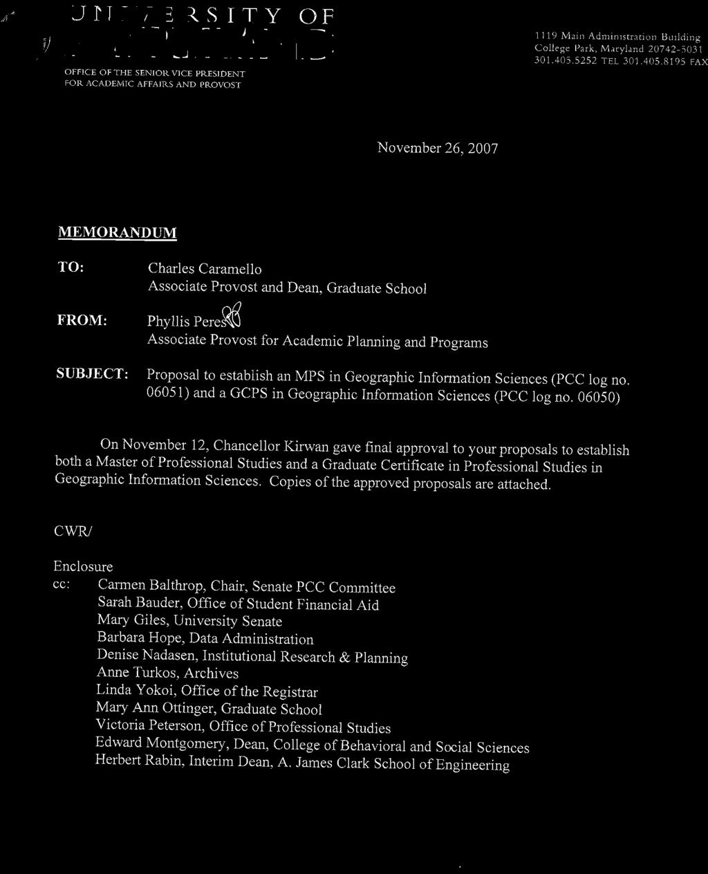
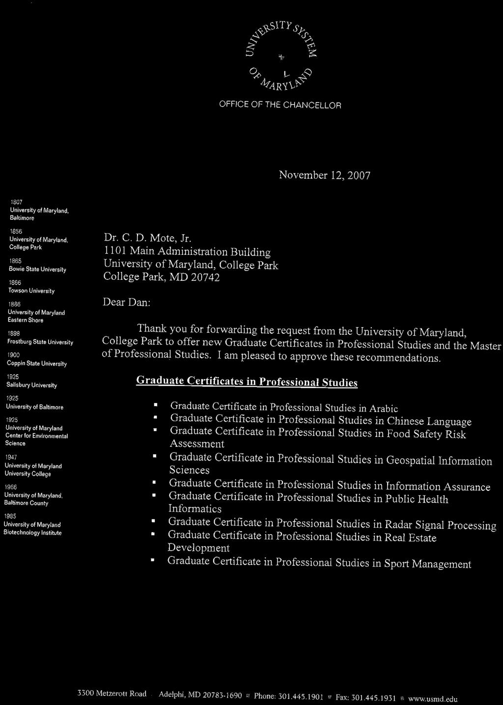
5 PROPOSAL FOR NEW INSTRUCTIONAL PROGRAM UNIVERSITY OF MARYLAND AT COLLEGE PARK, MARYLAND Master of Professional Studies in Geospatial Information Sciences (GIS) PROPOSED INITIATION DATE: Fall 2007
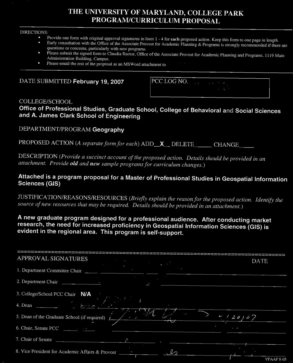
6 I. OVERVIEW and RATIONALE A. Briefly describe the nature of the proposed program and explain why the institution should offer it. [You may want to refer to student demand, market demand for graduates, institutional strengths, disciplinary trends, synergy with existing programs, and/or institutional strategic priorities.] The University of Maryland is committed to providing educational programs that meet the needs of a variety of audiences. As part of our graduate offerings, the Master of Professional Studies and the Graduate Certificate in Professional Studies are careerfocused degrees designed for students who wish to increase their subject-matter knowledge as well as prepare themselves for new challenges related to their professional areas. These programs are administered by the Office of Professional Studies (OPS), with academic oversight provided by the Graduate School. Introduction According to the U.S. Department of Labor, the geospatial technology industry can be defined as an information technology field of practice that acquires, manages, interprets, integrates, displays, analyzes, or otherwise uses data focusing on geographic, temporal, or spatial contexts. It incorporates tools such as aerial and satellite remote sensing imagery, global positioning systems (GPS), and computerized geographic information systems (GIS). The Master of Professional Studies in Geospatial Information Sciences (GIS) will focus on advanced geospatial information sciences and their related technologies. The growth of Geospatial Information Sciences has underpinned the rejuvenation of the geography discipline, in the U.S. and internationally, over the last three decades. Geospatial technologies include computer-based geographic information systems, remote sensing, and spatial analysis and modeling. The University of Maryland Department of Geography has built a world class research program sustained by over $5 million of research grants on an annual basis. The Department of Geography is recognized nationally and internationally for its leadership in land remote sensing and allied GIS applications. The department s undergraduate program has more than doubled in size since the introduction of our Geographic Information Systems and Automated Cartography focus in the early 1990 s. The Department of Geography will use its accumulated experience to provide a cutting edge Master s degree for professionals; exploiting its unique academic profile within the Washington, D.C. region. Nature of proposed program Drawing on the considerable expertise of GIS faculty within the Department of Geography, the 31-credit Master of Professional Studies in Geospatial Information Sciences will provide education in all the key areas of GIS most relevant to the 2
7 contemporary workplace, including Geographic Information Systems methods, remote sensing techniques, spatial analytical methods, modeling and specialized computer programming tailored to GIS needs. Students will be well-versed in the theoretical underpinnings of GIS and given substantial practical experience in the application of state of the art computer-based systems to a wide range of real world problems. The Master s program is designed to accommodate GIS working professionals. Market for Graduates Introduction of a Master of Professional Studies in Geospatial Information Sciences is part of a larger trend nationally and internationally. In 2004, the U.S. Department of Labor identified geospatial technologies as one of the three most important emerging and evolving fields, along with nanotechnology and biotechnology. Adeo Strategy Partners conducted a market analysis for the University of Maryland College Park Office of Professional Studies about a potential Master s level degree and/or graduate certificate program in the field of Geospatial Information Sciences. Adeo s research concluded that GeospatiaI Information Sciences is a field that is experiencing rapid growth. It is used heavily in the federal government, and is growing quickly in state, county, and local government. Private industry, traditionally focused on supplying GIS to the federal government alone, is discovering applications for GIS in multiple directions. Demand for well-trained GIS professionals is growing much faster than supply. Trained individuals are needed at multiple levels from certified entry-level technicians to Ph.D. research scientists. There is a strong demand in the Greater Washington D.C. area for educated GIS personnel. Neither the national nor the regional educational markets have been able to keep up with the demand for GIS professionals, though programs are exploding onto the market from many sources. The only strong regional competition for a post-baccalaureate program comes from Penn State University (online programs for both a postbaccalaureate certificate and a Master s degree). Other local offerings are focused on select courses at the undergraduate level and include Towson University and University of Maryland Baltimore Campus as the most recognized. Given the strong demand for GIS professionals and the lack of adequate supply in the local area, the University of Maryland College Park has the opportunity to meet a need that exists immediately. In fact, some industry professionals warn that any program not launched relatively soon risks being late to the market. 3
8 B. How big is the program expected to be? From what other programs serving current students, or from what new populations of potential students, onsite or offsite, are you expecting to draw? The Master of Professional Studies in Geospatial Information Sciences is designed for students with diverse backgrounds (e.g., engineering, computer sciences, social sciences, earth sciences and geography) who require specialized training in Geographic Information Sciences and in the application of geospatial technologies, specifically geographic information systems, remote sensing, spatial analysis and modeling. Students are trained for careers in all the private, public, and nonprofit sectors. The program will draw a professional audience. Initial enrollment is anticipated at 5 10 students in Year 1 (GCPS and MPST combined). Expected growth is to reach students in Year 2. II. CURRICULUM A. Provide a full catalog description of the proposed program, including educational objectives and any areas of concentration. The Master of Professional Studies in Geospatial Information Sciences is a 31-credit graduate program (10 courses and a 1-credit professional practices seminar) comprised of courses from the Department of Geography located in the College of Behavioral and Social Sciences and one course from the A. James Clark School of Engineering, at the University of Maryland College Park. B. List the courses (number, title, semester credit hours) that would constitute the requirements and other components of the proposed program. Provide a catalog description for any courses that will be newly developed or substantially modified for the program. The program will consist of the following required (existing) courses: Required Courses (12 credits): GEOG 472 Remote Sensing: Digital Processing and Analysis; (3 credits) Digital image processing and analysis applied to satelite and aircraft land remote sensing data. Consideration is given to preprocessing steps including calibration and geo registration. Analysis methods include digital image exploration, feature extraction thematic classification, change detection, and biophysical characterization. One or more application examples may be reviewed. There is a $40.00 lab fee for this course. GEOG 473 Geographic Information Systems and Spatial Analysis; (3 credits) Analytical uses of geographic information systems; data models for building geographic data bases; types of geographic data and spatial problems; practical experience using advanced software for thematic domains such as terrain analysis, land suitability 4
9 modeling, demographic analysis, and transportation studies. There is a $40.00 lab fee for this course. GEOG 606 Quantitative Spatial Analysis; (3 credits) This course covers the statistical modeling of spatial data and data analysis that are most useful to geographers and others who use spatial data. It provides the student with more advanced methods with an emphasis on practical techniques for problem solving. Home assignments are designed to help the student understand the fundamental concepts and principles in depth and allow the student to gain experience in the use of S-Plus statistical software and two powerful extensions of ArcGIS 9.1: Spatial analyst, and Geostatistical analyst. There is a $40.00 lab fee for this course. GEOG 676 Programming for GIS; (3 credits) This course is an introduction to programming for geography graduate students. The foundational concepts of computer programming will be introduced and the Visual Basic programming language will be the implementation medium for those concepts. By the end of the semester students will be able to design and implement programs that are correct, robust, and user-friendly for a variety of situations using both structured and object-oriented programming concepts. This course will also present advanced programming concepts and practice, including modeling environmental situations and ArcObjects, the underlying structure of ArcGIS. There is a $40.00 lab fee for this course. Advanced GIS (6 credits: select 2 of the 4): Geographic Information Systems: GEOG 673 GIS Modeling; (3 credits) This course introduces advanced techniques in the GIS data manipulation, geostatistics and geospatial modeling. The fundamental theories behind the analytical and modeling techniques are covered in detail. The theoretical knowledge will be enforced by a series of intensive computer exercises using real data sets. It covers descriptive and predictive GIS modeling techniques, including logit modeling (logistic regression), spatial statistics, geo-statistics, environmental diversity indices, Boolean logic, and map algebra. There is a $40.00 lab fee for this course. GEOG 674 GIS Spatial Databases (3 credits) Many GIS functions revolve around spatial attribute data management. Therefore, a good understanding of database design and manipulation is of great benefit for the GIS practitioner. This course uses typical GIS database software and covers data acquisition & database creation, data structure & modeling, data management, information queries, and integration of multiple data sources in GIS. This course will also cover Oracle and Internet database and web services. There is a $40.00 lab fee for this course. 5
10 Remote Sensing: GEOG 671 Remote Sensing Instruments and Observtions (3 credits) Detailed examination of land remote sensing instruments, observatories and resultant measurements in the optical portion of the EM spectrum. Includes computer-based exercises that examine the importance of data geo-registration and radiometric calibration in land measurements. There is a $40.00 lab fee for this course. GEOG 672 Biophysics of Optical Remote Sensing (3 credits) Biophysical principles, phenomena and processes underlying multispectral remote sensing in the optical portion of the EM spectrum. Includes computer-based exercises that explore the biophysical basis of land patterns and dynamics observed in remote sensing data. There is a $40.00 lab fee for this course. Professional Project Management and Final Project (7 credits): GEOG 795 Professional Practices Seminar (1 credit) A professional practice seminar will be included to help prepare students for the work place. Topics will include development of a resume, physical preparation of a resume, choosing and helping reference writers, conduct of a successful interview, negotiating an employment package, giving professional presentations, proposal preparation, writing reports, codes of ethics and responsibilities to the broader community including pro bono work. The course will include presentations from practitioners in the GIS field. This course will also include basic project management skills and strategies to help prepare students for undertaking the internship and resultant final project. ENCE 662 Introduction to Project Management (3 credits) Introduction to project management including: overview and concepts of project management (principles, body of knowledge, strategies); planning successful projects (defining, specifying, delivery options, scheduling, budgeting); implementing (organizing the team, work assignments, team building, effective leadership); executing (performance measurement, maintaining the schedule, adjustments/mid-course corrections, record keeping, status reporting, communications, managing conflict, time management); and closeout(performance measurement, maintaining the schedule, adjustments/mid-course corrections, record keeping, status reporting, communications, managing conflict, time management). GEOG 797 Professional Project (3 credits) Each student must undertake a project as a demonstration of his/her competence in geospatial science and technologies. The data and materials for this project can originate from an internship (internal or external to the department), or from relevant work experience at the student s current employer. The Geography Department will work with each student individually to determine the best mechanism for obtaining the necessary data and experience. Under the direction of a faculty advisor, the student will prepare a Project Report which shall contain an explanation of the requirements for the work, a technical account of the activities undertaken, including a literature review, a 6
11 description of the methods and approaches taken, a critical discussion of the results obtained, along with conclusions and recommendations developed from the project. The final project will consist of a full fledged GIS application that is up and running and can be tested. This will enable the student to present potential employers with a portfolio containing an example of their ability to manage and develop a GIS application project and will show that they understand how to apply the technology to real world situations. Systematic Classes in Graduate Geography (6 credits): Students will choose one human and one physical 600-level course (3 credits each) GEOG 600 Introduction to Human Geography (3 credits) Introduces students to current trends and developments in human geography in the areas of geography as social science, space and place, and human dimensions of global change, and to research procedures in this field. GEOG 602 Introduction to Physical Geography (3 credits) Introduces students to current trends and developments in physical geography and to research procedures in the field. GEOG 614 Human Dimensions of Global Change (3 credits) The intersection of human and biophysical systems from the vantage point of the impact of human actions on the environment are examined. The impact of the biophysical environment on humans is also discussed. GEOG 615 Land Cover and Land Use Change (3 credits) This class provides an examination of land cover and land use change science, addressing the causes, impacts and projection of change. Key concepts of land use science are presented and recent research papers and case studies are reviewed. Class consists of lectures, invited presentations and individual student projects and presentations. GEOG 632 Economic Geography (3 credits) An advanced graduate level introduction to the effects of geography on economic activities and the effects of economic incentives, institutions, and activities on the nature and sustainability of human and environmental geographic systems. GEOG 642 Ecosystem Processes and Human Habitability (3 credits) Biological and biogeographical processes relevant to the capability of the earth's biota to support the demands of its human populations. GEOG 645 Advanced Climatology (3 credits) Advanced study of elements and controls of the Earth's climate. Analysis of the energy and water balances at the earth's surface and their importance and application to life on this planet. 7
12 C. Describe any selective admissions policy or special criteria for students selecting this field of study. It is required that student applicants will have completed a sequence of course work equivalent to the Department of Geography s 300-level offerings in statistics, remote sensing, GIS, and computer cartography as well as one year of calculus. Students who do not have this academic background may have sufficient professional experience to warrant acceptance into the program. The admissions policy will reflect current standards established by the Graduate School, including the prerequisite bachelor s degree and a cumulative 3.0 GPA. Official undergraduate transcripts from all colleges attended must be provided. A current resume is required. 8
13 III. STUDENT LEARNING OUTCOMES AND ASSESSMENT The purpose of this assessment plan is to set clear guidelines, identify articulated outcomes, and ensure avenues for continuous improvement. It is the mission of the Office of Professional Studies to provide programs that meet UMD s institutional goals and objectives for educational activities. Student Learning Outcomes 1. Students will illustrate comprehension of issues related to Geospatial Information Sciences (GIS). 2. Students will assess the relevance of program content as it applies to their professional and educational needs Assessment Measures and Criteria Measurement A: Successful completion of paper and/or special project focusing on issues related to GIS. Criterion A: 80% of students will attain a 2 or better on Comprehension Scale Measurement B: OPS Pre and Post- Test Assessment. Criterion B: 80% of students will show gains between Pre and Post- Test questions #2, #3, #4, #5 and #6 (see attachment). Measurement A: An exit interview will be conducted with a random sample of graduates (80%) to assess their overall satisfaction with the certificate. Criterion A: 80% of respondents will correlate academic program offerings to needs Measurement B: OPS Pre and Post- Test Assessment. Criterion B: 80% of students will show gains between Pre and Post- Test questions #7, #8, #9, and #10 (see attachment). Assessment Schedule Comprehension Scale will be scored by faculty, and data collected annually by OPS. All Pre-Test data will be collected by OPS prior to first class attendance by annual cohort. All Post-Test data will collected by OPS after conclusion of last class by annual cohort. Responses will be collected and discussed with the Academic Oversight committee for retention purposes. All Pre-Test data will be collected by OPS prior to first class attendance by annual cohort. All Post-Test data will collected by OPS after conclusion of last class by annual cohort. 9
14 IV. FACULTY AND ORGANIZATION A. Who will provide academic direction and oversight for the program? [This might be a department, a departmental subgroup, a list of faculty members, or some other defined group.] The degree will be housed in the Graduate School. Continuing academic and program direction will be provided by the Program Oversight Committee while the project itself will be managed by the Office of Professional Studies. Members of the Program Oversight Committee include: Graduate Director (academic chair): Shunlin Liang Associate Professor, Department of Geography College of Behavioral and Social Sciences Graduate School Representative: Charles Caramello Dean, Graduate School OPS Program Representative (program management chair): Ken Carter Program Manager, Office of Professional Studies B. If the program is not to be housed and administered within a single academic unit, provide details of its administrative structure. The Master of Professional Studies in Geospatial Information Sciences will be housed in the Graduate School and managed by the Office of Professional Studies. A faculty member from the Department of Geography in the College of Behavioral and Social Sciences will serve as Graduate Director and will provide the academic leadership for the team. OPS will manage and coordinate the Program Oversight Committee as well as all other components of the program. Faculty selection and appointments will be made by the Department of Geography. All faculty, including adjunct faculty, will be members of the Graduate Faculty and approved by the Dean of the Graduate School to teach. 10
15 V. OFF-CAMPUS PROGRAMS (if necessary) A. If at Shady Grove indicate how students will access student services Not applicable B. If on-line describe the concerns in Principles and Guidelines for Online Programs are to be addressed. If the program decides to offer courses on-line, the PCC will be consulted for guidance. VI. OTHER ISSUES A. Describe any cooperative arrangements with other institutions or organizations that will be important for the success of this program. Not applicable B. Will the program require or seek accreditation? Is it intended to provide certification or licensure for its graduates? Are there academic or administrative constraints as a consequence? No VII. COMMITMENT TO DIVERSITY The University of Maryland is an equal opportunity institution with respect to both education and employment. The University does not discriminate on the basis of race, color, national origin, sex, age, or handicap in admission or access to, or treatment or employment in, its programs and activities as required by federal (Title VI, Title IX, Section 504) and state laws and regulations. Through its actions and statements of policy the University of Maryland has demonstrated a commitment to diversity by creating programs of study which explore the experiences, perspectives, and contributions of a wide variety of cultures, groups, and individuals; and has sought to create a campus environment which encourages tolerance and respect for individuals regardless of differences in age, race, ethnicity, sex, religion, disability, sexual orientation, class, political affiliation, and national origin. VIII. REQUIRED PHYSICAL RESOURCES A. Additional library and other information resources required to support the proposed program. You must include a formal evaluation by Library staff. 11
16 This program uses existing courses and therefore additional library resources are not required. B. Additional facilities, facility modifications, and equipment that will be required. This is to include faculty and staff office space, laboratories, special classrooms, computers, etc. This program does not require additional resources. C. Impact, if any, on the use of existing facilities and equipment. Examples are laboratories, computer labs, specially equipped classrooms, and access to computer servers. This program does not require additional resources. IX. RESOURCE NEEDS AND SOURCES A. List new courses to be taught and needed additional sections of existing courses. Describe the anticipated advising and administrative loads. Indicate the personnel resources (faculty, staff, and teaching assistants) that will be needed to cover all these responsibilities. There will be no impact on existing resources. This program is self-support. Courses may be cancelled due to low enrollment. B. List new faculty, staff, and teaching assistants needed for the responsibilities in A, and indicate the source of the resources for hiring them Adjunct University of Maryland faculty may be needed for this program. University of Maryland faculty who teach in the program will be compensated using overloads. Other faculty may include retired faculty and professionals in the field. Adjuncts will be paid from course tuition. C. Some of these teaching, advising, and administrative duties may be covered by existing faculty and staff. Describe your expectations for this, and indicate how the current duties of these individuals will be covered, and the source of any needed resources. Approval of all faculty overloads for teaching and advising will be in accordance with University of Maryland policy and procedures. OPS is responsible for the overall administrative management of the program. D. Identify the source to pay for the required physical resources identified in Section VIII. above. Tuition revenue will be used to cover the program expenses. 12

17 E. List any other required resources and the anticipated source for them Not applicable F. Complete the additional proposal and financial tables as required by MHEC. Not applicable for MPSTIGCPS programs. Add it ional Approva Is (see PCC coversheet for other required signatures) v- h-dlu 3/7b7 Associate Provost and Dean, Office of Professional Studies \ A A ~arihawawrw ean, A. James Clark School of Engineering
1. Omit Human and Physical Geography electives (6 credits) 2. Add GEOG 677:Internet GIS (3 credits) 3. Add 3 credits to GEOG 797: Final Project
 2. Add GEOG 677:Internet GIS (3 credits) 3. Add 3 credits to GEOG 797: Final Project") The Department of Geography and the Office of Professional Studies propose to modify the Master of Professional Studies in Geospatial Information Sciences (GIS) as follows: 1. Omit Human and Physical Geography
The Department of Geography and the Office of Professional Studies propose to modify the Master of Professional Studies in Geospatial Information Sciences (GIS) as follows: 1. Omit Human and Physical Geography
SOUTH DAKOTA BOARD OF REGENTS. Academic and Student Affairs ******************************************************************************
 SOUTH DAKOTA BOARD OF REGENTS Academic and Student Affairs AGENDA ITEM: 7 C (4) DATE: June 28-30, 2016 ****************************************************************************** SUBJECT: New Minor:
Dr. Emily A. Fogarty, Coordinator History, Politics and Geography Dept School of Arts & Sciences
 Geography Dr. Emily A. Fogarty, Coordinator History, Politics and Geography Dept. Emily.Fogarty@farmingdale.edu 631-420-2739 School of Arts & Sciences The History, Politics and Geography Department offers
geographic patterns and processes are captured and represented using computer technologies
 Proposed Certificate in Geographic Information Science Department of Geographical and Sustainability Sciences Submitted: November 9, 2016 Geographic information systems (GIS) capture the complex spatial
Geography (GEOG) Courses
 Courses") Geography (GEOG) 1 Geography (GEOG) Courses GEOG 100. Introduction to Human Geography. 4 (GE=D4) Introduction to the global patterns and dynamics of such human activities as population growth and movements,
Geography (GEOG) 1 Geography (GEOG) Courses GEOG 100. Introduction to Human Geography. 4 (GE=D4) Introduction to the global patterns and dynamics of such human activities as population growth and movements,
MASTER OF APPLIED GEOGRAPHY (M.A.GEO.) MAJOR IN GEOGRAPHIC INFORMATION SCIENCE
 MAJOR IN GEOGRAPHIC INFORMATION SCIENCE") Master of Applied Geography (M.A.Geo.) Major in Geographic Information Science 1 MASTER OF APPLIED GEOGRAPHY (M.A.GEO.) MAJOR IN GEOGRAPHIC INFORMATION SCIENCE Major Program The Master of Applied Geography
Master of Applied Geography (M.A.Geo.) Major in Geographic Information Science 1 MASTER OF APPLIED GEOGRAPHY (M.A.GEO.) MAJOR IN GEOGRAPHIC INFORMATION SCIENCE Major Program The Master of Applied Geography
MASTER OF APPLIED GEOGRAPHY (M.A.GEO.) MAJOR IN GEOGRAPHY RESOURCE AND ENVIRONMENTAL STUDIES
 MAJOR IN GEOGRAPHY RESOURCE AND ENVIRONMENTAL STUDIES") Master of Applied Geography (M.A.Geo.) Major in Geography Resource and Environmental Studies 1 MASTER OF APPLIED GEOGRAPHY (M.A.GEO.) MAJOR IN GEOGRAPHY RESOURCE AND ENVIRONMENTAL STUDIES Major Program
Master of Applied Geography (M.A.Geo.) Major in Geography Resource and Environmental Studies 1 MASTER OF APPLIED GEOGRAPHY (M.A.GEO.) MAJOR IN GEOGRAPHY RESOURCE AND ENVIRONMENTAL STUDIES Major Program
GRADUATE CERTIFICATE PROGRAM
 GRADUATE CERTIFICATE PROGRAM GEOGRAPHIC INFORMATION SCIENCES Department of Geography University of North Carolina Chapel Hill Conghe Song, Director csong @email.unc.edu 919-843-4764 (voice) 919-962-1537
CERTIFICATE PROGRAM IN
 CERTIFICATE PROGRAM IN GEOGRAPHIC INFORMATION SCIENCE Department of Geography University of Utah 260 S. Central Campus Dr., Rm 270 Salt Lake City, UT 84112-9155 801-581-8218 (voice); 801-581-8219 (fax)
Department Of Geography. MSc Applied GIS.
 Department Of Geography. MSc Applied GIS. This is a really exciting time to be in GIS, with new tools and new software allowing the application of GIS techniques to an ever-increasing range of fields.
Proposal for Revision to the Geographic Information Systems (GIS) Academic Certificate Community College of Philadelphia.
 Academic Certificate Community College of Philadelphia.") Proposal for Revision to the Geographic Information Systems (GIS) Academic Certificate Community College of Philadelphia February 24, 2010 Kathy Smith Chair, Social Science Contributors Christopher Murphy
Proposal for Revision to the Geographic Information Systems (GIS) Academic Certificate Community College of Philadelphia February 24, 2010 Kathy Smith Chair, Social Science Contributors Christopher Murphy
Geography and Geographic Information Science (Geog)
") University of North Dakota 1 Geography and Geographic Information Science (Geog) http://www.arts-sciences.und.edu/geography Atkinson, Munski (Graduate Director), Niedzielski, Rundquist, Todhunter, Vandeberg
University of North Dakota 1 Geography and Geographic Information Science (Geog) http://www.arts-sciences.und.edu/geography Atkinson, Munski (Graduate Director), Niedzielski, Rundquist, Todhunter, Vandeberg
BACHELOR OF GEOINFORMATION TECHNOLOGY (NQF Level 7) Programme Aims/Purpose:
 Programme Aims/Purpose:") BACHELOR OF GEOINFORMATION TECHNOLOGY ( Level 7) Programme Aims/Purpose: The Bachelor of Geoinformation Technology aims to provide a skilful and competent labour force for the growing Systems (GIS) industry
BACHELOR OF GEOINFORMATION TECHNOLOGY ( Level 7) Programme Aims/Purpose: The Bachelor of Geoinformation Technology aims to provide a skilful and competent labour force for the growing Systems (GIS) industry
INTEGRATING GEOSPATIAL PERSPECTIVES IN THE ANTHROPOLOGY CURRICULUM AT THE UNIVERSITY OF NEW MEXICO (UNM)
") INTEGRATING GEOSPATIAL PERSPECTIVES IN THE ANTHROPOLOGY CURRICULUM AT THE UNIVERSITY OF NEW MEXICO (UNM) VERONICA ARIAS HEATHER RICHARDS JUDITH VAN DER ELST DEPARTMENT OF ANTHROPOLOGY MARCH 2005 INTEGRATING
INTEGRATING GEOSPATIAL PERSPECTIVES IN THE ANTHROPOLOGY CURRICULUM AT THE UNIVERSITY OF NEW MEXICO (UNM) VERONICA ARIAS HEATHER RICHARDS JUDITH VAN DER ELST DEPARTMENT OF ANTHROPOLOGY MARCH 2005 INTEGRATING
Diffusion of GIS in Public Policy Doctoral Program
 Diffusion of GIS in Public Policy Doctoral Program By Fulbert Namwamba PhD Southern University This presentation demonstrate how GIS was introduced in the Public Policy Doctoral Program at Southern University,
The B.S.G.E. program is accredited by the Engineering Accreditation Commission of ABET,
 Geomatics Engineering The program of study leading to the Bachelor of Science in Geomatics Engineering (B.S.G.E.) deals with designing solutions to measure, map, model, analyze and graphically display
REGULATIONS FOR THE POSTGRADUATE DIPLOMA IN GEOGRAPHIC INFORMATION SYSTEMS (PDipGIS)
") 182 REGULATIONS FOR THE POSTGRADUATE DIPLOMA IN GEOGRAPHIC INFORMATION SYSTEMS (PDipGIS) (See also General Regulations) PDGIS 1 Admission requirements To be eligible for admission to studies leading to
182 REGULATIONS FOR THE POSTGRADUATE DIPLOMA IN GEOGRAPHIC INFORMATION SYSTEMS (PDipGIS) (See also General Regulations) PDGIS 1 Admission requirements To be eligible for admission to studies leading to
PLANNING (PLAN) Planning (PLAN) 1
 Planning (PLAN) 1") Planning (PLAN) 1 PLANNING (PLAN) PLAN 500. Economics for Public Affairs Description: An introduction to basic economic concepts and their application to public affairs and urban planning. Note: Cross-listed
Planning (PLAN) 1 PLANNING (PLAN) PLAN 500. Economics for Public Affairs Description: An introduction to basic economic concepts and their application to public affairs and urban planning. Note: Cross-listed
Molinaro Keyword: Geography. Associate Professors: Walasek, Ph.D.; (Chair), Wolf, Ph.D.
, Wolf, Ph.D.") 126 - Geography GENERAL INFO GRADUATE UNDREGRADUATE ADULT/NON-TRAD POLICIES STUDENT LIFE ADMISSIONS INTRODUCTION Degree Offered: Bachelor of Arts. Associate Professors: Walasek, Ph.D.; (Chair), Wolf, Ph.D.
126 - Geography GENERAL INFO GRADUATE UNDREGRADUATE ADULT/NON-TRAD POLICIES STUDENT LIFE ADMISSIONS INTRODUCTION Degree Offered: Bachelor of Arts. Associate Professors: Walasek, Ph.D.; (Chair), Wolf, Ph.D.
GIS Certification: How will it be used to improve education?
 GIS Certification: How will it be used to improve education? Deidre Sullivan OSTO Workshop November 11, 2008 1 What is GIS? Geographic Information Systems It is a science, a tool, and a software It assists
DRAFT SYLLABUS. Please use Blackboard to send messages.
 SYLLABUS Course Title: Geographic Information Systems and Spatial Analysis for Public Policy Academic Department/Course Number: PUBP 754 Semester/Year: Fall 2017 Building/Room: FH 307 Days/Time: W 4:30
CAA 1 of 30. To: OAA Date: 6/14/2010. Cover Letter for Proposals from the Department of Geography
 1 of 30 To: OAA Date: 6/14/2010 Cover Letter for Proposals from the Department of Geography This is the transmittal cover letter to the Office of Academic Affairs that reflects the efforts by the Department
DIPLOMA IN GEOMATICS (NQF Level 6)
") DIPLOMA IN GEOMATICS ( 6) Programme Aims/Purpose: The Diploma in Geomatics programme was purposefully designed to prepare students for a career as survey technician, with specialised knowledge and skills
DIPLOMA IN GEOMATICS ( 6) Programme Aims/Purpose: The Diploma in Geomatics programme was purposefully designed to prepare students for a career as survey technician, with specialised knowledge and skills
WHAT YOU WILL LEARN TODAY
 WHAT YOU WILL LEARN TODAY Overview of the new QGIS Academy Curriculum Background on curriculum development Curriculum alignment with national standards Description of the five GIS courses Details of the
4. 1. PROGRAM: Architectural Technology CODE: A40100 DEGREE: Associate in Applied Science DESCRIPTION/PURPOSE
 ARCHITECTURAL TECHNOLOGY DESCRIPTION/PURPOSE PROGRAM: Architectural Technology CODE: A40100 DEGREE: Associate in Applied Science The Architectural Technology curriculum prepares individuals with knowledge
CHEMISTRY, BS. Degree Requirements. Admissions. Policies. Requirements. Admissions & Policies. Teacher Licensure. BS without Concentration
 Chemistry, BS CHEMISTRY, BS Banner Code: SC-BS-CHEM Academic Advising Phone: 70-99-07 Email: sslayden@gmu.edu Website: cos.gmu.edu/chemistry/undergraduate-programs/ This program is approved by the American
Pathways. Pathways through the Geography Major
 Pathways through the Major majors may structure their course selections around a sub-field of. Pathways are suggestions for classes in, in related disciplines, and skills training. Each pathway includes
Programme title: MChem Chemistry (Mathematical and Computational Chemistry)
") Faculty of Life Sciences Programme Specification Programme title: MChem Chemistry (Mathematical and Computational Chemistry) Academic Year: 2018/19 Degree Awarding Body: Final and interim award(s): University
Faculty of Life Sciences Programme Specification Programme title: MChem Chemistry (Mathematical and Computational Chemistry) Academic Year: 2018/19 Degree Awarding Body: Final and interim award(s): University
Bachelor of Science in Geography (Fall 2016) Student
 Student") Bachelor of Science in Geography (Fall 2016) Student Student ID# Anticipated Graduation Term Advisor Minimum GPA 2.00 Today's Date 2016-2017 Undergraduate Catalog Requirements System Gen Ed Requirements
Bachelor of Science in Geography (Fall 2016) Student Student ID# Anticipated Graduation Term Advisor Minimum GPA 2.00 Today's Date 2016-2017 Undergraduate Catalog Requirements System Gen Ed Requirements
LEHMAN COLLEGE OF THE CITY UNIVERSITY OF NEW YORK. 1. Type of Change: Change in Degree Requirements
 Alpha Number: Hegis Code 1214 Program Code: 30600 1. Type of Change: Change in Degree Requirements 2. From: [The curriculum consists of 45 graduate credits and includes core courses, an area of specialization,
GEOGRAPHY, ENVIRONMENT, AND SUSTAINABILITY (GES)
") Geography, Environment, and Sustainability (GES) 1 GEOGRAPHY, ENVIRONMENT, AND SUSTAINABILITY (GES) GES 102 The Historical Geography of the Western World 3 A study of the geographical factors which combine
Geography, Environment, and Sustainability (GES) 1 GEOGRAPHY, ENVIRONMENT, AND SUSTAINABILITY (GES) GES 102 The Historical Geography of the Western World 3 A study of the geographical factors which combine
GEOG 508 GEOGRAPHIC INFORMATION SYSTEMS I KANSAS STATE UNIVERSITY DEPARTMENT OF GEOGRAPHY FALL SEMESTER, 2002
 GEOG 508 GEOGRAPHIC INFORMATION SYSTEMS I KANSAS STATE UNIVERSITY DEPARTMENT OF GEOGRAPHY FALL SEMESTER, 2002 Course Reference #: 13210 Meeting Time: TU 2:05pm - 3:20 pm Meeting Place: Ackert 221 Remote
CHEMISTRY, BS. Admissions. Policies. Degree Requirements. Admissions & Policies. Requirements. BS without Concentration.
 Chemistry, BS CHEMISTRY, BS Banner Code: SC-BS-CHEM Academic Advising Phone: 70-99-07 Email: sslayden@gmu.edu Website: cos.gmu.edu/chemistry/undergraduate-programs/ This program is approved by the American
WHAT YOU WILL LEARN TODAY
 WHAT YOU WILL LEARN TODAY Overview of the new GeoAcademy Curriculum Background on curriculum development Curriculum alignment with national standards Description of the five GIS courses Details of the
Advanced Readings. Environment and Land Use Concentration The following seminars and studios would apply
 Community Development and Housing Concentration URP 720 Urban Housing Policies URP 722 Community Development and Housing URP 724 Urban Revitalization Studio URP 726 Citizen Participation Strategies URP
School of Geography and Geosciences. Head of School Degree Programmes. Programme Requirements. Modules. Geography and Geosciences 5000 Level Modules
 School of Geography and Geosciences Head of School Degree Programmes Graduate Diploma: Dr W E Stephens Health Geography Research Environmental History and Policy (see School of History) M.Res.: M.Litt.:
CHEMISTRY, B.S. (SCIENCE)
") Chemistry, B.S. (Science) 1 CHEMISTRY, B.S. (SCIENCE) Begin Campus: Any Penn State Campus End Campus: University Park Program Description This major provides a strong foundation in the theory and practice
Chemistry, B.S. (Science) 1 CHEMISTRY, B.S. (SCIENCE) Begin Campus: Any Penn State Campus End Campus: University Park Program Description This major provides a strong foundation in the theory and practice
Dr. Stephen J. Walsh Department of Geography, UNC-CH Fall, 2007 Monday 3:30-6:00 pm Saunders Hall Room 220. Introduction
 Geographic Information Systems Geography 491 Dr. Stephen J. Walsh Department of Geography, UNC-CH Fall, 2007 Monday 3:30-6:00 pm Saunders Hall Room 220 Introduction Organizations that have a planning,
Moraine Valley Community College. Geographic Information Systems
 Moraine Valley Community College Geographic Information Systems GIS Information What are Geographic Systems? Geographic information systems (GIS) integrate computer software and hardware to collect, organize,
NERCHE Self-Assessment Rubric for the Institutionalization of Diversity, Equity, and Inclusion in Higher Education
 NERCHE Self-Assessment Rubric for the Institutionalization of Diversity, Equity, and Inclusion in Higher Education College of Education and Human Development University of Massachusetts Boston 100 Morrissey
Programme Study Plan
 Faculty of Social and Life Sciences Programme Study Plan Geographic Information Systems Programme Code: Programme Title: TGLIT Engineering: Surveying Technology and Geographical IT Credits: 180 Programme
2.1.9 Expansion of Instructional GIS Lab Page 1 of 6. Fiscal Year 2002 Years Following Fiscal Year 2002 $61, $23,625.00
 2.1.9 Expansion of Instructional GIS Lab Page 1 of 6 Proposal for the Use of the FY2002 Technology Fee Submitting Organization: Anthropology and Geography Contact Person: Zhi-Yong Yin Email: gegzyy@panther.gsu.edu
Annex I to Resolution 6.2/2 (Cg-XVI) Approved Text to replace Chapter B.4 of WMO Technical Regulations (WMO-No. 49), Vol. I
 Approved Text to replace Chapter B.4 of WMO Technical Regulations (WMO-No. 49), Vol. I") Annex I to Resolution 6.2/2 (Cg-XVI) Approved Text to replace Chapter B.4 of WMO Technical Regulations (WMO-No. 49), Vol. I TECHNICAL REGULATIONS VOLUME I General Meteorological Standards and Recommended
Annex I to Resolution 6.2/2 (Cg-XVI) Approved Text to replace Chapter B.4 of WMO Technical Regulations (WMO-No. 49), Vol. I TECHNICAL REGULATIONS VOLUME I General Meteorological Standards and Recommended
Core Courses for Students Who Enrolled Prior to Fall 2018
 Biostatistics and Applied Data Analysis Students must take one of the following two sequences: Sequence 1 Biostatistics and Data Analysis I (PHP 2507) This course, the first in a year long, two-course
Strategic Plan for the Geospatial Teaching, Research, and Outreach in CNR. The CNR Geospatial Steering Committee, March 31, 2008
 Strategic Plan for the Geospatial Teaching, Research, and Outreach in CNR The CNR Geospatial Steering Committee, March 31, 2008 Current Mission for the Geospatial Learning Center Established in 1995, the
Overview of the William and Mary GIS Certificate Program. Draft Language as of 4/20/2018
 Overview of the William and Mary GIS Certificate Program Draft Language as of 4/20/2018 The Post-Baccalaureate Certificate in Geospatial Information Systems (Science) provides students with a post-baccalaureate
GEOGRAPHIC INFORMATION SYSTEMS SPECIALIST 3 DEFINITION:
 Hunterdon County Department of Planning and Land Use Vacancy: Geographic Information Systems Specialist 3 Full Time: 40 Hours per Week Compensation: $42,000.00 per year GEOGRAPHIC INFORMATION SYSTEMS SPECIALIST
ENVIRONMENT AND NATURAL RESOURCES 3700 Introduction to Spatial Information for Environment and Natural Resources. (2 Credit Hours) Semester Syllabus
 Semester Syllabus") ENVIRONMENT AND NATURAL RESOURCES 3700 Introduction to Spatial Information for Environment and Natural Resources COURSE INSTRUCTOR: Dr. Kris Jaeger Assistant Professor 359 Kottman Hall (Mondays and Tuesdays)
ENVIRONMENT AND NATURAL RESOURCES 3700 Introduction to Spatial Information for Environment and Natural Resources COURSE INSTRUCTOR: Dr. Kris Jaeger Assistant Professor 359 Kottman Hall (Mondays and Tuesdays)
International Development
 International Development Office: The Payson Center for International Development and Technology Transfer, 300 Hébert Hall Phone: 504-865-5240 Fax: 504-865-5241 Website: www.payson.tulane.edu/ Program
FORMAT 5 Submit originals and one copy and electronic copy to Governance/Faculty Senate Office ( electronic copy to
 FORMAT 5 Submit originals and one copy and electronic copy to Governance/Faculty Senate Office (email electronic copy to jbharvie@alaska.edu) SUBMITTED BY: PROGRAM/DEGREE REQUIREMENT CHANGE (MAJOR) Department
CALIFORNIA STATE POLYTECHNIC UNIVERSITY, POMONA ACADEMIC SENATE ACADEMIC PROGRAMS COMMITTEE REPORT TO THE ACADEMIC SENATE AP
 CALIFORNIA STATE POLYTECHNIC UNIVERSITY, POMONA ACADEMIC SENATE ACADEMIC PROGRAMS COMMITTEE REPORT TO THE ACADEMIC SENATE AP-009-167 BS IN GEOGRAPHY GEOSPATIAL ANALYSIS OPTION Academic Programs Committee
GEOGRAPHY (GE) Courses of Instruction
 Courses of Instruction") GEOGRAPHY (GE) GE 102. (3) World Regional Geography. The geographic method of inquiry is used to examine, describe, explain, and analyze the human and physical environments of the major regions of the
GEOGRAPHY (GE) GE 102. (3) World Regional Geography. The geographic method of inquiry is used to examine, describe, explain, and analyze the human and physical environments of the major regions of the
Rutgers-Newark PHYSICS RUTGERS THE STATE UNIVERSITY OF NEW JERSEY NEWARK
 THE STATE UNIVERSITY OF NEW JERSEY RUTGERS NEWARK Rutgers-Newark PHYSICS Number of programs offered.............. 4 Number of students in program........... 10 Average size of upper-level classes.............
Joanne N. Halls, PhD Dept. of Geography & Geology David Kirk Information Technology Services
 Joanne N. Halls, PhD Dept. of Geography & Geology David Kirk Information Technology Services Geographic Information Systems manage and analyze data to solve spatial problems. Real World Abstraction Analysis
Change the narrative for Chemistry, and change the major and minor requirements for Chemistry
 APC Document 37 Change the narrative for Chemistry, and change the major and minor requirements for Chemistry Effective Date: Fall 2016 1. Delete: On page 99-101, the Chemistry narrative, and the major
GIScience in Urban Planning Education - Experience from University of Maryland
 GIScience in Urban Planning Education - Experience from University of Maryland February 3, 2007 University of Tokyo Qing Shen Professor of Urban Studies and Planning School of Architecture,
SAULT COLLEGE OF APPLIED ARTS AND TECHNOLOGY SAULT STE. MARIE, ONTARIO COURSE OUTLINE
 SAULT COLLEGE OF APPLIED ARTS AND TECHNOLOGY SAULT STE. MARIE, ONTARIO COURSE OUTLINE COURSE TITLE: GIS Applications CODE NO. : SEMESTER: 10W PROGRAM: AUTHOR: Geographic Information Systems Applications
Discounts & Scholarships Tuition discount rate
 AFFORDABILITY best value for their tuition and fees and provide financial aid to support qualified students in meeting their education Tuition Revenue from tuition and fees (history) 5 0 0 0 0 5 Cost of
GIS TECHNICIAN I GIS TECHNICIAN II
 GIS TECHNICIAN I GIS TECHNICIAN II CITY OF ROSEVILLE DEFINITION To perform a variety of technical office and field work duties related to the creation and maintenance of maps, tables, graphs and other
DEPARTMENT of CHEMISTRY AND BIOCHEMISTRY
 DEPARTMENT of CHEMISTRY AND BIOCHEMISTRY ACADEMIC GUIDANCE 2015-2016 PROGRAMS B.S. in Chemistry B.A. in Chemistry B.S. in Biochemistry B.S. in Physical Sciences with specialization in Chemistry or Physics
Snowden Cartography 1 GEOG 315:001 Cartography Thursdays 4:00 6:30PM F375 Fall 2010 Dr. Snowden Course Description
 Snowden Cartography 1 www.drksnowden.com GEOG 315:001 Cartography Thursdays 4:00 6:30PM F375 Fall 2010 Dr. Snowden Course Description Principles and theory of basic map design, layout, and communication.
ASSESSMENT OF STUDENT LEARNING Department of Geology University of Puerto Rico at Mayaguez. Progress Report
 ASSESSMENT OF STUDENT LEARNING Department of Geology University of Puerto Rico at Mayaguez Progress Report Period of Report August to December of 2004. Purpose of our Assessment The fundamental purpose
CONTENT. 2 Subject Aims 2. 6 Assessment Strategies 5. 7 Maintaining Standards 5. 9 Annexes 8
 CONTENT Page No Foreword III 1 Introduction 1 1.1 Subject Benchmark statement 1 1.2 Nature and Extent of the Subject 2 2 Subject Aims 2 3 Subject Knowledge and Understanding 3 4 Skills and Attitudes 4
MASTER OF SCIENCE (M.S.) MAJOR IN GEOGRAPHY
 MAJOR IN GEOGRAPHY") Master of Science (M.S.) Major in Geography 1 MASTER OF SCIENCE (M.S.) MAJOR IN GEOGRAPHY Major Program The Master of Science (M.S.) degree with a major in Geography is designed to give highly qualified
Master of Science (M.S.) Major in Geography 1 MASTER OF SCIENCE (M.S.) MAJOR IN GEOGRAPHY Major Program The Master of Science (M.S.) degree with a major in Geography is designed to give highly qualified
Section 2. Indiana Geographic Information Council: Strategic Plan
 Section 2. Indiana Geographic Information Council: Strategic Plan Introduction A geographic information system (GIS) is an automated tool that allows the collection, modification, storage, analysis, and
MIDDLE TENNESSEE STATE UNIVERSITY Global Studies / Cultural Geography Major Matrix Page 1 of 7
 Page 1 of 7 I. Social Studies Core GS 4990 (3) Senior Seminar in Global Studies SSC 1. Demonstrate critical thinking in the social sciences by GEOG 2000 (1/3) Introduction to Regional Geography posing
GIS Visualization: A Library s Pursuit Towards Creative and Innovative Research
 GIS Visualization: A Library s Pursuit Towards Creative and Innovative Research Justin B. Sorensen J. Willard Marriott Library University of Utah justin.sorensen@utah.edu Abstract As emerging technologies
LEHMAN COLLEGE OF THE CITY UNIVERSITY OF NEW YORK DEPARTMENT OF CHEMISTRY CURRICULUM CHANGE
 LEHMAN COLLEGE OF THE CITY UNIVERSITY OF NEW YORK DEPARTMENT OF CHEMISTRY CURRICULUM CHANGE Name of Program and Degree Award: Chemistry BS Hegis Number: 1905 Program Code: 02663 Effective Term: Fall 2015
MARINE STUDIES (MARINE SPATIAL PLANNING & MANAGEMENT) MASTER S DEGREE
 MASTER S DEGREE") MARINE STUDIES (MARINE SPATIAL PLANNING & MANAGEMENT) MASTER S DEGREE Influence, lead and provide decision making support for the management and planning of coastal and marine spaces. PROGRAM DESCRIPTION
MARINE STUDIES (MARINE SPATIAL PLANNING & MANAGEMENT) MASTER S DEGREE Influence, lead and provide decision making support for the management and planning of coastal and marine spaces. PROGRAM DESCRIPTION
Purpose Study conducted to determine the needs of the health care workforce related to GIS use, incorporation and training.
 GIS and Health Care: Educational Needs Assessment Cindy Gotz, MPH, CHES Janice Frates, Ph.D. Suzanne Wechsler, Ph.D. Departments of Health Care Administration & Geography California State University Long
MARINE STUDIES (MARINE SPATIAL PLANNING & MANAGEMENT) MASTER S DEGREE
 MASTER S DEGREE") MARINE STUDIES (MARINE SPATIAL PLANNING & MANAGEMENT) MASTER S DEGREE Influence, lead and provide decision making support for the management and planning of coastal and marine spaces. PROGRAM DESCRIPTION
MARINE STUDIES (MARINE SPATIAL PLANNING & MANAGEMENT) MASTER S DEGREE Influence, lead and provide decision making support for the management and planning of coastal and marine spaces. PROGRAM DESCRIPTION
8. Who is the university administrator responsible for verifying data (and completing IPEDS reports) at your institution?
 at your institution?") NAAB Annual Report -- I Statistical Report SECTION A. INSTITUTIONAL CHARACTERISTICS 1. Program Contact Information: Name rth Carolina State University Title School of Architecture, College of Design Office
NAAB Annual Report -- I Statistical Report SECTION A. INSTITUTIONAL CHARACTERISTICS 1. Program Contact Information: Name rth Carolina State University Title School of Architecture, College of Design Office
FIRE DEPARMENT SANTA CLARA COUNTY
 DEFINITION FIRE DEPARMENT SANTA CLARA COUNTY GEOGRAPHIC INFORMATION SYSTEM (GIS) ANALYST Under the direction of the Information Technology Officer, the GIS Analyst provides geo-spatial strategic planning,
RESOLUTION NO
 RESOLUTION NO. 09-2017 Adopting Job Descriptions for Engineering and GIS Manager and GIS Analyst and Amending the Pay Resolution to Accommodate Said Positions and Amending the Staffing Chart to Accommodate
FORMAT 5 Submit originals and one copy and electronic copy to Governance/Faculty Senate Office ( electronic copy to
 FORMAT 5 Submit originals and one copy and electronic copy to Governance/Faculty Senate Office (email electronic copy to fysenat@uaf.edu) PROGRAM/DEGREE REQUIREMENT CHANGE (MAJOR/MINOR) SUBMITTED BY: Department
GEOGRAPHY COURSES UNDERGRADUATE GRADUATE CERTIFICATE FACULTY. Explanation of Course Numbers. Bachelor's program. Minors.
 GEOGRAPHY The Department of Geography is dedicated to achieving excellence in research and education through the diffusion of geographic knowledge that focuses on the relationships between the physical
PHYSICS. For Senior Comprehensives. Requirements for a Major. Physics 1
 Physics 1 PHYSICS Physics is the study of the fundamental laws that govern our universe. Our curriculum is designed to give our students a solid foundation for understanding these laws and how they were
Non Geog prereq. Total major. Major electives
 Geography curriculum revision and new major proposal: Breakdown of distribution of quarter credit hours by major and specialization CAA 1 of 139 Major and specialization Geography BA Core (all majors)
Exit Programme Outcomes (Qualification Outcomes): Upon completion of the Bachelor of Geomatics programme, graduates should be able to:
: Upon completion of the Bachelor of Geomatics programme, graduates should be able to:") BACHELOR OF GEOMATICS (NQF - Level 7) Programme Aims/Purpose: The Bachelor of Geomatics programme is purposefully designed prepare students for a career as professional surveyor, with high level knowledge
BACHELOR OF GEOMATICS (NQF - Level 7) Programme Aims/Purpose: The Bachelor of Geomatics programme is purposefully designed prepare students for a career as professional surveyor, with high level knowledge
Advancing Green Chemistry Practices in Business
 Green Chemistry and Commerce Council: 6 th Annual GC3 Innovators Roundtable Advancing Green Chemistry Practices in Business Barbara Peterson, Ph.D. Marty Mulvihill, Ph.D. Program Director Executive Director,
COLLEGE OF PUBLIC AFFAIRS AND COMMUNITY SERVICE School of Public Administration Emergency Services Program Bachelor of Science in Emergency Management
 COLLEGE OF PUBLIC AFFAIRS AND COMMUNITY SERVICE School of Public Administration Emergency Services Program Bachelor of Science in Emergency Management (2015/2016 Catalog) Emergency Management develops
Cover/Signature Page - Abbreviated Template/Abbreviated Template with Curriculum
 Cover/Signature Page - Abbreviated Template/Abbreviated Template with Curriculum Institution Submitting Request: University of Utah Proposed Title: Astronomy & Astrophysics Emphasis for Physics BA/BS Currently
Bachelor s Degree in Atmospheric Science. Approved by American Meteorological Society Council September 22, 2010
 Bachelor s Degree in Atmospheric Science Approved by American Meteorological Society Council September 22, 2010 1. Introduction The primary purpose of this statement is to provide guidance to university
GIS ADMINISTRATOR / WEB DEVELOPER EVANSVILLE-VANDERBURGH COUNTY AREA PLAN COMMISSION
 GIS ADMINISTRATOR / WEB DEVELOPER EVANSVILLE-VANDERBURGH COUNTY AREA PLAN COMMISSION SALARY RANGE INITIATION $43,277 SIX MONTHS $45,367 POSITION GRADE PAT VI The Evansville-Vanderburgh County Area Plan
Geospatial Science and Technology Model Courses and Certificate:
 Geospatial Science and Technology Model Courses and Certificate: Guidelines and Tools to Align Curriculum to Workforce Needs Ann Johnson Associate Director gisajohnson@delmar.edu Funded by National Science
Bachelor of Science in Geology
 Bachelor of Science in Geology 1 Bachelor of Science in Geology Why study geology? In Geology you get to apply techniques and knowledge from chemistry, physics, biology and math to answer important questions
LEHMAN COLLEGE CITY UNIVERSITY OF NEW YORK DEPARTMENT OF ENVIRONMENTAL, GEOGRAPHIC, AND GEOLOGICAL SCIENCES CURRICULAR CHANGE
 LEHMAN COLLEGE CITY UNIVERSITY OF NEW YORK DEPARTMENT OF ENVIRONMENTAL, GEOGRAPHIC, AND GEOLOGICAL SCIENCES CURRICULAR CHANGE Hegis Code: 2206.00 Program Code: 452/2682 1. Type of Change: New Course 2.
PROGRAM REQUIREMENTS Degree: Bachelor of Science Major: Chemistry
 2017-2018 PROGRAM REQUIREMENTS Degree: Bachelor of Science Major: Chemistry About This Major... Chemistry students gain a unique perspective on the composition, properties, and reactivity of the substances
Science, General. Program Description
 Program Description This program is designed to provide students with a basic science background, preparing them to move into a curriculum at a four-year institution leading to a degree in such fields
CERTIFICATE NOTIFICATION FORM
 CERTIFICATE NOTIFICATION FORM Institution: Georgia College & State University College/Division: Arts & Sciences Department: History & Geography Name of Certificate: Geographic Information Science CIP Code:
Geospatial Services in Special Libraries: A Needs Assessment Perspective
 Purdue University Purdue e-pubs Libraries Faculty and Staff Scholarship and Research Purdue Libraries 5-17-2013 Geospatial Services in Special Libraries: A Needs Assessment Perspective Ilana R. Barnes
SELF-STUDY FOR THE BACHELOR OF ARTS DEGREE IN GEOLOGY AT THE UNIVERSITY OF HAWAI I AT HILO
 SELF-STUDY FOR THE BACHELOR OF ARTS DEGREE IN GEOLOGY AT THE UNIVERSITY OF HAWAI I AT HILO 1. Is the Geology B.A. degree program organized to meet its objectives? The Bachelor of Arts in Geology program
Complete version as of 1 October 2017
 Note: The legally binding versions are found in the University of Innsbruck Bulletins (in German). Appendix to the University of Innsbruck Bulletin of 3 June 2015, Issue 60, No. 457 Original version published
Teaching Field: Geology Date: 10/16/2015 Higher Learning Commission (HLC) Faculty Qualifications for Hiring
 Faculty Qualifications for Hiring") Teaching Field: Geology Date: 10/16/2015 Higher Learning Commission (HLC) Faculty Qualifications for Hiring The Geology Instructional Council of the Maricopa County Community College District is firmly
Teaching Field: Geology Date: 10/16/2015 Higher Learning Commission (HLC) Faculty Qualifications for Hiring The Geology Instructional Council of the Maricopa County Community College District is firmly
SYLLABUS. Departmental Syllabus. General Chemistry. Departmental Syllabus. Departmental Syllabus. Departmental Syllabus. Departmental Syllabus
 SYLLABUS DATE OF LAST REVIEW: 05/2018 CIP CODE: 24.0101 SEMESTER: COURSE TITLE: COURSE NUMBER: General Chemistry CHEM-0109 CREDIT HOURS: 5 INSTRUCTOR: OFFICE LOCATION: OFFICE HOURS: TELEPHONE: EMAIL: KCKCC-issued
Environmental Studies Seminar
 Graduation Requirements In addition to the requirements listed below, students must satisfy: 1. the University regulations (see the Academic Regulations of the University section of this Calendar), 2.
8. Who is the university administrator responsible for verifying data (and completing IPEDS reports) at your institution?
 at your institution?") NAAB Annual Report -- I Statistical Report SECTION A. INSTITUTIONAL CHARACTERISTICS 1. Program Contact Information: Name rth Carolina State University Title School of Architecture, College of Design Office
NAAB Annual Report -- I Statistical Report SECTION A. INSTITUTIONAL CHARACTERISTICS 1. Program Contact Information: Name rth Carolina State University Title School of Architecture, College of Design Office
PROGRAM EVALUATION PRELIMINARY REPORT. The following information is organized by program specialty areas for
 PROGRAM EVALUATION PRELIMINARY REPORT For the 2016-2017 academic year, DePaul Counseling Program faculty conducted a program evaluation by reviewing available data and surveying stakeholders. The following
College contact: Karen Carney, Associate Dean, College of Liberal Arts and Sciences,
 PROPOSAL TO THE SENATE COMMITTEE ON EDUCATIONAL POLICY TO ESTABLISH OR MODIFY AN UNDERGRADUATE MINOR Title of the proposed min: Revision to Chemistry Min Sponsing unit(s): Department of Chemistry; Profess
8. Who is the university administrator responsible for verifying data (and completing IPEDS reports) at your institution?
 at your institution?") NAAB Annual Report -- I Statistical Report SECTION A. INSTITUTIONAL CHARACTERISTICS 1. Program Contact Information: Name University of Louisiana - Lafayette Title School of Architecture and Design Office
NAAB Annual Report -- I Statistical Report SECTION A. INSTITUTIONAL CHARACTERISTICS 1. Program Contact Information: Name University of Louisiana - Lafayette Title School of Architecture and Design Office