Invasive Plant Inventory & Survey Methods Web Seminar Series
|
|
|
- Lee George
- 6 years ago
- Views:
Transcription

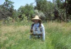
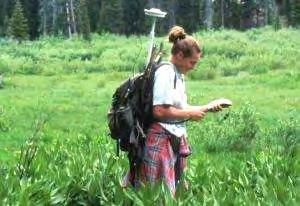
1 Invasive Plant Inventory & Survey Methods Web Seminar Series TODAY S PRESENTATION Landscape-Scale Wildland Inventories/Surveys: Utah State University Methods Kimberly Edvarchuk Utah State University

2 Landscape-Scale Wildland Inventories: Utah State University Methods
3 What is your background?
4 GETTING STARTED Step #1 Set Project Objectives Step #2 Match Methods to Objectives


5 What is a Weed Survey / Inventory? A visual representation of the weed situation as seen by the surveyor that is used to guide decisions in the management of weed species.

6 Know Where the Weeds Are!


7 Better Prioritization of Areas and Species for Management


8 Set Control Priorities and Guide Field Operations EDRR and eradication of new invaders Containment / reduction of widespread species Estimation of resources required


9 $1.50 / acre $2.50 / acre $6 / acre $9 / acre

10 DEFINING THE SEARCH METHOD Where do you start?

11 Focus on Priority Areas Use Patterns - Disturbance Roads / Trails Campgrounds/Visitor Use Areas Riparian Areas Backcountry sites Forest boundary Management Goals Riparian Areas Grazing Areas Wildlife Habitat Resources Impacted Prescribed burns T & E Habitat Erosion Potential Wildlife Habitat

12 Define Search Pattern Set search pattern according to target size, terrain, cover, and species

13 Trails / Roads 25 yards on either side of the trail

14 Rivers / Streams 25 yards on either side of the river

15
16 What Should be the Maximum Distance Between Search Paths? Based on maximum distance at which the least visible target (species and size) can be consistently recognized under actual field conditions (Effective Detection Distance) Used to establish the Effective Detection Swath Width or Effective Detection Search Width (EDSW)
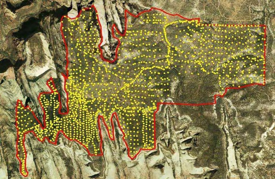
 100 Yard Effective Swath 100")
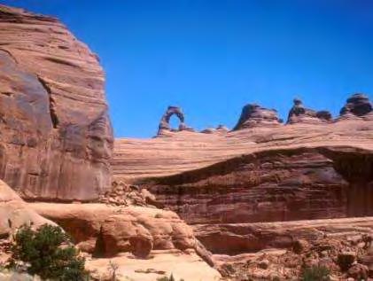
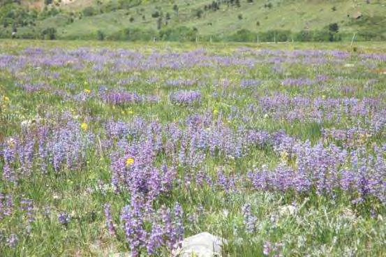
17 Excellent Visibility Medium Weed (Russian Knapweed) 100 Yard Effective Swath 100 yds

18 Poor Visibility Medium Weed 25 Yard Effective Swath 25 yds
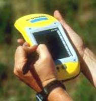
19 UTM Method
20 S N UTM Eastings
21 S N UTM Northings
22 S N EDSW = 50 Meters Determine the Appropriate EDSW in Meters
23 S N N N N Select a UTM Starting Point With Northing / Easting Value Ending in 00 or other EDSW Increment
24 S N N Begin Walking Along the Envisioned Northing or Easting Grid Line, Keeping the Corresponding UTM Value as Constant as Possible

25 S N N N When Swath Is Completed, Move 1 EDSW North, and on the Next Incremental UTM Grid Line

26 Contouring Search Pattern

27 Document species in T&E habitat for eradication
28 Questions??? Setting Objectives / Priorities Search Methods
29 DEFINING THE INFESTATION


30 Define Target Species Single or Multiple Species? Control Priority Based? Eradicate Control / Contain Ignore


31 Define Target Growth Stage Mature Plants? Include Seedlings?


32 Define Minimum Target Size Single Plants? Patches?
33 A Dilemma Find Every Weed? Or Search All Acres? Usually Can t Do Both


34 Is it Practical to Search for Every Plant?
35 How Long Would it Take to Inventory this Area for all Single Plants of Spotted Knapweed?

36 How Long Would it Take to Inventory this Area for all Patches of Spotted Knapweed 0.25-Acre (104 x 104 ft) or Larger?
37 How Long Would it Take to Inventory this Area for all Single Plants of Spotted Knapweed?

38 How Long Would it Take to Inventory this Area for all Patches of Spotted Knapweed 0.25-Acre (104 x 104 ft) or Larger?
39 There s a Point in the Life of Every Problem When its Big Enough to be Seen, But Small Enough to be Solved. - Governor Mike Leavitt
40 Setting Target Size Set Minimum Detection Target Size to represent the largest infestation that, if missed in the current inventory, could still be eradicated at the size it would be when found in the next inventory USU MDTS = 0.01 acre

41 Minimum Detection Target Size Set Based Upon Project Objectives Be Consistent Throughout Project
42 What Constitutes a Single Patch?
43 Should I Map them as 1 Patch or 3?

44 Common Question: How far apart must 2 weed plants or patches be before they are considered separate infestations?
45 Patch Separation Resolution (PSR) Maximum Distance Between Individual Plants or Patches of Weeds Considered Part of the Same Mapping Feature Infestation
46 50 Yards How many weed patches?
47 50 Yards PSR Distance 10 Yards 6 Points
48 PSR Distance 25 Yards 4 Points

49 Patch Separation Resolution Set Based Upon Project and/or Control Objectives Be Consistent Throughout Project
50 Estimating Patch Size Accuracy Consistency Efficiency
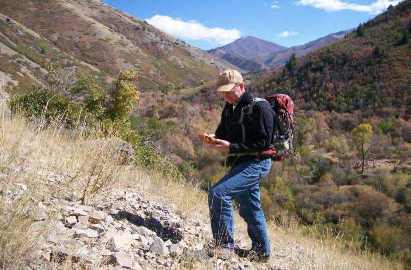
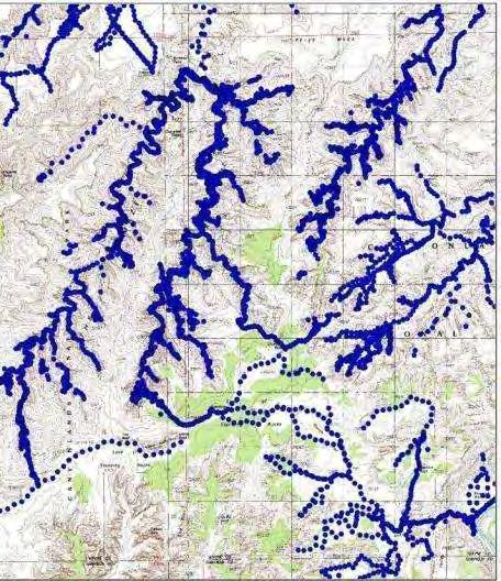
")

51 Points vs. Polygons (Same infestation mapped both ways) POINTS 5 Point Sizes 2 Density Categories Acres Infested POLYGONS Patch Perimeters 2 Density Categories Acres Infested

52 Polygon (Screen-drawn)
 Average of shortest and longest radii Length x")
53 Laser Rangefinders Estimate size of infestations with more precision Patch radius (center to edge) Average of shortest and longest radii Length x width

54 Size: 0.5 acre 30 ft 180 ft Total Area: 21,600 sq ft

55 Which feature would you use? 1 st known population of Oxeye daisy in National Forest Goal: Eradication

56 Which feature would you use? Map multiple species in 50,000 acre National Forest Goal: Control / Contain

57 Questions??? Describing Infestations Search Methods
58 ADDITIONAL CONSIDERATIONS

59 Track Logs
60 Indicates Boundaries and Search Coverage
61 Document/Protect Weed Free Areas


62 Is This the Only One? 1 Scotch Thistle Document Areas Searched but No Weeds Found

63 Identify and Protect Clean Lands

64 Summary Set Clear Objectives Match Methods to Objectives Prioritize areas Determine search method Determine minimum target size Determine patch separation resolution Document Searched Areas Include methods as part of IPM plan

65 Standardize Procedures Among Staff
Butte County Fire Department
 Butte County Fire Department Basic Land Navigation Verification Sheet I verify that Print Supervisor s name has completed the Print Employee s name Basic Land Navigation self study guide on. Date Attached
Data Collection and GIS Applications
 Data Collection and GIS Applications Governor s s Conference on the Management of the Illinois River System Jeff Jack of all Trades Boeckler, IDNR Introduction Collecting available GIS data sets Creating
Montana s Noxious Weeds: Weeds 101
 Montana s Noxious Weeds: Weeds 101 MODULE 1 Module 1: Introduction Weedy vs. Noxious A weed is: A plant growing where it isn t wanted. Whereas a noxious weed is: A plant growing where it isn t wanted and
Using Transline Herbicide to Control Invasive Plants
 Using Transline Herbicide to Control Invasive Plants Vanelle F. Carrithers DowElanco 28884 S. Marshall Road, Mulino, OR 97042 Transline is a selective, broadleaf herbicide that provides excellent control
Butte County Fire Department
 Butte County Fire Department Basic Land Navigation Verification Sheet I verify that Print Supervisor's name Print Employee's name has completed the Basic Land Navigation self study guide on Date Attached
The Invasion of False Brome in Western Oregon
 The Invasion of False Brome in Western Oregon GIS II Presentation Winter 2006 Will Fellers Kurt Hellerman Kathy Strope Statia Cupit False Brome (Brachypodium sylvaticum) Perennial bunchgrass native to
Exercise 2: Working with Vector Data in ArcGIS 9.3
 Exercise 2: Working with Vector Data in ArcGIS 9.3 There are several tools in ArcGIS 9.3 used for GIS operations on vector data. In this exercise we will use: Analysis Tools in ArcToolbox Overlay Analysis
The Weed Battle. Sage Fitch, Salt Lake County Weed Specialist
 The Weed Battle Noxious and Invasive Weed Management by The Salt Lake County Weed Program and The Bonneville CWMA Sage Fitch, Salt Lake County Weed Specialist Our program & our partners Who are we and
Exercise 2: Working with Vector Data in ArcGIS 9.3
 Exercise 2: Working with Vector Data in ArcGIS 9.3 There are several tools in ArcGIS 9.3 used for GIS operations on vector data. In this exercise we will use: Analysis Tools in ArcToolbox Overlay Analysis
Mapping for Successful Management. Kayla Malone Chaffee County Noxious Weed Department Supervisor
 Mapping for Successful Management Kayla Malone Chaffee County Noxious Weed Department Supervisor Outline Mapping and CDA guidelines EDDMapS Point, line, or polygon? Plant life cycles Examples of implementation
WEED WATCH LEEANNE MILA EL DORADO COUNTY DEPARTMENT OF AGRICULTURE
 WEED WATCH LEEANNE MILA EL DORADO COUNTY DEPARTMENT OF AGRICULTURE YELLOW STARTHISTLE WHY DO WE CARE ABOUT INVASIVE WEEDS? HIGHLY AGGRESSIVE DISPLACE NATIVES AND DESIRABLE PLANTS DECREASE WILDLIFE HABITAT
15 Non-Native Plants at Lake Mead National Recreation Area
 15 Non-Native Plants at Lake Mead National Recreation Area To report weed locations use non-native plant survey form and/or contact: Carrie Norman Exotic Plant Manager carrie_norman@nps.gov 702-293-8734
Squamish River Estuary
 Squamish River Estuary The Wildlife Management Area (WMA) was divided into the following sub-divisions (Fig 1) 1. Squamish River East Bank 2. Crescent Slough 3. Central Delta 4. Dredge Spoils 5. Uplands
Weed Identification and Control. Jim Wanstall NMDA State Noxious Weed Coordinator
 Weed Identification and Control Jim Wanstall NMDA State Noxious Weed Coordinator What Is A Weed? A weed is any plant that interferes with the management objectives for a particular site. An invasive weed
The FNAI Invasive Plants Program
 The FNAI Invasive Plants Program What we do and how we can help the Northwest FL CISMA Frank Price Invasive Plants Program Manager Staff of 32 Part of FUS and the NatureServe network 100% contract funded
Invasive Species in Your Backyard
 Invasive Species in Your Backyard Grand Traverse Regional Land Conservancy, Benzie Conservation District, Sleeping Bear Dunes National Lakeshore, Leelanau Conservancy, The Nature Conservancy, Saving Birds
GIS IN ECOLOGY: ANALYZING RASTER DATA
 GIS IN ECOLOGY: ANALYZING RASTER DATA Contents Introduction... 2 Raster Tools and Functionality... 2 Data Sources... 3 Tasks... 4 Getting Started... 4 Creating Raster Data... 5 Statistics... 8 Surface
One of the many strengths of a GIS is that you can stack several data layers on top of each other for visualization or analysis. For example, if you
 One of the many strengths of a GIS is that you can stack several data layers on top of each other for visualization or analysis. For example, if you overlay a map of the habitat for an endangered species
New Invasives and Other Weeds to Worry About. Clallam County Noxious Weed Control Program
 New Invasives and Other Weeds to Worry About Clallam County Noxious Weed Control Program What s wrong with Noxious Weeds? Numerous Impacts Reduce crop value or production Pose hazard to humans and animals
leeanne mila El dorado county department agriculture
 leeanne mila El dorado county department Of agriculture } highly aggressive displace natives and desirable plants } decrease wildlife habitat forming monocultures } Reduce recreational values and uses
Introduction to GIS I
 Introduction to GIS Introduction How to answer geographical questions such as follows: What is the population of a particular city? What are the characteristics of the soils in a particular land parcel?
Summary Description Municipality of Anchorage. Anchorage Coastal Resource Atlas Project
 Summary Description Municipality of Anchorage Anchorage Coastal Resource Atlas Project By: Thede Tobish, MOA Planner; and Charlie Barnwell, MOA GIS Manager Introduction Local governments often struggle
Garlic Mustard Distribution
 Garlic Mustard Distribution Brian Adair Solye Brown Alliaria Petiolata (garlic mustard) Biennial Brought to North America as a culinary and medicinal herb (useful treating skin ulcers, throat infections,
Landscape Planning and Habitat Metrics
 Landscape Planning and Habitat Metrics Frank W. Davis National Center for Ecological Analysis and Synthesis UC Santa Barbara (Tools for Landscape Biodiversity Planning) Jimmy Kagan Institute for Natural
Grizzly Bears and GIS. The conservation of grizzly bears and their habitat was recognized as an important land use objective
 Grizzly Bears and GIS Introduction: The conservation of grizzly bears and their habitat was recognized as an important land use objective in the Robson Valley LRMP. The LRMP recommended retention of unharvested
Montana s Noxious Weeds: Integrated Weed Management
 Montana s Noxious Weeds: Integrated Weed Management MODULE 5 Integrated Weed Management Begin with the end in mind... Kill the weed Yes, but not the whole story Healthy plant community that meets management
Map Reading 101: Using and Reading Maps and Plans
 Map Reading 101: Using and Reading Maps and Plans A Key Skill for Land Use Commissioners Paula Stahl, LLA, ASLA, AICP Land Use Educator Green Valley Institute Land Use Academy 1 How most of us react to
Battle Tactics from Camp Ripley, The War on Invasive Species
 Battle Tactics from Camp Ripley, The War on Invasive Species Kayla Malone maka0811@stcloudstate.edu Camp Ripley, MN Camp Ripley is a 53,000-acre regional training facility for our military, federal, state,
Lab 5 - Introduction to the Geodatabase
 Lab 5 - Introduction to the Geodatabase 1. Design Process GIS is becoming an increasingly accessible and important tool for land managers. In this exercise you will begin creating a Personal Geodatabase
Flood Hazard Zone Modeling for Regulation Development
 Flood Hazard Zone Modeling for Regulation Development By Greg Lang and Jared Erickson Pierce County GIS June 2003 Abstract The desire to blend current digital information with government permitting procedures,
2014 report on the distribution of Boneseed within the Port Hills Containment Zone
 2014 report on the distribution of Boneseed within the Port Hills Containment Zone Report No. R15/151 ISBN 978-0-947507-11-4 (print) 978-0-947507-12-1 (web) Mark Parker July 2015 Report No. R15/151 ISBN
Review of Riparian Function Riparian Management Riparian Monitoring
 Review of Riparian Function Riparian Management Riparian Monitoring Water Shed Water Catchment Water catching creek Water shedding creek Properly functioning riparian area Properly Functioning Riparian
A Regional Database Tracking Fire Footprint Each Year within the South Atlantic Region: Current Database Description and Future Directions
 A Regional Database Tracking Fire Footprint Each Year within the South Atlantic Region: Current Database Description and Future Directions Last Updated on September 30, 2018 Contributors: NatureServe,
JEFFERSON COUNTY NOXIOUS WEED CONTROL BOARD 380 Jefferson Street, Port Townsend Ext. 205
 JEFFERSON COUNTY NOXIOUS WEED CONTROL BOARD 380 Jefferson Street, Port Townsend 98368 360 379-5610 Ext. 205 noxiousweeds@co.jefferson.wa.us BEST MANAGEMENT PRACTICES Meadow Knapweed (Centaurea jacea x
Topographic Maps. Take Notes as you view the slides
 Topographic Maps Take Notes as you view the slides Lesson Objectives Define a topographic map and state its uses. Describe how contour lines show the elevations, shape, and slope of the land. Identify
Basic Map Skills for the Outdoors
 Geography 80-20 80% of what there is to know, for 20% of the sweat Basic Map Skills for the Outdoors Map Scale Map source: US Geological Survey Four ways to indicate map scale: Representative fraction
USING THE MILITARY LENSATIC COMPASS
 USING THE MILITARY LENSATIC COMPASS WARNING This presentation is intended as a quick summary, and not a comprehensive resource. If you want to learn Land Navigation in detail, either buy a book; or get
Noxious Weeds in Rangeland thinking back.
 Noxious Weeds in Rangeland thinking back. Spotted knapweed (Centaurea maculosa) Fred Rinder, Deputy Agricultural Commissioner Weed and Vertebrate Management Fresno County Photo: Fred Rinder Fresno County
1) NetMap Overview. 2) Habitat modeling HIP & Beyond. 3) What do you do with habitat models? 4) NetMap a platform for regional analysis & interactions
 NetMap Overview. 2) Habitat modeling HIP & Beyond. 3) What do you do with habitat models? 4) NetMap a platform for regional analysis & interactions") 1) NetMap Overview 2) Habitat modeling HIP & Beyond 3) What do you do with habitat models? 4) NetMap a platform for regional analysis & interactions Overview Multiple analysis tools Creates universal stream/hillslope
1) NetMap Overview 2) Habitat modeling HIP & Beyond 3) What do you do with habitat models? 4) NetMap a platform for regional analysis & interactions Overview Multiple analysis tools Creates universal stream/hillslope
Topographic Maps Knowledge of Maps What are they? What are they used for? Why are they important?
 Topographic Maps Knowledge of Maps What are they? What are they used for? Why are they important? Topographic Maps Maps that show the change in elevation of land. Elevation is the height of land above
An Introduction to Day Two. Linking Conservation and Transportation Planning Lakewood, Colorado August 15-16, 16, 2006
 An Introduction to Day Two Linking Conservation and Transportation Planning Lakewood, Colorado August 15-16, 16, 2006 1 Agenda Day One Transportation Planning Heritage Program State Wildlife Action Plan
What Do You See? FOR 274: Forest Measurements and Inventory. Area Determination: Frequency and Cover
 What Do You See? Message of the Day: Many options exist to determine the size, area, or extent of a feature on a landscape FOR 274: Forest Measurements and Inventory Lecture 7: Measures of Land Area Frequency
Assessing Michigan s Biological diversity. Michigan Natural Features Inventory MSU Extension
 Assessing Michigan s Biological diversity John Paskus,, Amy Derosier,, Edward Schools, and Helen Enander Michigan Natural Features Inventory MSU Extension Goal Provide scientifically based information
GROUND DISTURBANCE AND REVEGETATION GUIDELINES
 GROUND DISTURBANCE AND REVEGETATION GUIDELINES Ravalli County Weed District 329 Airport Road Stevensville, Montana 59870 406-777-5842 kmorris@rc.mt.gov To comply with the MONTANA S COUNTY WEED CONTROL
Exercise: guided tour
 Exercise: guided tour Yves Bühler & Lukas Stoffel Seminar in snow, slush- and debris flows RAMMS Demonstration, September 3 rd 2013, Longyearbyen, Norway Swiss Federal Institute for Forest, Snow and Landscape
Bipole III Transmission Project Construction Environmental Protection Plan Construction Section N1 Environmentally Sensitive Site Locations Map 25
 ± DOCUMENT PATH: G :\_GIS_PROJECT_FOLDER\00_HYDRO\111440054_BPIII_EPP\ARCMAP\ESS_N1\BPIII_CENVPP_N1N2N3N4C1SECTIONBASEMAP_MAPBOOK_BTB_STANTEC_20131207.MXD N1-S11 Tower 10 E-723206, N-6272609 N1-Soils-154
The Role of Mapping, GPS, and GIS in Trail Design and Construction
 The Role of Mapping, GPS, and GIS in Trail Design and Construction How do we normally think about MAPS and TRAILS? Idea of map as final product Trail maps Kiosk / trailhead maps Survey plat Map as Product
Distinct landscape features with important biologic, hydrologic, geomorphic, and biogeochemical functions.
 1 Distinct landscape features with important biologic, hydrologic, geomorphic, and biogeochemical functions. Have distinguishing characteristics that include low slopes, well drained soils, intermittent
Annual Report. Noxious Weed Control and Eradication Activities on Lands in Inyo and Mono Counties
 2008 Annual Report Noxious Weed Control and Eradication Activities on Lands in Inyo and Mono Counties Inyo and Mono Counties Agricultural Commissioner s Office 207 W South Street Bishop, CA 93514 760.873.7860
Web Soil Survey National Cooperative Soil Survey
 121 52' 18'' W Irrigated Capability Class Sutter County, California () 121 51' 49'' W 597600 597700 597800 597900 598000 598100 598200 39 6' 27'' N 39 6' 27'' N 39 5' 57'' N 4328400 4328500 4328600 4328700
¾À 280. ESS Features Heritage. Points of Access* !( Proposed Access Point. !( Archaeological Water. Major Stream Crossing Abandoned Rail Crossing # #
 ± DOCUMENT PATH: G :\_GIS_PROJECT_FOLDER\00_HYDRO\111440054_BPIII_EPP\ARCMAP\ESS_N1\BPIII_CENVPP_N1N2N3N4C1SECTIONBASEMAP_MAPBOOK_BTB_STANTEC_20131207.MXD 386 N1-S30 385 BURNTWOOD RIVER Coordinate System:
Climate Change Scenario Planning: A Tool for Managing Resources in an Era of Uncertainty
 Climate Change Scenario Planning: A Tool for Managing Resources in an Era of Uncertainty Leigh Welling Climate Change Coordinator National Park Service Natural Resource Stewardship & Science Mount Rainier
Web Soil Survey National Cooperative Soil Survey
 122 14' 27'' W () 122 13' 37'' W 40 8' 40'' N 564700 564800 564900 565000 565100 565200 565300 565400 565500 565600 565700 565800 40 8' 40'' N 4443400 4443500 4443600 4443700 4443800 4443900 4444000 4443400
Integrating Remote Sensing and Observations into Decision Support Systems for Invasive Weeds
 Integrating Remote Sensing and Observations into Decision Support Systems for Invasive Weeds E. Raymond Hunt, Jr. USDA-ARS Hydrology and Remote Sensing Laboratory Beltsville, Maryland, USA Objectives Predict
Chapter 6. Fundamentals of GIS-Based Data Analysis for Decision Support. Table 6.1. Spatial Data Transformations by Geospatial Data Types
 Chapter 6 Fundamentals of GIS-Based Data Analysis for Decision Support FROM: Points Lines Polygons Fields Table 6.1. Spatial Data Transformations by Geospatial Data Types TO: Points Lines Polygons Fields
MAPPING AND ANALYSIS OF FRAGMENTATION IN SOUTHEASTERN NEW HAMPSHIRE
 MAPPING AND ANALYSIS OF FRAGMENTATION IN SOUTHEASTERN NEW HAMPSHIRE Meghan Graham MacLean, PhD Student Dr. Russell G. Congalton, Professor Department of Natural Resources & the Environment, University
Steve Pye LA /22/16 Final Report: Determining regional locations of reference sites based on slope and soil type. Client: Sonoma Land Trust
 Steve Pye LA 221 04/22/16 Final Report: Determining regional locations of reference sites based on slope and soil type. Client: Sonoma Land Trust Deliverables: Results and working model that determine
Weed Management in Reclamation Reclamation 101. Brian A. Mealor Weed Extension Specialist University of Wyoming
 Weed Management in Reclamation Reclamation 101 Brian A. Mealor Weed Extension Specialist University of Wyoming Today s Assumption: In today s discussion we are working in lands that have been drastically
What is a watershed or landscape perspective?
 What is a watershed or landscape perspective? -remove sediment -add sediment -add wood, riparian manipulation -alter (engineer) channel/floodplain morphology -restore/abandon roads You are here What is
The Refugia Concept: Using Watershed Analysis to Prioritize Salmonid Habitat for Conservation and Restoration
 The Refugia Concept: Using Watershed Analysis to Prioritize Salmonid Habitat for Conservation and Restoration Christopher May Battelle & UW Cumulative Impacts of Urbanization Landscape Alterations Loss
Some experiences with alien plant mapping in Slovenia. Mario Lešnik Faculty of Agriculture and Life Sciences University of Maribor, Slovenia
 Some experiences with alien plant mapping in Slovenia Mario Lešnik Faculty of Agriculture and Life Sciences University of Maribor, Slovenia Mapping is one of the middle steps in process of ivasive plant
APPENDIX A TREATMENT ACTIVITIES BY ALTERNATIVE
 APPENDIX A TREATMENT ACTIVITIES BY ALTERNATIVE Table B-1: Summary of Activities by Alternative Activity Regeneration Harvest acres Intermediate Harvest acres Total Harvest Acres No Action Alt. 2 Proposed
Central Coast Tracking Trash. Trash Webinar #3 September 19, 2017
 Central Coast Tracking Trash Trash Webinar #3 September 19, 2017 Webinar #3: Agenda Trash App v0.2 release Intro to tracking annual progress towards compliance Intro to prioritizing actions Next webinar
Planned Burn (PB)-Piedmont online version user guide. Climate, Ecosystem and Fire Applications (CEFA) Desert Research Institute (DRI) June 2017
-Piedmont online version user guide. Climate, Ecosystem and Fire Applications (CEFA) Desert Research Institute (DRI) June 2017") Planned Burn (PB)-Piedmont online version user guide Climate, Ecosystem and Fire Applications (CEFA) Desert Research Institute (DRI) June 2017 The Planned Burn (PB)-Piedmont model (Achtemeier 2005) is
Planned Burn (PB)-Piedmont online version user guide Climate, Ecosystem and Fire Applications (CEFA) Desert Research Institute (DRI) June 2017 The Planned Burn (PB)-Piedmont model (Achtemeier 2005) is
Topographic Maps. More than a Road Map
 Topographic Maps More than a Road Map What is a Topographic Map? Scaled representation of features on the surface of the Earth such as roads, rivers, and plains Provides information about land elevations
Chapter 6 Mapping and Online Tools
 Chapter 6 Mapping and Online Tools The stream site you monitor is just part of a much larger system. When analyzing stream health, it is important to take a holistic view by considering the entire watershed.
Spotted Knapweed Eradication Project, Spruce Gulch, Colorado 2010 Progress report
 Spotted Knapweed Eradication Project, Spruce Gulch, Colorado 2010 Progress report T.R. Seastedt, PhD. and D.K. Knochel, Ph.D. University of Colorado, Boulder The difficult we do immediately; the impossible
Monitoring of Alliaria petiolata in Kleinstuck Preserve
 Monitoring of Alliaria petiolata in Kleinstuck Preserve Ben Cooper Kelsey Hassevoort Neil Matthews-Pennanen Zachary Smith Kalamazoo College, Biology Department June 2009 Introduction Invasive species are
Chesapeake Bay Program s New Land Cover Map (and some other neat stuff)
") Chesapeake Bay Program s New Land Cover Map (and some other neat stuff) Cassandra Pallai Geospatial Project Manager Chesapeake Conservancy December 6, 2016 Potomac Watershed Partnership Chesapeake Conservancy
Chesapeake Bay Program s New Land Cover Map (and some other neat stuff) Cassandra Pallai Geospatial Project Manager Chesapeake Conservancy December 6, 2016 Potomac Watershed Partnership Chesapeake Conservancy
Native Species? In US prior to European settlement
 INVASIVE SPECIES Native Species? An organism that is a part of the balance of nature that has developed over hundreds or thousands of years in a particular region or ecosystem. In US prior to European
Chapter 1: Introduction to Safety and Ethics
 Core Curriculum Standards Met by Each Chapter On the Right Trail meets Utah s Social Studies Core Curriculum Standards for grades 3-7. Each chapter has specific standard objectives, which are met by the
Puakea, Hawaiÿi. Puakea, Hawaiÿi WATERSHED FEATURES
 Puakea, Hawaiÿi DAR Watershed Code: 85046 Puakea, Hawaiÿi WATERSHED FEATURES Puakea watershed occurs on the island of Hawaiÿi. The Hawaiian meaning of the name is white blossom. The area of the watershed
GIS IN ECOLOGY: ANALYZING RASTER DATA
 GIS IN ECOLOGY: ANALYZING RASTER DATA Contents Introduction... 2 Tools and Functionality for Raster Data... 2 Data Sources... 3 Tasks... 4 Getting Started... 4 Creating Raster Data... 5 Summary Statistics...
The Role of Wilderness in Climate Change Adaptation
 The Role of Wilderness in Climate Change Adaptation A Case Study of the Northern Rockies Greg Aplet, Bo Wilmer Goal: Sustaining Ecosystem Services Sustaining the full suite of benefits we receive from
WEED NEWS. A flower falls, even though we love it; and a weed grows, even though we do not love it. nox ious. ˈnäkSHəs. In This Issue.
 WEED NEWS Klickitat County Noxious Weed Control Board Volume 2; Issue 3 May 2015 nox ious ˈnäkSHəs Adjective: Harmful, injurious to health or physical well-being, poisonous or very unpleasant. A flower
Doing Things Differently: Tracking Invasive Exotic Plants in the Florida Park Service
 Florida Park Service Doing Things Differently: Tracking Invasive Exotic Plants in the Florida Park Service 21 May 2013 The Big Picture 171 State Parks and Trails across 5 Districts ~785,000 Acres Almost
Geographical Information Systems
 Geographical Information Systems Geographical Information Systems (GIS) is a relatively new technology that is now prominent in the ecological sciences. This tool allows users to map geographic features
1. The topographic map below shows a depression contour line on Earth's surface.
 1. The topographic map below shows a depression contour line on Earth's surface. Points A, B, C, and D represent surface locations. Contour line elevations are in feet. Which profile best shows the topography
Preliminary Calculation of Landscape Integrity in West Virginia Based on Distance from Weighted Disturbances
 Preliminary Calculation of Landscape Integrity in West Virginia Based on Distance from Weighted Disturbances Michael Dougherty and Elizabeth Byers Technical Support and Wildlife Diversity Units, Wildlife
Keanahalululu Gulch, Hawaiÿi
 DAR Watershed Code: 85021 WATERSHED FEATURES Keanahalululu Gulch watershed occurs on the island of Hawaiÿi. The Hawaiian meaning of the name is unknown. The area of the watershed is 4.1 square mi (10.6
Mapping wildness in Scotland s Countryside: a beginner s guide
 Mapping wildness in Scotland s Countryside: a beginner s guide Dr Steve Carver, Wildland Research Institute, University of Leeds The 2007 Perception Survey of Scottish residents carried out by Market Research
Appendix 2b. NRCS Soil Survey
 Appendix 2b NRCS Soil Survey 118 19' 25'' W Nonirrigated Capability Class Antelope Valley Area, California (Del Sur Solar Site) 118 17' 28'' W 378900 379200 379500 379800 380100 380400 380700 381000 381300
Bipole III Transmission Project Construction Environmental Protection Plan Construction Section N2 Environmentally Sensitive Site Locations Map 81
 ± DOCUMENT PATH: G :\_GIS_PROJECT_FOLDER\00_HYDRO\111440054_BPIII_EPP\ARCMAP\ESS_N2\BPIII_CENVPP_N1N2N3N4C1SECTIONBASEMAP_MAPBOOK_BTB_STANTEC_20131201.MXD 196 Coordinate System: UTM Zone NAD83 Data Source:
How can you factor the trinomial x 2 + bx + c into the product of two binomials? ACTIVITY: Finding Binomial Factors
 7.7 Factoring x 2 + bx + c How can you factor the trinomial x 2 + bx + c into the product of two binomials? 1 ACTIVITY: Finding Binomial Factors Work with a partner. Six different algebra tiles are shown
Investigation of the Effect of Transportation Network on Urban Growth by Using Satellite Images and Geographic Information Systems
 Presented at the FIG Congress 2018, May 6-11, 2018 in Istanbul, Turkey Investigation of the Effect of Transportation Network on Urban Growth by Using Satellite Images and Geographic Information Systems
Different types of maps and how to read them.
 Different types of maps and how to read them. A map is a picture or representation of the Earth's surface, showing how things are related to each other by distance, direction, and size. Maps have been
AS 410 Land Navigation. Chpt 4-1
 AS 410 Land Navigation Chpt 4-1 Overview Types of Maps Map Legends / Scales Latitude and Longitude Orienteering Why? Why important to learn how to read a compass and map? No cell phone coverage Mountain
Calculations for Road Maintenance
 objectives Calculations for Road Maintenance Provide a review of the mathematics commonly used in roadway maintenance to calculate areas, volumes, rates, and costs. Provide examples of common roadway maintenance
Chapter 14 The technical role of government authorities in watershed management
 Chapter 14 The technical role of government authorities in watershed management 14.1 Objectives and procedural outline 1) Purpose of this chapter as related to participatory watershed management The participatory
Ecological Site Description Overview
 Ecological Site Description Overview 2018 Coastal Zone Soil Survey (CZSS) Work Planning Conference Savannah, GA January 9th, 2018 Greg Taylor Senior Regional Soil Scientist USDA-NRCS Raleigh, NC j.greg.taylor@nc.usda.gov
GARLIC MUSTARD (Alliaria petiolata) EMERGING PEST PLANT IN NC
 EMERGING PEST PLANT IN NC") GARLIC MUSTARD (Alliaria petiolata) EMERGING PEST PLANT IN NC AGENDA Background on Garlic Mustard Ecological threats Control strategies Early Detection, Rapid Response: Fighting an invasion along Ellerbe
GARLIC MUSTARD (Alliaria petiolata) EMERGING PEST PLANT IN NC AGENDA Background on Garlic Mustard Ecological threats Control strategies Early Detection, Rapid Response: Fighting an invasion along Ellerbe
NR402 GIS Applications in Natural Resources. Lesson 9: Scale and Accuracy
 NR402 GIS Applications in Natural Resources Lesson 9: Scale and Accuracy 1 Map scale Map scale specifies the amount of reduction between the real world and the map The map scale specifies how much the
Prioritizing Invasive Species Management in the Carlsbad Hydrologic Unit
 University of Redlands InSPIRe @ Redlands MS GIS Program Major Individual Projects Geographic Information Systems 7-2014 Prioritizing Invasive Species Management in the Carlsbad Hydrologic Unit Michelle
Blue Mountain Province
 Rolling Provincial Review: Implementation 2001-2003 Province 23 Columbia Basin Fish & Wildlife Authority Province FY 2001-2003 Spending Summaries NPCC Recommendations and BPA Spending by Project Category,
California Urban and Biodiversity Analysis (CURBA) Model
 Model") California Urban and Biodiversity Analysis (CURBA) Model Presentation Overview Model Overview Urban Growth Model Policy Simulation and Evaluation Model Habitat Fragmentation Analysis Case Study: Santa
California Urban and Biodiversity Analysis (CURBA) Model Presentation Overview Model Overview Urban Growth Model Policy Simulation and Evaluation Model Habitat Fragmentation Analysis Case Study: Santa
Development of Riparian Maps for Sonoma County Long Term Riparian Corridor Conservation. Mark Tukman & Dylan Loudon Tukman Geospatial
 L A N D F O R Development of Riparian Maps for Sonoma County Long Term Riparian Corridor Conservation Mark Tukman & Dylan Loudon Tukman Geospatial L I F E Mark Background on functional riparian mapping
GIS sources for terrain analyses
 8.5. 11.5.2018 GIS sources for terrain analyses major Ing. Josef Rada University of Defence Brno Czech Republic 1 Introduction - Project of VGHMÚř and University of Defence; - objective: search for the
Evaluating Corridors. Jeff Jenness Dan Majka Paul Beier. CorridorDesigner Workshop Fall 2007
 Evaluating Corridors Jeff Jenness Dan Majka Paul Beier CorridorDesigner Workshop Fall 2007 1 1 Evaluating Corridors Test Alternative Corridors Least cost methods always provide a best solution, even when
Development of statewide 30 meter winter sage grouse habitat models for Utah
 Development of statewide 30 meter winter sage grouse habitat models for Utah Ben Crabb, Remote Sensing and Geographic Information System Laboratory, Department of Wildland Resources, Utah State University
***When doing the lab report write-up, be sure to follow the guidelines.***
 Topographic Maps Lab Vocabulary: topography - study of the shapes and features of the earth's surface elevation - height above sea level bench mark - a point that has been accurately measured for its position