Quality Assessment using METEO-Cert
|
|
|
- Jesse Wilcox
- 5 years ago
- Views:
Transcription

1 Instruments and Observing Methods Report No. 126 WEATHER CLIMATE WATER Quality Assessment using METEO-Cert The MeteoSwiss Classification Procedure for Automatic Weather Stations J. Fisler, M. Kube, C. Stocker, E. Grüter (Switzerland)
2 This publication is available in pdf format, from the WMO Library website: World Meteorological Organization, 2017 The right of publication in print, electronic and any other form and in any language is reserved by WMO. Short extracts from WMO publications may be reproduced without authorization, provided that the complete source is clearly indicated. Editorial correspondence and requests to publish, reproduce or translate this publication in part or in whole should be addressed to: Chairperson, Publications Board World Meteorological Organization (WMO) 7 bis, avenue de la Paix Tel.: +41 (0) P.O. Box 2300 Fax: +41 (0) CH-1211 Geneva 2, Switzerland Publications@wmo.int NOTE The designations employed in WMO publications and the presentation of material in this publication do not imply the expression of any opinion whatsoever on the part of WMO concerning the legal status of any country, territory, city or area, or of its authorities, or concerning the delimitation of its frontiers or boundaries. The mention of specific companies or products does not imply that they are endorsed or recommended by WMO in preference to others of a similar nature which are not mentioned or advertised. The findings, interpretations and conclusions expressed in WMO publications with named authors are those of the authors alone and do not necessarily reflect those of WMO or its Members. This publication has been issued without formal editing.
3 FOREWORD The increasing demand for meteorological observational data, particularly as inputs to numerical weather prediction and early warning systems, represents a huge challenge for many National Meteorological and Hydrological Services (NMHSs). Due to limited budgets, NMHSs often face a lack of measuring sites and stations, and seek for additional data sources from other meteorological data providers. These data providers may not necessarily follow the WMO requirements at every instance. Therefore, quality and appropriateness of their data must be carefully assessed before use. The Swiss NMHS (MeteoSwiss), although possessing a state-of-the-art network consisting of 150 fully equipped AWSs and about 100 automatic rain gauges, has been integrating data from automatic weather stations (AWSs) owned by other public institutions and private companies, since MeteoSwiss developed and applied a neutral, objective method, called METEO-Cert (Meteorological Certification) to assess partner stations. The method was implemented in 2010 by MeteoSwiss. Three years later, MeteoSwiss tasked the Swiss Federal Institute of Metrology (METAS), as a neutral body, to carry out an independent assessments at the stations sites. Both, MeteoSwiss and partners stations were included into the assessment. It this report, METEO-Cert and its application is described. The METEO-Cert process assigns qualitative flags to each station and its instruments. Those qualitative flags provide valuable information on the applicability of the measured data and help to identify potential improvement of the station s exposure. The implementation of the METEO-Cert assessment, that will be repeated every five years to every AWS, has already led to improvement of about 10 % of the overall assessed stations. Even more, it has had a very positive impact sensitising meteorological community in the country on the benefits of implementing the WMO Integrated Global Observing System (WIGOS). Integration of the existing infrastructure by knowing quality of the data and understanding their fit-for-purpose use, has enabled effective and efficient exploitation of available resources. The implementation of the METEO-Cert has also contributed significantly to strengthening the partnerships between MeteoSwiss and other private and public meteorological data providers. Although developed for the purpose of MeteoSwiss, the METEO-Cert procedure is very general and can easily be adapted to meteorological services in different countries. I wish to express my sincere gratitude and that of the WMO Commission for Instruments and Methods of Observation to Mr J. Fisler and to his co-authors, for this valuable report, which should help other NMHSs to gather and assess additional data from their partners, thus enabling better spatial data coverage and improving quality of their services. (Prof. B. Calpini) President Commission for Instruments and Methods of Observation - v -
4 TABLE OF CONTENTS FOREWORD... v TABLE OF CONTENTS... vi SUMMARY... vii 1. Introduction Methods: How the procedure was developped History Requirements Principle of METEO-Cert Criteria and Assessment Instruments Siting and exposure Station supervision Post-Analysis: Data Availability and Timeliness Adaptations for Switzerland METEO-Cert classification procedure and tool Results Instruments Siting and exposure Station supervision Post-Analysis: Data Availability and Timeliness Overall results Discussion Conclusion Acknowledgment Glossary References Appendix: Sample Report of SwissMetNet Station Plaffeien vi -
5 SUMMARY In 2004, the Swiss National Meteorological and Climatological Service (MeteoSwiss) started to build its automatic observation network SwissMetNet. This state-of-the-art network meets the highest WMO requirements. For budget reasons it was limited to about 150 fully equipped automatic weather stations (AWSs) plus additional 100 automatic rain gauges. Based on the gap analysis of the Rolling Review of Requirements process (WMO, 2015) it became clear that both internal and external clients were in need of more observation data in order to generate better predictions in the field of nowcasting, warnings and hydrology. Therefore, in 2008 MeteoSwiss started to systematically integrate AWS from networks of other public institutions (e.g. cantons or research institutes) and private weather services (e.g. MeteoGroup) into its central data storage platform, the MeteoSwiss Data Warehouse (DWH). The integration of 3 rd party network data thus significantly increased the coverage of meteorological surface observations over Switzerland. Ultimately, this leads to a higher accuracy and quality in the field of warning and nowcasting. However, integrating AWSs from other networks also brings challenges concerning the quality and uncertainty of these additional data sources. This IOM report presents MeteoSwiss development of a neutral Meteorological Certification process called METEO-Cert. Based on WMO principles and regulations METEO-Cert does an independent assessment of both the quality of 3 rd party network data and MeteoSwiss own observation network SwissMetNet. As a result it provides quality flags which can be added to each corresponding data set in the DWH. The hereof resulting quality information leads to a known uncertainty of the integrated AWS and is of great importance when using the data for further data processing. It can be delivered in combination with the data itself to every user within and outside MeteoSwiss. In 2010, MeteoSwiss started implementing METEO-Cert and in 2013 mandated the Swiss Federal Institute of Metrology (METAS) as a neutral inspector to carry out the assessments at the stations sites to ensure the neutrality of this process. Reason to outsource this process was to guarantee utmost neutrality in the quality assessment of partner stations. Since 2014, the quality information resulting of the METEO-Cert procedure is stored in the MeteoSwiss DWH and is accessible to the user. This integration of quality and uncertainty information follows the principle of the WMO Integrated Global Observing System (WIGOS) and brings a clear overall improvement in the evolution of practices (CIMO siting classification of the AWS, used instrument technology, network services, etc.) for both MeteoSwiss and private partners. As a result of METEO-Cert, about 10 % of the overall assessed stations (both public and private) have been improved based on the findings and deliver now higher quality observation data. Also due to METEO-Cert the local station managers have acquired a higher sensibility towards changes in and around the AWS which, if not addressed and solved, can lead to a higher uncertainty of the observation data. In order to monitor these improvements METEO-Cert is applied to every AWS every five years. This IOM report maps out the principles and challenges associated with this process. It further provides background information on how METEO-Cert operates and how its future development is planned. Finally, it shows how the tool can be adapted and used by decision makers of other national meteorological and hydrological services (NMHSs) to evaluate the quality of partner networks in their country and to decide whether the data should be integrated or not. - vii -
6 1. INTRODUCTION In accordance with the user driven demands analysed in the Rolling Review of Requirements process and the implementation of WIGOS (WMO, 2015) MeteoSwiss pursues the strategy to strengthen its cooperation with partners in Switzerland and in border regions of neighbouring countries. The main goal is to use synergies when developing its observation network. In addition, MeteoSwiss as the national weather service, is responsible for performing official mandates with the known reliability. The quality control of measurements is part of this duty. The purpose of the METEO-Cert quality control procedure is twofold: 1. It ensures that WMO standards are met for both MeteoSwiss and partner stations. 2. It attributes a data quality level to the data of both MeteoSwiss and partner stations. Through this quality labelling it is possible to compare partner stations with MeteoSwiss stations and to have a systematic acquisition of metadata regarding quality on a regular basis. Knowing the quality level, and thus the degree of representativeness of data from 3 rd party networks, helps also to identify the possible areas of application of the data and its limitations. METEO-Cert can only be applied on AWSs built for meteorology or climatology. The procedure 1 is neither applicable to stations with manual observations nor to stations focusing on other applications, such as agricultural or road meteorology. Those stations are located at special sites (e.g. within the crops or next to a highway) and do not follow the CIMO siting recommendations (WMO, 2014) for a typical climatological or a surface synoptic station. 1 The procedure could of course be further developed to also assess other types of weather stations, but for MeteoSwiss the aim was to focus on meteorology and climatology.
7 2. METHODS: HOW THE PROCEDURE WAS DEVELOPPED 2.1. History In 2008, MeteoSwiss started integrating data from 3 rd party networks in order to reduce costs and to fill observation data gaps identified in the Rolling Review of Requirements process. While many clients were happy with the increased coverage of meteorological surface observations, some of them were reluctant to use the data since the quality of the sources and ultimately the uncertainty of the partner data was not known. They wanted to have systematically gained information about the data quality in order to decide if the partner data could be used for a certain application. This led, in 2010, to the development of the METEO-Cert quality assessment procedure, which is presented in this paper Requirements With the integration of data from 3 rd party networks, the demand for comprehensive metadata about those stations rose. The requirements of the data users were manifold: What is the measurement uncertainty of the instruments used by partners? Can their data also be used during winter? Are the instruments heated? What purpose was the station built for? Meteorology? Climatology? Where is the station? What is the surrounding vegetation? Are there obstacles nearby? Which stations can be used for model assimilation or verification? So the goal of the procedure was to have an objective tool to assess stations, to assign an overall quality level or uncertainty flag to partner data, and to define the possible fields of application for each partner station Principle of METEO-Cert METEO-Cert is based on the requirements for high quality measurements defined in the WMO Guide to Meteorological Instruments and Methods of Observation (the CIMO Guide), which states in Part I, Chapter 1: The accuracy with which an observation describes the state of a selected part of the atmosphere is not the same as the uncertainty of the instrument, because the value of the observation also depends on the instrument s exposure to the atmosphere. and The stated achievable uncertainties can be obtained with good instrument systems that are properly operated, but are not always obtained in practice. (WMO, 2014). So, high quality measurement data can be obtained by means of using: 1. Automatic weather station (AWS); 2. High quality measuring instruments; 3. Selecting the optimal site and exposure; 4. Well-trained staff doing regular maintenance, inspections and calibrations. In METEO-Cert these four points are assessed for every meteorological variable measured on the evaluated AWS. An overall assessment of a station as a whole is not done since it is quite possible that, for example an open and exposed site is suitable for measuring a variable like wind but not for precipitation. Therefore the individual meteorological variables are assessed separately. As a result of the assessment each meteorological variable is given a quality label: 1. Fully compliant: All the WMO requirements defined in the CIMO Guide are fulfilled. High quality station with lowest possible uncertainty. 2. Compliant: Most WMO requirements fulfilled. Intermediate but still acceptable uncertainty for certain fields of application, such as nowcasting and warning. 3. Not compliant: Some important WMO requirements are not fulfilled. Be aware of the limitations and use data with caution since the uncertainty is not known. 2
8 For simplicity, MeteoSwiss has decided to use a very easy to understand labelling method with only three levels. As a rule of thumb, it can be stated that meteorological variables labelled fully compliant can be used for climatology, since only well maintained high quality instruments on very representative sites fall within this category. Although variables that are compliant could still be used in meteorology (where a higher uncertainty is still tolerable), they would have to be checked in depth before being used in a climatological study. Meteorological variables that are not compliant do have a very high or even unknown uncertainty and the use of such data should be analyzed case by case. It is important to understand the limitations of the quality label: the procedure s focus is an inspection on site! A variable that is labelled not compliant can still deliver high quality measurement data. For example, in high alpine regions, MeteoSwiss has installed many thermometers at 6 m above rock instead of 2 m above grass, due to the snow height in winter. The meteorological variables measured by such an instrument with a non-standard measurement height are therefore not compliant according to the CIMO Guide, but if one is aware of the possible higher uncertainty due to the special site, the data can of course be used for both meteorology and climatology (especially if one has long series of data at the same site) Criteria and Assessment The METEO-Cert questionnaire (a sample report is provided in Appendix) includes about 100 criteria grouped into general criterion for the AWS, and specific criteria for each meteorological variable (temperature, precipitation, wind, etc.). For each criterion there are two thresholds ( fully compliant and compliant ) which are used for the assessment of the criteria. The criterion with the lowest quality label is used as the overall result for a meteorological variable. The general criteria section of the questionnaire contains questions concerning general information about the AWS which is stored as metadata in the DWH: Station information: AWS name, coordinates, altitude, station type (regular or mountain station), general description and comment by inspector (WMO 2014, Part I, 1, annex 1.C) Inspector information: Date of inspection, name, contact information, etc. Operator information: Name, contact information, keeper information (if applicable), etc. But there are two criteria valid for the whole station which are being assessed by METEO-Cert: Observing Cycle: What frequency does AWS measure a certain meteorological variable at? Transmission Interval: How often does AWS transmit the observation data to operator? For certain applications like nowcasting and warning a high sampling is important. Since only AWSs are assessed by METEO-Cert, these two criteria are crucial: in order to be fully compliant, stations must be able to measure and transmit data every 10 minutes; hourly transmission is still considered compliant. Stations that measure and/or transmit daily are considered not compliant for all meteorological variables they measure Instruments The METEO-Cert questionnaire is assessing instruments measuring the following meteorological variables: temperature and humidity, pressure, wind, precipitation, global radiation and sunshine duration. This set was chosen because they are all covered in the WMO/ISO Siting classification scheme (WMO 2014, Part I, 1, annex 1.B). Instruments measuring other variables such as visibility, cloud height or radioactivity, are currently not covered but could be added to METEO-Cert if the CIMO siting classification is broadened accordingly. For each meteorological variable the questionnaire provides an extensive database with instrument names, manufacturer, resolution, information on heating, etc. The inspector chooses the correct instrument from a pulldown menu of the METEO-Cert tool developed in Microsoft Excel, 3
9 and most of the criteria concerning the instrument section are filled-out automatically. Some of the criteria within this section are: Operational measurement uncertainty of instrument ( accuracy of instrument) Ventilation and heating. Is the used instrument constructed for outdoor use ( weather-proof )? Does the instrument also work under cold conditions (snow, icing)? Is the operating range compatible with extreme wind gusts? It is important to understand that METEO-Cert does not assess the instruments individually through, for example laboratory or outdoor compliance tests, or by relying on comparative studies. This is due to the fact that results of comparative studies do not always apply to the weather conditions in Switzerland and they usually do not include all instruments available on the market (for instance, new instruments are missing). Instead, the procedure relies on the information provided by the manufacturer and compares those values with the operational measurement uncertainties defined in the CIMO Guide (WMO, 2014) and in CIMO s sustained performance classification (Leroy, 2013). This has the advantage that the comparison is neutral (operator does not assess his own and/or 3 rd party instruments) and that new instruments can be included in METEO-Cert without having to assess them first. However, this approach also has its limitations since the results of METEO-Cert rely on untested information provided by the manufacturer. Table 1. Operational measurement uncertainty requirements in METEO-Cert Meteorological variable Fully compliant Compliant (Annex 1.E in WMO-No. 8) Class C in Leroy (2013) Temperature 0.2 K 1 K Humidity 3 % 10 % Pressure 0.15 hpa 1 hpa Wind speed 10 % 15 % Wind direction 5 10 Precipitation 5 % 10 % Radiation 2 % 10 % Sunshine 2 % 10 % Table 2. Requirements concerning ventilation and heating Meteorological variable Ventilation (active) Heating Temperature & Humidity Required Required Pressure - - Wind speed & direction - Required for mountain stations* Precipitation - Required for mountain stations* Radiation & Sunshine Mountain stations require means to ensure glass dome is kept free (ventilation and/or heating)* * Regular stations can still reach compliant if criteria is not met. Mountain stations (see section 2.5) missing the criteria are always labelled not compliant. 4
10 Siting and exposure A high quality instrument does not automatically guarantee reliable measurements if the chosen measurement site is not representative or the exposure to the environment is not adequate. Therefore METEO-Cert uses different criteria to ensure that the recommendations listed in the CIMO Guide are followed correctly. Those criteria are: 1. Measurement height; 2. CIMO Siting Classification; 3. Correct exposure of the instrument. The CIMO Guide lists measurements heights for every meteorological variable in the according chapters (WMO, 2014). If a height range (e.g. for precipitation from 0.5 m to 1.5 m; WMO 2014, Part I, 6, 6.1.4) is given, then METEO-Cert uses the value typical for Switzerland (such as for precipitation where 1.5 m is used). Check Table 3 for an overview of the acceptable measurement heights. As explained in section 2.5, METEO-Cert does distinguish between regular and mountain stations. Table 3. Measurement height thresholds used in METEO-Cert Meteorological variable Regular stations Mountain stations (Elevation below 1000 m) (Elevation over 1000 m) Temperature/Humidity 2 m (±10 %) Max. 3 m Pressure Exact instrument height must be known by operator with an uncertainty of ±1 m (±5 m for compliant ) Wind 10 m in flat open land. Higher in rougher terrain (rule of thumb: 10m above the mean roughness of terrain)* Precipitation 1.5 m (±10 %) Max. 3 m * Refer to METEO-Cert manual (Fisler and Kube, 2015) for details about how wind measurement height is assessed depending on terrain roughness using the Davenport classification. The CIMO siting classification for surface observing stations on land (WMO, 2014, Part I, 1, appendix 1.B) is an WMO/ISO standard (ISO 19289, 2015) and the most widely accepted reference to characterize environmental conditions and to rate a site s representativeness for measuring a certain meteorological variable. Therefore METEO-Cert relies heavily on this classification system. One of the main points when doing an inspection is to evaluate the site class for every measured meteorological variable. Class 1 and 2 are considered fully compliant for a regular station and class 3 is still compliant. Class 4 and 5 are rated as not compliant in METEO-Cert. Mountain stations, due to the complex terrain in high altitude regions, are labelled fully compliant up to CIMO siting class 3, and compliant for class 4. On site, the inspector has to evaluate further if the instrument is correctly exposed to the environment. This yes/no question does contain a certain amount of ambiguity but the METEO-Cert manual (Fisler and Kube, 2015) provides a useful guideline for each meteorological variable, indicating what is meant by correct. Such as: Temperature and humidity: instrument is free standing (at least 2 m radius) and not attached to a wall. Housing is white and intact. Pressure: instrument is exposed to open air and housing of instrument is intact. Wind: mast is straight and is strong enough to withhold extreme wind gusts. Precipitation: Mast is straight (if not, tipping-bucket gauges can show measurement bias), instrument is not installed on a roof and is not sheltered by close objects or instruments. Radiation and sunshine duration: Instrument is levelled, free standing and housing intact. 5
11 Station supervision Instruments should be calibrated, checked regularly by means of control measurements and replaced if expected uncertainty is no longer achieved. In addition, measuring instruments should be subjected to an automatic data control and, ideally, set to run redundantly (parallel measurement). This reduces maintenance work as faulty instruments are automatically tracked. In METEO-Cert the following five criteria are involved in the assessment of a station supervision: 1. Calibration or replacement: calibration must be carried at defined intervals (e.g. every few years) in an accredited laboratory. In case on site replacement is an issue, in situ calibration can also be considered. 2. Control: Control measurements are carried out by the operator at the station once a year. 3. Maintenance: Instruments must be checked and cleaned regularly by a keeper. A list of expected tasks carried out by the keeper are described for every meteorological variable in the METEO-Cert manual (Fisler and Kube, 2015). 4. Parallel measurement: A second instrument is operated at the observation station and provides a redundant set of data. 5. Data quality control: Plausibility of measurement data is continuously validated. Outliers, measurement errors etc. should be reported to the operator automatically and lead to appropriate maintenance work. Table 4. METEO-Cert station supervision concept overview Frequency Maintenance Control Calibration Weekly or several times a year Annually Every few years Location At station At station In laboratory Personnel Keeper Operator Accredited laboratory Task Visual check, clean instruments, cut grass and report problems Defect/Problem Report to operator Accepted alternative Automatic data control Control measurements, open instruments, test, adjust and replace Calibration in laboratory Repair on site or replace Replace if calibration not possible Parallel measurement Regular replacement The CIMO Guide does not list any exact number of weeks or years for tasks like maintenance, control measurements or calibrations. Instead it lists general recommendations such as in Part I, Chapter 1: instruments should be maintained regularly so that the quality of observations does not deteriorate. And also the Manual on the WMO Integrated Global Observing System (WMO, 2015) is very unspecific when it comes to maintenance, inspections and calibration: Members shall determine the frequency and timing (schedule) of the preventive maintenance taking into account the type of observing system, environmental and climate conditions of the observing site and platform, and the instrumentation installed. Therefore, the thresholds used for the five station supervision criteria were determined empirically based on both the expertise of MeteoSwiss and discussions with operators of 3 rd party networks. Needless to say that these five criteria were the most controversially discussed points while developing METEO-Cert. Especially private operators of 3 rd party networks do not have the budgets nor the staff to fulfil all of them. Furthermore, it has to be stated that for most applications like nowcasting or warning there is no need for highly calibrated instruments (some of the cheaper instruments used in meteorology do not even offer the possibility to be calibrated). As a result of many discussions with staff of both MeteoSwiss and partner stations, METEO-Cert 6
12 does not expect from the operator to fulfil all five criteria. Instead the following thresholds were defined: 1. Fully compliant: At least three station supervision criteria are met. 2. Compliant: Two criteria are met. 3. Not compliant: One or none of the station supervision criteria are met Post-Analysis: Data Availability and Timeliness When integrating data from 3 rd party networks, it is important to check if the promised downtime and transmission intervals are met. Therefore the post-analysis part of METEO-Cert examines one year of data and does assess if the following criteria do meet the requirements: Timeliness: How fast are the data delivered to the client? Often same as transmission interval, but in some cases the 3 rd party networks process data slowly, which results in higher delivery times and therefore higher timeliness values. Data Availability: Completeness of the data set measured by an AWS. Observation data should be available as complete as possible and instrument failures kept to a minimum. These two criteria are also used in the Observing Systems Capability Analysis and Review Tool (OSCAR, see and thus using RRR an NMHS can define its needs and compare those gaps with a partners capabilities. The Manual on the WIGOS (WMO, 2015) recommends: Members should address the requirements for timeliness (...) which result from the RRR process and in accordance with the details provided by other sections as appropriate. The Guide to the Global Observing System (WMO, 2010) recommends: Effective real-time quality control monitoring (...) should include checks of (...) completeness and timeliness of the collection of observational data and The point at which a decline from 100 % becomes sufficient to render the system no longer cost-effective might depend somewhat upon the circumstances of its use; in general, however, the aim is to achieve a data availability of more than 90 % for successful operational systems. For Regional Basic Synoptic Stations, a data availability of at least 95 % appears to be indispensable for daily routine work. But METEO-Cert is using specific thresholds, which meet the needs of MeteoSwiss (see Table 5). They have been taken from the MeteoSwiss measurement concept (Häberli et al., 2008) and they are also used in MeteoSwiss own observation network SwissMetNet. Other NMHSs might use other thresholds and therefore adapt the procedure accordingly. Its recommended to use a one-year-dataset to calculate the 3 rd party networks timeliness and data availability values. For METEO-Cert the post-analysis examination of one year of data is done only once within every assessment cycle (for example every five years). But within MeteoSwiss the check if data availability and timeliness rates are met by both partner and MeteoSwiss stations has been implemented as a reoccurring process. The verification of the values listed in Table 5 is now done continuously (for example every month) and if the goals are not met, some measures are defined in order to address and fix the problem that caused the dropping rates. Table 5. Timeliness and data availability thresholds (as define by MeteoSwiss) Generic Timeliness OSCAR/Requirements lists user requirements for nowcasting goal at 5-15min and threshold at min. Data Availability 95 % for RBSN 90 % for operational systems Specific for METEO-Cert (Häberli et al., 2008) Fully compliant: 20 min Compliant: 90 min Not compliant: > 90 min Fully compliant: 96 % Compliant: 80 % Not compliant: < 80 % 7
13 2.5. Adaptations for Switzerland Nearly all the METEO-Cert criteria, presented in detail in the previous section, are taken from the CIMO Guide (WMO, 2014). Although the CIMO Guide is a reference document accepted worldwide, it sometimes defines ranges (such as for measurement height) and provides recommendations which are not applicable in every country. Therefore for METEO-Cert some adaptations for Switzerland had to be introduced. Those adaptations were made based on the expertise and the authority of MeteoSwiss as a NMHS. All the adaptations are listed in Table 6. Furthermore, in order to cope with the extreme conditions of high altitude environments, the concept of mountain stations has been introduced into METEO-Cert. All stations with an elevation above 1000 m are called mountain stations and they have different thresholds for some criteria than regular stations. On the one hand, an instrument heating must be more powerful for a mountain station than for a regular station (non-heated instruments are always labelled not compliant at mountain stations). On the other hand, it is very hard to find locations that correspond to CIMO siting classification, and therefore less strict thresholds apply for this criteria. Furthermore, depending on the expected maximum snow height, instruments at mountain stations can be installed higher than those on regular stations. The elevation threshold of 1000 m has already been used in the SwissMetNet project as a rule of thumb for deciding whether rain gauges should be installed at 1.5 m or 2 m, due to expected snow heights. Table 6. Comparison of respective thresholds as defined in the CIMO Guide and adaptation for Switzerland as implemented in METEO-Cert Generic (as defined in CIMO Guide) Measurement height The CIMO Guide does allow heights of 0.5 m to 1.5 m for rain gauges, and 1.2 m to 2 m for thermometers. But it also states to keep instrument: above the maximum expected depth of snow cover (WMO, 2014). Heating and/or ventilation Optional: In some localities it may be desirable ; (WMO, 2014, Part I, 5). Solid precip. measurement Optional: Heating devices can be used ; (WMO, 2014, Part I, 6) Rain gauge collector size The range of mm 2 is most convenient (WMO, 2014, Part I, 6). Extreme wind gusts 3 s wind gusts with no max, that an instrument be able to measure, defined. (WMO, 2014, Part I, 5) Threshold for sunshine >120 W/m 2 (WMO, 2014, Part I, 8) Coordinate system used World Geodetic System 1984 with Long./Lat. (WGS 84) Specific for Switzerland (as defined in METEO-Cert) Set to 1.5 m for rain gauges (Sevruk, 1985) and 2 m for thermometers on regular stations (MeteoSwiss, 2016). Up to 3 m for mountain stations. See Table 3 for more details! Required for most variables in order to be fully compliant (Müller, 1983). See Table 2 Required in order to be fully compliant since solid precip. common all over Switzerland. 200 mm 2 (According to Gutermann, 1974 the Swiss standard since the Hellmann gauge was introduced) 1 s gusts with max 180 km/h (discussed in Ceppi, 2008) >200 W/m 2 (Müller, 1989) For historical reasons different than WMO recommendation Swiss coordinate system used (CH1903) 8

14 2.6. METEO-Cert classification procedure and tool The classification procedure or METEO-Cert focuses on an on-site inspection and on the objective recording of the criteria listed in the METEO-Cert questionnaire. It is important that inspectors have meteorological knowledge and that they are able to apply appropriately the CIMO siting classification and distinguish different instrument types. Figure 1. The classification procedure of METEO-Cert The three main steps of METEO-Cert are: 1. Each inspection is preceded by a pre-analysis of the AWS (Step 1 in Figure 1). During this pre-analysis the operator (usually the station owner, see Glossary for details) provides basic metadata information like lists of installed instruments, measured meteorological variables, map/coordinates, station history etc. The inspector determines if the station meets the basic requirements to be certified and requests calibration certificates of the instruments (if available). 2. The second step is the inspection and it should be carried out every five years in line with recommendations of the CIMO Guide (WMO, 2014, Part I, 1). At the inspection the questionnaire is filled out, metadata about the visit are collected (who visited the station and when) and pictures of the AWS, as well as of the instruments, are taken. 3. For step 3, the post-analysis procedure, it is necessary to have at least one year of data to be able to evaluate if the requirements for data availability and timeliness are met. These values can already be calculated by the operator at the time of the site inspection, if the AWS has been in operation for at least one year. The METEO-Cert tool has been developed in Microsoft Excel. An interactive questionnaire with pulldown menus guides the inspector through the process and makes sure that only valid values are entered into the questionnaire. The assessment of the criteria and the overall results are calculated directly by the tool when filling out the questionnaire. An example is shown in Figure 2, where the blue part is filled out by the inspector, the colour code to the right shows the assessment of the criteria, while the red text on the top of middle column represents the overall 9
15 assessment for the meteorological variable. An example of a full report written by METAS is provided in the Appendix. Precipitation Fully Compliant 22 Sensor Lambrecht: 1518 H3 Is instrument designed to work under snow and hail conditions? Yes 2 Is instrument heating site-appropriate? Yes 2 Is instrument based on tipping-gauge pricinple? Yes Accuracy [%] 2% 2 Collector size 200 mm2 2 Measurement height 1.5 m 2 Is the sensor correctly exposed? Yes 2 CIMO Siting Classification 1 2 Is the instrument on a roof? No 2 Station supervision [points] 7 2 Frequency of calibration in lab or replacement? [years] 5 years 2 Frequency of comparison measurements or controls on site by ope 24 months 1 Frequency of maintenance by Keeper? [week] 2 weeks 2 Is there a parallel measurement with a second instrument? No 0 Is there automatic data control or monitoring? Yes 2 Post-Analysis: Data availability [%] 100.0% 2 Post-Analysis: Timeliness [min] 3.2 min 2 Figure 2. Example of the METEO-Cert questionnaire In total, about 100 criteria per station, or around 20 criteria per meteorological variable are assessed. The overall result for a meteorological variable is defined by the lowest result of one criteria (with the exception of station supervision, see section 2.4.3). If for example a rain gauge is mounted on a roof, or mounted on a 5 m pole, then the variable precipitation of this station is considered not compliant, even if it is a well maintained high quality instrument. Or, if a temperature sensor is located next to a large parking lot (e.g. CIMO Siting Class 4 or 5) it will always be labelled not compliant, independently of the used instrument, the type of supervision or the data transmission rate. On the other hand, an instrument not reaching the CIMO operational measurement uncertainty requirements (see Table 1) will never be labelled fully compliant, even if mounted on the most representative site at 2 m above grass. 10
16 3. RESULTS The application of the METEO-Cert procedure is carried out by a third party organization in order to guarantee a neutral assessment. In Switzerland the inspections are conducted by METAS, which is responsible for national standards, primary and secondary calibrations, and quality control duties. For this study, 806 instruments were analyzed (Table 7). Table 7. Number of instruments inspected by METAS ( ) Operator Total MeteoSwiss Partner Overall assessed instruments: Instruments As expected, all of the assessed instruments were built for outdoor use. One from a national weather service can expect that, but when it comes to partner stations it is reassuring to see that without exception, all used instruments are built for meteorological use. When it comes to the measurement uncertainty of the instruments, there is a difference between MeteoSwiss and partner stations (see Figure 3). MeteoSwiss uses, with one exception, only instruments that are fully compliant with the CIMO Guide s recommended operational measurement uncertainties (WMO, 2014, Part I, 1, annex 1.E) MeteoSwiss Partner Fully Compliant Compliant Not Compliant Figure 3. Measurement uncertainty criteria for MeteoSwiss and partner instruments The only exception is the SPN1 Sunshine Pyranometer, by Delta-T Devices, with an operational measurement uncertainty of 5 % instead of the recommended 2 %. The SPN1 is used to measure global radiation and sunshine duration on some new stations, that were built for meteorology and warning purposes. On the other hand, the MeteoSwiss network consists of many high quality radiation stations that are part of the National (Swiss) and the Regional Basic Climatological Network (NBCN and RBCN, respectively), the Swiss Alpine Climate Radiation Monitoring (SACRaM) and part of the international Baseline Surface Radiation Network (BSRN). BSRN is the global baseline monitoring network for monitoring radiation fluxes at the Earth's surface. 11
17 Partner stations on the other hand show that around one third of the used instruments do not follow the uncertainty recommendations of the CIMO Guide. This is mostly due to the use of Davis Vantage Pro2 (see Figure 5) or similar all-in-one weather stations by private operators. The reason is that the intended measurement purpose of those private operator networks does not lie in the field of climatology. This means that for those partners there is no motivation to follow the strict recommendations of the CIMO Guide, achievable only by using expensive high quality instruments. Using less expensive instruments, which are still compliant to applications in meteorology and warnings, allows private operators to maintain a dense station network at lower costs. As long as the end-user of the data is aware of its limitation, there are no objections against this strategy. A closer look at fully compliant partner instruments shows that many Swiss cantons use the same (Lambrecht and Ott) rain gauges as MeteoSwiss for their hydrological station network. The data of those stations are therefore comparable to the MeteoSwiss data and climatologists at MeteoSwiss have also started to use partner stations operated by cantons in their studies, in the last few years. This was one of the findings of the METEO-Cert inspections that led to a higher density of meteorological data in the MeteoSwiss DWH at lower costs. A list of those stations can be found in (Kube, et al., 2016, annex A). The use of ventilation and heating, a criterion assessed for all meteorological variables except pressure (Figure 4), shows that there is an even clearer distinction between MeteoSwiss and partner instruments. MeteoSwiss uses only instruments that are ventilated and heated in order to ensure accurate measurements both during hot summer days, and cold, snowy winter days MeteoSwiss Partner Fully Compliant Compliant Not Compliant Figure 4. Heating/Ventilation criteria for MeteoSwiss and partner instruments Partners often use compact all-in-one weather stations that are not ventilated and where only the rain gauge is heated. Furthermore heating is usually not available on solar powered partner stations because the high energy consumption of such instruments cannot be satisfied by a solar panel (for examples see Figure 5). For mountain stations the lack of heating is not compliant according to the CIMO Guide, since their correct operation in winter cannot be guaranteed. This is the case for 16 partner instruments measuring either global radiation or wind. For 56 instruments mounted on regular stations the missing heating leads to the label compliant. All the other 115 partner instruments do offer satisfying ventilation or heating and are therefore fully compliant. 12
, solar powered station in Nollen (Canton of Thurgau) and non-heated wind gauge in the mountain village of Juf (Private")
 listed in Table 3.")
 have been mounted on a tower for a specific purpose and therefore")
18 Figure 5. Examples of non-heated partner stations. From left to right: tipping bucket rain gauge in Bercher (Canton of Vaud), solar powered station in Nollen (Canton of Thurgau) and non-heated wind gauge in the mountain village of Juf (Private partner) Siting and exposure Measurement heights for temperature, wind and precipitation should be built according to the CIMO Guide recommendations (if maximum snow heights allows it) listed in Table 3. Tower stations are considered not compliant in most cases since they don t use standard heights for measuring wind or temperature. Those instruments (such as the wind gauge of the MeteoSwiss station PSI Würenlingen, placed on a 70-m tower as shown in Figure 7) have been mounted on a tower for a specific purpose and therefore were never intended to be fully compliant with CIMO measurement height regulations. The results show that MeteoSwiss is measuring both temperature and rain (with the exception of some high altitude stations shown in Figure 8) on the recommended measurement heights. For wind measurements, the recommendation from the CIMO guide is to measure at 10 m above the mean roughness of the terrain. Since MeteoSwiss mostly measures at 10 m above ground, even in more urban areas with a high roughness, some of the instruments were only labelled compliant or even not compliant due to the higher measurement uncertainty (see (Fisler and Kube, 2015) for details on how uncertainty, based on measurement height and terrain roughness, was calculated). But defining the thresholds for the wind measurement heights has been and still is a heavily debated issue, so those results should be interpreted with caution. 13

.")
19 Temp MeteoS. 4 0 Temp Part. 8 Precip MeteoS Precip Part Wind MeteoS Wind Part Fully Compliant Compliant Not Compliant Figure 6. Measurement height compliances for temperature, precipitation and wind, for both, MeteoSwiss and partner stations In total about 85 % of all MeteoSwiss instrument are fully compliant with CIMO s measurement height regulations and only 15 % are either compliant or not compliant. All of those cases have a specific reason why they deviate from the standard, either external factors such as expectant snow heights, or because the station was not built for climatology (e.g. tower stations). Figure 7. Examples of not compliant measurement heights: the rain gauge of the Lugano station on a large roof (left), and the wind gauge of the PSI Würenlingen station at 70 m tower (right). 14


20 Figure 8. Examples of MeteoSwiss high altitude stations, from left to right: Grimsel, Gütsch, Säntis In comparison, only 55 % of the partner instruments follow strictly the measurement heights recommended by the WMO. Around 35 % of the instruments are labelled compliant (meaning that they more or less follow the recommended heights) and 10 % of the instruments do not follow the recommendations at all and are labelled not compliant. Based on these results, some partners have started to adjust their measurement heights and thus, in further inspections these problems might not be visible anymore. Examples can be seen in Figure 9, but for more details about the improvements done by partners based on the METEO-Cert reports refer to the chapter 4. Figure 9. Examples of partner stations which at measurement heights have been adjusted after the findings of the METEO-Cert (from left to right: Marthalen, Schwyz and Sax) METEO-Cert uses the CIMO Siting Classification to assess if an instrument has been placed at a site, which is representative for the measured meteorological variable. According to this 15
 whereas nearly 40 % of the partner sites are class 4 and 5")
, wind (2), precipitation (3), radiation (4) and sunshine duration (5).")
21 classification, 70 % of MeteoSwiss instruments are in class 1 and 2 ( fully compliant ) whereas less than 40 % of the partner instruments are in these classes. On the other hand MeteoSwiss has about 15 % of not compliant sites (class 4 and 5, such as high altitude stations built on special sites) whereas nearly 40 % of the partner sites are class 4 and 5 and thus not compliant. 100% 90% 80% 70% 60% 50% 40% 30% 20% 10% 0% MeteoSwiss Partner Figure 10. A relative comparison of CIMO siting classes for temperature (1), wind (2), precipitation (3), radiation (4) and sunshine duration (5). Left: MeteoSwiss stations (495 instruments), right: partner stations (187 instruments). These results show that optimizing measurement sites and looking for sites with a lower Siting Class is the most effective action for augmenting the METEO-Cert quality label of both, MeteoSwiss and partner stations. For an interpretation of the results please see chapter 4. Figure 11. Examples of MeteoSwiss stations: CIMO siting class 1 (Berne, left), and class 2 (Elm, right). Both stations are considered as Fully Compliant in METEO-Cert for temperature and humidity. 16
 and Class 5 (Luzern, right).")
 and a new location(right), after the publication of the METEO-Cert Besides")
. Results show that 99.")

22 METEO-Cert: The MeteoSwiss classification procedure for automatic weather stations Figure 12. Examples of MeteoSwiss stations: CIMO siting Class 4 (PSI Würenlingen, left) and Class 5 (Luzern, right). Both stations are considered as Not Compliant for temperature and humidity, due to shading. Figure 13. The partner station of Zernez, a former location (left) and a new location(right), after the publication of the METEO-Cert Besides choosing a good site there is also the correct exposure which will determine if a measurement is representative or not (see METEO-Cert manual for more details about the correct exposure). Results show that 99.7 % of MeteoSwiss instruments and 96 % of partner instruments are correctly exposed and thus fully compliant with CIMO standards concerning exposure. Some examples of not correctly exposed instruments are shown in Figure 14. Luckily, the operator of those partner stations helped eliminating those shortcomings after the publication of the METEO-Cert results, and in a next inspection those stations could receive a higher quality label. 17
 and Meteoswiss (bottom) instruments considered as not correctly exposed: the rain")
, wind sensor too close to lamp (bottom left), temperature sensor")


23 Figure 14. Examples of partners (top) and Meteoswiss (bottom) instruments considered as not correctly exposed: the rain gauge opening was blocked (top left), the thermometer was installed on a copper roof (top middle), the wind gauge was too close to a chimney (top right), wind sensor too close to lamp (bottom left), temperature sensor too close to house (bottom right) Station supervision Both partner and MeteoSwiss stations are investing time and money in the maintenance of their networks. This is reflected in the results. In the case of MeteoSwiss, 580 out of the total 590 instruments show best results for station supervision. The remaining 10 instruments are mostly radiation instruments mounted on roofs or towers where the warden does not have access to clean the instrument every two weeks (for example, the radiation instruments at PSI Würenlingen station shown in Figure 7). About two thirds of the partner stations show results that are fully compliant and one third is compliant. Those instruments are mainly low quality stations which cannot be calibrated and thus fail with this criterion. 18
24 Fully Compliant Compliant Not Compliant MeteoSwiss Partner Figure 15. Station supervision results for MeteoSwiss and partner instruments 3.4. Post-Analysis: Data Availability and Timeliness In order to assess data availability METEO-Cert analyzes one year of ten minute data and ranks the results as fully compliant if 96 % of the values are available, and as compliant if at least 80 % of the values of a measured meteorological variable like temperature or precipitation are available. MeteoSwiss tries to operate within these boundaries and repair defect instruments as fast as possible. Therefore nearly all variables measured by MeteoSwiss are fully compliant in respect to this criterion (mostly showing data availability rates of over 99 %). The five cases labelled compliant (Figure 16) were caused by instruments which had longer repair cycles due to restricted access of these stations. Their data availability ranged between 92 % and 95.9 %. Also the partner stations show very satisfying data availability rates and thus in 181 cases instruments got the label fully compliant (Figure 16). Most of the 22 cases labelled compliant are rain or wind gauges, instruments that are typically more affected by harsh environmental conditions and prone to malfunction. The six cases rated not compliant are all meteorological variables measured by a partner station in a remote mountain village in the southern part of Switzerland. The communication network is very weak, data transmission rate is around 50% and therefore all six meteorological variables measured at the station are labelled not compliant in respect to the data availability criteria. 19
25 MeteoSwiss Partner Fully Compliant Compliant Not Compliant Figure 16. Data availability (the completeness of the data delivery over one year) Timeliness does not seem to be an issue for both MeteoSwiss and partner stations. MeteoSwiss stations are within the defined thresholds, most measured meteorological variables exceeding those thresholds by far with a data delivery time of 2-4 minutes. Partner stations are also fully compliant in most cases, with the exception of certain cantons that, for budget reasons, have a defined data delivery time of one hour. As data delivery costs of mobile networks drop, it is expected that all partner station will operate in a ten minute delivery mode, soon MeteoSwiss Partner Fully Compliant Compliant Not Compliant Figure 17. Timeliness results (how fast the data are delivered to the client) 3.5. Overall results In total two thirds of the assessed instruments are operated by MeteoSwiss and one third by both private or public partners such as cantons or national institutions (Table 7). The overall assessment shows satisfying results for MeteoSwiss, whereas partner stations show some room for improvement, especially when it comes to the stations siting. This is certainly due to the fact that MeteoSwiss, as the NMHS of Switzerland and member of WMO, needs to comply with WMO 20
26 regulations, whereas partners do not have this obligation. On the other hand, private partners often have other constraints or requirements set by their customers (e.g. budget, placement, etc.) which they need to comply with. About 70 % of the assessed MeteoSwiss instruments are fully compliant with the WMO regulations for climate use (Figure 18). Nearly 25 % of the instruments fall within the category compliant, meaning that they comply with most of the WMO regulations. About half of those instruments are radiation and sunshine duration sensors, which do not reach the operational measurement uncertainty limit set by the CIMO guide. This instrument has been chosen for budget reasons. They measure both radiation and sunshine duration in one instrument. In addition, they are cheaper and require less maintenance than similar instruments. But, as discussed in section 3.1, MeteoSwiss also has high quality radiation stations that are part of the international Baseline Surface Radiation Network (BSRN) or the Regional National Basic Climatological Network (RBCN). The other half of the instruments labelled compliant are set up in a location with CIMO siting class of 3 (or 4 at a mountain station). The siting is also responsible for ranking the remaining 5 % of the instruments as not compliant, making this criterion the most important for the MeteoSwiss stations when it comes to future improvements of their SwissMetNet network Fully Compliant Compliant Not Compliant MeteoSwiss Partner Figure 18. Overall results for MeteoSwiss and partner stations. Only 7 % partner instruments were labelled fully compliant. These are mainly partner stations equipped with higher quality instruments of the Thies company, used throughout Switzerland at important locations. When looking at this poor result, it has to be kept in mind that most partner stations are not aimed at climatology and thus the chosen instrument, site or supervision will never be fully compliant with all the WMO regulations. Nevertheless, the label compliant should be reached when using the data of an instrument for meteorology and nowcasting. Most of the assessed partner stations use lower quality instrument built for nowcasting. Due to their lower accuracy (Operational measurement uncertainty class C, according to Table 1) they cannot be fully compliant. This mainly explains why more than a half of the partner instruments (56 %) are assessed as compliant. No improvement in their rating is possible as long as this instrument is used. But within this class there are 10 high quality rain gauges mounted at representatives sites that could reach the label fully compliant if the operator (mostly cantons) would increase the transmission rate to real-time data delivery. This is not done by those 21
27 institutions for budget reasons. But all of them have the option to switch to real-time data delivery when severe weather conditions are forecasted. The remaining 37 % of the partner instruments were assessed as not compliant due to the following reasons (sometimes in combination): Poor CIMO Siting Class (52x); Lack of heating at mountain stations (16x); Measurement height not in accordance with WMO regulations (15x); Low data availability due to unstable mobile communication network (6x). A closer look at these stations shows that the vast majority has been setup in private gardens or on rooftops. Thus the stations are often surrounded by obstacles and do not measure at standard heights, which could potentially influence the measurement. Furthermore, some compact weather stations do not offer a heating for every instrument. This can be problematic, for example for wind measurements in mountainous environment. Another problem with some all-in-one weather stations is that it is not possible to adjust the measurement heights of the sensors individually. In some cases the rain gauge is built on top of the temperature sensor and therefore, the operator has to choose if the temperature measurement should be done at 2 m or the top of the rain gauge should be placed at 1.5 m. Being fully compliant for both sensors will never be possible. 22
28 4. DISCUSSION During the last six years MeteoSwiss has developed and implemented a quality control procedure for automatic weather stations called METEO-Cert. Since then, the procedure has been producing meaningful and useful results for both MeteoSwiss and its partners. The Swiss Federal Institute of Metrology METAS, being responsible for the inspections at the weather stations, has confirmed the objectiveness and applicability of METEO-Cert. Since 2015, METAS has been accredited by the Swiss Accreditation Service for their application of the METEO-Cert procedure (SAS, 2015) based on ISO/IEC The main challenges when creating and implementing METEO-Cert were: Criteria: What are the criteria that influence the uncertainty of a measurement on a weather station? Objectiveness: Can a criteria be recorded or measured in an objective way by the person doing the assessment? Rating: What are the thresholds for each criteria and how should they be weighted for the overall result of a variable? Inspector: Who will conduct the assessment? What are the requirements in order to be accredited as an inspector? Most of the criteria (operational measurement uncertainty, measurement height, etc.) and their acceptable thresholds were found in the CIMO Guide (WMO, 2014). There were also criteria which were described in a more general, non-measurable way, such as regular maintenance and calibration is needed. After many discussions with both the MeteoSwiss and partner staff all the criteria concerning maintenance and calibration were defined in a clear and objective way summarized in section Other challenges were the adaptations of the CIMO guide that had to be made due to special regulations in Switzerland or for historic reasons. These are summarized and explained in section 2.5. Another challenge encountered during the implementation of the procedure was the changing inspectors due to changes in the METAS staff. Even though the criteria are as objective as possible, there will always remain some ambiguity when assessing a CIMO siting class or the roughness of a terrain. Also the way the questionnaire (Figure 2) was filled out was not always consistent. As a result, the questionnaire was enriched with pulldown-menus and some other improvements of the tool were implemented in order to prevent faulty reports. To address the problem of new METAS staff each new inspector has now to make their first three station visits with an experienced METAS inspector and a MeteoSwiss expert, in order to make sure that the METEO-Cert procedure is applied in a consistent way. Every year, since 2013, the latest certification results are analyzed with the station maintenance teams of both, MeteoSwiss and partner networks. Especially the meteorological variables of stations which are not compliant are reviewed and possible improvements are discussed with the operator. As a result of this process, about 20 % of partner stations have been improved using one of the following measures: Adjusting measurement heights (mostly wind sensors); Relocating the station or removing of obstacles (e.g. trees) leading to a more representative CIMO siting class; Adding heating systems (especially for rain gauges); Switching to real-time data transmission. Together with some minor improvements on MeteoSwiss stations, it can be stated that with the help of METEO-Cert around 10 % of the assessed stations have been improved. When looking at the not compliant MeteoSwiss stations (as shown in the previous chapter, a reason for that are higher CIMO siting classes) it has to be kept in mind that MeteoSwiss usually builds stations in flat and open areas mostly dominated by agricultural land. Having a contract with the landowner for at least 30 years, ensures stable conditions around the station. Nevertheless, both trees and agglomerations are growing and agricultural land is converted into 23
29 residential area. Stations once built in sites with a CIMO siting class 1 or 2 can be reclassified into siting class 3 or 4. In some examples MeteoSwiss aimed at better locations to build their SwissMetNet stations, but did not receive the construction permit by the local authorities and had to remain at the original location. Other stations were built on specific sites such as nuclear power plants (for example PSI Würenlingen shown in Figure 7) or airports, fulfilling a particular purpose and not having climatology as a primary focus. Thus surrounding (cooling) towers or concrete areas influencing wind or temperature measurements were accepted when choosing the location. There are also the mountain stations such as Säntis, Gütsch or Grimsel, which due to their high altitude terrain and extreme snow heights in winter will never achieve a requirement of 2 m above grass (Siting Class 1 for temperature measurement as recommended in the CIMO Guide). This shows the limits of the labelling. In order to address this problem, in 2017 METEO-Cert will be adapted in such a way that high altitude stations (which will be called alpine stations ) will accept measurement heights of up to 6 m. Other changes for high altitude stations are planned for 2017 and will hopefully lead to more meaningful results for these special sites. But even if the method does have certain limitations for high altitude stations, the METEO-Cert results offer important metadata to clients when using the data of these stations. Also, a still ongoing discussion is on how to publish the detailed results of METEO-Cert. In a first step a condensed summary is published in the MeteoSwiss App and on the website for most meteorological variables labelled Not Compliant. For example, the two cases presented in Figure 7 led to a comment about the PSI Würenlingen station, Wind measurement on exposed site on a tower 70 m above ground (Figure 19), and another comment about the special siting of the Lugano station. These comments are easily comprehensible by the audience of the app, and experts working with, for example wind speed, are aware of the limitations when using the data of the PSI Würenlingen station. In a second step, it is planned to publish the detailed METEO-Cert results on the MeteoSwiss website, including exact instrument types, CIMO siting classes for every meteorological variable, measurement heights, etc. A good example of how this could be achieved can be seen on the station metadata files (fiche de poste) of the MeteoFrance open data website ( MeteoFrance publishes CIMO siting classes including remarks on nearby obstacles, terrain roughness, measurement heights, instrument types, etc., for every station of their network. 24
30 Figure 19. A view of the PSI Würenlingen station in the MeteoSwiss App (left) and on the website (right). Comments on tower wind measurement are circled in red. 25
31 5. CONCLUSION The METEO-Cert results for the period from 2013 to 2016, lead to following conclusions: Deficiencies become visible and improvements can be made to both, the SwissMetNet and partner stations, in order to be fully compliant. Those improvements, discussed in yearly workshops with the operators, can even lead to relocating a station. Operators of weather stations (such as maintenance staff) have become more sensible to quality issues related to nearby obstacles, measurement heights, station supervision and other criteria assessed in the METEO-Cert procedure, which can have an effect on the uncertainty of the measurement data. METEO-Cert provides an objective decision tool when it comes to the question of integrating an existing partner station, instead of building a new station at a given location in order to reduce costs (assuming that integrating a partner station is cheaper than building a new station). METEO-Cert provides profound information (via metadata collected through METEO-Cert) about how the data can be applied in meteorological and climatological applications. Although having been developed for Switzerland, the procedure could easily be adapted for other weather services if required. Currently a bit more than two third of the fully equipped MeteoSwiss AWSs have been assessed by METAS. The remaining stations will be assessed in 2017 and Further work and research after that period will have to be done in order to define the exact impacts and consequences that METEO-Cert results have on the operation of a weather station network. One consequence could be that stations which are part of WMO's Regional Basic Climatological Network (RBCN) or Centennial Observing Stations network must get the fully compliant label. One of the findings from period was that METEO-Cert, in many cases, does not deliver meaningful results for high altitude stations. In order to address this problem, in 2017 the concept of alpine stations was introduced for stations at elevations above 1800 m. This is a third station type next to the already existing regular stations (<1000 m) and mountain stations (>1000 m). Alpine stations will allow measurements on roofs or measurement heights up to 6 m (due to extreme snow heights) and will not require grass cover on the measurement sites if it is not representative for the region. Further studies will show if these improvements lead to more meaningful results for high altitude stations. Another change for 2017 is that wind siting classes will be captured in eight geographic directions. This will allow to be more flexible when assessing the representativeness of a site for wind measurements. For example, stations in alpine valleys have sometimes high siting classes due to obstacles near the stations. But these obstacles were not in the main wind directions of the valley and thus not influencing the wind measurement. Nevertheless, the label Not Compliant for wind was given to this type of station, which does not reflect the reality adequately. As a possible outlook for further development, it can be said that the procedure itself is flexible enough to be adapted for other national weather services. The adaptation for Switzerland presented in section 2.5 could easily be changed in order to comply with the requirements set by other operators of weather stations, or by a foreign government. Furthermore, the METEO-Cert report contains an extensive list of more than 300 instruments used worldwide, which is crucial when making inspections at stations outside of Switzerland. Last but not least, the methodology can also be adapted in such a way that it is compliant with other standards and important regulations, such as those for aeronautic, road or agricultural meteorology. This could be done either by developing new criteria, or by adapting the thresholds for the existing criteria. 26
32 6. ACKNOWLEDGMENT We would like to thank our colleagues from MeteoSwiss who provided insight and expertise that greatly assisted the research: Michael Begert, Thomas Schlegel, Luca Modolo, Arthur Kunz, Michael Kopp, Marco Stoll, Christian Felix, Laurent Vuilleumier, Emmanuel Brocard, Yves-Alain Roulet, Marc Musa, Stephan Vogt, Markus Abbt, Manuel Capitanio, Roman Brogli, Andrea Merlone and Krunoslav Premec. Since 2013, we have also received a lot of support from METAS, the Swiss Federal Institute of Metrology. Thanks go to Gulian Couvreur for his patience and continued support while implementing the procedure and working on the details of the reports and the certificates. Last but not least we are grateful for the trust and confidence that our superior Bertrand Calpini had in this work and for the support throughout the last years. It was also Bertrand Calpini who originally had the vision not only to integrate 3 rd party networks at MeteoSwiss, but also to create a tool for assessing their quality. 27
33 7. GLOSSARY AWSs: Automatic Weather Stations BSRN: Baseline Surface Radiation Network DWH: Data Ware House GUM: Guide to the Expression of Uncertainty in Measurement Inspector: A neutral body (such as METAS) conducting the METEO-Cert inspections. Keeper: In general the landowner (such as farmer) or a person living close to the AWS responsible for cutting grass, cleaning the instruments every few weeks and for contacting the operator in case of visible defects and malfunctioning of the AWS. Manufacturer: Company producing meteorological instruments. METAS: Federal Institute of Metrology Switzerland ( METEO-Cert: Quality assessment procedure for AWSs developed by MeteoSwiss Mountain stations: AWSs above 1000 m. Can be exposed to extreme cold and to extreme snow heights. NBCN: National Basic Climatological Network NMHS: National Meteorological and Hydrological Service Operator: Person or body responsible for running an AWS and for fixing and replacing instruments in case of failure. Usually the operator is also owner of the AWS but in certain cases the owner can mandate e.g. an engineering company to run an AWS network. OSCAR: Observing Systems Capability Analysis and Review Tool RBCN: Regional Basic Climatological Network Regular stations: AWSs below 1000 m, usually not exposed to extreme snow heights. RRR: Rolling Review of Requirements SACRaM: Swiss Alpine Climate Radiation Monitoring SwissMetNet: MeteoSwiss surface observation station network WIGOS: WMO Integrated Global Observing System 28
34 8. REFERENCES Ceppi, P., P. M. Della-Marta, and C. Appenzeller, 2008: Extreme Value Analysis of Wind Speed Observations over Switzerland, Arbeitsberichte der MeteoSchweiz, 219, 48p. Fisler, J., and M. Kube, 2015: METEO-Cert manual: Acceptance Procedure for Automatic Weather Stations, MeteoSwiss Quality Control. MeteoSchweiz, Zurich. Version 3.1. Retrieved from: tomatisches-messnetz/zertifizierung-von-messstationen.html Gutermann, T., 1974: Zur Niederschlagsmessung in der Schweiz: Aktuelle Beobachtungsnetze und grundsätzliche Messprobleme. Arbeitsberichte der Schweizerischen Meteorologischen Zentralanstalt SMA, Nr. 45. Häberli, C., C. Stocker, T. Konzelmann, and M. Musa, 2008: Das automat. Stationsnetz. Messkonzept 2010/07 I (automatische Bodenstationen), Version 5.0. ISO 19289, 2015: Air quality - Meteorology - Siting classifications for surface observing stations on land. International Organization for Standardization, Geneva, Switzerland. JCGM (Joint Committee for Guides in Metrology), 2008: GUM - Guide to the Expression of Uncertainty in Measurement Kube M, J. Ambühl, C. Appenzeller, P. Binder, T. Comment, C. Félix, J. Fisler, C. Frei, M. Gaia, U. Germann, E. Grüter, A. Hering, F. Keller, L. Mayoraz, D. Meier, L. Nisi, L. Panziera, T. Reiniger, H. Romang, S. Reynolds, C. Schmutz, M. Stoll, S. Vogt and B. Calpini, 2016: Optimierung der Warnung und Alarmierung vor Naturgefahren bei MeteoSchweiz, Fachbericht 259, 136 pp. Müller, G., 1983: Messung der Lufttemperatur in der Schweiz. Schweizerischen Meteorologischen Anstalt SMA, Zürich. Müller, G., 1989: Schwellwert für Sonnenscheindauermessungen ANETZ. Bericht und Antrag z.h. GKS vom Aktennotiz der Schweizerischen Meteorologischen Anstalt. Leroy, Michel, 2013: Sustained Performance Classification for Surface Observing Stations on Land. Draft Version CIMO/WMO. MeteoSwiss, 2016: MeteoSchweiz Website > Wetter > Wetterbegriffe > Temperaturen. Retrieved from SAS, 2015: Akkreditierungsnummer SIS 0175: Eidgenössisches Institut für Metrologie METAS, Konformitätsbewertungsstelle METAS-Cert. Swiss Accreditation Service, Berne. Retrieved from Sevruk, B., 1985: Der Niederschlag in der Schweiz. Bericht der Arbeitsgruppe Niederschlag der Hydrologischen Kommission der Schweizerischen Naturforschenden Gesellschaft SNG. No 31. World Meteorological Organization, 2010: Guide to the Global Observing System (WMO-No. 488). Geneva., 2014: Guide to Meteorological Instruments and Methods of Observation (WMO-No. 8). Geneva., 2015: Manual on the WMO Integrated Global Observing System (WMO-No. 1160). Geneva. 29

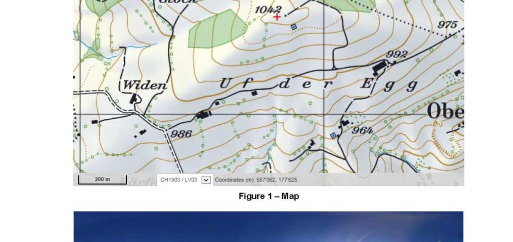
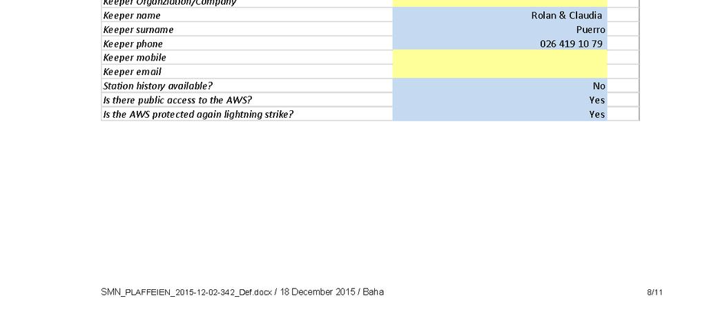
35 9. APPENDIX: SAMPLE REPORT OF SWISSMETNET STATION PLAFFEIEN 30
36 31


37 32

38 33

39 34


40 35

41 36


42 37

43 38


44 39
Integrating third party data from partner networks: Quality assessment using MeteoSwiss Meteorological Certification procedure
 Federal Department of Home Affairs FDHA Federal Office of Meteorology and Climatology MeteoSwiss Integrating third party data from partner networks: Quality assessment using MeteoSwiss Meteorological Certification
MeteoSwiss acceptance procedure for automatic weather stations
 MeteoSwiss acceptance procedure for automatic weather stations J. Fisler, M. Kube, E. Grueter and B. Calpini MeteoSwiss, Krähbühlstrasse 58, 8044 Zurich, Switzerland Phone:+41 44 256 9433, Email: joel.fisler@meteoswiss.ch
METEO-Cert: Acceptance Procedure for Automatic Weather Stations
 Eidgenössisches Departement des Innern EDI Bundesamt für Meteorologie und Klimatologie MeteoSchweiz METEO-Cert: Acceptance Procedure for Automatic Weather Stations Joël Fisler, Marlen Kube & Bertrand Calpini
STATUS OF THE WIGOS DEMONSTRATION PROJECTS
 STATUS OF THE WIGOS DEMONSTRATION PROJECTS Demonstration Project Morocco Strengthening Moroccan RIC Capacities (Submitted by Rabia Merrouchi, National Meteorological Service of Morocco (DMN)) February
Quality Assurance and Quality Control
 Quality Assurance and Quality Control of Surface Observations in JMA Japan Meteorological Agency Hakaru MIZUNO "Guide to Meteorological Instruments and Methods of Observation", WMO-No.8, 7th ed., 2008.
1 Introduction. Station Type No. Synoptic/GTS 17 Principal 172 Ordinary 546 Precipitation
 Use of Automatic Weather Stations in Ethiopia Dula Shanko National Meteorological Agency(NMA), Addis Ababa, Ethiopia Phone: +251116639662, Mob +251911208024 Fax +251116625292, Email: Du_shanko@yahoo.com
Quality assurance for sensors at the Deutscher Wetterdienst (DWD)
") Quality assurance for sensors at the Deutscher Wetterdienst (DWD) Quality assurance / maintenance / calibration Holger Dörschel, Dr Tilman Holfelder WMO International Conference on Automatic Weather Stations
Quality assurance for sensors at the Deutscher Wetterdienst (DWD) Quality assurance / maintenance / calibration Holger Dörschel, Dr Tilman Holfelder WMO International Conference on Automatic Weather Stations
SwissMetNet: The New Automatic Meteorological Network of Switzerland
 SwissMetNet: The New Automatic Meteorological Network of Switzerland Heimo A. 1, Calpini B. 1, Konzelmann T. 2, Suter S. 2 Federal ffice of Meteorology and Climatology MeteoSwiss 1 Aerological Station,
Guidelines on Quality Control Procedures for Data from Automatic Weather Stations
 Guidelines on Quality Control Procedures for Data from Automatic Weather Stations Igor Zahumenský Slovak Hydrometeorological Institute SHMI, Jeséniova 17, 833 15 Bratislava, Slovakia Tel./Fax. +421 46
Part 5: Total stations
 Provläsningsexemplar / Preview INTERNATIONAL STANDARD ISO 17123-5 Third edition 2018-02 Optics and optical instruments Field procedures for testing geodetic and surveying instruments Part 5: Total stations
Components of uncertainty in measurements by means of AWS
 Components of uncertainty in measurements by means of AWS G. Coppa, F. Sanna, C. Musacchio, A. Merlone INRiM Istituto Nazionale di Ricerca Metrologica Outline Metrology and Meteorology Uncertainty in temperature
2 nd Cryonet-Asia Worskshop Salekhard, Russian Federation (2-5 February 2016)
") WMO 2 nd Cryonet-Asia Worskshop Salekhard, Russian Federation (2-5 February 2016) WMO Rolling Review of Requirements (RRR) Etienne Charpentier Chief, WMO Observing Systems Division WMO; Name of Department
WMO 2 nd Cryonet-Asia Worskshop Salekhard, Russian Federation (2-5 February 2016) WMO Rolling Review of Requirements (RRR) Etienne Charpentier Chief, WMO Observing Systems Division WMO; Name of Department
QualiMET 2.0. The new Quality Control System of Deutscher Wetterdienst
 QualiMET 2.0 The new Quality Control System of Deutscher Wetterdienst Reinhard Spengler Deutscher Wetterdienst Department Observing Networks and Data Quality Assurance of Meteorological Data Michendorfer
Representivity of wind measurements for design wind speed estimations
 Representivity of wind measurements for design wind speed estimations Adam Goliger 1, Andries Kruger 2 and Johan Retief 3 1 Built Environment, Council for Scientific and Industrial Research, South Africa.
Applications. Remote Weather Station with Telephone Communications. Tripod Tower Weather Station with 4-20 ma Outputs
 Tripod Tower Weather Station with 4-20 ma Outputs Remote Weather Station with Telephone Communications NEMA-4X Enclosure with Two Translator Boards and Analog Barometer Typical Analog Output Evaporation
The WMO Global Basic Observing Network (GBON)
") The WMO Global Basic Observing Network (GBON) A WIGOS approach to securing observational data for critical global weather and climate applications Robert Varley and Lars Peter Riishojgaard, WMO Secretariat,
The WMO Global Basic Observing Network (GBON) A WIGOS approach to securing observational data for critical global weather and climate applications Robert Varley and Lars Peter Riishojgaard, WMO Secretariat,
WeatherHawk Weather Station Protocol
 WeatherHawk Weather Station Protocol Purpose To log atmosphere data using a WeatherHawk TM weather station Overview A weather station is setup to measure and record atmospheric measurements at 15 minute
The Colorado Climate Center at CSU. residents of the state through its threefold
 The CoAgMet Network: Overview History and How It Overview, Works N l Doesken Nolan D k and d Wendy W d Ryan R Colorado Climate Center Colorado State University First -- A short background In 1973 the federal
The WMO Global Basic Observing Network (GBON)
") The WMO Global Basic Observing Network (GBON) A WIGOS approach to securing observational data for critical global weather and climate applications Robert Varley and Lars Peter Riishojgaard, WMO Secretariat,
The WMO Global Basic Observing Network (GBON) A WIGOS approach to securing observational data for critical global weather and climate applications Robert Varley and Lars Peter Riishojgaard, WMO Secretariat,
Country Report for Japan (Submitted by Kenji Akaeda, Japan Meteorological Agency)
") Japan JMA/WMO Workshop on Quality Management in Surface, Climate and Upper-air Observations in RA II (Asia) Tokyo, Japan 27 30 July 2010 Doc. Japan (10.VII.2010) Country Report for Japan (Submitted by
Japan JMA/WMO Workshop on Quality Management in Surface, Climate and Upper-air Observations in RA II (Asia) Tokyo, Japan 27 30 July 2010 Doc. Japan (10.VII.2010) Country Report for Japan (Submitted by
The Vaisala AUTOSONDE AS41 OPERATIONAL EFFICIENCY AND RELIABILITY TO A TOTALLY NEW LEVEL.
 The Vaisala AUTOSONDE AS41 OPERATIONAL EFFICIENCY AND RELIABILITY TO A TOTALLY NEW LEVEL. Weather Data Benefit For Society The four most important things about weather prediction are quality, reliability,
WIGOS, the RRR, and the Vision for WIGOS in 2040
 WIGOS, the RRR, and the Vision for WIGOS in 2040 Lars Peter Riishojgaard WIGOS Project Office, WMO Secretariat WMO; Observing and Information Systems Department) Overview 1. Brief introduction to WIGOS
Provläsningsexemplar / Preview INTERNATIONAL STANDARD ISO Second edition
 INTERNATIONAL STANDARD ISO 17123-4 Second edition 2012-06-01 Optics and optical instruments Field procedures for testing geodetic and surveying instruments Part 4: Electro-optical distance meters (EDM
MANAGEMENT OF THE NIEMEN RIVER BASIN WITH ACCOUNT OF ADAPTATION TO CLIMATE CHANGE. Hydro-meteorological Monitoring System
 MANAGEMENT OF THE NIEMEN RIVER BASIN WITH ACCOUNT OF ADAPTATION TO CLIMATE CHANGE Hydro-meteorological Monitoring System Draft Interim Report Milestone 1 Giovanni Crema 18 October 2012 Scope of work assessment
Questionnaire on Quality Management for Surface Meteorological Observations in Regional Association II (Asia)
") Questionnaire on Quality Management for Surface Meteorological Observations in Regional Association II (Asia) RA II WIGOS Project to Enhance the Availability and Quality of Management Support for NMHSs
Questionnaire on Quality Management for Surface Meteorological Observations in Regional Association II (Asia) RA II WIGOS Project to Enhance the Availability and Quality of Management Support for NMHSs
Annex I to Resolution 6.2/2 (Cg-XVI) Approved Text to replace Chapter B.4 of WMO Technical Regulations (WMO-No. 49), Vol. I
 Approved Text to replace Chapter B.4 of WMO Technical Regulations (WMO-No. 49), Vol. I") Annex I to Resolution 6.2/2 (Cg-XVI) Approved Text to replace Chapter B.4 of WMO Technical Regulations (WMO-No. 49), Vol. I TECHNICAL REGULATIONS VOLUME I General Meteorological Standards and Recommended
Annex I to Resolution 6.2/2 (Cg-XVI) Approved Text to replace Chapter B.4 of WMO Technical Regulations (WMO-No. 49), Vol. I TECHNICAL REGULATIONS VOLUME I General Meteorological Standards and Recommended
Quality assurance for sensors at the Deutscher Wetterdienst (DWD)
") Paper submitted to ICAWS 2017: Topic 3 Sustainability of the measurements: Calibration, intercomparisons, laboratory and field performance tests, quality assurance and control assessment for traceable
Paper submitted to ICAWS 2017: Topic 3 Sustainability of the measurements: Calibration, intercomparisons, laboratory and field performance tests, quality assurance and control assessment for traceable
PRELIMINARY WIND RESOURCE ASSESSMENT OF WINDYGATES FIRST NATIONS PROJECT. Department of Innovation, Energy and Mines Contact. Rick Halas Document No
 PRELIMINARY WIND RESOURCE ASSESSMENT OF WINDYGATES FIRST NATIONS PROJECT Client Department of Innovation, Energy and Mines Contact Rick Halas Document No Issue B Status Classification Client s Discretion
AN INTERNATIONAL SOLAR IRRADIANCE DATA INGEST SYSTEM FOR FORECASTING SOLAR POWER AND AGRICULTURAL CROP YIELDS
 AN INTERNATIONAL SOLAR IRRADIANCE DATA INGEST SYSTEM FOR FORECASTING SOLAR POWER AND AGRICULTURAL CROP YIELDS James Hall JHTech PO Box 877 Divide, CO 80814 Email: jameshall@jhtech.com Jeffrey Hall JHTech
CLIMATE CHANGE ADAPTATION BY MEANS OF PUBLIC PRIVATE PARTNERSHIP TO ESTABLISH EARLY WARNING SYSTEM
 CLIMATE CHANGE ADAPTATION BY MEANS OF PUBLIC PRIVATE PARTNERSHIP TO ESTABLISH EARLY WARNING SYSTEM By: Dr Mamadou Lamine BAH, National Director Direction Nationale de la Meteorologie (DNM), Guinea President,
WMO Guidelines on the Calculation of Climate Normals
 WMO Guidelines on the Calculation of Climate Normals 2017 edition WEATHER CLIMATE WATER WMO-No. 1203 WMO Guidelines on the Calculation of Climate Normals 2017 edition WMO-No. 1203 EDITORIAL NOTE METEOTERM,
REQUIREMENTS FOR WEATHER RADAR DATA. Review of the current and likely future hydrological requirements for Weather Radar data
 WORLD METEOROLOGICAL ORGANIZATION COMMISSION FOR BASIC SYSTEMS OPEN PROGRAMME AREA GROUP ON INTEGRATED OBSERVING SYSTEMS WORKSHOP ON RADAR DATA EXCHANGE EXETER, UK, 24-26 APRIL 2013 CBS/OPAG-IOS/WxR_EXCHANGE/2.3
The Kentucky Mesonet: Entering a New Phase
 The Kentucky Mesonet: Entering a New Phase Stuart A. Foster State Climatologist Kentucky Climate Center Western Kentucky University KCJEA Winter Conference Lexington, Kentucky February 9, 2017 Kentucky
The WMO Integrated Global Observing System (WIGOS), current status and planned regional activities
, current status and planned regional activities") The WMO Integrated Global Observing System (WIGOS), current status and planned regional activities Dr. Lars Peter Riishojgaard WMO Secretariat, Geneva Outline Introduction to WIGOS WMO The Rolling Review
The WMO Integrated Global Observing System (WIGOS), current status and planned regional activities Dr. Lars Peter Riishojgaard WMO Secretariat, Geneva Outline Introduction to WIGOS WMO The Rolling Review
FLORA: FLood estimation and forecast in complex Orographic areas for Risk mitigation in the Alpine space
 Natural Risk Management in a changing climate: Experiences in Adaptation Strategies from some European Projekts Milano - December 14 th, 2011 FLORA: FLood estimation and forecast in complex Orographic
Weather Stations. Evaluation copy. 9. Post live weather data on the school s web site for students, faculty and community.
 Weather Stations Computer P6 Collecting and analyzing weather data can be an important part of your Earth Science curriculum. It might even be an ongoing part of your entire course. A variety of activities
Operational Applications of Awos Network in Turkey
 Operational Applications of Awos Network in Turkey by Soner Karatas Turkish State Meteorological Service Electronic Observing Systems Division Kütükcü Alibey Cad. No:4 06120 Kalaba-Ankara-TURKEY Tel:+90-312-302
Innovative Sustainable Technology
 Innovative Sustainable Technology DIG is committed to practices that contribute to irrigation and energy efficiency, creating healthy living conditions while maintaining environmentally sound operating
A TEST OF THE PRECIPITATION AMOUNT AND INTENSITY MEASUREMENTS WITH THE OTT PLUVIO
 A TEST OF THE PRECIPITATION AMOUNT AND INTENSITY MEASUREMENTS WITH THE OTT PLUVIO Wiel M.F. Wauben, Instrumental Department, Royal Netherlands Meteorological Institute (KNMI) P.O. Box 201, 3730 AE De Bilt,
MxVision WeatherSentry Web Services Content Guide
 MxVision WeatherSentry Web Services Content Guide July 2014 DTN 11400 Rupp Drive Minneapolis, MN 55337 00.1.952.890.0609 This document and the software it describes are copyrighted with all rights reserved.
Recent Improvement of Integrated Observation Systems in JMA
 Recent Improvement of Integrated Observation Systems in JMA Mr Osamu Suzuki and Mr Yoshihiko Tahara Japan Meteorological Agency 1-3-4 Otemachi, Chiyoda-ku, Tokyo 100-8122, Japan Tel: +81-3-3212-8341, Fax:
Future Global Data-processing and Forecasting System (GDPFS)
") Future Global Data-processing and Forecasting System (GDPFS) Enabling Seamless Activities from Research to Operations to Service (R2O2S) for the benefits of Members Michel Jean President of CBS The GDPFS
Future Global Data-processing and Forecasting System (GDPFS) Enabling Seamless Activities from Research to Operations to Service (R2O2S) for the benefits of Members Michel Jean President of CBS The GDPFS
World Meteorological Organization
 World Meteorological Organization Opportunities and Challenges for Development of Weather-based Insurance and Derivatives Markets in Developing Countries By Maryam Golnaraghi, Ph.D. Head of WMO Disaster
Nicolas Duchene 1, James Smith 1 and Ian Fuller 2
 A METHODOLOGY FOR THE CREATION OF METEOROLOGICAL DATASETS FOR LOCAL AIR QUALITY MODELLING AT AIRPORTS Nicolas Duchene 1, James Smith 1 and Ian Fuller 2 1 ENVISA, Paris, France 2 EUROCONTROL Experimental
Climate Services in Seychelles
 Climate Services in Seychelles Vincent Amelie Seychelles Met. Services Email: v.amelie@meteo.gov.sc Regional Consultation on Climate Services in the Indian Ocean Islands, Ebène, Mauritius, 14-16 March
The AWS based operational urban network in Milano: achievements and open questions.
 The AWS based operational urban network in Milano: achievements and open questions. Frustaci Giuseppe, Curci Savino, Pilati Samantha, Lavecchia Cristina, Paganelli Chiara Fondazione Osservatorio Meteorologico
Technical Report DMI SYNOP AWS Summit. Data status March Ellen Vaarby Laursen. SYNOP weather station Summit.
 10-09 DMI SYNOP AWS 04416 Summit. Data status March 2010. Ellen Vaarby Laursen SYNOP weather station 04416 Summit Picture Taken: 2007:06:20 16:16:11 Picture Taken: 2009:07:09 08:22:51 Copenhagen 2010 www.dmi.dk/dmi/tr
Meteorological Service
 Meteorological Service The Meteorological Service in Oman was established in 1973. Oman joined ICAO in 1973 Oman joined WMO in 1975. Meteorological Service is under the framework of the Directorate General
Road weather forecast for different customer systems in Switzerland
 Proceedings of the 10th SIRWEC Conference. 22-24 March 2000. Davos. Switzerland 10 Road weather forecast for different customer systems in Switzerland Foreword André-Charles Letestu and Urs Keller Swiss
WMO Public Weather Services: Enhanced Communication Skills for Improved Service Delivery. by S.W. Muchemi (WMO)
") WMO Public Weather Services: Enhanced Communication Skills for Improved Service Delivery by S.W. Muchemi (WMO) Functions of the Public Weather Services (PWS) programme of WMO To strengthen the capabilities
WMO Public Weather Services: Enhanced Communication Skills for Improved Service Delivery by S.W. Muchemi (WMO) Functions of the Public Weather Services (PWS) programme of WMO To strengthen the capabilities
RWSC ARWIS Specifications - Sensors & Accuracy
 - Sensors & Accuracy Sensors from which jurisdictions will configure their road weather information systems. Class Sensor Parameter Accuracy Range Operating Survival COMMON CORE SENSORS Atmospherics Thermistor
C1: From Weather to Climate Looking at Air Temperature Data
 C1: From Weather to Climate Looking at Air Temperature Data Purpose Students will work with short- and longterm air temperature data in order to better understand the differences between weather and climate.
AWOS. Automated Weather Observing Systems COASTAL
 AWOS Automated Weather Observing Systems COASTAL Environmental Systems Monitor Monitor Your Your World World Coastal s Experience & Expertise Since 1981, Coastal Environmental Systems, Inc. (Coastal) has
INCA-CE achievements and status
 INCA-CE achievements and status Franziska Strauss Yong Wang Alexander Kann Benedikt Bica Ingo Meirold-Mautner INCA Central Europe Integrated nowcasting for the Central European area This project is implemented
Vaisala AviMet Automated Weather Observing System
 Vaisala AviMet Automated Weather Observing System Solutions to meet your challenges Our mission: to help you operate succesfully Safe, economical, reliable and flexible operation of your airport is ensured
Wali Ullah Khan Pakistan Meteorological Department
 An overview of Weather Observation practices over Pakistan By Wali Ullah Khan Pakistan Meteorological Department JMA/WMO TRAINING WORKSHOP ON CALIBRATION AND MAINTENANCE OF METEOROLOGICAL INSTRUMENTS IN
The Fundamentals of Moisture Calibration
 The Fundamentals of Moisture The following guide will provide you with a basic knowledge of humidity calibration, help you to understand your requirements and select an appropriate solution. 1 Why Humidity
How to shape future met-services: a seamless perspective
 How to shape future met-services: a seamless perspective Paolo Ruti, Chief World Weather Research Division Sarah Jones, Chair Scientific Steering Committee Improving the skill big resources ECMWF s forecast
USE OF SATELLITE INFORMATION IN THE HUNGARIAN NOWCASTING SYSTEM
 USE OF SATELLITE INFORMATION IN THE HUNGARIAN NOWCASTING SYSTEM Mária Putsay, Zsófia Kocsis and Ildikó Szenyán Hungarian Meteorological Service, Kitaibel Pál u. 1, H-1024, Budapest, Hungary Abstract The
WeatherWatcher ACP. Astronomers Control Panel (V4 or >) Ambient Virtual Weather Station (Pro or Internet editions) ASCOM platform v4.
 Ambient Virtual Weather Station (Pro or Internet editions) ASCOM platform v4.") WeatherWatcher ACP Software This is a minimum equipment list: Astronomers Control Panel (V4 or >) Ambient Virtual Weather Station (Pro or Internet editions) ASCOM platform v4.1 or higher Hardware Weather
WeatherWatcher ACP Software This is a minimum equipment list: Astronomers Control Panel (V4 or >) Ambient Virtual Weather Station (Pro or Internet editions) ASCOM platform v4.1 or higher Hardware Weather
International Training Course on Use of Meteorological Instruments, from 5 to 16 June 2014, Nanjing, China
 ~ ~ \ ~-. -- I ~ WMOOMM World Meteorological Organization Organisation meteorologique mondiale Secretariat 7 bis, avenue de Ia Paix - Case postale 2300 - CH 1211 Geneve 2- Suisse Tel.: +41 (0) 22 730 8111
The Montague Doppler Radar, An Overview
 ISSUE PAPER SERIES The Montague Doppler Radar, An Overview June 2018 NEW YORK STATE TUG HILL COMMISSION DULLES STATE OFFICE BUILDING 317 WASHINGTON STREET WATERTOWN, NY 13601 (315) 785-2380 WWW.TUGHILL.ORG
Meteorological Instruments for Solar Energy
 Meteorological Instruments for Solar Energy gillinstruments.com Gill Instruments has been designing and manufacturing professional use compact weather stations and ultrasonic wind speed and direction sensors
Latest generation testo air velocity & IAQ probes with cable handle. Instruction manual
 Latest generation testo air velocity & IAQ probes with cable handle Instruction manual Contents Contents 1 About this document... 5 2 Safety and disposal... 5 3 System description... 6 4 Description of
Monitoring Extreme Weather Events. February 8, 2010
 Monitoring Extreme Weather Events February 8, 2010 Extensive network of over 800 stations across the Prairies Good coverage across entire agriculture production region Network of networks strategy includes
Strategic Planning of Tuvalu Meteorological Service
 WMO Regional Seminar on Enhancing Service Delivery by National Meteorological & Hydrological Services (NMHSs( NMHSs) ) in RA V Kuala Lumpur, Malaysia, 2 6 April 2007 Strategic Planning of Tuvalu Meteorological
McArthur River Mining Borroloola Caravan and Devils Spring Stations
 Borroloola Caravan and Devils Spring Ambient Air Quality Monitoring Validated Report 1 st July 2016 31 st July 2016 Report No.: DAT10991 Report issue date: 25 th August 2016 Maintenance contract: MC1100,
Wind Resource Assessment Practical Guidance for Developing A Successful Wind Project
 December 11, 2012 Wind Resource Assessment Practical Guidance for Developing A Successful Wind Project Michael C Brower, PhD Chief Technical Officer Presented at: What We Do AWS Truepower partners with
Climate Variables for Energy: WP2
 Climate Variables for Energy: WP2 Phil Jones CRU, UEA, Norwich, UK Within ECEM, WP2 provides climate data for numerous variables to feed into WP3, where ESCIIs will be used to produce energy-relevant series
WMO SPICE. World Meteorological Organization. Solid Precipitation Intercomparison Experiment - Overall results and recommendations
 WMO World Meteorological Organization Working together in weather, climate and water WMO SPICE Solid Precipitation Intercomparison Experiment - Overall results and recommendations CIMO-XVII Amsterdam,
ADL110B ADL120 ADL130 ADL140 How to use radar and strike images. Version
 ADL110B ADL120 ADL130 ADL140 How to use radar and strike images Version 1.00 22.08.2016 How to use radar and strike images 1 / 12 Revision 1.00-22.08.2016 WARNING: Like any information of the ADL in flight
2.1. Accuracy, n- how close the indication of the thermometer is to the true value.
 AASHTO Accreditation Policy and Guidance on Thermometer Selection and Records Revised: January 25, 2018 Revision #: 0 1. Objective 1.1. The purpose of this document is to clearly define acceptance criteria
QUALITY MANAGEMENT IN SURFACE, CLIMATE AND UPPER-AIR OBSERVATIONS IN CHINA
 China JMA/WMO Workshop on Quality Management in Surface, Climate and Upper-air Observations in RA II (Asia) Tokyo, Japan 27-30 July 2010 Doc. Country (.VII.2010) QUALITY MANAGEMENT IN SURFACE, CLIMATE
Centralized Forecasting Registration and Communication Requirements for Distribution Connected Variable Generators. IESO Training
 Centralized Forecasting Registration and Communication Requirements for Distribution Connected Variable Generators IESO Training May 2017 Centralized Forecasting - Registration and Communication Requirements
Weather observations from Tórshavn, The Faroe Islands
 Weather observations from Tórshavn, The Faroe Islands 1953-2014 - Observation data with description John Cappelen Copenhagen 2015 http://www.dmi.dk/fileadmin/rapporter/tr/tr15-09 page 1 of 14 Colophon
SuperPack North America
 SuperPack North America Speedwell SuperPack makes available an unprecedented range of quality historical weather data, and weather data feeds for a single annual fee. SuperPack dramatically simplifies
Site assessment for a type certification icing class Fraunhofer IWES Kassel, Germany
 Site assessment for a type certification icing class Kai Freudenreich 1, Michael Steiniger 1, Zouhair Khadiri-Yazami 2, Ting Tang 2, Thomas Säger 2 1 DNV GL Renewables Certification, Hamburg, Germany kai.freudenreich@dnvgl.com,
Comparison of Vaisala Radiosondes RS41 and RS92 WHITE PAPER
 Comparison of Vaisala Radiosondes RS41 and RS92 WHITE PAPER Table of Contents CHAPTER 1 Introduction... 4 CHAPTER 2 Key Improvements in RS41... 5 CHAPTER 3 RS41 and RS92 Comparison Tables... 6 CHAPTER
Data Quality Assurance System. Hong Kong, China
 INtegrated Meteorological Data Quality Assurance System (INDAS) in Hong Kong, China JMA/WMO Workshop on Quality Management in Surface, Climate and Upper-air Observations in RA II, Tokyo, 27-30 July 2010
THE CLIMATE INFORMATION MODULE
 Climate Information and Prediction Services (CLIPS) -Curriculum- THE CLIMATE INFORMATION MODULE designed by Dipl.-Met. Peer Hechler Deutscher Wetterdienst P.O. Box 10 04 65 63004 Offenbach Germany THE
Use of reanalysis data in atmospheric electricity studies
 Use of reanalysis data in atmospheric electricity studies Report for COST Action CA15211 ElectroNet Short-Term Scientific Missions (STSM) 1. APPLICANT Last name: Mkrtchyan First name: Hripsime Present
Instruments and Methods of Observation Programme, the Report of the President of CIMO. Report to Cg-XV May 2007 Dr. J. Nash President of CIMO
 Instruments and Methods of Observation Programme, the Report of the President of CIMO Report to Cg-XV May 2007 Dr. J. Nash President of CIMO 1 CIMO Mission To promote and facilitate international standardisation
Guidance on Aeronautical Meteorological Observer Competency Standards
 Guidance on Aeronautical Meteorological Observer Competency Standards The following guidance is supplementary to the AMP competency Standards endorsed by Cg-16 in Geneva in May 2011. Format of the Descriptions
Enhancing Weather Information with Probability Forecasts. An Information Statement of the American Meteorological Society
 Enhancing Weather Information with Probability Forecasts An Information Statement of the American Meteorological Society (Adopted by AMS Council on 12 May 2008) Bull. Amer. Meteor. Soc., 89 Summary This
Introductions to RIC-Beijing. NAN Xuejing, CUI Xiai Meteorological Observation Center China Meteorological Administration March,2018
 Introductions to RIC-Beijing NAN Xuejing, CUI Xiai China Meteorological Administration March,2018 Contents 1. China Meteorological Administration (CMA) Organization 2. (MOC) Functional Structure Responsibilities
Road weather forecasts and MDSS in Slovakia
 ID: 0030 Road weather forecasts and MDSS in Slovakia M. Benko Slovak Hydrometeorological Institute (SHMI), Jeséniova 17, 83315 Bratislava, Slovakia Corresponding author s E-mail: martin.benko@shmu.sk ABSTRACT
Investigating Factors that Influence Climate
 Investigating Factors that Influence Climate Description In this lesson* students investigate the climate of a particular latitude and longitude in North America by collecting real data from My NASA Data
Operational Perspectives on Hydrologic Model Data Assimilation
 Operational Perspectives on Hydrologic Model Data Assimilation Rob Hartman Hydrologist in Charge NOAA / National Weather Service California-Nevada River Forecast Center Sacramento, CA USA Outline Operational
EAS 535 Laboratory Exercise Weather Station Setup and Verification
 EAS 535 Laboratory Exercise Weather Station Setup and Verification Lab Objectives: In this lab exercise, you are going to examine and describe the error characteristics of several instruments, all purportedly
TNI V1M Standard Update Guidance on Detection and Quantitation
 TNI V1M4 2016 Standard Update Guidance on Detection and Quantitation GUID-3-109-Rev0 January 30, 2019 This material represents the opinion of its authors. It is intended solely as guidance and does not
Data QC within the Belgian synoptic and climatological networks: an overview
 Data QC within the Belgian synoptic and climatological networks: an overview Cédric Bertrand & Michel Journée (Cedric.Bertrand@meteo.be, Michel.Journee@meteo.be) Royal Meteorological Institute of Belgium
Station Maintenance and Calibration Report ABRAHAM LINCOLN BIRTHPLACE NATIONAL HISTORIC SITE March 13, 2007
 Station Maintenance and Calibration Report ABRAHAM LINCOLN BIRTHPLACE NATIONAL HISTORIC SITE March 13, 2007 National Park Service Gaseous Pollutant Monitoring Program Prepared by Air Resource Specialists,
MeteoSwiss Spatial Climate Analyses: Documentation of Datasets for Users
 Federal Department of Home Affairs FDHA Federal Office of Meteorology and Climatology MeteoSwiss MeteoSwiss Spatial Climate Analyses: Documentation of Datasets for Users Figure 1: Distribution of the 48-hour
Planning and Situation of the Meteorological Observation in The Republic of Korea
 Republic of Korea JMA/WMO Workshop on Quality Management in Surface, Climate and Upper-air Observations in RA II (Asia) Tokyo, Japan 27-30 July 2010 Doc. Country (.VII.2010) Planning and Situation of the
473 Dew Point Hygrometer
 High Performance Chilled Mirror Hygrometer With Cable Mounted Measuring Heads Highly precise chilled mirror dew point technology Cable mounted dew point and temperature measurement Aspirated and direct
London Heathrow Field Site Metadata
 London Heathrow Field Site Metadata Field Site Information Name: Heathrow src_id (Station ID number): 708 Geographic Area: Greater London Latitude (decimal ): 51.479 Longitude (decimal ): -0.449 OS Grid
AUTOMATIC MEASUREMENT OF ICING ON THE WEST OF THE CZECH REPUBLIC
 AUTOMATIC MEASUREMENT OF ICING ON THE WEST OF THE CZECH REPUBLIC J. Chum, J. Vojta, J. Hošek Institute of Atmospheric Physics, Boční II / 1401, Praha 4, Czech republic 1 INTRODUCTION We report our experience
Implementation Guidance of Aeronautical Meteorological Observer Competency Standards
 Implementation Guidance of Aeronautical Meteorological Observer Competency Standards The following guidance is supplementary to the AMP competency Standards endorsed by Cg-16 in Geneva in May 2011. Please
Seamless Data-Processing and Forecasting System (SDPFS)
") WMO Seamless Data-Processing and Forecasting System (SDPFS) Jan Daňhelka WMO; Commission for Hydrology Introduction GDPFS intended span over hydrology domain is a new challange for hydrological community
WMO Seamless Data-Processing and Forecasting System (SDPFS) Jan Daňhelka WMO; Commission for Hydrology Introduction GDPFS intended span over hydrology domain is a new challange for hydrological community
INCA CE: Integrating Nowcasting with crisis management and risk prevention in a transnational framework
 INCA CE: Integrating Nowcasting with crisis management and risk prevention in a transnational framework Yong Wang ZAMG, Austria This project is implemented through the CENTRAL EUROPE Programme co-financed