Examples of Polarimetric and Non-Polarimetric Signatures of Bat Emergences
|
|
|
- Angela Hutchinson
- 6 years ago
- Views:
Transcription


1 Examples of Polarimetric and Non-Polarimetric Signatures of Bat Emergences Phillip Chilson * School of Meteorology & Advanced Radar Research Center University of Oklahoma * Currently on sabbatical at the Swiss Ornithological Institute ( Schweizerische Vogelwarte )
2 Presentation Outline Introduction to the Brazilian free-tailed bat (Tadarida brasiliensis) Polarimetric observations of bats at X-band Modeling of radar backscatter from bats Polarimetric observations of bats using NEXRAD (polarimetric & non-polarimetric) Summary
3 Brazilian Free-Tailed Bat
4 Brazilian Free-Tailed Bat (in words) Medium sized bat (11-14 g) with a wing span of cm Found in the western United States, south through Mexico, Central America and into northern South America Prefer to roost in caves but will also roost in attics, under bridges, or in abandoned buildings Most migrate to Central America and Mexico during the winter Aerial insectivores: consume large amounts of moths and other insects Largest known colony is Bracken Cave near San Antonio, Texas so e esti ates pla e up 20 illio ats the e at ti es

")


5 Brazilian Free-Tailed Bat (in pictures) Location of Bracken and Frio Caves Range of Brazilian free-tailed bats Foraging
6 X-Band Observations of Bats
7 Using Storm Biology Chasing Radars to Study Brazilian Free-Tailed Bats Frio Cave in central Texas hosts a large number (several million) Brazilian Free-Tailed bats On different occasions we have taken 2 different polarimetric X-band weather radars to Texas to study these bats Motivation was to investigate the emergence features of the bats, investigate their nocturnal foraging behavior, and to provide a base data set for comparison with observations from NEXRAD


8 Mobile Radars RaXPol NOXP RaXPol: OU Radar NOXP: NOAA NSSL / OU Radar Both are X-band (3-cm wavelength), Dual-polarization weather radars


9 Observations of Bat Emergence from Frio Cave Using X-Band Radar


10 Frio Cave, Texas: July 10, :35 UTC (20:35 LT) NOXP: Z NOXP: V r NEXRAD: Z NOXP: ZDR


11 Frio Cave, Texas: July 10, :10 UTC (21:10 LT) NOXP: Z NOXP: V r NEXRAD: Z NOXP: ZDR
12 Modeling of Radio-Wave Backscatter from Bats
13 RCS Modeling: Method of Moments Aim is simulate the radar cross section (RCS) of an object of interest using numerical models Co st u t a plate odel of the o je t with ea h plate ei g characterized by a given complex dielectric constant Use the computer model to solve the integral equation form of Maxwell s e uatio s fo ea h plate a d dete i e the resulting surface induction currents Calculate the electromagnetic field generated from the cumulative contributions of the induction currents The result is used to find the RCS of the object

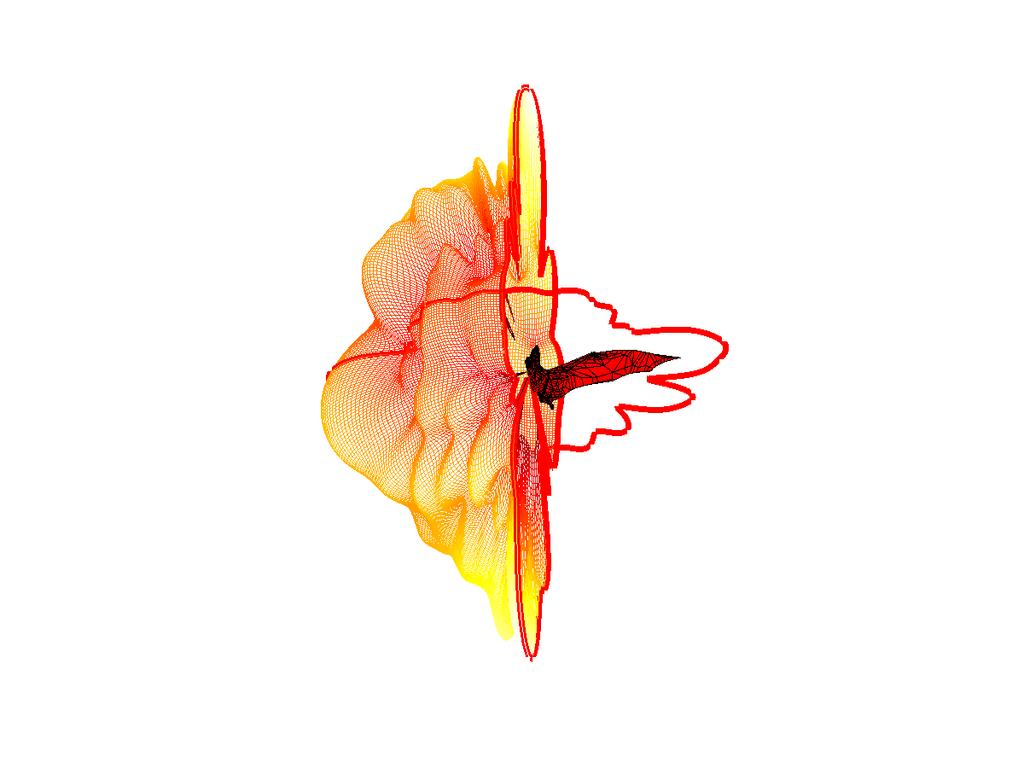
14 Plate Model of the Brazilian Free- Tailed Bat
15 RCS Calculated for the Brazilian Free- Tailed Bat


16 a) b) c)


17 Field Measurements / Model Validation Dual-polarization RCS measurements of a deceased Brazilian free-tailed bat at X-band. The mounting frame allows for measurements across 360 along a single plane of the bat.


18 Field Measurements / Model Validation Bistatic measurements were made using two polarimetric horn antennas (left) and an Agilent Network Analyzer (right).

19 Orientation of Bat During Validation
20 Comparison of RCS Values (dbsm) Valid for X-band Modeled values shown in red Measured values shown in blue
 c) f)")

21 a) d) e) b) c) f)
22 NEXRAD Observations of Bats


23 Bat Emergences Seen on NEXRAD Many bat colonies in central Texas Shown here are a few as detected by NEXRAD during the maternity season

24 Frio Emergence as Seen on NEXRAD: UNQC_CREF Data

25 Frio Cave Emergence as Seen with NEXRAD Level II Data
26 The following images show emergences of Brazilian free-tailed bats as seen by NEXRAD Data are for 03 July 2014 at 20:50 local time Images have been created using Level III data using a common meteorological software package: WeatherScope

27

28 Reflectivity (dbz): Lowest Scan Frio Cave Bracken Cave Ney Cave Gust Front

29 Radial Velocity (m/s): Lowest Scan Frio Cave Bracken Cave Ney Cave Gust Front

30 Differential Reflectivity (db): Lowest Scan Frio Cave Bracken Cave Ney Cave Gust Front

31 Correlation Coefficient (unitless): Lowest Scan Frio Cave Bracken Cave Ney Cave Gust Front
32 And finally an example from the National Severe Storms Laboratory as posted on Facebook: Bat emergence from Selman Cave in Oklahoma 28 June 20:49 local time as seen on KVNX

33
34 Summary & Conclusions
35 Conclusions Radar is being used to study the behavior of Brazilian freetailed bats Observations have been made a several roosts in Texas Polarimetric data can be used to Discriminate between different types of volant animals and weather Estimates of number densities of bats in the aerosphere Determine orientation of animals in flight These results apply to other aggregating species such as swifts and swallows
36 On-going and Future Work Perform more validation of the model using other radar observations at other frequencies Model other species of animals Integrate the results into a realistic radar simulator Other ideas?
 Winifred Frick (University of California Santa Cruz)")
37 Acknowledgements Also participating in the study are Djordje Mirkovic, Phil Stepanian, & Jeff Kelly (University of Oklahoma) Winifred Frick (University of California Santa Cruz)

38 Hic sunt dracones
The response of birds to abrupt natural hazards as observed using weather radar
 The response of birds to abrupt natural hazards as observed using weather radar Phillip B. Chilson 1, Amy Daniel 2, Stephen B. Cocks 3, Daniel S. Berkowitz 3, Valery Melnikov 4, Winifred F. Frick 5, Andrew
USING A DUAL-POLARIMETRIC WEATHER RADAR SIMULATOR TO INVESTIGATE MICROWAVE BACKSCATTER FROM BIRDS
 P10.22 1 USING A DUAL-POLARIMETRIC WEATHER RADAR SIMULATOR TO INVESTIGATE MICROWAVE BACKSCATTER FROM BIRDS Phillip B. Chilson 1,2,, Kara Bolognini 1, Boon Leng Cheong 2, and Jeff Kelly 3,4 1 School of
Meteorology 311. RADAR Fall 2016
 Meteorology 311 RADAR Fall 2016 What is it? RADAR RAdio Detection And Ranging Transmits electromagnetic pulses toward target. Tranmission rate is around 100 s pulses per second (318-1304 Hz). Short silent
Chapter 19 : Utility of WSR-88 weather radar for monitoring nocturnal avian migration in the offshore environment
 Chapter 19 : Utility of WSR-88 weather radar for monitoring nocturnal avian migration in the offshore environment Phillip B. Chilson 1 and Evan M. Adams 2 1 University of Oklahoma 2 Abstract Although developed
ERAD THE EIGHTH EUROPEAN CONFERENCE ON RADAR IN METEOROLOGY AND HYDROLOGY
 ERAD 2014 - THE EIGHTH EUROPEAN CONFERENCE ON RADAR IN METEOROLOGY AND HYDROLOGY Microphysical interpretation of coincident simultaneous and fast alternating horizontal and vertical polarization transmit
Thunderstorm Downburst Prediction: An Integrated Remote Sensing Approach. Ken Pryor Center for Satellite Applications and Research (NOAA/NESDIS)
") Thunderstorm Downburst Prediction: An Integrated Remote Sensing Approach Ken Pryor Center for Satellite Applications and Research (NOAA/NESDIS) Topics of Discussion Thunderstorm Life Cycle Thunderstorm
Thunderstorm Downburst Prediction: An Integrated Remote Sensing Approach Ken Pryor Center for Satellite Applications and Research (NOAA/NESDIS) Topics of Discussion Thunderstorm Life Cycle Thunderstorm
Mobile, phased-array, X-band Doppler radar observations of tornadogenesis in the central U. S.
 Mobile, phased-array, X-band Doppler radar observations of tornadogenesis in the central U. S. Howard B. Bluestein 1, Michael M. French 2, Ivan PopStefanija 3 and Robert T. Bluth 4 Howard (Howie Cb ) B.
(Preliminary) Observations of Tropical Storm Fay Dustin W Phillips Kevin Knupp, & Tim Coleman. 34th Conference on Radar Meteorology October 8, 2009
 Observations of Tropical Storm Fay Dustin W Phillips Kevin Knupp, & Tim Coleman. 34th Conference on Radar Meteorology October 8, 2009") (Preliminary) Observations of Tropical Storm Fay Dustin W Phillips Kevin Knupp, & Tim Coleman 34th Conference on Radar Meteorology October 8, 2009 Outline I. Research Equipment MIPS, MAX, KJAX (WSR-88D)
(Preliminary) Observations of Tropical Storm Fay Dustin W Phillips Kevin Knupp, & Tim Coleman 34th Conference on Radar Meteorology October 8, 2009 Outline I. Research Equipment MIPS, MAX, KJAX (WSR-88D)
IMPROVEMENTS OF POLARIMETRIC RADAR ECHO CLASSIFICATIONS. Ronald Hannesen* Selex-Gematronik, Neuss, Germany
 P13.14 IMPROVEMENTS OF POLARIMETRIC RADAR ECHO CLASSIFICATIONS Ronald Hannesen* Selex-Gematronik, Neuss, Germany 1. INTRODUCTION A two-step radar echo classification is applied on polarimetric radar data:
Polarization Diversity for the National Weather Service (NWS), WSR-88D radars
, WSR-88D radars") Polarization Diversity for the National Weather Service (NWS), WSR-88D radars Dusan S. Zrnic National Severe Storm Laboratory Norman, OK 73069, USA In the early eighties the NOAA s National Severe Storms
Polarization Diversity for the National Weather Service (NWS), WSR-88D radars Dusan S. Zrnic National Severe Storm Laboratory Norman, OK 73069, USA In the early eighties the NOAA s National Severe Storms
Monitoring bird migration by weather radar
 Monitoring bird migration by weather radar Adriaan Dokter and Iwan Holleman Introduction Weather and bird migration are intimately related. Evolution has shaped the migration strategies of birds such that
Estimating the Impact of a 3-dB Sensitivity Loss on WSR-88D Data
 P12R.9 Estimating the Impact of a 3-dB Sensitivity Loss on WSR-88D Data Kevin A. Scharfenberg*, Kim L. Elmore, Eddie Forren, and Valery Melnikov Cooperative Institute for Mesoscale Meteorology Studies,
TORNADO AND TORNADOGENESIS EVENTS SEEN BY THE NOXP, X-BAND, DUAL- POLARIZATION RADAR DURING VORTEX2 2010
 5.2 TORNADO AND TORNADOGENESIS EVENTS SEEN BY THE NOXP, X-BAND, DUAL- POLARIZATION RADAR DURING VORTEX2 2010 Donald W. Burgess * Cooperative Institute for Mesoscale Meteorological Studies, The University
POLARIMETRIC RADAR OBSERVATION OF A TORNADO AT C-BAND
 P2.21 POLARIMETRIC RADAR OBSERVATION OF A TORNADO AT C-BAND Raquel Evaristo, Teresa Bals-Elsholz, Adam Stepanek, Bart Wolf, Kevin Goebbert, Anthony Lyza, Travis Elless Valparaiso University, Valparaiso,
Comparison of polarimetric radar signatures in hailstorms simultaneously observed by C-band and S-band radars.
 Comparison of polarimetric radar signatures in hailstorms simultaneously observed by C-band and S-band radars. R. Kaltenboeck 1 and A. Ryzhkov 2 1 Austrocontrol - Aviation Weather Service, Vienna and Institute
Quantifying animal phenology in the aerosphere at a continental scale using NEXRAD weather radars
 Quantifying animal phenology in the aerosphere at a continental scale using NEXRAD weather radars JEFFREY F. KELLY, 1,2, J. RYAN SHIPLEY, 1 PHILLIP B. CHILSON, 3 KENNETH W. HOWARD, 4 WINIFRED F. FRICK,
Tornadoes pose a high risk because the low atmospheric pressure, combined with high wind velocity, can:
 Tornadoes are powerful, circular windstorms that may be accompanied by winds in excess of 200 miles per hour. Tornadoes typically develop during severe thunderstorms and may range in width from several
Recent observations of tornadoes using a mobile, rapid-scan, polarimetric, X-band, Doppler radar
 Recent observations of tornadoes using a mobile, rapid-scan, polarimetric, X-band, Doppler radar Howard B. Bluestein 1, Jeffrey C. Snyder 2, Kyle J. Thiem 1, Zachary B. Wienhoff 1, Jana B. Houser 3, and
7 AN ADAPTIVE PEDESTAL CONTROL ALGORITHM FOR THE NATIONAL WEATHER RADAR TESTBED PHASED ARRAY RADAR
 7 AN ADAPTIVE PEDESTAL CONTROL ALGORITHM FOR THE NATIONAL WEATHER RADAR TESTBED PHASED ARRAY RADAR David Priegnitz 1, S. M. Torres 1 and P. L. Heinselman 2 1 Cooperative Institute for Mesoscale Meteorological
7 WSR-88D OBSERVATIONS OF AN EXTREME HAIL EVENT IMPACTING ABILENE, TX ON 12 JUNE 2014
 28TH CONFERENCE ON SEVERE LOCAL STORMS 7 WSR-88D OBSERVATIONS OF AN EXTREME HAIL EVENT IMPACTING ABILENE, TX ON 12 JUNE 2014 ARTHUR WITT * NOAA/National Severe Storms Laboratory, Norman, OK MIKE JOHNSON
Dual-Wavelength Polarimetric Radar Analysis of the May 20th 2013 Moore, OK, Tornado
 Dual-Wavelength Polarimetric Radar Analysis of the May 20th 2013 Moore, OK, Tornado Alexandra Fraire Borunda California State University Fullerton, Fullerton, CA Casey B. Griffin and David J. Bodine Advanced
COMMUNITY EMERGENCY RESPONSE TEAM TORNADOES
 Tornadoes are powerful, circular windstorms that may be accompanied by winds in excess of 200 miles per hour. Tornadoes typically develop during severe thunderstorms and may range in width from several
Tornadoes. Tornadoes COMMUNITY EMERGENCY RESPONSE TEAM TORNADOES
 Tornadoes Tornadoes Tell the participants that tornadoes are powerful, circular windstorms that may be accompanied by winds in excess of 200 miles per hour. Tornadoes typically develop during severe thunderstorms
P5.4 WSR-88D REFLECTIVITY QUALITY CONTROL USING HORIZONTAL AND VERTICAL REFLECTIVITY STRUCTURE
 P5.4 WSR-88D REFLECTIVITY QUALITY CONTROL USING HORIZONTAL AND VERTICAL REFLECTIVITY STRUCTURE Jian Zhang 1, Shunxin Wang 1, and Beth Clarke 1 1 Cooperative Institute for Mesoscale Meteorological Studies,
WMO Aeronautical Meteorology Scientific Conference 2017
 Session 1 Science underpinning meteorological observations, forecasts, advisories and warnings 1.1 En route phenomena 1.1.1 Ice crystal icing, and airframe icing research Signatures of supercooled liquid
DETECTION OF BIRDS AND INSECTS USING POLARIMETRIC RADAR OBSERVATION
 P5.3 DETECTION OF BIRDS AND INSECTS USING POLARIMETRIC RADAR OBSERVATION Pengfei Zhang *, Alexander Ryzhkov, and Dusan Zrnic 2 CIMMS, University of Oklahoma, Norman, Oklahoma 2 NOAA/National Severe Storms
11B.3 ADAPTIVE TECHNIQUE TO EXTRACT INTRINSIC INSECTS BACKSCATTER DIFFERENTIAL PHASE FROM POLARIMETRIC SPECTRA
 11B.3 ADAPTIVE TECHNIQUE TO EXTRACT INTRINSIC INSECTS BACKSCATTER DIFFERENTIAL PHASE FROM POLARIMETRIC SPECTRA Svetlana Bachmann* and Dusan Zrnic Cooperative Institute for Mesoscale Meteorological Studies,
Ensemble Kalman Filter Assimilation of Radar Data for a Convective Storm using a Two-moment Microphysics Scheme 04/09/10
 Ensemble Kalman Filter Assimilation of Radar Data for a Convective Storm using a Two-moment Microphysics Scheme 04/09/10 Youngsun Jung 1, Ming Xue 1,2, and Mingjing Tong 3 CAPS 1 and School of Meteorology
Spatiotemporal Variability of ZDR Column Areal and Altitudinal Extent in Tornadic and Nontornadic Supercells
 Spatiotemporal Variability of ZDR Column Areal and Altitudinal Extent in Tornadic and Nontornadic Supercells Background Assessment of microphysical distributions provides insight into processes that govern
OBSERVATIONS OF WINTER STORMS WITH 2-D VIDEO DISDROMETER AND POLARIMETRIC RADAR
 P. OBSERVATIONS OF WINTER STORMS WITH -D VIDEO DISDROMETER AND POLARIMETRIC RADAR Kyoko Ikeda*, Edward A. Brandes, and Guifu Zhang National Center for Atmospheric Research, Boulder, Colorado. Introduction
Patrick N. Gatlin, Kevin R. Knupp, Timothy A. Coleman Earth Systems Science Center, University of Alabama Huntsville, Huntsville, AL. 1.
 P. 3 th Conference on Radar Meteorology Williamsburg, VA, -9 Oct 9 Observations of atmospheric waves that moved across northern Alabama on December using the ARMOR Doppler radar and the Mobile Integrated
Observations of hail cores of tornadic thunderstorms with four polarimetric radars
 Observations of hail cores of tornadic thunderstorms with four polarimetric radars Valery Melnikov 1,2, Dusan Zrnic 2, Donald Burgess 1,2, and Edward Mansell 2 1 The University of Oklahoma, CIMMS, Norman,
Discrimination of Bird and Insect Radar Echoes in Clear-Air. Using High-Resolution Radars. William J. Martin *
 Discrimination of Bird and Insect Radar Echoes in Clear-Air Using High-Resolution Radars William J Martin * Center for Analysis and Prediction of Storms, University of Oklahoma, Norman, Oklahoma Alan Shapiro
APPLICATION OF SPECTRAL POLARIMETRY TO A HAILSTORM AT LOW ELEVATION ANGLE
 13A.3 1 APPLICATION OF SPECTRAL POLARIMETRY TO A HAILSTORM AT LOW ELEVATION ANGLE T.-Y. Yu 1,2,3,, H. Le 1,2, Y. Wang 4,5, A. Ryzhkov 3,4,5, and M. Kumjian 6 1 School of Electrical and Computer Engineering,
Convective Structures in Clear-Air Echoes seen by a Weather Radar
 Convective Structures in Clear-Air Echoes seen by a Weather Radar Martin Hagen Deutsches Zentrum für Luft- und Raumfahrt Oberpfaffenhofen, Germany Weather Radar Weather radar are normally used to locate
Meteorological Studies with the Phased Array Weather Radar and Data Assimilation Using the Ensemble Kalman Filter
 Meteorological Studies with the Phased Array Weather Radar and Data Assimilation Using the Ensemble Kalman Filter Tian-You Yu University of Oklahoma, 202 West Boyd, rm 427, Norman, OK 73019 phone: (405)
Examining the effect of the vertical wind shear environment on polarimetric signatures in numerically-simulated supercells
 Examining the effect of the vertical wind shear environment on polarimetric signatures in numerically-simulated supercells Jeffrey C. Snyder 1, H. B. Bluestein 1, D. T. Dawson II 2, and Y. Jung 2 1 School
Figure 1: Tephigram for radiosonde launched from Bath at 1100 UTC on 15 June 2005 (IOP 1). The CAPE and CIN are shaded dark and light gray,
. The CAPE and CIN are shaded dark and light gray,") Figure 1: Tephigram for radiosonde launched from Bath at 1100 UTC on 1 June 200 (IOP 1). The CAPE and CIN are shaded dark and light gray, respectively; the thin solid line partially bounding these areas
Figure 1: Tephigram for radiosonde launched from Bath at 1100 UTC on 1 June 200 (IOP 1). The CAPE and CIN are shaded dark and light gray, respectively; the thin solid line partially bounding these areas
Radar Data Quality Control and Assimilation at the National Weather Radar Testbed (NWRT)
") Radar Data Quality Control and Assimilation at the National Weather Radar Testbed (NWRT) Dr. Qin Xu CIMMS, University of Oklahoma, 100 E. Boyd (Rm 1110), Norman, OK 73019 phone: (405) 325-3041 fax: (405)
Radar Data Quality Control and Assimilation at the National Weather Radar Testbed (NWRT) Dr. Qin Xu CIMMS, University of Oklahoma, 100 E. Boyd (Rm 1110), Norman, OK 73019 phone: (405) 325-3041 fax: (405)
Spectral Density of Polarimetric Variables Separating Biological Scatterers in the VAD Display
 1186 J O U R N A L O F A T M O S P H E R I C A N D O C E A N I C T E C H N O L O G Y VOLUME 24 Spectral Density of Polarimetric Variables Separating Biological Scatterers in the VAD Display SVETLANA BACHMANN
ECHO CLASSIFICATION AND SPECTRAL PROCESSING FOR THE DISCRIMINATION OF CLUTTER FROM WEATHER
 P4R.6 ECHO CLASSIFICATION AND SPECTRAL PROCESSING FOR THE DISCRIMINATION OF CLUTTER FROM WEATHER Michael Dixon, Cathy Kessinger and John Hubbert National Center for Atmospheric Research*, Boulder, Colorado
Tornadoes 101. What is a tornado? Roping tornado. + High Resolution (Credit: NOAA) Where do tornadoes come from? Tornadoes come from thunderstorms.
 Where do tornadoes come from? Tornadoes come from thunderstorms.") March, 2013 BEACON NEWSLETTER TEAM LT COL SHARON WILLIAMS LT COL VAN DON WILLIAMS MAJOR JAMES RIDLEY, SR. MAJOR MANUEL CEJA Inside this Issue Republished Articles Pages Tornadoes 101 1-3 Tornadoes 101
March, 2013 BEACON NEWSLETTER TEAM LT COL SHARON WILLIAMS LT COL VAN DON WILLIAMS MAJOR JAMES RIDLEY, SR. MAJOR MANUEL CEJA Inside this Issue Republished Articles Pages Tornadoes 101 1-3 Tornadoes 101
The impact of wet radome on the quality of polarimetric measurements. January 5, 2010
 The impact of wet radome on the quality of polarimetric measurements 1. Introduction January 5, 2010 It is well known that wet radome causes attenuation of microwave radiation. Such a transmission loss
TORNADOES. DISPLAY VISUAL A Tornado Is... Tornadoes can: Rip trees apart. Destroy buildings. Uproot structures and objects.
 TORNADOES Introduce tornadoes by explaining what a tornado is. DISPLAY VISUAL A Tornado Is... A powerful, circular windstorm that may be accompanied by winds in excess of 250 miles per hour. Tell the participants
RELATIONSHIP OF GRAUPEL SHAPE TO DIFFERENTIAL REFLECTIVITY: THEORY AND OBSERVATIONS. Raquel Evaristo 1, Teresa Bals-Elsholz 1
 RELATIONSHIP OF GRAUPEL SHAPE TO DIFFERENTIAL REFLECTIVITY: 14 THEORY AND OBSERVATIONS Raquel Evaristo 1, Teresa Bals-Elsholz 1 Earle Williams 2, Alan J. Fenn 2, Michael Donovan 2, David Smalley 2 1 Valparaiso
AN ANALYSIS OF A SHALLOW COLD FRONT AND WAVE INTERACTIONS FROM THE PLOWS FIELD CAMPAIGN
 AN ANALYSIS OF A SHALLOW COLD FRONT AND WAVE INTERACTIONS FROM THE PLOWS FIELD CAMPAIGN P.105 Carter Hulsey and Kevin Knupp Severe Weather Institute and Radar & Lightning Laboratories, University of Alabama
Fundamentals of Radar Display. Atmospheric Instrumentation
 Fundamentals of Radar Display Outline Fundamentals of Radar Display Scanning Strategies Basic Geometric Varieties WSR-88D Volume Coverage Patterns Classic Radar Displays and Signatures Precipitation Non-weather
Is Spectral Processing Important for Future WSR-88D Radar?
 Is Spectral Processing Important for Future WSR-88D Radar? Carlos A. Rodríguez Rivera University of Puerto Rico, Mayagüez Campus Mentor: Dr. Robert Palmer University of Oklahoma Abstract: Processing speed
The Avian Hazard Advisory System
 101 The Avian Hazard Advisory System T. Adam Kelly a, Ronald Merritt a, Maj Thomas J. Donalds b and Ronald L. White a a 3160 Airport Rd, Suite 22-A, Panama City, FL, 32405 b 4th Wing, Seymour Johnson AFB,
P11.7 DUAL-POLARIZATION, MOBILE, X-BAND, DOPPLER-RADAR OBSERVATIONS OF HOOK ECHOES IN SUPERCELLS
 P11.7 DUAL-POLARIZATION, MOBILE, X-BAND, DOPPLER-RADAR OBSERVATIONS OF HOOK ECHOES IN SUPERCELLS Francesc Junyent Lopez 1, A. Pazmany 1, H. Bluestein 2, M. R. Kramar 2, M. French 2, C. Weiss 2 and S. Frasier
Real time mitigation of ground clutter
 Real time mitigation of ground clutter John C. Hubbert, Mike Dixon and Scott Ellis National Center for Atmospheric Research, Boulder CO 1. Introduction The identification and mitigation of anomalous propagation
Snow Microphysical Retrieval Based on Ground Radar Measurements
 Snow Microphysical Retrieval Based on Ground Radar Measurements V. Chandrasekar Colorado State University June 27, 2007 1 Outline Role of inter comparing ground and space borne radar Class of measurements
Lab 6 Radar Imagery Interpretation
 Lab 6 Radar Imagery Interpretation Background Weather radar (radio detection and ranging) is another very useful remote sensing tool used in meteorological forecasting. Microwave radar was developed in
Ecography. Supplementary material
 Ecography ECOG-04028 Dokter, A. M., Desmet, P., Spaaks, J. H., van Hoey, S., Veen, L., Verlinden, L., Nilsson, C., Haase, G., Leijnse, H., Farnsworth, A., Bouten, W. and Shamoun-Baranes, J. 2019. biorad:
P6.18 THE IMPACTS OF THUNDERSTORM GEOMETRY AND WSR-88D BEAM CHARACTERISTICS ON DIAGNOSING SUPERCELL TORNADOES
 P6.18 THE IMPACTS OF THUNDERSTORM GEOMETRY AND WSR-88D BEAM CHARACTERISTICS ON DIAGNOSING SUPERCELL TORNADOES Steven F. Piltz* National Weather Service, Tulsa, Oklahoma Donald W. Burgess Cooperative Institute
A ZDR Calibration Check using Hydrometeors in the Ice Phase. Abstract
 A ZDR Calibration Check using Hydrometeors in the Ice Phase Michael J. Dixon, J. C. Hubbert, S. Ellis National Center for Atmospheric Research (NCAR), Boulder, Colorado 23B.5 AMS 38 th Conference on Radar
Numerical and Experimental Radar Cross Section Analysis of the Quadrocopter DJI Phantom 2
 Numerical and Experimental Radar Cross Section Analysis of the Quadrocopter DJI Phantom 2 Arne Schröder 1, Matthias Renker 2, Uwe Aulenbacher 3, Axel Murk 1, Urs Böniger 2, Roland Oechslin 2, and Peter
Bird migration monitoring across Europe using
 Bird migration monitoring across Europe using weather radar M. de Graaf, H. Leijnse, A. Dokter, J. Shamoun-Baranes, H. van Gasteren, J. Koistinen, and W. Bouten 7th European Conference on Radar in Meteorology
10R.1 DUAL-POLARIZATION OBSERVATIONS OF TORNADOES AT CLOSE RANGE MADE WITH A MOBILE X-BAND DOPPLER RADAR
 10R.1 DUAL-POLARIZATION OBSERVATIONS OF TORNADOES AT CLOSE RANGE MADE WITH A MOBILE X-BAND DOPPLER RADAR Howard B. Bluestein *, and Michael M. French Stephen Frasier, Kery Hardwick, Francesc Junyent, and
Prepared by: with contributions by: C o o p e r a tiv e In s titu te fo r
 O b s e r v a t i o n s and C l a s s i f i c a t i o n o f E c h o e s with the P o l a r i m e t r i c W S R - 8 8 D R a d a r J. L a d u e Prepared by: T. S c h u u r, A. R y z h k o v, a n d P. H e
FAA Weather Research Plans
 FAA Weather Research Plans Presented to: Friends /Partners in Aviation Weather Vision Forum By: Ray Moy FAA Aviation Weather Office Date: Aviation Weather Research Program (AWRP) Purpose: Applied Research
THE DETECTABILITY OF TORNADIC SIGNATURES WITH DOPPLER RADAR: A RADAR EMULATOR STUDY
 P15R.1 THE DETECTABILITY OF TORNADIC SIGNATURES WITH DOPPLER RADAR: A RADAR EMULATOR STUDY Ryan M. May *, Michael I. Biggerstaff and Ming Xue University of Oklahoma, Norman, Oklahoma 1. INTRODUCTION The
, (1) 10.3 COMPARISON OF POLARIMETRIC ALGORITHMS FOR HYDROMETEOR CLASSIFICATION AT S AND C BANDS
 10.3 COMPARISON OF POLARIMETRIC ALGORITHMS FOR HYDROMETEOR CLASSIFICATION AT S AND C BANDS") 10.3 COMPARISON OF POLARIMETRIC ALGORITHMS FOR HYDROMETEOR CLASSIFICATION AT S AND C BANDS A. Ryzhkov (1), D. Zrnic (), P. Zhang (1), J. Krause (1), H. Park (3), D. Hudak (4), J. Young (4), J. L. Alford
10.3 COMPARISON OF POLARIMETRIC ALGORITHMS FOR HYDROMETEOR CLASSIFICATION AT S AND C BANDS A. Ryzhkov (1), D. Zrnic (), P. Zhang (1), J. Krause (1), H. Park (3), D. Hudak (4), J. Young (4), J. L. Alford
P.083 SEVERE WEATHER EVENTS DETECTED BY PUERTO RICO S TROPINET DUAL-POLARIZED DOPPLER X-BAND RADARS NETWORK
 P.083 SEVERE WEATHER EVENTS DETECTED BY PUERTO RICO S TROPINET DUAL-POLARIZED DOPPLER X-BAND RADARS NETWORK Leyda León, José Colom, Carlos Wah University of Puerto Rico, Mayagüez Campus, Mayagüez, PR 1.
Remote Sensing in Meteorology: Satellites and Radar. AT 351 Lab 10 April 2, Remote Sensing
 Remote Sensing in Meteorology: Satellites and Radar AT 351 Lab 10 April 2, 2008 Remote Sensing Remote sensing is gathering information about something without being in physical contact with it typically
LIGHTNING ACTIVITY AND CHARGE STRUCTURE OF MICROBURST PRODUCING STORMS
 LIGHTNING ACTIVITY AND CHARGE STRUCTURE OF MICROBURST PRODUCING STORMS Kristin M. Kuhlman, Travis M. Smith Cooperative Institute for Mesoscale Meteorological Studies, University of Oklahoma and NOAA/National
OPEN RADAR SCIENCE FOR FUN AND, YES, EVEN PROFIT.
 OPEN RADAR SCIENCE FOR FUN AND, YES, EVEN PROFIT. SCOTT COLLIS Atmospheric Scientist, Argonne National Laboratory. Senior Institute Fellow, Northwestern University. ROBERT JACKSON, ZACH SHERMAN AND MARK
Solar Radiophysics with HF Radar
 Solar Radiophysics with HF Radar Workshop on Solar Radiophysics With the Frequency Agile Solar Radiotelescope (FASR) 23-25 May 2002 Green Bank, WV Paul Rodriguez Information Technology Division Naval Research
Lecture 8 Notes, Electromagnetic Theory II Dr. Christopher S. Baird, faculty.uml.edu/cbaird University of Massachusetts Lowell
 Lecture 8 Notes, Electromagnetic Theory II Dr. Christopher S. Baird, faculty.uml.edu/cbaird University of Massachusetts Lowell 1. Scattering Introduction - Consider a localized object that contains charges
Tornadoes. Tornadoes are an interesting topic because as often as they occur in the United
 John Bucaro Environmental Hazards Dr. Scott 9/17/03 Tornadoes Tornadoes are an interesting topic because as often as they occur in the United States scientists still do not know much about them. They occur
TIME EVOLUTION OF A STORM FROM X-POL IN SÃO PAULO: 225 A ZH-ZDR AND TITAN METRICS COMPARISON
 TIME EVOLUTION OF A STORM FROM X-POL IN SÃO PAULO: 225 A ZH-ZDR AND TITAN METRICS COMPARISON * Roberto V Calheiros 1 ; Ana M Gomes 2 ; Maria A Lima 1 ; Carlos F de Angelis 3 ; Jojhy Sakuragi 4 (1) Voluntary
Darcy. S. Saxion* and Richard L. Ice Air Force Weather Agency, Operating Location K, Norman, Oklahoma Radar Operations Center
 5 NEW SCIENCE FOR THE WSR-88D: STATUS OF THE DUAL POLARIZATION UPGRADE Darcy. S. Saxion* and Richard L. Ice Air Force Weather Agency, Operating Location K, Norman, Oklahoma Radar Operations Center 1. INTRODUCTION
Dual-Pol RadarFirst Lab Exercise
 Dual-Pol RadarFirst Lab Exercise Possible Uses of Dual-Pol Radar Data for Emergency Management Objective: This exercise serves as a first introduction to using dual-pol radar data. In the lab, you will
A NEW WAY TO INVESTIGATE DYNAMICS IN A STORM USING DOPPLER SPECTRA FROM WEATHER RADAR
 6B.9 A NEW WAY TO INVESTIGATE DYNAMICS IN A STORM USING DOPPLER SPECTRA FROM WEATHER RADAR Tian-You Yu,3, R. Reinoso-Rondinel,3, and R. D. Palmer,3 School of Electrical & Computer Engineering, Univ. of
Experimental Test of the Effects of Z R Law Variations on Comparison of WSR-88D Rainfall Amounts with Surface Rain Gauge and Disdrometer Data
 JUNE 2001 NOTES AND CORRESPONDENCE 369 Experimental Test of the Effects of Z R Law Variations on Comparison of WSR-88D Rainfall Amounts with Surface Rain Gauge and Disdrometer Data CARLTON W. ULBRICH Department
Satellites, Weather and Climate Module 1: Introduction to the Electromagnetic Spectrum
 Satellites, Weather and Climate Module 1: Introduction to the Electromagnetic Spectrum What is remote sensing? = science & art of obtaining information through data analysis, such that the device is not
Finite Element Method (FEM)
") Finite Element Method (FEM) The finite element method (FEM) is the oldest numerical technique applied to engineering problems. FEM itself is not rigorous, but when combined with integral equation techniques
Finite Element Method (FEM) The finite element method (FEM) is the oldest numerical technique applied to engineering problems. FEM itself is not rigorous, but when combined with integral equation techniques
Preliminary result of hail detection using an operational S-band polarimetric radar in Korea
 Preliminary result of hail detection using an operational S-band polarimetric radar in Korea Mi-Young Kang 1, Dong-In Lee 1,2, Cheol-Hwan You 2, and Sol-Ip Heo 3 1 Department of Environmental Atmospheric
ERAD 2012 Toulouse, France 26 June 2012
 Taking the Microphysical Fingerprints of Storms with Dual-Polarization Radar Matthew R. Kumjian 1, Alexander V. Ryzhkov 1, Silke Trömel 2, and Clemens Simmer 2 1. Cooperative Institute for MesoscaleMeteorological
Tropical Rainfall Rate Relations Assessments from Dual Polarized X-band Weather Radars
 Tropical Rainfall Rate Relations Assessments from Dual Polarized X-band Weather Radars Carlos R. Wah González, José G. Colom Ustáriz, Leyda V. León Colón Department of Electrical and Computer Engineering
7B.3 A New Surface-based Polarimetric Hydrometeor Classification Algorithm for the WSR-88D Network. Norman, Oklahoma.
 7B.3 A New Surface-based Polarimetric Hydrometeor Classification Algorithm for the WSR-88D Network Terry J. Schuur 1,2, Alexander V. Ryzhkov 1,2, Heather D. Reeves 1,2, J. Krause 1,2, Matthew R. Kumjian
An Algorithm to Nowcast Lightning Initiation and Cessation in Real-time
 An Algorithm to Nowcast Initiation and Cessation in Real-time An Data Mining Model Valliappa 1,2 Travis Smith 1,2 1 Cooperative Institute of Mesoscale Meteorological Studies University of Oklahoma 2 Radar
HydroClass TM. Separating meteorological and non-meteorological targets in Vaisala radar systems. Laura C. Alku 8th July 2014
 HydroClass TM Separating meteorological and non-meteorological targets in Vaisala radar systems 8th July 2014 HydroClass Software for hydrometeor classification Uses dual polarization observations Utilizes
b. The boundary between two different air masses is called a.
 NAME Earth Science Weather WebQuest Part 1. Air Masses 1. Find out what an air mass is. http://okfirst.mesonet.org/train/meteorology/airmasses.html a. What is an air mass? An air mass is b. The boundary
Diagnosing the Intercept Parameter for Exponential Raindrop Size Distribution Based on Video Disdrometer Observations: Model Development
 Diagnosing the Intercept Parameter for Exponential Raindrop Size Distribution Based on Video Disdrometer Observations: Model Development Guifu Zhang 1, Ming Xue 1,2, Qing Cao 1 and Daniel Dawson 1,2 1
Wind data collected by a fixed-wing aircraft in the vicinity of a typhoon over the south China coastal waters
 Wind data collected by a fixed-wing aircraft in the vicinity of a typhoon over the south China coastal waters P.W. Chan * and K.K. Hon Hong Kong Observatory, Hong Kong, China Abstract: The fixed-wing aircraft
Channelling effect of the coastline and radar observed insect migration
 Channelling effect of the coastline and radar observed insect migration Matti Leskinen 1, Hannu Savijärvi 2, Susanna Lautaportti 2, Kauri Mikkola 3 1 Department of Physics University of Helsinki, P.O.Box
Research Article Forecasting Strategies for Haboobs: An Underreported Weather Phenomenon
 Advances in Meteorology, Article ID 904759, 6 pages http://dx.doi.org/10.1155/2014/904759 Research Article Forecasting Strategies for Haboobs: An Underreported Weather Phenomenon Mark J. Dempsey The Graduate
Mutah University, P.O. Box 7, Mutah, Al-Karak, 61710, Jordan 2 Department of Electrical Engineering,
 American Journal of Applied Sciences 5 (12): 1764-1768, 2008 ISSN 1546-9239 2008 Science Publications Models for Mixed Ensemble of Hydrometeors and their Use in Calculating the Total Random Cross Section
Advanced Radar Research Center, University of Oklahoma 3190 Monitor Ave. Norman, OK U.S.A.
 Advanced Radar Research Center, University of Oklahoma 3190 Monitor Ave. Norman, OK 73019 U.S.A. http://arrc.ou.edu Norman has a long history of radar research, development, and application among the University
Preliminary Observations of Cloud and Precipitation Characteristics in the Brisbane, Australia Region
 Preliminary Observations of Cloud and Precipitation Characteristics in the Brisbane, Australia Region Sarah Tessendorf April 23, 2008 R. Bruintjes,, J. Wilson, R. Roberts, E. Brandes,, P. May, J. Peter,
P3.17 THE DEVELOPMENT OF MULTIPLE LOW-LEVEL MESOCYCLONES WITHIN A SUPERCELL. Joshua M. Boustead *1 NOAA/NWS Weather Forecast Office, Topeka, KS
 P3.17 THE DEVELOPMENT OF MULTIPLE LOW-LEVEL MESOCYCLONES WITHIN A SUPERCELL Joshua M. Boustead *1 NOAA/NWS Weather Forecast Office, Topeka, KS Philip N. Schumacher NOAA/NWS Weather Forecaster Office, Sioux
NOTES AND CORRESPONDENCE. An Example of the Use of Mobile, Doppler Radar Data for Tornado Verification
 884 W E A T H E R A N D F O R E C A S T I N G VOLUME 24 NOTES AND CORRESPONDENCE An Example of the Use of Mobile, Doppler Radar Data for Tornado Verification MICHAEL M. FRENCH AND HOWARD B. BLUESTEIN School
The Pennsylvania State University The Graduate School College of Earth and Mineral Sciences
 The Pennsylvania State University The Graduate School College of Earth and Mineral Sciences RADAR OBSERVATIONS OF DENDRITIC GROWTH ZONES IN COLORADO WINTER STORMS A Thesis in Meteorology by Robert S. Schrom
Measuring In-cloud Turbulence: The NEXRAD Turbulence Detection Algorithm
 Measuring In-cloud Turbulence: The NEXRAD Turbulence Detection Algorithm John K. Williams,, Greg Meymaris,, Jason Craig, Gary Blackburn, Wiebke Deierling,, and Frank McDonough AMS 15 th Conference on Aviation,
CHARACTERIZATION AND MITIGATION OF WIND TURBINE CLUTTER ON THE WSR-88D NETWORK
 8B.8 1 CHARACTERIZATION AND MITIGATION OF WIND TURBINE CLUTTER ON THE WSR-88D NETWORK B. M. Isom 1,, R. D. Palmer, G. S. Secrest, R. D. Rhoton, D. Saxion, J. L. Winslow 4, J. Reed 4, T. Crum 4, and R.
Robert E. Saffle * Mitretek Systems, Inc., Falls Church, VA
 5.1 NEXRAD Product Improvement - Expanding Science Horizons Robert E. Saffle * Mitretek Systems, Inc., Falls Church, VA Michael J. Istok National Weather Service, Office of Science and Technology, Silver
Title: Storm of the Century: Documenting the 1993 Superstorm
 A. PAIIF 2011 Cover Page Title: Storm of the Century: Documenting the 1993 Superstorm Point of Contact: Name: Alex Granger Email: alex.granger@noaa.gov Phone Number: 571-555-9278 Mailing Address: Research
Guided Notes Weather. Part 2: Meteorology Air Masses Fronts Weather Maps Storms Storm Preparation
 Guided Notes Weather Part 2: Meteorology Air Masses Fronts Weather Maps Storms Storm Preparation The map below shows North America and its surrounding bodies of water. Country borders are shown. On the
Tracking the 2016 Diamondback moth outbreak
 Rothamsted Research where knowledge grows Tracking the 2016 Diamondback moth outbreak Charlotte Wainwright AgroEcology Department, Rothamsted Research January 2017 Data sources Citizen science data Several