Tools for building and delivering 3D models Perspectives by the BGS
|
|
|
- Iris Kennedy
- 5 years ago
- Views:
Transcription

1 Tools for building and delivering 3D models Perspectives by the BGS Holger Kessler (on behalf of the 3D community of BGS) Kingsley Dunham Centre Keyworth Nottingham NG12 5GG Tel NERC All rights reserved GGIPAC Workshop Geoscience Australia Canberra 29 th November 2006
2 Background Building the models Application and delivery of models A look to the future Kingsley Dunham Centre Keyworth Nottingham NG12 5GG Tel


3 3-D modelling definition of terms A model is an abstract representation of a system from the modeller's viewpoint (source wikipedia.org) Mathematical models and spatial models are different things Geological modelling is as old as the science itself The difference now: we can capture, manage and visualise geology like never before We sometimes prefer to call it 3d geological mapping


4 How we got to where we are - 5 year research programme (DGSM) into 3D geological modelling completed in 2005 ( - Standards, data formats and workflows have been established - GSI3D and gocad have been chosen as corporate software - Systematic geological models of the UK are now core deliverable of the Survey the LithoFrame concept was born - Development of products and delivery methods is now one of the key priorities 30 projects and more than 50 staff have contributed to the work presented here A BIG THANKS TO ALL
 since 1996 methodology published in his PhD in 2000 since 2002")

5 The GSI3D methodology developed by Hans-Georg Sobisch (INSIGHT, Cologne, Germany) since 1996 methodology published in his PhD in 2000 since 2002 co-operation with the BGS and bespoke development of software tool the Geologist s vision published in the Geoscientist (vol. 14) in 2004 More on: bgs.ac.uk/3dg
 modelling projects Solid purple completed")

6 Areas of work Glasgow Current large scale (10k and 50k) modelling projects Solid purple completed Diagonal lines in progress Manchester York Doncaster Grimsby Ipswich/ Sudbury London/ Thames Gateway 400 km
7 Building models

8 The Modelling workflow Intranet based standardised workflow links to applications, reference documents and metadata enforces common approach
 exports are formatted for GSI3D and gocad is the VITAL link between corporate databases and modelling")
9 The Data Portal Intranet based retrieval application runs ArcIMS and uses Java to retrive data from ORACLE or SAN (Small Area Network) exports are formatted for GSI3D and gocad is the VITAL link between corporate databases and modelling applications


10 What do you need to build subsurface models? Stratigraphy (topology) DTM (Digital Terrain Model) Coded boreholes Geological linework Existing geological surfaces Geochemical and geophysical measurements Hydrogeological data Topographic data Historic land use data..


11 but most importantly: we need geologists


12 Interactive section drawing expert interpretation


13 Completed fence diagram 5 km


14 The main differences in approach Superficials and simple bedrock - GSI3D Geological interpolation through expert knowledge from heterogeneous datasets. Full stack modelling approach Complex and deep bedrock gocad Mathematical interpolation 200m through algorithms from quality well and geophysical data. 1km Surface modelling approach Fault planes Coal seam surfaces
15 Application of Models

 Crown Copyright.")
16 Hydrogeological visualisation Conceptual hydrogeological pathways at a a pumping station in Grimsby (top) and along the Manchester ship canal (bottom) Crown Copyright. All Rights Reserved


17 Railway track bed geometry Liverpool to Manchester Railway Flixton Central Manchester mm 1430mm Alignment 35m Worst Top 35m Mean Track Gauge
18 A look to the future
19 Further development of bedrock modelling functionality in a 3 year project The aim is one single integrated, easy to use workflow and software solution to carry out 3D mapping of both superficial deposits and bedrock. The tool will be tied to working practices of bedrock surveyors and will have a strong link to field survey teams on the ground. Tender process for external consultancy is still in progress. INSIGHT is the current preferred bidder.

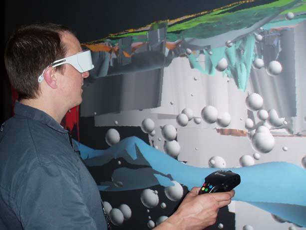
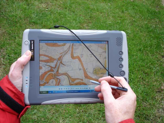
20 Virtual field reconnaissance & 3D surveying in the field
21 Delivering models to clients BGS has identified 5 User Requirements for 3D model Viewers Free Sold Licensed Thumbnails/Screenshots Frozen movies of models - *.avi, *.mov and flash Preview of model with interactive function 3D pdf The 3D geological map Subsurface Viewer The full model in 3D software LithoFrame model Increasing interactivity Not one technology will suit all purposes and we still have to work closely with customers, from schools to industry to find out what really works for them!


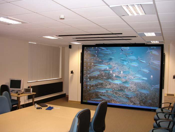
22 Live demonstration of the Subsurface Viewer The 3D geological map Key features of the Subsurface Viewer: JAVA based platform independent software is free for the client delivers full richness of geological model including property information user can export sections, maps and 3D view as raster maps potential for web-enabling enabling most importantly, it communicates our science
3D Geoscience models and their delivery to customers
 3D Geoscience models and their delivery to customers Holger Kessler, Mike Lelliott, Dave Bridge, Jon Ford, Hans-Georg Sobisch, Steve Mathers, Simon Price, Jo Merritt, Bruce Napier & Kate Royse GSA Annual
ASK Network Partnership
 ASK Network Partnership Hugh Barron & Diarmad Campbell, BGS NERC All rights reserved Scottish Water, Shieldhall, 30 August 2013 What is ASK? Accessing Subsurface Knowledge..a knowledge exchange network
3D attributed models for addressing environmental and engineering. geoscience problems in areas of urban regeneration a case study in
 Merritt, J.E. et al., 3D attributed models page 1 10/07/07 3D attributed models for addressing environmental and engineering geoscience problems in areas of urban regeneration a case study in Glasgow,
Development of a national geophysical log data archive: legacy data as a national asset
 Development of a national geophysical log data archive: legacy data as a national asset Andrew Kingdon & Mark Fellgett Contributions by Helen Bonsor & Diarmad Campbell aki@bgs.ac.uk 0115 936 3415 Preserving
A model of the Ipswich Urban area, geological mapping in 3D.
 A model of the Ipswich Urban area, geological mapping in 3D. Steve Mathers British Geological Survey, Keyworth, Nottingham E-mail sjma@bgs.ac.uk Background Over the last ten years the British Geological
Big data in the Geoscience: A portal to physical properties Andrew Kingdon, Mark Fellgett and Martin Nayembil
 Big data in the Geoscience: A portal to physical properties Andrew Kingdon, Mark Fellgett and Martin Nayembil British Geological Survey, Keyworth, Nottingham, NG12 5GG, aki@bgs.ac.uk Geosciences were early
Does the SDCP need inputs from geology?
 The British Geological Survey s Experience and Expertise in Supporting Projects such as the Sirte Depression Connection Project David Ovadia Director of International Kingsley Dunham Centre Keyworth Nottingham
Collaborative Geotechnical BIM technologies. Carl Grice Software Development Director (Keynetix) Holger Kessler - Team Leader Modelling Systems (BGS)
 Holger Kessler - Team Leader Modelling Systems (BGS)") Collaborative Geotechnical BIM technologies Carl Grice Software Development Director (Keynetix) Holger Kessler - Team Leader Modelling Systems (BGS) 1 2 3 Current Challenges R&D Project Proposed Solution
Collaborative Geotechnical BIM technologies Carl Grice Software Development Director (Keynetix) Holger Kessler - Team Leader Modelling Systems (BGS) 1 2 3 Current Challenges R&D Project Proposed Solution
Geological Models for Infrastructure Design:
 Geological Models for Infrastructure Design: Reducing Geotechnical Risk and Supporting Sustainability Alan Keith Turner Emeritus Professor of Geological Engineering CSM Visiting Research Associate - British
Geology Map Extracts. Geology Map Extracts. Report prepared for: Orkney Sustainable Energy Ltd 6 North End Road Stromness Orkney KW16 3AG
 Report prepared for: Orkney Sustainable Energy Ltd 6 North End Road Stromness Orkney KW16 3AG Geology Map Extracts This report is designed for users carrying out preliminary site assessments who require
User Guide: RADON POTENTIAL DATASET - England and Wales
 User Guide: RADON POTENTIAL DATASET - England and Wales This document provides information for users of the joint HPA-BGS RADON POTENTIAL DATASET for England and Wales. 1. Background to joint Health Protection
BGS landslide data and mapping in Britain
 BGS landslide data and mapping in Britain Peter Hobbs British Geological Survey prnh@bgs.ac.uk Kingsley Dunham Centre Keyworth Nottingham NG12 5GG Tel 0115 936 3100 Acknowledgements Thanks to: Andrew Gibson
GeoVisionary Virtual Fieldwork For Real Geologists
 Page 1 of 9 Monday, February 07, 2011 Subscribe Sitem Home News Articles Dialogue Events Blogs Resources Articles Features GeoVisionary Virtual Fieldwork For Real Geologists GeoVisionary Virtual Fieldwork
Geological 3D modelling of Quaternary sequences using GSI3D an example of the surroundings of Berne
 armasuisse Geological 3D modelling of Quaternary sequences using GSI3D an example of the surroundings of Berne 9 th Swiss Geoscience Meeting, Zurich 2011 Salomè Michael, Roland Baumberger, Nils Oesterling,
indigeo Consultants Pvt Ltd Geophysical Surveys Geological Surveys GIS & Data Solutions Image Processing indigeo Company Profile, Page 1
 indigeo Consultants Pvt Ltd Geophysical Surveys Geological Surveys GIS & Data Solutions Image Processing MM Corner, 3 rd Floor #58, Banaswadi Main Road Bangalore 560033 INDIA Ph: +91 80 41638310 Mob: +91
Demo Schedule and Abstracts
 2014 Paradigm Technology Roadshow - Brisbane Demo Schedule and Abstracts 11 June 2014 Hilton Hotel Brisbane, Australia www.pdgm.com Location: Brisbane Time Presentation Title Featured Technologies 3:00
Outline Brief Overview MapPlace Website Data Delivery & Map Themes Digital Geology
 BRITISH COLUMBIA GEOLOGICAL SURVEY Kirk Hancock Pat Desjardins Nick Massey BRITISH COLUMBIA Ministry of Energy and Mines Ward Kilby acknowledged developer of MapPlace Outline Brief Overview MapPlace Website
Geology 1:50,000 Maps Legends
 Geology 1:50,000 s Legends MGR WGR WMGR LSGR rtificial Ground and Landslip Made Ground (Undivided) Worked Ground (Undivided) Infilled Ground Landscaped Ground (Undivided) rtificial Deposit Void rtificial
Management of Geological Information for Mining Sector Development and Investment Attraction Examples from Uganda and Tanzania
 Mineral Wealth Conference 2016 Kampala / Uganda Management of Geological Information for Mining Sector Development and Investment Attraction Examples from Uganda and Tanzania Andreas Barth 1, Andreas Knobloch
Our Services. What We Do. How We Can Help. Contact us today: January (0)
") Listening and Understanding to Optimize our Efficiency Our Experience and Knowledge to Work for You Tailor-made Solutions to Meet your Needs Our Challenge is You Success What We Do Our Services GeoViz
Listening and Understanding to Optimize our Efficiency Our Experience and Knowledge to Work for You Tailor-made Solutions to Meet your Needs Our Challenge is You Success What We Do Our Services GeoViz
EMMA : ECDC Mapping and Multilayer Analysis A GIS enterprise solution to EU agency. Sharing experience and learning from the others
 EMMA : ECDC Mapping and Multilayer Analysis A GIS enterprise solution to EU agency. Sharing experience and learning from the others Lorenzo De Simone, GIS Expert/ EMMA Project Manager 2014 GIS Workshop,
GeoTeric. Overview. See the Geology Before you Interpret. Cognitive Interpretation Reveal the Geology, Interpret the Data, Validate your Model.
 GeoTeric Overview See the Geology Before you Interpret Cognitive Interpretation Reveal the Geology, Interpret the Data, Validate your Model. World Leading Cognitive Interpretation COGNITIVE bydesign CONDITION
Figure 1: The 3D Models for Teaching Team discussing learning points that can be explored through 3D geological models.
 3D models for teaching and learning geoscience Emma Ward Abstract Although 3D geological models have been used in teaching as early as 1841, recent developments in 3D geological modelling methods and visualisation
NEW PRODUCTS AND ADVANCEMENTS IN 3-D MODELLING PROTOCOLS BASED ON STUDIES IN THICK DRIFT AREAS IN ONTARIO, CANADA
 NEW PRODUCTS AND ADVANCEMENTS IN 3-D MODELLING PROTOCOLS BASED ON STUDIES IN THICK DRIFT AREAS IN ONTARIO, CANADA Abigail K. Burt and Andrew F. Bajc Ontario Geological Survey, 933 Ramsey Lake Road, Sudbury,
What is the scope for carbon capture and storage in Northern Ireland. Michelle Bentham
 What is the scope for carbon capture and storage in Northern Ireland Michelle Bentham Kingsley Dunham Centre Keyworth Nottingham NG12 5GG Tel 0115 936 3100 What is Carbon Capture and Storage? Capture of
Features and Benefits
 Autodesk LandXplorer Features and Benefits Use the Autodesk LandXplorer software family to help improve decision making, lower costs, view and share changes, and avoid the expense of creating physical
Canadian Board of Examiners for Professional Surveyors Core Syllabus Item C 5: GEOSPATIAL INFORMATION SYSTEMS
 Study Guide: Canadian Board of Examiners for Professional Surveyors Core Syllabus Item C 5: GEOSPATIAL INFORMATION SYSTEMS This guide presents some study questions with specific referral to the essential
3-D Geological Modelling at the OGS Products and Applications. I made a model!!! Now what?
 3-D Geological ling at the OGS Products and Applications or. I made a model!!! Now what? Abigail Burt Andy Bajc Riley Mulligan Desmond Rainsford John Dodge Meet the team Abigail Burt Andy Bajc Riley Mulligan
Dept. of Earth and Environmental Sciences, University of Waterloo, 200 University Ave W, Waterloo, Ontario, Canada, N2L 3G1 2
 A modelling strategy to develop a regional Quaternary geological model across rural and urban areas and administrative borders using existing geological information M. Ross 1, M. Parent 2, A. Taylor 1
Geological linework: communicating a surveyor s tacit understanding of uncertainty via expert elicitation Russell Lawley, Mark Barron and Katy Lee
 Geological linework: communicating a surveyor s tacit understanding of uncertainty via expert elicitation Russell Lawley, Mark Barron and Katy Lee Overview Drivers Background Geological scenarios SHELF
The Next Generation GIS/LIS A Surveys Information System Integrated within a GIS
 The Next Generation GIS/LIS A Surveys Information System Integrated within a GIS Michael F. WEIR, USA Key words: Linking, Snapping, GIS, Measurements, Measurement Data, GIS Features, Spatial Quality. SUMMARY
INSPIRE in the context of EC Directive 2002/49/EC on Environmental Noise
 INSPIRE in the context of EC Directive 2002/49/EC on Environmental Noise Simon Shilton Acustica Ltd, United Kingdom Nigel Jones Extrium Ltd, United Kingdom About the Authors www.acustica.co.uk Acoustics
Geovisionary software for 3D visualisation and petroleum exploration in southern Tajikistan
 Geovisionary software for 3D visualisation and petroleum exploration in southern Tajikistan Colm Jordan 1, Luke Bateson 1, Jennifer Bow 2, Andy Newell 3, Bruce Napier 1 and Rosemary Johnson Sabine 4 1
Using MAGIC to Access Spatial Imagery: Putting ER Mapper Image Web Server, ArcIMS and MrSID to work in your Library
 Using MAGIC to Access Spatial Imagery: Putting ER Mapper Image Web Server, ArcIMS and MrSID to work in your Library Patrick McGlamery Shirley Quintero University of Connecticut Libraries Building the Connecticut
Imagery and the Location-enabled Platform in State and Local Government
 Imagery and the Location-enabled Platform in State and Local Government Fred Limp, Director, CAST Jim Farley, Vice President, Leica Geosystems Oracle Spatial Users Group Denver, March 10, 2005 TM TM Discussion
Near Surface Geophysics
 Near Surface Geophysics The Geological Society Careers Day, Nottingham 2017 Tim Grossey CGeol Director Geophysics, RSK Geosciences Copyright of RSK 24 November 2017 1 What is Geophysics? Earth science
Economic information for planning
 Economic information for planning Fiona McEvoy Economic Geologist and GIS Specialist Kingsley Dunham Centre Keyworth Nottingham NG12 5GG Tel 0115 936 3100 Overview Original MIST project environmentally
The Canadian Ceoscience Knowledge Network. - A Collaborative Effort for Unified Access to Ceoscience Data
 The Canadian Ceoscience Knowledge Network - A Collaborative Effort for Unified Access to Ceoscience Data The Canadian Geoscience Knowledge Network A Collaborative Effort for Unified Access to Geoscience
EDUCATION DAYS RIO DE JANEIRO AUGUST 2018 I RIO DE JANEIRO, BRAZIL.
 EDUCATION DAYS RIO DE JANEIRO 2018 27 31 AUGUST 2018 I RIO DE JANEIRO, BRAZIL www.learninggeoscience.org Welcome to Rio! EAGE is pleased to invite you to visit Rio de Janeiro for our Education Days Rio
Geotechnical Data for Transportation Infrastructure. Tim Spink, Mott MacDonald
 Geotechnical Data for Transportation Infrastructure Tim Spink, Mott MacDonald The transportation geotechnical asset Foundations Tunnels Road & track bed Earthworks Also supports: communication lines noise
Geosciences Data Digitize and Materialize, Standardization Based on Logical Inter- Domain Relationships GeoDMS
 Geosciences Data Digitize and Materialize, Standardization Based on Logical Inter- Domain Relationships GeoDMS Somayeh Veiseh Iran, Corresponding author: Geological Survey of Iran, Azadi Sq, Meraj St,
Blog. Infraworks 360 Model Creation Process. by David Crowther
 Page 1 of 6 Infraworks 360 Model Creation Process by David Crowther Cadline has a team of geospatial specialists with expertise in the integration of both CAD and GIS applications, and so were asked to
ArcGIS. for Server. Understanding our World
 ArcGIS for Server Understanding our World ArcGIS for Server Create, Distribute, and Manage GIS Services You can use ArcGIS for Server to create services from your mapping and geographic information system
OPEN ACCESS GEOLOGY: USING THE INSTITUTIONAL REPOSITORY TO HOST STATE GEOLOGICAL SURVEY PUBLICATIONS
 OPEN ACCESS GEOLOGY: USING THE INSTITUTIONAL REPOSITORY TO HOST STATE GEOLOGICAL SURVEY PUBLICATIONS Lisa Johnston and Harvey Thorleifson Science and Engineering Library, University of Minnesota, 108 Walter
ZONES ZONES LANDING GEOLOGY WELLBORE QUICKLY IDENTIFY WHITE PAPER CLEARFORK UPPER SPRABERRY LOWER SPRABERRY WOLFCAMP A WOLFCAMP B WOLFCAMP C
 GEOLOGY ZONES QUICKLY IDENTIFY CLEARFORK UPPER SPRABERRY LOWER SPRABERRY WOLFCAMP A WELLBORE LANDING ZONES WOLFCAMP B WOLFCAMP C WHITE PAPER WOLFCAMP D GEOLOGY ZONES: Introduction Avg - cum12monthsoil
Geosciences Career Pathways (Including Alternative Energy)
") Geosciences Career Pathways (Including Alternative Energy) Shale Carbonates Clastics Unconventionals Geology Characterization and Production Properties of Gas Shales Geomechanics in International Shale
Geosciences Career Pathways (Including Alternative Energy) Shale Carbonates Clastics Unconventionals Geology Characterization and Production Properties of Gas Shales Geomechanics in International Shale
MineScape Geological modelling, mine planning and design
 INTELLIGENT MINING SOLUTIONS MineScape Geological modelling, mine planning and design Specifically developed to meet the mining industry s rigorous demands, MineScape is used at more than 200 of the world
MULTI-SENSOR CORE LOGGING (MSCL) AND X-RAY RADIOGRAPHY CORE LOGGING SERVICES
 AND X-RAY RADIOGRAPHY CORE LOGGING SERVICES") MULTI-SENSOR CORE LOGGING (MSCL) AND X-RAY RADIOGRAPHY CORE LOGGING SERVICES IF CORE S WORTH TAKING, IT S WORTH LOGGING MSCL APPLICATIONS Any core material collected for a science or engineering objective
MULTI-SENSOR CORE LOGGING (MSCL) AND X-RAY RADIOGRAPHY CORE LOGGING SERVICES IF CORE S WORTH TAKING, IT S WORTH LOGGING MSCL APPLICATIONS Any core material collected for a science or engineering objective
Bridging the Gap between Engineering and GIS
 Bridging the Gap between Engineering and GIS Presented by: Karen Stewart, B.Tech, GISP Manager of Geomatics Township of Langley February 13, 2006 Agenda Introduction History Goals Implementation Benefits
Introduction to the 176A labs and ArcGIS Purpose of the labs
 Introduction to the 176A labs and ArcGIS Purpose of the labs Acknowledgement: Slides by David Maidment, U Texas-Austin and Francisco Olivera (TAMU) Hands-on experience with a leading software package Introduction
Geofacets Seminar & Interactive Workshop
 Geofacets Seminar & Workshop University of Bergen Geofacets Seminar & Interactive Workshop UNIVERSITY OF BERGEN Sandra Merten Geofacets Product Manager University of Bergen, 22 March 2017 Geofacets Seminar
Geological information for Europe : Towards a pan-european Geological Data Infrastructure
 Geological information for Europe : Towards a pan-european Geological Data Infrastructure Integrating geoscientific information for EU competitiveness Co-funded by the European Union European societal
Geology 1:10,000 Maps Legends
 Geology 1:10,000 s Legends WGR DDGR LSGR MGR SLIP HED LV HYHD rtificial Ground and Landslip Worked Ground (Undivided) Disturbed Ground (Undivided) Landscaped Ground (Undivided) Made Ground (Undivided)
Managing the mining cycle using GeoVisionary
 Terrington / Napier / Büchi / Procópio: Managing the mining cycle using GeoVisionary 1 Managing the mining cycle using GeoVisionary R. Terrington & B. Napier, British Geological Survey, UK A. Büchi, Coffey
Three Dimensional Modeling of Geological Parameters in Volcanic Geothermal Systems. Part I Methods and Data.
 Proceedings World Geothermal Congress 2015 Melbourne, Australia, 19-25 April 2015 Three Dimensional Modeling of Geological Parameters in Volcanic Geothermal Systems. Part I Methods and Data. Gunnlaugur
Outline. What is MapPlace? MapPlace Toolbar & PopUp Menu. Geology Themes 1:5M 1:1M BCGS 1:250,000. Terranes
 Outline BRITISH COLUMBIA Overview and Explore MapPlace Website Data Delivery & Map Themes Data Sources & Updates Feature Topics New Data & Maps New MINFILE Online Exploration Assistant with Image Analysis
ERDAS ER Mapper Software
 ERDAS ER Mapper Software ER Mapper professional software is widely used in exploration industry and geologist worldwide for satellite image exploitation. It is known for its:- Powerful image processing
GIS: Introductory Guide to MapPlace. Workshop Agenda. How the Maps Work. Geographic Information Systems. -The MapPlace is a web GIS application
 1 Introductory Guide to MapPlace Workshop 2007 Larry Jones MapPlace & Geoscience Databases Pat Desjardins Corporate GIS Gib McArthur Manager, Resource Information Kirk Hancock MINFILE Geologist Ward Kilby
Geoinformation as a basis for the sustainable use of the subsurface. (Northern Germany)
") Geoinformation as a basis for the sustainable use of the subsurface An approach from Lower Saxony (Northern Germany) Jörg Elbracht, Hans Joachim Heineke & Udo Müller Geologic Survey of Lower Saxony Dep.
Geoinformation as a basis for the sustainable use of the subsurface An approach from Lower Saxony (Northern Germany) Jörg Elbracht, Hans Joachim Heineke & Udo Müller Geologic Survey of Lower Saxony Dep.
3D-NORGE: A NEW PROJECT TO BUILD A 3D BEDROCK MAP OF NORWAY
 3D-NORGE: A NEW PROJECT TO BUILD A 3D BEDROCK MAP OF NORWAY Henderson; I.H.C. & Grøtan, B.O. Geological Survey of Norway, Leif Eirikssons Veg 39, 7491, Trondheim, iain.henderson@ngu.no 1. INTRODUCTION
ZFL, Center of Remote Sensing of Land Surfaces, University of Bonn, Germany. Geographical Institute, University of Bonn, Germany
 Communication of Research Results The IMPETUS Atlas H.-P. Thamm 1, M. Judex 1, O.Schultz 2, S.Krüger 1 & M. Christoph 3 1 ZFL, Center of Remote Sensing of Land Surfaces, University of Bonn, Germany 2 Geographical
Mineral Exploration Using GIS
 King Fahad University of Petroleum and Minerals City and Regional Planning Department CRP 514: Introduction to GIS Term 112 Mineral Exploration Using GIS Term paper presentation By Mutasim Osman ID # g201105050
Introduction to the 176A labs and ArcGIS
 Introduction to the 176A labs and ArcGIS Acknowledgement: Slides by David Maidment, U Texas-Austin and Francisco Olivera (TAMU) Purpose of the labs Hands-on experience with one software pakage Introduction
Mineral Resources Branch. Natural Resources
 Mineral Resources Branch Natural Resources ! Brian Fisher - Geologist / GIS Specialist - supervisor! Jeff Poole - Geologist / GIS Specialist - IMS specialist! John MacNeil - Geologist / GIS Specialist
Building an Enterprise GIS for Chicago s Water Reclamation District
 Building an Enterprise GIS for Chicago s Water Reclamation District Presenters Presented at the 2010 ESRI User Conference Authored and Presented By Sanjay Patel, PE, CEM, CMRP Metropolitan Water Reclamation
Innovation. The Push and Pull at ESRI. September Kevin Daugherty Cadastral/Land Records Industry Solutions Manager
 Innovation The Push and Pull at ESRI September 2004 Kevin Daugherty Cadastral/Land Records Industry Solutions Manager The Push and The Pull The Push is the information technology that drives research and
Horda Platform Charge Atlas A MULTI-CLIENT STUDY
 Horda Platform Charge Atlas Migris now offers a study assessing the probabilities of hydrocarbon charge in the Horda Platform area. A MULTI-CLIENT STUDY DELIVERABLES The results of the study are delivered
User Guide Mining Hazard (not including coal) in Great Britain (version 5). Open Report OR/10/046
 in Great Britain (version 5). Open Report OR/10/046") User Guide Mining Hazard (not including coal) in Great Britain (version 5). Open Report OR/10/046 Contents Contents... 2 Introduction... 3 Background... 3 What the dataset shows... 3 Class Descriptions...
User Guide Mining Hazard (not including coal) in Great Britain (version 5). Open Report OR/10/046 Contents Contents... 2 Introduction... 3 Background... 3 What the dataset shows... 3 Class Descriptions...
William Smith Exhibition A Level Geology Challenge
 William Smith Exhibition A Level Geology Challenge RELEVANT TO GEOLOGY GCE A LEVEL SYLLABUS About this resource This resource for A Level has been written to support the William Smith Maps exhibition,
Road Ahead: Linear Referencing and UPDM
 Road Ahead: Linear Referencing and UPDM Esri European Petroleum GIS Conference November 7, 2014 Congress Centre, London Your Work Making a Difference ArcGIS Is Evolving Your GIS Is Becoming Part of an
BHP Billiton Mineral Exploration Perspective Mineral Exploration Imperatives [Key Business Drivers]
![BHP Billiton Mineral Exploration Perspective Mineral Exploration Imperatives [Key Business Drivers]](/thumbs/74/70001151.jpg "BHP Billiton Mineral Exploration Perspective Mineral Exploration Imperatives [Key Business Drivers]") BHP Billiton Mineral Exploration Perspective Mineral Exploration Imperatives [Key Business Drivers] Solid Earth and Environment Grid CANBERRA, July 2003 Liedeke Bosma Chief Geologist Knowledge Management
BHP Billiton Mineral Exploration Perspective Mineral Exploration Imperatives [Key Business Drivers] Solid Earth and Environment Grid CANBERRA, July 2003 Liedeke Bosma Chief Geologist Knowledge Management
The MapPlace Using Web-Based Mineral Exploration Data as an Environmental Tool
 The MapPlace Using Web-Based Mineral Exploration Data as an Environmental Tool David Tupper PGeo Pottinger Gaherty Environmental Consultants Ltd Ward Kilby PGeo Cal Data Ltd Larry Jones PGeo BC Ministry
ESRI Survey Summit August Clint Brown Director of ESRI Software Products
 ESRI Survey Summit August 2006 Clint Brown Director of ESRI Software Products Cadastral Fabric How does Cadastral fit with Survey? Surveyors process raw field observations Survey measurements define high-order
The World Bank and the Open Geospatial Web. Chris Holmes
 The World Bank and the Open Geospatial Web Chris Holmes Geospatial is Everywhere QuickTime and a TIFF (Uncompressed) decompressor are needed to see this picture. Spatial Data Infrastructure (SDI) the sources,
ESRI Delivering geographic information systems to millions of users
 Using Web GIS to Track Government Spending and Performance Eric Floss - ESRI April 12, 2010 ESRI Delivering geographic information systems to millions of users GIS Is Changing Everything How We Reason
Map Name(s) and Date(s) Historical Map - Slice A
 and Date(s) Historical Map - Slice A") VectorMap Local Published 2016 Source map scale - 1:10,000 VectorMap Local (Raster) is Ordnance Survey's highest detailed 'backdrop' mapping product. These maps are produced from OS's VectorMap Local,
VectorMap Local Published 2016 Source map scale - 1:10,000 VectorMap Local (Raster) is Ordnance Survey's highest detailed 'backdrop' mapping product. These maps are produced from OS's VectorMap Local,
Model metadata report for Manchester and Salford, NW England. Land Use Planning and Development Programme Open Report OR/12/068
 Model metadata report for Manchester and Salford, NW England Land Use Planning and Development Programme Open Report OR/12/068 BRITISH GEOLOGICAL SURVEY Land Use Planning and Development PROGRAMME OPEN
A Temporal Hydrologic Database for Rapidly Changing Landscapes
 A Temporal Hydrologic Database for Rapidly Changing Landscapes Using Mt. St. Helens in Washington as a Pilot Site Adam Mosbrucker Geog 575 BACKGROUND: Client / User U.S. Geological Survey Cascades Volcano
Data Aggregation with InfraWorks and ArcGIS for Visualization, Analysis, and Planning
 Data Aggregation with InfraWorks and ArcGIS for Visualization, Analysis, and Planning Stephen Brockwell President, Brockwell IT Consulting, Inc. Join the conversation #AU2017 KEYWORD Class Summary Silos
3D Urban Information Models in making a smart city the i-scope project case study
 UDC: 007:528.9]:004; 007:912]:004; 004.92 DOI: 10.14438/gn.2014.17 Typology: 1.04 Professional Article 3D Urban Information Models in making a smart city the i-scope project case study Dragutin PROTIĆ
The geological map database of Great Britain: Version One complete. So what's next?
 The geological map database of Greatain: Version One complete. Keyworth, Nottingham, UK NG12 5GG Email: ij@bgs.ac.uk Tel: +44 115 9363214 Fax: +44 115 9363269 Web: http://www.bgs.ac.uk ABSTRACT So what's
Digital Cartography in the Royal Library - the National Library of Sweden
 LIBER QUARTERLY, ISSN 1435-5205 LIBER 1999. All rights reserved K.G. Saur, Munich. Printed in Germany Digital Cartography in the Royal Library - the National Library of Sweden by GÖRAN BÄÄRNHIELM Digital
Press kit Kartotrak 2014 June 2nd, 2014
 Press kit Kartotrak 2014 June 2nd, 2014 Worldwide leader in Geostatistics, Geovariances enables its clients involved with mapping, resource estimation or risk analysis to benefit from more than 25 years
Delivering Met to the Military User
 Delivering Met to the Military User Andy Kirkman Met Office Defence Business Manager ECMWF MOS Workshop - November 2007 Crown copyright 2006 Page 1 Delivering Met to the Military User This Presentation
HertfordshireCC GIS Standards (draft) Contents
 Contents") Standards for Geographic Information Systems Contents Requirements for the procurement of systems with mapping/gis functionality...2 Background...2 System Requirements...2 HCC Corporate Standard for Spatial
Standards for Geographic Information Systems Contents Requirements for the procurement of systems with mapping/gis functionality...2 Background...2 System Requirements...2 HCC Corporate Standard for Spatial
GTK GeoKernel and Data Management. Material from Niina Ahtonen, Esa Kauniskangas and Tero Rönkkö
 GTK GeoKernel and Data Management Esa Kauniskangas 31.5.2010 Material from Niina Ahtonen, Esa Kauniskangas and Tero Rönkkö 1 GTK s operational areas Northern Finland Office Rovaniemi Western Finland Office
SOLUTIONS ADVANCED GIS. TekMindz are developing innovative solutions that integrate geographic information with niche business applications.
 ADVANCED GIS SOLUTIONS TekMindz are developing innovative solutions that integrate geographic information with niche business applications. TEK INDZ TM GIS Services Overview At the leading edge of geospatial
TATA CHEMICALS MAGADI LIMITED (Mining Section) TRONA CRUSHING PLANT AND PREWASH TANK FACILITY PROJECT
 TRONA CRUSHING PLANT AND PREWASH TANK FACILITY PROJECT") 1 TATA CHEMICALS MAGADI LIMITED (Mining Section) TRONA CRUSHING PLANT AND PREWASH TANK FACILITY PROJECT RFQ for Geotechnical Investigations and Foundation Recommendations TCML/MS/RFQ1/2017 October 2017
1 TATA CHEMICALS MAGADI LIMITED (Mining Section) TRONA CRUSHING PLANT AND PREWASH TANK FACILITY PROJECT RFQ for Geotechnical Investigations and Foundation Recommendations TCML/MS/RFQ1/2017 October 2017
New mapping of natural and manmade radioactivity
 New mapping of natural and manmade radioactivity Cathy Scheib and Dave Jones Acknowledgements: Tellus and JAC teams; Don Appleton (BGS); Jon Miles & Martyn Green (HPA); Robert Lamour (EHSNI); David Sanderson
THE DIGITAL TERRAIN MAP LIBRARY: AN EXPLORATIONIST S RESOURCE
 THE DIGITAL TERRAIN MAP LIBRARY: AN EXPLORATIONIST S RESOURCE By I.C.L. Webster, P.J. Desjardins and W.E. Kilby KEYWORDS: digital terrain maps, digital terrain stability maps, surficial geology, GIS, raster
Table 1 - Checklist of Assessment and Reporting Criteria (The JORC Code, 2012 Edition)
") DINGO (PEARL CREEK) PROJECT JORC RESOURCE Table 1 - Checklist of Assessment and Reporting Criteria (The JORC Code, 2012 Edition) The following table provides a summary of important assessment and reporting
DINGO (PEARL CREEK) PROJECT JORC RESOURCE Table 1 - Checklist of Assessment and Reporting Criteria (The JORC Code, 2012 Edition) The following table provides a summary of important assessment and reporting
CPR 514 Term Paper Haitham Alsahfy G
 CPR 514 Term Paper 2011 Haitham Alsahfy G201001540 Submitted to : Dr. Bager Al Ramadan Date : 1/1/2012 Abstract: GIS is a fundamental tool for success in Oil and Gas exploration operations. It usually
Use and implementation of standards Formatting and viewing geological logs. Sytze van Heteren and Helen Glaves
 Use and implementation of standards Formatting and viewing geological logs Sytze van Heteren and Helen Glaves Pieter Bruegel the Elder, ca. 1563 The Little Tower of Babel Museum Boijmans Van Beuningen,
TECHNICAL STUDIES. rpsgroup.com/energy
 TECHNICAL STUDIES RPS Energy - a global energy consultancy RPS Energy is part of the RPS Group plc, a FTSE 250 company with an annual turnover of $700m and over 4700 employees. As one of the world s leading
ESRI educational site license in Bahir Dar University. Tegegn Molla Abebe Mengaw Geospatial Data and Technology Center, BDU
 ESRI educational site license in Bahir Dar University Tegegn Molla Abebe Mengaw Geospatial Data and Technology Center, BDU September, 2016 Mission, Vision Purpose and Values of the GDTC Mission of GDTC
Pan-Arctic Digital Elevation Map (Pan-Arctic DEM)
") Memorandum to CAFF Board 07/28/2017 BACKGROUND: Pan-Arctic Digital Elevation Map (Pan-Arctic DEM) ArcticDEM is a National Geospatial-Intelligence Agency (NGA)-National Science Foundation (NSF) publicprivate
Memorandum to CAFF Board 07/28/2017 BACKGROUND: Pan-Arctic Digital Elevation Map (Pan-Arctic DEM) ArcticDEM is a National Geospatial-Intelligence Agency (NGA)-National Science Foundation (NSF) publicprivate
AAPG European Region Annual Conference Paris-Malmaison, France November RESOURCES PERSPECTIVES of the SOUTHERN PERMIAN BASIN AREA
 AAPG European Region Annual Conference Paris-Malmaison, France 23-24 November 2009 RESOURCES PERSPECTIVES of the SOUTHERN PERMIAN BASIN AREA J.C. DOORNENBAL, TNO Built, Environment and Geosciences, Geological
(2008) 8 (6) ISSN
 8 (6) ISSN") Le Cozannet, Gonéri and Hosford, Steven and Douglas, John and Serrano, Jean-Jacques and Coraboeuf, Damien and Comte, Jérémie (2008) Connecting hazard analysts and risk managers to sensor information. Sensors,
Le Cozannet, Gonéri and Hosford, Steven and Douglas, John and Serrano, Jean-Jacques and Coraboeuf, Damien and Comte, Jérémie (2008) Connecting hazard analysts and risk managers to sensor information. Sensors,
Reaxys Medicinal Chemistry Fact Sheet
 R&D SOLUTIONS FOR PHARMA & LIFE SCIENCES Reaxys Medicinal Chemistry Fact Sheet Essential data for lead identification and optimization Reaxys Medicinal Chemistry empowers early discovery in drug development
Agenda. Status of GI activities. NGII Framework. SDI from the national policy perspective
 Towards a National Geographic Information Infrastructure: Overcoming Impediments to the Development of SDI in Nepal R.R. Chhatkuli Email: chhatkuli@ngiip.gov.np & D.M. Kayastha Email: chhatkuli@ngiip.gov.np