PUBLICATIONS Guidebook; San Juan Basin, New Mexico and Colorado; 153 pages, 40 illustrations, edited by V. C. Kelley et al.
|
|
|
- Malcolm Taylor
- 6 years ago
- Views:
Transcription
1 ,,,., "; " i ",!, r. PUBLICATIONS Guidebook; San Juan Basin, New Mexico and Colorado; 153 pages, 40 illustrations, edited by V. C. Kelley et al. (out of print) Guidebook; South and west sides of the San Juan Basin, New Mexico and Arizona; 163 pages, 69 illustrations, edited by Clay T. Smith and Caswell Silver. (out of print) Guidebook; Rio Grande Country, central New Mexico; 126 pages, 51 illustrations, edited by Ross B. Johnson and Charles B. Read Guidebook; Southwestern New l~iexico; 156 pages, 67 illustrations, edited by Frank E. Kottlowsld et al Guidebook; Southeastel~ New Mexico; 213 pages, 83 illustrations edited by T. F. Stipp Guidebook; S0uth-central l~ew Mexico; 193 pages; 70 illustrations, edited by J. Paul Fitzsimmons. These publications may be purchased over the co,rater the New ~e~co Bureau of i~ines and i~iineral Resources, Socorro, New l~exico; and at the Geology Department, University of New I~exico, Albuquerque, New Mexico. They may be ordered by matl from the Director, New Me, co Bureau of l~ines and hdlneral Resources, Socorro, New Mexico.
2 NEW MEXICO GEOLOGICAL SOCIETY. Guidebook OF SOUTHEASTERN SANGRE DE CRISTO MOUNTAINS NEW MEXICO SEVENTH FIELD CONFERENCE OCTOBER 19, 20 & 21, 1956

3
4 NEW MEXICO GEOLOGICAL SOCIETY * SEVENTH FIELD CONFERENCE CONTENTS New Mexico Geological Society, Officers and Committees... 7 Acknowledgements... 8 Schedule... 9 Instructions... : 12 Introduction By A. Rosenzweig First Day of Field Conference Resume of Geology Road Log Second Day of Conference Resume of Geology Road Log... :.- 53 Third Day of Conference Resume of Geology Road Log Supplemental Road Log, Mora to Sapello Notes on the Geology of the Southeastern Sangre de Cristo Mountains, New Mexi co By E. H. Baltz and G. O. Bachmanl The Rio Grande Depression from Taos to Santa Fe By V. C. Kelley The Santa Fe Group of North- Central New Mexico By Brewster Baldwin Late Cretaceous and Tertiaery Stratigraphy of the Raton Basin of New Mexico and Colorado By R. B. Johnson, G. H. Dixon, and A. A. Wanek Stratigraphy of the Plains Area Adjacent to the Sangre de Cristo Mountains, New Mexico By R. L. Griggs and S. A. Northrop Mining in the Southern Part of the Sangre de Cristo Mountains By E. C. Anderson Precambrian Geology of the Picuris Range, North- Central New Mexico By Arther Montgomery Members of the New Mexico Geological Society Business and Professional Directory..:
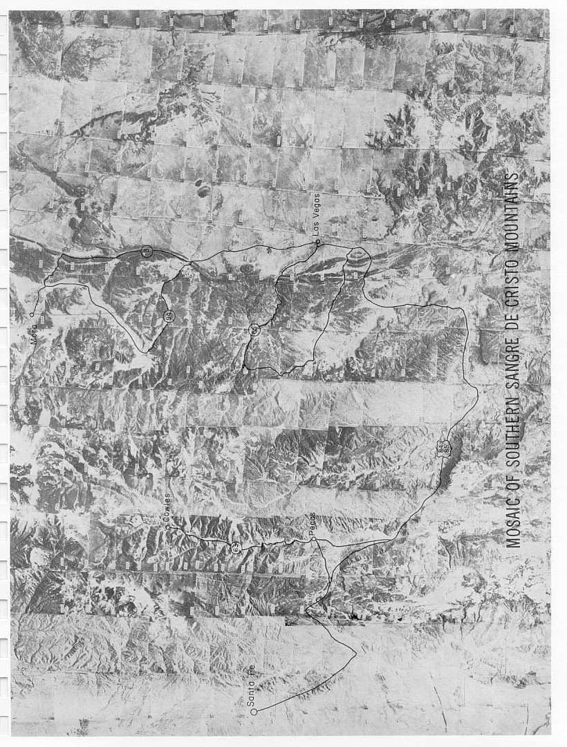
5 NEW MEXICO GEOLOGICAL SOCIETY SEVENTH FIELD CONFERENCE ILLUSTRATIONS Red River pass from ReJica Peak north of Wheeler Peak... Frontispiece Mosaic of Southern Sangre de Cristo Mountains Graphic sections of Magdalena group and Sangre de Cristo formation in the Southern Songre de Cristo Mountains Map showing the thickness of rocks from the base of the Magdalena group to the top of the Abo or Sangre de Cristo formation Graphic sections of Permian rocks in the southern Sangre de Cristo Mountains Map showing combined thickness of Yeso and San Adres formations Index to maps for first day Map Map Explanation for geologic maps 1-2 and Map West wall of Pecos River canyon at Dalton Campground West side of Pecos River at Terrero near Stop View to north through gorge of Pecos River Map Glorieta Mesa from Pecos State Monument, Stop Bernal Butte Map Explanation for maps 1-5, 1-6, 2-3, and Map 1-6 and Graphic sections of Paleozoic rocks in parts of Mora County, New Mexico Index to maps for second day Map View of east front of Elk Mountain Range from Stop I Southeast side of Hermit s Peak Panoramic view south side of Gallinas River at Montezuma, Stop Map Map East front of the mountains from north of Storrie Lake... 66
6 NEW MEXICO GEOLOGICAL SOCIETY * SEVENTH FIELD CONFERENCE Map P, ioherm in black shale of upper Sandia formation View to north of wind gap south of Mora River at Stop :2 Map View to theast from Holman Hill atstop North side of Rio Pueblo canyon at Tres Riteski area Cross- bedded conglomeatic sandstone of the Sandia formation; north side of Rio Pueblo canyon North side of Rio Pueblo canyon west of bridge at Stop Map 2-7 and View to northeast across Taos Index to road maps for third day Map Panoramic view of Moreno Valley to the north East side of Moreno Valley near Monte Verde Ranch Hill north of Eagle Nest between dam and Eagle Nest Lodge Panoramic view of north side of Comanche Creek west of Mutz Ranch Geographic and physiographic features of the southern Sangre de Cri sto mountains Relations of Paleozoic rocks in the southeastern Sangre de Cristo mountains Principal structural features of the southeastern Sangre de Cristo mountains and adjacent region in New Mexico Structural profiles across parts of the southeastern Sangre de Cristo mountains and adjacent region Tectonic map of the Rio Grande depression and adjacent regions between Santa Fe and Taos, New Mexico Regional sketch map of the Rio Grande valley and its environs Nomenclature and tentative correlations of units in the Santa Fe group Map of the structural Raton Basin of New Mexico and Colorado Upper Cretaceous and Tertiary formations of the Raton Mesa region and Huerfano Park Contact relationships of Vermejo formation, Trinidad sandstone, and Pierre shale between Cimmaron and Dawson, New Mexico I sopach map of the Trinidad sandstone in the Raton Mesa region of Colorado and New Mexico... "126
7 NEW MEXICO GEOLOGICAL SOCIETY * SEVENTH FIELD CONFERENCE I sopach map of the Vermejo formation in the Rafon Mesa region of Colorado and New Mexico Diagram showing inferred intertonguing relationships of the Poison Canyon formation and Raton formation between Weston, Colorado and Ute Park, New Mexico Contact relationships between Poison Canyon formation and underlying Tertiary and Cretaceous formations from vicinity of Trinidad, Colorado to southern part of Huerfano Park, Colorado Index of mining districts in the southern part of the Sangre de Cristo mountains Geologic map of the Picuris Range
8 NEW MEXICO GEOLOGICAL SOCIETY * SEVENTH FIELD CONFERENCE NEW MEXICO GEOLOGICAL SOCIETY OFFICERS Clay T. Smith President New Mexico Institute of Mining and Technology Brewster Baldwin Vice President State Bureau of Mines Sherman A. Wengerd Secretary University of New Mexico J. Paul Fitzsimmons Treasurer University of New Mexico FIELD CONFERENCE COMMITTEE General chairman Brewster Baldwin State Bureau of Mines Road Log Trip arrangements Charles B. Read U.S. Geological Survey Elmer Baltz U.S. Geological Survey R. W. Foster State Bureau of Mines Willian E. Hale U.S. Geological Survey Frank Titus U.S. Geological Survey Reservations Zane Spiegel State Engineer P s Office Editor A. Rosenzweig University of New Mexico Assistant editor Philip T. Hayes U.S. Geological Survey Publicity Sidney Spiegel Consultant Advertising Paul M. Laird Sinclair Oil & Gas Company
9 NEW MEXICO GEOLOGICAL SOCIETY * SEVENTH FIELD CONFERENCE ACKNOWLEDGEMENTS The New Mexico GeoJogicaJ Society and the members of the Conference Committee wish to acknowledge with gratitude and appreciatation the assistance and cooperation of all those mem- 10ers, individuals, organizations and advertisers who have contributed to the field conference and guidebook. The society is particularly.indebted to the authors of the various papers appearing in the guidebook. These individuals have contributed generously of their time and knowledge to furnish.invaluable material for the conference. A special word of thanks is due those persons whose efforts resulted in the road logs and geological resumes which are the core of our activities. To the Mutz brothers of EagJe Nest, Ed Springer, and the Monte Verde Ranch, a word of thanks for permitting us to cross and trample their fertile fields. Both speakers and audience af the various stops will be grateful to James W. McClure and the Lane-Wells Company for furnishing the sound equipment used on this trip. Our sincere thanks to the New Mexico State Police, and especially those officers accompanying the caravan, for their assistance and cooperation in managing so long astring of cars. Finally, our appreciation to the following organizations and their personnel who have contributed so generously of their time: the New Mexico Institute of Mining and Technology, the State Bureau of Mines, the State Engineer s Office, the University of New Mexico, and the United States Geological Survey.
10 NEW MEXICO GEOLOGICAL SOCIETY * SEVENTH FIELD CONFERENCE SCHEDULE Thursday, October 18. Friday, October 19. 3:00 pm to 10:00 pm. Registration. Lobby of the La Fonda Hotel, Santa Fe. 7:30 am Caravan assembles (see road log). 8:00 am Caravan leaves Santa Fe. 12:00 n Lunch at Cowles. Saturday, October 20. Sunday, October 21. 6:00 pm Caravan arrives in Las Vegas. 7:30 am Caravan assembles (see road log). 8:00 am Caravan leaves Las Vegas. 12:30 pm Lunch south of Mora. 6:30 pm Caravan arrives in Taos. 8:00 pm Banquet -Smorgasbord, Sagebrush Inn, Taos. 7:30 am Caravan assembles (see road log). 8:00 am Caravan leaves Taos. 12:00 n Lunch at Eagle Nest (pit barbeque). 4:00 pm Conference disbands at Stop 4. 9

11
12
NEW MEXICO GEOLOGICAL SOCIETY
 NEW MEXICO GEOLOGICAL SOCIETY. Guidebook OF SOUTHEASTERN SANGRE DE CRISTO MOUNTAINS NEW MEXICO SEVENTH FIELD CONFERENCE OCTOBER 19, 20 & 21, 1956 CONTENTS New Mexico Geological Society, Officers and Committees...
NEW MEXICO GEOLOGICAL SOCIETY. N M i ~-. G S ~--~ I-1. Guidebook SOUTHWESTERN NEW MEXICO FOURTH FIELD CONFERENCE. October & 18, 1953
 NEW MEXICO GEOLOGICAL SOCIETY N M i ~-. G S ~--~ I-1 Guidebook OF SOUTHWESTERN NEW MEXICO FOURTH FIELD CONFERENCE October 15-16-17 & 18, 1953 NEW MEXICO GEOLOGICAL SOCIETY * FOURTH FIELD CONFERENCE * SOUTHWESTER
FOREWORD C. E. CHAPIN W. E. ELSTON. Frontispiece: Socorro Peak from campus of New Mexico Institute of Mining and Technology (Photo by H. L.
 .. st ^ :%''L.: FOREWORD This volume has been prepared for the spring meeting of the New Mexico Geological Society, May 17-20, 1978. Previous spring meetings of the Society have generally consisted of
SOUTHWESTERN SAN JUAN MOUNTAINS COLORADO EIGHTH FIELD CONFERENCE SEPTEMBER 5, 6 & 7, 1957
 NEW MEXICO GEOLOGICAL SOCIETY Guidebook I OF SOUTHWESTERN SAN JUAN MOUNTAINS COLORADO EIGHTH FIELD CONFERENCE SEPTEMBER 5, 6 & 7, 1957 N E W M E X I C O G E O L O G I C A L S O C I E T Y * E I G H T H
New Mexico Geological Society
 New Mexico Geological Society Downloaded from: http://nmgs.nmt.edu/publications/guidebooks/27 Structural framework of the southern Raton Basin, New Mexico Lee A. Woodward and D. O. Snyder, 1976, pp. 125-127
GUIDEBOOK OF VERMEJO PARK NORTHEASTERN NEW MEXICO. , Editors R O D N E Y C. E W I N G B A R R Y S. K U E S t- 7: i tt t i I - 7
 GUIDEBOOK OF VERMEJO PARK NORTHEASTERN NEW MEXICO, Editors R O D N E Y C. E W I N G B A R R Y S. K U E S. 1..t- 7: i tt t i I - 7 NEW MEXICO GEOLOGICAL SOCIETY CONTENTS President's Message Committees vii
New Mexico Geological Society
 New Mexico Geological Society Downloaded from: http://nmgs.nmt.edu/publications/guidebooks/25 Structure of the Guadalupe Box area, Sandoval County, New Mexico Harvey R. DuChene, 1974, pp. 131-135 in: Ghost
Cretaceous Shelf Sandstones and Shelf Depositional Sequences, Western Interior Basin, Utah, Colorado and New Mexico
 Cretaceous Shelf Sandstones and Shelf Depositional Sequences, Western Interior Basin, Utah, Colorado and New Mexico Salt Lake City, Utah to Albuquerque, New Mexico June 30-July 7, 1989 Field Trip Guidebook
EAST-Ck\TRAL \EW MIHXICO
 QUID 111300K of EAST-Ck\TRAL \EW MIHXICO EDITORS Vincent C. Kelley Frederick D. Trauger NEW MEXICO GEOLOGICAL SOCIETY TWENTY-THIRD FIELD CONFERENCE September 28, 29, and 30, 1972 CONTENTS President's Message
Kiwanis International
 Page 1 of 7 Southwest 02 Division 2 K0003A Albuquerque NM 86 87 1.16 +1 K04781 Aztec NM 4 4 0.00 K14177 Bloomfield NM 4 4 0.00 K08906 Coronado, Albuquerque NM 11 11 0.00 K17384 Corrales NM 39 40 2.56 +1
Overview of Selected Shale Plays in New Mexico*
 Overview of Selected Shale Plays in New Mexico* Ron Broadhead 1 Search and Discovery Article #10627 (2014)** Posted August 18, 2014 *Adapted from presentation at RMAG luncheon meeting, Denver, Colorado,
New Mexico Geological Society
 New Mexico Geological Society Downloaded from: http://nmgs.nmt.edu/publications/guidebooks/30 Structure and stratigraphy of the Hagan embayment--a new look Bruce A. Black, 1979, pp. 101-105 in: Santa Fe
Memorabilia of the Uranium Boom of the 1950 s*
 Memorabilia of the Uranium Boom of the 1950 s* Mark Wood 1 Search and Discovery Article #70125 (2012)** Posted October 8, 2012 *Adapted from oral presentation given at AAPG Rocky Mountain Section meeting,
THE QAA. Newsletter of the Quiet Aircraft Association REUNION. Quiet Aircraft Association September 25-27, 2015
 THE QAA Newsletter of the Quiet Aircraft Association http://quietaircraft.org 2015 REUNION Quiet Aircraft Association September 25-27, 2015 Crowne Plaza Concord/Walnut Creek, CA Thursday, September 24
New Mexico Geological Society
 New Mexico Geological Society Downloaded from: http://nmgs.nmt.edu/publications/guidebooks/18 Geomorphology and structure in the Grants mineral belt Robert A. Laverty, 1967, pp. 188-194 in: Defiance, Zuni,
NIDIS Intermountain West Drought Early Warning System December 4, 2018
 12/4/2018 NIDIS Drought and Water Assessment NIDIS Intermountain West Drought Early Warning System December 4, 2018 Precipitation The images above use daily precipitation statistics from NWS COOP, CoCoRaHS,
NIDIS Weekly Climate, Water and Drought Assessment Summary. Upper Colorado River Basin June 28, 2011
 NIDIS Weekly Climate, Water and Drought Assessment Summary Upper Colorado River Basin June 28, 2011 PrecipitaFon and Snowpack Fig. 1: June month to date precipitafon in inches. Fig. 2: June 19 25 precipitafon
New Mexico Geological Society
 New Mexico Geological Society Downloaded from: http://nmgs.nmt.edu/publications/guidebooks/35 Structural anomalies in the Espanola Basin Bruce A. Black, 1984, pp. 59-62 in: Rio Grande Rift (Northern New
B. T. Brady, M. S. Bedinger, John Mikels, William H. Langer, and Deborah A. Mulvihill
 DEPARTMENT OF THE INTERIOR UNITED STATES GEOLOGICAL SURVEY TO ACCOMPANY WRI REPORT 83-4121-B MAP SHOWING GROUND-WATER LEVELS, SPRINGS. AND DEPTH TO GROUND WATER, BASIN AND RANGE PROVINCE, TEXAS by B. T.
LESSONS LEARNED FROM MINING-INFLUENCED WATERS STUDIES AT THE NEW MEXICO BUREAU OF GEOLOGY AND MINERAL RESOURCES
 LESSONS LEARNED FROM MINING-INFLUENCED WATERS STUDIES AT THE NEW MEXICO BUREAU OF GEOLOGY AND MINERAL RESOURCES Virginia T. McLemore New Mexico Bureau of Geology and Mineral Resources New Mexico Institute
NEW MEXICO GEOLOGICAL SOCIETY. i-- ---t - E. Guidebook OF THE. South and West Sides OF THE SAN JUAN BASIN SECOND FIELD CONFERENCE
 NEW MEXICO GEOLOGICAL SOCIETY " ---t - E /" i--, Guidebook OF THE South and West Sides OF THE SAN JUAN BASIN NEW MEXICO AND ARIZONA : SECOND FIELD CONFERENCE October 12-13-14, 1951 EDUCATIONAL University
New Mexico Geological Society
 New Mexico Geological Society Downloaded from: http://nmgs.nmt.edu/publications/guidebooks/27 Summary of Precambrian geology and geochronology of northeastern New Mexico James M. Robertson, J. F. Callender,
Petroleum possibilities of the Cuervo trough, Tucumcari Basin, New Mexico
 Petroleum possibilities of the Cuervo trough, Tucumcari Basin, New Mexico Charles B. Reynolds and Irene B. Reynolds Geological Associates, 4409 San Andres NE, Albuquerque, New Mexico 87110 Abstract One
Cambrian and Early Ordovician Stratigraphy and Paleontology of the Basin and Range Province, Western United States
 Cambrian and Early Ordovician Stratigraphy and Paleontology of the Basin and Range Province, Western United States Las Vegas, Nevada to Salt Lake City, Utah July 1-7, 1989 Field Trip Guidebook T125 Leader:
New Mexico Geological Society
 New Mexico Geological Society Downloaded from: http://nmgs.nmt.edu/publications/guidebooks/27 Subsurface Paleozoic stratigraphy of the northeastern New Mexico basin and arch complex J. Wayland Roberts,
Daniel Koning, Peggy Johnson, and John Hawley. New Mexico Bureau of Geology and Mineral Resources
 Daniel Koning, Peggy Johnson, and John Hawley Daniel Koning 1, Gary Smith 2, and Adam Read 1 1 New Mexico Bureau of Geology and Mineral Resources 2 University of New Mexico Santa Fe Group Definition (Spiegel
New Mexico Geological Society
 New Mexico Geological Society Downloaded from: http://nmgs.nmt.edu/publications/guidebooks/26 Tectonic significance of the Pony Hills, Luna County, New Mexico LeRoy L. Corbitt and Fred L. Nials, 1975,
Paul Lawless Resource Play Playing the Migration Route
 New Orleans Chapter Newsletter Society of Independent Professional Earth Scientists Volume 15, Number 12 February 2014 Paul Lawless Resource Play Playing the Migration Route Chairman s Column Last month,
ENGLE COAL FIELD. David E. Tabet
 OPEN FILE REPORT 115 SUMMARY OF THE GEOLOGY OF THE ENGLE COAL FIELD by David E. Tabet THE ENGLE COAL FIELD Introduction The Engle coal field (Lee, 1905), named for the small town of Engle along the Santa
Unit 2: Geology of Tsikw aye (Mesa Prieta)
") GEOLOGIC HISTORY OF NEW MEXICO: Teacher Resource Sheet The geologic history of New Mexico is wonderfully diverse. Exposed within the state s boundaries are Precambrian igneous and metamorphic rocks more
GEOLOGIC HISTORY OF NEW MEXICO: Teacher Resource Sheet The geologic history of New Mexico is wonderfully diverse. Exposed within the state s boundaries are Precambrian igneous and metamorphic rocks more
New Mexico Geological Society
 New Mexico Geological Society Downloaded from: http://nmgs.nmt.edu/publications/guidebooks/17 Late Cretaceous and Tertiary stratigraphy of the Raton basin of New Mexico and Colorado Ross B. Johnson, G.
[LLAZC03000.L EA0000 LVRCA13SA A, AZ SRP Notice of Temporary Closures of Public Lands in La Paz County, AZ
 This document is scheduled to be published in the Federal Register on 01/15/2013 and available online at http://federalregister.gov/a/2013-00542, and on FDsys.gov 4310-32-P DEPARTMENT OF THE INTERIOR Bureau
Geological Society of Nevada
 Geological Society of Nevada SOUTHERN NEVADA CHAPTER Newsletter March, 2001 PRESIDENT Chris Riechen Consultant VICE PRESIDENT Jean Cline UNLV Dept. of Geoscience TREASURER Paul Bowen Consultant SECRETARY
A little helpful hint.. PLEASE TAKE CORNELL NOTES AND THEN REWRITE YOUR NOTES AT HOME. YOU WILL NEED TO ORGANIZE YOUR NOTES USING EITHER MAIN IDEAS
 JOANNE HOWARD A little helpful hint.. PLEASE TAKE CORNELL NOTES AND THEN REWRITE YOUR NOTES AT HOME. YOU WILL NEED TO ORGANIZE YOUR NOTES USING EITHER MAIN IDEAS OR QUESTIONS Can you name the Regions of
ENGINEER S CERTIFICATION OF FAULT AREA DEMONSTRATION (40 CFR )
") PLATTE RIVER POWER AUTHORITY RAWHIDE ENERGY STATION BOTTOM ASH TRANSFER (BAT) IMPOUNDMENTS LARIMER COUNTY, CO ENGINEER S CERTIFICATION OF FAULT AREA DEMONSTRATION (40 CFR 257.62) FOR COAL COMBUSTION RESIDUALS
PLATTE RIVER POWER AUTHORITY RAWHIDE ENERGY STATION BOTTOM ASH TRANSFER (BAT) IMPOUNDMENTS LARIMER COUNTY, CO ENGINEER S CERTIFICATION OF FAULT AREA DEMONSTRATION (40 CFR 257.62) FOR COAL COMBUSTION RESIDUALS
G E O L O G Y A N D G R O U N D - W A T E R R E S O U R C E S O F S A N M I G U E L C O U N T Y, N E W M E X I C O
 G E O L O G Y A N D G R O U N D - W A T E R R E S O U R C E S O F S A N M I G U E L C O U N T Y, N E W M E X I C O GROUND-WATER REPORT 2 Geology and Ground-Water Resources of San Miguel County, New Mexico
CONTENTS. Foreword... Lee A. Woodward and Stuart A. Northrop. Vincent C. Kelley Plate Tectonics and the Laramide Orogeny... Peter J.
 CONTENTS Foreword... Lee A. Woodward and Stuart A. Northrop Vincent C. Kelley... 1 Plate Tectonics and the Laramide Orogeny... Peter J. Coney 5 Laramide Deformation of Rocky Mountain Foreland: Geometry
Bluff: 7:29 am Belen: 12:25 pm Airtime: 4.9 hrs Total PIC Time: Total Logged Time:
 Sunday, October 8, 2017 Cobra flight #605, PIC #618, 4 landings San Juan Goosenecks, Monument Valley, Tall Rocks, Royal Arch, Shiprock, Chaco, Blue Hole, Mt Taylor Plateau Bluff: 7:29 am Belen: 12:25 pm
PRECIPITATION. Last Week Precipitation:
 12/3/2014 NIDIS Drought and Water Assessment PRECIPITATION The images above use daily precipitation statistics from NWS COOP, CoCoRaHS, and CoAgMet stations. From top to bottom, and left to right: most
1. How many unconformities exist in each column? Note that it is not the same number, necessarily, for each column!
 Geology 103 Name(s): Lab 5: Sequence stratigraphy Introduction: In the previous lab, you were able to illustrate Walther s Law by showing how transgressive rock sequences mirrored the offshore facies sequence.
PRECIPITATION. Last Week Precipitation:
 2/24/2015 NIDIS Drought and Water Assessment PRECIPITATION The images above use daily precipitation statistics from NWS COOP, CoCoRaHS, and CoAgMet stations. From top to bottom, and left to right: most
State-Approved Museums List: Archaeology
 State-Approved Museums List: Archaeology Accepts Archaeological Collections Statewide 1. Office of the State Archaeologist of Colorado, History Colorado Center, 1200 Broadway, Denver, CO 80203, 303-866-3392,
New Mexico Geological Society
 New Mexico Geological Society Downloaded from: http://nmgs.nmt.edu/publications/guidebooks/16 Geologic structure pattern of Grant County, New Mexico Frederick D. Trauger, 1965, pp. 184-187 in: Southwestern
GCAGS Journal. A Publication of the Gulf Coast Association of Geological Societies (A Section of the American Association of Petroleum Geologists)
") GCAGS Journal A Publication of the Gulf Coast Association of Geological Societies (A Section of the American Association of Petroleum Geologists) Volume 4 2015 Editor Barry Jay Katz Managing Editor James
GCAGS Journal A Publication of the Gulf Coast Association of Geological Societies (A Section of the American Association of Petroleum Geologists) Volume 4 2015 Editor Barry Jay Katz Managing Editor James
Shelby R. Barker, GIT Staff Geologist, Kleinfelder Graduate Student, CSU Fullerton
 April 2010 This Meeting: Wednesday, April 7 th Time: Social: 6:00pm Dinner: 6:30pm Lecture: 7:00pm Location: LSA Associates 1500 Iowa Ave Suite 200 Riverside, CA 92507 (Map on Pg.4) Coming to Dinner? Please
NIDIS Drought and Water Assessment
 7/23/13 1:57 PM PRECIPITATION The images above use daily precipitation statistics from NWS COOP, CoCoRaHS, and CoAgMet stations. From top to bottom, and left to right: most recent 7-days of accumulated
New Mexico Geological Society
 New Mexico Geological Society Downloaded from: http://nmgs.nmt.edu/publications/guidebooks/23 Engineering geology problems at dam and reservoir sites in east-central New Mexico Zane Spiegel, 1972, pp.
I--1. , Nl " G S ~ ~~ _../~ NEW MEXICO GEOLOGICAL SOCIETY. Guidebook of SOU T HE A STERN MEXICO. NEW FIFTH FIELD CONFERENCE . LOWELL E. BOGART.
 NEW MEXICO GEOLOGICAL SOCIETY. LOWELL E. BOGART f ~, Nl " G S ~ ~~ _../~ ~ I--1 Guidebook of SOU T HE A STERN NEW MEXICO. FIFTH FIELD CONFERENCE October 21- _92-23 & 24, 1954 , CONTENTS 1 n Foreword...
Short Course. Petroleum Geochemistry & Basin Evaluation. Available to EGI Corporate Associate Members. Overview. Objectives.
 Short Course Instructor: David Thul, M.Sc. Manager of Petroleum Geochemistry Petroleum Geochemistry & Basin Evaluation Available to EGI Corporate Associate Members Course Structure Lectures, presentation
Precipitation. Standardized Precipitation Index. NIDIS Intermountain West Drought Early Warning System September 5, 2017
 9/6/2017 NIDIS Drought and Water Assessment NIDIS Intermountain West Drought Early Warning System September 5, 2017 Precipitation The images above use daily precipitation statistics from NWS COOP, CoCoRaHS,
a) Piedmont: e) Monument: f) Plateau: g) Mesa: h) Butte: i) Playa: j) Perennial Stream:
 Piedmont: e) Monument: f) Plateau: g) Mesa: h) Butte: i) Playa: j) Perennial Stream:") Name: Lab day: Tuesday Wednesday CEEES/SC 10110L-20110L Planet Earth Laboratory Laboratory #11: Arid Environments & Landforms Readings: See handout at http://www.nd.edu/~cneal/physicalgeo/lab-deserts/index.html.
Name: Lab day: Tuesday Wednesday CEEES/SC 10110L-20110L Planet Earth Laboratory Laboratory #11: Arid Environments & Landforms Readings: See handout at http://www.nd.edu/~cneal/physicalgeo/lab-deserts/index.html.
Objectives. Understand the different physical & human characteristics of each region
 TEXAS REGIONS Objectives Know the 4 regions of Texas Understand the different physical & human characteristics of each region Understand how physical differences affect human characteristics (way of life)
PRECIPITATION. Last Week Precipitation:
 12/1/2015 NIDIS Drought and Water Assessment PRECIPITATION The images above use daily precipitation statistics from NWS COOP, CoCoRaHS, and CoAgMet stations. From top to bottom, and left to right: most
Chapter 4 Population Change in Colorado s River Basins: A Brief History from 1950 to 2000 and Forecasts from 2000 to 2030
 Jim Westkott 1 1Department of Local Affairs, State of Colorado Abstract This chapter will summarize and present data on population change in Colorado from to and on expected change from to by river basin.
Structural Geology Lab. The Objectives are to gain experience
 Geology 2 Structural Geology Lab The Objectives are to gain experience 1. Drawing cross sections from information given on geologic maps. 2. Recognizing folds and naming their parts on stereoscopic air
David Gold Hiking Tours
 David Gold Hiking Tours Join us for a West Texas Active Adventure Tour February 14 21, 2017 Led by David Gold and Ulrike Porat The Big Bend area of West Texas is one of the most remote, and least visited
PRECIPITATION. Last Week Precipitation:
 PRECIPITATION The images above use daily precipitation statistics from NWS COOP, CoCoRaHS, and CoAgMet stations. From top to bottom, and left to right: most recent 7-days of accumulated precipitation in
New Mexico Geological Society
 New Mexico Geological Society Downloaded from: http://nmgs.nmt.edu/publications/guidebooks/27 Pediments of the Vermejo Park area, New Mexico Charles L. Pillmore and Glenn R. Scott, 1976, pp. 111-120 in:
[LLAZC X.L EA0000; AZ SRP ] Notice of Temporary Closures: Selected Public Lands in La Paz County, AZ
![[LLAZC X.L EA0000; AZ SRP ] Notice of Temporary Closures: Selected Public Lands in La Paz County, AZ](/thumbs/89/100188672.jpg "[LLAZC X.L EA0000; AZ SRP ] Notice of Temporary Closures: Selected Public Lands in La Paz County, AZ") This document is scheduled to be published in the Federal Register on 12/29/2017 and available online at https://federalregister.gov/d/2017-28217, and on FDsys.gov 4310-32 DEPARTMENT OF THE INTERIOR Bureau
This document is scheduled to be published in the Federal Register on 12/29/2017 and available online at https://federalregister.gov/d/2017-28217, and on FDsys.gov 4310-32 DEPARTMENT OF THE INTERIOR Bureau
Laboratory data for calcic soils in central New Mexico: Background information for mapping Quaternary deposits in the Albuquerque Basin
 Laboratory data for calcic soils in central New Mexico: Background information for mapping Quaternary deposits in the Albuquerque Basin Michael N. Machette, Thomas Long, George 0. Bachman, and Ned R. Timbel
Relative Age-dating -- Discovery of Important Stratigraphic Principles Y
 R Steinberg DMC/4-08 EARTH HISTORY 1404 Example 1: Y S P Q Four different rock units (layers of different rock types), labeled Y, S, P, and Q, are seen in a road cut, as shown schematically above: 1) Are
Geologic Map of the Hatch Quadrangle, Doña County, New Mexico
 Geologic Map of the Hatch Quadrangle, Doña County, New Mexico By William R. Seager May 1995 New Mexico Bureau of Geology and Mineral Resources Open-file Digital Geologic Map OF-GM 213 Scale 1:24,000 This
Virginia T. McLemore, New Mexico Bureau of Geology and Mineral Resources, New Mexico Institute of Mining and Technology, Socorro, NM 87801,
 Virginia T. McLemore, New Mexico Bureau of Geology and Mineral Resources, New Mexico Institute of Mining and Technology, Socorro, NM 87801, ginger@gis.nmt.edu U2011, Casper, Wy September 20, 2011 Acknowledgments
NIDIS Weekly Climate, Water and Drought Assessment Summary. Upper Colorado River Basin July 31, 2012
 NIDIS Weekly Climate, Water and Drought Assessment Summary Upper Colorado River Basin July 31, 2012 Fig. 1: July month-to-date precipitation in inches. Fig. 2: SNOTEL WYTD precipitation percentiles (50%
GEOLOGIC MAPS AND GEOLOGIC STRUCTURES A TEXAS EXAMPLE
 GEOLOGIC MAPS AND GEOLOGIC STRUCTURES A TEXAS EXAMPLE Roger Steinberg Assistant Professor of Geology Del Mar College 101 Baldwin Corpus Christi, TX 78404 361-698-1665 rsteinb@delmar.edu For the maps accompanying
1.8 Ga metamorphic rocks of Mingus Mountain. (Note: All digital images by Prof. C. Merguerian.)
") Geology 143A: Field Course to Northern Arizona Led By: Dr. Charles Merguerian, Chairman, Geology Department Spring 2010 Spring Break (March 27-Apr 3, 2010) Through an integrated lecture and field course,
Geology 143A: Field Course to Northern Arizona Led By: Dr. Charles Merguerian, Chairman, Geology Department Spring 2010 Spring Break (March 27-Apr 3, 2010) Through an integrated lecture and field course,
PRECIPITATION. Last Week Precipitation:
 3/30/2016 NIDIS Drought and Water Assessment PRECIPITATION The images above use daily precipitation statistics from NWS COOP, CoCoRaHS, and CoAgMet stations. From top to bottom, and left to right: most
Aeromagnetic map of the Death Valley ground-water model area, Nevada and California
 Aeromagnetic map of the Death Valley ground-water model area, Nevada and California By D.A. Ponce and R.J. Blakely Prepared in cooperation with the Nevada Operations Office National Nuclear Security Administration
Gold and Silver Deposits in Colorado Symposium 2017 Page 2
 Page 2 The Friends of the Colorado School of Mines Geology Museum, the Denver Region Exploration Geologists Society (DREGS), and the Colorado School of Mines Geology Museum, invite paper submissions for
Preliminary Geothermal Resource Assessment for the Raton Basin, Colorado
 GRC Transactions, Vol. 36, 2012 Preliminary Geothermal Resource Assessment for the Raton Basin, Colorado Karoline Bohlen Colorado School of Mines Keywords Geothermal, Raton Basin, Colorado, sedimentary,
Edited by J. Richard Kyle
 GUIDEBOOK SERIES Volume 8 INDUSTRIAL MINERAL RESOURCES OF THE DELAWARE BASIN, TEXAS AND NEW MEXICO Edited by J. Richard Kyle Carlsbad 1MC Mine ',, NEW '',,, MEXICO Dallas Van Horn ~------~------------~...............,..............
New Mexico Geological Society
 New Mexico Geological Society Downloaded from: http://nmgs.nmt.edu/publications/guidebooks/7 Mining in the southern part of the Sangre de Cristo Mountains Eugene C. Anderson, 1956, pp. 139-142 in: Southeastern
National Association of Geoscience Teachers Far Western Section Fall Conference. California State University Fresno October 8-10, 2010
 National Association of Geoscience Teachers Far Western Section Fall Conference California State University Fresno October 8-10, 2010 Hosted by the CSU Fresno Earth and Environmental Sciences Department,
New Mexico Geological Society
 New Mexico Geological Society Downloaded from: http://nmgs.nmt.edu/publications/guidebooks/33 History of water use in the greater Albuquerque area Thomas E. Kelly, 1982, pp. 351-355 in: Albuquerque Country
Airtime 0.2. Airtime: 5.7
 Monday, May 28, 2012 413th Cobra flight, 425th PIC, 3 landings Testflight Belen: 4:00pm Airtime 0.2 Belen: 4:12pm Friday, June 1, 2012 414th Cobra flight, 426th PIC, 3 landings Sandia Crossing, Las Vegas
Structural Geology Lab. The Objectives are to gain experience
 Geology 2 Structural Geology Lab The Objectives are to gain experience 1. Drawing cross sections from information given on geologic maps. 2. Recognizing folds and naming their parts on stereoscopic air
Robert S. Sawin Stratigraphic Research Section Kansas Geological Survey. Open-File Report
 Copies of Archived Correspondence Pertinent to the Decision to Classify the Exposure at Point of Rocks, Morton County, Kansas, as Jurassic by the Kansas Geological Survey in 1967 Robert S. Sawin Stratigraphic
PRECIPITATION. Last Week Precipitation:
 12/30/2014 NIDIS Drought and Water Assessment PRECIPITATION The images above use daily precipitation statistics from NWS COOP, CoCoRaHS, and CoAgMet stations. From top to bottom, and left to right: most
Belen: 7:56 am Mid-Valley: 10:09 am Mid-Valley: 10:14 am Belen: 11:34 am Airtime: 3.5 hrs Total PIC Time: Total Logged Time: 1565.
 Tuesday, May 2, 2017 Cobra flight #582, PIC #595, 3 landings Amber Hills, Caldron of Hell, Valley of the Horses, Caldron, Puerco Elk, Belen, Rio Grande, Mid-Valley, Manzano Mountain Ridge Run Belen: 7:56
Jurassic Coast Fieldtrip
 Field trip leaders: Members of the convener team Dates: Thursday 11 th and Friday 12 th April Jurassic Coast Fieldtrip Logistics: Note that the field trip will begin and end in Piccadilly, London (in front
New Mexico Geological Society
 New Mexico Geological Society Downloaded from: http://nmgs.nmt.edu/publications/guidebooks/12 Ground-water geology of the Rio Grande trough in north-central New Mexico, with sections on the Jemez caldera
PRECIPITATION. Last Week Precipitation:
 1/28/2015 NIDIS Drought and Water Assessment PRECIPITATION The images above use daily precipitation statistics from NWS COOP, CoCoRaHS, and CoAgMet stations. From top to bottom, and left to right: most
2. What type of rocks would you expect in this area, based on the topography? What is your reasoning?
 Geology 101 Bonus Lab Name Topographic maps are useful in helping us interpret the history of the landscape of an area. The questions below are designed to help you learn to interpret topographic maps.
New Mexico Geological Society
 New Mexico Geological Society Downloaded from: http://nmgs.nmt.edu/publications/guidebooks/26 Direct-current soundings on the La Mesa surface near Kilbourne and Hunts Holes, New Mexico Dallas B. Jackson
Structure contours on Bone Spring Formation (Lower Permian), Delaware Basin
, Delaware Basin") Structure contours on Bone Spring Formation (Lower Permian), Delaware Basin By Ronald F. Broadhead and Lewis Gillard New Mexico Bureau of Geology and Mineral Resources, a division of New Mexico Tech, Socorro
Structure contours on Bone Spring Formation (Lower Permian), Delaware Basin By Ronald F. Broadhead and Lewis Gillard New Mexico Bureau of Geology and Mineral Resources, a division of New Mexico Tech, Socorro
NIDIS Intermountain West Drought Early Warning System February 12, 2019
 NIDIS Intermountain West Drought Early Warning System February 12, 2019 Precipitation The images above use daily precipitation statistics from NWS COOP, CoCoRaHS, and CoAgMet stations. From top to bottom,
Colorado Prehistory: A Context For The Southern Colorado River Basin READ ONLINE
 Colorado Prehistory: A Context For The Southern Colorado River Basin READ ONLINE If you are searched for the ebook Colorado Prehistory: A Context for the Southern Colorado River Basin in pdf format, then
Relative Age-dating -- Discovery of Important Stratigraphic Principles
 Roger Steinberg Assistant Professor of Geology Del Mar College 101 Baldwin Corpus Christi, TX 78404 361-698-1665 rsteinb@delmaredu Abstract: When piecing together the geologic history of the Earth, geologists
ARIZONA GEOLOGICAL SOCIETY GUIDEBOOK II
 ARIZONA GEOLOGICAL SOCIETY SOUTHERN ARIZONA GUIDEBOOK II Combined with the 2nd Annual Arizona Geological Society Digest Edited by L. A. Heindl Prepared for Field Trips held in connection with Geological
[ 1.2 ] Texas Geography
![[ 1.2 ] Texas Geography](/thumbs/78/78091378.jpg "[ 1.2 ] Texas Geography") [ 1.2 ] Texas Geography [ 1.2 ] Texas Geography Learning Objectives Identify how geography helps people understand and organize information about a place. Compare the physical and human characteristics
[ 1.2 ] Texas Geography [ 1.2 ] Texas Geography Learning Objectives Identify how geography helps people understand and organize information about a place. Compare the physical and human characteristics
GUIDIHBOOK of the SAN LUIS BASIN, COLORADO H. L. JAMES. Editor NEW MEXICO GEOLOGICAL SOCIETY
 (jo GUIDIHBOOK of the SAN LUIS BASIN, COLORADO H. L. JAMES Editor NEW MEXICO GEOLOGICAL SOCIETY TWENTY-SECOND FIELD CONFERENCE September 30-October 1-2, 1971 NEW MEXICO GEOLOGICAL SOCIETY-TWENTY-SECOND
PHYSIOGRAPHIC REGIONS OF THE LOWER 48 UNITED STATES
 PHYSIOGRAPHIC REGIONS OF THE LOWER 48 UNITED STATES LAURENTIAN UPLAND 1. Superior Upland ATLANTIC PLAIN 2. Continental Shelf (not on map) 3. Coastal Plain a. Embayed section b. Sea Island section c. Floridian
Hydrogeology of the San Agustin Plains
 Hydrogeology of the San Agustin Plains Alex Rinehart, Daniel Koning and Stacy Timmons New Mexico Bureau of Geology New Mexico Tech 16 August 2017 62nd New Mexico Water Conference Acknowledgments Community
WWA Summer Tour. Tuesday, June 20, Lander, Wyoming. Contents. Final Water Forum for Snowcover & Stream flow Generation
 Issue Sixty Five, Volume Two 2017 WWA Officers WWA Summer Tour Tuesday, June 20, 2017 Lander, Wyoming Tour highlights include: Worthen Meadows. Sinks Canyon, Popo Agie River Restoration project, Popo Agie
SL GEOLOGY AND MINING. Coal bearing strata in the project area are referable primarily to the Allegheny Group of
 SL-145-1 GEOLOGY AND MINING Coal bearing strata in the project area are referable primarily to the Allegheny Group of Pennsylvania age. These rocks occur as dissected remnants overlying the ridge-forming
New Mexico Geological Society
 New Mexico Geological Society Downloaded from: http://nmgs.nmt.edu/publications/guidebooks/29 Laramide thrust faulting, Klondike Hills, southwestern New Mexico LeRoy L. Corbitt, F. L. Nials, and R. J.
Cretaceous, Dakota Formation, Terra Cotta Member South Side of I-70, Salina County, Kansas
 Cretaceous, Dakota Formation, Terra Cotta Member South Side of I-70, Salina County, Kansas Written By: Steven D.J. Baumann G-102010-1A Outcrop looking southeast Photo taken by: Steven Baumann on 10-20-2010
Geologic History of Texas: The Making of Texas Over 1.5 Billion Years
 # 4 Geologic History of Texas: The Making of Texas Over 1.5 Billion Years Dr. Richard Kyle March 24, 2000 Produced by and for Hot Science - Cool Talks by the Environmental Science Institute. We request
NIDIS Intermountain West Drought Early Warning System October 30, 2018
 10/30/2018 NIDIS Drought and Water Assessment NIDIS Intermountain West Drought Early Warning System October 30, 2018 Precipitation The images above use daily precipitation statistics from NWS COOP, CoCoRaHS,
Colorado CoCoRaHS. Colorado CoCoRaHS. Because Every Drop Counts! November 2014 Volume 2, Issue 11
 U.S. PRECIPITATION (% OF AVERAGE) LOOKING BACK AT OCTOBER 2014 October was a fairly dry month for much of the nation with the exception of the Pacific Northwest, portions of New England and the Tennessee