Promoting synergy between airports and cities to achieve sustainable development
|
|
|
- Cameron Goodman
- 6 years ago
- Views:
Transcription

1 Promoting synergy between airports and cities to achieve sustainable development
2 Content 1. Airports / Aviation 2. Urbanization 3. Shared Threads & Opportunities 4. Synergistic Development for Sustainability 5. Aviation & Urbanization in Africa 6. SDGs
3 1/6 Airports / Aviation
 Gateways, Corridors and Global Freight Distribution: Transpacific Issues")
4 Airport - Growing Importance Airports will shape business location and urban development in the 21st century as much as highways did in the 20th century, railways in the 19th and seaports in the 18 th - Dr. John D. Kasarda *Concept Adapted from Rodriquez, J.P (2007) Gateways, Corridors and Global Freight Distribution: Transpacific Issues
5 Airport Shifting Focus
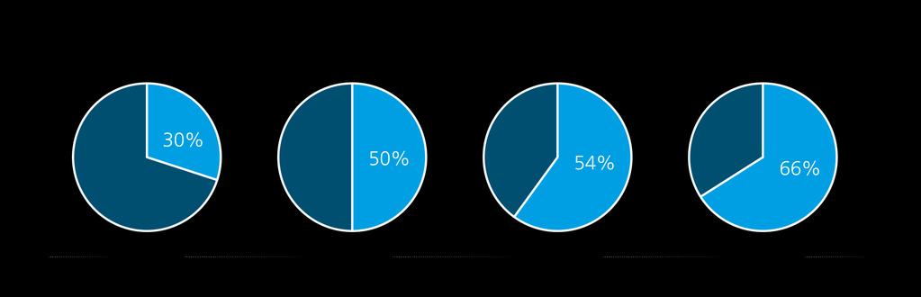
6 Aviation Insufficient Support 3.5% 34.6% 58M 1.1B World s GDP World Trade Employment Value VERSUS 2.6% Int l Tourists Funding of Infrastructure and Service support
7 2/6 Urbanization
8 Rapid Urbanization
9 3/6 Shared Threads & Opportunities

10 Shared Threads - Opportunities
11 4/6 Synergistic Development for Sustainability
12 Suitable Airport Location- close to the City Airports close to the CBD benefits of short commuting distances, however face land use incompatibilities and excessive noise Locations further from the city center enjoys less restrictive land use, however create commuting inefficiencies The combined suitability curve illustrate the most adequate locations balancing different urban factors *Concept Adapted from Hofstra University (2015)

13 Transport Corridors in Regional Development Airports hubs create nodal points in a city region Connected to city and rural areas via transport corridors Circulation of people, goods and services boost economic growth along the corridors and on the neighboring urban area As crucial link in integrating resources *Concept Adapted from Rodrique, J.P (2007) Gateways, Corridors and Global Freight Distribution: Transpacific Issues
14 5/6 Aviation & Urbanization in Africa

15 Aviation in Africa
16 Aviation in Africa

17 Aviation in Africa Focal 5 Airports in 3 cities Coverage and distribution of airports Intercontinental flight routes between 12 countries Emphasized routes / active triangles

18 Urbanization in Africa


19 Urbanization in Africa
20 GDP & Total Air Passengers Close alignment between GDP and TAP *GDP data extracted from United Nations Environment Programme. Global Environment Outlook, GEO Data Portal, Human Development Index (HDI)2010 TAP data provided by ICAO
 e.g. Swaziland & Lesotho *Raw Data extracted from United Nations Environment Programme.")
21 Correlation between ITAs & HDI Countries with less arrivals (yellow & green) tend to have lower HDI (yellow & light red, shrinkage in area) Countries with more arrivals (dark blue) tend to have higher HDI (dark red, expansion in area) e.g. Swaziland & Lesotho *Raw Data extracted from United Nations Environment Programme. Global Environment Outlook, GEO Data Portal, Human Development Index (HDI)2010
22 Correlation between ITAs & HDI Ethiopia with less arrivals reduced size due to lower HDI Kenya & South Africa with more arrivals - exaggerated/enlarged due to high HDI Aviation as one of the indicators of development level *Raw data extracted from United Nations Environment Programme. Global Environment Outlook, GEO Data Portal, Human Development Index (HDI)2010

23 Project Location & Profile South Africa: strongest in Air Passengers, HDI, UR and GDP Kenya overtakes Ethiopia in HDI, UR and GDP Ethiopia with the largest population, and higher passengers than Kenya

24 Case Study - Nairobi, Kenya *Raw data downloaded from Openstreetmap Building Density Land Use Natural Setting Open Space Public Transportation Road Hierarchy Underdeveloped Area Waste & Recycling (GIF)

25 Case Study - Ekurhuleni & Johannesburg, South Africa *Raw data downloaded from Openstreetmap Residential, commercial and industrial land uses feature close to the airports Higher density of land use development around OR Tambo, which is closer to the CBD Diffused development around Lanseria airport, which is privately owned

26 Case Study - Ekurhuleni & Johannesburg, South Africa *Raw data downloaded from Openstreetmap Quantify: the concentration of amenities OR Tambo IA: apparent concentration effect Lanseria: private, lack of transportation support

27 Case Study - Addis Ababa, Ethiopia Proximity to the CBD both strength and constraint Proposed light rail expansion plan to connect the airport for sustainability *Raw data downloaded from Openstreetmap
28 6/6 SDG

29 Conclusion The city is a place where a lot of problems are concentrated; but the city also has the resources to overcome these problems and be the place of development. - Prof. Valentino Castellini, Italy, 1998
30 Future areas of interventions Joint Planning Assessment of air transport s contribution (GDP) to urban development Mobilise more cities/airport authorities for a Network of joint action Analysis of cities and their airports (e.g. impact of airport on the evolution of built up areas) Support the implementation of SDG targets in relation to cities and air transport
31
Botswana National Spatial Plan Botsreal Property Forum- 30 May, 2018
 Botswana National Spatial Plan 2036 Botsreal Property Forum- 30 May, 2018 What is the National Spatial Plan? A framework and process for planning that is: National (to guide national development policies,
Sharthi Laldaparsad Statistics South Africa, Policy Research & Analysis. Sub-regional workshop on integration of administrative data,
 Sub-regional workshop on integration of administrative data, big data and geospatial information for the compilation of SDG indicators and International Workshop on Global Fundamental Geospatial Data Themes
Dar es Salaam - Reality Check Workshop
 Dar es Salaam - Reality Check Workshop hosted by GIZ and Dar es Salaam City Council Introduction: Key Urban Characteristics of Dar es Salaam Challenges and Opportunities for Resilient Development in the
High-Level Euro-Asia Regional Meeting on Improving Cooperation on Transit, Trade Facilitation and the 2030 Agenda for Sustainable Development
 High-Level Euro-Asia Regional Meeting on Improving Cooperation on Transit, Trade Facilitation and the 2030 Agenda for Sustainable Development Date: 7 to 9 March 2017 Sheraton Hanoi Hotel Hanoi, Vietnam
The 3V Approach. Transforming the Urban Space through Transit Oriented Development. Gerald Ollivier Transport Cluster Leader World Bank Hub Singapore
 Transforming the Urban Space through Transit Oriented Development The 3V Approach Gerald Ollivier Transport Cluster Leader World Bank Hub Singapore MDTF on Sustainable Urbanization The China-World Bank
Identifying Megaregions in the US: Implications for Infrastructure Investment
 7. 10. 2 0 08 Identifying Megaregions in the US: Implications for Infrastructure Investment Dr. Myungje Woo Dr. Catherine L. Ross Jason Barringer Harry West Jessica Lynn Harbour Doyle Center for Quality
National Spatial Development Perspective (NSDP) Policy Coordination and Advisory Service
 Policy Coordination and Advisory Service") National Spatial Development Perspective (NSDP) Policy Coordination and Advisory Service 1 BACKGROUND The advances made in the First Decade by far supersede the weaknesses. Yet, if all indicators were
National Spatial Development Perspective (NSDP) Policy Coordination and Advisory Service 1 BACKGROUND The advances made in the First Decade by far supersede the weaknesses. Yet, if all indicators were
The importance of visioning in urban strategic planning By Peter Robinson. MILE Master Class Urban Strategic Planning March 2016
 The importance of visioning in urban strategic planning By Peter Robinson MILE Master Class Urban Strategic Planning March 2016 Typical strategic planning process Where are we now? Where are we going?
AFRICAN URBANIZATION: SOME KEY ISSUES. Patricia Jones University of Oxford IGC Conference, Dar es Salaam 25 th February 2015
 AFRICAN URBANIZATION: SOME KEY ISSUES Patricia Jones University of Oxford IGC Conference, Dar es Salaam 25 th February 2015 Introduction New project on urbanization in Africa. World Bank funded but independent
African requirements for SDI standardization Antony Cooper Operating Unit Fellow Built Environment CSIR PO Box 395, Pretoria, 0001, South Africa
 ISO/TC 211 workshop on spatial data infrastructures (SDIs) African requirements for SDI standardization Antony Cooper Operating Unit Fellow Built Environment CSIR PO Box 395, Pretoria, 0001, South Africa
High Speed / Commuter Rail Suitability Analysis For Central And Southern Arizona
 High Speed / Commuter Rail Suitability Analysis For Central And Southern Arizona Item Type Reports (Electronic) Authors Deveney, Matthew R. Publisher The University of Arizona. Rights Copyright is held
Nepal-China Economic Relationship: Learning and Unlearning from Chinese Model of Development
 1 WELCOME TO THE PRESENTATION ON Nepal-China Economic Relationship: Learning and Unlearning from Chinese Model of Development Pukar Lamichhane 2 Presentation Outline 1. Introduction 2. Overview of Chinese
National Planning Framework Louth County Council Submission
 National Planning Framework 2040 Louth County Council Submission 10 th November 2017 2 Louth County Council Introduction The primacy of the Dublin / Belfast corridor in the urban network on the island
Applications of GIS and Urban Modelling for Environmental Policy. Overview
 Decision Support Tools for Managing Urban Environment in Ireland Applications of GIS and Urban Modelling for Environmental Policy Sheila Convery, HarutyunShahumyan Overview The MOLAND Model Waste water
The Global Statistical Geospatial Framework and the Global Fundamental Geospatial Themes
 The Global Statistical Geospatial Framework and the Global Fundamental Geospatial Themes Sub-regional workshop on integration of administrative data, big data and geospatial information for the compilation
Urban Geography Unit Test (Version B)
") Urban Geography Unit Test (Version B) 1. What function do the majority of the world s ten most populated cities serve? a. a fortress city to resist foreign invasion b. a port city for transporting people
Urban Geography Unit Test (Version B) 1. What function do the majority of the world s ten most populated cities serve? a. a fortress city to resist foreign invasion b. a port city for transporting people
City of Johannesburg Department: Development Planning And Urban Management Development Planning and Facilitation
 City of Johannesburg Department: Development Planning And Urban Management Development Planning and Facilitation Marlboro Urban Development Framework: Discussion Document July 2007 1 Prepared for Department
SECTION 5 KEY FOCUS AREAS
 SECTION 5 KEY FOCUS AREAS 164 5.1. Development Focus and Implementation Within Region E there are six Key Focus Areas for the City of Johannesburg. These are areas where interventions will have the greatest
Leveraging Urban Mobility Strategies to Improve Accessibility and Productivity of Cities
 Leveraging Urban Mobility Strategies to Improve Accessibility and Productivity of Cities Aiga Stokenberga World Bank GPSC African Regional Workshop May 15, 2018 Roadmap 1. Africa s urbanization and its
THE KWAZULU-NATAL SPATIAL ECONOMIC DEVELOPMENT STRATEGY (PSEDS):
:") THE KWAZULU-NATAL SPATIAL ECONOMIC DEVELOPMENT STRATEGY (PSEDS): PROMOTING URBAN AND RURAL LINKAGES IN THE BEST INTEREST OF RURAL AND URBAN DEVELOPMENT By Frikkie Brooks General Manager: Municipal Planning
THE KWAZULU-NATAL SPATIAL ECONOMIC DEVELOPMENT STRATEGY (PSEDS): PROMOTING URBAN AND RURAL LINKAGES IN THE BEST INTEREST OF RURAL AND URBAN DEVELOPMENT By Frikkie Brooks General Manager: Municipal Planning
Challenges and Potentials of Place Based Information Management in Nepal"
 Nineteenth United Nations Regional Cartographic Conference for Asia and the Pacific, Bangkok, Thailand, 29 October 1 November 2012 Challenges and Potentials of Place Based Information Management in Nepal"
Local Economic Activity Around Rapid Transit Stations
 Local Economic Activity Around Rapid Transit Stations The Case of Chicago s Orange Line Julie Cooper, MPP 2014 Harris School of Public Policy Transport Chicago June 6, 2014 Motivation Impacts of transit
Spatial Analysis and Modeling of Urban Land Use Changes in Lusaka, Zambia: A Case Study of a Rapidly Urbanizing Sub- Saharan African City
 Spatial Analysis and Modeling of Urban Land Use Changes in Lusaka, Zambia: A Case Study of a Rapidly Urbanizing Sub- Saharan African City January 2018 Matamyo SIMWANDA Spatial Analysis and Modeling of
Central Baltic Programme
 Central Baltic Programme 2014-2020 About the Central Baltic Programme 2014-2020 Builds on the Central Baltic INTERREG IV A Programme 2007-2013 Cross-border cooperation projects in the central Baltic Sea
CORRIDORS OF FREEDOM Access Management (Ability) Herman Pienaar: Director City Transformation and Spatial Planning
 Herman Pienaar: Director City Transformation and Spatial Planning") CORRIDORS OF FREEDOM Access Management (Ability) 2016 Herman Pienaar: Director City Transformation and Spatial Planning PLANNING DEVELOPMENT PROCESS RATHER THAN A PLAN CAPITAL INVESTMENT DEVELOPMENT FACILITATION
CORRIDORS OF FREEDOM Access Management (Ability) 2016 Herman Pienaar: Director City Transformation and Spatial Planning PLANNING DEVELOPMENT PROCESS RATHER THAN A PLAN CAPITAL INVESTMENT DEVELOPMENT FACILITATION
Unit 9: Changing urban environments
 Name: Unit 9: Changing urban environments I can statement... RAG Score. R=1, A=2, G=3 9.1 What are the characteristics of urbanisation. I can describe what urbanisation is. I can describe what a push and
IGCSE Geography Unit 2: Types of Settlement
 IGCSE Geography Unit 2: Types of Settlement Recommended Prior Knowledge An understanding of the factors that affect the nature, location, growth and structure of settlements. A good general knowledge,
CLAREMONT MASTER PLAN 2017: LAND USE COMMUNITY INPUT
 Planning and Development Department 14 North Street Claremont, New Hampshire 03743 Ph: (603) 542-7008 Fax: (603) 542-7033 Email: cityplanner@claremontnh.com www.claremontnh.com CLAREMONT MASTER PLAN 2017:
Foreword. Vision and Strategy
 GREATER MANCHESTER SPATIAL FRAMEWORK Friends of Walkden Station Consultation Response January 2017 Foreword Friends of Walkden Station are a group of dedicated volunteers seeking to raise the status and
Cities and Human Settlements: Operationalising SDGs interlinkages through spatial approaches and place-making Maruxa Cardama
 Cities and Human Settlements: Operationalising SDGs interlinkages through spatial approaches and place-making Maruxa Cardama UN-DESA EGM in preparation of HLPF UN Headquarters, NYC 25-26 January 2018 Is
Global Atmospheric Circulation. Past climate change and natural causes. Global climate change and human activity
 GCSE Geography Edexcel B Revision Checklist Paper 1. Global Geographical Issues Topic 1. Hazardous Earth Key Idea I know/ understand The world s climate system Global Atmospheric Circulation Past climate
The sustainable location of low-income housing development in South African urban areas
 Sustainable Development and Planning II, Vol. 2 1165 The sustainable location of low-income housing development in South African urban areas S. Biermann CSIR Building and Construction Technology Abstract
Challenges and Successes in Sharing Geospatial Data in Africa
 Challenges and Successes in Sharing Geospatial Data in Africa 2018 GeoNode Summit Torino, Italy March 26-28, 2018 Bernard Justus Muhwezi Manager, Geo-Information Services Uganda Bureau of Statistics, Kampala,
APPENDIX I - AREA PLANS
 ROUTE 37 WEST LAND USE PLAN ROUTE 37 WEST LAND USE PLAN Recent land use decisions and development trends have drawn attention to the land within the Route 37 western by-pass area between Route 50 and
Beyond Mobility - Understanding and comparing urban accessibility in European Cities. Guy Hitchcock, Knowledge Leader
 Beyond Mobility - Understanding and comparing urban accessibility in European Cities Guy Hitchcock, Knowledge Leader 2 Study on improving the understanding of urban accessibility and road congestion in
C) Discuss two factors that are contributing to the rapid geographical shifts in urbanization on a global scale.
 Discuss two factors that are contributing to the rapid geographical shifts in urbanization on a global scale.") AP Human Geography Unit VII. Cities and Urban Land Use Free Response Questions FRQ 1 Rapid urbanization in Least Developed Countries (LDCs) has many profound impacts for the world. Answer the following
AP Human Geography Unit VII. Cities and Urban Land Use Free Response Questions FRQ 1 Rapid urbanization in Least Developed Countries (LDCs) has many profound impacts for the world. Answer the following
On transport and other infrastructure knitting regions together
 Published as: WITLOX, F. (2011) On transport and other infrastructure knitting regions together. In: A. VAN RENTERGHEM (Ed.) Polycentric Regions facing Global Challenges. A Role for Strategic Spatial Planning
Date: June 19, 2013 Meeting Date: July 5, Consideration of the City of Vancouver s Regional Context Statement
 Section E 1.5 To: From: Regional Planning and Agriculture Committee Lee-Ann Garnett, Senior Regional Planner Planning, Policy and Environment Department Date: June 19, 2013 Meeting Date: July 5, 2013 Subject:
Edexcel Geography Advanced Paper 2
 Edexcel Geography Advanced Paper 2 SECTION B: SHAPING PLACES Assessment objectives AO1 Demonstrate knowledge and understanding of places, environments, concepts, processes, interactions and change, at
By Frikkie Brooks General Manager: Municipal Planning KwaZulu-Natal Department of Local Government and Traditional Affairs South Africa
 THE KWAZULU-NATAL SPATIAL ECONOMIC DEVELOPMENT STRATEGY (PSEDS): PROMOTING URBAN AND RURAL LINKAGES IN THE BEST INTEREST OF RURAL AND URBAN DEVELOPMENT By Frikkie Brooks General Manager: Municipal Planning
MODULE 1 INTRODUCING THE TOWNSHIP RENEWAL CHALLENGE
 MODULE 1 INTRODUCING THE TOWNSHIP RENEWAL CHALLENGE FOCUS OF THE MODULE Township renewal challenges and developmental outcomes covered in this module: Historical origins of townships and the inherited
Joint Planning Advisory Council July 19, 2011
 Joint Planning Advisory Council July 19, 2011 Global Cities Program Objectives Helping advance strategic thinking in a variety of critical areas. Facilitating informed decisionmaking on the part of public
Integrated Infrastructure Planning & Spatial Mapping
 Integrated Infrastructure Planning & Spatial Mapping Presenter: Heidi Dixon, Principal Social Planner, DTPLI 23 May 2014 PART 1 PLAN MELBOURNE : Metropolitan Planning Strategy PART 2 Case Study: DTPLI
The Impact of Tianjin-Baoding Intercity Railway on the Traffic Pattern of the Jing-Jin-Ji Urban Agglomeration QI Lei1,a*,GUO Jing2
 3rd International Conference on Management, Education Technology and Sports Science (METSS 2016) The Impact of Tianjin-Baoding Intercity Railway on the Traffic Pattern of the Jing-Jin-Ji Urban Agglomeration
Local Area Key Issues Paper No. 13: Southern Hinterland townships growth opportunities
 Draft Sunshine Coast Planning Scheme Review of Submissions Local Area Key Issues Paper No. 13: Southern Hinterland townships growth opportunities Key Issue: Growth opportunities for Southern Hinterland
Spatial analysis of locational conflicts
 Spatial analysis of locational conflicts Case study: Locational conflicts generated by the expansion of built up surfaces in the northern area of Bucharest, Romania Diana A. ONOSE 1, Cristian I. IOJĂ 2,
Mr. Chairman, Hon ble Ministers, Excellencies, Distinguished participants, Ladies and Gentlemen.
 Ministerial Level Exchange of Views on National Experiences on improving transport connectivity and trade facilitation for the achievement of the SDGs: BHUTAN Mr. Chairman, Hon ble Ministers, Excellencies,
LLDCS IN THE GLOBAL AGENDA: CHALLENGES AND INTERNATIONAL RESPONSES CHAIR OF THE GROUP OF LLDCS IN GENEVA
 LLDCS IN THE GLOBAL AGENDA: CHALLENGES AND INTERNATIONAL RESPONSES CHAIR OF THE GROUP OF LLDCS IN GENEVA E X P E R T G R O U P M E E T I N G O N T H E M I D T E R M R E V I E W O F T H E V P O A F O R
IOP Conference Series: Earth and Environmental Science. Related content OPEN ACCESS
 IOP Conference Series: Earth and Environmental Science OPEN ACCESS Using GIS to integrate the analysis of land-use, transportation, and the environment for managing urban growth based on transit oriented
Experiences of public-private partnerships in the Euromediterranean relations and in the Po Valley, promoting a more balanced European territory
 Experiences of public-private partnerships in the Euromediterranean relations and in the Po Valley, promoting a more balanced European territory Claudio Tolomelli PolyMetrexPlus project s objectives To
Developing Quality of Life and Urban- Rural Interactions in BSR
 Developing Quality of Life and Urban- Rural Interactions in BSR Sakari Saarinen Union of the Baltic Cities, Commission on Environment Seminar on Quality of Life in Small Communities, 27 May 2010, Kärdla,
Department of Lands Planning and Housing. Development Plan of Mombasa City County
 Department of Lands Planning and Housing Development Plan of Mombasa City County Mombasa Gate City Profile Location and Linkages Located between the latitudes 3 80 and 4 10 S and longitudes 39 60 and 39
Figure 10. Travel time accessibility for heavy trucks
 Figure 10. Travel time accessibility for heavy trucks Heavy truck travel time from Rotterdam to each European cities respecting the prescribed speed in France on the different networks - Road, motorway
Economic Development and Transport in New Zealand. Thomas Simonson 4/7/2016
 Economic Development and Transport in New Zealand Thomas Simonson 4/7/2016 Definitions > Economics is about people and communities, and the skills, equipment and resources they acquire to pursue their
Understanding and Measuring Urban Expansion
 VOLUME 1: AREAS AND DENSITIES 21 CHAPTER 3 Understanding and Measuring Urban Expansion THE CLASSIFICATION OF SATELLITE IMAGERY The maps of the urban extent of cities in the global sample were created using
UNIVERSITY OF CAMBRIDGE INTERNATIONAL EXAMINATIONS International General Certificate of Secondary Education
 UNIVERSITY OF CAMBRIDGE INTERNATIONAL EXAMINATIONS International General Certificate of Secondary Education *9751541575* GEOGRAPHY 0460/23 Paper 2 October/November 2011 Candidates answer on the Question
Engagement on Strategies to Overcome Inequality
 Engagement on Strategies to Overcome Inequality Civil Society Engagement with Poverty Julian Sendin 1-2 June 2017 Kievits Kroon Country Estate, Pretoria, South Africa 1. Ndifuna Ukwazi Ndifuna Ukwazi is
Mogale City. Spatial Development Framework
 Mogale City Spatial Development Framework 2009 SPATIAL DEVELOPMENT FRAMEWORK 2009 December 2009 The content of this document is based on work done by the consultants and does not necessarily reflect the
TRANSPORT CHALLENGES AND OPPORTUNITIES FOR LANDLOCKED COUNTRIES FOR ACHIEVING SUSTAINABLE DEVELOPMENT GOALS
 TRANSPORT CHALLENGES AND OPPORTUNITIES FOR LANDLOCKED COUNTRIES FOR ACHIEVING SUSTAINABLE DEVELOPMENT GOALS Robert Earley, consultant 11 th Intergovernmental Regional Environmentally Sustainable Transport
WORLD COUNCIL ON CITY DATA
 WORLD COUNCIL ON CITY DATA WCCD ISO 37120 STANDARDIZED CITY DATA TO MEET UN SDG TARGETS UN WORLD DATA FORUM Presented by: James Patava www.dataforcities.org @wccitydata PUBLICATION OF THE FIRST ISO STANDARD
FINAL YEAR PRESENTATION USE OF GEOSPATIAL TECHNOLOGY IN SUITABILITY ANALYSIS FOR NEW SITES OF MULTI-LEVEL CAR PARKING AREAS
 FINAL YEAR PRESENTATION USE OF GEOSPATIAL TECHNOLOGY IN SUITABILITY ANALYSIS FOR NEW SITES OF MULTI-LEVEL CAR PARKING AREAS PRESENTED BY JASPHER OTIENO SUPERVISOR DR.NYIKA Contents Overview Area of study
Enquiry question: How does the world s climate system function, why does it change and how can this be hazardous for people?
 Content Topic 1: Hazardous Earth Enquiry question: How does the world s climate system function, why does it change and how can this be hazardous for people? 1.1 The atmosphere operates as a global system
Regional Transit Development Plan Strategic Corridors Analysis. Employment Access and Commuting Patterns Analysis. (Draft)
") Regional Transit Development Plan Strategic Corridors Analysis Employment Access and Commuting Patterns Analysis (Draft) April 2010 Contents 1.0 INTRODUCTION... 4 1.1 Overview and Data Sources... 4 1.2
Regional Transit Development Plan Strategic Corridors Analysis Employment Access and Commuting Patterns Analysis (Draft) April 2010 Contents 1.0 INTRODUCTION... 4 1.1 Overview and Data Sources... 4 1.2
This table connects the content provided by Education Perfect to the NSW Syllabus.
 Education Perfect Geography provides teachers with a wide range of quality, engaging and innovative content to drive positive student learning outcomes. Designed by teachers and written by our in-house
MULTIPLE CHOICE. Choose the one alternative that best completes the statement or answers the question.
 AP Test 13 Review Name MULTIPLE CHOICE. Choose the one alternative that best completes the statement or answers the question. 1) Compared to the United States, poor families in European cities are more
convenience truth 4 concepts and their SYNTHESIS a convenience truth 5.0
 5.0 Concept 1 Interconnected Places: Use the framework of our arterials to both connect and distinguish urban places Vancouver s existing urban structure, based on the original streetcar city pattern,
The National Policy Strategy for Infrastructure and Spatial Planning CODE24 CONFERENCE. Emiel Reiding
 The National Policy Strategy for Infrastructure and Spatial Planning Emiel Reiding Structure of presentation 1. Spatial planning in the Netherlands 2. National Policy Strategy Aims National interests 3.
ESPON evidence on European cities and metropolitan areas
 BEST METROPOLISES Final Conference 18 April 2013, Warsaw ESPON evidence on European cities and metropolitan areas Michaela Gensheimer Structure of Intervention Content Part I: What is the ESPON 2013 Programme?
November 29, World Urban Forum 6. Prosperity of Cities: Balancing Ecology, Economy and Equity. Concept Note
 November 29, 2010 World Urban Forum 6 Prosperity of Cities: Balancing Ecology, Economy and Equity Concept Note 1 CONTENT Thematic Continuity Conceptualizing the Theme The 6 Domains of Prosperity The WUF
THE ROLE OF REGIONAL SPATIAL PLANNING IN SUPPORTING LONG-TERM ECONOMIC GROWTH IN NORTHERN IRELAND
 THE ROLE OF REGIONAL SPATIAL PLANNING IN SUPPORTING LONG-TERM ECONOMIC GROWTH IN NORTHERN IRELAND Jenny Pyper Director 6 th Annual ICLRD Conference 20 January 2011 PURPOSE OF REGIONAL PLANNING Framework
The National Spatial Strategy
 Purpose of this Consultation Paper This paper seeks the views of a wide range of bodies, interests and members of the public on the issues which the National Spatial Strategy should address. These views
Subject: Note on spatial issues in Urban South Africa From: Alain Bertaud Date: Oct 7, A. Spatial issues
 Page 1 of 6 Subject: Note on spatial issues in Urban South Africa From: Alain Bertaud Date: Oct 7, 2009 A. Spatial issues 1. Spatial issues and the South African economy Spatial concentration of economic
Is better access key to inclusive cities? Making urban areas accessible
 10 11 GLOBAL DEBATES Is better access key to inclusive cities? Making urban areas accessible by Jeff Gutman and Nirav Patel Design and layout: 10 Is better access key to inclusive cities? Making urban
Seaport Status, Access, and Regional Development in Indonesia
 Seaport Status, Access, and Regional Development in Indonesia Muhammad Halley Yudhistira Yusuf Sofiyandi Institute for Economic and Social Research (LPEM), Faculty of Economics and Business, University
GIS Analysis of Crenshaw/LAX Line
 PDD 631 Geographic Information Systems for Public Policy, Planning & Development GIS Analysis of Crenshaw/LAX Line Biying Zhao 6679361256 Professor Barry Waite and Bonnie Shrewsbury May 12 th, 2015 Introduction
Urban-Rural Partnerships in Europe
 Disclaimer: The views expressed in this document are those of the author, and do not necessarily reflect the views and policies of the Asian Development Bank (ADB), its Board of Directors, or the governments
Bishkek City Development Agency. Urban Planning Bishkek
 Bishkek City Development Agency Urban Planning Bishkek Bishkek City Development Agency Official name City budget Population Area GRP Import value Export value External trade turnover Foreign direct investments
Chapter 1 Data Collection
 Chapter 1 Data Collection 1. Climate of Brunei Darussalam and Temburong District Situated at around four degrees north of the Equator, Brunei Darussalam enjoys an equatorial climate with an abundance of
Topic 4: Changing cities
 Topic 4: Changing cities Overview of urban patterns and processes 4.1 Urbanisation is a global process a. Contrasting trends in urbanisation over the last 50 years in different parts of the world (developed,
Measuring community severance for transport policy and project appraisal
 Urban Transport XIX 559 Measuring community severance for transport policy and project appraisal P. R. Anciaes London School of Economics and Political Science, UK Abstract The construction of transport
International Development
 International Development Discipline/Multi-discipline or trans-disciplinary field Tahmina Rashid Associate Professor, International Studies What is Development? a. Development as a state or condition-static
[ ] MONITORING THE SPATIAL IMPACTS OF THE EGNATIA MOTORWAY egnatia odos observatory
![[ ] MONITORING THE SPATIAL IMPACTS OF THE EGNATIA MOTORWAY egnatia odos observatory](/thumbs/72/66290986.jpg "[ ] MONITORING THE SPATIAL IMPACTS OF THE EGNATIA MOTORWAY egnatia odos observatory") ] egnatia odos observatory MONITORING THE SPATIAL IMPACTS OF THE EGNATIA MOTORWAY 2014 http://observatory.egnatia.gr MINISTRY OF INFRASTRUCTURE, TRANSPORT AND NETWORKS 2 A tool at the service of spatial
] egnatia odos observatory MONITORING THE SPATIAL IMPACTS OF THE EGNATIA MOTORWAY 2014 http://observatory.egnatia.gr MINISTRY OF INFRASTRUCTURE, TRANSPORT AND NETWORKS 2 A tool at the service of spatial
The Governance of Land Use
 The planning system The Governance of Land Use United Kingdom Levels of government and their responsibilities The United Kingdom is a unitary state with three devolved governments in Northern Ireland,
SAHEL AND. Club WEST AFRICA
 SAHEL AND Club WEST AFRICA Informing policies for Africa s urban future Africa is projected to have the fastest urban growth rate in the world by 2050, Africa s cities will be home to an additional 950
2. What is a settlement? Why do services cluster in settlements?
 Chapter 12: Services Introduction and Case Study (p. 397-399) 1. What is a service? How do LDCs and MDCs differ in regards to the number of workers employed in service- sector jobs? 2. What is a settlement?
East Bay BRT. Planning for Bus Rapid Transit
 East Bay BRT Planning for Bus Rapid Transit Regional Vision Draper Prison The Bottleneck is a State-Level issue, Salt Lake County 2050 Population: 1.5M Draper Prison hopefully with some State-Level funding!
CIV3703 Transport Engineering. Module 2 Transport Modelling
 CIV3703 Transport Engineering Module Transport Modelling Objectives Upon successful completion of this module you should be able to: carry out trip generation calculations using linear regression and category
North and Central Asia: Overview and Recent Trends. Tiziana Bonapace Head Subregional Office for North and Central Asia, ESCAP
 North and Central Asia: Overview and Recent Trends Tiziana Bonapace Head Subregional Office for North and Central Asia, ESCAP North and Central Asia: An Idiosyncratic Setting High economic volatility After
South Africa will in 2010 host the Soccer World Cup.
 13 International Context South Africa is located in the southern part of Africa and borders in the north to Namibia, Botswana, Zimbabwe, Mozambique and Swaziland. Lesotho in the east is completely surrounded
Regional Growth Strategy Work Session Growth Management Policy Board
 Regional Growth Strategy Work Session Growth Management Policy Board September 6, 2018 1 Overview Recap June GMPB work session Objectives and outcomes Regional geographies Growth scenarios Breakout Discussion:
Spatial profile of three South African cities
 Spatial Outcomes Workshop South African Reserve Bank Conference Centre Pretoria September 29-30, 2009 Spatial profile of three South African cities by Alain Bertaud September 29 Email: duatreb@msn.com
ACCESSIBILITY TO SERVICES IN REGIONS AND CITIES: MEASURES AND POLICIES NOTE FOR THE WPTI WORKSHOP, 18 JUNE 2013
 ACCESSIBILITY TO SERVICES IN REGIONS AND CITIES: MEASURES AND POLICIES NOTE FOR THE WPTI WORKSHOP, 18 JUNE 2013 1. Significant differences in the access to basic and advanced services, such as transport,
Impact Evaluation of Rural Road Projects. Dominique van de Walle World Bank
 Impact Evaluation of Rural Road Projects Dominique van de Walle World Bank Introduction General consensus that roads are good for development & living standards A sizeable share of development aid and
Remarks. for. H.E. Mr. Gyan Chandra Acharya
 Please check against delivery Remarks for H.E. Mr. Gyan Chandra Acharya Under-Secretary-General and High Representative for the Least Developed Countries, Landlocked Developing Countries and Small Island
Achieving the Vision Geo-statistical integration addressing South Africa s Developmental Agenda. geospatial + statistics. The Data Revolution
 Achieving the Vision Geo-statistical integration addressing South Africa s Developmental Agenda geospatial + statistics The Data Revolution humble beginnings, present & future - South Africa UN World Data
_INTRODUCTION TSHWANE...3 EXISTING SPATIAL FORM... 3 NATURE OF THE PROBLEM...3 STUDY AREA...5 INTRODUCTION
 CHAPTER: 1 _INTRODUCTION TSHWANE...3 EXISTING SPATIAL FORM... 3 NATURE OF THE PROBLEM...3 STUDY AREA...5 INTRODUCTION 2 TSHWANE Pretoria, the inner city region of Tshwane, a place of great significance,
CERTIFIED RESOLUTION. introduction: and dated May 29, 2017, as attached, as appropriate
 15322 Buena Vista Avenue, White Rock BC, Canada V4B 1Y6 www.whiterockcity.ca City of White Rock P: 604.541.22121 F: 604.541.9348 /2tC% City Clerk s Office IT E ROC K June 13,2017 Stephanie Lam, Deputy
The Impacts of Transport Accessibility on Population Change across Rural, Suburban, and. Urban Areas: A Case Study of Wisconsin at Subcounty Levels
 The Impacts of Transport Accessibility on Population Change across Rural, Suburban, and Urban Areas: A Case Study of Wisconsin at Subcounty Levels Guangqing Chi Department of Sociology and Social Science
GRAAD 12 NATIONAL SENIOR CERTIFICATE GRADE 12
 GRAAD 12 NATIONAL SENIOR CERTIFICATE GRADE 12 GEOGRAPHY P1 FEBRUARY/MARCH 2013 MARKS: 300 TIME: 3 hours This question paper consists of 11 pages and a 12-page annexure. Geography/P1 2 DBE/Feb. Mar. 2013
Improving rural statistics. Defining rural territories and key indicators of rural development
 Improving rural statistics Defining rural territories and key indicators of rural development Improving rural statistics Improving Rural Statistics In 2016, the Global Strategy to improve Agricultural