Numerical Modelling for Optimization of Wind Farm Turbine Performance
|
|
|
- Harold Floyd
- 5 years ago
- Views:
Transcription


1 Numerical Modelling for Optimization of Wind Farm Turbine Performance M. O. Mughal, M.Lynch, F.Yu, B. McGann, F. Jeanneret & J.Sutton Curtin University, Perth, Western Australia 19/05/2015 COOPERATIVE RESEARCH CENTRE FOR CONTAMINATION ASSESSMENT AND REMEDIATION OF THE ENVIRONMENT
2 OVERVIEW OF PRESENTATION Acknowledgements Introduction Objective Methodology Weather Research Forecasting (WRF) Sensitivity Analysis Coherent Doppler LIDAR (CDL) versus WRF Comparison Coupling WRF to OpenFOAM Conclusions Future work Q & As SCHEME OF PRESENTATION
3 ACKNOWLEDGEMENTS Cooperative Research Centre for Contamination Assessment and Remediation of Environment (CRC CARE), Australian Government This work was supported by resources provided by the Pawsey Supercomputing Centre with funding from the Australian Government and the Government of Western Australia." Department of Environment Regulation (DER), Government of Western Australia Dr Peter Rye, DER, Government of Western Australia Associate Professor Diandong Ren, Curtin University ACKNOWLEDGEMENTS
4 INTRODUCTION Significance of short term numerical forecasting (STF) Significance and role of CDL in STF Mesoscale model shortcomings at wind farm scale Significance of meso and microscale model coupling Proposed technique Wind energy grid integration challenges INTRODUCTION
 610 to 1524 m (elevation")
 Mast C (46 m) Mast A (39 m)")
5 THE LAKE TURKANA WIND FARM Lake Turkana wind farm characteristics 325 MW Located in Marsabit district, near Lake Turkana Kenya, East Africa 140 to 700 km (width) 610 to 1524 m (elevation above sea level) CRC CARE & DER joint campaign (2009) to map the wind field using CDL Three masts [~40 m] and CDL used for numerical model validation Mast B (38 m) Mast C (46 m) Mast A (39 m) INTRODUCTION

6 COHERENT DOPPLER LIDAR Lockheed Martin WindTracer 1.6 µm Doppler- Lidar employed in determining wind fields at Lake Turkana State of the art eye safe technology with a range of 8-12 km 250 km 2 coverage for winds COHERENT DOPPLER LIDAR

")
7 LAKE TURKANA TOPOGRAPHY Topographic Height (m) Topographic Height (m) INTRODUCTION
8 OBJECTIVES Develop a short term forecasting technique Investigate on the use of an optimised configuration of (WRF) software Evaluate model performance using CDL and mast observations Improve wind farm forecasting by applying a coupled WRF and CFD (OpenFOAM) model Improve initialization data for WRF using CDL observations Achieved In Progress OBJECTIVE
9 METHODOLOGY WRF sensitivity analysis and validation via in situ and CDL observations Coupling optimised WRF model with OpenFOAM for prediction of micro-scale wind for improving turbine energy output estimation Evaluating impact using comparisons with in situ meteorological measurements WRF initialization data tuning incorporating CDL observations Achieved In Progress METHODOLOGY
10 WRF SENSITIVITY ANALYSIS WRF performance validation in Western Australia Sensitivity analysis conducted at Lake Turkana, Kenya site Sensitivity analysis includes testing initialization fields, physical & parametrization schemes, grid configurations, terrain complexity and satellite data Validation criteria based on Root Mean Square Error (RMSE) and Correlation Coefficient between in situ and predicted winds Considering Mast as true measurements Best results obtained through changing initialization fields WRF SENSITIVITY ANALYSIS

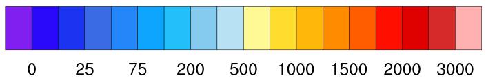
11 SENSITIVITY ANALYSIS RESULTS Results of sensitivity analysis at Lake Turkana European Centre for Medium-Range Weather Forecasts (ECMWF) initialization field selected with 70 km horizontal resolutions 60 model levels 6 hourly temporal resolution Configuration 4 domains 36 model levels Domain Size km x km Geographic Resolution Grid Resolution km Time Step s Domain x ` Domain x837 5` 9 10 Topographic Height (m) Domain x 297 2` Domain x WRF SENSITIVITY ANALYSIS
12 SENSITIVITY ANALYSIS RESULTS Wind Speed ms -1 Mast A vs WRF Mast mean WRF mean RMSE 1.66 Correlation Coefficient 0.69 Comparison of wind speed comparison between mast A (10 mins sampling), WRF predicted wind(10 mins sampling) and CDL at 39 m height (Time UTC) CDL vs WRF RMSE 2.24 Correlation coefficient 0.60 LIDAR Mean 10.5 Mast A VS WRF Wind Direction Mast mean WRF mean RMSE Correlation Coefficient 0.44 Comparison of wind speed comparison between mast A (10 mins sampling) and WRF predicted wind (10 mins sampling) at 39 m height (Time UTC) WRF SENSITIVITY ANALYSIS


13 CDL TERRAIN FOLLOWING WIND MAP COMPARISON WITH WRF Zoomed in data at CDL location WRF Wind Speed (m/sec) CDL WRF COMPARISON CDL Terrain Following Map
14 LAKE TURKANA CDL-WRF COMPARISON AT PROPOSED TURBINE LOCATIONS WRF-CDL at proposed turbine locations suggests WRF has captured the wind speeds well spatially and even at locations other than masts Turbine location away from the mountain suggests terrain complexity is reduced and better RMSE values compared with mast-wrf comparison are achieved. RMSE 1.23 ms -1 Correlation Coefficient 0.84 RMSE 1.14 ms -1 Correlation Coefficient 0.81 CDL WRF COMPARISON
15 WRF TO OPENFOAM COUPLING Reliable micro-siting and cost energy estimation demands meso micro scale model coupling In STF coupled model can ingest inputs from WRF forecast running in real mode and use them to predict turbulence structures affecting wind speed ensuring reliable forecast. Spatial and temporal grids are, in general, non-matching WRF grid moves in the vertical with time-dependent pressure variation. Ambiguous mechanism for transferring turbulent energy from one code to the other The validation of these models is also difficult as the measurement data available is limited WRF TO OPENFOAM COUPLING

16 WRF TO OPENFOAM COUPLING Proposed technique surpasses other techniques having real time data from CDL. The solver can handle complex terrain features e.g. topography, temperature & pressure variations etc. Capability to capture a complete wind profile from WRF CDL data can be further ingested to improve initial conditions from WRF to bring fluxes up to right values at solver boundaries The software performance is tested in Lake Turkana and the results are validated with CDL The results are not an artefact of nudging in WRF Coupled WRF-CFD predicts turbulence structures due to topography catastrophic for turbines WRF Coupled CFD WRF TO OPENFOAM COUPLING
 Results agree well with CDL data as compared to WRF WRF TO OPENFOAM")
17 WRF TO OPENFOAM COUPLING Terrain extracted from SRTM data 4X4X2 km mesh (wind direction SE) Neumann and Dirichlet conditions applied to boundaries Simulation conducted on a Cray XC40 (24 nodes each with 64GB RAM) Results agree well with CDL data as compared to WRF WRF TO OPENFOAM COUPLING
18 CONCLUSIONS WRF modelling (without coupling) at Lake Turkana in a data sparse region of complex terrain typically achieves RMSE in speed of 1.6 ms -1 and direction of 12 and a correlation coefficient of 0.69 when validated against mast observations Comparison of WRF predictions with CDL demonstrates an improved performance of the model with RMSE in wind speed of 1.2 ms -1, and correlation coefficient 0.84 respectively when validated against meteorological observations; a 25% improvement in wind prediction and a 22% improvement in the correlation coefficient (against in situ mast data). The retrieval of vertical winds is showing significant skill with CFD / OpenFOAM having a low standard deviation of 3.35 ms-1 compared to WRF s of 4.71 ms-1 when validated against CDL winds CONCLUSIONS
19 FUTURE WORK Promote the advantages of CDL in wind farm research particularly in their potential operational role in enhancing the prediction of winds for improved infrastructure protection (e.g. turbulence, severe wind gusts) and for improved lead time energy generation management. It is intended to integrate local observations from CDL to improve the initialization fields for WRF Analyse the impact of integrating CDL data and assessing its impact on the knowledge of wind speed and direction information Determining the best criteria for judging a numerical model output in terms of wind speed and direction FUTURE WORK


20 Questions? Q & A
Microscale Modelling and Applications New high-res resource map for the WASA domain and improved data for wind farm planning and development
 Microscale Modelling and Applications New high-res resource map for the WASA domain and improved data for wind farm planning and development Niels G. Mortensen, Jens Carsten Hansen and Mark C. Kelly DTU
Wind conditions based on coupling between a mesoscale and microscale model
 Wind conditions based on coupling between a mesoscale and microscale model José Laginha Palma and Carlos Veiga Rodrigues CEsA Centre for Wind Energy and Atmospheric Flows Faculty of Engineering, University
Nesting large-eddy simulations within mesoscale simulations in WRF for wind energy applications
 Performance Measures x.x, x.x, and x.x Nesting large-eddy simulations within mesoscale simulations in WRF for wind energy applications Julie K. Lundquist Jeff Mirocha, Branko Kosović 9 WRF User s Workshop,
Effect of Wind Turbine Wakes on the Performance of a Real Case WRF-LES Simulation
 Effect of Wind Turbine Wakes on the Performance of a Real Case WRF-LES Simulation Paula Doubrawa 1, A. Montornès 2, R. J. Barthelmie 1, S. C. Pryor 1, G. Giroux 3, P. Casso 2 1 Cornell University, Ithaca,
Wind speed and direction predictions by WRF and WindSim coupling over Nygårdsfjell
 Journal of Physics: Conference Series PAPER OPEN ACCESS Wind speed and direction predictions by WRF and WindSim coupling over Nygårdsfjell To cite this article: M Bilal et al 1 J. Phys.: Conf. Ser. 753
MODELING ATMOSPHERIC SIGNALS IN SPACEBORNE INTERFEROMETRIC SAR DATA
 MODELING ATMOSPHERIC SIGNALS IN SPACEBORNE INTERFEROMETRIC SAR DATA F.J Meyer 1) 2), W. Gong 1), P. Webley 1) 3), D. Morton 4) 1)Earth & Planetary Remote Sensing, University of Alaska Fairbanks 2)Alaska
Wind Power Forecasting Using Non-Linear ARMAX Models and Neural Networks
 Wind Power Forecasting Using Non-Linear ARMAX Models and Neural Networks Frede Aakmann Tøgersen & Kim Emil Andersen Wind & Site Competence Centre Technology R & D Vestas Wind Systems A/S Agenda Introducing
Mesoscale meteorological models. Claire L. Vincent, Caroline Draxl and Joakim R. Nielsen
 Mesoscale meteorological models Claire L. Vincent, Caroline Draxl and Joakim R. Nielsen Outline Mesoscale and synoptic scale meteorology Meteorological models Dynamics Parametrizations and interactions
Vindkraftmeteorologi - metoder, målinger og data, kort, WAsP, WaSPEngineering,
 Downloaded from orbit.dtu.dk on: Dec 19, 2017 Vindkraftmeteorologi - metoder, målinger og data, kort, WAsP, WaSPEngineering, meso-scale metoder, prediction, vindatlasser worldwide, energiproduktionsberegninger,
Speedwell High Resolution WRF Forecasts. Application
 Speedwell High Resolution WRF Forecasts Speedwell weather are providers of high quality weather data and forecasts for many markets. Historically we have provided forecasts which use a statistical bias
11B.1 OPTIMAL APPLICATION OF CLIMATE DATA TO THE DEVELOPMENT OF DESIGN WIND SPEEDS
 11B.1 OPTIMAL APPLICATION OF CLIMATE DATA TO THE DEVELOPMENT OF DESIGN WIND SPEEDS Andries C. Kruger * South African Weather Service, Pretoria, South Africa Johan V. Retief University of Stellenbosch,
Validation n 1 of the Wind Data Generator (WDG) software performance. Comparison with measured mast data - Complex site in Southern France
 software performance. Comparison with measured mast data - Complex site in Southern France") Validation n 1 of the Wind Data Generator (WDG) software performance Comparison with measured mast data - Complex site in Southern France Mr. Tristan Fabre* La Compagnie du Vent, GDF-SUEZ, Montpellier,
Validation n 1 of the Wind Data Generator (WDG) software performance Comparison with measured mast data - Complex site in Southern France Mr. Tristan Fabre* La Compagnie du Vent, GDF-SUEZ, Montpellier,
Added Value of Convection Resolving Climate Simulations (CRCS)
") Added Value of Convection Resolving Climate Simulations (CRCS) Prein Andreas, Gobiet Andreas, Katrin Lisa Kapper, Martin Suklitsch, Nauman Khurshid Awan, Heimo Truhetz Wegener Center for Climate and Global
Added Value of Convection Resolving Climate Simulations (CRCS) Prein Andreas, Gobiet Andreas, Katrin Lisa Kapper, Martin Suklitsch, Nauman Khurshid Awan, Heimo Truhetz Wegener Center for Climate and Global
WASA WP1:Mesoscale modeling UCT (CSAG) & DTU Wind Energy Oct March 2014
 & DTU Wind Energy Oct March 2014") WASA WP1:Mesoscale modeling UCT (CSAG) & DTU Wind Energy Oct 2013 - March 2014 Chris Lennard and Brendan Argent University of Cape Town, Cape Town, South Africa Andrea N. Hahmann (ahah@dtu.dk), Jake Badger,
WASA WP1:Mesoscale modeling UCT (CSAG) & DTU Wind Energy Oct 2013 - March 2014 Chris Lennard and Brendan Argent University of Cape Town, Cape Town, South Africa Andrea N. Hahmann (ahah@dtu.dk), Jake Badger,
Global Wind Atlas validation and uncertainty
 Downloaded from orbit.dtu.dk on: Nov 26, 20 Global Wind Atlas validation and uncertainty Mortensen, Niels Gylling; Davis, Neil; Badger, Jake; Hahmann, Andrea N. Publication date: 20 Document Version Publisher's
Application and verification of ECMWF products 2016
 Application and verification of ECMWF products 2016 RHMS of Serbia 1 Summary of major highlights ECMWF forecast products became the backbone in operational work during last several years. Starting from
Wind Flow Modeling The Basis for Resource Assessment and Wind Power Forecasting
 Wind Flow Modeling The Basis for Resource Assessment and Wind Power Forecasting Detlev Heinemann ForWind Center for Wind Energy Research Energy Meteorology Unit, Oldenburg University Contents Model Physics
Interim (5 km) High-Resolution Wind Resource Map for South Africa
 High-Resolution Wind Resource Map for South Africa") Interim (5 km) High-Resolution Wind Resource Map for South Africa Metadata and further information October 2017 METADATA Data set name Interim (5 km) High-Resolution Wind Resource Map for South Africa
Interim (5 km) High-Resolution Wind Resource Map for South Africa Metadata and further information October 2017 METADATA Data set name Interim (5 km) High-Resolution Wind Resource Map for South Africa
Comparison of a Mesoscale Model with FINO Measurements in the German Bight and the Baltic Sea
 Comparison of a Mesoscale Model with FINO Measurements in the German Bight and the Baltic Sea F. Durante; DEWI Italy A. Westerhellweg; DEWI GmbH, Wilhelmshaven B. Jimenez; DEWI GmbH Oldenburg F. Durante
Descripiton of method used for wind estimates in StormGeo
 Descripiton of method used for wind estimates in StormGeo Photo taken from http://juzzi-juzzi.deviantart.com/art/kite-169538553 StormGeo, 2012.10.16 Introduction The wind studies made by StormGeo for HybridTech
Validation of 2-meters temperature forecast at cold observed conditions by different NWP models
 Validation of 2-meters temperature forecast at cold observed conditions by different NWP models Evgeny Atlaskin Finnish Meteorological Institute / Russian State Hydrometeorological University OUTLINE Background
Wind and turbulence structure in the boundary layer around an isolated mountain: airborne measurements during the MATERHORN field study
 Wind and turbulence structure in the boundary layer around an isolated mountain: airborne measurements during the MATERHORN field study Stephan F.J. De Wekker 1, G.D. Emmitt 2, S. Greco 2, K. Godwin 2,
June 2011 Wind Speed Prediction using Global and Regional Based Virtual Towers in CFD Simulations
 June 2011 Wind Speed Prediction using Global and Regional Based Virtual Towers in CFD Simulations Master of Science in Wind Power Project Management By Roger Moubarak Energy Technology at Gotland University
Wind Power Forecast based on ARX Model with Multi Time Scale Parameter
 Wind Power Forecast based on ARX Model with Multi Time Scale Parameter Atsushi YAMAGUCHI Research Associate, Takeshi ISHIHARA Professor, Typical Model flow NWP data Geographic information Prediction of
Reducing Uncertainty of Near-shore wind resource Estimates (RUNE) using wind lidars and mesoscale models
 using wind lidars and mesoscale models") Downloaded from orbit.dtu.dk on: Dec 16, 2018 Reducing Uncertainty of Near-shore wind resource Estimates (RUNE) using wind lidars and mesoscale models Floors, Rogier Ralph; Vasiljevic, Nikola; Lea, Guillaume;
Downloaded from orbit.dtu.dk on: Dec 16, 2018 Reducing Uncertainty of Near-shore wind resource Estimates (RUNE) using wind lidars and mesoscale models Floors, Rogier Ralph; Vasiljevic, Nikola; Lea, Guillaume;
Wind Forecasts in Complex Terrain Experiences with SODAR and LIDAR
 Wind Forecasts in Complex Terrain René Cattin, Saskia Bourgeois, Silke Dierer, Markus Müller, Sara Koller Meteotest, Switzerland Private company founded in 1981 28 employees Any kind of meteorological
Application and verification of ECMWF products 2008
 Application and verification of ECMWF products 2008 RHMS of Serbia 1. Summary of major highlights ECMWF products are operationally used in Hydrometeorological Service of Serbia from the beginning of 2003.
Importance of Numerical Weather Prediction in Variable Renewable Energy Forecast
 Importance of Numerical Weather Prediction in Variable Renewable Energy Forecast Dr. Abhijit Basu (Integrated Research & Action for Development) Arideep Halder (Thinkthrough Consulting Pvt. Ltd.) September
Generating Virtual Wind Climatologies through the Direct Downscaling of MERRA Reanalysis Data using WindSim
 Generating Virtual Wind Climatologies through the Direct Downscaling of MERRA Reanalysis Data using WindSim WindSim Americas User Meeting December 4 th, 2014 Orlando, FL, USA Christopher G. Nunalee cgnunale@ncsu.edu
Multi Time Scale Wind Energy Forecasting Model based on Meteorological Simulation and Onsite Measurement
 Multi Time Scale Wind Energy Forecasting Model based on Meteorological Simulation and Onsite Measurement Kota ENOKI, Takeshi ISHIHARA, Atsushi YAMAGUCHI, Yukinari FUKUMOTO, The University of Tokyo Tokyo
SMAP and SMOS Integrated Soil Moisture Validation. T. J. Jackson USDA ARS
 SMAP and SMOS Integrated Soil Moisture Validation T. J. Jackson USDA ARS Perspective Linkage of SMOS and SMAP soil moisture calibration and validation will have short and long term benefits for both missions.
DOPPLER LIDAR IN THE WIND FORECAST IMPROVEMENT PROJECTS
 EPJ Web of Conferences 11911, 10001 (2016) DOPPLER LIDAR IN THE WIND FORECAST IMPROVEMENT PROJECTS Yelena Pichugina 1, 2*, Robert Banta 2, Alan Brewer 2, Aditya Choukulkar 1, 2, Melinda Marquis 2, Joe
What is a wind atlas and where does it fit into the wind energy sector?
 What is a wind atlas and where does it fit into the wind energy sector? DTU Wind Energy By Hans E. Jørgensen Head of section : Meteorology & Remote sensing Program manager : Siting & Integration Outline
An Investigation of Reforecasting Applications for NGGPS Aviation Weather Prediction: An Initial Study of Ceiling and Visibility Prediction
 An Investigation of Reforecasting Applications for NGGPS Aviation Weather Prediction: An Initial Study of Ceiling and Visibility Prediction Kathryn L. Verlinden, Oregon State University David Bright, WFO
Wind Atlas for South Africa (WASA)
") Wind Atlas for South Africa (WASA) Andre Otto (SANEDI), Jens Carsten Hansen (DTU Wind Energy) 7 November 2014 Outline Why Wind Resource Assessment Historical South African Wind Atlases Wind Atlas for South
Wind Atlas for South Africa (WASA) Andre Otto (SANEDI), Jens Carsten Hansen (DTU Wind Energy) 7 November 2014 Outline Why Wind Resource Assessment Historical South African Wind Atlases Wind Atlas for South
Application and verification of ECMWF products 2009
 Application and verification of ECMWF products 2009 RHMS of Serbia 1. Summary of major highlights ECMWF products are operationally used in Hydrometeorological Service of Serbia from the beginning of 2003.
Energy Resource Group, DIT
 Energy Resource Group, DIT Wind Urchin: An Innovative Approach to Wind Resource Measurement Dr. Derek Kearney 11.05 am E: derek.kearney@dit.ie Introduction Energy Resource Group (ERG) The problem with
AN INTERNATIONAL SOLAR IRRADIANCE DATA INGEST SYSTEM FOR FORECASTING SOLAR POWER AND AGRICULTURAL CROP YIELDS
 AN INTERNATIONAL SOLAR IRRADIANCE DATA INGEST SYSTEM FOR FORECASTING SOLAR POWER AND AGRICULTURAL CROP YIELDS James Hall JHTech PO Box 877 Divide, CO 80814 Email: jameshall@jhtech.com Jeffrey Hall JHTech
WRF MODEL STUDY OF TROPICAL INERTIA GRAVITY WAVES WITH COMPARISONS TO OBSERVATIONS. Stephanie Evan, Joan Alexander and Jimy Dudhia.
 WRF MODEL STUDY OF TROPICAL INERTIA GRAVITY WAVES WITH COMPARISONS TO OBSERVATIONS. Stephanie Evan, Joan Alexander and Jimy Dudhia. Background Small-scale Gravity wave Inertia Gravity wave Mixed RossbyGravity
An evaluation of wind indices for KVT Meso, MERRA and MERRA2
 KVT/TPM/2016/RO96 An evaluation of wind indices for KVT Meso, MERRA and MERRA2 Comparison for 4 met stations in Norway Tuuli Miinalainen Content 1 Summary... 3 2 Introduction... 4 3 Description of data
TRANSBOUNDARY FLOOD FORECASTING THROUGH DOWNSCALING OF GLOBAL WEATHER FORECASTING AND RRI MODEL SIMULATION
 TRANSBOUNDARY FLOOD FORECASTING THROUGH DOWNSCALING OF GLOBAL WEATHER FORECASTING AND RRI MODEL SIMULATION Rashid Bilal 1 Supervisor: Tomoki Ushiyama 2 MEE15624 ABSTRACT The study comprise of a transboundary
A Community Gridded Atmospheric Forecast System for Calibrated Solar Irradiance
 A Community Gridded Atmospheric Forecast System for Calibrated Solar Irradiance David John Gagne 1,2 Sue E. Haupt 1,3 Seth Linden 1 Gerry Wiener 1 1. NCAR RAL 2. University of Oklahoma 3. Penn State University
Validation of Boundary Layer Winds from WRF Mesoscale Forecasts over Denmark
 Downloaded from orbit.dtu.dk on: Dec 14, 2018 Validation of Boundary Layer Winds from WRF Mesoscale Forecasts over Denmark Hahmann, Andrea N.; Pena Diaz, Alfredo Published in: EWEC 2010 Proceedings online
EVALUATION OF A HIGH RESOLUTION ATMOSPHERIC URBAN-SCALE (CANOPY) MODEL FOR ENERGY APPLICATIONS IN STRUCTURED AREAS
 MODEL FOR ENERGY APPLICATIONS IN STRUCTURED AREAS") Proceedings of the 14 th International Conference on Environmental Science and Technology Rhodes, Greece, 3-5 September 2015 EVALUATION OF A HIGH RESOLUTION ATMOSPHERIC URBAN-SCALE (CANOPY) MODEL FOR ENERGY
Proceedings of the 14 th International Conference on Environmental Science and Technology Rhodes, Greece, 3-5 September 2015 EVALUATION OF A HIGH RESOLUTION ATMOSPHERIC URBAN-SCALE (CANOPY) MODEL FOR ENERGY
Linking mesocale modelling to site conditions
 VindKraftNet Mesoscale Workshop 3 March 2010, Vestas Technology HQ, Århus, Denmark Linking mesocale modelling to site conditions Jake Badger, Andrea Hahmann, Xiaoli Guo Larsen, Claire Vincent, Caroline
Logistics. Goof up P? R? Can you log in? Requests for: Teragrid yes? NCSA no? Anders Colberg Syrowski Curtis Rastogi Yang Chiu
 Logistics Goof up P? R? Can you log in? Teragrid yes? NCSA no? Requests for: Anders Colberg Syrowski Curtis Rastogi Yang Chiu Introduction to Numerical Weather Prediction Thanks: Tom Warner, NCAR A bit
Scatterometer winds in rapidly developing storms (SCARASTO) First experiments on data assimilation of scatterometer winds
 First experiments on data assimilation of scatterometer winds") Scatterometer winds in rapidly developing storms (SCARASTO) First experiments on data assimilation of scatterometer winds Teresa Valkonen, EUMETSAT fellow Norwegian Meteorological Institute MET Norway,Oslo
Scatterometer winds in rapidly developing storms (SCARASTO) First experiments on data assimilation of scatterometer winds Teresa Valkonen, EUMETSAT fellow Norwegian Meteorological Institute MET Norway,Oslo
Assimilation of Satellite Infrared Brightness Temperatures and Doppler Radar Observations in a High-Resolution OSSE
 Assimilation of Satellite Infrared Brightness Temperatures and Doppler Radar Observations in a High-Resolution OSSE Jason Otkin and Becky Cintineo University of Wisconsin-Madison, Cooperative Institute
Representivity of wind measurements for design wind speed estimations
 Representivity of wind measurements for design wind speed estimations Adam Goliger 1, Andries Kruger 2 and Johan Retief 3 1 Built Environment, Council for Scientific and Industrial Research, South Africa.
Simulating the Vertical Structure of the Wind with the WRF Model
 Simulating the Vertical Structure of the Wind with the WRF Model Andrea N Hahmann, Caroline Draxl, Alfredo Peña, Jake Badger, Xiaoli Lársen, and Joakim R. Nielsen Wind Energy Division Risø National Laboratory
An Integrated Approach to the Prediction of Weather, Renewable Energy Generation and Energy Demand in Vermont
 1 An Integrated Approach to the Prediction of Weather, Renewable Energy Generation and Energy Demand in Vermont James P. Cipriani IBM Thomas J. Watson Research Center Yorktown Heights, NY Other contributors
Vertical Velocity Statistics and Turbulence Characterization by Coherent Doppler Lidar during Typhoon MAWAR
 P28 Xiaochun Zhai Vertical Velocity Statistics and Turbulence Characterization by Coherent Doppler Lidar during Typhoon MAWAR Xiaochun Zhai, Songhua Wu(a, b), Xiaoquan Song(a, b) Ocean Remote Sensing Institute,
EMS September 2017 Dublin, Ireland
 Cover Reliability in modeling extreme precipitation rain rates supports in progress strategies for the improvement of operational severe weather forecasts and simulations of climate change scenarios EMS2017-161
ABSTRACT INTRODUCTION
 Application of a non-hydrostatic mesoscale meteorological model to the Aveiro Region, Portugal M. Coutinho," T. Flassak,* C. Borrego" ^Department of Environmental and Planning, University of Aveiro, 3800
Impact of METOP ASCAT Ocean Surface Winds in the NCEP GDAS/GFS and NRL NAVDAS
 Impact of METOP ASCAT Ocean Surface Winds in the NCEP GDAS/GFS and NRL NAVDAS COAMPS @ Li Bi 1,2 James Jung 3,4 Michael Morgan 5 John F. Le Marshall 6 Nancy Baker 2 Dave Santek 3 1 University Corporation
Royal Netherlands Meteorological Institute Ministry of Infrastructure and the Environment
 Royal Netherlands Meteorological Institute Ministry of Infrastructure and the Environment 3D Exploration of Weather Data in Combination with IASI L2 Products for Better Understanding of Potential Applications
A HIGH-RESOLUTION RAPIDLY-UPDATED METEOROLOGICAL DATA ANALYSIS SYSTEM FOR AVIATION APPLICATIONS
 A HIGH-RESOLUTION RAPIDLY-UPDATED METEOROLOGICAL DATA ANALYSIS SYSTEM FOR AVIATION APPLICATIONS C. S. Lau *, J. T. K. Wan and M. C. Chu Department of Physics, The Chinese University of Hong Kong, Hong
Impact of sea surface temperature on COSMO forecasts of a Medicane over the western Mediterranean Sea
 Impact of sea surface temperature on COSMO forecasts of a Medicane over the western Mediterranean Sea V. Romaniello (1), P. Oddo (1), M. Tonani (1), L. Torrisi (2) and N. Pinardi (3) (1) National Institute
Investigation of the Air-Wave-Sea Interaction Modes Using an Airborne Doppler Wind Lidar: Analyses of the HRDL data taken during DYNAMO
 DISTRIBUTION STATEMENT A. Approved for public release; distribution is unlimited. Investigation of the Air-Wave-Sea Interaction Modes Using an Airborne Doppler Wind Lidar: Analyses of the HRDL data taken
IMPLEMENTATION OF PRESSURE BASED SOLVER FOR SU2. 3rd SU2 Developers Meet Akshay.K.R, Huseyin Ozdemir, Edwin van der Weide
 IMPLEMENTATION OF PRESSURE BASED SOLVER FOR SU2 3rd SU2 Developers Meet Akshay.K.R, Huseyin Ozdemir, Edwin van der Weide Content ECN part of TNO SU2 applications at ECN Incompressible flow solver Pressure-based
Opportunities provided by fine-scale meteorological sensor array
 Opportunities provided by fine-scale meteorological sensor array R.M. Randall, C.M Hocut, D.K. Knapp, B.T. MacCall, & J.A. Smith MSA Program Overview Army Challenge Research gaps exist which challenge
Forecasting scenarios of wind power generation for the next 48 hours to assist decision-making in the Australian National Electricity Market
 Forecasting scenarios of wind power generation for the next 48 hours to assist decision-making in the Australian National Electricity Market ABSTRACT Nicholas J. Cutler 1, Hugh R. Outhred 2, Iain F. MacGill
Radar data assimilation using a modular programming approach with the Ensemble Kalman Filter: preliminary results
 Radar data assimilation using a modular programming approach with the Ensemble Kalman Filter: preliminary results I. Maiello 1, L. Delle Monache 2, G. Romine 2, E. Picciotti 3, F.S. Marzano 4, R. Ferretti
Forecasting of Optical Turbulence in Support of Realtime Optical Imaging and Communication Systems
 Forecasting of Optical Turbulence in Support of Realtime Optical Imaging and Communication Systems Randall J. Alliss and Billy Felton Northrop Grumman Corporation, 15010 Conference Center Drive, Chantilly,
REQUIREMENTS FOR WEATHER RADAR DATA. Review of the current and likely future hydrological requirements for Weather Radar data
 WORLD METEOROLOGICAL ORGANIZATION COMMISSION FOR BASIC SYSTEMS OPEN PROGRAMME AREA GROUP ON INTEGRATED OBSERVING SYSTEMS WORKSHOP ON RADAR DATA EXCHANGE EXETER, UK, 24-26 APRIL 2013 CBS/OPAG-IOS/WxR_EXCHANGE/2.3
Accuracy of near real time updates in wind power forecasting with regard to different weather regimes
 Accuracy of near real time updates in wind power forecasting with regard to different weather regimes Nadja Saleck 1, Florian Bertsch 2, Lüder von Bremen 1, Detlev Heinemann 1 1 ForWind, University of
Swedish Meteorological and Hydrological Institute
 Swedish Meteorological and Hydrological Institute Norrköping, Sweden 1. Summary of highlights HIRLAM at SMHI is run on a CRAY T3E with 272 PEs at the National Supercomputer Centre (NSC) organised together
THE ATMOSPHERIC MOTION VECTOR RETRIEVAL SCHEME FOR METEOSAT SECOND GENERATION. Kenneth Holmlund. EUMETSAT Am Kavalleriesand Darmstadt Germany
 THE ATMOSPHERIC MOTION VECTOR RETRIEVAL SCHEME FOR METEOSAT SECOND GENERATION Kenneth Holmlund EUMETSAT Am Kavalleriesand 31 64293 Darmstadt Germany ABSTRACT The advent of the Meteosat Second Generation
WASA Project Team. 13 March 2012, Cape Town, South Africa
 Overview of Wind Atlas for South Africa (WASA) project WASA Project Team 13 March 2012, Cape Town, South Africa Outline The WASA Project Team The First Verified Numerical Wind Atlas for South Africa The
The use of high resolution prediciton models for energy asessment -challenges in cold climate. Gard Hauge
 The use of high resolution prediciton models for energy asessment -challenges in cold climate Gard Hauge gard.hauge@stormgeo.com Outline Models and methods Wind Resource Mapping Challenges in cold climate
90 s. MS-Micro. Primitives NOABL. high. low. CPU / Information/ Global Market
 2010 2000 90 s MS-Micro Primitives NOABL low high CPU / Information/ Global Market 2010 2000 European Wind Atlas flatland 90 s Danish Revolution Risoe MS-Micro Primitives NOABL low high CPU / Information/
Model Output Statistics (MOS)
") Model Output Statistics (MOS) Numerical Weather Prediction (NWP) models calculate the future state of the atmosphere at certain points of time (forecasts). The calculation of these forecasts is based on
Model Output Statistics (MOS) Numerical Weather Prediction (NWP) models calculate the future state of the atmosphere at certain points of time (forecasts). The calculation of these forecasts is based on
Big Data Analysis in Wind Power Forecasting
 Big Data Analysis in Wind Power Forecasting Pingwen Zhang School of Mathematical Sciences, Peking University Email: pzhang@pku.edu.cn Thanks: Pengyu Qian, Qinwu Xu, Zaiwen Wen and Junzi Zhang The Keywind
AEROSOL. model vs data. ECWMF vs AERONET. mid-visible optical depth of aerosol > 1 m diameter. S. Kinne. Max Planck Institute Hamburg, Germany
 AEROSOL model vs data ECWMF vs AERONET mid-visible optical depth of aerosol > 1 m diameter Max Planck Institute Hamburg, Germany S. Kinne Overview data-sets ECMWF simulations aerosol quality data reference
Rapid Prototyping of Cutting-Edge Meteorological Technology: The ATEC 4DWX System
 Rapid Prototyping of Cutting-Edge Meteorological Technology: The ATEC 4DWX System James F. Bowers U.S. Army Dugway Proving Ground Dugway, Utah 84022-5000 Scott P. Swerdlin and Thomas T. Warner National
Remote Wind Measurements Offshore Using Scanning LiDAR Systems
 OWA Report Remote Wind Measurements Offshore Using Scanning LiDAR Systems Offshore Wind Accelerator Wakes 2014 Remote Wind Measurements Offshore Using Scanning LiDAR Systems Lee Cameron lee.cameron@res-group.com
Verification of 1 km ensemble wind predictions
 18 th World IMACS / MODSIM Congress, Cairns, Australia 13-17 July 29 http://mssanz.org.au/modsim9 Verification of 1 km ensemble wind predictions Katzfey, J.J. 1 J. McGregor 1, M. Thatcher 1 and B. Ebert
The Properties of Convective Clouds Over the Western Pacific and Their Relationship to the Environment of Tropical Cyclones
 The Properties of Convective Clouds Over the Western Pacific and Their Relationship to the Environment of Tropical Cyclones Principal Investigator: Dr. Zhaoxia Pu Department of Meteorology, University
Numerical Weather Prediction. Meteorology 311 Fall 2010
 Numerical Weather Prediction Meteorology 311 Fall 2010 Closed Set of Equations Same number of equations as unknown variables. Equations Momentum equations (3) Thermodynamic energy equation Continuity equation
Wind Potential Evaluation in El Salvador Abstract: Key words: 1. Introduction Corresponding author:
 Journal of Energy and Power Engineering 11 (2017) 225-232 doi: 10.17265/1934-8975/2017.04.002 D DAVID PUBLISHING Tsutomu Dei 1, Hironori Hayasi 2, Takeshi Okamura 3 and Izumi Ushiyama 4 1. Division of
IMPORTANCE OF SATELLITE DATA (FOR REANALYSIS AND BEYOND) Jörg Schulz EUMETSAT
 Jörg Schulz EUMETSAT") IMPORTANCE OF SATELLITE DATA (FOR REANALYSIS AND BEYOND) Jörg Schulz EUMETSAT Why satellite data for climate monitoring? Global coverage Global consistency, sometimes also temporal consistency High spatial
IMPORTANCE OF SATELLITE DATA (FOR REANALYSIS AND BEYOND) Jörg Schulz EUMETSAT Why satellite data for climate monitoring? Global coverage Global consistency, sometimes also temporal consistency High spatial
INVESTIGATION FOR A POSSIBLE INFLUENCE OF IOANNINA AND METSOVO LAKES (EPIRUS, NW GREECE), ON PRECIPITATION, DURING THE WARM PERIOD OF THE YEAR
, ON PRECIPITATION, DURING THE WARM PERIOD OF THE YEAR") Proceedings of the 13 th International Conference of Environmental Science and Technology Athens, Greece, 5-7 September 2013 INVESTIGATION FOR A POSSIBLE INFLUENCE OF IOANNINA AND METSOVO LAKES (EPIRUS,
Proceedings of the 13 th International Conference of Environmental Science and Technology Athens, Greece, 5-7 September 2013 INVESTIGATION FOR A POSSIBLE INFLUENCE OF IOANNINA AND METSOVO LAKES (EPIRUS,
wind power forecasts
 wind power forecasts the user friendly forecast studio about aiolos users Aiolos is Vitec s market-leading tool for effective management for all of your forecasts. With Aiolos it is possible to predict
GFAS Methodology & Results
 GFAS Methodology & Results Johannes W. Kaiser, Imke Hüser, Berit Gehrke Max Planck Institute for Chemistry, DE Tadas Nikonovas, Weidong Xu, Martin G. Wooster King s College London, UK Ioannis Bistinas,
Offshore wind farm. Copenhagen, 10 March Charlotte Hasager. Senior scientist DTU Wind Energy. Application of mesoscale models with wind farm
 Copenhagen, 10 March 2015 Application of mesoscale models with wind farm EERA parametrisations Design in EERA-DTOC Tool for P. J. H. Volker(1), J. Badger(1), A. N. Hahmann(1),. S. Hansen(1), M. Badger(1),
Investigating low-level jet wind profiles using two different lidars
 Investigating low-level jet wind profiles using two different lidars B.J. Vanderwende 1 J.K. Lundquist 1,2 1. Atmospheric and Oceanic Sciences University of Colorado Boulder, CO USA 2. National Renewable
The Integration of WRF Model Forecasts for Mesoscale Convective Systems Interacting with the Mountains of Western North Carolina
 Proceedings of The National Conference On Undergraduate Research (NCUR) 2006 The University of North Carolina at Asheville Asheville, North Carolina April 6-8, 2006 The Integration of WRF Model Forecasts
Methodology for the creation of meteorological datasets for Local Air Quality modelling at airports
 Methodology for the creation of meteorological datasets for Local Air Quality modelling at airports Nicolas DUCHENE, James SMITH (ENVISA) Ian FULLER (EUROCONTROL Experimental Centre) About ENVISA Noise
Numerical Weather Prediction in 2040
 Numerical Weather Prediction in 2040 10.8 µm GEO imagery (simulated!) Peter Bauer, ECMWF Acks.: N. Bormann, C. Cardinali, A. Geer, C. Kuehnlein, C. Lupu, T. McNally, S. English, N. Wedi will not discuss
Extreme wind atlases of South Africa from global reanalysis data
 Extreme wind atlases of South Africa from global reanalysis data Xiaoli Guo Larsén 1, Andries Kruger 2, Jake Badger 1 and Hans E. Jørgensen 1 1 Wind Energy Department, Risø Campus, Technical University
Deep Thunder. Local Area Precision Forecasting for Weather-Sensitive Business Operations (e.g. Electric Utility)
") 1 Deep Thunder Local Area Precision Forecasting for Weather-Sensitive Business Operations (e.g. Electric Utility) Dipl. Ing. Helmut Ludwar Chief Technologist Wien, im Oktober 2010 Forecasts for Weather-Sensitive
1 Deep Thunder Local Area Precision Forecasting for Weather-Sensitive Business Operations (e.g. Electric Utility) Dipl. Ing. Helmut Ludwar Chief Technologist Wien, im Oktober 2010 Forecasts for Weather-Sensitive
Austrian Wind Atlas and Wind Potential Analysis
 Austrian Wind Atlas and Wind Potential Analysis A. Krenn 1, H. Winkelmeier 1, R. Cattin 2, S. Müller 2, Truhetz 3, M. Biberacher 4, T. Eder 4 1. Energiewerkstatt, Friedburg, Austria 2. Meteotest, Bern,
The PaTrop Experiment
 Improved estimation of the tropospheric delay component in GNSS and InSAR measurements in the Western Corinth Gulf (Greece), by the use of a highresolution meteorological model: The PaTrop Experiment N.
142 HAIL CLIMATOLOGY OF AUSTRALIA BASED ON LIGHTNING AND REANALYSIS
 142 HAIL CLIMATOLOGY OF AUSTRALIA BASED ON LIGHTNING AND REANALYSIS Christopher N. Bednarczyk* Peter J. Sousounis AIR Worldwide Corporation, Boston, MA 1. INTRODUCTION * The highly uneven distribution
MODELING PRECIPITATION OVER COMPLEX TERRAIN IN ICELAND
 MODELING PRECIPITATION OVER COMPLEX TERRAIN IN ICELAND Philippe Crochet 1, Tómas Jóhannesson 1, Oddur Sigurðsson 2, Helgi Björnsson 3 and Finnur Pálsson 3 1 Icelandic Meteorological Office, Bústadavegur
The European Wind Profiler Network CWINDE Problems and Prospects
 The European Wind Profiler Network CWINDE Problems and Prospects Volker Lehmann Deutscher Wetterdienst GB Forschung und Entwicklung Meteorologisches Observatorium Lindenberg Volker.Lehmann@dwd.de but first...
TARGETED WEATHER FORECASTS FOR SMALL UNMANNED AIRCRAFT SYSTEMS
 1.4 TARGETED WEATHER FORECASTS FOR SMALL UNMANNED AIRCRAFT SYSTEMS Christopher A. Roseman* Brian M. Argrow University of Colorado Boulder, Boulder, Colorado James O. Pinto National Center for Atmospheric
USE OF SATELLITE INFORMATION IN THE HUNGARIAN NOWCASTING SYSTEM
 USE OF SATELLITE INFORMATION IN THE HUNGARIAN NOWCASTING SYSTEM Mária Putsay, Zsófia Kocsis and Ildikó Szenyán Hungarian Meteorological Service, Kitaibel Pál u. 1, H-1024, Budapest, Hungary Abstract The
INTRODUCTION OF THE RECURSIVE FILTER FUNCTION IN MSG MPEF ENVIRONMENT
 INTRODUCTION OF THE RECURSIVE FILTER FUNCTION IN MSG MPEF ENVIRONMENT Gregory Dew EUMETSAT Abstract EUMETSAT currently uses its own Quality Index (QI) scheme applied to wind vectors derived from the Meteosat-8
Influence of 3D Model Grid Resolution on Tropospheric Ozone Levels
 Influence of 3D Model Grid Resolution on Tropospheric Ozone Levels Pedro Jiménez nez, Oriol Jorba and José M. Baldasano Laboratory of Environmental Modeling Technical University of Catalonia-UPC (Barcelona,