North Carolina Board of Examiners for Engineers and Surveyors 4601 Six Forks Rd, Suite 310 Raleigh, NC 27609
|
|
|
- Ralph Short
- 5 years ago
- Views:
Transcription

1 where science, engineering and software meet... June 8, 2018 North Carolina Board of Examiners for Engineers and Surveyors 4601 Six Forks Rd, Suite 310 Raleigh, NC Re: V American Traffic Solutions: Uncertified Plans and Unlicensed Practice of Engineering in North Carolina Dear NCBELS, After reading the June 5, 2018 article in Wilmington s Port City Daily, I now have an idea of what you seek. You wish to see the word engineering on these red-light camera installation plans or know that elements within the plans require engineering. To help fulfill your quest, let me point out a handful of elements on these plans which require engineering: 1. Signage. Many of the plans specify the photo-enforced sign to be used in conjunction with the camera. North Carolina red-light camera statute 160A mandates the sign to be an advance warning sign. There is a federal engineering standard which pertains to all warning signs. Manual of Uniform Traffic Control Devices (MUTCD 2C.02) standard is that The use of warning signs shall be based on an engineering study or on engineering judgment. (For context, see Exhibits A and B). Many Wilmington red-light camera installation plans tell the builder to use this sign: 1


2 One sees these signs in Wilmington: This sign is at north-bound S 17 th at Dawson. This is at Todd Platzer s intersection. Platzer is the witness in V Many of Wilmington s plans depict these signs. The S 17th at Dawson plan does not depict the sign, but the sign is still present on the ground. Here is the same sign in Raleigh. This one is at Six Rowan. Look out your NCBEL s window and behold: Greenville uses a different sign. All Greenville plans tell the builder to use this sign: 2
3 From installation plans to engineering, here are the bullets: Many of the Wilmington plans and all of the Greenville plans tell the builder what sign to use. Any traffic control photographic system installed on a street or highway must be identified by appropriate advance warning sign. -- NCGS 160A (b1). The use of warning signs shall be based on an engineering study or on engineering judgment. --- MUTCD 2C.02 (01), NCGS Connect the dots: The red-light camera plans shall be based on engineering study or engineering judgement Existing Engineering Failure in Raleigh and Wilmington Did you notice the difference between Wilmington s signs and Greenville s signs? Wilmington and Raleigh use the wrong signs. Wilmington/Raleigh Regulatory Signs Greenville Warning Signs NCGS 160A and Session Law require cities to use warning signs. White signs are regulatory signs. Yellow signs are warning signs. It is difference between MUTCD Section 2B and 2C. Everyone is supposed to be using the yellow warning signs. 3

4 Wilmington s and Raleigh s signs not advance warning signs. By using the wrong sign, Raleigh and Wilmington do not satisfy the statutory engineering requirements. Because of this seeming innocuous engineering failure in signage alone, there has not been one red-light camera citation that Raleigh or Wilmington issued that has been legal. Greenville s and Fayetteville s signs are advance warning signs. Those signs are legal. As for Fayetteville, though American Traffic Solutions has chosen to conceal its Fayetteville plans, I drove around Fayetteville and saw that Fayetteville uses these legal signs: Fayetteville 2. Violation Point. Every plan shows the violation point. See the Wilmington RLC plan on the next page. The violation point is where the red-light camera flashes and begins to ticket drivers. The violation point is a function of intersection geometry, and intersection geometry is the exclusive domain of the licensed professional engineer. Only a P.E. can design intersections. State laws define intersection entry points differently, and so the violation points move accordingly. (Traffic signal plans do not show violation points. Only RLC plans do.) To accommodate weird geometries, such as line of sight issues, the engineer can change the default location of the violation point. The violation point also moves if the stop bar does not exist or has worn off. 4
5 Wilmington Todd Platzer s Intersection 3. The Location of the Camera. Every plan shows the location of the camera. Look for it above. You cannot put a camera just anywhere. You cannot put one in middle of the road or in a sidewalk. And the distances from the intersection to the camera to the advance warning signs are the responsibility of a licensed professional engineer. Let me give you a poignant example from Fayetteville, North Carolina. Fayetteville has the singular distinction of being the only city in the world that has killed a person by dropping a red-light camera on the person s head. Fayetteville put a red-light camera in the highway median. A drunk driver drove into the median, hit the pole and the camera fell off. The camera landed on the passenger s head. 24 year-old Mary Elizabeth May died. 5
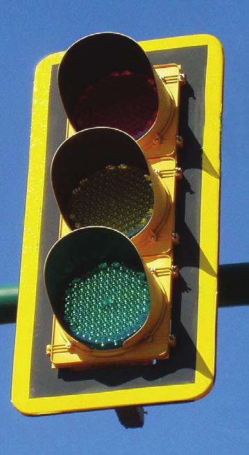
6 No one should place heavy suspended objects on a pole in a highway median. Such decisions directly affect the life of the public. Not just anyone can make such decisions. The decisions fall under the responsible charge of a P.E. because the P.E. is responsible for the entire intersection, including cameras, signs and all. 4. The Red-Light Camera Installation Plan Itself. Let us not strain out the gnat and swallow the camel. So here is the camel. The very existence of the red-light camera installation plan first requires that the yellow change interval has been determined by engineering practices-- MUTCD 4D.26 (3). Therefore, one cannot even install a camera, let alone draw up a plan, without first double-checking that the yellow change interval has been determined by engineering practices. The person drawing up the plan has to know engineering practices to double-check engineering practices; otherwise, he puts the public at risk. In North Carolina, yellow change intervals have been determined by practices, but not engineering practices. NCGS 89C-3 (6) application of physics. You know this is my core beef. 5. Systems Engineering Requiring a P.E. NCGS 160A defines the red-light camera as a traffic control device working in tandem with the traffic signal. In systems engineering, this is a classic example of a system of systems ( SOS ). The person drawing up the red-light camera installation plan is extending the functionality of the traffic signal. A traffic signal with extensions is a hybrid traffic signal. Any traffic signal, whether original configuration or hybrid, is still a traffic signal, and as such remains in the responsible charge of the licensed professional engineer. North Carolina law and the Raleigh installation plans reflect the system of systems beautifully. Many of Raleigh s red-light camera installation plans are explicitly called Signal Upgrades. The plans are certified by a P.E. by a firm licensed to practice engineering in North Carolina. This is as it is supposed to be. 6
7
8 EXHIBIT A North Carolina Laws 8
9 Document Links: Start of Document HISTORY: NOTES: GENERAL STATUTES OF NORTH CAROLINA *** Statutes current through the 2009 Regular Session *** *** Annotations current through September 18, 2009 *** CHAPTER 160A. CITIES AND TOWNS ARTICLE 15. STREETS, TRAFFIC AND PARKING 160A Use of traffic control photographic systems Go to the North Carolina Code Archive Directory N.C. Gen. Stat. 160A (2009) (a) A traffic control photographic system is an electronic system consisting of a photographic, video, or electronic camera and a vehicle sensor installed to work in conjunction with an official traffic control device to automatically produce photographs, video, or digital images of each vehicle violating a standard traffic control statute or ordinance. (b) Any traffic control photographic system or any device which is a part of that system, as described in subdivision (a) of this section, installed on a street or highway which is a part of the State highway system shall meet requirements established by the North Carolina Department of Transportation. Any traffic control system installed on a municipal street shall meet standards established by the municipality and shall be consistent with any standards set by the Department of Transportation. (b1) Any traffic control photographic system installed on a street or highway must be identified by appropriate advance warning signs conspicuously posted not more than 300 feet from the location of the traffic control photographic system. All advance warning signs shall be consistent with a statewide standard adopted by the Department of Transportation in conjunction with local governments authorized to install traffic control photographic systems. (c) Municipalities may adopt ordinances for the civil enforcement of G.S by means of a traffic control photographic system, as described in subsection (a) of this section. Notwithstanding the provisions of G.S , in the event that a municipality adopts an ordinance pursuant to this section, a violation of G.S at a location at which a traffic control photographic system is in operation shall not be an infraction. An ordinance authorized by this subsection shall provide that: (1) The owner of a vehicle shall be responsible for a violation unless the owner can furnish evidence that the vehicle was, at the time of the violation, in the care, custody, or control of another person. The owner of the vehicle shall not be responsible for the violation if the owner of the vehicle, within 30 days after notification of the violation, furnishes the officials or agents of the municipality which issued the citation either of the following: a. An affidavit stating the name and address of the person or company who had the care, custody, and control of the vehicle. b. An affidavit stating that the vehicle involved was, at the time, stolen. The affidavit must be supported with evidence that supports the affidavit, including insurance or police report information. (1a) Subdivision (1) of this subsection shall not apply, and the registered owner of the vehicle shall not be responsible for the violation, if notice of the violation is given to the registered owner of the vehicle more than 90 days after the date of the violation. (2) A violation detected by a traffic control photographic system shall be deemed a noncriminal violation for which a civil penalty of fifty dollars ($ 50.00) shall be assessed, and for which no points authorized by G.S (c) shall be
10 assigned to the owner or driver of the vehicle nor insurance points as authorized by G.S (3) The owner of the vehicle shall be issued a citation which shall clearly state the manner in which the violation may be challenged, and the owner shall comply with the directions on the citation. The citation shall be processed by officials or agents of the municipality and shall be forwarded by personal service or first-class mail to the address given on the motor vehicle registration. If the owner fails to pay the civil penalty or to respond to the citation within the time period specified on the citation, the owner shall have waived the right to contest responsibility for the violation, and shall be subject to a civil penalty not to exceed one hundred dollars ($ ). The municipality may establish procedures for the collection of these penalties and may enforce the penalties by civil action in the nature of debt. (4) The municipality shall institute a nonjudicial administrative hearing to review objections to citations or penalties issued or assessed under this section. (c1) The duration of the yellow light change interval at intersections where traffic control photographic systems are in use shall be no less than the yellow light change interval duration specified in the Design Manual developed by the Signals and Geometrics Section of the North Carolina Department of Transportation. (d) This section applies only to the Cities of Albemarle, Charlotte, Durham, Fayetteville, Greensboro, Greenville, High Point, Locust, Lumberton, Newton, Rocky Mount, and Wilmington, to the Towns of Chapel Hill, Cornelius, Huntersville, Matthews, Nags Head, Pineville, and Spring Lake, and to the municipalities in Union County. HISTORY: , ss. 1, 2; , s. 1; , ss. 1, 2; , s. 2; , s. 48(c); , s. 1; , s. 2; , ss. 1, 2; , s. 37; , s. 1; , s. 2; , s. 2. NOTES: LOCAL MODIFICATION. --City of Albemarle: , s. 1; city of Charlotte: , s. 1; city of Durham: , s. 1; city of Fayetteville: , s. 1; city of Locust: , s. 1; city of Rocky Mount: , s. 1; town of Chapel Hill: , s. 2(b); municipalities in Union County: , s.1. USE OF TRAFFIC CONTROL PHOTOGRAPHIC SYSTEMS IN WAKE COUNTY AND THE CITY OF CONCORD. -- Sessions Laws , ss. 3, 4, as amended by Session Laws , s. 3, enacted local laws governing the use of traffic control photographic systems in Wake County and the City of Concord. EDITOR'S NOTE. --Session Laws , s. 1, effective June 23, 1997, enacted this section and s. 2 made it effective as to the city of Charlotte. Session Laws , s. 1, effective April 17, 1999, added the city of Fayetteville. Session Laws , effective January 1, 2000, in s. 1, added subsection (b1), added "nor insurance points as authorized by G.S " at the end of subdivision (c)(2), and in s. 2, added the cities of Greensboro, High Point, and Rocky Mount. Session Laws , effective January 1, 2000, in s. 1 made the same changes as were made by Session Laws , s. 1, and in s. 2 added Charlotte, Fayetteville, Greenville, Wilmington, and Greensboro and the towns of Huntersville, Matthews, and Cornelius. Session Laws , s. 48(c), effective August 13, 1999, and designed to resolve duplicate enactments by Session Laws and , repealed Session Laws , ss. 1 and 2, and rewrote Session Laws , s. 2, as amended by Session Laws and Session Laws , to add the city of Wilmington, and the towns of Cornelius, Huntersville, and Matthews. Session Laws , s. 1, effective June 30, 2000, added the cities of Greenville and Lumberton, and the town of Pineville. Session Laws , s. 2, effective July 10, 2000, added the town of Chapel Hill. The section has been codified at the direction of the Revisor of Statutes. EFFECT OF AMENDMENTS. --Session Laws , s. 2, effective September 1, 2007, and applicable to offenses committed on or after that date, inserted "Locust" in subsection (d). LEGAL PERIODICALS. --For recent development, "Picture It: Red Light Cameras Abide by the Law of the Land," see 80 N.C.L. Rev (2002). LexisNexis 50 State Surveys, Legislation & Regulations Speed Detection & Traffic Control Devices CASE NOTES DUE PROCESS. --Because G.S. 160A-300.1(c)(4) and a city ordinance promulgated pursuant to it provided an adequate method to challenge the legality of a city's program to catch red-light violators by use of automatic cameras
11 EXHIBIT B Select Pages from the MUTCD 9


12 Including Revision 1 dated May 2012 and Revision 2 dated May 2012
13 2009 Edition Page 103 CHAPTER 2C. WARNING SIGNS AND OBJECT MARKERS Section 2C.01 Function of Warning Signs Support: 01 Warning signs call attention to unexpected conditions on or adjacent to a highway, street, or private roads open to public travel and to situations that might not be readily apparent to road users. Warning signs alert road users to conditions that might call for a reduction of speed or an action in the interest of safety and efficient traffic operations. Section 2C.02 Application of Warning Signs 01 The use of warning signs shall be based on an engineering study or on engineering judgment. Guidance: 02 The use of warning signs should be kept to a minimum as the unnecessary use of warning signs tends to breed disrespect for all signs. In situations where the condition or activity is seasonal or temporary, the warning sign should be removed or covered when the condition or activity does not exist. Option: 03 Consistent with the provisions of Chapter 2L, changeable message signs may be used to display a warning message. 04 Consistent with the provisions of Chapter 4L, a Warning Beacon may be used in combination with a standard warning sign. Support: 05 The categories of warning signs are shown in Table 2C Warning signs provided in this Manual cover most of the conditions that are likely to be encountered. Additional warning signs for low-volume roads (as defined in Section 5A.01), temporary traffic control zones, school areas, grade crossings, and bicycle facilities are discussed in Parts 5 through 10, respectively. 07 Section 1A.09 contains information regarding the assistance that is available to jurisdictions that do not have engineers on their staffs who are trained and/or experienced in traffic control devices. Section 2C.03 Design of Warning Signs 01 Except as provided in Paragraph 2 or unless specifically designated otherwise, all warning signs shall be diamond-shaped (square with one diagonal vertical) with a black legend and border on a yellow background. Warning signs shall be designed in accordance with the sizes, shapes, colors, and legends contained in the Standard Highway Signs and Markings book (see Section 1A.11). Option: 02 A warning sign that is larger than the size shown in the Oversized column in Table 2C-2 for that particular sign may be diamond-shaped or may be rectangular or square in shape. 03 Except for symbols on warning signs, minor modifications may be made to the design provided that the essential appearance characteristics are met. Modifications may be made to the symbols shown on combined horizontal alignment/intersection signs (see Section 2C.11) and intersection warning signs (see Section 2C.46) in order to approximate the geometric configuration of the intersecting roadway(s). 04 Word message warning signs other than those provided in this Manual may be developed and installed by State and local highway agencies. 05 Warning signs regarding conditions associated with pedestrians, bicyclists, and playgrounds may have a black legend and border on a yellow or fluorescent yellow-green background. 06 Warning signs regarding conditions associated with school buses and schools and their related supplemental plaques shall have a black legend and border on a fluorescent yellow-green background (see Section 7B.07). Section 2C.04 Size of Warning Signs 01 Except as provided in Section 2A.11, the sizes for warning signs shall be as shown in Table 2C-2. December 2009 Sect. 2C.01 to 2C.04
14 Page Edition 02 A W16-1P plaque shall not be used alone. If a W16-1P plaque is used, it shall be mounted below either a Vehicular Traffic Warning sign (see Section 2C.49) or a Non-Vehicular Warning sign (see Section 2C.50). The background color of the W16-1P plaque shall match the background color of the warning sign with which it is displayed. Section 2C.61 Photo Enforced Plaque (W16-10P) Option: 01 A Photo Enforced (W16-10P) plaque or a PHOTO ENFORCED (W16-10aP) word message plaque (see Figure 2C-12) may be mounted below a warning sign to advise road users that the regulations associated with the condition being warned about (such as a traffic control signal or a toll plaza) are being enforced by photographic equipment. 02 If used below a warning sign, the Photo Enforced (W16-10P or W16-10aP) plaque shall be a rectangle with a black legend and border on a yellow background. Section 2C.62 NEW Plaque (W16-15P) Option: 01 A NEW (W16-15P) plaque (see Figure 2C-12) may be mounted above a regulatory sign when a new regulation takes effect in order to alert road users to the new traffic regulation. A NEW plaque may also be mounted above an advance warning sign (such as a Signal Ahead sign for a newly-installed traffic control signal) for a new traffic regulation. 02 The NEW plaque shall not be used alone. 03 The NEW plaque shall be removed no later than 6 months after the regulation has been in effect. Section 2C.63 Object Marker Design and Placement Height Support: 01 Type 1, 2, and 3 object markers are used to mark obstructions within or adjacent to the roadway. Type 4 object markers are used to mark the end of a roadway. 02 When used, object markers (see Figure 2C-13) shall not have a border and shall consist of an arrangement of one or more of the following types: Type 1 a diamond-shaped sign, at least 18 inches on a side, consisting of either a yellow (OM1-1) or black (OM1-2) sign with nine yellow retroreflective devices, each with a minimum diameter of 3 inches, mounted symmetrically on the sign, or an all-yellow retroreflective sign (OM1-3). Type 2 either a marker (OM2-1V or OM2-1H) consisting of three yellow retroreflective devices, each with a minimum diameter of 3 inches, arranged either horizontally or vertically on a white sign measuring at least 6 x 12 inches; or an all-yellow horizontal or vertical retroreflective sign (OM2-2V or OM2-2H), measuring at least 6 x 12 inches. Type 3 a striped marker, 12 x 36 inches, consisting of a vertical rectangle with alternating black and retroreflective yellow stripes sloping downward at an angle of 45 degrees toward the side of the obstruction on which traffic is to pass. The minimum width of the yellow and black stripes shall be 3 inches. Type 4 a diamond-shaped sign, at least 18 inches on a side, consisting of either a red (OM4-1) or black (OM4-2) sign with nine red retroreflective devices, each with a minimum diameter of 3 inches, mounted symmetrically on the sign, or an all-red retroreflective sign (OM4-3). Support: 03 A better appearance can be achieved if the black stripes are wider than the yellow stripes. 04 Type 3 object markers with stripes that begin at the upper right side and slope downward to the lower left side are designated as right object markers (OM3-R). Object markers with stripes that begin at the upper left side and slope downward to the lower right side are designated as left object markers (OM3-L). Guidance: 05 When used for marking obstructions within the roadway or obstructions that are 8 feet or less from the shoulder or curb, the minimum mounting height, measured from the bottom of the object marker to the elevation Sect. 2C.60 to 2C.63 December 2009
15 Page Edition Figure 2C-12. Supplemental Warning Plaques W16-1P W16-2P W16-2aP W16-3P W16-3aP W16-4P W16-5P W16-6P W16-7P W16-8P W16-8aP W16-9P W16-10P W16-10aP W16-13P W16-15P W16-18P Note: The background color (yellow or fluorescent yellow-green) shall match the color of the warning sign that it supplements. 02 Supplemental warning plaques shall be used only in combination with warning or regulatory signs. They shall not be mounted alone or displayed alone. If used, a supplemental warning plaque shall be installed on the same post(s) as the warning or regulatory sign that it supplements. 03 Unless otherwise provided in this Manual for a particular plaque, supplemental warning plaques shall be mounted below the sign they supplement. Section 2C.54 Design of Supplemental Warning Plaques 01 A supplemental warning plaque used with a warning sign shall have the same legend, border, and background color as the warning sign with which it is displayed. A supplemental warning plaque used with a regulatory sign shall have a black legend and border on a yellow background. 02 Supplemental warning plaques shall be square or rectangular. Section 2C.55 Distance Plaques (W16-2 Series, W16-3 Series, W16-4P, W7-3aP) Option: 01 The Distance Ahead (W16-2 series and W16-3 series) plaques (see Figure 2C-12) may be used to inform the road user of the distance to the condition indicated by the warning sign. 02 The Next Distance (W7-3aP and W16-4P) plaques (see Figures 2C-4 and 2C-12) may be used to inform road users of the length of roadway over which the condition indicated by the warning sign exists. Section 2C.56 Supplemental Arrow Plaques (W16-5P, W16-6P) Guidance: 01 If the condition indicated by a warning sign is located on an intersecting road and the distance between the intersection and condition is not sufficient to provide adequate advance placement of the warning sign, a Supplemental Arrow (W16-5P or W16-6P) plaque (see Figure 2C-12) should be used below the warning sign. Sect. 2C.53 to 2C.56 December 2009
Municipal Act, 2001 Loi de 2001 sur les municipalités
 Municipal Act, 2001 Loi de 2001 sur les municipalités ONTARIO REGULATION 239/02 MINIMUM MAINTENANCE STANDARDS FOR MUNICIPAL HIGHWAYS Consolidation Period: From January 25, 2013 to the e-laws currency date.
Standard Highway Sign Border Specifications
 Standard Highway Sign Border Specifications A Radius Radius B C SIGN SIZE SIGN SIZE Variable Radius B C SIGN SIZE BORDER WIDTHS A B C CORNER RADIUS 18 4 30 36 48 60.375.375.375 1.375.375.438 1.5.5.375.65
CITY OF BEAVER DAM SNOW & ICE REMOVAL POLICY
 CITY OF BEAVER DAM SNOW & ICE REMOVAL POLICY Revised January, 2016 Approved by Operations Committee: February 1, 2016 This snow and ice removal policy guides Public Works personnel with deicing, plowing,
H IG HWAY WINTER OPERATIONS SNOW REMOVAL AND ICE CONTROL POLICY. Revised January 4, 2016
 ! H IG HWAY WINTER OPERATIONS SNOW REMOVAL AND ICE CONTROL POLICY Adopted January 11, 2010 Revised January 4, 2016 Pol icy It is the goal and intent of the Town of Sullivan to provide timely, efficient
of the street when facing south and all even numbers south of Railroad Avenue shall be on the righthand side of the street when facing south.
 Page 312 of the street when facing south and all even numbers south of Railroad Avenue shall be on the righthand side of the street when facing south. (Code 1980, 26-133; Code 2003, 22-267) Secs. 46-310
Superseded. REGULATORY R-047 (Revised/08) - Use Winter Tires or Carry Chains Beyond This Point October 1 April 30
 - Use Winter Tires or Carry Chains Beyond This Point October 1 April 30") To: Subject: All HQ Directors: Operations, Planning & Major Projects All Regional Directors All District Managers Transportation All Ministry Regional Traffic Engineers, (RTEs) Manager, Provincial Sign
To: Subject: All HQ Directors: Operations, Planning & Major Projects All Regional Directors All District Managers Transportation All Ministry Regional Traffic Engineers, (RTEs) Manager, Provincial Sign
April 10, Mr. Curt Van De Walle, City Manager City of Castle Hills 209 Lemonwood Drive Castle Hills, Texas 78213
 Mr. Curt Van De Walle, City Manager City of Castle Hills 209 Lemonwood Drive Castle Hills, Texas 78213 Subject: Revised Castle Hills BASIS Charter School Traffic Impact Analysis Review City of Castle Hills,
TOWN OF THORNTON, NEW HAMPSHIRE WINTER AND INCLEMENT WEATHER POLICY AND PRIORITIES
 TOWN OF THORNTON, NEW HAMPSHIRE WINTER AND INCLEMENT WEATHER POLICY AND PRIORITIES Pursuant to RSA 231:92 a, the Thornton Board of Selectmen hereby establishes the following policy and procedure for winter
City of Saginaw Right of Way Division Snow and Ice Removal Policy January 18, 2016
 Snow and Ice Removal Policy January 18, 2016 It is the policy of the to provide snowplowing and ice removal services in order to: Provide safe traveling conditions for motorists and pedestrians Assist
Snow and Ice Removal
 Policy # 6.6 Procedure # - Replaces 5.10 & 5.10A Revises - Date Approved February 10, 2014 Method of Approval Resolution #17 1. PRINCIPLES The City of Dauphin desires to maintain the City streets, lanes,
Uncertainty in the Yellow Change Interval
 Uncertainty in the Yellow Change Interval Abstract The difference between legal and illegal when it comes to running a red light is not black and white. Engineering is never exact. Tolerance is routine
IOWA COUNTY ORDINANCE NO. 22 IOWA COUNTY SNOW & ICE POLICY
 IOWA COUNTY ORDINANCE NO. 22 IOWA COUNTY SNOW & ICE POLICY AN ORDINANCE REPEALING ESTABLISHING THE POLICY AND LEVEL OF SERVICE IN RESPECT TO CLEARANCE OF SNOW AND ICE AND MAINTENANCE OF IOWA COUNTY S SECONDARY
Municipality of Grey Highlands Policy
 Municipality of Grey Highlands Policy Policy Name: Maintenance Standards Plan for Municipal Roadways Policy Number: A09-T-02 Department: Transportation & Environmental Services Authority: Director of Transportation
CITY OF NEW LONDON WINTER ROAD & SIDEWALK MAINTENANCE POLICY
 CITY OF NEW LONDON WINTER ROAD & SIDEWALK MAINTENANCE POLICY GENERAL The purpose of this policy is to set up acceptable procedures and policies for the winter maintenance of public areas in the City of
CEDAR COUNTY ORDINANCE NO. 6
 CEDAR COUNTY ORDINANCE NO. 6 AN ORDINANCE TO ESTABLISH THE POLICY AND LEVEL OF SERVICE IN RESPECT TO CLEARANCE OF SNOW OR ICE AND MAINTENANCE OF THIS COUNTY'S SECONDARY ROADS DURING THE WINTER MONTHS.
Town of Barnstable. Department of Public Work. Snow and Ice Control Operations Plan
 Town of Barnstable Department of Public Work Snow and Ice Control Operations Plan I. Mission: The mission of the Department of Public Works is to remove accumulations of snow and ice from town, county
Snow and Ice Control POLICY NO. P-01/2015. CITY OF AIRDRIE Snow and Ice Control Policy
 Page 1 CITY OF AIRDRIE Snow and Ice Control Effective Date: Approved By: Approved On: March 17, 2015 City Council March 16, 2015 Revision Date: Resolution #: ------ PURPOSE: The City of Airdrie is responsible
2013 NASCIO Award Submission Category: Cross-Boundary Collaboration and Partnerships. Project Title: Public Safety and Enterprise GIS in Tennessee
 2013 NASCIO Award Submission Category: Cross-Boundary Collaboration and Partnerships Project Title: Public Safety and Enterprise GIS in Tennessee State of Tennessee, Board of Parole State of Tennessee,
Dunn County Snow Removal Policy
 Dunn County Snow Removal Policy OVERVIEW With the advent of another winter season in the northern plains comes the possibility of snow, freezing rain and slippery roadways, and area resident s concern
SNOW CONTROL OPERATIONS 2017 PUBLIC SERVICES DEPARTMENT MAINTENANCE DIVISION
 SNOW CONTROL OPERATIONS 2017 PUBLIC SERVICES DEPARTMENT MAINTENANCE DIVISION 1 SNOW CONTROL OPERATIONS The following are the standard operating procedures f snow removal operations. 1. Plowing operations
Monitoring Scour Critical Bridges During Floods For Local Bridge Owners. Presented by
 Monitoring Scour Critical Bridges During Floods For Local Bridge Owners Presented by SAFETY FIRST DO NOT ENDANGER YOURSELF OR OTHERS WHILE MONITORING BRIDGES DO NOT ENTER FLOOD WATERS FLOOD WATERS INCLUDE
DE PUBLIC SERVICE COMPANY OF NEW HAMPSHIRE
 DE 05-142 PUBLIC SERVICE COMPANY OF NEW HAMPSHIRE Petition for License to Construct and Maintain Electric Lines Over and Across the Public Waters of the Nashua River in the City of Nashua, New Hampshire
Uniform Sign Plan (USP) Travis Park 89-USP-007
 Travis Park 89-USP-007") Uniform Sign Plan (USP) Travis Park 89-USP-007 These guidelines are published for informational purposes. A sign permit application must be submitted and a permit issued prior to installation of a sign.
Uniform Sign Plan (USP) Travis Park 89-USP-007 These guidelines are published for informational purposes. A sign permit application must be submitted and a permit issued prior to installation of a sign.
COUNCIL POLICY MANUAL
 COUNCIL POLICY MANUAL SECTION: PUBLIC WORKS SUBJECT: SNOW & ICE CONTROL POLICY 2012/2013 GOAL: Pages: 1 of 10 Approval Date: Dec. 3, 2012 Res. # 1001/2012 To annually identify the winter maintenance costs
[LLAZC03000.L EA0000 LVRCA13SA A, AZ SRP Notice of Temporary Closures of Public Lands in La Paz County, AZ
 This document is scheduled to be published in the Federal Register on 01/15/2013 and available online at http://federalregister.gov/a/2013-00542, and on FDsys.gov 4310-32-P DEPARTMENT OF THE INTERIOR Bureau
SNOW CONTROL OPERATIONS
 SNOW CONTROL OPERATIONS PUBLIC WORKS TEAM STREET MAINTENANCE DIVISION SNOW CONTROL OPERATIONS Standard Operating Procedures for Snow Removal Operations. 1. Plowing operations will be initiated when snow
DELAWARE COUNTY ORDINANCE NO. 3
 DELAWARE COUNTY ORDINANCE NO. 3 AN ORDINANCE TO ESTABLISH THE POLICY AND LEVEL OF SERVICE IN RESPECT TO CLEARANCE OF SNOW OR ICE AND MAINTENANCE OF THIS COUNTY'S SECONDARY ROADS DURING THE WINTER MONTHS.
City of Brainerd, Minnesota Snowplowing Policy
 City of Brainerd, Minnesota Snowplowing Policy 1. Introduction The city of Brainerd, Minnesota, finds that it is in the best interest of the residents of the city to assume basic responsibility for control
HOUSE BILL No June 19, 2007, Introduced by Reps. Warren, Ward, Gillard, Wojno and Bauer and referred to the Committee on Regulatory Reform.
 HOUSE BILL No. 4947 HOUSE BILL No. 4947 June 19, 2007, Introduced by Reps. Warren, Ward, Gillard, Wojno and Bauer and referred to the Committee on Regulatory Reform. A bill to amend 1980 PA 299, entitled
Woodford County Erosion Prevention Plan and Permit. Application #
 Woodford County Erosion Prevention Plan and Permit Application # Date Instructions: Applicant will complete Parts A and B, and attach a proposed site diagram. This diagram must be completed in accordance
Montmorency County Traffic Crash Data & Year Trends. Reporting Criteria
 June 2017 Revised 10/3/17 2016 Reporting Criteria Please pay particular attention to the wording when interpreting the three levels of data gathered for this report. Crash The Crash Level analyzes data
Resolution Number: (2) Resolution Title: Snow Policy Date Signed: 11/26/12. DAVIS COUNTY Snow Policy Resolution
 Resolution Title: Snow Policy Date Signed: 11/26/12. DAVIS COUNTY Snow Policy Resolution") Resolution Number: 112612(2) Resolution Title: Snow Policy Signed: 11/26/12 DAVIS COUNTY Snow Policy Resolution A RESOLUTION TO ESTABLISH THE POLICY AND LEVEL OF SERVICE IN RESPECT TO CLEARANCE OF SNOW
Resolution Number: 112612(2) Resolution Title: Snow Policy Signed: 11/26/12 DAVIS COUNTY Snow Policy Resolution A RESOLUTION TO ESTABLISH THE POLICY AND LEVEL OF SERVICE IN RESPECT TO CLEARANCE OF SNOW
When is sign lighting needed? How much is needed?
 When is sign lighting needed? How much is needed? Background National polices / guidelines Sign sheeting materials Sign lighting options Visual Complexity Closed-Course Legibility Study Open-Road Recognition
Town of Bowden Province of Alberta Policy Document ( ) SNOW REMOVAL POLICY
 SNOW REMOVAL POLICY") Town of Bowden Box 338, 2101 20 th Ave Bowden, Alberta, T0M 0K0 Town of Bowden Province of Alberta Policy Document (2019-01) SNOW REMOVAL POLICY 1 INTRODUCTION The purpose of this policy is to establish
Town of Bowden Box 338, 2101 20 th Ave Bowden, Alberta, T0M 0K0 Town of Bowden Province of Alberta Policy Document (2019-01) SNOW REMOVAL POLICY 1 INTRODUCTION The purpose of this policy is to establish
Major Crime Map Help Documentation
 Major Crime Map Help Documentation This web application is designed to make it easier to visualize and understand crime trends in Overland Park. The data for this application are generally limited to relatively
WORK SESSION AGENDA COMMITTEE-OF-THE-WHOLE APRIL 1, 2019 CITY COUNCIL CHAMBERS IMMEDIATELY FOLLOWING THE COUNCIL MEETING
 WORK SESSION AGENDA COMMITTEE-OF-THE-WHOLE APRIL 1, 2019 CITY COUNCIL CHAMBERS IMMEDIATELY FOLLOWING THE COUNCIL MEETING 1. Snow Removal Procedures Steven Lang 2. 2020 Budget Streets & Highways Tom Dankert
Active Traffic & Safety Management System for Interstate 77 in Virginia. Chris McDonald, PE VDOT Southwest Regional Operations Director
 Active Traffic & Safety Management System for Interstate 77 in Virginia Chris McDonald, PE VDOT Southwest Regional Operations Director Interstate 77 at Fancy Gap Mountain Mile markers 0-15 Built in late
PROVINCIAL HEALTH AUTHORITIES OF ALBERTA ACT
 Province of Alberta PROVINCIAL HEALTH AUTHORITIES Revised Statutes of Alberta 2000 Current as of January 1, 2002 Published by Alberta Queen s Printer Alberta Queen s Printer 7 th Floor, Park Plaza 10611-98
TAKE ROLL CALL TO DETERMINE IF THERE IS A QUORUM OF MEMBERS PRESENT
 LAWRENCE SIGN CODE BOARD OF APPEALS AGENDA JULY 5, 2018 6:35 P.M., CITY COMMISSION MEETING ROOM, FIRST FLOOR OF CITY HALL, SIXTH AND MASSACHUSETTS STREET, LAWRENCE, KANSAS CALL THE MEETING TO ORDER TAKE
CHAPTER 6 STREETS, SIDEWALKS AND ALLEYS SECTION STREET NAME CHANGES AND NUMBERING HOUSES AND OTHER BUILDINGS.
 CHAPTER 6 STREETS, SIDEWALKS AND ALLEYS SECTION 1 601.000. STREET NAME CHANGES AND NUMBERING HOUSES AND OTHER BUILDINGS. 601.001. REDESIGNATION. A. All streets or avenues running generally easterly and
OXFORD HEIGHTS SUBDIVISION EMERGENCY EVACUATION PLAN
 OXFORD HEIGHTS SUBDIVISION EMERGENCY EVACUATION PLAN March 27, 2007 Oxford Heights Overview and Historical Conditions Oxford Heights is a medium sized community located on the southern side of Elizabeth
RESOLUTION NO
 RESOLUTION NO. 09-2017 Adopting Job Descriptions for Engineering and GIS Manager and GIS Analyst and Amending the Pay Resolution to Accommodate Said Positions and Amending the Staffing Chart to Accommodate
Department of Transportation. National Highway Traffic Safety Administration. [Docket No. NHTSA ; Notice 2]
![Department of Transportation. National Highway Traffic Safety Administration. [Docket No. NHTSA ; Notice 2]](/thumbs/89/99595080.jpg "Department of Transportation. National Highway Traffic Safety Administration. [Docket No. NHTSA ; Notice 2]") This document is scheduled to be published in the Federal Register on 04/12/2016 and available online at http://federalregister.gov/a/2016-08362, and on FDsys.gov Department of Transportation National
This document is scheduled to be published in the Federal Register on 04/12/2016 and available online at http://federalregister.gov/a/2016-08362, and on FDsys.gov Department of Transportation National
AS STANDARD
 AS 1319-1994 STANDARD SAFETY SIGNS FOR THE OCCUPATIONAL ENVIRONMENT COMPLIES WI TH THE ST ANDARDS AUST RAL I A COMMITTEE INDU ST RI AL WARNI NG SIG N S Safety Signs are crucial in any work environment.
City of Rhinelander Snow and Ice Policy
 City of Rhinelander Snow and Ice Policy General: Policy: Procedure: The ability to react promptly and decisively to varying winter weather conditions with regard to snow removal and ice control on city
[LLNVS01000 L EA0000 LVRCF A 18X MO# ] Notice of Temporary Closure of Public Land in Clark County, Nevada
![[LLNVS01000 L EA0000 LVRCF A 18X MO# ] Notice of Temporary Closure of Public Land in Clark County, Nevada](/thumbs/96/127731372.jpg "[LLNVS01000 L EA0000 LVRCF A 18X MO# ] Notice of Temporary Closure of Public Land in Clark County, Nevada") This document is scheduled to be published in the Federal Register on 03/07/2019 and available online at https://federalregister.gov/d/2019-04135, and on govinfo.gov 4310-HC DEPARTMENT OF THE INTERIOR
This document is scheduled to be published in the Federal Register on 03/07/2019 and available online at https://federalregister.gov/d/2019-04135, and on govinfo.gov 4310-HC DEPARTMENT OF THE INTERIOR
Report to the Seventy-first Legislative Assembly on the Implementation of 1999 Senate Bill 12 Relating to Public Safety and Rapidly Moving Landslides
 Report to the Seventy-first Legislative Assembly on the Implementation of 1999 Senate Bill 12 Relating to Public Safety and Rapidly Moving Landslides December 28, 2000 Department of Geology and Mineral
NATHAN HALE HIGH SCHOOL PARKING AND TRAFFIC ANALYSIS. Table of Contents
 Parking and Traffic Analysis Seattle, WA Prepared for: URS Corporation 1501 4th Avenue, Suite 1400 Seattle, WA 98101-1616 Prepared by: Mirai Transportation Planning & Engineering 11410 NE 122nd Way, Suite
ATTENTION PARENTS/GUARDIANS PLEASE READ THE ATTACHED INFORMATION AND RETAIN FOR YOUR RECORDS OR RETURN IF APPLICABLE
 Please frequent our website for ongoing news and information at www.coralspringscharter.org ATTENTION PARENTS/GUARDIANS PLEASE READ THE ATTACHED INFORMATION AND RETAIN FOR YOUR RECORDS OR RETURN IF APPLICABLE
SPEED LIMIT STUDY ELDRON BLVD NE & SE FROM AMERICANA BLVD NE TO BAYSIDE LAKES BLVD. Engineering and Traffic Investigation Conducted by:
 SPEED LIMIT STUDY ELDRON BLVD NE & SE FROM AMERICANA BLVD NE TO BAYSIDE LAKES BLVD Engineering and Traffic Investigation Conducted by: Elia Twigg, P.E. Kwabena Ofosu, Ph.D., P.E. Public Works Department
BEFORE THE BOARD OF COUNTY COMMISSIONERS OF LANE COUNTY, OREGON
 BEFORE THE BOARD OF COUNTY COMMISSIONERS OF LANE COUNTY, OREGON ORDER NO. 18-05-22-06 IN THE MATTER OF SURRENDER OF A PORTION OF COAST GUARD STATION ROAD (COUNTY ROAD NUMBER 65) AND A PORTION OF S. HARBOR
SNOW REMOVAL GUIDE. City Of Orange Township. Public Works Snow Removal Hotline: (973) My Orange Hotline: (973)
 My Orange Hotline: (973)") Mayor Dwayne D. Warren, Esq. And The Orange Municipal Council MOVING ORANGE FORWARD City Of Orange Township SNOW REMOVAL GUIDE Public Works Snow Removal Hotline: (973) 266-4030 My Orange Hotline: (973)
Mayor Dwayne D. Warren, Esq. And The Orange Municipal Council MOVING ORANGE FORWARD City Of Orange Township SNOW REMOVAL GUIDE Public Works Snow Removal Hotline: (973) 266-4030 My Orange Hotline: (973)
Winter Storm Response - January 2016 Due to the uncertainty of the event, we must be prepared
 Winter Storm Response - January 2016 Due to the uncertainty of the event, we must be prepared 1 Highway Patrol Winter Storm Operations 48 Hours Pre-Storm Met with State Emergency Management Team to discuss
Montmorency County Traffic Crash Data & Year Trends. Reporting Criteria
 June 2018 Revised 8/3/2018 2017 Reporting Criteria Please pay particular attention to the wording when interpreting the three levels of data gathered for this report. Crash The Crash Level analyzes data
Subject: Desert Palisades Specific Plan - Tram Way Access Sight Distance
 Endo Engineering Traffic Engineering Air Quality Studies Noise Assessments July 13, 2015 Mr. Ed Freeman Pinnacle View, LLC P.O. Box 1754 Lake Oswego, OR 97035-0579 Subject: Desert Palisades Specific Plan
YORK REGION DISTRICT SCHOOL BOARD. Procedure #NP464.0, Snow/Ice Clearance and Removal
 YORK REGION DISTRICT SCHOOL BOARD Procedure #NP464.0, Snow/Ice Clearance and Removal Application The Snow/Ice Clearance and Removal procedure addresses the practices to be followed with regards to the
RESOLUTION NO INTRODUCTION
 RESOLUTION NO. 0824 A RESOLUTION TO ESTABLISH THIS CITY S SNOW AND ICE CONTROL POLICY DURING WINTER MONTHS, SPECIFICALLY DEFINED AS NOVEMBER THROUGH MARCH. BE IT RESOLVED BY THE CITY COUNCIL OF SOLON,
SUMMARY OF RESEARCH; UNNAMED ROAD # $ - USGS Topo Proof Map FLPMA The use of and jurisdiction of UNNAMED ROAD # pre-dates the
 SUMMARY OF RESEARCH; UNNAMED ROAD #927 107 195$ - USGS Topo Proof Map 1976- FLPMA The use of and jurisdiction of UNNAMED ROAD #927107 pre-dates the Bureau of Land Management. Historical records of the
Contents. Ipswich City Council Ipswich Adopted Infrastructure Charges Resolution (No. 1) Page
 Page") Ipswich City Council Ipswich Adopted Infrastructure Charges Resolution (No. 1) 2014 Contents Page Part 1 Introduction 3 1. Short title 3 2. Commencement 3 3. Sustainable Planning Act 2009 3 4. Purpose
Ipswich City Council Ipswich Adopted Infrastructure Charges Resolution (No. 1) 2014 Contents Page Part 1 Introduction 3 1. Short title 3 2. Commencement 3 3. Sustainable Planning Act 2009 3 4. Purpose
IMPROVING FLOOD RISK COMMUNICATIONS: SIGNS OF CHANGING BEHAVIOR? DANIEL M. TOMCZAK, CFM
 IMPROVING FLOOD RISK COMMUNICATIONS: SIGNS OF CHANGING BEHAVIOR? DANIEL M. TOMCZAK, CFM CH2M HILL, INC RALEIGH, NC U.S. HOW MUCH RISK DO WE WANT TO TAKE DRIVING THROUGH FLOOD WATERS? TURN AROUND DON T
Annual Collision Report
 2016 Annual Collision Report Contents The Annual Collision Report is a summary of statistics associated with traffic collisions that occurred in the City of Winnipeg. This information is provided by Manitoba
SNOW REMOVAL POLICY ITASCA COUNTY TRANSPORTATION DEPARTMENT
 ITASCA COUNTY TRANSPORTATION DEPARTMENT Effective Date: November 1, 1989 Revised: November 18, 2014 Policy Number: Operations 89-4 Distribution: Commissioner's Office Engineer's Office All Garages Number
JEP John E. Jack Pflum, P.E. Consulting Engineering 7541 Hosbrook Road, Cincinnati, OH Telephone:
 JEP John E. Jack Pflum, P.E. Consulting Engineering 7541 Hosbrook Road, Cincinnati, OH 45243 Email: jackpflum1@gmail.com Telephone: 513.919.7814 MEMORANDUM REPORT Traffic Impact Analysis Proposed Soccer
ANNUAL KEY USE AND INDEMNIFICATION AGREEMENT
 ANNUAL KEY USE AND INDEMNIFICATION AGREEMENT (2018-2019) Brighton Estates Property Owners Association, Inc. (BEPOA) and the undersigned Owner enter into this Annual Key Use and Indemnification Agreement
TOWN OF WINCHESTER OFFICE OF THE PLANNING DEPARTMENT. 71 Mount Vernon Street. Winchester, MA 01890
 BRIAN SZEKELY TOWN PLANNER Winchester Board of Selectmen 71 Mt. Vernon St. Winchester, MA 01890 TOWN OF WINCHESTER OFFICE OF THE PLANNING DEPARTMENT 71 Mount Vernon Street Winchester, MA 01890 August 11,
CHAPTER 3. CAPACITY OF SIGNALIZED INTERSECTIONS
 CHAPTER 3. CAPACITY OF SIGNALIZED INTERSECTIONS 1. Overview In this chapter we explore the models on which the HCM capacity analysis method for signalized intersections are based. While the method has
AGENDA. 6. AB 475 and SB 386: require rear amber strobe lights on horse-drawn vehicles for safety after dark and during inclement
 AGENDA Eau Claire County Highway Committee Thursday January 4th, 2018 / 6:15 am Eau Claire County Highway Department - Room 101 2000 Spooner Avenue, Altoona, WI 54720 1. Call the meeting to order. 2. Confirmation
ENHANCING AND ENCOURAGING ACTIVE MODES OF TRANSPORTATION. The proposed 2016 amendments and additions to O.Reg 239/02 under the Municipal Act, 2001.
 1 ENHANCING AND ENCOURAGING ACTIVE MODES OF TRANSPORTATION The proposed 2016 amendments and additions to O.Reg 239/02 under the Municipal Act, 2001. Overview Photo Credit: dandyhorsemagazine.com, 2015
STATISTICAL ANALYSIS OF LAW ENFORCEMENT SURVEILLANCE IMPACT ON SAMPLE CONSTRUCTION ZONES IN MISSISSIPPI (Part 1: DESCRIPTIVE)
") STATISTICAL ANALYSIS OF LAW ENFORCEMENT SURVEILLANCE IMPACT ON SAMPLE CONSTRUCTION ZONES IN MISSISSIPPI (Part 1: DESCRIPTIVE) Tulio Sulbaran, Ph.D 1, David Marchman 2 Abstract It is estimated that every
STATISTICAL ANALYSIS OF LAW ENFORCEMENT SURVEILLANCE IMPACT ON SAMPLE CONSTRUCTION ZONES IN MISSISSIPPI (Part 1: DESCRIPTIVE) Tulio Sulbaran, Ph.D 1, David Marchman 2 Abstract It is estimated that every
MONTGOMERY COUNTY SNOW PLAN
 2018 2019 MONTGOMERY COUNTY SNOW PLAN COMMUNICATION DURING SNOW/ICE SITUATIONS Communication will be established prior/during all winter storms between the Sheriff s Office, Public Works Department, and
TRAFFIC IMPACT STUDY. Platte Canyon Villas Arapahoe County, Colorado (Arapahoe County Case Number: Z16-001) For
 For") TRAFFIC IMPACT STUDY For Platte Canyon Villas Arapahoe County, Colorado (Arapahoe County Case Number: Z16-001) February 2015 Revised: August 2015 April 2016 July 2016 September 2016 Prepared for: KB Home
TRAFFIC IMPACT STUDY For Platte Canyon Villas Arapahoe County, Colorado (Arapahoe County Case Number: Z16-001) February 2015 Revised: August 2015 April 2016 July 2016 September 2016 Prepared for: KB Home
Schedule C By-Law Snow and Ice Control Services - Project Specifications for Various Parking Lots
 SNOW AND ICE CONTROL SERVICES - (4) SEPARATE DEPARTMENTS SCHEDULE C REQUEST FOR PROPOSAL 2244 Schedule C By-Law Snow and Ice Control Services - Project Specifications for Various Parking Lots 1.0 General
Town of Oconomowoc Snow & Ice Control Policy
 Town of Oconomowoc Snow & Ice Control Policy Introduction The purpose of this policy is to provide a detailed overview of the Town s snow & ice control operations including its goals and objectives. All
SUMMARY OF RESEARCH; EASY CHAIR CRATER ROAD # USGS Topo Proof Map FLPMA The use of and jurisdiction of EASY CHAIR CRATER ROAD
 SUMMARY OF RESEARCH; EASY CHAIR CRATER ROAD #955540 1967 - USGS Topo Proof Map 1976 - FLPMA The use of and jurisdiction of EASY CHAIR CRATER ROAD #955540 pre-dates the Bureau of Land Management. Historical
Evaluation of fog-detection and advisory-speed system
 Evaluation of fog-detection and advisory-speed system A. S. Al-Ghamdi College of Engineering, King Saud University, P. O. Box 800, Riyadh 11421, Saudi Arabia Abstract Highway safety is a major concern
VIRGINIA S I-77 VARIABLE SPEED LIMIT SYSTEM FOR LOW VISIBILITY CONDITIONS
 VIRGINIA S I-77 VARIABLE SPEED LIMIT SYSTEM FOR LOW VISIBILITY CONDITIONS Christopher D. McDonald, PE, PTOE Regional Operations Director, Southwest Region NRITS and ITS Arizona Annual Conference October
North Carolina Simplified Inundation Maps For Emergency Action Plans December 2010; revised September 2014; revised April 2015
 North Carolina Simplified Inundation Maps For Emergency Action Plans December 2010; revised September 2014; revised April 2015 INTRODUCTION Emergency Action Plans (EAPs) are critical to reducing the risks
Independent Analysis of Yellow Signal Timing Issues at Red Light Camera Approaches in the City of St. Petersburg
 Independent Analysis of Yellow Signal Timing Issues at Red Light Camera Approaches in the City of St. Petersburg by Matt Florell stpetecameras.org 2014-01-06 1 X. Introduction This analysis is meant as
SAMPLE LIGHTING MANAGEMENT PLAN FOR INTERNATIONAL DARK SKY PARKS/RESERVES/SANCTUARIES
 SAMPLE LIGHTING MANAGEMENT PLAN FOR INTERNATIONAL DARK SKY PARKS/RESERVES/SANCTUARIES This document is provided by IDA for the purpose of creating a plan for appropriately lighting parks and similar protected
The Newsletter of the Summerlakes Homeowners Association
 Sun The Newsletter of the Summerlakes Homeowners Association January 2018 Summerlakes Homeowners Association 3S020 Continental Drive Warrenvillle, Illinois 60555 FACILITY HOURS (Fall/Winter) Monday-Friday,
Session 6: and Evaluation. M c Farland Management, LLC
 Session 6: Performance Measurement and Evaluation State of the Practice Overview 1 Why Evaluate WRTM Strategies Understand system performance and benefits Specific benefits directly attributable to WRTM
CITY OF STURGIS 1984 REVISED ORDINANCES TITLE 35-1
 CITY OF STURGIS 1984 REVISED ORDINANCES TITLE 35-1 TITLE 35 WIND ENERGY SYSTEMS (Title 35 enacted effective July 21, 2010, Ordinance 2010-06) Chapters: 35.01: General Provisions 35.02: Permitted Use 35.03:
INDOT Office of Traffic Safety
 Intro to GIS Spatial Analysis INDOT Office of Traffic Safety Intro to GIS Spatial Analysis INDOT Office of Traffic Safety Kevin Knoke Section 130 Program Manager Highway Engineer II Registered Professional
A Thesis Proposal. Agrawal, Ravi. Submitted to the Office of Graduate Studies of Texas A&M University
 Using Finite Element Structural Analysis of Retroreflective Raised Pavement Markers (RRPMs) to Recommend Testing Procedures for Simulating Field Performance of RRPMs A Thesis Proposal By Agrawal, Ravi
[LLAZC X.L EA0000; AZ SRP ] Notice of Temporary Closures: Selected Public Lands in La Paz County, AZ
![[LLAZC X.L EA0000; AZ SRP ] Notice of Temporary Closures: Selected Public Lands in La Paz County, AZ](/thumbs/89/100188672.jpg "[LLAZC X.L EA0000; AZ SRP ] Notice of Temporary Closures: Selected Public Lands in La Paz County, AZ") This document is scheduled to be published in the Federal Register on 12/29/2017 and available online at https://federalregister.gov/d/2017-28217, and on FDsys.gov 4310-32 DEPARTMENT OF THE INTERIOR Bureau
This document is scheduled to be published in the Federal Register on 12/29/2017 and available online at https://federalregister.gov/d/2017-28217, and on FDsys.gov 4310-32 DEPARTMENT OF THE INTERIOR Bureau
Sign Code Amendment: Illustrated Definitions. Prepared for the Monday, May 15, 2017 Planning Commission Work Session Meeting
 Sign Code Amendment: Illustrated Definitions Prepared for the Monday, May 15, 2017 Planning Commission Work Session Meeting SIGN Any o letter, o word or symbol, o poster, o picture, o reading matter, or
Traffic accidents and the road network in SAS/GIS
 Traffic accidents and the road network in SAS/GIS Frank Poppe SWOV Institute for Road Safety Research, the Netherlands Introduction The first figure shows a screen snapshot of SAS/GIS with part of the
Texas Transportation Institute The Texas A&M University System College Station, Texas
 1. Report No. FHWA/TX-03/4150-1 4. Title and Subtitle ANALYSIS OF TXDOT THICKNESS MEASUREMENT PROCEDURES FOR THERMOPLASTIC PAVEMENT MARKINGS Technical Report Documentation Page 2. Government Accession
Date of occurrence Location name O Porriño (Pontevedra) Local time 09:25 Latitude Railway vehicle movement events Train derailment.
 Local time 09:25 Latitude Railway vehicle movement events Train derailment.") -5165 Occurrence Summary What Location Date of occurrence 09-09-16 Location name O Porriño (Pontevedra) Local time 09:25 Latitude Event type Railway vehicle movement events Train derailment Longitude Description
-5165 Occurrence Summary What Location Date of occurrence 09-09-16 Location name O Porriño (Pontevedra) Local time 09:25 Latitude Event type Railway vehicle movement events Train derailment Longitude Description
Derogation Criteria for the Requirements for Generators Network Code
 Derogation Criteria for the Requirements for Generators Network Code Decision Paper Reference: CER/17/084 Date Published: 13/04/2017 Closing Date: 0 Executive Summary Commission Regulation (EU) 2016/631
Minimum Standards for Wetland Delineations
 Minimum Standards for Wetland Delineations Jason Gipson Chief, Utah/Nevada Regulatory Branch Sacramento District Regulatory Program Workshop 16 Mar 2016 US Army Corps of Engineers Delineation Report Minimum
SDI Development in Georgia. Mari Khardziani Head of International Relations Unit National Agency of Public Registry
 SDI Development in Georgia Mari Khardziani Head of International Relations Unit National Agency of Public Registry Kehl, Germany September 5, 2017 2 National Agency of Public Registry Legal Entity of Public
Checklist: Deposing the Driver in an Auto Accident
 Checklist: Deposing the Driver in an Auto Accident 1. PERSONAL BACKGROUND All names ever used Present and past residences for 10 years If the deponent has rented a residence, get the name and address of
The Use of Geographic Information Systems (GIS) by Local Governments. Giving municipal decision-makers the power to make better decisions
 by Local Governments. Giving municipal decision-makers the power to make better decisions") The Use of Geographic Information Systems (GIS) by Local Governments Giving municipal decision-makers the power to make better decisions Case Study: Examples of GIS Usage by Local Governments in North
The Use of Geographic Information Systems (GIS) by Local Governments Giving municipal decision-makers the power to make better decisions Case Study: Examples of GIS Usage by Local Governments in North
Quality Pavement Markings
 Quality Pavement Markings Idaho Asphalt Conference Moscow, Idaho October 26, 2006 Purpose of Pavement Markings Provide the visual information needed by the driver to guide their vehicle Ed Lagergren,,
Preparing Spatial Data
 13 CHAPTER 2 Preparing Spatial Data Assessing Your Spatial Data Needs 13 Assessing Your Attribute Data 13 Determining Your Spatial Data Requirements 14 Locating a Source of Spatial Data 14 Performing Common
Report TR-CW That staff be authorized to install signage on roads identified in Schedule A as excluded from By-law ; and
 Report TR-CW-30-17 To: Warden Barfoot and Committee of the Whole From: Pat Hoy, Director of Transportation Services Meeting Date: October 26, 2017 Subject: ATV Access on Grey County Roads Status: Recommendation(s)
Derivation of the Yellow Change Interval Formula
 Derivation of the Yellow Change Interval Formula Brian Ceccarelli, PE; Joseph Shovlin, PhD The yellow change interval formula traffic engineers use to set yellow light durations originated from a paper
TOWN OF MOUNT GILEAD BOARD OF COMMISSIONERS AGENDA
 TOWN OF MOUNT GILEAD BOARD OF COMMISSIONERS AGENDA 110 West Allenton Street, Mount Gilead, North Carolina, 27306 December 4, 2018 The Mount Gilead Board of Commissioners will meet at 7:00 p.m. at Highland
Focused Traffic Analysis for the One Lincoln Park Project
 September 15, 2015 Mr. Bill Johnson Coldwell Banker 511 Sir Francis Drake Boulevard Greenbrae, CA 94904 Focused Traffic Analysis for the One Lincoln Park Project Dear Mr. Johnson; As requested, W-Trans