In-situ radiation measurements and GIS visualization / interpretation
|
|
|
- Milo Park
- 5 years ago
- Views:
Transcription
1 In-situ radiation measurements and GIS visualization / interpretation Román Padilla Alvarez, Iain Darby Nuclear Science and Instrumentation Laboratory Department of Nuclear Sciences and Applications, International Atomic Energy Agency
2 Outline Intro NSIL Need for radiological monitoring Some features inherent to in-situ measurements Compliance to needs Effective sampling Spatial distribution of radiation GPS readings Measurement and Interpretation Comparability of data Data validation Interpolation Probability maps
 Provision of analytical services (MS and other")
3 NSIL: Nuclear Science and Instrumentation Laboratory Spectrometry Instrumentation Mission: Assisting Member States in introducing and extending the use of nuclear instrumentation and radiation spectrometry techniques Training Research aimed to improve analytical performance and to extend applicability (Adaptive Research) Provision of analytical services (MS and other IAEA units)
4 Regular Budget Activities Major programme 1. Nuclear Power, Fuel Cycle and Nuclear Science Programme 1.4 (D) Nuclear Science Subprogramme (D.3) Accelerators and Nuclear Spectrometry for Material Science and Analytical Applications PROJECTS ( ): Facilitating experiments with accelerators (Particle and Synchrotron) Nuclear Instrumentation (for Environmental and other Applications)
5 TC Budget Activities National, Regional and Interregional projects Technical backstopping o Concepts and designs review o Implementation Procurement Expert missions Regional Training courses Fes and SVs Around 20 fellows month trained at NSIL
6 ERA monitoring Problem: Monitoring of Radionuclides and/or other Hazardous Substances in the Environment Example of conceptual model for a mining / milling site


7 Characterization of sites for remediation Problem: Assessing the amount and distribution of Radionuclides and/or other Hazardous Substances in the site
8 Typical cases of radiologically affected sites include: Uranium mining / milling sites Sites with increased amounts of NORM o mining of phosphate rocks, REE, bismuth, zirconium, titanium, oil exploitation Sites affected by discharges (accidental or planned) of radionuclides Nuclear weapons test areas Military sites Nuclear industry or other radiological facilities accidents
9 Site characterization challenges Samples may differ by composition and aggregation The concentration of contaminants of concern (abundance) is unknown Heterogeneous spatial distribution of the COC Need to analyze different compartments (soil, water, biota) Large amount of samples required to evaluate the status and extent of the contamination
10 Balanced order of priorities in site characterization Is there contamination (Y/N) o Trigging level corresponding to established (or to be established) regulation Presence or not How to assess the extent (spatial distribution) of the contamination? Knowledge of previous activities + logic sampling campaign In-situ fast screening Accuracy required for the results o High? Poor? Acceptable? Additional needs: o To avoid misclassifications (false positives/ negatives) o To minimize hazardous exposure o To reduce costs o To shorten time delay for decision taking
11 An ideal analytic technique Sensitivity Specificity o The response to the inspected property (measurand, analyte) highest possible! Lowest DL! o To which extent the measured signal reflects only of the presence (qualitative) and amount (quantitative) of the analyte Interference free! Accuracy of the measurement result o To which extent the result is true and precise Better possible accuracy!
12 An ideal analytic technique Uncertainty of measurement result o Uncertainty is the parameter associated with the result of a measurement that characterizes the dispersion of the values that could reasonably be attributed to the measurand Minimal possible uncertainty! Time delay in obtaining the results Cost Immediate! Minimal!
13 In real life what matters is Fitness for purpose o To which extent the analytical method fulfils the expectations in regard to the results of analysis Analytical Problem definition o What my sample is? Matrix type Homogeneity of distribution of the property o What do I need to assess in it? Analytes (COC) o What is the expected level of presence of the analyte? Mass fraction, activity concentration o How accurate and uncertain can be the results? Depends on the purpose of the characterization

14 Laboratory vs. in-situ Gamma spectrometry: Sample size Appropriate sampling representative Highly accurate analysis Mostly for soils, biota, foodstuff Marinelli beaker: ~ 1 dm 3
15 In-situ Gamma spectrometry: Sample size

16 In-situ Effective Volume shape (85 %) 10 m x 0.3 m ~ 3 m 3 The measured signal is integrated over large volume Suitable for large scale estimation
17 In-situ Depth distribution
18 Compliance to requirements Sensitivity Specificity o Similar to laboratory (even shorter measurement time per spot!) o Sufficient for most cases (improved res. Scintillators) Accuracy and uncertainty of the measurement result o Worst for individual measurement, but at large scale characterization, better Time delay: immediate Cost: Much less!!!


19 Surface radiological assessment Surface measurements: Shift from Gas-filled (GM / PIC / PC) to Low resolution gamma spectrometry (Scintillation detectors) NaI(Tl), BGO, CeBr CdZnTe CsI Measurement time: For dose rate ~ 1 s For radionuclide activity concentration ~ 1 5 min.
 10-114 61 267 56.7 114-250 24 771 22.9 250-500 11 660 10.8 500-1140 5 283 4.9 1140-10400 5 036 4.")
20 Surface radiological assessment measurements 2 ½ days of measurements Dose rate (nsv/h) Nr (%)


21 In-depth radiological assessment Bore hole measurements: High density Scintillation detectors (BGO)
22 In-situ techniques for radiological assessment
23 GPS coordinates Accuracy: - For out of shelf (non-expensive devices) in the order of 5 10 m - Open space (not covered areas) - Effects from multiple reflections at buildings or topography (cliffs, high buildings) can bias the coordinate readings
24 Effect of reflections
25 Effect of reflections
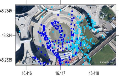
26 Effect of reflections
27 GPS coordinates - Higher precision data is also available - OmniSTAR is a satellite based augmentation system (SBAS) service provider. OmniSTAR correction signals are proprietary, and a subscription must be bought - Differential Global Positioning System (DGPS) Reference radio beacon systems network of fixed, groundbased reference stations to broadcast the difference between the positions indicated by the satellite systems and the known fixed positions

28 Usability of data - Several instruments might be used at once - Each instruments has different calibrations Rescaling readings: - It is recommended to use at least one instrument having calibration made by an accredited laboratory. The measurements obtained with other instruments can be rescaled to the values of the calibrated instrument

29 Usability of data - Several instruments might be used at once - Each instruments has different calibrations Rescaling readings: - Compare readings among the different instruments at locations where different dose rate levels are found. Differences not exceeding 25 % can be re-scaled to those of the instrument selected for reference
30 Data validation: Coordinate validation: The data sets have to be thoroughly examined to correct positioning errors if any, in combination with background map or visual localization. Incorrect values: To exclude the cases presenting missing or wrong values (probe saturation or probe failure for instance). Detection limits: Shall be considered as valuable information. Depending on the intended processing algorithm, be replaced by either the DL, or by different fractions of the detection limits (in Geochemistry to use half of the DL) Duplicates: Measurements performed within a distance less than the targeted spatial resolution in a grid plan) must be removed or replaced by a single value (the minimum, the maximum or the average of the defined cluster
31 Data analysis and interpretation: Base maps are needed Simple statistical treatment. Correlation among different variables, if more than one has been measured). Understanding the spatial variability of data. Interpretation and representation of the results

32 Base maps: Base maps: Maps from the surveyed areas have to be available and properly geo-referenced. The measurement results have to be represented in such maps. - Option 1: Use professional software or free ware packages - Option 2: Recalibrate aerial imagery
33 Base maps: Base maps: Maps from the surveyed areas have to be available and properly geo-referenced. The measurement results have to be represented in such maps. - Option 1: Use professional software or free ware packages - Option 2: Recalibrate aerial imagery - Option 3: Contact Frank Albinet

34 Simple statistics: Simple statistical treatment, to reveal minimum and maximum values, as well as the variability of the data. Correlation among different variables, if more than one has been measured).

35 Spatial variability: Understanding the spatial variability of data. Experimental variograms represent the variability of the measurement values according to the distance between each pair of data points To infer some information from the spatial structure of the data set, if there is any to assess if an adequate sampling plan has been performed

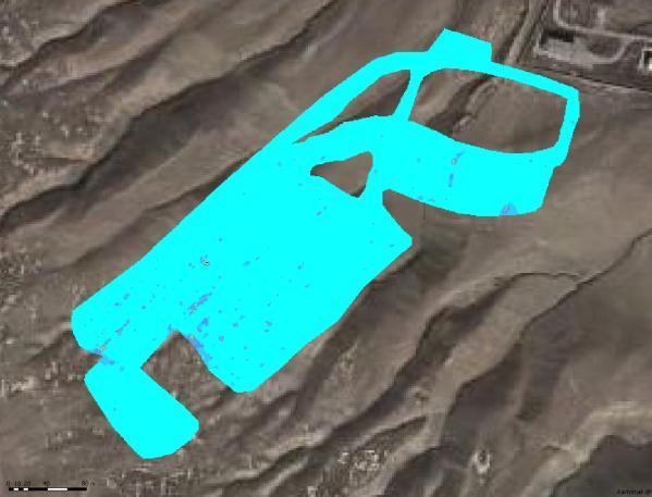
36 Pathway measurements: Measured cells: 22, total area: ca. 7.7 ha Average length of each followed path: 6.5 km

37 Interpolation: Natural Neighbor Natural neighbor: weighted average of the neighboring observations, where the weights are proportional to the "borrowed area of Thiessen polygons n NN x, y = w i M x i, xy i i=1
38 Kriging: The interpolated values are modeled by a Gaussian process governed by prior covariances. Kriging predicts the value of a function at a given point by computing a weighted average of the known values of the function in the neighborhood of the point Allows calculating the uncertainty of the prediction (based on variogram results) Possibility to calculate the probability of exceeding a given acceptance value (based on Gaussian distribution)
 Data set was taken with a 40 m separation Interpolation was made as to create a 5 m")
39 Comparison: Experimental interpolation Source data: Altitude in digital terrain model (5 m grid) Data set was taken with a 40 m separation Interpolation was made as to create a 5 m grid

40 Interpolation by Krigging:
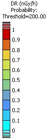
41 Probability:

42 Data analysis and interpretation: Interpretation and representation of the results Background info

43 Data analysis and interpretation: Interpretation and representation of the results Background info
44 IN-SITU Working Group: Harmonization of procedures for site characterization, depending on the radiological impact. Comparison of the performance of detectors and sampling heads. For example, probes for bore-hole analysis can be useful for soil depth profile studies, whereas special sampler designs could be useful for measuring activity concentration in water bodies at different depths. A comparison of the performance of different statistical approaches for interpretation of the results is required. Such evaluation shall be made for data sets representing different types of contamination.
45 Thanks for your time and attention
Mobile Unit for Site Characterization: Results of a Demonstration Event
 Mobile Unit for Site Characterization: Results of a Demonstration Event Román Padilla Alvarez Nuclear Spectrometry and Applications Laboratory Department of Nuclear Sciences and Applications, Horst Monken
Dose Reconstruction Methods and Source Term Assessment using Data from Monitoring Networks and Mobile Teams A German Approach
 Dose Reconstruction Methods and Source Term Assessment using Data from Monitoring Networks and Mobile Teams A German Approach M. Bleher, U. Stöhlker, F. Gering Federal Office for Radiation Protection (BfS),
Radioactive Waste Management
 International Journal of Research in Engineering and Science (IJRES) ISSN (Online): 2320-9364, ISSN (Print): 2320-9356 Volume 4 Issue 6 ǁ June. 2016 ǁ PP.67-71 Asma Osman Ibrahim Osman 1, Hamid Mohamed
Methodologies and tools developed by CEA/SAS
 Characterization and Visualization Technologies in DD&R December 8 th 2011, France Methodologies and tools developed by CEA/SAS Julien ATTIOGBE attiogbe@geovariances.com CEA-FAR/SAS 1 Software Development
SADA General Information
 SADA General Information Windows--based freeware designed to integrate scientific models with decision and cost analysis frameworks in a seamless, easy to use environment. Visualization/GIS Custom Analysis
GEOGRAPHIC INFORMATION SYSTEMS Session 8
 GEOGRAPHIC INFORMATION SYSTEMS Session 8 Introduction Geography underpins all activities associated with a census Census geography is essential to plan and manage fieldwork as well as to report results
IdentiFINDER Digital Hand Held Spectrometer & Dose Rate Meter for Portable Applications
 fire IdentiFINDER Digital Hand Held Spectrometer & The world s smallest spectrometer and dose rate meter designed for portable applications. safety security identifinder - CH (yellow) CZT and neutron detector
This document is a preview generated by EVS
 INTERNATIONAL STANDARD ISO 13168 First edition 2015-07-01 Water quality Simultaneous determination of tritium and carbon 14 activities Test method using liquid scintillation counting Qualité de l eau Détermination
LATE PHASE OF NUCLEAR ACCIDENT IN AGRICULTURE WEAKNESSES IN DECISION MAKING DUE TO LACK OF DATA, KNOWLEDGE AND SKILL AND POSSIBLE INNOVATION
 IAEA expert meeting on Radiation Protection after Fukushima Accident, Vienna 17-21 Feb 2014 LATE PHASE OF NUCLEAR ACCIDENT IN AGRICULTURE WEAKNESSES IN DECISION MAKING DUE TO LACK OF DATA, KNOWLEDGE AND
Residual activity (contamination) Radiation exposure levels
 Radiation exposure levels") Field Survey Techniques to be Used for the PRR-1 Kristine Marie Romallosa Radiation Protection Services PHILIPPINE NUCLEAR RESEARCH INSTITUTE Why field survey? To identify location measure and give extent
Field Survey Techniques to be Used for the PRR-1 Kristine Marie Romallosa Radiation Protection Services PHILIPPINE NUCLEAR RESEARCH INSTITUTE Why field survey? To identify location measure and give extent
SLOVENIAN ALARM AND MONITORING NETWORKS
 SLOVENIAN ALARM AND MONITORING NETWORKS Jasmina Kožar Logar, Denis Glavič-Cindro "Jožef Stefan" Institute,, Slovenia CHERNOBYL 25 YEARS LATER: STUDIES, REMARKS AND RECENT FINDINGS June 21-22-23, 2011 UDINE
Geostatistics for radiological characterization: overview and application cases
 Geostatistics for radiological characterization: overview and application cases Yvon DESNOYERS a* a GEOVARIANCES, 49bis av. Franklin Roosevelt, 77215 Avon, France *corresponding author: yvon.desnoyers@geovariances.com
EPRI Report: Review of Geostatistical Approaches to Characterization of Subsurface Contamination
 EPRI Report: Review of Geostatistical Approaches to Characterization of Subsurface Contamination - 17442 Richard McGrath *, Richard Reid*, Phung Tran* *Electric Power Research Institute, 3420 Hillview
USE OF RADIOMETRICS IN SOIL SURVEY
 USE OF RADIOMETRICS IN SOIL SURVEY Brian Tunstall 2003 Abstract The objectives and requirements with soil mapping are summarised. The capacities for different methods to address these objectives and requirements
Sensitivity of the IRD whole-body counter for in vivo measurements in the case of accidental intakes
 Sensitivity of the IRD whole-body counter for in vivo measurements in the case of accidental intakes B.M. Dantas, E.A. Lucena and A.L.A. Dantas Laboratório de Monitoração In Vivo Divisão de Dosimetria
Characterising NORM hazards within subsea oil and gas facilities. Daniel Emes SA Radiation
 Characterising NORM hazards within subsea oil and gas facilities. Daniel Emes SA Radiation What is in Oil and Gas NORM? Naturally Occurring Radioactive Material (NORM) can be characterized into many forms.
TECHNICAL WORKING GROUP ITWG GUIDELINE ON IN-FIELD APPLICATIONS OF HIGH- RESOLUTION GAMMA SPECTROMETRY FOR ANALYSIS OF SPECIAL NUCLEAR MATERIAL
 NUCLE A R FORENSIC S INTERN ATION A L TECHNICAL WORKING GROUP ITWG GUIDELINE ON IN-FIELD APPLICATIONS OF HIGH- RESOLUTION GAMMA SPECTROMETRY FOR ANALYSIS OF SPECIAL NUCLEAR MATERIAL This document was designed
U.S. EPA Superfund Counts Per Minute (CPM) Electronic Calculator Stuart A. Walker. U.S. Environmental Protection Agency, Washington, DC.
 Electronic Calculator Stuart A. Walker. U.S. Environmental Protection Agency, Washington, DC.") U.S. EPA Superfund Counts Per Minute (CPM) Electronic Calculator 14336 Stuart A. Walker U.S. Environmental Protection Agency, Washington, DC. 20460 ABSTRACT The U.S. Environmental Protection Agency (EPA)
U.S. EPA Superfund Counts Per Minute (CPM) Electronic Calculator 14336 Stuart A. Walker U.S. Environmental Protection Agency, Washington, DC. 20460 ABSTRACT The U.S. Environmental Protection Agency (EPA)
RADIATION MONITORING NETWORKS and some results from the reactor accident in Fukushima
 RADIATION MONITORING NETWORKS and some results from the reactor accident in Fukushima Sixth Annual Workshop on Radiation Measurement Cross Calibration Project June 13-15, 2011 Middle East Scientific Institute
Characterization Survey Techniques and Some Practical Feedback
 International Atomic Energy Agency Characterization Survey Techniques and Some Practical Feedback Lawrence E. Boing R 2 D 2 Project Workshop December 3-7, 2007 Manila, The Philippines 3/17/2008 NSRW/WSS
Geostatistical characterisation of contaminated metals: methodology and illustrations
 1 Geostatistical characterisation of contaminated metals: methodology and illustrations Per Lidar and Arne Larsson, Studsvik Nuclear AB Yvon Desnoyers, Geovariances Symp. on Recycling of Metals arising
Application of SADA for 3D Subsurface Characterization and Suggested Approach for Volumetric Compliance with Decommissioning Dose Criteria
 Application of SADA for 3D Subsurface Characterization and Suggested Approach for Volumetric Compliance with Decommissioning Dose Criteria Robert Stewart, Ph.D. Oak Ridge National Laboratory University
The PEAC-WMD Gamma Radiation Dose Calculator
 The PEAC-WMD Gamma Radiation Dose Calculator During the last couple of months newsletters I ve discussed some of the new computational tools included in the PEAC-WMD 2007 (v5.5) application. This month
WM2011 Conference, February 27 - March 3, 2011, Phoenix, AZ
 Methodology for Determination of Exposure Point Concentration Using both Systematic and Biased Samples for Radiological Risk and Dose Assessments 11488 Randy Hansen*, Michael Steven Passig*, Mahmudur Rahman**
UNCORRECTED PROOF. Table of Contents
 00-Stabin-Prelims SNY001-Stabin (Typeset by spi publisher services, Delhi) vii of xvi June 1, 2007 17:15 Preface xiii Acknowledgments xv Chapter 1. Introduction to Health Physics 1 1.1 Definition of Health
Specific Accreditation Guidance
 Specific Accreditation Guidance Materials Characterisation of Metallic Items by X-Ray Fluorescence and Atomic (Arc/Spark) Emission Techniques August 2018 Copyright National Association of Testing Authorities,
Importance of uncertainties in dose assessment to prove compliance with radiation protection standards
 Importance of uncertainties in dose assessment to prove compliance with radiation protection standards Manfred TSCHURLOVITS, Atominstitute of Austrian Universities, Vienna University of Technology, Stadionallee
Procedure for determining radionuclides in foodstuffs at elevated levels of contamination by gamma spectrometry
 Procedure for determining radionuclides in foodstuffs at elevated levels of contamination by gamma spectrometry E- -SPEKT-LEBM-02 Authors: O. Frindik M. Heilgeist W. Kalus R. Schelenz Federal coordinating
Softwares for radiological assessment of buildings & soils
 Softwares for radiological assessment of buildings & soils Given by Jean-Guy Nokhamzon jean-guy.nokhamzon@cea.fr Julien ATTIOGBE, Didier DUBOT didier.dubot@cea.fr CEA/DSV/USLT/SPRE/SAS Jean-Jacques PERAUDIN
Accelerator Facility Accident Report
 Accelerator Facility Accident Report 31 May 2013 Incorporated Administrative Agency - Japan Atomic Energy Agency Inter-University Research Institute - High Energy Accelerator Research Organization Subject:
Annex I to Resolution 6.2/2 (Cg-XVI) Approved Text to replace Chapter B.4 of WMO Technical Regulations (WMO-No. 49), Vol. I
 Approved Text to replace Chapter B.4 of WMO Technical Regulations (WMO-No. 49), Vol. I") Annex I to Resolution 6.2/2 (Cg-XVI) Approved Text to replace Chapter B.4 of WMO Technical Regulations (WMO-No. 49), Vol. I TECHNICAL REGULATIONS VOLUME I General Meteorological Standards and Recommended
Annex I to Resolution 6.2/2 (Cg-XVI) Approved Text to replace Chapter B.4 of WMO Technical Regulations (WMO-No. 49), Vol. I TECHNICAL REGULATIONS VOLUME I General Meteorological Standards and Recommended
Reference Materials for Trade and Development: Quality and Comparability
 Reference Materials for Trade and Development: Quality and Comparability A. Introduction Scientific measurements are a basic input to decisions made in many areas of human activity. In particular, physical
Michael G. Stabin. Radiation Protection and Dosimetry. An Introduction to Health Physics. 4) Springer
 Springer") Michael G. Stabin Radiation Protection and Dosimetry An Introduction to Health Physics 4) Springer Table of Contents Preface Acknowledgments Chapter 1. Introduction to Health Physics 1 1.1 Definition of
Michael G. Stabin Radiation Protection and Dosimetry An Introduction to Health Physics 4) Springer Table of Contents Preface Acknowledgments Chapter 1. Introduction to Health Physics 1 1.1 Definition of
12/18/2016. Radioanalysis Laboratory Capabilities and Issues. Eleventh Annual Radiation Measurement Cross Calibration Workshop RMCC XI
 1. Introduction 2. Laboratories Gamma spectrometry laboratory. Radiochemistry laboratory. Analytical chemistry laboratory. Alpha spectrometry laboratory Gross alpha / beta laboratory. Neutron activation
Toward an automatic real-time mapping system for radiation hazards
 Toward an automatic real-time mapping system for radiation hazards Paul H. Hiemstra 1, Edzer J. Pebesma 2, Chris J.W. Twenhöfel 3, Gerard B.M. Heuvelink 4 1 Faculty of Geosciences / University of Utrecht
NEW DEVELOPMENTS OF AUTORADIOGRAPHY TECHNIQUE TO IMPROVE ALPHA AND BETA MEASUREMENTS FOR DECOMMISSIONING FACILITIES
 NEW DEVELOPMENTS OF AUTORADIOGRAPHY TECHNIQUE TO IMPROVE ALPHA AND BETA MEASUREMENTS FOR DECOMMISSIONING FACILITIES PASCAL FICHET, C MOUGEL, Y DESNOYERS, P SARDINI, H WORD DEN SERVICE D ETUDES ANALYTIQUES
Key Considerations for Ensuring Quality Radioanalytical Laboratory Services for Superfund Sites Activities
 Key Considerations for Ensuring Quality Radioanalytical Laboratory Services for Superfund Sites Activities John Griggs, Director Center for Radioanalytical Laboratory Science (CERLS) National Air and Radiation
A robust statistically based approach to estimating the probability of contamination occurring between sampling locations
 A robust statistically based approach to estimating the probability of contamination occurring between sampling locations Peter Beck Principal Environmental Scientist Image placeholder Image placeholder
Press kit Kartotrak 2014 June 2nd, 2014
 Press kit Kartotrak 2014 June 2nd, 2014 Worldwide leader in Geostatistics, Geovariances enables its clients involved with mapping, resource estimation or risk analysis to benefit from more than 25 years
THE IMPLEMENTATION OF RADIOLOGICAL CHRACTERIZATION FOR REACTOR DECOMMISSIONING. China Nuclear Power Engineering Co. Ltd, Beijing , China
 Proceedings of the 18th International Conference on Nuclear Engineering ICONE18 May 17-21, 2010, Xi'an, China ICONE18- THE IMPLEMENTATION OF RADIOLOGICAL CHRACTERIZATION FOR REACTOR DECOMMISSIONING DENG
International Atomic Energy Agency. Department of Nuclear Sciences and Applications. IAEA Environment Laboratories
 International Atomic Energy Agency Department of Nuclear Sciences and Applications IAEA Environment Laboratories Vienna International Centre, P.O. Box 100, 1400 Vienna, Austria REFERENCE SHEET CERTIFIED
THE USE OF GAMMA RAY DATA TO DEFINE THE NATURAL RADIATION ENVIRONMENT
 IAEA-TECDOC-566 THE USE OF GAMMA RAY DATA TO DEFINE THE NATURAL RADIATION ENVIRONMENT A TECHNICAL DOCUMENT ISSUED BY THE INTERNATIONAL ATOMIC ENERGY AGENCY, VIENNA, 1990 The SAEA does not normally maintain
RADIOACTIVITY IN CHEMICAL FERTILIZERS
 RADIOACTIVITY IN CHEMICAL FERTILIZERS Milica M. Rajačić, Nataša B. Sarap, Marija M. Janković, Jelena D. Nikolić, Dragana J. Todorović and Gordana. Pantelić Institute for Nuclear Sciences "Vinča", University
INCREMENTAL SAMPLING METHODOLOGY
 INCREMENTAL SAMPLING METHODOLOGY 1. INTRODUCTION Incremental sampling methodology (ISM) is a structured composite sampling and processing protocol having specific elements designed to reduce data variability
Investigation of Uncertainty Sources in the Determination of Gamma Emitting Radionuclides in the WBC
 Investigation of Uncertainty Sources in the Determination of Gamma Emitting Radionuclides in the WBC A. Specification Whole body counting method is used to detect the gamma rays emitted by radio nuclides,
Radiological Characterization of Buildings at the Ranstad Uranium Works
 Radiological Characterization of Buildings at the Ranstad Uranium Works Report presented at the Workshop on Radiological Characterization for Decommissioning Studsvik, Nyköping, Sweden 17 19 April 2012
General Regression Neural Networks for Estimating Radiation Workers Internal Dose
 General Regression Neural Networks for Estimating Radiation s Internal Dose Eman Sarwat and Nadia Helal Radiation Safety Dep. ENRRA., Egyptian Nuclear and Radiological Regulatory Authority, 3, Ahmed El
Radioactivity measurements for the ERMES project at the STELLA facility
 EPJ Web of Conferences 24, 02002 (2012) DOI: 10.1051/ epjconf/ 20122402002 C Owned by the authors, published by EDP Sciences - SIF, 2012 Radioactivity measurements for the ERMES project at the STELLA facility
IAEA-SM-367/10/04/P SCREENING AND RADIOMETRIC MEASUREMENT OF ENVIRONMENTAL SWIPE SAMPLES
 IAEA-SM-367/10/04/P SCREENING AND RADIOMETRIC MEASUREMENT OF ENVIRONMENTAL SWIPE SAMPLES V. MAIOROV, A. CIURAPINSKI, W. RAAB and V. JANSTA Safeguards Analytical Laboratory, International Atomic Energy
Facilitating Survey Sampling in Low- and Middle-Income Contexts Through Satellite Maps and Basic Mobile Computing Technology
 Facilitating Survey Sampling in Low- and Middle-Income Contexts Through Satellite Maps and Basic Mobile Computing Technology 6 th European Survey Association Conference Survey Research in Developing Countries
Procedure for determining radionuclides in plant samples (indicators) by gamma spectrometry
 by gamma spectrometry") Procedure for determining radionuclides in plant samples (indicators) by gamma spectrometry F- -SPEKT-PFLAN-01 Author: A. Wiechen Federal coordinating office for soil, vegetation, animal feed and food
Procedure for determining radionuclides in plant samples (indicators) by gamma spectrometry F- -SPEKT-PFLAN-01 Author: A. Wiechen Federal coordinating office for soil, vegetation, animal feed and food
Optimization of Sediment Sampling at a Tidally Influenced Site (ArcGIS)
") Optimization of Sediment Sampling at a Tidally Influenced Site (ArcGIS) Contacts: Mark Malander, ExxonMobil Environmental Services Company, mark.w.malander@exxonmobil.com, Jeffrey A. Johnson, Newfields, Inc.,
Optimization of Sediment Sampling at a Tidally Influenced Site (ArcGIS) Contacts: Mark Malander, ExxonMobil Environmental Services Company, mark.w.malander@exxonmobil.com, Jeffrey A. Johnson, Newfields, Inc.,
Minimum Detectable and Maximum Missable Activities
 and Maximum Missable The HPA Approach David Williams 18 May 2005 Centre for Radiation, Chemical and Environmental Hazards Radiation Protection Division formerly the National Radiological Protection Board
General Overview of Radiation Detection and Equipment
 www.inl.gov INL/MIS-11-22727 General Overview of Radiation Detection and Equipment International Nuclear Safeguards Policy and Information Analysis Course Monterey Institute of International Studies June
O R D E R OF THE HEAD OF THE STATE NUCLEAR POWER SAFETY INSPECTORATE
 O R D E R OF THE HEAD OF THE STATE NUCLEAR POWER SAFETY INSPECTORATE ON THE APPROVAL OF NUCLEAR SAFETY REQUIREMENTS BSR-1.9.1-2011 STANDARDS OF RELEASE OF RADIONUCLIDES FROM NUCLEAR INSTALLATIONS AND REQUIREMENTS
Monitoring of Ionizing Radiations facilities Experience and challenge
 Monitoring of Ionizing Radiations facilities Experience and challenge Lebanese Atomic Energy Commission The LAEC was established in 1996 with the full support and assistance of the IAEA, having the mandate
Mobile GIS Applications in US Surface Coal Mining Reclamation
 Mobile GIS Applications in US Surface Coal Mining Reclamation Robert Welsh: US Office of Surface Mining Reclamation and Enforcement (OSM) TIPS Branch Denver, CO US Office of Surface Mining Bureau in Dept.
Statistical Uncertainty What, When, Why and How RETS/REMP Workshop Jim Key Key Solutions, Inc.
 Statistical Uncertainty What, When, Why and How 2005 RETS/REMP Workshop Jim Key Key Solutions, Inc. www.keysolutionsinc.com What Do I Use and When CL MDA MDC LTL LLD Detection Limits A Posteriori After
Research Methods in Environmental Science
 Research Methods in Environmental Science Module 5: Research Methods in the Physical Sciences Research Methods in the Physical Sciences Obviously, the exact techniques and methods you will use will vary
Section 3: Nuclear Radiation Today
 : Nuclear Radiation Today Preview Key Ideas Bellringer Where is Radiation? Beneficial Uses of Nuclear Radiation Risks of Nuclear Radiation Nuclear Power Key Ideas Where are we exposed to radiation? What
USING METEOROLOGICAL ENSEMBLES FOR ATMOSPHERIC DISPERSION MODELLING OF THE FUKUSHIMA NUCLEAR ACCIDENT
 USING METEOROLOGICAL ENSEMBLES FOR ATMOSPHERIC DISPERSION MODELLING OF THE FUKUSHIMA NUCLEAR ACCIDENT 17th International Conference on Harmonisation within Atmospheric Dispersion Modelling for Regulatory
How GIS can be used for improvement of literacy and CE programmes
 How GIS can be used for improvement of literacy and CE programmes Training Workshop for Myanmar Literacy Resource Center (MLRC) ( Yangon, Myanmar, 11 20 October 2000 ) Presented by U THEIN HTUT GEOCOMP
Terrestrial gamma dose rates along one of the coastal highways in Sri Lanka
 Sri Lankan Journal of Physics, Vol. 2 (21) 1-6 Institute of Physics - Sri Lanka Terrestrial gamma dose rates along one of the coastal highways in Sri Lanka C.S. Sumithrarachchi and R. Hewamanna * Department
Characterization of Large Structures & Components
 Structures & Components KEY BENEFITS Key Drivers: Lack of good knowledge about the position, the identification and the radiological specification of contamination on or inside large components. Significant
DATA SOURCES AND INPUT IN GIS. By Prof. A. Balasubramanian Centre for Advanced Studies in Earth Science, University of Mysore, Mysore
 DATA SOURCES AND INPUT IN GIS By Prof. A. Balasubramanian Centre for Advanced Studies in Earth Science, University of Mysore, Mysore 1 1. GIS stands for 'Geographic Information System'. It is a computer-based
Spatiotemporal Analysis of Environmental Radiation in Korea
 WM 0 Conference, February 25 - March, 200, Tucson, AZ Spatiotemporal Analysis of Environmental Radiation in Korea J.Y. Kim, B.C. Lee FNC Technology Co., Ltd. Main Bldg. 56, Seoul National University Research
IAEA-TECDOC Clearance
 IAEA-TECDOC-1000 Clearance The IAEA does The originating Section of this publication in the IAEA was: Waste Safety Section International Atomic Energy Agency Wagramerstrasse FOREWORD It has long been recognized
Author(s): Charles K. Cover, P.E. Federal Energy Regulatory Commission
: Charles K. Cover, P.E. Federal Energy Regulatory Commission") Using GIS to Help Manage a National Energy Program Author(s): Charles K. Cover, P.E. Federal Energy Regulatory Commission The Federal Energy Regulatory Commission (FERC) has statutory oversight on key
Using GIS to Help Manage a National Energy Program Author(s): Charles K. Cover, P.E. Federal Energy Regulatory Commission The Federal Energy Regulatory Commission (FERC) has statutory oversight on key
Application of national regulations for metallic materials recycling from the decommissioning of an Italian nuclear facility.
 Application of national regulations for metallic materials recycling from the decommissioning of an Italian nuclear facility. Giovanni Varasano *, Leonardo Baldassarre*, Edoardo Petagna*. SOGIN Spa, ITREC
2016 No. 410 (W. 128) WATER, ENGLAND AND WALES. The Water Supply (Water Quality) (Amendment) Regulations 2016
 WATER, ENGLAND AND WALES. The Water Supply (Water Quality) (Amendment) Regulations 2016") W E L S H S T A T U T O R Y I N S T R U M E N T S 2016 No. 410 (W. 128) WATER, ENGLAND AND WALES The Water Supply (Water Quality) (Amendment) Regulations 2016 Made - - - - 21 March 2016 Laid before Parliament
W E L S H S T A T U T O R Y I N S T R U M E N T S 2016 No. 410 (W. 128) WATER, ENGLAND AND WALES The Water Supply (Water Quality) (Amendment) Regulations 2016 Made - - - - 21 March 2016 Laid before Parliament
SWGDRUG GLOSSARY. Independent science-based organization that has the authority to grant
 SWGDRUG GLOSSARY These definitions were developed and adopted by the SWGDRUG Core Committee from a variety of sources including The United Nations Glossary of Terms for Quality Assurance and Good Laboratory
M E E T I n s t r u m e n t s G.m.b.H.
 T a m a r i s k e n g a s s e 1 0 2 / 1 3 / 5 A - 1 2 2 0 V i e n n a, A U S T R I A T e l : + 4 3 1 2 8 5 4 5 7 2, F a x : + 4 3 1 2 8 3 6 4 2 9 E - m a i l : office@mateval.com www.mateval.com Portable
ɣ-radiochromatography
 nuclear instruments Kapitel_y_Graphy.indd 1 19.08.09 10:27 n u c l e a r i n s t r u m e n t s Index HPLC-detectors TLC-detectors GABI* analog output GABI* digital output to PC minigita*, 1 trace scanner
Gridding of precipitation and air temperature observations in Belgium. Michel Journée Royal Meteorological Institute of Belgium (RMI)
") Gridding of precipitation and air temperature observations in Belgium Michel Journée Royal Meteorological Institute of Belgium (RMI) Gridding of meteorological data A variety of hydrologic, ecological,
Gridding of precipitation and air temperature observations in Belgium Michel Journée Royal Meteorological Institute of Belgium (RMI) Gridding of meteorological data A variety of hydrologic, ecological,
Procedures for the Release of Sites
 Procedures for the Release of Sites Matthias Bothe Verein für Kernverfahrenstechnik und Analytik Rossendorf e.v. PF 510119, 01314 Dresden, Germany matthias.bothe@vkta.de Research Site Rossendorf (former
HALF LIFE. NJSP HMRU June 10, Student Handout CBRNE AWARENESS Module 4 1. Objectives. Student will
 June 10, 2004 Radiological/Nuclear Overview 1 Student will demonstrate a knowledge of self protection techniques identify types of radiation and their associated hazards demonstrate a knowledge of terminology
APPENDIX G EVALUATION OF MEASUREMENT UNCERTAINTY
 APPENDIX G EVALUATION OF MEASUREMENT UNCERTAINTY Table of Contents 1. SCOPE... 2 2. REFERENCES... 2 3. TERMS AND DEFINITIONS... 2 4. BACKGROUND... 4 5. EVALUATION OF MEASUREMENT UNCERTAINTY POLICY... 5
It s a Model. Quantifying uncertainty in elevation models using kriging
 It s a Model Quantifying uncertainty in elevation models using kriging By Konstantin Krivoruchko and Kevin Butler, Esri Raster based digital elevation models (DEM) are the basis of some of the most important
Applications of GIS in Electrical Power System
 Applications of GIS in Electrical Power System Abdulrahman M. AL-Sakkaf 201102310 CRP 514 May 2013 Dr. Baqer M. AL-Ramadan Abstract GIS has been widely used in various areas and disciplines. This paper
COMPARISON OF PERSONNEL RADIATION MONITORING DOSIMETERS DESIGNED FOR MEDICAL FIELD
 COMPARISON OF PERSONNEL RADIATION MONITORING DOSIMETERS DESIGNED FOR MEDICAL FIELD Kirill SKOVORODKO, Birute GRICIENE, Milda PETKELYTE Radiation Protection Division, Vilnius University Hospital Santaros
XA TERRESTRIAL GAMMA DOSE RATE MAPS, THEIR COMPILATION AND VERIFICATION RADIOMETRIC MAP OF THE CZECH REPUBLIC
 TERRESTRIAL GAMMA DOSE RATE MAPS, THEIR COMPILATION AND VERIFICATION RADIOMETRIC MAP OF THE CZECH REPUBLIC XA9745936 M. MATOLIN Faculty of Science, Charles University, Prague, Czech Republic Abstract Maps
Mapping the Baseline of Terrestrial Gamma Radiation in China
 Radiation Environment and Medicine 2017 Vol.6, No.1 29 33 Note Mapping the Baseline of Terrestrial Gamma Radiation in China Zhen Yang, Weihai Zhuo* and Bo Chen Institute of Radiation Medicine, Fudan University,
The Pharmaceutical and Chemical Journal, 2017, 4(6): Research Article
: Research Article") , 217, 4(6):53-6 Available online www.tpcj.org Research Article ISSN: 2349-792 CODEN(USA): PCJHBA Determination of Natural Radioactivity Concentration Levels in Soil Samples in Odigbo Local Government
, 217, 4(6):53-6 Available online www.tpcj.org Research Article ISSN: 2349-792 CODEN(USA): PCJHBA Determination of Natural Radioactivity Concentration Levels in Soil Samples in Odigbo Local Government
AUTOMATED TEMPLATE MATCHING METHOD FOR NMIS AT THE Y-12 NATIONAL SECURITY COMPLEX
 AUTOMATED TEMPLATE MATCHING METHOD FOR NMIS AT THE Y-1 NATIONAL SECURITY COMPLEX J. A. Mullens, J. K. Mattingly, L. G. Chiang, R. B. Oberer, J. T. Mihalczo ABSTRACT This paper describes a template matching
WASTE MANAGEMENT GLOSSARY
 IAEA-TECDOC-264 RADIOACTIVE WASTE MANAGEMENT GLOSSARY A TECHNICAL DOCUMENT ISSUED RADIOACTIVE WASTE MANAGEMENT GLOSSARY IAEA, VIENNA, 1982 Printed by the IAEA in Austria April 1982 PLEASE BE AWARE THAT
Preparation of Database for Urban Development
 Preparation of Database for Urban Development By PunyaP OLI, 1. Chairman, ERMC (P) Ltd., Kathmandu, Nepal. Email: punyaoli@ermcnepal.com 2. Coordinator, Himalayan College of Geomatic Engineering and Land
5th Caribbean Environmental Forum and Exhibition (CEF 5) Montego Bay, Jamaica June 21-25, 2010
 Montego Bay, Jamaica June 21-25, 2010") 5th Caribbean Environmental Forum and Exhibition (CEF 5) Montego Bay, Jamaica June 21-25, 2010 Watershed Modeling in the Caribbean: Application of Geographic Information Systems (GIS) in the Assessment
5th Caribbean Environmental Forum and Exhibition (CEF 5) Montego Bay, Jamaica June 21-25, 2010 Watershed Modeling in the Caribbean: Application of Geographic Information Systems (GIS) in the Assessment
Technical Drafting, Geographic Information Systems and Computer- Based Cartography
 Technical Drafting, Geographic Information Systems and Computer- Based Cartography Project-Specific and Regional Resource Mapping Services Geographic Information Systems - Spatial Analysis Terrestrial
COMPARISON OF DIGITAL ELEVATION MODELLING METHODS FOR URBAN ENVIRONMENT
 COMPARISON OF DIGITAL ELEVATION MODELLING METHODS FOR URBAN ENVIRONMENT Cahyono Susetyo Department of Urban and Regional Planning, Institut Teknologi Sepuluh Nopember, Indonesia Gedung PWK, Kampus ITS,
Meteorological monitoring system for NPP Kozloduy. Hristomir Branzov
 Meteorological monitoring system for NPP Kozloduy Hristomir Branzov National Institute of Meteorology and Hydrology 66 Tzarigradsko schaussee, Sofia 784, Bulgaria Tel. (+359 2) 975 35 9, E-mail: Hristomir.Branzov@meteo.bg
QUALIFICATION SPECIFICATION
 QUALIFICATION SPECIFICATION Nuclear & Integrated Nuclear Engineering & Science (RQF) ECITB Level 3 Certificate in Nuclear Engineering & Science (RQF) ECITB Level 3 Diploma in Nuclear Engineering & Science
A gamma-gamma coincidence spectrometer for nuclear attribution and safeguard applications
 IAEA-CN-184/174 A gamma-gamma coincidence spectrometer for nuclear attribution and safeguard applications Weihua Zhang, Jing Yi, Pawel Mekarski and Kurt Ungar Radiation Protection Bureau of Health Canada,
RADEAGLET. Lightweight Handheld Radioisotope Identification Device
 RADEAGLET Lightweight Handheld Radioisotope Identification Device Weighing Only 900 grams, the RADEAGLET is the Lightest HH-RIID in the world! The Perfect Instrument for First Responders Who Need to Wear
RiskCity Training package on the Application of GIS for multi- hazard risk assessment in an urban environment.
 RiskCity Training package on the Application of GIS for multi- hazard risk assessment in an urban environment. Cees van Westen (Westen@itc.nl) & Nanette C. Kingma (Kingma@itc.nl) ITC: Training & Research
Measurement and Instrumentation, Data Analysis. Christen and McKendry / Geography 309 Introduction to data analysis
 1 Measurement and Instrumentation, Data Analysis 2 Error in Scientific Measurement means the Inevitable Uncertainty that attends all measurements -Fritschen and Gay Uncertainties are ubiquitous and therefore
Gamma background measurements in the Boulby Underground Laboratory
 J Radioanal Nucl Chem (2013) 298:1483 1489 DOI 10.1007/s10967-013-2540-9 Gamma background measurements in the Boulby Underground Laboratory Dariusz Malczewski Jan Kisiel Jerzy Dorda Received: 1 March 2013
A61-02 CALA Guidance on Traceability Revision 1.2 October 15, 2012
 Revision 1.2 October 15, 2012 PAGE II TABLE OF CONTENTS TABLE OF CONTENTS... 1 GUIDANCE...2 1.0 Introduction... 2 2.0 Uncertainty and Traceability... 2 3.0 Need for Traceability... 3 3.1 What does traceability
INSTRUMENTAL TECHNIQUE FOR THE DETECTION AND IDENTIFICATION OF RADIOACTIVE, FISSILE AND EXTRA HAZARDOUS SUBSTANCES
 17th World Conference on Nondestructive Testing, 25-28 Oct 2008, Shanghai, China INSTRUMENTAL TECHNIQUE FOR THE DETECTION AND IDENTIFICATION OF RADIOACTIVE, FISSILE AND EXTRA HAZARDOUS SUBSTANCES Nikolay
EA-10/13. EA Guidelines on the Calibration of Temperature Block Calibrators. Publication Reference PURPOSE
 Publication Reference EA-10/13 EA Guidelines on the Calibration of Temperature Block Calibrators PURPOSE This document been produced by EA to improve the harmonisation in the calibration of temperature
APPENDIX G ESTIMATION OF UNCERTAINTY OF MEASUREMENT
 APPENDIX G ESTIMATION OF UNCERTAINTY OF MEASUREMENT Table of Contents 1. SCOPE... 2 2. REFERENCES... 2 3. TERMS AND DEFINITIONS... 2 4. BACKGROUND... 4 5. ESTIMATION OF UNCERTAINTY OF MEASUREMENT POLICY...