The Fast Track to Organization Wide GIS. The Small Municipal and County Government Enterprise License Agreement Program
|
|
|
- Kevin Ferguson
- 5 years ago
- Views:
Transcription


1 The Fast Track to Organization Wide GIS The Small Municipal and County Government Enterprise License Agreement Program

2 Small Jurisdictions Have Big Job Say government and most people will think of local government, no matter where they live. Local governments supply everyday services such as picking up the trash, providing police protection, and maintaining the streets as well as managing the future of communities through intelligent and sustainable planning. Citizens expectations of government services remain the same whether a government is that of a large city or a small community, despite the fact that small jurisdictions have far fewer resources. Small cities, villages, and counties must deliver the same services with fewer staff members and smaller budgets. In a time of tighter budgets for governments of all sizes, maintaining service levels for customers both inside and outside the organization becomes ever more challenging for smaller jurisdictions. Increasingly, these governments are recognizing that using geographic information system (GIS) throughout their organizations can help more efficiently deliver services. Enterprise GIS Enhances Efficiency More than 30 years ago, local governments of all sizes began using GIS. Initially, this use was confined to single projects. Often, GIS gave staff better tools for analyzing land use when preparing a general plan. As the benefits of GIS became more widely known, GIS expanded to other departments. In recent years, local governments have discovered that the geographic framework GIS supplies can benefit the whole organization. Known as enterprise GIS, this architecture integrates geospatial data and services across the organization. It supplies an infrastructure that extends and enables existing enterprise systems using geospatial data and services. With an enterprise GIS, city staff can access information from multiple departments quickly, providing better service to both internal and external customers. Online applications let citizens locate information, apply for permits, pay fees, and perform other transactions without visiting city offices. GIS also enhances critical services such as fire response. Benefits from an enterprise GIS include Considerably reduced data redundancy Improved accuracy and integrity of geographic information Efficient and timely data sharing Improved enterprise-wide knowledge management and decision support capabilities High levels of interoperability between GIS and non-gis applications More effective use of departmental GIS skills and resources Reduced overall GIS maintenance and support costs The Brookline GIS is a townwide integrated system and a program that serves the public and all departments internally. It is the hub for all GIS activities throughout the town. Feng Yang, GIS Manager Town of Brookline, Massachusetts
3 Getting to the Enterprise Level More Quickly The Small Municipal and County Government Enterprise License Agreement (ELA) Program Better funding and more staffing enables large cities and counties to more quickly capitalize on the advantages of enterprise GIS. For cities and counties with populations of fewer than 100,000, implementing an enterprise GIS has been more challenging. To extend the benefits of enterprise GIS to smaller jurisdictions, ESRI developed the Small Municipal and County Government Enterprise License Agreement (ELA) program, a program that lowers the cost barrier to implementing an enterprise GIS. This new type of licensing agreement makes GIS widely available to local governments in the United States with populations of fewer than 100,000 at an affordable price. The ELA offers a three-tiered schedule based on population size. Who Is Eligible for ELA? Counties Cities Villages With populations of Parishes fewer than 100,000 Townships Boroughs Delivering GIS across the Organization Mapping and Reporting Data Creation Internet Data Access, Citizen Portals Analysis Enterprise Logistics/ Navigation Data Center Visualization Mobile Field-Workers
4 Small Municipal and County Government Enterprise License Agreement (ELA) Program ESRI s ArcGIS software is the core technology in the ELA program. ArcGIS, an open and interoperable technology platform, is a complete system to author, serve, and use geographic information and serves analysts, decision makers, field staff, and the public through mobile, Web, and desktop clients. ELA includes software for the desktop and server, training, application development, support, and software maintenance. Software ArcInfo, ArcEditor, and ArcView ArcGIS desktop extensions (ArcPress, Spatial Analyst, Network Analyst, 3D Analyst, Geostatistical Analyst, ArcGIS Publisher, ArcScan, Maplex for ArcGIS, and Job Tracking for ArcGIS [JTX ]) ArcGIS Server (Advanced, Standard, and Basic at the Workgroup and Enterprise levels) ArcGIS Server extensions (Network, 3D, Spatial, Geostatistical, Schematics, and Job Tracking for ArcGIS [JTX]) ArcIMS ArcGIS Engine Runtime deployments (3D, Spatial, Geodatabase Update, Network, Schematics, and Maplex) Maintenance on an unlimited number of licenses Clients may continue to purchase any product, maintenance, or service not offered in the ELA through normal channels and procedures. Training To effectively apply the technology supplied by the ELA program, participating communities will receive credit for all standard classes taught by ESRI s Virtual Campus and a 5 percent discount for ESRI s instructor-led training. In addition, communities will receive complimentary registrations to the ESRI International User Conference based on population size. Application Development ESRI Developer Network (EDN SM ) offers a suite of component-based development frameworks for rapidly building industry-specific GIS applications in-house. These applications can be delivered on the desktop, client, Web, or server tier and embedded in both new and existing applications. EDN includes ArcGIS Server A comprehensive Web-based GIS ArcGIS Engine Developer Kit Components for creating custom desktop GIS applications ArcGIS Image Server Dynamic imagery distribution ArcIMS Geopublishing on the Internet ArcReader Desktop map viewer Support ELA includes specific levels of technical support based on population. This support covers calls that address problems, questions, or comments relating to Software installation and configuration Functional use of the software Interfacing the applications with hardware or peripheral devices Requesting product enhancements or reporting software defects
5 Geoenabling Government through ELA While San Juan County has a small population (16,000), that population is spread over 136 islands in the northwest portion of the state of Washington. San Juan s geography has made the job of supplying services to citizens especially challenging for county staff. San Juan County was one of the first governments to take advantage of the ELA program. County GIS coordinator Melissa Crane is looking forward to improving operations and workflows in many departments using the GIS software and services purchased through this agreement. She plans to spatially enable tax assessments, road management, permitting systems, and other business applications. She also wants the county s field crews to access GIS so they can collect timely, accurate data and upload it into the county s database. GIS is somewhat contagious, so more people are getting interested in it and want to learn more about it. With the ELA, we can provide the software they want without any additional cost. It gives people the tools they need to do their jobs and makes it easier for them to get the information they need. The ELA will also make it easier to deliver information to the public. We are public servants and we need to serve our community; I think this will better enable us to do that. Melissa Crane, GIS Coordinator San Juan County, Washington Training and Support Benefits by Population Tier Population Benefits < 25,000 Credit for ESRI Virtual Campus (applies to all standard classes) Two named callers for technical support Two complimentary ESRI International User Conference registrations Discount for instructor-led training (5 percent) 25,000 to 49,999 Credit for ESRI Virtual Campus (applies to all standard classes) Three named callers for technical support Three complimentary ESRI International User Conference registrations Discount for instructor-led training (5 percent) 50,000 to 100,000 Credit for ESRI Virtual Campus (applies to all standard classes) Four named callers for technical support Four complimentary ESRI International User Conference registrations Discount for instructor-led training (5 percent)
6 Other Things to Consider ELA Benefits Get flexible GIS deployments to desktops, servers, and mobile devices. Consolidate GIS and IT initiatives and establish internal standards. For small municipalities and counties, the road to an enterprise GIS begins with a needs assessment. This process identifies where GIS technology can be applied in an organization and explores strategies for sustaining GIS through grants and longterm funding. During a needs assessment, the organization can determine how GIS technology fits into the complete workflow. The greatest benefits are realized when GIS supports the geographic needs of the entire organization. In addition to ELA, the following optional products and services can help ensure continued success for an enterprise GIS. Data Incorporate GIS into mission-critical applications and workflows. Achieve organization-wide GIS more quickly and less expensively. Over the last several months, our user base has grown so rapidly that I had to start asking people who were not using ArcGIS for critical operational purposes to please close out and free up the license for someone else. When I saw this ELA, I knew it would be a really good time for us to get into it. The cost-benefit analysis made it a no-brainer. Tony Foisy, GIS Manager City of Midland, Michigan ESRI provides a wide variety of ready-to-use geospatial data products delivered either as Web services or packaged media. ESRI s data products include ArcGIS Data Appliance ArcGIS SM Online Community Data ESRI Data & Maps StreetMap Premium Web-based applications are often an optimal solution for reducing paperwork, automating tasks, and providing access to government databases. ArcGIS Online provides ready-to-use content and can serve as a primary source for round-the-clock data availability. Users can access two-dimensional maps, threedimensional globes, and tasks via the Web to quickly start their GIS projects. ArcGIS Online also provides developers with a comprehensive Web platform for integrating GIS content and capabilities into desktop, server, mobile, or Web applications. For more information, visit Hardware ESRI joins forces with its corporate hardware partners to provide special offers that can save users money when they configure or upgrade their GIS. For more information about these offers, visit


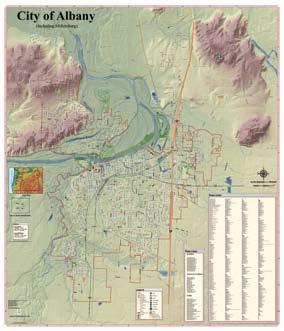
7 Small Jurisdictions Embrace ELA Program ESRI s Small Municipal and County Government ELA program provides access to ESRI GIS technology with a straightforward, tiered pricing schedule. ESRI s ArcGIS software is an open and interoperable technology platform that provides advanced visualization and cartographic capabilities, spatial analysis, geographic data management, and more. ArcGIS software is a complete system to author, serve, and use geographic information. The technology gets geographic information to those who need it including analysts, decision makers, field staff, and the public. City of Albany, Oregon According to Pete Brandstetter, data systems manager for the City of Albany, Oregon, removing GIS software administration from department workflows is one of the benefits of ELA. This will help expand the use of GIS across departments in this city of 47,000. Whatever we decide we want to pursue, we are able to do that now, Brandstetter said. I think this will be really conducive to allowing new people to come to the table and take off on application development and data creation without any kind of roadblocks in their way. The City of Albany, Oregon, is using the ELA to allow more city departments to benefit from GIS. City of Auburn, Alabama The City of Auburn, a college town with approximately 48,000 full-time residents, saw the ELA as a way to save money, eliminate software license management, and improve the current organization-wide GIS. Having the ELA is going to give us a lot of freedom to develop our GIS in ways that better serve the city s staff and citizens. We can utilize Web-based ArcGIS products, ArcGIS Desktop, ArcGIS Engine, and ArcGIS extensions, says Christopher Graff, GIS coordinator, City of Auburn. It s pretty amazing to not be constrained by cost considerations. Really the only thing that could slow us down now is our imagination. City of Frankfort, Kentucky The City of Frankfort, Kentucky, with a population of 28,000, recognized the benefits of an ELA. This agreement allows all staff in the capital city s government to access GIS software that will improve productivity and enhance service to citizens. Now the new GIS office in the IT department can deploy desktop, server, and mobile GIS software quickly and uniformly throughout the enterprise without worrying about software license procurement, says Julsun Pacheco, IT manager, City of Frankfort. Without this program, we would be unable to deploy GIS to all our departments and develop the GIS-based applications we need.
8 ESRI 380 New York Street Redlands, California USA Phone: Fax: ESRI Regional Offices Olympia St. Louis Minneapolis Philadelphia Boston For more than 35 years, ESRI has been helping people make better decisions through management and analysis of geographic information. A full-service GIS company, ESRI offers a framework for implementing GIS technology and business logic in any organization from personal GIS on the desktop to enterprise-wide GIS servers (including the Web) and mobile devices. ESRI GIS solutions are flexible and can be customized to meet the needs of our users. California ext Denver ESRI International Offices Australia San Antonio Hungary Washington, D.C Charlotte Poland Belgium/Luxembourg India Portugal For More Information GIS-XPRT ( ) Bulgaria Canada Chile Indonesia Italy Japan Romania Singapore Spain Locate an ESRI value-added reseller near you at China (Beijing) Korea Sweden China (Hong Kong) Lebanon Thailand Outside the United States, contact your local ESRI distributor. For the number of your distributor, call ESRI at , ext , or visit our Web site at Eastern Africa Finland France Malaysia Muscat Netherlands Turkey United Kingdom Venezuela Germany/Switzerland Northeast Africa No. GS-35F-5086H INLD20M10/08ai Copyright 2008 ESRI. All rights reserved. ESRI, ArcView, ArcIMS, the ESRI globe logo, ArcInfo, ArcEditor, ArcGIS, ArcPress, 3D Analyst, ArcScan, Maplex, JTX, EDN, ArcReader, Community, and are trademarks, registered trademarks, or service marks of ESRI in the United States, the European Community, or certain other jurisdictions. Other companies and products mentioned herein may be trademarks or registered trademarks of their respective trademark owners. Printed in USA
An ESRI White Paper March 2008 PLTS for ArcGIS Aeronautical Solution: Managing Aeronautical Data with Feature Builder
 An ESRI White Paper March 2008 PLTS for ArcGIS Aeronautical Solution: Managing Aeronautical Data with Feature Builder ESRI 380 New York St., Redlands, CA 92373-8100 USA TEL 909-793-2853 FAX 909-793-5953
ArcGIS. 3D Analyst. Three-Dimensional Visualization and Analysis
 ArcGIS 3D Analyst ArcGIS 3D Analyst ESRI ArcGIS 3D Analyst provides powerful and advanced visualization, analysis, and surface generation tools. Using, you can view extremely large sets of data in three-dimensions
Production Line Tool Sets
 Production Line Tool Sets Tools for high-quality database production and cartographic output Production Line Tool Sets Production Line Tool Sets (PLTS) by ESRI are a collection of software applications
ArcGIS. for Server. Understanding our World
 ArcGIS for Server Understanding our World ArcGIS for Server Create, Distribute, and Manage GIS Services You can use ArcGIS for Server to create services from your mapping and geographic information system
ArcGIS. Military Analyst. GIS Tools for the Defense and Intelligence Communities
 ArcGIS Military Analyst GIS Tools for the Defense and Intelligence Communities ArcGIS Military Analyst GIS Tools for the Defense and Intelligence Communities As an extension to ArcGIS Desktop (ArcView,
Geostatistical Analyst. Statistical Tools for Data Exploration, Modeling, and Advanced Surface Generation
 Geostatistical Analyst Statistical Tools for Data Exploration, Modeling, and Advanced Surface Generation ArcGIS Geostatistical Analyst: Statistical Tools for Data Exploration, Modeling, and Advanced Surface
Crime Analysis. GIS Solutions for Intelligence-Led Policing
 Crime Analysis GIS Solutions for Intelligence-Led Policing Applying GIS Technology to Crime Analysis Know Your Community Analyze Your Crime Use Your Advantage GIS aids crime analysis by Identifying and
UNIT 4: USING ArcGIS. Instructor: Emmanuel K. Appiah-Adjei (PhD) Department of Geological Engineering KNUST, Kumasi
 Department of Geological Engineering KNUST, Kumasi") UNIT 4: USING ArcGIS Instructor: Emmanuel K. Appiah-Adjei (PhD) Department of Geological Engineering KNUST, Kumasi Getting to Know ArcGIS ArcGIS is an integrated collection of GIS software products ArcGIS
UNIT 4: USING ArcGIS Instructor: Emmanuel K. Appiah-Adjei (PhD) Department of Geological Engineering KNUST, Kumasi Getting to Know ArcGIS ArcGIS is an integrated collection of GIS software products ArcGIS
ArcGIS : Engineered for Interoperability
 ArcGIS : Engineered for Interoperability An ESRI White Paper January 2006 ESRI 380 New York St., Redlands, CA 92373 8100, USA TEL 909 793 2853 FAX 909 793 5953 E MAIL info@esri.com WEB www.esri.com Copyright
ArcGIS for Desktop. ArcGIS for Desktop is the primary authoring tool for the ArcGIS platform.
 ArcGIS for Desktop ArcGIS for Desktop ArcGIS for Desktop is the primary authoring tool for the ArcGIS platform. Beyond showing your data as points on a map, ArcGIS for Desktop gives you the power to manage
July September 2007 Vol. 10 No. 3
 July September 2007 Vol. 10 No. 3 Optimizing a Sampling Network Automating the Use of Geostatistical Tools for Lake Tahoe Area Study By Witold Fraczek, ESRI Application Prototype Lab, and Andrzej Bytnerowicz,
PC ARC/INFO and Data Automation Kit GIS Tools for Your PC
 ESRI PC ARC/INFO and Data Automation Kit GIS Tools for Your PC PC ARC/INFO High-quality digitizing and data entry Powerful topology building Cartographic design and query Spatial database query and analysis
Better Topographic Map Production Using ArcGIS. A Comprehensive Solution for Mapping Organizations
 Better Topographic Map Production Using ArcGIS A Comprehensive Solution for Mapping Organizations The World Is Always Changing As a member of a national mapping organization, you know this is true. You
GIS for Crime Analysis. Building Better Analysis Capabilities with the ArcGIS Platform
 GIS for Crime Analysis Building Better Analysis Capabilities with the ArcGIS Platform Crime Analysis The Current State One of the foundations of criminological theory is that three things are needed for
Introduction to ArcGIS Server - Creating and Using GIS Services. Mark Ho Instructor Washington, DC
 Introduction to ArcGIS Server - Creating and Using GIS Services Mark Ho Instructor Washington, DC Technical Workshop Road Map Product overview Building server applications GIS services Developer Help resources
October 2011 ArcGIS 10 for Server Functionality Matrix
 October 2011 ArcGIS 10 for Server Functionality Matrix Esri, 380 New York St., Redlands, CA 92373-8100 USA TEL 909-793-2853 FAX 909-793-5953 E-MAIL info@esri.com WEB www.esri.com Copyright 2011 Esri All
GIS for Food and Agriculture Solutions for Production, Agribusiness, and Government
 GIS for Food and Agriculture Solutions for Production, Agribusiness, and Government GIS Software Geographic Information System Solutions for Food and Agriculture Preserving the environment, managing assets,
Deploying Portal for ArcGIS STUDENT EDITION
 Deploying Portal for ArcGIS STUDENT EDITION Copyright 2016 Esri All rights reserved. Course version 2.0.1. Version release date November 2016. Printed in the United States of America. The information contained
How does ArcGIS Server integrate into an Enterprise Environment? Willy Lynch Mining Industry Specialist ESRI, Denver, Colorado USA
 How does ArcGIS Server integrate into an Enterprise Environment? Willy Lynch Mining Industry Specialist ESRI, Denver, Colorado USA wlynch@esri.com ArcGIS Server Technology Transfer 1 Agenda Who is ESRI?
Cartography with Esri Production Mapping
 Cartography with Esri Production Mapping All rights reserved. Course version 1.3. Version release date September 2015. Printed in the United States of America. The information contained in this document
Deploying and Maintaining a Multiuser Geodatabase. Student Edition
 Deploying and Maintaining a Multiuser Geodatabase Student Edition Copyright 2015 Esri All rights reserved. Course version 1.1. Version release date May 2015. Printed in the United States of America. The
Gov 2.0. Encourage citizen engagement, deliver transparency, and foster collaboration with ArcGIS.
 Gov 2.0 Encourage citizen engagement, deliver transparency, and foster collaboration with ArcGIS. F E D E R A L GIS A Platform for Open Government Upon taking office, President Barack Obama issued an open
GENERALIZATION IN THE NEW GENERATION OF GIS. Dan Lee ESRI, Inc. 380 New York Street Redlands, CA USA Fax:
 GENERALIZATION IN THE NEW GENERATION OF GIS Dan Lee ESRI, Inc. 380 New York Street Redlands, CA 92373 USA dlee@esri.com Fax: 909-793-5953 Abstract In the research and development of automated map generalization,
DP Project Development Pvt. Ltd.
 Dear Sir/Madam, Greetings!!! Thanks for contacting DP Project Development for your training requirement. DP Project Development is leading professional training provider in GIS technologies and GIS application
GIS Capability Maturity Assessment: How is Your Organization Doing?
 GIS Capability Maturity Assessment: How is Your Organization Doing? Presented by: Bill Johnstone Principal Consultant Spatial Vision Group November 8, 2018 1. Motivation for Capability Maturity Models
ASSESSMENT. Industry Solutions Harness the Power of GIS for Property Assessment
 ASSESSMENT Industry Solutions Harness the Power of GIS for Property Assessment Esri Canada has thousands of customers worldwide who are using the transforming power of GIS technology to collect, maintain,
Esri Overview for Mentor Protégé Program:
 Agenda Passionate About Helping You Succeed Esri Overview for Mentor Protégé Program: Northrop Grumman CSSS Jeff Dawley 3 September 2010 Esri Overview ArcGIS as a System ArcGIS 10 - Map Production - Mobile
Web GIS & ArcGIS Pro. Zena Pelletier Nick Popovich
 Web GIS & ArcGIS Pro Zena Pelletier Nick Popovich Web GIS Transformation of the ArcGIS Platform Desktop Apps GIS Web Maps Web Scenes Layers Evolution of the modern GIS Desktop GIS (standalone GIS) GIS
December 2009 ArcGIS Server Functionality Matrix
 December 2009 ArcGIS Server 9.3.1 Functionality Matrix ESRI 380 New York St., Redlands, CA 92373-8100 USA TEL 909-793-2853 FAX 909-793-5953 E-MAIL info@esri.com WEB www.esri.com Copyright 2009 ESRI All
An ESRI Technical Paper June 2007 An Overview of Distributing Data with Geodatabases
 An ESRI Technical Paper June 2007 An Overview of Distributing Data with Geodatabases ESRI 380 New York St., Redlands, CA 92373-8100 USA TEL 909-793-2853 FAX 909-793-5953 E-MAIL info@esri.com WEB www.esri.com
Working with ArcGIS Online
 Esri International User Conference San Diego, CA Technical Workshops July 12, 2011 Working with ArcGIS Online Bern Szukalski, Deane Kensok Topics for this Session ArcGIS Online Overview ArcGIS Online Content
ESRI educational site license in Bahir Dar University. Tegegn Molla Abebe Mengaw Geospatial Data and Technology Center, BDU
 ESRI educational site license in Bahir Dar University Tegegn Molla Abebe Mengaw Geospatial Data and Technology Center, BDU September, 2016 Mission, Vision Purpose and Values of the GDTC Mission of GDTC
Oakland County Parks and Recreation GIS Implementation Plan
 Oakland County Parks and Recreation GIS Implementation Plan TABLE OF CONTENTS 1.0 Introduction... 3 1.1 What is GIS? 1.2 Purpose 1.3 Background 2.0 Software... 4 2.1 ArcGIS Desktop 2.2 ArcGIS Explorer
Write a report (6-7 pages, double space) on some examples of Internet Applications. You can choose only ONE of the following application areas:
 on some examples of Internet Applications. You can choose only ONE of the following application areas:") UPR 6905 Internet GIS Homework 1 Yong Hong Guo September 9, 2008 Write a report (6-7 pages, double space) on some examples of Internet Applications. You can choose only ONE of the following application
UPR 6905 Internet GIS Homework 1 Yong Hong Guo September 9, 2008 Write a report (6-7 pages, double space) on some examples of Internet Applications. You can choose only ONE of the following application
June 19 Huntsville, Alabama 1
 June 19 Huntsville, Alabama 1 Real-Time Geospatial Data: The Fusion of PI and ArcGIS Enabling Smarter Facilities Management OSIsoft and Esri Mapping and Location Analytics Platform Supporting Your Use
MAPPS 2012 Geospatial Products and Services Excellence Awards Awards Entry Form
 MAPPS 2012 Geospatial Products and Services Excellence Awards 2012 Awards Entry Form Please include a copy of this document with the project/product submission Entry Information Submission Number: 1741558
Esri and GIS Education
 Esri and GIS Education Organizations Esri Users 1,200 National Government Agencies 11,500 States & Regional Agencies 30,800 Cities & Local Governments 32,000 Businesses 8,500 Utilities 12,600 NGOs 11,000
No. of Days. ArcGIS 3: Performing Analysis ,431. Building 3D cities Using Esri City Engine ,859
 What s New? Creating Story Maps with ArcGIS Field Data Collection and Management Using ArcGIS Get Started with Insights for ArcGIS Introduction to GIS Using ArcGIS & ArcGIS Pro: Essential Workflow Migrating
No. of Days. ArcGIS Pro for GIS Professionals ,431. Building 3D cities Using Esri City Engine ,859
 What s New? Creating Story Maps with ArcGIS Field Data Collection and Management Using ArcGIS Get Started with Insights for ArcGIS Introduction to GIS Using ArcGIS & ArcGIS Pro: Essential Workflow Migrating
ArcGIS Enterprise: What s New. Philip Heede Shannon Kalisky Melanie Summers Sam Williamson
 ArcGIS Enterprise: What s New Philip Heede Shannon Kalisky Melanie Summers Sam Williamson ArcGIS Enterprise is the new name for ArcGIS for Server What is ArcGIS Enterprise ArcGIS Enterprise is powerful
No. of Days. Building 3D cities Using Esri City Engine ,859. Creating & Analyzing Surfaces Using ArcGIS Spatial Analyst 1 7 3,139
 Q3 What s New? Creating and Editing Data with ArcGIS Pro Editing and Maintaining Parcels Using ArcGIS Spatial Analysis Using ArcGIS Pro User Workflows for ArcGIS Online Organizations Q3-2018 ArcGIS Desktop
OC Enterprise GIS. Kevin Hills, PLS Cameron Smith, GISP. OC Survey
 OC Enterprise GIS Kevin Hills, PLS Cameron Smith, GISP OC Survey Discussion Points Background & Organizational Structure of OCPW Past practices prior to Enterprise Wide GIS License (ELA) Participating
STATE GEOGRAPHIC INFORMATION DATABASE
 STATE GEOGRAPHIC INFORMATION DATABASE Data Information and Knowledge Management STATE GEOGRAPHIC INFORMATION DATABASE EXECUTIVE SUMMARY Utah has developed one of the most comprehensive statewide GIS resources
Geospatial natural disaster management
 Geospatial natural disaster management disasters happen. are you ready? Natural disasters can strike almost anywhere at any time, with no regard to a municipality s financial resources. These extraordinarily
Leveraging Web GIS: An Introduction to the ArcGIS portal
 Leveraging Web GIS: An Introduction to the ArcGIS portal Derek Law Product Management DLaw@esri.com Agenda Web GIS pattern Product overview Installation and deployment Configuration options Security options
Portal for ArcGIS: An Introduction. Catherine Hynes and Derek Law
 Portal for ArcGIS: An Introduction Catherine Hynes and Derek Law Agenda Web GIS pattern Product overview Installation and deployment Configuration options Security options and groups Portal for ArcGIS
Migrating from ArcMap to ArcGIS Pro
 Migrating from ArcMap to ArcGIS Pro Migrating from ArcMap to ArcGIS Pro STUDENT EDITION Table of Contents Esri resources for your organization Course introduction Course introduction Course goals Installing
GIS for the Beginner on a Budget
 GIS for the Beginner on a Budget Andre C. Bally, RLA, GIS Coordinator, Harris County Public Infrastructure Department Engineering Division This presentation, GIS for Beginners on a Budget. will briefly
Corporate. Information. Railway Infrastructure Administrator. Year indracompany.com
 geospatial and mobility Corporate Geographic Information System of ADIF Railway Infrastructure Administrator. Year 2009-2010 Corporate Geographic Information System of ADIF ADIF. Spanish Administrator
Data Aggregation with InfraWorks and ArcGIS for Visualization, Analysis, and Planning
 Data Aggregation with InfraWorks and ArcGIS for Visualization, Analysis, and Planning Stephen Brockwell President, Brockwell IT Consulting, Inc. Join the conversation #AU2017 KEYWORD Class Summary Silos
Getting Started with Community Maps
 Esri International User Conference San Diego, California Technical Workshops July 24, 2012 Getting Started with Community Maps Shane Matthews and Tamara Yoder Topics for this Session ArcGIS is a complete
CHAPTER 22 GEOGRAPHIC INFORMATION SYSTEMS
 CHAPTER 22 GEOGRAPHIC INFORMATION SYSTEMS PURPOSE: This chapter establishes the administration and use of to improve the quality and accessibility of Department s spatial information and support graphical
Case Study Saginaw County, Michigan
 Case Study Saginaw County, Michigan Averaging more than 40 inches of snow a year, Saginaw County, Michigan, and its more than 196,000 residents often suffer harsh winters that would paralyze traffic if
Global Data Catalog initiative Christophe Charpentier ArcGIS Content Product Manager
 Global Data Catalog initiative Christophe Charpentier ArcGIS Content Product Manager ccharpentier@esri.com We are in a global economy Global Economy Business and Operations are now global Strategic need
OFWIM 2017 Annual Conference What Does Web GIS Really Mean for Fish and Wildlife Agencies?
 Content Open Mapping OFWIM 2017 Annual Conference What Does Web GIS Really Mean for Fish and Wildlife Agencies? Imagery Spatial Analysis Mike Bialousz, Esri 3D Data Exploration Real-Time Apps Visualization
REPORT ON INVESTMENTS
 REPORT ON INVESTMENTS D.T2.3.3 Investments for technical equipment for the implementation of Web-GIS platform in Mantova 1 Local support group designing Mantova Web-GIS platform. Picture by Maria Giulia
ArcGIS 2: Essential Workflows. Student Edition
 ArcGIS 2: Essential Workflows Student Edition Copyright 2016 Esri All rights reserved. Course version 4.0. Version release date March 2016. Printed in the United States of America. The information contained
Crime Analyst Extension. Christine Charles
 Crime Analyst Extension Christine Charles ccharles@esricanada.com Agenda Why use Crime Analyst? Overview Tools Demo Interoperability With our old software it could take a police officer up to forty minutes
Incorporating ArcGIS Pro in your Curriculum
 AAG, Boston 2017 April 5, 2017 Incorporating ArcGIS Pro in your Curriculum Geri Miller Agenda Concerns Acknowledged Learning curve ArcGIS Pro does not have all the tools (perception) Licensing and offline
Local Government. VALOR GIS Specialist South Georgia RDC
 Lw Low Cost GIS Sl Solutions for Local Government By: Joe Bendis VALOR GIS Specialist South Georgia RDC SERUG 2008 GIS success through cooperation $ $ VALOR Today: 5 staff members dedicated to VALOR innovations,
ArcGIS Enterprise: Administration Workflows STUDENT EDITION
 ArcGIS Enterprise: Administration Workflows STUDENT EDITION Copyright 2019 Esri All rights reserved. Course version 1.1. Version release date April 2019. Printed in the United States of America. The information
GIS Solutions for Surveying. Building New Opportunities
 GIS Solutions for Surveying Building New Opportunities GIS Solutions for Surveying Building New Opportunities Surveyors depend on a variety of software and technology to gather existing information, collect
SOLUTIONS ADVANCED GIS. TekMindz are developing innovative solutions that integrate geographic information with niche business applications.
 ADVANCED GIS SOLUTIONS TekMindz are developing innovative solutions that integrate geographic information with niche business applications. TEK INDZ TM GIS Services Overview At the leading edge of geospatial
Web GIS Patterns and Practices
 FedGIS Conference February 24 25, 2016 Washington, DC Web GIS Patterns and Practices Philip Heede Jay Theodore Witt Mathot Web GIS Transformation of the ArcGIS Platform Desktop Apps Web Maps Web Scenes
Portal for ArcGIS: An Introduction
 Portal for ArcGIS: An Introduction Derek Law Esri Product Management Esri UC 2014 Technical Workshop Agenda Web GIS pattern Product overview Installation and deployment Security and groups Configuration
Introduction to Portal for ArcGIS
 Introduction to Portal for ArcGIS Derek Law Product Management March 10 th, 2015 Esri Developer Summit 2015 Agenda Web GIS pattern Product overview Installation and deployment Security and groups Configuration
UTAH S STATEWIDE GEOGRAPHIC INFORMATION DATABASE
 UTAH S STATEWIDE GEOGRAPHIC INFORMATION DATABASE Data Information and Knowledge Management NASCIO Awards 2009 STATE GEOGRAPHIC INFORMATION DATABASE B. EXECUTIVE SUMMARY Utah has developed one of the most
Image Analysis with ArcGIS. Student Edition
 Image Analysis with ArcGIS Student Edition Copyright 2016 Esri All rights reserved. Course version 2.0. Version release date May 2016. Printed in the United States of America. The information contained
NR402 GIS Applications in Natural Resources
 NR402 GIS Applications in Natural Resources Lesson 1 Introduction to GIS Eva Strand, University of Idaho Map of the Pacific Northwest from http://www.or.blm.gov/gis/ Welcome to NR402 GIS Applications in
Web GIS: Architectural Patterns and Practices. Shannon Kalisky Philip Heede
 Web GIS: Architectural Patterns and Practices Shannon Kalisky Philip Heede Web GIS Transformation of the ArcGIS Platform Desktop Apps Server GIS Web Maps Web Scenes Layers Web GIS Transformation of the
GIS Resources for Local Governments
 ISSUE PAPER SERIES GIS Resources for Local Governments February 2018 NEW YORK STATE TUG HILL COMMISSION DULLES STATE OFFICE BUILDING 317 WASHINGTON STREET WATERTOWN, NY 13601 (315) 785-2380 WWW.TUGHILL.ORG
7 GEOMATICS BUSINESS SOLUTIONS - ANNUAL REPORT 2006
 7 GEOMATICS BUSINESS SOLUTIONS - ANNUAL REPORT 2006 The Planning and Economic Development Committee recommends the adoption of the recommendation contained in the following report November 30, 2006, from
Law Enforcement Solutions and Applications
 ArcGIS for Solutions and Applications Solutions and Applications ArcGIS for Platform ArcGIS for Collection of solutions and applications for law enforcement. Built on the ArcGIS platform. For any named
ArcGIS. The Complete Geographic Information System
 ArcGIS The Complete Geographic Information System ArcGIS The Complete Geographic Information System ESRI ArcGIS is an integrated collection of software products for building a complete geographic information
Introduction to ArcGIS Server Development
 Introduction to ArcGIS Server Development Kevin Deege,, Rob Burke, Kelly Hutchins, and Sathya Prasad ESRI Developer Summit 2008 1 Schedule Introduction to ArcGIS Server Rob and Kevin Questions Break 2:15
Introduction to Portal for ArcGIS. Hao LEE November 12, 2015
 Introduction to Portal for ArcGIS Hao LEE November 12, 2015 Agenda Web GIS pattern Product overview Installation and deployment Security and groups Configuration options Portal for ArcGIS + ArcGIS for
Development of a Web-Based GIS Management System for Agricultural Authorities in Iraq
 Development of a Web-Based GIS Management System for Agricultural Authorities in Iraq USCID Water Management Conference Phoenix, Arizona April 18, 2013 Gabriele Bonaiti Extension Program Specialist David
GIS Building Communities beyond National Borders (Building Successful Spatial Data Infrastructures) Nick Land, ESRI Europe
 Nick Land, ESRI Europe") GIS Building Communities beyond National Borders (Building Successful Spatial Data Infrastructures) Nick Land, ESRI Europe UK worst flooding in the last 60 years 350,000 households without drinking water
GIS Building Communities beyond National Borders (Building Successful Spatial Data Infrastructures) Nick Land, ESRI Europe UK worst flooding in the last 60 years 350,000 households without drinking water
Esri Training by Microcenter Prepare to Innovate. Microcenter Course Catalog
 Esri Training by Microcenter Prepare to Innovate 2015 Instructor-Led Courses Microcenter Course Catalog ArcGIS Foundational Courses Designed to meet the learning needs of professionals whose GIS experience
GIS Boot Camp for Education June th, 2011 Day 1. Instructor: Sabah Jabbouri Phone: (253) x 4854 Office: TC 136
 x 4854 Office: TC 136") GIS Boot Camp for Education June 27-30 th, 2011 Day 1 Instructor: Sabah Jabbouri Phone: (253) 833-9111 x 4854 Office: TC 136 Email: sjabbouri@greenriver.edu http://www.instruction.greenriver.edu/gis/ Summer
GIS Boot Camp for Education June 27-30 th, 2011 Day 1 Instructor: Sabah Jabbouri Phone: (253) 833-9111 x 4854 Office: TC 136 Email: sjabbouri@greenriver.edu http://www.instruction.greenriver.edu/gis/ Summer
Anchorage, Alaska. Case Study. Nearly everyone in Anchorage, Alaska, can tell you what happens the first Saturday
 Goals Leverage spatial and related data to improve municipal business practices. Improve access to municipal GIS data. Promote coordinated and effective use of GIS and database technology throughout the
STEREO ANALYST FOR ERDAS IMAGINE Stereo Feature Collection for the GIS Professional
 STEREO ANALYST FOR ERDAS IMAGINE Stereo Feature Collection for the GIS Professional STEREO ANALYST FOR ERDAS IMAGINE Has Your GIS Gone Flat? Hexagon Geospatial takes three-dimensional geographic imaging
What Would John Snow Do (Today)? Part 1
? Part 1") What Would John Snow Do (Today)? Part 1 Tanya Bigos and Derek Law @Tanyabigos @GIS_Bandit Thurs Oct 19 th, 2017 Outline Overview of the ArcGIS Platform Whiteboard discussion Summary Questions A Whole New
What Would John Snow Do (Today)? Part 1 Tanya Bigos and Derek Law @Tanyabigos @GIS_Bandit Thurs Oct 19 th, 2017 Outline Overview of the ArcGIS Platform Whiteboard discussion Summary Questions A Whole New
ArcGIS Earth for Enterprises DARRON PUSTAM ARCGIS EARTH CHRIS ANDREWS 3D
 ArcGIS Earth for Enterprises DARRON PUSTAM ARCGIS EARTH CHRIS ANDREWS 3D ArcGIS Earth is ArcGIS Earth is a lightweight globe desktop application that helps you explore any part of the world and investigate
GIS Geographical Information Systems. GIS Management
 GIS Geographical Information Systems GIS Management Difficulties on establishing a GIS Funding GIS Determining Project Standards Data Gathering Map Development Recruiting GIS Professionals Educating Staff
Finding Common Ground Through GIS
 Finding Common Ground Through GIS Matthew Stone, MPH Special Unit for Technical Assistance Chronic Disease and Injury Control California Department of Public Health ESRI Health GIS Conference Scottsdale,
Changes in Esri GIS, practical ways to be ready for the future
 Changes in Esri GIS, practical ways to be ready for the future John Sharrard, Esri April 16, 2015 The only thing that is constant is change. Heraclitus, ca. 500 B.C. My story (of experiencing change) Changes
Information. Information Technology. Geographic. Services (GIS) 119 W Indiana Ave Deland, FL 32720
 119 W Indiana Ave Deland, FL 32720") Information Technology Geographic Information Services (GIS) 119 W Indiana Ave Deland, FL 32720 A GIS consists of 5 primary components: Hardware Software People Data Methods or Business Processes --- Hardware
Information Technology Geographic Information Services (GIS) 119 W Indiana Ave Deland, FL 32720 A GIS consists of 5 primary components: Hardware Software People Data Methods or Business Processes --- Hardware
Rural Louisiana. A quarterly publication of the Louisiana Tech Rural Development Center
 Rural Louisiana A quarterly publication of the Louisiana Tech Rural Development Center Volume 4, No. 1, Fall 2009 Editor: Aaron K. Lusby Director, Asst. Professor Newsletter design: Stephanie Tidwell Student
Abstract: Traffic accident data is an important decision-making tool for city governments responsible for
 Kalen Myers, GIS Analyst 1100 37 th St Evans CO, 80620 Office: 970-475-2224 About the Author: Kalen Myers is GIS Analyst for the City of Evans Colorado. She has a bachelor's degree from Temple University
GIS Software. Evolution of GIS Software
 GIS Software The geoprocessing engines of GIS Major functions Collect, store, mange, query, analyze and present Key terms Program collections of instructions to manipulate data Package integrated collection
ADDENDUM NO. 1 TO THE BIDDING /CONTRACT DOCUMENTS AND SPECIFICATIONS CITY OF COCOA BEACH BID NO: CB15-002
 ADDENDUM NO. 1 TO THE BIDDING /CONTRACT DOCUMENTS AND SPECIFICATIONS CITY OF COCOA BEACH GEOGRAPHIC INFORMATION SYSTEM (GIS) SERVICES CONTRACT BID NO: CB15-002 March 11, 2016 To All Interested Bidders:
FIRE DEPARMENT SANTA CLARA COUNTY
 DEFINITION FIRE DEPARMENT SANTA CLARA COUNTY GEOGRAPHIC INFORMATION SYSTEM (GIS) ANALYST Under the direction of the Information Technology Officer, the GIS Analyst provides geo-spatial strategic planning,
ArcGIS Desktop II: Tools and Functionality
 ArcGIS Desktop II: Tools and Functionality All rights reserved. Course version 1.2. Revised June 2008. Printed in the United States of America. The information contained in this document is the exclusive
Geog 469 GIS Workshop. Managing Enterprise GIS Geodatabases
 Geog 469 GIS Workshop Managing Enterprise GIS Geodatabases Outline 1. Why is a geodatabase important for GIS? 2. What is the architecture of a geodatabase? 3. How can we compare and contrast three types
ArcGIS Tools for Professional Cartography
 ArcGIS Tools for Professional Cartography By Makram Murad-al-shaikh M.S. Cartography Senior instructor ESRI Educational Services ICC - A Coruña - Spain, 9-16 July, 2005 Overview Overview of the ArcGIS
GIS Monroe Geographic Information System March 14, 2018
 GIS Monroe Geographic Information System March 14, 2018 Goals Maintain Enterprise/County-wide geo-database Increase spatial accuracy of data Build and acquire more data layers Increase use of GIS; as another
Introduction to GIS. Geol 4048 Geological Applications of Remote Sensing
 Introduction to GIS Geol 4048 Geological Applications of Remote Sensing GIS History: Before Computers GIS History Using maps for a long time Dr. Roger F. Tomlinson Father of GIS He was an English geographer
Introducing ArcGIS Engine
 1 Introducing ArcGIS Engine ESRI ArcGIS Engine is a platform for building custom standalone geographic information system (GIS) applications that support multiple application programming interfaces (APIs),
Geodatabase Replication for Utilities Tom DeWitte Solution Architect ESRI Utilities Team
 Geodatabase Replication for Utilities Tom DeWitte Solution Architect ESRI Utilities Team 1 Common Data Management Issues for Utilities Utilities are a distributed organization with the need to maintain