Benchmarking Spatial Data Infrastructure Development in Hong Kong
|
|
|
- Steven Cunningham
- 5 years ago
- Views:
Transcription


1 Benchmarking Spatial Data Infrastructure Development in Hong Kong Dr. Conrad Tang Associate Professor, Department of Land Surveying and Geo-Informatics, The Hong Kong Polytechnic University Mr. Lesly Lam Vice Chairman, Land Survey Division, The Hong Kong Institute of Surveyors Scope This is a HKIS sponsored research study to provide a comparison study between the advanced SDIs and the current status of the Hong Kong SDI, and promote developments of Spatial Data Infrastructure in Hong Kong. Marrakech, Morocco, May
2 United Nations initiative Dept of Economic and Social Affairs Role of government regulator, implementer legislation & regulatory framework Links to Australia, Bahrain, Brazil, Canada, Chile, China, India, Japan, Portugal, Korea, Spain & USA. Web access from The Infrastructure (regulatory framework) Legislation + Government Administration USA, European Union, Japan, Korea, Government Administration Australia, Canada, China, Marrakech, Morocco, May


3 USA National SDI Policy 1994 President Decree - Clinton Executive Order established executive branch leadership for development of the coordinated National Spatial Data Infrastructure, and called for development of a National Geospatial Data Clearinghouse, spatial data standards, a National Digital Geospatial Data Framework and partnerships for data acquisition. Federal Geographic Data Committee FGDC Chairman Secretary of the Interior Vice Chairman DD of Office of Management & Budget Web access from Legislation Directive 2007/2/EC of the European Parliament and of the Council of 14 March 2007 establishing an Infrastructure for Spatial Information in the European Community (INSPIRE) was published in the official Journal on the 25th April Web access from Marrakech, Morocco, May
 Law 12/2010")
 Implementation & Utilization of the NGIS Act ( 2000 April, Law No. 6201) Enforcement Decree (2000 July, President Decree No.")

4 GIS law in Spain ( 2007 ) Royal Decree 1545/2007, Chapter VI reorganizes the NATIONAL GEOGRAPHIC HIGH COUNCIL Advisory group Coordination of Cartography and GI Representatives 14 Ministries 17 Regional Governments 6 from Federation of Local Authorities Technical Secretariat: IGN Spain GIS law in Spain ( 2010 ) Law 12/2010 Geographic information infrastructures & Services in Spain Spanish NSDI ( IDEE ) Web access from GIS law in Korea ( 2000 ) Implementation & Utilization of the NGIS Act ( 2000 April, Law No. 6201) Enforcement Decree (2000 July, President Decree No ) Establishment of Master Plan & Local Operation Plan, Management Committee, Executive Secretary, Subcommittees, Technical Support Agency, Fundamental GI, GI Database, Cooperative Council, Prevention of Overlapping, Investment, Distribution Management Organization, Meta Data, User fee, Security, Duplication. Reference : GI Section, MOCT, Gwacheon-City, Gyeonggi-Do, , Korea Marrakech, Morocco, May

 The House of Representatives of Indonesia passed the Geospatial Information Act.")
5 GIS law in Japan ( 2007 ) The Geospatial Information Authority of Japan (GSI) is the only national organization that conducts basic survey and mapping and instructs related organizations to clarify the conditions of land in Japan and that provides the results of surveys to help improve this land. Web access from Indonesia Geospatial Information Act ( 2011 ) The House of Representatives of Indonesia passed the Geospatial Information Act. The GI Bill has been prepared in the 1990s. Reference : Marrakech, Morocco, May
6 The Infrastructure (regulatory framework) Legislation + Government Administration USA, European Union, Japan, Korea, Government Administration Australia, Canada, China, Singapore Canada SDI regulatory framework 1988 Inter-Agency Committee on Geomatics (IACG) Steering Committee - Assistant Deputy Minister from 18 departments Working Groups Directors from 14 departments 1996 Canadian Geospatial Data Infrastructure Initiative To enable timely access to geospatial data holdings and services in support of policy, decision making and economic development through a co-operative interconnected infrastructure of government, private sector and academia participants Canadian Geomatics Accord Canadian Council on Geomatics (CCOG) Marrakech, Morocco, May

7 Canadian Geospatial Data Infrastructure Online access to government information National framework data International standards Data partnerships Data distribution - Supportive policy Web access from Easy & cost effective access to spatial data Australian Spatial Data Directory online metadata Standards Content (data dictionaries, land use codes,..) Access (ISO TC211 GI series and information retrieval; OpenGIS Consortium & FGDC) Exchange (Geography Markup Language, Scalable Vector Graphics, Uniform Resource Identifiers) Web access from Marrakech, Morocco, May


8 China provides 1:4,000,000 digital topographic data Data Dictionary Data Layers Standard and Specifications Metadata Data Browsing Service Documents Web access from China s national SDI regulatory structure Reference : [Ji, 2009] Marrakech, Morocco, May
![China s national SDI framework Reference : [Ji, 2009]](/docs-images/90/101604532/images/9-0.jpg "Singapore SDI regulatory framework 1984 Civil Service Data")


9 China s national SDI framework Reference : [Ji, 2009] Singapore SDI regulatory framework 1984 Civil Service Data Administration Program Land Data, Population Data & Business Data 1989 Land Data Hub From CD rom data in 1990s to online delivery in 2004 INLIS sale office 2007 LandNet web based 2010 Integrated Government Marrakech, Morocco, May
 Data sharing partnerships")

10 NSDI benchmark components Policy Executive branches Development plan Fundamental Geographic Information (Data types) Data sharing partnerships Geospatial Data Clearinghouse Data access through internet Operating procedure Data Standard Data collection, exchange, storage Marrakech, Morocco, May
")

11 SMO is the SDI government representative organization in Hong Kong Government SDI Policy (1) Data Alignment Measures Slope, Building, Lot, Road Contour line & TPU/SB Marrakech, Morocco, May
12 Government SDI Policy (2) Background A department may own several GISs Still many GISs are developing Data Alignment Measure for 15 departments The Policy To appoint a GIS Manager for each department and a GIS Administrator for each GIS in the same department. GIS Manager is to formulate and implement strategy for developing GIS. Marrakech, Morocco, May
 plans to provide geo-spatial information services to the public through GovHK supported by a geo-spatial information hub.")
13 Government SDI Policy (3) 14 May 2008 Legislative Council Questions 15 : Spatial Data Infrastructure In collaboration with the Lands Department, the Office of the Government Chief Information Officer(OGCIO) plans to provide geo-spatial information services to the public through GovHK supported by a geo-spatial information hub. By 2008, Google Maps are seen in HK Marrakech, Morocco, May


14 HK Government launches open data portal Launched on 31 March 2011 ( 1.5 year pilot scheme ) web-based open data portal - data.one.gov.hk. The pilot open data initiative aims to encourage the wider dissemination of geo-referenced government facility data and traffic-related data across the community. Data.One Data.One is a portal to facilitate the dissemination of Public Sector Information (PSI) for value-added re-use. Geo-referenced data & real-time traffic data for free download. Web access from Marrakech, Morocco, May

15 Marrakech, Morocco, May


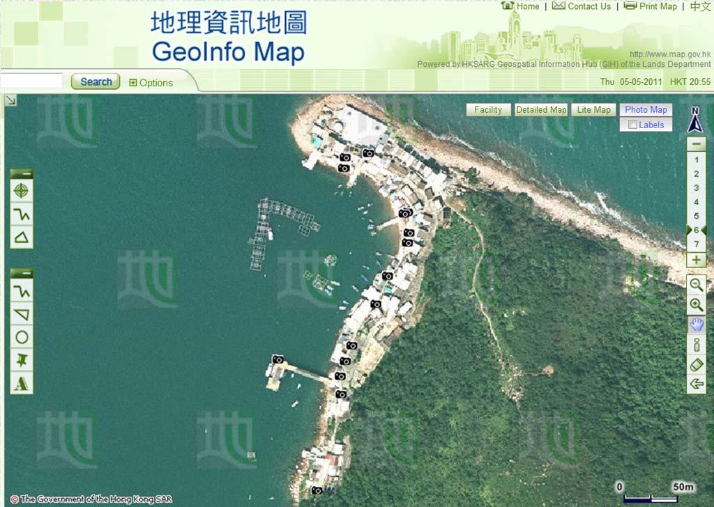
16 Supply image, not the map data GeoInfo Map ( 地理資訊地圖 ) Marrakech, Morocco, May

17 Government Depts with SDI Data Architectural Services Department Buildings Department Census and Statistics Department Civil Engineering and Development Department Drainage Services Department Electrical and Mechanical Services Department Environmental Protection Department Highways Department Housing Department Lands Department Land Registry Planning Department Rating and Valuation Department Transport Department Water Supplies Department Marrakech, Morocco, May
 Computerized information exchange system System development: Joint Utility Policy Group Mass")
![Transit Railway appointed the contractor: UtilityINFO Limited Reference : [Li & Cheng, 2010] Individual Departmental](/docs-images/90/101604532/images/18-1.jpg "Databases Data with different structure, quality and standard.")
18 Facility Data Electronic Mark Plant Circulation System (EMPC) (2002) Joint project 12 participants (facility corporations & government departments) Computerized information exchange system System development: Joint Utility Policy Group Mass Transit Railway appointed the contractor: UtilityINFO Limited Reference : [Li & Cheng, 2010] Individual Departmental Databases Data with different structure, quality and standard. Developed after [Seifert, 2007] Marrakech, Morocco, May
![Geospatial Information Hub data circulation within the Government Reference : [Sung, 2007] HK SDI Development NEXT STAGE Legal, institutional, policy & social issues amongst government departments](/docs-images/90/101604532/images/19-0.jpg "and facility corporations (data providers) Technical Problems Data Integration Semantic heterogeneity Structural heterogeneity Syntactic heterogeneity meaning/interpretation data structure search &")
19 Geospatial Information Hub data circulation within the Government Reference : [Sung, 2007] HK SDI Development NEXT STAGE Legal, institutional, policy & social issues amongst government departments and facility corporations (data providers) Technical Problems Data Integration Semantic heterogeneity Structural heterogeneity Syntactic heterogeneity meaning/interpretation data structure search & query Reference : [Mohammadi, 2007] Marrakech, Morocco, May
20 Summary Hong Kong is a rich society with a wealth of SDI data. The policy on SDI is rather preliminary, as compared with the advanced societies. A legal structural development for SDI is preferable because it legally defines the data and settles the arrangement amongst data provides. References KRIHS (2007). Establishment of National GIS of Korea, Special Report Volume 8, Korea Research Institute for Human Settlements, ISBN Li, S. & Cheng, H. (2010). Develop a GIS-based Electronic Mark Plant Circulation system in a collaborative and end-user computing approach, pdf file on ppt presentation, MTRC_Utility Info.pdf, accessed from Mohammadi, H. (2007). Spatial Data Integration: a Necessity for Spatially Enabling Government, Towards a Spatially Enabled Society, Edited by Abbas Rajabifard, The University of Melbourne, p Ji, M. (2009). China s National Spatial Data Infrastructure CNSDI: Current Status and Prospect, powerpoint presentation in the 4 th International Symposium on NSDI, Tokyo. Japan, June Sung, H. (2007). GeoSpatial Information Hub in HKSAR, Lands Department, HKSAR Government, ppt presentation in FIG Commission 7 Annual Meeting, Souel, Korea, Williamson, I. et al (2010). Land Administration for Sustainable development, ESRI Press Academic, Redlands, California, USA. Marrakech, Morocco, May
21 Thank You Marrakech, Morocco, May
Global Geospatial Information Management Country Report Finland. Submitted by Director General Jarmo Ratia, National Land Survey
 Global Geospatial Information Management Country Report Finland Submitted by Director General Jarmo Ratia, National Land Survey Global Geospatial Information Management Country Report Finland Background
Appropriation Directions for 2007
 INSPIRE in Sweden An Important Part of the National Geodata Strategy Monica Lagerqvist Nilsson Appropriation Directions for 2007 A commission to investigate the necessity to adjust the Swedish legislation
CLICK HERE TO KNOW MORE
 CLICK HERE TO KNOW MORE GeoSpace for Singapore s Whole-of-Government Data Sharing Asia GeoSpatial Forum 17 19 Oct 2011 Lee Kim Haw Singapore Land Authority Introducing Singapore Land Authority Limited
GSDI Global Spatial Data Infrastructure. Convergences between Geo Spatial Communities: key decision for decision making
 GSDI Global Spatial Data Infrastructure Convergences between Geo Spatial Communities: key decision for decision making April 14 th 2010 Bas Kok GSDI Past-President Director of International Affairs, Dutch
The future of SDIs. Ian Masser
 The future of SDIs Ian Masser Presentation Considers two questions relating to the future development of SDIs throughout the world Where have we got to now? Where should we go from here? Identifies four
Data Origin. Ron van Lammeren CGI-GIRS 0910
 Data Origin Ron van Lammeren CGI-GIRS 0910 How to obtain geodata? Geo data initiative Executive Order 12906, "Coordinating Geographic Data Acquisition and Access: The National Spatial Data Infrastructure,"
Data Origin. How to obtain geodata? Ron van Lammeren CGI-GIRS 0910
 Data Origin How to obtain geodata? Ron van Lammeren CGI-GIRS 0910 Spatial Data interest Improvement of policy making. ± 90% of all information used by government has spatial characteristics SPATIAL INFORMATION
Technical Specifications. Form of the standard
 Used by popular acceptance Voluntary Implementation Mandatory Legally enforced Technical Specifications Conventions Guidelines Form of the standard Restrictive Information System Structures Contents Values
Voices from Private Sector: Insights for Future NSDI Development in Indonesia
 Voices from Private Sector: Insights for Future NSDI Development in Indonesia Ta n d a n g Yu l i a d i D w i P u t ra, Ryosuke S h i b a s a k i I n st i t u t e o f I n d u st r i a l S c i e n c e,
The Process of Spatial Data Harmonization in Italy. Geom. Paola Ronzino
 The Process of Spatial Data Harmonization in Italy Geom. Paola Ronzino ISSUES Geospatial Information in Europe: lack of data harmonization the lack of data duplication of data CHALLENGES Challenge of INSPIRE:
The GIS Path Forward Saskatchewan s Geomatics Strategic Plan
 The GIS Path Forward Saskatchewan s Geomatics Strategic Plan John Potter, SK Ministry of Central Services Office of Geomatics Coordination Sept.17/13 Table of Contents 1. 2011-2016, Geomatics Strategic
US National Spatial Data Infrastructure A Spatial Framework for Governance and Policy Development to Enable a Location-Based Digital Ecosystem
 GeoPlatform Workshop 7 Dec 2016, Department of the Interior Washington, D.C. US National Spatial Infrastructure A Spatial Framework for Governance and Policy Development to Enable a Location-Based Digital
Turkey s National SDI Implementation
 Onur PAŞAOĞULLARI Head of Department Turkey s National SDI Implementation Presentation Plan NSDI Background General Directorate of Geographic Information Systems NSDI Project INSPIRE Directive Urban Information
Spatially Enabled Society
 International Seminar on Land Administration Trends and Issues in Asia and the Pacific Region Spatially Enabled Society Abbas Rajabifard Vice Chair PCGIAP-WG3 Vice-President (President Elect), GSDI Association
Brazil Paper for the. Second Preparatory Meeting of the Proposed United Nations Committee of Experts on Global Geographic Information Management
 Brazil Paper for the Second Preparatory Meeting of the Proposed United Nations Committee of Experts on Global Geographic Information Management on Data Integration Introduction The quick development of
Upgrade the Datasets in NSDI for Smarter Services with the Cases of China
 Upgrade the Datasets in NSDI for Smarter Services with the Cases of China By Dr. JIANG Jie Dept of GeoInformaiton Service Platform National Geomatics Center of China October 7, 2015 Jeju, Republic of Korea
Report of the Regional Committee of UN-GGIM for Asia and the Pacific (UN-GGIM-AP)
") Report of the Regional Committee of UN-GGIM for Asia and the Pacific (UN-GGIM-AP) At the Eighth Session of UN-GGIM UN Headquarters, New York, 1 3 August 2018 About UN-GGIM-AP One of the five regional committees
Report of the Regional Committee of UN-GGIM for Asia and the Pacific (UN-GGIM-AP) At the Eighth Session of UN-GGIM UN Headquarters, New York, 1 3 August 2018 About UN-GGIM-AP One of the five regional committees
2007 / 2008 GeoNOVA Secretariat Annual Report
 2007 / 2008 GeoNOVA Secretariat Annual Report Prepared for: Assistant Deputy Minister and Deputy Minister of Service Nova Scotia and Municipal Relations BACKGROUND This report reflects GeoNOVA s ongoing
SWEDISH SDI DEVELOPMENT & IMPLEMENTATION OF INSPIRE
 SWEDISH SDI DEVELOPMENT & IMPLEMENTATION OF INSPIRE Christina Wasström, Lantmäteriet, 801 82 Gävle, Sweden, christina.wasstrom@lm.se ABSTRACT The Swedish Government and Parliament has given Lantmäteriet
Agenda. Status of GI activities. NGII Framework. SDI from the national policy perspective
 Towards a National Geographic Information Infrastructure: Overcoming Impediments to the Development of SDI in Nepal R.R. Chhatkuli Email: chhatkuli@ngiip.gov.np & D.M. Kayastha Email: chhatkuli@ngiip.gov.np
Major Opportunities in Spatial Data Infrastructure Communities
 Major Opportunities in Spatial Data Infrastructure Communities Bas Kok President GSDI June 17 th 2008 FIG Working Week: Integrating Generations 14-19 June 2008 Stockholm, Sweden http://www.gsdi.org 1 GSDI
Realizing benefits of Spatial Data Infrastructure A user s perspective from Environment Agency - Abu Dhabi
 Realizing benefits of Spatial Data Infrastructure A user s perspective from Environment Agency - Abu Dhabi Anil Kumar Director, Environment Information Management 26 April 2012 Geospatial World Forum,
National Spatial Data Infrastructures (NSDIs): North American Experience
: North American Experience") National Spatial Data Infrastructures (NSDIs): North American Experience Henry Tom International Symposium on NSDI (National Spatial Data Infrastructure) Center for Spatial Information Science University
National Spatial Data Infrastructures (NSDIs): North American Experience Henry Tom International Symposium on NSDI (National Spatial Data Infrastructure) Center for Spatial Information Science University
Proposal for a DIRECTIVE OF THE EUROPEAN PARLIAMENT AND OF THE COUNCIL. establishing an infrastructure for spatial information in the Community
 Proposal for a DIRECTIVE OF THE EUROPEAN PARLIAMENT AND OF THE COUNCIL establishing an infrastructure for spatial information in the Community INSPIRE http://inspire.jrc.it/ Alessandro Annoni 1 EU Commission
Evolution and development of National Spatial Data Infrastructure in Republic of Moldova
 Agency for Land Relations and Cadastre of the Republic of Moldova Evolution and development of National Spatial Data Infrastructure in Republic of Moldova Alexandru Morcov Deputy general director ALRC
Concept Formulation of Geospatial Infrastructure. Hidenori FUJIMURA*
 Concept Formulation of Geospatial Infrastructure 1 Concept Formulation of Geospatial Infrastructure Hidenori FUJIMURA* (Published online: 28 December 2016) Abstract Technical trends in the field of surveying
Analysis of Regional Fundamental Datasets Questionnaire
 Permanent Committee on GIS Infrastructure for Asia and the Pacific Working Group 2 Regional Fundamental Data Summary Report on Analysis of Regional Fundamental Datasets Questionnaire ABBAS RAJABIFARD and
From PCGIAP to UN GGIM AP: A Regional Perspective on GGIM
 Regional Committee of United Nations Global Geospatial Information Management for Asia and the Pacific (UN-GGIM-AP) Established by a United Nations Resolution From PCGIAP to UN GGIM AP: A Regional Perspective
INSPIRing effort. Peter Parslow Ordnance Survey December Various European approaches to managing an SDI
 INSPIRing effort Peter Parslow Ordnance Survey December 2015 Various European approaches to managing an SDI WHAT IS INSPIRE? A European Union Directive A community effort: http://inspire.ec.europa.eu/
NSDI Implementation. Milo Robinson FGDC. U. S. Policy OMB Circular A-16 From Global GSDI To Local Canadian/ U.S. Projects
 NSDI Implementation Milo Robinson FGDC U. S. Policy OMB Circular A-16 From Global GSDI To Local Canadian/ U.S. Projects Federal Geographic Data Committee (FGDC) A US Federal Interagency committee responsible
Spatial Statistical Information Services in KOSTAT
 Distr. GENERAL WP.30 12 April 2010 ENGLISH ONLY UNITED NATIONS ECONOMIC COMMISSION FOR EUROPE (UNECE) CONFERENCE OF EUROPEAN STATISTICIANS EUROPEAN COMMISSION STATISTICAL OFFICE OF THE EUROPEAN UNION (EUROSTAT)
Economic and Social Council
 United Nation E/C.20/2012/4/Add.1 Economic and Social Council Distr.: General 2 July 2012 Original: English Committee of Experts on Global Geospatial Information Management Second session New York, 13-15
Compact guides GISCO. Geographic information system of the Commission
 Compact guides GISCO Geographic information system of the Commission What is GISCO? GISCO, the Geographic Information System of the COmmission, is a permanent service of Eurostat that fulfils the requirements
The Global Statistical Geospatial Framework and the Global Fundamental Geospatial Themes
 The Global Statistical Geospatial Framework and the Global Fundamental Geospatial Themes Sub-regional workshop on integration of administrative data, big data and geospatial information for the compilation
David Lanter PhD GISP. Information Security Risks and Controls of Public Geospatial Datasets July 17, 2014
 David Lanter PhD GISP Information Security Risks and Controls of Public Geospatial Datasets July 17, 2014 This Presentation CDM Smith applies GIS and develops custom applications producing, deploying and
CHAPTER 22 GEOGRAPHIC INFORMATION SYSTEMS
 CHAPTER 22 GEOGRAPHIC INFORMATION SYSTEMS PURPOSE: This chapter establishes the administration and use of to improve the quality and accessibility of Department s spatial information and support graphical
National Spatial Data Infrastructure International workshop 9 th June, 2015 Terelj Hotel, Mongolia
 1 st session: NSDI policy, planning and the legal framework Formation of NSDI policy and legal framework in Mongolia Khurelshagai Ayurzana, Director General, Administration of Land Affairs, Geodesy and
INDONESIA S S UPDATE: GEOSPATIAL INFORMATION FOR SUSTAINABLE DEVELOPMENT RELATED TO INA SDI Dr. Asep Karsidi, M.Sc
 INDONESIA S S UPDATE: GEOSPATIAL INFORMATION FOR SUSTAINABLE DEVELOPMENT RELATED TO INA SDI Dr. Asep Karsidi, M.Sc GEOSPATIAL INFORMATION AGENCY 08 August, 2012 OUTLINE 1. Transformation Bakosurtanal into
INSPIRE Basics. Vlado Cetl European Commission Joint Research Centre. https://ec.europa.eu/jrc/
 INSPIRE Basics Vlado Cetl European Commission Joint Research Centre https://ec.europa.eu/jrc/ Serving society Stimulating innovation Supporting legislation Outline SDI? Why European SDI? INSPIRE Policy
GEOSPATIAL INFORMATION UTILIZATION PROMOTION BILL
 This is an Unofficial Translation of the Geospatial Information Utilization Promotion Bill. It is offered to the readership of the JOURNAL OF SPACE LAW as a convenience. While this translation's title
Phurith Meeprom 1, Kaew Nualchawee 2. Geoinformatics Faculty, Burapha University. 169 Long Had Rd. Bangsean, Chonburi, 20131, Thailand
 THE WEB MAP SERVER INTERFACE: STANDARDIZATION AND APPLICATION DEVELOPMENT IN THAILAND AND ITS TRENDS TOWARD NATIONAL SPATIAL DATA INFRASTRUCTURE POLICY Phurith Meeprom 1, Kaew Nualchawee 2 Geoinformatics
PAN AMERICAN INSTITUTE OF GEOGRAPHY AND HISTORY Specialized Organization of the OAS
 PAN AMERICAN INSTITUTE OF GEOGRAPHY AND HISTORY Specialized Organization of the OAS 10 th UNRCC Americas United Nations, New York, 20 August 2013 PAIGH, SIRGAS, PC-IDEA and GeoSUR 2013-2015 Joint Action
REGIONAL SDI DEVELOPMENT
 REGIONAL SDI DEVELOPMENT Abbas Rajabifard 1 and Ian P. Williamson 2 1 Deputy Director and Senior Research Fellow Email: abbas.r@unimelb.edu.au 2 Director, Professor of Surveying and Land Information, Email:
Standards in Action: The Canadian Geospatial Data Infrastructure (CGDI)
") Standards in Action: The Canadian Geospatial Data Infrastructure (CGDI) Craig Stewart ISO/TC211 Standards in Action Workshop, September 14, 2005 Presentation Outline Overview of SDIs Overview of Canada
Standards in Action: The Canadian Geospatial Data Infrastructure (CGDI) Craig Stewart ISO/TC211 Standards in Action Workshop, September 14, 2005 Presentation Outline Overview of SDIs Overview of Canada
Geospatial Policy Development and Institutional Arrangements *
 HIGH LEVEL FORUM ON GLOBAL GEOSPATIAL MANAGEMENT INFORMATION WORKING PAPER No. 13 First Forum Seoul, Republic of Korea, 24-26 October 2011 Geospatial Policy Development and Institutional Arrangements *
Roadmap to interoperability of geoinformation
 Roadmap to interoperability of geoinformation and services in Europe Paul Smits, Alessandro Annoni European Commission Joint Research Centre Institute for Environment and Sustainability paul.smits@jrc.it
THAILAND NSDI DVELOPMENT PROGRAM: ThaiSDI
 THAILAND NSDI DVELOPMENT PROGRAM: ThaiSDI Dr.Chaowalit Silapathong Director of Geo-informatics Office Geo-Informatics and Space Technology Development Agency (Public Organization): GISTDA chaow@gistda.or.th
INSPIRE in Sweden - an Important Part of the National Geodata Strategy
 INSPIRE in Sweden - an Important Part of the National Geodata Strategy Ewa RANNESTIG and Monica LAGERQVIST NILSSON, Sweden Key words: National Geodata Strategy, National Infrastructure for Spatial Information,
Economic and Social Council
 United Nations Economic and Social Council Distr.: General 18 July 2016 Original: English Committee of Experts on Global Geospatial Information Management Sixth session New York, 3-5 August 2016 Item 2
INTEGRATION OF BUILT AND NATURAL ENVIRONMENTAL DATASETS WITHIN NATIONAL SDI INITIATIVES
 UNITED NATIONS E/CONF.97/6/IP. 38 and IP. 39 ECONOMIC AND SOCIAL COUNCIL Seventeenth United Nations Regional Cartographic Conference for Asia and the Pacific Bangkok, 18-22 September 2006 Item 7 of the
Country Report of Nigeria *
 HIGH LEVEL FORUM ON GLOBAL CONFERENCE ROOM PAPER GEOSPATIAL MANAGEMENT INFORMATION NO. 17 First Forum Seoul, Republic of Korea, 24-26 October 2011 Country Report of Nigeria * * Submitted by: Mr. Ganiyu
The Swedish National Geodata Strategy and the Geodata Project
 The Swedish National Geodata Strategy and the Geodata Project Ewa Rannestig, Head of NSDI Co-ordination Unit, Lantmäteriet, ewa.rannstig@lm.se Ulf Sandgren, Project Manager Geodata Project, Lantmäteriet,
COMMISSION 3 SPATIAL INFORMATION MANAGEMENT WORK PLAN
 Appendix to item 34.3 FIG Congress in Washington, 19-26 April 2002 COMMISSION 3 SPATIAL INFORMATION MANAGEMENT WORK PLAN 2002 2006 1. Title Spatial Information Management. 2. Terms of Reference - Management
Technical Framework Methodology as a core of building up the NSDI NSDI Implementation Specifics in Serbia
 Technical Framework Methodology as a core of building up the NSDI NSDI Implementation Specifics in Serbia Luka Jovičić SDI Consultant@ Gramont Ltd. Aleksandar Dedić RGA NSDI department Dragica Pajić RGA
UN GGIM and National SDI Strategy
 MSDI Open Forum on 26 th January 2016 Contributing to the successful delivery of MSDI UN GGIM and National SDI Strategy Hiroshi Murakami Deputy Administrator Geospatial Information Authority of Japan Geospatial
The Saudi Experience
 The Saudi Experience The need for NSDI A national GIS Concept Study 1992 NSDI Basic Components Formation of the National Committee Obstacles Conclusion Sharing and utilizing the Geospatial data Cost effective
GIS present situation in Japan
 GIS present situation in Japan September 26, 2006 INTERPREVENT 2006 in Niigata University Geographic Information Analysis Research Div. Geography and Crustal Dynamics Research Senter Geographical Survey
ECONOMIC AND SOCIAL COUNCIL
 UNITED NATIONS E/CONF.102/3 ECONOMIC AND SOCIAL COUNCIL Nineteenth United Nations Regional Cartographic Conference for Asia and the Pacific Bangkok, 29 October 1 November 2012 Item 4 of the provisional
Spatial Data Infrastructure for Prosperous Nepal
 Spatial Data Infrastructure for Prosperous Nepal Rabin K. SHARMA and Babu Ram ACHARYA, Nepal Key words: Metadata, Clearinghouse, Sustainable development, Good governance, SUMMARY This paper examines the
Case Studies on Mega Cities
 Case Studies on Mega Cities Paul Kelly Director, Spatial Strategies Pty Ltd Vice Chair FIG Commission 3 The Case Study Cities Hong Kong SAR, China (Q) Tokyo, Japan (Q) Seoul, Korea (Q) Istanbul, Turkey
DEVELOPMENT OF NATIONAL SPATIAL DATA INFRASTRUCTURE IN KOREA
 DEVELOPMENT OF NATIONAL SPATIAL DATA INFRASTRUCTURE IN KOREA Sangdeuk HAN and HeungMuk CHO, Korea Key words: Geographic Information System(GIS), National Spatial Data Infrastructure (NSDI), Framework data,
GIS Capability Maturity Assessment: How is Your Organization Doing?
 GIS Capability Maturity Assessment: How is Your Organization Doing? Presented by: Bill Johnstone Principal Consultant Spatial Vision Group November 8, 2018 1. Motivation for Capability Maturity Models
Developing national SDI platform for Greece
 SDI Developing national SDI platform for Greece This paper aims to develop a National SDI model for Greece incorporating theoretical and conceptual aspects S ALEXIADOU AND A RAJABIFARD The Spatial Data
Funding systems used in Mexico to support institutional arrangements: INEGI case
 Funding systems used in Mexico to support institutional arrangements: INEGI case Sistemas de financiamiento usados en México, para soportar arreglos institucionales: Caso INEGI United Nations Committee
Spatial Data Infrastructure Concepts and Components. Douglas Nebert U.S. Federal Geographic Data Committee Secretariat
 Spatial Data Infrastructure Concepts and Components Douglas Nebert U.S. Federal Geographic Data Committee Secretariat August 2009 What is a Spatial Data Infrastructure (SDI)? The SDI provides a basis for
What s the problem? A Modern Odyssey in Search of Relevance. The search for relevance. Some current drivers for new services. Some Major Applications
 A Modern Odyssey in Search of Relevance FIG Working Week, Athens, 24 May 2004 Paul Kelly ANZLIC Executive Director The search for relevance 1. New expectations for spatial services 2. Are we ready to meet
Spatial Data Infrastructures in Greece: State of play Spring 2003
 Spatial Data Infrastructures in : State of play Spring 2003 Country report on SDI elaborated in the context of a study commissioned by the EC (EUROSTAT & DGENV) in the framework of the INSPIRE initiative
Building a national spatial data infrastructure. Thorben Hansen, Head of Division Danish Agency for Data Supply and Efficiency
 Building a national spatial data infrastructure Thorben Hansen, Head of Division Danish Agency for Data Supply and Efficiency About Spatial Data Infrastructure Spatial data come from many sources and is
Open spatial data infrastructure
 Open spatial data infrastructure a backbone for digital government Thorben Hansen Geomatikkdagene 2018 Stavanger 13.-15. mars Spatial Data Infrastructure definition the technology, policies, standards,
Ministry of ICT of I.R.IRAN
 The ECO 8/6 mill km 2 10 Slamic countries ~330 mill people Oil, Gas, Industries,Tourism 2 Issue transformation in last decade Problem solving needs more integrated approach More interaction &complexity
INSPIRE General Introduction & Service Architecture
 INSPIRATION Spatial Data Infrastructure in the Western Balkans INSPIRE General Introduction & Service Architecture 1st National INSPIRATION Workshop Croatia November 21-22, 2012 A multi-countryprojectfunded
Development of a Virtual Australia Utilising an SDI Enabled Platform
 Development of a Virtual Australia Utilising an SDI Enabled Platform Abbas RAJABIFARD, Andrew BINNS and Ian WILLIAMSON, Australia Key words: SDI, Virtual Australia, enabling platform SUMMARY Spatial Data
Aboriginal communities strengthen governance with location-based tools in the 21st century
 Aboriginal communities strengthen governance with location-based tools in the 21st century Today, Aboriginal communities are taking advantage of the geomatics technologies that underpin popular online
What is the PCGIAP? Overview on PCGIAP Activities and the Asia/Pacific Region. Membership. Background. Aims. Asia-Pacific SDI
 3rd FIG Regional Conference for Asia and the Pacific Jakarta, Indonesia, 3-7th October 2004 Overview on PCGIAP Activities and the Asia/Pacific Region What is the PCGIAP? Haji Matusin Matasan Surveyor General,
LAND INFORMATION SYSTEM A TOOL TO KEEP THE REGISTRY OF PLANNING PERMISSION. CASE STUDY OF THE SZCZUTOWO COMMUNE
 INFRASTRUKTURA I EKOLOGIA TERENÓW WIEJSKICH INFRASTRUCTURE AND ECOLOGY OF RURAL AREAS Nr 2/IV/2013, POLSKA AKADEMIA NAUK, Oddział w Krakowie, s. 15 27 Komisja Technicznej Infrastruktury Wsi LAND INFORMATION
Norwegian spatial data infrastructure supporting disaster risk management Norwegian Mapping Authority
 Norwegian spatial data infrastructure supporting disaster risk management Norwegian Mapping Authority Arvid Lillethun, Norwegian Mapping Authority Land and Poverty 2018 Conference, World Bank 19.-23. March
The Role of Spatial Data Infrastructures in Establishing an Enabling Platform for Decision Making in Australia
 This article from Research and Theory in Advancing Spatial Data Infrastructure Concepts (ed. Harlan Onsrud; Redlands, CA: ESRI Press, 2007) is made available under a Creative Commons License, Attribution
GIS at UCAR. The evolution of NCAR s GIS Initiative. Olga Wilhelmi ESIG-NCAR Unidata Workshop 24 June, 2003
 GIS at UCAR The evolution of NCAR s GIS Initiative Olga Wilhelmi ESIG-NCAR Unidata Workshop 24 June, 2003 Why GIS? z z z z More questions about various climatological, meteorological, hydrological and
Key Elements of the Geographical Information System of Mexico *
 UNITED NATIONS E/CONF.99/IP.1 ECONOMIC AND SOCIAL COUNCIL Ninth United Nations Regional Cartographic Conference for the Americas New York, 10-14 August 2009 Item 7(a) of the provisional agenda Strategy,
KUNMING FORUM ON UNITED NATIONS GLOBAL GEOSPATIAL INFORMATION MANAGEMENT CITIES OF THE FUTURE: SMART, RESILIENT
 KUNMING FORUM ON UNITED NATIONS GLOBAL GEOSPATIAL INFORMATION MANAGEMENT CITIES OF THE FUTURE: SMART, RESILIENT and SUSTAINABLE Yunnan Zhenzhuang Guest House, Kunming, China 10 12 May 2017 BACKGROUND CONCEPT
Corporate. Information. Railway Infrastructure Administrator. Year indracompany.com
 geospatial and mobility Corporate Geographic Information System of ADIF Railway Infrastructure Administrator. Year 2009-2010 Corporate Geographic Information System of ADIF ADIF. Spanish Administrator
SDI Development in Georgia. Mari Khardziani Head of International Relations Unit National Agency of Public Registry
 SDI Development in Georgia Mari Khardziani Head of International Relations Unit National Agency of Public Registry Kehl, Germany September 5, 2017 2 National Agency of Public Registry Legal Entity of Public
Global Spatial Data Infrastructure Association
 http://www.gsdi.org Global Spatial Data Infrastructure Association a global forum to support exchange of ideas and encourage joint activities at the global level Members: Think global, act local Organization:
Inventory of United Nations Resolutions on Cartography Coordination, Geographic Information and SDI 1
 Inventory of United Nations Resolutions on Cartography Coordination, Geographic Information and SDI I. Resolutions on Cartography Coordination and Establishment of United Nations Regional Cartographic
Administration of Mineral Rights
 Administration of Mineral Rights Deborah Archibald Industry, Tourism and Investment, GNWT Malcolm Robb Aboriginal Affairs and Northern Development Canada Business Today How applications are being treated
INSPIRE - A Legal framework for environmental and land administration data in Europe
 INSPIRE - A Legal framework for environmental and land administration data in Europe Dr. Markus Seifert Bavarian Administration for Surveying and Cadastre Head of the SDI Office Bavaria Delegate of Germany
Challenges in Geospatial Policy Formulation and Programme Management
 Challenges in Geospatial Policy Formulation and Programme Management Luiz Paulo Souto Fortes, PhD An Exchange with the Geospatial Industry for UN-GGIM Seoul, October 23, 2011 BRAZIL Land area 8,514,876.599
Challenges and Potentials of Place Based Information Management in Nepal"
 Nineteenth United Nations Regional Cartographic Conference for Asia and the Pacific, Bangkok, Thailand, 29 October 1 November 2012 Challenges and Potentials of Place Based Information Management in Nepal"
The Integrated Ge spatial Information Framework to the strengthening of NSDI, Mongolia
 Young Geospatial Professionals Summit 21 NOV 2018 The Integrated Ge spatial Information Framework to the strengthening of NSDI, Mongolia BAYARMAA ENKHTUR Geospatial information and technology department
THE ROLE OF GEOSPATIAL AT THE WORLD BANK
 THE ROLE OF GEOSPATIAL AT THE WORLD BANK INSPIRE Conference Barcelona, Spain September 26, 2016 Kathrine Kelm Senior Land Administration Specialist Global Land and Geospatial Unit The World Bank Group
NATIONAL SPATIAL DATA INFRASTRUCTURE OF SPAIN: ORGANISATIONAL & LEGAL FRAMEWORK.
 NATIONAL SPATIAL DATA INFRASTRUCTURE OF SPAIN: ORGANISATIONAL & LEGAL FRAMEWORK. ABSTRACT. Sebastian Mas-Mayoral Antonio F. Rodríguez-Pascual Instituto Geográfico Nacional (National Geographic Institute)
EuroSDR (European Spatial Data Research)
") EuroSDR (European Spatial Data Research) ROLLING RESEARCH PLAN 2015-2018 EuroSDR Secretariat Public Governance Institute KU Leuven Parkstraat 45 bus 3609 3000 Leuven Belgium Tel.: +32 16 32 31 80 Fax:
EuroSDR (European Spatial Data Research) ROLLING RESEARCH PLAN 2015-2018 EuroSDR Secretariat Public Governance Institute KU Leuven Parkstraat 45 bus 3609 3000 Leuven Belgium Tel.: +32 16 32 31 80 Fax:
Oman NSDI Supporting Economic Development. Saud Al-Nofli Director of Spatial Data Directorate General of NSDI, NCSI
 Oman NSDI Supporting Economic Development 2017 Saud Al-Nofli Director of Spatial Data Directorate General of NSDI, NCSI "It s critical to make correct decisions the first time to optimize the Investments
Country Report on SDI Activities in Singapore *
 UNITED NATIONS E/CONF.100/CRP.9 ECONOMIC AND SOCIAL COUNCIL Eighteenth United Nations Regional Cartographic Conference for Asia and the Pacific Bangkok, 26-29 October 2009 Item 7(a) of the provisional
Section 2. Indiana Geographic Information Council: Strategic Plan
 Section 2. Indiana Geographic Information Council: Strategic Plan Introduction A geographic information system (GIS) is an automated tool that allows the collection, modification, storage, analysis, and
Adding value to Copernicus services with member states reference data
 www.eurogeographics.org Adding value to Copernicus services with member states reference data Neil Sutherland neil.sutherland@os.uk GIS in the EU 10 November 2016 Copyright 2016 EuroGeographics 61 member
To: Ross Martin, Lisa Stapleton From: Brad Lind Subject: Joint Funding Agreement with USGS for 2012 Imagery Date: March 14, 2012.
 To: Ross Martin, Lisa Stapleton From: Brad Lind Subject: Joint Funding Agreement with USGS for 2012 Imagery Date: March 14, 2012 Attached are two copies of the Joint Funding Agreement (JFA) between SanGIS
Virtual Australia Developing an enabling platform to improve opportunities in the spatial information industry
 Virtual Australia Developing an enabling platform to improve opportunities in the spatial information industry The role that the development of Spatial Data Infrastructure initiatives is playing within
2018/1 The integration of statistical and geospatial information. The Regional Committee of UN-GGIM: Americas:
 The following are the conclusions and recommendations of the Regional Committee of the United Nations on Global Geospatial Information Management for the Americas, during its Fifth Session, Thursday 8
ESTABLISHMENT OF KARNATAKA GEOPORTAL AND ITS ROLE IN PLANNING
 ESTABLISHMENT OF KARNATAKA GEOPORTAL AND ITS ROLE IN PLANNING By H. Hemanth Kumar Karnataka State Council for Science & Technology (KSCST), Indian Institute of Science, Bangalore, India Abstract Natural