CIMIS. California Irrigation Management Information System
|
|
|
- Brice Ray
- 5 years ago
- Views:
Transcription

1 CIMIS California Irrigation Management Information System
2 What is CIMIS? A network of over 130 fully automated weather stations that collect weather data throughout California and provide estimates of Reference Evapotranspiration (ETo) to the users
3
 Evapotranspiration (ET) is the loss of water to the atmosphere by the combined processes of evaporation (from soil")
4 What is CIMIS? CIMIS calculates estimates of grass reference evapotranspiration (ETo) Evapotranspiration (ET) is the loss of water to the atmosphere by the combined processes of evaporation (from soil and plant surfaces) and transpiration (from plant tissues). It is an indicator of how much water your crops, lawn, garden, and trees need for healthy growth and productivity.
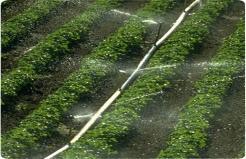
5 What is CIMIS? CIMIS was designed to assist with efficient water and energy use. CIMIS helps agricultural growers and landscape managers administering parks, golf courses and other landscapes develop water budgets for determining when to irrigate and how much water to apply.
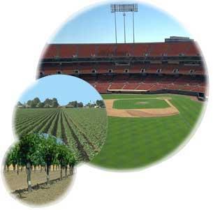
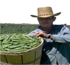
6 Who uses CIMIS data? Growers. Consultants. Water agencies. Public agencies. Home owners. Researchers. Firefighters. Investigators

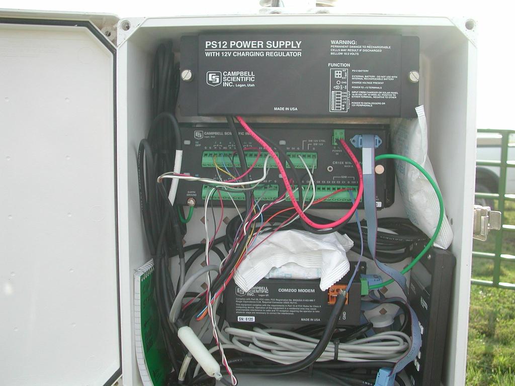
7 Anemometer Pyranometer Wind Vane Rain Gauge Temperature/ Relative Humidity Sensor Solar Panel Soil Temperature Probe

8
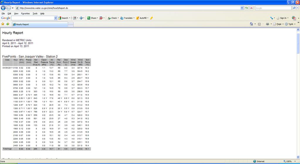
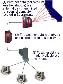
9 How does CIMIS work? Dataloggers poll the sensors every minute. Solar radiation (Rs), air temperature (Ta), wind speed (U2), and Relative Humidity (RH) data is collected. Additionally precipitation (P), soil temperature (Ts) and wind direction are measured. Sixty minute-by-minute readings are averaged/totaled.
10 How does CIMIS work? Daily maximum, minimum, average, and total values are calculated by the end of each day. Hourly and daily values are stored in the dataloggers. The CIMIS computer calls stations every 6 hours and retrieves data. Data goes through quality control (QC) procedures. Measured and calculated parameters are stored in the CIMIS database. Reference evapotranspiration (ETo) is calculated. Final data is posted on the CIMIS website.
11
12
13
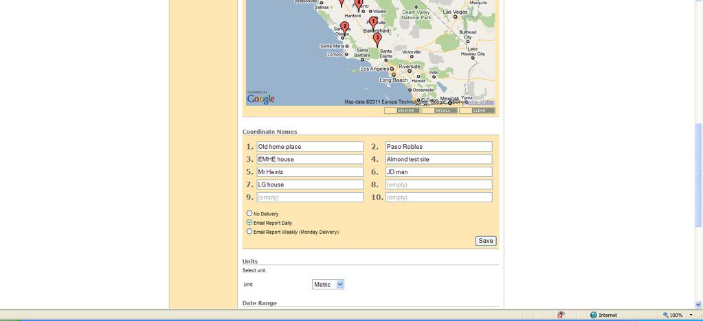
14 Whats new? Hourly data updated every 6 hours Spatial CIMIS My CIMIS scheduler
15

16 Necessary to select the end date as today s date. Default setting is yesterday s date.
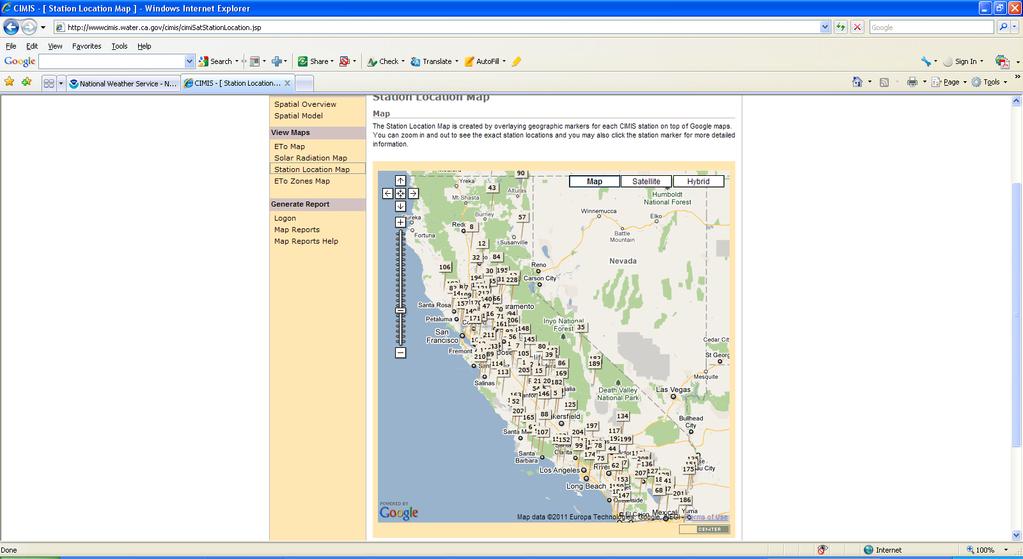
17
18 Spatial cimis wwwcimis.water.ca.gov/cimis/cimisatmodel.jsp
19 Spatial CIMIS Because of California's diverse landmass and climate, many locations within the state lack a representative CIMIS station CIMIS initiated a project with the UC Davis to explore the potential for using remotely sensed data for the estimation of ETo (to mitigate the spatial data gap). Geostationary Operational Environmental Satellites (GOES) were selected..
20 The Department of Water Resources (DWR) formed an advisory committee comprised of individuals with expertise in remote sensing, GIS, modeling, and water management from DWR and UCD. The committee met, on an as needed basis, to discuss new developments and plan future actions. After thorough research, the team decided to use combinations of data derived from satellites and interpolated between CIMIS station measurements to estimate ETo at a 2 km spatial resolution.
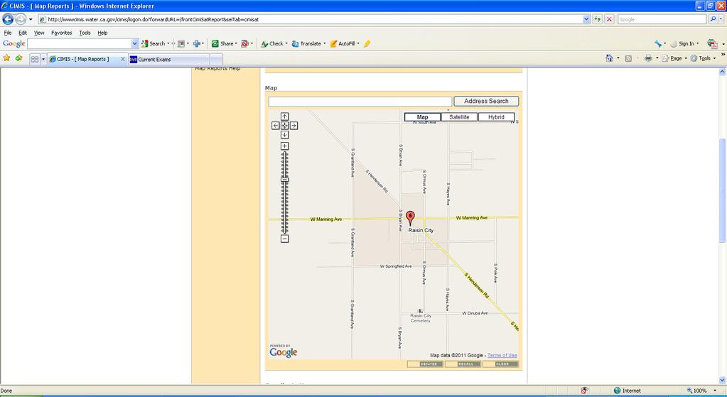
21 Daily reference evapotranspiration (ETo) at 2 km spatial resolution was calculated statewide using the American Society of Civil Engineers version of the Penman-Monteith equation (ASCE-PM). Required input parameters for the ASCE-PM ETo equation are solar radiation (Rs), air temperature (Ta), relative humidity (RH), and wind speed at two meters height (U2). These parameters are estimated at each pixel (2 km square grid) using various methods.
22 Daily Rs (solar radiation) is generated from the visible band of the National Oceanic and Atmospheric Administration's (NOAA) Geostationary Operational Environmental Satellite (GOES) using the Heliosat-II model.
23 Air temperature, relative humidity, and wind speed values at each pixel were obtained by interpolating between point measurements from the CIMIS stations. Two interpolation methods, DayMet and Spline, were selected based on accuracy of results, code availability, and computational efficiency.
24 Daily Rs from GOES Air Temperature (Ta), Relative Humidity (RH), Wind speed (U2) collected from CIMIS weather stations. (Interpolated) Spatial CIMIS ET o
25 Daily CIMIS ET o Map

26 July 15, 2010
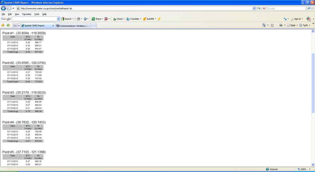
27 Daily solar radiation map
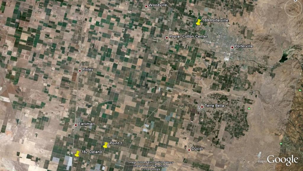
28 July 16, 2010
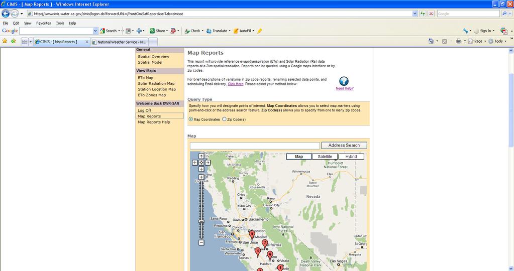
29 Spatial CIMIS Map Report
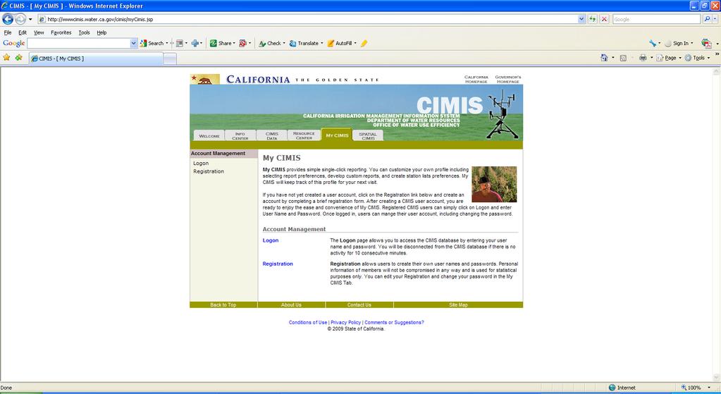
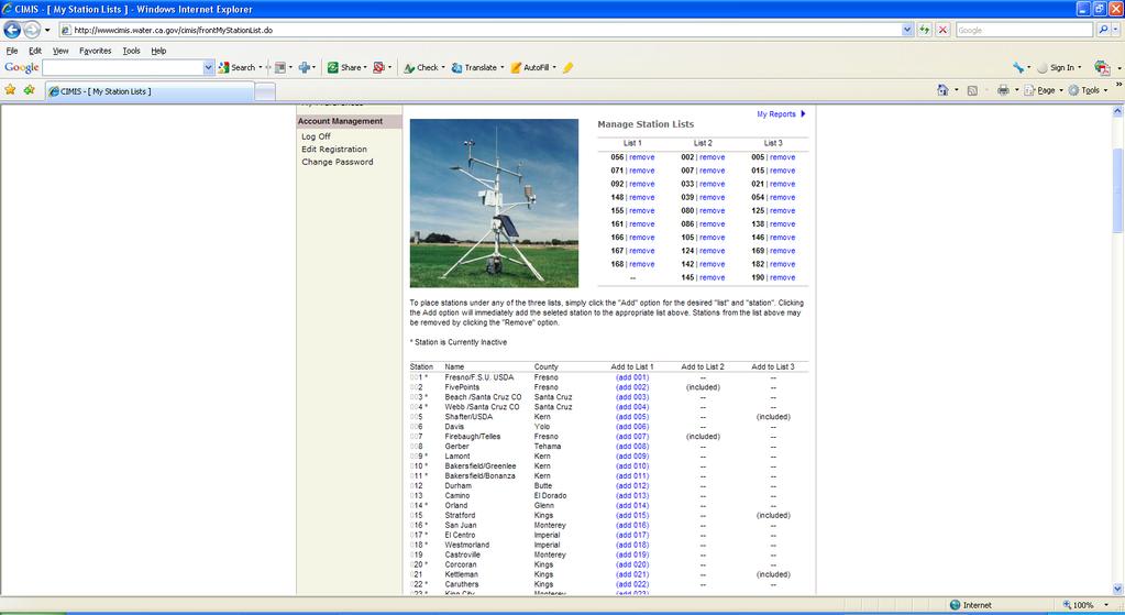
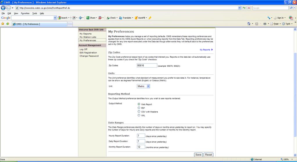
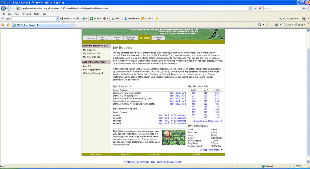
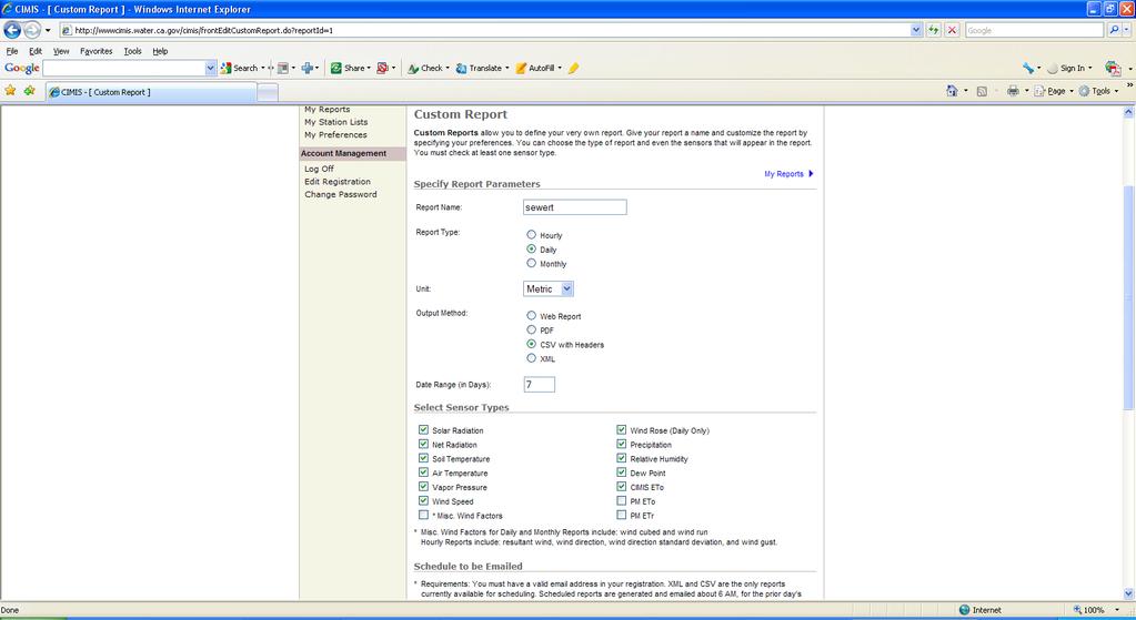
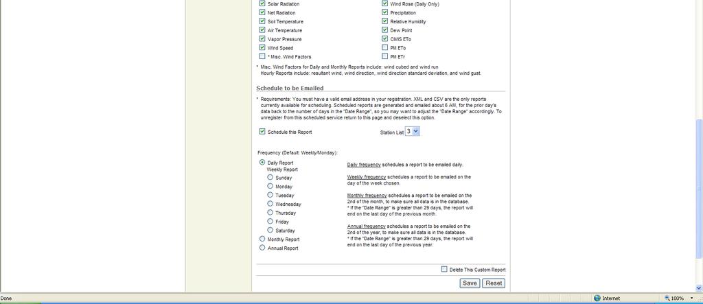
30
31
32
33 Or english
34
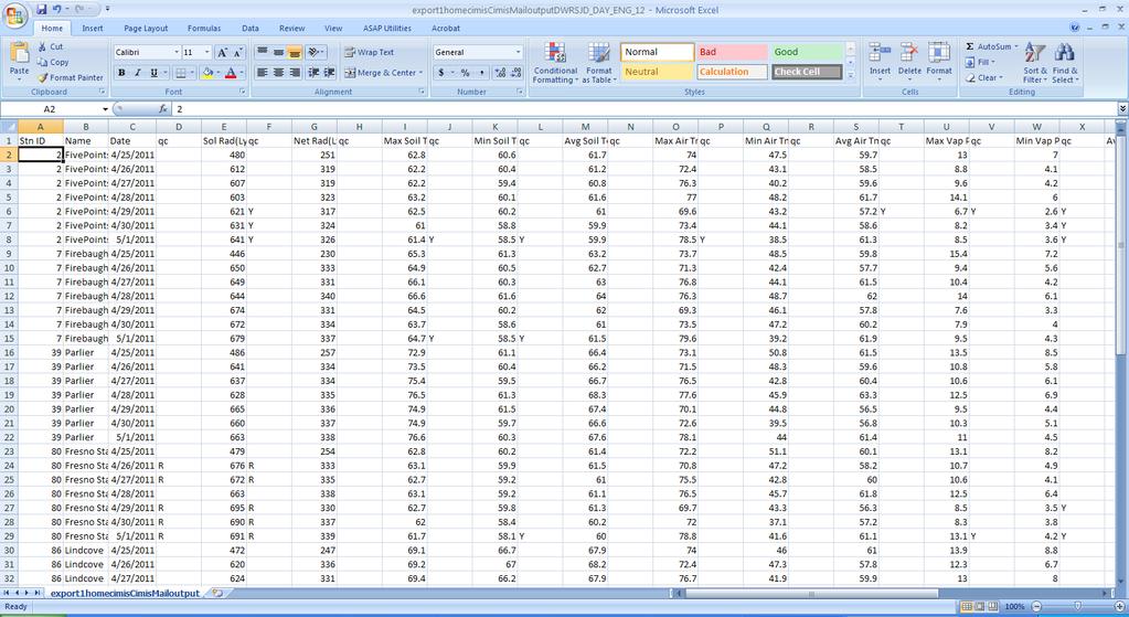
35 /16/ Point Lat Long Date CIMIS ETo (in) (in/day) Sol Rad (Ly/day) /14/ /15/ /16/ /14/ /15/ /16/ /14/ /15/ /16/ /14/ /15/ /16/ /14/ /15/ /16/ /14/ /15/ /16/ /14/ /15/
36 60 Point inches 169 Porterville inches 182 Delano inches point Porterville 182 Delano /1/2010 2/1/2010 3/1/2010 4/1/2010 5/1/2010 6/1/2010 7/1/2010 8/1/2010 9/1/ /1/ /1/ /1/2010
37
38 My CIMIS
39
40
41
42
43
44
45
46

47 For More Information: call Or Visit Us Online At: Irrigation Management Tool And More! What is CIMIS? Increase Energy and Water Use Efficiency!
The TexasET Network and Website User s Manual
 The TexasET Network and Website http://texaset.tamu.edu User s Manual By Charles Swanson and Guy Fipps 1 September 2013 Texas AgriLIFE Extension Service Texas A&M System 1 Extension Program Specialist;
The Colorado Climate Center at CSU. residents of the state through its threefold
 The CoAgMet Network: Overview History and How It Overview, Works N l Doesken Nolan D k and d Wendy W d Ryan R Colorado Climate Center Colorado State University First -- A short background In 1973 the federal
The Colorado Agricultural no Meteorological Network (CoAgMet) and Crop ET Reports
 and Crop ET Reports") C R O P S E R I E S Irrigation Quick Facts The Colorado Agricultural no. 4.723 Meteorological Network (CoAgMet) and Crop ET Reports A.A. Andales, T. A. Bauder and N. J. Doesken 1 (10/09) CoAgMet is a network
C R O P S E R I E S Irrigation Quick Facts The Colorado Agricultural no. 4.723 Meteorological Network (CoAgMet) and Crop ET Reports A.A. Andales, T. A. Bauder and N. J. Doesken 1 (10/09) CoAgMet is a network
Eric. W. Harmsen 1, John Mecikalski 2, Vanessa Acaron 3 and Jayson Maldonado 3
 Estimating Ground-Level Solar Radiation and Evapotranspiration In Puerto Rico Using Satellite Remote Sensing Eric. W. Harmsen 1, John Mecikalski 2, Vanessa Acaron 3 and Jayson Maldonado 3 1 Department
Variability of Reference Evapotranspiration Across Nebraska
 Know how. Know now. EC733 Variability of Reference Evapotranspiration Across Nebraska Suat Irmak, Extension Soil and Water Resources and Irrigation Specialist Kari E. Skaggs, Research Associate, Biological
The Kentucky Mesonet: Entering a New Phase
 The Kentucky Mesonet: Entering a New Phase Stuart A. Foster State Climatologist Kentucky Climate Center Western Kentucky University KCJEA Winter Conference Lexington, Kentucky February 9, 2017 Kentucky
Eric. W. Harmsen Agricultural and Biosystems Engineering Department, University of Puerto Rico Mayaguez Campus
 AN OPERATIONAL WATER AND ENERGY BALANCE ALGORITHM FOR PUERTO RICO Eric. W. Harmsen Agricultural and Biosystems Engineering Department, University of Puerto Rico Mayaguez Campus DÉCIMA REUNIÓN NACIONAL
MxVision WeatherSentry Web Services Content Guide
 MxVision WeatherSentry Web Services Content Guide July 2014 DTN 11400 Rupp Drive Minneapolis, MN 55337 00.1.952.890.0609 This document and the software it describes are copyrighted with all rights reserved.
Google Earth Engine METRIC (GEM) Application for Remote Sensing of Evapotranspiration
 Application for Remote Sensing of Evapotranspiration") Google Earth Engine METRIC (GEM) Application for Remote Sensing of Evapotranspiration Nadya Alexander Sanchez, Quinn Hart, Justin Merz, and Nick Santos Center for Watershed Sciences University of California,
Google Earth Engine METRIC (GEM) Application for Remote Sensing of Evapotranspiration Nadya Alexander Sanchez, Quinn Hart, Justin Merz, and Nick Santos Center for Watershed Sciences University of California,
An Online Platform for Sustainable Water Management for Ontario Sod Producers
 An Online Platform for Sustainable Water Management for Ontario Sod Producers 2014 Season Update Kyle McFadden January 30, 2015 Overview In 2014, 26 weather stations in four configurations were installed
BERMAD Irrigation. BIC2000 Weather Station SYSTEM GUIDE VERSIONS : BIC ; PC 4.90
 BIC2000 Weather Station SYSTEM GUIDE VERSIONS : BIC2000 3.92; PC 4.90 CONTENTS 1. SYSTEM OVERVIEW 3 2. WEATHER STATION SETUP 4 2.1 ISS AND CONSOLE SETUP 4 2. RF RTU SYSTEM SETUP 5 2.2 BIC2000 WEATHER STATION
Innovative Sustainable Technology
 Innovative Sustainable Technology DIG is committed to practices that contribute to irrigation and energy efficiency, creating healthy living conditions while maintaining environmentally sound operating
Topographic Distance Functions for Interpolation of Meteorological Data
 Topographic Distance Functions for Interpolation of Meteorological Data Burkhard Lehner 1, Georg Umlauf 1, Bernd Hamann 2, Susan Ustin 2 1. University of Kaiserslautern, Germany, {lehner umlauf}@informatik.uni-kl.de
TORO SENTINEL APPLICATION NOTE AN01: ET-BASED PROGRAMMING
 TORO SENTINEL APPLICATION NOTE AN01: ET-BASED PROGRAMMING Version: 12-17-2010 ET-BASED IRRIGATION IN SENTINEL Irrigating by ET: In order to irrigate by ET in Sentinel, the user has to perform a number
North Carolina Climate July 2011
 North Carolina Climate July 2011 Online: http://www.nc-climate.ncsu.edu/office/newsletters North Carolina Climate, the monthly newsletter of the State Climate Office of NC, covers a monthly climate summary
Natural Event Documentation
 ADDENDUM Natural Event Documentation Corcoran, Oildale and Bakersfield, California September 22, 2006 San Joaquin Valley Unified Air Pollution Control District May 23, 2007 Natural Event Documentation
Evapotranspiration. Rabi H. Mohtar ABE 325
 Evapotranspiration Rabi H. Mohtar ABE 325 Introduction What is it? Factors affecting it? Why we need to estimate it? Latent heat of vaporization: Liquid gas o Energy needed o Cooling process Saturation
Evapotranspiration monitoring with Meteosat Second Generation satellites: method, products and utility in drought detection.
 Evapotranspiration monitoring with Meteosat Second Generation satellites: method, products and utility in drought detection. Nicolas Ghilain Royal Meteorological Institute Belgium EUMeTrain Event week
5B.1 DEVELOPING A REFERENCE CROP EVAPOTRANSPIRATION CLIMATOLOGY FOR THE SOUTHEASTERN UNITED STATES USING THE FAO PENMAN-MONTEITH ESTIMATION TECHNIQUE
 DEVELOPING A REFERENCE CROP EVAPOTRANSPIRATION CLIMATOLOGY FOR THE SOUTHEASTERN UNITED STATES USING THE FAO PENMAN-MONTEITH ESTIMATION TECHNIQUE Heather A. Dinon*, Ryan P. Boyles, and Gail G. Wilkerson
AN INTERNATIONAL SOLAR IRRADIANCE DATA INGEST SYSTEM FOR FORECASTING SOLAR POWER AND AGRICULTURAL CROP YIELDS
 AN INTERNATIONAL SOLAR IRRADIANCE DATA INGEST SYSTEM FOR FORECASTING SOLAR POWER AND AGRICULTURAL CROP YIELDS James Hall JHTech PO Box 877 Divide, CO 80814 Email: jameshall@jhtech.com Jeffrey Hall JHTech
Estimation of Wavelet Based Spatially Enhanced Evapotranspiration Using Energy Balance Approach
 Estimation of Wavelet Based Spatially Enhanced Evapotranspiration Using Energy Balance Approach Dr.Gowri 1 Dr.Thirumalaivasan 2 1 Associate Professor, Jerusalem College of Engineering, Department of Civil
QualiMET 2.0. The new Quality Control System of Deutscher Wetterdienst
 QualiMET 2.0 The new Quality Control System of Deutscher Wetterdienst Reinhard Spengler Deutscher Wetterdienst Department Observing Networks and Data Quality Assurance of Meteorological Data Michendorfer
N ew York State Agricultural Experiment S tation vnrfx* NYSAES I Publications I Latest Press Releases
 N ew York State Agricultural Experiment S tation vnrfx* NYSAES I Publications I Latest Press Releases CORNELL U N I V E R S I T Y GENEVA NEW YORK. 100 Years of New York Weather August 16th, 2000 CONTACT:
AgWeatherNet A Tool for Making Decisions Based on Weather
 AgWeatherNet A Tool for Making Decisions Based on Weather Gerrit Hoogenboom Director, AgWeatherNet & Professor of Agrometeorology Washington State University Prosser, Washington November 14, 2013 Washington
Leon Creek Watershed October 17-18, 1998 Rainfall Analysis Examination of USGS Gauge Helotes Creek at Helotes, Texas
 Leon Creek Watershed October 17-18, 1998 Rainfall Analysis Examination of USGS Gauge 8181400 Helotes Creek at Helotes, Texas Terrance Jackson MSCE Candidate University of Texas San Antonio Abstract The
P1.34 MULTISEASONALVALIDATION OF GOES-BASED INSOLATION ESTIMATES. Jason A. Otkin*, Martha C. Anderson*, and John R. Mecikalski #
 P1.34 MULTISEASONALVALIDATION OF GOES-BASED INSOLATION ESTIMATES Jason A. Otkin*, Martha C. Anderson*, and John R. Mecikalski # *Cooperative Institute for Meteorological Satellite Studies, University of
SOUTH MOUNTAIN WEATHER STATION: REPORT FOR QUARTER 2 (APRIL JUNE) 2011
 2011") SOUTH MOUNTAIN WEATHER STATION: REPORT FOR QUARTER 2 (APRIL JUNE) 2011 Prepared for ESTANCIA BASIN WATERSHED HEALTH, RESTORATION AND MONITORING STEERING COMMITTEE c/o CLAUNCH-PINTO SOIL AND WATER CONSERVATION
SOUTH MOUNTAIN WEATHER STATION: REPORT FOR QUARTER 2 (APRIL JUNE) 2011 Prepared for ESTANCIA BASIN WATERSHED HEALTH, RESTORATION AND MONITORING STEERING COMMITTEE c/o CLAUNCH-PINTO SOIL AND WATER CONSERVATION
Development of High Resolution Gridded Dew Point Data from Regional Networks
 Development of High Resolution Gridded Dew Point Data from Regional Networks North Central Climate Science Center Open Science Conference May 20, 2015 Ruben Behnke Numerical Terradynamic Simulation Group
Accuracy of Meteonorm ( )
") Accuracy of Meteonorm (7.1.6.14035) A detailed look at the model steps and uncertainties 22.10.2015 Jan Remund Contents The atmosphere is a choatic system, not as exactly describable as many technical
Accuracy of Meteonorm (7.1.6.14035) A detailed look at the model steps and uncertainties 22.10.2015 Jan Remund Contents The atmosphere is a choatic system, not as exactly describable as many technical
A sensitivity and uncertainty analysis. Ministry of the Walloon Region Agricultural Research Centre
 Development of an agrometeorological model integrating leaf wetness duration estimation and weather radar data to assess the risk of head blight infection in wheat A sensitivity and uncertainty analysis
Zachary Holden - US Forest Service Region 1, Missoula MT Alan Swanson University of Montana Dept. of Geography David Affleck University of Montana
 Progress modeling topographic variation in temperature and moisture for inland Northwest forest management Zachary Holden - US Forest Service Region 1, Missoula MT Alan Swanson University of Montana Dept.
Eric. W. Harmsen 1, John Mecikalski 2, Pedro Tosado Cruz 1 Ariel Mercado Vargas 1
 Estimating Evapotranspiration using Satellite Remote Sensing in Puerto Rico, Haiti and the Dominican Republic Eric. W. Harmsen 1, John Mecikalski 2, Pedro Tosado Cruz 1 Ariel Mercado Vargas 1 1. University
A GROUND-BASED PROCEDURE FOR ESTIMATING LATENT HEAT ENERGY FLUXES 1 Eric Harmsen 2, Richard Díaz 3 and Javier Chaparro 3
 A GROUND-BASED PROCEDURE FOR ESTIMATING LATENT HEAT ENERGY FLUXES 1 Eric Harmsen 2, Richard Díaz 3 and Javier Chaparro 3 1. This material is based on research supported by NOAA-CREST and NASA-EPSCoR (NCC5-595).
Monitoring Extreme Weather Events. February 8, 2010
 Monitoring Extreme Weather Events February 8, 2010 Extensive network of over 800 stations across the Prairies Good coverage across entire agriculture production region Network of networks strategy includes
The Delaware Environmental Monitoring & Analysis Center
 The Delaware Environmental Monitoring & Analysis Center Tina Callahan Delaware Estuary Science & Environmental Summit 2013 January 27-30, 2013 What is DEMAC? Delaware Environmental Monitoring & Analysis
Mesonet Cattle Comfort Advisor Description Edited May 26, 2016
 Mesonet Cattle Comfort Advisor Description Edited May 26, 2016 INTRODUCTION Comfortable cattle are productive cattle. Comfortable cattle gain better and maintain a higher level of health. The Mesonet Cattle
Evapotranspiration forecast using SWAT model and weather forecast model
 Evapotranspiration forecast using SWAT model and weather forecast model Pedro Chambel-Leitão (1), Carina Almeida (1), Eduardo Jauch (1), Rosa Trancoso (1), Ramiro Neves (1), José Chambel Leitão (2) (1)
AGRICULTURAL WATER RESOURCES DECISION SUPPORT SYSTEM AND EVAPOTRANSPIRATION TOOLBOX. L. Albert Brower, Curtis L. Hartzell, and Steffen P.
 AGRICULTURAL WATER RESOURCES DECISION SUPPORT SYSTEM AND EVAPOTRANSPIRATION TOOLBOX L. Albert Brower, Curtis L. Hartzell, and Steffen P. Meyer 1 ABSTRACT: There is a critical need for improvement in calculating
Estimating Summertime Evapotranspiration Across Indiana. Principal Investigators: Johnny Nykiel. Ryan Knutson. Jesse Steinweg-Woods
 Estimating Summertime Evapotranspiration Across Indiana Principal Investigators: Johnny Nykiel Undergraduate Department of Earth and Atmospheric Science Ryan Knutson Undergraduate Department of Earth and
Discoverer Automated Weather System Data Quality Control Report
 Discoverer Automated Weather System Data Quality Control Report Kennard B. Kasper and Shawn R. Smith World Ocean Circulation Experiment (WOCE) Surface Meteorological Data Assembly Center Center for Ocean
Lecture 6: Precipitation Averages and Interception
 Lecture 6: Precipitation Averages and Interception Key Questions 1. How much and when does Whatcom County receive rain? 2. Where online can you find rainfall data for the state? 3. How is rainfall averaged
Chapter 2 Agro-meteorological Observatory
 Chapter 2 Agro-meteorological Observatory Abstract A Meteorological observatory is an area where all the weather instruments and structures are installed. The chapter gives a description of a meteorological
Speedwell High Resolution WRF Forecasts. Application
 Speedwell High Resolution WRF Forecasts Speedwell weather are providers of high quality weather data and forecasts for many markets. Historically we have provided forecasts which use a statistical bias
Accessing and Using National Long Term Ecological Research (LTER) Climate and Hydrology Data from ClimDB and HydroDB: A Tutorial
 Climate and Hydrology Data from ClimDB and HydroDB: A Tutorial") Accessing and Using National Long Term Ecological Research (LTER) Climate and Hydrology Data from ClimDB and HydroDB: A Tutorial Gordon M. Heisler USDA Forest Service, Syracuse, NY Gary Fisher U.S. Geological
Accessing and Using National Long Term Ecological Research (LTER) Climate and Hydrology Data from ClimDB and HydroDB: A Tutorial Gordon M. Heisler USDA Forest Service, Syracuse, NY Gary Fisher U.S. Geological
Evapotranspiration and Irrigation Water Requirements for Washington State
 Evapotranspiration and Irrigation Water Requirements for Washington State R. Troy Peters, PE, PhD Extension Irrigation Specialist Washington State University Irrigated Ag. Research and Extension Cntr Prosser,
Predicting Weather Conditions. Do you have a career as a meteorologist?
 Predicting Weather Conditions Do you have a career as a meteorologist? It is essential for students for know 1. Weather conditions and patterns can be based on weather data collected from various sources.
Atmospheric Sciences 321. Science of Climate. Lecture 14: Surface Energy Balance Chapter 4
 Atmospheric Sciences 321 Science of Climate Lecture 14: Surface Energy Balance Chapter 4 Community Business Check the assignments HW #4 due Today, HW#5 is posted Quiz Today on Chapter 3, too. Mid Term
COOP Modernization: NOAA s Environmental Real-time Observation Network in New England, the Southeast and Addressing NIDIS in the West
 COOP Modernization: NOAA s Environmental Real-time Observation Network in New England, the Southeast and Addressing NIDIS in the West Ken Crawford NWS Office of Science and Technology Special Presentation
USGS Water Census Guidelines and Specifications for ET Remote Sensing
 USGS Water Census Guidelines and Specifications for ET Remote Sensing U.S. Department of the Interior U.S. Geological Survey Guidelines and specifications Many prior and ongoing crop ET remote sensing
Research Note COMPUTER PROGRAM FOR ESTIMATING CROP EVAPOTRANSPIRATION IN PUERTO RICO 1,2. J. Agric. Univ. P.R. 89(1-2): (2005)
: (2005)") Research Note COMPUTER PROGRAM FOR ESTIMATING CROP EVAPOTRANSPIRATION IN PUERTO RICO 1,2 Eric W. Harmsen 3 and Antonio L. González-Pérez 4 J. Agric. Univ. P.R. 89(1-2):107-113 (2005) Estimates of crop
Research Note COMPUTER PROGRAM FOR ESTIMATING CROP EVAPOTRANSPIRATION IN PUERTO RICO 1,2 Eric W. Harmsen 3 and Antonio L. González-Pérez 4 J. Agric. Univ. P.R. 89(1-2):107-113 (2005) Estimates of crop
1 Introduction. Station Type No. Synoptic/GTS 17 Principal 172 Ordinary 546 Precipitation
 Use of Automatic Weather Stations in Ethiopia Dula Shanko National Meteorological Agency(NMA), Addis Ababa, Ethiopia Phone: +251116639662, Mob +251911208024 Fax +251116625292, Email: Du_shanko@yahoo.com
Manoa Watershed Water Balance Study: Potential ET
 Manoa Watershed Water Balance Study: Potential ET Wyatt Blair, Josh Donovan, Max Irion, Jordan Muratsuchi, and David Heir Geography 405 Fall 2016 Overview Introduction Objectives Methodology Results Summary/Conclusion
Flux Tower Data Quality Analysis in the North American Monsoon Region
 Flux Tower Data Quality Analysis in the North American Monsoon Region 1. Motivation The area of focus in this study is mainly Arizona, due to data richness and availability. Monsoon rains in Arizona usually
Applications/Users for Improved S2S Forecasts
 Applications/Users for Improved S2S Forecasts Nolan Doesken Colorado Climate Center Colorado State University WSWC Precipitation Forecasting Workshop June 7-9, 2016 San Diego, CA First -- A short background
Accuracy of cotton-planting forecasts assessed in the San Joaquin Valley
 RESEARCH ARTICLE Accuracy of cotton-planting forecasts assessed in the San Joaquin Valley Douglas J. Munier Peter B. Goodell Joyce F. Strand In the first evaluation of its kind, we found that the UC Cooperative
SWAT WEATHER DATABASE TOOL
 A SUPPORT SYSTEM FOR THE LONG-TERM ANALYSIS OF CLIMATE SCENARIOS WITH SWAT Arthur H. Essenfelder Centro Euro-Mediterraneo sui Cambiamenti Climatici CMCC 2017 INTERNATIONAL SWAT CONFERENCE 28 30 JUNE 2017,
WATER AND ENERGY BALANCE ESTIMATION IN PUERTO RICO USING SATELLITE REMOTE SENSING
 WATER AND ENERGY BALANCE ESTIMATION IN PUERTO RICO USING SATELLITE REMOTE SENSING Eric. W. Harmsen, Ariel Mercado Vargas, Pedro Tosado Cruz, Jonellys M Maldonado Morales and Angel O. Ortiz Lozada OCTAVA
Complex Terrain (EDUCT) experiment, conducted by the National Center for Atmospheric
 experiment, conducted by the National Center for Atmospheric") Alex Ameen Shenandoah Trip Paper I visited Shenandoah National Park on April 11, 2009 to investigate the Education in Complex Terrain (EDUCT) experiment, conducted by the National Center for Atmospheric
Alex Ameen Shenandoah Trip Paper I visited Shenandoah National Park on April 11, 2009 to investigate the Education in Complex Terrain (EDUCT) experiment, conducted by the National Center for Atmospheric
Local Precipitation Variability
 Local Precipitation Variability Precipitation from one storm can vary from neighborhood to neighborhood. What falls in your yard may not fall in the next. The next time it rains see how the precipitation
Vermont Soil Climate Analysis Network (SCAN) sites at Lye Brook and Mount Mansfield
 sites at Lye Brook and Mount Mansfield") Vermont Soil Climate Analysis Network (SCAN) sites at Lye Brook and Mount Mansfield 13 Years of Soil Temperature and Soil Moisture Data Collection September 2000 September 2013 Soil Climate Analysis Network
Vermont Soil Climate Analysis Network (SCAN) sites at Lye Brook and Mount Mansfield 13 Years of Soil Temperature and Soil Moisture Data Collection September 2000 September 2013 Soil Climate Analysis Network
SUBJECT AREA(S): science, math, solar power, visible light, ultraviolet (UV), infrared (IR), energy, Watt, atmospheric conditions
: science, math, solar power, visible light, ultraviolet (UV), infrared (IR), energy, Watt, atmospheric conditions") Our Place in Space Cosmic Rays AUTHOR: Jamie Repasky GRADE LEVEL(S): 3-5 SUBJECT AREA(S): science, math, solar power, visible light, ultraviolet (UV), infrared (IR), energy, Watt, atmospheric conditions
Our Place in Space Cosmic Rays AUTHOR: Jamie Repasky GRADE LEVEL(S): 3-5 SUBJECT AREA(S): science, math, solar power, visible light, ultraviolet (UV), infrared (IR), energy, Watt, atmospheric conditions
Trevor Lee Director, Buildings. Grant Edwards PhD Department of Environment and Geography
 Weather Affects Building Performance Simulation v Monitoring real time solar and coincident weather data for building optimisation and energy management Trevor Lee Director, Buildings Grant Edwards PhD
4.5 Comparison of weather data from the Remote Automated Weather Station network and the North American Regional Reanalysis
 4.5 Comparison of weather data from the Remote Automated Weather Station network and the North American Regional Reanalysis Beth L. Hall and Timothy. J. Brown DRI, Reno, NV ABSTRACT. The North American
Lecture notes: Interception and evapotranspiration
 Lecture notes: Interception and evapotranspiration I. Vegetation canopy interception (I c ): Portion of incident precipitation (P) physically intercepted, stored and ultimately evaporated from vegetation
Range Cattle Research and Education Center January CLIMATOLOGICAL REPORT 2016 Range Cattle Research and Education Center.
 1 Range Cattle Research and Education Center January 2017 Research Report RC-2017-1 CLIMATOLOGICAL REPORT 2016 Range Cattle Research and Education Center Brent Sellers Weather conditions strongly influence
Alberta Climate Information Service (ACIS) Definitions. Disclaimer. Overview
 Definitions. Disclaimer. Overview") Alberta Climate Information Service (ACIS) Definitions Disclaimer Please note that due to technical difficulties AF s IT team has only committed to having ACIS and Roping the web services achieve a 95%
Alberta Climate Information Service (ACIS) Definitions Disclaimer Please note that due to technical difficulties AF s IT team has only committed to having ACIS and Roping the web services achieve a 95%
New Digital Soil Survey Products to Quantify Soil Variability Over Multiple Scales
 2006-2011 Mission Kearney Foundation of Soil Science: Understanding and Managing Soil-Ecosystem Functions Across Spatial and Temporal Scales Progress Report: 2006021, 1/1/2007-12/31/2007 New Digital Soil
Meteorological Instruments for Solar Energy
 Meteorological Instruments for Solar Energy gillinstruments.com Gill Instruments has been designing and manufacturing professional use compact weather stations and ultrasonic wind speed and direction sensors
Regional Drought Decision Support System (RDDSS) Project Update and Product Concepts
 Project Update and Product Concepts") Regional Drought Decision Support System (RDDSS) Project Update and Product Concepts Part of the Red River Basin Decision Information Network (RRBDIN) NEXT-GEN RRBDIN Decision Support for the Red River
Regional Drought Decision Support System (RDDSS) Project Update and Product Concepts Part of the Red River Basin Decision Information Network (RRBDIN) NEXT-GEN RRBDIN Decision Support for the Red River
Range Cattle Research and Education Center January CLIMATOLOGICAL REPORT 2012 Range Cattle Research and Education Center.
 1 Range Cattle Research and Education Center January 2013 Research Report RC-2013-1 CLIMATOLOGICAL REPORT 2012 Range Cattle Research and Education Center Brent Sellers Weather conditions strongly influence
Sensing Strategies and Software Tools to Help Farmers Adapt to a Changing Climate
 Sensing Strategies and Software Tools to Help Farmers Adapt to a Changing Climate John D. Lea-Cox Department of Plant Science and Landscape Architecture University of Maryland, College Park, MD USA JLC@umd.edu
Correcting Real Time Automatic Weather Stations Data Through Quality Checks and Analysis
 Correcting Real Time Automatic Weather Stations Data Through Quality Checks and Analysis Sd. Thouseef Ahmed Shoaib and Syed Nayab Rasool Andhra Pradesh State Development Planning Society, Hyderabad Email:
Recent Improvement of Integrated Observation Systems in JMA
 Recent Improvement of Integrated Observation Systems in JMA Mr Osamu Suzuki and Mr Yoshihiko Tahara Japan Meteorological Agency 1-3-4 Otemachi, Chiyoda-ku, Tokyo 100-8122, Japan Tel: +81-3-3212-8341, Fax:
Snow Melt with the Land Climate Boundary Condition
 Snow Melt with the Land Climate Boundary Condition GEO-SLOPE International Ltd. www.geo-slope.com 1200, 700-6th Ave SW, Calgary, AB, Canada T2P 0T8 Main: +1 403 269 2002 Fax: +1 888 463 2239 Introduction
HOW TO GUIDE. Loading climate data from online database
 HOW TO GUIDE Loading climate data from online database Copyright and publisher: EMD International A/S Niels Jernes vej 10 9220 Aalborg Ø Denmark Phone: +45 9635 44444 e-mail: emd@emd.dk web: www.emd.dk
Land Data Assimilation at NCEP NLDAS Project Overview, ECMWF HEPEX 2004
 Dag.Lohmann@noaa.gov, Land Data Assimilation at NCEP NLDAS Project Overview, ECMWF HEPEX 2004 Land Data Assimilation at NCEP: Strategic Lessons Learned from the North American Land Data Assimilation System
Country Report for Japan (Submitted by Kenji Akaeda, Japan Meteorological Agency)
") Japan JMA/WMO Workshop on Quality Management in Surface, Climate and Upper-air Observations in RA II (Asia) Tokyo, Japan 27 30 July 2010 Doc. Japan (10.VII.2010) Country Report for Japan (Submitted by
Japan JMA/WMO Workshop on Quality Management in Surface, Climate and Upper-air Observations in RA II (Asia) Tokyo, Japan 27 30 July 2010 Doc. Japan (10.VII.2010) Country Report for Japan (Submitted by
SAMPLE. SITE SPECIFIC WEATHER ANALYSIS Wind Report. Robinson, Smith & Walsh. John Smith REFERENCE:
 SAMPLE SITE SPECIFIC WEATHER ANALYSIS Wind Report PREPARED FOR: Robinson, Smith & Walsh John Smith REFERENCE: JACK HIGGINS / 4151559-01 CompuWeather Sample Report Please note that this report contains
Available data and products for Agricultural purpose at the National Meteorological Agency of Ethiopia
 Available data and products for Agricultural purpose at the National Meteorological Agency of Ethiopia NSF-PIRE KICKOFF CONFERENCE, JULY 11-12 DELANO HOTEL, BAHIR DAR By Melesse Lemma National Meteorological
Weather Stations. Evaluation copy. 9. Post live weather data on the school s web site for students, faculty and community.
 Weather Stations Computer P6 Collecting and analyzing weather data can be an important part of your Earth Science curriculum. It might even be an ongoing part of your entire course. A variety of activities
Appendix C. AMEC Evaluation of Zuni PPIW. Appendix C. Page C-1 of 34
 AMEC s Independent Estimate of PPIW Crop Water Use Using the ASCE Standardized Reference Evapotranspiration via Gridded Meteorological Data, and Estimation of Crop Coefficients, and Net Annual Diversions
Non-Acoustical Inputs
 CHAPTER 18 Non-Acoustical Inputs This chapter discusses the use of external transducers and devices to provide non-acoustical data to the Model 831. Included are the following: 831-INT 831-INT Interface
2016 EXPLANATION OF OBSERVATIONS BY REFERENCE NUMBER
 S 2016 EXPLANATION OF OBSERVATIONS BY REFERENCE NUMBER tation was moved to 10905 Virginia Forest Court Glen Allen, Virginia in Henrico County on June 10, 2008. Latitude 37 39' 18.87" (37.65537) Longitude
Urban Forest Effects-Dry Deposition (UFORE D) Model Enhancements. Satoshi Hirabayashi
 Model Enhancements. Satoshi Hirabayashi") Urban Forest Effects-Dry Deposition (UFORE D) Model Enhancements Satoshi Hirabayashi The Davey Institute, The Davey Tree Expert Company, Syracuse, New York 13210, USA Surface Weather Data NOAA Integrated
Urban Forest Effects-Dry Deposition (UFORE D) Model Enhancements Satoshi Hirabayashi The Davey Institute, The Davey Tree Expert Company, Syracuse, New York 13210, USA Surface Weather Data NOAA Integrated
CSO Climate Data Rescue Project Formal Statistics Liaison Group June 12th, 2018
 CSO Climate Data Rescue Project Formal Statistics Liaison Group June 12th, 2018 Dimitri Cernize and Paul McElvaney Environment Statistics and Accounts Presentation Structure Background to Data Rescue Project
NEW CGMS BASELINE FOR THE SPACE-BASED GOS. (Submitted by the WMO Secretariat) Summary and Purpose of Document
 Summary and Purpose of Document") WORLD METEOROLOGICAL ORGANIZATION COMMISSION FOR BASIC SYSTEMS OPEN PROGRAMME AREA GROUP ON INTEGRATED OBSERVING SYSTEMS EXPERT TEAM ON SATELLITE SYSTEMS ET-SAT-7/Inf. 2 (12.III.2012) ITEM: 8.1 SEVENTH
WORLD METEOROLOGICAL ORGANIZATION COMMISSION FOR BASIC SYSTEMS OPEN PROGRAMME AREA GROUP ON INTEGRATED OBSERVING SYSTEMS EXPERT TEAM ON SATELLITE SYSTEMS ET-SAT-7/Inf. 2 (12.III.2012) ITEM: 8.1 SEVENTH
Weather versus Climate: What is the difference? Sources of Weather Information
 Joel O. Paz, Extension Agrometerologist and Gerrit Hoogenboom, Professor & REI Coordinator Department of Biological and Agricultural Engineering Weather versus Climate: What is the difference? The difference
AgWeatherNet and WA Climate Nic Loyd Meteorologist and Associate in Research AgWeatherNet
 AgWeatherNet and WA Climate Nic Loyd Meteorologist and Associate in Research AgWeatherNet February 23, 2017 Lewis County WSU Extension; Chehalis, WA AgWeatherNet Background WA Climate: Past, Present, and
Module 11: Meteorology Topic 3 Content: Weather Instruments Notes
 Introduction In order for meteorologists to accurately predict the weather, they take thousands of different weather measurements each day. Meteorologists need to use many tools in order to draw an accurate
Operational Perspectives on Hydrologic Model Data Assimilation
 Operational Perspectives on Hydrologic Model Data Assimilation Rob Hartman Hydrologist in Charge NOAA / National Weather Service California-Nevada River Forecast Center Sacramento, CA USA Outline Operational
Texas Alliance of Groundwater Districts Annual Summit
 Texas Alliance of Groundwater Districts Annual Summit Using Remote-Sensed Data to Improve Recharge Estimates August 28, 2018 by Ronald T. Green1, Ph.D., P.G. and Stu Stothoff2, Ph.D., P.G. Earth Science
Product Description. 1 of 6
 Product Description The 6250 Vantage Vue Wireless Weather Station provides accurate, reliable weather monitoring in a self-contained, easy-to-install system. Designed to provide the weather data you need
SAMPLE. SITE SPECIFIC WEATHER ANALYSIS Wind Report. Robinson, Smith & Walsh. John Smith. July 1, 2017 REFERENCE: 1 Maple Street, Houston, TX 77034
 SAMPLE SITE SPECIFIC WEATHER ANALYSIS Wind Report PREPARED FOR: Robinson, Smith & Walsh John Smith July 1, 2017 REFERENCE: JACK HIGGINS / 4151559-01 1 Maple Street, Houston, TX 77034 CompuWeather Sample
Texas Statewide Mesonet Network (TexMesonet) Dr. Kantave Greene 11/15/17
 Dr. Kantave Greene 11/15/17") Texas Statewide Mesonet Network (TexMesonet) Dr. Kantave Greene 11/15/17 1 Observe weather features Why Mesonets? Thunderstorms Squall lines Dry-lines Sea breezes Improve weather & flood forecasts Drought
Texas Statewide Mesonet Network (TexMesonet) Dr. Kantave Greene 11/15/17 1 Observe weather features Why Mesonets? Thunderstorms Squall lines Dry-lines Sea breezes Improve weather & flood forecasts Drought
Counselor s Name: Counselor s Ph #: 1) Define meteorology. Explain how the weather affects farmers, sailors, aviators,
 Define meteorology. Explain how the weather affects farmers, sailors, aviators,") Weather Merit Badge Workbook This workbook is not required but is designed to help you with this merit badge. No one can add or subtract from the Boy Scout Requirements #33215. Use page backs & add pages
Weather Merit Badge Workbook This workbook is not required but is designed to help you with this merit badge. No one can add or subtract from the Boy Scout Requirements #33215. Use page backs & add pages
Walloon Agricultural Research Centre (CRA-W) Meteorological data and lateblight modeling
 Meteorological data and lateblight modeling") (CRA-W) Meteorological data and lateblight modeling China-Europe Workshop of Potato Sustainable and Efficient Productions Harbin, 24th of July 2015 Damien Rosillon Version 25/04/2014 CRA-W : A public agricultural
(CRA-W) Meteorological data and lateblight modeling China-Europe Workshop of Potato Sustainable and Efficient Productions Harbin, 24th of July 2015 Damien Rosillon Version 25/04/2014 CRA-W : A public agricultural
KEY WORDS: Palmer Meteorological Drought Index, SWAP, Kriging spatial analysis and Digital Map.
 PALMER METEOROLOGICAL DROUGHT CLASSIFICATION USING TECHNIQUES OF GEOGRAPHIC INFORMATION SYSTEM IN THAILAND S. Baimoung, W. Waranuchit, S. Prakanrat, P. Amatayakul, N. Sukhanthamat, A. Yuthaphan, A. Pyomjamsri,
Regional Consultation on Climate Services at the National Level for South East Europe Antalya, Turkey November
 malsale@meteo.gov.vu Regional Consultation on Climate Services at the National Level for South East Europe Antalya, Turkey 21-22 November 2014 n.rudan@rhmzrs.com Capacities for the management of climatic
RainMachine Mini- 8 Quick- Start Guide
 RainMachine Mini- 8 Quick- Start Guide Table of Contents Inside the Box... 3 Wiring Diagram... 4 Hardware Installation... 5 Initial Setup... 6 How it works... 13 Operation... 8 Program Properties... 10
Gridding of precipitation and air temperature observations in Belgium. Michel Journée Royal Meteorological Institute of Belgium (RMI)
") Gridding of precipitation and air temperature observations in Belgium Michel Journée Royal Meteorological Institute of Belgium (RMI) Gridding of meteorological data A variety of hydrologic, ecological,
Gridding of precipitation and air temperature observations in Belgium Michel Journée Royal Meteorological Institute of Belgium (RMI) Gridding of meteorological data A variety of hydrologic, ecological,