TROPICAL CYCLONE GENESIS. Todd B. Kimberlain and Richard J. Pasch WMO RA-IV Workshop on Hurricane Forecasting & Warning 7 March 2016
|
|
|
- Mariah Sutton
- 6 years ago
- Views:
Transcription


1 TROPICAL CYCLONE GENESIS Todd B. Kimberlain and Richard J. Pasch WMO RA-IV Workshop on Hurricane Forecasting & Warning 7 March 2016
2 Outline / Topics Climatology Large-scale conditions associated with tropical cyclone (TC) formation Relation to ENSO, intraseasonal variability Theories of genesis Meso-scale aspects of genesis TC genesis in global models Web sites of genesis parameters Operational (NHC) genesis forecasting Forecast exercise

3 WMO Definition of a Tropical Cyclone: A warm-core, nonfrontal synoptic-scale cyclone, originating over tropical or subtropical waters, with organized deep convection and closed surface wind circulation about a well-defined center.

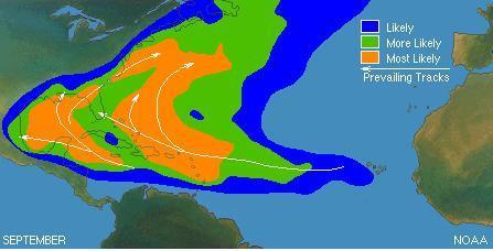
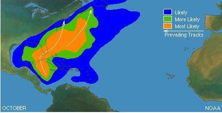
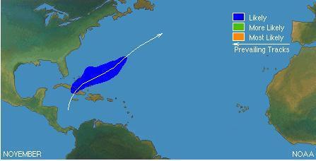
4 Principal Areas of Tropical Cyclone Formation
5 Factors Governing the Climatology of Tropical Cyclone Formation in the Atlantic Basin In the long-term mean, typically, there is a lag between the occurrence of the most favorable thermodynamic conditions (in terms of static stability) and the most favorable dynamical conditions (in terms of vertical wind shear). The atmosphere tends to be more unstable later in the season. The vertical shear tends to be weaker earlier in the season.


6 Atlantic Highly peaked with a secondary peak in mid- October Eastern North Pacific Bimodal distribution
7

8 Interannual variability of the frequency of Atlantic tropical waves, Inactive year 100 Very quiet seasons Tropical waves Inactive year Note that TC genesis is not a function of the number of available disturbances.

9 Large-Scale Conditions and Other Characteristics Associated with TC A pre-existing disturbance containing abundant deep convection Latitudes poleward ~5º Adequate ocean thermal energy - SST > 26ºC extending to a depth of 60 m A sufficiently unstable atmosphere & deep layer of moist air Small vertical shear of the horizontal wind Formation Necessary but not sufficient conditions!

 of usually 3 mb or more")
10 Large-Scale Conditions and Other Characteristics Associated with TC Upper-tropospheric anticyclonic outflow over the area Enhanced lower tropospheric relative vorticity Appearance of curved banding features in the deep convection Falling surface pressure: 24-hour pressure changes (falls) of usually 3 mb or more Formation (cont d)
11 We observe universally that tropical storms form only within pre-existing disturbances An initial disturbance therefore forms part of the starting mechanism. A weak circulation, low pressure and a deep moist layer are present at the beginning. The forecaster need not look into areas which contain no such circulations. Herbert Riehl (1954)
 Magenta dots are TC")

12 Important Intraseasonal Predictors for 5-Day Genesis Forecasts Blue favorable upper-level conditions (lower shear and more unstable) Magenta dots are TC genesis points in early 2012 Diagnostic tools involving the MJO and other intraseasonal oscillations are becoming increasingly important but are still used qualitatively


13 MADDEN-JULIAN OSCILLATION: RELATED TO INTRASEASONAL VARIABILITY IN TC ACTIVITY? ACTIVE PERIOD IN ATLANTIC BASIN 200 MB VELOCITY POTENTIAL 5 N-5 S 5- DAY RUNNING MEAN


14 A Tool for Tracking and Forecasting the MJO Conceptual model showing idealized phases of MJO progression Phases 8 through 3 most active phases for the Atlantic

15 Idealized CCKW-influenced TC genesis Day -2 Region of enhanced cyclonic vorticity generation Background easterly flow Disturbance N EQ E Eastward propagating CCKW, indicated by negative OLR anomalies and low-level anomalous westerly winds

16 Idealized CCKW-influenced TC genesis Day -1 N E Q E

17 Idealized CCKW-influenced TC genesis Day 0 N E Q E
18 Idealized CCKW-influenced TC genesis Day +1 N E Q E
19 Idealized CCKW-influenced TC genesis Day +2 N E Q E Newlydeclared TC
20 How are Intraseasonal Oscillations Used at NHC? Used as a way to increase forecaster confidence in a given situation if conceptual model of CCKWs and genesis matches model solutions. Any adjustments to 5-day genesis probabilities based on intraseasonal signals are small and subjectively determined. Global models handle the MJO much more accurately than individual CCKWs, and thus the forecaster can add value to the deterministic models. No operational standard on use of CCKW in genesis forecasts (about half of forecasters use it). 21


21 Influence of El Niño/La Niña on TC Genesis During El Niño episodes, fewer TCs form over the deep tropical Atlantic and Caribbean; tendency for more to form at subtropical latitudes. The opposite generally occurs during La Niña years. In the eastern North Pacific, El Niño typically enhances TC activity, with a tendency for stronger hurricanes during El Niño (e.g., 1997, 2006) (El Niño) 2010 (La Niña)
22 2 Formal Theories of TC Genesis CISK (Ooyama, Charney and Eliasen) WISHE (Emanuel)
23 CISK Acronym for: Conditional Instability of the Second Kind - A cooperative feedback between small-scale convection (frictionally-induced convergence and latent heat release) and the larger-scale circulation (a growing disturbance) - A simplified linear theory which assumes that flow is in gradient balance - When latent heat release balances surface frictional dissipation, the cyclone maintains its intensity NOTE: ALTHOUGH THIS THEORY IS FREQUENTLY ATTACKED, IT STILL HAS SOME INTUITIVELY APPEALING ASPECTS!
24 LARGE-SCALE WAVE CISK LOW-LEVEL CYCLONIC VORTICITY EKMAN PUMPING (FRICTIONALLY- INDUCED CONVERGENCE) TRANSVERSE (SECONDARY) CIRCULATION RELEASE OF LATENT HEAT VORTEX TUBE STRETCHING INCREASE OF LOW-LEVEL CYCLONIC VORTICITY

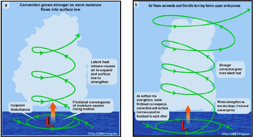
25 CISK Schematic
26 The more fundamental question about the CISK concept is how can cooperation between cyclone-scale and convective-scale circulations produce their simultaneous development including the formation and intensification of a warm core? It is difficult to see how it can happen because, if there are no sources, θ e is simply redistributed by these motions individually, and therefore by the total motion, without creating a new maximum. Conditional instability simply converts the vertical variation of θ e to the horizontal variation while the mass distribution in θ e space is conserved. Any instability that changes this distribution, therefore, inevitably involves processes other than cooperation between cyclone-scale circulation and convective clouds. Since the cooperation alone does not produce new instability, the concept of CISK as distinguished from the usual conditional instability can hardly be justified. (Arakawa, 2004 J. Climate) This suggests that another mechanism for TC genesis, that involves thermodynamics and a source of heat, should be invoked. WISHE is such a mechanism.
27 WISHE ACRONYM FOR: Wind Induced SurfaceEHeat ExchangeE -Heat release and instability in the free troposphere is governed by the evaporation of moisture from the sea (i.e., the extraction of energy from the underlying ocean surface) -Evaporation is primarily determined by the magnitude of the surface winds

28 WISHE DEEP CONVECTION, INITIATED THROUGH EKMAN PUMPING, WILL PRODUCE CONVECTIVE-SCALE DOWNDRAFTS THAT WILL STABILIZE THE LOWER LAYER OF THE ATMOSPHERE CONVECTION CAN INCREASE THE TEMPERATURE OF THE VORTEX CORE. IN A MOIST TROPICAL ATMOSPHERE, THE WISHE PROCESS CAN ACT AS A POSITIVE FEEDBACK TO THE WARM- CORE CYCLONE. THE TROPOSPHERE MUST BECOME NEARLY SATURATED IN THE VORTEX CORE THE ENHANCED SURFACE FLUXES ASSOCIATED WITH STRONG SURFACE WINDS NEAR THE CORE CAN INCREASE THE SUBCLOUD MOIST STATIC ENERGY.


29 Stage 1-Stage 2 Genesis Zehr (1992) INNER CORE MAY ORIGINATE AS A MID-LEVEL MESO-VORTEX (NEAR 700 MB) THAT FORMS IN ASSOCIATION WITH A MESOSCALE CONVECTIVE SYSTEM (MCS)

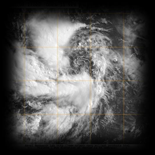
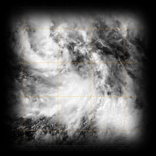
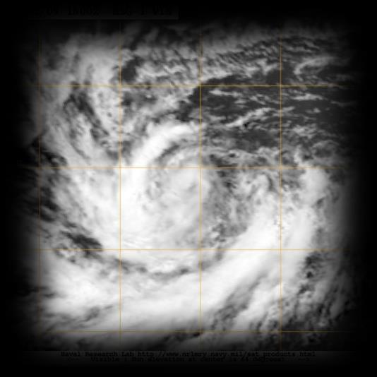
30 Multiple midlevel mesoscale vortices during genesis stage. (Reasor et al J. Atmos. Sci.) 8/19/96 8/19/96 8/19/96 8/20/96 (Hurricane Dolly)

31 WIND AND VORTICITY WITHIN SOUTHERN CONVECTIVE REGION, 8/19/96
 Based on retrospective runs of this new GFS for 2013-2015, some slight improvement in TC")
32 Changes to Global Models relevant to TC genesis forecasting: In May of 2016 (proposed), the data assimilation scheme of the Global Forecast System (GFS) spectral model will change to a 4-D hybrid ensemble variational analysis, and some additional data will be included (AMSU-A radiances and AVHRR winds) Based on retrospective runs of this new GFS for , some slight improvement in TC genesis prediction by the GFS is expected this year. Next week, the ECMWF global model will also undergo an upgrade, with an increase in horizontal resolution to about 9 km (with the number of vertical levels remaining at 130), and with improvements to the data assimilation and model physics. These changes should lead to an improved structural representation of tropical cyclones, but it is not yet known how these changes will affect the ECMWF forecasts of TC genesis.


33 Verification of TC cyclogenesis in the GFSX comparison to current and previous version of the GFS (based on work done by Dan Halperin and Bob Hart)
34
35
36 Web site for monitoring real-time model forecasts of cyclogenesis: Web site of archived model forecasts of cyclogenesis for 2010: gfs_gen_2010/
37 Genesis Probability by Dvorak Uses Dvorak intensity estimates from all invests/disturbances (both developing and non-developing) from Example: Invest with a 1.0 TAFB CI Number has 35% chance of genesis within 48 h. Real-time guidance at moe.met.fsu.edu/genesis More information in Cossuth et al. (2013) Number Atlantic TC Genesis Probability by TAFB Fix
 Best objective genesis guidance to date Uses statistics on")

38 FSU Guidance ( Best objective genesis guidance to date Uses statistics on dynamical model forecasts of genesis to develop probabilities Multi-model consensus gives most reliable forecasts Scheme provides guidance on many more systems than are mentioned in the TWO
 Several projects (e.g.")
39 CIRA Tropical cyclone-based formation probabilities Ensemble-based probabilities generated (use consensus of this?) Several projects (e.g. Joint Hurricane Testbed), with the goal to provide objective genesis guidance Other Tools

 Models appear to have some geographical biases they perform better in the eastern Atlantic and western Caribbean, but worse in the Subtropics.")

40 TC Genesis Forecasting at the NHC Primary guidance comes from global models but considerable subjectivity involved in NHC genesis forecasts Global models can depict TC formation even in complex cases fairly realistically GFS and ECMWF seem to have greatest skill, but more systematic verification is needed (consensus-based still the best?) Models appear to have some geographical biases they perform better in the eastern Atlantic and western Caribbean, but worse in the Subtropics. Models generally change to some degree annually so forecasters accustomed to a model s performance in one season will have to reacquaint himself/herself with the new model each season A genesis parameter which combines 850-mb circulation, shear, instability, and moisture has shown some promise for anticipating TC formation. At time of genesis GFS model forecasts poor for Irene several days out Genesis forecast for Katia superb


41 Excerpted from the TWO at 1800 UTC 8/26/14: A tropical wave is forecast to move off the west coast of Africa late this week. Conditions appear to be favorable for some development thereafter while the system moves westward at 10 to 15 mph across the eastern Atlantic. * Formation chance through 48 hours...low...near 0 percent. * Formation chance through 5 days...medium...40 percent. 144-h operational GFS forecast of 850 mb winds, vorticity, and mslp from 1200 UTC 8/26/ h new GFS forecast of 850 mb winds, vorticity, and mslp from 1200 UTC 8/26/14

42 Verifying 850 mb winds, vorticity, and mslp for 120 h: nada! 43

43 Arthur GFS Forecasts Valid 00Z 1 July

44 Gonzalo GFS Forecasts Valid 00Z 12 October

45 GFS Genesis forecasts for Joaquin ECMWF Little signal at long-range in GFS, broad low/trough in ECMWF ECMWF detected genesis about a day earlier than the GFS

46 00Z 8/28/13 5-day genesis probability 20% A TROPICAL WAVE OVER WEST AFRICA IS EXPECTED TO MOVE OVER THE FAR EASTERN ATLANTIC IN ABOUT THREE DAYS. SOME DEVELOPMENT IS POSSIBLE AFTER THAT TIME WHILE THE SYSTEM MOVES WEST- NORTHWESTWARD AT 10 TO 15 MPH. THIS SYSTEM HAS A LOW CHANCE...NEAR 0 PERCENT...OF BECOMING A TROPICAL CYCLONE DURING THE NEXT 48 HOURS...AND A LOW CHANCE...20 PERCENT...OF BECOMING A TROPICAL CYCLONE DURING THE NEXT 5 DAYS. GFS 126-h forecast valid at 00Z 2 September mb relative vorticity and wind and

47 00Z 8/29/13 5-day genesis probability 30% A TROPICAL WAVE LOCATED OVER WEST AFRICA IS EXPECTED TO MOVE WESTWARD AT 10 TO 15 MPH...AND AN AREA OF LOW PRESSURE COULD FORM AFTER THE WAVE MOVES OFF OF THE COAST ON FRIDAY. SOME DEVELOPMENT OF THIS LOW IS POSSIBLE LATE THIS WEEK OR EARLY THIS WEEKEND BEFORE UPPER-LEVEL WINDS BECOME UNFAVORABLE BY EARLY NEXT WEEK. THIS SYSTEM HAS A LOW CHANCE...10 PERCENT...OF BECOMING A TROPICAL CYCLONE DURING THE NEXT 48 HOURS...AND A MEDIUM CHANCE...30 PERCENT...OF BECOMING A TROPICAL CYCLONE DURING THE NEXT 5 DAYS WHILE IT MOVES NEAR THE CAPE VERDE ISLANDS. GFS 126-h forecast valid at 00Z 1 September mb relative vorticity and wind and

48 GFS 108-h forecast valid at 06Z 3 September mb relative vorticity and wind and MSLP 00Z 8/30/13 5-day genesis probability 50% A BROAD AREA OF LOW PRESSURE ASSOCIATED WITH A TROPICAL WAVE IS PRODUCING SHOWERS AND THUNDERSTORMS OVER WESTERN AFRICA. THIS SYSTEM SHOULD MOVE WESTWARD OVER THE FAR EASTERN ATLANTIC OCEAN ON FRIDAY... AND NEAR THE CAPE VERDE ISLANDS LATE SATURDAY. ENVIRONMENTAL CONDITIONS APPEAR CONDUCIVE FOR DEVELOPMENT...AND A TROPICAL DEPRESSION COULD FORM OVER THE WEEKEND. AFTER THAT TIME...THE ENVIRONMENT IS FORECAST TO BECOME LESS CONDUCIVE WHILE THE SYSTEM MOVES TOWARD THE WEST-NORTHWEST OVER THE EASTERN ATLANTIC. THIS SYSTEM HAS A MEDIUM CHANCE...40 PERCENT...OF BECOMING A TROPICAL CYCLONE DURING THE NEXT 48 HOURS...AND A MEDIUM CHANCE...50 PERCENT...OF BECOMING A TROPICAL CYCLONE DURING THE NEXT 5 DAYS.

49 METEOSAT IR Imagery and GFS Analysis valid 00Z 2 September 2013

50 NHC opens invests to monitor suspicious weather systems more carefully There are no standards for opening invests unlike for initiating a tropical cyclone package based on forecaster prerogative Guidance is typically run when a cloud system center is apparent (but not always!) Users are reminded to be extremely cautious about using parameters associated with particular invests in decision-making NHC Invest Systems


51 Tropical Weather Outlook Gives a general synopsis of weather systems in the Atlantic basin that have the potential for tropical cyclone formation during the next 48 hours. Disturbances are color-coded by their likelihood/probability of formation: low, medium, or high. Issued every 6 hours during the hurricane season 0000, 0600, 1200, 1800 UTC 2 AM, 8 AM, 2 PM, 8 PM EDT


52 5-day Genesis Product THIS SYSTEM HAS A LOW CHANCE 10 PERCENT OF BECOMING A TROPICAL CYCLONE DURING THE NEXT 48 HOURS THIS SYSTEM HAS A MEDIUM CHANCE 40 PERCENT OF BECOMING A TROPICAL CYCLONE DURING THE NEXT 5 DAYS.

53 5-day Genesis Product Disturbance 1-2 Day (%) 3-5 Day (%) 1-5 Day (%) # # # Day probability will always be the same or higher than the 2- day Since the probabilities are additive, can back out the 3-5 day %
54 5-Day Graphical Tropical Weather Outlook - Overview graphic shows entire basin, with single disturbance graphics available to avoid cases of overlapping areas - (X) indicates initial location of disturbance, if it exists at the issuance time - Arrows connect initial position of disturbance with area of formation potential

55 Special Tropical Weather Outlook Issued anytime that there are significant changes with respect to disturbances in the regular Tropical Weather Outlook. Can be updated for either the 2- or 5-day probabilities Most commonly updated when formation probabilities are too low Often used to report findings of a recon invest mission

56 Verification Results of 2- and 5-Day Genesis Forecasts - Atlantic

57 Verification Results of 2- and 5-Day Genesis Forecasts - Pacific
58 Forecast Exercise
Tropical Storm List
 Tropical Storm Email List http://tstorms.org/ tropical-storms@tstorms.org Tropical-Storms is a mailing list only for those who are professionally active in either the research or forecasting of tropical
An upper to mid level circulation (Low) in the NW Caribbean is
 in the NW Caribbean is") WEEKLY WEATHER OUTLOOK BELIZE, CENTRAL AMERICA PERIOD: Monday-Monday, Oct. 1 October 8, 2012 DATE ISSUED: Monday, Oct 1, 2012 6:00 am RFrutos EcoSolutions & Services SYNOPSIS: An upper to mid level circulation
WEEKLY WEATHER OUTLOOK BELIZE, CENTRAL AMERICA PERIOD: Monday-Monday, Oct. 1 October 8, 2012 DATE ISSUED: Monday, Oct 1, 2012 6:00 am RFrutos EcoSolutions & Services SYNOPSIS: An upper to mid level circulation
Tropical Cyclone Genesis: What we know, and what we don t!
 Tropical Cyclone Genesis: What we know, and what we don t! Allison Wing! NSF Postdoctoral Research Fellow! Lamont-Doherty Earth Observatory! Columbia University! Overview! Climatology! What We Know! Theories!
Intraseasonal Variability and TC Forecasting
 Intraseasonal Variability and TC Forecasting 2017 WMO Class Eric Blake Hurricane Specialist National Hurricane Center 3/1/2017 Outline Madden-Julian Oscillation (MJO) MJO analysis tools Kelvin Waves Brief
COLORADO STATE UNIVERSITY FORECAST OF ATLANTIC HURRICANE ACTIVITY FROM AUGUST 14 AUGUST 27, 2014
 COLORADO STATE UNIVERSITY FORECAST OF ATLANTIC HURRICANE ACTIVITY FROM AUGUST 14 AUGUST 27, 2014 We expect that the next two weeks will be characterized by below-average amounts (less than 70 percent)
COLORADO STATE UNIVERSITY FORECAST OF ATLANTIC HURRICANE ACTIVITY FROM AUGUST 4-17, 2015
 COLORADO STATE UNIVERSITY FORECAST OF ATLANTIC HURRICANE ACTIVITY FROM AUGUST 4-17, 2015 We expect that the next two weeks will be characterized by below-average amounts (
ENSO Cycle: Recent Evolution, Current Status and Predictions. Update prepared by Climate Prediction Center / NCEP 23 April 2012
 ENSO Cycle: Recent Evolution, Current Status and Predictions Update prepared by Climate Prediction Center / NCEP 23 April 2012 Outline Overview Recent Evolution and Current Conditions Oceanic Niño Index
Tropical Waves. John Cangialosi and Lixion Avila National Hurricane Center. WMO Region IV Tropical Cyclone Workshop
 Tropical Waves John Cangialosi and Lixion Avila National Hurricane Center WMO Region IV Tropical Cyclone Workshop Outline Basic definition Schematic diagrams/interactions Operational products/forecasts
ENSO: Recent Evolution, Current Status and Predictions. Update prepared by: Climate Prediction Center / NCEP 9 November 2015
 ENSO: Recent Evolution, Current Status and Predictions Update prepared by: Climate Prediction Center / NCEP 9 November 2015 Outline Summary Recent Evolution and Current Conditions Oceanic Niño Index (ONI)
ENSO Cycle: Recent Evolution, Current Status and Predictions. Update prepared by Climate Prediction Center / NCEP 25 February 2013
 ENSO Cycle: Recent Evolution, Current Status and Predictions Update prepared by Climate Prediction Center / NCEP 25 February 2013 Outline Overview Recent Evolution and Current Conditions Oceanic Niño Index
Hurricanes are intense vortical (rotational) storms that develop over the tropical oceans in regions of very warm surface water.
 storms that develop over the tropical oceans in regions of very warm surface water.") Hurricanes: Observations and Dynamics Houze Section 10.1. Holton Section 9.7. Emanuel, K. A., 1988: Toward a general theory of hurricanes. American Scientist, 76, 371-379 (web link). http://ww2010.atmos.uiuc.edu/(gh)/guides/mtr/hurr/home.rxml
Hurricanes: Observations and Dynamics Houze Section 10.1. Holton Section 9.7. Emanuel, K. A., 1988: Toward a general theory of hurricanes. American Scientist, 76, 371-379 (web link). http://ww2010.atmos.uiuc.edu/(gh)/guides/mtr/hurr/home.rxml
The 2009 Hurricane Season Overview
 The 2009 Hurricane Season Overview Jae-Kyung Schemm Gerry Bell Climate Prediction Center NOAA/ NWS/ NCEP 1 Overview outline 1. Current status for the Atlantic, Eastern Pacific and Western Pacific basins
Prospects for subseasonal forecast of Tropical Cyclone statistics with the CFS
 Prospects for subseasonal forecast of Tropical Cyclone statistics with the CFS Augustin Vintzileos (1)(3), Tim Marchok (2), Hua-Lu Pan (3) and Stephen J. Lord (1) SAIC (2) GFDL (3) EMC/NCEP/NOAA During
ENSO Cycle: Recent Evolution, Current Status and Predictions. Update prepared by Climate Prediction Center / NCEP 5 August 2013
 ENSO Cycle: Recent Evolution, Current Status and Predictions Update prepared by Climate Prediction Center / NCEP 5 August 2013 Outline Overview Recent Evolution and Current Conditions Oceanic Niño Index
COLORADO STATE UNIVERSITY FORECAST OF ATLANTIC HURRICANE ACTIVITY FROM AUGUST 30 SEPTEMBER 12, 2013
 COLORADO STATE UNIVERSITY FORECAST OF ATLANTIC HURRICANE ACTIVITY FROM AUGUST 30 SEPTEMBER 12, 2013 We expect that the next two weeks will be characterized by average amounts (70-130 percent) of activity
Lectures on Tropical Cyclones
 Lectures on Tropical Cyclones Chapter 1 Observations of Tropical Cyclones Outline of course Introduction, Observed Structure Dynamics of Mature Tropical Cyclones Equations of motion Primary circulation
ENSO Cycle: Recent Evolution, Current Status and Predictions. Update prepared by Climate Prediction Center / NCEP 11 November 2013
 ENSO Cycle: Recent Evolution, Current Status and Predictions Update prepared by Climate Prediction Center / NCEP 11 November 2013 Outline Overview Recent Evolution and Current Conditions Oceanic Niño Index
ENSO: Recent Evolution, Current Status and Predictions. Update prepared by: Climate Prediction Center / NCEP 30 October 2017
 ENSO: Recent Evolution, Current Status and Predictions Update prepared by: Climate Prediction Center / NCEP 30 October 2017 Outline Summary Recent Evolution and Current Conditions Oceanic Niño Index (ONI)
Introduction of climate monitoring and analysis products for one-month forecast
 Introduction of climate monitoring and analysis products for one-month forecast TCC Training Seminar on One-month Forecast on 13 November 2018 10:30 11:00 1 Typical flow of making one-month forecast Observed
Climate Forecast Applications Network (CFAN)
") Forecast of 2018 Atlantic Hurricane Activity April 5, 2018 Summary CFAN s inaugural April seasonal forecast for Atlantic tropical cyclone activity is based on systematic interactions among ENSO, stratospheric
Forecast of 2018 Atlantic Hurricane Activity April 5, 2018 Summary CFAN s inaugural April seasonal forecast for Atlantic tropical cyclone activity is based on systematic interactions among ENSO, stratospheric
COLORADO STATE UNIVERSITY FORECAST OF ATLANTIC HURRICANE ACTIVITY FROM SEPTEMBER 15 SEPTEMBER 28, 2015
 COLORADO STATE UNIVERSITY FORECAST OF ATLANTIC HURRICANE ACTIVITY FROM SEPTEMBER 15 SEPTEMBER 28, 2015 We expect that the next two weeks will be characterized by below-average amounts (
COLORADO STATE UNIVERSITY FORECAST OF ATLANTIC HURRICANE ACTIVITY FROM SEPTEMBER 1 SEPTEMBER 14, 2015
 COLORADO STATE UNIVERSITY FORECAST OF ATLANTIC HURRICANE ACTIVITY FROM SEPTEMBER 1 SEPTEMBER 14, 2015 We expect that the next two weeks will be characterized by below-average amounts (
ENSO Cycle: Recent Evolution, Current Status and Predictions. Update prepared by Climate Prediction Center / NCEP 15 July 2013
 ENSO Cycle: Recent Evolution, Current Status and Predictions Update prepared by Climate Prediction Center / NCEP 15 July 2013 Outline Overview Recent Evolution and Current Conditions Oceanic Niño Index
COLORADO STATE UNIVERSITY FORECAST OF ATLANTIC HURRICANE ACTIVITY FROM AUGUST 18-31, 2017
 COLORADO STATE UNIVERSITY FORECAST OF ATLANTIC HURRICANE ACTIVITY FROM AUGUST 18-31, 2017 We expect that the next two weeks will be characterized by above-average amounts (>130%) of activity relative to
Hurricanes. April 14, 2009
 Tropical Weather & Hurricanes Chapter 15 April 14, 2009 Tropical meteorology Tropics characterized by seasonal wet and drier periods- wet when sun is nearly overhead at noon and inter-tropical convergence
Issued by the: Climate Services Division Fiji Meteorological Service Nadi Airport. 27 October 2010 GENERAL STATEMENT
 Fiji Meteorological Service (FMS) Tropical Cyclone Guidance for Season 2010/11 for the Fiji and the Southwest Pacific RSMC Region 160E to 120W Equator to 25 South Issued by the: Climate Services Division
COLORADO STATE UNIVERSITY FORECAST OF ATLANTIC HURRICANE ACTIVITY FROM SEPTEMBER 25 OCTOBER 8, 2014
 COLORADO STATE UNIVERSITY FORECAST OF ATLANTIC HURRICANE ACTIVITY FROM SEPTEMBER 25 OCTOBER 8, 2014 We expect that the next two weeks will be characterized by below-average amounts (
PRMS WHITE PAPER 2014 NORTH ATLANTIC HURRICANE SEASON OUTLOOK. June RMS Event Response
 PRMS WHITE PAPER 2014 NORTH ATLANTIC HURRICANE SEASON OUTLOOK June 2014 - RMS Event Response 2014 SEASON OUTLOOK The 2013 North Atlantic hurricane season saw the fewest hurricanes in the Atlantic Basin
ENSO Cycle: Recent Evolution, Current Status and Predictions. Update prepared by Climate Prediction Center / NCEP 24 September 2012
 ENSO Cycle: Recent Evolution, Current Status and Predictions Update prepared by Climate Prediction Center / NCEP 24 September 2012 Outline Overview Recent Evolution and Current Conditions Oceanic Niño
COLORADO STATE UNIVERSITY FORECAST OF ATLANTIC HURRICANE ACTIVITY FROM SEPTEMBER 28 OCTOBER 11, 2011
 COLORADO STATE UNIVERSITY FORECAST OF ATLANTIC HURRICANE ACTIVITY FROM SEPTEMBER 28 OCTOBER 11, 2011 We expect that the next two weeks will be characterized by below-average amounts (less than 70 percent)
Intraseasonal TC Variability and Seasonal Hurricane Forecasting
 Intraseasonal TC Variability and Seasonal Hurricane Forecasting 2018 WMO Class Eric Blake Hurricane Specialist National Hurricane Center 2/28/2018 Outline Madden-Julian Oscillation (MJO) MJO analysis tools
COLORADO STATE UNIVERSITY FORECAST OF ATLANTIC HURRICANE ACTIVITY FROM AUGUST 17 AUGUST 30, 2012
 COLORADO STATE UNIVERSITY FORECAST OF ATLANTIC HURRICANE ACTIVITY FROM AUGUST 17 AUGUST 30, 2012 We expect that the next two weeks will be characterized by above-average amounts (greater than 130 percent)
COLORADO STATE UNIVERSITY FORECAST OF ATLANTIC HURRICANE ACTIVITY FROM AUGUST 16 29, 2018
 COLORADO STATE UNIVERSITY FORECAST OF ATLANTIC HURRICANE ACTIVITY FROM AUGUST 16 29, 2018 We expect that the next two weeks will be characterized by below-normal amounts of hurricane activity. (as of 16
Introduction of products for Climate System Monitoring
 Introduction of products for Climate System Monitoring 1 Typical flow of making one month forecast Textbook P.66 Observed data Atmospheric and Oceanic conditions Analysis Numerical model Ensemble forecast
Hurricanes and Tropical Weather Systems:
 Hurricanes and Tropical Weather Systems: An influence on weather in parts of the USA Meteorology 411 Iowa State University Week 2 Bill Gallus Classification/Terminology Tropical Disturbance enhanced convection
Weekend Outlook Belize, Central America Valid for: Friday until Monday, May 25-28, 2012
 Weekend Outlook Belize, Central America Valid for: Friday until Monday, May 25-28, 2012 RFrutos Synopsis: Conditions this past week improved by Wednesday as a surface low and trough producing the showery
COLORADO STATE UNIVERSITY FORECAST OF ATLANTIC HURRICANE ACTIVITY FROM SEPTEMBER 13-SEPTEMBER 26, 2018
 COLORADO STATE UNIVERSITY FORECAST OF ATLANTIC HURRICANE ACTIVITY FROM SEPTEMBER 13-SEPTEMBER 26, 2018 We expect that the next two weeks will be characterized by near-normal amounts of hurricane activity.
2013 ATLANTIC HURRICANE SEASON OUTLOOK. June RMS Cat Response
 2013 ATLANTIC HURRICANE SEASON OUTLOOK June 2013 - RMS Cat Response Season Outlook At the start of the 2013 Atlantic hurricane season, which officially runs from June 1 to November 30, seasonal forecasts
What is the Madden-Julian Oscillation (MJO)?
?") What is the Madden-Julian Oscillation (MJO)? Planetary scale, 30 90 day oscillation in zonal wind, precipitation, surface pressure, humidity, etc., that propagates slowly eastward Wavelength = 12,000 20,000
What is the Madden-Julian Oscillation (MJO)? Planetary scale, 30 90 day oscillation in zonal wind, precipitation, surface pressure, humidity, etc., that propagates slowly eastward Wavelength = 12,000 20,000
COLORADO STATE UNIVERSITY FORECAST OF ATLANTIC HURRICANE ACTIVITY FROM AUGUST 2 AUGUST 15, 2013
 COLORADO STATE UNIVERSITY FORECAST OF ATLANTIC HURRICANE ACTIVITY FROM AUGUST 2 AUGUST 15, 2013 We expect that the next two weeks will be characterized by below-average amounts (
The Impact of air-sea interaction on the extratropical transition of tropical cyclones
 The Impact of air-sea interaction on the extratropical transition of tropical cyclones Sarah Jones Institut für Meteorologie und Klimaforschung Universität Karlsruhe / Forschungszentrum Karlsruhe 1. Introduction
ENSO Cycle: Recent Evolution, Current Status and Predictions. Update prepared by Climate Prediction Center / NCEP July 26, 2004
 ENSO Cycle: Recent Evolution, Current Status and Predictions Update prepared by Climate Prediction Center / NCEP July 26, 2004 Outline Overview Recent Evolution and Current Conditions Oceanic NiZo Index
July Forecast Update for Atlantic Hurricane Activity in 2017
 July Forecast Update for Atlantic Hurricane Activity in 2017 Issued: 4 th July 2017 by Professor Mark Saunders and Dr Adam Lea Dept. of Space and Climate Physics, UCL (University College London), UK Forecast
COLORADO STATE UNIVERSITY FORECAST OF ATLANTIC HURRICANE ACTIVITY FROM SEPTEMBER 27-OCTOBER 10, 2018
 COLORADO STATE UNIVERSITY FORECAST OF ATLANTIC HURRICANE ACTIVITY FROM SEPTEMBER 27-OCTOBER 10, 2018 We expect that the next two weeks will be characterized by above-normal amounts of hurricane activity,
Atlantic Basin Satellite Image
 Tropical Update 11 AM EDT Friday, September 7, 2018 Tropical Depression Gordon, Tropical Storm Florence, Potential Tropical Cyclone #8 (90%), Invest 92L (90%) This update is intended for government and
Forced and internal variability of tropical cyclone track density in the western North Pacific
 Forced and internal variability of tropical cyclone track density in the western North Pacific Wei Mei 1 Shang-Ping Xie 1, Ming Zhao 2 & Yuqing Wang 3 Climate Variability and Change and Paleoclimate Working
Theoretical and Modeling Issues Related to ISO/MJO
 Theoretical and Modeling Issues Related to ISO/MJO Tim Li Department of Meteorology and IPRC University of Hawaii DYNAMO workshop, April 13-14, Boulder, Colorado 1. MJO Initiation issue: Role of air- sea
Analysis of Fall Transition Season (Sept-Early Dec) Why has the weather been so violent?
 Why has the weather been so violent?") WEATHER TOPICS Analysis of Fall Transition Season (Sept-Early Dec) 2009 Why has the weather been so violent? As can be seen by the following forecast map, the Fall Transition and early Winter Season of
WEATHER TOPICS Analysis of Fall Transition Season (Sept-Early Dec) 2009 Why has the weather been so violent? As can be seen by the following forecast map, the Fall Transition and early Winter Season of
August Forecast Update for Atlantic Hurricane Activity in 2012
 August Forecast Update for Atlantic Hurricane Activity in 2012 Issued: 6 th August 2012 by Professor Mark Saunders and Dr Adam Lea Dept. of Space and Climate Physics, UCL (University College London), UK
Tropical Cyclone Hyperactivity in the Eastern and Central Caribbean Sea During the 2005 Atlantic Hurricane Season
 Proceedings of the National Conference On Undergraduate Research (NCUR) 2006 The University of North Carolina at Asheville Asheville, North Carolina April 6 8, 2006 Tropical Cyclone Hyperactivity in the
KUALA LUMPUR MONSOON ACTIVITY CENT
 T KUALA LUMPUR MONSOON ACTIVITY CENT 2 ALAYSIAN METEOROLOGICAL http://www.met.gov.my DEPARTMENT MINISTRY OF SCIENCE. TECHNOLOGY AND INNOVATIO Introduction Atmospheric and oceanic conditions over the tropical
Charles Jones ICESS University of California, Santa Barbara CA Outline
 The Influence of Tropical Variations on Wintertime Precipitation in California: Pineapple express, Extreme rainfall Events and Long-range Statistical Forecasts Charles Jones ICESS University of California,
Link between Hurricanes and Climate Change: SST
 Link between Hurricanes and Climate Change: SST FRIDAY: PROJECT 2 Proposals due! Bring laptops on weds (at least one per group)! Discuss assessment on Weds. Roger Francois will talk on Friday about the
COLORADO STATE UNIVERSITY FORECAST OF ATLANTIC HURRICANE ACTIVITY FROM AUGUST 16 AUGUST 29, 2013
 COLORADO STATE UNIVERSITY FORECAST OF ATLANTIC HURRICANE ACTIVITY FROM AUGUST 16 AUGUST 29, 2013 We expect that the next two weeks will be characterized by above-average amounts (greater than 130 percent)
Hurricane Risk: Importance of Climate Time Scale and Uncertainty
 Hurricane Risk: Importance of Climate Time Scale and Uncertainty FCHLPM Workshop Peter S. Dailey, Ph.D. July 23-24, 2009 2009 AIR WORLDWIDE CORPORATION 1 Agenda Importance of Understanding Climate Change,
By: J Malherbe, R Kuschke
 2015-10-27 By: J Malherbe, R Kuschke Contents Summary...2 Overview of expected conditions over South Africa during the next few days...3 Significant weather events (27 October 2 November)...3 Conditions
Ocean-Atmosphere Interactions and El Niño Lisa Goddard
 Ocean-Atmosphere Interactions and El Niño Lisa Goddard Advanced Training Institute on Climatic Variability and Food Security 2002 July 9, 2002 Coupled Behavior in tropical Pacific SST Winds Upper Ocean
WEEKEND WEATHER OUTLOOK BELIZE, CENTRAL AMERICA
 WEEKEND WEATHER OUTLOOK BELIZE, CENTRAL AMERICA PERIOD: Friday, July 6 until Monday, July 9, 2012 DATE ISSUED: Friday, July 6, 2012; 9:00 am RFrutos SYNOPSIS: An active tropical wave (TW) just west of
The Formation of Tropical Cyclones 1
 The Formation of Tropical Cyclones 1 David J. Raymond Physics Department and Geophysical Research Center New Mexico Tech Socorro, NM, USA 1 Work supported by US National Science Foundation and Office of
地球系统科学前沿讲座 台风研究现状和问题 林岩銮
 地球系统科学前沿讲座 台风研究现状和问题 林岩銮 2013.3.18 Satellite image of Hurricane Floyd approaching the east coast of Florida in 1999. The image has been digitally enhanced to lend a three-dimensional perspective. Credit:
WEEKLY WEATHER OUTLOOK BELIZE, CENTRAL AMERICA
 WEEKLY WEATHER OUTLOOK BELIZE, CENTRAL AMERICA PERIOD: Sunday, July 1 until Monday, July 9, 2012 DATE ISSUED: Sunday, July 1, 2012 3:00 pm RFrutos EcoSolutions & Services SYNOPSIS: The features of interest
El Niño Update Impacts on Florida
 Current Issues in Emergency Management (CIEM) Sessions 1 &2 October 12 th and 26 th, 2006 Florida Division of Emergency Management Tallahassee, Florida El Niño Update Impacts on Florida Bart Hagemeyer
Evaluating a Genesis Potential Index with Community Climate System Model Version 3 (CCSM3) By: Kieran Bhatia
 By: Kieran Bhatia") Evaluating a Genesis Potential Index with Community Climate System Model Version 3 (CCSM3) By: Kieran Bhatia I. Introduction To assess the impact of large-scale environmental conditions on tropical cyclone
Evaluating a Genesis Potential Index with Community Climate System Model Version 3 (CCSM3) By: Kieran Bhatia I. Introduction To assess the impact of large-scale environmental conditions on tropical cyclone
Challenges in forecasting the MJO
 Challenges in forecasting the MJO Augustin Vintzileos University of Maryland ESSIC/CICS-MD Jon Gottschalck NOAA/NCEP/CPC Outline Forecasting at the interface between weather and climate Multi-scale impacts
Inner core dynamics: Eyewall Replacement and hot towers
 Inner core dynamics: Eyewall Replacement and hot towers FIU Undergraduate Hurricane Internship Lecture 4 8/13/2012 Why inner core dynamics is important? Current TC intensity and structure forecasts contain
July Forecast Update for North Atlantic Hurricane Activity in 2018
 July Forecast Update for North Atlantic Hurricane Activity in 2018 Issued: 5 th July 2018 by Professor Mark Saunders and Dr Adam Lea Dept. of Space and Climate Physics, UCL (University College London),
Why the Atlantic was surprisingly quiet in 2013
 1 Why the Atlantic was surprisingly quiet in 2013 by William Gray and Phil Klotzbach Preliminary Draft - March 2014 (Final draft by early June) ABSTRACT This paper discusses the causes of the unusual dearth
July Forecast Update for Atlantic Hurricane Activity in 2016
 July Forecast Update for Atlantic Hurricane Activity in 2016 Issued: 5 th July 2016 by Professor Mark Saunders and Dr Adam Lea Dept. of Space and Climate Physics, UCL (University College London), UK Forecast
El Niño-Southern Oscillation, the Madden-Julian Oscillation and Atlantic basin tropical cyclone rapid intensification
 JOURNAL OF GEOPHYSICAL RESEARCH, VOL. 117,, doi:10.1029/2012jd017714, 2012 El Niño-Southern Oscillation, the Madden-Julian Oscillation and Atlantic basin tropical cyclone rapid intensification Philip J.
Topic 3.2: Tropical Cyclone Variability on Seasonal Time Scales (Observations and Forecasting)
") Topic 3.2: Tropical Cyclone Variability on Seasonal Time Scales (Observations and Forecasting) Phil Klotzbach 7 th International Workshop on Tropical Cyclones November 18, 2010 Working Group: Maritza Ballester
Topic 3.2: Tropical Cyclone Variability on Seasonal Time Scales (Observations and Forecasting) Phil Klotzbach 7 th International Workshop on Tropical Cyclones November 18, 2010 Working Group: Maritza Ballester
Comments by William M. Gray (Colorado State University) on the recently published paper in Science by Webster, et al
 on the recently published paper in Science by Webster, et al") Comments by William M. Gray (Colorado State University) on the recently published paper in Science by Webster, et al., titled Changes in tropical cyclone number, duration, and intensity in a warming environment
Comments by William M. Gray (Colorado State University) on the recently published paper in Science by Webster, et al., titled Changes in tropical cyclone number, duration, and intensity in a warming environment
Tropical Cyclones. Objectives
 Tropical Cyclones FIU Undergraduate Hurricane Internship Lecture 2 8/8/2012 Objectives From this lecture you should understand: Global tracks of TCs and the seasons when they are most common General circulation
1. INTRODUCTION: 2. DATA AND METHODOLOGY:
 27th Conference on Hurricanes and Tropical Meteorology, 24-28 April 2006, Monterey, CA 3A.4 SUPERTYPHOON DALE (1996): A REMARKABLE STORM FROM BIRTH THROUGH EXTRATROPICAL TRANSITION TO EXPLOSIVE REINTENSIFICATION
WEEKEND WEATHER OUTLOOK BELIZE, CENTRAL AMERICA
 WEEKEND WEATHER OUTLOOK BELIZE, CENTRAL AMERICA PERIOD: Friday, July 13 until Monday, July 16, 2012 DATE ISSUED: Friday, June 13, 2012, 9:00 am RFrutos SYNOPSIS: A weak pressure gradient over the NW Caribbean
August Forecast Update for Atlantic Hurricane Activity in 2016
 August Forecast Update for Atlantic Hurricane Activity in 2016 Issued: 5 th August 2016 by Professor Mark Saunders and Dr Adam Lea Dept. of Space and Climate Physics, UCL (University College London), UK
Outlook 2008 Atlantic Hurricane Season. Kevin Lipton, Ingrid Amberger National Weather Service Albany, New York
 Outlook 2008 Atlantic Hurricane Season Kevin Lipton, Ingrid Amberger National Weather Service Albany, New York Summary 2007 Hurricane Season Two hurricanes made landfall in the Atlantic Basin at category-5
The Planetary Circulation System
 12 The Planetary Circulation System Learning Goals After studying this chapter, students should be able to: 1. describe and account for the global patterns of pressure, wind patterns and ocean currents
April Forecast Update for North Atlantic Hurricane Activity in 2019
 April Forecast Update for North Atlantic Hurricane Activity in 2019 Issued: 5 th April 2019 by Professor Mark Saunders and Dr Adam Lea Dept. of Space and Climate Physics, UCL (University College London),
UPDATE OF REGIONAL WEATHER AND SMOKE HAZE (September 2017)
") UPDATE OF REGIONAL WEATHER AND SMOKE HAZE (September 2017) 1. Review of Regional Weather Conditions in August 2017 1.1 Southwest Monsoon conditions continued to prevail in the region in August 2017. The
UPDATE OF REGIONAL WEATHER AND SMOKE HAZE (September 2017) 1. Review of Regional Weather Conditions in August 2017 1.1 Southwest Monsoon conditions continued to prevail in the region in August 2017. The
COLORADO STATE UNIVERSITY FORECAST OF ATLANTIC HURRICANE ACTIVITY FROM OCTOBER 13 OCTOBER 26, 2017
 COLORADO STATE UNIVERSITY FORECAST OF ATLANTIC HURRICANE ACTIVITY FROM OCTOBER 13 OCTOBER 26, 2017 We expect that the next two weeks will be characterized by above-normal hurricane activity. (as of 13
ESCI 241 Meteorology Lesson 19 Tropical Cyclones Dr. DeCaria
 ESCI 241 Meteorology Lesson 19 Tropical Cyclones Dr. DeCaria READING: Chapter 16 GENERAL A tropical cyclone is a large, low-pressure system that forms over the tropical oceans. Tropical cyclones are classified
UPDATE OF REGIONAL WEATHER AND SMOKE HAZE (December 2017)
") UPDATE OF REGIONAL WEATHER AND SMOKE HAZE (December 2017) 1. Review of Regional Weather Conditions for November 2017 1.1 In November 2017, Southeast Asia experienced inter-monsoon conditions in the first
UPDATE OF REGIONAL WEATHER AND SMOKE HAZE (December 2017) 1. Review of Regional Weather Conditions for November 2017 1.1 In November 2017, Southeast Asia experienced inter-monsoon conditions in the first
ENSO Outlook by JMA. Hiroyuki Sugimoto. El Niño Monitoring and Prediction Group Climate Prediction Division Japan Meteorological Agency
 ENSO Outlook by JMA Hiroyuki Sugimoto El Niño Monitoring and Prediction Group Climate Prediction Division Outline 1. ENSO impacts on the climate 2. Current Conditions 3. Prediction by JMA/MRI-CGCM 4. Summary
2011 Atlantic Hurricane Activity and Outlooks A Climate/ Historical Perspective
 2011 Atlantic Hurricane Activity and Outlooks A Climate/ Historical Perspective Gerry Bell NOAA Lead Seasonal Hurricane Forecaster Climate Prediction Center/ NWS Related Publications: Bell and Chelliah
AnuMS 2018 Atlantic Hurricane Season Forecast
 AnuMS 2018 Atlantic Hurricane Season Forecast Issued: May 10, 2018 by Dale C. S. Destin (follow @anumetservice) Director (Ag), Antigua and Barbuda Meteorological Service (ABMS) The *AnuMS (Antigua Met
Chapter 24 Tropical Cyclones
 Chapter 24 Tropical Cyclones Tropical Weather Systems Tropical disturbance a cluster of thunderstorms about 250 to 600 km in diameter, originating in the tropics or sub-tropics Tropical depression a cluster
NOAA 2015 Updated Atlantic Hurricane Season Outlook
 NOAA 2015 Updated Atlantic Hurricane Season Outlook Dr. Gerry Bell Lead Seasonal Forecaster Climate Prediction Center/ NOAA/ NWS Collaboration With National Hurricane Center/ NOAA/ NWS Hurricane Research
Understanding the Global Distribution of Monsoon Depressions
 DISTRIBUTION STATEMENT A. Approved for public release; distribution is unlimited. Understanding the Global Distribution of Monsoon Depressions William R. Boos PO Box 208109 New Haven, CT 06520 phone: (203)
WEEKLY WEATHER OUTLOOK BELIZE, CENTRAL AMERICA
 WEEKLY WEATHER OUTLOOK BELIZE, CENTRAL AMERICA PERIOD: Sunday, June 17 until Monday, June 25, 2012 DATE ISSUED: Sunday, June 17, 2012; 3:00 pm RFrutos EcoSolutions & Services SYNOPSIS: An upper level trough
DISTRIBUTION STATEMENT A. Approved for public release; distribution is unlimited.
 DISTRIBUTION STATEMENT A. Approved for public release; distribution is unlimited. The Probabilistic Nature of Extended-Range Predictions of Tropical Cyclone Activity and Tracks as a Factor in Forecasts
COLORADO STATE UNIVERSITY FORECAST OF ATLANTIC HURRICANE ACTIVITY FROM AUGUST 31 SEPTEMBER 13, 2012
 COLORADO STATE UNIVERSITY FORECAST OF ATLANTIC HURRICANE ACTIVITY FROM AUGUST 31 SEPTEMBER 13, 2012 We expect that the next two weeks will be characterized by average amounts (70-130 percent) of activity
GPC Exeter forecast for winter Crown copyright Met Office
 GPC Exeter forecast for winter 2015-2016 Global Seasonal Forecast System version 5 (GloSea5) ensemble prediction system the source for Met Office monthly and seasonal forecasts uses a coupled model (atmosphere
AnuMS 2018 Atlantic Hurricane Season Forecast
 AnuMS 2018 Atlantic Hurricane Season Forecast : June 11, 2018 by Dale C. S. Destin (follow @anumetservice) Director (Ag), Antigua and Barbuda Meteorological Service (ABMS) The *AnuMS (Antigua Met Service)
Global Climate Patterns and Their Impacts on North American Weather
 Global Climate Patterns and Their Impacts on North American Weather By Julie Malmberg and Jessica Lowrey, Western Water Assessment Introduction This article provides a broad overview of various climate
UPDATE OF REGIONAL WEATHER AND SMOKE HAZE (May 2017)
") UPDATE OF REGIONAL WEATHER AND SMOKE HAZE (May 2017) 1. Review of Regional Weather Conditions in April 2017 1.1 Inter monsoon conditions, characterised by afternoon showers and winds that are generally
UPDATE OF REGIONAL WEATHER AND SMOKE HAZE (May 2017) 1. Review of Regional Weather Conditions in April 2017 1.1 Inter monsoon conditions, characterised by afternoon showers and winds that are generally
Initialization of Tropical Cyclone Structure for Operational Application
 DISTRIBUTION STATEMENT A. Approved for public release; distribution is unlimited. Initialization of Tropical Cyclone Structure for Operational Application PI: Tim Li IPRC/SOEST, University of Hawaii at
Introduction to Meteorology & Climate. Climate & Earth System Science. Atmosphere Ocean Interactions. A: Structure of the Ocean.
 Climate & Earth System Science Introduction to Meteorology & Climate MAPH 10050 Peter Lynch Peter Lynch Meteorology & Climate Centre School of Mathematical Sciences University College Dublin Meteorology
Tropical Update. 5 AM EDT Monday, October 8, 2018 Tropical Storm Michael, Tropical Storm Leslie, Invest 92L (10%) & African Tropical Wave (50%)
 & African Tropical Wave (50%)") Tropical Update 5 AM EDT Monday, October 8, 2018 Tropical Storm Michael, Tropical Storm Leslie, Invest 92L (10%) & African Tropical Wave (50%) This update is intended for government and emergency response
Tropical Update 5 AM EDT Monday, October 8, 2018 Tropical Storm Michael, Tropical Storm Leslie, Invest 92L (10%) & African Tropical Wave (50%) This update is intended for government and emergency response
Comments on: Increasing destructiveness of tropical cyclones over the past 30 years by Kerry Emanuel, Nature, 31 July 2005, Vol. 436, pp.
 Comments on: Increasing destructiveness of tropical cyclones over the past 30 years by Kerry Emanuel, Nature, 31 July 2005, Vol. 436, pp. 686-688 William M. Gray Department of Atmospheric Science Colorado
Toward Seamless Weather-Climate Prediction with a Global Cloud Resolving Model
 DISTRIBUTION STATEMENT A. Approved for public release; distribution is unlimited. Toward Seamless Weather-Climate Prediction with a Global Cloud Resolving Model PI: Tim Li IPRC/SOEST, University of Hawaii