METEOROLOGY FOR PPL PILOTS
|
|
|
- Emerald Hunt
- 5 years ago
- Views:
Transcription
1 METEOROLOGY FOR PPL PILOTS edition 2 Greg Reeve 1
2 Special thanks must go to Chris Webster, Meteorologist at MetService. His invaluable help in providing material and assisting with editing and peer reviewing this text is much appreciated. Thanks must also go to Tamara GnjidicVuksa, Aviation Meteorologist at MetService, for allowing me use some of her work on the new GRAFOR and GNZSIGWX products in this publication. I would also like to acknowledge Nicola Cornish, Multimedia Designer at MetService, for the many hours of work she has done in tidying up and formatting my work Greg Reeve 2
3 Meteorological Service Of New Zealand Ltd 2018 All Rights Reserved. This book or any portion thereof may not be reproduced or used in any manner whatsoever without the express written permission of the publisher. ISBN: (Epub) Meteorology for PPL pilots (2018) Contact: Greg Reeve, Meteorologist Ohakea Phone: (06) Mobile:
4 CONTENTS INTRODUCTION Decode Domestic Meteorological Reports and Forecasts Weather Maps The Atmosphere Temperature and Heat Exchange Processes Atmospheric Pressure and Density Wind Local Winds Water Vapour Atmospheric Stability Inversions Cloud Precipitation Visibility and Fog Aircraft Icing Thunderstorms Mountain Weather Airmasses and Fronts Turbulence New Zealand Weather Assess Satellite and Radar Imagery, and Non-Aviation-Specific Weather Information Interpret Domestic Meteorological Services, Reports and Forecasts
5 INTRODUCTION MetService NZ Ltd has produced this book on Meteorology for Private Pilot s Licence. It is designed not only to help you pass your PPL Meteorology examination, but to give you the necessary tools to be able to make sound weather-based decisions in relation to your flying activities. The manual is comprised of twenty-one chapters set out in accordance with Subject No 8 PPL Meteorology syllabus as stated in the Civil Aviation Authority Advisory Circular AC61-3 as introduced by the CAA on November 24 th, 2017 Throughout this publication, reference is made to Southern Hemisphere examples; any references to Northern Hemisphere examples are largely ignored. The Northern Hemisphere is a mirror image of the Southern Hemisphere so wind directions etc. are reversed. MetService wishes you happy and safe flying! 5
6 8.2 Decode Domestic Meteorological Reports and Forecasts Demonstrate how to access avia3on meteorological informa3on for New Zealand through the MetFlight internet web-site In plain language, decode the informa3on contained in the following forecasts and reports: (a) GRAFOR; (b) TAF; (c) TREND; (d) METAR; (e) SPECI; (f) METAR AUTO; (g) GNZSIGWX; (h) ATIS; (i) AWIB; (j) BWR; (k) Pilot Reports; (l) AAW; (m) GSM Demonstrate how to access avia3on meteorological informa3on for New Zealand through the MetFlight internet web-site. Access to the MetFlight GA internet-based web-site is free to all recreational pilots operating at or below 10,000ft, under VFR or IFR rules (please note, this web-site is only to be used for non-commercial purposes). To access MetFlight, log on to: URL: Username: Password: hwp://meylight.metra.co.nz your licence number the ini3al grant date of your licence in the form d/mm/yyyy The above instructions will work for most pilots, however there are a few variations, and these are explained by clicking on the Help button once you have entered the login page of the MetFlight GA web-site In plain language, decode the informa3on contained in the following forecasts and reports: Please note: This objective, 8.2.4, is listed correctly at the beginning of this chapter, in accordance with Subject No 8 PPL Meteorology, as stated in the Civil Aviation Authority Advisory Circular AC61-3. However, the AAW, GRAFOR, GNZSIGWX and GSM products should all be considered together when planning a cross country flight. Therefore, these products will be covered first, and consecutively (and consequently, out of order) in this book to facilitate a better learning experience. The purpose of this topic is simply to decode meteorological forecasts and reports. Learning how to interpret this decoded data is a different proposition altogether, and this is covered in chapter 8.52 toward the end of this book. 6
.")
7 (l) AAW Aviation Area Winds In MetFlight, Aviation Area Winds (and in fact, all of the forecasts and observations required for planning a crosscountry flight) are accessed by selecting the areas required for your planned flight from the map (see figure 1 below). After clicking on the GET WEATHER BRIEFING button, the selected area winds, along with the current GRAFOR maps, the GNZSIGWX and GSM, plus TAFs and observational data will appear on the screen. ALL these products should then be considered together when planning for a cross-country flight. Fig. 1 The Avia)on Area Wind Selec)on Map in MetFlight. 7
. Fig.")
8 The AAW lists wind speed and direction (in knots and degrees true) at 1000, 3000, 5000, 7000 and feet AMSL. It also includes temperature forecasts (in degrees C) from 5000 feet upwards. Significant anticipated changes in either the forecast wind or the forecast temperatures will be shown to the right of the main listing under the appropriate time (UTC). Fig. 2 An Example of the Aviation Area Wind Listing for the AL (Alps) Area. 8
9 (a) GRAFOR GRaphical Aviation FORecast Fig. 3 An Example of a GRAFOR for New Zealand. 9
10 ABT ABV MON AFT AMD COT BECMG BFR BDRY BKN BLDG CLR BASE CONS CB DTRT EMBD EXC EXTD FRQ FM IMPR VAL LAN INTSF ISOL LCA MT MTW MOV NSC NSW OCNL OVC SCT About Above Above Mountains After Amend/Amended At the coast Becoming Before Boundary Broken Building Clear Cloud Base Continuous Cumulonimbus Deteriorating/deteriorate Embedded in a layer Except Extended/extending Frequent From Improving In Valleys Inland Intensifying Isolated Local/locally/location/located Mountain Mountain Waves Moving/Move Nil Significant Cloud Nil Significant Weather Occasional/occasionally Overcast Scattered 10
11 SECT SFC TS TL TCU VCY WKN WDSPR WI Sector Surface Thunderstorm Till (followed by time by which weather change is forecast to end) Towering Cumulus Vicinity Weakening Widespread Within Fig. 4 Common Abbreviations Used in GRAFOR and GNZSIGWX Products. Explanation and decode The caption for each chart consists of a title/validity box and a disclaimer box. The disclaimer box is a reminder to pilots about the implications of the use of CB in the chart and that heights are in feet AMSL. The disclaimer also reminds pilots to refer to the GNZSIGWX chart for occurrences of moderate turbulence and/or icing (along with several other moderate aviation hazards), and to refer to the GSM for any SIGMETs regarding severe events. Fig. 5 An Example of a Title/Validity Box and a Disclaimer Box. If the chart is amended, the abbreviation AMD is inserted in the validity box and a remark box is added above the validity box to briefly explain why the amendment has been made, as highlighted below. Fig. 6 An Example of the Title/Validity Box When the GRAFOR is Amended. GRAFOR forecasts contain sec=oned off por=ons of New Zealand where similar weather exists. In each weather box, the worst condi)ons expected are shown as follows: visibility, cloud layers below 10000ft AMSL, and weather. In addi=on, spot freezing levels and the posi=ons of fronts are included on the charts. 11

12 GRAFOR products are issued overnight with three charts valid at 0600, 1200 and 1800 local. Another issue is produced around mid-morning, with validities of 1200, 1800, and Midnight local. However, not all elements found on the chart are valid at the time quoted. Some are valid at the spot time of the chart, while others are valid within ±3 hours of the stated fixed validity time. See Chart Elements and Validities below. Chart Elements and Validi3es Information Symbol Description and units Fixed validity time Validity ±3h to fixed time Freezing level Hundreds of feet AMSL. Fronts Cold front Warm front Occluded front Stationary front Cloud/weather areas Delineated by thick green lines (note: the black dots are the location of commonly used aerodromes). Cloud/weather group Non-deep convective cloud Box with cloud, weather and visibility information, with an arrow pointing to the relevant chart area. Described by amounts in oktas, with bases and tops (in hundreds of feet AMSL, as a single value or a range). Amounts can be: OVC 8 oktas BKN 5-7 oktas SCT 3-4 oktas NSC nil significant cloud (less than 3 oktas and/or bases higher than 10,000 FT AMSL). 12
13 Deep convective cloud Described by spatial coverage: ISOL area with maximum spatial coverage up to 50% OCNL - area with maximum spatial coverage greater than 50% but less than 75% FRQ - area with maximum spatial coverage greater than 75% EMBD can be added to indicate that convective cloud is embedded in layers of other cloud. Type of cloud: TCU or CB. Visibility and weather Bases and tops (in hundreds of feet AMSL, as a single value or a range). XXX means tops are above 10,000 FT AMSL. Prevailing visibility with dominant type of weather, along with deterioration of conditions given as the lowest visibility, the type of weather that is causing it, and the location and timing of the occurrence. If there isn t any significant weather, abbreviation NSW (nil significant weather) will be used. Fig. 7 A Description of the Chart Elements and Validities Found in GRAFOR Products. 13
 + Heavy TS Thunderstorm DR Low Drifting BL Blowing RA Rain GS Small Hail and/or snow pellets FG Fog HZ Haze FU Smoke FC Funnel cloud(s) (Tornadoes or Water Spouts) FZ Freezing")
14 Significant Weather Elements used in GRAFORs Qualifier Weather Phenomena Intensity or Proximity Descriptor Precipitation Obscuration Other Light SH Shower(s) DZ Drizzle BR Mist SQ Squall Moderate (no qualifier) + Heavy TS Thunderstorm DR Low Drifting BL Blowing RA Rain GS Small Hail and/or snow pellets FG Fog HZ Haze FU Smoke FC Funnel cloud(s) (Tornadoes or Water Spouts) FZ Freezing (Super-cooled) GR Hail SN Snow SG Snow Grains VA Volcanic Ash DU Widespread Dust PO Dust/sand Whirls (dust devils) SS Sandstorm IC Ice Crystals (Diamond Dust) SA Sand DS Dust storm Fig. 8 A List of Significant Weather Elements Found in GRAFOR Products. Note that this list is based on the significant weather types used in TAF and METAR (see Fig 13). Some examples of GRAFOR decodes Information or symbol Decode Freezing level: 8,500 FT AMSL. Freezing level: 11,500 FT AMSL. Cloud: 5-7 oktas with base at 2000 FT AMSL and top at 6000 FT AMSL. Visibility and weather: 30 KM in good conditions but reduced to 6000 M in showers of rain in the eastern part of the delineated area. Cloud: 5-7 oktas with base at 6500 FT AMSL and top ABV 10,000 FT. Visibility and weather: 30 KM, nil significant weather. Cloud: 3-4 oktas with bases between 5000 and 7000 FT AMSL and tops ABV 9000 FT AMSL. Visibility and weather: 25KM, light showers of rain can often be observed in the area. Cloud: Nil significant. Visibility and weather: 35KM, nil significant weather. 14


15 Cloud: 5-7 oktas with bases between 1500 and 2500 FT AMSL, and tops ABV 10,000 FT AMSL. Less than 50% of the area covered by embedded TCU with base 2000 FT AMSL and top ABV 10,000 FT AMSL. Visibility and weather: 20 KM, light rain can often be observed in the area; visibility reduced to 5000 M in rain within 50 NM of the front. Cloud: Nil significant cloud. Visibility and weather: 500 M in fog, that will dissipate by 22Z. Cloud: 5-7 oktas with bases between 8000 and 10,000 FT AMSL, and tops ABV 10,000 FT AMSL. Visibility and weather: 35KM, light showers of rain can often be observed in the area. Cold front lying over southern Fiordland. Grey circle represents location of Manapouri Aerodrome (NZMO). Fig. 9 Some Examples of Decoded GRAFOR Elements. 15
 Fig. 10 An Example of a GNZSIGWX Chart.")
16 (g) GNZSIGWX Graphical New Zealand SIGnificant WX (weather) Fig. 10 An Example of a GNZSIGWX Chart. 16
, when the chart was issued (1954 UTC on 11 th June 2018) and the period through which the chart is valid")
, that the use of the term CB implies severe")
17 Decodes and/or explana3ons of the informa3on contained in the GNZSIGWX Chart in figure 10: Information or symbol Decode and/or Explanation The title box states the product name (GRAPHICAL NZ SIGWX), the height through which the chart is valid (in this case from sea level to 10000ft AMSL), when the chart was issued (1954 UTC on 11 th June 2018) and the period through which the chart is valid (2100Z on the 11 th to 1200Z on the 12 th ). This is the disclaimer box which states that the chart is valid within the NZZC FIR only, that all heights are in feet AMSL (unless otherwise specified), that the use of the term CB implies severe turbulence and icing, and that pilots should refer to the GSM for any SIGMET information. The legend box shows the symbols and shadings used to denote and explain the presence of moderate hazards within the NZZC FIR (icing, turbulence, radio activity, volcanic ash, CB s and mountain waves). Please note: the occurrences of severe hazards will not be shown on this chart. Instead, pilots must refer to the GSM for information regarding severe phenomena. Moderate turbulence forecast from sea level to a height above the upper level of the chart. Moderate turbulence forecast above 10000ft AMSL in mountain waves. The use of the term mountain waves implies the possibility of moderate to severe aircraft icing in the updrafting portion of the waves. If the forecaster believes the icing may be significant, they will include an icing warning in this box along with the moderate turbulence indication. Moderate icing forecast above 7000ft AMSL, with the top of the icing condition above the 10000ft upper limit of the chart. Icing conditions improving about and north of Auckland Airport from 0000Z. Isolated embedded CB, bases 2000ft AMSL, tops above the upper limit of the chart. CB s easing north of Gisborne from 0200Z. Moderate icing forecast above 4000ft AMSL, with the top of the icing condition above the 10000ft upper limit of the chart. The icing confined to the area north of Timaru at first but spreading elsewhere by 0000Z. Moderate turbulence forecast between the surface and 6000ft AMSL. Fig. 11 Decodes and Explanations of the Information Contained in Figure
18 (m) GSM Graphical SIGMET Monitor SIGMET - SIGnificant METeorological information for pilots. SIGMETs are issued by MetService in both written and graphical form whenever the following hazardous conditions are observed or forecast. SIGMETs are issued for: - Thunderstorms: obscured, embedded, frequent or in a squall line, with or without hail - Tropical cyclone - Severe turbulence - Severe icing in cloud or due to freezing rain - Severe mountain waves - Heavy sandstorm or dust storms - Volcanic ash cloud and volcanic ejecta Each SIGMET is numbered consecutively and numbering is reset to SIGMET 01 at 0001 UTC daily. Most SIGMETs are valid for FOUR hours but are reviewed after three hours. At that time, a new SIGMET is issued and the old one cancelled. This ensures continuity where an event lasts more than 4 hours. SIGMETs for Tropical Cyclones and Volcanic Ash are valid for 6 hours and reviewed after 5 hours. They also include an outlook (OTLK) for the TWELVE hours after the end of the sixhour period of the SIGMET, and the name of the TC or Volcano. Note that SIGMETs are not issued for isolated Cb clouds. There are two SIGMET areas in New Zealand: NZZC and NZZO (oceanic) corresponding to the Flight Information Regions. The following abbreviations are used to indicate intensity changes: INTSF WKN NC intensifying, weakening, no change in intensity. 18
19 Fig. 12 An example of a Graphical SIGMET. 19
20 Decodes of the SIGMETs shown in figure 12: SIGMET 29 (The red shaded area) NZZC SIGMET 29 VALID / NZKL-NZZC NEW ZEALAND FIR SEV TURB FCST WI S4550 E S4250 E S4520 E S4800 E S4550 E16530 SFC/FL120 STNR WKN NZZC SIGMET 29 within the NZZC FIR SIGnificant METeorological information number 29 the 29 th SIGMET or SIGMET cancellation issued since 0000 UTC on the 22 nd of the month / valid for the four-hour period from 1735 UTC on the 22 nd to 2135 UTC on the 22 nd (UTC dates). NZKL NZZC NEW ZEALAND FIR SEV TURB FCST WI issued from the Kelburn Met Office in Wellington. for the mainland, New Zealand Flight Information Region severe turbulence forecast within the polygon bounded by S4550 E S4250 E S4520 E S4800 E S4550 E16530 lat/long pairs SFC/FL120 STNR WKN between mean sea level and Flight Level 120 (12,000ft) AMSL the polygon is stationary intensity weakening SIGMETs 30 and 31 would have been cancellations of previously issued SIGMETs. 20
21 SIGMET 32 (The spot point overhead Dunedin Airport) NZZC SIGMET 32 VALID / NZKL- NZZC NEW ZEALAND FIR SEV ICE OBS AT 1944Z S4551 E FT/FL110 Severe Ice observed at 1944UTC (7.44 NZST on the 23 rd day of the month) at position 45 degrees 51 minutes south, 170 degrees 4 minutes east, between 9000ft and 11000ft AMSL. SIGMET 33 (The blue shaded area) NZZC SIGMET 33 VALID / NZKL-NZZC NEW ZEALAND FIR SEV ICE FCST WI S4630 E S4600 E S4320 E S4340 E S4630 E FT/FL120 MOV NE 15KT NC NZZC SIGMET 33 within the NZZC FIR SIGnificant METeorological informa=on number 33 the 33 rd SIGMET or SIGMET cancella=on issued since 0000 UTC on the 22 nd of the month / valid for the four-hour period from 1937 UTC on the 22 nd to 2357 UTC on the 22 nd (UTC dates). NZKL NZZC NEW ZEALAND FIR SEV ICE FCST WI issued via the Kelburn Met Office in Wellington. for the mainland, New Zealand Flight Informa=on Region severe icing forecast within the polygon bounded by S4630 E S4600 E S4320 E S4340 E S4630 E17030 lat/long pairs 4000FT/FL120 between 4000` above mean sea level and Flight Level 120 (12,000`) AMSL MOV NE 15KT NC this polygon moving northeast at 15 knots no change in intensity 21
22 (b) TAF; Terminal Aerodrome Forecast Forecast weather conditions within an 8-km radius of the aerodrome. All forecasts are issued in UTC time. There are two types of TAF available to GA; Domestic and International, valid for various time lengths between about 12 hours (Domestic) and 24 hours (International). Domestic TAFs are issued overnight and updated again in the late morning. International TAFs are issued 4 times per day, approximately 1 hour prior to the start of the validity period. Amendments (AMD) are issued when the actual weather conditions vary markedly from the forecast conditions. (See Table GEN of the AIP New Zealand Vol. 1, GEN 3.5 (Met Section) for amendment criteria). (c) TREND; A TREND forecast These are appended to METAR, METAR AUTO or SPECI reports from Auckland, Wellington, Christchurch, Ohakea and Whenuapai aerodromes only. They are short term forecasts, valid for the two hours immediately following the issue time of the METAR, METAR AUTO or SPECI. This TREND forecast takes precedence over the TAF for the two-hour period of its validity. TRENDs and TAFs are forecasts of future weather and should be used when planning flights, especially cross country. (d) METAR; METeorological Aerodrome Report METAR are only issued from Whenuapai, Ohakea and Milford Sound airports. They are manually produced routine reports of actual weather conditions. They are issued every hour, on the hour during hours of ATC coverage, regardless of the state of the weather being reported, and they include information on cloud within the whole visible sky. Times used are Co-Ordinated Universal Time (UTC - French). (e) SPECI; SPECIal meteorological aerodrome report. SPECI are only issued from Whenuapai, Ohakea and Milford Sound airports. They are a manually produced report of poor weather conditions, issued at times other than the top of the hour, when the weather conditions deteriorate or improve past certain significant levels. To re-iterate, they can be issued at any stage during the hour, but not on the hour. On-the-hour reports will always be labelled as a METAR. SPECI's are usually issued if there is a significant wind change OR if the cloud base reduces to 1500ft or lower OR visibility reduces to/or below 8000m. All reports issued in UTC time. (f) METAR AUTO; METeorological Aerodrome Report, AUTOmatic. METAR AUTO are the dominant form of aerodrome report. They are routine weather reports in METAR format from an Automatic Weather Station (AWS). They are issued every half hour, 24 hours a day from most aerodromes in New Zealand s where scheduled passenger services occur. SPECI versions of METAR AUTO reports are not issued. All reports are issued in UTC time. METAR AUTO, METAR and SPECI reports are just that reports of conditions at the airfield at the time the observation was produced. These reports become historical as soon as they are issued, and the more time goes by, the older and less relevant they become. These reports should never be used as forecasts, unless the observation has a TREND forecast attached (see below for details). 22
23 Terminology and Units used in TAF and TREND forecasts and in METAR AUTO, METAR and SPECI reports. Day of month + Time: Wind: Prevailing Visibility: UTC (equivalent to GMT) NZST is UTC +12 hours, NZDT is UTC +13 hours degrees TRUE, indicating the direction from which the wind is coming in KNOTS. Prevailing Visibility is defined as the maximum visibility covering at least half the horizon (note: individual sectors of the horizon can be added together to complete more than half of the total horizon). The rules for the International Aerodromes are slightly different from the other aerodromes in the country At NZAA, NZWN and NZCH only METRES up to 9999 metres At all New Zealand aerodromes, apart from NZAA, NZWN and NZCH METRES up to 9999 metres, then Whole KILOMETRES above and including 10KM, up to 99KM Wx Codes: Significant weather is designated by combinations of two-letter codes: For example: TS: Thunderstorm SHRA: Moderate Shower of Rain BCFG: Patches of Fog For a full list of weather codes used in reports and forecasts, see figure 13, later in this section. Cloud amounts are: SKC NSC FEW SCT BKN OVC CAVOK Cloud bases: Cloud types: Air Pressure: NOSIG: SKy Clear: 0/8ths, used at all aerodromes other than NZAA, NZWN and NZCH No Significant Cloud Cloud i.e. no cumulonimbus (Cb) or towering cumulus (TCu) observed at any height, and no other cloud below the highest minimum sector altitude, which is 5000ft at NZAA, 6500ft at NZWN, and 7000ft at NZCH. 1-2/8ths 3-4/8ths 5-7/8ths 8/8ths Cloud And Visibility OK. Visibility 10km or better, no cumulonimbus (Cb) or towering cumulus (TCu) observed at any height. No other cloud below 5000ft or the highest minimum sector altitude, which is 5000ft at NZAA, 6500ft at NZWN, and 7000ft at NZCH. Used exclusively at NZAA, NZWN and NZCH. Bases are given in hundreds of FEET above ground level (AGL) e.g. 004 = 400ft AGL, 020 = 2,000ft AGL, 037 = 3700ft AGL, 150 = 15,000ft AGL etc. Only Towering Cumulus (TCu) and Cumulonimbus (Cb) are reported or forecast in METAR, SPECI, METAR AUTO, TAF and TREND forecasts, e.g. SCT020TCU is 3-4/8 of Towering Cumulus, with a base of 2,000ft AGL. HECTOPASCALS (hpa) rounded down to the nearest whole hpa. NO SIGnificant change is expected to occur within the two-hour TREND forecast period. METAR, SPECI and/or METAR AUTO reports from NZAA 23
24 (Auckland Intl), NZWN (Wellington Airport), NZCH Christchurch Intl), NZWP (Whenuapai) and NZOH (Ohakea) may be appended with this TREND. It indicates that regardless of whether the reported weather is good or bad, it is expected to remain that way for the next 2 hours. So, if the ceiling and/or visibility are poor and the TREND says NOSIG, then conditions will remain poor (for the next two hours at least). TEMPO: BECMG: PROB: FM: NSW: RE: WS Rdrdr: WS ALL RWY: RMK: AMD: COR: TEMPOrary changes, each lasting less than 60-minutes during the specified time frame, and where the temporary conditions are less dominant than the original conditions forecast. BECoMinG, where a permanent change is expected to take place gradually throughout the period specified. PROBability that a phenomenon will occur. PROB is used if the phenomenon (e.g. TS, FG etc) has a 30% or 40% chance of occurring e.g. PROB40 FG. FroM Nil Significant Weather REcent WindShear on the designated Runway drdr, or WindShear affecting all runways. REMarks in plain language appended to METAR or SPECI reports as required. AMenDed, as in TAF AMD, indicating that conditions have not turned out as forecast, and consequently the forecast has been changed. CORrected, as in METAR COR, SPECI COR or TAF COR, indicating that an error has been made in the coding of the message, and the text has been corrected (but not amended in the case of TAF COR). //: // is inserted into METAR AUTO reports in place of present weather when the sensor is unable to detect weather, either because there is no current weather or because the current weather condition is not detectable by the sensor (e.g. funnel clouds FC can t be seen by present weather sensors). NCD: No Cloud Detected by the AWS. NCD inserted into a METAR AUTO report indicates that the AWS cloud sensor has not registered any cloud. It does not necessarily mean there is no cloud within the vicinity of the aerodrome. ///: /// inserted at the end of the cloud groups in METAR AUTO reports indicates that the AWS cannot determine if the cloud types are Cb or TCu. ////: //// indicates that visibility is not reported (probably due to a faulty sensor). /////////: ///////// indicates cloud is not reported (probably due to a faulty sensor). Oktas: VV001: Oktas is the phonetic pronunciation of eighths or octaves of cloud cover (see cloud amounts above). Vertical Visibility 100ft in this case. 002 would be 200ft etc. Used only in METAR AUTO reports when fog is reported in the weather group. 24
25 Figure 13 below, lists the various significant weather groups which, when used separately or in groups, will describe the current or forecast weather at an aerodrome. The list and accompanying notes were correct as of 30 th October (The official list of current abbreviations can be found in the AIP New Zealand Vol. 1, GEN 3.5 (Met Section)) Code for significant present and forecast weather at the aerodrome (weather within 8km of the aerodrome reference point) Qualifier Weather Phenomena Intensity or Proximity Descriptor Precipitation Obscuration Other Light SH Shower(s) DZ Drizzle BR Mist SQ Squall Moderate (no qualifier) + Heavy TS Thunderstorm MI Shallow BC Patches RA Rain GS Small Hail and/or snow pellets FG Fog HZ Haze FU Smoke FC Funnel cloud(s) (Tornadoes or Water Spouts) VC In the Vicinity (between 8 & 16km of the aerodrome reference point). PR Partial (covering part of the aerodrome) DR Low Drifting BL Blowing FZ Freezing (Super-cooled) GR Hail SN Snow SG Snow Grains PL Ice Pellets IC Ice Crystals (Diamond Dust) VA Volcanic Ash DU Widespread Dust SA Sand PO Dust/sand Whirls (dust devils) SS Sandstorm DS Duststorm Notes: 1. The weather groups described above are primarily set out in such a way that by following simple rules (as set out in notes 3 to 7 below), the most appropriate description(s) of the present weather entered into an encoded METAR or SPECI message can be decoded. 2. Any of the groups or combinations of groups described above, except for the term VC, may be used to forecast weather phenomena in TREND, TAF and GRAFOR products. The following notes apply exclusively to the way that present weather is encoded in METAR and SPECI reports. 3. The weather group(s) are coded by combining appropriate abbreviations from each column working from left to right e.g. a heavy shower of rain is encoded as: +SHRA. 4. If there is more than one weather phenomenon, up to 3 separate groups are encoded in the same order as the columns in the table e.g. light drizzle and fog is encoded as: -DZ FG. 5. An exception to the above rule is that two or more forms of precipitation are joined together with the dominant type first e.g. SNRA indicates moderate snow and rain (sleet), with snow the dominant precipitation. 6. GS signifies that the largest hailstones are less than 5mm in diameter, otherwise GR is used. 7. In the absence of any precipitation, (a) FG (fog) is used when visibility is less than 1000m. (b) BR (mist) is used when visibility is between 1000m and 5000m. (c) HZ (haze) is used when visibility is less than 5000m, and the reduction is caused by something other than water droplets or ice crystals. Fig. 13 A List of Weather Codes Used Separately or in Groups in Present and Forecast Weather Products at Airfields (TAFs, TRENDs, METARs, SPECIs and METAR AUTO s). 25
26 Change Indicators Used in TAFs. Times of a change will be indicated by two digits representing the date, and two digits representing the hour in UTC. They are usually found in pairs of FOUR Figure groups immediately after the change term. The first FOUR digits indicate the beginning of period. The last FOUR digits show the end of period. e.g. 1 TEMPO 1306/1310 -RA BKN temporary changes, each lasting less than 60-minutes (light rain and cloud with base at 1200ft) are expected between 0600 and 1000 UTC. The weather before the change period will still be the dominant of the two conditions i.e. Fig. 14 A Graphical Representation of the Term TEMPO e.g. 2 BECMG 2112/ KT... a lasting change to 15-knot north-easterly winds is expected to occur between 1200 UTC and 1400UTC on the 21st of the month i.e. Fig. 15 A Graphical Representa)on of the Term BECMG If there is a complete change of conditions expected to the main body of a TAF the indicator FM is used followed by a SIX figure date/time group. e.g. 3 FM KT 60KM NSW FEW from 0700 UTC on the 21 st day of the month, the condi=ons described in the main body of the TAF will be replaced with a light north-easterly and nil significant weather. 26
27 Change Indicators Used in TRENDs. Times of any significant change to actual conditions are indicated by the time indicator abbreviations [e.g. FM (from), TL (until) and AT (at)] followed by a time. Because of the relatively short nature of a TREND forecast, times are indicated as FOUR figure groups, the first two digits representing hours and the last two digits minutes UTC. However, if a change is expected to be occurring over the whole two hour forecast period, no time indicators are used. e.g. 1 e.g. 2 e.g. 3 e.g. 4 e.g. 5 e.g. 6 TEMPO 4000 BKN012 Temporary changes (lasting less than 60 minutes) in visibility (to 4000m) and cloud base (to 1200ft) expected during the next two hours (whole period of the TREND). BECMG 30KM A permanent change in visibility (to 30KM) is expected to occur during the next two hours. BECMG FM G35KT A permanent change (to gusty south-easterly winds) is expected to occur in the period from 1330UTC until the end of the TREND forecast period. TEMPO TL DZ Temporary changes each lasting less than 60 minutes (visibility reducing to 7000 metres in heavy drizzle) are expected from the issue time of the METAR/SPECI until 2000UTC. BECMG TL FG A permanent change (to 400m visibility in fog) is expected to occur in the period between the issue time of the METAR/SPECI and 1230 UTC i.e. fog onset is expected by 1230 UTC. BECMG AT G55KT A permanent change to a strong gusty southerly is due to arrive AT 2300UTC. METAR AUTO, METAR and SPECI Formatting. METAR AUTO, METAR and SPECI always follow the same format, which is: Type of report METAR or SPECI Location NZXX. If accessed from MetFlight, the location is contained in the title line. AUTO if it is indeed an auto report. Wind Direction and Speed including gusts if 10 knots or more above the mean. Wind Variability Only reported if the total variability in direction is 60 degrees or more. Visibility in metres up to 9999, or kilometres from 10KM to 99KM. Runway Visual Range (RVR) reported from NZAA and/or NZCH when RVR or visibility is less than 1500 metres. Weather if any, otherwise not included. Cloud groups up to 4 groups depending on what layers are reported. TCu and Cb are the only cloud types reported. Layers will be reported in ascending order. Temperature and Dew Point In whole degrees Celsius. Pressure in whole units of Hectopascals. TREND TREND forecast for all reports from NZWP, NZOH, NZAA, NZWN and NZCH only. Remark RMK. Any remark entered into manual METAR and/or SPECI reports only. 27
28 An example and decode of METAR AUTO without a TREND: METAR NZWUA Z AUTO 32012G22KT 300V010 20KM BKN240/// 19/13 Q1004 Decode: METAR NZWUA Z AUTO METAR AUTO for Whanganui Aerodrome issued at 0030UTC on the 14 th of the month (this report was in May, so the local time was 12.30pm on the 14 th ) G22KT Wind from 320 Degrees True (a northwesterly) at 12 knots, gus=ng to 22 knots. 300V010 Wind varying between 300 degrees true and 010 degrees true. 20KM Prevailing Visibility 20 kilometres. BKN240/// Cloud broken (5-7/8) at 24,000 feet AGL, type unknown. 19/13 Temperature 19 degrees Celsius, Dew Point 13 degrees Celsius. Q1004 QNH 1004 Hectopascals. An example and decode of METAR AUTO with a TREND: METAR NZAA Z AUTO 20008KT 9999 FEW009/// SCT023/// 24/20 Q0997 TEMPO 4000 SHRA FEW020TCU Decode: METAR NZAA Z AUTO METAR AUTO for Auckland Airport issued at 2030UTC on the 14th of the month (this report was in February, so the local time was 9.30am on the 15th) KT Wind from 200 Degrees True (a southerly) at 8 knots Prevailing Visibility is 10 kilometres or better. FEW009/// Cloud few eighths (1-2/8) at 900 feet AGL. Type unknown. SCT023/// Cloud scattered (3-4/8) at 2,300 feet AGL. Type unknown. 24/20 Temperature 24 degrees Celsius, Dew Point 20 degrees Celsius. Q0997 QNH 997 Hectopascals. TEMPO 4000 SHRA FEW020TCU TREND forecast for the next two hours is: Temporary changes each lasting less than 60 minutes where prevailing visibility drops to 4000 metres in moderate showers of rain, and with a few eighths of Towering Cumulus cloud at 2000 feet AGL, and where the original conditions dominate. 28
29 Examples and decodes of TAFs: TAF AMD NZWB Z 1419/ KT 20KM -RA SCT040 BKN050 TEMPO 1419/ RA BKN012 PROB30 TEMPO 1503/ RA BKN FT WIND 14045KT BECMG 1503/ KT QNH MNM 1000 MAX 1009 Decode of TAF TAF AMD Terminal Aerodrome Forecast, Amended NZWB For Woodbourne Aerodrome Z Issue at 1904UTC on the 14 th of the month (UTC date) 1419/1506 Valid from 1900UTC on the 14 th to 0600UTC on the 15 th of the month (either 0700 to 1800 NZST on the 15 th of the month, or 0800 to 1900 NZDT on the 15 th of the month) 27010KT 20KM -RA Wind forecast to be from 270 True 10 knots, prevailing visibility forecast to be 20 kilometres in light rain SCT040 BKN050 Scattered (3 4 oktas) cloud at 4000 feet AGL, and broken (5 7 oktas) cloud at 5000 feet AGL PROB30 TEMPO There is a 30% probability that temporary changes will occur (each lasting less than 60 minutes) 1503/1506 Between UTC on the 15 th day of the month ( NZST or NZDT) RA BKN006 Prevailing Visibility reducing to 3000 metres, in heavy rain with broken (5 7 oktas) cloud at 600 feet AGL 2000FT WIND 14045KT The wind at 2,000 feet is forecast to be from 140 True at 45 knots. BECMG 1503/ foot wind changing permanently between 0300 and 0400 UTC on the 15 th to 24015KT Wind from 240 o True at 15 knots. QNH MNM 990 MAX 999 The forecast minimum QNH at Woodbourne is expected to be 990hPa and the Maximum QNH is forecast to be 999hPa. 29
30 TAF NZRO Z 1212/ G28KT 20KM -RA FEW010 BKN020 TEMPO 1212/ SHRA BKN FT WIND 35035KT BECMG 1300/ KT QNH MNM 1003 MAX 1012 Decode of TAF: TAF Terminal Aerodrome Forecast NZRO For Rotorua Airport Z Issued at 1105 UTC on the 12th of the month (UTC date). 1921/2012 Valid from 1200 UTC on the 12th (UTC date) to 0600 UTC on the13th of the month G28KT Surface wind forecast to be from 360 degrees True, 15 knots gusting to 28 knots. 20KM -RA Prevailing visibility is forecast at 20 kilometres in light rain. FEW010 BKN020 Cloud is forecast as Few (1 2 oktas) cloud at 1000 feet above aerodrome level (AGL) and broken (5 7 oktas) cloud with a base at 2,000 feet AGL. TEMPO Temporarily (temporary changes, each lasting less than 60 minutes) 1212/1223 Between 1200 UTC on the 12th and 2300 UTC on the 12 th SHRA BKN008 Visibility will reduce to 4,000 metres in moderate showers of rain and broken 5 7 oktas) of cloud at 800 feet AGL. 2000FT WIND 35035KT Wind at 2,000 feet above aerodrome is forecast to be 350 degrees True at 35 knots BECMG 1300/ foot wind changing permanently between 0000 and 0200 UTC on the 13 th to 32025KT Wind from 320 degrees True at 25 knots. QNH MNM 1003 MAX 1012 Forecast QNH is in the range 1003hPa to 1012hPa during the period. 30
31 (h) ATIS Automatic Terminal Information Service; ATIS is a continuous broadcast service operated at busy airfields by ATC staff. The broadcast contains weather information, including wind speed and direction (in degrees magnetic), visibility, cloud layers (with height above aerodrome level), temperature, dew point and QNH. It also includes other pertinent information such as the runway in use, the time of recording and an indicator letter, given in the phonetic alphabet, to differentiate between each subsequent recording. The purpose of ATIS is to pass on relevant information to the pilots and reduce the work load on the controller. ATIS is certified under CAR Part 171, and its information can therefore be relied upon to be accurate. (i) AWIB Aerodrome and Weather Information Broadcasts; AWIB are operated in a similar manner to ATIS except that they are non-certified, and the information transmitted is recorded automatically, and may be extracted from several non-certified sources. Consequently, AWIB are advisory only, and should not be relied upon. In some instances, the AWIB weather information will be extracted from a MetService Automatic Weather Station. In others, the information will originate from a non-certified, private AWS. (j) BWR Basic Weather Reports; Basic Weather Reports are verbal weather reports passed to pilots from non-certificated observers near an airfield or important place (like a mountain pass for example). Such observers are expected to have at least a rudimentary level of training in how to create such reports. If provided through a UNICOM or ATS operator, the report can be afforded a level of confidence as to its accuracy. BWR s provided from other sources should not be treated with the same level of confidence. (k) Pilot reports. Pilot reports, in the form of PIREPs or AIREPs are an integral part of the aviation weather system. Good feedback from pilots ultimately provides better information for other pilots and helps to improve the forecast. All pilot weather reports are passed back to MetService. If severe weather was encountered, the aviation forecaster will issue appropriate amended or updated forecasts and may issue or change a SIGMET. Weather that s better than the forecast is also very useful to know about. So, your reports are put to good use, and MetService encourages you to make them whenever you encounter any noteworthy weather. Even if a SIGMET exists for the weather element turbulence for example your experience will help the forecaster to more accurately define the area involved. 31
32 8.4 Weather Maps Identify the following features found on surface weather maps: (a) Isobars; (b) Anticyclone ( high ); (c) Depression ( low or cyclone ); (d) Ridge of high pressure; (e) Trough of low pressure; (f) Col; (g) Fronts (Cold, Warm (warm sectors), Occluded and Stationary); (h) Tropical cyclones Explain the most common weather characteristics of each feature Define pressure gradient Identify areas of light, moderate and strong winds on a weather map Identify the following features found on surface weather maps: (a) Isobars; The term iso means equal and the term bar means pressure (hence the word barometer ). So, the term isobar means equal pressure or, more precisely, a line on a weather map connecting places with equal pressure. Isobars define many of the other features mentioned in this objective. Fig. 16 Isobars (black lines), and Wind Direction (in red, for Southern Hemisphere). If an isobar is labelled 1012, the pressure at MSL is 1012hPa along its entire length. On one side of the line, the pressures will be higher than 1012hPa and on the other; the pressures are lower than 1012hPa. 32

33 (b) Anticyclone ( high ); An anticyclone, or high, is a region of relatively high pressure shown by at least one or more enclosed isobars surrounding the centre where pressures are highest. There is no minimum pressure assigned to regions of high pressure. In theory, a high with a central pressure of say 980hPa could exist if the pressures surrounding it were lower still. Fig. 17 An Anticyclone or High (Wind Directions in red, for Southern Hemisphere). (c) Depression ( low or cyclone ); Depressions, also referred to as lows, or cyclones (Figure 18), are regions of relatively low pressure shown by moreor-less circular and concentric isobars surrounding the central L where pressures are lowest. There is no maximum pressure assigned to a region of low pressure. In theory, a low with a central pressure of say 1030hPa can exist if the pressures surrounding it are higher. Fig. 18 A Depression, Cyclone or Low (Southern Hemisphere) (d) Ridge of high pressure; A ridge of high pressure, often referred to simply as a ridge, is an extension of the isobars away from the parent high in any direction. Often a high may have several ridges extending from it. The dashed blue line in Figure 19 below denotes the axis of the ridge; however, it should be noted that ridges are NEVER marked on a weather map. Fig. 19 A Ridge of High Pressure 33
34 (e) Trough of low pressure; A trough of low pressure, or in simple terms, a trough, is an extension of the isobars away from the parent low such that the pressure at any point along the trough line is lower than the pressure on either side of the trough. The isobars change direction at the axis of the trough, indicating a sharp change in wind direction. All fronts of any kind mark troughs. Other troughs may be marked by a solid bold line (not an isobar see Figure 20 below) and on rare occasions, they may have no markings at all. Fig. 20 A Trough of Low Pressure (f) Col; A col is a region of almost even pressure between two opposing highs and two opposing lows (see Figure 21 below). It can be likened to a pass or saddle in a mountain range. Fig. 21 Cols with Differing Orienta)ons 34
35 (g) Fronts (Cold, Warm (warm sectors), Occluded and Stationary); Fronts mark the boundaries between airmasses with different temperature and moisture characteristics. Fig. 22 The four Frontal Types their Symbols and Colour Codes. (Note: the dashed line on the stationary front represents a weak front) Fronts travel in the direction that the triangles of half circles are facing. For more information on fronts, see chapter (h) Tropical cyclones. In the tropics, a different set of terms is used to describe low pressure systems, although the direction of the circulation is the same. With the right conditions, weak low-pressure areas and/or tropical disturbances, may develop and deepen to become tropical depressions and, with further development, they may become tropical cyclones. Another point of difference from mid-latitude or polar lows is that tropical cyclones are named. In other parts of the world the terms typhoon or hurricane are used to denote tropical cyclones, however, apart from the direction of rotation, tropical cyclones, hurricanes and typhoons are all the same kinds of low pressure system formed in the same manner. 35
36 Fig. 23 A Tropical Cyclone (named Bola in this case) Explain the most common weather characteristics of each feature: (a) (b) Isobars; Isobars control both the wind speed and direction, although both may be modified markedly when the isobars cross a land mass. The concept of wind generation is explained in , and more detail is provided in chapter Direction is referred to in the remainder of this chapter. Anticyclone ( high ); In an anticyclone, the isobars are more widely spaced than in a low, particularly near the centre, therefore highs are generally associated with light winds. The circulation of the air relative to the centre is ANTICLOCKWISE in the Southern Hemisphere. The weather in anticyclones is often described as being fine with light winds, however there may be regions within an anticyclone that contain showers and others where you may experience extremely low cloud and/or poor visibility in fog or drizzle. In fact, the poor weather associated with anticyclones can be practically unflyable by VFR aircraft. This type of weather has played a major role in many aircraft accidents in New Zealand and should not be taken lightly when planning a flight. (c) Depression ( low or cyclone ); In depressions, the isobars are closer together than in anticyclones; therefore, lows are often associated with strong winds. Again, speed and directions modifications may occur as a low crosses a land mass, and often, if the low comes up against a mountain barrier (like the Southern Alps), it will fill in off the West Coast while a new depression forms off the East Coast. Thus, the bad weather in the west eases (but only very, very slowly), while a new batch of bad weather forms in the east of the South Island as the developing low off-shore winds up. The circulation of the air relative to the centre of a depression or low is CLOCKWlSE in the Southern Hemisphere. Depressions are usually associated with poor or deteriorating weather, often unsuitable for VFR flight strong winds, turbulence, extensive and often very low cloud (especially on exposed coasts), poor visibility, icing and thunderstorms. While there are exceptions, generally the influences of an approaching low on any planned crosscountry flight should cause the pilot to take extra cognisance of the forecast and observed weather along the proposed track. (d) (e) (f) Ridge of high pressure; The weather associated with ridges is like that found in anticyclones. Trough of low pressure; The weather associated with a trough tends to be like that experienced in a low, however at times there may be no significant weather, and on others there may be a region of severe thunderstorm activity not suitable for VFR flights. Col; A col is a region of light and variable winds. Moisture fed into the col along the converging wind axis may well form thunderstorms in summer or fog in winter. 36

37 (g) (h) Fronts (Cold, Warm (warm sectors), Occluded and Stationary); Fronts are usually associated with very poor flying conditions; low cloud, poor visibility, turbulence and airframe icing. Cold fronts are often accompanied by thunderstorms. Frontal weather is explained in more detail in chapter Tropical cyclones. When tropical cyclones leave the sub-tropics, and enter mid-latitudes, their structure changes. As they leave behind their source of energy the warm tropical waters they begin to weaken rapidly. However, if they then run into colder mid-latitude air, the temperature difference between the warm core and the cold air to the south causes a rapid pressure drop and consequently, a rapid re-invigoration. This new storm a hybrid between a tropical cyclone and mid-latitude low can become large. Many of the storms that affect northern and eastern coasts of the North Island are of this type, and the flying weather associated with them is extremely poor Define pressure gradient. Pressure gradient is a measure of the rate of change of pressure over distance. Consider the example in Figure 24 below. Here a gas cylinder is filled with air under immense pressure. If the valve is opened fully, the air inside rushes out quickly as the internal and external pressures try to equalise. However, as the pressure inside the cylinder decreases, the speed of the flow decreases until only a trickle of air is escaping from the cylinder, and of course, the flow will eventually stop when the pressure inside the cylinder equals the ambient pressure outside of it. Fig. 24 Pressure Gradient Principles The spacing of the isobars demonstrates this concept. On the weather map (fig 24), the isobars over the South Island are very close together. Therefore, there is a strong pressure gradient, leading to very strong winds across the Southern Alps and through the East Coast region of the country from the Catlins to the Wairarapa/Hawkes Bay. The reason why the wind in the atmosphere doesn t blow directly from high to low pressure (as in the gas cylinder) will be explained in chapter
38 8.4.8 Identify areas of light, moderate and strong winds on a weather map. Fig. 25 Identifying Areas of Light, Moderate and Strong Winds on a Weather Map On this weather map (fig 25), the isobars at the points marked A are widely spaced, indicating a weak pressure gradient and therefore light winds. At B the spacing s are a lot closer, suggesting perhaps moderate winds, and at C, the isobar spacing is quite tight, thus the winds here will be strong. Almost every weather map will have identifiable areas where the winds can be described as light, moderate or strong. 38
 Nitrogen; (b) Oxygen; (c) All other trace gases combined. 8.6.8 Describe the presence and importance of the following in the atmosphere: (a) Water vapour; (b) Aerosols.")
39 8.6 The Atmosphere Describe the structure of the troposphere and lower stratosphere Outline the characteristics of the troposphere in terms of: (a) Horizontal and vertical motions, (b) Vertical variation of mass, (c) Vertical variation of temperature; and (d) Depth List the percentages of the following gases in the troposphere: (a) Nitrogen; (b) Oxygen; (c) All other trace gases combined Describe the presence and importance of the following in the atmosphere: (a) Water vapour; (b) Aerosols Describe the structure of the troposphere and lower stratosphere. The atmosphere can be divided into layers according to physical and/or chemical properties. For meteorological purposes, the divisions based on temperature are of greatest use (see Figure 26). Only the lowest two layers are of interest to aviation because all our flight takes place in either the Troposphere or in the lower portion of the Stratosphere. Fig. 26 The Structure of the Atmosphere 39
40 Within the troposphere, temperature generally decreases with height. Between the top of the troposphere and the lower portion of the stratosphere, there exists a boundary called the tropopause. This is effectively a cap which separates the weather bearing troposphere from the almost perpetually fine stratosphere. Very occasionally, some weather (the top of a Cumulonimbus cloud for example) will break through the tropopause and penetrate the lower stratosphere. Such occurrences are generally short lived however. In the lower portion of the stratosphere, temperature remains constant with increasing height Outline the characteristics of the troposphere in terms of: The troposphere has the following characteristics: (a) horizontal and vertical motions; It is always in motion moving horizontally and/or vertically, thus over-turning. Horizontal motion is, of course, simply wind. Vertical motions are caused by convection, frontal lifting and orographic lifting (wind flow over mountains). (b) (c) (d) vertical variation of mass; The troposphere contains 75% of the mass of the atmosphere in mid-latitudes. 50% of the mass of the atmosphere is found below 5000ft. vertical variation of temperature; and Throughout this layer the temperature of the environment generally decreases with increasing height - averaging close to 2 C/1000ft. However, this value varies greatly with time and location. This change of temperature is called the Environmental Lapse Rate or ELR (see chapter 8.18). depth. In mid-latitudes, the troposphere is found at an average height of 36,090ft. It is therefore close to 11km deep above New Zealand. In addition, as mentioned in 8.6.2, the troposphere is capped in most places by a temperature inversion or isothermal layer. This cap is the dividing line between the troposphere and the stratosphere and is called the TROPOPAUSE. Near the equator, where there is greater heating and therefore greater vertical expansion of the atmosphere, the average height of the tropopause is around 56,000ft (~15km). Near the poles, the average height of the tropopause is only about 28000ft (~9km). The tropopause is higher during the summer months than it is in winter again, due to thermal expansion and/or contraction. Temperature usually decreases with increasing height within the troposphere. By convention, this is referred to as a positive lapse rate (even though the temperature is decreasing). Occasionally temperature will increase with increasing height a negative lapse rate called an inversion. An isothermal layer is one in which the temperature remains constant with increasing height (the term iso means equal). The importance of inversions to aviation is discussed in Chapter
41 8.6.6 List the percentages of the following gases in the troposphere: The atmosphere is made up of a mixture of various gases. Up to about 100km above the surface of the earth, the proportions by volume of this mixture remain almost constant, except for water vapour. The percentages by volume are listed in Figure 27 below. Note that water vapour is not included in this table because the amounts vary considerably in the lower atmosphere from around 4% by volume in humid air near the equator to almost 0% in the dry, cold air near the poles. GAS % BY VOLUME (a) Nitrogen (N2) ~78 (b) Oxygen (O2) ~21 (c) All other trace gases ~1 Fig. 27 The Composition of Dry Air Describe the presence and importance of the following in the atmosphere: (a) Water vapour; WATER VAPOUR is the gaseous state of water in the atmosphere. It enters the atmosphere through the evapotranspiration process (see ). When water vapour changes state in the atmosphere to its liquid or solid state (water or ice), it releases latent heat. This heat release destabilises the atmosphere. Conversely, the evaporation of liquid cloud droplets and the sublimation of ice cloud crystals cool the atmosphere and therefore increase atmospheric stability. More on the change of state of water can be found in Chapter (b) Aerosols. AEROSOLS are minute particles of sea-salt, dust, volcanic ash, smoke etc. floating freely in the atmosphere. Effectively, they are any tiny solid particle with a crystalline structure at the molecular level. Water vapour and aerosols are the building blocks for all cloud and hence precipitation as well. Inside every single cloud droplet, there is an aerosol. Just like water vapour, all aerosols originate from the surface of the earth, so the higher we go, the less of these elements we encounter. Above the tropopause, there is virtually no water vapour and almost no aerosols; hence there is little or no cloud in the stratosphere or above. The role of aerosols in the atmosphere is explained more fully in chapter
42 8.8 Temperature and Heat Exchange Processes Outline the measurement of surface air temperature in New Zealand (as reported in aviation observations) and relate that to actual temperatures experienced above a sealed or grass runway Define solar and terrestrial radiation Outline the balance of incoming solar radiation versus outgoing terrestrial radiation Explain the effect of solar and terrestrial radiation on the daily temperature range Describe the effect of the following on daily air temperature: (a) Latitude; (b) Season; (c) Strong winds; (d) Wind direction; (e) Cloud cover; (f) Coastal or inland location; (g) Surface type Describe the transfer of heat in the atmosphere with reference to the processes of: (a) Conduction; (b) Convection; (c) Advection Outline the measurement of surface air temperature in New Zealand (as reported in aviation observations) and relate that to actual temperatures experienced above a sealed or grass runway. Air temperature is measured in degrees Celsius. In this scale, water freezes at 0 o C and boils at 100 o C (but only if the air pressure is hPa see chapter 8.10). The temperature sensor is placed in a louvered shelter called a Stevenson screen, set at a height of about 1.5 metres above a grassed surface, thus it is sheltered from direct radiation and precipitation but exposed to the wind flow. This is the temperature as reported in METARs etc. It is important to realise that this temperature may not be representative of the temperature above the runway you are using, depending on the surface type and/or the time of day. Early in the morning (around dawn), the temperature above the runway, regardless of type, will be close to that indicated in the METAR. It is possible, however, that if the air temperature is only a degree or two above zero degrees C, the runway surface may well be frosty, and this will affect aircraft braking. Around mid-afternoon when the METAR temperature is near the daily maximum, the temperature above the runway will almost certainly be substantially warmer than the air temperature reported in the METAR. If the runway in use is a grass runway, the temperature above it is likely to be around 3-5 degrees warmer due to the runway s exposure to direct radiation. If, however, the runway is of sealed bitumen construction, the temperature above it may be in the order of 10 s of degrees higher. For example, if the recorded, sheltered air temperature is say 25 o C, the temperature at 1.5 metres above a grass runway may be around 28 to 30 o C and above a sealed runway at 1.5 metres, the temperature may be somewhere near 40 o C in direct sunlight. The temperature in the lowest 10cm will likely be around 50 to 60 o C. When operating an aircraft in these temperatures, performance will be reduced. 42

43 8.8.4 Define solar and terrestrial radiation. Solar radiation is SHORT wavelength radiation from the sun that warms our earth/atmosphere system. The temperature of the surface of the sun is very hot. It averages around 6,000 C, and during solar flares the temperature may reach 350,000 C. At such high temperatures, the sun emits radiation in short wavelengths which transmit large amounts of energy. About 1 billionth of the sun s total output reaches the earth s atmosphere. Terrestrial radiation is radiation emitted by the earth and its atmosphere to space. The word terrestrial has it routes in the Latin word Terra, meaning earth or land e.g. terracotta a pot made of earth or extra-terrestrial meaning not of this earth. As the earth s average temperature is only 15 C, it emits radiation in LONG wavelengths which carry much less energy than short wavelengths do Outline the balance of incoming solar radiation versus outgoing terrestrial radiation. At its simplest, incoming solar radiation must balance outgoing terrestrial radiation for the temperature of the earth s atmosphere to remain at an average temperature of 15 o C at mean sea level (see , the International Standard Atmosphere). Recent trends in global warming suggest that this balance has been upset slightly. The imbalance has been caused by an increase in man-made carbon dioxide (CO2) which is absorbing outgoing terrestrial radiation and therefore causing the atmosphere to warm up. The increase in CO2 is small, however the impact on global temperature is very marked Explain the effect of solar and terrestrial radiation on the daily temperature range. The rate at which long-wave terrestrial radiation is emitted from the earth depends on the amount of incoming solar radiation heating it. Thus, there is a complex feedback mechanism operating. Incoming short-wave solar radiation is weak when the sun first rises, but the earth has been losing heat to space through terrestrial radiation all night, so that the minimum temperature occurs just after dawn. Solar radiation increases with the sun's elevation. As the ground warms, the rate of loss by longwave radiation also increases. After midday, the short-wave intensity starts to decrease whilst long-wave radiation is still increasing. The two rates become equal about three hours after midday on land, so this is the time of maximum temperature. Fig. 28 Incoming Short-wave radiation (S), Outgoing Long-wave radiation (L), and Temperature (T) near the ground during the Diurnal Cycle. 43
44 Describe the effect of the following on daily air temperature: Figure 28 demonstrated the balance of incoming solar radiation vs. outgoing terrestrial radiation which creates, under normal conditions, a 24-hour temperature cycle with the minimum temperature occurring just after sunrise and the maximum temperature being reached about mid-afternoon. The actual temperature experienced depends on several other factors: (a) Latitude; Near the equator, the midday rays from the sun strike the earth almost perpendicular to its surface. This results in maximum heating per unit area of the surface and consequently the daily maximum temperature is very warm. Near the poles, the sun angle, even at the height of summer, is very low. Thus, the heating per unit area is low resulting in much colder maximum temperatures. The effect of latitude is to create very warm temperatures near the equator, decreasing steadily to very cold temperatures near the poles. (b) Seasons; No matter what time of year, near the equator the sun beats down relentlessly. Thus, while there are temperature changes across the seasons at the equator, these changes are small it basically remains hot. However, at the South Pole, the sun is below the horizon for all the winter months, so the temperature falls rapidly because there is continued outgoing terrestrial radiation, but no incoming solar radiation to offset it. Therefore, the temperature gradient between the equator and the pole is much greater during the Southern Hemisphere winter and spring than it is during the summer and autumn. Because of the seasonal variation in the elevation of the sun at mid-latitudes, it is colder in winter than in summer at any given location within New Zealand. (c) Strong winds; The diurnal variation of surface air temperature tends to be greatest if calm conditions prevail. If it is windy, mixing of the air occurs through a deeper layer, and the gain of heat by day and loss by night is then shared by more molecules in the air through greater depth. Thus, the diurnal range of temperature is reduced during windy conditions. (d) Wind direction; Wind direction will also play a role; a southerly flow onto New Zealand will tend to be much colder than a northerly flow. (e) Cloud cover; Cloudiness reduces the diurnal range of temperature. During the day, thick clouds reflect much of the incoming solar radiation. This reduces daytime temperatures. By contrast, at night clouds absorb the long-wave radiation being radiated upwards from the earth s surface. These clouds then re-radiate much of this heat energy back to the earth s surface. In this way, cloud acts like a 'blanket', keeping the earth s surface and the air below the cloud relatively warm. Diurnal variation of surface air temperatures is therefore reduced during cloudy conditions. (f) Coastal or inland; Sea surface temperatures are slow to change during a 24-hour period. Thus, the temperatures at locations near the coast will be moderated by the effect of the cooler sea by day and the warmer sea by night, creating lower maximums and higher minimums. Inland, temperatures can be considerably warmer by day and colder (frosty) by night because the tempering effect of the sea is non-existent. (g) Surface type; Different land surfaces may heat up at differing rates, given their exposure to similar amounts of incoming solar radiation mostly based on their colour. Darker surfaces will absorb incoming radiation much more quickly than will lighter surfaces, and thus the temperatures above these surfaces may be quite different. This explains why glider pilots often find ascending air and hence lift above dark ploughed paddocks or patches of dark forest. Any of the factors described in the bullet points above may combine to create the differing maximums and minimums we experience from day to day. 44
45 Describe the transfer of heat in the atmosphere with reference to the processes of: (a) (b) Conduction; Conduction is heat transfer by contact or touch. Air is a very poor conductor of heat, so conduction only occurs within a shallow layer of about 10cm above the earth s surface. It should be noted that the term heat is used here in a generic sense to describe both heating and cooling (negative heating) of the air immediately above the earth s surface. Convection; Convection is heat transfer by the vertical movement of mass (liquids and/or gases) e.g. the cumuliform cloud formation process. This process relies on the atmosphere changing density as the temperature changes and is an important method of heat energy transfer in the atmosphere. Convection is responsible for the redistribution of heat from the equator to the poles and for transporting most of the heat away from the earth s surface. Convec=on currents also transport large quan==es of water vapour alo` which release latent heat into the atmosphere when condensa=on occurs. (c) Advection. Advection is horizontal heat transfer by wind e.g. a cold southerly outbreak, or a warm humid air-flow `from the subtropics. To summarise; Heat enters and leaves the earth/atmosphere system via solar and terrestrial radia3on respec3vely. Heat is then transferred within the atmosphere by conduc3on, convec3on and advec3on. 45
46 Define atmospheric pressure Atmospheric Pressure and Density State the pressure units used in New Zealand aviation State the significance of air pressure to aviation Define pressure lapse rate State the approximate pressure lapse rate in the atmosphere below 10,000ft Explain how surface pressure rises when air is added to the vertical column above the ground, and vice versa Define the International Standard Atmosphere (ISA) with reference to pressure, temperature, density, and temperature lapse rates Describe how New Zealand conditions differ from ISA Explain how deviation from ISA values influences performance of aircraft and aircraft engines Define: (a) (b) QNH and altitude; QFE and height Explain the effects of changes in MSL pressure on aircraft in flight, and why a pressure altimeter requires a subscale adjustment Explain the importance of correct subscale setting Define atmospheric pressure. Atmospheric pressure, as reported as the QNH in METARs etc. is the total weight of the column of air above the point where the pressure is being measured. It is made up of the partial pressures contributed by each of the constituent gases, including water vapour. It amounts to almost 1kg/cm 2, or about 10 tonnes/m 2. Why then, do many everyday objects not collapse under this immense weight? Simply put, air pressure exerts its force in all directions. The air pressure pushing against a cardboard box from the outside is exactly balanced by the same force pushing outward from the inside. Man-made objects and your body are built to withstand one or more atmospheres of pressure State the pressure units used in New Zealand aviation. The unit used to measure pressure in aviation is the HECTOPASCAL (hpa). HECTO = 100; PASCAL = 1 Newton/m². NEWTON = unit of force acting on 1 kg (initially stationary) to give a velocity of 1m/s after 1 second. 46

47 State the significance of air pressure to aviation. To an aviator, it is essential that you know how high you are above the ground, especially when flying in mountainous terrain. For most pilots involved in the pursuit of aviation, this is done using the altimeter, which is an instrument that indicates the height of the aircraft above a set reference point. But altimeters don t measure height instead, they measure pressure. The altimeter in your aircraft is essentially a barometer which measures air pressure, not height, in its internal workings. Through a series of linkages, this pressure reading is converted to a height which is displayed on the front dial of the instrument. A second instrument on your instrument panel the vertical speed indicator or VSI also works by measuring changes in pressure as your aircraft climbs or descends and converts these changes to vertical speeds. So, the significance of air pressure changes in both the horizontal and the vertical are of vital importance to aviation Define pressure lapse rate. Air is a fluid, compressed by the weight of the air above it. Therefore, it is DENSEST and HEAVIEST at the earth s surface. As we ascend, the pressure must decrease. Therefore, we can positively make the following statement: Air pressure must always decrease with increasing height. As an aircraft ascends the air pressure falls off rapidly, although not at a steady rate. This fall in pressure with increasing height is called the pressure lapse rate (see figure 29 below). Fig. 29 A Graph of Decreasing Pressure with Increasing Height 47
48 State the approximate pressure lapse rate in the atmosphere below 10,000ft. Near the earth s surface (below 10,000ft AMSL) a 1hPa decrease in pressure occurs for approximately every 30ft (9m) increase in height Explain how surface pressure rises when air is added to the vertical column above the ground, and vice versa. In we established that atmospheric pressure is the total weight of the column of air above the point where the pressure is being measured. It therefore makes sense that if a process within the atmosphere adds air into the vertical column above the ground, the pressure exerted at the bottom of the column will increase. Imagine a measuring cylinder (the left-hand cylinder in figure 30) partially filled with a fluid. If conditions within the atmosphere combine to cause more fluid to be added to this vertical column (the right-hand example), the tropopause height rises, the weight of air in the column increases, and therefore, the surface pressure rises. Fig. 30 A Rise in Surface Pressure Resulting from Air being added to the Vertical Column. An anticyclone is an area of high pressure (relative to pressures surrounding it). This higher pressure has come about because air has been added to the vertical column above. Conversely, a low is created when air is removed from the vertical column causing, the surface pressure to decrease and the tropopause to lower. 48

49 Define the International Standard Atmosphere (ISA. The International Standard Atmosphere, or ISA, is based on the following assumed conditions: MSL Temperature = 15 o C MSL Pressure = hPa MSL Density = 1225 grams per cubic metre Temperature lapse rate = 1.98 o C per 1000 feet up to 36090ft, then isothermal at 56.5 o C up to approximately 20km. For all intents and purposes, we can assume the standard temperature lapse rate to be 2 o C/1000ft for the remainder of this publication. It should be noted that exact ISA conditions rarely, if ever, exist. To emphasise this fact, consider Figure 31 below. The pressure at MSL is only equal to hPa along the narrow orange line. Everywhere else probably more than % of the chart the pressure is either higher or lower than ISA at mean sea level!! And this has only considered one of the four elements. Fig. 31 The hPa Isobar highlighted in orange. Clearly, the odds of all four conditions aligning at one time is extremely small, however ISA provides a necessary reference point for the calculations of such things as wing lift and engine power output Describe how New Zealand conditions differ from ISA. ISA is the average condition of the atmosphere. This average considers the very warm temperatures found near the equator and the extremely cold conditions found at the poles. New Zealand, lying as it does in mid-latitudes, experiences conditions roughly half way between these extremes. Therefore, our average conditions are close to those quoted in ISA, but there are variations between the far north and the far south of the country, and between summer and winter. 49

50 Explain how deviation from ISA values influences performance of aircraft and aircraft engines. Aircraft performance, both lift and power output, is primarily a function of air density. In higher density air, the aircraft s performance will be enhanced and in low density air, performance will be degraded. From a simplified version of the Ideal Gas Law (below), we can see that air density is a function of both air pressure and air temperature. Where = air density P = Pressure T = Temperature, and R = the Ideal Gas constant While pressure, moisture content and altitude all effect air density and therefore aircraft performance, the greatest contributor to degraded performance is temperatures higher than the ISA temperature applicable to the altitude being flown. In Figure 32, the solid yellow line dividing the red and blue areas is the International Standard Atmospheric temperature lapse rate plotted on a graph of temperature versus height. Only when flying in conditions equalling this line is the aircraft producing the lift and power stated in the operators manual. If flying in conditions on the red side of the line, performance will be degraded and the further you are to the right, the worse the performance will be. Flight anywhere in the blue area equates to improved performance. Fig. 32 Aircraft Performance at Temperatures other than ISA. (ISA Temperature is represented by the yellow line). 50
51 But what do we mean by reduced performance? When air density is lower than ISA, usually because of temperatures higher than ISA and pressures lower than ISA, at the height being flown, we have what is known as a High Density Altitude environment (or high DA). In other words, the air density currently being experienced would be found at a higher altitude in ISA than the altitude currently being flown. In high DA environments: the engine will deliver less power due to the reduced oxygen content of the air, the propeller will generate less thrust because it is biting into lighter, less dense air, and the wings will generate less lift because there are less air molecules passing over them. To compensate for this, the aircraft needs to fly at a faster ground speed, therefore take-off requires more runway, landing ground speed is greater, so more runway is required to pull up, the rate of climb will be markedly decreased, and the serviceable ceiling will be reduced. Low DA environments promote better aircraft performance across the board. The table below highlights the effects of high temperature on Density Altitude at some NZ locations. In these examples, the MSL pressure is assumed to be ISA at hPa and the Dew Point is assumed to be 15 o C. When temperatures are high as in the first two examples, the pressure is often low. If we were to lower the pressure by around 15hPa and increase the dew point to perhaps 22 o C, the DA can increase by as much as 500ft over that shown in the table....at High Elevations (MSL Pressure assumed to be hPa, Dew Point 15 o C) Aerodrome Elevation in feet Absolute Max. Temp. Degrees C Density Altitude in feet Molesworth Queenstown At Low Elevations (MSL Pressure assumed to be hPa, Dew Point 15 o C) Napier New Plymouth Fig. 33 Examples of High Density Altitudes at Standard Pressure in NZ. Even near sea level, high temperatures may result in a marked increase in DA. This is evidenced by the Napier and New Plymouth examples in the table above Define: (a) QNH and altitude; QNH aerodrome level pressure corrected to MSL using the ISA temperature lapse rate. When set on the altimeter, the instrument will read the ALTITUDE of the aircraft above MSL. Almost all flying within the GA community will be conducted with QNH set on the altimeter. This makes it easier to conduct cross-country flights in that the heights of mountain ranges to be crossed are given in feet above mean sea level (AMSL) and the aircraft will be flying at an altitude above MSL. Flight in the circuit of an airfield is usually conducted at aerodrome level plus 1000ft plus rounding up to the nearest whole 100ft. For example, the airfield elevation at Matamata (NZMA) is 182ft. Circuits are conducted at ft, therefore at 1200ft indicated. 51

52 (b) QFE and height. QFE aerodrome level pressure set on the altimeter. When QFE is selected, the altimeter will read the HEIGHT of the aircraft above the aerodrome. QFE is only used by parachutists and pilots conducting low-level aerobatics. This is because, in both cases, the pilot or parachutist always needs to know their true height above the ground without the need to apply corrections. Figure 34 below shows a comparison between the two settings. The aircraft on the right (with QNH set on its altimeter) is flying at 2000ft indicated above the QNH reference point which is MSL. The aircraft on the left is flying at 2000ft indicated above its reference point which is the airfield. Fig. 34 Al)meter SeQngs Explain the effects of changes in MSL pressure on aircraft in flight, and why a pressure altimeter requires a subscale adjustment. On cross-country flights, it is essential that you obtain the latest QNH setting from ATC and adjust the altimeter accordingly during the flight. Failure to do this will result in the aircraft being either higher, or lower than indicated on the altimeter. To give an example of this: The pressure at Hokitika may, in a strong northwest flow, be as much as 15hPa higher than the pressure at Christchurch. If you were to fly from Hokitika to Christchurch using only the QNH obtained from Hokitika, on arrival overhead Christchurch your aircraft will be 30ft x 15hPa = 450ft lower than the height indicated on the altimeter. There are two simple ways of remembering the effects of not altering your QNH setting on a cross-country flight. The first, the Chinese Twins, refers to the readings obtained from the altimeter. The Chinese Twins are: HI LO HI & LO HI LO For HI LO HI when flying from high pressure to low pressure the altimeter will read high i.e. you are lower than indicated. The reverse is true for LO HI LO. 52
53 Alternatively, you may choose to memorise this poem which refers to the real height of the aircraft: When flying from HIGH to LOW, watch out below. In this case, the poem is suggesting the aircraft is lower than the height indicated on the altimeter Explain the importance of correct subscale setting. As stated earlier in , your aircraft altimeter is essentially an aneroid barometer calibrated in feet instead of hpa. Since the air pressure may change from day to day or even hour-to-hour, the altimeter must be calibrated to operate accurately at whatever the current air pressure is. To facilitate changes in MSL pressure, the altimeter has a subscale adjustment. It is essential that the correct QNH pressure (or QFE if applicable) is set on the altimeter sub-scale. All altimeters are calibrated to ISA conditions. The atmosphere rarely, if ever, conforms to ISA, therefore the height indicated by your altimeter is not necessarily the true height of your aircraft above the pressure surface set on the altimeter. The errors become quite large at high altitudes, however all altimeters will be experiencing the same errors so vertical separations are maintained. 53
54 8.12 Wind Define the measurement of the standard surface wind in aviation meteorological reports and forecasts State the units used to describe wind speed State the units used to describe wind direction with reference to: (a) Forecasts and observations issued by MetService, (b) Spot winds relayed to pilots by Air Traffic Control List the three forces acting to generate wind at low-levels Outline the cause of Coriolis force List the three properties of Coriolis force Define the geostrophic wind Explain how friction affects the surface wind velocity Explain what is meant by the friction layer Describe the elements that influence the depth of the friction layer Define the following terms: (a) Gust; (b) Squall; (c) Veering; (d) Backing Describe the diurnal variation of the surface wind over the: (a) Land; (b) Sea Describe the changes in wind velocity when climbing out of, or descending through, the friction layer Describe the limitations of windsocks in New Zealand Describe how an approximate wind direction can be determined from: (a) Ripples on water; (b) Wind lanes on water; (c) Wind shadow on bodies of water; (d) Cloud shadows State Buys Ballot s Law Explain how applying Buys Ballot s Law can: (a) Determine the location of high and low-pressure areas; (b) Be used as a basic forecasting tool. 54
55 Define the measurement of the standard surface wind in aviation meteorological reports and forecasts. The standard surface wind as stated in aviation observations and forecasts is measured at the top of a 10- metre mast and averaged over a 10-minute period State the units used to describe wind speed. The wind measurement as defined in above is reported in knots (nautical miles per hour) and in degrees true when issued from MetService. Note: All wind directions used in aviation state the direction from which the wind is coming e.g. a wind reported as 050 degrees true is blowing from 050 degrees true towards the observer (or from the northeast) and is called a northeasterly wind State the units used to describe wind direction with reference to: (a) (b) Forecasts and observations issued by MetService, The aviation industry generally uses magnetic wind directions, however observed and forecast winds supplied in products from MetService are provided in degrees true. This is because meteorological data often covers large areas in which the magnetic North changes significantly. To convert true winds to magnetic winds, subtract 20 degrees in the north of the country, and subtract 25 degrees in the far south. Spot winds relayed to pilots by Air Traffic Control. Spot winds provided from Air Traffic Control are supplied in degrees magnetic, however if they are passing you a wind from a METAR or TAF etc, the direction will be read to you as stated in those products i.e. in degrees true. The wind as stated on ATIS broadcasts is also given in degrees magnetic List the three forces acting to generate wind at low-levels. There are three forces acting to generate wind at low-levels. They are: 1. Pressure Gradient (see 8.4.4). 2. Coriolis Force (see ), and 3. Friction (see ) Outline the cause of Coriolis force. Coriolis force is caused by the rotation of the earth. It is named after its discoverer, Gaspard-Gustave Coriolis ( ), a French Scientist. Coriolis discovered that any object in motion relative to a rotating frame of reference (the earth) will deflect to the left in the Southern Hemisphere (and to the right in the Northern Hemisphere). Imagine people standing on a turntable (figure 35) which is rotating in a clockwise direction. The person at a throws a ball to the person at b, but by the time the ball gets to the end of its flight, the person in position x has rotated into the position formerly occupied by b. Although having travelled along the straight red path, to the people standing on the roundabout, the ball appears to have followed the green path and curved off to the left. In fact, if the ball is thrown from any position on the rotating disk, it will appear to deflect to the left. Thus, Coriolis is not a real force, but an apparent force often described as the Coriolis Effect but non-theless, an effect that must be taken into consideration when considering wind motion. 55

56 Fig. 35 The Coriolis Effect List the three properties of Coriolis force. The three properties of Coriolis force are as follows: 1. It acts at right angles, and to the left of motion in the Southern Hemisphere. 2. Its strength is proportional to the wind speed the stronger the wind, the stronger the Coriolis force. 3. Its strength is also proportional to the sine of the latitude; therefore, it is zero at the equator and at its maximum strength at the poles Define the geostrophic wind. The Geostrophic Wind is the wind that would result from an exact balance of Pressure Gradient force (PGF) and Coriolis force (CF) when the isobars are straight (figure 36). Because the surface frictional force is not involved in this definition, this wind balance represents the real wind found above the friction layer wherever there are straight isobars drawn on the weather map i.e. above about 1,000ft AMSL out at sea. The resultant wind flows parallel to the isobars, and the wind speed is controlled by the magnitude of the PGF, as represented by the spacing of the isobars. 56
57 . Fig. 36 The Geostrophic Wind Balance (Southern Hemisphere) Explain how friction affects the surface wind velocity. Friction is proportional to surface roughness and acts opposite to the wind flow direction, thus slowing the wind down. The PGF is not affected by friction, however the CF is. In above, we established that one of the properties of Coriolis force is that it is proportional to the wind speed. Therefore, as friction causes the wind speed to reduce, the CF must also decrease. Fig. 37 Geostrophic Wind Balance (A) and Frictional Wind Balance (B). The thin double arrow in B is the resultant of CF and Friction. 57
 balances")
58 As the CF decreases, the excess PGF turns the wind across the isobars towards low pressure. Note that in the frictional wind balance on the right in figure 37, the resulting balance of the new CF and the frictional force (the black double arrow pointing towards the top of the page) balances exactly with the PGF. The size of the angle θ in figure 37 depends on the roughness of the underlying surface. At sea, this angle between the wind and isobars is around degrees. At an airfield in a relatively flat area, e.g. Auckland Airport, the wind will have an angle of perhaps 30 degrees across the isobars; at an airfield in a mountainous environment, for example Queenstown Airport, the angle may be as much as 90 degrees. In theory, if the angle between the wind direction and isobars is 90 degrees, the wind speed should be zero because friction alone would balance PGF. The wind speed and CF should be non-existent. But this does not happen. In fact, in a very strong northwest flow perpendicular to the Southern Alps, the wind at ridge-top level will be crossing the isobars at right angles, but rather than being calm, it will be extremely strong. The reasons for this are twofold: 1. (Figure 38) The wind piling up against the West Coast causes a rise in sea level pressure, and this creates a strong windward ridge (red dashed line). With all this air piling up in the west, there is a deficit of air reaching the lee side of the ranges, so a strong leeward trough is created (blue dashed line). Between these two features, the isobars are very close together creating an extremely strong pressure gradient and therefore very strong winds. Note that although the isobars would suggest the wind is blowing from the southwest over the South Island ranges, the wind will still, in fact, be blowing from the northwest because of the extreme effect of friction. This wind is described as ageostrophic. Fig. 38 Windward Ridge and Leeward Trough with a Strong Pressure Gradient over the South Island (thin black lines are isobars). 2. (Figure 39) Almost every time a strong northwest wind blows, there is a stable layer or inversion at some height above the ridge line (albeit possibly weak). The air rising on the windward side of the mountain range is squeezed through the gap above the ridge line and below the inversion. Just like the venturi in an aircraft carburettor, the wind accelerates as it passes through this gap. Some of the windiest places in New Zealand are across ridges and through mountain passes. 58
on of the Venturi effect over Mountain Ranges The surface of the Earth exerts a frictional drag on the wind flowing over it.")
59 The strongest wind gust ever recorded in New Zealand was 135 knots at Mt John Observatory above the township of Tekapo on April 18th, 1970 in just such a flow Explain what is meant by the friction layer. Fig. 39 Cross-sec)on of the Venturi effect over Mountain Ranges The surface of the Earth exerts a frictional drag on the wind flowing over it. This drag acts to slow the wind down and causes the air to tumble within the lower portion of the atmosphere. This tumbling, turbulent air is confined within the friction layer Describe the elements that influence the depth of the layer. The depth of the friction layer is determined by the roughness of the underlying surface and the speed of the wind blowing across it. The surface of the ocean exerts little frictional drag on the wind not only because the biggest waves at sea are only as big as small hills on land, but also because the waves tend to travel with the wind to a certain extent, and therefore offer less resistance. Thus, the friction layer may only be a few hundred to perhaps 1000ft deep over the sea. Over land, however, there is no give in the surface features, so obstacles like trees, buildings, hills and mountains have a much greater slowing effect on the wind. The turbulence generated by the wind flow over these objects affects a deeper layer of the atmosphere from perhaps 2000ft over relatively flat country plains, to around 3000ft over built up areas, and to as much as 15,000ft or more over, and downstream from the South Island mountain ranges. Within the friction layer there is usually some degree of turbulence, ranging from very light turbulence on a light wind day to extreme turbulence downwind from a large mountain range when the wind is flowing perpendicular to the range and the pressure gradient is very strong. A stable layer within the atmosphere will enhance this turbulence (see figure 39 above, and chapter 8.18). 59
60 Define the following terms: (a) (b) Gust; A gust is defined as a short-term increase in the wind speed which lasts for only a few seconds. For a gust to be reported in a METAR, METAR AUTO etc, the gust speed must exceed the mean wind speed by at least 10 knots. Gusts occur when turbulence briefly drags the stronger wind near the top of the friction layer down to the surface. Squall; A squall is a sudden increase in wind speed which must meet three defined criteria: 1. The wind must reach a speed of at least 22 knots. 2. It must increase by at least 16kt, and 3. It must last for at least one minute. Squalls are most often associated with passing Cumulonimbus (Cb) showers and are often accompanied by thunderstorms and/or very heavy showers. Marked changes in wind direction may also accompany squalls. (c) (d) Veering; A clockwise change in the wind direction around the compass, e.g. if the wind direction changes from 320 degrees true (north-westerly wind), through north to 040 degrees true (a northeasterly wind), the wind has veered. Backing. An anticlockwise change of the wind direction around the compass e.g. if the wind direction changes from 320 degrees true (northwesterly wind), through west to 240 degrees true (a southwesterly wind), the wind has backed Describe the diurnal variation of the surface wind over the: (a) Land; Over land, wind strength near the earth's surface tends to reach a maximum in the afternoon. This is when maximum gustiness is likely to occur as the stronger wind at the top of the friction layer is dragged briefly down to the surface by frictional tumbling. At night, the air in contact with the cooling ground cools through the process of conduction. This often results in a surface inversion or isothermal layer forming. This stable layer decouples the surface winds from the stronger winds at the top of the friction layer. Consequently, the surface wind speed decreases and may even become calm. This night-time surface wind is also strongly turned away from the geostrophic direction because with slower speeds there is less CF. In other words, this surface wind is more strongly affected by the PGF, and therefore tends towards the PGF direction. By day, as the land heats up again, the stable layer breaks down, resulting in more vertical exchange, and a deepening of the friction layer. The faster air aloft readily mixes down to the surface, so that the surface winds increase and back toward the geostrophic direction. This daily cycle is known as diurnal wind variation. It is due to changes in atmospheric stability within the friction layer, which in turn is caused by changes in surface temperature. The diurnal wind variation can be masked by strong pressure gradients, changes in the geostrophic flow, or other local wind effects (see chapter 8.14). 60
61 Fig. 40 Diurnal Wind Variation Even though surface winds will be changing as indicated in Figure 40, in the absence of a change in pressure gradient, the geostrophic wind at the top of the friction layer will keep blowing from the same direction and at the same speed throughout the 24-hour period. (b) Sea. Over the sea this effect is slight because the sea temperature, unlike land, does not change much diurnally Describe the changes in wind velocity when climbing out of, or descending through, thefriction layer. As a rule of thumb, in relatively flat country (where most airfields are situated), the day-time surface wind will be: 2/3 of the 2000k mean wind speed, Gus3ng to the mean 2000k wind speed, and Veered by 30 degrees from the mean 2000k wind direc3on. For example, at Hamilton Airport if the 2000ft wind is forecast to be 27030KT, the surface wind will likely be around 30020G30KT. So, as you climb through the friction layer, the wind will back by about 30 degrees and increase in strength until you reach the top of the friction layer. You will probably experience some light to moderate turbulence which will cease once you ascend through the top of the friction layer, even though the wind speeds may continue to increase. On descending through the friction layer, the process is reversed. You will begin to encounter some turbulence. This is the first indicator that you have descended into the top of the friction layer. The wind strength will gradually decrease as you descend, and the wind direction will veer by about 30 degrees during the descent. Please note however, that while this pattern generally works, local effects in mountainous regions may well result in a significantly different set of wind conditions. 61
 in a mean wind speed of 15 knots i.e. it is rated as a 15-knot windsock.")
62 Describe the limitations of windsocks in New Zealand. The international standard for windsocks in relation to wind strength is defined by both the FAA and ICAO. This standard states that the windsock should stand horizontal (or parallel to the ground) in a mean wind speed of 15 knots i.e. it is rated as a 15-knot windsock. In New Zealand, there are many different types of windsocks installed at airfields throughout the country; however, the most common would probably be a windsock rated at 25 knots. Different windsocks behave differently in respect of wind speed; consequently, judging an accurate wind speed can only be achieved if the windsock rating is known. The AIPNZ does not state the rating of windsocks installed at airfields within New Zealand. Fig.41 Standard Windsock Performance Any windsock built to the international standard should behave as indicated in figure 41. Be wary however, as some cheaper windsocks, made from unspecified materials, will not perform this way. Despite the limitations in speed indications from windsocks in New Zealand, they are very good indicators of wind direction, particularly regarding cross-winds Describe how an approximate wind direction can be determined from: Fig. 42 Ripples and Wind Shadows on a body of Water (a) (c) Ripples on water, and Wind shadow on water; In figure 42, both the ripple effect and the wind shadow effect are clearly demonstrated. The ripples in the background are at right angles to the wind flow. From above, these ripples will probably not be visible unless you are flying at a very low-level, however from a higher perspective, the glassy side of the body of water will appear reflective while the rippled side will be dull looking. 62
. This indicates that the wind, albeit very light, is blowing over the photographer s left shoulder towards the far side of the lake at right angles to the demarcation line.")
63 In this example, there is a clear demarcation between the very smooth, glass-like surface nearest the camera and the slightly choppy, non-reflective surface on the far side of the lake (indicated by the arrows). This indicates that the wind, albeit very light, is blowing over the photographer s left shoulder towards the far side of the lake at right angles to the demarcation line. There is, however, one scenario where the shadowing will not follow the rule described above. Often on bigger lakes, on an otherwise calm morning, shadowing may appear on the water where a river empties into the lake as shown in figure 43 below. This is due to the katabatic wind draining from the valley out onto the lake (see ), or by stronger pressure-driven winds being funnelled down the valley. Fig. 43 Wind Shadowing on a Lake Downstream from a River Valley. (b) Wind lanes on water; Wind lanes on water form because of the Langmuir Circulation in wind speeds of between 6 and 25 knots. Wind speed and direction must be constant. In these conditions, floating material and bubbles are concentrated in lines parallel to the direction of the wind (see figures 44 and 45 below). In some circumstances, the wind lane may be orientated up to 20 degrees from the wind direction due to cross currents within the water itself. Fig. 44 Wind Lanes on Water Formed by the Langmuir Circulation If the current is too strong and/or is off-set by more than 20 degrees from the wind direction, the Langmuir circulation is destroyed, and the wind lanes cease to exist. So, wind lanes on water tell us the wind direction (within 20 degrees) and that the surface wind speed in these instances must be between 6 and 25 knots. 63

64 Fig. 45 Wind Lanes on a Highland Loch in Scotland. The Wind is Blowing from Right to Left. (d) Cloud shadows. So long as the cloud bases are no higher than about ft, and the clouds have little vertical extent, their shadows moving across the ground can give a good indication of what the surface wind will be doing. However, the rule of thumb described in above needs to be applied i.e. the wind speed at the surface will be approximately 2/3 of the shadow speed, and to get the wind direction at the surface, you will need to add approximately 30 degrees to the direction from which the shadows are moving. And of course, if the surface winds are gusty, the gust speed will equal that of the shadow speed. Note: It is not possible to use this rule if the cloud bases are higher than about 3000ft or if the clouds are taller than about ft, because of the increased decoupling of the ground and the cloud State Buys Ballot s Law. Buys Ballot was a Dutch chemist and meteorologist in the 19 th century. He is well known in meteorology for the Law named after him which states: 'If you stand with your back to the wind in the Southern Hemisphere, the LOW PRESSURE is on your RIGHT' (The reverse is true in the Northern Hemisphere). Historically, this law was an early statement of the geostrophic wind balance (see ). It is accurate only when the geostrophic flow is approximated in the atmosphere in other words, at sea or over gently rolling country. It doesn t work in mountainous terrain. Buys Ballot s law does not consider friction however. To take friction into consideration in the Southern Hemisphere, stand with your back to the wind, and then turn anticlockwise by about 30 degrees. The true low-pressure centre is now at 90 o to your right. This rule too, will work in most places, but not in the mountainous regions. 64
65 Explain how applying Buys Ballot s Law can: (a) Determine the location of high and low-pressure areas; In most cases, Buys Ballot s law works, however there are exceptions. Away from the influences of mountain ranges, Buys Ballot s law can be used to ascertain where the lows and highs are located relative to your position. If you are in the mountains, try to observe any clouds near the mountain tops to determine where the wind is coming from. SOUTHERLY WIND: With a southerly wind on your back (you are looking north), the low centre must be out to your right i.e. to the east. By implication, the centre of high pressure must be out to the west. NORTHERLY WIND: If, however, you were looking south with the wind on your back, the high has passed to the east and the low to the west is most likely moving toward you. WESTERLY WIND: When the wind is a westerly, Buys Ballot s law states that the low is to the south and the high is to the north. This is the most common set-up in New Zealand. EASTERLY WIND: Easterlies suggest the highs are to the south and the lows are to the north. See and for information regarding the significance of the positions of highs and lows around New Zealand. (b) Be used as a basic forecasting tool. Most of our weather moves from west to east across the country. Like most things in meteorology, there are exceptions, however these are quite rare. Having used Buys Ballot s law to establish the positions of the highs and lows, we are now at a point where we can consider the basic weather that will most likely follow. SOUTHERLY WIND: When the low is to the east, it will almost always continue to move away from the country to the east or southeast, taking the poor weather with it. The high, which must be out to the west, will be moving onto New Zealand, with the promise of improving weather over the next day or two at least. NORTHERLY WIND In this case, the high is to the east and is moving away, while the low is to the west. This low will be moving onto the country bringing deteriorating weather, especially in western districts. WESTERLY WIND: West/east flows are a little more problematical. A westerly wind implies the lows are to the south and the highs are to the north. In these situations, we tend to get four or five days of average to poor weather in the west, and windy, but generally fine conditions in the east of the country. This pattern will be followed by two or so days of fine weather with lighter winds. The cycle then repeats itself. When the westerly winds blow, turbulence can be a real problem in the east of the country. In summer, we tend to experience much better weather and less wind in this situation than we do during the remainder of the year. EASTERLY WIND: When the winds are from the east, the lows are to the north and the highs are to the south. In such situations, the highs often stay anchored in roughly the same position, usually between the South Island and Chatham Islands, and sometimes for weeks on end. Such highs are referred to by meteorologists as blocking highs. In these cases, the weather you are experiencing now is most likely to continue for some time possibly weeks. In both the Northern and Southern Hemispheres, easterlies have acquired the name of Beasterly Easterlies. This is because they often deliver very poor flying conditions to the east of the country from Northland to Otago. Such situations are responsible for many of the flooding episodes in Northland, the eastern Coromandel/western Bay of Plenty, and around the ranges west from Gisborne to Wairarapa, and from Marlborough to Otago. 65
 Associated cloud and precipitation; (e) Associated turbulence. 8.14.")
66 8.14 Local Winds Describe the development of sea breezes with reference to: (a) Horizontal and vertical limits around New Zealand; (b) Timing of the occurrence; (c) Average strength of the sea breeze; (d) Associated cloud and precipitation; (e) Associated turbulence Describe the development of katabatic winds with reference to: (a) Timing of the occurrence; (b) Average strength of katabatic winds over New Zealand Describe the effect of local obstructions on wind flow Describe terrain channelling in New Zealand Explain how atmospheric stability enhances terrain channelling Describe the development of sea breezes with reference to: A sea breeze is a wind that blows from the water onto the land that develops in coastal areas, whether at the seashore or at the foreshore of a large lake (see figures 46, 47 and 48). (a) Horizontal and vertical limits around New Zealand; In a coastal location, and on days with a slack pressure gradient, the day starts with no horizontal pressure gradient through depth, so there is little or no wind at low-levels - see figure 46. Fig. 46 Cross-section Prior to the Sea Breeze formation. After sunrise, the sun starts to beat down on both the land and the water with equal intensity; however, the land heats up much more quickly than the water does (this concept was discussed in ). As the land becomes warmer than the sea, conduction and low-level mixing causes thermal expansion of the air above the land. This induces a higher pressure aloft over the land than at the same height out to sea. A pressure gradient has been created at about 1000ft, and so the first indication of a developing sea breeze circulation is an offshore flow aloft in response to this unequal pressure gradient (see figure 47). 66


67 Fig. 47 Sea Breeze formation: offshore flow aloft. With the shift of the air from over the land to over the sea at around 1,000ft, and further heating at low levels, the pressure over the land starts to fall. This creates lower pressure immediately above the land compared to the same height above the sea. Thus, the remaining three legs of the circulation kick in at about the same time and the process is complete; the sea breeze is now fully developed see figure 48. Fig. 48 Fully developed Sea Breeze Circulation. As the day progresses, the sea breeze penetrates further and further inland, often to about 30km or so and, on occasion, much further. For example, a sea breeze up the Clutha River valley will arrive at Wanaka airfield at around 5pm, having taken much of the day to penetrate the 250 odd kilometres upstream, including piling up against, and jumping over, several dams. The wind direction will often turn slightly anticlockwise within a few hours of development in response to the Coriolis Effect which needs air movement in the order of 30km to become noticeable. (b) (c) (d) Timing of the occurrence; Sea and lake breezes occur commonly in New Zealand during the summer, occasionally in spring and autumn, and rarely during the winter. If a sea breeze is going to develop in New Zealand, it will do so between mid-morning and late-afternoon, or not at all. Average strength of the sea breeze; Typical speeds in New Zealand are in the order of knots, however due to special circumstances, Nelson gets a sea breeze of around 25 knots from the northeast. Sea breezes are strongly affected by terrain, being blocked by ridges, but penetrating far up valleys. Even when the geostrophic wind dominates over the sea breeze, the geostrophic wind is usually modified to some extent. Associated cloud development; The cool air flowing off the sea forms a low-level inversion. This kills convection to such an extent that the edge of the sea breeze is often marked by the boundary between fair weather cumulus inland (in the rising branch of the 67

68 circulation) and clear skies towards the coast and out to sea (in the sinking branch of the circulation). There may also be a band of well-developed cumulus along this boundary (figure 49). Showers or even thunderstorms can develop if the air mass is unstable. This is known as a sea breeze front. Fig. 49 A Well-Defined Sea Breeze Front from South Manukau Harbour to northern Taranaki. Occasionally, where a narrow peninsula exists, sea breezes from opposite coasts clash head-on causing massive thunderstorms that are fed with moist air for as long as the sea breeze clash exists. A classic example of this is Whenuapai Airbase, where on February 16th, 1966, 107mm of rain fell in 1 hour due solely to the sea breeze convergence. (e) Associated turbulence. The turbulence associated with a sea breeze circulation varies greatly depending on which part of the circulation you find yourself in. Off-shore, the air will be descending, however this descent is generally gentle with little or no associated turbulence. Over the coastal fringe, orographic uplift by hills etc. may create light turbulence. Further inland beneath or within the sea breeze front, individual convective currents may result in moderate turbulence, and if Cumulonimbus clouds have developed, no matter what the trigger mechanism, the turbulence will be severe. Conditions favourable for sea breeze development are: - a coastal situation (sea or lake), - fine weather, especially summertime, - a slack pressure gradient, and - the period mid-morning to late-afternoon for onset Describe the development of katabatic winds with reference to: The word katabatic has its origins in the Greek word katabatikos which means moving downward or down a slope. A katabatic wind is therefore a down-slope wind. 68

69 As the hills or mountains cool at night, the lower layer of air in contact with the sloping ground also cools through the process of conduction. Essentially the air in contact with the slope becomes colder, and therefore heavier, than the free air at the same height above the centre of the valley. This cold, heavy air then slides downhill due to the force of gravity (see Figure 50 below). (a) (b) Timing of the occurrence; Katabatic winds occur most commonly during the winter months; however, they can occur in summer on very clear nights where there is a large river catchment system. Onset can vary from just after sunset on a cold clear winter s evening, to just before dawn if conditions have taken all night to reach their optimum. Katabatics generally die out by mid to late morning or are replaced by the geostrophic wind. Average strength of katabatic winds over New Zealand. Because katabatics form on sloping ground, it makes sense that the strength of the katabatic is a function of the size of the catchment area and the steepness of the slopes involved in the process. Katabatic winds are particularly enhanced in mountainous regions where a large basin drains through a narrow valley or gorge. Fig. 50 Kataba)c Wind Development. The katabatic wind speed varies from a barely perceptible drift to perhaps 15 or 20kts in some New Zealand gorges. Taken to the extreme, some regions of Antarctica are barraged by storm force katabatics for most of the winter in places reaching more than 100 knots. A well-known local example of the katabatic wind is the "Greymouth Barber" on the West Coast of the South Island named the Barber because it is said to be so cold that it shaves the hair off your face. The Greymouth Barber is the only locally named wind in New Zealand Describe the effect of local obstructions on wind flow. A local low-level obstruction to a strong surface flow will create tumbling and turbulence downstream from the object. Immediately downwind the air will be dumping toward the ground, creating a localised down-draught. Helicopter pilots operating into pads immediately down-wind of a building or a row of trees should be very cautious in strong wind scenarios. 69

70 A general rule of thumb The turbulent zone created by an object in the air flow extends to twice the height of the object vertically and 15 times the height of the object horizontally before steady frictional flow is re-established Describe terrain channelling in New Zealand. Terrain channelling occurs when air is forced through a constriction caused by adjacent high ground; a valley system, a pass or saddle, or the gap between two islands etc. The effect is the same as the venturi effect within an aircraft carburettor. The controlling factors for terrain channelling are: - wind speed as a function of the pressure gradient - the steepness and proximity of adjacent high ground - the stability of the atmosphere a stable layer will enhance the effect. Some well-known examples of terrain channelling are the winds through Cook Strait, Foveaux Strait, the Manawatu Gorge, and Colville Channel. And, of course, many, many smaller-scale examples exist around the country Explain how atmospheric stability enhances this effect. When an air flow encounters hills or mountains in its path, it is inevitable that some of this air will be forced to rise over these obstacles. However, if a stable atmosphere exists at or below ridge-top level, air resists being lifted. In these situations, rather than simply encountering the obstacle and automatically rising over it, a large portion of the airflow will be diverted around the obstacle. In doing this, venturi effects are set up. Fig. 51 Schematic of Wind Modification over central New Zealand in a 15 Knot Westerly. 70
71 Figure 51 for example, shows the terrain channelling effects that occur around central New Zealand in a steady-state 15 knot westerly wind and in stable conditions. North of about Karamea (A) the low-level winds are deflected up the West Coast towards Farewell Spit (B) where a small acceleration occurs. Because of the high relief around Marlborough and the lower North Island, the wind bends to become a northerly through Cook Strait (C) and here, the venturi effect really kicks in with the wind accelerating to around 30 knots. The wind also changes direction slightly and accelerates through the gap that is the Manawatu Gorge (D). Immediately downwind from the gorge is the Puketoi Range (E). This range has a gentle upslope on its western face, and a very steep drop-off on its eastern face. This set-up forces the strong wind that exists through the gorge to accelerate further around the northern and southern ends of the Puketoi s, resulting in northwesterlies of around 40 to 50 knots on the ground at Castle Point (G) and at Cape Turnagain (F). The portion of wind which rises over the Puketoi Range dumps on the eastern side of the range. Many anecdotal stories exist of very severe turbulence and down-drafts being reported in the lee of the Puketoi s. In stronger westerly flows, surface winds of around 70 knots gusting more than 100 knots have been recorded by the automatic weather stations at Castlepoint and Cape Turnagain. Clearly, terrain channelling can cause extremely strong localised winds, and many such examples can be found around the country in strong wind situations. In addition, the air that IS forced to rise over a mountain barrier in a stable flow will tend to take the lowest possible route to get back to mean sea level on the lee side of the range. This route is not necessarily the shortest route! It means that the wind will rapidly accelerate through passes or saddles again due to the venturi effect then follow the river valleys back to sea-level in the east. Such passes and saddles are often the very places where pilots will attempt to cross the range!! This effect is so pronounced that even small constraints, like the river valleys that snake their way across the Canterbury Plains, are associated with much stronger winds than the flat land on either side is (as witnessed by the tilting truck signs as you approach the river bridges on S.H. 1 south of Christchurch). 71
72 8.16 Water Vapour Explain how the temperature of air influences its capacity to hold water vapour Define the term relative humidity Define the term dew point Explain the effect of moisture content of air on the dew point Explain why dew point is a better measure than relative humidity for aviation purposes Describe each of the following processes with regard to the changes of state of water: (a) Condensation; (b) Evaporation; (c) Deposition; (d) Sublimation; (e) Melting; (f) Freezing Explain how water vapour enters the atmosphere by the process of: (a) Evaporation; (b) Transpiration State the effect of the following on the rate of evaporation: (a) Air and water temperature; (b) Moisture content of air; (c) Wind speed Define latent heat State the significance of the release of latent heat into the atmosphere during the cloud formation process Explain how the temperature of air influences its capacity to hold water vapour. The processes that relate to the behaviour and content of water vapour in the air are complex. If you go to YouTube and search for temperature vs water vapour content, you will find dozens of short videos with people, professionals and amateurs alike, trying to explain how the temperature of the air influences its capacity to hold water vapour. Some succeed admirably while others fail miserably. While it is important that you, as a pilot, understand the influence of temperature on water vapour content in the air, the purpose of this objective is not to turn you into a fully-fledged chemist or physicist. So, to get around this complex topic, a simplified description is offered, which although not perfect from a scientific point of view, meets the requirements of the objective and is much easier to understand. 72
73 It is: Air appears to behave like a sponge. When the air temperature increases, the sponge grows, and the air can hold more water vapour. When the temperature falls, the sponge shrinks, and the air can hold less water vapour. So ultimately, we can say: The warmer the air parcel, the more water vapour it can hold Define the term relative humidity. Relative humidity is the amount of water vapour present in air expressed as a percentage of the amount needed for saturation to occur at the same temperature. Therefore; A change in the relative humidity in the atmosphere can be caused in two ways: 1. By a change in water vapour content in a parcel of air, or 2. By a change in temperature Define the term dew point. Dew point temperature is the temperature to which a parcel of air must be cooled (at constant pressure) to become saturated Explain the effect of moisture content of air on the dew point. If moisture is added to the air, the dew point temperature goes up. If moisture is removed, the dew point temperature goes down. The air temperature is always the dew point temperature. By comparing the dew point temperature with the air temperature, we have a measure of water vapour content of that air i.e. the closer the air and the dew point temperatures are, the nearer we are to saturation, and to condensation taking place. Having knowledge of the air temperature and the dew point temperature, and how they are trending against each other is a handy tool when considering such things as when radiation fog will form, or how low the cloud will be when it does form. As a rule of thumb, the closer the temperature and dew point are, the lower the cloud base Explain why dew point is a better measure than relative humidity for aviation purposes. Even though no water vapour is added, if the air cools, then the RH will increase. This is automatic and is a consequence of the fact that the capacity of the air to hold water vapour is temperature dependant. Thus, the existing amount of water vapour represents a higher percentage of the total capacity of the air to hold moisture. Conversely, warming the air results in decreased RH even though no water vapour has been removed from the air. Thus, when the RH changes, we cannot be sure if it was due to a change in the amount of water vapour or a change 73
74 in the temperature of the air, or both. For this reason, it is not a useful measurement of water vapour content for aviation. While dew point temperature doesn t tell us how much water vapour there is in the air, it does give us a very useful temperature value to compare with the air temperature. For example, consider the development of radiation fog during the evening at Hamilton Airport (figure 52). The temperature/dew point data from the NZHN AUTO METAR report shows the following: Time Temperature (ºC) Dew Point (ºC) 7pm pm pm pm pm The fog formed at around 11pm. Fig. 52 Table of Air Temperature/Dew Point Temperature Leading up to Fog Formation at Hamilton Airport. At 9pm, it would be easy to assume that the fog will form by 10pm the temperature has dropped at a steady rate, but the dew point has not changed. However, at 10pm we see that while the temperature continued to fall, for the first time the dew point has also decreased. If the dew point temperature drops, it can only indicate one thing there is less water vapour in the air than there was an hour earlier. So, the question is where has this water vapour gone? The answer is that it has been deposited onto the colder ground as dew hence the name dew point. In fact, every case of radiation fog development goes through this process whereby a heavy dew is deposited on the ground prior to the fog forming. This process generally delays the fog formation by an hour or two. The closer that temperature and dew point temperature are, the closer we are to saturation occurring at ground level Describe each of the following processes with regard to the changes of state of water: (a) (b) Condensation; Condensation is the process by which invisible water vapour, changes to its (visible) liquid water state. For condensation to occur, the air temperature must cool to meet the dew point temperature, and there must be something for the vapour to condense onto an aerosol, also known as a condensation nucleus (see (b)). Evaporation; Evaporation is the reverse process to condensation, whereby liquid water changes naturally back to water vapour in the environment e.g. evaporation from the soil and other wet sources like puddles, lakes, and the sea, or the evaporation of cloud droplets. In a saturated environment, condensation and evaporation occur at equal rates, effectively cancelling each other out. Evaporation only becomes obvious when the air in contact with the liquid source is less than saturated. (c) Deposition; This is the process whereby water vapour deposits directly to ice without passing through the liquid water phase. This process is most readily observed in older style freezers. Every time the freezer door is opened, some water vapour from the kitchen enters the freezer box. This moisture then deposits directly onto the inside of the freezer box as ice, and over time the ice builds up and chokes the freezer box. Modern freezers have systems to prevent this ice build-up. 74
75 (d) (e) (f) Sublimation; This is the reverse process to deposition. When sublimation occurs, water vapour molecules escape an ice surface without the ice melting to liquid water first. Both deposition and sublimation must occur at temperatures colder than 0 o C. Melting; Ice melts to liquid water when the temperature rises above 0ºC, but only if the pressure is hPa. Freezing; This is the process whereby liquid water changes to the solid state of ice. The freezing point of water is 0ºC, but only if the pressure is hPa Define latent heat. When water changes between its three states of ice, liquid water and water vapour, the processes involved must include the uptake or release of LATENT HEAT. Latent (meaning hidden) heat is the heat energy needed to convert ice to liquid water, liquid water to water vapour and/or ice directly to vapour without a change in temperature. Figure 53 shows the rela=onship between the changes of state of water and the uptake and release of latent heat. Fig. 53 Latent Heat Uptake (blue) and Release (red) during the changes in the State of Water. Consider a beaker of ice that has been removed from the freezer and allowed to partially melt (Figure 54 below). To melt the ice, heat energy must be added to the ice/water setup; however, the temperature of the water surrounding the blocks of ice remains at 0 o C. All the added heat energy has been used to break down the bonds within the ice and this energy has been stored in the liquid water as latent heat. Only after the last of the ice has melted, will any additional heat input start to warm the water within the beaker. 75

76 Fig. 54 Mel)ng Ice in Liquid Water at a Constant Temperature of 0 o C. This process also applies when liquid water evaporates. In ideal conditions, all the added heat energy is used to give the water molecules the energy required to break free from the surface of the liquid water. Only after the water has completely evaporated does any additional heat input end up heating the air containing the water vapour. The heat energy required for the evaporation process is obtained from the substances surrounding the liquid water i.e. the ground, the air or maybe even you. This principle is well illustrated by the cooling sensation you feel when air blows over your skin moist with perspiration or wet after leaving a swimming pool. Very importantly, the process is reversible. For condensation to occur, the water vapour molecules must release the energy that was added during the evaporation process. This energy, called the latent heat of condensation, heats the air in which the condensation process is occurring, causing the air to tend towards instability (more on this in chapter 8.18). This energy plays an important role in producing violent weather and can act to transfer great quantities of heat energy from tropical oceans towards poleward locations. When condensation occurs in the atmosphere, it forms clouds and/or fog. The freezing process also results in the release of latent heat to the environment Name and explain the processes by which water vapour enters the atmosphere. Water vapour enters the atmosphere through two distinct processes; the first is evaporation as described in (b) above, and the second is through a process called transpiration by which moisture is carried through plants from roots to small pores on the underside of leaves, where it is released to the environment as water vapour. Collectively, these two processes are called EVAPOTRANSPIRATION. Apart from evaporating clouds, all evapotranspiration takes place from the surface of the earth; therefore, it makes sense that more water vapour is found at low-levels, than at higher-levels in the troposphere State the effect of the following on the rate of evaporation: (a) (b) Air and water temperature; The temperature of the evaporating water and the temperature of the air play a part in the rate of evaporation. At higher water temperatures, a greater rate of evaporation is observed due to the increased energy of the molecules in the water, and with higher air temperatures, the air can hold more water vapour, so it will readily accept a greater rate of evaporation. Moisture content of air; The amount of water vapour already present in the air also plays a part; the drier the air is initially, the greater the rate of evaporation. 76
77 (c) Wind speed. Finally, the wind speed will play a role. The faster the air is moving, the greater the evaporation rate because molecules escaping the surface of the water are whisked away on the wind, maintaining a lower water vapour pressure immediately above the liquid water surface. For this reason, puddles evaporate more quickly on a windy day than they do on a calm day State the significance of the release of latent heat into the atmosphere during the cloud formation process. Clouds form in the atmosphere through the process of condensation, and this process releases latent heat into the atmosphere through which the cloud is forming. This released heat destabilises the atmosphere, and if enough cloud is formed and enough heat is released, it can force the atmosphere to become unstable (see 8.18). In an unstable atmosphere, the clouds can now grow unchecked, to become fully fledged cumulonimbus, or thunderstorm clouds (see ). Cumulonimbus clouds pose a major threat to aviation and should be avoided at all costs. A separate chapter ( 8.30) deals with the problems aviators face when confronted with thunderstorm activity. 77
78 8.18 Atmospheric Stability Define: (a) (b) (c) Stable air; Unstable air; Conditionally unstable air Describe how the stability of a rising (or sinking) parcel of air is determined by its temperature compared with the temperature of the surrounding environment Describe what is meant by environmental lapse rate (ELR) Explain how the environmental temperature and dew point lapse rates are found Outline the term adiabatic process State the value of the dry adiabatic lapse rate (DALR) at low-levels in mid-latitudes State the approximate value of the saturated adiabatic lapse rate (SALR) at low-levels in midlatitudes State the conditions needed for conditionally unstable air to be forced to become unstable Define: (a) (b) Inversion; Isothermal layer Explain why inversions and isothermal layers are very atmospherically stable Determine atmospheric stability by applying basic lifting scenarios, with given ELR rates Define: Fig. 55 Stable (a), Unstable (b), and (c) Conditionally unstable air (a) Stable air; Air displaced vertically is colder than the environment (and therefore heavier) and sinks back to its original level once the lifting force is removed (figure 55 (a)). 78
79 (b) (c) Unstable air; Air displaced vertically will become warmer than the environment (and therefore lighter) and will continue to rise when the lifting force ceases (figure 55 (b)). Conditionally unstable air. Air displaced ver=cally will have a temperature equal to the environment and will remain at the newly akained level when the li`ing force is removed (figure 55 (c)). However, as the name suggests, if certain condi3ons can be met, the parcel can be forced to become unstable and will then con3nue to rise (see ) Describe how the stability of a rising (or sinking) parcel of air is determined by its temperature compared with the temperature of the surrounding environment. When considering the stability of the atmosphere, it is convenient to think of the parcel of rising air as if it were an invisible balloon or bubble of air. Just like a hot air balloon, if the temperature inside the parcel becomes warmer than the surrounding environment during the lifting process, the parcel will continue to rise when the lifting force ceases because the air inside is less dense than the air outside. This parcel has risen into an unstable atmosphere. If the air inside the parcel becomes colder than the environment during the lift, the parcel will sink when the lifting force ceases because it will be denser than the surrounding environment. The parcel has risen into a stable atmosphere. Clearly, from the explanations above, the temperature changes within a rising parcel of air are not necessarily the same as the temperature changes that are occurring within the surrounding environment. The reasons for this are explained in below Describe what is meant by environmental lapse rate (ELR). As we ascend through the lower portion of the atmosphere, the temperature generally decreases. Earlier, when we looked at ISA, we established that this decrease averages around 2 o C/1000ft. This number is not set in concrete, however. It is, in fact, only the average. In reality, the rate of change of temperature with increasing height can change quite quickly over time and vertical distance, including increases in temperature with increasing height (inversions) and isothermal layers; layers where the temperature remains constant with increasing height (see ). The vertical temperature profile that exists in the atmosphere at any given time is referred to as the ENVIRONMENTAL LAPSE RATE (ELR) Explain how the environmental temperature and dew point lapse rates are found. The environmental temperature and dew point lapse rates are found by sending a weather balloon aloft which is carrying an electronic instrument package called a radiosonde. The radiosonde measures temperature, dew point and pressure every minute or so, and radios this information back to a ground station. The data gathered from weather balloons is then plotted on a graph called a Tephigram (figure 56). Additional data can be gathered from aircraft and from satellites. 79
.")
80 Fig. 56 A Tephigram showing the Environmental Temperature and Dew Point Lapse Rates (the RH and LH plotted black lines respectively). Clearly the Tephigram is a complicated graph, but in its simplest form, it is no more than a graph of temperature versus height (the first of which appeared in Figure 26, 8.6.2). For the remainder of this text, we will continue to use the simplified graph. Meteorologists can ascertain a plethora of useful information from tephigrams which helps in the forecasting of such things as widespread flooding and thunderstorm development Outline the term adiabatic process. When a parcel of air is forced to rise through the atmosphere, it undergoes a process that results in its internal temperature decreasing. The process is as follows: The parcel is forced to rise It is subjected to less pressure Therefore, it expands Expansion results in cooling This cooling process occurs because the air molecules within the parcel have more room to move about, and so they collide less frequently and therefore generate less heat. This process is known as an Adiabatic Process and it is reversible i.e. if the parcel sinks, it warms up. The term adiabatic means that temperature changes within the parcel are due wholly to work done i.e. there is no (diabatic) heat exchange between the inside of the parcel and the air outside of the parcel. 80
81 State the value of the dry adiabatic lapse rate (DALR) at low-levels in mid-latitudes. If the parcel of rising air is dry (i.e. there is no cloud and its internal relative humidity is between 0 and 99%), the: DALR = 3 o C/1000k State the approximate value of the saturated adiabatic lapse rate (SALR) at low-levels in mid-latitudes. If, however, the air is saturated (i.e. cloud has formed and therefore the RH within the parcel is 100%), the rate of cooling during continued lifting is offset by latent heat released into the environment during the condensation process. This added heat doesn t stop the cooling process, but it does slow it down. At low-levels in mid-latitudes, the rate of cooling is reduced such that the: SALR = 1.5 o C/1000k State the conditions needed for conditionally unstable air to be forced to become unstable. When forced to rise, conditionally unstable air may become unstable if certain conditions are met. To become unstable, a sufficient depth of cloud must form. This will result in the release of latent heat which will slowly destabilise the rising parcel of air. The process is an extension of that shown in The parcel is forced to rise (from above) It is subjected to less pressure Therefore, it expands Expansion results in cooling Continued cooling leads to condensation This forms cloud Cloud formation releases latent heat Release enough latent heat and destabilisation occurs Destabilise the air sufficiently and the rising parcel of air becomes warmer than the surrounding air and therefore, continues to rise of its own accord even though the lifting force has gone Define: (a) (b) inversion; The term inversion is derived from the verb invert which means to put upside down or in the opposite posi=on, order, or arrangement. Since the usual ELR arrangement is for temperature to decrease with increasing height through the troposphere, an inversion is a shallow layer where the inverse of this occurs i.e. the temperature will increase with increasing height through this layer. isothermal layer. The term isothermal is derived from the word iso meaning equal and the word thermal meaning temperature. So, an isothermal layer is one through which temperature remains constant with increasing height (see figure 57). 81
82 The forma=on processes and the significance of inversions to avia=on are explained in Fig. 57. A Graph of Temperature vs. Height showing an ELR that includes an Inversion and an Isothermal Layer Explain why inversions and isothermal layers are very atmospherically stable. Whenever a parcel of air is lifted through the atmosphere, it must cool at either the DALR or the SALR, or at a combination of both rates if cloud forms during the lift. So, when this parcel passes through an inversion, its internal temperature will be cooling down, while the environment around it is warming up. If the lifting force was removed whilst the parcel was still within the inversion layer, its internal temperature will almost certainly be lower than the environment surrounding it; in other words, the environment will be stable, and the parcel will want to sink back to its starting position. If a lifted parcel is passing through an isothermal layer, the same process occurs, except that the difference between the parcel and the environment will not be as marked. Either way, inversions and isothermal layers represent stable layers through which a parcel of rising air will struggle to penetrate. Only if the lifting force is very strong and/or the inversion or isothermal layer is very weak will the parcel be able to pass through the layer and continue to rise. 82
ng whether the liwed parcel is Dry or Saturated). Figure 58 shows four basic li`ing scenarios with given ELR rates.")
83 Determine atmospheric stability by applying basic lifting scenarios, with given ELR rates. Fig. 58 Four Basic LiWing Scenarios with given ELR rates. (Note the blue text in each box, indica)ng whether the liwed parcel is Dry or Saturated). Figure 58 shows four basic li`ing scenarios with given ELR rates. In this case, the mountain is 3000ft high, the ELR is decreasing at 2 o C/1000ft (like ISA), and the temperature at the surface is 20 o C. The parcel of rising air is dry, and so its temperature decreases by 3 o C every 1000ft. A) At mountain top, the parcel has attained a temperature of 11 o C compared with the surrounding environment at a temperature of 14 o C The parcel being colder than the environment means the atmosphere is STABLE, and this parcel will sink down the lee side of the mountain. B) In B, the mountain is again 3000ft high, the ELR is decreasing at 1 o C/1000ft, and the temperature at the surface is again 20 o C. The parcel of rising air is saturated, and so its temperature falls by 1.5 o C every 1000ft. At mountain top, the parcel has attained a temperature of 15.5 o C compared with the environment at 17 o C. The parcel is again colder than the environment, so once again, the atmosphere is STABLE, and the parcel will sink on the lee side. C) In C, the mountain is 6000ft high, and the dry lifted parcel has attained a temperature of 3 o C compared with -1 o C for the environment at mountain top, so this scenario is UNSTABLE. When the forced lifting ceases at the top of the mountain, the parcel will continue to rise of its own accord. D) In this example, the mountain is 12,000ft high and the lift of dry air to mountain top produces a result where both the lifted parcel and the environment have attained a temperature of -13 o C. This is a CONDITIONALLY UNSTABLE situation. In this example, if cloud had formed at ANY height, the temperature of the parcel would end up warmer than the environment at ridge-top level and the atmosphere would become unstable for the saturated parcel. 83
84 8.20 Inversions Explain the factors involved in the development of a: (a) Radiation inversion; (b) Turbulence inversion; (c) Subsidence inversion; (d) Frontal inversion Explain the effect of inversions on: (a) Formation of cloud; (b) Visibility; (c) Turbulence; (d) Dew point; (e) The increased risk of carburettor icing; (f) The presence of wind shear; (g) Aircraft performance Explain the factors involved in the development of a: (a) Radiation inversion; Fig. 59 The Radiation Inversion formation process. Radiation inversions occur overnight in clear sky conditions. The earth loses long-wave radiation to space at night, and thus it cools down. The air in immediate contact with the cooling ground is also cooled by conduction and lowlevel mixing. The cooled air may eventually reach 100 to 300 feet above the surface, with the coldest air remaining near the surface. This induces an inversion off the surface (figure 59). The temperature of the air above the inversion is not affected by surface cooling (air is a poor conductor), so it may be considerably warmer than the air at ground level. This is why helicopters are so useful for fighting frosts in horticulture they drag the warm air aloft down to the surface to keep the surface temperature above zero Celsius. Radiation fog and mist can only form in the presence of a radiation inversion. 84
85 (b) Turbulence inversion; Fig. 60 The Turbulence Inversion formation process. Turbulence inversions (fig 60) are created at the top of the friction layer. They usually start with a uniform environmental temperature lapse rate of around 1 to 2 degrees Celsius per 1000ft. Turbulence is induced within the friction layer by a wind of at least 10 knots blowing over surface obstacles like small hills, trees and buildings. The depth of the turbulence and therefore the friction layer is determined by the roughness of the surface and the speed of the wind. Turbulence inversions can occur at heights between about 1000 and 5000 feet, however they are most common at around 2000 to 3000 feet. So, the air beneath the friction layer becomes turbulent (but mostly only light from an aviation perspective), and this tumbling motion means that some of the air is rising and some is falling. The air that is rising is subjected to less pressure and so it expands and cools adiabatically. The descending air is compressed and warmed adiabatically. The rising and falling air mixes with the environmental air. The cooling in the top half of the layer is off-set by the warming in the bottom half of the layer. A new steeper lapse rate one approximating the Dry Adiabatic Lapse Rate of 3 o C per 1000 feet is created. The air above the friction layer is unaffected by the turbulence below, and so it remains warmer than the induced cooling beneath the newly created inversion. If sufficient moisture is present for the cooling to reach saturation point, Stratocumulus cloud is produced with the tops capped by the top of the inversion. Sc is a cloud induced by turbulence in this case. 85
86 (c) Subsidence inversion; Fig. 61 The Subsidence Inversion formation process. Subsidence inversions have their roots in the upper troposphere during the initial formation process of a developing surface high pressure area. High-level air just beneath the tropopause converges and begins to sink and, as more air converges into the same area, the surface pressure starts to rise. The sinking air is subjected to increasing pressure and is therefore compressed, and so it warms adiabatically. A subsidence inversion is first created in the mid-troposphere. As the air continues to descend, the inversion develops and becomes stronger. The descent usually stops somewhere between 3,000 and 8,000ft above MSL, where it meets weak convective currents rising off the surface (see fig 61). The sinking air above a subsidence inversion originates in the upper troposphere where the air is very dry and typically cloud-free. If you fly up through one of these inversions, there will be a very marked decrease in relative humidity and dew point as you do so, and consequently, there is likely to be very little cloud, if any, above a subsidence inversion. 86

87 (d) Frontal inversion. Fig. 62 The Frontal Inversion formation process. A frontal inversion occurs at any frontal surface when warm air is forced to rise over the top of a layer of colder air. The height at which the inversion is intercepted depends on your position relative to the surface position of the front. Closer to this position and the inversion will be lower; further away and the inversion will be higher (see fig 62). In radiation, turbulence and subsidence inversions, the atmosphere tends to dry out above the inversion. Frontal inversions are different in that the air temperature and the dew point temperature will remain close together through the inversion because the cloud layer will often be continuous through this area, with heavy rain falling through it Explain the effect of inversions on: Inversions affect avia=on in several ways. The principal ones are: (a) Formation of cloud; Stratocumulus cloud has two formation processes. Both involve an inversion, or the development of an inversion. The first includes turbulent mixing within the friction layer which creates an inversion, usually at a height of between 3000ft and 5000ft. If sufficient moisture is available just beneath the inversion, stratocumulus (Sc) cloud may form. This type of cloud is stratocumulus formed by turbulence, as explained in (b). The second process involves a developing cumuliform cloud that, on reaching a strong inversion, stops growing or, on reaching a weak inversion, punches through it and continues to grow vertically. In either case, Sc cloud will spread out horizontally beneath the inversion. Very low-level cloud and/or fog often require the development of a radiation inversion to form. Such inversions develop off the surface and so the moisture is trapped at very low levels. Layered cloud found at higher levels in the troposphere is also often associated with weak inversions. (b) Visibility; Inversions act like a blanket to trap low-level pollutants, especially around towns and cities or industrial areas, and near the coast on windy days. Consequently, visibility beneath an inversion can be substantially reduced. It is not uncommon to have 100km plus visibility above the inversion but have only 10 20km visibility below. 87
88 (c) Turbulence; Beneath an inversion, light mechanical turbulence is common. Just below the top of the inversion the turbulence may become moderate as the fast-moving laminar air above the inversion interacts with the slower moving air beneath, creating wind shear. Above the inversion, the turbulence will cease, even though the wind speeds will almost certainly be higher than at lower levels. (d) Dew point; Inversions cap most of the vertical transport of moisture from the earth s surface. This means that, assuming no other factors are at play, the water vapour content of this air will slowly increase over time, and so will the dew point temperature. The relative humidity may or may not increase depending on the temperature of the air beneath the inversion. (e) The increased risk of carburettor icing; Not only does the risk of carburekor icing increase in an inversion, but the severity is likely to increase slightly as well. This is simply because the air beneath the inversion traps increasing amounts of water vapour. As the pressure in the carburekor venturi decreases and the air rapidly cools, the air containing a higher water vapour content will more readily form ice if the temperature falls below 0 0 C within the barrel. Carburekor icing is covered in more detail in (f) The presence of wind shear. Inversions enhance the effect of wind shear by decoupling (or separa=ng) the faster moving air above the inversion from the slower moving air beneath. Thus, inversions are almost always associated with turbulence due to wind shear. When inversions occur close to the ground, the risk posed by this wind shear increases (see figure 64, in ). (g) Aircraft performance. Apart from the turbulence and wind-shear already covered above, most aircraft will experience some degradation in performance when passing through an inversion. Some light aircraft, particularly some 4 or 6 seaters, are quite under-powered for the tasks they are often called upon to perform. An aircraft that is loaded full of people and fuel (but still within the performance envelope at take-off) may well struggle to climb through an inversion. This is because the air within the inversion is considerably less dense then the air was at take-off due to the combined effects of increasing temperature and lowering pressure. 88
89 8.22 Cloud Describe the cloud formation process Describe the operational characteristics of the cloud sensor used in Automatic Weather Stations (AWS), and reported in METAR AUTO reports State the approximate altitude limits (in New Zealand latitudes) of: (a) High cloud; (b) Middle cloud; (c) Low cloud Define the meaning of the following cloud terms: (a) Cumulus or Cumulo (prefix); (b) Stratus or Strato (prefix); (c) Alto (prefix); (d) Nimbo (prefix) or Nimbus (suffix); (e) Cirrus or Cirro (prefix) Describe the following lifting mechanisms found in the atmosphere: (a) Orographic; (b) Convection (including thermals ); (c) Turbulence; (d) Widespread ascent (including fronts) List the cloud types associated with each lifting mechanism Describe the following cloud types and include a description of likely turbulence and precipitation: (a) Stratocumulus; (b) Stratus; (c) Cumulus; (d) Cumulonimbus/towering cumulus; (e) Lenticular Visually identify the following cloud types: (a) Towering Cumulus; (b) Cumulonimbus Explain how, in well-mixed conditions, changes in surface dew point relate to the cloud base Describe the processes that lead to cloud dissipation Describe the cloud formation process. All cloud found in the atmosphere (excluding fog) is formed when air is lifted and cooled. Air is lifted by one of four mechanisms in the atmosphere: interaction with hills etc. (orography), mechanical turbulence, convection, and slow widespread ascent (including fronts). These four mechanisms are explained in more detail in Once the air is lifted, it behaves exactly as a balloon full of air would, except that the physical balloon is, of course, non-existent. This balloon, or parcel, is subjected to less pressure which causes expansion, which in turn causes 89
 8.22.")
90 cooling, leading to condensation and cloud formation. This process is shown in figure 63 (start at the bottom of the figure). Fig. 63 The Cloud Formation process. (In the real atmosphere, the physical balloon is non-existent, and the air is invisible.) Describe the operational characteristics of the cloud sensor used in Automatic Weather Stations (AWS), and reported in METAR AUTO reports. Given that almost all observations are now created by Automatic Weather Stations (AWS) it is important to understand how these machines record cloud amounts and bases, and what the characteristics of the instrumentation are. Modern cloud ceilometers (fig 64) fire a low-powered laser beam upward. The beam bounces off the base of a cloud layer back to the ground unit and, through simple mathematics, calculates the height of the layer. A portion of the beam will also pass through the lowest layer and bounce off a higher layer, so multiple layers can be scanned. They operate by day and at night. In terms of cloud amounts, the sensor measures the time it records a base versus the time it doesn t for the same height, so for example, if it registers cloud at say 1500 feet for 50% of the time, there is an estimated 4/8ths of cloud in the layer, reported as SCT. The system is very accurate at measuring cloud bases immediately above the sensor. The cloud reported in the observation will only be accurate in cases where the cloud is moving across the sensor in clumps, or in an overcast situation. There are limitations however, and these are: The sensor only samples cloud that passes immediately above, so distant clouds are missed. A small patch of stationary cloud immediately above the sensor will be reported as an overcast layer when the sky may be far from overcast. Approaching low cloud will be missed until it is immediately over the sensor. An overcast layer with a hole immediately above the sensor may be recorded as NCD No Cloud Detected. Finally, the sensor cannot differentiate between cloud types, thus /// is included after every cloud group to indicate that the cloud could be either TCu or Cb. Note that in some instances, it is easy to estimate what the cloud type should be. For example, a layer reported as OVC for several hours must be layer cloud Sc or St. It cannot be TCu or Cb. 90

91 Fig. 64 Cloud Ceilometer State the approximate altitude limits (in New Zealand latitudes) of: The basic cloud types may be divided into three groups according to the altitude of their base. The height of the cloud base may vary considerably with season and latitude. The approximate altitude range over New Zealand is: (a) High Clouds 20,000 feet to the tropopause (b) Middle Clouds 6,500 feet to 20,000 feet (c) Low Clouds Surface to 6,500 feet. On occasion, however, clouds in each group may be found a little outside of these ranges Define the meaning of the following cloud terms: Despite the great variety of cloud forms observed from day to day or even hour to hour, these forms generally fall into groups described by the following five Latin words: 91
92 (a) (b) (c) (d) (e) CUMULUS or CUMULO (pile): A heaped or puffy appearance produced by convective up-currents. STRATUS or STRATO (layer): Sheet-like cloud produced by the slow, gradual lifting of the air. ALTO (middle): Relating to cloud types found in the middle troposphere. NIMBO or NIMBUS (heavy rain): Relating to cloud types which produce heavy rain. CIRRUS or CIRRO(curl): Often with streaky appearance. Consists entirely of ice crystals. The internationally agreed nomenclature is based on these basic cloud forms and follows a scheme proposed in 1803 by Luke Howard, a London pharmacist. The cloud names hence describe their appearance, e.g. Nimbostratus is a layer cloud producing heavy rain while Altocumulus is a heaped or puffy cloud appearing in the middle troposphere Describe the following lifting mechanisms found in the atmosphere: Earlier, we discussed the changes that occur to a parcel of air that is lifted into the atmosphere. Here, we examine the four processes that will result in lifting. (a) (b) Orographic; The word orographic relates to mountains. Orographic lifting therefore occurs whenever wind is forced to rise over a mountain barrier. Convection (including thermals ); Convective lifting results when low-level air is heated, e.g. when land is heated directly by solar radiation, or when a cold outbreak of air moves over a warmer sea. The air in contact with this warmer surface is heated by conduction and therefore becomes lighter than the air surrounding it, and so rises spontaneously due to its own internal buoyancy. Thermals (sometimes referred to as blue thermals ) are areas where convection is occurring, but the air is very dry, and so the thermal has not been able to rise high enough to create enough internal cooling (through the adiabatic process) for the parcel to become saturated, and therefore cloud has not formed. (c) (d) Turbulence; Turbulence describes the process whereby air tumbles over obstacles like buildings, trees and smaller hills and bluffs. The mechanical nature of the tumbling creates an overturning motion, with some of the air rising and thus cooling. If the low-level atmosphere is stable and sufficient lifting occurs for the air to become saturated, then cloud will form. Widespread ascent (including fronts); As air spirals into the centre of a low, convergence occurs at the surface which in turn leads to lifting over a vast area. While much of the cloud formation surrounding a low will be due to frontal lifting, large portions of this cloud, particularly that which occurs around the centre of the low, is formed by slow, widespread ascent. Different parts of the ascent may have completely different stability characteristics, therefore any, and all of the cloud types are likely to be found in association with this type of lifting. Cloud formed by frontal lifting is also a subset of this lifting mechanism. All fronts, whether cold, warm, occluded or stationary, mark the presence of a trough of low pressure, and all fronts are associated with cold air underlying warm air to some extent or other. Where cold and warm air meet, they will maintain their individual characteristics (i.e. they won t mix). Consequently, the colder, more dense air hugs the surface, while the warmer, less dense air rises above the cold airmass. 92
93 List the cloud types associated with each lifting mechanism. For cloud type descrip=ons men=oned in this objec=ve, see and (a) Orography; To windward: All the ten basic cloud forms, including frequent Cumulonimbus clouds and thunderstorms. The ten basic cloud groups are (including TCu which is a subset of Cu cloud): Cirrus Cirrocumulus Cirrostratus Altocumulus Altostratus Nimbostratus Cumulonimbus Towering Cumulus Cumulus Stratocumulus Stratus (Ci) (Cc) (Cs) (Ac) (As) (Ns) (Cb) (TCu) (Cu) (Sc) (St) To leeward: Predominantly Ac Len=cularis and Cu/St cloud in the form of Rotor cloud (see 8.32 and 8.40). (b) Convection; Predominantly TCu and Cb. (c) Turbulence; If stable: If unstable: Stratocumulus and/or Stratus. Fair weather Cu to full blown Cb clouds (if very unstable). (d) Widespread ascent; Cold fronts: All types, but predominantly Cb. Warm fronts: Predominantly those clouds containing the words Stratus or Strato. Sta3onary and Occluded fronts: All cloud types possible, but generally not as hazardous as cold fronts Describe the following cloud types including a description of likely turbulence and precipitation: This objective asks for the characteristics and associated flying conditions of the Low Cloud grouping and lenticularis cloud figure 65 below. In the Associated Weather column of the table, the first bullet point describes weather, the second airframe icing, and the third, turbulence. NAME DESCRIPTION ASSOCIATED WEATHER M I D D L E C L O U D lenticular Ac - lens shaped clouds formed in the crests of wave motions downwind from a mountain range. - No weather as such. - possible light to moderate ice in the updrafting portion of each wave. Severe ice in updrafting portion of waves where the airmass has originated in the subtropics. - Nil turbulence in lenticular cloud, although downdrafts may exceed A/C climb capabilities. Severe turbulence beneath and between wave systems, especially in the rotor zones. 93

94 L O W C L O U D cumulonimbus/ towering cumulus Cb TCu - rainy heaped cloud with large vertical extent. - upper portion usually fibrous and spread out in an anvil shape stratocumulus Sc - billowy or rolled layer of cloud cumulus Cu - heap cloud developing vertically, with cauliflower tops In Cb s; - Showers of rain, snow or hail. Possible thunderstorms and lightning. - Moderate-heavy glaze ice. - Severe both in and below cloud. Violent on entering/exiting cloud. In TCu; - Severe icing, moderate turbulence. - Generally nil. But light rain/drizzle possible. - Light-moderate rime icing if freezing level low. - Light turbulence especially passing through an inversion. - Possible showers of rain or snow from Towering Cumulus (TCu). - Light-moderate glaze icing just above freezing level. - Mod-severe turbulence both in and below cloud. stratus St - layer cloud with uniform base - Drizzle with reduced visibility. - Usually nil icing (not cold enough). - Light turbulence especially passing through an inversion. Fig. 65 Descriptions of the Four Basic Low Cloud Types and AC Lenticularis, and Associated Weather Visually identify the following cloud types: Fig. 66. A Towering Cumulus Cloud (Note the absence of heavy rain from the base of the cloud). 94
,")

95 Fig. 67 A Mature and Active Cumulonimbus (or Thunderstorm Cell). Note the heavy rain shaft from the bottom of the cloud, the lightning, the lack of an anvil on top (so this Cb is in the early Mature stage), and a developing TCu cloud immediately to the left). Fig. 68 A Dissipating Cumulonimbus (or Thunderstorm Cell). This Stage is Characterised by the Development of Cirrus clouds as Glaciation is beginning on the Fringes of the Anvil. Note: the development of the anvil alone does not indicate that the cell has entered the dissipating stage, but glaciation does. 95
96 Explain how, in well-mixed conditions, changes in surface temperature and/or dew point relate to the cloud base. The difference between the surface temperature and dew point can be a useful tool in calculating the likely cloud base. The closer the surface temperature and dew point are, the lower the cloud base will be. Frequently, we awake to a reasonably low cloud base, but during the day, the base rises as the temperature climbs, whilst the dew point remains reasonably constant. There are two useful rules of thumb which can be used to calculate an approximate cloud base, but they only work on the assump=on that air between the ground and cloud base is well-mixed. The rules of thumb are: For convective clouds (TCu and Cb): Cloud 400 x ( T - Td ) For all other cloud types formed by forced lifting : Cloud 250 x ( T - Td ) Key: T = surface temperature, Td = surface dew point Describe the processes that lead to cloud dissipation. There are three methods by which clouds dissipate. They are: Sinking of air In regions where air is subsiding, the temperature is increasing because the pressure is also increasing. Subsidence is found in anticyclones and in small areas adjacent to cumuliform clouds. Descending air is also found on the downwind side of wave crests. Mixing with clear air The mixing of saturated air with drier air near cumulus tops leads to evaporation of the cloud droplets. Evaporation cools the air and therefore it begins to sink. Sinking warms the air, and so further evaporation takes place. Direct warming Often during the afternoon, the temperature at ground level increases, but the dew point remains the same. As the temperature and dew point separate, the cloud base rises and eventually the bases may reach the level of the cloud tops causing the cloud to dissipate completely from the bottom up. 96
97 8.24 Precipitation Define: (a) (b) Precipitation; Virga Describe the following types of precipitation: (a) Rain; (b) Drizzle; (c) Snow; (d) Sleet; (e) Hail State the difference between large drizzle and small rain droplets Describe the following terms in relation to precipitation: (a) Continuous rain; (b) Intermittent rain; (c) Showers Define the following precipitation rates: (a) Light; (b) Moderate; (c) Heavy Define: (a) Precipitation; Precipitation is liquid water droplets or solid ice particles falling to the ground from a cloud above. It comes in many forms, namely: Drizzle Freezing Drizzle Rain Freezing Rain Snow Sleet, and Hail (small hail or larger hailstones) (b) Virga. Virga is any type of precipitation which falls from a cloud, but which evaporates before reaching the ground Describe the following types of precipitation: (a) (b) Rain (-RA, RA +RA, -SHRA, SHRA, +SHRA); Rain is liquid precipitation (with droplet sizes bigger than drizzle droplets see ). Most rain in New Zealand starts life as snow which melts when it falls beneath the freezing level. Rain comes in two forms continuous and/or intermittent from stratiform cloud, and showers from convective type clouds. Drizzle (-DZ, DZ, +DZ); Drizzle is uniform precipitation composed exclusively of small droplets of water very close to one another. The drops appear almost to float, thus making even slight movements of the air visible. Drizzle falls from a continuous and 97
98 dense layer of STRATUS cloud, usually with a low base which may, at times, touch the ground. To an aviator, the worst feature of drizzle is the reduction in visibility which can be very marked at times. (c) (d) (e) Snow (-SN, SN, +SN); Snow consists of ice crystals which have coalesced to form a snowflake. Snow occurs when the freezing level is so near the earth s surface that aggregations of ice crystals do not have time to melt before reaching the ground. Generally, this means that the freezing level must be below 1000ft AGL. Sleet (-SNRA, SNRA, +SNRA, -RASN, RASN, +RASN); Sleet (a mixture of rain and snow) is especially likely when the air temperature at the surface is about 1 to 2 C. Sleet rarely occurs with an air temperature above 4 C. Hail (-GR, GR, +GR and -GS, GS, +GS). Hail starts life as an ice embryo high up in a Cumulonimbus (Cb) cloud. This embryo gets caught up in the cycle of updrafts and downdrafts within the cloud, gaining a layer of rime ice each time it reaches the higher, colder levels in the cloud and a layer of clear or glaze ice when it is in the lower, warmer (but still colder than zero Celsius) part of the cloud. Note that these processes are identical to those which cause airframe icing (see 8.28). Hail eventually becomes too heavy to be supported by the up-drafts and falls from the cloud base or is ejected from the side or even from the anvil of the cloud. Most hail in New Zealand is small and is sometimes also called graupel. But in intense storms, large hail can reach marble or even golf ball size and may be encountered in clear air up to 5km from the anvil of the cloud that produced it State the difference between large drizzle and small rain droplets. Scientifically, the changeover point from a large drizzle droplet to a small rain droplet occurs at 0.5mm, however measuring the size of a droplet would be very difficult without some very expensive instrumentation. A much easier way to measure droplet size exists simply look at the droplets falling into a puddle. If the droplet creates a ringlet which spreads out across the puddle, it is a rain droplet. If there is NO ringlet, it is a drizzle droplet simple as that Describe the following terms in relation to precipitation: (a) (b) (c) Continuous rain; Continuous rain only falls from stratiform or layer cloud: nimbostratus (Ns) and, sometimes, from thick altostratus (As) or stratocumulus (Sc). Rain is characterised by a gradual beginning and ending, and a steady rate of fall. Sometimes breaks occur in the rain for a short period. In this case, there is not a break in the cloud sheet, just a thinning of it. Intermittent rain; Intermittent precipitation is like continuous precipitation in that it falls from layer clouds. The only difference is that the clouds are slowly thinning, and the rain is becoming intermittent prior to cessation, or the cloud is slowly thickening, in which case, the rain will eventually become more persistent. Showers. Showers fall only from cumuliform cloud - cumulonimbus (Cb) and sometimes well-developed towering cumulus (TCu) i.e. from the tall, towering type clouds. Showers are characterised by their abrupt beginning and end and by the generally rapid and sometimes violent variations in the intensity of the precipitation. In general, they are of short duration with fine intervals between the showers. There can be showers of rain, sleet, snow or hail. 98
99 Define the following precipitation rates: Precipitation rates are measured as light, moderate or heavy based on the accumulation rate per hour as follows: (a) Light Between a trace of rain and < 2.5mm/hour (b) Moderate > 2.5mm/hour and 10mm/hour (c) Heavy > 10mm/hour 99
100 8.26 Visibility and Fog Define prevailing visibility Explain why illumination from the sun or moon has no effect on prevailing visibility Describe the operational characteristics of the visibility sensor used in Automatic Weather Stations (AWS), and reported in METAR AUTO reports Describe the effect on visibility, of the following: (a) Precipitation; (b) Fog and mist; (c) Haze and smoke; (d) Sea spray; (e) Blowing snow; (f) Sun glare Explain the factors involved in slant range List the types of fog, classified by their method of formation Describe the meteorological conditions required for the formation and dispersal of: (a) Radiation fog; (b) Advection fog Explain how katabatic winds may enhance or inhibit radiation fog depending on their strength Describe the operational problems associated with fog Define prevailing visibility. Visibility is the greatest horizontal distance at which a black object can be seen and recognised against the sky at the horizon in daylight and is a ground-based observation only. Prevailing visibility is the visibility as reported and forecast in METAR AUTOs, TAFs, TRENDs etc. It is the maximum horizontal visibility covering at least half of the total horizon (note: the visibility may be a maximum in several different directions. These areas do not have to be adjoining so long as their combined total covers at least half the horizon). Effectively, this means the prevailing visibility is the distance at which some detail can be seen. For example, if a range of hills is 30km away and you can see the hills but can t make out any detail or contrast between objects, the prevailing visibility is something just short of 30km say 25 to 28km. For this reason, visibilities recorded by human eyes are subjective. If there is a large enough difference between the maximum and minimum visibilities, the minimum visibility is also reported along with its direction Explain why illumination from the sun or moon has no effect on prevailing visibility. Visibility is not a function of illumination, but rather a function of the transparency of the air. For example, at night the visibility might be 30km, but unless an object up to 30km away is illuminated, we can t see it. So, to perceive 100

101 objects with our eyes, they must be illuminated in some way. In the absence of any illumination on a very dark night, the visibility may still be excellent. Sunlight and moonlight simply provide illumination to an already existing visibility, but they do not alter the visibility at all Describe the operational characteristics of the visibility sensor used in Automatic Weather Stations (AWS), and reported in METAR AUTO reports. The visibility sensors used in AWS are called Forward Scatter Meters (see figure 69). They fire out a beam of infrared light which is scattered by minute particles floating in the air. Some of the light beam will be scattered into the receiver about half a metre away. From the amount of scatter received, the instrument can measure the turbidity of the air, and then calculate the horizontal visibility by extrapolation. They operate by day or night. The visibility is only sampled near the sensor; therefore, the limitations are: The prevailing visibility may be much better than reported if there is localised mist or fog near the sensor only. In such situations, it would be useful to view a sequence of recent reports rather than one routine report in isolation. The prevailing visibility may be very poor in some areas around the aerodrome if fog has formed over the airfield but not near the sensor. Approaching poor visibility associated with an isolated shower, or rain with a front will not be measured until it reaches the sensor. The sensor cannot determine directions where there are significant visibility variations. Most of the MetService visibility sensors are limited to reporting visibility up to 20km only. Thus, when visibility is reported as 20km, it could be considerably better than that. Fig. 69 A Forward Scatter Visibility Meter. 101
102 Describe the effect on visibility, of the following: (a) Precipitation; Rain Intensity: Light Moderate Heavy Visibility: Little reduction 3,000 metres 10 kilometres less than 3,000 metres The visibility in rain depends on both the droplet size and distribution of drops in a given volume. The effect of drizzle or snow differs from rain because both reflect more light which causes a further reduction in visibility. DZ or Snow Intensity: Light Moderate Heavy Visibility: 8,000 metres or more less than 8,000 metres but more than 500m less than 500m Drizzle, snow and sleet may be encountered in both warm and cold frontal conditions. Snow and sleet can also be associated with Cb's, where such precipitation occurs in the form of showers. (b) Fog or mist; The visibility in fog and mist is a function of how many water droplets there are in suspension in the atmosphere, and therefore how much light scatter there is. In all other respects, the make-up and formation processes are the same. Therefore, the difference comes down to one of actual visibility reduction caused. Fog Mist Visibility: < 1,000 metres 1,000 metres (c) Haze and smoke; Haze is solid particles of dust, smoke, and other chemical pollutants in suspension in the atmosphere. To be reported in a METAR, the visibility in haze and/or smoke must reduce visibility considerably. Haze (HZ) & Smoke (FU) Visibility: 5,000 metres Visibility reductions due to haze and smoke are made considerably worse by the presence of a low-level inversion and by airfield proximity to the sources of these two obscuration elements i.e. close to cities or forest burn-offs etc. (d) Sea spray. In rough sea conditions, breaking waves result in very small sea water droplets being thrown up into the air. These droplets then get caught in the turbulent air above the waves and tumble about rather than returning to the sea surface. The water quickly evaporates, leaving behind minute particles of sea salt. In large concentrations, these sea salt aerosols can reduce visibility markedly. The worst visibilities will be along the shore-line where the waves are breaking. However, in extremely rough sea states, visibility reductions to perhaps 10km have been observed many kilometres inland. 102
103 Another problem associated with sea salt aerosols is that they stick to all surfaces they touch; especially aircraft windscreens where they will form an oily sheen which can further reduce visibility. Sea salt aerosols are by far the most numerous of all condensation nuclei in the atmosphere and therefore play a significant role in the development of cloud. They are particularly common in NZ because the country is surrounded by ocean. (e) Blowing snow. Visibility reductions in blowing snow can be extremely poor and flying on instruments within the effected layer will be a necessity. Blowing snow, or blizzards, is caused by wind lifting snow off the surface. Just how high the snow is lifted is a function of wind speed, snow state (wet or dry), and stability within the lower atmosphere. Generally, immediately above a snow-covered surface, a very low-level inversion will exist. This limits the height to which the snow is lifted to the lowest 100 feet or so. For new, dry snow, a 10-knot wind will often be enough to cause visibility reductions to almost zero within the lowest 20 feet or so. Old or wet snow may require up to 40 knots to achieve the same result. Blowing snow should not be confused with flight through a heavy snow storm. With the former, the very poor visibility is confined to a shallow layer immediately above the surface. Visibility above blowing snow will generally be good. The poor visibility associated with flight through a heavy snowstorm will be extremely poor through a great of perhaps 20,000 feet or more. (f) Sun glare. Sun glare can be a serious problem for any aviator. In (a) and (b) above it was mentioned that increased light scatter resulted in reduced visibility. Clearly, if the sun is shining directly into your eyes, your ability to see is greatly reduced even though the visibility may be excellent. A good pair of sunglasses and a serviceable sun visor in your aircraft will help reduce this problem, as will keeping the windscreen clean. Another option to overcome this problem may be to opt for a landing or take-off on a different runway if conditions permit Explain the factors involved in slant range. Reported visibility is a ground-based observation and, in general, air-to-air and air-to-ground visibility will be greater - except in precipitation. In figure 70, slant range is demonstrated. The higher an aircraft flies, the greater the distance the pilot will be able to see. Thus, a pilot is likely to spot their destination airfield earlier if they fly a little higher. 103

104 Fig. 70 Increased Slant Range with Increased Height. Fig. 71 Loss of Forward Visibility on Approach. Problems may arise if there is a hazy layer near the ground. Viewed from above, during an overhead re-join for example, the airfield and its features may be clearly visible because the haze layer is shallow when viewed from immediately overhead A in figure 71. Upon lining up for finals however B in figure 71 the slant visibility through the haze layer cause the airfield to disappear into the murk while the ground directly below may still be visible. At some point along the approach, C in figure 71, the airfield will reappear and the approach can be continued. However, in such circumstances you should be fully aware of any obstacles that may exist along the approach path trees for example and have a clearly set plan of action to abort the landing and climb away if you reach a predetermined decision height and the airfield is still not visible. 104
105 List the types of fog, classified by their method of formation. Fog comes in several different forms, but each relies on the air at ground or sea-level being cooled from below to the point of saturation, at which point condensation occurs. The different types of fog are as follows: Radiation fog: Caused by the earth cooling at night due to the loss of terrestrial radiation to space. Advection fog: Caused by moist air from the sub-tropics moving south over colder waters and being cooled from below. Steam fog: Formed when cold air moves over warm water. The high rate of evaporation from the water quickly saturates the cold air above, and wispy fog forms. This form of fog is rarely a problem to aviation. Frontal fog: On very rare occasions, when there is a prolonged period of rain associated with a warm front, the air near the ground can become saturated due to the rain evaporating into it. Effectively, the cloud base continues to lower to ground level as the frontal surface approaches. Upslope fog: This is simply the cloud formation process as described in So, it is low-level stratus (St) cloud, however if you are on the side of the hill above the cloud base, you are effectively within a fog layer. The most common types of fog experienced in New Zealand are radiation and advection fog. These are explained in detail in below Describe the meteorological conditions required for the formation and dispersal of: (a) Radiation fog; This type of fog, also known as valley fog, will form if the following conditions are met: Clear sky, with a low humidity aloft to maintain it. Location over land. If the sky is clear at night, the earth s heat is radiated out into space as long-wave radiation. The ground cools, and the air in contact with the ground also cools through conduction. This cooling process slowly spreads upwards through the lower layers of the atmosphere. If the sky remains clear (so that cooling continues) and the air is sufficiently moist, then condensation eventually takes place. If the cooling process occurs in calm conditions, the cooling affects only a very shallow layer near the ground and so only dew or frost will form. However, with a slight breeze of 1 or 2 knots, the air is mixed a little and therefore cooled through a deeper layer. The updrafts also help in keeping the water droplets suspended in the air. Radiation fog only forms over land; however, this will include mud flats if the tide is out. Auckland Airport is usually only prone to radiation fog if the conditions required coincide with a low tide. Once formed, radiation fogs may drift out over harbours and estuaries. If the surface wind is stronger than about 7-8 knots, the depth of the friction layer is increased. This mixes warmer, drier air from near the top of the inversion down to the surface, effectively lowering the relative humidity and stopping the fog from forming. If radiation fog has formed and the wind then increases, it will clear through the same process. Usually radiation fog clears quickly after the sun has risen. The sun s heat penetrates the fog layer and warms the earth below. The earth in turn warms the air above it, causing the water droplets to evaporate from the ground up. Thus, when radiation fog clears, it usually appears to lift into a layer of ragged low cloud which then disperses over time as the surface temperature and dew point separate, and the cloud base rises. The presence of an upper cloudsheet may delay the clearance of fog. 105
106 (b) Advection fog; The term advection simply means horizontal transport in the atmosphere, so advection fog (sometimes called sea fog ) results from horizontal movement, or, more simply, wind. For advection fogs to form in the Southern Hemisphere, the air must have a northerly component to it bringing warm moist air from the sub-tropics over a progressively cooler sea or land surface where it is cooled from below. If it is cooled to its dew point over a depth of a few hundred feet, typically requiring at least a few days, then fog will form. In contrast to radiation fog, advection fog will form under much less stringent conditions. The formation conditions (related to cloud cover, location, time of day, humidity near the surface and wind) are described below, but some of the points listed are not in fact restrictions at all; they are given for simple comparison purposes. So, advection fog forms: In clear or cloudy skies. Over land or sea. At any time of day or night. With high humidity near the ground and In all wind speeds, up to knots. Advection fog is much more persistent than radiation fog and, in some circumstances, may last for days. In most cases, the clearance of advection fog occurs when there is a complete change in airmass i.e. a front passes through the area followed by a drier airmass. In rare circumstances, the sun may warm the air enough to cause the water droplets to evaporate. Once formed, the fog will persist even if the wind increases to storm force, so long as the wind direction and original airmass is maintained. Ships reporting storm force winds and huge seas with near zero visibility in fog are reasonably common in the North Atlantic. The fog which sometimes dogs Wellington Airport is advection fog that has formed off the east coast of the North Island and has been dragged around Cape Palliser to arrive at Wellington in a light southerly flow Explain how katabatic winds may enhance or inhibit radiation fog depending on their strength. Katabatic winds flow down valleys so if radiation fog is to form in a valley, the katabatic flow must be no more than the 7-8 knot allowable in the radiation fog formation process. Radiation fog is very much influenced by topography, and valleys often have a ready supply of moisture and light katabatic winds flowing down them, enhancing the likelihood of fog forming (see figure 72 below). If the valley system is big enough however like the Rangitikei river valley for example the katabatic wind may become too strong and kill any chance of fog formation. Radiation fog is uncommon at Ohakea airfield. 106
, affecting take-offs and landings.")
107 Fig. 72 Valley Fog in a Mountainous Environment Describe the operational problems associated with fog. Fog has the potential to severely disrupt aircraft operations. This is due to the serious reduction of visibility which fog causes (sometimes to less than 100m), affecting take-offs and landings. While in flight, fog is not a problem since it is rarely more than a few hundred feet thick. However, it can become quite widespread at times, limiting the number of usable airfields, so caution should be exercised. Fog may occur in any season of the year if the formation conditions are met but is most frequent from late autumn to early spring. 107
108 8.28 Aircraft Icing List the hazards of airframe icing to aircraft in flight Explain the processes involved in the formation of hoar frost on an aircraft on the ground and in flight State the dangers of hoar frost and the actions required to alleviate these dangers on the ground and in flight Explain why flight in cloud above the freezing-level can be very hazardous Explain how to avoid or alleviate all forms of airframe icing other than hoar frost State the hazards for light aircraft from: (a) Snow; (b) Sleet; (c) Hail Explain the environmental factors involved in carburettor icing, including; (a) Moisture content; (b) Temperature; (c) Temperature gradient (inversions) State the temperature range that carburettor ice typically forms in Explain how the accretion rate of carburettor ice is influenced by the throttle setting Explain the conditions that can cause carburettor icing while on the ground. Flight in icing conditions should be avoided by all but the most experienced pilots in aircraft designed to fly in such conditions. Even so, many pilots and aircraft meeting the above criteria worldwide have crashed. Because this text is aimed at PPL pilots, this section on airframe icing is far from exhaustive; however, it does give a good basic introduction to the subject. 108
109 List the hazards of airframe icing to aircraft in flight. Aircra` may be exposed to many hazards if airframe icing is encountered in flight. While it is unlikely that an aircra` flying under VFR rules will encounter all or perhaps any of these hazards, the magnitude of the list should be a very good indicator to PPL pilots of the danger icing poses to aircra` in flight. The hazards are: Decreased lift Decreased thrust Increased weight Increased drag Tail plane stalling (in most cases before the main plane) Main plane stalling Damage to trailing surfaces from blocks of ice falling off forward surfaces Ice ingestion into engines causing damage Intake icing Propeller icing High-altitude ice crystals may cause a loss of power in jet engines Landing doors frozen shut Control surfaces freezing solid Uncommanded full deflection of control surfaces Uneven ice distribution leading to severe vibration and structural failure Poor radio reception due ice build-up on aerials Poor visibility due icing on windscreens Pitot tube and static vents icing over Explain the processes involved in the formation of hoar frost on an aircraft on the ground and in flight. Hoar frost forms mostly on aircraft parked outside on a cold winter s night, however it can also form in flight. The night-time/early morning hoar frost is simply a function of the land and adjacent surfaces (such as parked aircraft) radiating heat to space on a clear night. This causes the land and the surfaces to cool to sub-zero temperatures. Any dew on the aircraft then freezes and the process of deposition then continues to build ice crystals directly onto the skin of the aircraft as frost (not just on the wings, but all over). NOTE: This type of icing is extremely dangerous if not properly removed before flight is attempted (see below). The CAA s accident files describe any number of aircraft accidents attributed to hoar frost which has not been properly cleared from the aircraft. Hoar frost in flight occurs when an aircraft is initially flown in temperatures colder than 0 o C for a period, such that the skin of the aircraft cools to temperatures colder than zero. If the aircraft then descends into cloud, or even into air beneath the freezing level with a high relative humidity, hoar frost will form quickly on the aircraft skin. This form of hoar frost is not normally dangerous as it melts very quickly. However, if the freezing level is very low and it forms on the windscreen, it may reduce the pilot s visibility to zero at a crucial stage during the approach State the dangers of hoar frost and the actions required to alleviate these dangers on the ground and in flight. A coating of hoar frost formed on a parked aircraft overnight presents a very real threat to flight. It not only adds weight to the aircraft, but if not cleared properly, it can markedly reduce lift, resulting in the aircraft failing to get airborne before the end of the runway, or struggling into the air then stalling shortly after take-off. This type of ice must be removed from the airframe before take-off is attempted. There are a few methods to do this, but each has its drawbacks. They are: Delay take-off until the ice has fully melted naturally. This will work but your departure may be delayed for several hours. 109
110 Use a stiff broom to brush the worst of the ice off. This works but may damage the aircraft paint scheme. At times, a thick layer of dew may form on the aircraft before freezing takes place. This ice cannot be removed by brushing the aircraft. Spray the aircraft with a de-icing fluid, usually propylene glycol fluid. It works well, but it is expensive, and it s unlikely you can access it easily anyway. Spraying the aircraft with water from a garden hose. And of course, this works, BUT it won t work if the hose was left outside overnight as the water in the hose will be frozen. If you can spray water on the aircraft, keep spraying the entire aircraft until the whole skin has warmed to the temperature of the tap water. Having done this, you should then endeavour to get airborne as soon as possible or you may inadvertently end up with a worse icing problem as water on the aircraft skin and trapped in control surfaces etc. may, within 15 to 30 minutes, freeze in the sub-zero air Explain why flight in cloud above the freezing-level can be very hazardous. Earlier in this publication, we established that aerosols are an important ingredient in the development of cloud. Inside every cloud droplet (and there are billions of them), there is an aerosol. Now, aerosols come in two forms: Condensation nuclei and Freezing nuclei. Below the freezing level, in temperatures greater than 0 o C, every cloud droplet must contain a condensation nucleus. If we were to lift these droplets above the freezing level (into an environment where temperatures may be significantly colder than 0 o C), we would expect the droplet to freeze. But this doesn t happen automatically. In fact, unless the droplet contains a suitable freezing nucleus, it will remain liquid. These liquid water droplets are called Super-Cooled Water Droplets or SCWD. As the SCWD s continue to rise into progressively colder air, they will eventually reach a temperature at which the internal aerosol switches from being a condensation nucleus to a freezing nucleus and at that point, the droplet will freeze. The temperature at which this happens depends on the crystalline nature of the aerosol. By the time the air temperature has cooled to -40 o C, all the condensation nuclei will have switched to become freezing nuclei. Your aircraft is an amazingly good freezing nucleus. When SCWD collide with your aircraft, they will freeze to the airframe on contact. So, all cloud immediately above the freezing level has the potential to create an airframe icing problem. This is especially true if forced lifting has occurred i.e. in TCu, Cb and the updrafting portion of some Ac Lenticularis cloud. Flight into cloud above the freezing level exposes your aircraft to any of the potential hazards listed in above Explain how to avoid or alleviate all forms of airframe icing other than hoar frost. The answer to this objective is simple avoid flight in all cloud types above the freezing level. If you do decide to undertake flight in cloud, and you observe ice forming anywhere on the airframe during flight, get out of the cloud immediately, or descend below the freezing level immediately if possible State the hazards for light aircraft from: As a rule, solid precipitation is not a hazard to aircraft in terms of icing because it bounces off the airframe. However, there are still hazards associated with snow, sleet and hail. (a) Snow; Snow encountered during flight will tend to swirl around the aircraft. It will accumulate against objects where it can become trapped under the windscreen wipers for example however the biggest threat in flight is the very poor visibility it creates. Snow on the aircraft while parked on the ground is another matter altogether. It should be fully removed before flight is attempted. 110

111 (b) Sleet; Sleet will tend to stick to the aircraft in flight; however, the problem is not that serious because sleet, by its very nature, is only found beneath the freezing level in air that is a degree or two warmer than zero Celsius. Consequently, if possible, descent by perhaps 500ft, should get you below the sleet level. If, however, you cannot descend, or you elect to continue flight in sleet conditions, the build-up of slushy ice on the leading edge of the wing will cause the stall speed to slowly rise, and as you slow the aircraft on approach, a fully developed stall is a distinct possibility. (c) Hail. Hail can cause serious damage to aircraft in flight or on the ground. In flight, medium sized hail (bigger than perhaps 10 15mm) will cause dents on leading edges. Hail stones bigger than about 20mm, will cause large dents on wings and spinners, and may crack windscreens. Aircraft parked outside in large hail will also be severely dented, and large hail will pass right through fabric-covered aircraft like Tiger Moths, necessitating a complete re-skin of the aircraft Explain the environmental factors involved in carburettor icing, including; Carburettor icing occurs when cooling takes place as moist air passes through the carburettor venturi. The cooling is partly due to the fall in pressure as the air accelerates through the venturi, and partly due to fuel evaporation, where the latent heat of evaporation is taken from the surrounding air and metal. Combined, these two effects may lower the temperature in the barrel by as much as 25 to 30 degrees Celsius. The ice build-up adds to the venturi constriction and will increase the speed of the flow through the carburettor, causing a further lowering of the pressure which in turn increases the cooling rate. Thus, carburettor ice feeds on itself until the excessively rich mixture kills the engine (see figure 73). Fig. 73 Carburettor Icing under power and at idle. (a) Moisture content; The higher the moisture content of the air, the more likely it is that serious carburettor icing will form. This is because the high water vapour content provides plenty of moisture to form ice. 111
112 (b) (c) Temperature; Clearly, if the temperature within the carburettor barrel is capable of being cooled by up to 30 o C, the outside air temperature (OAT) need not be close to, or below zero degrees Celsius for carburettor icing to occur. In fact, warmer sub-tropical air can have a high water vapour content (temperature/dew point close together, 23/20 for example), meaning carburettor icing is more likely to form at higher temperatures than at quite low temperatures where there is limited water vapour available. Temperature gradient (inversions). Inversions occur when warm, and often moist air overlies cold, relatively dry air. Therefore, flight immediately above the inversion is more prone to icing than flight below it State the temperature range that carburettor ice typically forms in. Carburettor icing can form over a wide range of temperatures, from -15 o C to +30 o C Explain how the accretion rate of carburettor ice is influenced by the throttle setting. Fig. 74 Carburettor Icing for different Power Settings, Temperatures and Dew Points. Figure 74 above demonstrates the relationship between power settings, outside air temperature, dew point and relative humidity in New Zealand latitudes. Clearly, carburettor icing is a very real threat to aircraft fitted with carburettors in this country Explain the conditions that can cause carburettor icing while on the ground. When on the ground at idle power settings, carburettor icing is a serious problem. With the throttle closed, the risk of ice jamming the butterfly shut is high, especially if the aircraft is parked for an extended period while a novice pilot works slowly through the pre-take-off checks. For this reason, we apply carburettor heat to melt any ice prior to take-off. Carburettor heat is unfiltered warm air extracted from around the exhaust system. This heated air is less dense than the ambient air, and so there will be a noticeable drop in RPM when carb heat is applied. But being unfiltered means there is a risk of introducing dust and seeds etc. into the carburettor and engine. These not only cause wear and tear on the engine but may ultimately lead to an engine failure after take-off. Aircraft which are used frequently from grass strips should be kept clean in the engine bay to avoid exacerbating this potential problem. 112

113 8.30 Thunderstorms State the three conditions required for the development of thunderstorms Describe the three stages in the life-cycle of a thunderstorm List the hazards associated with thunderstorms Explain why light aircraft should always avoid flight in the vicinity of thunderstorms State the three conditions required for the development of thunderstorms. There are three conditions that must be met for thunderstorms to develop. They are: A trigger mechanism to initiate lifting. An adequate supply of moisture. Conditional Instability through a deep layer. The trigger can be caused by a front, orography, convection or low-level convergence. The adequate supply of moisture provides the fuel for the Cb development through the release of latent heat as the cloud forms. The release of latent heat destabilises the atmosphere and accelerates the updrafts. This causes more cloud to form, which releases more latent heat, which accelerates the updrafts. This feedback mechanism feeds what is effectively a huge heat engine. Moisture content at ground level also determines the height of the cloud base Describe the three stages in the life-cycle of a thunderstorm. A single cell upright Cb goes through three stages during its life cycle (figure 75). Fig. 75 The Three Stages in the Life Cycle of a Thunderstorm. 113
114 The Cumulus or Developing Stage. The initial stage, called the Cumulus or Developing Stage, involves updrafts only, with huge amounts of latent heat released due to cloud formation. Because there are no downdrafts, turbulence is no more than light to moderate and most of the other hazards associated with Cb development have also yet to materialise. There is however, one hazard that may reach a severe state at this stage, and that is airframe icing due to the large and numerous super-cooled liquid water droplets being carried aloft into the cloud by the updrafts. Light rain is possible during this stage of development. The Mature Stage. This stage, as the name suggests, is when the Cb cell reaches full maturity. Any of the eight hazards associated with Cb s may now exist, although it is extremely unlikely that a tornado will form out of an upright, stationary Cb cloud (see below). This stage is characterised by the onset of heavy precipitation at the surface. An anvil will start to form at the top of the cloud as the droplets spread out horizontally beneath the tropopause. The Anvil or Dissipating Stage. Once the anvil starts to become glaciated, with clear signs of cirrus and/or cirrostratus cloud development, the Cb has entered the final stage in its life cycle. The updrafts cease, and the hazards quickly weaken and disappear. Often the bottom two-thirds of the cell will evaporate, leaving the cirrus anvil behind. This remaining cloud is benign. Each stage lasts about half an hour on average, so the total life cycle of an upright, stationary Cb is around hours total. Be wary, however, as Cb s rarely form in isolation. There are usually other cells in the vicinity at different stages in their life cycles List the hazards associated with thunderstorms. There are eight hazards associated with thunderstorms. They are: Severe Turbulence. Severe Airframe Icing. Atmospheric Electrical Phenomena (Lightning strikes). Microbursts. First Gust or Gust Front. Hail. Very Poor Visibility. Tornadoes. This objective does not ask for a description of each of these hazards. Suffice it to say, that each of these hazards individually has the potential to cause severe damage, if not total destruction to an aircraft in flight. When occurring simultaneously in any combination, the threat posed by thunderstorms (Cb clouds) cannot be understated. The turbulence associated with thunderstorms is covered in more detail in (a) Explain why light aircraft should always avoid flight in the vicinity of thunderstorms. While many aircraft have successfully flown through thunderstorms in New Zealand and overseas, there is a very large number of aircraft that have crashed during the attempt. The dangers are simply not worth the risk. In terms of VFR flight anywhere near Cb clouds by inexperienced PPL pilots, the best advice is simple: AVOID AVOID AVOID 114
115 Define the Föhn wind Mountain Weather In Föhn wind conditions, describe the typical weather: (a) To windward of the mountain range; (b) Above the mountain range; (c) On the lee side of the mountain range Describe the mountain lee-wave (standing wave) development process Describe the formation of rotor zones Explain the associated dangers of rotor zones to aircraft operations With regard to VFR flight in a light aircraft in mountainous terrain, describe the meteorological factors that should be considered during the flight planning phase and enroute, including: (a) Cloud base; (b) Turbulence; (c) Adverse and favourable winds; (d) Visibility; (e) Track selection; (f) The anticipated timing of any expected weather change; Define the Föhn wind. The Föhn wind is a warm, dry and very gusty wind blowing down the lee side of a major mountain range. Föhn is the name of the strong southerly wind which blows over the Alps in Europe, and the name has been adopted here in New Zealand to describe the strong Nor-wester which frequently blows from the Hawkes Bay to south Otago In Föhn wind conditions, describe the typical weather: (a) (b) (c) To windward of the mountain range; When Föhn conditions exist in the east of the country, the weather to windward of the mountain range will almost certainly be unflyable by most pilots. Cloud bases will be extremely low (perhaps 100 to 500ft AMSL), often with heavy precipitation and very poor visibility. Frequent embedded thunderstorms are also a distinct possibility. Definitely NOT VFR flight conditions. Above the mountain range; About and immediately to the west of the ridge line, conditions will be like those explained in (a) above, with the addition of extremely strong winds, especially through the passes and valleys leading up to them. On the lee side of the mountain range. Immediately to the east of the ridge line, there will be a rapid clearance of most of the cloud below the mountain tops. This is because the air immediately in the lee of the mountain range is dumping and therefore warming up causing the cloud to evaporate. Often, a layer of higher cloud with bases around 15 20,000ft will exist. Often the precipitation doesn t stop, as large rain droplets can be blown well downstream and appear to fall from relatively clear skies. Visibility in this rain is usually not bad, however, as the droplets are widely spaced. So, weather wise, flight conditions in the east could best be described as OK for VFR flight. However, the big problem will be the large areas of moderate to severe turbulence at heights between ground level and about 1.5 times the 115
116 height of the range. At times, in strong flows, this turbulence may border on extreme, especially in rotor zones (see figure 59) Describe the mountain lee-wave (standing wave) development process. Under suitable conditions, air which has been forced to rise over a mountain range will form a series of lee waves, often spreading hundreds of kilometres downwind from the generating range. This happens when the air that has been displaced upward on the windward side of the mountain barrier encounters a stable layer at about ridge-top level which provides the restoring force for descent on the lee-ward side. Like a pendulum, the equilibrium point is over-shot and a downstream series of vertical oscillations is formed. Conditions favourable for well-developed lee waves are: - wind flow to within 30 of perpendicular to the ridge line - at least 20kt wind at ridge top level - wind speed increasing with height - little variation of wind direction with height - a stable layer in the atmosphere at about ridge top level (to provide the restoring force for waves) Lee waves are frequent and often well developed over New Zealand in northwest flows. They can extend downstream of mountain ranges for several hundred kilometres before they eventually dampen out over the ocean. Vertical speeds of several thousands of feet per minute can occur. The wave system can extend to 80,000ft over the Southern Alps while gliders have soared to 36,000ft in the Wairarapa off hills about 5000ft high. The wavelength depends on the speed of the wind and the stability of the air. Wavelengths are typically 10-40km. The amplitude of waves is determined by the shape of the mountain range (see figure 76). Multiple ranges can have the effect of cancelling out the wave, or, on rare occasions, of doubling the amplitude and halving the wave length. This can result in a phenomenon known as an Hydraulic Jump. Hydraulic jumps can create extremely strong down-drafting air which has sufficient force to flatten large expanses of forest. A light aircraft attempting to fly through a hydraulic jump is almost certainly courting disaster. Encountering a down-drafting portion of the wave near ground-level, or immediately upwind from rising ground can also be fraught with danger. 116

117 Fig. 76 Mountain Lee Wave Development. 117

118 Describe the formation of rotor. Rotor Zones form when the flow through the ridge or trough of a wave system is so fast that it sets up a rotation in the horizontal about the centre of rotation in the ridge or trough curvature. Alternatively, if the pressure difference between the windward and leeward side of the ranges is sufficient to force the strong winds all the way to ground level on the lee side, the low-level wind is retarded by friction with the underlying earth creating a rotation at low levels which develops into a low-level rotor zone. The low-level wind is effectively caught in the undertow of the land. Rotors are extremely turbulent and have destroyed aircraft in flight in New Zealand. Often the rotor zone will form in a reduced moisture environment. When this happens, the rotor still exists, but there will be no cloud to signal its existence. For this reason, flight in the zones where rotors are likely to exist should be avoided at all cost. The favoured areas for rotors to form are: Under the crests of each wave system (indicated by the presence of high level lenticular cloud. Immediately in the lee of the ridge-line at about ridge-top height. At higher levels, in the troughs of the wave system between lenticular cloud lines. At very low-levels when the northwest wind is touching down at the surface Explain the associated dangers of rotor zones to aircraft operations. x Fig. 77 Stacked Len)cular Wave Cloud (above), with Ragged Rotor Cloud in the Upper-right foreground. The image above was taken in Patagonia, Argentina ( Linde Waidhofer Western Eye Photography). Similar cloudscapes are often observed about and east of the ranges in the South Island, and occasionally east of the North Island ranges in very strong west-northwest flows. The roughened, almost black rotor cloud in the foreground toward the top right of the image is the only indicator as to the presence of rotor zones. 118
119 It should be noted, however, that this will not be the only rotor zone within the area encompassed by this image. Underneath the crests of any lenticular clouds, there is the potential for rotor zones to exist, and often, between wave systems at higher-levels, counter-rotating rotors may also exist. If you imagine drawing a line diagonally across this image from the top le` to the X in the lower right-hand corner, you will almost certainly be drawing a line through the centre of further rotor zones. These zones are not indicated by clouds, however, because most of the lower-level moisture has been removed by rain on the western side of the ranges. The chaotic nature of rotor zones, and thus the likely severe turbulence, is indicated by the ragged appearance of any rotor cloud that does form. Rotors tumble rapidly, and the cloud associated with them (where it exists) is constantly and rapidly changing shape. A cursory glance at rotor cloud will reveal perhaps nothing more than a scrap of ragged, thin looking cloud which you may feel you could fly through in a few seconds. However, if you take the time to watch the cloud for a minute or two, you will observe its truly violent nature. The wind-shears associated with rotor zones have been known to destroy aircra` in flight. In 1995, at the World Gliding Championships held out of Omarama in the South Island, a brand-new Nimbus 4 glider broke up in flight when the aircra` flew into a rotor zone between wave systems at 8000` just north of Lindis Pass. Gliders are built to fly in poten=ally very rough condi=ons, however this one, having never been stressed in flight before, was unable to withstand the strains encountered in the aggressively revolving rotor. Other anecdotal stories exist of aircra` entering a rotor zone, and the pilot suddenly finding themselves upside down and completely out of control With regard to VFR flight in a light aircraft in mountainous terrain, describe the meteorological factors that should be considered during the flight planning phase and en-route, including: Every weather situation presents somewhat different conditions in mountainous terrain. On any two occasions when the weather patterns look the same, the weather experienced along a well flown route may be surprisingly dissimilar. For this reason, it is not possible to give complete instruction on this objective. There are, however, some points in relation to each of these elements that may prove useful. The following points are made on the assumption that conditions are flyable in and around the Southern Alps. Note: When flying in the mountains it is essential that you prepare well. This includes: Knowing your own limitations and sticking to them. Knowing the limitations of your aircraft. Being fully prepared before the flight; which includes Getting hold of the latest up-to-date forecast. Studying the route thoroughly, including spot heights for saddles etc., and considering whether a valley is wide enough to make a safe U-turn in. Knowing the position of wires, and clearly marking them on your map. Planning and conducting a passenger brief. Ensuring everyone on board is wearing suitable clothing and footwear. Thoroughly pre-flighting the aircraft are all the nav lights working? Is everything secured? etc. Planning and allowing for escape routes, and Having an adequate flight-following and alerting service in place. So, this objective asks you to consider six specific points in relation to the meteorological factors and track selection when flying in the mountains. They are: 119

120 (a) (b) (c) Cloud base; As a rule, the cloud base will be much lower on the windward side of the ranges often unflyable. On the lee side of the divide, cloud bases will be high often well above the highest ridges. Some lower level cloud may exist in the form of rotor clouds. These should be avoided at all costs. Cloudscapes in mountainous terrain can change very rapidly. A slight increase in moisture advected into an area of rising air can result in the sudden formation of cloud where none existed previously. For this reason, always keep checking behind you to ensure your escape route remains open. Cloud that is forming rapidly above or about far off ridges is a good indication that dew point temperatures are rising. Rising dew points generally mean more cloud development and lowering bases, and such cloud development can occur rapidly in mountainous terrain. Turbulence; To windward, light to moderate turbulence is common. Severe turbulence, though possible, is rare except in thunderstorms. In the lee of the ranges, severe turbulence is relatively common, especially in rotor zones, but it s also possible anywhere within the friction layer. In addition, hydraulic jumps as described in above can create downdrafts that may force a light aircraft into the ground. Adverse and favourable winds; The path that the wind takes when flowing around and over mountain ranges is incredibly complex and is influenced by many factors. They include: The wind strength. The angle of the flow near the ranges. The shape of the mountain ranges. The stability of the air. The vertical profile of wind speed and direction. The orientation of the valley systems. The location of passes and higher peaks, and The effects of multiple ranges. In some valleys, the flow will align itself with the valley either up it or down it. Flying in these valleys is generally not a problem. In others, however, the wind may be across the valley, and this frequently sets up a rotation in the vertical which could be clockwise or counter-clockwise depending on wind and terrain considerations (see Figure 78 below). In this case, it would be advisable to establish which side of the valley is updrafting, and which side is down-drafting. Avoid the down-drafting side if possible the combination of rising ground and descending air can be disastrous. Flying on the updrafting side, however, will help you stay clear of terrain. Fig. 78 An Example of Differing Valley Flows due to Terrain Effects. Where possible, make use of updra`ing air it s much safer to fly in the updra`s in mountainous environments but keep an eagle eye out for other traffic pilots flying the other way may have the same idea of flying on the updra`ing side of the valley. 120
121 (d) Visibility; Generally, visibility will be poor on the windward side of the range in rain, drizzle or snow. On the lee side visibility is usually very good; however, curtains of rain or virga may exist some distance downstream from the main divide. There are, of course, exceptions when pockets of poor visibility may still exist on the lee side, particularly if a front is passing overhead. In very strong winds, visibility at low-levels in east coast valleys may be reduced due to blowing dust and sand, especially after extended dry spells in the braided river systems. Another problem associated with visibility is one related to visual illusions and loss of horizons. Learn to visualise where the horizon is and superimpose this line on the mountains in front of you. This will help you maintain both attitude and altitude. (e) Track selection; Obviously, selecting a route or track to get from A to B depends on the weather on the day. If you are lucky and the weather is fine, you can save time by flying high and in a straight line from departure to destination, or you might use the good flying conditions to get down into the valleys and enjoy the scenery. If the weather is a little dodgy, however, often taking the long way around is the best option. For example, if you want to get from Christchurch to Queenstown, the best option may be to fly down the coast to Invercargill, then fly north via Lumsden and the valley following SH6 to Queenstown. It all depends on the weather on the day. Plan a route through the passes etc to your destination, but always be prepared to change your plans if the passes are closed due weather. And of course, be wary of a pass closing behind you. Regardless of the track chosen, there are some useful tips to flying in the mountains. With little or no indication as to which way the wind is rotating in some valleys, choosing the correct side of the valley to fly in may be problematical. The CAA GAP publication on Mountain Flying recommends that when flying up or down a valley with a high traffic density (around Mt Cook for example), you should always fly on the right-hand side so that opposing traffic will always be on the opposite side of the valley. This is certainly worthwhile in the major valley systems where there are sometimes many aircraft flying. However, in lesser valleys, flying on the RHS may put you in the down-drafting air not a good idea when close to rising ground. Better to fly on the up-drafting side of the valley and to always allow enough room to do a 180 degree turn. NEVER enter a valley which is too narrow to do a 180º turn in. When crossing a ridge, do so at a 45 o angle. Thus, if sink is encountered, the turn back towards safety will be at a shallower angle of bank with less wing loading and less distance to cover. Always be wary of sink approaching the ridge-line, or during any turn-back. In stronger winds, expect stronger sink, so approach ridge-lines at a greater height. And remember, the wind blowing through passes or saddles is often stronger than the wind blowing over the higher ridge-lines. If you get lost flying in the ranges, follow the biggest valley you can find downstream. Not only will the valley tend to broaden downstream, but it will eventually lead to bigger rivers, roads, and towns where you can re-orientate yourself. (f) The anticipated timing of any expected weather change; Thorough pre-flight planning, including asking yourself what if? will help you to be ready for in-flight conditions that you were not anticipating. Weather in the mountains can and frequently does change very quickly. Set your personal minima and stick to them. If conditions are deteriorating and are getting close to your personal pre-set minima, play your Joker card and turn back immediately. Note any scraps of cloud developing where none previously existed. They may indicate that higher moisture content air is being advected into the area. During the hours prior to the planned flight, keep an eye on the sky. If upper level lenticular waves are slowly moving away from the generating range, the upper level winds are increasing, even though the surface winds may not be. 121
122 Another very useful rule of thumb: If the mountain airfield TAFs (NZQN, NZMC etc) have three or more QNH forecast lines indicating rapidly falling pressures, consider cancelling your proposed flight. The weather will deteriorate over the next 5 10 hours, and once the deterioration starts, it will be rapid. 122
123 Define an airmass Airmasses and Fronts State the two airmasses that routinely affect the New Zealand region Define a front Describe the formation processes of the following frontal types: (a) Cold; (b) Warm; (c) Occluded; (d) Stationary Describe the range of weather conditions typically associated with fronts in the New Zealand region State the similarities and differences between cold and warm fronts, with reference to changes in: (a) Temperature; (b) Air pressure; (c) Wind; (d) Cloud; (e) Precipitation Describe the typical associated factors for a southerly flow onto New Zealand: (a) Stability; (b) Cloud types; (c) Likely precipitation; (d) Visibility reductions; (e) Turbulence Describe the typical associated factors for a northerly flow onto New Zealand. (a) Stability; (b) Cloud types; (c) Likely precipitation; (d) Visibility reductions; (e) Turbulence Define an airmass. An airmass is defined as a large body of air whose physical characteristics, especially temperature and humidity, are approximately the same, level for level, over large horizontal distances (hundreds or thousands of kilometres). They generally form under stationary anticyclonic conditions where winds remain light for a period of at least five days. 123
124 State the two airmasses that routinely affect the New Zealand region. As New Zealand is a long narrow country in mid-latitudes, surrounded by large expanses of ocean, we only experience two of the seven global airmasses. They are; mt mp Tropical mari3me airmasses that are warm and moist. These airmasses move onto New Zealand from the north and northeast, where the sea surface is relatively warm. Polar mari3me airmasses that are cold and moist. These airmasses move onto New Zealand from the south or southwest. This type of airmass does not originate in a high but is air that has spent a considerable time over the Southern Ocean, where the sea surface temperature is very cold Define a front. Fronts mark the boundaries between airmasses with different temperature and moisture characteristics. In New Zealand latitudes, when mt and mp airmasses come together, a front is formed. The type of front depends on which airmass is moving the quickest (see (g)) Describe the formation processes of the following frontal types: (a) Cold; Cold fronts are the most common of the frontal types. Cold fronts form when a cold mp airmass moves more quickly than and displaces a mt airmass. The colder airmass will force the warmer air to rise quickly at the frontal surface. Cold fronts are unstable features. (b) Warm (or warm sectors); Classical warm fronts as found and defined in the Northern Hemisphere are rare if not non-existent in the Southern Hemisphere. Instead, we experience what forecasters have termed warm sectors. Southern Hemisphere warm sectors are drawn with the same symbols as the classical warm fronts, however the length of the front tends to be much shorter than Northern Hemisphere examples. Warm sectors occur when moving warm mt air comes up against the much colder mp airmass. Rather than rise abruptly, the warm air slides very slowly and very gently in a shallow wedge over the top of the cold air. Warm sectors are stable frontal features. (c) (d) Occluded; Occluded fronts are drawn on weather maps when there is a band of precipitation, but it lacks the characteristics of a cold or a warm front. The classical occlusion forms when a cold front catches up with a preceding warm front, lifting the frontal boundary completely off the surface. They therefore tend to have a weak temperature gradient at lowlevels. However, precipitation continues from the elevated frontal boundary, and the precipitation still falls to the surface. Stationary; Officially, any front that slows down to less than 5 knots ground speed is redrawn as a stationary front. This explains why stationary fronts drawn on a series of weather maps often appear to move substantially over a 24-hour period Describe the range of weather conditions typically associated with fronts in the New Zealand region. Cold; Cold fronts are most likely to produce thunderstorms and/or heavy showers because of their unstable nature. The poor weather associated with cold fronts generally lasts no more than 2 3 hours (although there are exceptions). Cold fronts are most active, and therefore most dangerous, when they are fast moving; 25 to 40 knots, or when the temperature difference across the front is greater than 5 o C. 124

125 Warm; Because warm sectors are stable in nature, the cloud types produced are layer-type clouds (St Sc, As, Ns and Cs). These clouds produce extended periods of rain or drizzle, frequently accompanied by very poor visibility and extensive very low cloud. Occlusions; Occlusions will tend to have only a weak temperature gradient across the surface front. However, there is likely to be extensive middle and upper cloud associated with the elevated frontal boundary. Precipitation is usual, but mostly only light or moderate in intensity. Stationary; Stationary fronts are often weakening fronts, however on occasion; they can result in an extended (2-3 day) period of extremely poor weather if they stall overhead State the similarities and differences between cold and warm fronts, with reference to changes in: Figure 79 compares the various weather elements associated with the passage of both cold and warm fronts. Conditions up until the frontal passage are in plain text. Conditions behind the front are highlighted in yellow. (Note: Wind speed is not included as this depends on isobar spacings. Wind speeds can be anything from light to very strong for both types of fronts). Fig. 79 Comparison of Weather associated with the Passage of Cold and Warm Fronts. (Post frontal conditions highlighted in yellow) Describe the typical associated factors for a southerly flow onto New Zealand: (a) Stability; A southerly flow onto New Zealand will deliver cold, moist maritime polar (mp) air onto the country. As this cold air flows northward, it moves over a progressively warmer sea or land surface. Thus, the air at low-levels is warmed from below. This destabilises the airmass. (b) Cloud types; Convection begins to occur within this unstable airmass, and Cumulus (Cu), Towering Cumulus (TCu), and Cumulonimbus (Cb) clouds form in the flow. These clouds, by their very nature, form in individual, separated, but closely spaced convection currents. 125
126 (c) (d) Likely Precipitation; Cumuliform clouds like this produce showers of rain, hail, snow or sleet. These showers may be very heavy and frequent, but they fall is short bursts with short gaps between them when the weather is often quite good. Visibility reductions; In showers, particularly heavy showers associated with Cb clouds, the visibility may be very poor perhaps as low as 1000m at times. In between showers however, the visibility will generally be very good. (e) Turbulence. Southerly flows are often quite strong, and on occasion, they reach storm force. Over land, moderate to severe mechanical turbulence may exist, particularly in the lee of any ranges. Within the flow itself, turbulence within cumulonimbus cells may be severe at times as is always the case with any Cb cloud. The modifica3on of a southerly flow onto New Zealand is best summarised as follows: A southerly flow onto New Zealand The cold air is moving over a progressively warmer sea surface Therefore, it warms up near the surface This results in increased instability Pockets of air break away from the surface (convection) Cu, TCu and Cb cloud form Resulting in showers of rain, hail, snow & sleet Poor visibility at times and It is often turbulent Describe the typical associated factors for a northerly flow onto New Zealand. (a) Stability; A northerly flow from the tropics or sub-tropics will be warm and very moist. As it moves south over a progressively colder sea surface temperature, the airmass is cooled from below. This causes a low-level inversion to develop which is a major indicator of stable atmospheric conditions. (b) Cloud types; Even though the environment is stable, cloud can still form if there is a trigger to cause forced lifting. In a flow originating in the sub-tropics, the lifting mechanism will be either frontal lifting caused by a warm front, or the converging circulation surrounding a low of sub-tropical origin (both collectively fall under the heading of widespread ascent ). In addition, further lifting may be caused over the New Zealand landmass by orographic lifting. The clouds generated in this stable flow will be stratiform in nature i.e. clouds that form in layers: Stratus (St), Stratocumulus (Sc), Altostratus (As), Nimbostratus (Ns), and Cirrostratus (Cs). (c) Likely precipitation; Any precipitation that does form within a stable flow must fall from stratiform cloud. Thus, the precipitation will be in the form of continuous or intermittent rain or drizzle. (d) Visibility reductions; With an inversion close to the surface, the visibility will slowly decline prior to the arrival of any precipitation due to pollutants getting trapped at low-levels. Prior to the rain, the visibility may drop over time to between 15 and 20km. Once the rain sets in, the visibility will drop to between 2000m and 5000m, and this condition may last for many hours. (e) Turbulence; 126
127 The severity of turbulence generated depends on the isobar spacing delivering this flow onto New Zealand. Often the isobars are reasonably widely spaced, and so the turbulence generated is nothing more than light to moderate in intensity. However, every now and then, a low of tropical or sub-tropical origin reinvigorates as it moves into New Zealand latitudes, and the isobars can become very close. This of course, will generate severe turbulence when orographically lifted. In addition, there is likely to be a narrow zone of wind shear at the inversion, which will also generate light to moderate turbulence. So, to summarise: In a northerly flow onto New Zealand The warm air is moving over a progressively colder sea surface Therefore, it cools down near the surface This develops an inversion and increased stability Any lifting results in stratiform clouds forming St, Sc, Ns, As and Cs, with very low bases possible This results in continuous RA or DZ and Poor visibility With mostly light to moderate turbulence, but severe if the isobars are close together. 127
128 8.40 Turbulence Define the term wind shear Describe the effects of low-level wind-shear on aircraft operations in the: (a) Take-off; and (b) Approach and landing phases of flight Describe the cause(s), factors involved, and dangers associated with: (a) Convective (thermal) turbulence; (b) Mechanical turbulence small scale and large scale; (c) Wake turbulence Describe the techniques commonly used to avoid or minimise: (a) Convective (thermal) turbulence; (b) Mechanical turbulence; (c) Wake turbulence Define the term wind shear. Wind shear is defined as: A sudden change in wind speed and/or direction over a short distance, either horizontally or vertically. Thus, wind shear creates tumbling motions within the atmosphere which are experienced by aircraft as turbulence Describe the effects of low-level wind-shear on aircraft operations in the: An encounter with low-level wind-shear can be very problematical for all pilots PPL included (a) Take-off; There are a couple of ways in which your flight may be upset when encountering low-level wind-shear on take-off (i) (ii) The first involves taking-off with a moderate to strong crosswind component (relative to the aircraft type), and while this may not strictly involve wind-shear, it is non-the-less something you need to be ready for as a pilot, otherwise, a runway excursion or a flight upset could result. A specific example sometimes (though rarely) exists at Wellington Airport. As noted in objective in the section on Local Winds, Wellington is very much prone to terrain channelling. When the broad-scale flow over central New Zealand is westerly, the surface wind at Wellington Airport will be from the north to NNW. The dramatic change in wind direction from the top of the friction layer down to the surface is due to terrain channelling and friction. The wind shear will be greatest when the air mass is stable. But if conditions are unstable (e.g. with lots of convection), the shear is less, and the occasional strong westerly gust may push down to the surface, creating a significant, but short-lived cross-wind on the Wellington Airport runway. It is not the purpose of this text to teach you how to fly the aircraft that is the job of your flying instructor. However, suffice-it-to-say, if a strong crosswind is present or encountered whilst taking off, control corrections will be required to combat the natural tendency for the aircraft to weathervane into the wind, or to prevent a wing-drop, or worse. The second happens if a major wind-shift is encountered during the take-off roll or soon after it. If, whilst taking off into a headwind, you suddenly encounter a strong tailwind, the take-off roll distance will increase markedly as your aircraft struggles to accelerate to the required airspeed for take-off. 128
129 If encountered shortly after take-off, you may encounter significant sink, and even if the aircraft doesn t sink, the rate of climb and the angle of climb will both be reduced. This type of shear also comes with a fair amount of turbulence, so you will also have to deal with this whilst fighting to get the aircraft safely away from the ground. There is one bright light on the horizon in this situation however. It is very unlikely that you will ever encounter such a major wind shift on take-off, without there being some significant visual indications to warn you of the impending wind change. Most wind direction and speed changes of this nature at or near ground level, are the result of a gust front associated with an approaching cumulonimbus cloud. Such clouds, along with approaching heavy rain, a very dark horizon, and possible lightning and thunder usually advertise their presence well before they arrive. If you suspect an approaching thunderstorm is close by, delay the take-off. In addition, be wary of high based Cb clouds those likely to be found in Central Otago and perhaps above the North Island Volcanic Plateau, especially if they have virga falling from their base. Stronger wind-shears are often associated with these higher based clouds due to the cooling effect of the evaporation accelerating the downdrafts. (b) Approach and landing phases of flight; In the United States, the Federal Aviation Administration has conducted trials on low-level wind-shear and has determined that a 35-knot wind-shear just above ground-level is enough to cause almost all pilots to lose control and crash the aircraft. To put this into perspective, if a gust front associated with a traveling thunderstorm is approaching an airfield and the wind changes from a northerly of 10 knots to a southerly of 25 knots with the gust front, a 35-knot wind-shear has just occurred. Gust fronts in New Zealand often have gusts up around the 50-knot mark, so even though our thunderstorms are relatively benign by world standards, they are still capable of causing significant lowlevel wind-shear. The forecast 2000ft wind added to all domestic TAFs in New Zealand is there to help pilots anticipate the presence of low-level wind shear. The greater the speed differential, and/or the greater the difference in the angle of the wind between the surface and 2000ft, the greater the chances of encountering low-level wind-shear. There are many examples in the CAA files of aircraft in New Zealand encountering low-level wind shear which has resulted in a heavy landing, or the aircraft landing short of the runway Figure 80 below shows the flight profile of an aircraft on the approach to landing. In the top diagram, the aircraft experiences sink as it descends into the calm layer beneath the inversion. In this instance however, the pilot has time to adjust to the wind-shear experienced. In the second diagram, the sink occurs at a lower height. If the pilot applies too much power to overcome the sink, the aircraft may end up above the ideal approach path, resulting in a touchdown further into the runway. And in the bottom diagram, the shear-zone is encountered at very low-levels. If the pilot is slow to react to the sink, the aircraft may touchdown short of the runway. 129
, factors involved, dangers, and techniques commonly used to avoid or minimise: Motions within the atmosphere can be broken down into waves, from the smallest waves: gusts with")
130 Fig. 80 Effects of Low-Level Wind Shear on the Approach Path Describe the cause(s), factors involved, dangers, and techniques commonly used to avoid or minimise: Motions within the atmosphere can be broken down into waves, from the smallest waves: gusts with a wavelength of just metres to the largest: planetary waves with wavelengths of 10,000km or so. All turbulence as experienced by an aircraft is a function of the interaction of the plane in flight with one or more of these waves at an appropriate wavelength. When thinking about how an aircraft will be affected by wave motions, we need to consider the size of the aircraft and its speed of travel. This is because severe turbulence is experienced when the wavelength and amplitude align with the aircraft s movement through the air. Figure 81 demonstrates how a light aircraft and a heavy aircraft may experience completely opposite extremes of turbulence at different wavelengths. 130

131 Fig. 81 Wavelengths in relation to Aircraft Size and Speed. Incidentally, in the severe turbulence generated downstream from a mountain range, these two wave lengths and many others besides will be mixed together, meaning that regardless of size and/or speed, all aircraft are likely to experience severe turbulence in these conditions. (a) Convective (thermal) turbulence; Mature Cb s contain very strong updrafts and downdrafts in juxtaposition to each other. These vertical winds can reach speeds more than 5000ft per minute in New Zealand, thus generating a very violent overturning motion, sufficient at times to tear the wings off an aircraft. Since no VFR private pilot should be caught flying inside a Cb cloud, the internal turbulence should not affect them. Another source of turbulence associated with Cb s is caused by Microbursts columns of rapidly descending air beneath the Cb cloud base. Despite common misconceptions, microbursts can and do develop in New Zealand and extreme care should be exercised when considering taking off or landing with a Cb just off the end of the runway. Almost all New Zealand s microbursts will be wet microbursts i.e. accompanied by rain, and therefore clearly visible. If encountered, microbursts can force an aircraft down to the ground (figure 82). Fig. 82 Flight through a Microburst. 131
.")
132 Another source of convective turbulence is a by-product of the microburst. When a microburst hits the ground, it spreads out horizontally, creating a phenomenon known as a First Gust or Gust Front (see figure 83). A First Gust or Gust Front is the boundary between the cold outflow air resulting from the microburst and the warm inflow air feeding a Cb. The warmer air, being less dense, rises over the cold air, frequently creating what is known as a roll cloud on the leading edge of an advancing Cb cell. In New Zealand, this gust front may precede the Cb cell by up to 5km and the roll cloud may not be visible if there is insufficient moisture in the air. It is not uncommon for the surface wind to change direction by 180 o instantly with the passage of the gust front, and for the wind to change from 10 knots or so ahead of it to gusts of 40 to 50 knots behind the gust front a wind shear of perhaps 50 or 60 knots. Attempting to cut in front of an approaching Cb and gust front to land into a 10-knot head wind is fraught with danger. If the gust front catches you before touchdown, the best you can hope for is a very hard landing. It just gets worse after that. Fig. 83 A Gust Front Approaching Ohakea from the NW. (b) Mechanical turbulence small scale and large scale; For the most part, large scale turbulence has been covered in chapter 8.32, Mountain Weather. However, there are a few additional aspects of large scale turbulence that should be considered. As most mountains have rugged terrain, and waves are associated with strong winds, the friction or boundary layer will be deep and turbulent immediately above and in the lee of the ranges. The turbulent zone generated beneath these waves may extent hundreds of kilometres out to sea (see figure 84). 132

133 Fig. 84 Well-developed Lee Waves downwind from the North Island Mountain Ranges (and cloud streets over the Central North Island). In addition, strong updrafts and, more importantly, strong downdrafts are likely to exist. These vertical winds will often exceed the performance of your aircraft, meaning that if caught in an updraft, the aircraft will soar like a glider and gain height despite the pilot s best efforts to lose height. If the aircraft gets caught in a downdraft, the experience can be much more alarming, as even at full power and with the aircraft set up for maximum rate of climb, it may well be descending at several thousand feet per minute. This coupled with rising ground well, you get the picture, and it s not nice. Low ground speed is another hazard, although it can be advantageous too. A low ground speed means you will be in the danger zone for longer. Countering this is the fact that a low ground speed will give you a little more time to make decisions about escaping or turning away from the ridge line. A local low-level obstruction to the strong surface flow will create tumbling and turbulence downstream from the object. Immediately downwind the air will be dumping toward the ground, creating a localised down-draught. Helicopter pilots operating into pads immediately down-wind of a building or a row of trees should be very cautious in strong wind scenarios. 133
.")

134 (c) Wake turbulence. Wake turbulence forms off aircraft wing-tips because of the high pressure under the wing being forced around the end of the wing towards lower pressure above. Fig. 85 Wake Turbulence generated from Aircraft Wing-tips. The rotation generated slowly sinks and expands outward behind the generating aircraft (see Figure 85). It can be disastrous if encountered at low-level, particularly during the take-off and landing phases of flight, when the induced roll and yaw occurs with little height for recovery. Wake turbulence only forms when the wings are loaded, so its generation ceases on touchdown and doesn t develop until the generating aircraft rotates on take-off. The turbulence generated will be worse if the generating aircraft is heavy, slow and clean i.e. no flap and landing gear up. In calm conditions, the vortices generated off the wing-tips during a landing or take-off will sink to ground, and then spread out horizontally away from the runway in opposite directions. If, however, there is a slight cross-wind, one of the vortices may be pushed slowly toward and then over the operational runway. Be very aware of this possibility. There are several different options open to a pilot in terms of avoiding wake turbulence. The first two, dealing with the landing and take-off phases of flight, are detailed in Figure 86. An approach above the approach path, and a touchdown beyond the touchdown point of the generating aircraft will keep a light aircraft out of the unsafe zone. Likewise, a rotation prior to the rotation, and a steeper climb rate than the generating aircraft will avoid the problem. Where these options are not available, the next best option is to wait. There are recommended minimum time delays which need to be applied between generating aircraft and following aircraft. If at a controlled airfield, ATC will advise you of the hold time appropriate for the aircraft types involved. Light aircraft can also generate wake turbulence which can be significant for following aircraft if close behind, especially if conducting a streamed landing as part of a formation. Fig. 86 Safe Zones (blue) for Landing and Take-off in relation to Wake Turbulence Generated by other Aircraft. In the cruise, a light aircra` should maintain a separa=on of 5NM behind a medium weight aircra` and 6NM behind a heavy aircra`. And a final point of note: helicopters may also generate very dangerous wake turbulence, par=cularly large helicopters like the RNZAF NH90 s. 134
135 8.44 New Zealand Weather Describe how the following factors determine the general weather features found around New Zealand: (a) Latitude; (b) Oceanic surroundings; (c) Topography Identify westerly situations and easterly situations on a weather map and describe the impact of each situation on flying weather around New Zealand For any area or location in New Zealand, determine the wind direction(s) which expose that location to very poor flying conditions, and the wind directions which result in sheltering Describe how the following factors determine the general weather features found around New Zealand: (a) (b) (c) Latitude; New Zealand, located as it is between 34 o S and 47 o S, lies in the middle of the area defined as Mid-Latitudes. This therefore defines the Type of Weather Systems we will experience, typically mobile sequences of highs and lows. Oceanic surroundings; Being surrounded by oceans means that our weather is Maritime or Moist in nature. Topography. Our mountainous land mass, generally lying across the prevailing flow, Modifies the weather resulting from (a) and (b) above. New Zealand lies in an area of eastward-traveling highs and lows with variable weather, high average water vapour content, and mountains that produce strong orographic effects giving bigger contrasts between east and west than between north and south Identify westerly situations and easterly situations on a weather map and describe the impact of each situation on flying weather around New Zealand. Note: The conditions explained below for this objective are the most likely conditions to exist in westerly and easterly situations. As with almost all weather scenarios in New Zealand, exceptions can and do apply, most often due to small changes in water vapour content of the air. Probably 85% of the weather we experience in New Zealand involves westerly situations winds from between NW and SW across the country. To promote winds from these directions, the highs generally travel across or to the north of New Zealand and the lows travel to the south of the country. In westerly situations, the highs and lows travel quite quickly from west to east which often results in a repeating 4 to 7-day weather pattern. West of the main divide and in the west of the North Island, we experience a day or so of northwesterlies ahead of a front, accompanied by low cloud and poor visibility in frontal precipitation. Following this, we get a day or two of southwesterlies bringing occasional showers before a ridge of high pressure delivers a few days of settled weather. During summer, this pattern generally extends, with much longer fine spells, and shorter, less intense bad weather spells. In these westerly situations, the east of the country often experiences extended periods of fine weather which can 135

136 produce drought conditions. The only real problem for aviators in this scenario is that turbulence will frequently be in the moderate to severe category. When the winds come from the east, the highs must be to the south of NZ and the lows to the north. When this easterly situation occurs, the highs are often anchored south of the Chatham Islands for extended periods of time. This promotes east to north-east winds from Northland to south Canterbury, and because this wind direction is stable, very poor flying conditions often persist for many days in the east of the country. Meanwhile, in the west of the country, brilliant flying conditions are usually experienced (although it may be very turbulent for aviation) For any area or location in New Zealand, determine the wind direction(s) which expose that location to very poor flying conditions, and the wind directions which result in sheltering. Almost every location in New Zealand has at least one wind direction that results in that location being exposed to poor flying conditions. By exposed, we mean the flow is coming off the sea with little or no modification and/or minimal sheltering from mountain ranges. The table (figure 87) below lists the exposed and sheltered wind directions for each of the 17 Aviation Area Wind Zones within New Zealand. Note that the Exposed to column is the direction from which the worst weather can be expected, while the Sheltered from column lists the directions which will almost certainly deliver fine (if not turbulent) weather to the area. Wind directions not mentioned may have weather ranging from fine to poor depending on the meteorological situation, but these directions will not deliver the extremes of weather conditions. Exposed to Sheltered from FN NE S to SE TA N to NE S to SE ED N to NE SE to SSW TK W E to SE MH E W CP NE SSW SA W NE DV E NW ST NW & S NE & SW TN N to NW S KA E SW WW NW SE AL NW or E E or NW PL E NW CY S to SE NE GE E to S NW FD NW E Fig. 87 Exposed and Sheltered Flows within the Seventeen Aviation Area Wind zones. 136
 Areas of stable and unstable air; (b) Frontal cloud bands; (c) Positions of lows and anticyclones. 8.50.")
137 8.50 Assess Satellite and Radar Imagery, and Non-Aviation-Specific Weather Information With respect to NZ VFR operations, using satellite imagery available in MetFlight, identify the following: (a) Areas of stable and unstable air; (b) Frontal cloud bands; (c) Positions of lows and anticyclones With respect to NZ VFR operations, interpret radar imagery available in MetFlight in terms of: (a) Likely cloud types; (b) Precipitation types and intensity; (c) Speed of movement and timing and the expected impact at given locations Describe the limitations of non-aviation-specific weather information With respect to NZ VFR operations, using satellite imagery available in MetFlight, identify the following: Figure 88 shows one of the standard satellite images available in MetFlight the Tasman/NZ (IR) image. The same image is shown in figure 89 with the addition of overlay information which highlights points (a), (b), and (c) for this objective. Fig. 88 An Infra-Red Satellite Image in the New Zealand region, from the Japanese Himawari-8 Satellite (at 0200UTC on 20 July 2017). 137
, or no indicated cloud at all, and are a classic signature of stable anticyclonic conditions.")
138 (a) Areas of stable and unstable air; Area 1: In figure 89, the areas marked with the number 1 indicate low-level stability. These areas are characterised by vast slabs of stratocumulus cloud (coloured grey), or no indicated cloud at all, and are a classic signature of stable anticyclonic conditions. Note: at times, low-level cloud like this will not show up on an infra-red image. This is because the temperatures of the cloud tops and the underlying ocean or land are the same therefore the sensor on the satellite thinks it is looking at the sea or land surface and fails to register any cloud at all. At other times, especially during winter, and mostly overnight or in the early morning, large portions of Australia, and inland New Zealand will indicate a solid grey cloud layer, when none exists. This is because inland frosts have cooled the surface to such an extent that the sensor on the satellite thinks it is detecting cold cloud tops associated with a thick layer of stratiform cloud. These are both common traits of IR imagery. Area 1a: As above, but with remnants of old high cloud above. Area 2: Area 3: Area 4: Area 5: This area (within the green boundaries) shows mid-level and high-level cloud (bright white) associated with both warm and cold fronts. Much of this cloud will be stable in nature, however, there will be large areas of embedded Cb clouds, especially near the cold fronts. Part of this cloud is also due to the presence of a high-level jet stream however, it is difficult to distinguish the frontal cloud from the jet stream cirrus. This is an area of cloud associated with a weak cold front. It is mostly stratiform with some embedded TCu. This area is very unstable and contains active cumulonimbus clouds (light grey clumps) which are slightly spaced out as individual cells. Meteorologists refer to this type of cloud mass as open cellular clouds, and they deliver showery conditions with occasional thunderstorms. This area is also open cellular, however this airmass, whilst still displaying evidence of instability, is nowhere near as unstable as area 4. Area 5 is full of cumulus and small towering cumulus clouds (speckled grey) and delivers mostly light showers. Fig. 89 Identifying Cloud Signatures on an Infra-Red Satellite Image (refer to figure 88). (b) Frontal cloud bands; The fronts on figure 89 are indicated as follows: Light blue lines Cold fronts (note the dashed blue line is a weak cold front). Red lines Warm fronts or sectors. Purple line Stationary front. Dashed orange lines Trough lines. 138
 Likely cloud types; Cloud types can be inferred from the precipitation signatures displayed in")
139 (c) Positions of lows and anticyclones. These are all indicated by L s and H s on figure With respect to NZ VFR operations, interpret radar imagery available in MetFlight in terms of: (a) Likely cloud types; Cloud types can be inferred from the precipitation signatures displayed in radar imagery. In figure 90, all the precipitation signatures are of rain or drizzle, either in continuous or intermittent form. Rain and drizzle only fall from stratiform cloud. In this image, a rain-band is pushing down onto New Zealand from a sub-tropical low, which means this airmass originated in the sub-tropics. This supports the idea that this precipitation is falling from layered stable cloud. So, in this image we can infer that the cloud types are low-level stratus, along with stratocumulus, nimbostratus, altostratus and cirrostratus. Fig. 90 Identifying Cloud and Rain Signatures on Radar Imagery. In figure 91, all the precipitation is falling in the form of showers; showers of rain, hail snow or sleet. Therefore, we can surmise that the airmass has originated to the south of New Zealand and is very unstable. All the cloud types are cumuliform; cumulus, towering cumulus and isolated cumulonimbus. 139
 Precipitation types and intensity; In figure 90, although the precipitation is either rain or drizzle, it is falling in several different forms and intensities.")
140 Fig. 91 Identifying Cloud and Shower Signatures on Radar Imagery. (b) Precipitation types and intensity; In figure 90, although the precipitation is either rain or drizzle, it is falling in several different forms and intensities. The blue returns inside the red polygons: These are areas of continuous moderate to heavy rain. The yellow echoes within the light blue polygon: This is an area of continuous light rain and/or drizzle. The blue echoes within the green ellipse: These are areas of intermittent moderate to heavy rain. The yellow echoes within the green ellipse: These are areas of intermittent light rain and/or drizzle. The yellowy/grey echoes within the purple polygon: This type of precipitation signature frequently indicates the presence of virga (precipitation evaporating before it hits the ground). Sometimes, light snow can also look like this. In figure 91, the showers of rain, hail, snow or sleet are of light to moderate (yellow), or moderate to heavy (blue) intensity. (c) Speed of movement and timing and the expected impact at given locations. Predicting the onset of rain (from stratiform cloud) using radar imagery can be problematical, especially if a travelling band of rain comes up against higher land. This is because rain develops as a function of the depth of the cloud. For example, rain spreading down from the NW onto the north Taranaki coast frequently appears 140
141 to stall for a number of hours before suddenly and rapidly spreading into the Whanganui and Manawatu regions. The phenomenon happens regularly in other parts of New Zealand as well. While not always accurate, the forecasts give you the best indication of when the rain will start to fall, as forecasters have access to model data which considers this type of sheltering effect. Bands of showers, however, will often move at a steady rate, and plotting the movement of the leading edge of a line of showers using the radar imagery will often give quite accurate results. Figure 92 demonstrates how to calculate the arrival of a band of showers, or the leading edge of a swarm of showers at Hamilton Airport. Use the New Zealand Radar montage for this exercise. 1. When the line of showers first appears on the edge of the radar image, use a water-soluble pen to draw a line along the leading edge (for example, line A drawn at 2258Z). 2. An hour or two later, check the radar again, and draw a second line along the leading edge (B at 0058Z). For the purposes of this exercise, I have used a two-hour interval. 3. Now draw parallel lines ahead of this second line with a similar spacing and continue these lines until you have drawn a line past the location you are interested in. These lines, labelled C and D, represent the approximate position of the leading edge, in this case at 0258Z and 0458Z. 4. Now you can interpolate between lines C and D to get an estimation of the arrival time of these showers in this case, the estimate for time of arrival at Hamilton will be approximately 0445Z (4.45pm NZST, or 5.45pm NZDT). Fig. 92 Calculating the Arrival Time of a Band of Showers. Generally, this method will be accurate to within about ½ an hour, and often closer than that. 141
142 Describe the limitations of non-aviation-specific weather information. There is a myriad of different sources of weather information available to anyone who cares to look for them: Internet Newspapers Television news bulletins Radio Your Aunt Daisy s bunions A mate who lives 17km from the airfield you plan to fly into in the Southern Alps MetFlight Every one of these sources can get the forecast right on any given day (even if only by chance). And of course, any one of these sources could give you a crook steer on the day. So, let s look at each of these sources and assess their usefulness or otherwise. Internet To test the weather information available on the internet, I searched for Geraldine weather forecast. There were many sites offering various forecasts for Geraldine, most of them from multi-national weather forecasting companies and most obviously producing forecasts directly from global weather models. None of the companies mentioned what model they were using. The shortest term of forecast was eight days into the future and the longest gave daily forecasts out to 35 days in advance. Three things concern me as a forecaster. One accurate daily forecasts beyond about 5 days are more a function of luck, rather than good modelling, and 35 days and beyond is just ridiculous. Two these multi-national companies have no interest in the real flying weather anywhere in New Zealand. In fact, it s highly unlikely that a human ever looks at any of the New Zealand forecasts they issue, apart from perhaps Auckland, Wellington and Christchurch. The third thing that concerns me is the complete lack of detail. If a pilot were to consider flying somewhere in New Zealand in say 12 days time based on one of these forecasts, they would be foolhardy in the extreme. Newspapers Newspaper weather pages are, for the most part, compiled by MetService and sent in camera ready format to the newspapers about 12 hours before publication. They typically contain a lot of local climate data, plus general NZ and world forecasts. While these forecasts are OK, they are not written with aviation in mind. They are 12 hours old before you see them, and possibly up to 24 hours old before you use them. Television news bulletins These forecasts are very good for general use, but they lack the detail appropriate to aviation use. And of course, if you are viewing an evening weather bulletin, the forecast is for tomorrow, and you should really be accessing more up-to-date aviation forecasts on the day that the flight takes place. Radio Forecasts over the radio are an interesting proposition. There are a few suppliers in the market, but once again these forecasts are not tailored to aviation. In addition, although some radio stations get regular updates, others, because of the type of station they are and the audience they are targeting, pay lip service to accuracy and have been known to read out yesterday s forecast today. Your Aunt Daisy s bunions There s no doubt that a bunion or a dickey knee can play up just before rain, but as a forecasting tool for aviation, they completely lack credibility. A mate who lives 17km from the airfield you plan to fly into in the Southern Alps Calling a mate down the line is fine if he has been trained to pass on Basic Weather Reports (BWR), and he is very familiar with the local conditions etc. However, this method of gathering data for a pending flight can be fraught with 142
143 danger. Firstly, he may not be trained in properly assessing the weather. The weather where he is may be startlingly different from a nearby mountainous airstrip, and while it may be fine at your departure point and at his location, there could well be foul weather en-route. MetFlight It will not surprise anyone that I would recommend MetFlight to all recreational pilots in New Zealand. And now that the government has made MetFlight available free-of-charge to private and recreational pilots, there is no reason for pilots not to make good use of it. The forecasts in MetFlight are written by dedicated aviation forecasters who are writing these forecasts to exacting standards, and who are truly dedicated to producing the best aviation forecast products that they can. From my time as an operational aviation forecaster, I know that following a day where the forecast did not go according to plan, most if not all the forecasters will come to work early the next day to pore over the previous day s data and try to spot clues as to why the weather didn t do what they expected, and they will try to learn from the experience. BUT and this is a big BUT. In mid-latitudes where we live, there is no such thing as a forecaster who gets his or her forecasts perfectly right every time. Every forecaster, no matter who they are, who they work for, or where they work will, from time-to-time, get the forecast wrong. Weather is an inexact science especially in mid-latitudes. FORECASTERS DO GET THE FORECASTS WRONG FROM TIME-TO-TIME. And because the forecast is not a guarantee of the weather you are likely to encounter, it becomes crucial that you understand what the forecast is telling you; that you learn about local effects and that you have a plan B or even C, if your original plan begins diverging from that which you expected. The last chapter in this book, chapter 8.52 looks at how to select and interpret met information, and how to apply local knowledge to your decision-making process. More importantly, it will help you recognise situations where the weather is deteriorating (or is likely to deteriorate) and make appropriate in-flight decisions to survive when it does. 143
144 8.52 Interpret Domestic Meteorological Services, Reports and Forecasts With reference to information contained in GRAFOR, AAW, GNZSIGWX, TAF, TREND, METAR, SPECI, METAR AUTO, GSM, ATIS, AWIB, BWR and Pilot Reports: (a) Decide which forecasts and reports should be considered for an indicated flight between given locations; (b) Utilising the forecasts and reports, and the application of local knowledge, demonstrate sound planning and decision-making State the significance of forecast or observed low-level moisture to flight With reference to information contained in GRAFOR, AAW, GNZSIGWX, TAF, TREND, METAR, SPECI, METAR AUTO, GSM, ATIS, AWIB, BWR and Pilot Reports: (a) Decide which forecasts and reports should be considered for an indicated flight between given locations; Within MetFlight, there is a wide range of information available to recreational pilots and at times, the scope of this data can seem quite daunting. But knowing what information to consider and how to interpret that information is crucial to planning and executing safe flights. If your intended flight is just to do circuits then, obviously, you don t even need to look at the forecasts right? You can see what the weather is doing and while you are in the circuit, you can keep an eye on the weather. Anecdotal evidence suggests however, that pilots doing circuit consolidation are often so focused on the task at hand that they fail to recognise when the weather begins to deteriorate. This early stage in your flying training is a great time to put good aviation practices in place which will hold you in good stead for the rest of your flying life. As you become more proficient with your down-wind checks in the circuit, consider adding a weather check to the list. Generally, though, when in the circuit, the runway is always in view, and if the weather does start to change, it s an easy call to knock it off and land. And of course, checking the weather prior to every flight is an example of good airmanship, and is a good habit to get into. Cross-country flights are another matter. Let s consider the met requirements for a flight from Hamilton to Paraparaumu via the tiger country between Mt Ruapehu, Mt Taranaki and Whanganui. Your planned route is to fly to the west to Raglan, then follow the coast south to about Awakino, and then proceed due south across the tiger country to Waverley, and on to Whanganui. After refuelling at Whanganui, the plan is to follow the coast south to Paraparaumu. (Note: The term Tiger Country is a well-known and often used metaphor for this part of the Taranaki/Whanganui districts. Pilots have used the term for many years to describe this area where navigation is difficult and a number of aircraft have crashed in poor weather). As a minimum, the following products should be considered for this flight: The appropriate AAW (Aviation Area Winds) for the proposed flights. The GRAFOR (Graphical Aviation Forecasts) charts. Be sure to consider all charts that are appropriate for the length of flight being conducted. 144
145 The GNZSIGWX (Graphical New Zealand Significant Weather) charts. In particular, pay attention to any forecast of moderate turbulence and icing, and again, be sure to consider all charts that are appropriate for the length of flight being conducted. TAFs for departure and destinations: NZHN, NZWU and NZPP TAFs for alternative airfields: NZNP, NZAP, and NZPM METAR AUTOs for all the above TAF locations: NZHN, NZWU, NZPP, NZNP, NZAP and NZPM And most importantly, the GSM (Graphical SIGMET Monitor) if applicable, for any severe weather occurrences. Additional information: The products listed above are the absolute minimum you should take into consideration for this cross-country flight. In addition, other products which are freely available in the MetFlight web-site may be of help when planning this flight. These are; 1. The latest MSL analysis and prognosis maps will give you a good clue as to the current situation and how it is changing. 2. The latest satellite and radar imagery may help you identify areas of moisture which may be of significance to your proposed flight. 3. Webcams there are many high-resolution webcam images available within MetFlight. Most are located at aerodromes, but a few are located at places in the mountains where flights frequently take place, and more are planned. These images may help you make informed decisions. In addition, ATIS (Automated Terminal Information Services), AWIB (Aerodrome and Weather Information Broadcast), BWR (Basic Weather Report as reported by friends or fellow pilots you may know along the route), and Pilot Reports issued through the ACNZ reporting system may be available to help with your decision-making process. (b) Utilising the forecasts and reports, and the application of local knowledge, demonstrate sound planning and decision-making. So, let us consider using the forecasts and observations listed in (a) above for a departure time of 11.30am on 16 th October The minimum products as listed above are displayed below (figure 93 pages 148 to 153). The highlighted parts will be discussed further. 145

146 AVIATION AREA WINDs 146
147 GRAFORs 147

148 GNZSIGWX TAFs TAF NZHN Z 1520/ KT 30KM BKN030 BECMG 1521/ G25KT FM KT 20KM -SHRA BKN FT WIND 24025KT QNH MNM 1017 MAX 1026 TAF NZNP Z 1520/ KT 20KM -SHRA BKN030 TEMPO 1604/ SHRA 2000FT WIND 24025KT QNH MNM 1017 MAX 1026 TAF NZAP Z 1520/ G30KT 30KM BKN030 BECMG 1605/ KT 2000FT WIND 25025KT QNH MNM 1015 MAX 1024 TAF NZWU Z 1520/ G35KT 20KM -SHRA BKN020 BECMG 1600/ G25KT BECMG 1603/ KT 2000FT WIND 28025KT QNH MNM 1015 MAX
149 TAF NZPM Z 1520/ G25KT 20KM -SHRA BKN025 BECMG 1604/ KT 2000FT WIND 27025KT BECMG 1601/ KT QNH MNM 1014 MAX 1023 TAF NZPP Z 1520/ KT 30KM SCT020 FM KT 20KM -SHRA BKN030 BECMG 1602/ KT TEMPO 1602/ SHRA 2000FT WIND 30025KT BECMG 1601/ KT QNH MNM 1013 MAX 1022 METAR AUTOs METAR NZHN Z AUTO 25012KT 31KM OVC033/// 15/09 Q1021 METAR NZAP Z AUTO 27024KT 19KM NCD 13/09 Q1017 METAR NZNP Z AUTO 26018KT 14KM FEW024/// BKN032/// BKN039/// 15/12 Q1020 METAR NZWU Z AUTO 29023G33KT 13KM BKN023/// 16/11 Q1018 METAR NZPM Z AUTO 29017G28KT 260V340 15KM FEW023/// BKN028/// BKN033/// 15/10 Q1018 METAR NZPP Z AUTO 03012KT 17KM FEW019/// 16/12 Q
150 Fig. 93 AAWs, GRAFORs, GNZSIGWX, TAFs, METAR AUTOs and Graphical SIGMET (pages ) for a Proposed Flight from Hamilton to Paraparaumu. 150
151 So, let s consider the products shown in figure 93 above and determine whether your flight should proceed or not. Note that a PPL pilot with many years of experience may well cope with this scenario more than adequately. This case study however, assumes a PPL student, or qualified pilot with limited experience. First up, I have highlighted any mention of precipitation in yellow in the GRAFORs, TAFs and METARs. While at a glance it doesn t look too bad with regards to showers, there are four things worth noting things that I would keep in the back of my mind if I was to conduct this flight. 1. The TAF for Paraparaumu has visibility reductions to 7000m from 3pm (0200 UTC). This is after our planned arrival time, so it shouldn t present too much of a problem, and in any case, if the showers arrive early, there are several airfields available if we need to backtrack, including Otaki airstrip and Foxpine. 2. The forecast for New Plymouth is also mentioning visibility reductions to 7000m in showers, but not until after 5pm. OK, this shouldn t be a problem, but it should still get my attention, because along with the Paraparaumu TAF, it suggests that there is a gradual tendency towards increased moisture content in the low-level air as the afternoon wears on. 3. While the GRAFORs don t mention that the showers are likely to be isolated in nature, a quick look at the latest radar imagery will indicate this fact. There is also a direct link in MetFlight to the MetService home page (by clicking on the button), where the district forecasts for the Waikato, Taranaki, the Manawatu and Horowhenua confirmed that the showers would be isolated. Again, if this is what happens, then I would see no reason not to continue the flight based on forecast visibility reductions in showers. Any light showers encountered should be easy to fly around, or even through. 4. HOWEVER, to repeat - the forecasts do indicate an increasing moisture trend into the later part of the afternoon, so I will note this fact, and be prepared to change my plans if necessary. Next, I would quickly look at the forecast and actual visibilities (outside of showers). These are highlighted in blue. And here, I note a slight problem. All the forecasts state the prevailing visibility is going to be between 20 and 30km, however the reported visibilities in the METAR AUTO reports vary from 31km at best, down to 13km at worst at Whanganui. And although I haven t included the METAR or METAR AUTO for Ohakea, I know that the visibility at Ohakea at 11am was 12km (and this information would have been freely available in MetFlight if you chose to look for it). The question which immediately springs to my mind is WHY? Why is the actual visibility worse than the forecast? The answer comes down to wind and sea the wind is quite strong 23 knots gusting to 33 knots at Whanganui, so the action of the wind on the sea waves is creating salt spray which is creating an abundance of sea salt aerosols in the air, and these in turn are reducing the visibility more than the forecaster originally thought they would. So, there are now two more points worth noting: 1. The visibility is not the best, and because we know what is generating the poor visibility, we can assume that the worst visibilities (outside of showers) will be near the coast where the effects of the wind on the sea are greatest. Of itself, visibility of say 12 to 15km is not that bad, however I know from experience that when these visibilities are accompanied by cloudy to overcast skies (as is the case here), the definition between cloud and the visible horizon is degraded appreciably. Now, if you are cruising at 120 knots and the visibility is say, 12km, the total picture you observe in front of you will change completely in less than 3½ minutes. This isn t necessarily a problem, but it is sure worth noting, because it means that if the weather starts to deteriorate in front of you, you only have 3½ minutes to react to those changes. 2. There is moderate turbulence forecast everywhere along the route below 10000ft, because of the wind strength (see the GNZSIGWX chart). Yes, you could probably handle this, but it s not going to be pleasant or comfortable. On this planned route, there are no problems with terrain until you get to the leg from Awakino to Waverley where the Minimum Safe Altitude (MSA) is marked on the map as 2700ft amsl. Now we come up against a real problem, because the cloud bases (highlighted in green) as forecast in the GRAFOR are expected to be at 2000ft amsl from about Stratford southwards, and the MSA through this area is 2700ft amsl. This should immediately be seen as a deal breaker for the planned route. 151
152 And finally, the SIGMET is suggesting some severe turbulence below 10,000ft to the west of Paraparaumu, however it is expected to weaken, so it shouldn t pose a threat to this flight. Based on the discussion above, clearly this flight, as planned, cannot be completed due to the forecast low cloud across the tiger country. However, there are seven possible alternatives you might like to consider. 1. Let s ponder the inland route via Taupo and the Desert Road corridor. Taupo is reporting no cloud that s good. However, the cloud bases through the Desert Road summit area are forecast to be 2000ft amsl, which is well below summit height, so this is not a viable option. 2. You could consider flying the route as planned and having a look at conditions through the tiger country to see if it is passable, but this would probably only be a viable option if the visibility was as originally forecast i.e km. With visibilities of 12 or 13km, this may be a risky proposition. 3. A third option exists that being to fly on down the coast to about Waitara, then head due south overhead Stratford to Hawera, and then on down the coast to Whanganui. This may work out as the MSA along this route is 1700ft amsl, however, it doesn t leave much room for error. If the cloud base is just 300ft lower than forecast, it s a no go option. 4. Another option try to get on top of the cloud if possible for the leg across the tiger country. HOWEVER, there is an element of risk involved in this course of action. If the cloud cover increases to the point where there are no suitable holes to get back beneath the cloud, you may find yourself in a nasty situation. Being trapped on top of cloud (whilst not as bad as being trapped in a cloud layer), can still be very disconcerting, especially if fuel is becoming an issue. And don t forget, the tendency is for low-level moisture to increase during the afternoon. 5. You could consider flying east from Hamilton into the Bay of Plenty, then down the east coast of the North Island after all, the weather in much of the area is forecast to be fantastic. The problems? It adds a lot of extra miles and therefore cost to the trip, and its likely you will run into the front somewhere near the Manawatu Gorge, with a risk of isolated TCu and showers with visibility down to 7000m. 6. The best option however, if you absolutely must make this trip on this day, would be to stick to the coast south of Awakino, and go via Cape Egmont. This way, alternate airfields at New Plymouth, and Hawera become options and all high ground is avoided. Note however a must fly cross country flight should never be an impera3ve. Too many pilots have lost their lives by flying in poor weather condi3ons. Get-there-i3s is a very real and dangerous threat, especially at PPL level. 7. A seventh, and final option also exists if it is not important that you make it to Paraparaumu on this day, consider rescheduling the flight to a day with better forecast weather. Let s now consider the additional products listed at the end of (a) above, to see if any extra useful information can be gleaned. 152
153 Fig. 94 MSL Analysis at 7am local on 16 th October The analysis at 7am shows a southwest flow over New Zealand with a trough followed by a cold front moving up the West Coast of the South Island. Fig. 95 MSL Prognosis at 1pm on 16 th October The prognosis map for 1pm on the same day indicates that the trough, although now offshore, is expected to lie abeam Cape Egmont, and the cold front is expected to be moving into the South Taranaki Bight during the afternoon. It would be fair to assume the increased low-level moisture mentioned in point 2 above is being fed into the area by this trough and cold front. 153

154 Fig. 96. The Tasman/NZ (IR) satellite image at 10am on 16 th October The infra-red image shown in figure 96 will be of little help for the planning of this flight. It does show the slab of low stratocumulus cloud over the North Island; however, it completely lacks any useful detail. Again, the question is WHY is this cloud so indistinct? The answer is that the temperatures of the cloud tops and the underlying land or sea surface are the same (or very close to being the same). Consequently, the cloud becomes almost indistinguishable from the surface below it (see (a), Area 1). 154

155 Fig. 97. The VIS NZ satellite image at 10am on 16 th October The visible image however (fig 97), shows the extent of the cloud along the whole of the proposed route. While this image doesn t give any indication as to the height of the cloud tops, the GRAFORs indicate that the tops of most of this cloud is around 5000ft amsl. So, this image helps us to establish the extent of the cloud cover along the route, and the GRAFORs, TAFs and observations give us an idea of the height of the bases and tops of this extensive cloud layer. If is worth noting that there appear to be a few gaps in the cloud over the tiger country, but remember, this is just a snapshot in time. With an increase in forecast low-level moisture, if there are any gaps, they are likely to close at any moment, so it is best to treat this layer as if it were a solid overcast. 155

156 Fig. 98. The Radar Image (300km range) at 10am on 16 th October 2017 from New Plymouth Airport. At first glance, there might appear to be nothing of interest showing on the radar image from New Plymouth. But a closer inspection will reveal a few light echoes about 60km due NE of the radar centre in the Awakino/Mokau area. So here is the first solid evidence of the existence of the light showers that are forecast in the TK and SA GRAFOR areas. Although the next few paragraphs are beyond the scope of the objectives in this book, they may provide some interesting information to the reader about radar technology. When a weather radar starts a new set of sweeps, the minimum elevation of the beam is 0.5 degrees above horizontal. The beam travels in a straight line, however the earth curves away from the beam (see figure 99). At 100km from the radar, the bottom of the beam is approximately 9500ft above the earth s surface, and this figure increases to approximately 34000ft at 200km, and 55000ft at 300km. At 60km, the bottom of the beam is approximately 4000ft amsl, so the precipitation at Awakino/Mokau is being picked up by the radar in the top 1000ft of the cloud layer. This suggests the precipitation, whilst still meeting the requirements to be called showers (in terms of its isolated nature), could perhaps be better described as drizzly showers, and therefore the possibility exists that the visibility could be somewhat less than forecast. Beyond 70km, the radar will not pick up any precipitation in this situation. So, this radar image is useful, but you need to look closely at it to appreciate the important information it is portraying. Remember, there may be other showers beyond the 70km mark which are too low to get picked up by the radar. 156
157 Fig. 99. A Schematic Showing the Height of the Radar Beam at 100km Steps, when set at its Lowest Elevation. The upshot of all this discussion is clear. Attempting to fly through the tiger country in these conditions is fraught with danger. You will have to cope with generally poor visibility (12-15km), constant moderate turbulence, cloud bases which are forecast to be on the ridge tops on the southern part of the route, and possible drizzly showers where the actual visibility may be substantially less than the minimum 15km mentioned in the forecasts. Is it worth it? Personally, I think the risk of flying the proposed route is too great, and yet, surprisingly, in weather situations like this or worse many pilots continue to fly into rugged country like this, and occasionally, they get into trouble that has very unforgiving consequences. On the following page, I have inserted a copy of part of the 1: navigation map for the tiger country between Mt Taranaki and Mt Ruapehu (figure 100). This portion of map is not quite full size. Below it, I have inserted a portion of this map (figure 101), which is presented as full size, and which represents the only part of the map that you can relate to the view out of the window when the visibility is 5000 metres. Think about that you are flying along looking out for and trying to avoid drizzly showers and reducing cloud bases ahead, when suddenly, despite your best efforts, you find yourself in a drizzly shower which is reducing the visibility to 5000m. You haven t looked at the map for a couple of minutes because of the inclement weather, and so now you hope to navigate your way out of this mess by relating ground features you CAN see out the window with a tiny area of a large map which is only 18mm in diameter. 157


158 Fig A Portion of the 1/500,000 Scale Map Showing Most of the Taranaki Tiger Country. (Not quite full size) Fig A Portion of the 1/500,000 Scale Map Showing a 5000m Visibility Restriction Over the Taranaki Tiger Country (full size). 158
159 So, to summarise the procedures for accessing and interpreting weather conditions for a proposed flight 1. Before you start, set your own weather limits based on your level of training and experience. If needs be, ask your instructor to help you complete this process. Note: as time progresses and you gain more experience, you can push these limits out little by little. 2. Access ALL the required forecast and observational data for the planned flight from MetFlight (including the additional products as described in (a) above, and in detail in below). 3. Take note of forecast and observed: 4. Precipitation 5. Visibility reductions 6. Turbulence en-route 7. Cloud bases and amounts 8. Compare these weather variables with your own personal weather limits, and against the MSA values noted on your navigation chart. 9. Use local knowledge to help you make a go/no-go decision. ASK your instructor or some other knowledgeable person for advice (but don t rely solely on that advice). 10. It is a good idea at this stage to make a few notes regarding any possible problems you could possibly encounter weather-wise during the flight. 11. Use the forecast winds to plan fuel consumption, and plan alternates for any unexpected poor weather encountered and for refuelling purposes if needed. 12. Make a mental or written note to continually monitor the weather, both ahead of, and behind you, and be prepared to terminate the flight at any stage State the significance of forecast or observed low-level moisture to flight. It is fitting that this should be the last objective in this manual, as it is, in my opinion, one of the most important objectives in the Civil Aviation Authority Advisory Circular AC61-3 meteorology syllabus. Most weather-related accidents and incidents in the GA community are related to one of two things. The first, and most important is: Low-level visible moisture. And the second is: Wind and wind related occurrences. Any observed or forecast low-level moisture should raise a warning flag for a pilot; that is not to say that you should immediately abandon your current or proposed flight, but rather you should give serious weight to its significance. Increasing low-level moisture will inevitably lead to the development of low cloud and poor visibility in our mountainous terrain. The combinations and rising dew points and rising ground, with an onshore flow must result in cloud formation if sufficient lifting occurs. And if that increasing moisture is due to an approaching frontal system, the cloud bases may start out quite high, however they will lower, and sometimes very quickly, as the dew point temperature increases. And don t be fooled into thinking you need a mountain or a large hill for this to occur either. The height that the cloud forms is not related to how high the hills are, but rather how close the temperature and dew point temperatures are. On several occasions, I have observed broken stratus cloud at around ft above Ohakea in moist westerly flows. Out to sea, the air is clear of all cloud, but as this very humid air comes ashore, two things happen. Firstly, the air is forced to rise over the sand dunes which are no more than ft high, so this results in lifting and therefore, cooling. Secondly, as the air encounters the dunes, it slows down 159
160 slightly because of increased friction. The air coming in from the sea is not being slowed, so it runs into this slower moving air resulting in convergence, which adds to the lifting sufficient for low-level cloud to form. Another smart thing to do is monitor the dew point temperature over time. If the dew point temperature is rising, more low-level moisture is entering the area. This will not necessarily result in cloud immediately, but if the trend continues, at some point, low cloud becomes inevitable. Often, a front will sweep through an area and dump quite a lot of rain. All through the rain period and often after the rain has stopped, this added water will evaporate into the air causing the dew point to rise. If this time of rising dew point temperatures corresponds to a rapidly falling temperature in the clear air of evening, radiation fog becomes a distinct possibility. Too many pilots have lost their lives by continuing to fly into deteriorating weather, which, whether forecast or not, was either clearly visible before departure, or became visible ahead of them during the flight. In either case, such weather is always avoidable if good decision-making processes are followed. Flying can be heaps of fun, however when things go wrong and they will from time-to-time it can rapidly become a very stressful pursuit. Some things, like a sudden engine failure for example, are drilled into you through practice, practice and more practice. You hope the engine will never fail, but you instinctively know how to deal with it when it does happen. Being caught out by bad weather though, is simply something that should never happen. ALL flights at PPL level into poor weather must have resulted from a poor decision by the pilot. Either you took off in already existing poor conditions or you decided to continue the flight into poor weather ahead forecast or not. A Decision-making Flow chart: Figure 102 presents a GOOD decision-making flow chart for any flight with regard to poor weather. The aim of every flight should ultimately be to reach the yellow highlighted box. You don t have to have a beer and tell war stories, but the fact that you could if you chose to, means you have reached the ultimate goal you re still alive and, hopefully, the aircraft is still in one piece. Everything that has gone before in this book, has been written to educate you, and prepare you, for some of the weather experiences you will come up against during your flying career as a recreational pilot. A bad forecast, a good forecast, or even the lack of a forecast, never killed anyone. Forecasts are simply planning data written on a piece of paper or on a computer display. They are certainly designed to help you make good decisions, but they don t make the decision for you you make those decisions yourselves. As pilots, you alone hold the key to a long and enjoyable participation in aviation. Train yourself to set your own weather limits and don t ever push those limits. The weather can be very unforgiving to aviators. Don t let that one bad decision become the last decision you ever make. 160
161 Fig. 102 Flowchart of GOOD Decision making during a Cross Country Flight. 161
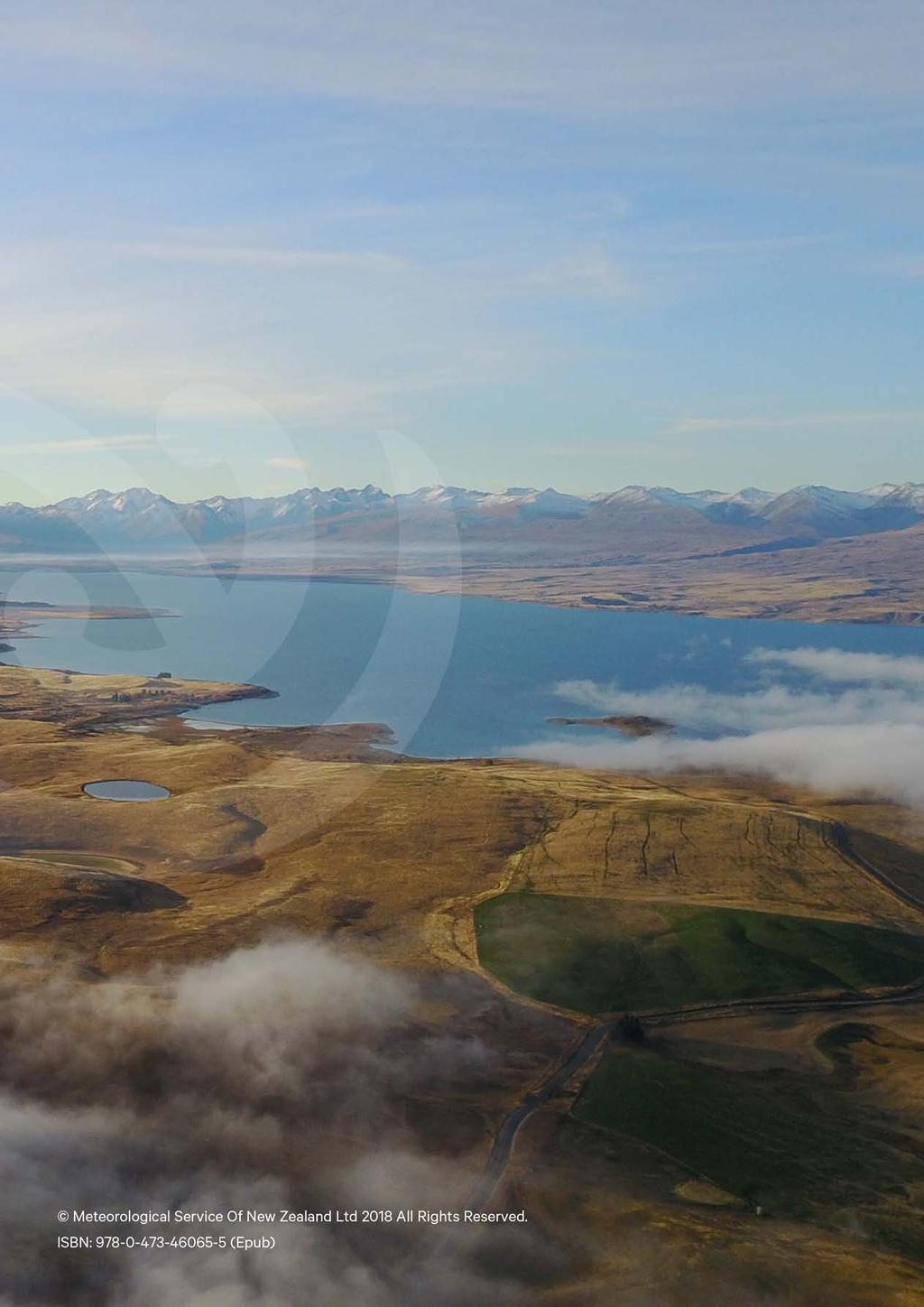
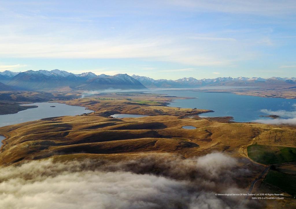
162 162
Aerodrome Forecast (TAF)
") AVIATION WEATHER PRODUCTS () Bureau of Meteorology Aviation Weather Services A is a coded statement of meteorological conditions expected at an and within a radius of five nautical miles of the reference
AVIATION WEATHER PRODUCTS () Bureau of Meteorology Aviation Weather Services A is a coded statement of meteorological conditions expected at an and within a radius of five nautical miles of the reference
TAF CCCC YYGGggZ YYHHHH dddff(f)gffkt VVVVSM [ww NNNhhh] [Wshhh/dddffKT] [TTTTT xxxx] repeated as needed
![TAF CCCC YYGGggZ YYHHHH dddff(f)gffkt VVVVSM [ww NNNhhh] [Wshhh/dddffKT] [TTTTT xxxx] repeated as needed](/thumbs/80/81003809.jpg "TAF CCCC YYGGggZ YYHHHH dddff(f)gffkt VVVVSM [ww NNNhhh] [Wshhh/dddffKT] [TTTTT xxxx] repeated as needed") Encoding TAFs Terminal Aerodome Forecast (TAF) Terminal forecasts for the world follow an internationally accepted format. The TAFs are issued four times daily for 24 hour periods beginning at 00Z, 06Z,
Encoding TAFs Terminal Aerodome Forecast (TAF) Terminal forecasts for the world follow an internationally accepted format. The TAFs are issued four times daily for 24 hour periods beginning at 00Z, 06Z,
Issue of SIGMET/AIRMET warning
 Issue of SIGMET/AIRMET warning 1 Presentation Objectives After this presentation session you will be able to: Warn for Hazardous weather phenomena using the correct ICAO coding with regards to SIGMET/AIRMET
GRAPHICAL NZ SIGWX Graphical New Zealand Significant Weather Chart
 GRAPHICAL NZ SIGWX Graphical New Zealand Significant Weather Chart USER GUIDE GRAPHICAL NZ SIGWX (Graphical New Zealand Significant Weather Chart) 1. Introduction 1.1 The GNZSIGWX Chart provides forecast
KEY TO DECODING THE U.S. METAR OBSERVATION REPORT
 KEY TO DECODING THE U.S. METAR OBSERVATION REPORT Example METAR Report METAR KABC 121755Z AUTO 21016G24KT 180V240 1SM R11/P6000FT -RA BR BKN015 0VC025 06/04 A2990 RMK A02 PK WND 20032/25 WSHFT 1715 VIS
Aerodrome Reports and Forecasts
 Aerodrome Reports and Forecasts A Users Handbook to the Codes WMO-No. 782 Aerodrome Reports and Forecasts A Users Handbook to the Codes WMO-No. 782 Fifth edition November 2008 WMO-No. 782 World Meteorological
Meteorology METARs. References: FTGU pages AWWS:
 Meteorology 5.09 METARs References: FTGU pages 160-163 AWWS: www.flightplanning.navcanada.ca 5.09 METARs MTPs: Weather Observing Stations METARs Weather Observing Stations Weather observation are taken
Meteorology METARs Weather Observing Stations. MTPs: 5.09 METARs References: FTGU pages AWWS:
 Meteorology 5.09 References: FTGU pages 160-163 AWWS: www.flightplanning.navcanada.ca MTPs: Weather Observing Stations 5.09 Weather Observing Stations Weather observation are taken every hour at selected
TAF Decoder Courtesy of the Aviation Weather Center
 TAF Decoder Courtesy of the Aviation Weather Center A Terminal Aerodrome Forecast (TAF) is a concise statement of the expected meteorological conditions at an airport during a specified period (usually
METEOROLOGICAL SERVICES
 AIP New Zealand GEN 3.5-1 GEN 3.5 METEOROLOGICAL SERVICES 1 RESPONSIBLE SERVICE 1.1 Civil Aviation Authority 1.1.1 The Civil Aviation Authority is the meteorological authority for New Zealand and is responsible
Effective: SPECI ALERTING
 AUSTRALIA AERONAUTICAL INFORMATION SERVICE AIRSERVICES AUSTRALIA GPO BOX 367, CANBERRA ACT 2601 Phone: 02 6268 4874 Email: aim.editorial@airservicesaustralia.com Effective: AERONAUTICAL INFORMATION CIRCULAR
Aviation Weather Reports
 Aviation Weather Reports Aviation Weather Reports METAR: hourly weather report (issued on the hour every hour) SPECI: special weather observations issued at times other than on the hour, as a result of
METEOROLOGY. 1 The average height of the tropopause at 50 N is about A 14 km B 16 km C 11 km D 8 km
 1 The average height of the tropopause at 50 N is about A 14 km B 16 km C 11 km D 8 km 2 In the lower part of the stratosphere the temperature A is almost constant B decreases with altitude C increases
TERMINAL AERODROME FORECAST
 1. Introduction TERMINAL AERODROME FORECAST Basically, a Terminal Aerodrome Forecast (or Terminal Area Forecast, TAF) is a message with a defined format with the objective to report a weather forecast
Issue of SIGMET/AIRMET warning part II
 Issue of SIGMET/AIRMET warning part II 1 SIGMET SIGMET is warning information and hence it is of highest priority amongst other types of meteorological information provided to the aviation users. This
QLD-S NSW-E NSW-W VIC TAS. A HEADER giving details of the time of issue and the associated validity period.
 FLIGHT FORECASTS Flight Forecasts are issued on request for flights for which GAFs are not available. They are subject to the requirements of AIP GEN 3.5 para 3.1 and AIP GEN 3.5 para 10.3. Flight forecasts
GEN 3.5 METEOROLOGICAL SERVICES
 AIP GEN 3.5-1 GEN 3.5 METEOROLOGICAL SERVICES 1. RESPONSIBLE SERVICE The meteorological services for civil aviation at Jordan are provided by the Jordanian Meteorological Department. Postal Address: Director
Subject No 8 - PPL Meteorology
 Subject No 8 - PPL Meteorology Notes: This syllabus is principally based on the meteorology as applicable to flying a single piston-engine General Aviation type aeroplane or helicopter, within New Zealand
2. A mountain breeze (katabatic wind) blows : DOWN THE SLOPE DURING THE NIGHT
 blows : DOWN THE SLOPE DURING THE NIGHT") MODEL E-EXAM (ATPL) NO.3 1. Among the ten groups of clouds, the following two are mentioned specifically in MET-reports and forecasts intended for aviation: CUMULONIMBUS AND TOWERING CUMULUS 2. A mountain
MODEL E-EXAM (ATPL) NO.3 1. Among the ten groups of clouds, the following two are mentioned specifically in MET-reports and forecasts intended for aviation: CUMULONIMBUS AND TOWERING CUMULUS 2. A mountain
SAMPLE ASSESSMENT TASKS AVIATION ATAR YEAR 12
 SAMPLE ASSESSMENT TASKS AVIATION ATAR YEAR 12 Copyright School Curriculum and Standards Authority, 2015 This document apart from any third party copyright material contained in it may be freely copied,
Explain in plain language the coded or pictorial information contained in:
 Subject No. 20 CPL METEOROLOGY Notes: This syllabus is principally based on the regional meteorology as applicable to flying a twin engine aircraft IFR, within the South Pacific region at or below FL 250.
according to and water. High atmospheric pressure - Cold dry air is other air so it remains close to the earth, giving weather.
 EARTH'S ATMOSPHERE Composition of the atmosphere - Earth's atmosphere consists of nitrogen ( %), oxygen ( %), small amounts of carbon dioxide, methane, argon, krypton, ozone, neon and other gases such
MET 3502 Synoptic Meteorology. Lecture 5: Surface Weather Elements
 MET 3502 Synoptic Meteorology Lecture 5: Surface Weather Elements Surface Weather Elements Not observations of the surface, but Observations made by an observer (or instrument) at the surface Example:
GRAPHICAL AREA FORECASTS (GAF) feet. Flight Information Region boundary QLD-S NSW-E VIC TAS
 feet. Flight Information Region boundary QLD-S NSW-E VIC TAS") GRAPHICAL AREA FORECASTS (GAF) Unlike at TAF, a Graphical Area Forecasts (GAFs) does not describe conditions expected at a particular location, it refers to a defined area and is intended for use in planning
GRAPHICAL AREA FORECASTS (GAF) Unlike at TAF, a Graphical Area Forecasts (GAFs) does not describe conditions expected at a particular location, it refers to a defined area and is intended for use in planning
How to issue SIGMET. SIGMET Seminar for Asia/Pacific Region Bangkok, Thailand, July 2007
 How to issue SIGMET SIGMET Seminar for Asia/Pacific Region Bangkok, Thailand, 11-13 July 2007 Shikembaru, Toru 志堅原透 Japan Meteorological Agency (JMA) 日本気象庁 Japan Meteorological Agency 1 Contents of lecture
METEOROLOGICAL AIRPORT REPORT
 1. Introduction 1.1. METAR IVAO TM Training Department Headquarters METEOROLOGICAL AIRPORT REPORT A METAR (Meteorological Airport Report) is a meteorological observation report (not a prediction) dedicated
Syllabus details and associated Learning Objectives (A) and EIR METEOROLOGY
 and EIR METEOROLOGY") Syllabus details associated Learning Objectives 050 00 00 00 METEOROLOGY 050 01 00 00 THE ATMOSPHERE 050 01 02 00 Air temperature 050 01 02 04 Lapse rates LO Describe qualitatively quantitatively the temperature
Syllabus details associated Learning Objectives 050 00 00 00 METEOROLOGY 050 01 00 00 THE ATMOSPHERE 050 01 02 00 Air temperature 050 01 02 04 Lapse rates LO Describe qualitatively quantitatively the temperature
ROYAL CANADIAN AIR CADETS PROFICIENCY LEVEL FOUR INSTRUCTIONAL GUIDE SECTION 5 EO C ANALYZE WEATHER INFORMATION PREPARATION
 ROYAL CANADIAN AIR CADETS PROFICIENCY LEVEL FOUR INSTRUCTIONAL GUIDE SECTION 5 EO C436.03 ANALYZE WEATHER INFORMATION Total Time: 90 min PREPARATION PRE-LESSON INSTRUCTIONS Resources needed for the delivery
Science Olympiad Meteorology Quiz #2 Page 1 of 8
 1) The prevailing general direction of the jet stream is from west to east in the northern hemisphere: 2) Advection is the vertical movement of an air mass from one location to another: 3) Thunderstorms
Your Source for Global Aviation Forecasts
 Your Source for Global Aviation Forecasts (831) 238-5054 100 Sky Park Drive Monterey, CA 93940 Weather4Cast.com Live Weather Data Feeds Weather4Cast.com provides Live Aviation Weather Data Feeds formatted
AERODROME METEOROLOGICAL OBSERVATION AND FORECAST STUDY GROUP (AMOFSG)
") AMOFSG/9-SN No. 31 22/8/11 AERODROME METEOROLOGICAL OBSERVATION AND FORECAST STUDY GROUP (AMOFSG) NINTH MEETING Montréal, 26 to 30 September 2011 Agenda Item 5: Observing and forecasting at the aerodrome
AMOFSG/9-SN No. 31 22/8/11 AERODROME METEOROLOGICAL OBSERVATION AND FORECAST STUDY GROUP (AMOFSG) NINTH MEETING Montréal, 26 to 30 September 2011 Agenda Item 5: Observing and forecasting at the aerodrome
GEMPAK Symbols, Lines, and Markers APPENDIX C. SYMBOLS, LINES, and MARKERS. Past Weather. Pressure tendency with change.
 APPENDIX C SYMBOLS, LINES, and MARKERS SYMBOLS The World Meteorological Organization (WMO) has established a standard set of symbols depicting descriptive reports of certain types of weather observations.
DEPARTMENT OF EARTH & CLIMATE SCIENCES SAN FRANCISCO STATE UNIVERSITY. Metr Fall 2014 Test #1 September 30, 2014
 DEPARTMENT OF EARTH & CLIMATE SCIENCES SAN FRANCISCO STATE UNIVERSITY NAME Metr 302.02 Fall 2014 Test #1 September 30, 2014 200 pts (4 pts each answer) Part I. Surface Chart Interpretation. Questions 1
STUDY UNIT SEVENTEEN GRAPHICAL AIRMAN S METEOROLOGICAL ADVISORY (G-AIRMET)
") STUDY UNIT SEVENTEEN GRAPHICAL AIRMAN S METEOROLOGICAL ADVISORY (G-AIRMET) 341 (10 pages of outline) 17.1 Product Description....................................................... 341 17.2 Issuance...............................................................
STUDY UNIT SEVENTEEN GRAPHICAL AIRMAN S METEOROLOGICAL ADVISORY (G-AIRMET) 341 (10 pages of outline) 17.1 Product Description....................................................... 341 17.2 Issuance...............................................................
Section 7: Hazard Avoidance
 7.1 In-Flight Hazard Awareness Section 7: Hazard Avoidance As technology improves, pilots have more and more real-time information within reach in all phases of flight. Terrain proximity, real-time weather
LAPL(A)/PPL(A) question bank FCL.215, FCL.120 Rev METEOROLOGY 050
/PPL(A) question bank FCL.215, FCL.120 Rev METEOROLOGY 050") METEOROLOGY 050 1 Below the tropopause, the ICAO Standard Atmosphere (ISA) assumes? A mean sea level pressure of 1013.25 hpa together with a mean sea level temperature of 15 C, decreasing by 1.98 C per
METEOROLOGY 050 1 Below the tropopause, the ICAO Standard Atmosphere (ISA) assumes? A mean sea level pressure of 1013.25 hpa together with a mean sea level temperature of 15 C, decreasing by 1.98 C per
MACIS documentation. a. Temporal resolution: For each month and the hole year
 MACIS documentation Wind: 1. Relative frequency of mean wind speed b. Treshold values: mean wind speed greater, greater equal, less, less equal 3, 5, 10, 12, 15 20, 22, 25 kt 2. Relative frequency of gusts
Chapter 1 Anatomy of a Cyclone
 Chapter 1 Anatomy of a Cyclone The Beast in the East 15-17 February 2003 Extra-tropical cyclone an area of low pressure outside of the tropics Other names for extra-tropical cyclones: Cyclone Mid-latitude
GEN 3.5 METEOROLOGICAL SERVICES
 GEN-3.5-1 3.5.1 RESPONSIBLE SERVICE GEN 3.5 METEOROLOGICAL SERVICES The authority entrusted with the provision of aeronautical meteorological service is the Lithuanian Hydrometeorological Service. Lithuanian
Most types of clouds are found in the troposphere, and almost all weather occurs within this
 Meteorology Most types of clouds are found in the troposphere, and almost all weather occurs within this layer. Air pressure and the density of the air also decrease with altitude. That's why the cabins
Explanation and decode for code figures used in the Wokingham 0900 and 1500 GMT observations
 Appendix 2. Explanation and decode for code figures used in the Wokingham 0900 and 1500 GMT observations VV : Visibility. Code figures 00 to 50 are in km and tenths e.g. 01 = 0.1 km = 100 m, 33 = 3.3 km,
Aerodrome Weather Observer
 Aerodrome Weather Observer METARAWS/SPECIAWS Reporting and Recording Bureau of Meteorology Training Centre Commonwealth of Australia 2016 This work is copyright. Apart from any use as permitted under the
WMO Aeronautical Meteorology Scientific Conference 2017
 Session 2 Integration, use cases, fitness for purpose and service delivery 2.2 Terminal Area and Impact-based forecast Data-driven influence model of weather condition in airport operational performance
Subject No 20 - CPL Meteorology
 Subject No 20 - CPL Meteorology Notes: This syllabus is principally based on the regional meteorology as applicable to flying a twin engine aircraft IFR, within the South Pacific region at or below FL
Work Package 1: Final Project Report Appendix E: The METAR data
 Work Package 1: Final Project Report Appendix E: The METAR data First Assessment of the operational Limitations, Benefits & Applicability for a List of package I AS applications FALBALA Project Drafted
AIR MASSES. Large bodies of air. SOURCE REGIONS areas where air masses originate
 Large bodies of air AIR MASSES SOURCE REGIONS areas where air masses originate Uniform in composition Light surface winds Dominated by high surface pressure The longer the air mass remains over a region,
1. Which weather map symbol is associated with extremely low air pressure? A) B) C) D) 2. The diagram below represents a weather instrument.
 B) C) D) 2. The diagram below represents a weather instrument.") 1. Which weather map symbol is associated with extremely low air pressure? 2. The diagram below represents a weather instrument. Which weather variable was this instrument designed to measure? A) air pressure
1. Which weather map symbol is associated with extremely low air pressure? 2. The diagram below represents a weather instrument. Which weather variable was this instrument designed to measure? A) air pressure
CHAPTER 9 - SPECIAL OBSERVATIONS
 CHAPTER 9 - AL OBSERVATIONS 9.1 Introduction This chapter explains the criteria for taking special observations (). 9.2 Special Observations s are taken whenever mandatory criteria are met, and at the
Mid-Latitude Cyclones and Fronts. Lecture 12 AOS 101
 Mid-Latitude Cyclones and Fronts Lecture 12 AOS 101 Homework 4 COLDEST TEMPS GEOSTROPHIC BALANCE Homework 4 FASTEST WINDS L Consider an air parcel rising through the atmosphere The parcel expands as it
Preflight Weather Analysis Lesson 4 Part 4 of 4
 Preflight Weather Analysis Lesson 4 Part 4 of 4 Presented by Find-it Fast Books Unlimited FREE Downloads of this course available at www.finditfastbooks.org 1 The slide sequence for Lesson 4 is a little
Flight Dispatcher Aviation Meteorology Required Knowledge
 Flight Dispatcher Aviation Meteorology Required Knowledge 3.1 THE EARTH'S ATMOSPHERE 1 Properties 2 Vertical Structure 3 ICAO Standard Atmosphere 3.2 ATMOSPHERIC PRESSURE 1 Pressure Measurements 2 Station
777 Neptune Groundschool Weather reporting & forecasts
 777 Neptune Groundschool 2018 Weather reporting & forecasts Weather Reporting Weather Forecast is a prediction of what the weather conditions will be in the future Weather Report tells the reader of what
The enduring fog and low cloud episode of 5-10 December 2015: Big Bubble Fog Trouble
 1. Overview The enduring fog and low cloud episode of 5-10 December 2015: Big Bubble Fog Trouble By Richard H. Grumm National Weather Service State College, PA An enduring low cloud and fog episode affected
Wind direction measures in degrees Occasion described with codes, when is calm or variable wind. Explanation
 Introduction The searching results explanations of meteorological data Depending on the parameter, the instrumental measuring or visual observation method is used for the meteorological observations. Instrumentally
How the Bureau of Meteorology contributes to the integrated risk picture. Presented by Michael Berechree
 How the Bureau of Meteorology contributes to the integrated risk picture Presented by Michael Berechree Mission Meteorological Service The mission of the Bureau's Aviation Meteorological Service is to
Weather and the Atmosphere. RAP Short Course
 Weather and the Atmosphere RAP Short Course Syllabus 1) Vertical structure and composition of the atmosphere, basic weather variables 2) Warming Earth and its atmosphere the diurnal and seasonal cycles
data manipulation (2)
") Information Science in Action Week 06 data manipulation (2) College of Information Science and Engineering Ritsumeikan University last week: data manipulation (1) the evolution of protocols push vs. pull
Information Science in Action Week 06 data manipulation (2) College of Information Science and Engineering Ritsumeikan University last week: data manipulation (1) the evolution of protocols push vs. pull
Guidance on Aeronautical Meteorological Observer Competency Standards
 Guidance on Aeronautical Meteorological Observer Competency Standards The following guidance is supplementary to the AMP competency Standards endorsed by Cg-16 in Geneva in May 2011. Format of the Descriptions
Appendix X for CAP 437 Offshore Helicopter Landing Areas Guidance on Standards.
 Appendix X for CAP 437 Offshore Helicopter Landing Areas Guidance on Standards. Additional Guidance relating to the provision of Meteorological Information from Offshore Installations 1. Introduction This
Information Note on the Webpage for Significant Convection Monitoring and Forecast
 Information Note on the Webpage for Significant Convection Monitoring and Forecast The webpage displays both the real-time products for monitoring of significant convection and forecast products for significant
ERTH 465 Fall Laboratory Exercise 5. Surface Weather Observations (METARS) and Frontal Analysis (300 pts)
 and Frontal Analysis (300 pts)") ERTH 465 Fall 2017 Laboratory Exercise 5 Surface Weather Observations (METARS) and Frontal Analysis (300 pts) Insert in ringed-three hole binder. Point deductions for sloppy or late work. Due date: Tuesday
ERTH 465 Fall 2017 Laboratory Exercise 5 Surface Weather Observations (METARS) and Frontal Analysis (300 pts) Insert in ringed-three hole binder. Point deductions for sloppy or late work. Due date: Tuesday
Introduction to SIGMET. 28 June 2016 Japan Meteorological Agency
 Introduction to SIGMET 28 June 2016 Japan Meteorological Agency SIGMET Definition SIGMET information Information issued by a meteorological watch office concerning the occurrence or expected occurrence
LAPL/PPL question bank FCL.215, FCL.120 Rev METEOROLOGY 050
 LAPL/PPL question bank FCL.215, FCL.120 Rev. 1.7 11.10.2018 METEOROLOGY 050 1 Below the tropopause, the ICAO Standard Atmosphere (ISA) assumes? A mean sea level pressure of 1225g/m³ together with a mean
Meteorology COMMERCIAL PILOT LICENCE AEROPLANE & HELICOPTER TRAINING AND EXAMINATION WORKBOOK WRITTEN BY PETER LIND
 Meteorology COMMERCIAL PILOT LICENCE AEROPLANE & HELICOPTER TRAINING AND EXAMINATION WORKBOOK WRITTEN BY PETER LIND DESIGNED FOR THE CIVIL AVIATION SAFETY AUTHORITY MANUAL OF STANDARDS online practice
Gleim Private Pilot FAA Knowledge Test 2015 Edition, 1st Printing Updates July 2015
 Page 1 of 6 Gleim Private Pilot FAA Knowledge Test 2015 Edition, 1st Printing Updates July 2015 NOTE: Deleted text is displayed with a line through it. New text is shown with a blue background. If you
Module 9 Weather Systems
 Module 9 Weather Systems In this module the theory of atmospheric dynamics is applied to different weather phenomena. The first section deals with extratropical cyclones, low and high pressure areas of
THUNDERSTORMS-RISK FACTORS IN AVIATION. CASE STUDY: AREA OF RESPONSABILITY OF THE BUCHAREST- OTOPENI AERODROME ON
 RISCURI ŞI CATASTROFE, NR. XIV, VOL. 17, NR.2/2015 THUNDERSTORMS-RISK FACTORS IN AVIATION. CASE STUDY: AREA OF RESPONSABILITY OF THE BUCHAREST- OTOPENI AERODROME ON 30.06.2009 C. L. ŞCHIOPU 1, NICOLETA
Tuesday, September 13, 16
 Weather Weather State Objectives 4.c, 4.d, 4.h. Discussion What are some ways in which weather affects your everyday life? Discussion What are some ways in which weather affects your everyday life? What
Meteorology. I. The Atmosphere - the thin envelope of gas that surrounds the earth.
 Meteorology I. The Atmosphere - the thin envelope of gas that surrounds the earth. A. Atmospheric Structure - the atmosphere is divided into five distinct layers that are based on their unique characteristics.
WEATHER. rain. thunder. The explosive sound of air as it is heated by lightning.
 WEATHER rain thunder The explosive sound of air as it is heated by lightning. rainbow lightning hurricane They are intense storms with swirling winds up to 150 miles per hour. tornado cold front warm front
Weather Related Factors of the Adelaide floods ; 7 th to 8 th November 2005
 Weather Related Factors of the Adelaide floods ; th to th November 2005 Extended Abstract Andrew Watson Regional Director Bureau of Meteorology, South Australian Region 1. Antecedent Weather 1.1 Rainfall
Figure 1. Idealized global atmospheric circulation (C = surface convergence, D = surface divergence).
.") page - Laboratory Exercise #8 - Introduction to Atmospheric Science: Global Circulation and Weather Makers Section A - Global Atmospheric Circulation: To understand weather you need to understand how the
page - Laboratory Exercise #8 - Introduction to Atmospheric Science: Global Circulation and Weather Makers Section A - Global Atmospheric Circulation: To understand weather you need to understand how the
Metar And Taf Decoding
 Metar And Taf Decoding 1 / 6 2 / 6 3 / 6 Metar And Taf Decoding examples: kmem 230853z auto 18014g18kt 10sm clr 16/m02 a3008 rmk ao2 slp117 t01561022 tsno $ klax 161550z cor 11004kt 2 1/2sm hz bkn011 bkn015
Weather - is the state of the atmosphere at a specific time & place
 Weather Section 1 Weather - is the state of the atmosphere at a specific time & place Includes such conditions as air pressure, wind, temperature, and moisture in the air The Sun s heat evaporates water
National Transportation Safety Board Office of Aviation Safety Washington, D.C December 10, 2012 WEATHER STUDY DCA13RA025
 A. ACCIDENT National Transportation Safety Board Office of Aviation Safety Washington, D.C. 20594-2000 December 10, 2012 WEATHER STUDY DCA13RA025 Location: Monterrey, Mexico Date: December 9, 2012 Time:
METEOROLOGY PANEL (METP) WORKING GROUP- METEOROLOGICAL OPERATION GROUP (MOG) FIRST MEETING
 WORKING GROUP- METEOROLOGICAL OPERATION GROUP (MOG) FIRST MEETING") 8 28/7/15 METEOROLOGY PANEL (METP) WORKING GROUP- METEOROLOGICAL OPERATION GROUP (MOG) FIRST MEETING Gatwick, United Kingdom, 08 to 11 September 2015 Agenda Item 3: Matters relating to SADIS 3.3: Operations
8 28/7/15 METEOROLOGY PANEL (METP) WORKING GROUP- METEOROLOGICAL OPERATION GROUP (MOG) FIRST MEETING Gatwick, United Kingdom, 08 to 11 September 2015 Agenda Item 3: Matters relating to SADIS 3.3: Operations
Sources of Hourly Surface Data and Weather Maps for the U.S.
 Sources of Hourly Surface Data and Weather Maps for the U.S. Weather Underground Weather Underground http://www.wunderground.com/history/ maintains a deep archive of hourly reports for around the world.
Chapter Introduction. Weather. Patterns. Forecasts Chapter Wrap-Up
 Chapter Introduction Lesson 1 Lesson 2 Lesson 3 Describing Weather Weather Patterns Weather Forecasts Chapter Wrap-Up How do scientists describe and predict weather? What do you think? Before you begin,
Use the terms from the following list to complete the sentences below. Each term may be used only once.
 Skills Worksheet Directed Reading Section: Air Masses Use the terms from the following list to complete the sentences below. Each term may be used only once. high pressure poles low pressure equator wind
Manual on Codes. Regional Codes and National Coding Practices Volume II edition Updated in 2017 WEATHER CLIMATE WATER. WMO-No.
 Manual on Codes Regional Codes and National Coding Practices Volume II 2011 edition Updated in 2017 WEATHER CLIMATE WATER WMO-No. 306 Manual on Codes Regional Codes and National Coding Practices Volume
Aviation Hazards: Thunderstorms and Deep Convection
 Aviation Hazards: Thunderstorms and Deep Convection TREND Diagnosis of thunderstorm hazards using imagery Contents Satellite imagery Visible, infrared, water vapour Basic cloud identification Identifying
REPORT ON COMPARISON BETWEEN THE NUMBER OF COORDINATED SIGMET AND TOTAL SIGMET ISSUANCE FROM PILOT PROJECT TIME FRAME(MONDAY TO FRIDAY FROM 00UTC
 Wrap up Meeting Of The Pilot Project on SIGMET Coordination, Singapore 27 29 March 2017 REPORT ON COMPARISON BETWEEN THE NUMBER OF COORDINATED SIGMET AND TOTAL SIGMET ISSUANCE FROM PILOT PROJECT TIME FRAME(MONDAY
Implementation Guidance of Aeronautical Meteorological Observer Competency Standards
 Implementation Guidance of Aeronautical Meteorological Observer Competency Standards The following guidance is supplementary to the AMP competency Standards endorsed by Cg-16 in Geneva in May 2011. Please
Atmosphere and Weather Revision Notes
 Atmosphere and Weather Revision Notes Atmosphere The blanket of gases that surrounds the Earth is called the atmosphere. The main gases are nitrogen (78 %), oxygen (21 %), water vapour, ozone and carbon
Meteorology. Review Extreme Weather a. cold front. b. warm front. What type of weather is associated with a:
 Meteorology 5.08 Extreme Weather References: FTGU pages 132, 144, 145, 148-155 Air Command Weather Manual Chapters 9 and 15 Review What type of weather is associated with a: a. cold front b. warm front
Page 1. Name:
 Name: 1) As the difference between the dewpoint temperature and the air temperature decreases, the probability of precipitation increases remains the same decreases 2) Which statement best explains why
Weather Notes. Chapter 16, 17, & 18
 Weather Notes Chapter 16, 17, & 18 Weather Weather is the condition of the Earth s atmosphere at a particular place and time Weather It is the movement of energy through the atmosphere Energy comes from
Weather Legends in FOREFLIGHT MOBILE
 Weather Legends in FOREFLIGHT MOBILE 14th Edition Covers ForeFlight Mobile v9.4 on ipad Radar Legends (when from Internet) Snowy/Icy Precipitation Mixed Precipitation Rain Echo top (in 100 s of feet) ex:
CAP 437 Offshore Meteorological Observer Training
 CAP 437 Offshore Meteorological Observer Training Training for Meteorological Observers in support of Offshore Helicopter Operations CAP 437 Offshore Meteorological Observer Training Page 1 Meteorological
Plan for operational nowcasting system implementation in Pulkovo airport (St. Petersburg, Russia)
") Plan for operational nowcasting system implementation in Pulkovo airport (St. Petersburg, Russia) Pulkovo airport (St. Petersburg, Russia) is one of the biggest airports in the Russian Federation (150
Plan for operational nowcasting system implementation in Pulkovo airport (St. Petersburg, Russia) Pulkovo airport (St. Petersburg, Russia) is one of the biggest airports in the Russian Federation (150
AMDAR Forecast Applications. Richard Mamrosh NWS Green Bay, Wisconsin, USA
 AMDAR Forecast Applications Richard Mamrosh NWS Green Bay, Wisconsin, USA AMDAR has many applications Aviation Low level wind shear Ceilings and visibilities Icing and turbulence Winter Storms Precipitation
Meteorology Today. 1 Aug st Lt Libby Haynes Capt Kim Mevers
 Meteorology 1950 - Today 1 Aug 2018 1 st Lt Libby Haynes Capt Kim Mevers What is meteorology? Is it important to you? Meteorology is the science of the atmosphere embracing both weather and climate. It
b. The boundary between two different air masses is called a.
 NAME Earth Science Weather WebQuest Part 1. Air Masses 1. Find out what an air mass is. http://okfirst.mesonet.org/train/meteorology/airmasses.html a. What is an air mass? An air mass is b. The boundary
DEPARTMENT OF GEOSCIENCES SAN FRANCISCO STATE UNIVERSITY. Metr Fall 2012 Test #1 200 pts. Part I. Surface Chart Interpretation.
 DEPARTMENT OF GEOSCIENCES SAN FRANCISCO STATE UNIVERSITY NAME Metr 356.01 Fall 2012 Test #1 200 pts Part I. Surface Chart Interpretation. Figure 1. Surface Chart for 1500Z 7 September 2007 1 1. Pressure
Allocation of percentage Marks Practical rd February, st March, th March nd March
 UNIVERSITY OF NAIROBI COLLEGE OF BIOLOGICAL AND PHYSICAL SCIENCES School of Physical Sciences Post Graduate Diploma in Aviation Meteorology Aviation Weather (SMR 525) Practical Manual for Academic Year
Science 1206 Chapter 1 - Inquiring about Weather
 Science 1206 Chapter 1 - Inquiring about Weather 1.1 - The Atmosphere: Energy Transfer and Properties (pp. 10-25) Weather and the Atmosphere weather the physical conditions of the atmosphere at a specific
ADL110B ADL120 ADL130 ADL140 How to use radar and strike images. Version
 ADL110B ADL120 ADL130 ADL140 How to use radar and strike images Version 1.00 22.08.2016 How to use radar and strike images 1 / 12 Revision 1.00-22.08.2016 WARNING: Like any information of the ADL in flight
Meteorology Unit Study Guide
 Name: Key Pd. Date: 1. Define meteorology Meteorology Unit Study Guide Study of the atmosphere including weather and weather patterns 2. The most abundant gas in the atmosphere by volume is. This gas comprises
Mr. P s Science Test!
 WEATHER- 2017 Mr. P s Science Test! # Name Date 1. Draw and label a weather station model. (10 pts) 2. The is the layer of the atmosphere with our weather. 3. Meteorologists classify clouds in about different
WO2 ROZSA-HRABINSKI METEOROLOGY 1
 WO2 ROZSA-HRABINSKI METEOROLOGY 1 INTRODUCTION What are we covering today? The Atmosphere Clouds Atmospheric Stability Temperature and Humidity THE ATMOSPHERE THE ATMOSPHERE The atmosphere is composed