WEATHER ON WHEELS Middle School Program
|
|
|
- Laurence Paul
- 5 years ago
- Views:
Transcription

1 WEATHER ON WHEELS Middle School Program MAST ACADEMY OUTREACH Post-Site Activities Miami-Dade County Public Schools Miami, Florida
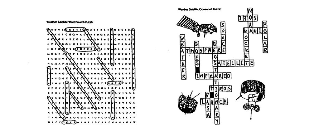
2 MAST ACADEMY OUTREACH WEATHER ON WHEELS POST-SITE PACKAGE TABLE OF CONTENTS Teacher Instructions 1 Analysis of Class Weather Data 3 Weather Satellites 6 Activity: Around the World 12 Satellite Word Search 19 Satellite Crossword Puzzle 20 Answer Key 21
3 TEACHER INSTRUCTIONS Make copies of the post-site lessons for each student. Do not copy the answer key. Have each student complete the lessons. Grade the lessons. Incorporate the score for the postsite activities into the scores for the pre- and on-site activities. A Certificate Request Form will be mailed to you after the date of your WOW visit. Record percent scores for all participating students on this form. Certificates of recognition will be awarded top all students earning a percent score of 80% or above. Complete the evaluation form mailed to you with the Certificate Request Form, and return it to MAST Academy Outreach, Mail Code 7161, or fax to within 10 days of completing activities.
4 Analysis of Class Weather Data Directions: While on Weather on Wheels, you and your classmates collected measurements of temperature, relative humidity, air pressure, and wind speed (among other things) from the Weather Monitor. Since these measurements were taken as you rotated through the various weather stations, each group collected the measurements at different times. In this activity, you will compile class data to see if these measurements changed over the time period you spent aboard Weather on Wheels. Use the chart below to compile class data. The data should be arranged chronologically (that is, earliest measurement first, latest measurement last). Space is provided for up to 10 groups of measurements. The changes in each measurement over time can then be graphed using the graphs on the following pages. Be sure to properly label (with units) each graph. Time Outside Temperature ( 0 C) Relative Humidity (%) Air Pressure (mb) Wind Speed (mph)
5 Changes in Temperature over Time Changes in Air Pressure over Time Time Changes in Relative Humidity over Time Time Changes in Wind Speed over Time Time Time
6 Answer the following questions: 1. Did the temperature from the Weather Monitor increase or decrease over time, or did it stay about the same? 2. If the temperature changed much during the measurement period, explain why. Consider time of day, % cloud cover, etc. in your explanation. 3. Did the relative humidity increase or decrease over time, or did it stay about the same? 4. How do the changes (if any) in relative humidity compare to changes in temperature? 5. Did the air pressure increase or decrease over time, or did it stay about the same? 6. How do the changes (if any) in air pressure compare to changes in temperature? 7. Did the wind speed increase or decrease over time, or did it stay about the same? 8. How do the changes (if any) in wind speed compare to changes in temperature? Air pressure?
7 Weather Satellites The National Aeronautics and Space Administration (NASA) launched TIROS (Television Infrared Observational Satellite), our nation's first series of weather satellites, on April 1, Weather satellites can take two different kinds of images to record Earth's atmosphere. Visible, or daylight, pictures can be taken. These images show variations in the surface of Earth and contours of the clouds as they might look to an astronaut in space. When no visible light is present, satellite cameras can rely on infrared wave lengths, which the human eye cannot see but which are temperature sensitive. Infrared TV images record the differences in heat given off by clouds and Earth. Warmer areas, such as the ground, appear dark gray or black in these pictures. Cooler areas are represented by various shades of gray; in the case of clouds, each successively lighter shade of gray represents a higher-altitude cloud. Attached to the bottom of each TIROS satellite were two tiny cameras, one wideangle and one narrow-angle, that recorded images of Earth's cloud cover as our planet rotated on its axis. Because the satellites had to keep spinning in order to maintain their orientation, the cameras aboard TIROS photographed different strips of cloud cover with each turn of the satellite. TIROS 1 was placed in a near-equatorial orbit, and was able to photograph cloud patterns at some distance above and below the equator, eventually photographing two-thirds of our planet's cloud cover. Through the images these satellites sent back to Earth, meteorologists could monitor cloud patterns over large portions of Earth for the first time. The first TIROS cameras, however, could record only the day side of Earth. Night photographs were impossible.
8
9 Then NASA engineers developed a type of TIROS satellite that could not only spin on its axis and remain stable, but also turned in space like a cartwheel. Instrumentation was attached to the rim of this satellite, so that it always had a camera looking at Earth. Two of these newer types of satellites - TIROS 9 and 10 - were placed in Sun-synchronous, polar orbits. As illustrated below, a polar-orbiting satellite circles the globe from north to south. In a Sun-synchronous orbit, a satellite crosses over the same point on Earth at the same times each day. Scientists, therefore, can compare changes that take place over a particular area of Earth from one time to next. The orbit derives its name from the fact that time on Earth is determined by the position of our planet with respect to the Sun.
10
11 It was not until 1964, when NASA launched Nimbus, that recording at night became possible. Nimbus could remain stable without having to spin, so its sensors could face Earth constantly. In addition, Nimbus carried infrared radiometers capable of taking the first night images of clouds. The Nimbus satellites also carried prototypes, or test models, of space-borne instruments that would eventually lead to our current weather satellites, which can scan all of Earth 24 hours a day. The TOS (TIROS Operational System) series, derived from experience gained with TIROS 9 and 10, was launched by NASA in The TOS series was a further improvement on TIROS. These satellites gathered even more sophisticated kinds of weather information than the earlier satellites, and distributed the information to a wider variety of users than TIROS. Four years later, in 1970, the ITOS (Improved TIROS Operational System) series of weather satellites was launched. In addition to its two TV cameras making daylight images, ITOS carried a scanning radiometer enabling the satellite to take images of Earth from space regularly and around-the-clock. In 1970, NASA transferred the operation of weather satellites to a newly established agency, the National Oceanic and Atmospheric Administration (NOAA) in the U.S. Department of Commerce. In this new partnership, NOAA manages the processing and distribution of the millions of bits of data and images that the weather satellites produce daily. NASA, in turn, contributes to the research and development of these satellites, oversees their manufacture by private companies, purchases and launches the satellites, and evaluates their performance in flight. With the launch of the NOAA-N series in June 1979, the current generation of polarorbiting weather satellites made its way into space. The instrumentation aboard these satellites can observe both the surface features of our planet and the vertical structure of the atmosphere. The newest generation of weather satellites is the GOES (Geostationary Operational Environmental Satellite) series. Unlike polar-orbiting weather satellites, a GOES satellite is positioned above the equator, where it travels at a speed matching Earth's rotation. Thus the satellite, appearing fixed above that one spot on the equator, can see one side of Earth at all times. To get this incredible pole-to-pole view from one spot above the equator, a geostationary orbit must attain an extraordinary high altitude.
12 One GOES satellite is positioned to image the western United States and the Pacific Ocean. The other satellite images eastern United States and the Atlantic Ocean. Together they cover most of the Western Hemisphere from the North Pole to the South Pole, each one sending back messages to Earth twice a day. Thus, this pair of satellites assures that measurements for any region in the Western Hemisphere are no more than six hours old. In severe weather conditions, engineers at ground stations here on Earth can direct the GOES cameras to take images more often. Most of the weather photographs on television originate on the GOES satellites. We see them after computers have enhanced the data, usually making the clouds appear white and superimposing the clouds on a map with lines dividing states or regions.
13 Activity: Around the World Focus Task Supplies Model of Weather Satellite Views of Earth Students construct models of Earth and the two types of weather satellites and demonstrate the way each offers a different view of Earth. A sheet of light cardboard or one side of a manila file folder, 6 straight pins, tape, a pair of scissors, a pen or fine marker, 2 paper clips, photocopies of the polar-orbit and geostationary-orbit templates that appear after this activity, and 2 styrofoam balls, each 75 millimeters (3 inches) in diameter. Procedure General Preparation 1. Using the orbit templates as a guide, cut out one ring representing a polar orbit and one ring representing a geostationary orbit. (Hint: you'll find it easier to cut out the inside circle if you fold each paper ring in half before you begin.) 2. Lay the two paper rings on one side of a manila folder or sheet of light cardboard. Trace the outlines, and cut out the two orbit rings. 3. Glue each paper ring onto a cardboard ring so the rings are rigid. Making the Polar-Orbiter Model 1. Stick one straight pin into a styrofoam ball. Stick another pin in the other side of the ball, directly below the first one. Label the points "N" and "S" for the North Pole and South Pole. 2. Use a marker to draw a circle around the ball from pole to pole. 3. Place a polar-orbit ring over the ball, lining it up with the circle you just drew. 4. Tape an orbit ring to the pins at the poles. The ball should rotate freely under the ring, as shown in the illustration on the template. 5. Clip one of the satellite rings to the polar orbit at the zero mark on the orbit, halfway between the North Pole and South Pole. This will be the starting point.
14 Answer the following questions: 6a. What imaginary line on Earth runs directly below the satellite? b. What is the latitude of this imaginary line? 7. Holding the model by its orbit, rotate Earth to the right until it lines up with the line you drew for the polar orbit. a. By rotating the model to the right, did you rotate Earth east or west? b. Does the satellite move with Earth as it turns? c. In which direction does the satellite move? 8. Move the satellite northward until it is over the North Pole. Answer the following questions: a. What area on Earth is the satellite photographing? b. What is the latitude of the point directly below the satellite? c. How many degrees in its orbit has the satellite now moved? 9. Continue moving the satellite in its orbit until you reach Earth's equator again. Remember, as the satellite moves, Earth turns slightly on its axis. Rotate Earth a little to the right. Answer the following questions:
15 a. In which direction is the satellite now traveling: North, South, East, or West? b. How many degrees has the satellite moved around its orbit? c. What is the latitude of the area being photographed by the satellite? 10. Move the satellite further until it is now over the South Pole. Also, rotate Earth just a little more on its axis. Answer the following questions: a. How many degrees does the satellite move through one orbit? b. The satellite is back over the equator again. What happened to Earth's position while the satellite was orbiting? c. Is the satellite photographing the exact spot at the equator as it did on the previous orbit? Explain. d. The satellite will continue to cross the equator at a slightly different place on each orbit. When will the satellite cross the same point that it crossed at the very start? e. How long will it take the satellite to photograph the entire Earth? f. How long does it take before the satellite can take a second photograph of the same spot on Earth?
16 g. What type of orbit is this? h. Name a satellite that was launched into this type of orbit.
17 Making the Geostationary-Orbiter Model 1. Take the remaining styrofoam ball, and draw a circle half-way between the poles. This line will represent the equator. 2. Place two pins opposite each other at the equator. 3. Use a marker to draw another circle around the ball, this time from pole to pole. Stick two pins into the line, one opposite the other. Label the points "N" and "S" for the North Pole and South Pole. 4. Line up the zero mark on the orbit with the equator, as shown in the small illustration on the template. Tape the geostationary-orbit ring to the pins. The ball should rotate freely under the ring, as shown in the illustration on the template. 5. Clip the satellite on its orbit at the zero mark, halfway between the North Pole and South Pole. This will be the starting point. What area on Earth is the satellite photographing? 6. Hold the styrofoam ball by the pins at its poles, and rotate it slowly to the right. Answer the following questions: a. When you stationed the satellite on its orbit at the zero mark, what area of Earth was it imaging? b. While Earth is turning on its axis, what area is the satellite photographing? c. In which direction is the satellite moving: North, South, East, West? d. Will the satellite ever be able to photograph the other side of Earth? e. Name a satellite that has been launched into this type of orbit.
18
19
20 Answer Key Analysis of Class Weather Data Answers will vary with specific measurements collected. Around the World Part 1 Making the Polar-Orbit Model 6. a) the equator b) 0 degrees 7. a) east b) no c) west (opposite the direction of Earth's rotation 8. a) the North Pole b) 90 degrees c) 90 degrees 9. a) south b) 180 degrees c) 0 degrees 10. a) 360 degrees b) rotates from west to east c) no; that spot has moved east as the Earth rotated d) at the same time the next day e) one day f ) polar orbit g) TIROS, ITOS, NOAA-N Part 2: Making the Geostationary-Orbit Model
21
22
MAST ACADEMY OUTREACH. WOW (Weather on Wheels)
") MAST ACADEMY OUTREACH MIDDLE SCHOOL PROGRAM Adventures Aboard WOW (Weather on Wheels) Post-Site Packet MAST Academy Maritime and Science Technology High School Miami-Dade County Public Schools Miami, Florida
MAST ACADEMY OUTREACH MIDDLE SCHOOL PROGRAM Adventures Aboard WOW (Weather on Wheels) Post-Site Packet MAST Academy Maritime and Science Technology High School Miami-Dade County Public Schools Miami, Florida
WEATHER ON WHEELS Elementary School Program MAST ACADEMY OUTREACH Pre-Site Activities Miami-Dade County Public Schools Miami, Florida
 WEATHER ON WHEELS Elementary School Program MAST ACADEMY OUTREACH Pre-Site Activities Miami-Dade County Public Schools Miami, Florida WEATHER INSTRUMENTS On Weather on Wheels, you will use a variety of
MAST ACADEMY OUTREACH. WOW (Weather on Wheels)
") MAST ACADEMY OUTREACH ELEMENTARY PROGRAM Adventures Aboard WOW (Weather on Wheels) Teacher Instructions / Answer Keys MAST Academy Maritime and Science Technology High School Miami-Dade County Public Schools
MAST ACADEMY OUTREACH ELEMENTARY PROGRAM Adventures Aboard WOW (Weather on Wheels) Teacher Instructions / Answer Keys MAST Academy Maritime and Science Technology High School Miami-Dade County Public Schools
MAST ACADEMY OUTREACH. WOW (Weather on Wheels)
") MAST ACADEMY OUTREACH ELEMENTARY PROGRAM Adventures Aboard WOW (Weather on Wheels) Post-Site Packet MAST Academy Maritime and Science Technology High School Miami-Dade County Public Schools Miami, Florida
MAST ACADEMY OUTREACH ELEMENTARY PROGRAM Adventures Aboard WOW (Weather on Wheels) Post-Site Packet MAST Academy Maritime and Science Technology High School Miami-Dade County Public Schools Miami, Florida
Learning Lab Seeing the World through Satellites Eyes
 Learning Lab Seeing the World through Satellites Eyes ESSENTIAL QUESTION What is a satellite? Lesson Overview: Engage students will share their prior knowledge about satellites and explore what satellites
4 Forecasting Weather
 CHAPTER 2 4 Forecasting Weather SECTION Understanding Weather BEFORE YOU READ After you read this section, you should be able to answer these questions: What instruments are used to forecast weather? How
ACTIVITY CLASSROOM. Observe the Moon's Phases. General Information
 CLASSROOM ACTIVITY Observe the Moon's Phases General Information Grade level: All cycles Students per group: Individual or group activities When: After the Planetarium visit Duration: One 50-minute period,
Recommended Grade Level: 8 Earth/Environmental Science Weather vs. Climate
 Lab Activity Title: Climate Factors Past and Present Recommended Grade Level: 8 Discipline: Earth/Environmental Science Topic: Weather vs. Climate Time Requirements: 90 minutes Submitted by: Karen McCabe
Moon. Grade Level: 1-3. pages 1 2 pages 3 4 pages 5 page 6 page 7 page 8 9
 Moon Grade Level: 1-3 Teacher Guidelines Instructional Pages Activity Page Practice Page Homework Page Answer Key pages 1 2 pages 3 4 pages 5 page 6 page 7 page 8 9 Classroom Procedure: Approximate Grade
4 Forecasting Weather
 CHAPTER 16 4 Forecasting Weather SECTION Understanding Weather BEFORE YOU READ After you read this section, you should be able to answer these questions: What instruments are used to forecast weather?
When: Before the Planetarium visits your school. Type of activity: Observation, visualization, discovery
 CLASSROOM ACTIVITY Sundials General information Grade level: Elementary cycle three Students per group: Individual activity When: Before the Planetarium visits your school Duration: One to two 50-minute
Background: What is Weather?
 Weather Maps Background: What is Weather? Weather is the day-to-day state of the atmosphere. The interaction of three important factors result in weather systems: air temperature, air pressure, and the
Astronomy Review. Use the following four pictures to answer questions 1-4.
 Astronomy Review Use the following four pictures to answer questions 1-4. 1. Put an X through the pictures that are NOT possible. 2. Circle the picture that could be a lunar eclipse. 3. Triangle the picture
1-ESS1 Earth s Place in the Universe 1-ESS1-2 Make observations at different times of year to relate the amount of daylight to the time of year.
 LESSON: Sunlight GRADE: 1 OBJECTIVES: 1-ESS1 Earth s Place in the Universe 1-ESS1-2 Make observations at different times of year to relate the amount of daylight to the time of year. MATERIALS & RESOURCES:
Answer Questions 1 4
 Name Date Period Introduction: Even though the moon does not appear to turn on its own axis from the Earth s point of view, it is indeed rotating as it revolves around the Earth. In the following activity,
L ESSON P LAN:DETERMINING THE E FFECT OF D ISTANCE (PART 1) AND I NCLINATION (PART 2)
 AND I NCLINATION (PART 2)") L ESSON P LAN:DETERMINING THE E FFECT OF D ISTANCE (PART 1) AND I NCLINATION (PART 2) In the activity at the heart of this lesson, the students will measure the effect of distance and inclination on the
L ESSON P LAN:DETERMINING THE E FFECT OF D ISTANCE (PART 1) AND I NCLINATION (PART 2) In the activity at the heart of this lesson, the students will measure the effect of distance and inclination on the
Earth & Space Science, Interpreting Data DURATION Preparation: 5 minutes Activity: 40 minutes (total over one day)
") Objectives In this activity students will: 1. Observe how the position of the sun in the sky changes during the course of the day 2. Discover the cardinal directions by tracking the motion of the sun Materials
Objectives In this activity students will: 1. Observe how the position of the sun in the sky changes during the course of the day 2. Discover the cardinal directions by tracking the motion of the sun Materials
What's Up, Earth? Header Insert Image 1 here, right justified to wrap. Grade Level. 3rd. Time Required: 60 minutes
 What's Up, Earth? Header Insert Image 1 here, right justified to wrap Image 1 ADA Description:? Caption:? Image file path:? Source/Rights: Copyright? Grade Level 3rd Time Required: 60 minutes Group Size:
Keep Your Eye on the Sky - Clouds and Weather Student Worksheet #1: The Clouds Below
 Student Worksheet #1: The Clouds Below How do meteorologists predict and forecast our weather? Meteorologists use weather instruments to measure weather factors such as temperature, humidity, wind speed
Reasons for the Seasons (Grades 1 2) Post-Visit Activities. We hope that you enjoyed your visit to the Children s Science Explorium!
 Post-Visit Activities. We hope that you enjoyed your visit to the Children s Science Explorium!") Reasons for the Seasons (Grades 1 2) Post-Visit Activities We hope that you enjoyed your visit to the Children s Science Explorium! To help reinforce the concepts covered during today s field trip, we
Reasons for the Seasons (Grades 1 2) Post-Visit Activities We hope that you enjoyed your visit to the Children s Science Explorium! To help reinforce the concepts covered during today s field trip, we
Full Moon. Phases of the Moon
 Phases of the Moon The Moon takes 29.5 days to orbit Earth. This is a lunar month. The gravity of the Earth keeps the Moon in orbit. The Moon does not produce light. We see the Moon because it reflects
MODULE 2 LECTURE NOTES 1 SATELLITES AND ORBITS
 MODULE 2 LECTURE NOTES 1 SATELLITES AND ORBITS 1. Introduction When a satellite is launched into the space, it moves in a well defined path around the Earth, which is called the orbit of the satellite.
Earth Motions Packet 14
 Earth Motions Packet 14 Your Name Group Members Score Minutes Standard 4 Key Idea 1 Performance Indicator 1.1 Explain complex phenomena, such as tides, variations in day length, solar insolation, apparent
Unit 11 Section 1 Computer Lab. Part 1: REMOTE SENSING OF THE EARTH SYSTEM BY SATELLITE
 Unit 11 Section 1 Computer Lab Part 1: REMOTE SENSING OF THE EARTH SYSTEM BY SATELLITE Educational Outcomes: Satellites orbiting the planet are ideal platforms for monitoring the Earth system from above
Go to Click on the first animation: The north pole, observed from space
 IDS 102 The Seasons on a Planet like Earth As the Earth travels around the Sun, it moves in a giant circle 300 million kilometers across. (Well, it is actually a giant ellipse but the shape is so close
The Solar System. Grade Level: 4 6
 The Solar System Grade Level: 4 6 Teacher Guidelines pages 1 2 Instructional Pages pages 3 5 Activity Pages pages 6 9 Crossword Puzzle page 10 Answer Key page 11 Classroom Procedure 1. Distribute the Address
Teacher s Guide For. Measuring the Earth s Temperature
 Teacher s Guide For Measuring the Earth s Temperature For grade 7 - College Program produced by Centre Communications, Inc. for Ambrose Video Publishing, Inc. Executive Producer William V. Ambrose Teacher's
Weather Systems Study Guide:
 Weather Systems Study Guide: 1. Draw a diagram of Earth s water cycle and label each part. 2. Explain how the water cycle works. 3. What happens in the troposphere and stratosphere? Atmosphere Level What
Back to basics: From Sputnik to Envisat, and beyond: The use of satellite measurements in weather forecasting and research: Part 1 A history
 Back to basics: From Sputnik to Envisat, and beyond: The use of satellite measurements in weather forecasting and research: Part 1 A history Roger Brugge 1 and Matthew Stuttard 2 1 NERC Data Assimilation
Weather Watchers Part II: Mini-Meteorologists
 Weather Watchers Part II: Mini-Meteorologists Key Words: anemometer, barometer, climate, clouds, hail, meteorologist, precipitation, rain, rain gauge, sleet, snow, weather, wind vane Goals: Desired Outcomes
The Sun-Earth-Moon System. Learning Guide. Visit for Online Learning Resources. Copyright NewPath Learning
 The Sun-Earth-Moon System Learning Guide Visit www.newpathlearning.com for Online Learning Resources. Copyright NewPath Learning Table of Contents Lesson 1 - How the Earth Moves... 2 Lesson 2 - Seasons
WeatherHawk Weather Station Protocol
 WeatherHawk Weather Station Protocol Purpose To log atmosphere data using a WeatherHawk TM weather station Overview A weather station is setup to measure and record atmospheric measurements at 15 minute
ELEMENTARY SCIENCE PROGRAM MATH, SCIENCE & TECHNOLOGY EDUCATION. A Collection of Learning Experiences WEATHER Weather Student Activity Book
 ELEMENTARY SCIENCE PROGRAM MATH, SCIENCE & TECHNOLOGY EDUCATION A Collection of Learning Experiences WEATHER Weather Student Activity Book Name This learning experience activity book is yours to keep.
MAST ACADEMY OUTREACH. WOW (Weather on Wheels)
") MAST ACADEMY OUTREACH ELEMENTARY PROGRAM Adventures Aboard WOW (Weather on Wheels) Pre-Site Packet MAST Academy Maritime and Science Technology High School Miami-Dade County Public Schools Miami, Florida
MAST ACADEMY OUTREACH ELEMENTARY PROGRAM Adventures Aboard WOW (Weather on Wheels) Pre-Site Packet MAST Academy Maritime and Science Technology High School Miami-Dade County Public Schools Miami, Florida
b. Assuming that the sundial is set up correctly, explain this observation.
 Astronomy 100 Name(s): Exercise 3: Seasons in the sun The following exercise illustrates some basic ideas about time, and how our position in the solar system uniquely configures the measurement of time.
DRAFT. Caption: An astronaut climbs down a lunar module on the surface of the Moon. <Insert figure 1.4 here; photograph of the surface of Mars>>
 01 Exploring Space TALKING IT OVER Throughout history, people have been fascinated by space. For a long time, people could only use their eyes to make observations of objects in the sky at night. In the
THIS IS HOW I SEE IT (1 HOUR)
") (1 HOUR) Addresses NGSS Level of Difficulty: 3 Grade Range: 3-5 (with 6th Grade Extentions) OVERVIEW In this activity, students will construct interactive lunar cycle models to illustrate the phases of
(1 HOUR) Addresses NGSS Level of Difficulty: 3 Grade Range: 3-5 (with 6th Grade Extentions) OVERVIEW In this activity, students will construct interactive lunar cycle models to illustrate the phases of
Climate versus Weather
 Climate versus Weather What is climate? Climate is the average weather usually taken over a 30-year time period for a particular region and time period. Climate is not the same as weather, but rather,
GEOL- 270: Issues in Oceanography Developed by Jessica Kleiss, Lewis & Clark College
 GEOL- 270: Issues in Oceanography Developed by Jessica Kleiss, Lewis & Clark College Lab 02: Ocean floor bathymetry. Material for students to bring: A calculator A ruler Pens and pencils Objectives: Interpret
Map Skills Lesson 1. Materials: maps, pencils, Lesson 1 Worksheet, strips of paper, grid paper
 Map Skills Lesson 1 Use cardinal directions, map grids, scales, and titles to locate places on a map. Interpret a map using information from its title, compass rose, scale, and legend. Vocabulary: map,
5E's. View the video clip:
 5E's TEKS 8.10 (C) identify the role of the oceans in the formation of weather systems such as hurricanes Engage View the video clip: http://www.youtube.com/watch?v=h9vpwmtnozc What is a hurricane? How
As the World Turns. Vocabulary rotate, revolve, tilt, frame of reference, spin, axis. Science Enhanced Scope and Sequence Grade 3
 As the World Turns Strand Earth Patterns, Cycles, and Change Topic Seasons, day and night Primary SOL 3.8 The student will investigate and understand basic patterns and cycles occurring in nature. Key
Weather Observations. Weather Observations. 1 of 10. Copyright 2007, Exemplars, Inc. All rights reserved.
 As we begin our unit on weather, we will go outside and observe as many things as we can about the weather today using our senses. On your recording sheet, describe what you observe in detail and use what
What Patterns Can Be Observed in a Year?
 LESSON 3 What Patterns Can Be Observed in a Year? From this vantage point, you can see the moon, sun, stars, and Earth. From Earth s surface, there are patterns to how the sun, moon, and stars appear in
Sea Ice and Satellites
 Sea Ice and Satellites Overview: Students explore satellites: what they are, how they work, how they are used, and how to interpret satellite images of sea ice using Google Earth. (NOTE: This lesson may
#PS-06 3-D Constellation Kit Teacher's Notes and Activities
 Science Teaching through its Astronomical Roots #PS-06 3-D Constellation Kit Teacher's Notes and Activities Abstracted from the Project STAR activity book, Where We are in Space and Time. Project STAR
The Sun and Water Cycle
 The last time you took a shower, did you think about where the water came from? Sure, it came out of the showerhead, but what about before that? The water you used to wash could have spent time in the
Celestial Sphere & Solar Motion Lab (Norton s Star Atlas pages 1-4)
") Name: Date: Celestial Sphere & Solar Motion Lab (Norton s Star Atlas pages 1-4) Italicized topics below will be covered only at the instructor s discretion. 1.0 Purpose: To understand a) the celestial
Name: Date: Celestial Sphere & Solar Motion Lab (Norton s Star Atlas pages 1-4) Italicized topics below will be covered only at the instructor s discretion. 1.0 Purpose: To understand a) the celestial
Meridian Circle through Zenith, North Celestial Pole, Zenith Direction Straight Up from Observer. South Celestial Pole
 Chapter 3 How Earth and Sky Work- Effects of Latitude In chapters 3 and 4we will learn why our view of the heavens depends on our position on the Earth, the time of day, and the day of the year. We will
Ebook Code: REAU4045. The Earth & Life Science Series. Weather. Science activities for 6 to 9 year olds
 Ebook Code: REAU4045 The Earth & Life Science Series Weather Science activities for 6 to 9 year olds Written by Judy Gabrovec. Ready-Ed Publications - 2005. Published by Ready-Ed Publications (2005) P.O.
The sun and water cycle
 reflect The last time you took a shower, did you think about where the water came from? Sure, it came out of the showerhead, but what about before that? The water you used to wash could have spent time
What Objects Are Part of the Solar System?
 What Objects Are Part of the Solar System? Lesson 1 Quiz Josleen divided some of the planets into two main groups. The table below shows how she grouped them. Paul created a poster showing the solar system.
EROSIONAL FEATURES. reflect
 reflect Have you ever looked at the land around you and wondered what processes shaped what you see? Perhaps you see mountains, valleys, rivers, or canyons. Do you know how long these geologic features
Lab Activity on the Moon's Phases and Eclipses
 Lab Activity on the Moon's Phases and Eclipses 2008 Ann Bykerk-Kauffman, Dept. of Geological and Environmental Sciences, California State University, Chico * Objectives When you have completed this lab
MOON MADNESS SCIENCE GRADES 3-5 JOYCE TATE & NANCY FARLEY. TIME ALLOTMENT: Two 45-minute classes (and one complete cycle of moon phases).
.") MOON MADNESS TIME ALLOTMENT: Two 45-minute classes (and one complete cycle of moon phases). OVERVIEW: The lessons contained in the Moon Mania CD are designed to help the student learn more about the earth
MOON MADNESS TIME ALLOTMENT: Two 45-minute classes (and one complete cycle of moon phases). OVERVIEW: The lessons contained in the Moon Mania CD are designed to help the student learn more about the earth
Image 1: Earth from space
 Image 1: Earth from space Credit: NASA Spacecraft: Apollo 17 Sensor: camera using visible light Image date: December 7, 1972 This image is a photograph of Earth taken by Harrison "Jack" Schmitt, an astronaut
Weather Unit. Daily Weather:
 Satellites, Weather and Climate Lesson plan summary: Weather Created by: Richard Meyer Burlington High School, Burlington VT Grade Level: 9-12 Curriculum Target Benchmarks: Subject keywords: Weather, Unisys
b. So at 12:00 p.m., are the shadows pointing in the direction you predicted? If they are not, you must explain this observation.
 Astronomy 100 Name(s): Exercise 2: Timekeeping and astronomy The following exercise illustrates some basic ideas about time, and how our position in the solar system uniquely configures the measurement
Lesson IV. TOPEX/Poseidon Measuring Currents from Space
 Lesson IV. TOPEX/Poseidon Measuring Currents from Space The goal of this unit is to explain in detail the various measurements taken by the TOPEX/Poseidon satellite. Keywords: ocean topography, geoid,
Examples and Explanations for a Flat Earth 16/10/2006 Andy Roff
 Why do we believe the Earth is a sphere? You ve been told this by your teachers and parents since you were small, but have you really got any proof? Can you prove by sound reasoning and factual evidence
Your web browser (Safari 7) is out of date. For more security, comfort and the best experience on this site: Update your browser Ignore
 is out of date. For more security, comfort and the best experience on this site: Update your browser Ignore") Your web browser (Safari 7) is out of date. For more security, comfort and the best experience on this site: Update your browser Ignore AURO RA northern lights (aurora borealis), southern lights (aurora
Your web browser (Safari 7) is out of date. For more security, comfort and the best experience on this site: Update your browser Ignore AURO RA northern lights (aurora borealis), southern lights (aurora
Clouds and Rain Unit (3 pts)
") Name: Section: Clouds and Rain Unit (Topic 8A-2) page 1 Clouds and Rain Unit (3 pts) As air rises, it cools due to the reduction in atmospheric pressure Air mainly consists of oxygen molecules and nitrogen
Name: Section: Clouds and Rain Unit (Topic 8A-2) page 1 Clouds and Rain Unit (3 pts) As air rises, it cools due to the reduction in atmospheric pressure Air mainly consists of oxygen molecules and nitrogen
The force of gravity holds us on Earth and helps objects in space stay
 96 R E A D I N G The force of gravity holds us on Earth and helps objects in space stay in orbit. The planets in the Solar System could not continue to orbit the Sun without the force of gravity. Astronauts
LAB 15. Lab 15. Air Masses and Weather Conditions: How Do the Motions and Interactions of Air Masses Result in Changes in Weather Conditions?
 Lab Handout Lab 15. Air Masses and Weather Conditions: How Do the Motions and Interactions of Air Masses Result in Changes in Weather Conditions? Introduction Meteorology is the study of the atmosphere.
Creating eclipses in the classroom
 Creating eclipses in the classroom During an eclipse, the Sun or the Moon seems to disappear, these are called solar or lunar eclipses, respectively. These astronomical phenomena have been shrouded in
Student Exploration: Hurricane Motion
 Name: Date: Student Exploration: Hurricane Motion Vocabulary: air pressure, Coriolis effect, eye, hurricane, knot, meteorologist, precipitation Prior Knowledge Questions (Do these BEFORE using the Gizmo.)
5 - Seasons. Figure 1 shows two pictures of the Sun taken six months apart with the same camera, at the same time of the day, from the same location.
 ASTR 110L 5 - Seasons Purpose: To plot the distance of the Earth from the Sun over one year and to use the celestial sphere to understand the cause of the seasons. What do you think? Write answers to questions
Kids Garden Teacher s Guide: Grade 3
 Kids Garden Teacher s Guide: Grade 3 California Content Standards Grade 2 Science: 2a, 6a, 6c, 6d, 6e What s Going On? The Kids Garden gives children the opportunity to explore the natural community of
Activity #2 - Major Ocean Surface Currents
 Activity #2 - Major Ocean Surface Currents Concepts # 3 & 6 # 3 Atmospheric cells and ocean gyres redistribute heat from low to high latitudes, which influences climate, weather, and ocean temperature.
The lesson essential questions that will guide our investigations are:
 Properties of the Atmosphere: Understanding Patterns Through Observation and Data Collection that Lead to Prediction of Local and Global Weather and Climate. Up until this point in class you have learned
Tools of Modern Astronomy
 Tools of Modern Astronomy Are Those Stars Really a Group? 1. Cut ten pieces of thread to different lengths between 5 cm and 25 cm. Tape a 1- cm plastic foam ball to the end of each piece of thread. 2.
Tilted Earth Lab Why Do We Have Seasons?
 Name Class Tilted Earth Lab Why Do We Have Seasons? Purpose: In this investigation, you are going to figure out how the axis (or tilt) of the Earth, combined with the revolution (orbit) of Earth around
International Cooperation in Operational Environmental Satellites: The U.S. Experience
 Committee on the Peaceful Uses of Outer Space Science and Technology Sub committee Forty seventh session February 17, 2010 Vienna, Austria International Cooperation in Operational Environmental Satellites:
Inquiry 2.1 (Investigating Lunar Phases) Purpose: What causes Earth to see the moon go through different moon phases?
 Purpose: What causes Earth to see the moon go through different moon phases?") Inquiry 2.1 (Investigating Lunar Phases) Purpose: What causes Earth to see the moon go through different moon phases? Background Information: What is an orbital plane? The surface on which a body (object)
Inquiry 2.1 (Investigating Lunar Phases) Purpose: What causes Earth to see the moon go through different moon phases? Background Information: What is an orbital plane? The surface on which a body (object)
Lab 20. Predicting Hurricane Strength: How Can Someone Predict Changes in Hurricane Wind Speed Over Time?
 Predicting Hurricane Strength How Can Someone Predict Changes in Hurricane Wind Speed Over Time? Lab Handout Lab 20. Predicting Hurricane Strength: How Can Someone Predict Changes in Hurricane Wind Speed
Lecture 4: Meteorological Satellites and Instruments. Acknowledgement: Dr. S. Kidder at Colorado State Univ.
 Lecture 4: Meteorological Satellites and Instruments Acknowledgement: Dr. S. Kidder at Colorado State Univ. Homework for the Spring Break: get some tangible, preliminary results for your final project.
Weather Observation Journal
 Weather Observation Journal Levels Overview: Elders and scientists alike use Weather Observation Journals to note patterns in the weather and to have a written record of stories and information shared
7 th Grade Science DO NOW. OBJECTIVES: By the end of today s lesson, you will be able to
 7 th Grade Science Unit: Earth, Sun, and Moon Lesson: ESM 4_Rotation and Revolution Name: Date: Monday, October 24, 2016 Homeroom: DO NOW SWBAT define and identify lines of latitude and longitude. SWBAT
Ocean s Influence on Weather and Climate
 Earth is often called the Blue Planet because so much of its surface (about 71%) is covered by water. Of all the water on Earth, about 96.5%, is held in the world s oceans. As you can imagine, these oceans
LAB 19. Lab 19. Differences in Regional Climate: Why Do Two Cities Located at the Same Latitude and Near a Body of Water Have Such Different Climates?
 Lab Handout Lab 19. Differences in Regional Climate: Why Do Two Cities Located at the Same Latitude and Near a Body of Water Have Such Different Climates? Introduction Weather describes the current atmospheric
Activity - Using GPS Data and Geologic Markers to Track Plate Motion
 Name: Date: Hour: Activity - Using GPS Data and Geologic Markers to Track Plate Motion Section Points Received Points Possible Part A Analysis 4.5 Part B Analysis 11.5 Total 16 Introduction: GPS satellites
4. What verb is used to describe Earth s
 Name: Date: 1 Read the text and then answer the questions. No matter where on Earth you live, you have day and night. That happens because of a movement of Earth called rotation. Earth rotates, or turns,
The Exploration of Space
 The Exploration of Space Rocket Program Robert Goddard is the Father of Modern Rocketry. National Aeronautics and Space Administration (NASA) formed in 1958. Combined all the separate rocket programs into
I. Objectives Describe vertical profiles of pressure in the atmosphere and ocean. Compare and contrast them.
 ERTH 430: Lab #1: The Vertical Dr. Dave Dempsey Fluid Dynamics Pressure Gradient Force/Mass Earth & Clim. Sci. in Earth Systems SFSU, Fall 2016 (Tuesday, Oct. 25; 5 pts) I. Objectives Describe vertical
WEATHER ON WHEELS Elementary School Program
 WEATHER ON WHEELS Elementary School Program MAST ACADEMY OUTREACH On-Site Packet Miami-Dade County Public Schools Miami, Florida MAST ACADEMY OUTREACH WEATHER ON WHEELS ELEMENTARY ON-SITE HIGHLIGHTS PACKET
Inquiry (Investigating Lunar Phases)
") Inquiry 5.1 5.3 (Investigating Lunar Phases) Directions: Write down on a sheet of note book paper the purpose and any answer to questions that are asked throughout the inquiry. Purpose: What causes Earth
Inquiry 5.1 5.3 (Investigating Lunar Phases) Directions: Write down on a sheet of note book paper the purpose and any answer to questions that are asked throughout the inquiry. Purpose: What causes Earth
The Reason for Seasons
 activity 19 The Reason for Seasons BROWARD COUNTY ELEMENTARY SCIENCE BENCHMARK PLAN Grade 4 Quarter 2 Activity 19 SC.E.1.2.1 The student knows that the tilt of the Earth on its own axis as it rotates and
Southington Public Schools Curriculum Map Subject: Science Grade: 6
 Southington Public Schools Curriculum Map Subject: Science Grade: 6 UNIT TITLE #1 Heat Energy / Weather # 2 Solar System #3 Energy in the Earth s System #4 Erosion #5 Water: Human Impact TIMELINE Sept.
Pd: Date: Page # Describing Weather -- Lesson 1 Study Guide
 Name: Pd: Date: Page # Describing Weather -- Lesson 1 Study Guide Rating Before Learning Goals Rating After 1 2 3 4 Describe weather. 1 2 3 4 1 2 3 4 List and define the variables used to describe weather.
TEMPERATURE AND DEEP OCEAN CIRCULATION
 TEMPERATURE AND DEEP OCEAN CIRCULATION OVERVIEW Ocean currents arise in several ways. For example, wind pushes the water along the surface to form wind-driven currents. Over larger areas, circular wind
Why There Is Weather?
 Lecture 6: Weather, Music Of Our Sphere Weather and Climate WEATHER The daily fluctuations in atmospheric conditions. The atmosphere on its own can produce weather. (From Understanding Weather & Climate)
? 1. How old is Earth and the Moon? Warm-Up 145. The Moon: Earth s Traveling Companion Name:
 The Moon: Earth s Traveling Companion Warm-Up 145 What is the Moon? What is important about it? How did the Moon end up where it is? The Moon and Earth were formed at the same time. This happened about
Pre and Post-Visit Activities. Water, Water Everywhere
 Pre and Post-Visit Activities Water, Water Everywhere Table of Contents: Important Information: 2 Vocabulary: 3 Pre-Visit Activities: 4 Post-Visit Activities: 5 Vocabulary Word Search: 6 Journey of Water
Predicting Weather Conditions. Do you have a career as a meteorologist?
 Predicting Weather Conditions Do you have a career as a meteorologist? It is essential for students for know 1. Weather conditions and patterns can be based on weather data collected from various sources.
Temperature Changes OBJECTIVES PREPARATION SCHEDULE MATERIALS. The students. For each student. For each team of two. For the class
 activity 3 Temperature Changes OBJECTIVES Students observe changes in air temperature and discover the role of the Sun in heating Earth. The students measure and record outdoor air temperature at three
MAST ACADEMY OUTREACH. WOW (Weather on Wheels)
") MAST ACADEMY OUTREACH MIDDLE SCHOOL PROGRAM Adventures Aboard WOW (Weather on Wheels) On-Site Highlights Packet MAST Academy Maritime and Science Technology High School Miami-Dade County Public Schools
MAST ACADEMY OUTREACH MIDDLE SCHOOL PROGRAM Adventures Aboard WOW (Weather on Wheels) On-Site Highlights Packet MAST Academy Maritime and Science Technology High School Miami-Dade County Public Schools
THE ATMOSPHERE IN MOTION
 Funding provided by NOAA Sectoral Applications Research Project THE ATMOSPHERE IN MOTION Basic Climatology Oklahoma Climatological Survey Factor 1: Our Energy Source Hi, I m the Sun! I provide 99.9999+
Tools of the Trade Using Weather Tools Grade 1-5
 Tools of the Trade Using Weather Tools Grade 1-5 OVERVIEW: Weather is a condition of the atmosphere and meteorologists are scientists who use instruments to gather data in order to study and then forecast
Section 2. Locating Astronomical Objects in the Night Sky What Do You See? What Do You See? Think About It. Investigate.
 Section 2 Locating Astronomical Objects in the Night Sky Section 2 Locating Astronomical Objects in the Night Sky What Do You See? What Do You See? Learning Outcomes In this section, you will Construct
A Living Planet. The Earth Inside and Out
 A Living Planet The Earth Inside and Out Planet Earth Earth s Rotation, Revolution, and Tilt Most of Earth s energy comes from the Sun, which we call solar energy. Imagine that the Earth has an imaginary