Design Hydraulic Study. Bridge 09C-0134, Blairsden-Graeagle Road over Middle Fork Feather River. Plumas County. Prepared for:
|
|
|
- Melissa Dixon
- 5 years ago
- Views:
Transcription

1 Design Hydraulic Study Bridge 09C-0134, Blairsden-Graeagle Road over Middle Fork Feather River Plumas County Prepared for: Quincy Engineering, Inc 3247 Ramos Circle Sacramento, CA Prepared by: Pacific Hydrologic Incorporated 1062 Market Street Redding, CA Norman S. Braithwaite, P.E. December 3, 2013
2 TABLE OF CONTENTS Introduction 1 Description of Basin 2 Description of Stream and Site 2 Hydrologic Analysis 3 Hydraulic Analysis 5 Scour and Erosion 7 Other Considerations 8 Conclusions and Recommendations 9 TABLE 1, Stream and Gaged Basin Characteristics 4 TABLE 2, Estimated 50- and 100-Year Flood Peak Flows 4 TABLE 3, Existing Hydraulic Conditions 6 TABLE 4, Preferred Bridge Hydraulic Conditions 7 TABLE 5, Total Potential Scour 8 PHOTOS FIGURES APPENDIX A APPENDIX B APPENDIX C APPENDIX D Additional Hydrologic Data Additional Hydraulic Data Scour Calculations References ii
3 Executive Summary Purpose: Funding Program: Design Flood: Clearance for Drift: Design Exception: Replace deficient bridge. HBP Standard Design Flood (21100-cfs, 50-year recurrence) 3.0-feet None required for flood hydraulic conditions Recommendations: Min. Soffit Elevation feet (to meet recommendations of Caltrans and FHWA) Pier Scour Elevation feet Abutment Scour Elevation Abutment 1, 4339-feet Abutment 3, 4346-feet Abutment Protection Recommended to reduce the long term potential for damage to abutments from bank erosion and bank migration. Note regarding estimates of potential scour: Potential scour has been estimated using empirical equations presented in FHWA HEC-18. These equations do not consider geotechnical conditions and therefore assume all substrate is erodible. The potential scour estimates identified in this report may be inappropriate if a geotechnical investigation identifies material resistant to erosion at higher elevations. Preferred Bridge Characteristics: Soffit Elevation feet (4.59-ft above Q50, 3.13-ft above Q100) Overtopping Flood Impact on Flood Risk Impact on Channel cfs, approximately 150-year recurrence Minor (0.18-foot) increase in water surface elevation during the most probable 100-year flood but no increase in flood risk to structures because no structures are present within the 100-year floodplain. Preferred bridge is not expected to aggravate channel instability. iii
4 Design Hydraulic Study Blairsden-Graeagle Road over Middle Fork Feather River INTRODUCTION Background: This bridge hydraulic analysis has been prepared for the sole purpose of meeting the requirements of 23 CFR and dealing with bridges, structures, and hydraulics. Although potentially useful for other purposes, this analysis has not been prepared for any other purpose. Reuse of information contained in this report for purposes other than those for which this analysis and report are intended is not endorsed or encouraged by the author and is at the sole risk of the entity reusing information herein contained. Estimates of peak flows for frequent flood peaks (5-year or more frequent), if shown in this report, should not be considered accurate unless an overtopping flood of 5-year or more frequent is identified. Analyses to meet the requirements of FEMA, the State of California Reclamation Board, low flow environmental or construction concerns and for other purposes may be provided as additional services. Design Standards: Funding: Hydraulic design of the preferred bridge is based on standards recommended by Caltrans (Local Programs Manual - reference 1). Exceptions to these design standards are recommended only if meeting the standard is found to be impractical or unreasonably costly for the proposed project and the exception does not result in an increased risk of damage during floods. Local design standards provided in writing prior to the preparation of the hydraulic analysis have also been considered. HBP Existing Bridge: Year Constructed Truss 1910, Approaches 1965 Length feet nominal (261-ft effective) Clear Width 14.1-feet Total Width 18.0-feet Skew (hydraulic) None Lanes 1 Speed Limit Not posted Load Limit None Structure 6-span steel stringer, 1-span Pratt through truss, 2-spans steel stringer. The existing bridge will not be removed. Deficiency Function Sketch Figure 1, page 14 Photos 1-4, pages 11, 12 Significance: Description of Service Forest resources, alternate route for SR-89 Length of Detour 2-miles on roads of equal or greater service Description of Road Straight, flat 1
5 Preferred Bridge: Length feet nominal, feet effective hydraulic Clear Width 26.0-ft Total Width ft Skew (hydraulic) 10-degrees Lanes 2 Speed Limit Not posted Load Limit None Structure Two span CIP/PS Concrete Box Girder Traffic During Construction Maintained on existing bridge General Plan Figure 2, page 15 DESCRIPTION OF BASIN Geographic Location: Above Blairsden-Graeagle Road, the Middle Fork Feather River drains a small basin on the northern end of the Sierra Nevada Mountain Range. Receiving Waters: Characteristics: Land use: Vegetation: Geologic: Sacramento River Area of basin 711 sq-mi. Shape Tenticular rectangle Highest elevation 8800-ft Babbitt Peak on the southeast border of basin Lowest elevation 4350-ft near bridge Elevation index 5.1 Average annual precipitation (basin wide) 25-in Aspect North Forest resources. rural residential, small farms and ranches Conifer forest Topographic features indicate moderate potential for significant landslides capable of causing channel instability and risk to bridge integrity. Basin: Figure 3, page 16 DESCRIPTION OF STREAM AND SITE Stream Channel: In the vicinity of Blairsden-Graeagle Road, the Middle Fork Feather River is wide, shallow, and mildly meandering. The channel is confined along the right bank by a hillside. Along the left bank and on the inside of a large bend is a low, wide floodplain with a top elevation near that of the 100-year flood. The Middle Fork Feather River is shown in Photos 5 and 6 (page 13). 2
6 Stream Banks: Existing Bridge: The banks of the Middle Fork Feather River consist of alluvium on the left and colluvium on the right with a moderate cover of grasses, willow, and evergreen trees. The existing Blairsden-Graeagle Road bridge over Middle Fork Feather River is an eight span structure aligned perpendicular to the channel. Site Topography: Figure 4, page 17 HYDROLOGIC ANALYSIS Hydrologic Stability: Infrequent floods in Middle Fork Feather River are substantially natural and not significantly influenced by land use activities within the drainage basin. Flood History: Floods in Middle Fork Feather River have not been known to overtop Blairsden-Graeagle Road. Number of Methods: Two methods were investigated for estimating potential infrequent flood peak flows in Middle Fork Feather River. These include adjustment (translation) of known flood frequency curves at a proximate streamgage and direct application of the USGS Sierra Region Equations. Translation Analysis: Approach Translation analysis consists of estimating the infrequent flood peak flows by comparison with gaged stream or river basins. After identification of representative gaged basins, flood frequency relationships for the gaged basins are determined by plotting annual flood peaks and computing the normal probability Log-Pearson Type III curve fit (reference 7). If the Log-Pearson type III curve fit reasonably represents the plotted data for the less frequent floods, it is considered representative of the gaged basin and used as a basis of comparison. If not, a line of best visual fit may be used as a basis of comparison. After identifying representative flood-frequency relationships for the gaged basins, candidate flood frequency relationships representing the stream or river at the proposed project site are estimated by adjusting the gaged basin flood frequency relationship to account for differences in characteristics between the gaged basin and the basin above the proposed project. The adjustments are made using the area, elevation and precipitation exponents of the appropriate USGS region equation (reference 8). Basin Characteristics Characteristics of gaged basins found to be potentially representative of the basin above the proposed project and having records of adequate length to reasonably identify the infrequent flood peak flows are identified in Table 1. 3
7 TABLE 1 Stream and Gaged Basin Characteristics Basin Description Middle Fork Feather River at Blairsden-Graeagle Road Middle Fork Feather River near Clio USGS Gage Number Area (sq mi) Average Annual Precip (in) Elevation Index Years of Record n/a n/a Gaged basin flood frequency curves Plotted flood frequency data and curves for the gaged basins used in this analysis are shown in Appendix A. Regional Equations: Approach The USGS has published a set of regional equations for estimating infrequent flood peak flows in ungaged natural streams and rivers (not affected by lakes, reservoirs, substantial development or substantial reclamation projects) throughout most of California (reference 8). These equations are useful for planning level and rough preliminary estimates of infrequent flood peak flows and corroboration of flood frequency estimates using more detailed procedures. Flood peak flows estimated by these equations should only be relied upon for design if confidence in other methodologies is low and if verified by other methodologies. The empirical equations estimate flood peak flows from basin characteristics including area, elevation index and precipitation. Use of the area, elevation index and precipitation factor exponents of the regional equation for adjustment of flood characteristics from representative long term gaged basins (described in Regional Analysis above) is generally considered to provide a more reliable estimate of infrequent flood peak flows for the ungaged basin. Flood Peak Flows: Candidate flood frequency relationship All candidate flood frequency curves derived from regional analysis for the proposed project site are plotted and shown in Appendix A. Estimated 50- and 100-year flood peak flows from all methods investigated are summarized in Table 2. TABLE 2 Estimated 50- and 100-year Flood Peak Flows Estimated from 50-Year (cfs) 100-Year (cfs) Spanish Creek above Blackhawk Creek at Keddie USGS Sierra Region Equations Selected flood frequency relationship The flood frequency relationship estimated from Middle Fork Feather River near Clio has been selected as most appropriate for design of the replacement bridge. The estimate from the USGS Sierra Region Equations was not selected because these 4
8 equations are intended to provide a rough estimate of flood peak flows in the Sierra Nevada Mountains when local data is unavailable. The selected flood frequency relationship is shown in Figure 5 (page 18). Flood of Record: cfs on February 1, 1963 but a higher peak flow was likely to have been experienced January 1, 1997 after the streamgage was out of service. HYDRAULIC ANALYSIS Backwater Model: Backwater program The Corps of Engineers HEC-RAS version backwater program (reference 3) has been selected for modeling hydraulic characteristics representing existing conditions, preliminary bridge configurations and the preferred bridge. This program has been selected because of its long history of use (derived from HEC-2), wide acceptance and great flexibility for evaluating bridge configurations. Cross-section data Stream cross-sections and Manning s roughness coefficients upstream and downstream of the proposed project have been assumed constant for all models. Cross-sections used in the backwater models were from a recent ground survey. Locations of cross-sections used in the backwater model are shown on Figure 6 (page 19). Crosssections have been adjusted for skew as appropriate. Elevation Datum NAVD88 Manning s Roughness Coefficients Mannings Roughness Coefficients for the channel and banks were estimated by observation and comparison with similar channels identified in Roughness Coefficients of Natural Channels (reference 6). Manning's roughness coefficients ranging from to were used to represent the channel and ranging from to were used to represent the banks. Contraction and Expansion Coefficients Contraction and expansion coefficients of 0.1 and 0.3 respectively were used to represent the natural channel. These were raised to 0.3 and 0.5 respectively in the vicinity of the existing bridge. Downstream starting water surface elevation assumption The normal depth method in HEC-RAS was selected for estimating the downstream water surface elevation. A slope of 0.002, estimated from the slope of the stream channel, was used as the starting slope. Four surveyed crosssections and two interpolated cross-sections were used to isolate the effects of downstream starting water surface elevation assumption from water surface elevations at the bridge. 5
9 Existing Bridge: Purpose The existing condition backwater model has been prepared to identify and document existing hydraulic conditions and to serve as a basis of comparison with which to evaluate preliminary and preferred bridge configurations. Channel roughness coefficient at bridge to Bank roughness coefficient at bridge to Contraction coefficient 0.3 (at bridge) Expansion coefficient 0.5 (at bridge) Bridge modeling method Energy. Drift assumption 2 x actual pier width with 3-foot minimum Figure 7 (page 20) shows how existing bridge is represented in model. Model results Existing flood hydraulic conditions are summarized in Table 3. Existing condition flood profiles and a stage discharge curve at cross-section 2310 are shown in Figures 9 and 10 (pages 22, 23). Summary output tables from the existing condition HEC-RAS backwater model are included in Appendix B. TABLE 3: Existing Hydraulic Conditions upstream of existing bridge (with drift except as noted) Flood Flow (cfs) Recurrence (years) W.S. Elevation 1 (feet) Avg. Channel Velocity 2 (fps) Standard Design Base Base (no drift) Flood of Record < ± 9.5± Overtopping Flood ± ± Notes: 1) At cross-section 2310 located approximately 40-feet upstream of the existing bridge. 2) Highest average channel velocity in vicinity of bridge. Preliminary Bridges: Backwater models were prepared to represent three candidate bridge configurations. Results from these models were provided to project staff in the form of a preliminary hydraulic analysis report. Using information provided in the preliminary hydraulic analysis report and considering additional factors not related to hydraulic conditions, a bridge configuration was selected as the preferred bridge for final design. Preferred Bridge: The preferred bridge backwater model has been prepared to identify hydraulic requirements and impacts of the preferred bridge. Channel roughness coefficient at bridge to Overbank roughness coefficient at bridge to Contraction coefficient 0.3 (at bridge) Expansion coefficient 0.5 (at bridge) Bridge modeling method Energy. Drift assumption Pier assumed 11-feet wide (2 x actual pier width) 6
10 Figure 8 (page 21) shows how preferred bridge is represented in model. Model results Preferred bridge hydraulic conditions are summarized in Table 4. Preferred bridge flood profiles and a stage discharge curve at cross-section 2310 are shown in Figures 9 and 10 (pages 22, 23). Stage discharge curves at cross-sections 2250 for bridge design and 4080 for flood risk assessment are shown in Figures 11 and 12 respectively (pages 24, 25). Summary output tables from the preferred bridge HEC-RAS backwater model are included in Appendix B. TABLE 4: Preferred Bridge Hydraulic Conditions (with drift except as noted) Flood Flow (cfs) Recurrence (years) W.S. Elevation 1 (feet) Avg. Channel Velocity 2 (fps) Standard Design Base Base (no drift, x-sec 2310) Flood of Record < ± 9.0± Overtopping Flood ± ± Notes: 1) Except as noted, at cross-section 2250 located approximately 15-feet upstream of the preferred bridge for the purpose of identifying bridge geometric requirements. 2) Average channel velocity approaching bridge assuming existing abutments removed. 3) At cross-section 2310 located approximately 40-feet upstream of the existing bridge for the purpose of comparison with existing hydraulic conditions. SCOUR AND EROSION Channel Stability: In the vicinity of Blairsden-Graeagle Road, the Middle Fork Feather River channel appears to be substantially in a state of dynamic equilibrium. The channel may however experience transient aggradation events associated with landslides entering Frazier Creek, a tributary entering Middle Fork Feather River a short distance upstream of the bridge. Replacement of the existing Blairsden-Graeagle bridge with the preferred bridge is not expected to affect sediment transport and therefore is not expected to aggravate channel instability. Abutment Local: Abutments of the preferred bridge will not redirect a significant volume of water from the floodplain to the channel during the most probable 100- year flood. Therefore application of the Froehlich Equation in FHWA HEC-18 is precluded. Abutments, however, should be designed considering or protected against potential bank erosion or channel migration. It is not unrealistic to expect up to five feet of additional abutment exposure as a result of bank erosion or channel migration over the expected life of the bridge. 7
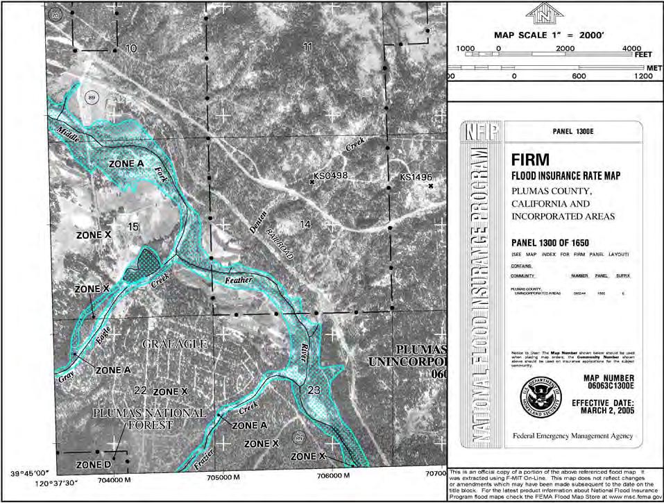
11 Pier Local: Contraction Local: Total Scour: Potential pier scour has been estimated to be 13.2-feet using the limiting pier scour equation presented in FHWA HEC-18. The preferred bridge does not constitute a significant contraction of the flood channel. Total potential scour and potential scour elevations at piers are summarized in Table 5. Scour computations and data are included in Appendix C. Location Ground Elev. TABLE 5 Total Potential Scour (feet) Degradation (widening) Contractio n Scour Local Scour Total Scour Scour Elev. Abutment Pier Abutment OTHER CONSIDERATIONS: Drift: Transient Aggradation Existing Bridge: FEMA: There is a large potential for significant volumes of small to medium size drift (branches to small tree trunks) and a modest potential for large drift (large tree trunks) in Middle Fork Feather River. Drift has been considered in the design of the preferred bridge by providing larger span lengths than the existing bridge and more clearance for drift than the minimum recommended. In the event of a landslide entering Frazier Creek, it is likely that sediment will fill the active channel of Middle Fork Feather River to a significant degree during the subsequent transient aggradation event. During such events the water surface elevations of moderate recurrence events can well exceed the water surface elevation estimated for the most probable 100- year flood. While it is impossible to predict or assign a recurrence to these events, they are not particularly uncommon and measures can be implemented to minimize damage should such an event occur. The existing bridge will not be removed after construction of the preferred bridge. The preferred bridge is located within a reach of channel that has flood risk mapped by FEMA using approximate study methods. As such, projects may encroach into the floodplain to the extent they result in a 1.0- foot increase in the water surface elevation of the most probable 100-year flood provided the increase does not result in an increased risk of damage 8
12 to structures or other negative impacts. The preferred bridge is expected to result in a 0.18-foot increase in water surface elevation during the most probable 100-year flood at and for a short distance upstream of the bridge. No structures are in or adjacent to the channel upstream of Blairsden- Graeagle Road therefore the minor increase in water surface elevation during the most probable 100-year flood does not reflect an increase in the risk of damage to structures. No FEMA applications are believed necessary for the bridge replacement project. CONCLUSIONS AND RECOMMENDATIONS Design Flood: Clearance for Drift: Design Exception: Recommendations: Caltrans and FHWA recommend that new and replacement bridges be designed with a minimum soffit elevation equal to the water surface elevation of the most probable 50-year flood (Standard Design Flood) plus appropriate clearance for drift or to the water surface elevation of the most probable 100-year flood (Base Flood) with no clearance for drift, whichever is higher. The minimum clearance for drift recommended by Caltrans and FHWA for bridges over rivers of 3.0-feet is appropriate at this site. None required for flood hydraulic conditions Minimum Soffit Elevation The minimum soffit elevation of a bridge meeting the recommendations of Caltrans and FHWA is ft. This represents the elevation of the Standard Design Flood plus 3.0-feet of clearance for drift. Pier Scour Elevation Pier 2 should be designed considering total potential scour to an elevation of feet. Abutment Scour Elevation Abutment 1 should be designed considering or protected against total potential scour to an elevation of 4339-feet. Abutment 2 should be designed considering or protected against total potential scour to an elevation of 4346-feet. Abutment Protection Recommended to an elevation 3-feet above the water surface elevation during the most probable 100-year flood or to the top of bank, whichever is higher, to reduce risks of damage during a transient aggradation event and of long term potential for damage to abutments from bank erosion and bank migration. 9
13 Note regarding estimates of potential scour: Potential scour has been estimated using empirical equations presented in FHWA HEC-18. These equations do not consider geotechnical conditions and therefore assume all substrate is erodible. The potential scour estimates identified in this report may be inappropriate if a geotechnical investigation identifies material resistant to erosion at higher elevations. Preferred Bridge Characteristics: Soffit Elevation feet (4.59-ft above Q50, 3.13-ft above Q100) Overtopping Flood Impact on Flood Risk Impact on Channel cfs, approximately 150-year recurrence Minor (0.18-foot) increase in water surface elevation during the most probable 100-year flood but no increase in flood risk to structures because no structures are present within the 100-year floodplain. Preferred bridge is not expected to aggravate channel instability. 10


14 Photo 1: Looking downstream (north) at Bridge 09C-0134, Blairsden-Graeagle Road over Middle Fork Feather River Photo 2: Looking upstream (north) at Bridge 09C-0134, Blairsden-Graeagle Road over Middle Fork Feather River 11


15 Photo 3: Looking east across Bridge 09C-0134, Blairsden-Graeagle Road over Middle Fork Feather River Photo 4: Looking west across Bridge 09C-0134, Blairsden-Graeagle Road over Middle Fork Feather River 12


16 Photo 5: Looking downstream at Middle Fork Feather River from Bridge 09C-0134, Blairsden-Graeagle Road Photo 6: Looking upstream at Middle Fork Feather River from Bridge 09C-0134, Blairsden-Graeagle Road 13
17 Figure 1: Sketch of Existing Bridge 14

18 Figure 2: Preferred Bridge Preliminary General Plan 15


19 Figure 3: Middle Fork Feather River Drainage Basin above Blairsden-Graeagle Road 16

20 Figure 4: Site Topography 17
21 Figure 5: Flood Frequency Curve of Middle Fork Feather River at Blairsden Graeagle Road 18

22 Figure 6: Approximate Locations of Surveyed Cross-sections used in Backwater Model 19

23 Figure 7: Existing Bridge as Represented in Backwater Model 20

24 Figure 8: Preferred Bridge as Represented in Backwater Model 21

25 Figure 9: Existing Condition and Preferred Bridge Flood Profiles 22
26 Figure 10: Existing Condition and Preferred Bridge Stage Discharge Curve at Cross-section 2310 for Flood Risk Assessment 23
27 Figure 11: Preferred Bridge Stage Discharge Curve at Cross-section 2250 for Bridge Design 24
28 Figure 12: Existing Condition and Preferred Bridge Stage Discharge Curve at Cross-section 4080 (upstream end of model) for flood risk assessment 25
29 APPENDIX A Additional Hydrologic Figures
30
31 APPENDIX B Additional Hydraulic Data


32 Backwater Model Summary Output, Existing Condition without Drift


33 Backwater Model Summary Output, Existing Condition with Drift


34 Backwater Model Summary Output, Preferred Bridge without Drift


35 Backwater Model Summary Output, Preferred Bridge with Drift
36
37 APPENDIX C Scour Calculations
38
39 APPENDIX D References
40 REFERENCES 1) Caltrans Local Programs Manual. 2) United States Army Corps of Engineers, 1990, HEC-1, Flood Hydrograph Package, Users Manual, Publication No. CPD-1A, Version 4.0, Hydrologic Engineering Center, Davis, CA 3) United States Army Corps of Engineers, 1997, HEC-RAS, River Analysis System, Applications Guide, Publication No. CPD-70, Version 2.0, Hydraulic Engineering Center, Davis, CA. 4) United States Department of Transportation, 1993, HEC-18, Evaluating Scour at Bridges, Second Edition, Report Number FHWA-IP , Federal Highway Administration, Washington DC. 5) United States Department of Transportation, 1991, Hydraulic Engineering Circular Number 20, Stream Stability at Highway Structures, Report Number FHWA-IP , Federal Highway Administration, Washington DC. 6) United States Geological Survey, Harry Barnes Jr., 1967, Roughness Characteristics of Natural Channels, U.S.G.S. Water Supply Paper 1849, U.S.G.S., Denver Federal Center, Denver, CO. 7) United States Geological Survey, Interagency Advisory Committee on Water Resources Data, 1981, Bulletin 17B, Guidelines for Determining Flood Flow Frequency, National Technical Information Service report number PB /AS, U.S. Department of Commerce, NTIS, Springfield, VA. 8) United States Geological Survey, Waananan and Crippen, 1977, Magnitude and Frequency of Floods in California, Report number USGS/WRI 77-21, U.S.G.S., Menlo Park, CA. 9) United States Geological Survey, Water Resources Data for California, Many years, Many volumes, U.S.G.S., Sacramento, CA. 10) Walesh, Stewart G., 1989, Urban Surface Water Management, John Wiley and Sons, New York, NY. 11) Braithwaite, Norman S. Bridge Design Considerations, Non-proximate Geologic Hazards, Floodplain Management Association, 2002, Vol. 3, No. 1, Mission Viejo, Calif. 12) Braithwaite, Norman S. Stream Channel Instability: Cultural Influence and Watershed Planning, Proceedings of the 23 rd Semi-Annual Fall Conference of the California Floodplain Management Association, Integrating Floodplain and Watershed Management, Sept. 3-6, ) MCWA; c:\data\qpro\russian\pwasurvey. 14) Federal Emergency Management Agency, Floodway Flood boundary and floodway map, Mendocino County, CA, (unincorporated areas), Panel 692 of 1100, June 14, 1982, Community- Panel Number B.
DRAFT Design Hydraulic Study. Bridge 04C-0055, Mattole Road Bridge over Mattole River at Honeydew. Humboldt County. Prepared for:
 DRAFT Design Hydraulic Study Bridge 04C-0055, Mattole Road Bridge over Mattole River at Honeydew Humboldt County Prepared for: Morrison Structures Incorporated 1890 Park Marina Drive, Suite 104 Redding,
UPPER COSUMNES RIVER FLOOD MAPPING
 UPPER COSUMNES RIVER FLOOD MAPPING DRAFT BASIC DATA NARRATIVE FLOOD INSURANCE STUDY SACRAMENTO COUTY, CALIFORNIA Community No. 060262 November 2008 Prepared By: CIVIL ENGINEERING SOLUTIONS, INC. 1325 Howe
YELLOWSTONE RIVER FLOOD STUDY REPORT TEXT
 YELLOWSTONE RIVER FLOOD STUDY REPORT TEXT TECHNICAL REPORT Prepared for: City of Livingston 411 East Callender Livingston, MT 59047 Prepared by: Clear Creek Hydrology, Inc. 1627 West Main Street, #294
LOMR SUBMITTAL LOWER NEHALEM RIVER TILLAMOOK COUNTY, OREGON
 LOMR SUBMITTAL LOWER NEHALEM RIVER TILLAMOOK COUNTY, OREGON Prepared for: TILLAMOOK COUNTY DEPARTMENT OF COMMUNITY DEVELOPMENT 1510-B THIRD STREET TILLAMOOK, OR 97141 Prepared by: 10300 SW GREENBURG ROAD,
The last three sections of the main body of this report consist of:
 Threatened and Endangered Species Geological Hazards Floodplains Cultural Resources Hazardous Materials A Cost Analysis section that provides comparative conceptual-level costs follows the Environmental
LOMR SUBMITTAL LOWER NESTUCCA RIVER TILLAMOOK COUNTY, OREGON
 LOMR SUBMITTAL LOWER NESTUCCA RIVER TILLAMOOK COUNTY, OREGON Prepared for: TILLAMOOK COUNTY DEPARTMENT OF COMMUNITY DEVELOPMENT 1510-B THIRD STREET TILLAMOOK, OR 97141 Prepared by: 10300 SW GREENBURG ROAD,
PENNSYLVANIA DEPARTMENT OF TRANSPORTATION ENGINEERING DISTRICT 3-0
 PENNSYLVANIA DEPARTMENT OF TRANSPORTATION ENGINEERING DISTRICT 3-0 LYCOMING COUNTY S.R.15, SECTION C41 FINAL HYDROLOGIC AND HYDRAULIC REPORT STEAM VALLEY RUN STREAM RELOCATION DATE: June, 2006 REVISED:
HYDROLOGIC AND HYDRAULIC REPORT FOR SR. 0522, SECTION 5BN ALONG BLACKLOG CREEK CROMWELL TOWNSHIP HUNTINGDON COUNTY. Prepared for:
 HYDROLOGIC AND HYDRAULIC REPORT FOR SR. 0522, SECTION 5BN ALONG BLACKLOG CREEK CROMWELL TOWNSHIP Prepared for: KCI Technologies, Inc. Mechanicsburg, PA and Pennsylvania Department of Transportation Engineering
JOURNAL OF ENVIRONMENTAL HYDROLOGY The Electronic Journal of the International Association for Environmental Hydrology VOLUME
 JOURNAL OF ENVIRONMENTAL HYDROLOGY The Electronic Journal of the International Association for Environmental Hydrology VOLUME 18 2010 REDUCED CHANNEL CONVEYANCE ON THE WICHITA RIVER AT WICHITA FALLS, TEXAS,
APPENDIX B Hydraulic Considerations for Pipeline Crossings of Stream Channels
 APPENDIX B Hydraulic Considerations for Pipeline Crossings of Stream Channels B-1 B-2 APPENDIX B HYDRAULIC CONSIDERATIONS FOR PIPELINE CROSSINGS OF STREAM CHANNELS Pipeline crossings of perennial, intermittent,
Dealing with Zone A Flood Zones. Topics of Discussion. What is a Zone A Floodplain?
 Dealing with Zone A Flood Zones Topics of Discussion Overview of Zone A Floodplains Permitting Development in Zone A Floodplains Estimating Flood Elevations in Zone A Flood Insurance Implications Letters
Bank Erosion and Morphology of the Kaskaskia River
 Bank Erosion and Morphology of the Kaskaskia River US Army Corps Of Engineers St. Louis District Fayette County Soil and Water Conservation District Team Partners : Carlyle Lake Ecosystem Partnership Vicinity
Evaluation of Scour Depth around Bridge Piers with Various Geometrical Shapes
 Evaluation of Scour Depth around Bridge Piers with Various Geometrical Shapes Dr. P. D. Dahe * Department of Civil Engineering, SGGSIE&T, Vishnupuri, Nanded (Maharashtra) S. B. Kharode Department of Civil
PENNSYLVANIA DEPARTMENT OF TRANSPORTATION DISTRICT 6-0 HYDROLOGIC AND HYDRAULIC REPORT. for SR 3062, SECTION 29S STRASBURG ROAD.
 PENNSYLVANIA DEPARTMENT OF TRANSPORTATION DISTRICT 6-0 HYDROLOGIC AND HYDRAULIC REPORT for SR 3062, SECTION 29S STRASBURG ROAD over WEST BRANCH OF BRANDYWINE CREEK EAST FALLOWFIELD TOWNSHIP, CHESTER COUNTY
PRELIMINARY CULVERT ANALYSIS REPORT FOR CULVERT NO. 008-C OREGON AVENUE OVER PINEHURST CREEK
 PRELIMINARY CULVERT ANALYSIS REPORT FOR CULVERT NO. 008-C OREGON AVENUE OVER PINEHURST CREEK Prepared for The District of Columbia Department of Transportation Washington, D.C. Prepared by Parsons Transportation
Squaw Creek. General Information
 General Information is a tributary to the Salmon River. It enters the north side of the river about 0 miles downstream of North Fork, Idaho. The study reach is about a 30 ft length of stream about 2 miles
HYDROLOGY AND HYDRAULICS MUSKEG RIVER BRIDGE
 PUBLIC WORKS CANADA HYDROLOGY AND HYDRAULICS MUSKEG RIVER BRIDGE KILOMETRE 207.9, LIARD HIGKWAY December 1978 I I f I I I I # Bolter Parish Trimble Ltd. ONLIULTINO Public Works, Canada, 9925-109 Street,
Avoiding Geohazards in the Mid-Atlantic Highlands by Using Natural Stream Principles
 Avoiding Geohazards in the Mid-Atlantic Highlands by Using Natural Stream Principles J. Steven Kite, WVU Neal Carte, WVDOT Will Harman, Michael Baker Corp. Donald D. Gray, WVU Photo: W. Gillespie North
Appendix E Guidance for Shallow Flooding Analyses and Mapping
 Appendix E Guidance for Shallow Flooding Analyses and Mapping E.1 Introduction Different types of shallow flooding commonly occur throughout the United States. Types of flows that result in shallow flooding
Field Observations and One-Dimensional Flow Modeling of Summit Creek in Mack Park, Smithfield, Utah
 Intermountain Center for River Rehabilitation and Restoration, Utah State University 31 July 2018 Field Observations and One-Dimensional Flow Modeling of Summit Creek in Mack Park, Smithfield, Utah I.
OBJECTIVES. Fluvial Geomorphology? STREAM CLASSIFICATION & RIVER ASSESSMENT
 STREAM CLASSIFICATION & RIVER ASSESSMENT Greg Babbit Graduate Research Assistant Dept. Forestry, Wildlife & Fisheries Seneca Creek, Monongahela National Forest, West Virginia OBJECTIVES Introduce basic
CASE STUDIES. Introduction
 Introduction The City of Winston-Salem faces the challenge of maintaining public infrastructure (e.g., water and sewer lines, storm drains, roads, culverts and bridges) while minimizing the potential impacts
Countermeasure Calculations and Design
 Countermeasure Calculations and Design Summarized from Bridge Scour and Stream Instability Countermeasures, Experience, Selection, and Design Guidance, Second Edition, Publication No. FHWA NHI 01-003,
Summary of Hydraulic and Sediment-transport. Analysis of Residual Sediment: Alternatives for the San Clemente Dam Removal/Retrofit Project,
 Appendix N SUMMARY OF HYDRAULIC AND SEDIMENT-TRANSPORT ANALYSIS OF RESIDUAL SEDIMENT: ALTERNATIVES FOR THE SAN CLEMENTE DAM REMOVAL/RETROFIT PROJECT, CALIFORNIA the San Clemente Dam Removal/Retrofit Project,
GEOL 1121 Earth Processes and Environments
 GEOL 1121 Earth Processes and Environments Wondwosen Seyoum Department of Geology University of Georgia e-mail: seyoum@uga.edu G/G Bldg., Rm. No. 122 Seyoum, 2015 Chapter 6 Streams and Flooding Seyoum,
TSEGI WASH 50% DESIGN REPORT
 TSEGI WASH 50% DESIGN REPORT 2/28/2014 Daniel Larson, Leticia Delgado, Jessica Carnes I Table of Contents Acknowledgements... IV 1.0 Project Description... 1 1.1 Purpose... 1 Figure 1. Erosion of a Headcut...
Why Geomorphology for Fish Passage
 Channel Morphology - Stream Crossing Interactions An Overview Michael Love Michael Love & Associates mlove@h2odesigns.com (707) 476-8938 Why Geomorphology for Fish Passage 1. Understand the Scale of the
3.11 Floodplains Existing Conditions
 Other stormwater control practices may be needed to mitigate water quality impacts. In addition to detention facilities, other practices such as vegetated basins/buffers, infiltration basins, and bioswales
MEANDER MIGRATION MODEL ASSESSMENT FOR THE JANUARY 2005 STORM, WHITMAN PROPERTY, SAN ANTONIO CREEK, VENTURA COUNTY, CALIFORNIA
 MEANDER MIGRATION MODEL ASSESSMENT FOR THE JANUARY 2005 STORM, WHITMAN PROPERTY, SAN ANTONIO CREEK, VENTURA COUNTY, CALIFORNIA Prepared by Eric Larsen, Ph.D. Mark Rains, Ph.D. October 2006 INTRODUCTION
Historical channel change on the Upper Gila River, Arizona and New Mexico in response to anthropogenic modifications and extreme floods
 Historical channel change on the Upper Gila River, Arizona and New Mexico in response to anthropogenic modifications and extreme floods www.archives.gov www.paztcn.wr.usgs.gov wrh.noaa.gov Upper Gila River
REDWOOD VALLEY SUBAREA
 Independent Science Review Panel Conceptual Model of Watershed Hydrology, Surface Water and Groundwater Interactions and Stream Ecology for the Russian River Watershed Appendices A-1 APPENDIX A A-2 REDWOOD
Stream Geomorphology. Leslie A. Morrissey UVM July 25, 2012
 Stream Geomorphology Leslie A. Morrissey UVM July 25, 2012 What Functions do Healthy Streams Provide? Flood mitigation Water supply Water quality Sediment storage and transport Habitat Recreation Transportation
APPENDIX A M&T/Llano Seco Long-Term Water Reliability Study These photos are examples of rock spurs in use throughout the United States
 APPENDIX A M&T/Llano Seco Long-Term Water Reliability Study These photos are examples of rock spurs in use throughout the United States Glenn Colusa Irrigation District completed a Sacramento River project
Technical Memorandum No Sediment Model
 Pajaro River Watershed Study in association with Technical Memorandum No. 1.2.9 Sediment Model Task: Development of Sediment Model To: PRWFPA Staff Working Group Prepared by: Gregory Morris and Elsie Parrilla
Section 4: Model Development and Application
 Section 4: Model Development and Application The hydrologic model for the Wissahickon Act 167 study was built using GIS layers of land use, hydrologic soil groups, terrain and orthophotography. Within
 Red River Flooding June 2015 Caddo and Bossier Parishes Presented by: Flood Technical Committee Where the Rain Falls Matters I-30 versus I-20 I-20 Backwater and Tributary Floods (Localized) 2016 Flood
Flood Hazard Inundation Mapping. Presentation. Flood Hazard Mapping
 Flood Hazard Inundation Mapping Verne Schneider, James Verdin, and JeradBales U.S. Geological Survey Reston, VA Presentation Flood Hazard Mapping Requirements Practice in the United States Real Time Inundation
Ways To Identify Background Verses Accelerated Erosion
 Ways To Identify Background Verses Accelerated Erosion Establish Background Condition From Old Ground Photos, Aerial Photos, and Maps Compare Rate Over Time At the Same Location, or for Reaches Channel
L OWER N OOKSACK R IVER P ROJECT: A LTERNATIVES A NALYSIS A PPENDIX A: H YDRAULIC M ODELING. PREPARED BY: LandC, etc, LLC
 L OWER N OOKSACK R IVER P ROJECT: A LTERNATIVES A NALYSIS A PPENDIX A: H YDRAULIC M ODELING PREPARED BY: LandC, etc, LLC TABLE OF CONTENTS 1 Introduction... 1 2 Methods... 1 2.1 Hydraulic Model... 1 2.2
Degradation Concerns related to Bridge Structures in Alberta
 Degradation Concerns related to Bridge Structures in Alberta Introduction There has been recent discussion regarding the identification and assessment of stream degradation in terms of how it relates to
Solutions to Flooding on Pescadero Creek Road
 Hydrology Hydraulics Geomorphology Design Field Services Photo courtesy Half Moon Bay Review Solutions to Flooding on Pescadero Creek Road Prepared for: San Mateo County Resource Conservation District
MEMORANDUM. Situation. David Ford Consulting Engineers, Inc J Street, Suite 200 Sacramento, CA Ph Fx
 David Ford Consulting Engineers, Inc. 2015 J Street, Suite 200 Sacramento, CA 95811 Ph. 916.447.8779 Fx. 916.447.8780 MEMORANDUM To: Brad Moore, PE, USACE From: Nathan Pingel, PE (Lic # CA 63242), and
ADDRESSING GEOMORPHIC AND HYDRAULIC CONTROLS IN OFF-CHANNEL HABITAT DESIGN
 ADDRESSING GEOMORPHIC AND HYDRAULIC CONTROLS IN OFF-CHANNEL HABITAT DESIGN Conor Shea - Hydrologist U.S. Fish and Wildlife Service Conservation Partnerships Program Arcata, CA Learning Objectives Examine
May 7, Roger Leventhal, P.E. Marin County Public Works Laurel Collins Watershed Sciences
 May 7, 2013 Roger Leventhal, P.E. Marin County Public Works Laurel Collins Watershed Sciences Background Funded in 2009 under EPA 2100 Grant for $30k and managed by SFEP Project Goals: Update original
A STUDY OF LOCAL SCOUR AT BRIDGE PIERS OF EL-MINIA
 A STUDY OF LOCAL SCOUR AT BRIDGE PIERS OF EL-MINIA Dr. Gamal A. Sallam 1 and Dr. Medhat Aziz 2 ABSTRACT Bridges are critical structures that require a substantial investment to construct and serve an important
Bank stabilization by redirective structures on the Santa Clara River, Ventura County, CA
 116 Alex Yescas Senior Water Resources Engineer Atkins North America Bank stabilization by redirective structures on the Santa Clara River, Ventura County, CA Abstract The Santa Clara River is one of the
Technical Memorandum No
 Pajaro River Watershed Study in association with Technical Memorandum No. 1.2.10 Task: Evaluation of Four Watershed Conditions - Sediment To: PRWFPA Staff Working Group Prepared by: Gregory Morris and
GEOL 652. Poudre River Fieldtrip
 GEOL 652. Poudre River Fieldtrip One of the more difficult variables to measure and/or estimate when studying flow in natural channels is that of roughness. Roughness, usually approximated with Manning
9. PROBABLE MAXIMUM PRECIPITATION AND PROBABLE MAXIMUM FLOOD
 9. PROBABLE MAXIMUM PRECIPITATION AND PROBABLE MAXIMUM FLOOD 9.1. Introduction Due to the size of Watana Dam and the economic importance of the Project to the Railbelt, the Probable Maximum Flood (PMF)
INFLOW DESIGN FLOOD CONTROL SYSTEM PLAN 40 C.F.R. PART PLANT YATES ASH POND 2 (AP-2) GEORGIA POWER COMPANY
 GEORGIA POWER COMPANY") INFLOW DESIGN FLOOD CONTROL SYSTEM PLAN 40 C.F.R. PART 257.82 PLANT YATES ASH POND 2 (AP-2) GEORGIA POWER COMPANY EPA s Disposal of Coal Combustion Residuals from Electric Utilities Final Rule (40 C.F.R.
INFLOW DESIGN FLOOD CONTROL SYSTEM PLAN 40 C.F.R. PART 257.82 PLANT YATES ASH POND 2 (AP-2) GEORGIA POWER COMPANY EPA s Disposal of Coal Combustion Residuals from Electric Utilities Final Rule (40 C.F.R.
Illinois State Water Survey Division
 Illinois State Water Survey Division SURFACE WATER SECTION SWS Miscellaneous Publication 108 SEDIMENT YIELD AND ACCUMULATION IN THE LOWER CACHE RIVER by Misganaw Demissie Champaign, Illinois June 1989
3.12 Geology and Topography Affected Environment
 3 Affected Environment and Environmental Consequences 3.12 Geology and Topography 3.12.1 Affected Environment 3.12.1.1 Earthquakes Sterling Highway MP 45 60 Project Draft SEIS The Kenai Peninsula is predisposed
Chapter 3 Erosion in the Las Vegas Wash
 Chapter 3 Erosion in the Las Vegas Wash Introduction As described in Chapter 1, the Las Vegas Wash (Wash) has experienced considerable change as a result of development of the Las Vegas Valley (Valley).
Red River Levee Panel
 Red River Levee Panel Mississippi River Commission Monday, August 9, 2017 Red River Levees in LA & AR NONE along TX & OK Boarder Red River Levee Issues Caddo Levee Cherokee Park Authorization Bossier Levee
ESTIMATING JOINT FLOW PROBABILITIES AT STREAM CONFLUENCES USING COPULAS
 ESTIMATING JOINT FLOW PROBABILITIES AT STREAM CONFLUENCES USING COPULAS Roger T. Kilgore, P.E., D. WRE* Principal Kilgore Consulting and Management 2963 Ash Street Denver, CO 80207 303-333-1408 David B.
Mount St. Helens Project Cowlitz River Levee Systems 2009 Level of Flood Protection Update Summary
 Mount St. Helens Project Cowlitz River Levee Systems 2009 Level of Flood Protection Update Summary Cowlitz River at Longview/Kelso, Washington February 4, 2010 Executive Summary USACE periodically updates
Do you think sediment transport is a concern?
 STREAM RESTORATION FRAMEWORK AND SEDIMENT TRANSPORT BASICS Pete Klingeman 1 What is Your Restoration Project Like? k? Do you think sediment transport is a concern? East Fork Lewis River, WA Tidal creek,
GEOMORPHIC CHANGES IN LOWER CACHE CREEK 2012
 GEOMORPHIC CHANGES IN LOWER CACHE CREEK 2012 Eric W. Larsen Technical Memorandum Prepared for Cache Creek Technical Advisory Committee Natural Resources Program Yolo County Board of Supervisors 2012 Prepared
FUTURE MEANDER BEND MIGRATION AND FLOODPLAIN DEVELOPMENT PATTERNS NEAR RIVER MILES 200 TO 191 OF THE SACRAMENTO RIVER PHASE III REPORT
 FUTURE MEANDER BEND MIGRATION AND FLOODPLAIN DEVELOPMENT PATTERNS NEAR RIVER MILES 200 TO 191 OF THE SACRAMENTO RIVER PHASE III REPORT Eric W. Larsen REPORT FOR DUCKS UNLIMITED March 31, 2006-1 - Contents
Appendix C Fluvial Flood Hazards
 Appendix C Fluvial Flood Hazards Sea Level Rise Vulnerability Assessment and Adaptation Project March 2019 Contents Contents... i Figures... i Tables... i Definitions, Acronyms, & Abbreviations... ii
Issue 44: Phase II & III H&H Issues Date: 07/03/2006 Page 1
 Background Phase I of the NCFMP studies have primarily focused on the coastal plain and sandhills physiographic regions in of the State. Phase II and III study areas will focus on the piedmont, foothills,
Hydraulics of bendway weirs
 River Basin Management IV 389 Hydraulics of bendway weirs C. Thornton 1, S. Abt 1, D. Baird 2 & R. Padilla 3 1 Colorado State University, Fort Collins, CO, USA 2 U.S. Bureau of Reclamation, Denver, CO,
JACINTO. Sediment Transport and Scour Analysis San Jacinto River, Stage 4 North and South Levees SAN ENGINEERING STUDY. Prepared for: Prepared by:
 ENGINEERING STUDY Sediment Transport and Scour Analysis San Jacinto River, Stage 4 North and South Levees Prepared for: Prepared by: RIVERSIDE COUNTY FLOOD CONTROL & WATER CONSERVATION DISTRICT & SAN JACINTO
FUTURE MEANDER BEND MIGRATION AND FLOODPLAIN DEVELOPMENT PATTERNS NEAR RIVER MILES 241 TO 235, SACRAMENTO RIVER
 FUTURE MEANDER BEND MIGRATION AND FLOODPLAIN DEVELOPMENT PATTERNS NEAR RIVER MILES 241 TO 235, SACRAMENTO RIVER Eric W. Larsen University of California, Davis With the assistance of Evan Girvetz REPORT
Assessment. Assessment
 2001 SPRINGBROOK CREEK RESTORATION - THREE YEAR POST-CONSTRUCTION REVIEW - Presented by Bruce Henderson and Andy Harris 2005 River Restoration Northwest Symposium Skamania Lodge, Washington www.hendersonlandservices.com
MODELING OF LOCAL SCOUR AROUND AL-KUFA BRIDGE PIERS Saleh I. Khassaf, Saja Sadeq Shakir
 ISSN 2320-9100 11 International Journal of Advance Research, IJOAR.org Volume 1, Issue 8,August 2013, Online: ISSN 2320-9100 MODELING OF LOCAL SCOUR AROUND AL-KUFA BRIDGE PIERS Saleh I. Khassaf, Saja Sadeq
!"#$%&&'()*+#$%(,-./0*)%(!
*+#$%(,-./0*)%(!") 8:30 Sign in Hoosic River Revival Coalition!"#$%&&'()*+#$%(,-./0*)%(! 12-#30+4/#"5-(60 9:00 Welcome and Introductions 9:15 Goals for Today s Program: A Description of the Planning Process 9:30 First Session:
8:30 Sign in Hoosic River Revival Coalition!"#$%&&'()*+#$%(,-./0*)%(! 12-#30+4/#"5-(60 9:00 Welcome and Introductions 9:15 Goals for Today s Program: A Description of the Planning Process 9:30 First Session:
STABILIZATION OF THE H&CT RAILWAY STONE DAM WALTER E. SKIPWITH, PE, JOYCE CRUM, AIA AND JOHN BAUMGARTNER, PE. Introduction.
 STABILIZATION OF THE H&CT RAILWAY STONE DAM WALTER E. SKIPWITH, PE, JOYCE CRUM, AIA AND JOHN BAUMGARTNER, PE I. A. Introduction General The Old Stone Dam is located in the upper reach of Cottonwood Creek
TOWN OF FORT KENT, MAINE AROOSTOOK COUNTY
 TOWN OF FORT KENT, MAINE AROOSTOOK COUNTY PRELIMINARY: 01/07/2013 Federal Emergency Management Agency COMMUNITY NUMBER 230019V000A NOTICE TO FLOOD INSURANCE STUDY USERS Communities participating in the
Vermont Stream Geomorphic Assessment. Appendix E. River Corridor Delineation Process. VT Agency of Natural Resources. April, E0 - April, 2004
 Vermont Stream Geomorphic Assessment Appendix E River Corridor Delineation Process Vermont Agency of Natural Resources - E0 - River Corridor Delineation Process Purpose A stream and river corridor delineation
Grant 0299-NEP: Water Resources Project Preparatory Facility
 Document Produced under Grant Project Number: 45206 May 2016 Grant 0299-NEP: Water Resources Project Preparatory Facility Final Report Volume 3 East Rapti (1 of 9) Prepared by Pvt. Ltd. For Ministry of
USGS Flood Inundation Mapping of the Suncook River in Chichester, Epsom, Pembroke and Allenstown, New Hampshire
 USGS Flood Inundation Mapping of the Suncook River in Chichester, Epsom, Pembroke and Allenstown, New Hampshire NH Water & Watershed Conference Robert Flynn, USGS NH-VT Water Science Center March 23, 2012
Rosgen Classification Unnamed Creek South of Dunka Road
 Rosgen Classification Unnamed Creek South of Dunka Road Prepared for Poly Met Mining Inc. September 2013 Rosgen Classification Unnamed Creek South of Dunka Road Prepared for Poly Met Mining Inc. September
Working with Natural Stream Systems
 Working with Natural Stream Systems Graydon Dutcher Delaware County Soil & Water Conservation District Stream Corridor Management Program Tropical Storm Sandy October 29,2012 What is a Watershed?
Why Stabilizing the Stream As-Is is Not Enough
 Why Stabilizing the Stream As-Is is Not Enough Several examples of alternatives to the County s design approach have been suggested. A common theme of these proposals is a less comprehensive effort focusing
YANKTON COUNTY, SOUTH DAKOTA
 YANKTON COUNTY, SOUTH DAKOTA AND INCORPORATED AREAS Community Name Community Number GAYVILLE, TOWN OF* 460205 IRENE, TOWN OF 460120 LESTERVILLE, TOWN OF* 460206 MISSION HILL, TOWN OF 460091 UTICA, TOWN
Two-Dimensional Simulation of Truckee River Hydrodynamics
 Two-Dimensional Simulation of Truckee River Hydrodynamics by Stephen H. Scott PURPOSE: The purpose of this Coastal and Hydraulics Engineering Technical Note (CHETN) is to demonstrate the use of multidimensional
Hydraulic and Sediment Transport Modeling Strategy
 Appendix B Hydraulic and Sediment Transport Modeling Strategy May 2014 Technical Memorandum Channel Capacity Report January 2015 San Joaquin River Restoration Program Hydraulic and Sediment Transport Modeling
Monitoring Scour Critical Bridges During Floods For Local Bridge Owners. Presented by
 Monitoring Scour Critical Bridges During Floods For Local Bridge Owners Presented by SAFETY FIRST DO NOT ENDANGER YOURSELF OR OTHERS WHILE MONITORING BRIDGES DO NOT ENTER FLOOD WATERS FLOOD WATERS INCLUDE
Analysis of the Cause for the Collapse of a Temporary Bridge Using Numerical Simulation
 Engineering, 2013, 5, 997-1005 Published Online December 2013 (http://www.scirp.org/journal/eng) http://dx.doi.org/10.4236/eng.2013.512121 Analysis of the Cause for the Collapse of a Temporary Bridge Using
Figure 1. Map of Feather River Basin in northern California. (A) Region straddles the northwestern Sierra Nevada and Sacramento Valley.
 Region straddles the northwestern Sierra Nevada and Sacramento Valley.") Figure 1. Map of Feather River Basin in northern California. (A) Region straddles the northwestern Sierra Nevada and Sacramento Valley. (B) Feather River Basin with Yuba and Bear subbasins. Most hydraulic
Figure 1. Map of Feather River Basin in northern California. (A) Region straddles the northwestern Sierra Nevada and Sacramento Valley. (B) Feather River Basin with Yuba and Bear subbasins. Most hydraulic
MATHEMATICAL MODELING OF FLUVIAL SEDIMENT DELIVERY, NEKA RIVER, IRAN. S.E. Kermani H. Golmaee M.Z. Ahmadi
 JOURNAL OF ENVIRONMENTAL HYDROLOGY The Electronic Journal of the International Association for Environmental Hydrology On the World Wide Web at http://www.hydroweb.com VOLUME 16 2008 MATHEMATICAL MODELING
Laboratory Exercise #3 The Hydrologic Cycle and Running Water Processes
 Laboratory Exercise #3 The Hydrologic Cycle and Running Water Processes page - 1 Section A - The Hydrologic Cycle Figure 1 illustrates the hydrologic cycle which quantifies how water is cycled throughout
Local Flood Hazards. Click here for Real-time River Information
 Local Flood Hazards Floods of the White River and Killbuck Creek are caused by runoff from general, and/or intense rainfall. Other areas of flooding concern are from the Boland Ditch and Pittsford Ditch.
Chapter 10 - Sacramento Method Examples
 Chapter 10 Sacramento Method Examples Introduction Overview This chapter presents two example problems to demonstrate the use of the Sacramento method. These example problems use the SACPRE and HEC-1 computer
Dolores River Watershed Study
 CHAPTER 4: RIVER AND FLOODPLAIN ISSUES The Dolores River falls into a category of streams in Colorado that share some unique characteristics. Like some other mountain streams in the state, it has a steep
LOCATED IN INDIAN RIVER COUNTY PREPARED FOR S.J.R.W.M.D. AND F.W.C.D. DECEMBER, 2003 Updated 2007 Updated May 2014 PREPARED BY
 FELLSMERE WATER CONTROL DISTRICT EAST MASTER DRAINAGE PLAN AND STORMWATER HYDROLOGIC ANALYSIS OF THE GRAVITY DRAINAGE SYSTEM LOCATED BETWEEN THE EAST BOUNDARY, LATERAL U, THE MAIN CANAL, AND DITCH 24 LOCATED
Vegetation effects on river hydraulics. Johannes J. (Joe) DeVries David Ford Consulting Engineers, Inc. Sacramento, CA
 DeVries David Ford Consulting Engineers, Inc. Sacramento, CA") Vegetation effects on river hydraulics Johannes J. (Joe) DeVries David Ford Consulting Engineers, Inc. Sacramento, CA jjdevries@ford-consulting.com SAC05 D2P31 RM 99.0L VIEW UPSTREAM AT UPSTREAM END DWR
Vegetation effects on river hydraulics Johannes J. (Joe) DeVries David Ford Consulting Engineers, Inc. Sacramento, CA jjdevries@ford-consulting.com SAC05 D2P31 RM 99.0L VIEW UPSTREAM AT UPSTREAM END DWR
HYDROLOGIC AND WATER RESOURCES EVALUATIONS FOR SG. LUI WATERSHED
 HYDROLOGIC AND WATER RESOURCES EVALUATIONS FOR SG. LUI WATERSHED 1.0 Introduction The Sg. Lui watershed is the upper part of Langat River Basin, in the state of Selangor which located approximately 20
Sessom Creek Sand Bar Removal HCP Task 5.4.6
 Sessom Creek Sand Bar Removal HCP Task 5.4.6 Prepared by: Dr. Thomas Hardy Texas State University Dr. Nolan Raphelt Texas Water Development Board January 6, 2013 DRAFT 1 Introduction The confluence of
Subcommittee on Sedimentation Draft Sediment Analysis Guidelines for Dam Removal
 Subcommittee on Sedimentation Draft Sediment Analysis Guidelines for Dam Removal August 4, 2011 Jennifer Bountry, M.S., P.E. Tim Randle, M.S., P.E., D.WRE. Blair Greimann, Ph.D., P.E. Sedimentation and
CR AAO Bridge. Dead River Flood & Natural Channel Design. Mitch Koetje Water Resources Division UP District
 CR AAO Bridge Dead River Flood & Natural Channel Design Mitch Koetje Water Resources Division UP District Old County Road AAO Bridge Map courtesy of Marquette County Silver Lake Basin McClure Basin
Stop 1: Marmot Dam Stop 1: Marmot Dam
 Stop 1: Marmot Dam Stop 1: Marmot Dam Following the removal of Marmot Dam in 2007, the fate of the reservoir sediments has been monitored through a series of surveys and sediment transport measurements.
Overview of fluvial and geotechnical processes for TMDL assessment
 Overview of fluvial and geotechnical processes for TMDL assessment Christian F Lenhart, Assistant Prof, MSU Research Assoc., U of M Biosystems Engineering Fluvial processes in a glaciated landscape Martin
UGRC 144 Science and Technology in Our Lives/Geohazards
 UGRC 144 Science and Technology in Our Lives/Geohazards Flood and Flood Hazards Dr. Patrick Asamoah Sakyi Department of Earth Science, UG, Legon College of Education School of Continuing and Distance Education
The Yellow River Initiative: The Birth of a System Approach to Challenges Facing the Everglades of the North
 The Yellow River Initiative: The Birth of a System Approach to Challenges Facing the Everglades of the North Robert Barr and Siavash Beik 2016 INAFSM Annual Conference Belterra Conference Center, Indiana
Channel-Forming Discharge
 Channel-Forming Discharge by R. R. Copeland, D. S. Biedenharn, and J. C. Fischenich PURPOSE: The purpose of this Technical Note is to provide guidance and cautions to be used in approximating channel-forming
Embarras River Watershed Digital Floodplain Mapping, Champaign County, Illinois
 Contract Report 2002-05 Embarras River Watershed Digital Floodplain Mapping, Champaign County, Illinois by Sally A. McConkey and Mark D. Johanson Prepared for the Illinois Department of Natural Resources
Kaskaskia Morphology Study Headwaters to Lake Shelbyville
 Kaskaskia Morphology Study Headwaters to Lake Shelbyville KWA Mini Summit 5 March 2012 1 Kaskaskia Morphology Study Headwaters to Lake Shelbyville Conducted by U.S. Army Corps of Engineers, St. Louis District
Case Study 2: Twenty-mile Creek Rock Fords
 Case Study : Twenty-mile Creek Rock Fords Location Crossing Description Washington. Okanagan National Forest. Methow Valley Ranger District. Chewuch river basin, East Chewuch Road. The Twenty-mile Creek