NATURAL-STATE MODEL UPDATE OF OLKARIA DOMES GEOTHERMAL FIELD
|
|
|
- Shavonne Fowler
- 5 years ago
- Views:
Transcription
1 Orkustofnun, Grensasvegur 9, Reports 2014 IS-108 Reykjavik, Iceland Number 7 NATURAL-STATE MODEL UPDATE OF OLKARIA DOMES GEOTHERMAL FIELD Maureen Nechesa Ambunya Kenya Electricity Generating Company KenGen P.O. Box Naivasha KENYA mambunya@kengen.co.ke ABSTRACT The Olkaria Domes geothermal field is located at the southeast edge of the Greater Olkaria geothermal area (GOGA). The area is bound approximately by the Ol Njorowa gorge to the west and a ring of domes to the east and south of the field. The Olkaria Domes field is a high-temperature field with most of the wells producing two-phase fluid. This report aims at discussing and updating the natural-state model of the Olkaria Domes field reservoir, incorporating data from recently drilled wells. Several 3-D natural-state numerical models of the entire GOGA geothermal system have been developed, the first in 1987 by G.S. Bödvarsson and K. Pruess. Downhole profiles of temperature and pressure in the wells were interpreted to obtain the natural state of the reservoir in the wells locale. Previous work was incorporated and an inclusive model developed that forms the basis of a simple numerical model for the natural state that could provide the standard, pre-exploitation natural state of the Olkaria Domes field reservoir. In this report, the main focus will be on updating the natural-state model of the Olkaria Domes field, equivalent to the undisturbed formation before exploitation of the resource began. Previous models have been developed, the latest completed in 2012 by the Mannvit/ÍSOR/Vatnaskil/Verkís consortium. 1. INTRODUCTION The Greater Olkaria geothermal area (GOGA) is one of the most exploited geothermal systems in the world. It is located in the East African Rift system that extends from the afar triple junction at the Gulf of Aden in the north to the south in Beira, Mozambique (Abbate et al., 1995). The rift is part of a continental divergent zone where spreading results in the thinning of the crust and the eruption of lavas and associated volcanic activities (Lagat, 2004). There are two divisions in the East African Rift valley: the Eastern and the Western rift valleys. Geothermal activity is rampant in many areas of the Kenyan rift, which is a segment of the East African Rift that runs from Lake Turkana to Lake Natron in northern Tanzania. There are about fourteen geothermal prospects (Figure 1) that are associated with Quaternary volcanic centres occurring in the axial region of the Kenyan rift (Omenda, 1998). Currently, two geothermal prospect areas are under exploitation for electricity production: the GOGA area and the Eburru geothermal field. In the Menengai geothermal field, drilling activities are currently ongoing in 1
2 Ambunya 2 Report 7 preparation for future exploitation. GOGA is in the southern part of the Kenyan rift, located to the south of Lake Naivasha and roughly 120 km northwest of Nairobi city. In the 1950s, exploration of geothermal resources in Kenya started with geological surveys in the region between Olkaria and Lake Bogoria in the northern part of the rift. The result was the drilling of two exploration wells, X-1 and X-2, in Olkaria field in which high temperatures were encountered at depth (Kenya Power Company, 1984). The success of these wells lead to further studies including surface exploration and resource capacity assessments. By 1976, six deep wells had been drilled and the field was eventually subdivided into various prospect sectors for easier development. The sectors were named with respect to Olkaria hill as shown in Figure 2. In 1981 the first 15 MWe generating unit harnessing steam from the Olkaria East field was commissioned. Later, in 1982 and 1985, two additional units (units 2 and 3), each 15 MWe, were commissioned, respectively. Olkaria FIGURE 1: Location of Greater Olkaria geothermal II, located in the Olkaria Northeast area and other volcanic centres in Kenya sector, was commissioned in 2003, (Ofwona et al., 2006) producing 70 MWe. An additional 35 MWe turbine was commissioned in May 2010, increasing the generating capacity to 105 MWe. Olkaria III, located in the Olkaria West field, currently generates a total capacity of 110 MWe. The first 12 MWe unit at Olkaria III was commissioned in 2000, a second 36 MWe unit was later commissioned in 2009 and the third 52 MWe unit was completed in February Currently, construction of a fourth 140MWe unit plant in the Olkaria East field is near completion as well as a 140 MWe plant in the Olkaria Domes geothermal field. 2. FIELD REVIEW 2.1 Olkaria Domes field development KenGen, the state-run power generating company in Kenya, carried out a detailed geo-scientific survey in the Domes sector. The survey undertaken between 1992 and 1997 involved geology, geophysics, and geochemistry as well as heat flow measurements. Analysis of data from this study lead to the siting of three exploration wells, OW-901, OW-902 and OW-903 which were drilled between 1998 and 1999


3 Report 7 3 Ambunya (Lagat, 2004). All three wells were successful and able to discharge steam. Down-hole data from the drilled wells was analysed and additional geophysical surveys were carried out with MT and TEM techniques. The success of the three exploration wells lead to appraisal drilling where six wells were drilled within the field. Since then there have been numerous drilling activities in the field and increased development. FIGURE 2: Olkaria field subsections 2.2 Geological overview of Olkaria Domes field Geo-scientific studies conducted over time in the Olkaria field indicate that the field is a remnant of an old caldera complex cut by N-S normal rifting faults that became the centre for later eruptions, forming rhyolitic and pumice domes (Ofwona, 2002). The surface and subsurface rocks are dominated by pyroclastics, tuffs, rhyolites and some basalts which may vary considerably from one place to another. Figure 3 shows the structure within the Greater Olkaria volcanic complex. They include the ring FIGURE 3: Structural map of Olkaria (Lagat, 2004)

4 Ambunya 4 Report 7 structure, the Ol Njorowa gorge,the ENE-WSW Olkaria fault and N-S, NNE-SSW, NW-SE and WNW- ESE trending faults (Lagat, 2004). In general, faults are very scarce in the Olkaria Domes field but dominate in other parts of the complex. In the Olkaria Domes area there are hydroclastic craters located on the northern part of the field that mark a magmatic explosion edge (Mungania, 1999). The craters form a row over which the extrapolated caldera rim trace (ring structure) passes. The field is also bound by Ol Njorowa gorge that demarcates the field from the Olkaria East field. OW-916 is a well drilled in the Olkaria Domes field and exhibits the typical lithology of most of the wells in the field. From Figure 4 we can deduce that the lithology of the Olkaria Domes field is dominated by pyroclastics, tuffs, rhyolites, trachytes and basalts with minor syenite intrusives. FIGURE 4: Hydrothermal alteration minerals in Well OW-916 (Mwangi, 2012)

5 Report 7 5 Ambunya 2.3 Geophysical overview of Olkaria Domes field In the analysis based on transient electromagnetic (TEM) and magneto-telluric (MT) soundings, at 0 m a.s.l., the high-temperature alteration (resistive core) dominates in the centre of the Olkaria Domes field (Wanjohi, 2011). In Figure 5 the high-resistivity anomaly of Ωm extends over most of the area except in the northern and southern parts. This high-resistivity anomaly can be associated with the dominance of high-temperature alteration minerals (Kandie, 2010) and may indicate an area containing geothermal fluids of relatively high temperatures. Overlying the highresistivity core is a lower resistivity (<20 Ωm) layer in the northern and southern parts of the field. This could be a zone of high permeability where hydrothermal alteration is not advanced, suggesting a possible upflow zone beneath (Wanjohi, 2011). FIGURE 5: Iso-resistivity map of Domes area at sea level (Wanjohi, 2011) 2.4 Geochemical overview of Olkaria Domes Geothermal fluids in the Olkaria Domes reservoir are bicarbonate in nature and correspond to peripheral waters (Malimo, 2009). The Olkaria Domes fluids seem to plot similarly to those of the Olkaria West and Olkaria Central fields, unlike the wells in the Olkaria East field and in Olkaria Northeast which discharge sodium-chloride type water of a mature nature. Solute and gas geothermometry indicate high temperatures in the range of C (Malimo, 2009). Fluid extracted from the Olkaria Domes wells contain low calcium concentrations and high ph. Calcite scaling can be expected to be minimal in these wells but the fluid has to be separated at temperatures above 100 C to prevent silica scaling (Karingithi, 2000). Studies, done by Kamunya et al. (2014), show that wells in the Olkaria Domes field discharge a mixture of chloride and bicarbonate end-member water, as shown in Figure 6. Bicarbonate waters are found in areas to the FIGURE 6: Water types of the Domes geothermal area (Kamunya et al., 2014)

. 2.")
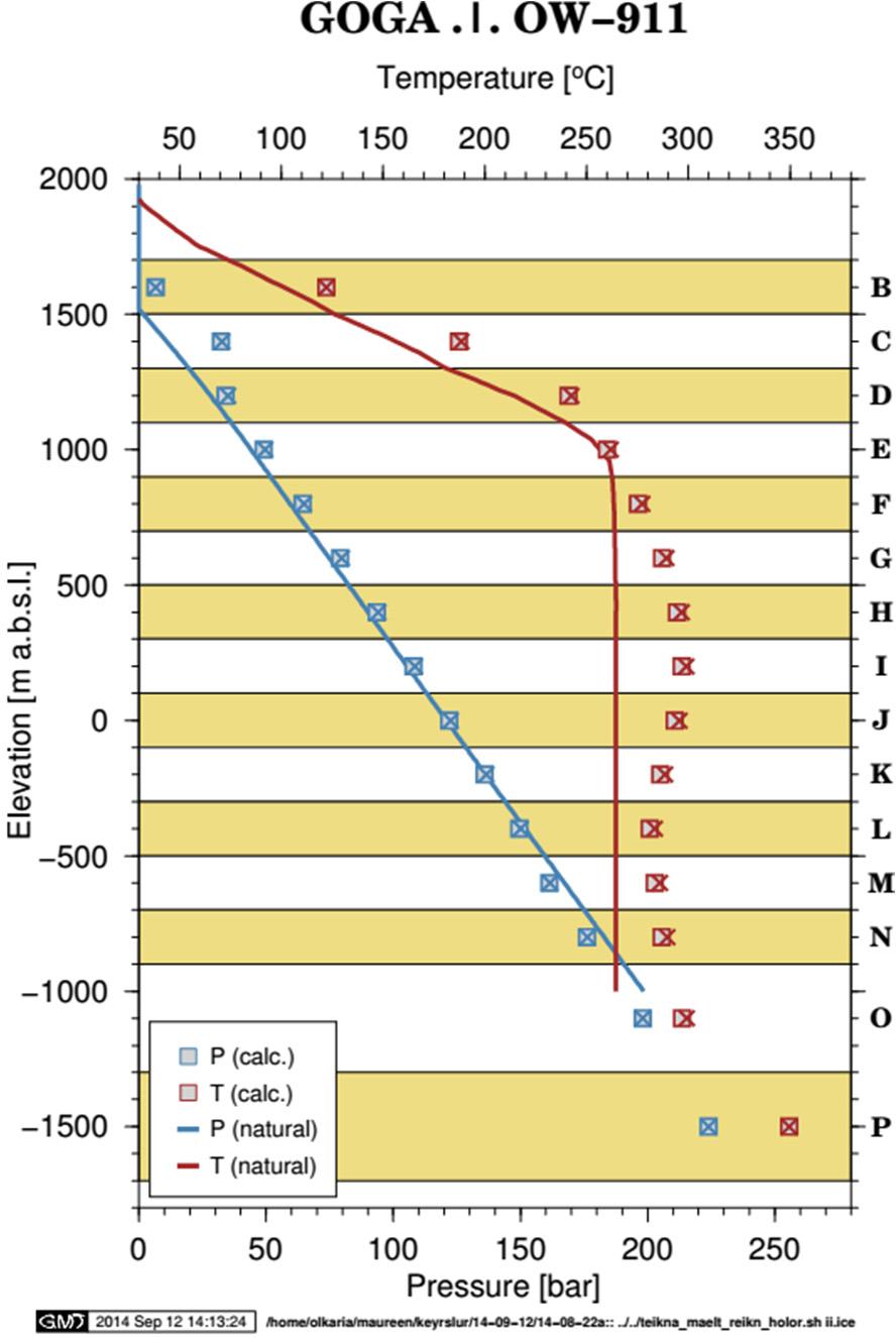
6 Ambunya 6 Report 7 northeast and southwest of the Olkaria Domes field. This could be due to the contribution of recharge fluids through the NE-SW faulting and the interpreted buried caldera that forms a concentric series of rhyolitic ash domes in the east, frequently referred to as the ring structure (Kamunya et al., 2014). 2.5 Temperature and pressure in Olkaria Domes geothermal field Temperature and pressure models have become important tools in the calibration of natural-state models of geothermal systems before exploitation. The temperature plots of a few selected wells in the Olkaria Domes field (Appendix I) illustrate conductive heat flow down to 1000 m depth; below this depth convective flow is dominant. The calculated formation temperature and initial pressure, assumed to be the natural temperature and pressure conditions at the well location, are extrapolated from temperature and pressure measurements for a given well, taking into account the effect of boiling and internal flows. The data obtained is used as a basis for calibration of the numerical model. The location of the wells in the Olkaria Domes field is shown in Figure 7. FIGURE 7: Wells in the Greater Olkaria geothermal field; the red box marks the Olkaria Domes field Figure 8 shows the estimated formation temperature for Olkaria Domes vertical wells. The plot shows that a majority of the wells have the same characteristic nature of conductive heat transfer from the surface to around 1000 m depth, with convective heat flow below that depth. A vertical cross-section in the NW-SE direction across the Olkaria Domes field is shown in Figure 9a. From the cross-section, an isotherm map was generated, showing the existence of hot plumes around Wells OW-916A, OW-916B, OW-912A, OW-915A, OW-909A, OW910A, OW-901, OW-921A and OW-904B. These hot plumes of 260 C isotherm reach up to around 1000 m a.s.l. This is also seen in isotherm maps at different depths in Figure 10.
7 Report 7 7 Ambunya OW-901 OW-902 OW-903 OW-904 OW-906 OW-908 OW-909 OW-910 OW-911 OW-912 OW-914 OW-915 OW-916 OW-917 OW-918 OW-919 OW Temperature ( C) FIGURE 8: Estimated formation temperature plot for Olkaria Domes vertical wells The isotherms in the southern part of the well field show low temperature around Well OW-911A, and in the southeast and northwest parts of the field they indicate cooling around Wells OW-918A, OW- 905A and OW-907B. The isotherms indicate that the main up-flow zone for the Olkaria Domes field is located in the area around Wells OW-914 and OW-915 and eastward. Other minor up-flow zones are observed around Wells OW-901 and OW-904. Slight cooling is observed around Wells OW-910 and OW-916. Pressure drives the flow of fluids in a reservoir and during production there is usually pressure drawdown in the field. Hence, pressure logging is performed in order to acquire information on the regional geothermal system and determine the initial reservoir pressure before production began (Stefánsson and Steingrímsson, 1980). The pressure logs in the Olkaria Domes wells have been studied and the pressure contours plotted at different depths (Figure 11). High-pressure regions are associated with the upflow zones in the field.
8 Ambunya 8 Report 7 a) b) c) FIGURE 9: NW-SE cross-section; a) location; and vertical contours plotted for b) temperature and c) pressure; arrows indicate estimated direction of flow within the reservoir
9 Report 7 9 Ambunya Northings (m) a) Northings (m) b) Northings (m) c) FIGURE 10: Temperature contours at a) 1000 m a.s.l.; b) 0 m a.s.l.; and c) 400 m b.s.l.
10 Ambunya 10 Report a) OW-901 OW-906A OW-906 OW-902A OW-902 OW-902B OW-921A OW-904A OW-904B OW-921 OW-904 OW-903 OW-905A OW-903B OW-907A OW-903A OW-910 OW-908 OW-908A OW-915B OW-915 OW-915A OW-910BOW-910A OW-909A OW-909 OW-919 OW-919B OW-912 OW-915C OW-915D OW-919D OW-919A OW-919C OW-914 OW-916 OW-916B OW-916A OW-912A OW-912B OW-914B OW-918A OW-918 OW b) OW-919 OW-919D OW-921A OW-905A OW-919B OW-919C OW-919A OW-901 OW-907A OW-921 OW-904B OW-915B OW-915C OW-904A OW-903B OW-914B 124 OW-904 OW-906A OW-906 OW-903A OW-915 OW OW-902A OW-903 OW-910 OW-910B OW-915A OW-915D OW-902 OW-908 OW-910A 134 OW-909A OW-916 OW-916B OW c) OW-902B OW-908A OW-921A OW-919 OW-905A OW-919D OW-907A OW-919B OW-919A OW-901 OW-921 OW-919C OW-904B OW-904A OW-915B OW-915C OW-903B OW-914B 124 OW-916A OW-909 OW-912A OW-912B OW-912 OW-918 OW-918A OW-906A OW-902A OW-904 OW-903A OW-910 OW-915 OW OW-910B OW-910A OW-908 OW-909 OW-902B OW-908A OW-915D OW-915A OW-916 OW-909A OW-916B OW-917 OW-912A OW-916A OW-918 OW-918A OW-912 OW-912B Eastings (m) FIGURE 11: Pressure contours at a) 1000 m a.s.l.; b) 0 m a.s.l.; and c) 400 m b.s.l.
11 Report 7 11 Ambunya 3. CONCEPTUAL MODELS 3.1 Fluid and heat flow in hydrothermal systems Hydrothermal systems are comprised of fluid, heat, and permeability in a naturally occurring geological formation. Geothermal energy is the heat energy kept within the earth s crust and therefore forms the roots of a hydrothermal system. This energy can be accessed through drilling and harnessed using various technologies. The geothermal fluid transports energy from the crust to the surface. Hence, there is transfer of both mass (fluid) and thermal heat that plays a very important role in geothermal energy exploitation. The flow of fluid through porous and fractured media is described by two main equations; the pressure diffusion equation and Darcy s law. Darcy s law describing fluid flow in groundwater systems is given in Equation 1 (Bear, 1979): Q KA dh dl Values of K and h can be written in simple form as shown in Equation 2: K k ρg μ,h p z (2) ρg q Q A k ρg μ d dl p ρg z (3) where q is the fluid mass flux vector (kg/s m 2 ), ρ is the fluid density, µ is the dynamic viscosity of the fluid, g is the gravitational constant, Q is the mass flow rate (kg/s), k is the rock permeability (m 2 ), p is the fluid pressure (Pa), A is the cross-sectional area through which fluid flows, z is the force in z direction and l is the distance over which flow occurs. In Equation 3 there are two forces acting in the direction of flow: the net pressure force and gravitational force in the direction of flow. For mass transfer evaluations as well as reservoir pressure changes in geothermal reservoirs, the pressure differential equation is used. It is a combination of mass conservation and Darcy s law for the mass flow. Equation 4 describes storativity, the property of mass extraction that controls how initial pressure changes occur in geothermal reservoirs. This property varies from one rock type to another. m PVρ c 1 c (4) In the above equation, Δm is the change in mass (kg) stored, Δp is the change in pressure (Pa), ρ w is the density of water, ɸ is the porosity, and c w and c r are the compressibility of water and rock, respectively. In heat flow (thermal flow), a general heat conduction equation is given by: (1) Q K T (5) where Q is the heat flux density (J /s m 2 ), K is the thermal conductivity of the material (J /s C.m) and T is the temperature gradient. Using Fourier s law combined with the principle of conservation of energy, Equation 6 can be derived: ρβ dt dt K T M (6) where ρ is the density, β is the heat capacity (J /kg C) of the material, M is an immersed heat source/sink density (J /s kg), T is the temperature gradient, t is the time and K is the thermal conductivity of the material.
: dt dt β ρ μ T.")
12 Ambunya 12 Report 7 Since the process of heat transport through permeable media in geothermal systems involves heat conduction through the rock matrix, fluid percolation through pores and fracture and heat transfer between the fluid and the rock matrix, an equation of heat transport can be deduced (Axelsson, 2012): dt dt β ρ μ T. K T (7) where ρ w is the density of water, β w is the heat capacity (J /kg C) of the water, T is the temperature gradient, t is the time, K is the thermal conductivity of the material, <ρβ> is the heat capacity of the rock matrix and µ is the dynamic viscosity of the fluid. FIGURE 12: Flow characteristics within a cell R β ρ gc Tkh ʋk In natural-state geothermal systems, free convection is the most common heat transfer process. Due to variations in temperature in geothermal systems, buoyancy forces are produced as a result of variation in density. As meteoric water percolates beneath the earth, it is heated at great depths and rises back up to the surface, causing flow against the decreasing pressure gradient direction. This can be compared to a flow through a single cell (Figure 12). The flow characteristics within a cell can be summarized by combining Equations 1, 4 and 7 and simplifying them into one function called the Rayleigh number: where R a is the Rayleigh number, g is gravitational acceleration, c w is the thermal expansion coefficient for water, k is rock permeability, β w is the heat capacity of the fluid, T is the temperature difference over a given distance, h is the thickness of the reservoir, ρ w is the density of water, K is the thermal conductivity of the material and ʋ is the kinematic viscosity. This number is used to estimate conditions for the development of a natural-state hydrothermal system. It gives the ratio of buoyancy forces to viscous resistance. For convective flow in a saturated aquifer, R 4π known as the critical Rayleigh number and the value normally ranges from 100 to 1000 in geothermal systems (Ofwona, 2002). Before exploitation, the initial fluid circulation in the hydrothermal reservoir is controlled by the dynamic balance of mass and heat but, during exploitation, fluid flow is controlled by the pressure gradient created by the discharging well. (8) 3.2 Characteristics of Olkaria Domes wells Unlike most of the wells in other Olkaria fields, wells in the Olkaria Domes field consist of 20 diameter surface casing down to a depth of 60 m, followed by 13 3/8 diameter anchor casing down to 300 m depth, followed by 9 5/8 diameter production casing down to m depth and finally 7 diameter slotted liners in the production hole (Figure 13). Temperature and pressure logs in the wells indicate that most FIGURE 13: Casing design for most Olkaria Domes wells
13 Report 7 13 Ambunya wells have traversed multiple permeable zones (Figure 14). Due to an overall good permeability of the formation, most of the wells are very good producers. The formation permeability influences the ability of fluid to flow through the feed zones to the well, hence determining the inflow performance. FIGURE 14: Pressure isobars with 50 bar isoline from 1000 m The discharge test results obtained from discharging Olkaria Domes wells indicate that the fluid from the reservoir is two-phase fluid with high enthalpy. An enthalpy iso-map is shown in Figure 15; the eastern part of the field registers high enthalpy values compared to the western part of the field. This is in agreement with temperature contours and indicates that this eastern region is an up-flow zone within the field. FIGURE 15: Enthalpy distribution in the Olkaria Domes field

14 Ambunya 14 Report 7 FIGURE 16: Conceptual model with up-flow zones in the Greater Olkaria geothermal area 3.3 Conceptual models of the Domes field Conceptual models are important in field developmental plans, including selecting the locations and targets of future wells. They are descriptive or qualitative models incorporating and unifying the essential physical features of the systems (Grant et al., 1982). They are created using the analysis of geological and geophysical information, temperature and pressure data, as well as information on the chemical content of reservoir fluids. Through the use of conceptual models, resource assessment can be made including volumetric assessments and numerical modelling. The conceptual model of the GOGA area has been constantly updated and developed in past years (Mannvit/ÍSOR/Vatnaskil/Verkís Consortium, 2011). A simple conceptual model that describes the location of the heat source and features of the hydrological system within the entire Olkaria field is represented in Figure 16. One up-flow zone exists beneath the ring structure in the southeast corner of the Olkaria Domes field, related to the magmatic body evident beneath the area. This magmatic body is located in the centre of the Olkaria Domes area, while the up-flow zone is located in the southeast part of the area. Fracture-controlled permeability related to the ring structure could explain why the up-flow to the Olkaria Domes system is offset southeast of the heat source. The up-flow to the Eastern field and northwest part of the Olkaria Domes field could also be related to the magmatic body beneath the Olkaria Domes area, as well as the body beneath the Eastern field (Mannvit/ÍSOR/Vatnaskil/Verkís Consortium, 2012).). For the purpose

15 Report 7 15 Ambunya of this study, a simple conceptual model based on temperature information for Olkaria Domes is presented schematically in Figure 17. FIGURE 17: Simple conceptual model showing the location of up-flow zones (black arrows) in the Olkaria Domes area
16 Ambunya 16 Report 7 4. NUMERICAL MODELLING 4.1 Theoretical review TOUGH2 (Transport of Unsaturated Groundwater and Heat) is a general purpose numerical simulator used for modelling non-isothermal flow of multi-component, multi-phase fluids in one, two and threedimensional porous and fractured media. It is mainly applied in geothermal reservoir studies, nuclear waste isolation studies, environmental assessment and remediation, and flow and transport in variably saturated media and aquifers (Pruess et al., 1999). The simple mass and energy balance equations solved by TOUGH2 can be written in general form as shown in Equation 9. d dt M dv F.ndГ q dv (9) where F = Mmass flux; q = Sinks and sources; n = Normal vector on the surface element, pointing inwards into Г n ; M = Mass per volume. Г In Equation 9, the rate of change of fluid mass in V n is equal to the net inflow across the surface Г n plus the net gain from the fluid sources. Generally, TOUGH2 solves governing equations for the conservation of energy and mass using an integral finite volume structure on both regular and irregular grids. In the preceding sections, fluid flow was described with a multi-phase extension of Darcy s law and heat flux carried by both conduction (Fourier s law) and fluid convection. In a fluid mixture, there are several equations of state that can provide thermo-physical properties of the fluid depending on the characteristics of the system. TOUGH2 can handle sample problems for different equations of state as well as phase transition in the system and diffusion between different phases (Pruess et al., 1999). When developing a model, the entire volume of the geothermal system is divided into numerous grid elements. The elements are designed in such a manner that each element or group of elements is assigned different hydrological and thermal properties using the conceptual model as a guide. To solve relevant equations for conservation and flow of heat and mass, both finite difference and finite element methods can be used in simulation for natural inflow and outflow in the system (Axelsson, 2013). 4.2 Previous numerical models Several 3-D natural-state numerical models of the entire Olkaria geothermal system have been developed over the years; the first one in 1987 by G.S. Bödvarsson and K. Pruess. The model focussed on the natural state of the Olkaria geothermal system, deducing that the natural recharge to the system amounted to about 600 kg/s, mainly from the Olkaria East field and partially from the Olkaria Northeast and West fields (Bödvarsson and Pruess, 1987). After several updates from different studies, Ofwona (2002) updated the 1987 model on the basis of both new well data and an additional decade of monitoring data. The same grid was used with an area of about 110 km 2 and a thickness of 1550 m. From his model, it was concluded that the natural state of the system could be simulated by 565 kg/s hot recharge distributed between the western and eastern parts of the Olkaria system, with two up-flow zones in the Northeast sector and one in the East sector. He also concluded that the Olkaria geothermal system is an open system with pressure draw-down confined to production zones (Ofwona, 2002). More recent work was done 2011 and 2012 by a Consortium composed of the Icelandic companies: Mannvit, ISOR, Vatnaskil and Verkís. Their updated model consisted of a grid that covered an area of 720 km 2 and a thickness of 3600 m. The model depth ranges between 1900 m a.s.l. and 1700 m b.s.l. and has 15 layers, each containing 2463 elements. The model was designed using the TOUGH2/iTOUGH2 code


 covers an area of 720 km 2 and covers a depth range from about 2000 m a.s.l. to 1700 m b.s.l. The mesh consists of 36,945 elements and 144,597 connections.")
17 Report 7 17 Ambunya which is extensively used in modelling liquid-dominated reservoirs all over the world. From the model it was concluded that the natural state of the system could be simulated by providing sources with just over 200 kg/s of fluids with an average enthalpy of 1600 kj/kg. 4.3 An update to the existing 3D natural-state model of the Olkaria Domes field General approach For the purpose of this study, the most recent numerical model of the entire Olkaria geothermal field, created from the ongoing cooperation between the Mannvit/ÍSOR/Vatnaskil/Verkís consortium and KenGen team, was used. The new wells in the Olkaria Domes field were incorporated into the model in order to update the natural-state model of the field. The horizontal mesh grid for the entire Olkaria system (Figure 18) covers an area of 720 km 2 and covers a depth range from about 2000 m a.s.l. to 1700 m b.s.l. The mesh consists of 36,945 elements and 144,597 connections. The mesh grid has scarce elements near the boundary but becomes dense at the centre of the geothermal system. This is because at the centre of the geothermal system, thermodynamic variable gradients are likely to be greater (in space and time). The top and bottom layers are inactive with 4940 elements. They are set inactive so as to restrain the temperature and pressure gradients in the model, hence conserving a constant temperature and pressure in the top and bottom layers while limiting fluid flow into or out of the adjacent layers. FIGURE 18: The numerical model mesh grid of GOGA (Mannvit/ÍSOR/Vatnaskil/Verkís Consortium, 2012); the red box marks the Olkaria Domes field
18 Ambunya 18 Report 7 The vertical view of the model consists of a total of 15 layers. The top 13 layers are 200 m thick and the bottom two layers are 400 m thick (Figure 19). Layers B and P represent the top and bottom layers, respectively, and both layers are inactive. There are several different rock types assigned to the elements in the model. Distribution of the rock types was determined by the hydrological flow patterns in the field (as observed in the temperature and pressure logs). Figure 20 shows the distribution of rock types in the numerical model. There are 31 rock types in the entire model. An assumption is that all the rock types have the same physical properties such as density, thermal conductivity and specific heat capacity but with different permeability and porosity (Table 1). Different permeability in horizontal and vertical directions is assigned for different rock types but is the same in the y direction. Porosity and permeability values ranged between the lowest permeable to highest permeable rock types, as shown in Table 1. FIGURE 19: Vertical view of the numerical model mesh for the Olkaria geothermal system, showing layer names and thicknesses TABLE 1: Physical properties for rocks in the numerical model of the Olkaria Geothermal system Rock physical properties Permeable Low permeability rock rock Density (kg/m 3 ) Specific heat capacity (kj/(kg.k)) Thermal conductivity (W/(m C)) Permeability (md): Horizontal Vertical Porosity (%) Changes made using the current model and discussion Injection rates and enthalpy values of the sources were adjusted gradually until there was no more change in the model results. A heat source was introduced in element (OB459) to account for the high temperature in the wells around this region. From the temperature isotherm map (Figure 10), a conspicuously low temperature is noted in the field around Wells OW-905A, OW-907B and OW-903B. To improve the fit in the model, new rock types and a cold source were added to the model (Figure 20). A rock type called BARIA with low permeability was introduced as a barrier that hinders flow of fluid

19 Report 7 19 Ambunya between the up-flow zone and the cold region. The barrier reduces the flow of heat and mass to the cold region and also reduces the low-enthalpy fluid flow across to the up-flow zone. Some wells indicated a temperature inversion at the bottom of the reservoir, hence, the permeability of rock type EBCL in layers M and N was progressively adjusted until an improved match between simulated and observed data was achieved. In general, the permeability distribution and the strength of the mass and heat up-flow into the system were adjusted and the model was then rerun until a reasonable FIGURE 20: Distribution of rock types within the reservoir; black line is the BARIA rock type (modified from match between the Mannvit/ÍSOR/Vatnaskil/Verkís, 2012) calculated and measured data was reached. Table 2 shows the final calibrated properties of the sources defined in the model Results and discussion TABLE 2: Properties of sources Properties Hot source Cold source Flow rate (kg/s) Average enthalpy (kj/kg) Appendix II shows graphs of pressure and temperature calculated by the calibrated model compared with estimated formation temperatures. The model calculations fit the measured data well for most of the wells. An exception, however, is observed in areas within low-temperature zones. Some changes were made in the model so as to obtain a reasonable fit around these areas. This included introducing a barrier rock type and a cold source. Other modifications included changing the rate of mass and heat flow into the system as well as permeability changes. Calculated temperature and pressure contours are presented in Figures 21 and 22. The temperature contours closely match with temperature contours obtained from measured data but for pressure there is a bit of mismatch between the two. Figure 23 shows the downhole temperature and pressure calculated by the model as a function of the estimated formation temperature and pressure. For a perfect match, the points should fall into some trend of a straight line. The spread of the points gives an idea of the quality of the fit of the model.
20 Ambunya 20 Report 7 a) Northings (m) b) OW-901 Ow-921A OW-921 OW-905A OW-907B OW-919D OW-919 OW-919B OW-919A OW-904 OW-906A OW-906 OW-903 OW-904B OW-904A OW-915B OW-915C OW-903B OW-907A OW-914B OW-915 OW-903A OW-914 OW-910 OW-902A OW-915D OW-915A OW-910B OW-910A OW-916 OW-902 OW-908 OW-908B OW-909A OW-916B OW-917 OW-909 OW-916A OW-908A OW-912A OW-918 OW-918A OW-902B OW-911 OW-912B OW-911A OW Eastings (m) c) OW-901 OW-921A OW-904B OW-905A OW-907B OW-921 OW-904A OW-915B OW-903B OW-919B OW-919 OW-919D OW-919A OW-915C OW-914B OW-906A OW-902A OW-904 OW-907A OW-903A OW-910 OW-915 OW OW-910B OW-915A OW-915D OW-908 OW-910A OW-909A OW-916 OW-908B OW-916B OW OW-902B OW-908A OW-911A OW-909 OW-912 OW-912A OW-916A OW-918 OW-912B OW-918A Eastings (m) FIGURE 21: Calculated temperature contours: a) Layer E; b) Layer J; c) Layer L
21 Report 7 21 Ambunya a) b) Northings (m) c) 150 FIGURE 22: Calculated pressure contours: a) Layer E; b) Layer J; c) Layer L
22 Ambunya 22 Report 7 5. CONCLUSIONS AND RECOMMENDATIONS The Olkaria Domes reservoir can be classified as a convective cell with a magmatic intrusion in the central part of the field. Associated with the magma intrusion is the major up-flow zone in the southeast part of the field and a minor up-flow zone in the northwest part of the field. From the temperature and pressure models, these up-flow zones are manifested as hot plumes and surrounded by cold downflow zones. This type of convection flow within the reservoir indicates good recharge to the system. The major up-flow zone in the field extends all the way to the eastern part of the field. An initial study concluded that the up-flow zone was in the southeast part of the field. But from the research presented here, the zone extends to the eastern part of the field. To obtain the best match, Olkaria Domes field can be simulated for natural state by an injection of a total mass of about 71 kg/s and enthalpy of 1650 kj/kg of water. To acquire a better match between the measured values and the calculated model in the region of local cooling around Wells OW-907A and OW-905A, a cold source of 5.78 kg/s and enthalpy of 950 kj/kg is introduced. From the cross-sectional temperature plot, one can see that hot plumes are surrounded by cold down flow zones. This is an indication of good recharge to the system Calculated pressure (bar) Calculated temperature ( C) FIGURE 23: a) Downhole pressure calculated by the model as a function of estimated formation pressure; b) Downhole temperature calculated by the model as a function of estimated formation temperature
23 Report 7 23 Ambunya The model should be updated to include Well OW-922 which was recently drilled outside the ring structure. This would help to delineate the possible extent of the resource outside the ring structure. And perhaps one or two wells should be drilled north of Well OW-907B to measure the extent of the local cooling in the area. ACKNOWLEDGEMENTS My sincere gratitude goes to Mr. Lúdvík S. Georgsson, the Director of the UNU Geothermal Training Programme for the opportunity to take part in the Programme, the Deputy Director, Mr. Ingimar Gudni Haraldsson, for his help and support, Ms. Thórhildur Ísberg, Mr. Markús A.G. Wilde and Ms. Málfrídur Ómarsdóttir for their great support during my study and stay in Iceland, to the staff of UNU, Orkustofnun and ÍSOR, to my supervisors, Dr. Andri Arnaldsson from Vatnaskil Consulting Engineers and Ms. Saeunn Halldórsdóttir from ISOR, for their diligent assistance and advice during my research project, to my employer, the Kenya Electricity Generating Company Ltd. for the chance to attend the training, and to the UNU fellows: thank you for the magnificent time and discussions we shared. Thanks to my wonderful mother for her love and encouragement, and my sister Phanice for the great support. Finally, I thank God for His sufficient grace that made the programme possible. REFERENCES Abbate, E., Passerini, D., and Zan, L., 1995: Strike-slip faults in a rift area: A transect in the Afar Triangle, East Africa. Tectonophysics, 241, Axelsson G., 2012: The physics of geothermal energy. In: Sayigh, A. (ed.), Compreh. Renew. Energy, 7, Axelsson, G., 2013: Dynamic modelling of geothermal systems. Paper presented at Short Course V on Conceptual Modelling of Geothermal Systems organised by UNU-GTP and LaGeo, Santa Tecla, El Salvador. UNU-GTP, CD-16, 21 pp. Bear, J., 1979: Hydraulics of groundwater. McGraw-Hill, Inc., NY, 569 pp. Bödvarsson, G.S., and Pruess, K., 1987: Numerical simulation studies of the Olkaria geothermal field. Kenya Power Company, Ltd., internal report. Grant, M.A., Donaldson, I.G., and Bixley, P.F., 1982: Geothermal reservoir engineering. Academic Press, New York, 369 pp. Karingithi, C.W., 2000: Geochemical characteristics of the Greater Olkaria geothermal field, Kenya. Report 9 in: Geothermal training in Iceland UNU-GTP, Iceland, Kamunya, M.K., Wafula, E., and Wamalwa, R., 2014: Update of the Olkaria geochemical conceptual model. KenGen, Kenya, internal report. Kandie, J.R., 2011: Geology report of East of Olkaria Domes. KenGen, Kenya, internal report. Kenya Power Company, 1984: Background report for scientific and technical review meeting. Kenya Power Co., Ltd., internal report prepared by KRTA, 254 pp. Lagat, J.K., 2004: Geology, hydrothermal alteration and fluid inclusion studies of the Olkaria Domes geothermal field, Kenya. University of Iceland, MSc thesis, UNU-GTP, Iceland, report 2, 79 pp.
24 Ambunya 24 Report 7 Malimo, S.J., 2009: Interpretation of geochemical well test data for wells OW-903b, OW-904b and OW- 909, Olkaria Domes, Kenya. Report 17 in: Geothermal training in Iceland UNU-GTP, Reykjavík, Mannvit/ÍSOR/Vatnaskil/Verkís Consortium, 2011: Revision of the conceptual model of the Greater Olkaria geothermal system- Phase I. Mannvit/ÍSOR/Vatnaskil/Verkís, Reykjavík, 100 pp. Mannvit/ÍSOR/Vatnaskil/Verkís Consortium, 2012: Development of the numerical model of the Greater Olkaria geothermal system - Phase I. Mannvit/ÍSOR/Vatnaskil/Verkís, Reykjavík, 95 pp. Mungania, J., 1999: Summary of updates of the geology of the Olkaria Domes geothermal field. KenGen - Kenya Electricity Generating Company, Ltd., unpubl. report. Mwangi, D.W., 2012: Borehole geology and hydrothermal mineralisation of well OW 916, Olkaria Domes geothermal field, Naivasha, Kenya. Report 24 in: Geothermal training in Iceland UNU- GTP, Iceland, Ofwona, C.O., 2002: A reservoir study of Olkaria East geothermal system, Kenya. University of Iceland, MSc thesis, UNU-GTP, Iceland, report 1, 74 pp. Omenda, P.A., 1998: The geology and structural controls of the Olkaria geothermal system, Kenya. Geothermics, 27-1, Pruess, K., Oldenburg, C., and Moridis, G., 1999: TOUGH2, user s guide version 2.0. Lawrence Berkeley National Laboratory, 197 pp. Stefánsson, V., and Steingrímsson, B.S., 1980: Geothermal logging I, an introduction to techniques and interpretation. Orkustofnun, Reykjavík, report OS-80017/JHD-09, 117 pp. Wanjohi, A., 2011: Geophysics report east of Olkaria Domes (Akira) geothermal field. KenGen, Kenya, internal report. APPENDIX I: Temperature and pressure profiles with formation temperatures in selected Olkaria Domes wells FIGURE 1: Well OW-907B: a) Temperature profiles; b) Pressure profiles
25 Report 7 25 Ambunya FIGURE 2: Well OW-911: a) Temperature profiles; b) Pressure profiles FIGURE 3: Well OW-914C: a) Temperature profiles; b) Pressure profiles FIGURE 4: Well OW-915C: a) Temperature profiles; b) Pressure profiles
26 Ambunya 26 Report 7 FIGURE 5: Well OW-916B: a) Temperature profiles; b) Pressure profiles FIGURE 6: Well OW-919: a) Temperature profiles; b) Pressure profiles


27 Report 7 27 Ambunya APPENDIX II: Calibration results from the updated 3-D natural-state model


28 Ambunya 28 Report 7


29 Report 7 29 Ambunya


30 Ambunya 30 Report 7


31 Report 7 31 Ambunya


32 Ambunya 32 Report 7


33 Report 7 33 Ambunya

34 Ambunya 34 Report 7


35 Report 7 35 Ambunya


36 Ambunya 36 Report 7


37 Report 7 37 Ambunya


38 Ambunya 38 Report 7
HIGH TEMPERATURE HYDROTHERMAL ALTERATION IN ACTIVE GEOTHERMAL SYSTEMS A CASE STUDY OF OLKARIA DOMES
 Proceedings, 6 th African Rift Geothermal Conference Addis Ababa, Ethiopia, 2 nd 4 th November 2016 HIGH TEMPERATURE HYDROTHERMAL ALTERATION IN ACTIVE GEOTHERMAL SYSTEMS A CASE STUDY OF OLKARIA DOMES James
Structural Controls on the Chemistry and Output of the Wells in the Olkaria Geothermal Field, Kenya
 Proceedings 5 th African Rift geothermal Conference Arusha, Tanzania, 29-31 October 2014 Structural Controls on the Chemistry and Output of the Wells in the Olkaria Geothermal Field, Kenya (Wamalwa, R.N.)
INITIAL CONDITIONS OF WELLS OW 905A, OW 907A, OW 913A AND OW 916A, AND A SIMPLE NATURAL STATE MODEL OF OLKARIA DOMES GEOTHERMAL FIELD, KENYA
 GEOTHERMAL TRAINING PROGRAMME Reports 2011 Orkustofnun, Grensasvegur 9, Number 17 IS-108 Reykjavik, Iceland INITIAL CONDITIONS OF WELLS OW 905A, OW 907A, OW 913A AND OW 916A, AND A SIMPLE NATURAL STATE
Determination of Calcite Scaling Potential in OW-903 and OW-914 of the Olkaria Domes field, Kenya
 PROCEEDINGS, Fortieth Workshop on Geothermal Reservoir Engineering Stanford University, Stanford, California, January 26-28, 2015 SGP-TR-204 Determination of Calcite Scaling Potential in OW-903 and OW-914
Revision of the Conceptual Model for the Olkaria Geothermal System, Kenya
 PROCEEDINGS, 42nd Workshop on Geothermal Reservoir Engineering Stanford University, Stanford, California, February 13-15, 2017 SGP-TR-212 Revision of the Conceptual Model for the Olkaria Geothermal System,
CONCEPTUAL MODEL AND RESOURCE ASSESSMENT FOR THE OLKARIA GEOTHERMAL SYSTEM, KENYA
 Presented at Short Course V on Conceptual Modelling of Geothermal Systems, organized by UNU-GTP and LaGeo, in Santa Tecla, El Salvador, February 24 - March 2, 2013. GEOTHERMAL TRAINING PROGRAMME LaGeo
INITIAL CONDITIONS OF WELLS OW-906A, OW-908, OW-910A AND OW-914 AND A SIMPLE NATURAL STATE MODEL OF OLKARIA DOMES GEOTHERMAL FIELD, KENYA
 GEOTHERMAL TRAINING PROGRAMME Report 2011 Orkustofnun, Grensasvegur 9, Number 22 IS-108 Reykjavik, Iceland INITIAL CONDITIONS OF WELLS OW-906A, OW-908, OW-910A AND OW-914 AND A SIMPLE NATURAL STATE MODEL
THE FLUID CHARACTERISTICS OF THREE EXPLORATION WELLS DRILLED AT OLKARIA-DOMES FIELD, KENYA
 PROCEEDINGS, Thirty-Third Workshop on Geothermal Reservoir Engineering Stanford University, Stanford, California, January 28-3, 28 SGP-TR-185 THE FLUID CHARACTERISTICS OF THREE EXPLORATION WELLS DRILLED
Structural Controls on the Geochemistry and Output of the Wells in the Olkaria Geothermal Field of the Kenyan Rift Valley
 International Journal of Geosciences, 216, 7, 1299-139 http://www.scirp.org/journal/ijg ISSN Online: 2156-8367 ISSN Print: 2156-8359 Structural Controls on the Geochemistry and Output of the Wells in the
ANALYSIS OF DOWNHOLE DATA AND PRELIMINARY PRODUCTION CAPACITY ESTIMATE FOR THE OLKARIA DOMES GEOTHERMAL FIELD, KENYA
 GEOTHERMAL TRAINING PROGRAMME Reports 1999 Orkustofnun, Grensásvegur 9, Number 11 IS-108 Reykjavík, Iceland ANALYSIS OF DOWNHOLE DATA AND PRELIMINARY PRODUCTION CAPACITY ESTIMATE FOR THE OLKARIA DOMES
INTERGRATED GEOPHYSICAL METHODS USED TO SITE HIGH PRODUCER GEOTHERMAL WELLS
 Presented at Short Course VII on Exploration for Geothermal Resources, organized by UNU-GTP, GDC and KenGen, at Lake Bogoria and Lake Naivasha, Kenya, Oct. 27 Nov. 18, 2012. GEOTHERMAL TRAINING PROGRAMME
WELL TEST ANALYSIS AND TEMPERATURE AND PRESSURE MONITORING OF KRAFLA AND NESJAVELLIR HIGH-TEMPERATURE GEOTHERMAL FIELDS, ICELAND
 Orkustofnun, Grensasvegur 9, Reports 2014 IS-108 Reykjavik, Iceland Number 25 WELL TEST ANALYSIS AND TEMPERATURE AND PRESSURE MONITORING OF KRAFLA AND NESJAVELLIR HIGH-TEMPERATURE GEOTHERMAL FIELDS, ICELAND
A RESERVOIR STUDY OF OLKARIA EAST GEOTHERMAL SYSTEM, KENYA
 GEOTHERMAL TRAINING PROGRAMME Reports 2002 Orkustofnun, Grensásvegur 9, Number IS-08 Reykjavík, Iceland A RESERVOIR STUDY OF OLKARIA EAST GEOTHERMAL SYSTEM, KENYA M.Sc. Thesis Department of Civil and Environmental
GEOTHERMAL ENERGY POTENTIAL FOR LONGONOT PROSPECT, KENYA. By Mariita N. O. Kenya Electricity Generating Company
 GEOTHERMAL ENERGY POTENTIAL FOR LONGONOT PROSPECT, KENYA By Mariita N. O. Kenya Electricity Generating Company PRESENTATION OUTLINE INTRODUCTION REGIONAL SETTING GEOLOGY GEOTHERMAL MANIFESTATIONS HYDROGEOLOGY
Reservoir Evaluation and Modelling of the Eburru Geothermal System, Kenya
 Reservoir Evaluation and Modelling of the Eburru Geothermal System, Kenya Felix Mutugi Mwarania Faculty of Industrial Engineering, Mechanical Engineering and Computer Science University of Iceland 2014
An updated numerical model of the Greater Olkaria geothermal system, Kenya
 PROCEEDINGS, 43rd Workshop on Geothermal Reservoir Engineering Stanford University, Stanford, California, February 12-14, 2018 SGP-TR-213 An updated numerical model of the Greater Olkaria geothermal system,
Update of the Conceptual Model of the Olkaria Geothermal System
 GRC Transactions, Vol. 40, 2016 Update of the Conceptual Model of the Olkaria Geothermal System Daniel Kenya Electricity Generating Company Limited, Naivasha, Kenya dsaitet@kengen.co.ke Keywords Olkaria,
LECTURES ON GEOTHERMAL IN KENYA AND AFRICA
 GEOTHERMAL TRAINING PROGRAMME Reports 2005 Orkustofnun, Grensásvegur 9, Number 4 IS-108 Reykjavík, Iceland LECTURES ON GEOTHERMAL IN KENYA AND AFRICA Martin N. Mwangi (lecturer and co-ordinator) Kenya
WAMUNYU EDWARD MUREITHI I13/2358/2007
 WAMUNYU EDWARD MUREITHI I13/2358/2007 Olkaria geothermal area is situated south of Lake Naivasha on the floor of the southern segment of the Kenya rift. The geology of the Olkaria Geothermal area is subdivided
GEOTHERMAL WELL SITING USING GIS: A CASE STUDY OF MENENGAI GEOTHERMAL PROSPECT
 GEOTHERMAL WELL SITING USING GIS: A CASE STUDY OF MENENGAI GEOTHERMAL PROSPECT Levi Shako Geothermal Development Company P. O Box 17700-20100, Nakuru, Kenya. lshako@gdc.co.ke ABSTRACT Geothermal well site
APPLICATION OF GEOPHYSICS TO GEOTHERMAL ENERGY EXPLORATION AND MONITORING OF ITS EXPLOITATION
 Presented at Short Course III on Exploration for Geothermal Resources, organized by UNU-GTP and KenGen, at Lake Naivasha, Kenya, October 24 - November 17, 2008. GEOTHERMAL TRAINING PROGRAMME Kenya Electricity
Synthesis of Well Test Data and Modelling of Olkaria South East Production Field
 Proceedings World Geothermal Congress 2015 Melbourne, Australia, 19-25 April 2015 Synthesis of Well Test Data and Modelling of Olkaria South East Production Field Daniel Saitet Mailing address, P.O Box
APPENDICES TO THE REPORT: JOINT 1-D INVERSION OF TEM AND MT DATA FROM OLKARIA DOMES GEOTHERMAL AREA, KENYA
 GEOTHERMAL TRAINING PROGRAMME Reports 2009 Orkustofnun, Grensásvegur 9, Number 16 IS-108 Reykjavík, Iceland APPENDICES TO THE REPORT: JOINT 1-D INVERSION OF TEM AND MT DATA FROM OLKARIA DOMES GEOTHERMAL
Geo-scientific Data Integration to Evaluate Geothermal Potential Using GIS (A Case for Korosi-Chepchuk Geothermal Prospects, Kenya)
") Geo-scientific Data Integration to Evaluate Geothermal Potential Using GIS (A Case for Korosi-Chepchuk Geothermal Prospects, Kenya) Levi Shako and Joseph Mutua Geothermal Development Company, P. O. Box
Geo-scientific Data Integration to Evaluate Geothermal Potential Using GIS (A Case for Korosi-Chepchuk Geothermal Prospects, Kenya) Levi Shako and Joseph Mutua Geothermal Development Company, P. O. Box
Numerical Simulation of Devolution and Evolution of Steam-Water Two-Phase Zone in a Fractured Geothermal Reservoir at Ogiri, Japan
 GRC Transactions, Vol. 37, 2013 Numerical Simulation of Devolution and Evolution of Steam-Water Two-Phase Zone in a Fractured Geothermal Reservoir at Ogiri, Japan Yohei Tateishi 1, Ryuichi Itoi 1, Toshiaki
Annað veldi ehf. Geothermal Provinces of Kenya
 Annað veldi ehf Geothermal Provinces of Kenya David Köndgen and Skuli Johannsson September 29, 2009 OUTLINE Overview Geology of Kenya Excursus: The Wilson Cycle How do rifts form? The world of Platetectonics
Vincent Kipkirui Koech
 Blési hot spring at Geysir geothermal field Vincent Kipkirui Koech NUMERICAL GEOTHERMAL RESERVOIR MODELLING AND INFIELD REINJECTION DESIGN, CONSTRAINED BY TRACER TEST DATA: CASE STUDY FOR THE OLKARIA GEOTHERMAL
Heat Loss Assessment of Selected Kenyan Geothermal Prospects
 GRC Transactions, Vol. 36, 2012 Heat Loss Assessment of Selected Kenyan Geothermal Prospects Hilary M. Mwawasi Geothermal Development Company, Nairobi, Kenya hmwawasi@gdc.co.ke Keywords Geothermal prospects,
Ammon O. Omiti Kenya Electricity Generation P.o. Box Naivasha - Kenya
 Proceedings, 6 th African Rift Geothermal Conference Addis Ababa, Ethiopia, 2 nd 4 th November 2016 INVESTIGATION OF GEOLOGICAL STRUCTURES USING ELECTROMAGNETIC DOWN-HOLE TEMPERATURE AND WELL LOGS ON PETREL
NUMERICAL MODELLING OF THE KAMOJANG GEOTHERMAL SYSTEM, INDONESIA
 GEOTHERMAL TRAINING PROGRAMME Reports 2004 Orkustofnun, Grensásvegur 9, Number 20 IS-108 Reykjavík, Iceland NUMERICAL MODELLING OF THE KAMOJANG GEOTHERMAL SYSTEM, INDONESIA Agus Aromaharmuzi Zuhro PERTAMINA,
GEOTHERMAL BOREHOLE INVESTIGATIONS DURING AND AFTER DRILLING
 Presented at Workshop for Decision Makers on Geothermal Projects in Central America, organized by UNU-GTP and LaGeo in San Salvador, El Salvador, 26 November to 2 December 2006. GEOTHERMAL BOREHOLE INVESTIGATIONS
Integrated Geophysical Model for Suswa Geothermal Prospect using Resistivity, Seismics and Gravity Survey Data in Kenya
 Proceedings World Geothermal Congress 2015 Melbourne, Australia, 19-25 April 2015 Integrated Geophysical Model for Suswa Geothermal Prospect using Resistivity, Seismics and Gravity Survey Data in Kenya
Characterization of Subsurface Permeability of the Olkaria East Geothermal Field
 PROCEEDINGS, 44th Workshop on Geothermal Reservoir Engineering Stanford University, Stanford, California, February 11-13, 2019 SGP-TR-214 Characterization of Subsurface Permeability of the Olkaria East
NUMERICAL MODELING STUDY OF SIBAYAK GEOTHERMAL RESERVOIR, NORTH SUMATRA, INDONESIA
 PROCEEDINGS, Twenty-Sixth Workshop on Geothermal Reservoir Engineering Stanford University, Stanford, California, January 29-31, 21 SGP-TR-168 NUMERICAL MODELING STUDY OF SIBAYAK GEOTHERMAL RESERVOIR,
Geothermal Exploration in Eritrea
 Geothermal Exploration in Eritrea Ermias Yohannes, Eritrea Ministry of Energy and Mines, Department of Mines ermias_yohannes@yahoo.com Short Course on Surface Exploration for Geothermal Resources UNU-GTP
STATUS OF GEOTHERMAL EXPLORATION IN KENYA AND FUTURE PLANS FOR ITS DEVELOPMENT
 GEOTHERMAL TRAINING PROGRAMME 30 th Anniversary Workshop Orkustofnun, Grensásvegur 9, August 26-27, 2008 IS-108 Reykjavík, Iceland STATUS OF GEOTHERMAL EXPLORATION IN KENYA AND FUTURE PLANS FOR ITS DEVELOPMENT
Geophysical Surveys of The Geothermal System of The Lakes District Rift, Ethiopia
 Geophysical Surveys of The Geothermal System of The Lakes District Rift, Ethiopia By: Befekadu Oluma By: Geophysics Department Geological Survey of Ethiopia The formation of the rift was preceded by a
SUB-SURFACE GEOLOGY AND HYDROTHERMAL ALTERATION OF WELLS LA-9D AND LA-10D OF ALUTO LANGANO GEOTHERMAL FIELD, ETHIOPIA
 Proceedings, 6 th African Rift Geothermal Conference Addis Ababa, Ethiopia, 2 nd -4 th November 2016 SUB-SURFACE GEOLOGY AND HYDROTHERMAL ALTERATION OF WELLS LA-9D AND LA-10D OF ALUTO LANGANO GEOTHERMAL
Geothermal Potential of the Kenya Rift: energy estimates based on new data. Peter Omenda and Silas Simiyu KenGen
 Geothermal Potential of the Kenya Rift: energy estimates based on new data Peter Omenda and Silas Simiyu KenGen 1 Introduction Kenya relies on three major sources of energy in the electricity sub sector:
Applicability of GEOFRAC to model a geothermal reservoir: a case study
 PROCEEDINGS, Thirty-Ninth Workshop on Geothermal Reservoir Engineering Stanford University, Stanford, California, February 24-26, 2014 SGP-TR-202 Applicability of GEOFRAC to model a geothermal reservoir:
Evaluation of Subsurface Structures Using Hydrothermal Alteration Mineralogy A Case Study of Olkaria South East Field
 GRC Transactions, Vol. 39, 2015 Evaluation of Subsurface Structures Using Hydrothermal Alteration Mineralogy A Case Study of Olkaria South East Field Michael M. Mwania Kenya Electricity Generating Company
Heat (& Mass) Transfer. conceptual models of heat transfer. large scale controls on fluid movement. distribution of vapor-saturated conditions
 Transfer. conceptual models of heat transfer. large scale controls on fluid movement. distribution of vapor-saturated conditions") Heat (& Mass) Transfer conceptual models of heat transfer temperature-pressure gradients large scale controls on fluid movement distribution of vapor-saturated conditions fluid flow paths surface manifestations
Heat (& Mass) Transfer conceptual models of heat transfer temperature-pressure gradients large scale controls on fluid movement distribution of vapor-saturated conditions fluid flow paths surface manifestations
RESPONSE OF WAIRAKEI GEOTHERMAL RESERVOIR TO 40 YEARS OF PRODUCTION
 RESPONSE OF WAIRAKEI GEOTHERMAL RESERVOIR TO 4 YEARS OF PRODUCTION Allan Clotworthy Contact Energy Ltd, Private Bag 21, Taupo, New Zealand Key Words: geothermal, production, reinjection, reservoir, Wairakei
STRUCTURAL GEOLOGY OF EBURRU-BADLANDS GEOTHERMAL PROSPECT. Kubai.R and Kandie.R
 STRUCTURAL GEOLOGY OF EBURRU-BADLANDS GEOTHERMAL PROSPECT Key words: Structures, Geology, Geothermal Kubai.R and Kandie.R Kenya Electricity Generating Company KenGen P.O Box 785-20117 Naivasha. KENYA kiende.rose@gmail.com/
The importance of understanding coupled processes in geothermal reservoirs. Thomas Driesner October 19, 2016
 The importance of understanding coupled processes in geothermal reservoirs Thomas Driesner October 19, 2016 Findings from natural hydrothermal systems Interaction of permeability and fluid properties The
TORFAJÖKULL, ICELAND A RHYOLITE VOLCANO AND ITS GEOTHERMAL RESOURCE
 Presented at Short Course VI on Exploration for Geothermal Resources, organized by UNU-GTP, GDC and KenGen, at Lake Bogoria and Lake Naivasha, Kenya, Oct. 27 Nov. 18, 2011. GEOTHERMAL TRAINING PROGRAMME
GeothermEx, Inc. GEOTHERMAL RESERVOIR ASSESSMENT METHODOLOGY FOR THE SCIENTIFIC OBSERVATION HOLE PROGRAM, KILAUEA EAST RIFT ZONE, HAWAII TASK 1 REPORT
 (415) 527 9876 CABLE ADDRESS- GEOTHERMEX TELEX 709152 STEAM UD FAX (415) 527-8164 Geotherm Ex, Inc. RICHMOND. CALIFORNIA 94804-5829 GEOTHERMAL RESERVOIR ASSESSMENT METHODOLOGY FOR THE SCIENTIFIC OBSERVATION
A New Combinational Terminology for Geothermal Systems
 International Journal of Geosciences, 2013, 4, 43-48 http://dx.doi.org/10.4236/ijg.2013.41005 Published Online January 2013 (http://www.scirp.org/journal/ijg) A New Combinational Terminology for Geothermal
Exploration of Geothermal High Enthalpy Resources using Magnetotellurics an Example from Chile
 Exploration of Geothermal High Enthalpy Resources using Magnetotellurics an Example from Chile Ulrich Kalberkamp, Federal Institute for Geosciences and Natural Resources (BGR), Stilleweg 2, 30655 Hannover,
INTERPRETATION OF GEOCHEMICAL WELL TEST DATA FOR WELLS OW-903B, OW-904B AND OW-909 OLKARIA DOMES, KENYA
 GEOTHERMAL TRAINING PROGRAMME Reports 29 Orkustofnun, Grensásvegur 9, Number 17 IS-18 Reykjavík, Iceland INTERPRETATION OF GEOCHEMICAL WELL TEST DATA FOR WELLS OW-93B, OW-94B AND OW-99 OLKARIA DOMES, KENYA
Japan Engineering Consultants, Inc., Energy and Industrial Technology Development Organization,Tokyo, Japan
 DEEP GEOTHERMAL STRUCTURE AND THE HYDROTHERMAL SYSTEM THE GEOTHERMAL FIELD, JAPAN M. H. K. MATSUDA', T. K. Japan Engineering Consultants, Inc., Japan Energy and Industrial Technology Development Organization,Tokyo,
MODELING AND NUMERICAL ANALYSIS OF THE TWO-PHASE GEOTHERMAL RESERVOIR AT OGIRI, KYUSHU, JAPAN
 PROCEEDINGS, Thirty-Fourth Workshop on Geothermal Reservoir Engineering Stanford University, Stanford, California, February 9-11, 2009 SGP-TR-187 MODELING AND NUMERICAL ANALYSIS OF THE TWO-PHASE GEOTHERMAL
Overview of geophysical methods used in geophysical exploration
 Overview of geophysical methods used in geophysical exploration Lúdvík S. Georgsson United Nations University Geothermal Training Programme Orkustofnun Reykjavík ICELAND The role of the geophysicist Measuring
COUNTRY UPDATE REPORT FOR KENYA 2016
 Proceedings, 6 th African Rift Geothermal Conference Addis Ababa, Ethiopia, 2 nd 4 th November 2016 COUNTRY UPDATE REPORT FOR KENYA 2016 1 Peter Omenda and 2 Peketsa Mangi 1 Geothermal Consultant, P. O.
Preparation for a New Power Plant in the Hengill Geothermal Area, Iceland
 Proceedings World Geothermal Congress 2005 Antalya, Turkey, 24-29 April 2005 Preparation for a New Power Plant in the Hengill Geothermal Area, Iceland Einar Gunnlaugsson and Gestur Gíslason Reykjavik Energy,
ANALYTICAL AND NUMERICAL MODELLING OF COLD WATER INJECTION INTO HORIZONTAL RESERVOIRS
 GEOTHERMAL TRAINING PROGRAMME Reports 00 Orkustofnun, Grensásvegur 9, Number 4 IS-108 Reykjavík, Iceland ANALYTICAL AND NUMERICAL MODELLING OF COLD WATER INJECTION INTO HORIZONTAL RESERVOIRS Hennadiy Chetveryk,
THE USE OF GIS IN GEOTHERMAL RESOURCE MANAGEMENT: A CASE STUDY OF OLKARIA GEOTHERMAL PROJECT
 Presented at SDG Short Course II on Exploration and Development of Geothermal Resources, organized by UNU-GTP, GDC and KenGen, at Lake Bogoria and Lake Naivasha, Kenya, Nov. 9-29, 2017. Kenya Electricity
Structural Geology tectonics, volcanology and geothermal activity. Kristján Saemundsson ÍSOR Iceland GeoSurvey
 Structural Geology tectonics, volcanology and geothermal activity Kristján Saemundsson ÍSOR Iceland GeoSurvey Discussion will be limited to rift zone geothermal systems with sidelook on hot spot environment.
NOTICE CONCERNING COPYRIGHT RESTRICTIONS
 NOTICE CONCERNING COPYRIGHT RESTRICTIONS This document may contain copyrighted materials. These materials have been made available for use in research, teaching, and private study, but may not be used
Geology and Hydrothermal Alteration of the Hverahlid HT-System, SW-Iceland
 Proceedings World Geothermal Congress 2010 Bali, Indonesia, 25-29 April 2010 Geology and Hydrothermal Alteration of the Hverahlid HT-System, SW-Iceland Steinþór Níelsson and Hjalti Franzson ISOR Iceland
Geothermal Exploration in Eritrea
 Geothermal Exploration in Eritrea Short Course III on Exploration for Geothermal Resources November 2008, Naivasha, Kenya Ermias Yohannes Berhane Ermias_yohannes@yahoo.com Ministry of Energy and Mines
NATURAL STATE MODELLING OF THE MUTNOVSKY GEOTHERMAL FIELD, KAMCHATKA, RUSSIA
 GEOTHERMAL TRAINING PROGRAMME Reports 2003 Orkustofnun, Grensásvegur 9, Number 21 IS-108 Reykjavík, Iceland NATURAL STATE MODELLING OF THE MUTNOVSKY GEOTHERMAL FIELD, KAMCHATKA, RUSSIA Olga Vereina SC
INTERPRETATION OF INTERFERENCE EFFECTS IN THREE PRODUCTION WELLS IN THE KAWERAU GEOTHERMAL FIELD, NEW ZEALAND. Lynell Stevens and Kevin J Koorey
 PROCEEDINGS, Twenty-First Workshop on Geothermal Reservoir Engineering Stanford University, Stanford, California, January 22-24, 1996 SGP-TR-151 INTERPRETATION OF INTERFERENCE EFFECTS IN THREE PRODUCTION
Geophysical survey of a high-temperature field, Olkaria
 Presented at SDG Short Course I on Exploration and Development of Geothermal Resources, organized by UNU-GTP, GDC and KenGen, at Lake Bogoria and Lake Naivasha, Kenya, Nov. 10-31, 2016. Kenya Electricity
Using Repeat Microgravity Measurements to Track Reinjection in Liquid-Dominated Fields
 Proceedings World Geothermal Congress 25 Antalya, Turkey, 24-29 April 25 Using Repeat Microgravity Measurements to Track Reinjection in Liquid-Dominated Fields Trevor M. Hunt Institute of Geological &
Thermal Modeling of the Mountain Home Geothermal Area
 PROCEEDINGS, 41st Workshop on Geothermal Reservoir Engineering Stanford University, Stanford, California, February 22-24, 2016 SGP-TR-209 Thermal Modeling of the Mountain Home Geothermal Area Sabodh K.
Renewability Assessment of the Reykjanes Geothermal System, SW-Iceland. Gudni Axelsson et al. (see next slide) Iceland GeoSurvey (ÍSOR)
 Iceland GeoSurvey (ÍSOR)") Renewability Assessment of the Reykjanes Geothermal System, SW-Iceland (see next slide) Iceland GeoSurvey (ÍSOR) Contributors Iceland GeoSurvey (ÍSOR): Gudni Axelsson, Egill Á. Gudnason, Ragna Karlsdóttir
Renewability Assessment of the Reykjanes Geothermal System, SW-Iceland (see next slide) Iceland GeoSurvey (ÍSOR) Contributors Iceland GeoSurvey (ÍSOR): Gudni Axelsson, Egill Á. Gudnason, Ragna Karlsdóttir
STATUS OF GEOTHERMAL ENERGY PROJECTS IN TANZANIA
 STATUS OF GEOTHERMAL ENERGY PROJECTS IN TANZANIA Regional Geothermal Stakeholders Workshop for East African Rift System Countries and Partners 15-17 March 2010 Nairobi - Kenya Gabriel Mbogoni (Geologist-GST)
Geothermometer, Geoindicator and Isotope Monitoring in Lahendong Wells during
 Proceedings World Geothermal Congress 2015 Melbourne, Australia, 19-25 April 2015 Geothermometer, Geoindicator and Isotope Monitoring in Lahendong Wells during 2010-2012 Azka G., Suryanto S. and Yani A.
MODELLING THE DEWATERING AND DEPRESSURISATION OF THE LIHIR OPEN PIT GOLD MINE
 PROCEEDINGS, TOUGH Symposium 3 Lawrence Berkeley National Laboratory, Berkeley, California, May 12 14, 3 MODELLING THE DEWATERING AND DEPRESSURISATION OF THE LIHIR OPEN PIT GOLD MINE Stephen P. White 1
GEOTHERMAL RESOURCE ASSESSMENT OF THE WOTTEN WAVEN GEOTHERMAL FIELD DOMINICA, WEST INDIES
 Orkustofnun, Grensasvegur 9, Reports 2014 IS-108 Reykjavik, Iceland Number 12 GEOTHERMAL RESOURCE ASSESSMENT OF THE WOTTEN WAVEN GEOTHERMAL FIELD DOMINICA, WEST INDIES Melissa Anne De Freitas Energy Unit
MODELLING OF CONDITIONS CLOSE TO GEOTHERMAL HEAT SOURCES
 MODELLING OF CONDITIONS CLOSE TO GEOTHERMAL HEAT SOURCES Sæunn Halldórsdóttir (ÍSOR), Inga Berre (UiB), Eirik Keilegavlen (UiB) and Guðni Axelsson (ÍSOR) Photo: Auður Agla, ÍSOR Heat transfer in geothermal
GEOTHERMAL EXPLORATION PHASE
 Presented at Short Course on Geothermal Project Management and Development, organized by UNU-GTP, KenGen and MEMD-DGSM, at the Imperial Botanical Beach Hotel, Entebbe, Uganda, November 20-22, 2008. GEOTHERMAL
INFRARED AND SATELLITE IMAGES, AERIAL PHOTOGRAPHY
 Presented at Short Course VI on Exploration for Geothermal Resources, organized by UNU-GTP, GDC and KenGen, at Lake Bogoria and Lake Naivasha, Kenya, Oct. 27 Nov. 18, 2011. GEOTHERMAL TRAINING PROGRAMME
TWO DIFFERENT ROLES OF FRACTURES IN GEOTHERMAL DEVELOPMENT
 TWO DIFFERENT ROLES OF FRACTURES IN GEOTHERMAL DEVELOPMENT Mineyuki Hanano Japan Metals & Chemicals Co., Ltd., 1-3-6 Saien, Morioka-city, Iwate 020-0024, Japan, email: hananom@jmc.co.jp Key Words: geothermal
Fluid Chemistry of Menengai Geothermal Wells, Kenya
 GRC Transactions, Vol. 37, 2013 Fluid Chemistry of Menengai Geothermal Wells, Kenya Sylvia Joan Malimo Geothermal Development Company Ltd, Nakuru, Kenya smalimo@gdc.co.ke Keywords Fluid chemistry, geothermometers,
WELL DATA ANALYSIS AND VOLUMETRIC ASSESSMENT OF THE SOL DE MAÑANA GEOTHERMAL FIELD, BOLIVIA
 Orkustofnun, Grensasvegur 9, Reports 2015 IS-108 Reykjavik, Iceland Number 30 WELL DATA ANALYSIS AND VOLUMETRIC ASSESSMENT OF THE SOL DE MAÑANA GEOTHERMAL FIELD, BOLIVIA Pedro Rómulo Ramos Sullcani Empresa
Effects of Hydrothermal Alteration on Petrophysics and Geochemical Mobility of Reservoir Rocks In Olkaria Northeast Geothermal Field, Kenya
 PROCEEDINGS, 42nd Workshop on Geothermal Reservoir Engineering Stanford University, Stanford, California, February 13-15, 2017 SGP-TR-212 Effects of Hydrothermal Alteration on Petrophysics and Geochemical
Numerical Simulation Study of the Mori Geothermal Field, Japan
 Proceedings World Geothermal Congress 2010 Bali, Indonesia, 25-29 April 2010 Numerical Simulation Study of the Mori Geothermal Field, Japan Kazuyoshi Osada 1, Mineyuki Hanano 2, Kei Sato 1, Tatsuya Kajiwara
Country Update Report for Kenya
 Proceedings World Geothermal Congress 2015 Melbourne, Australia, 19-25 April 2015 Country Update Report for Kenya 2010-2014 Peter Omenda and Silas Simiyu Geothermal Development Company, P. O. Box 100746,
THE CHEMICAL CHARACTERISTICS OF GEOTHERMAL FLUIDS IN JIAODONG PENINSULA, SHANDONG, CHINA
 Orkustofnun, Grensasvegi 9, 40 th Anniversary Workshop IS-108 Reykjavik, Iceland April 26 2018 THE CHEMICAL CHARACTERISTICS OF GEOTHERMAL FLUIDS IN JIAODONG PENINSULA, SHANDONG, CHINA Tingting Zheng Shandong
. Slide 1. Geological Survey of Ethiopia, P.O.Box 2302, Addis Ababa, Ethiopia
 The electrical resistivity structure of the Southern Main Ethiopian Rift (around the Lake Abaya geothermal prospect) revealed by magneto-telluric telluric imaging Mohammednur Desissa and Yohanes Lema Geological
The Initial-State Geochemistry as a Baseline for Geochemical Monitoring at Ulubelu Geothermal Field, Indonesia
 Proceedings World Geothermal Congress 2015 Melbourne, Australia, 19-25 April 2015 The Initial-State Geochemistry as a Baseline for Geochemical Monitoring at Ulubelu Geothermal Field, Indonesia Mulyanto,
2. Governing Equations. 1. Introduction
 Multiphysics Between Deep Geothermal Water Cycle, Surface Heat Exchanger Cycle and Geothermal Power Plant Cycle Li Wah Wong *,1, Guido Blöcher 1, Oliver Kastner 1, Günter Zimmermann 1 1 International Centre
GEOTHERMAL ENERGY EXPLORATION IN UGANDA, COUNTRY UPDATE 2006
 GEOTHERMAL ENERGY EXPLORATION IN UGANDA, COUNTRY UPDATE 2006 Godfrey Bahati Department of Geological Survey and Mines, P.O Box 9, Entebbe, Uganda First East African Rift Geothermal Conference-ARGeo ARGeo-C1
GEOPHYSICAL METHODS USED IN GEOTHERMAL EXPLORATION
 Presented at Short Course IV on Exploration for Geothermal Resources, organized by UNU-GTP, KenGen and GDC, at Lake Naivasha, Kenya, November 1-22, 2009. Kenya Electricity Generating Co., Ltd. GEOTHERMAL
TEMPERATURE DISTRIBUTION AND CONCEPTUAL RESERVOIR MODEL FOR GEOTHERMAL FIELDS IN AND AROUND THE CITY OF REYKJAVÍK, ICELAND
 PROCEEDINGS, Twenty-fifth Workshop on Geothermal Reservoir Engineering Stanford University, Stanford, California, January 24-26, 2000 SGP-TR-165 TEMPERATURE DISTRIBUTION AND CONCEPTUAL RESERVOIR MODEL
United Nations University Geothermal Training Programme Iceland
 United Nations University Geothermal Training Programme Iceland Ingvar B. Fridleifsson, director United Nations University Geothermal Training Programme Reykjavik, Iceland www.unugtp.is United Nations
EASTERN RIFT STRUCTURAL GEOLOGY TECTONICS, VOLCANOLOGY AND GEOTHERMAL
 Presented at SDG Short Course I on Exploration and Development of Geothermal Resources, organized by UNU-GTP, GDC and KenGen, at Lake Bogoria and Lake Naivasha, Kenya, Nov. 10-31, 2016. Kenya Electricity
Country s location
 GEOTHERMAL EXPLORATION IN BURUNDI Short course III on Exploration for Geothermal Resources organized by UNU-GTP and KenGen Naivasha, Kenya, 24th October - 17 November, 2008 Presented by HUREGE Déogratias
TECHNICAL REVIEW OF GEOTHERMAL POTENTIAL OF NGOZI AND SONGWE GEOTHERMAL PROSPECTS, TANZANIA.
 Proceedings, 6 th African Rift Geothermal Conference Addis Ababa, Ethiopia, 2 nd 4 th November 2016 TECHNICAL REVIEW OF GEOTHERMAL POTENTIAL OF NGOZI AND SONGWE GEOTHERMAL PROSPECTS, TANZANIA 1 Kenneth
THREE DIMENSIONAL NUMERICAL MODELING OF MINDANAO GEOTHERMAL PRODUCTION FIELD, PHILIPPINES
 PROCEEDINGS, Thirty-Fifth Workshop on Geothermal Reservoir Engineering Stanford University, Stanford, California, February 1-3, 2010 SGP-TR-188 THREE DIMENSIONAL NUMERICAL MODELING OF MINDANAO GEOTHERMAL
Geochemical Modelling of Low-Temperature Geothermal Fields from Bihor County, Romania
 Proceedings World Geothermal Congress 2015 Melbourne, Australia, 19-25 April 2015 Geochemical Modelling of Low-Temperature Geothermal Fields from Bihor County, Romania Oana Stǎnǎşel, Iulian Stǎnǎşel University
GEOTHERMAL DEVELOPMENT IN THE COMOROS AND RESULTS OF GEOTHERMAL SURFACE EXPLORATION
 Proceedings, 6 th African Rift Geothermal Conference Addis Ababa, Ethiopia, 2 nd 4 th November 2016 GEOTHERMAL DEVELOPMENT IN THE COMOROS AND RESULTS OF GEOTHERMAL SURFACE EXPLORATION Mohamed Chaheire,
WELL TEST INTERPRETATION AND PRODUCTION PREDICTION FOR WELL SD-01 IN THE SKARDDALUR LOW-TEMPERATURE FIELD, SIGLUFJÖRDUR, N-ICELAND
 GEOTHERMAL TRAINING PROGRAMME Reports 2011 Orkustofnun, Grensasvegur 9, Number 19 IS-108 Reykjavik, Iceland WELL TEST INTERPRETATION AND PRODUCTION PREDICTION FOR WELL SD-01 IN THE SKARDDALUR LOW-TEMPERATURE
NATURE AND ASSESSMENT OF GEOTHERMAL RESOURCES
 Presented at SDG Short Course I on Sustainability and Environmental Management of Geothermal Resource Utilization and the Role of Geothermal in Combating Climate Change, organized by UNU-GTP and LaGeo,
Trevor M. Hunta and Warwick M. %slingb
 PROCEEDINGS, Nineteenth Workshop on Geothennal Reservoir Engineering Stanford University, Stanford, California, January 16-2, 1994 SGP-TR-147 Estimation of reservoir permeability using gravity change measurements
GEOTHERMAL POTENTIAL OF ST. KITTS AND NEVIS ISLANDS
 GEOTHERMAL POTENTIAL OF ST. KITTS AND NEVIS ISLANDS By Gerald W. Huttrer Geothermal Management Company, Inc. For the Eastern Caribbean Geothermal Energy Project ( Geo- Caraibes ; G-C ) Presented Using
Opportunities for Geothermal Development Created by New Technologies S2-1-2
 Opportunities for Geothermal Development Created by New Technologies S2-1-2 Geothermal Academy Masami Nakagawa Director of Geothermal Academy Fulbright Energy Specialist CSM/NREL Joint Appointee Department
Significance of Tectono-volcanic Axes in Menengai Geothermal Field
 Proceedings 5 th African Rift geothermal Conference Arusha, Tanzania, 29-31 October 2014 Significance of Tectono-volcanic Axes in Menengai Geothermal Field Keywords: Tectono-Volcano, Geothermal System,