International Association for Hydro-environment Engineering and Research (IAHR) Fountain HAKIM SABZEVARI UNIVERSITY. SABZEVar 2
|
|
|
- Nora Clark
- 5 years ago
- Views:
Transcription


1 International Association for Hydro-environment Engineering and Research (IAHR) Fountain HAKIM SABZEVARI UNIVERSITY SABZEVar 2
2 PROVIDERS: Samaneh Motamed Amirmohammad Khalvati Delaram Aliakbari Ali Bashtani Naser Nikmaram list 1. Sabzevar watershed 2. Sabzevar dams with tourism capability


3 Sabzevar Watershed Introduction Part of a land where all the water is leaking or flowing in it is reaches the end point, called watershed. The lowest point in a basin may be the sea, the lake, the swamp, the river and etc, which usually name it on the watershed. Fig.1. Example of a watershed Other English phrases to describe the watershed are: catchment, catchment area, catchment basin, drainage area, river basin and water basin. 1


4 Fig.2. Different parts of watershed In closed watershed, which known as the sink, water is collected into a point within the basin. It may be a permanent lake, or a desert, or a point where surface water is sunk into the ground. Fig.3. Watershed of the principal oceans and seas of the world 2

5 Iran watershed The watershed of Iran include 6 basins which are equal to the total area of the country. Fig.4. Iran watershed Each of these basins is separated into smaller basins. These six basins are: Caspian basin with 7 smaller basins, Persian Gulf basin and Oman Sea with 9 smaller basins, Urmia lake basin, central plateau basin with 9 smaller basins, the east boundary basin with 3 smaller basins, Qar-e-Qom basin. 3


6 Fig.5. Caspian basin Fig.6. Qom drainage basin Based on country divisions, watershed cover about 125 million hectares of land area. About 39 million hectares of the country's surface has been formed by deserts, swamps, lakes, and cities. 4
7 Sabzevar watershed Sabzevar basin is generally dry and desert climate with hot summers and cold winters. Its average annual rainfall is about 187 mm. Sabzevar Basin is divided into four categories, which we will describe them. 1- Sabzevar plain watershed Sabzevar plain seasonal rivers are usually dependent on the material and age of rocks and the gradient of the earth. The most important river of the central watershed or Kavir plain is Sabzevar Kalshor river. This river runs eastward to the west by a length of 235 km and eventually ends up in Mazinan desert. The area of this basin is square kilo. The condition of aquaculture breeding is provided In the course of this river. 2- Davarzan plain watershed Due to being near to Mazinan desert the basin is warm and dry, and its average rainfall is 155 mm. The highest point of it is 2924 high and the lowest point is 790 high which is in Mazinan desert. The depths of the alluvial of the Davarzan plain are reduced from east to west. The most important rivers in this basin are Davarzan, Bafreh and Mehr. 3- Qaleh Meidan watershed The area of this basin is 2083 square kilo and its average gradient is 1.7 percent. The main river of this basin called Sangerd with 20 kilometer length. The river currents of the basin are 67 million cubic, the most of which come out of the plain and flow into the Kal Shor river. 4- Jovein plain watershed This basin has cold winters and warm and dry summers, and its average rainfall is 300 mm. The total area of the basin is 6120 square kilo, which the highest point is The main rivers of this basin can be referred to the Jovein river. The length of this rivers is 250 kilo. References 1- "What is a watershed and why should I care? University of Delaware 2- "Hydrologic Unit Geography". Virginia Department of Conservation & Recreation 3- "Recommended Watershed Terminology". Watershed.org 4- "Drainage basin". The Physical Environment. University of Wisconsin Stevens Point 5- Bell, V. A.; Moore, R. J. (1998). "A grid-based distributed flood forecasting model for use with weather radar data: Part 1 Written by: Delaram Aliakbari Amir-Mohammad Khalvati Naser Nikmaram 5


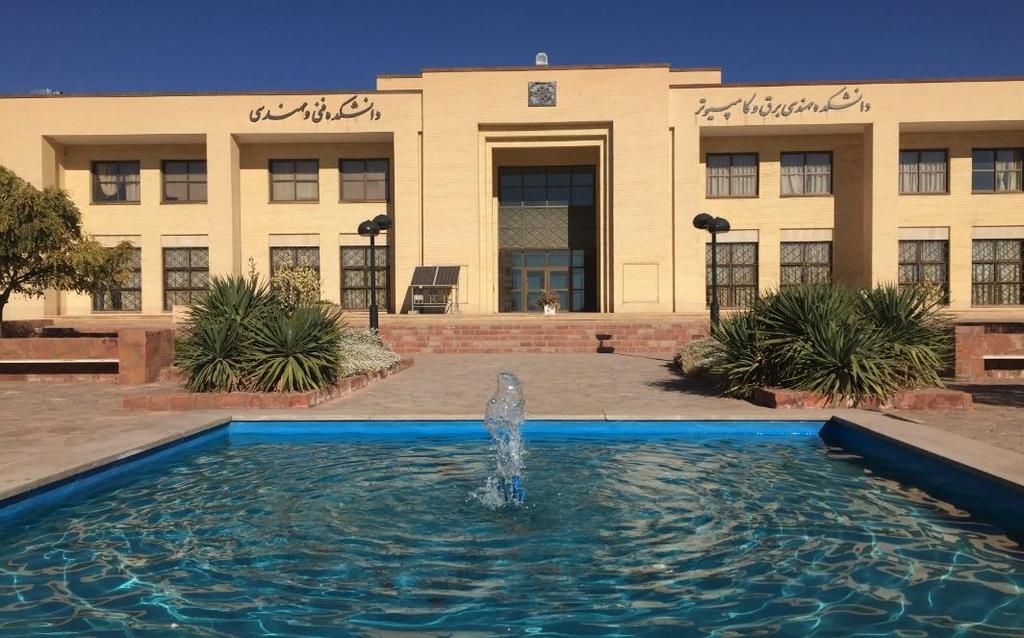
8 Spring in Hakim Sabzevari University 6

9 Sabzevar dams with tourism capability Introduction Today, the tourism industry is considered as an important part of the global economy. Among different types of tourism, nature tourism is an appropriate tool for achieving sustainable tourism. Ecotourism or tourism in nature is one of the most important types of tourism that has the most compatibility with development. Currently, most countries in the world are in a close competition, seeking to capitalize on their country's capabilities in order to attract more share of the income of the tourism industry. If ecotourism and tourism in nature are properly planned and managed, it can stimulate a developed process to achieve sustainable development in less developed areas. In the area of the dam and the lake behind them, there are areas that, in addition to having ecological values, have the potential to exploit the land for ecotourism. Dams tourism capability In addition to be considered as the most important sources of water and energy supply, dams also have high capacity for the development of the tourism industry. The natural scenery of the margin of the lake behind the dam on the one hand and the huge construction projects on the other hand provides many attractions for tourists. In many countries, the dams and lakes behind them are considered to be the most important tourist hubs and attract thousands of passengers annually. (e.g. Hoover dam in United States and Aswan in Egypt). Fig.1. Hoover dam 7


10 Fig.2. Aswan dam There are also large dams in Iran for example Karkheh, Karun 3, Masjed Soleiman, Shahid Rajai, Kowsar and Doosti. These dams with the large lakes that have been formed behind them are effective in creating the pleasant climate of the region. Fig.3. Karkheh dam 8

11 Fig.4. Karun 3 In general, dams can attract tourists in the following cases: 1- Water sports including water skiing and boating 2- Aquaculture for the development of fishing 3- The use of the main structures of the dam to visit domestic and foreign citizens 4- Holding scientific and technical tours in the fields of electricity, civil engineering and environment for experts, professors and students One of the main goals of the construction of all dams is tourism development. In this report, we introduce the features and objectives of construction of the most important dams in Sabzevar. 9
12 Dam name Type Height from the river Crest length Crest width Reservoir volume Construction purposes 1. Flood control Sangerd Rockfill dam million cubic 2. Aquaculture and tourism development Komayestan Gravity dam million cubic 1. Creation a recreational and tourism center 2. Aquaculture 1. Providing water for agriculture Yam Embankment dam million cubic 2. Creation a recreational center Table 1. Specifications of Sabzevar dam 10


13 Fig.5. Sangerd dam Fig.6. Komayestan dam 11
.")
14 Fig.7. Yam dam Conclusion The topic of tourism in the dam and the lake behind it, in Iran, is a new topic that has been very limited in recent years. While over hundreds of dams in Iran have been constructed by domestic and foreign consultants and engineers for different purposes (electricity supply and urban drinking water). But so far, there has not been a proper plan for using these dams as recreational and tourist destinations. Therefore, planning authorities for sustainable use of dams and lakes behind dams for tourism should be based on the potential of the dam and the lake behind dam. 12
15 References 1- Arenillas, Miguel; Castillo, Juan C. (2003). "Dams from the Roman Era in Spain. Analysis of Design Forms (with Appendix)". 1st International Congress on Construction History [20th 24th January]. Madrid 2- "Hoover Dam". National Historic Landmark summary listing 3- Rogers, J. David (September 22, 2005). "Hoover Dam: Grout Curtain Failure and Lessons Learned in Site Characterization 4-Egyptian Drainage Research Institute, DRI, yearbook 1995/ "Hydro-iran". Industcards.com. Retrieved 3 September Written by: Naser Nikmaram 13
Climate also has a large influence on how local ecosystems have evolved and how we interact with them.
 The Mississippi River in a Changing Climate By Paul Lehman, P.Eng., General Manager Mississippi Valley Conservation (This article originally appeared in the Mississippi Lakes Association s 212 Mississippi
Description DESCRIPTION
 DESCRIPTION The location of the Upper James Watershed is located in northeastern South Dakota as well as southeastern North Dakota. It includes the following counties located in North Dakota Barnes, Dickey,
MONITORING OF SURFACE WATER RESOURCES IN THE MINAB PLAIN BY USING THE STANDARDIZED PRECIPITATION INDEX (SPI) AND THE MARKOF CHAIN MODEL
 AND THE MARKOF CHAIN MODEL") MONITORING OF SURFACE WATER RESOURCES IN THE MINAB PLAIN BY USING THE STANDARDIZED PRECIPITATION INDEX (SPI) AND THE MARKOF CHAIN MODEL Bahari Meymandi.A Department of Hydraulic Structures, college of
MONITORING OF SURFACE WATER RESOURCES IN THE MINAB PLAIN BY USING THE STANDARDIZED PRECIPITATION INDEX (SPI) AND THE MARKOF CHAIN MODEL Bahari Meymandi.A Department of Hydraulic Structures, college of
GEOGRAPHY PAPER 312/ 1 K.C.S.E 1997 SECTION A Answer all the questions in this section.
 GEOGRAPHY PAPER 312/ 1 K.C.S.E 1997 SECTION A Answer all the questions in this section. 1. The diagram below shows the structure of the earth. Name the parts marked p, q and R Name the minerals that make
In the space provided, write the letter of the description that best matches the term or phrase. a. any form of water that falls to Earth s
 Skills Worksheet Concept Review In the space provided, write the letter of the description that best matches the term or phrase. 1. condensation 2. floodplain 3. watershed 4. tributary 5. evapotranspiration
Time allowed: 1 hour 30 minutes
 SPECIMEN ASSESSMENT MATERIAL GCSE GEOGRAPHY Paper 1 Living with the physical environment Specimen Materials For this paper you must have: a pencil a ruler. Time allowed: 1 hour 30 minutes Instructions
Temporal and Spatial Distribution of Tourism Climate Comfort in Isfahan Province
 2011 2nd International Conference on Business, Economics and Tourism Management IPEDR vol.24 (2011) (2011) IACSIT Press, Singapore Temporal and Spatial Distribution of Tourism Climate Comfort in Isfahan
Subject Area: Geography
 Long Term Planning Overview Key Stage 3 Subject Area: Geography Academic : 08-9 7 Assessment Your Island Home the physical and human geography of the UK and will investigate weather patterns, population
netw rks Guided Reading Activity Essential Question: How does geography influence the way people live? Earth's Physical Geography
 Guided Reading Activity Lesson 1 Earth and the Sun Essential Question: How does geography influence the way people live? Looking at Earth Directions: What are the layers that make up Earth? Use your textbook
SPECIFIC DEGRADATION AND RESERVOIR SEDIMENTATION. By Renee Vandermause & Chun-Yao Yang
 SPECIFIC DEGRADATION AND RESERVOIR SEDIMENTATION By Renee Vandermause & Chun-Yao Yang Outline Sediment Degradation - Erosion vs Sediment Yield - Sediment Yield - Methods for estimation - Defining Sediment
Climatic Extreme Events over Iran: Observation and Future Projection
 3rd Meeting of COMSATS International Thematic Research Group on Climate Change and Environmental Protection (22nd January 2014, Islamabad, Pakistan) Climatic Extreme Events over Iran: Observation and Future
Case Study: Australia. LI: To understand urbanisation issues and management strategies in Australia
 Case Study: Australia LI: To understand urbanisation issues and management strategies in Australia Warm Up Match the place names to the map: Urbanisation In 1910, fewer than 40% of Australians lived in
About places and/or important events Landmarks Maps How the land is, hills or flat or mountain range Connected to maps World Different countries
 What do you think you know about geography? About places and/or important events Landmarks Maps How the land is, hills or flat or mountain range Connected to maps World Different countries What do you
Sec$on 1: Geography and Early China. How does China s geography affect the culture?
 Sec$on 1: Geography and Early China How does China s geography affect the culture? Con$nents of the World Label the continents. Where is China located? Where is China located? In your groups, begin filling
The Impact of Geography in South and East Asia
 The Impact of Geography in South and East Asia Gobi desert, Mongolia Essential Question: How does geography impact the distribution of population throughout South and East Asia? I CAN Explain how geography
Content Area: Social Studies Standard: 1. History Prepared Graduates: Develop an understanding of how people view, construct, and interpret history
 Standard: 1. History Develop an understanding of how people view, construct, and interpret history 1. Organize and sequence events to understand the concepts of chronology and cause and effect in the history
M14/3/GEOGR/SP2/ENG/TZ0/XX/Q GEOGRAPHY STANDARD LEVEL PAPER 2. Monday 19 May 2014 (morning) 1 hour 20 minutes INSTRUCTIONS TO CANDIDATES
 1 hour 20 minutes INSTRUCTIONS TO CANDIDATES") M14/3/GEOGR/SP2/ENG/TZ0/XX/Q 22145203 GEOGRAPHY STANDARD LEVEL PAPER 2 Monday 19 May 2014 (morning) 1 hour 20 minutes INSTRUCTIONS TO CANDIDATES Do not open this examination paper until instructed to do
M14/3/GEOGR/SP2/ENG/TZ0/XX/Q 22145203 GEOGRAPHY STANDARD LEVEL PAPER 2 Monday 19 May 2014 (morning) 1 hour 20 minutes INSTRUCTIONS TO CANDIDATES Do not open this examination paper until instructed to do
Iceland. 1. Warm up. A. Talk about the picture and read the essay. B. Discuss the questions about the essay.
 1. Warm up A. Talk about the picture and read the essay. Iceland My country, Iceland, is one of the most beautiful countries on Earth. It is an island country. It is located in Europe, in the North Atlantic
Chapter 11. Rivers: Shaping our landscape
 Chapter 11 Rivers: Shaping our landscape Learning outcomes In this presentation you will learn: Common terms associated with rivers About the three stages of a river About the processes of river erosion
4th Grade Social Studies First Nine Weeks
 4th Grade Social Studies First Nine Weeks Multiple Choice Identify the choice that best completes the statement or answers the question. 1 Name the mountains that are located in the eastern United States.
Optimized positioning for accommodation centers in GIS using AHP techniques; a case study: Hamedan city
 Journal of Tourism & Hospitality Research Islamic Azad University, Garmsar Branch Vol. 2, No. 2, Autumn 2012, Pp.19-29 Optimized positioning for accommodation in GIS using AHP techniques; a case study:
Sediment Deposition LET THE RIVER RUN T E A C H E R. Activity Overview. Activity at a Glance. Time Required. Level of Complexity.
 Activity at a Glance Grade: 6 9 Subject: Science Category: Physical Science, Earth Science Topic: Deposition, River Systems Time Required Two 45-minute periods Level of Complexity Medium Materials* TI-73
Why Geography Matters
 Why Geography Matters Vocabulary words geography relative location absolute location physical feature human feature region modify adapt cause effect geography: The study of the Earth s physical and human
A heat source is any device or natural body that supplies heat.
 Heat Source and Heat Sinks Heat Source: A heat source is any device or natural body that supplies heat. Examples of a heat source: The sun, gas stove, fire, volcano, hot spring, radiator, electric heater,
Factors Affecting Human Settlement
 Factors Affecting Human Settlement Physical Factors One of the most basic factors affecting settlement patterns is the physical geography of the land. Climate is key, because if a place is too dry, too
Climate. Annual Temperature (Last 30 Years) January Temperature. July Temperature. Average Precipitation (Last 30 Years)
 January Temperature. July Temperature. Average Precipitation (Last 30 Years)") Climate Annual Temperature (Last 30 Years) Average Annual High Temp. (F)70, (C)21 Average Annual Low Temp. (F)43, (C)6 January Temperature Average January High Temp. (F)48, (C)9 Average January Low Temp.
Climate Annual Temperature (Last 30 Years) Average Annual High Temp. (F)70, (C)21 Average Annual Low Temp. (F)43, (C)6 January Temperature Average January High Temp. (F)48, (C)9 Average January Low Temp.
MARS AREA SCHOOL DISTRICT CURRICULUM GRADE: Grade 4
 MARS AREA SCHOOL DISTRICT CURRICULUM GRADE: Grade 4 Course Title: Social Studies Brief Description Overview: Students will explore the history, geography, government, and economy of the United States with
Guided Reading Activity
 Guided Reading Activity Lesson 1 Physical Features Essential Question: How does geography influence the way people live? A Vast Land Directions: Read the lesson and use your text to decide whether each
The agroclimatic resource change in Mongolia
 The agroclimatic resource change in Mongolia Azzaya D, Gantsetseg B, Munkhzul D Institute of Meteorology and Hydrology,Juulchny gudamj-5, Ulaanbaatar-46, Mongolia, 210646, meteoins@magicnet.mn, azzaya23@yahoo.com
NATIONAL SENIOR CERTIFICATE GRADE 12
 NATIONAL SENIOR CERTIFICATE GRADE 12 GEOGRAPHY P1 FEBRUARY/MARCH 2015 MARKS: 225 TIME: 3 hours This question paper consists of 12 pages and an annexure of 12 pages. *GEOGE1* Geography/P1 2 INSTRUCTIONS
Monthly Long Range Weather Commentary Issued: SEPTEMBER 19, 2016 Steven A. Root, CCM, Chief Analytics Officer, Sr. VP,
 Monthly Long Range Weather Commentary Issued: SEPTEMBER 19, 2016 Steven A. Root, CCM, Chief Analytics Officer, Sr. VP, sroot@weatherbank.com SEPTEMBER 2016 Climate Highlights The Month in Review The contiguous
Ancient China UNIT 4 GEOGRAPHY CHALLENGE. 1 Unit 4 Geography Challenge. Teachers Curriculum Institute
 UNIT 4 GEOGRAPHY CHALLENGE Ancient China N W E S 0 250 500 miles 0 250 500 kilometers Albers Conic Equal-Area Projection AW_ISN_U04_01 Ancient China Second Proof TCI18 108 1 Unit 4 Geography Challenge
Cambridge International Examinations Cambridge International General Certificate of Secondary Education
 Cambridge International Examinations Cambridge International General Certificate of Secondary Education *3123242964* GEOGRAPHY 0460/22 Paper 2 October/November 2014 Candidates answer on the Question Paper.
Explain the impact of location, climate, natural resources, and population distribution on Europe. a. Compare how the location, climate, and natural
 SS6G10 Explain the impact of location, climate, natural resources, and population distribution on Europe. a. Compare how the location, climate, and natural resources of Germany, the United Kingdom and
Hydrologic Forecast Centre Manitoba Infrastructure, Winnipeg, Manitoba. FEBRUARY OUTLOOK REPORT FOR MANITOBA February 23, 2018
 Page 1 of 17 Hydrologic Forecast Centre Manitoba Infrastructure, Winnipeg, Manitoba FEBRUARY OUTLOOK REPORT FOR MANITOBA February 23, 2018 Overview The February Outlook Report prepared by the Hydrologic
3) What is the difference between latitude and longitude and what is their affect on local and world weather and climate?
 What is the difference between latitude and longitude and what is their affect on local and world weather and climate?") www.discoveryeducation.com 1) Describe the difference between climate and weather citing an example of each. Describe how water (ocean, lake, river) has a local effect on weather and climate and provide
www.discoveryeducation.com 1) Describe the difference between climate and weather citing an example of each. Describe how water (ocean, lake, river) has a local effect on weather and climate and provide
The Five Themes of Geography How Do We View the World Around Us?
 The Five Themes of Geography How Do We View the World Around Us? By Nicole Copeland What is Geography? Geography is the study of the earth''s surface; includes people''s responses to topography and climate
UNIVERSITY OF CAMBRIDGE INTERNATIONAL EXAMINATIONS International General Certificate of Secondary Education
 UNIVERSITY OF CAMBRIDGE INTERNATIONAL EXAMINATIONS International General Certificate of Secondary Education * 6 2 6909951 3 * GEOGRAPHY 0460/22 Paper 2 May/June 2010 Candidates answer on the Question Paper.
NIDIS Intermountain West Drought Early Warning System December 30, 2018
 1/2/2019 NIDIS Drought and Water Assessment NIDIS Intermountain West Drought Early Warning System December 30, 2018 Precipitation The images above use daily precipitation statistics from NWS COOP, CoCoRaHS,
Seasonal Climate Watch January to May 2016
 Seasonal Climate Watch January to May 2016 Date: Dec 17, 2015 1. Advisory Most models are showing the continuation of a strong El-Niño episode towards the latesummer season with the expectation to start
Ms. Latoya Regis. Meteorologist Hydrometeorological Service, Guyana
 Ms. Latoya Regis Meteorologist Hydrometeorological Service, Guyana Background Ninety percent (90%) of Guyana s population resides along the (Atlantic) Coast, which is below mean sea level and accounts
This table connects the content provided by Education Perfect to the NSW Syllabus.
 Education Perfect Geography provides teachers with a wide range of quality, engaging and innovative content to drive positive student learning outcomes. Designed by teachers and written by our in-house
NIDIS Intermountain West Regional Drought Early Warning System February 7, 2017
 NIDIS Drought and Water Assessment NIDIS Intermountain West Regional Drought Early Warning System February 7, 2017 Precipitation The images above use daily precipitation statistics from NWS COOP, CoCoRaHS,
4.3 Climate (6.3.3) Explore this Phenomena. The same sun shines on the entire Earth. Explain why these two areas have such different climates.
 Explore this Phenomena. The same sun shines on the entire Earth. Explain why these two areas have such different climates.") Explore this Phenomena The same sun shines on the entire Earth. 4.3 Climate (6.3.3) Explain why these two areas have such different climates. 89 6.3.3 Climate Develop and use a model to show how unequal
Explore this Phenomena The same sun shines on the entire Earth. 4.3 Climate (6.3.3) Explain why these two areas have such different climates. 89 6.3.3 Climate Develop and use a model to show how unequal
Canada s Natural Systems. Canadian Geography 1202 September/October 2014
 Canada s Natural Systems Canadian Geography 1202 September/October 2014 Canada s Natural Systems Natural System: A system found in nature Here are the four natural systems that we will explore in the next
Witchampton CofE First School Geography Curriculum Map
 2016-2017 Autumn People and : 30-50 Show interest in the lives of people who are familiar to them. Shows interest in different occupations. Remembers and talks significant events in their own experience.
What is the largest country in the world? Russia
 What is the largest country in the world? #1 Russia CSCOPE 2007 2 Russia Dimensions #2-3 Spans 11 Time Zones From East to West: Gulf of Finland to Alaska From North to South: Above the Arctic Circle to
EQ: Discuss main geographic landforms of the U.S. & Canada and examine varied landforms in relation to their lifestyles.
 EQ: Discuss main geographic landforms of the U.S. & Canada and examine varied landforms in relation to their lifestyles. Places & Terms for Discussion Appalachian Mountains Great Plains Canadian Shield
The Impact of Geography in South and East Asia
 The Impact of Geography in South and East Asia Gobi desert, Mongolia Essential Question: How does the geography of SE Asia impact trade and the distribution of population throughout the region? (AKS #52a)
Written by Vowery Dodd Carlile and Traci Burnett Illustrated by Karen Birchak
 Written by Vowery Dodd Carlile and Traci Burnett Illustrated by Karen Birchak Table of Contents INTRODUCTION...5 TO THE TEACHER...6 STORIES ABOUT TEXAS: Background, Vocabulary Activities, Discussion Questions,
Flash Flood Guidance System On-going Enhancements
 Flash Flood Guidance System On-going Enhancements Hydrologic Research Center, USA Technical Developer SAOFFG Steering Committee Meeting 1 10-12 July 2017 Jakarta, INDONESIA Theresa M. Modrick Hansen, PhD
Weather and Climate Summary and Forecast Winter
 Weather and Climate Summary and Forecast Winter 2016-17 Gregory V. Jones Southern Oregon University February 7, 2017 What a difference from last year at this time. Temperatures in January and February
1- Water on Earth 2- Oceans and seas / continental waters 3- Uses, risks and problems of water
 Contents: I- Relief 1- Structure of the Earth and relief formation 2- Shaping of relief 3- Types of relief II- Water 1- Water on Earth 2- Oceans and seas / continental waters 3- Uses, risks and problems
1.Introduction 2.Relocation Information 3.Tourism 4.Population & Demographics 5.Education 6.Employment & Income 7.City Fees & Taxes 8.
 1.Introduction 2.Relocation Information 3.Tourism 4.Population & Demographics 5.Education 6.Employment & Income 7.City Fees & Taxes 8.Recreation & Activities 9.Climate Data 10.Economic Development History
Physical Geography: Patterns, Processes, and Interactions, Grade 11, University/College Expectations
 Geographic Foundations: Space and Systems SSV.01 explain major theories of the origin and internal structure of the earth; Page 1 SSV.02 demonstrate an understanding of the principal features of the earth
CLIMATE READY BOSTON. Climate Projections Consensus ADAPTED FROM THE BOSTON RESEARCH ADVISORY GROUP REPORT MAY 2016
 CLIMATE READY BOSTON Sasaki Steering Committee Meeting, March 28 nd, 2016 Climate Projections Consensus ADAPTED FROM THE BOSTON RESEARCH ADVISORY GROUP REPORT MAY 2016 WHAT S IN STORE FOR BOSTON S CLIMATE?
Activity 2.2: Recognizing Change (Observation vs. Inference)
") Activity 2.2: Recognizing Change (Observation vs. Inference) Teacher Notes: Evidence for Climate Change PowerPoint Slide 1 Slide 2 Introduction Image 1 (Namib Desert, Namibia) The sun is on the horizon
Activity 2.2: Recognizing Change (Observation vs. Inference) Teacher Notes: Evidence for Climate Change PowerPoint Slide 1 Slide 2 Introduction Image 1 (Namib Desert, Namibia) The sun is on the horizon
Grade 7 History Mr. Norton
 Grade 7 History Mr. Norton Section 1: Thinking Geographically Section 2: Land and Climates of the United States Section 3: The Tools of History Section 4: Economics and Other Social Sciences Grade 7 History
Optimal positioning of public parking by using Analytical Hierarchy Process (AHP) in geographic information system GIS. Case Study: Ramsar
 in geographic information system GIS. Case Study: Ramsar") 7 Optimal positioning of public parking by using Analytical Hierarchy Process (AHP) in geographic information system GIS. Case Study: Ramsar Dr Seyed Ali Hosseini 1 * Hossein Zeitooni 2 Received: 2017/07/12
7 Optimal positioning of public parking by using Analytical Hierarchy Process (AHP) in geographic information system GIS. Case Study: Ramsar Dr Seyed Ali Hosseini 1 * Hossein Zeitooni 2 Received: 2017/07/12
Investigation IV: Seasonal Precipitation and Seasonal Surface Runoff in the US
 Investigation IV: Seasonal Precipitation and Seasonal Surface Runoff in the US Purpose Students will consider the seasonality of precipitation and surface runoff and think about how the time of year can
Sedimentation in the Nile River
 Advanced Training Workshop on Reservoir Sedimentation Sedimentation in the Nile River Prof. Dr. Abdalla Abdelsalam Ahmed 10-16 Oct. 2007, IRTCES, Beijing, China CWR,Sudan 1 Water is essential for mankind
3/3/2013. The hydro cycle water returns from the sea. All "toilet to tap." Introduction to Environmental Geology, 5e
 Introduction to Environmental Geology, 5e Running Water: summary in haiku form Edward A. Keller Chapter 9 Rivers and Flooding Lecture Presentation prepared by X. Mara Chen, Salisbury University The hydro
EFFICIENCY OF THE INTEGRATED RESERVOIR OPERATION FOR FLOOD CONTROL IN THE UPPER TONE RIVER OF JAPAN CONSIDERING SPATIAL DISTRIBUTION OF RAINFALL
 EFFICIENCY OF THE INTEGRATED RESERVOIR OPERATION FOR FLOOD CONTROL IN THE UPPER TONE RIVER OF JAPAN CONSIDERING SPATIAL DISTRIBUTION OF RAINFALL Dawen YANG, Eik Chay LOW and Toshio KOIKE Department of
Geography Class XI Fundamentals of Physical Geography Section A Total Periods : 140 Total Marks : 70. Periods Topic Subject Matter Geographical Skills
 Geography Class XI Fundamentals of Physical Geography Section A Total Periods : 140 Total Marks : 70 Sr. No. 01 Periods Topic Subject Matter Geographical Skills Nature and Scope Definition, nature, i)
Flood management in Namibia: Hydrological linkage between the Kunene River and the Cuvelai Drainage System: Cuvelai-Etosha Basin
 Flood management in Namibia: Hydrological linkage between the Kunene River and the Cuvelai Drainage System: Cuvelai-Etosha Basin By: Leonard Hango Department of Water Affairs and Forestry Ministry of Agriculture
How Do the Great Lakes Affect Temperature?
 Temperature and Climate Activity 2 of Two How Do the Great Lakes Affect Temperature? In the activity "What happens to heat energy reaching the Great Lakes?" you learned that the pan of water was a good
Weather. A. atmosphere is a layer of gases that wrap around the Earth like a blanket.
 Weather I. The air around us A. atmosphere is a layer of gases that wrap around the Earth like a blanket. II. Weather Temperature Humidity Air pressure Wind 1. contains the air we breathe, protects us
Weather and Climate Summary and Forecast March 2018 Report
 Weather and Climate Summary and Forecast March 2018 Report Gregory V. Jones Linfield College March 7, 2018 Summary: The ridge pattern that brought drier and warmer conditions from December through most
(Country Report) Saudi Arabia
 Saudi Arabia") The 5th Meeting of the Coordinating Group of the RA II WIGOS Satellite Project 21 October, Vladivostok city, Russky Island, Russia Far Eastern Federal University (Country Report) Saudi Arabia General Authority
The 5th Meeting of the Coordinating Group of the RA II WIGOS Satellite Project 21 October, Vladivostok city, Russky Island, Russia Far Eastern Federal University (Country Report) Saudi Arabia General Authority
Earth Science Lesson Plan Quarter 2, Week 6, Day 1
 Earth Science Lesson Plan Quarter 2, Week 6, Day 1 1 Outcomes for Today Standard Focus: Earth Sciences 5.f students know the interaction of wind patterns, ocean currents, and mountain ranges results in
Ecological Context - Urban settlements are part of their surrounding ecosystem. Austin
 Ecological Context - Urban settlements are part of their surrounding ecosystem Austin Ecotone Division between West and East Flyway Uplift River Balcones Escarpment Central Texas Climate The principal
An investigation on the impacts of density currents on the sedimentation in dam reservoirs using TCM model; case study: Maroon dam
 University of Wollongong Research Online Faculty of Engineering and Information Sciences - Papers: Part A Faculty of Engineering and Information Sciences 2013 An investigation on the impacts of density
COURSE OUTLINE. GEO 101 Geography 3 Course Number Course Title Credits. Reference Liberal Arts Division Book List
 MERCER COUNTY COMMUNITY COLLEGE LIBERAL ARTS DIVISION COURSE OUTLINE GEO 101 Geography 3 Course Number Course Title Credits Required Materials: Catalog Description: Reference Liberal Arts Division Book
Long-Term Trend of Summer Rainfall at Selected Stations in the Republic of Korea
 Long-Term Trend of Summer Rainfall at Selected Stations in the Republic of Korea Il-Kon Kim Professor, Department of Region Information Rafique Ahmed Professor, Geography and Earth Science Silla University
A Living Planet. Chapter PHYSICAL GEOGRAPHY. What you will learn in this chapter. Summary of the chapter
 QUIT Main Ideas What you will learn in this chapter Summary Summary of the chapter Test your geographic knowledge by playing the. Main Ideas Section 1: The Earth Inside and Out The earth is the only habitable
Ancient China. Teachers Curriculum Institute Geography and the Early Settlement of China 1. AW_ISN_U04_01 Ancient China Second Proof TCI18 108
 G e o g r a p h y C h a l l e n g e Ancient China N W E S 0 250 500 miles 0 250 500 kilometers Albers Conic Equal-Area Projection AW_ISN_U04_01 Ancient China Second Proof TCI18 108 Teachers Curriculum
Evaluating Wildlife Habitats
 Lesson C5 4 Evaluating Wildlife Habitats Unit C. Animal Wildlife Management Problem Area 5. Game Animals Management Lesson 4. Evaluating Wildlife Habitats New Mexico Content Standard: Pathway Strand: Natural
Hydrologic Forecast Centre Manitoba Infrastructure, Winnipeg, Manitoba. MARCH OUTLOOK REPORT FOR MANITOBA March 23, 2018
 Page 1 of 21 Hydrologic Forecast Centre Manitoba Infrastructure, Winnipeg, Manitoba MARCH OUTLOOK REPORT FOR MANITOBA March 23, 2018 Overview The March Outlook Report prepared by the Hydrologic Forecast
8.E.1.1 Notes.notebook. November 02, 2014
 Unit 2 Hydrosphere 8.E.1.1 Structure of the Hydrosphere Water is the only substance on Earth that occurs naturally as a solid, a liquid, and a gas. Water covers 71% of Earth's surface! 97% of water on
A MODEL FOR RISES AND DOWNS OF THE GREATEST LAKE ON EARTH
 A MODEL FOR RISES AND DOWNS OF THE GREATEST LAKE ON EARTH Parviz Tarikhi Iranian Remote Sensing Center, Iran May 2005 1 Figure 1: West of Novshahr in the Iranian coast of Caspian; the dam constructed to
Passwords. Social Studies Vocabulary. Texas: Grade 7
 Passwords Social Studies Vocabulary Texas: Grade 7 To the Student What is federalism? How are independence and interdependence different? What does an anthropologist do? Passwords: Social Studies Vocabulary
Grade 8 Science. Unit 1: Water Systems on Earth Chapter 1
 Grade 8 Science Unit 1: Water Systems on Earth Chapter 1 Effects of Water? Churchill River Large Ocean Wave How do you use water? House Hold Use Personal Use Recreational Activities Water Distribution
What landforms make up Australia?!
 What landforms make up Australia? The tectonic forces of folding, faulting and volcanic activity have created many of Australia's major landforms. Other forces that work on the surface of Australia, and
Executive Summary. Water Quantity
 Executive Summary Stakeholders in the Rock-Glade Watershed have taken the initiative to proceed with watershed planning as provided by the State of Washington under the Watershed Management Act (Chapter
Natural Texas. Regions and Climates
 Natural Texas Regions and Climates Two Kinds: Physical geography Climate, vegetation, rivers, lakes, oceans, plateaus, plains, and mountain ranges Human geography Economic activities How we earn a living
Weather and Climate Summary and Forecast January 2019 Report
 Weather and Climate Summary and Forecast January 2019 Report Gregory V. Jones Linfield College January 4, 2019 Summary: December was mild and dry over much of the west, while the east was much warmer than
The Impact of Geography in South and East Asia
 The Impact of Geography in South and East Asia Gobi desert, Mongolia Essential Question: How does the geography of SE Asia impact trade and the distribution of population throughout the region? (AKS #52a)
THE CANADIAN CENTRE FOR CLIMATE MODELLING AND ANALYSIS
 THE CANADIAN CENTRE FOR CLIMATE MODELLING AND ANALYSIS As Canada s climate changes, and weather patterns shift, Canadian climate models provide guidance in an uncertain future. CANADA S CLIMATE IS CHANGING
2015 Fall Conditions Report
 2015 Fall Conditions Report Prepared by: Hydrologic Forecast Centre Date: December 21 st, 2015 Table of Contents Table of Figures... ii EXECUTIVE SUMMARY... 1 BACKGROUND... 2 SUMMER AND FALL PRECIPITATION...
investment decisions
 Climate modelling: A guide to investment decisions Vicky Pope Met Office Hadley Centre This is not an ADB material. The views expressed in this document are the views of the author/s and/or their organizations
INVESTIGATING CLIMATE CHANGE IMPACTS ON SURFACE SOIL PROFILE TEMPERATURE (CASE STUDY: AHWAZ SW OF IRAN)
") INVESTIGATING CLIMATE CHANGE IMPACTS ON SURFACE SOIL PROFILE TEMPERATURE (CASE STUDY: AHWAZ SW OF IRAN) Kazem Hemmadi 1, Fatemeh Zakerihosseini 2 ABSTRACT In arid and semi-arid regions, warming of soil
INVESTIGATING CLIMATE CHANGE IMPACTS ON SURFACE SOIL PROFILE TEMPERATURE (CASE STUDY: AHWAZ SW OF IRAN) Kazem Hemmadi 1, Fatemeh Zakerihosseini 2 ABSTRACT In arid and semi-arid regions, warming of soil
Graduate Courses Meteorology / Atmospheric Science UNC Charlotte
 Graduate Courses Meteorology / Atmospheric Science UNC Charlotte In order to inform prospective M.S. Earth Science students as to what graduate-level courses are offered across the broad disciplines of
Geography and the Early Settlement of China
 Geography and the Early Settlement of I N T E R A C T I V E S T U D E N T N O T E B O O K How did geography affect life in ancient? P R E V I E W Physical Features 1. Circle the physical features that
PREDICTING DROUGHT VULNERABILITY IN THE MEDITERRANEAN
 J.7 PREDICTING DROUGHT VULNERABILITY IN THE MEDITERRANEAN J. P. Palutikof and T. Holt Climatic Research Unit, University of East Anglia, Norwich, UK. INTRODUCTION Mediterranean water resources are under
NIDIS Intermountain West Drought Early Warning System September 4, 2018
 NIDIS Drought and Water Assessment NIDIS Intermountain West Drought Early Warning System September 4, 2018 Precipitation The images above use daily precipitation statistics from NWS COOP, CoCoRaHS, and
Application of Satellite Data for Flood Forecasting and Early Warning in the Mekong River Basin in South-east Asia
 MEKONG RIVER COMMISSION Vientiane, Lao PDR Application of Satellite Data for Flood Forecasting and Early Warning in the Mekong River Basin in South-east Asia 4 th World Water Forum March 2006 Mexico City,
Department of Geography: Vivekananda College for Women. Barisha, Kolkata-8. Syllabus of Post graduate Course in Geography
 India: Regional Problems and Resource management Module 11 (Full Marks 50) Unit I: Region and Regionalisation 1.1 Various bases of regionalisation of India; problems of identification and delineation.
Geography Long Term Plan. Autumn Spring Summer
 Geography Long Term Plan Autumn Spring Summer Year 1 Working Scientifically covered throughout the year Location Geography of UK Name, locate and identify characteristics of the four countries and capital
Flash flood disaster in Bayangol district, Ulaanbaatar
 Flash flood disaster in Bayangol district, Ulaanbaatar Advanced Training Workshop on Reservoir Sedimentation Management 10-16 October 2007. IRTCES, Beijing China Janchivdorj.L, Institute of Geoecology,MAS
A nalysis and Estimation of Tourism Climatic Index (TCI) and Temperature-Humidity Index (THI) in Dezfoul
 and Temperature-Humidity Index (THI) in Dezfoul") 2015 4th International Conference on Environmental, Energy and Biotechnology Volume 85 of IPCBEE (2015) DOI:10.7763/IPCBEE. 2015. V85. 6 A nalysis and Estimation of Tourism Climatic Index (TCI) and Temperature-Humidity
2015 4th International Conference on Environmental, Energy and Biotechnology Volume 85 of IPCBEE (2015) DOI:10.7763/IPCBEE. 2015. V85. 6 A nalysis and Estimation of Tourism Climatic Index (TCI) and Temperature-Humidity