National Seismological Centre: An Overview, Prospects and Challenges
|
|
|
- Benjamin Gregory
- 5 years ago
- Views:
Transcription
1 National Seismological Centre: An Overview, Prospects and Challenges By Soma Nath Sapkota Department of Mines and Geology National Seismological Centre Nepal
2 India Himalaya Tibetan Plateau India continental t convergence 1.8 m/century
3 India Himalaya Tibetan Plateau India continental t convergence 1.8 m/century
4 critical stress India Himalaya Tibetan Plateau India continental t convergence 1.8 m/century
5 India great earthquake 4-10 m Himalaya Tibetan Plateau time since last earthquake is a measure of size of next earthquake
6 About 50 million people living in Ganges plain are at risk from impending great Himalayan earthquakes, However, Surface rupture of most of the past earthquake are not found Return R t period undetermined d
7 Activities ities of NSC Monitoring of Earthquake Crustal Deformation Monitoring Paleoseismology Precursor Monitoring Preparation of Seismic Hazard and Risk Map Public Awareness for Teachers, Technical Personnel & Engineers
8 Our International national Collaborators ato 1. DASE (Departmment, Analyse Surveillance, Environnment ( Since 1978 ) 2. California Institute of Technology USA since 2001 Monitoring crustal deformation by establishing a network of GPS stations in collaboration with DASE. 3. IPGP ( Istitut de Physique du Globe de Paris, France ) 4. JICA ( Providing training for NSC/DMG staffs)
9 Objectives of National Seismological Centre Acquire seismic data by operating seismological network with high level of efficiency and provide the earthquake information to Home Ministry and other media to conduct search and rescue work immediately in case of potentially destructive ti earthquakes through h the seismic i alert system installed with in the system in NSC lab. Evaluation of seismic hazard of the country using the seismic data and other available geophysical, geological and geodetic data. Provide seismic bulletins to NEIC, ISC, USGS and contribute towards global seismological research. Conduct basic and applied research in the field of earthquakes in collaboration with various international and national scientific institution to mitigate the seismic hazard in the Himalayan region.
10 National Seismological Network

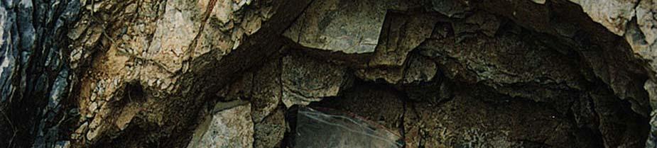
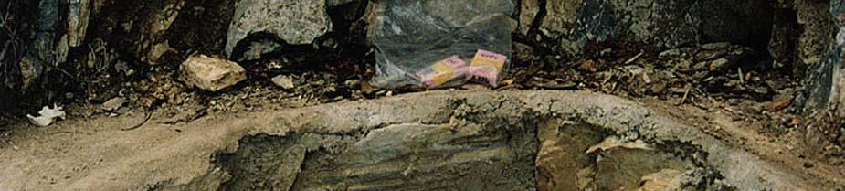
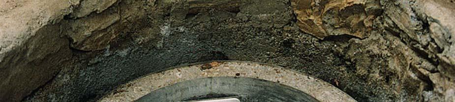
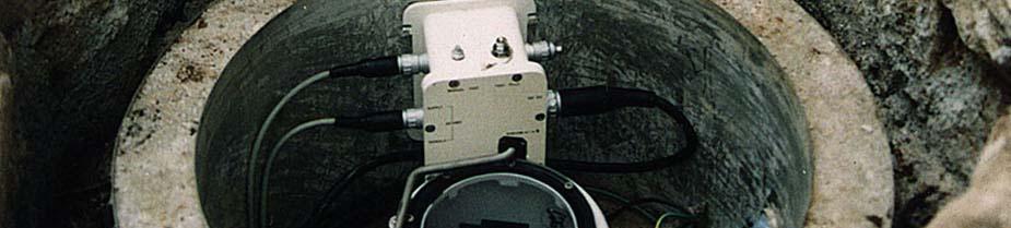

11 Seismic Vault
12
13
14 NSC Informs When It Detects>4.0 mag earthquake Earthquake >4.0 (Ml) Automatic Phone Call to Responsible Person Processing of the Earthquake data Localization of the Earthquake (20Minutes) Fax+Phone+website update Release of the Earthquake information to Radio, RSS, TVs, Home ministry and on official website
15 Press Released Eveents from 1994 to 2006
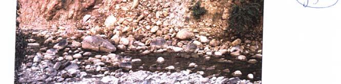
16
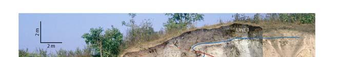
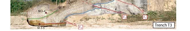
17 Original model: Seeber and Armbruster, 1981 Contours of microseismicity: Pandey et al., 1995
18 Purposed Accelerometer stations with historical earthquakes in background
19 Seismic and accelerometric network NSC seismic network 21 short period velocimetric i stations ti (1 component z) Allow deriving accelerations for most earthquakes recorded in Nepal, a necessary input to SHA model Stations in acquisition Pending installations Need for accelerometric stations Because the dynamic of the velocimetric station is not enough to cover the whole range from very small to large earthquakes es at short distances Accelerometric stations will therefore complement the existing seismic network: Since 2009, 3 stations are in acquisition in KKN, DMG, PKR
20
21 Locked Fault Zone (Bettinelli et al, 2006) The GPS data indicate that the MHT is Locked at depth less than about 20km and is creeping at about 20mm/yr below the high range and southern Tibet
22 Precursor Monitoring Radon Gas Monitoring
23 Sir Khola natural exposure dating Radiocarbon Dating from 2008 and 2009 work
24 Charnath Megatrench preliminary field interpretation Central part of East Wall W E F3
25 Charnath Megatrench preliminary field interpretation Northern part of East Wall W E F1 Boulder Bed F2


26
27
28 Future Prospects and Challenges 1. We have collected handful data from numbers of collaborative projects, we are in the process of extracting the necessary information from those data to address seismic hazard of the region. 2. DMG is a government organization and we are committed to provide the seismic Hazard and risk map of the country and microzonation study of big cities like Kathmandu, part of our research activities should focus in this direction. 3. For precise localisation of the earthquake we need to deploy some temporary stations in the north of microseismicity belt so that we could constrain the depth. 4. We have conducted many collaborative research in central Nepal section similar types of research should be conducted in western and far western Nepal (so called seismic gap) contd
29 Conclusion National Seismological Centre is emerging as a research centre for earthquake studies in this region Active tectonics and Structure of the crust and upper mantle across the central Nepal has been investigated with varieties of techniques. To quantify the seismic gap between 1934 and 1905 Earthquake our research activities i i should be focused in that area i.e. Western and Far-Western area. Segmentation of Himalayan arc, source delineation and attenuation factors should be developed and refined with new data set Scientific collaboration with other scientific institutions should also focus on applied issues like preparation of deterministic seismic hazard map of the country, microzonation studies of big cities of Nepal.
30
Widespread Ground Motion Distribution Caused by Rupture Directivity during the 2015 Gorkha, Nepal Earthquake
 Widespread Ground Motion Distribution Caused by Rupture Directivity during the 2015 Gorkha, Nepal Earthquake Kazuki Koketsu 1, Hiroe Miyake 2, Srinagesh Davuluri 3 and Soma Nath Sapkota 4 1. Corresponding
EARTHQUAKE HAZARD ASSESSMENT IN KAZAKHSTAN
 EARTHQUAKE HAZARD ASSESSMENT IN KAZAKHSTAN Dr Ilaria Mosca 1 and Dr Natalya Silacheva 2 1 British Geological Survey, Edinburgh (UK) imosca@nerc.ac.uk 2 Institute of Seismology, Almaty (Kazakhstan) silacheva_nat@mail.ru
A BROADBAND SEISMIC EXPERIMENT IN YUNNAN, SOUTHWEST CHINA. Sponsored by Defense Threat Reduction Agency. Contract No.
 A BROADBAND SEISMIC EXPERIMENT IN YUNNAN, SOUTHWEST CHINA Wenjie Jiao, 1 Winston Chan, 1 and Chunyong Wang 2 Multimax Inc., 1 Institute of Geophysics, China Seismological Bureau 2 Sponsored by Defense
Haiti: Earthquake on January 12, 2010
 Geophysical Hazards and Plate Boundary Processes In Central America, Mexico and the Caribbean Haiti: Earthquake on January 12, 2010 Situation, achievements and perspective. Hotel La Condesa, Costa Rica
Global Death and Construction: Earthquakes on an Urban Planet
 # 24 Global Death and Construction: Earthquakes on an Urban Planet Dr. Roger Bilham March 21, 2003 Produced by and for Hot Science - Cool Talks by the Environmental Science Institute. We request that the
Magnitude 7.3 NEPAL. Tuesday, May 12, 2015 at 07:05:19 UTC
 A magnitude 7.3 earthquake has occurred near Mount Everest. Early reports suggest 32 people have been killed and at least 1,000 were injured in the earthquake. The region is still in recovery from a 7.8
Earthquakes. Earthquake Magnitudes 10/1/2013. Environmental Geology Chapter 8 Earthquakes and Related Phenomena
 Environmental Geology Chapter 8 Earthquakes and Related Phenomena Fall 2013 Northridge 1994 Kobe 1995 Mexico City 1985 China 2008 Earthquakes Earthquake Magnitudes Earthquake Magnitudes Richter Magnitude
Deformation of Rocks. Orientation of Deformed Rocks
 Deformation of Rocks Folds and faults are geologic structures caused by deformation. Structural geology is the study of the deformation of rocks and its effects. Fig. 7.1 Orientation of Deformed Rocks
Lab 9: Satellite Geodesy (35 points)
") Lab 9: Satellite Geodesy (35 points) Here you will work with GPS Time Series data to explore plate motion and deformation in California. This lab modifies an exercise found here: http://www.unavco.org:8080/cws/pbonucleus/draftresources/sanandreas/
Lab 9: Satellite Geodesy (35 points) Here you will work with GPS Time Series data to explore plate motion and deformation in California. This lab modifies an exercise found here: http://www.unavco.org:8080/cws/pbonucleus/draftresources/sanandreas/
SEISMIC VELOCITY STRUCTURE OF THE NORTHWESTERN & NORTHEASTERN HIMALAYA AND ITS IMPLICATIONS FOR EARTHQUAKE HAZARD ASSESSMENT
 SEISMIC VELOCITY STRUCTURE OF THE NORTHWESTERN & NORTHEASTERN HIMALAYA AND ITS IMPLICATIONS FOR EARTHQUAKE HAZARD ASSESSMENT UKIERI Thematic Partnership Supriyo Mitra Keith Priestley Motivation ~50 Ma
Probabilistic Seismic Hazard Analysis of Nepal considering Uniform Density Model
 Proceedings of IOE Graduate Conference, 2016 pp. 115 122 Probabilistic Seismic Hazard Analysis of Nepal considering Uniform Density Model Sunita Ghimire 1, Hari Ram Parajuli 2 1 Department of Civil Engineering,
TEGAM s Connection to the EarthScope Project
 TEGAM s Connection to the EarthScope Project Introduction The EarthScope Project is an undertaking funded by the National Science Foundation in partnership with the United States Geological Survey and
Current Seismic Hazard Assessment and Creation of Early Warning System in the Republic of Armenia
 Current Seismic Hazard Assessment and Creation of Early Warning System in the Republic of Armenia Dr. Alvaro Antonyan, Dr. Valeri Arzumanyan National Survey for Seismic Protection Agency (NSSP) Ministry
Usually, only a couple of centuries of earthquake data is available, much shorter than the complete seismic cycle for most plate motions.
 Earthquake Hazard Analysis estimate the hazard presented by earthquakes in a given region Hazard analysis is related to long term prediction and provides a basis to expressed hazard in probabilistic terms.
From Earthquakes to Mountains: the Earth s Crust in Motion
 Dean s Freshman Honor Seminar (SCI 110) Eric Calais Associate Professor of Geophysics Purdue University Department of Earth and Atmospheric Sciences ecalais@purdue.edu http:/www.eas.purdue.edu/~calais
SONGS SSC. Tom Freeman GeoPentech PRELIMINARY RESULTS
 SONGS SSC Tom Freeman GeoPentech PRELIMINARY RESULTS Focused Questions Summarize the tectonic setting What is the seismogenic thickness? Are you including deep ruptures in the upper mantle (~30 km)? Do
Magnitude 7.5 PALU, INDONESIA
 A magnitude 7.5 earthquake occurred 80.8 km (50.2 mi) north of Palu, Indonesia at a depth of 10 km (6.2 miles). This earthquake triggered a tsunami with wave heights up to 2 m (6.6 ft) that an official
The Earthquake of Padang, Sumatra of 30 September 2009 scientific information and update
 The Earthquake of Padang, Sumatra of 30 September 2009 scientific information and update 01-October-2009 Christophe Vigny Directeur de recherches at CNRS Laboratoire de Géologie Geoscience Dept. Of ENS,
Tsunami Response and the Enhance PTWC Alerts
 Tsunami Response and the Enhance PTWC Alerts Ken Gledhill GeoNet Project Director Chair, Intergovernmental Coordination Group, Pacific Tsunami Warning and Mitigation System (PTWS) Overview 1. Procedures
crustal structure experiment beneath Wairarapa - Wellington area: results from SAHKE
 crustal structure experiment beneath Wairarapa - Wellington area: results from SAHKE Tim Stern and SAHKE team* * VUW, GNS, University of Southern California, University of Tokyo(Japan) SAHKE = Seismic
NATIONAL SEISMIC NETWORKS OF TURKEY
 Ministry of Public Works and Settlement General Directorate of Disaster Affairs EARTHQUAKE RESEARCH DEPARMENT (GDDA- ERD) NATIONAL SEISMIC NETWORKS OF TURKEY RELEMR WORKSHOP İSTANBUL - 2008 Sami ZÜNBÜL
Research on the Spatial Distribution Characteristics of b-value in Southwest Yunnan
 International Symposium on Computers & Informatics (ISCI 2015) Research on the Spatial Distribution Characteristics of b-value in Southwest Yunnan XIE ZHUOJUAN1, a, LU YUEJUN1, b 1Institute of Crustal
The Tectonic Setting of New Zealand
 The Tectonic Setting of New Zealand we are here Subduction-driven tectonics The New Zealand continent Papua New Guinea Australia 3,000,000 sq km micro-continent back-arc basin trench volcanism faults accretionary
Modelling Subduction Zone Seismogenic Hazards in Southeast Asia for Seismic Hazard Assessments
 Modelling Subduction Zone Seismogenic Hazards in Southeast Asia for Seismic Hazard Assessments Vicki-Ann Dimas 1,2 and Gary Gibson 3 1. Corresponding Author. Seismic Hazard Analyst, Seismology Research
Contemporary Tectonics and Seismicity of the Teton and Southern Yellowstone Fault Systems- Phase I
 University of Wyoming National Park Service Research Center Annual Report Volume 4 4th Annual Report, 1980 Article 16 1-1-1980 Contemporary Tectonics and Seismicity of the Teton and Southern Yellowstone
Magnitude 7.1 PERU. There are early reports of homes and roads collapsed leaving one dead and several dozen injured.
 A magnitude 7.1 earthquake has occurred offshore Peru. The earthquake struck just after 4 a.m. local time and was centered near the coast of Peru, 40 km (25 miles) south-southwest of Acari, Peru at a depth
Ground motion intensity map of the Tainan earthquake (Central Weather Bureau).
.") Taiwan lies on the boundary between the Eurasian Plate and the Philippine Sea Plate, which are converging at 80 mm per year. The island is the result of uplift caused by the collision of the northern end
Taiwan lies on the boundary between the Eurasian Plate and the Philippine Sea Plate, which are converging at 80 mm per year. The island is the result of uplift caused by the collision of the northern end
Overview of the Seismic Source Characterization for the Palo Verde Nuclear Generating Station
 Overview of the Seismic Source Characterization for the Palo Verde Nuclear Generating Station Scott Lindvall SSC TI Team Lead Palo Verde SSC SSHAC Level 3 Project Tuesday, March 19, 2013 1 Questions from
e-science on Earthquake Disaster Mitigation in Taiwan
 e-science on Earthquake Disaster Mitigation in Taiwan Eric Yen EGI User Forum, April 2011 ~50 earthquakes/day Taiwan Seismicity on Google Earth 0 15 30 70 100 150 km Eurasia Plate S01R Philippine Sea Plate
Estimation of Peak Ground Acceleration for Delhi Region using Finsim, a Finite Fault Simulation Technique
 215 Estimation of Peak Ground Acceleration for Delhi Region using Finsim, a Finite Fault Simulation Technique NEELIMA SATYAM. D* and K. S. RAO** * Earthquake Engineering Research Centre, International
Magnitude 7.5 PAPUA NEW GUINEA
 A magnitude 7.5 earthquake occurred 33 kilometers (20 miles) southwest of Tari, Papua New Guinea, at a depth of 35 km (22 miles). Papua New Guinea is located on the eastern half of the island of New Guinea,
Low-Latency Earthquake Displacement Fields for Tsunami Early Warning and Rapid Response Support
 Low-Latency Earthquake Displacement Fields for Tsunami Early Warning and Rapid Response Support Hans-Peter Plag, Geoffrey Blewitt Nevada Bureau of Mines and Geology and Seismological Laboratory University
Guidelines for Site-Specific Seismic Hazard Reports for Essential and Hazardous Facilities and Major and Special-Occupancy Structures in Oregon
 Guidelines for Site-Specific Seismic Hazard Reports for Essential and Hazardous Facilities and Major and Special-Occupancy Structures in Oregon By the Oregon Board of Geologist Examiners and the Oregon
DUBAI SEISMIC NETWORK (DSN)
") DUBAI SEISMIC NETWORK (DSN) Eman Al Khatibi 1, Kamal Abou Elenean 1 1 Dubai Municipality, Survey Department, P.O. Box: 67 Dubai U.A.E. 8 th Gulf Seismic Forum, 3-6 March 2013, Muscat-Sultanate of Oman
DUBAI SEISMIC NETWORK (DSN) Eman Al Khatibi 1, Kamal Abou Elenean 1 1 Dubai Municipality, Survey Department, P.O. Box: 67 Dubai U.A.E. 8 th Gulf Seismic Forum, 3-6 March 2013, Muscat-Sultanate of Oman
Magnitude 7.3 IRAQ. Early reports indicate that 140 have been killed with over 800 injuries reported. Sunday, November 12, 2017 at 18:18:17 UTC
 A magnitude 7.3 earthquake has occurred in the northern border region of Iran and Iraq centered about 350 kilometers (217 miles) north of Baghdad at a depth of 33.9 km (21 miles). The earthquake was felt
Lessons from the 2004 Sumatra earthquake and the Asian tsunami
 Lessons from the 2004 Sumatra earthquake and the Asian tsunami Kenji Satake National Institute of Advanced Industrial Science and Technology Outline 1. The largest earthquake in the last 40 years 2. Tsunami
Seismic and Tsunami Observations of Indonesia
 (Indonesia, Mr. Fatchurochman Iman, 2010-2011S, Mr. Dwi Hartanto/Mr. Tatok Yatimantoro, 2011-2012T) Seismic and Tsunami Observations of Indonesia 1. Seismic Monitoring Agency for Meteorology, Climatology
Overview. Tools of the Trade. USGS Decision-Making Tools for Pre-Earthquake Mitigation and Post-Earthquake Response
 USGS Decision-Making Tools for Pre-Earthquake Mitigation and Post-Earthquake Response Tools of the Trade DAVID WALD United States Geological Survey NEHRP Workshop: Developing Earthquake Scenarios Sept
ShakeAlert Earthquake Early Warning
 ShakeAlert Earthquake Early Warning Doug Given USGS, Pasadena Earthquake Program, Early Warning Coordinator 10 seconds 50 seconds 90 seconds USGS Earthquake Hazard Responsibilities USGS has the lead federal
Probabilistic seismic hazard assessment for Nepal
 Risk Analysis VII PI-45 Probabilistic seismic hazard assessment for Nepal H. Ram Parajuli1, J. Kiyono2, H. Taniguchi1, K. Toki1 & P. Nath Maskey3 1 Ritsumeikan Global Innovation Research Organization,
Magnitude 7.9 SE of KODIAK, ALASKA
 A magnitude 7.9 earthquake occurred at 12:31 am local time 181 miles southeast of Kodiak at a depth of 25 km (15.5 miles). There are no immediate reports of damage or fatalities. Light shaking from this
SEISMIC RISK ASSESSMENT IN ARMENIA
 SEISMIC RISK ASSESSMENT IN ARMENIA Hovhannes Khangeldyan Head of National Crisis Management Center Rescue Service Ministry of Emergency Situations of the Republic of Armenia Tokyo, 2016 ARMENIA: GEOGRAPHICAL
Seismicity in Pennsylvania and the Pennsylvania State Seismic Network (PASEIS)
") Seismicity in Pennsylvania and the Pennsylvania State Seismic Network (PASEIS) Andy Nyblade Department of Geosciences, Penn State University May 19, 2017 Shale Network Workshop Introduction Review of historic
Seismicity in Pennsylvania and the Pennsylvania State Seismic Network (PASEIS) Andy Nyblade Department of Geosciences, Penn State University May 19, 2017 Shale Network Workshop Introduction Review of historic
Magnitude 8.2 FIJI. A magnitude 8.2 earthquake occurred km (226.7 mi) E of Suva, Fiji at a depth of km (350 miles).
 E of Suva, Fiji at a depth of km (350 miles).") A magnitude 8.2 earthquake occurred 364.8 km (226.7 mi) E of Suva, Fiji at a depth of 563.4 km (350 miles). There is no risk of a tsunami from an earthquake at this depth. Images courtesy of Google The
A magnitude 8.2 earthquake occurred 364.8 km (226.7 mi) E of Suva, Fiji at a depth of 563.4 km (350 miles). There is no risk of a tsunami from an earthquake at this depth. Images courtesy of Google The
Establishment and Operation of a Regional Tsunami Warning Centre
 Establishment and Operation of a Regional Tsunami Warning Centre Dr. Charles McCreery, Director NOAA Richard H. Hagemeyer Pacific Tsunami Warning Center Ewa Beach, Hawaii USA Why A Regional Tsunami Warning
PEAK GROUND HORIZONTAL ACCELERATION ATTENUATION RELATIONSHIP FOR LOW MAGNITUDES AT SHORT DISTANCES IN SOUTH INDIAN REGION
 PEAK GROUND HORIZONTAL ACCELERATION ATTENUATION RELATIONSHIP FOR LOW MAGNITUDES AT SHORT DISTANCES IN SOUTH INDIAN REGION C.Srinivasan 1, M.L.Sharma 2, J. Kotadia 2 and Y.A.Willy 1 1. National Institute
Disaster Risk Reduction in Survey for Seismic Protection of MES
 Survey for Seismic Protection Ministry of Emergency Situations of Republic of Armenia Disaster Risk Reduction in Survey for Seismic Protection of MES Syuzanna Kakoyan Leading specialist at the Department
Earthquake patterns in the Flinders Ranges - Temporary network , preliminary results
 Earthquake patterns in the Flinders Ranges - Temporary network 2003-2006, preliminary results Objectives David Love 1, Phil Cummins 2, Natalie Balfour 3 1 Primary Industries and Resources South Australia
28th Seismic Research Review: Ground-Based Nuclear Explosion Monitoring Technologies
 GROUND TRUTH HYPOCENTERS AND 3D CRUSTAL VELOCITY STRUCTURE IN CENTRAL ASIA FROM IN-COUNTRY NETWORKS Thomas de la Torre 1, Gaspar Monsalve-Mejia 1, Anne F. Sheehan 1, Charlotte Rowe 2, and Michael Begnaud
Activity Pacific Northwest Tectonic Block Model
 Activity Pacific Northwest Tectonic Block Model The Cascadia tectonic margin is caught between several tectonic forces, during the relentless motions of the giant Pacific Plate, the smaller subducting
The 2003, M W 7.2 Fiordland Earthquake, and its nearsource aftershock strong motion data
 The 2003, M W 7.2 Fiordland Earthquake, and its nearsource aftershock strong motion data P. McGinty Institute of Geological & Nuclear Sciences, PO Box 30-368, Lower Hutt, New Zealand 2004 NZSEE Conference
The Greek Supersite: An initiative from the most tectonically active part of Europe
 The Greek Supersite: An initiatie from the most tectonically actie part of Europe Alexandros Saaidis, PhD. Institute of Engineering Seismology and Earthquake Engineering, EPPO GEO-XIII Plenary Side Eents
8.0 SUMMARY AND CONCLUSIONS
 8.0 SUMMARY AND CONCLUSIONS In November 2008, Pacific Gas and Electric (PG&E) informed the U.S. Nuclear Regulatory Commission (NRC) that preliminary results from the Diablo Canyon Power Plant (DCPP) Long
GEO-VIII November Geohazard Supersites and Natural Laboratories Progress Report. Document 9
 GEO-VIII 16-17 November 2011 Geohazard Supersites and Natural Laboratories Progress Report Document 9 This document is submitted to GEO-VIII for information. Geohazard Supersites and Natural Laboratories
A BROADBAND SEISMIC EXPERIMENT IN YUNNAN, SOUTHWEST CHINA. Sponsored by Defense Threat Reduction Agency. Contract No.
 A BROADBAND SEISMIC EXPERIMENT IN YUNNAN, SOUTHWEST CHINA Wenjie Jiao, 1 Winston Chan, 1 and Chunyong Wang 2 Multimax Inc., 1 Institute of Geophysics, China Seismological Bureau 2 Sponsored by Defense
NATO SfP HARMONIZATION OF SEISMIC HAZARD MAPS FOR THE WESTERN BALKAN COUNTRIES (BSHAP)
") Information Day NATO Science for Peace and Security (SPS) Programme: Enhancing Partnership through Cooperation 4 February 2010, Istanbul/Turkey Suleyman Demirel Cultural Centre / Istanbul Technical University
Information Day NATO Science for Peace and Security (SPS) Programme: Enhancing Partnership through Cooperation 4 February 2010, Istanbul/Turkey Suleyman Demirel Cultural Centre / Istanbul Technical University
New Progress of SinoProbe:
 New Progress of SinoProbe: Deep Exploration in China, 2008-2012 Shuwen DONG, Tingdong LI, et al. Chinese Academy of Geological Sciences Beijing 100037 China Background of Deep Exploration in World USA
Mw 7.8, Southwest of Sumatra, Indonesia Wed, 2 March 2016 at 12:49:48 UTC M /03/03
 Earthquake overview AFGHANISTA N PAKISTA N INDIA A moment magnitude (Mw) 7.8 earthquake struck in South West, Indonesia. The epicentre was centered about 800 km West South West of Padang, Sumatra province,
Measurements in the Creeping Section of the Central San Andreas Fault
 Measurements in the Creeping Section of the Central San Andreas Fault Introduction Duncan Agnew, Andy Michael We propose the PBO instrument, with GPS and borehole strainmeters, the creeping section of
INVESTIGATION OF SITE RESPONSE IN KATHMANDU VALLEY USING AFTERSHOCK DATA OF THE 2015 GORKHA EARTHQUAKE, NEPAL
 INVESTIGATION OF SITE RESPONSE IN KATHMANDU VALLEY USING AFTERSHOCK DATA OF THE 2015 GORKHA EARTHQUAKE, NEPAL Naresh MAHARJAN Supervisor: Toshiaki YOKOI MEE17704 Takumi HAYASHIDA ABSTRACT We used 16 aftershock
EARTHQUAKE LOCATIONS INDICATE PLATE BOUNDARIES EARTHQUAKE MECHANISMS SHOW MOTION
 6-1 6: EARTHQUAKE FOCAL MECHANISMS AND PLATE MOTIONS Hebgen Lake, Montana 1959 Ms 7.5 1 Stein & Wysession, 2003 Owens Valley, California 1872 Mw ~7.5 EARTHQUAKE LOCATIONS INDICATE PLATE BOUNDARIES EARTHQUAKE
Modelling Strong Ground Motions for Subduction Events in the Wellington Region, New Zealand
 Proceedings of the Ninth Pacific Conference on Earthquake Engineering Building an Earthquake-Resilient Society 14-16 April, 2011, Auckland, New Zealand Modelling Strong Ground Motions for Subduction Events
Magnitude 7.1 PHILIPPINES
 A magnitude 7.1 earthquake struck in the southeastern Philippines just after 8 am local time Tuesday morning killing 82 people and reducing a 17 th century church to rubble. Offices and schools were closed
Actual Continuous Kinematic Model (ACKIM) of the Earth s Crust based on ITRF2014
 of the Earth s Crust based on ITRF2014") Actual Continuous Kinematic Model (ACKIM) of the Earth s Crust based on ITRF2014 Hermann Drewes Technische Universität München Joint Scientific Assembly of the International Association of Geodesy and
Actual Continuous Kinematic Model (ACKIM) of the Earth s Crust based on ITRF2014 Hermann Drewes Technische Universität München Joint Scientific Assembly of the International Association of Geodesy and
An earthquake is the result of a sudden displacement across a fault that releases stresses that have accumulated in the crust of the earth.
 An earthquake is the result of a sudden displacement across a fault that releases stresses that have accumulated in the crust of the earth. Measuring an Earthquake s Size Magnitude and Moment Each can
Seismic Observation and Seismicity of Zimbabwe
 Seismic Observation and Seismicity of Zimbabwe Mr. Innocent Gibbon Tirivanhu MASUKWEDZA (2016 Global Seismology course) Meteorological Services Department of Zimbabwe 1. Introduction The Seismology section
Earthquake Hazards in Douglas County
 Earthquake Hazards in Douglas County Craig M. depolo Nevada Bureau of Mines and Geology Nevada Hazard Mitigation Planning Committee August 9, 2012 Earthquake Truths The consequences of bad earthquakes
FORMAT FOR TECHNICAL PAPERS
 TOWARDS A MODERNIZED GEODETIC DATUM FOR NEPAL: OPTIONS FOR DEVELOPING AN ACCURATE TERRESTRIAL REFERENCE FRAME FOLLOWING THE APRIL 25, 2015 MW7.8 GORKHA EARTHQUAKE Chris PEARSON 1, Niraj MANANDHA 2 ABSTRACT
Active Fault Observation and Research on Earthquake Potential in Taiwan. Chao-Chung Lin Central Geological Survey, Taiwan
 Active Fault Observation and Research on Earthquake Potential in Taiwan Chao-Chung Lin Central Geological Survey, Taiwan Outline Plate tectonic setting and historical earthquake disasters of Taiwan Geologic
THE EFFECT OF THE LATEST SUMATRA EARTHQUAKE TO MALAYSIAN PENINSULAR
 JURNAL KEJURUTERAAN AWAM (JOURNAL OF CIVIL ENGINEERING) Vol. 15 No. 2, 2002 THE EFFECT OF THE LATEST SUMATRA EARTHQUAKE TO MALAYSIAN PENINSULAR Assoc. Prof. Dr. Azlan Adnan Hendriyawan Structural Earthquake
Advanced Workshop on Evaluating, Monitoring and Communicating Volcanic and Seismic Hazards in East Africa.
 2053-8 Advanced Workshop on Evaluating, Monitoring and Communicating Volcanic and Seismic Hazards in East Africa 17-28 August 2009 Seismicity of the East African Rift Atalay Ayele W. Addis Ababa University
Journal of Geophysical Research Letters Supporting Information for
 Journal of Geophysical Research Letters Supporting Information for InSAR observations of strain accumulation and fault creep along the Chaman Fault system, Pakistan and Afghanistan H. Fattahi 1, F. Amelung
Investigation 5: What happens when plates move sideways past each other?
 Tectonics Investigation 5: Teacher Guide Investigation 5: What happens when plates move sideways past each other? Plates move sideways past each other at transform boundaries. At these boundaries, the
RESEARCH ASSIGNMENT SAN ANDREAS FAULT SYSTEM: - TECTONICS, GEOLOGY, FAULT DYNAMICS, AND HAZARDS -
 RESEARCH ASSIGNMENT SAN ANDREAS FAULT SYSTEM: - TECTONICS, GEOLOGY, FAULT DYNAMICS, AND HAZARDS - Due Date: TUESDAY JULY 25, 2017 by 11:59 pm A. Introduction: This writing assignment involves the research,
Earthquake maximum magnitude estimation considering regional seismotectonic parameters
 Southern Cross University epublications@scu 23rd Australasian Conference on the Mechanics of Structures and Materials 2014 Earthquake maximum magnitude estimation considering regional seismotectonic parameters
SCIENCE OF TSUNAMI HAZARDS
 SCIENCE OF TSUNAMI HAZARDS ISSN 8755-6839 Journal of Tsunami Society International Volume 29 Number 3 2010 POTENTIAL DEFICIENCIES IN EDUCATION, INSTRUMENTATION, AND WARNINGS FOR LOCALLY GENERATED TSUNAMIS
I. Locations of Earthquakes. Announcements. Earthquakes Ch. 5. video Northridge, California earthquake, lecture on Chapter 5 Earthquakes!
 51-100-21 Environmental Geology Summer 2006 Tuesday & Thursday 6-9:20 p.m. Dr. Beyer Earthquakes Ch. 5 I. Locations of Earthquakes II. Earthquake Processes III. Effects of Earthquakes IV. Earthquake Risk
Indian Ocean Tsunami Warning System: Example from the 12 th September 2007 Tsunami
 Indian Ocean Tsunami Warning System: Example from the 12 th September 2007 Tsunami Charitha Pattiaratchi 1 Professor of Coastal Oceanography, The University of Western Australia Email: chari.pattiaratchi@uwa.edu.au
The continental lithosphere
 Simplicity to complexity: The continental lithosphere Reading: Fowler p350-377 Sampling techniques Seismic refraction Bulk crustal properties, thickness velocity profiles Seismic reflection To image specific
Plate Boundary Observatory Working Group for the Central and Northern San Andreas Fault System PBO-WG-CNSA
 Plate Boundary Observatory Working Group for the Central and Northern San Andreas Fault System PBO-WG-CNSA Introduction Our proposal focuses on the San Andreas fault system in central and northern California.
GPS Strain & Earthquakes Unit 4: GPS strain analysis examples Student exercise
 GPS Strain & Earthquakes Unit 4: GPS strain analysis examples Student exercise Example 1: Olympic Peninsula Name: Please complete the following worksheet to estimate, calculate, and interpret the strain
Application of a GIS for Earthquake Hazard Assessment and Risk Mitigation in Vietnam
 Application of a GIS for Earthquake Hazard Assessment and Risk Mitigation in Vietnam Nguyen Hong Phuong Earthquake Information and Tsunami Warning Centre, VAST OUTLINE Introduction Fault Source Model and
Study on the feature of surface rupture zone of the west of Kunlunshan pass earthquake ( M S 811) with high spatial resolution satellite images
 with high spatial resolution satellite images") 48 2 2005 3 CHINESE JOURNAL OF GEOPHYSICS Vol. 48, No. 2 Mar., 2005,,. M S 811.,2005,48 (2) :321 326 Shan X J, Li J H, Ma C. Study on the feature of surface rupture zone of the West of Kunlunshan Pass
48 2 2005 3 CHINESE JOURNAL OF GEOPHYSICS Vol. 48, No. 2 Mar., 2005,,. M S 811.,2005,48 (2) :321 326 Shan X J, Li J H, Ma C. Study on the feature of surface rupture zone of the West of Kunlunshan Pass
Evidence for plate tectonics
 Evidence for plate tectonics See class powerpoint Printed tables 2x essay Qs markschemes Discuss/Evaluate the evidence for plate tectonics Discuss/evaluate the evidence for plate tectonics Essay: To what
(First Edition: prepared on 29/12/2003)
") (First Edition: prepared on 29/12/2003) Dr Sassan Eshghi 1 and Dr Mehdi Zaré 2 International Institute of Earthquake Engineering and Seismology, Tehran, P.O.Box: 19395/3913, IRAN e-mails: 1)s.eshghi@iiees.ac.ir,
(First Edition: prepared on 29/12/2003) Dr Sassan Eshghi 1 and Dr Mehdi Zaré 2 International Institute of Earthquake Engineering and Seismology, Tehran, P.O.Box: 19395/3913, IRAN e-mails: 1)s.eshghi@iiees.ac.ir,
Pre-earthquake activity in North-Iceland Ragnar Stefánsson 1, Gunnar B. Guðmundsson 2, and Þórunn Skaftadóttir 2
 International Workshop on Earthquakes in North Iceland Húsavík, North Iceland, 31 May - 3 June 2016 Pre-earthquake activity in North-Iceland Ragnar Stefánsson 1, Gunnar B. Guðmundsson 2, and Þórunn Skaftadóttir
Deterministic Seismic Hazard Assessment of Quetta, Pakistan
 Deterministic Seismic Hazard Assessment of Quetta, Pakistan M.A. Shah Micro Seismic Studies Programme, Islamabad, Pakistan Pakistan Institute of Engineering and Applied Sciences, Islamabad, Pakistan M.
USArray the first five years
 www.earthscope.org USArray the first five years USArray A Continental-Scale Seismic By the Numbers (2003 2008) More than 600 Transportable Array sites have been occupied and more than 535 permits acquired
Seismological Study of Earthquake Swarms in South-Eastern Puerto Rico
 Seismological Study of Earthquake Swarms in South-Eastern Puerto Rico Principal Investigator: Lillian Soto-Cordero [1] Co-Investigators: Victor Huérfano 1, Leonardo Cano [2], Robert Watts [3], and Christa
Challenges and Strategies for Monitoring Induced Seismic Activity
 Challenges and Strategies for Monitoring Induced Seismic Activity Designing and operating induced seismic monitoring networks to meet regulations Dario Baturan Geophysical Society of Tulsa 2015 Introduction
International Research Collaboration in Indonesia: LIPI as a special reference
 Workshop on Science & Technology Cooperation With Developing Countries on Global Issues. Tokyo, 8 October 2008 International Research Collaboration in Indonesia: LIPI as a special reference Hery Harjono
ShakeAlert Phase 1: West Coast Earthquake Early Warning. Doug Given, USGS EEW Coordinator Education Symposium, Dec. 4, 2018
 ShakeAlert Phase 1: West Coast Earthquake Early Warning Doug Given, USGS EEW Coordinator Education Symposium, Dec. 4, 2018 Population WA 7M OR 4M Annualized Earthquake Losses, $6.1B 61% in California,
7 Ground Motion Models
 7 Ground Motion Models 7.1 Introduction Ground motion equations are often called attenution relations but they describe much more than just the attenutation of the ground motion; they describe the probability
Magnitude 7.0 N of ANCHORAGE, ALASKA
 A magnitude 7.0 earthquake occurred just before 8:30 am local time 8 miles north of Anchorage at a depth of 40.9 km (25.4 miles). There are reports of major infrastructure damage and damage to many homes
Geotechnical Earthquake Engineering
 Geotechnical Earthquake Engineering by Dr. Deepankar Choudhury Humboldt Fellow, JSPS Fellow, BOYSCAST Fellow Professor Department of Civil Engineering IIT Bombay, Powai, Mumbai 400 076, India. Email: dc@civil.iitb.ac.in
CHAPTER 3 METHODOLOGY
 32 CHAPTER 3 METHODOLOGY 3.1 GENERAL In 1910, the seismological society of America identified the three groups of earthquake problems, the associated ground motions and the effect on structures. Indeed
GEORED Project: GNSS Geodesy Network for Geodynamics Research in Colombia, South America. Héctor Mora-Páez
 GEORED Project: GNSS Geodesy Network for Geodynamics Research in Colombia, South America. Héctor Mora-Páez Colombian Geological Survey UNAVCO SCIENCE MEETING Feb 27 March 1, 2012 Boulder, CO, TECTONIC
A magnitude 7.8 earthquake has occurred km (63.3 mi) ESE of Suva, Fiji at a depth of km (378 miles).
 ESE of Suva, Fiji at a depth of km (378 miles).") A magnitude 7.8 earthquake has occurred 101.8 km (63.3 mi) ESE of Suva, Fiji at a depth of 608.6 km (378 miles). There is no risk of a tsunami from an earthquake at this depth. Images courtesy of Google
A magnitude 7.8 earthquake has occurred 101.8 km (63.3 mi) ESE of Suva, Fiji at a depth of 608.6 km (378 miles). There is no risk of a tsunami from an earthquake at this depth. Images courtesy of Google
Geohazards and disaster risk reduction
 Geohazards and disaster risk reduction Susanne Sargeant 8 November 2017 Overview University and my PhD Seismology at BGS Learning other skills Working at the interface between science and resilience building
Originally published as:
 Originally published as: Henstock, T., McNeill, L., Dean, S., Barton, P., Tilmann, F., Rietbrock, A., Robinson, D., Gulick, S., Austin, J., Djajadihardja, Y., Natawidjaja, D., Permana, H., Bonneville,