a division of Teacher Created Materials
|
|
|
- Brittany Montgomery
- 5 years ago
- Views:
Transcription


1 Sample Pages from a division of Teacher Created Materials Thanks for checking us out. Please call us at with questions or feedback, or to order this product. You can also order this product online at For correlations to State Standards, please visit: Shell Professional and Strategy Resources:
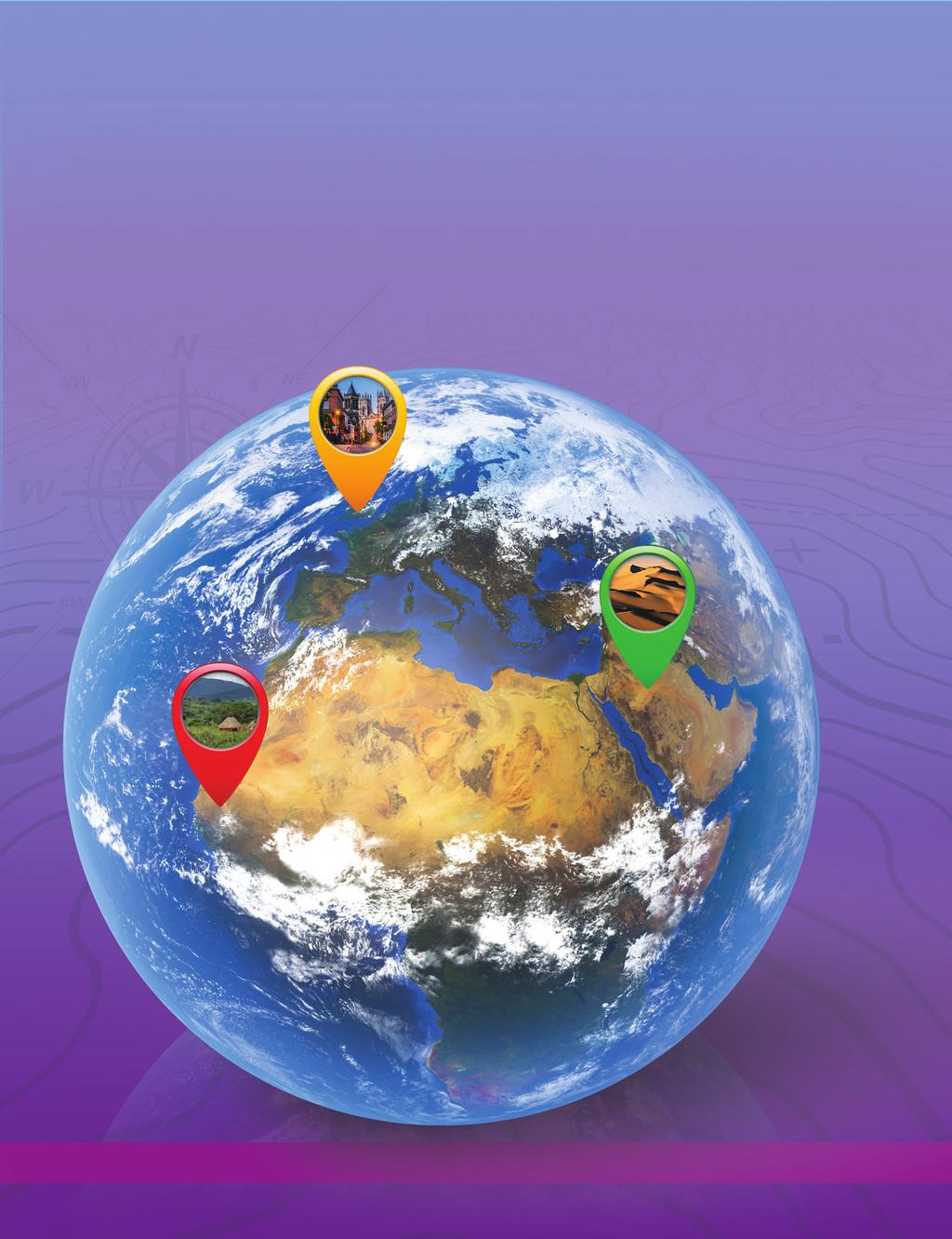


2 Level
3 Table of Contents Introduction...3 How to Use This Book...4 Standards Correlations...10 Daily Practice Pages...1 Answer Key...19 Additional Maps Rubrics Analysis Pages Digital Resources Introduction With today s geographic technology, the world seems smaller than ever. Satellites can accurately measure the distance between any two points on the planet and give detailed instructions about how to get there in real This may lead some people to wonder why we still study geography. While technology is helpful, it isn t always accurate. We may need to find detours around construction, use a trail map, outsmart our technology, and even be the creators of the next navigational technology. But geography is also the study of cultures and how people interact with the physical world. People change the environment, and the environment affects how people live. People divide the land for a variety of reasons. Yet no matter how it is divided or why, people are at the heart of these decisions. To be responsible and civically engaged, students must learn to think in geographical terms. The Need for Practice To be successful in geography, students must understand how the physical world affects humanity. They must not only master map skills but also learn how to look at the world through a geographical lens. Through repeated practice, students will learn how a variety of factors affect the world in which they live. Understanding Assessment In addition to providing opportunities for frequent practice, teachers must be able to assess students geographical understandings. This allows teachers to adequately address students misconceptions, build on their current understandings, and challenge them appropriately. Assessment is a long-term process that involves careful analysis of student responses from a discussion, project, practice sheet, or test. The data gathered from assessments should be used to inform instruction: slow down, speed up, or reteach. This type of assessment is called formative assessment. Shell Education Days of Geography 3
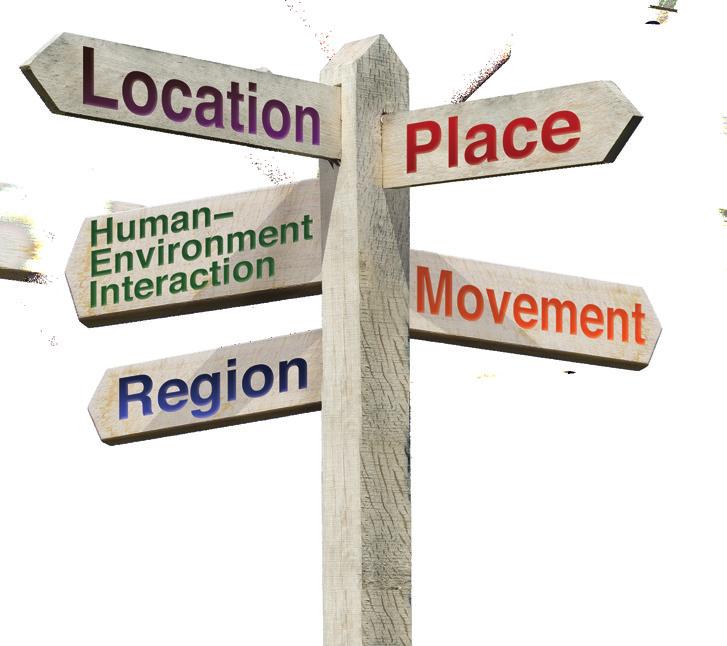
4 Weekly Structure How to Use This Book The first two weeks of the book focus on map skills. By introducing these skills early in the year, students will have a strong foundation on which to build throughout the year. The last two weeks allow students to practice naming states and capitals. Each of the remaining 30 weeks will follow a regular weekly structure. Each week, students will study a grade-level geography topic and a location in the world. Locations may be a town, a state, a region, a continent, or the whole world. Days 1 and 2 of each week focus on map skills. Days 3 and 4 allow students to apply information and data to what they have learned. Day helps students connect what they have learned to themselves. Day 1 Reading Maps: Students will study a grade-appropriate map and answer questions about it. Day 2 Creating Maps: Students will create maps or add to an existing map. Day 3 Read About It: Students will read a text related to the topic or location for the week and answer text-dependent or photo-dependent questions about it. Day 4 Think About It: Students will analyze a chart, diagram, or other graphic related to the topic or location for the week and answer questions about it. Day Geography and Me: Students will do an activity to connect what they learned to themselves. Five Themes of Geography Good geography teaching encompasses all five themes of geography: location, place, human environment interaction, movement, and region. Location refers to physical and absolute and relative locations or a specific point or place. The place theme refers to the human characteristics of a place. Human-environment interaction describes how humans affect their surroundings and how the environment affects the people who live there. Movement describes how and why people, goods, and ideas move between different places. The region theme examines how places are grouped into different regions. Regions can be divided based on a variety of factors, including physical characteristics, cultures, weather, political factors, and many others Days of Geography Shell Education
5 How to Use This Book (cont.) Using the Practice Pages The activity pages provide practice and assessment opportunities for each day of the school year. Teachers may wish to prepare packets of weekly practice pages for the classroom or for homework. As outlined on page 4, each week examines one location and one geography topic. WEEK 19 1 _ Date: Name: questions. of Peru. Then, answer the Directions: Study the map The first two days focus on map skills. On Day 1, students will study a map and answer questions about it. On Day 2, they will add to or create a map. WEEK Ecuador Name: 300 1,000 m high Creating Maps m high Peru Piura Brazil Pacific Ocean Reading Maps Land Elevation > 1,000 m high Iquitos 19 2 Colombia Directions _ complete : Peru has three Date: distinct the map. regions with their own ecosy stems. Follow the steps to Ecuador Piura Colombia Land Eleva tion > 1,000 m high Iquitos Peru 300 1,000 Lima m Brazil Cusco m high high Pacific Ocean Lima Legend Cusco Peru s capital city? desert of 1. What is the elevation mountains rainforest 1. Creat e a symb ol for each region in the legen 2. The deser d. t is a narro cities there? might people build fewer w strip along at higher elevations. Why the west 3. There are fewer cities 3. coast. Add The mountains your deser are just southern north t symbol parts of to the map. Peru. They east of the deser symbol to t, stretc the map. are the highe r elevationshing from the north _ on the map. 4. The rainfo ern to Add your the the map. rest takes up the mountains northeaste 10 rn part of Days of Geography the state.. Color Add your the Pacifi Shell Education rainforest c Ocean symbol blue. to the 2. Which city shown has highest elevation? Days of Geography Shell Educat ion WEEK 19 3 Date: _ tions. er the ques Then, answ photos. Name: study the. text, and ecosystems : Read the systems different Directions Peru s Eco ns. Each region has the rest regio animal life. ends and and rainfo and e the beach types of mountain, er, temperatures, to tell wher. Yet many desert, be hard world Peru has different weath dry. It can t deserts in the have tainside coast is dries They also the west to one of the the moun g the day on on t. The deser Peru is home es that grow be warm durin s. found there can The grass eratures desert beginanimals can be al Peru.. in centr alpacas. Temp plants and tains are s grow there s and s Moun of plant as llama d. Few The Ande als, such 6,000 kinds and humi for anim night. zon. Over e weather is hot at are food Th the Ama ing cold is part of d animals. cted. and freez is prote rest in Peru of endangere The rainfo many species much of the land also and There are in this region, live le peop 19 4 Name: Directions : Study the _ Date: circle graph. Then, answ er the quest ions. Land in Think Abo ut It ut It Peruvian Peruvian Read Abo Days 3 and 4 allow students to apply information and data from texts, charts, graphs, and other sources to the location being studied. WEEK Peru crops pasture other forest rainforest mountains desert Peruvian 1. Woul d it be bette r for a farme r to raise ed in Peru? crops or desert locat animals e is the in Peru? 1. Wher Why? s? for llama s provide mountain do the 2. What 2. What is most of the land region? in Peru used in each erently for? live diff le might peop 3. What 3. How else do you think land is used for in Peru? 107 Geography Days of Education Shell Days of Geography Shell Educat ion Name: _ Date: Directions: Compare and contrast one Be sure to label the region you chose. region of Peru to where you live on the Venn diagram. On Day, students will apply what they learned to themselves. WEEK 19 _ Geography and Me Using the Resources Where I Live Shell Education Days of Geography 109 Rubrics for the types of days (map skills, applying information and data, and making connections) can be found on pages and in the Digital Resources. Use the rubrics to assess students work. Be sure to share these rubrics with students often so that they know what is expected of them. Date: Name: _ Date: Name: _ Rubric Making Connections Map Skills Rubric Day Days 1 and 2 Name: Date: first two weeks of instruction. activity sheets from the 2 activity Directions: Evaluate students for students Days 1 and that, complete this rubric weeks can be Every five weeks after Their work over the five row. is needed per student. by writing a score in each sheets. Only one rubric their work in each category up to evaluated together. Evaluate write the total on the line. Students may earn and Then, add up their scores, up to 1 points total. points in each row and Skill Identifying Map Features Using Cardinal Directions Interpreting Maps Uses map features to correctly interpret maps all or nearly all the 3 1 Uses map Does not use features to map features correctly to correctly interpret maps interpret maps. most of the Does not Uses cardinal Uses cardinal use cardinal directions to directions to accurately locate accurately locate directions to accurately locate places all or places most of places. nearly all the the Does not Accurately Accurately accurately maps to answer maps to answer interpret maps questions all or questions most to answer questions. nearly all the of the Score Applying Informatio and Data Rubr n ic Days Skill Skill Interpreting Text Interpreting Data Correctly texts to answer questions all or nearly all the Correctly data to answer questions all or nearly all the 3 Correctly texts to answer questions most of the Correctly data to answer questions most of the 1 Does not correctly interpret texts to answer questions. 3 1 Score Makes Makes Does not make comparisons of comparisons of comparisons of one s own home one s own home one s own home or community or community to or community to to others all or others most of others. nearly all the the Makes Makes Does not make comparisons comparisons of comparisons of of one s daily one s daily life one s daily life Comparing life to those in to those in other to those in other One s Life other locations locations or locations or all or regions regions most of regions. or nearly all the the Uses Uses Does not use information information about locations information about other about locations or regions locations or or regions make to make to regions to make Making Connections connections connections life there connections about life there about about life there. most of the all or nearly all the 3 and 4 Directions: Complete this rubric every fi ve weeks to evaluate activity sheets. Only students Day 3 and one rubric is needed Day 4 be evaluated together. per student. Their work over the five Evaluate their work weeks can Then, add up their in each category by scores, and write writing a score in the total on the line. each row. each row and up to Students may earn 1 points total. Note: up to points in evaluated here. Weeks 1 and 2 are map skills only and will not be Applying Information Comparing One s Community Score Does not correctly interpret data to answer questions. Applies new information and Applies new Does not information and data to known apply new data to known information information and about locations information data to known about locations or regions all information or nearly all the or regions most about locations of the or regions. Total Points: _ Total Points: Shell Education Shell Education 210 activity sheets. to evaluate students Day rubric every five weeks be evaluated Directions: Complete this over the five weeks can per student. Their work row. Then, add up Only one rubric is needed writing a score in each work in each category by in each row and together. Evaluate their may earn up to points total on the line. Students evaluated here. their scores, and write the skills only and will not be Weeks 1 and 2 are map up to 1 points total. Note: Days of Geography Days of Geography Total Points: Shell Education Days of Geography Shell Education Days of Geography 7
6 Name: Date: _ WEEK 3 1 Directions: Study the map of Mexico. Then, answer the questions. United States Chihuahua Monterrey Gulf of Mexico Reading Maps Cabo San Lucas Mexico Cancún Pacific Ocean Puerto Vallarta Guadalajara Mexico City Veracruz Legend city capital Acapulco Belize Guatemala 1. Name at least one city on the Pacific coast. 2. Name at least one city on the coast of the Gulf of Mexico. 3. What is the capital of Mexico? 4. Name the three countries that border Mexico.. Name the southernmost city on this map. Shell Education Days of Geography 2

 Pacific Ocean Yukon Territory British Columbia Northwest Territories Alberta Canada Saskatchewan Nunavut Manitoba Hudson Bay Ontario Quebec")
7 Name: Date: _ WEEK 6 2 Directions: Read the text in the box. Use the information to shade the Appalachian Region on the map. Then, create a legend to show what the shaded region is. The Appalachian region is in the southeast part of the country. It includes all of New Brunswick, Nova Scotia, and Prince Edward Island. It includes the far eastern tip of Quebec. It also includes the part of Newfoundland and Labrador that is is close to Nova Scotia. Arctic Ocean Greenland Creating Maps Alaska (USA) Pacific Ocean Yukon Territory British Columbia Northwest Territories Alberta Canada Saskatchewan Nunavut Manitoba Hudson Bay Ontario Quebec Newfoundland and Labrador Prince Edward Island USA New Brunswick Nova Scotia Legend Atlantic Ocean Shell Education Days of Geography 41
8 WEEK 9 2 Name: Date: _ Directions: Follow the steps to complete the map. Creating Maps Mediterranean Sea Lebanon Nazareth Netanya Tel Aviv Jerusalem Ashdod Ashkelon Nahariyya Haifa Jordan River Syria Sea of Galilee Rahat Dead Sea Beersheba Israel Jordan Egypt Eilat 1. Most people in Israel are Jewish. But Jerusalem, Rahat, and Nazareth are home to many Muslims as well. Circle these cities on the map. 2. Color Israel green. 3. Use the clues in the box to label the countries that border Israel. Egypt is southwest of Israel. Lebanon borders Syria and the Mediterranean Sea. Jordan is east of the Jordan River. Syria is northeast of Israel Days of Geography Shell Education

9 WEEK 13 4 Name: Date: _ Directions: Study the timeline of railways in Australia. Then, answer the questions. 180s First railways open in Victoria, New South Wales, and South Australia. 1860s Tasmania opens first railway. Think About It 1870s West Australia and Queensland open first railway. 1880s Northern Territory opens first railway. 1910s Australian Capital Territory opens first railway. 1930s Companies begin using a standard-size railway on an interstate track. 190s Diesel engines are introduced. 1970s Steam engines are completely removed. 1990s A standard-size interstate track is completed. 1. How might Australian states and territories benefit from building railways? 2. Why might people have wanted to build a standard-size interstate track? 3. Why do you think it took so long to complete the standard-size railway? Days of Geography Shell Education
10 WEEK 14 Name: Date: _ Directions: Think of a landform near you. Examples include mountains, canyons, valleys, rivers, deltas, and plains. Complete the chart about the landform you choose. What is the name of the landform? Where is it located? Geography and Me Describe the landform. Draw the landform. How is it similar to and different from Uluru? Days of Geography Shell Education
a division of Teacher Created Materials
 Sample Pages from a division of Teacher Created Materials Thanks for checking us out. Please call us at 877-777-3450 with questions or feedback, or to order this product. You can also order this product
a division of Teacher Created Materials
 Sample Pages from a division of Teacher Created Materials Thanks for checking us out. Please call us at 877-777-3450 with questions or feedback, or to order this product. You can also order this product
Canadian Mapping Big Book
 Canadian Mapping Big Book Grades 4-6 Written by Lynda Golletz Illustrated by S&S Learning Materials About the Author: Lynda Golletz was an elementary school teacher for thirty-three years. She is the author
AP Human Geography World Atlas Project
 AP Human Geography World Atlas Project - 2018 Welcome to Robert E. Lee High School and Advanced Placement Human Geography! You are going to thoroughly enjoy this class. It will be a lot of work, but the
Outline Maps of Canada
 Outline Maps of Canada Grades K-3 About this book: Outline Maps of Canada is an important resource to help introduce and review mapping skills, with an emphasis on Canadian maps. Almost every map included
Markville. CGC 1DL/PL Geography. Geography of Canada. Natural Environment Unit Test
 Markville CGC 1DL/PL Geography Geography of Canada Natural Environment Unit Test Name: Thinking /10 Knowledge /10 Application /10 Communication /10 Part A: Blanks (1 mark each) Thinking Choose the correct
Canadian Mapping. Grades 5-6. Written by Lynda Golletz Illustrated by S&S Learning Materials
 Canadian Mapping Grades 5-6 Written by Lynda Golletz Illustrated by S&S Learning Materials About the Author: Lynda Golletz was an elementary school teacher for thirty-three years. She is the author of
Essential Questions What are the major physical components of the world, and how are they represented on a map? 3.4
 Third Grade Social Studies Unit One Six Weeks GEOGRAPHY Originally compiled by Russellville In order for students to understand that geography influences the development of a region as well as the interactions
About places and/or important events Landmarks Maps How the land is, hills or flat or mountain range Connected to maps World Different countries
 What do you think you know about geography? About places and/or important events Landmarks Maps How the land is, hills or flat or mountain range Connected to maps World Different countries What do you
The Five Themes of Geography
 The Five Themes of Geography The Five Themes of Geography Main Idea: Geographers use the Five Themes of Geography to help them study the Earth. The Five Themes of Geography Geography and You: Suppose a
Geographer s Toolkit. Geography of Canada
 Geographer s Toolkit Geography of Canada www.craigmarlatt.com/school Geographer s Toolkit 1. Parts of a Map Map Symbols Mapping Your Location 2. Types of Maps 3. Political Map of Canada 4. Drainage Map
Climate Change in Canada
 1 Climate Change in Canada Climate change is an urgent, global concern. The implications of climate change are significant and far reaching, with the potential of impacting future generations throughout
1. Origins of Geography
 II. ORIGINS AND BRANCHES OF GEOGRAPHY My Notes A. Origins of Geography Unit One 6 Before carefully examining the tools of the geographer, it would be useful to examine the origins and roots of this ancient
2 Georgia: Its Heritage and Its Promise
 TERMS region, erosion, fault, elevation, Fall Line, aquifer, marsh, climate, weather, precipitation, drought, tornado, hurricane, wetland, estuary, barrier island, swamp PLACES Appalachian Mountains, Appalachian
Map Skills Scavenger Hunt
 Map Skills Scavenger Hunt Introduction to: Continents Cardinal Directions Relative Location Equator and Prime Meridian Hemispheres Reading a Political Map Reading a Physical Map Idea: This product includes
4th Grade Social Studies First Nine Weeks
 4th Grade Social Studies First Nine Weeks Multiple Choice Identify the choice that best completes the statement or answers the question. 1 Name the mountains that are located in the eastern United States.
St John s Catholic Primary School. Geography Policy. Mission Statement
 St John s Catholic Primary School Geography Policy Mission Statement We at St John s strive for excellence in education by providing a safe, secure and caring family environment where individuals are valued
Suggested Activities. Pre-planning. Session One
 Suggested Activities Pre-planning Locate ball Assemble equipment In preparation for introducing the notion of geographic coordinates, bring to class in Session One a large ball (e.g., basketball, volleyball
Unit 1 Physical Setting
 Unit 1 Physical Setting Chapter 1: Finding Your Way Chapter 2: Our Natural Environment Chapter 3: The Changing Weather Chapter 4: A Place To Live Chapter 1: Finding Our Way Key Terms Lines of Latitude
World Geography. Teacher s Guide
 World Geography Teacher s Guide WALCH PUBLISHING Table of Contents To the Teacher.......................................................... vi Classroom Management.................................................
Many Ways to Name a Place
 Your web browser (Safari 7) is out of date. For more security, comfort and Activityapply the best experience on this site: Update your browser Ignore Many Ways to Name a Place What are the names for the
Grade 9 Social Studies Canadian Identity. Chapter 2 Review Canada s Physical Landscape
 Grade 9 Social Studies Canadian Identity Chapter 2 Review Canada s Physical Landscape Name: Unit 1: Empowerment Terms (notes or textbook) 1. Core 2. Crust 3. Mantle 4. Magma 5. Continental drift 6. Plate
Map Skills Unit. Note taking unit
 Map Skills Unit Note taking unit Introduction To learn about the Earth, we are going to learn about two geographic tools you can use.globes and maps. Globe A globe is a round model of the planet Earth
Geography Long Term Plan
 Geography Long Term Plan Year Group Children should be taught about: The topic this will be based on: Essential Learning Objectives: (Taken from Chris Quigley) Year 1 Name and locate the world s seven
CANADA S LANDFORM REGIONS
 CANADA S LANDFORM REGIONS Canada s Regions Canada is divided into Eight major regions. A Region is an area that is defined on the basis of the presence or absence of certain characteristics: Age of rock
Grade 9 Geography Chapter 11 - Climate Connections
 Grade 9 Geography Chapter 11 - Climate Connections 1. Define: Weather. 2. In what way has weather affected your activities in the last two weeks? 3. Define: Climate. 4. Canada s climate is a function of
Physical Geography. Ariel view of the Amazon Rainforest. A Look at the Seven Continents
 Physical Geography In this unit you will learn about general physical geography. The study of the Earth s surface features provides the setting for the human-environmental interactions and for the human
United States of America Geography
 United States of America Geography Part I by Sonja E. Schild LearnSmart Publishing Co. Vancouver, BC, Canada Phone: (604) 433-1347 ISBN 0-9694445-3-9 Notice! All rights reserved. Permission to reproduce
North America ATLANTIC OCEAN PACIFIC OCEAN. The First Americans. Labrador Sea. Caribbean Sea. USI_ISN_U01_01.eps. Second Proof TCI19 65.
 G e o g r a p h y C h a l l e n g e North America 70 N 180 N 60 170 W 30 W 160 W 40 W Labrador Sea 150 W 50 N 50 W Hud s on B ay 140 W 40 N 60 W ATLANTIC OCEAN 30 N PACIFIC OCEAN Gulf of Mexico 20 N 130
a division of Teacher Created Materials
 Sample Pages from a division of Teacher Created Materials Thanks for checking us out. Please call us at 877-777-3450 with questions or feedback, or to order this product. You can also order this product
Pre-AP World Geography Summer Assignment
 Pre-AP World Geography 2018-2019 Summer Assignment This is the summer assignment for students who intend on being accepted and enrolled in Pre-AP World Geography. Successful performance on this assignment
Sample. Contents SECTION 1: PLACE NAMES 6 SECTION 2: CONNECTING TO PLACES 21 SECTION 3: SPACES: NEAR AND FAR 53
 Contents Teachers' Notes 4 National Curriculum Links 5 SECTION 1: PLACE NAMES 6 Teachers' Notes 7-8 Activities Names Of Places 9 Place Names Are Important 1 10 Place Names Are Important 2 11 The Meanings
Your web browser (Safari 7) is out of date. For more security, comfort and the best experience on this site: Update your browser Ignore
 is out of date. For more security, comfort and the best experience on this site: Update your browser Ignore") Your web browser (Safari 7) is out of date. For more security, comfort and the best experience on this site: Update your browser Ignore Activityengage MAPPING W O RL D HERITAGE Where are sites of significant
Your web browser (Safari 7) is out of date. For more security, comfort and the best experience on this site: Update your browser Ignore Activityengage MAPPING W O RL D HERITAGE Where are sites of significant
World Geography Name This Country 4 th Grade
 World Geography Name This Country 4 th Grade West Brooke Curriculum By: Susan Adams & Jennifer Westbrook World Geography Name This Country 4 th Grade West Brooke Curriculum 2014 Written by: Susan Adams
MR. JOHNSON S. Geography OHIO COUNTY MIDDLE SCHOOL
 MR. JOHNSON S Geography OHIO COUNTY MIDDLE SCHOOL CHAPTER 1 Geography The science of geography is likely the oldest of all sciences. Geography is the answer to the question that the earliest humans asked,
Tuition, Medical and Behaviour Support Service
 Tuition, Medical and Behaviour Support Service Curriculum Policy - Primary Geography Reviewed: October 2018 Next Review: October 2019 Responsibility: Andrea Snow AIMS AND PRINCIPLES The national curriculum
What Is a Globe? Hemispheres. Main Idea Globes and maps provide different ways of showing features of the earth. Terms to Know
 r Main Idea Globes and maps provide different ways of showing features of the earth. Terms to Know hemisphere latitude longitude scale bar scale relief elevation contour line What Is a Globe? A globe is
GEOGRAPHY POLICY STATEMENT. The study of geography helps our pupils to make sense of the world around them.
 GEOGRAPHY POLICY STATEMENT We believe that the study of geography is concerned with people, place, space and the environment and explores the relationships between the earth and its peoples. The study
Climate Change: Why Worry?
 Climate Change: Why Worry? Lesson Overview Students will explore the meaning of Climate Change, with an emphasis on the impact expected on future human life, the adaptations which will be required, and
Map Skills Lesson 1. Materials: maps, pencils, Lesson 1 Worksheet, strips of paper, grid paper
 Map Skills Lesson 1 Use cardinal directions, map grids, scales, and titles to locate places on a map. Interpret a map using information from its title, compass rose, scale, and legend. Vocabulary: map,
Preview: Making a Mental Map of the Region
 Preview: Making a Mental Map of the Region Draw an outline map of Canada and the United States on the next page or on a separate sheet of paper. Add a compass rose to your map, showing where north, south,
Toposim Continents: Cordillera v1.0 1
 Toposim Continents: Cordillera v1.0 1 Contents Installation... 3 Support... 4 File Contents... 5 Coverage images... 6 Canada Cordillera... 6 British Columbia... 7 Yukon Territory... 8 Toposim Continents:
Geography Skills Progression. Eden Park Primary School Academy
 Geography Skills Progression Eden Park Primary School Academy In order to ensure broad and balanced coverage, we follow these principles: Within each phase, geography is a driver for at least 3 Learning
2011, 1998, 1987 Copyright by Remedia Publications, Inc. All Rights Reserved. Printed in the U.S.A.
 See the world REM 129A A Teaching Resource From 2011, 1998, 1987 Copyright by Remedia Publications, Inc. All Rights Reserved. Printed in the U.S.A. The purchase of this product entitles the individual
Understanding Projections
 GEOGRAPHY SKILLS 1 Understanding Projections The earth is a sphere and is best shown as a globe. For books and posters, though, the earth has to be represented as a flat object. To do this, mapmakers create
Five Themes of Geography of Ecuador
 LESSON 1 Five Themes of Geography of Ecuador Lesson Objective The students will be able to: find the five themes of geography (location, movement, human/environment interaction, place, and region) of Ecuador
4th Grade US Regional Geography First Nine Weeks
 4th Grade US Regional Geography First Nine Weeks 2014-2015 Identify the choice that best completes the statement or answers the question. 1 The line identified as 0 runs west and east on the globe and
Grade 7 History Mr. Norton
 Grade 7 History Mr. Norton Section 1: Thinking Geographically Section 2: Land and Climates of the United States Section 3: The Tools of History Section 4: Economics and Other Social Sciences Grade 7 History
The Arctic Ocean. Grade Level: This lesson is appropriate for students in Grades K-5. Time Required: Two class periods for this lesson
 The Arctic Ocean Lesson Overview: This lesson will introduce students to the Eastern Arctic Region and the benefits of the Arctic Ocean to the people who live in the Far North. This lesson can be modified
MEADOWS PRIMARY SCHOOL and NURSERY GEOGRAPHY POLICY
 MEADOWS PRIMARY SCHOOL and NURSERY GEOGRAPHY POLICY Purpose of study The teaching of Geography at Meadows is done by following the 2014 National Curriculum. The planning and teaching of the subject aims
ST AMBROSE CATHOLIC PRIMARY SCHOOL Geography Policy
 ST AMBROSE CATHOLIC PRIMARY SCHOOL Geography Policy 2017-2018 Our school policy is developed in accordance with the National Curriculum for Geography and Foundation Stage Curriculum for Understanding of
Geography Policy 2014
 Geography Policy 2014 DEFINITION Geography education should inspire in pupils a curiosity and fascination about the world and its people that will remain with them for the rest of their lives. Teaching
Geography Long Term Plan 2018
 Geography Long Term Plan 2018 Geography Co-ordinator: Megan Frost A high-quality geography education should inspire in pupils a curiosity and fascination about the world and its people that will remain
Warm up: (8 min) Use the Map, On the Prom (Color) Paper (Blk/White) and answer the questions on your paper
 Use the Map, On the Prom (Color) Paper (Blk/White) and answer the questions on your paper") Warm up: (8 min) Use the Map, On the Prom (Color) Paper (Blk/White) and answer the questions on your paper TX History: Mapping and Geography of Texas: We will discuss some slides and write notes on others
Warm up: (8 min) Use the Map, On the Prom (Color) Paper (Blk/White) and answer the questions on your paper TX History: Mapping and Geography of Texas: We will discuss some slides and write notes on others
Iceland. 1. Warm up. A. Talk about the picture and read the essay. B. Discuss the questions about the essay.
 1. Warm up A. Talk about the picture and read the essay. Iceland My country, Iceland, is one of the most beautiful countries on Earth. It is an island country. It is located in Europe, in the North Atlantic
This image cannot currently be displayed. Course Catalog. History and Geography Glynlyon, Inc.
 This image cannot currently be displayed. Course Catalog History and Geography 2016 Glynlyon, Inc. History and Geography Table of Contents COURSE OVERVIEW... 1 UNIT 1: OUR EARTH... 1 UNIT 2: SEAPORT CITIES...
Climate Change: How it impacts Canadians and what we can do to slow it down.
 Climate Change: How it impacts Canadians and what we can do to slow it down. Lesson Overview This lesson takes stock of how climate change has already affected Canadians in geographic, economic, and cultural
Unit 1: Geography. For additional information, refer to this website: 1 G e o g r a p h y
 Unit 1: Geography For additional information, refer to this website: http://mryoungtms.weebly.com/ 1 G e o g r a p h y Continents and Oceans SOL USI. 2a Essential Understanding: Continents are large land
name and locate the world s seven continents and five oceans
 Subject: Geography Activities National Curriculum Objectives One Progression of Skills Name the 7 continents and 5 oceans 3D Jigsaw task to locate continents and seas name and locate the world s seven
St Joseph s R.C. Primary School. Policy for Geography
 St Joseph s R.C. Primary School Policy for Geography 2016-2017 This policy is written with consideration to our school commitment to the Rights of the Child and our achievement of becoming a Rights Respecting
copyright 2015 White's Workshop
 16 vocabulary cards & pictures 3 printable maps of Florida 2 resource maps of Florida Task cards for political maps Task cards for physical maps Rubrics This packet supports the following Sunshine State
Geography of the Americas
 STATION ACTIVITY Geography of the Americas NAME: Directions: Using each station s text and maps, complete this graphic organizer. Olmec Mayans Aztecs Incas Where was this people group located? (include
Alleghany County Schools Curriculum Guide GRADE/COURSE: World Geography
 GRADE/COURSE: World 2013-14 GRADING PERIOD: 1 st Six Weeks Time Frame Unit/SOLs SOL # Strand Resource Assessment 8 days* The student will use maps, globes, satellite images, photographs, or diagrams to
Guided Reading Activity
 Guided Reading Activity Lesson 1 Physical Features Essential Question: How does geography influence the way people live? A Vast Land Directions: Read the lesson and use your text to decide whether each
World Geography. BY MARK STANGE and REBECCA LARATTA
 BY MARK STANGE and REBECCA LARATTA COPYRIGHT 2002 Mark Twain Media, Inc. ISBN 1-58037-205-8 Printing No. CD-1551 Mark Twain Media, Inc., Publishers Distributed by Carson-Dellosa Publishing Company, Inc.
Complete Geography Overview: Year 1 to Year 6
 Option 1 Complete Geography Overview: Year 1 to Year 6 Autumn Term Spring Term Summer Term Year 1 Where do I live? Around the World The Four Seasons Year 2 At the Farm Let s go on Safari My World and Me
The United States & Canada. A Regional Study of Anglo America
 A Regional Study of Anglo America Landform Regions of the United States & Canada world leaders in agricultural and industrial production because of... VAST LANDS stretch from the Atlantic Ocean on the
Our Lady Immaculate Catholic Primary School History and Geography Curriculum Map Would the Bog Baby survive in Liverpool?
 Year 1 and 2 - *Year 1 and 2 work on a two year cycle due to mixed classes Autumn 1 National Curriculum link: Human and physical geography - identify seasonal and daily weather patterns in the United Kingdom
Cardinal and Intermediate Directions:
 Name Period Parent Signature Due Date: (TBA) Geography/Map Skills Study Guide Continents and Oceans of the World: Label the continents (7) and oceans (4) on the lines below the map. 1 11 3 5 4 8 2 9 10
Geography. Programmes of study for Key Stages 1-3
 Geography Programmes of study for Key Stages 1-3 February 2013 Contents Purpose of study 3 Aims 3 Attainment targets 3 Subject content 4 Key Stage 1 4 Key Stage 2 5 Key Stage 3 6 2 Purpose of study A high-quality
Why VOCABULARY? clues
 It s GHSGT Time! Why VOCABULARY? Social Studies is all about MAKING CONNECTIONS Key Terms provide relational clues to guide you in answering test questions! The more WORDS you know, the smarter you are
Physical Geography of the United States and Canada Chapter 5 A Land of Contrasts
 Physical Geography of the United States and Canada Chapter 5 A Land of Contrasts Land Area Together the U.S. and Canada cover more than 7 million square miles. In total area, Canada ranks 2 nd and the
Reading a Map in Any Language. Dawn Shattuck NICC; Kathy Sundstedt School not available. Content Area (Req.): Geography Unit (Opt.
: Geography Unit (Opt.") Instructional Sequence/Procedure (Req.): 1. Distribute one copy of Chile map, written in Spanish, to each student group OR direct each group of students to access an online copy of a Chile map. 2. Together,
Instructional Sequence/Procedure (Req.): 1. Distribute one copy of Chile map, written in Spanish, to each student group OR direct each group of students to access an online copy of a Chile map. 2. Together,
NEWHAM BRIDGE PRIMARY SCHOOL FOUNDATION SUBJECTS CURRICULUM AND ASSESSMENT DOCUMENT GEOGRAPHY
 NEWHAM BRIDGE PRIMARY SCHOOL FOUNDATION SUBJECTS CURRICULUM AND ASSESSMENT DOCUMENT GEOGRAPHY Y1 Geography Curriculum Y1 Geography A.R.E Locational language: hills, beach, forest, town, country, address,
Warmup. geography compass rose culture longitude
 Warmup geography compass rose culture longitude ecosystem latitude 1. study of the special physical and human characteristics of a place or region 2. learned system of shared beliefs, traits, and values
A Correlation of. Eastern Hemisphere. Ohio s Learning Standards Social Studies: K-12 Grade 6
 A Correlation of Eastern Hemisphere To Grade 6 to,, Grade 6 Introduction This document demonstrates how, Eastern Hemisphere, Ohio Edition, meets : K-12 Social Studies for Grade 6. Correlation page references
CHAPTER 1: EXPLORING GEOGRAPHY
 CHAPTER 1: EXPLORING GEOGRAPHY Please Do Now: In your PDN section of your binder answer the following with one or two sentences: What is Geography? What is Geography? The study of where people, places,
Witchampton CofE First School Geography Curriculum Map
 2016-2017 Autumn People and : 30-50 Show interest in the lives of people who are familiar to them. Shows interest in different occupations. Remembers and talks significant events in their own experience.
Chapter 2 - Lessons 1 & 2 Studying Geography, Economics
 Chapter 2 - Lessons 1 & 2 Studying Geography, Economics How does geography influence the way people live? Why do people trade? Why do people form governments? Lesson 1 - How Does Geography Influence the
LANDFORMS CREATED AND CHANGED?
 HOW ARE LANDFORMS CREATED AND CHANGED? Landforms are created by different natural forces. Some are within Earth, and some are on the surface of Earth. Landforms can also be changed by humans. These changes
Chapter 1: America s Land Lesson 1: Land and Climate
 Chapter 1: America s Land Lesson 1: Land and Climate Geography: Describe landforms and other physical features of the United States. Geography: Explain how and why climate varies throughout the United
Willmar Public Schools Curriculum Map
 Subject Area Grade First Grade Date June 2005, reviewed June 2009 Unit Content Standards Addressed Skills/Benchmarks Essential Questions Assessments Unit 1 Here We Are and Our Class Our School Our Families
Grade 5: Social Studies Practices
 Grade 5: Social Studies Practices A. Gathering and Using Evidence 1. Develop questions to help identify evidence about topics related to the historical events occurring in the Western Hemisphere that can
Geography Route Planner
 Geography Route Planner Introduction to Route Planners Route Planners outline the Key Stages 1-3 curriculum to be taught within each campus of the Bury St Edmunds Trust. Each Route Planner has been designed
Unit 1: Basics of Geography Test Review
 Name Date Period Unit 1: Basics of Geography Test Review Directions: Reading the following sections and complete the questions, charts, and diagrams. Types of Maps Maps that have a particular theme are
Geography Mile Post 1
 Mile Post 1 Use world maps, atlases and globes to identify the UK and its countries, as well as the countries, continents and oceans studied at this key stage Key Skills IPC learning Goals 1.11 Be able
Chapter 1: The World of Geography
 Chapter 1: The World of Geography Chapter 1: What is Geography? *It is the study of our earth; our home. OR *Anything that can be mapped! *Geography mixes up the physical and human aspects of our world
Tropical Moist Rainforest
 Tropical or Lowlatitude Climates: Controlled by equatorial tropical air masses Tropical Moist Rainforest Rainfall is heavy in all months - more than 250 cm. (100 in.). Common temperatures of 27 C (80 F)
Grade 3 Social Studies
 Grade 3 Social Studies Social Studies Grade(s) 3rd Course Overview This course focuses on the five Wisconsin Model Academic standards for Social Studies: Geography, History, Political Science and Citizenship,
Sec$on 1: Geography and Early China. How does China s geography affect the culture?
 Sec$on 1: Geography and Early China How does China s geography affect the culture? Con$nents of the World Label the continents. Where is China located? Where is China located? In your groups, begin filling
Downloaded from
 I II III IV V VI Define the following terms:- a) Orbitb) Meteoroids c) Celestial bodies GEOGRAPHY ASSIGNMENTS The Earth In The Solar System d) Satellite e) Comets Give one word answers:- a) Blue planet
Geography Progression
 Geography Progression This document aims to track expectations for History within George Grenville Academy. What the National Curriculum says: KS1: Locational Knowledge: Name and locate the world s 7 continents
Houghton Mifflin Harcourt People We Know Minnesota Academic Standards in Social Studies, Grade 2
 Houghton Mifflin Harcourt People We Know 2012 correlated to the Minnesota Academic in Social Studies, Grade 2 Grade 2 2.1 Citizenship and Government 2.1.1 Civic Skills 2.1.1.1 Democratic government depends
Five Themes of Geography Project Ms. Kiesel, Per 5. The United States of America
 Five Themes of Geography Project Ms. Kiesel, Per 5 The United States of America Location Absolute Location : The USA is located in the continent of North America in the northern and western hemispheres.
New National Curriculum Geography Skills Planning KS1
 New National Curriculum Geography Skills Planning KS1 Enquiry Question Objective-essential knowledge skills or understanding Locational Knowledge Standards /Success Criteria Lesson progression over half
[ 1.2 ] Texas Geography
![[ 1.2 ] Texas Geography](/thumbs/78/78091378.jpg "[ 1.2 ] Texas Geography") [ 1.2 ] Texas Geography [ 1.2 ] Texas Geography Learning Objectives Identify how geography helps people understand and organize information about a place. Compare the physical and human characteristics
[ 1.2 ] Texas Geography [ 1.2 ] Texas Geography Learning Objectives Identify how geography helps people understand and organize information about a place. Compare the physical and human characteristics
8th Geography Pre-Test
 Quiz Preview Go back Student's Name appears here Course Name appears here QuizStar 8th Geography Pre-Test Quiz Directions Choose the BEST answer for each question. Directions: 1. Answer the questions below
Range of Opportunities
 Geograhy Curriculum Cropwell Bishop Primary School Range of Opportunities Year 1 Year 2 Year 3 Year 4 Year 5 Year 6 All Key Stage 1 Key Stage 2 Investigate the countries and capitals of the United Kingdom.
Unit 2 Study Guide: The World in Spatial Terms
 Name Date Hour Unit 2 Study Guide: The World in Spatial Terms TEST is WEDNESDAY, DECEMBER 19 TH This study guide contains all the concepts that will be on your test. Vocabulary words and concepts will
1-2. Level. Author JoBea Holt. Ph.D.
 1-2 Level Author JoBea Holt. Ph.D. Table of Contents Introduction Research and Introduction....... 4 Overview of Google Earth........ 6 How to Use This Book........... 8 Google Earth Reference Window..