Maritime delimitation and environmental protection of fragile seas
|
|
|
- Myles Brown
- 5 years ago
- Views:
Transcription
1 Gemma Andreone Istituto di Studi Giuridici Internazionali - Consiglio Nazionale delle Ricerche Marsafenet Cost Action Chair - Maritime delimitation and environmental protection of fragile seas
2 International jurisprudence approach wide agreement on the delimitation procedure proposed by the ICJ consisting of three distinct phases starting with the construction of a provisional equidistant line (1 st phase), then trying to adjust it on the basis of the relevant circumstances in order to render the final result equitable for both parties (2 nd phase), thus arriving at the verification test (3 rd phase) deep rooted idea of bilateralism in the definition of maritime boundaries general preference for geographical criteria pertaining to coasts and areas to be delimited circumstances other than geographical usually excluded with the aim of ensuring juridical certainty to delimitations
3 Geographical and Non Geographical factors Geographical factors: Lenth and morphology of the coastline Proportionality between the lenght of the coastline and the extension of the area Presence of islands Presence of ice and other geological or geomorphological factors of the CS Non Geographical factors : Economic factors, behaviour of the Parties, historical rights (such as fishing rights) navigational needs, secutiry needs and environmental factors. Economic factors can be divided into: relating to the existence of natural resources, such as oil, gas and fishing (economic factors in the strict sense) factors relating to socio economic aspects, such as the economic dependence of a State on natural resources ( the economic well being of a nation). 3
4 ICJ Judgment Case od the Gulf of Maine 1984 Important step in the evolution of jurisprudence Possibility of invoking the objection of catastrophic repercussions in the second phase of adjustment of the line of equidistance (the objection of the Gulf of Maine case) Following this decision, in at least three cases, two of them relating to semi enclosed seas, the ICJ and other tribunals have adopted solutions which differ slightly from the classic delimitation scheme, trying to respond to appeals for the protection of local communities fishing rights
5 Eritrea Yemen Award of the Arbitral Tribunal on delimitation 1999.Continuation of the traditional fishing regime. The delimitation line was not modified to accord with the fishing interests of either of the two Parties The tribunal did, however, stress the obligation of the Parties and of the Yemen to ensure the continuation of the traditional fishing regime, as decided in the previous arbitral decision on sovereignty (1998) In particular, the theory, based on Islamic law, of the continuation of the fishing regime traditionally existing in the area was confirmed in the arbitral decision on delimitation (1999)
6 Barbados / Trinidad and Tobago Award of the Arbitral Tribunal 2006 The circumstances relating to the fishing resources could not have any impact on the definition of the boundary line. The tribunal could not concern itself with fishing rights, since these were ultra petita The tribunal decided to delimit following only geographical criteria, and so adopted the criterion of equidistance. But at the same time imposed on the Parties «Trinidad and Tobago and Barbados are under a duty to agree upon the measures necessary to coordinate and ensure the conservation and development of flyingfish stocks, and to negotiate in good faith and conclude an agreement that will accord fisher folk of Barbados access to fisheries within the Exclusive Economic Zone of Trinidad and Tobago, subject to the limitations and conditions of that agreement and to the right and duty of Trinidad and Tobago to conserve and manage the living resources of waters within its jurisdiction».
7 Environmental factor The environmental factor, understood as the conservation of the marine environment under consideration for delimitation, has not been taken into account by jurisprudence, Legal basis of the powers of the coastal State within the continental shelf and the EEZ (artt 56, 58 etc) Not exclusive powers of the coastal States Concurrent powers of third States in environmental protection Rights of third States in the EEZ (freedom of navigations and other peaceful uses of the sea) Resolution of conflicts regarding the attribution of rights and jurisdiction in the EEZ (art.59) references to equity and to the respective importance of the interests involved to the parties as well as to the international community as a whole
8 Bilateral delimitation agreements Joint development zones / resources or environmental protection References to this criterion, or to the presence of natural resources, are diffused in bilateral agreements on delimitation joint management of a marine area straddling the maritime zones of two or more States cooperation in environmental protection Some examples of bilateral agreements established in some regional seas: The Senegal/Guinea Bissau joint development zone bilateral Management and Cooperation Agreement signed on 14 October 1993, The Colombia and Jamaica joint development zone 12 November 1993establishing a JDZ in the western Caribbean sea at the same time. The Nigeria and Sao Tome and Principe joint development zone In the Gulf of Guinea, 21 February It entered into force in The Barbados and Guyana Co operation Zone The treaty between Barbados and Guyana which was signed on 2 December 2003 creating a Co operation Zone and two different mechanisms to exercise civil and administrative joint jurisdiction over the living and non living resources in this Zone. Delimitation treaty between Norway and Russia regarding the Barents Sea and the Arctic Ocean was concluded on 15 September The treaty ensures the continuation of the extensive and fruitful Norwegian Russian fisheries cooperation with regards to living marine resources.

9 9 Nicaragua v. Colombia Territorial and maritime dispute ICJ judgment 2012

10 Conflicts in the Caribbean sea

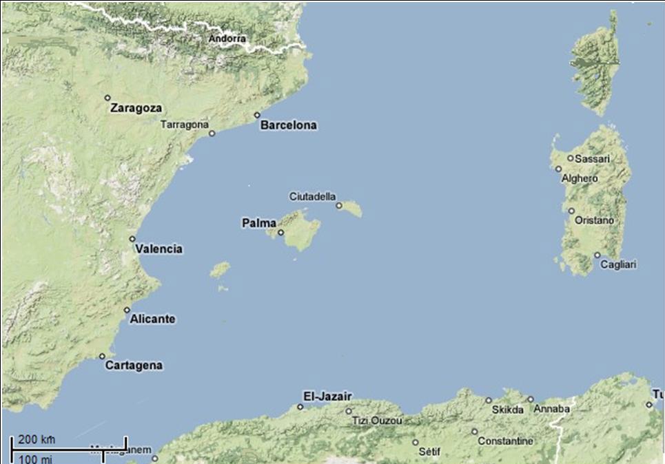
11 11 The MEDITERRANEAN SEA «JURISDICTIONNALISATION»

12 EXISTING MARITIME BORDERS


13 Mediterranean States delimitation conflicts French EEZ Spanish EEZ Italian EPZ


14 Mediterranean States delimitation conflicts Continental shelf border Italy Tunisia Fisheries Protection Zones Italian Environmental Protection Zone Tunisian EEZ Use of the border agreed for the CS also for the EEZ/EPZ = equitable solution?

15 Slovenia/ Croatia delimitation dispute
16 16
17 17
18 Some remarks very vague rules excessively restrictive interpretations of jurisprudence and of a varied conventional practice appeals of the scientific community and of international organizations for a softening of interstate maritime borders or, indeed, ignoring such boundaries. in semi enclosed and fragile seas call for bilateral or regional agreements aimed at the creation of cross border or inter regional marine protected areas (ex. Marine Peace Parks) an agreement or a judgment on maritime delimitation may solve an interstate problem, but it will not necessarily provide a definitive solution in the interests of the communities involved. 18
19 Conclusions or better.questions Would it possible and feasible to amplify the concept of equitable solution as far as allowing the collective interests of the international community to be considered, so overcoming the traditional idea of maritime delimitation a simple division of marine spaces? Since EEZs and continental shelves do not fall under the exclusive jurisdiction of States, but are zones where the interests and powers of more than one State coexist and overlap, including general interests of International Community (art.59 UNCLOS), in absence of agreement of the Parties on the maritime border, can an international court adopt predetermined delimitation schemes, in a deep rooted idea of bilateralism in the definition of maritime boundaries of a semi enclosed/fragile sea? In the light of the weakness of the legal basis of coastal states powers over the EEZ and the CS, can a delimitation process disregard more general considerations or values such as the safeguarding of the ecosystem which must be protected in the interests of future generations?


20 Thank you! Gemma Andreone Istituto di Studi Giuridici Internazionali - Consiglio Nazionale delle Ricerche Marsafenet Cost Action Chair -


21 COST ACTION - NET work of experts on the legal aspects of MARitime SAFEty and security 18 European Participating Countries 4 Non Cost Countries (Japan; New Zealand; Morocco; Russia) 70 Researchers involved 21
The Place of Joint Development in the Sustainable Arctic Governance
 The Place of Joint Development in the Sustainable Arctic Governance ShipArc2015: Joint WMU - IMO - Arctic Council International Conference on Safe and Sustainable Shipping in a Changing Arctic Environment
xxv PART I THE DIVIDED OCEANS: INTERNATIONAL LAW GOVERNING JURISDICTIONAL ZONES 1
 Contents Preface page xv List of Figures xvii List of Tables xviii List of Abbreviations xix Table of Cases xxi Table of Treaties and Instruments xxv PART I THE DIVIDED OCEANS: INTERNATIONAL LAW GOVERNING
Law of the Sea Symposium, February, 2016, TOKYO International Law for the Resources of the Sea
 Law of the Sea Symposium, 16-17 February, 2016, TOKYO International Law for the Resources of the Sea Segment 2 Governance of Resources of the Continental Shelf (including extended continental shelf) Introduction
Maritime Boundary Issues Singapore Workshop: Session 4
 Maritime Boundary Issues Singapore Workshop: Session 4 How States deal with factors that can affect boundary negotiations Dr. Robert W. Smith Independent Geographic Consultant U.S. Department of State
Disputes Concerning the Delimitation of the Continental Shelf beyond 200 M
 Disputes Concerning the Delimitation of the Continental Shelf beyond 200 M Professor Clive Schofield Head of Research, WMU/Sasakawa Global Ocean Institute World Maritime University Sweden and Leonardo
Outer Continental Shelf
 The Delimitation of the Outer Continental Shelf Presentation by Stephen Fietta Monaco, 17 October 2008 Latham & Watkins is the business name of Latham & Watkins (London) LLP, a registered limited liability
Maritime Boundary Delimitation: Recent ICJ Jurisprudence Nicaragua v Colombia; Peru v Chile
 Maritime Boundary Delimitation: Recent ICJ Jurisprudence Nicaragua v Colombia; Peru v Chile May 28, 2014 Prof. Seokwoo LEE Inha University Law School leeseokwoo@inha.ac.kr 1 Recent Developments The Black
Regional Aspects of Maritime Boundary Delimitation in the Gulf of Guinea: current situation, challenges and possible solutions
 Regional Aspects of Maritime Boundary Delimitation in the Gulf of Guinea: current situation, challenges and possible solutions BY JUSTIN TANGA BIANG UNNIPPON ALUMNAE 20092010 INTRODUCTION (1) For the purpose
MODELS AND TOOLS FOR GOVERNANCE OF
 Working Papers Collection No. 1/2015 MODELS AND TOOLS FOR GOVERNANCE OF THE ADRIATIC AND IONIAN SEAS www.unimc.it/maremap NATIONAL POLITICS AND EU POLITICS: THE MARITIME SPATIAL PLANNING AND INTEGRATED
Tore Henriksen a & Geir Ulfstein b a Faculty of Law, University of Tromsø, Tromsø, Norway. Available online: 18 Feb 2011
 This article was downloaded by: [Bibliotheek van het Vredespaleis] On: 03 May 2012, At: 03:44 Publisher: Taylor & Francis Informa Ltd Registered in England and Wales Registered Number: 1072954 Registered
COMPLICATIONS IN DELIMITING THE OUTER CONTINENTAL SHELF. Ron Macnab Geological Survey of Canada (Retired)
") COMPLICATIONS IN DELIMITING THE OUTER CONTINENTAL SHELF Ron Macnab Geological Survey of Canada (Retired) DISCLAIMER The contents of this presentation are the author s personal views only, and do not represent
COMPLICATIONS IN DELIMITING THE OUTER CONTINENTAL SHELF Ron Macnab Geological Survey of Canada (Retired) DISCLAIMER The contents of this presentation are the author s personal views only, and do not represent
The Three Equidistance Lines in Maritime Delimitation: What and Why? By: Dany Channraksmeychhoukroth* (Aug 2015)
") The Three Equidistance Lines in Maritime Delimitation: What and Why? By: Dany Channraksmeychhoukroth* (Aug 2015) Equidistance is a common term in math defined as the equal distance from every point. Similarly,
The Three Equidistance Lines in Maritime Delimitation: What and Why? By: Dany Channraksmeychhoukroth* (Aug 2015) Equidistance is a common term in math defined as the equal distance from every point. Similarly,
Polar complications in the law of the sea: A case study of the regime for research and survey activities in the Arctic Ocean
 2010 ABLOS Conference: Contentious Issues in UNCLOS Surely Not? International Hydrographic Bureau, 25-27 October 2010 Polar complications in the law of the sea: A case study of the regime for research
Linking Global and Regional Levels in the Management of Marine Areas Beyond National Jurisdiction
 Linking Global and Regional Levels in the Management of Marine Areas Beyond National Jurisdiction South Atlantic Region Session 4: «Experiences, Priorities and Opportunities in the South Atlantic and Indian
ITLOS s approach to the delimitation of the continental shelf beyond 200 M in Bangladesh/Myanmar: Theoretical and practical difficulties
 ITLOS s approach to the delimitation of the continental shelf beyond 200 M in Bangladesh/Myanmar: Theoretical and practical difficulties London International Boundary Conference 18-19 April 2013 Panel
Maritime boundaries in contemporary international law
 Campus Antonio Machado Baeza Date: 3rd-4th December, 2015 Coordinators of the Conference Víctor L. Gutiérrez Castillo and Gemma Andreone Venue: Universidad Internacional de Andalucía (Palacio de Jabalquinto,
CONFERENCE OF PARLIAMENTARIANS OF THE ARCTIC REGION. UN LOS Convention and the extended continental shelf in the Arctic
 CONFERENCE OF PARLIAMENTARIANS OF THE ARCTIC REGION UN LOS Convention and the extended continental shelf in the Arctic Presentation given by Dr. Kamrul Hossain Finnish Parliament 18 November 2009 Contents
CONTENTS. PREFACE AND ACKNOWLEDGEMENTS...xi ABBREVIATIONS... xiii FIGURES...xvii INTRODUCTION...1
 CONTENTS PREFACE AND ACKNOWLEDGEMENTS...xi ABBREVIATIONS... xiii FIGURES...xvii INTRODUCTION...1 CHAPTER 1 MAPS OF THE MARITIME WORLD AND LEGAL DEFINITIONS...21 1.1 Maps of the Maritime World...21 1.1.1
Maritime Boundary Negotiations National Considerations Dr. Robert W. Smith
 Maritime Boundary Negotiations National Considerations Dr. Robert W. Smith ABLOS: ADDRESSING DIFFICULT ISSUES IN UNCLOS 28 OCTOBER 2003 Practical Steps in the Negotiating Process 1. The Delimitation Process
Draft Presentation Carleton Conference on the Arctic Is There a Need for New Legal Regime in the Arctic?
 Draft Presentation Carleton Conference on the Arctic Is There a Need for New Legal Regime in the Arctic? Donald McRae, University of Ottawa The climatic changes affecting the Arctic have lead to visions
UNCLOS Zones and Maritime Boundary Delimitation: Overview of Legal Principles
 Schulich School of Law Marine and Environmental Law Institute UNCLOS Zones and Maritime Boundary Delimitation: Overview of Legal Principles Phillip Saunders QC Hainan, November 2016 China-ASEAN Advanced
State Practice on the Establishment of Multiple Maritime Boundaries: Assessing the Challenges of Separating Seabed and Water Column Boundaries
 State Practice on the Establishment of Multiple Maritime Boundaries: Assessing the Challenges of Separating Seabed and Water Column Boundaries Professor Clive Schofield The Australian National Centre for
No. 2009/9 3 February Maritime Delimitation in the Black Sea (Romania v. Ukraine)
") INTERNATIONAL COURT OF JUSTICE Peace Palace, Carnegieplein 2, 2517 KJ The Hague, Netherlands Tel.: +31 (0)70 302 2323 Fax: +31 (0)70 364 9928 Website: www.icj-cij.org Press Release Unofficial No. 2009/9
INTERNATIONAL COURT OF JUSTICE Peace Palace, Carnegieplein 2, 2517 KJ The Hague, Netherlands Tel.: +31 (0)70 302 2323 Fax: +31 (0)70 364 9928 Website: www.icj-cij.org Press Release Unofficial No. 2009/9
Sam Bateman and. State Practice Regarding Straight Baselines In East Asia Legal, Technical and Political Issues in a
 State Practice Regarding Straight Baselines In East Asia Legal, Technical and Political Issues in a Changing Environment Sam Bateman and Clive Schofield The Australian National Centre for Ocean Resources
Some Thoughts on Maritime Delimitation among the Northeast Asian States
 Some Thoughts on Maritime Delimitation among the Northeast Asian States Seokwoo LEE Assistant Professor College of Law INHA University Korea leeseokwoo@inha.ac.kr 1 I. Common geographical features II.
Delimitation of the continental shelf beyond 200 M in the light of recent case law
 Delimitation of the continental shelf beyond 200 M in the light of recent case law K.G. Jebsen Centre for the Law of the Sea Centre Days Workshop 23 September 2014 Session 2 Alex G. Oude Elferink K.G.
Iceland and the Arctic: The Politics of Territoriality. Valur Ingimundaron Professor of Contemporary History, University of Iceland
 Iceland and the Arctic: The Politics of Territoriality Valur Ingimundaron Professor of Contemporary History, University of Iceland Drivers of Icelandic Arctic Policies Geostrategic Position Economic Interests
World Oceans Day 2010 Our oceans: opportunities and challenges
 World Oceans Day 2010 Our oceans: opportunities and challenges Roundtable discussion on the United Nations Convention on the Law of the Sea fifteen years after its entry into force HOW EFFECTIVELY IS UNCLOS
Ocean Governance and the Japanese Basic Act on Ocean Policy
 Ocean Governance and the Japanese Basic Act on Ocean Policy Hiroshi Terashima Executive Director Ocean Policy Research Foundation 14 April 2009 The United Nations Nippon Foundation Fellowship Programme
OUTER CONTINENTAL SHELF CLAIMS IN THE ARCTIC. Presentation given by Dr. Kamrul Hossain ASA University Bangladesh 15 March 2010
 OUTER CONTINENTAL SHELF CLAIMS IN THE ARCTIC Presentation given by Dr. Kamrul Hossain ASA University Bangladesh 15 March 2010 Contents Historical background of the continental shelf Concept of continental
DELIMITATION OF THE MOZAMBIQUE MARITIME BOUNDARIES WITH NEIGHBORING STATES (INCLUDING THE EXTENDED CONTINENTAL SHELF) AND MANAGEMENT OF OCEAN ISSUES
 AND MANAGEMENT OF OCEAN ISSUES") DELIMITATION OF THE MOZAMBIQUE MARITIME BOUNDARIES WITH NEIGHBORING STATES (INCLUDING THE EXTENDED CONTINENTAL SHELF) AND MANAGEMENT OF OCEAN ISSUES Elisio B. Jamine United Nations The Nippon Fellowship
DELIMITATION OF THE MOZAMBIQUE MARITIME BOUNDARIES WITH NEIGHBORING STATES (INCLUDING THE EXTENDED CONTINENTAL SHELF) AND MANAGEMENT OF OCEAN ISSUES Elisio B. Jamine United Nations The Nippon Fellowship
Stewardship of the Central Arctic Ocean: The Arctic 5 versus the international community
 Stewardship of the Central Arctic Ocean: The Arctic 5 versus the international community The Central Arctic Ocean Ilulissat Declaration 2008 By virtue of their sovereignty, sovereign rights and jurisdiction
Natura 2000 in the marine environment: state of implementation and next steps
 Life on the blue planet: biodiversity research and the new European marine policies EPBRS European Platform on Biodiversity Research Strategy Porto, Portugal 7-9 November 2007 Natura 2000 in the marine
Panel III: Islands and Rocks:
 KMI, COLP, and NILOS Conference on Globalization and the Law of the Sea Panel III: Islands and Rocks: How Much Can a Rock Get? A Reflection from the Okinotorishima Rocks 1-3 December 2010 Marriot Metro
Sharing the Resources of the South China Sea
 Sharing the Resources of the South China Sea MARK J. VALENCIA Senior Fellow, East-West Center, Honolulu, Hawaii, U.SA. JON M. VAN DYKE Professor oflaw, Wm. S. Richardson School oflaw, University of Hawaii,
EXECUTIVE SUMMARY A SUBMISSION OF DATA AND INFORMATION ON THE OUTER LIMITS OF THE CONTINENTAL SHELF OF THE REPUBLIC OF NIGERIA PURSUANT TO
 EXECUTIVE SUMMARY A SUBMISSION OF DATA AND INFORMATION ON THE OUTER LIMITS OF THE CONTINENTAL SHELF OF THE REPUBLIC OF NIGERIA PURSUANT TO PART VI OF AND ANNEX II TO THE UNITED NATIONS CONVENTION ON THE
Council conclusions on Arctic issues. 2985th FOREIGN AFFAIRS Council meeting Brussels, 8 December 2009
 COU CIL OF THE EUROPEA U IO EN Council conclusions on Arctic issues 2985th FOREIGN AFFAIRS Council meeting Brussels, 8 December 2009 The Council adopted the following conclusions: The Council recalls its
Lessons learned from the Gulf of Maine case: the development of maritime boundary delimitation jurisprudence since UNCLOS III
 University of Wollongong Research Online Faculty of Law, Humanities and the Arts - Papers Faculty of Law, Humanities and the Arts 2008 Lessons learned from the Gulf of Maine case: the development of maritime
1982 United Nations Convention on the Law of the Sea
 1982 United Nations Convention on the Law of the Sea Article 16, 47, 75, 76 and 84 Article 16, 47, 75, 76 and 84 require Coastal States to deposit geographic information pertaining to their maritime limits
Coastal State Sovereignity in the Arctic Offshore: Is it Compatible with the Concept of a Borderless North?
 77 Coastal State Sovereignity in the Arctic Offshore: Is it Compatible with the Concept of a Borderless North? Ron Macnab Geological Survey of Canada (Retired) Introduction The notion of a Borderless North
Norway s Integrated Ocean Management (IOM) Policies and Plans - A Brief Presentation
 Policies and Plans - A Brief Presentation") OGS/- 20.08.2014. Paper based on an up-dated version of the author's presentation at the seminar "Økosystembasert tilnærming i Norge" ("Ecosystems-based Approach in Norway"), organized by the Tromsø University,
OGS/- 20.08.2014. Paper based on an up-dated version of the author's presentation at the seminar "Økosystembasert tilnærming i Norge" ("Ecosystems-based Approach in Norway"), organized by the Tromsø University,
The Relevance of Hydrography to UNCLOS; an Indonesian Perspective By: Prof. Dr. Hasjim Djalal, MA*
 The Relevance of Hydrography to UNCLOS; an Indonesian Perspective By: Prof. Dr. Hasjim Djalal, MA* As I understand it, the theme of this 6 th ABLOS Conference 2010 is Contentious Issues in UNCLOS- surely
Coastal State Sovereignty in the Arctic Offshore: Is it Compatible with the Concept of a Borderless North?
 Coastal State Sovereignty in the Arctic Offshore: Is it Compatible with the Concept of a Borderless North? A position paper presented for the 4 th NRF Open Meeting in Oulu, Finland and Luleå, Sweden, October
Maritime Delimitation in the Jurisprudence of the International Court of Justice*
 # The Author 2010. Published by Oxford University Press. All rights reserved. doi: 10.1093/chinesejil/jmq018... The Wang Tieya Lecture in Public International Law Maritime Delimitation in the Jurisprudence
Geographical analysis in maritime boundary delimitation
 Geographical analysis in maritime boundary delimitation Martin Pratt International Boundaries Research Unit Durham University, UK 1 Abstract Nearly one third of the earth s ocean area is now under coastal
Annex I. Common criteria for the choice of Protected Marine and Coastal Areas that could be included in SPAMI list
 Annex I Common criteria for the choice of Protected Marine and Coastal Areas that could be included in SPAMI list PROTOCOL CONCERNING SPECIALLY PROTECTED AREAS AND BIOLOGICAL DIVERSITY IN THE MEDITERRANEAN
Chapter 12: Pacific Realm and Polar Futures
 Geography: Realms, Regions and Concepts 15 th Edition By de Blij and Muller Chapter 12: Pacific Realm and Polar Futures Defining the Realm Sea Hemisphere: seas covering nearly an entire hemisphere Fragmented,
MARITIME PLANNING IN PORTUGAL
 MARITIME PLANNING IN PORTUGAL Marta Chantal Ribeiro 2 May 2007 In Portugal there is currently no strategic planning system in force for the maritime area as a whole The maritime area under Portuguese jurisdiction
Towards the Conceptualisation of Maritime Delimitation
 Towards the Conceptualisation of Maritime Delimitation Legal and Technical Aspects of a Political Process NUNO MARQUES ANTUNES MARTINUS NIJHOFF PUBLISHERS Ll-LIDEN BOSTON CONTENTS General Introduction
EQUITABLE PRINCIPLES OF MARITIME BOUNDARY DELIMITATION
 EQUITABLE PRINCIPLES OF MARITIME BOUNDARY DELIMITATION Equity emerged as a powerful symbol of aspired redistribution in international relations. Operationally, it has had limited impact in the Westphalian
A Parliamentary Resolution on Iceland's Arctic Policy
 A Parliamentary Resolution on Iceland's Arctic Policy (Approved by Althingi at the 139th legislative session March 28 2011) Althingi resolves to entrust the Government, after consultations with Althingi,
HAMILTON DECLARATION ON COLLABORATION FOR THE CONSERVATION OF THE SARGASSO SEA
 HAMILTON DECLARATION ON COLLABORATION FOR THE CONSERVATION OF THE SARGASSO SEA Hamilton, Bermuda 11 March, 2014 WE, THE SIGNATORIES LISTED BELOW: Recognising that the islands of Bermuda are the only land
Dr. Steven Lamy Sophie Cottle
 Dr. Steven Lamy Sophie Cottle The Circumpolar North has begun to acquire an identity of its own in the minds of policymakers and scholars alike. Yet this region cannot be understood properly as a cockpit
UNCLOS Delimitations
 A Member of the ACRI Group UNCLOS Delimitations IAGCIOGP-Joint-HSSE-Security-Forum 29th of September 2016 1/51 Foreword ARGANS Ltd. is a British SME specialised in Earth Observation by Remote Sensing.
ARCTIC FISHERIES: GOVERNANCE CHALLENGES AND OPPORTUNITIES
 Commentary ARCTIC FISHERIES: GOVERNANCE CHALLENGES AND OPPORTUNITIES FRANK MILLERD JULY 2011 Contact: fmillerd@wlu.ca Professor Emeritus, Department of Economics, Wilfrid Laurier University. Contact: fmillerd@wlu.ca.
GeomaticsWorld. Issue No 3 : Volume 21. Helping to unravel Easter Island s mysterious statues. DGI 2013: maritime security highlighted
 GeomaticsWorld MARCH APRIL 2013 Issue No 3 : Volume 21 BIM: repeat the message even if you lose the will to live Helping to unravel Easter Island s mysterious statues DGI 2013: maritime security highlighted
Slide 1 Geography: Realms, Regions, and Concepts 15 th Edition. Slide 2. Slide 3 Defining the Realm. Chapter 12: Pacific Realm and Polar Futures
 Slide 1 Geography: Realms, Regions, and Concepts 15 th Edition Chapter 12: Pacific Realm and Polar Futures Slide 2 Slide 3 Defining the Realm Sea Hemisphere: seas cover nearly an entire hemisphere: Fragmented,
How to Deal with Maritime Boundary Uncertainty in Oil and Gas Exploration and Production Areas*
 The University of Texas School of Law Presented: International Upstream Energy Transactions January 17-18, 2013 Houston, TX How to Deal with Maritime Boundary Uncertainty in Oil and Gas Exploration and
I. LIBYA I.1. COUNTRY CHARACTERISTICS. Country reports
 Country reports I. LIBYA Disclaimer This document has not been adopted by the European Commission and should therefore not be relied upon as a statement of the European Commission. The purpose of this
Clive Schofield * and David Freestone **
 Holding Back the Waves: Options to Secure Maritime Jurisdictional Claims in the Face of Sea Level Rise Clive Schofield * and David Freestone ** *Australian National Centre for Ocean Resources and Security
Third Annual Climate Science and Policy Conference, UC Santa Cruz: Earth s Climate Future: Unchartered Territory
 Third Annual Climate Science and Policy Conference, UC Santa Cruz: Earth s Climate Future: Unchartered Territory Geopolitics of Climate Change: The Arctic Case Steven L. Lamy, PhD Vice Dean for Academic
Seabed knowledge In support of UN SDGs
 Seabed knowledge In support of UN SDGs Evert Flier Fiskerifaglig forum 2. november 2017 Hydrography & small scale fishing Hydrography in Transition Serving the Maritime Community Hydrography in Transition
Briefing document of the status of maritime boundaries in Pacific island countries
 Secretariat of the Pacific Community Seventh Heads of Fisheries Meeting (28 Feb. 4 March 2011, Noumea, New Caledonia) Working Paper 5 Original: English Briefing document of the status of maritime boundaries
Offshore Energy and Maritime Spatial Planning in the German EEZ
 Offshore Energy and Maritime Spatial Planning in the German EEZ Bettina Käppeler, BSH Federal Maritime and Hydrographic Agency On Duty for Shipping and Seas German Exclusive Economic Zone EEZ not part
Country Fiche Estonia
 Country Fiche Estonia Deleted: October Updated May 2018 Deleted: 7 1. General information Size of internal waters (to the baseline) and territorial sea (12-nm zone from the baseline) approximately 25 200
INTERNATIONAL BOUNDARY FIXING AND THE ROLES OF INDONESIAN SURVEYORS
 INTERNATIONAL BOUNDARY FIXING AND THE ROLES OF INDONESIAN SURVEYORS by: Dr. Sobar Sutisna Sora Lokita Sydney, Australia, 11-16 April 2010 Badan Koordinasi Survei dan Pemetaan Nasional ( B A K O S U R T
INFORMATION RESOURCES FOR MARINE AND AQUATIC SCIENCES RESEARCH IN TRINIDAD AND TOBAGO
 INFORMATION RESOURCES FOR MARINE AND AQUATIC SCIENCES RESEARCH IN TRINIDAD AND TOBAGO Introduction Sharida Hosein The University of the West Indies Campus Libraries St Augustine, Trinidad and Tobago. West
EXECUTIVE SUMMARY A PARTIAL SUBMISSION OF DATA AND INFORMATION ON THE OUTER LIMITS OF THE CONTINENTAL SHELF OF THE KINGDOM OF TONGA PURSUANT TO
 EXECUTIVE SUMMARY A PARTIAL SUBMISSION OF DATA AND INFORMATION ON THE OUTER LIMITS OF THE CONTINENTAL SHELF OF THE KINGDOM OF TONGA PURSUANT TO PART VI OF AND ANNEX II TO THE UNITED NATIONS CONVENTION
NOAA Nautical Charts and Coastal and Marine Spatial Planning. Meredith Westington Chief Geographer NOAA/NOS/Office of Coast Survey
 NOAA Nautical Charts and Coastal and Marine Spatial Planning Meredith Westington Chief Geographer NOAA/NOS/Office of Coast Survey Ocean Policy Task Force What is CMSP? A comprehensive, adaptive, integrated,
UNIVERSITY OF NAIROBI
 UNIVERSITY OF NAIROBI THE STATUS OF MARITIME BOUNDARIES IN KENYA RATENG JACKLINE F19/2548/2008 A project report submitted to the Department of Geospatial and Space Technology in partial fulfillment of
Country Fiche Latvia Updated October 2016
 Country Fiche Latvia Updated October 2016 1. General information Marine area under Latvian jurisdiction includes inland sea waters, Territorial sea (12 nautical miles from the baseline) and exclusive economic
Country Fiche Lithuania
 Country Fiche Lithuania Updated June 2018 1. General information The Lithuanian maritime space is delimited by the Decree of the Government of the Republic of Lithuania of 6 December, 2004, No. 1597 and
Croatian physical planning system and strategic approach to MSP
 W 1/7 Past two years all over the Europe: case studies 2 Croatian physical planning system and strategic approach to MSP Vesna Marohnić Kuzmanović Head of Department Croatian Institute for Spatial Development
The Contribution of Hydrographic Charting to the Resolution and Portrayal of Offshore Property and Jurisdictional Boundaries.
 The Contribution of Hydrographic Charting to the Resolution and Portrayal of Offshore Property and Jurisdictional Boundaries. Susan Nichols, Geodesy and Geomatics Engineering, University of New Brunswick
THE MARITIME AND LAND BOUNDARY BETWEEN THE REPUBLIC OF CROATIA AND THE REPUBLIC OF SLOVENIA
 TH MARITIM AD LAD BOUDARY BT TH RPUBLIC OF AD TH RPUBLIC OF LOVIA Maps 2017 TABL OF COTT Map I Course of the Boundary outh of Brezovec-del/Murišće Map II Mouth of the Dragonja and the Bay Map III quidistance
DONAT PHARAND Professor of Law Emeritus, University of Ottawa, Canada Professeur de droit emerite, Universite d'ottawa, Canada
 The Continental Shelf and the Exclusive Economic Zone Delimitation and Legal Regime Le plateau Continental et la zone economique exclusive Delimitation et regime juridique edited by / sous la direction
CANADIAN HYDROGRAPHIC SERVICE & OCEANOGRAPHIC SERVICES
 CANADIAN HYDROGRAPHIC SERVICE & OCEANOGRAPHIC SERVICES Presentation to Warming of the North Conference Ottawa, March 2 nd, 2015 Denis Hains, Director General & Hydrographer General of Canada TIP OF THE
Japan s Arctic Policy
 Japan s Arctic Policy October 16th, 2015 The Headquarters for Ocean Policy Contents 1 Introduction Rapidly Changing Arctic Environment and Increasing Interest over the Arctic 1 2 Background and Purpose
COMMISSION OF THE EUROPEAN COMMUNITIES COMMUNICATION FROM THE COMMISSION TO THE EUROPEAN PARLIAMENT AND THE COUNCIL
 EN EN EN COMMISSION OF THE EUROPEAN COMMUNITIES Brussels, 20.11.2008 COM(2008) 763 final COMMUNICATION FROM THE COMMISSION TO THE EUROPEAN PARLIAMENT AND THE COUNCIL THE EUROPEAN UNION AND THE ARCTIC REGION
MAPS AND COORDINATES...
 Table of Contents 1 INTRODUCTION... 2 2 MAPS AND COORDINATES... 3 3 ADVISORY ASSISTANCE FROM COMMISSION MEMBERS... 3 4 PROVISIONS OF ARTICLE 76 INVOKED... 3 5 OUTSTANDING MARITIME DELIMITATIONS... 4 6
Pacific Islands Regional Maritime Boundaries Project
 Pacific Islands Regional Maritime Boundaries Project 31 st Star Conference, Nadi, FIJI 6-8 June 2016 Jens Kruger Head of Ocean & Coastal Geoscience Sector Andrick Lal Project Officer (Surveying) Emily
Mindful of the interests which the Parties share as immediate neighbours, and in a spirit of cooperation, friendship and goodwill; and
 page 1 Delimitation Treaties Infobase accessed on 13/03/2002 Treaty between the Government of Australia and the Government of the Republic of Indonesia establishing an exclusive economic zone boundary
Japan s Arctic Policy
 Japan s Arctic Policy October 16th, 2015 The Headquarters for Ocean Policy Ny-Ålesund Research Station National Institute of Polar Research Longyearbyen Research Site National Institute of Polar Research
China's Arctic Policy The State Council Information Office of the People's Republic of China. January 2018 First Edition 2018
 The State Council Information Office of the People's Republic of China published a white paper titled "China's Arctic Policy" on Friday. Following is the full text of the white paper: China's Arctic Policy
Vying for Sovereign Rights in the Central Arctic Ocean:
 Aarhus University Vying for Sovereign Rights in the Central Arctic Ocean: Does the Law of the Sea Convention 1982 cope? Balazs Ujvari Spring 2012 Introduction The Arctic Ocean is the smallest and least
MARITIME DELIMITATION IN THE BARENTS SEA AND INTERNATIONAL PRACTICE IN MARITIME DELIMITATION
 XXXI POLISH YEARBOOK OF IN TER NA TIO NAL LAW 2011 PL ISSN 0554-498X Michał Jan Filipek, Dzmitry Hruzdou* MARITIME DELIMITATION IN THE BARENTS SEA AND INTERNATIONAL PRACTICE IN MARITIME DELIMITATION Abstract
Maritime Spatial Planning in the Baltic Sea Region
 Maritime Spatial Planning in the Baltic Sea Region Talis Linkaits Head of VASAB Secretariat 20 May 2015 Helsinki A cooperation of ministers of the 11 Baltic Sea Region countries responsible for spatial
Country Fiche Estonia
 Country Fiche Estonia Updated October 2017 1. General information Size of internal waters (to the baseline) and territorial sea (12-nm zone from the baseline) approximately 25 200 km 2. Exclusive economic
The Delimitation of Maritime Boundaries in the Timor Sea
 The Delimitation of Maritime Boundaries in the Timor Sea R. D. Lumb Professor of Law, University of Queensland Introduction The island of Timor is situated in the Indian Ocean north west of Australia about
Boundaries and Borders
 Political Geography Origins: Antecedent Boundaries and Borders Existed in prehistoric times Usually align with physical boundaries Pyrenees between France/Spain Cultural linguistic borders between Germanic
Multilateral Governance in the Arctic via the Arctic Council and its Observers
 Multilateral Governance in the Arctic via the Arctic Council and its Observers an Arctic Community? Arne Riedel LL.M. Ecologic Institute, Berlin Table of contents The Arctic The Arctic region and Climate
VISION FOR THE ARCTIC KIRUNA, SWEDEN 15 MAY 2013
 VISION FOR THE ARCTIC KIRUNA, SWEDEN 15 MAY 2013 KIRUNA 15 MAY 2013 We, the eight Arctic States together with the six Arctic Indigenous Peoples Organizations, have met today at the end of the first round
The application of international law principle in practice of the delimitation on continental shelf
 World Maritime University The Maritime Commons: Digital Repository of the World Maritime University World Maritime University Dissertations Dissertations 2013 The application of international law principle
SEPARATE OPINION OF JUDGE GAO. A. Main Geographical Features of the Case
 197 SEPARATE OPINION OF JUDGE GAO 1. Although I have voted, with reluctance, in favour of the Judgment to the efffect that the majority of the delimitation line efffected by the Judgment represents in
Marine Spatial Planning in Hellas; Recent Facts and Perspectives
 XXV FIG CONGRESS Engaging the Challenges, Enhancing the Relevance Kuala Lumpur, Malaysia 16 21 June 2014 Marine Spatial Planning in Hellas; Recent Facts and Perspectives Mrs. Chaiditsa BOLANOU Surveying
IMA s ROLE IN COASTAL AND OCEAN GOVERNANCE IN TRINIDAD AND TOBAGO
 IMA s ROLE IN COASTAL AND OCEAN GOVERNANCE IN TRINIDAD AND TOBAGO Presented by Rahanna Juman, Deputy Director (Ag.) About the Institute of Marine Affairs Institute of Marine Affairs (IMA) was established,
Mediteranean sea issues in the view of ESPON ESaTDOR project and Marine Spatial Planning in Slovenia
 DIREKTORAT ZA PROSTOR, GRADITEV IN STANOVANJA Mediteranean sea issues in the view of ESPON ESaTDOR project and Marine Spatial Planning in Slovenia BlueMed meeting of stakeholders on a micro-regional level
Legal Implications for Delimitation of Airspace and Outer Space
 Legal Implications for Delimitation of Airspace and Outer Space Prof. Joanne Irene Gabrynowicz IISL/ECSL Symposium at the Legal Subcommittee of the Committee on the Peaceful Uses of Outer Space 28 March
Limits in the Seas. No. 96 June 6, Greece Italy. Continental Shelf Boundary. (Country Codes: GR-IT)
") Limits in the Seas No. 96 June 6, 1982 Greece Italy Continental Shelf Boundary (Country Codes: GR-IT) The Geographer Office of the Geographer Bureau of Intelligence and Research INTERNATIONAL BOUNDARY
Limits in the Seas No. 96 June 6, 1982 Greece Italy Continental Shelf Boundary (Country Codes: GR-IT) The Geographer Office of the Geographer Bureau of Intelligence and Research INTERNATIONAL BOUNDARY
Indonesia s Internal Maritime Boundaries
 University of Wollongong-Lecture in Boundaries, November 2005 Indonesia s Internal Maritime Boundaries 1 Lecture Outline Indonesia's internal maritime boundaries Law no. 22/1999 --> Law no. 32/2004 Technical