SEQUENCE OF PRESENTATION
|
|
|
- Leslie Owen
- 5 years ago
- Views:
Transcription
1 17 TH SESSION OF THE INTERGOVERNMENTAL CONSULTATIVE COMMITTEE MEETING ON THE REGIONAL SPACE APPLICATIONS PROGRAMME FOR SUSTAINABLE DEVELOPMENT November 2013, Bangkok, Thailand ACHIEVEMENTS OF APPLICATIONS OF SPACE TECHNOLOGY IN PAKISTAN TO SUPPORT SUSTAIANABLE DEVELOPEMENT SEQUENCE OF PRESENTATION 1. Pakistan - Key Statistics Years of Pakistan Space Programme 3. Earth Observations and Its Applications 4. International Collaboration 5. Conclusion


2 PAKISTAN - Key Statistics Economic Survey Population Area Agriculture 180 million 796,000 sq km 24 % of GDP 50 YEARS OF PAKISTAN NATIONAL SPACE PROGRAMME 2011 Mandate Carry out R&D activities in the field of Space Sciences & Technology Promote space applications for socio-economic development of the country
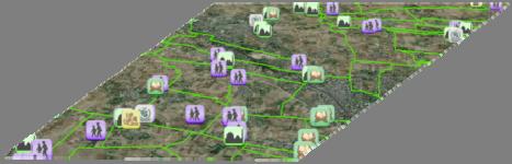
3 Earth Observation and its Applications EARTH OBSERVATIONS AND ITS APPLICATIONS Earth Observation and its applications has contributed significantly to national development and better management of available resources. The priority areas are: Agriculture and food security Health and education Hydrology Disaster monitoring and mitigation support Environment, climate change and snow / glacier monitoring Urban planning Land cover Mapping NSDI Coastal and marine resources Geology and mineral prospection Forestry AGRICULTURE AND FOOD SECURITY


 SPOT VGT 1000m Ancillary Ground Data Rainfall")
4 SATELLITE BASED CROP MONITORING SYSTEM On going project on the improvement of national and provincial capacity to collect and analyze agricultural information and deliver accurate, reliable, timely, precise and cost effective agricultural statistics using satellite and ground based observations to address issues of national food security. This is being obtained through: integration of remotely sensed data into existing data collection, analysis, and dissemination systems design and implementation of rigorous agriculture and rural survey methods (e.g. area frame and crop yield models) improvement of quality and outlook of current crop forecast/estimation bulletins development of human resources and technical capacities CROP MONITORING SYSTEM Blend of Satellite and Ground Systems SPOT 5 (2.5, 5, 10 m) SPOT VGT 1000m Ancillary Ground Data Rainfall Max Temp Min Temp Irrigation Fertilizer Field Info Analysis Forecast/Estimation


5 Development of agricultural masks for all major crops FAO, UN, SUPARCO collaborative project Objectives To develop agricultural mask showing distribution of different seasonal crops To understand the pattern of different main crops in response to market condition Assess the changes in agricultural land use Database development on spatiotemporal variation of different crops PAK-SCMS BULLETIN


6 HEALTH & EDUCATION DEVELOPMENT OF EDUCATION MANAGEMENT AND PLANNING SYSTEM


7 Factors analyzed for Correlations with Dengue Cases NDVI Relative Humidity Population Density Landuse /Landcover Lahore Land surface Temp DISASTER MONITORING AND MITIGATION SUPPORT


")


8 11/26/2013 MAJOR DISASTER MONITORING AND MITIGATION SUPPORT Since the earthquake of 2005 satellite imagery has been extensively utilized for relief/rescue, early recovery and rehabilitation/reconstruction efforts. SUPARCO & UN Office of Outer Space Affairs (UNOOSA) signed a cooperation agreement for establishment of UN-SPIDER Regional Support Office (RSO) during 47th Scientific & Technical Subcommittee Sessions on Peaceful Use of Outer Space (COPOUS) on 10th Feb 2010 PAK_RSO is Responsible for provision of timely space based information incase of major disaster in the region. It also undertakes awareness, capacity building and technical advisory support of organizations involved in disaster management and mitigation. The PAK-RSO operates on 24/7 basis. Landslides Earthquake 2013 Early Recovery Legend: Damaged Structures Temporary Shelters/Tents


9 ENVIRONMENT, CLIMATE CHANGE AND SNOW / GLACIER MONITORING 17 ENVIRONMENTAL MONITORING Strategic Country Environmental Assessment Monitoring Oil spill from Tasman Spirit Vessel using Satellite imagery Satellite based Aerosol Characterization, Source Apportionment and Impacts Study Feasibility Study for Development of Transportation Pollution Control Plan
 is enveloped with haze, dense winter fog starting from northeast to northwest and extended to the eastern part of Pakistan The maximum haze-affected area during")
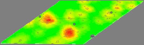
10 FOG AEROSOL CHARACTERIZATION, SOURCE APPORTIONMENT AND IMPACT ASSESSMENT Government of Pakistan approved a project to assess the increasing trend of winter dense fog in Punjab The results are: Indian region each year (October to March) is enveloped with haze, dense winter fog starting from northeast to northwest and extended to the eastern part of Pakistan The maximum haze-affected area during the last four years ( ) in Pakistan ranged from 155,241 Km 2 to 353,947 Km 2 The maximum winter fog-affected area during last four years in Pakistan ranged from 136,269 Km 2 to 380,921 Km 2 Agricultural productivity and human health affected POLLUTION - ENVIRONMENTAL IMPACTS Studies have been carried out on regional aerosols Integrated network of environmental observatories needs to be established to assess environmental impact including climate change


, China is carrying out research on Climate Change & Glacier")
11 NATIONAL ENVIRONNEMENTAL INFORMATION MANAGEMENT SYSTEM (NEIMS) To contribute in promotion of sustainable development through national capacity building in developing, managing and utilizing environmental information for decision-making To review and analyze current situation of environmental data/information management To develop sectoral and inter-sectoral database of existing environmental information To establish functional network of National Environmental Information Management System GLACIERS STUDIES SUPARCO in collaboration with Institute of Tibetan Plateau (ITP), China is carrying out research on Climate Change & Glacier Retreat, Snow/Ice in Northern Pakistan

12 HYDROLOGY DAM SITE SELECTION


13 PROGRAMME MONITORING UNIT (PMU) FOR IMPROVEMENT OF WATER COURSES Digitization of irrigation water courses and creation of a centralized spatial database Identification of water courses affected by flooding Field observations directly sent to PMU database through smartphone application URBAN PLANNING


 For")
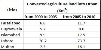

14 URBAN SPRAWL Urban Sprawl (conversion of agriculture lands) For National Environmental Information Management System (NEIMS)
 Encroachment (Semi built-up) Town boundary University Road LANDCOVER MAPPING OF")
15 UPGRADATION OF KCR (KARACHI CIRCULAR RAILWAY) Lyari Express Way Lyari River CURVE # 10 Sir Shah Suleman Road LEGEND: KCR Track PR Boundary Encroachment (Built-up) Encroachment (Semi built-up) Town boundary University Road LANDCOVER MAPPING OF PAKISTAN


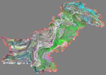
16 LANDCOVER MAPPING Mapping of Sindh and Punjab Provinces completed. KPK and Balochistan initiated in March 2013 KP GB China Afghanistan Punjab India Iran Balochistan Sindh * Sindh & Punjab provinces mapping has been completed NATIONAL SPATIAL DATA INFRASTRUCTURE

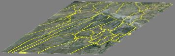

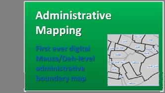
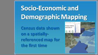


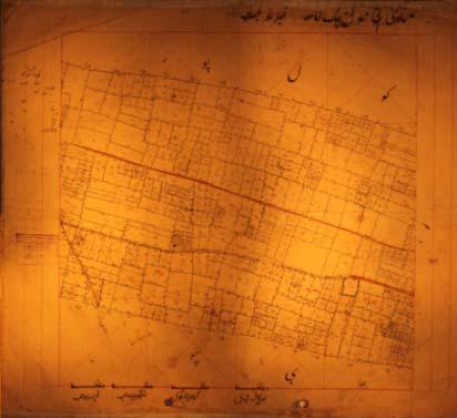
17 11/26/2013 NATIONAL SPATIAL DATABASE NATIONAL SPATIAL DATABASE SCANNING OF LAND REVENUE MAPS Dire need for preservation and digital storage of Land Revenue Maps ( )ﻣﺴﺎوﯼ Revenue Maps Last updated 1940 District Record Room, Jhelum Built 1860 Photographed 2010


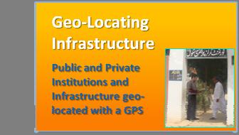
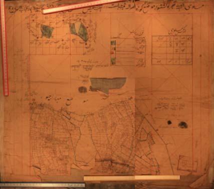
18 GEO LOCATING THE LAND REVENUE MAPS Availability of Land Revenue Maps to District Administrators EASE OF OVERSIGHT ACCESSIBILITY TRANSPARENCY موضع گرمالہ ٢٠١٠ قانونگوي ی جہلم ١ موضع گرمالہ مساوی ۴ ہاي ے ١٩۴٠ موضع گرمالہ قانونگوي ی جہلم ١ مواضعات ۴٣ مساوی ٢١٠ ہاي ے COASTAL AND MARINE RESOURCES


19 MAPPING & MONITORING COASTAL FORESTS Jiwani Gwadar Pasni Kalmat Khor Ormara Arabian Sea Sonmiani Karachi Indus River Thatta The locations of Mangrove Forests along the Coast of Sindh and Baluchistan, at Indus Delta Region Karachi Harbour Area Miani Hor, Sonmiani Bay Kalmat Khor Jiwani Lagoon, Gwadar Bay I n d u s D e l t a HABITAT MAPPING IN COASTAL REGIONS Identification of Low Lying Areas of Karachi for Tsunami Risk Mapping Arabian Sea Cyclones-Mapping of Cyclone Prone Areas, Inundation Mapping Monitoring and Mapping of Coastal Forest using Satellite Remote Sensing and GIS Techniques 10m SPOT-4 Classified Image of Study Area Determination of Sea Surface Temperature 10m SPOT-4 Landsat Image of Study Area

20 GEOLOGY AND MINERAL PROSPECTION METALLOGENIC ARC


21 FOLDS & FAULTS :POSSIBLE MINERAL PROSPECTS Fold Fault Fold MINERAL PROSPECTING AT KOH-E-SULTAN USING HYPERSPECTRAL IMAGE

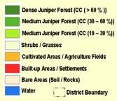
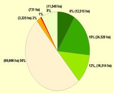
22 FORESTRY FOREST COVER ASSESSMENT IN ZIARAT
 Food & Agriculture Organization of United Nations Asia-Pacific Space Cooperation Org (APSCO) International")
 Asia-Pacific Regional Space Agency Forum (APRSAF) Committee on Space Research (COSPAR) International Society for Photogrammetry and Remote")
23 INTERNATIONAL COLLABORATION INTERNATIONAL COOPERATION UN Committee on the Peaceful Uses of Outer Space (UN COPUOS) China Academy of sciences (CAS) UN Economic & Social Commission for Asia & the Pacific (UN ESCAP) Food & Agriculture Organization of United Nations Asia-Pacific Space Cooperation Org (APSCO) International Astronomical Federation (IAF) SUPARCO United Nations Educational Scientific & Cultural Organization (UNESCO) The International Centre for Integrated Mountain Development (CIMOD) Asia-Pacific Regional Space Agency Forum (APRSAF) Committee on Space Research (COSPAR) International Society for Photogrammetry and Remote Sensing (ISPRS)
24 CONCLUSION Thank You
Building Institutional Capacity for Multi-Hazard Early Warning in Asia and the Pacific Subtitle
 Building Institutional Capacity for Multi-Hazard Early Warning in Asia and the Pacific Subtitle Title Keran Wang Chief, Space Applications Section ICT and Disaster Risk Reduction Division 22 May 2018 Pillar
RESAP Progress Report
 RESAP Progress Report December 2016 to October 2017 Presentation to the Twenty-first session of the Intergovernmental Consultative Committee on the Regional Space Applications Programme for Sustainable
Georeferencing and Satellite Image Support: Lessons learned, Challenges and Opportunities
 Georeferencing and Satellite Image Support: Lessons learned, Challenges and Opportunities Shirish Ravan shirish.ravan@unoosa.org UN-SPIDER United Nations Office for Outer Space Affairs (UNOOSA) UN-SPIDER
TOWARDS CLIMATE-RESILIENT COASTAL MANAGEMENT: OPPORTUNITIES FOR IMPROVED ICZM IN BELIZE
 TOWARDS CLIMATE-RESILIENT COASTAL MANAGEMENT: OPPORTUNITIES FOR IMPROVED ICZM IN BELIZE CHANTALLE SAMUELS Coastal Zone Management Authority and Institute The Caribbean Community Climate Change Centre VULNERABILITY
Capacity Building Programme
 Capacity Building Programme 14-17 August 2012 Space Technology for improving Hazard Mapping in Sri Lanka An event organised as a follow up of the UN-SPIDER Technical Advisory Mission to Sri Lanka - 17-21
Space Application in Support of Land Management for SDG Implementation
 Space Application in Support of Land Management for SDG Implementation Regional Expert Workshop on Land Accounting for SDG Monitoring and Reporting 26 September 2017 Space Application Section Information
Geospatial Information and Services for Disasters (GIS4D)
") Geospatial Information and Services for Disasters (GIS4D) 31 July 2017 Tae Hyung KIM ICT and Disaster Risk Reduction Division (IDD) UNESCAP 1 About ESCAP Who is ESCAP? United Nations Economic and Social
Geospatial Information and Services for Disasters (GIS4D) 31 July 2017 Tae Hyung KIM ICT and Disaster Risk Reduction Division (IDD) UNESCAP 1 About ESCAP Who is ESCAP? United Nations Economic and Social
Use of Geospatial data for disaster managements
 Use of Geospatial data for disaster managements Source: http://alertsystemsgroup.com Instructor : Professor Dr. Yuji Murayama Teaching Assistant : Manjula Ranagalage What is GIS? A powerful set of tools
Existing GIS Resources on the Indus Basin
 Existing GIS Resources on the Indus Basin Workshop on Spatial Information Analysis for the Sustainable Management of the Indus Basin in Pakistan May 26-27, 2003 Elements of Existing GIS Resources Data
A/AC.105/C.1/2012/CRP.10
 A/AC.105/C.1/2012/CRP.10 1 February 2012 English only Committee on the Peaceful Uses of Outer Space Scientific and Technical Subcommittee Forty-ninth session Vienna, 6-17 February 2012 Item 6 of the provisional
Geospatial Technologies for Resources Planning & Management
 Geospatial Technologies for Resources Planning & Management Lal Samarakoon, PhD Director, Geoinformatics Center Asian Institute of Technology, Thailand Content Geoinformatics for SDG Information Integration
Space-based technology and applications and space science for humanitarian affairs, environment and security
 Space-based technology and applications and space science for humanitarian affairs, environment and security LUC ST-PIERRE United Nations Office for Outer Space Affairs United Nations Office at Vienna
Socio-Economic Benefits of Weather, Water & Climate Services
 Socio-Economic Benefits of Weather, Water & Climate Services A Case Study of Pakistan Dr. Qamar-uz-Zaman Chaudhry Director General Pakistan Meteorological Department http://www.pakmet.com.pk Economic benefits
Earth Observations as a Tool To Achieve Sustainable Development Goals
 The image part with relationship ID rid3 was not found in the file. 16/10/2017 Earth Observations as a Tool To Achieve Sustainable Development Goals LI Jing, China GEO On behalf of the Group on Earth Observations
SPACE & UPPER ATMOSPHERE RESEARCH COMMISSION (SUPARCO)
") SPACE & UPPER ATMOSPHERE RESEARCH COMMISSION (SUPARCO) Pakistan Space & Upper Atmosphere Research Commission (SUPARCO) is the national space agency, responsible for execution of space technology ad applications
SPACE & UPPER ATMOSPHERE RESEARCH COMMISSION (SUPARCO) Pakistan Space & Upper Atmosphere Research Commission (SUPARCO) is the national space agency, responsible for execution of space technology ad applications
National Disaster Management Centre (NDMC) Republic of Maldives. Location
 Republic of Maldives. Location") National Disaster Management Centre (NDMC) Republic of Maldives Location Country Profile 1,190 islands. 198 Inhabited Islands. Total land area 300 sq km Islands range b/w 0.2 5 sq km Population approx.
National Disaster Management Centre (NDMC) Republic of Maldives Location Country Profile 1,190 islands. 198 Inhabited Islands. Total land area 300 sq km Islands range b/w 0.2 5 sq km Population approx.
Space Applications for Disaster Risk Reduction and Sustainable Development
 Space Applications for Disaster Risk Reduction and Sustainable Development Space Applications Section (SAS) ICT and Disaster Risk Reduction Division (IDD) UNESCAP Contents I. RESAP Activities 2016-2017
Geographic Information Infrastructure and Policy Framework for Sustainable Mountain Development in the Hindu Kush-Himalayas
 Geo SMART ASIA 2017 22-24 August, Kualalampur Geographic Information Infrastructure and Policy Framework for Sustainable Mountain Development in the Hindu Kush-Himalayas Basanta Shrestha, Director Strategic
Early Flood Warning System in Pakistan
 Early Flood Warning System in Pakistan By Muhammad Tahir Anwar Director General M/o National Food Security and Research Government of Pakistan Asian Water Cycle Forum 2016 March 1-2, 2016 Tokyo, Japan
Land Accounts - The Canadian Experience
 Land Accounts - The Canadian Experience Development of a Geospatial database to measure the effect of human activity on the environment Who is doing Land Accounts Statistics Canada (national) Component
AND THE COOPERATION WITH SENTINEL ASIA FOR DISASTER MANAGEMENT
 Ministry of Natural resources and Environment National Remote Sensing DEpartment NATIONAL REMOTE SENSING DEPARTMENT (NRSD) AND THE COOPERATION WITH SENTINEL ASIA FOR DISASTER MANAGEMENT By: Dr. Chu Hai
Effective Utilization of Synthetic Aperture Radar (SAR) Imagery in Rapid Damage Assessment
 Imagery in Rapid Damage Assessment") Effective Utilization of Synthetic Aperture Radar (SAR) Imagery in Rapid Damage Assessment Case Study Pakistan Floods SUPARCO M. Maisam Raza, Ahmad H. Rabbani SEQUENCE Flood Monitoring using Satellite
Effective Utilization of Synthetic Aperture Radar (SAR) Imagery in Rapid Damage Assessment Case Study Pakistan Floods SUPARCO M. Maisam Raza, Ahmad H. Rabbani SEQUENCE Flood Monitoring using Satellite
Development of Geospatial Information in Indonesia: Progress & Challenge
 Development of Geospatial Information in Indonesia: Progress & Challenge Dr. Nurwadjedi Sarbini Deputy of Thematic Geospatial Information Geospatial Information Agency (BIG) Geosmart Asia, September 29
UN GGIM and National SDI Strategy
 MSDI Open Forum on 26 th January 2016 Contributing to the successful delivery of MSDI UN GGIM and National SDI Strategy Hiroshi Murakami Deputy Administrator Geospatial Information Authority of Japan Geospatial
Establishment of Abdus Salam Geomagnetic Observatory Sonmiani, Pakistan: Site Selection to INTERMAGNET Certification
 Pakistan Space & Upper Atmosphere Research Commission Establishment of Abdus Salam Geomagnetic Observatory Sonmiani, Pakistan: Site Selection to INTERMAGNET Certification G. Murtaza Space Science Department
Report. Developing a course component on disaster management
 Report Developing a course component on disaster management By Chira Prangkio Tawee Chaipimonplin Department of Geography, Faculty of Social Sciences, Chiang Mai University Thailand Presented at Indian
By Lillian Ntshwarisang Department of Meteorological Services Phone:
 By Lillian Ntshwarisang Department of Meteorological Services Phone: +267 3612200 Email: lntshwarisang@gov.bw/ lntshwarisang@gmail.com Introduction Mandate of DMS Function of the Department Services to
Status and Challenges on Geo-DRM Information Systems in Tonga
 Name: Mafua- i-vai utukakau Maka Status and Challenges on Geo-DRM Information Systems in Tonga 1 Roles and Relationships Land and Geographic Information Systems (LGIS) Unit: Establish updated high-resolution
The City School. Pakistan Studies 2059/02 Paper 2 The Environment of Pakistan Class 9
 The City School Prep + Senior -1Section Pakistan Studies 2059/02 Paper 2 The Environment of Pakistan Class 9 Name: Class: The City School /PAF Chapter / Prep + Senior I Section / Worksheet for Intervention
Disaster RISK Management : Bhutanese Scenario
 Disaster RISK Management : Bhutanese Scenario Expert Group Meeting (EGM) on Geo-referenced Information Systems for Disaster Risk Management (Geo-DRM) and sustaining the Community of Practice (COP), Bangkok,
Spanish national plan for land observation: new collaborative production system in Europe
 ADVANCE UNEDITED VERSION UNITED NATIONS E/CONF.103/5/Add.1 Economic and Social Affairs 9 July 2013 Tenth United Nations Regional Cartographic Conference for the Americas New York, 19-23, August 2013 Item
Country Report Nepal Geospatial Data Sharing Initiatives of Survey Department Supporting Disaster Management
 Third JPTM Step 2 for Sentinel Asia 6-8 July, 2010 Manila, The Philippines Country Report Nepal Geospatial Data Sharing Initiatives of Survey Department Supporting Disaster Management Durgendra M Kayastha
Global Map: A Tool for Disaster Mitigation for the Asia and Pacific Region
 Global Map: A Tool for Disaster Mitigation for the Asia and Pacific Region D. R. Fraser Taylor Chair, International Steering Committee for Global Mapping (ISCGM) fraser_taylor@carleton.ca www. 18 th United
Vietnam Coastal Erosion - Cause and Challenges -
 Administration of Sea and Islands Center for Oceanography University of Transport and Communications, Hanoi Vietnam Vietnam Coastal Erosion - Cause and Challenges - Presenters: Pham Hoang KIEN Le Van CONG
Disaster Management and Spatial Data An Experience of Sri Lanka for Joint project team meeting 2012
 Disaster Management and Spatial Data An Experience of Sri Lanka for Joint project team meeting 2012 1 by Padma Kumara Withana Provincial Surveyor General Uva Province 2 Out line ü Introduction ü Natural
Urban Integrated Services and Multi-Hazard Early Warning Systems
 WMO for UN New Urban Agenda Urban Integrated Services and Multi-Hazard Early Warning Systems Gregory R. Carmichael WMO WMO Priority: Urbanization - Research and services for megacities and large urban
Geospatial framework for monitoring SDGs/Sendai targets By Shimonti Paul Sr. Assistant Editor Geospatial Media & Communications
 Geospatial framework for monitoring SDGs/Sendai targets By Shimonti Paul Sr. Assistant Editor Geospatial Media & Communications Outline 1. Introduction to Geospatial Media and Communications 2. Geospatial
Measuring Disaster Risk for Urban areas in Asia-Pacific
 Measuring Disaster Risk for Urban areas in Asia-Pacific Acknowledgement: Trevor Clifford, Intl Consultant 1 SDG 11 Make cities and human settlements inclusive, safe, resilient and sustainable 11.1: By
Status & Challengers of Cook Islands GEO DRM. Cook Islands GEO S/GIS History
 Status & Challengers of Cook Islands GEO DRM By Patrick A. ARIOKA Planning & Advisory Officer EMERGENCY MANAGEMENT COOK ISLANDS Cook Islands GEO S/GIS History 1990 NZODA/MFAT trained by Landcare Research
Report of the Regional Committee of UN-GGIM for Asia and the Pacific (UN-GGIM-AP)
") Report of the Regional Committee of UN-GGIM for Asia and the Pacific (UN-GGIM-AP) At the Eighth Session of UN-GGIM UN Headquarters, New York, 1 3 August 2018 About UN-GGIM-AP One of the five regional committees
Report of the Regional Committee of UN-GGIM for Asia and the Pacific (UN-GGIM-AP) At the Eighth Session of UN-GGIM UN Headquarters, New York, 1 3 August 2018 About UN-GGIM-AP One of the five regional committees
March 2007 The Survey Department of Sri Lanka
 Contribution of Survey Department of Sri Lanka for Mitigation of Disasters in Sri Lanka K.A.U.N.Kasthuri Deputy Surveyor General (Information Technology) March 2007 The Survey Department of Sri Lanka 1
Department of Geography: Vivekananda College for Women. Barisha, Kolkata-8. Syllabus of Post graduate Course in Geography
 India: Regional Problems and Resource management Module 11 (Full Marks 50) Unit I: Region and Regionalisation 1.1 Various bases of regionalisation of India; problems of identification and delineation.
GI Technology for Disaster Management
 GI Technology for Disaster Management 17 th ICC on the Regional Space Applications Programme for Sustainable Development (RESAP) 26 th Nov 2013 Bangkok Thailand Period and time of seasonal in thailand
KENYA NATIONAL BUREAU OF STATISTICS Workshop on
 KENYA NATIONAL BUREAU OF STATISTICS Workshop on Capacity Building in Environment Statistics: the Framework for the Development of Environment Statistics (FDES 2013) Coordination with Sector Ministries
Joint Meeting of RA II WIGOS Project and RA V TT-SU on 11 October 2018 BMKG Headquarter Jakarta, Indonesia. Mrs. Sinthaly CHANTHANA
 Joint Meeting of RA II WIGOS Project and RA V TT-SU on 11 October 2018 BMKG Headquarter Jakarta, Indonesia Mrs. Sinthaly CHANTHANA Lao PDR Background Department of Meteorology and Hydrology ( DMH ) in
The Governance of Land Use
 The planning system Levels of government and their responsibilities The Governance of Land Use COUNTRY FACT SHEET NORWAY Norway is a unitary state with three levels of government; the national level, 19
Copernicus Overview. Major Emergency Management Conference Athlone 2017
 Copernicus Overview Major Emergency Management Conference Athlone 2017 Copernicus is a European programme implemented by the European Commission. The services address six thematic areas: land, marine,
UNIT 11 SOUTH ASIA SG 1 - PHYSICAL GEOGRAPHY & THE ENVIRONMENT
 UNIT 11 SOUTH ASIA SG 1 - PHYSICAL GEOGRAPHY & THE ENVIRONMENT I. PHYSICAL GEOGRAPHY TAKE OUT YOUR PHYSICAL MAP OF SOUTH ASIA A. The Himalayan Mountains form the northern boundary of the region (color
DEPARTMENT OF GEOLOGY AND MINERAL INDUSTRIES WAYS & MEANS SUBCOMMITTEE ON NATURAL RESOURCES MARCH 2, 2017
 DEPARTMENT OF GEOLOGY AND MINERAL INDUSTRIES WAYS & MEANS SUBCOMMITTEE ON NATURAL RESOURCES MARCH 2, 2017 1 ABOUT DOGAMI AGENCY MISSION, VISION & GOALS 2 Lidar image of a stream network along the Umpqua
Local EPM Implementation Process in 5 stages
 Local PM Implementation Process in 5 stages 3. Working groups 1. City nvironmental Profile/ Outlook 5. Consolidation & Institutionalisation 4. Strategy & Action plans 2. City Consultation Urban nvironmental
MODELING AND SOCIO-ECONOMIC IMPACT ANALYSIS OF FLOODS IN COASTAL CITIES UNDER SEA LEVEL RISING SCENARIOS: A CASE STUDY OF KARACHI, PAKISTAN ABSTRACT
 MODELING AND SOCIO-ECONOMIC IMPACT ANALYSIS OF FLOODS IN COASTAL CITIES UNDER SEA LEVEL RISING SCENARIOS: A CASE STUDY OF KARACHI, PAKISTAN Habib-ur-Rehman 1), Rabin Bhattarai 2) 1) University of Engineering
ECONOMIC AND SOCIAL COUNCIL
 UNITED NATIONS E/CONF.102/3 ECONOMIC AND SOCIAL COUNCIL Nineteenth United Nations Regional Cartographic Conference for Asia and the Pacific Bangkok, 29 October 1 November 2012 Item 4 of the provisional
IGAD Climate Prediction and Applications Centre Monthly Bulletin, August 2014
 IGAD Climate Prediction and Applications Centre Monthly Bulletin, 1. HIGHLIGHTS/ ACTUALITES Rainfall activities were mainly observed over the central parts of the northern sector and western parts of equatorial
M14/3/GEOGR/SP2/ENG/TZ0/XX/Q GEOGRAPHY STANDARD LEVEL PAPER 2. Monday 19 May 2014 (morning) 1 hour 20 minutes INSTRUCTIONS TO CANDIDATES
 1 hour 20 minutes INSTRUCTIONS TO CANDIDATES") M14/3/GEOGR/SP2/ENG/TZ0/XX/Q 22145203 GEOGRAPHY STANDARD LEVEL PAPER 2 Monday 19 May 2014 (morning) 1 hour 20 minutes INSTRUCTIONS TO CANDIDATES Do not open this examination paper until instructed to do
M14/3/GEOGR/SP2/ENG/TZ0/XX/Q 22145203 GEOGRAPHY STANDARD LEVEL PAPER 2 Monday 19 May 2014 (morning) 1 hour 20 minutes INSTRUCTIONS TO CANDIDATES Do not open this examination paper until instructed to do
Geospatial Information for Disaster Risk Management in Asia-Pacific Region
 Geospatial Information for Disaster Risk Management in Asia-Pacific Region Ram S. Tiwaree, Dr.Eng. Space Applications Section Information and Communications Technology and Disaster Risk Reduction Division
Disaster Risk Assessment: Opportunities for GIS and data management with Open DRI
 Disaster Risk Assessment: Opportunities for GIS and data management with Open DRI Jacob Opadeyi Department of Geomatics Engineering and Land Management, The University of the West Indies, St. Augustine,
Progress Report. Flood Hazard Mapping in Thailand
 Progress Report Flood Hazard Mapping in Thailand Prepared By: Mr. PAITOON NAKTAE Chief of Safety Standard sub-beuro Disaster Prevention beuro Department of Disaster Prevention and Mitigation THAILAND E-mail:
PAKISTAN. WINTER RAINFALL PREDICTION Hazrat Mir. Cief Met Pakistan Meteorological Department 14 th, October2015
 PAKISTAN WINTER RAINFALL PREDICTION Hazrat Mir Cief Met Pakistan Meteorological Department 14 th, October2015 Monsoon 2013 seasonal forecast, PMD, Islamabad, 7 June, 2013 2 Monsoon 2013 seasonal forecast,
South Asian Climate Outlook Forum (SASCOF-6)
") Sixth Session of South Asian Climate Outlook Forum (SASCOF-6) Dhaka, Bangladesh, 19-22 April 2015 Consensus Statement Summary Below normal rainfall is most likely during the 2015 southwest monsoon season
Sixth Session of South Asian Climate Outlook Forum (SASCOF-6) Dhaka, Bangladesh, 19-22 April 2015 Consensus Statement Summary Below normal rainfall is most likely during the 2015 southwest monsoon season
Report on the Actions Taken on Resolutions of the Eighteenth United Nations Regional Cartographic Conference for Asia and the Pacific
 UNITED NATIONS E/CONF.102/7 ECONOMIC AND SOCIAL COUNCIL Nineteenth United Nations Regional Cartographic Conference for Asia and the Pacific Bangkok, 29 October 1 November 2012 Item 4 of the provisional
Inventory of United Nations Resolutions on Cartography Coordination, Geographic Information and SDI 1
 Inventory of United Nations Resolutions on Cartography Coordination, Geographic Information and SDI I. Resolutions on Cartography Coordination and Establishment of United Nations Regional Cartographic
Natural Disasters in Member Countries (2002 Summary)
") 4.2 Member Countries and their Disaster Characteristics: Table 5: Natural Disasters in Member Countries (2002 Summary) (Country/Disaster Type/Disaster Characteristics) Data Country DisType Count of TotAff
4.2 Member Countries and their Disaster Characteristics: Table 5: Natural Disasters in Member Countries (2002 Summary) (Country/Disaster Type/Disaster Characteristics) Data Country DisType Count of TotAff
GIS and Remote Sensing
 Spring School Land use and the vulnerability of socio-ecosystems to climate change: remote sensing and modelling techniques GIS and Remote Sensing Katerina Tzavella Project Researcher PhD candidate Technology
COPUOS and the UN Development Agenda. Niklas Hedman, UNOOSA
 COPUOS and the UN Development Agenda Niklas Hedman, UNOOSA 2 Committee on the Peaceful Uses of Outer Space Established 1959. In 1961 establishment of two Subcommittees Scientific and Technical Subcommittee
GIS (GEOGRAPHICAL INFORMATION SYSTEMS) AS A FACILITATION TOOL FOR SUSTAINABLE DEVELOPMENT IN AFRICA
 AS A FACILITATION TOOL FOR SUSTAINABLE DEVELOPMENT IN AFRICA") GIS (GEOGRAPHICAL INFORMATION SYSTEMS) AS A FACILITATION TOOL FOR SUSTAINABLE DEVELOPMENT IN AFRICA a presentation by Elizabeth Hicken GDEST Conference on Geospatial Sciences for Sustainable Development
GIS (GEOGRAPHICAL INFORMATION SYSTEMS) AS A FACILITATION TOOL FOR SUSTAINABLE DEVELOPMENT IN AFRICA a presentation by Elizabeth Hicken GDEST Conference on Geospatial Sciences for Sustainable Development
Roles of NGII in successful disaster management
 The Second UN-GGIM-AP Plenary Meeting Roles of NGII in successful disaster management Republic of Korea Teheran Iran 28 October 2013 Sanghoon Lee, Ph.D. NGII Outline Type of Disasters Occur in Korea Practical
Disaster Management & Recovery Framework: The Surveyors Response
 Disaster Management & Recovery Framework: The Surveyors Response Greg Scott Inter-Regional Advisor Global Geospatial Information Management United Nations Statistics Division Department of Economic and
Overview of Technical Advisory Missions
 Expert Group Meeting (EGM) on Georeferenced Information Systems for Disaster Risk Management (Geo-DRM) and sustaining the Community of Practice (COP) 23-25 April 2014 Bangkok Overview of Technical Advisory
Strategic Framework on Geospatial Information and Services for Disasters
 Strategic Framework on Geospatial Information and Services for Disasters Case Studies for the Caribbean and the Philippines --- Kunming Forum on United Nations Global Geospatial Information Management
Challenges and Potentials of Place Based Information Management in Nepal"
 Nineteenth United Nations Regional Cartographic Conference for Asia and the Pacific, Bangkok, Thailand, 29 October 1 November 2012 Challenges and Potentials of Place Based Information Management in Nepal"
European Space Agency
 Guidelines - Guidelines how/when to interact during the WebEx session: - Due to the number of attendees, please keep always your webcam and microphone switched-off - You can use anytime the chat to all
Remote Sensing and EO activities at the University of Turku
 Remote Sensing and EO activities at the University of Turku Niina Käyhkö Associate Professor Department of Geography and Geology GEO meeting/syke May 23rd, 2018 Geospatial competence at the University
Norwegian spatial data infrastructure supporting disaster risk management Norwegian Mapping Authority
 Norwegian spatial data infrastructure supporting disaster risk management Norwegian Mapping Authority Arvid Lillethun, Norwegian Mapping Authority Land and Poverty 2018 Conference, World Bank 19.-23. March
Geospatial Information Management in the Americas: Lessons for the Post-2015 development agenda
 Geospatial Information Management in the Americas: Lessons for the Post-2015 development agenda Rolando Ocampo President, UN-GGIM: Americas October 2014 The integration of statistical and geographical
Hazard monitoring by using new generation satellite data: Pakistan Metrological Department s perspective
 Hazard monitoring by using new generation satellite data: Pakistan Metrological Department s perspective Ms. Humeira Hafeez Pakistan Meteorological Department Top Three Hazards Monsoon Activity Tropical
Coastal Inundation Forecasting Demonstration Project CIFDP. Flood Forecasting Initiative-Advisory Group (FFI-AG 3), Geneva, 5-7 Dec, 2017
, Geneva, 5-7 Dec, 2017") Coastal Inundation Forecasting Demonstration Project CIFDP Flood Forecasting Initiative-Advisory Group (FFI-AG 3), Geneva, 5-7 Dec, 2017 Coastal Flooding & Vulnerable Populations Coastal populations are
Coastal Inundation Forecasting Demonstration Project CIFDP Flood Forecasting Initiative-Advisory Group (FFI-AG 3), Geneva, 5-7 Dec, 2017 Coastal Flooding & Vulnerable Populations Coastal populations are
On strategy for the development of the Russian Federation activities in the Antarctic for the period until 2020 and longer-term perspective
 Agenda Item: ATCM 5 Presented by: Original: Russian Federation Russian, English On strategy for the development of the Russian Federation activities in the Antarctic for the period until 2020 and longer-term
Applied Geoscience and Technology Division SOPAC. Joy Papao, Risk Information Systems Officer
 Joy Papao, Risk Information Systems Officer Secretariat of the Pacific Community SPC 22 Pacific Island States Head office in Noumea, New Caledonia 2 Regional offices (Pohnpei and Honiara) 600 staff 9 Technical
Part : General Situation of Surveying and Mapping. The Development of Surveying and Mapping in China. The contents
 The Development of Surveying and Mapping in China Dr. Ping Xiao China.P.R The contents Part : General Situation of Surveying and Mapping 1. The legal systems of surveying and mapping 2. The technologies
EuroGEOSS Protected Areas Pilot
 EuroGEOSS Protected Areas Pilot Max Craglia European Commission Joint Research Centre Part 1: the present MyNatura2000 Mobile app. Awareness raising & volunteered data collection. Natura2000 covers 18%
Application of Satellite Data for Flood Forecasting and Early Warning in the Mekong River Basin in South-east Asia
 MEKONG RIVER COMMISSION Vientiane, Lao PDR Application of Satellite Data for Flood Forecasting and Early Warning in the Mekong River Basin in South-east Asia 4 th World Water Forum March 2006 Mexico City,
GEOMATICS. Shaping our world. A company of
 GEOMATICS Shaping our world A company of OUR EXPERTISE Geomatics Geomatics plays a mayor role in hydropower, land and water resources, urban development, transport & mobility, renewable energy, and infrastructure
Working Together and Building a Secure and Prosperous Society
 APRSAF-13 Working Together and Building a Secure and Prosperous Society Space-Related Activities in Thailand 5 December 2006 1. Earth Observation 2. Space Communications 2.1 Thai Communication Satellites:
Operational Definitions of Urban, Rural and Urban Agglomeration for Monitoring Human Settlements
 Operational Definitions of Urban, Rural and Urban Agglomeration for Monitoring Human Settlements By Markandey Rai United Nations Human Settlements Programme PO Box-30030 Nairobi, Kenya Abstract The United
The Role of Urban Planning and Local SDI Development in a Spatially Enabled Government. Faisal Qureishi
 The Role of Urban Planning and Local SDI Development in a Spatially Enabled Government Faisal Qureishi 1 Introduction A continuous increase in world population combined with limited resources has lead
Progress on the Development of the Strategic Framework on Geospatial Information and Services for Disasters
 Progress on the Development of the Strategic Framework on Geospatial Information and Services for Disasters Dr. Peter N. Tiangco Administrator, NAMRIA, Philippines Co-chair, Working Group on Geospatial
USGS National Geospatial Program Understanding User Needs. Dick Vraga National Map Liaison for Federal Agencies July 2015
 + USGS National Geospatial Program Understanding User Needs Dick Vraga National Map Liaison for Federal Agencies July 2015 + Topics 2 Background Communities of Use User Surveys National Map Liaisons Partnerships
Creating synergies between Statistical and Geospatial information for better policy outputs: The case of Mexico
 Creating synergies between Statistical and Geospatial information for better policy outputs: The case of Mexico Geospatial & Statistics Integration for Informed Decision Making Geospatial World Forum 2017
OUTLINE OF PRESENTATION
 XXIV FIG International Congress 2010 SIDS Workshop, Small Island Developing States and The Millennium Development Goals 14 th and 15 th April 2010, Sydney, Australia. Case Study of the Papua New Guinea
ANNOUNCEMENT WMO/ESCAP PANEL ON TROPICAL CYCLONES THIRTY-EIGHTH SESSION NEW DELHI, INDIA
 WMO IMD ESCAP ANNOUNCEMENT THIRTY-EIGHTH SESSION NEW DELHI, INDIA (21-25 February 2011) HISTORICAL BACKGROUND The tropical cyclones are particularly severe in the north Indian Ocean region. The northern
Natura 2000 and spatial planning. Executive summary
 Natura 2000 and spatial planning Executive summary DISCLAIMER The information and views set out in this study are those of the author(s) and do not necessarily reflect the official opinion of the Commission.
Disaster Prevention and Management in Asia: The Context of Human Security and Its Relevance to Infrastructure Planning and Management
 Disaster Prevention and Management in Asia: The Context of Human Security and Its Relevance to Infrastructure Planning and Management Rajib Shaw http://www.iedm.ges.kyoto-u.ac.jp/ Contents Background and
Title: Earthquake Pre-Loss Estimation for Pakistan: Towards Development of GIS-based Analytical Framework
 Muhammad Ahmed HOUSE # 4/A TAJ MENSION NEAR SHOE MARKET, KARACHI POSTAL CODE: 74400 +92-321-2447473 muhammadahmed@neduet.edu.pk, ahmed.geographer@gmail.com Professional Profile Eager to bring university
Geospatial Policy Development and Institutional Arrangements *
 HIGH LEVEL FORUM ON GLOBAL GEOSPATIAL MANAGEMENT INFORMATION WORKING PAPER No. 13 First Forum Seoul, Republic of Korea, 24-26 October 2011 Geospatial Policy Development and Institutional Arrangements *
Disaster Management in Mongolia
 The Third UN-GGIM-AP Plenary Meeting Disaster Management in Mongolia ~Coordination among NGIA & Other Related Organizations and Recommendations~ Bali Indonesia 10 November 2014 Khurelshagai Ayurzana, Director
WMO. Early Warning System
 World Meteorological Organization Working together in weather, climate and water WMO Tropical Cyclone Early Warning System Koji Kuroiwa Tropical Cyclone Programme World Meteorological Organization For
Background Document: Report of the Regional Committee of United Nations Global Geospatial Information Management for Asia and the Pacific
 Background Document: Report of the Regional Committee of United Nations Global Geospatial Information Management for Asia and the Pacific 1. Summary 1. This report highlights the activities carried out
UN-SPIDER. In this issue. In focus What Satellites can see - Earth Observation for Disaster Response. June 2013 Vol. 2/13
 UN-SPIDER www.un-spider.org Nothing gives us a quicker overview than looking at something from a bird s perspective. In a disaster situation, after an earthquake or during a flood, satellite images can
GENERAL RECOMMENDATIONS. Session 7. Breakout discussion. discuss on regional and interregional. proposals 1. COLLABORATION BETWEEN PROGRAMMES
 Session 7 24 July 2016, 9.00-11.00 Breakout discussion on regional and interregional joint project proposals Mr Shahbaz Khan summarized the two days of presentations and exchanges and requested the participants
Report of the Working Group 2 Data Sharing and Integration for Disaster Management *
 UNITED NATIONS E/CONF.104/6 ECONOMIC AND SOCIAL COUNCIL Twentieth United Nations Regional Cartographic Conference for Asia and the Pacific Jeju, 6-9 October 2015 Item 5 of the provisional agenda Report