Launch of the Atlas and workshop on Land Use Land Cover
|
|
|
- Prosper Walton
- 5 years ago
- Views:
Transcription

1 The formal opening ceremony of the meeting took place on Tuesday 11 July 2017 and was chaired by Mrs. Fanta C. Kafando, Director of Environmental Preservation representing the Minister of the Environment of Burkina Faso in presence of Dr. Djimé Adoum, Executive Secretary of CILSS, HE Mr. Andrew Young, Ambassador of the United States of America in Burkina Faso, Mr. Robert Buzzard, Representative of USAID West Africa and Mr. Gray Tappan, Representative of the USGS. Over 100 participants composed of Directors General of Ministries, CONACILSS, parliamentarians, the Faso Farmers' Confederation, Technical and Financial Partners (EU, Canada, USAID, FAO, UNCCD, World Bank, ECOWAS, AU, and UEMOA) Experts from CILSS, USGS and USAID WA attended the workshop. The overall objective of this workshop is to inform West African decision-makers and technical and financial partners about the environmental monitoring tools / products developed by CILSS /ARC for decision support. Specifically, the workshop aims to promote: Actions to improve the capacity of CILSS and ECOWAS to formulate and implement action plans that build on previous national and regional validation workshops, learning events and stakeholder workshops; Strategies for effective use of project data and products to meet spatial analysis needs for national and local planning in countries. Essentially, get participants to focus and identify their product demands (eg, spatial dynamics of forest ecosystems, supporting carbon mapping); National programs, obligations and compliance with multilateral agreements on environment (eg national communications required under the UNFCCC) and how data and products can meet those needs; Establishing functional linkages between USGS, CILSS / ARC and the SERVIR project by determining which services, data, analytical approaches and project outputs could be used / supported by SERVIR West Africa at the AGRHYMET Regional Centre. High table of the ceremony, from right to left: Dr Gray, Dr Djimé, Mrs Fanta, HE Mr Andrew and Mr Robert


.")

2 Speeches at the Opening Ceremony An excerpt from Dr. Djimé s speech «this atlas, beyond its scientific value, aims to encourage not only action and mobilization for the protection of natural resources of West Africa and the Sahel, but also to the globalization of production systems to create wealth and employment. I therefore invite scientists, teachers, planners, development project managers, national, regional and local decisionmakers, PTFs, civil society organizations and students to make the most use of this book...» An excerpt from Dr Gray s speech «Land use Land cover maps in each West African country give us a much clearer picture of the changes (their types, patterns, magnitudes and driving factors). Knowledge of land use is essential to understanding and potentially addressing environmental sustainability issues such as climate change, increasing food demand, accelerated urbanization and changes in the functioning of ecosystems...» An excerpt from Mr Robert s speech «My point is that during the next two days we want to use our time together to get beyond producing a laundry list of potential uses of land use land cover data to an exploration of real problems to be solved and to which we can commit limited resources» An excerpt from Mr Andrew s speech «the LULC program has gathered an impressive amount of data and the atlas «a window on a changing world» we are launching today, contains mapping products of exceptional quality and accuracy. These data will support detailed analyzes at national and regional levels that affect land use, food security and natural resource management»


3 An excerpt from Mrs. Fanta's opening address «This book, which will be, in a few moment launched formally, is not only a reference document, but a real advocate for more investment in natural resource management. I take this opportunity to invite our partners to follow USAID in supporting our regional institutions such as the CILSS, which work tirelessly to improve the living conditions of the Sahelian and West African populations...»


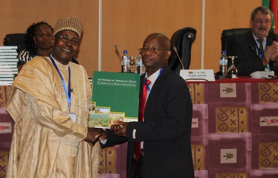
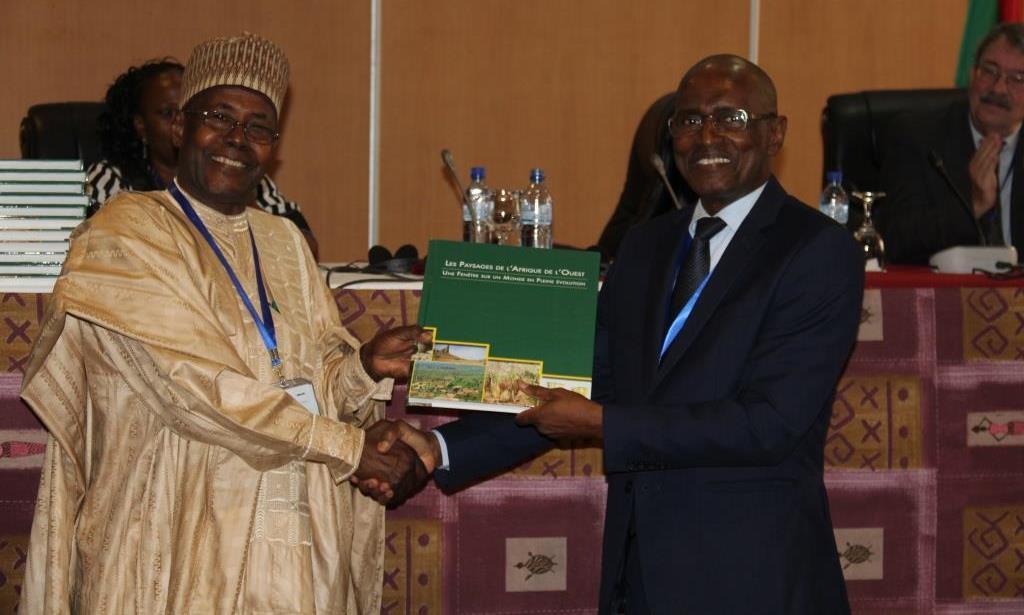
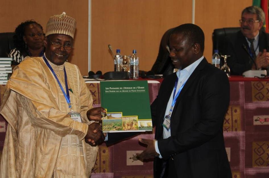
4 Formal delivery of the atlases to countries SP CONACILSS of Côte d Ivoire SP CONACILSS of Burkina Faso The representative of Ghana SP CONACILSS of Benin


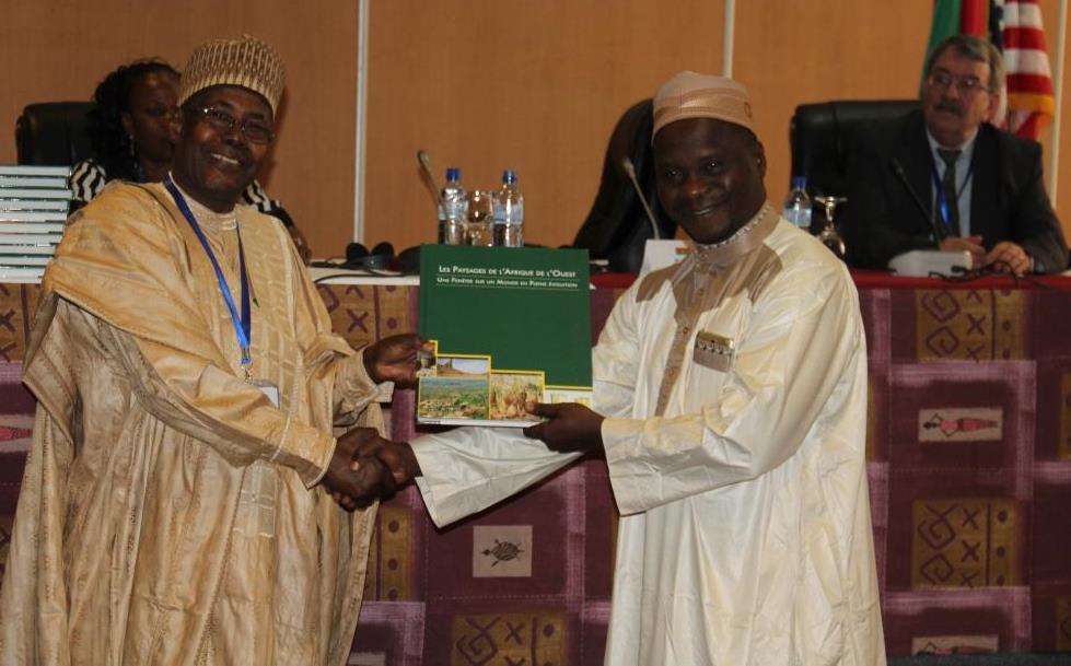
5 SP CONACILSS of the Gambia SP CONACILSS of the Guinea Bissau SP CONACILSS of the Guinea SP CONACILSS of Mali
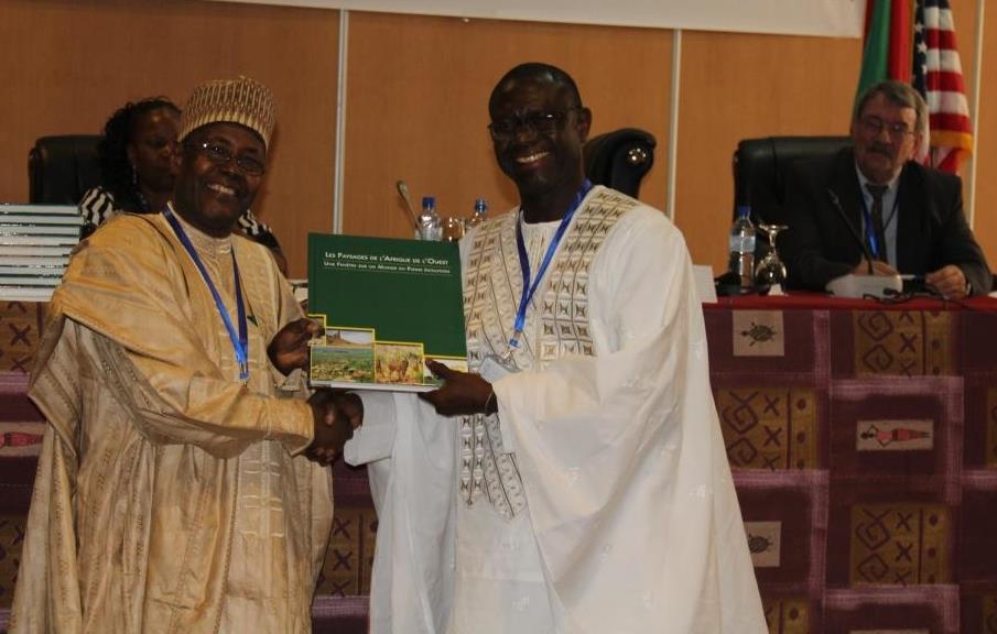
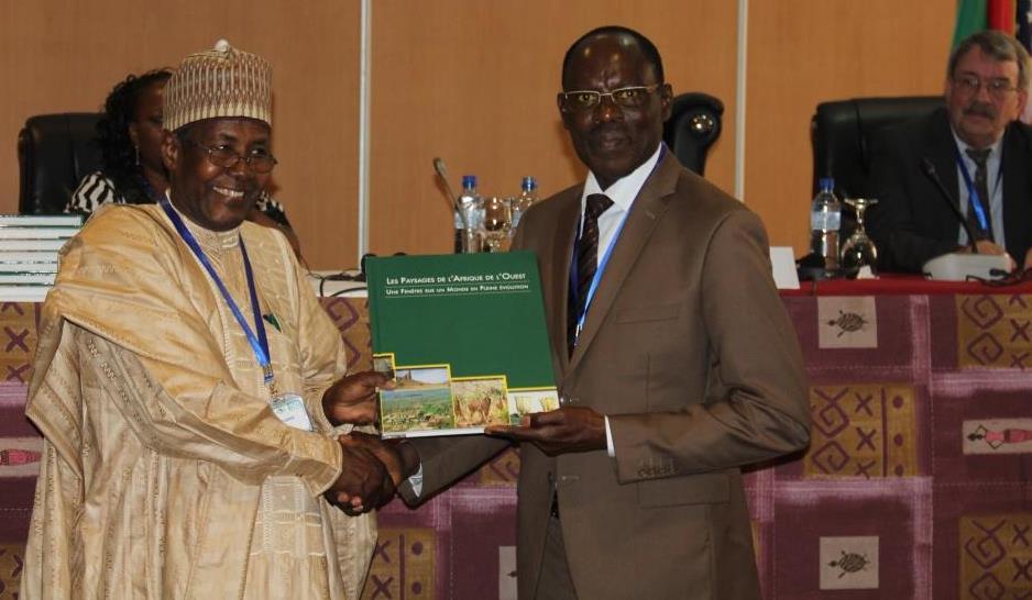
6 The representative of Niger SP CONACILSS of Tchad SP CONACILSS of Senegal SP CONACILSS of Togo


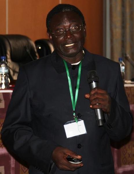
7 guided tour of the posters by Mr. Alfari Issifou Presentation of the Atlas by Mr Gray introduction to the decision support tool to assist countries in their national commitments to the implementation of international environmental conventions by Dr Djimé Adoum High table of the ceremony, from left to right: Mme Belém, Dr Djimé et M. Marc


8 presentation of the history of the LULC program by Mr. Alfari presentation of the results of the regional mapping by Mr. Alfari presentation of the LULC mapping: methodological approach by M. Gray presentation of mapping results and case studies: Burkina Faso by Mr. Sidibé


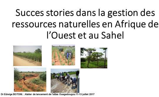
9 Mali by Dr Ballo Tchad by Dr Ouya Niger by M. Nouhou Presentation on Assisted Natural Regeneration in Niger and Burkina Faso by Dr. Botoni


 or")
10 presentation of analyzes and results on good practices, USAID / Sahel Regional Office program by Mr. Gray presentation on the database (metadata) web site (archiving) or downloading of data by Mr. Alfari


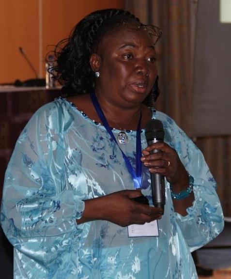
11 what contribution of the LULC tool to support the MEA implementation program? Presented by Dr. Kairé presentation of the SERVIR program: Building on the achievements of the LULC project implementation process by Mr. Saliou case study of the use of the atlas in Niger by Mrs. Zalia State of implementation of the SERVIR West Africa program by Mr. Bako


12 closing ceremony chaired by Dr. Djimé Adoum in presence of Mr. Robert facilitators of the workshop : Mr Atouga and Mr MBallo intervention of Mr Atouga High table of the closing ceremony, from left to right : M. Robert, Dr Djimé View of the room during the closing ceremony

13 Group photo
National workshops for analysis of Cadre Harmonisé of Nigeria : Consolidation and restitution
 Opening ceremony The formal opening ceremony of this meeting took place on friday october 28 th, 2016 and was chaired by Mr. Kevin Tekpat, DIR/NPFS representative the Permanent Secretary Federal Ministry
A contribution to GEOSS from the SDI for Georesources in Africa
 A contribution to GEOSS from the SDI for Georesources in Africa A. TELLEZ-ARENAS BRGM, France in behalf of: Dr. Marc URVOIS Project Coordinator BRGM, France Mineral Resources Division INSPIRE Conference
THE ROLE OF SEAMIC IN SUSTAINABLE MINERAL RESOURCES DEVELOPMENT IN AFRICA
 THE ROLE OF SEAMIC IN SUSTAINABLE MINERAL RESOURCES DEVELOPMENT IN AFRICA Ketema Tadesse Director General-SEAMIC Dar es Salaam, Tanzania August 11, 2009 SEAMIC BACKGROUND SEAMIC was established in 1977
13 th EUMETSAT User Forum in Africa
 13 th EUMETSAT User Forum in Africa GMES & Africa implementation in Western Africa Dogbeda M.Y. Azumah Regional Marine Centre University of Ghana Pictures zone UG GMES Presentation Layout UG G Project
RCOF Review [Regional Climate Outlook Forum for the Gulf of Guinea region of Africa - PRESAGG] Status Report
![RCOF Review [Regional Climate Outlook Forum for the Gulf of Guinea region of Africa - PRESAGG] Status Report](/thumbs/78/77466191.jpg "RCOF Review [Regional Climate Outlook Forum for the Gulf of Guinea region of Africa - PRESAGG] Status Report") RCOF Review 2017 [Regional Climate Outlook Forum for the Gulf of Guinea region of Africa - PRESAGG] Status Report Specific Climate features of concerned region This region typically covers the area below
RCOF Review 2017 [Regional Climate Outlook Forum for the Gulf of Guinea region of Africa - PRESAGG] Status Report Specific Climate features of concerned region This region typically covers the area below
GEF EXPANDED CONSTITUENCY WORKSHOP. 4-6 September, Abidjan, Cote d Ivoire. REPORT OF WORKSHOP PROCEEDINGS. Samuel Dotse
 GEF EXPANDED CONSTITUENCY WORKSHOP 4-6 September, 2012 Abidjan, Cote d Ivoire. REPORT OF WORKSHOP PROCEEDINGS Samuel Dotse RFP GEF NGO Network, West Africa FORWARD The Rapporteur- Samuel Dotse gratefully
SECOND GENERATION SEASONAL CLIMATE OUTLOOK PROGRAMME
 Page 1/5 CENTRE AFRICAIN POUR LES APPLICATIONS DE LA METEOROLOGIE AU DEVELOPPEMENT AFRICAN CENTRE OF METEOROLOGICAL APPLICATIONS FOR DEVELOPMENT Institution Africaine parrainée par la CEA et l OMM African
Sahel Conference 2007: Improving Lives by Understanding Weather. 2-6 April 2007 Ouagadougou, Burkina Faso
 Sahel Conference 2007: Improving Lives by Understanding Weather 2-6 April 2007 Ouagadougou, Burkina Faso Three Principal Sponsors Programme SAAGA, Burkina Faso Commité Permanent Inter-Etats de Lutte Contre
Cornelia F.A. van Wesenbeeck Amsterdam Centre for World Food Studies, VU University, Amsterdam. Study for SWAC/OECD
 Cornelia F.A. van Wesenbeeck Amsterdam Centre for World Food Studies, VU University, Amsterdam Study for SWAC/OECD Policies to improve FNS require solid empirical base At least headcounts of people below/above
Weather Climate Science to Service Partnership South Africa
 PROJECTS UNDERWAY Title of the Weather Climate Science to Service Partnership South Africa Together, building on an existing strong partnership, South African Weather Service and the Met Office will build
Economic and Social Council
 United Nation E/C.20/2012/4/Add.1 Economic and Social Council Distr.: General 2 July 2012 Original: English Committee of Experts on Global Geospatial Information Management Second session New York, 13-15
Statement of Mr. Sandagdorj Erdenebileg, Chief, Policy Development, Coordination, Monitoring and Reporting Service, UN-OHRLLS.
 Statement of Mr. Sandagdorj Erdenebileg, Chief, Policy Development, Coordination, Monitoring and Reporting Service, UN-OHRLLS at the Botswana National Workshop on the Vienna Programme of Action 27 th October
Implementing the Sustainable Development Goals: The Role of Geospatial Technology and Innovation
 Fifth High Level Forum on UN Global Geospatial Information Management Implementing the Sustainable Development Goals: The Role of Geospatial Technology and Innovation 28-30 November 2017 Sheraton Maria
African Coastal Atlas developments. 10 July 2008 EEA Copenhagen, Denmark
 African Coastal Atlas developments 10 July 2008 EEA Copenhagen, Denmark Africa Overview Africa has approximately 40 000 km of coast across 32 mainland countries and four island states. Africa's coastal
REPORT ON ACTIVITIES UNDERTAKEN SINCE THE 25TH SESSION OF THE INTERNATIONAL COORDINATING COUNCIL OF THE MAN & THE BIOSPHERE PROGRAMME
 AFRICAN NETWORK OF BIOSPHERE RESERVES (AFRIMAB) REPORT ON ACTIVITIES UNDERTAKEN SINCE THE 25TH SESSION OF THE INTERNATIONAL COORDINATING COUNCIL OF THE MAN & THE BIOSPHERE PROGRAMME 26 TH MAB ICC SESSION
CONFERENCE STATEMENT
 CONFERENCE STATEMENT We, the elected representatives from Canada, Denmark/Greenland, Finland, Iceland, Norway, Russia, Sweden and the United States of America; In collaboration with the indigenous peoples
Activity 6.3 Geoscience information infrastructure and management
 G E O S C I E N T I F I C K N O W L E D G E A N D S K I L L S I N A F R I C A N G E O L O G I C A L S U R V E Y S Activity 6.3 Geoscience information infrastructure and management CAG25 - TW4 Workshop
Making a Mental Map of the Region
 Africa Preview Making a Mental Map of the Region Draw an outline map of Africa on the next page or on a separate sheet of paper. Add a compass rose to your map, showing where north, south, east, and west
GEO Coastal Zone Community of Practice (CZCP)
") ! "#$%&" $'( )$*+,-.'// Global, regional and local trends in natural processes and human demands on coastal ecosystems jeopardize the ability of these ecosystems to support commerce, living resources,
! "#$%&" $'( )$*+,-.'// Global, regional and local trends in natural processes and human demands on coastal ecosystems jeopardize the ability of these ecosystems to support commerce, living resources,
OSS MISSION.
 GEO-CRADLE COORDINATING AND INTEGRATING STATE-OF-THE-ART EARTH OBSERVATION ACTIVITIES IN THE REGION OF NORTH OF AFRICA, MIDDLE EAST, AND BALKANS AND DEVELOPING LINKS WITH GEO RELATED INITIATIVES TOWARD
relationships between physical environments an society o Objective: Connect issues going on in East Africa with the United States Bell Ringer
 Monday, February 1 o Objective: Show the knowledge of East Africa s physical land and culture 21.2 Quiz Eastern Africa country and capital quiz Research current event articles in East Africa Watch CNN
Summary of Global Mapping Forum 2003 in Okinawa and its Outcomes
 Summary of Global Mapping Forum 2003 in Okinawa and its Outcomes 1 Summary of Global Mapping Forum 2003 in Okinawa and its Outcomes Hidetoshi NAKAJIMA Abstract Global Mapping Forum 2003 in Okinawa was
16540/14 EE/cm 1 DG E 1A
 Council of the European Union Brussels, 5 December 2014 (OR. en) 16540/14 ENV 965 CULT 139 NOTE From: To: Subject: General Secretariat of the Council Delegations Charter of Rome on Natural and Cultural
ADDRESSING THE DATA AND INFORMATION NEEDS FOR GOOD GOVERNANCE, SHARING EXPERIENCES FROM COTE D IVOIRE. 20 April 2016 to 22 April 2016 ADDIS ABABA
 20 April 2016 to 22 April 2016 ADDIS ABABA ADDRESSING THE DATA AND INFORMATION NEEDS FOR GOOD GOVERNANCE, SHARING EXPERIENCES FROM COTE D IVOIRE Dr. Edouard FONH-GBEI Director General of CNTIG, General
Developing Spatial Data Infrastructure (SDI) in Africa: A cooperative Geospatial information Management process
 in Africa: A cooperative Geospatial information Management process") IAMOSA Geneva 16-18 March 2011 Developing Spatial Data Infrastructure (SDI) in Africa: A cooperative Geospatial information Management process United Nations Economic Commission for Africa ICT and Sciences
IAMOSA Geneva 16-18 March 2011 Developing Spatial Data Infrastructure (SDI) in Africa: A cooperative Geospatial information Management process United Nations Economic Commission for Africa ICT and Sciences
Linking Global and Regional Levels in the Management of Marine Areas Beyond National Jurisdiction
 Linking Global and Regional Levels in the Management of Marine Areas Beyond National Jurisdiction South Atlantic Region Session 4: «Experiences, Priorities and Opportunities in the South Atlantic and Indian
a division of Teacher Created Materials
 Sample Pages from a division of Teacher Created Materials Thanks for checking us out. Please call us at 877-777-3450 with questions or feedback, or to order this product. You can also order this product
CONFERENCE STATEMENT
 Final draft CONFERENCE STATEMENT We, the elected representatives of Canada, Denmark/Greenland, the European Parliament, Finland, Iceland, Norway, Russia, Sweden and the United States of America; In collaboration
2007 / 2008 GeoNOVA Secretariat Annual Report
 2007 / 2008 GeoNOVA Secretariat Annual Report Prepared for: Assistant Deputy Minister and Deputy Minister of Service Nova Scotia and Municipal Relations BACKGROUND This report reflects GeoNOVA s ongoing
Current experiences in the use of satellite information in development aid activities
 Current experiences in the use of satellite information in development aid activities Meeting at ESA/ESRIN in Frascati 16 th of September 2017 #WorldInCommon AGENCE FRANÇAISE DE DÉVELOPPEMENT FRENCH DEVELOPMENT
Early Warning > Early Action: The Next Frontier. Dr. Arame Tall Climate Services- Global Coordinator, Champion
 Early Warning > Early Action: The Next Frontier Dr. Arame Tall Climate Services- Global Coordinator, Champion a.tall@cgiar.org 2 3/21/11 The Challenge: Bridging The Gap Seasonal Precipitation Forecast
EMPHASIZING THE NEED FOR THE DEVELOPMENT OF HIGH-QUALITY HISTORICAL CLIMATE DATASETS
 DATA, CAPACITY AND USER NEEDS FOR IMPACTS AND VULNERABILITY ASSESSMENTS IN SUPPORT OF ADAPTATION: ASSESSING AVAILABILITY AND NEEDS FOR THE DEVELOPMENT OF HISTORICAL CLIMATE DATASETS, THE WMO MEDARE INITIATIVE
THE ROLE OF GEOSPATIAL AT THE WORLD BANK
 THE ROLE OF GEOSPATIAL AT THE WORLD BANK INSPIRE Conference Barcelona, Spain September 26, 2016 Kathrine Kelm Senior Land Administration Specialist Global Land and Geospatial Unit The World Bank Group
African requirements for SDI standardization Antony Cooper Operating Unit Fellow Built Environment CSIR PO Box 395, Pretoria, 0001, South Africa
 ISO/TC 211 workshop on spatial data infrastructures (SDIs) African requirements for SDI standardization Antony Cooper Operating Unit Fellow Built Environment CSIR PO Box 395, Pretoria, 0001, South Africa
GLP Workshop on. The design of integrative models of natural and social systems in land change science
 The Global land Project Nodal Office on Integration and Modelling, Aberdeen, UK GLP Workshop on The design of integrative models of natural and social systems in land change science Introduction Post Workshop
Launch of the Global Wind Atlas
 The IRENA Global Atlas for Renewable Energy Launch of the Global Wind Atlas Oct 21, 2015 1 Title? No data 2 Title? Bankable data 3 Mission Statement IRENA s Renewable Energy Prospector The Global Atlas
Training on national land cover classification systems. Toward the integration of forest and other land use mapping activities.
 Training on national land cover classification systems Toward the integration of forest and other land use mapping activities. Guiana Shield 9 to 13 March 2015, Paramaribo, Suriname Background Sustainable
FINDINGS OF THE ARCTIC METEOROLOGY SUMMIT
 FINDINGS OF THE ARCTIC METEOROLOGY SUMMIT 2018 WWW.FMI.FI CHAIR S SUMMARY: 1 2 3 We need to be curious to explore the known unknowns. Meteorology is an elemental part of international collaboration in
KUNMING FORUM ON UNITED NATIONS GLOBAL GEOSPATIAL INFORMATION MANAGEMENT CITIES OF THE FUTURE: SMART, RESILIENT
 KUNMING FORUM ON UNITED NATIONS GLOBAL GEOSPATIAL INFORMATION MANAGEMENT CITIES OF THE FUTURE: SMART, RESILIENT and SUSTAINABLE Yunnan Zhenzhuang Guest House, Kunming, China 10 12 May 2017 BACKGROUND CONCEPT
Africa RiskView MONTHLY BULLETIN JANUARY Highlights: Rainfall
 The Africa RiskView Bulletin is a monthly publication by the African Risk Capacity (ARC). ARC is a Specialised Agency of the African Union designed to improve the capacity of AU Member States to manage
West Africa: The 2015 Season
 HIGHLIGHTS The West Africa 2015 growing season developed under an evolving El Nino event that will peak in late 2015. This region tends to have seasonal rainfall deficits in the more marginal areas during
Remarks. for. H.E. Mr. Gyan Chandra Acharya
 Please check against delivery Remarks for H.E. Mr. Gyan Chandra Acharya Under-Secretary-General and High Representative for the Least Developed Countries, Landlocked Developing Countries and Small Island
RECTAS
 RECTAS www.rectas.org RECTAS: Capacity Building in Space Technology and Geospatial Data Applications Isi A. Ikhuoria Executive Director, RECTAS, Ile-Ife, Nigeria e-mail: edrectas@rectas.org +234 803 373
What is Spatial Planning?
 Spatial Planning in the context of the Responsible Governance of Tenure What is Spatial Planning? Text-only version This course is funded by the European Union through the EU-FAO Improved Global Governance
Briefing. H.E. Mr. Gyan Chandra Acharya
 Briefing by H.E. Mr. Gyan Chandra Acharya Under-Secretary-General and High Representative for the Least Developed Countries, Landlocked Developing Countries and Small Island Developing States Briefing
Making the SDGs work for the Lake Chad Basin
 Making the SDGs work for the Lake Chad Basin SIDE EVENT ON THE MARGINS OF THE 2018 HIGH LEVEL POLITICAL FORUM 16 JULY 2018, 18.30 20.00 CONFERENCE ROOM 11, UN CONFERENCE BUILDING, UNITED NATIONS HEADQUARTERS,
THE SEVILLE STRATEGY ON BIOSPHERE RESERVES
 THE SEVILLE STRATEGY ON BIOSPHERE RESERVES 1 VISION FOR BIOSPHERE RESERVES IN THE 21 ST CENTURY The international Seville Conference on Biosphere Reserves, organised by UNESCO, adopted a two-pronged approach,
Aboriginal communities strengthen governance with location-based tools in the 21st century
 Aboriginal communities strengthen governance with location-based tools in the 21st century Today, Aboriginal communities are taking advantage of the geomatics technologies that underpin popular online
SHaSA. Strategy for the Harmonization of Statistics in Africa
 BANQUE AFRICAINE DE DEVELOPPEMENT AFRICAN DEVELOPMENT FUND Strategy for the Harmonization of Statistics in Africa Strategy for the Harmonization of Statistics in Africa 2017-2026 SHaSA Multi-Year Action
2018/1 The integration of statistical and geospatial information. The Regional Committee of UN-GGIM: Americas:
 The following are the conclusions and recommendations of the Regional Committee of the United Nations on Global Geospatial Information Management for the Americas, during its Fifth Session, Thursday 8
Launch of the ESPON 2013 Programme. European observation network on territorial development and cohesion
 Launch of the ESPON 2013 Programme European observation network on territorial development and cohesion Framework conditions for the ESPON 2013 Programme Policy development in use of territorial evidence
Spatially Enabled Society
 International Seminar on Land Administration Trends and Issues in Asia and the Pacific Region Spatially Enabled Society Abbas Rajabifard Vice Chair PCGIAP-WG3 Vice-President (President Elect), GSDI Association
Climate Adaptation and Mitigation Program for Aral Sea Basin CAMP4ASB (P151363)
") EUROPE AND CENTRAL ASIA Central Asia Environment & Natural Resources Global Practice IBRD/IDA Investment Project Financing FY 2016 Seq No: 6 ARCHIVED on 19-Dec-2018 ISR35024 Implementing Agencies: Ministry
EUROPE AND CENTRAL ASIA Central Asia Environment & Natural Resources Global Practice IBRD/IDA Investment Project Financing FY 2016 Seq No: 6 ARCHIVED on 19-Dec-2018 ISR35024 Implementing Agencies: Ministry
Table ronde 5 : Cartographie d'urgence Emergency Mapping.
 Table ronde 5 : Cartographie d'urgence Emergency Mapping MapAction is an international NGO that provides maps and other information services to help humanitarian relief organisations in the field MapAction
Statement. H.E. Mr. Gyan Chandra Acharya
 As delivered Statement by H.E. Mr. Gyan Chandra Acharya Under-Secretary-General and High Representative for the Least Developed Countries, Landlocked Developing Countries and Small Island Developing States
RWANDA LAND COVER MAPPING FOR Report on the Inception Meeting
 RWANDA LAND COVER MAPPING FOR 2015 Report on the Inception Meeting Prepared By: Regional Centre for Mapping of Resources for Development October 2016 Phone: +254 020 2680748/2680722 Mobile: +254 723 786161
Relaunching Agriculture: Strengthening Agriculture Public Services II Project (GAFSP - IDA) (P126744)
 (P126744)") Public Disclosure Authorized LATIN AMERICA AND CARIBBEAN Haiti Agriculture Global Practice IBRD/IDA Specific Investment Loan FY 2012 Seq No: 9 ARCHIVED on 17-Jun-2016 ISR23358 Implementing Agencies: Public
Public Disclosure Authorized LATIN AMERICA AND CARIBBEAN Haiti Agriculture Global Practice IBRD/IDA Specific Investment Loan FY 2012 Seq No: 9 ARCHIVED on 17-Jun-2016 ISR23358 Implementing Agencies: Public
Transparent, equitable and optimal exploitation of mineral resources to underpin broad-based sustainable growth and socio-economic development
 Mining in Africa African Mining Vision 2050: Transparent, equitable and optimal exploitation of mineral resources to underpin broad-based sustainable growth and socio-economic development Revenues generated
STATEMENT BY HONOURABLE BRIAN MUSHIMBA, M.P. MINISTER OF TRANSOPORT AND COMMUNICATION,
 ,. Please Check Against Delivery Republic of Zambia STATEMENT BY HONOURABLE BRIAN MUSHIMBA, M.P. MINISTER OF TRANSOPORT AND COMMUNICATION, CHAIR OF THE GROUP OF LLDCS At the Global Sustainable Transport
World Bank Group GEF Program
 World Bank Group GEF Program Global Environment Facility: -Transport World Bank GEF Coordination Team Content How does GEF work? World Bank s role in the GEF partnership The GEF transport activities What
Earth Observations as a Tool To Achieve Sustainable Development Goals
 The image part with relationship ID rid3 was not found in the file. 16/10/2017 Earth Observations as a Tool To Achieve Sustainable Development Goals LI Jing, China GEO On behalf of the Group on Earth Observations
DEVELOPMENT OF A CARTOGRAPHIC STRATEGY AND GEOSPATIAL SERVICES FOR DISASTER EARLY WARNING AND MITIGATION IN THE ECOWAS SUBREGION
 DEVELOPMENT OF A CARTOGRAPHIC STRATEGY AND GEOSPATIAL SERVICES FOR DISASTER EARLY WARNING AND MITIGATION IN THE ECOWAS SUBREGION L. A. Gueye a, M. S. Keita b,, J. O. Akinyede c, O. Kufoniyi d, G. Erin
The World Bank Ghana - Maternal, Child Health and Nutrition Project (P145792)
") Public Disclosure Authorized AFRICA Ghana Health, Nutrition & Population Global Practice IBRD/IDA Investment Project Financing FY 2014 Seq No: 5 ARCHIVED on 21-Aug-2016 ISR24840 Implementing Agencies:
Public Disclosure Authorized AFRICA Ghana Health, Nutrition & Population Global Practice IBRD/IDA Investment Project Financing FY 2014 Seq No: 5 ARCHIVED on 21-Aug-2016 ISR24840 Implementing Agencies:
PRECIS: Facilitating capacity building and climate vulnerability studies and applications in Africa
 PRECIS: Facilitating capacity building and climate vulnerability studies and applications in Africa Richard Jones Presentation to Met Africa group, Reading University 15.10.2007 Crown copyright Page 1
PRESENTATION BY JEAN BERTIN OUEDRAOGO, THE HONORABLE MINISTER OF INFRASTRUCTURES, TERRITORIAL UNLOCKING AND TRANSPORTATION BURKINA FASO
 SECOND HIGH-LEVEL FORUM ON THE GLOBAL MANAGEMENT OF GEOGRAPHIC INFORMATION ORGANIZED BY THE UNITED NATIONS IN COOPERATION WITH THE GOVERNMENT OF QATAR MINISTERIAL SEGMENT PRESENTATION BY JEAN BERTIN OUEDRAOGO,
NCAVES - Global initiative and national pilots
 NCAVES - Global initiative and national pilots Kavita Sharma UN Environment Pretoria, March 2018 Outline 1. Global initiative > Introduction > Objectives and deliverables >Activities in 2017 and 2018 2.
An Introduction to NatureServe Linking Conservation and Transportation Planning Phoenix, Arizona November 8 & 9, 2006
 An Introduction to NatureServe Linking Conservation and Transportation Planning Phoenix, Arizona November 8 & 9, 2006 1 NatureServe in Brief An independent, non-profit conservation organization Provides
Inuit Circumpolar Council
 TRADITIONAL KNOWLEDGE OF THE LAST ICE AREA WWF Last Ice Area Workshop Iqaluit June 4 & 5, 2013 Pitsey Moss-Davies, Research Coordinator ICC Canada Circumpolar Inuit 160,000 Inuit live in the Arctic spread
Smart City Governance for effective urban governance. David Ludlow Assoc. Professor European Smart Cities University of the West of England, Bristol
 Smart City Governance for effective urban governance David Ludlow Assoc. Professor European Smart Cities University of the West of England, Bristol Complexities of urban territorial governance Complexities
Presentation outline
 Man And The Biosphere Programme a short overview Managers workshop in the preparation of the Management Manual for UNESCO biosphere reserves in Africa Noeline Raondry Rakotoarisoa, Senior Programme Specialist
Cambridge International Examinations Cambridge Ordinary Level
 Cambridge International Examinations Cambridge Ordinary Level *2207173583* GEOGRAPHY 2217/13 Paper 1 May/June 2017 Candidates answer on the Question Paper. Additional Materials: Calculator Ruler 1 hour
United Nations Development Account 10 th tranche
 Sub-regional workshop on integration of administrative data, big data and geospatial information for the compilation of SDG indicators for English-speaking African countries 23-25 April 2018 CR6, United
MEMORANDUM OF UNDERSTANDING FOR THE ESTABLISHMENT OF A CARPATHIAN INTEGRATED BIODIVERSITY INFORMATION SYSTEM
 MEMORUM OF UNDERSTING FOR THE ESTABLISHMENT OF A CARPATHIAN INTEGRATED BIODIVERSITY INFORMATION SYSTEM BETWEEN DAPHNE - INSTITUTE OF APPLIED ECOLOGY (hereinafter referred to DAPHNE) EUROPEAN ACADEMY BOLZANO
CLLD Cooperation OFFER
 Title of the proposed project (English) CLLD Cooperation OFFER PARKS PROTECTION III - Management, Protection and Economic Development in Protected Areas Type of project (select as many as you want) Cooperation
COUNCIL OF THE EUROPEAN UNION. Brussels, 2 May /14 CULT 68
 COUNCIL OF THE EUROPEAN UNION Brussels, 2 May 2014 9129/14 CULT 68 NOTE from: General Secretariat of the Council to: Permanent Representatives Committee (Part 1) / Council No. prev. doc.: 8892/14 CULT
COEX CONVENTION AND EXHIBITION CENTRE SEOUL REPUBLIC OF KOREA
 REPUBLIC OF NAMIBIA SPEECH BY ALPHEUS G.!NARUSEB, (MP) MINISTER OF LANDS AND RESETTLEMENT IN THE REPUBLIC OF NAMIBIA AT THE HIGH LEVEL GLOBAL GEOSPATIAL INFORMATION MANAGEMENT FORUM ORGANISED BY THE UNITED
The World Bank Mali Reconstruction and Economic Recovery (P144442)
") Public Disclosure Authorized AFRICA Mali Social, Urban, Rural and Resilience Global Practice Global Practice IBRD/IDA Emergency Recovery Loan FY 2014 Seq No: 7 ARCHIVED on 30-Jun-2017 ISR28723 Implementing
Public Disclosure Authorized AFRICA Mali Social, Urban, Rural and Resilience Global Practice Global Practice IBRD/IDA Emergency Recovery Loan FY 2014 Seq No: 7 ARCHIVED on 30-Jun-2017 ISR28723 Implementing
DRAFT CONCEPT NOTE. WDR 2008: Agriculture for Development WDR 2007: Development and the Next Generation WDR 2006: Equity and Development
 WORLD DEVELOPMENT REPORT, WDR 2009 RESHAPING ECONOMIC GEOGRAPHY CONSULTATION - MENA REGION MAY 5-6, 2008 DRAFT CONCEPT NOTE The World Bank publishes each year a World Development Report (WDR) focusing
Item 17.4 of the Provisional Agenda SEVENTH SESSION OF THE GOVERNING BODY. Kigali, Rwanda, 30 October 3 November 2017
 August 2017 IT/GB-7/17/25 Add.1 E Item 17.4 of the Provisional Agenda SEVENTH SESSION OF THE GOVERNING BODY Kigali, Rwanda, 30 October 3 November 2017 Report from Norway on the Management of the Svalbard
NEPAL: FCPF READINESS GRANT FCPFR - FOREST CARBON PARTNERSHIP FACILITY
 Assignment: TF094724 NEPAL: FCPF READINESS GRANT FCPFR - FOREST CARBON PARTNERSHIP FACILITY Task Team Leader: 00000240969 Approving Manager: 00000082671 - Abdelaziz Lagnaoui - Kseniya Lvovsky Summary Information
Realizing benefits of Spatial Data Infrastructure A user s perspective from Environment Agency - Abu Dhabi
 Realizing benefits of Spatial Data Infrastructure A user s perspective from Environment Agency - Abu Dhabi Anil Kumar Director, Environment Information Management 26 April 2012 Geospatial World Forum,
Global Geospatial Information Management Country Report Finland. Submitted by Director General Jarmo Ratia, National Land Survey
 Global Geospatial Information Management Country Report Finland Submitted by Director General Jarmo Ratia, National Land Survey Global Geospatial Information Management Country Report Finland Background
Future perspectives for EO in Development
 Future perspectives for EO in Development Meeting at ESA/ESRIN in Frascati 11 th of September 2018 #WorldInCommon AGENCE FRANÇAISE DE DÉVELOPPEMENT FRENCH DEVELOPMENT AGENCY 01. What is AFD? France s international
7 TO 17 AUGUST 2017 NEW YORK. TASK TEAM FOR AFRICA by. Brahim Atoui : TTA, Convenor
 7 TO 17 AUGUST 2017 NEW YORK TASK TEAM FOR AFRICA by Brahim Atoui : TTA, Convenor Geographical Names standardization in Africa: Challenges and constraints A decade of actions BRIEF HISTORY African Countries
Mapping and Assessment of Ecosystems and their Services
 Mapping and Assessment of Ecosystems and their Services ALTER-Net Conference 2013: Science underpinning the EU 2020 Biodiversity Strategy. April 2013 Gent Joachim MAES 1 This presentation is based on the
Economic and Social Council
 United Nations Economic and Social Council Distr.: General 23 May 2012 Original: English E/CONF.101/100 Tenth United Nations Conference on the Standardization of Geographical Names New York, 31 July 9
Geographical indications day 10 and 11 June 2003, Geneva
 Geographical indications day 10 and 11 June 2003, Geneva Reception of WTO GI-Friendsgroup Members and their producers on the evening of 11 June, starting 18.00 h, buffet reception with GI products Opening
Climate Resilience Decision Making Framework in the Caribbean. A case of Spatial Data Management
 Climate Resilience Decision Making Framework in the Caribbean A case of Spatial Data Management Bishwa Pandey Sr. Data Management Specialist The World Bank Background The mission of The World Bank s Latin
RETA 6422: Mainstreaming Environment for Poverty Reduction Category 2 Subproject
 RETA 6422: Mainstreaming Environment for Poverty Reduction Category 2 Subproject A. Basic Data 1. Subproject Title: Poverty-Environment Mapping to Support Decision Making 2. Country Director: Adrian Ruthenberg
A Presenta*on to the Interna*onal Workshop on Global Fundamental Geospa*al Data Themes for Africa By Sultan Mohammed Alya Chairman of UN-GGIM: Africa
 A Presenta*on to the Interna*onal Workshop on Global Fundamental Geospa*al Data Themes for Africa By Sultan Mohammed Alya Chairman of UN-GGIM: Africa Execu*ve Bureau and Director General of Ethiopian Geospa*al
Lesson Plans. Geography. Grade 9. Mrs. Newgard. Monday, February 22
 Monday, February 22 o Objective: Compare and Contrast two African regions South African Map Quiz South Africa Current Events Lesson Plans Geography Grade 9 Mrs. Newgard Tuesday, February 23 relationships
Key issues of regional development: DIAMONT WP6 experience. Vincent Briquel, Cemagref, France
 Key issues of regional development: DIAMONT WP6 experience Vincent Briquel, Cemagref, France WP6 objectives DIAMONT: provide with a basis for monitoring the sustainability of regional development in the
NEWSLETTER ON THE EVENT Issue 2
 NEWSLETTER ON THE EVENT Issue 2 Integration of Sustainable Development Perspective into WH Convention 14 July 2016 THE PRESENTORS WELCOME AND OPENING The 40 th UNESCO World Heritage Committee Meeting was
Helen Kerfoot. Former Chair, UNGEGN / Emeritus Scientist, Natural Resources Canada
 Geographic names authorities, standardization and international cooperation Helen Kerfoot Former Chair, UNGEGN / Emeritus Scientist, Natural Resources Canada BGN at 100 years In recognition of international
Outline National legislative & policy context Regional history with ESSIM ESSIM Evaluation Phase Government Integration via RCCOM Regional ICOM Framew
 What MSP Implementation could change in the Maritimes Region Tim Hall, Regional Manager Oceans and Coastal Management Division Ecosystem Management Branch Fisheries and Oceans Canada Maritimes Region BIO
The current status, functions, challenges and needs of South Sudan Meteorological Department (SSMD)
") The current status, functions, challenges and needs of South Sudan Meteorological Department (SSMD) Presented: by Mojwok Ogawi Modo, South Sudan Meteorological Department. Background The present SSMD was
The current status, functions, challenges and needs of South Sudan Meteorological Department (SSMD) Presented: by Mojwok Ogawi Modo, South Sudan Meteorological Department. Background The present SSMD was
National Remote Sensing Center of China. Space Technology for Sustainable Development in China Status, Achievements and Futures.
 National Remote Sensing Center of China Space Technology for Sustainable Development in China Status, Achievements and Futures Jing Li National Remote Sensing Center of China Ministry of Science and Technology,
WORLD DAY TO COMBAT DESERTIFICATION 2018 IN MONGOLIA
 WORLD DAY TO COMBAT DESERTIFICATION 2018 IN MONGOLIA This year the WDCD slogan was Land has true value. Invest in it to address the importance of sustainable land use, land degradation prevention and its
UN GGIM and National SDI Strategy
 MSDI Open Forum on 26 th January 2016 Contributing to the successful delivery of MSDI UN GGIM and National SDI Strategy Hiroshi Murakami Deputy Administrator Geospatial Information Authority of Japan Geospatial
Resolution adopted by the General Assembly. [on the report of the Second Committee (A/67/440/Add.2)]
![Resolution adopted by the General Assembly. [on the report of the Second Committee (A/67/440/Add.2)]](/thumbs/94/121301610.jpg "Resolution adopted by the General Assembly. [on the report of the Second Committee (A/67/440/Add.2)]") United Nations General Assembly Distr.: General 3 April 2013 Sixty-seventh session Agenda item 23 (b) Resolution adopted by the General Assembly [on the report of the Second Committee (A/67/440/Add.2)]
United Nations General Assembly Distr.: General 3 April 2013 Sixty-seventh session Agenda item 23 (b) Resolution adopted by the General Assembly [on the report of the Second Committee (A/67/440/Add.2)]