International Workshop on Legal and Policy Frameworks for Geospatial Information Management: Licensing of Geospatial Information
|
|
|
- Brittany Thornton
- 5 years ago
- Views:
Transcription


 (Courtesy: Kumar Navalur, DigitalGlobe, New")
1 United Nations Committee of Experts on Global Geospatial Information Management International Workshop on Legal and Policy Frameworks for Geospatial Information Management: Licensing of Geospatial Information April 2018 Tanoa International Dateline Hotel Nuku alofa, Kingdom of Tonga (Source: NASA) (Courtesy: Kumar Navalur, DigitalGlobe, New York, 2017) 1

2 United Nations Committee of Experts on Global Geospatial Information Management Established in 2011 (E/RES/2011/24), a formal inter-governmental body reporting to ECOSOC, to: Discuss, enhance and coordinate Global Geospatial Information Management activities by involving Member States at the highest level. Work with Governments to make joint decisions and set directions on the use of geospatial information within national and global policy frameworks. Address global issues and contribute collective knowledge as a community with shared interests and concerns. Develop effective strategies to build geospatial capacity in developing countries. To make timely, reliable and authoritative geospatial information readily available and accessible to support national, regional and global development. Strengthening Geospatial Information Management ECOSOC Resolution 2016/27 - Acknowledged the considerable achievements and progress made by UN-GGIM in the area of global geospatial information management, and its contribution to the strengthening of geospatial information management capacities and utilization in developing countries. Recognized UN-GGIM s role in the implementation of the 2030 Agenda for Sustainable Development, the Sendai Framework, and other global development agendas within the purview of the United Nations. Stressed the need to strengthen the coordination and coherence of global geospatial information management, in capacity-building, norm-setting, data collection, dissemination and sharing, among others, through appropriate coordination mechanisms. Broaden and strengthen the mandate of the Committee of Experts as the relevant body on geospatial information consisting of government experts, and change the title of the item on ECOSOC s agenda from Cartography to Geospatial Information and invites the Committee to report on all matters relating to geography, geospatial information and related topics. 2

3 UN-GGIM Bureau: Co-Chairs: China, Netherlands Rapporteur: Cameroon UN-GGIM Regional Committees & Chairs: Africa: Ethiopia The Committee of Experts is the peak intergovernmental body to liaise and Americas: Mexico coordinate among Member States, and between Member States, international organizations and stakeholders, to foster better Arab States: Saudi Arabia coordination and coherence in geospatial information management Asia-Pacific: Japan Europe: Sweden UN-GGIM International Networks: Academic Network Geospatial Societies Private Sector Network United Nations Committee of Experts on Global Geospatial Information Management Strategic Framework (strengthening institutional arrangement in global geospatial information management (ECOSOC 2016/27)) UN-GGIM Decision 7/101:.... expressed support for progress on the strategic framework, and agreed that it provided a reference for prioritizing the work of the Committee and a tangible means to communicate its work;.... Suggested that efforts to implement the framework should be maximized through the support of the regional committees, thematic groups and other relevant stakeholders 3

4 UN-GGIM Strategic Framework UN-GGIM Strategic Framework
5 Strengthening National Geospatial Information Management, Systems and Capacities, and the Global Data Ecosystem Efforts and activities that contribute to the unique local-to-global value of UN-GGIM for Member States; strengthening national geospatial information management, systems and capacities; norm-setting, frameworks, principles, guides, standards and methodological development helping Member States implement their national development priorities, make decisions, and measure and monitor outcomes National geospatial information management and systems developing an overarching geospatial information management framework Geodesy and Global Geodetic Reference Frame Implementing Resolution A/RES/69/266, finalizing and implementing its roadmap Integration of Statistical and Geospatial Information Elaborating and developing guidance to implement the five principles Trends in National Institutional Arrangement developing guidance to facilitate to use of NIA principles, guidelines and instruments Global Fundamental Geospatial Data Themes promote and apply the agreed minimum list regionally 5


6 Geospatial information and services for disasters implementing the adopted strategic framework, consider an ECOSOC resolution Standards for global geospatial information management -reviewing and updating the standards guide with a focus on the data needs for SDGs Land administration and management developing policy guidance for an efficient, effective, sustainable and interoperable land administration Marine geospatial information implementing its work plan to addresses issues related to the availability and application marine geospatial information Legal and policy frameworks for geospatial information management implementing its work plan and progressing its activities to develop capacity Positioning geospatial information to address global challenges.... These challenges are real at the local level How can we better understand the scale of these challenges at the local level? Whatare the causes? Whomdo they impact? Whereare they? Knowing where people and things are and their relationship to each other is essential for informed decision-making. Comprehensive locationbased information is helping Governments to develop strategic priorities, make decisions, and measure and monitor outcomes. 6
 Pathway, 2014).")
.")
 The 2030 Agenda for Sustainable Development.")
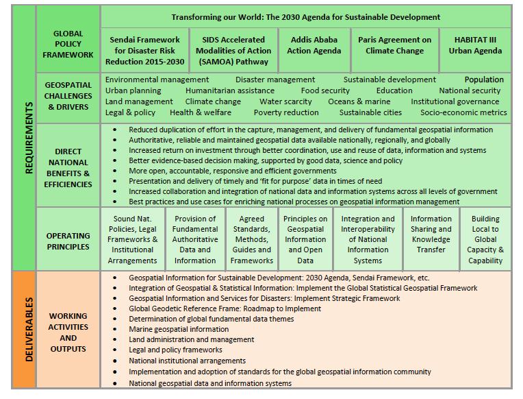
7 .. to strengthen the availability and accessibility of their data and statistical systems, in accordance with national priorities and circumstances, and enhance their management of complex data systems, including geospatial data platforms, by launching new partnership initiatives or scaling up existing initiatives; (SIDS Accelerated Modalities of Action (SAMOA) Pathway, 2014).. disseminate risk information with the best use of geospatial information technology; provide guidance on methodologies and standards for risk assessments, disaster risk modelling and the use of data;.. (Sendai Framework for Disaster Risk Reduction, ).. and to dedicate greater resources to the collection and sharing of data and knowledge, including traditional knowledge, in order to increase our knowledge of the ocean,.. (UN Ocean Conference, 2017) The 2030 Agenda for Sustainable Development.... to exploit the contribution to be made by a wide range of data, including earth observation and geospatial information, while ensuring national ownership in supporting and tracking progress. (Transforming our World: The 2030 Agenda for Sustainable Development, paragraph 76) 7


8 The 2030 Agenda: Goals, Targets, Indicators 17 SDGs 169 Targets 232 global indicators to follow-up and review progress Implementation via national planning processes, policies, strategies and frameworks Measuring and monitoring: Statistics, geospatial information, Earth observations and other Big Data TRANSFORMING OUR WORLD: THE 2030 AGENDA FOR SUSTAINABLE DEVELOPMENT General Assembly Resolution A/RES/70/1 Para. 76; Follow up and Review We will support developing countries, particularly African countries, LDCs, SIDS and LLDCs, in strengthening the capacity of national statistical offices and data systems to ensure access to high quality, timely, reliable and disaggregated data. We will promote transparent and accountable scaling-up of appropriate publicprivate cooperation to exploit the contribution to be made by a wide range of data, including earth observation and geospatial information, while ensuring national ownership in supporting and tracking progress. Target 17:18; Data, monitoring and accountability By 2020, enhance capacity-building support to developing countries, including for least developed countries and small island developing States, to increase significantly the availability of high-quality, timely and reliable data disaggregated by income, gender, age, race, ethnicity, migratory status, disability, geographic location and other characteristics relevant in national contexts. 8


9 Addressing the data needs for the 2030 Agenda helping Member States implement their national development priorities, implement the 2030 Agenda for Sustainable Development, and make decisions, and measure and monitor outcomes 9


10 Geospatial information for sustainable development Developing guidance and advice Disaggregation by geographic location; and Analysis ready satellite earth observations data for indicators Addressing the data needs for the 2030 Agenda New data sources and technologies for data collection will need to be explored, including through partnerships with civil society, the private sector and academia. The integration of geospatial information and statistical data will also be essential for the production of a number of indicators. (Sustainable Development Goals Report, 2016) Towards this end, national statistical systems need to invest in the technology and skills necessary to collect and integrate data from multiple sources, including integration of geospatial information with statistics and other data. (Sustainable Development Goals Report, 2017) helping Member States to implement strategic priorities, make decisions, and measure and monitor outcomes 10


noted the comments to analyze a number of complex issues regarding geospatial information including,")
11 The Sustainable Development Goals Report 2017 Implementation has begun, but the clock is ticking. This report shows that the rate of progress in many areas is far slower than needed to meet the targets by 2030 This report provides a snapshot of our efforts to date. It stresses that high-level political leadership and new partnerships will be essential for sustaining momentum. It also underscores the need for reliable, timely, accessible and disaggregated data to measure progress, inform decisionmaking and ensure that everyone is counted António Guterres Secretary-General, United Nations Addressing the data needs for the 2030 Agenda UN-GGIM Decision 7/106: Legal and policy frameworks, including issues related to authoritative data (g)noted the comments to analyze a number of complex issues regarding geospatial information including, definitions on open data, personal data, data privacy, data protection, data licensing and the security and misuse of data. 11
12 Legal and policy frameworks, including issues related to authoritative data recognized policy and legal frameworks for geospatial information as one of the issues that needed to be addressed (Report of the Secretary-General on the Inventory of Issues, August 2012) Since the fifth session (August 2015), UN-GGIM continued to note developments in geospatial technology that could have an impact on policy and legal frameworks supporting geospatial information management Including disruptive technologies, such as unmanned aircraft systems, autonomous vehicles collected and used geospatial information in ways that presented unique legal and policy challenges Sixth session agreed to an international forum on legal and policy issues and frameworks in Kuala Lumpur in October Legal and policy frameworks, including issues related to authoritative data International Forum on Policy and Legal Frameworks for Geospatial Information: Significant policy and legal challenges associated with geospatial information management include the quality, timeliness, comparability, authority, availability, accessibility, licensing, pricing, sharing, liability, privacy and security of data, and open data. Policy and legal issues impact geospatial information management at the local, national and international levels; and that these must be considered and balanced within national strategies, policies, laws and contexts; Developments and innovations in geospatial information and its related technologies and techniques are rapidly changing societal access to information; Policy and legal frameworks will evolve over time, respond to societal progress and technological developments, particularly as machine-learning environments become more prominent; and For such legal and policy frameworks to be effective they must allow for progressive and forward- looking strategies and include principles, guide and internationally agreed standards 12

.")
13 Legal and policy frameworks, including issues related to authoritative data The outcome of all the discussions and debates at the International Forum on Legal and Policy Frameworks for Geospatial Information Management were reflected in the Kuala Lumpur Declaration on Policy and Legal Frameworks for Geospatial Information. The Declaration was unanimously adopted by the participants, and by the fifth Plenary Meeting of the Regional Committee of the United Nations Global Geospatial Information Management for Asia and the Pacific (UN-GGIM-AP). The resolution of fifth Plenary Meeting of UN-GGIM-AP provided a path forward for the Committee of Experts and the global geospatial information community Legal and policy frameworks, including issues related to authoritative data UN-GGIM at its Seventh Session considered establishing a working group to explore policy and legal frameworks for geospatial information, with participants from both the geospatial and legal communities; develop a strategy and plan of action on policy and legal issues in order to begin the advocacy and engagement process, inclusive of a guide to the licensing and dissemination of geospatial information that can provide guidance to Member States; and contribute to developing capacity within the Member States on the policy and legal issues that impact the collection, use, storage and dissemination of geospatial information. 13

 Requested the working group to develop mechanisms for Member States to")


14 Seventh Session of the Committee of Experts UN-GGIM Decision 7/106 (c) Endorsed the establishment of the working group on legal and policy frameworks for geospatial information management,.... (d) Requested the working group to develop mechanisms for Member States to build capacity to address the legal and policy matters that had an impact on the collection, dissemination and application of geospatial information, and, in that regard, expressed appreciation for the development and preparation of the compendium on the licensing of geospatial information, and for the wide reviews and consultation that the compendium had received; (Aug 2017) UNITED NATIONS WORLD GEOSPATIAL INFORMATION CONGRESS November 2018 Deqing, Zhejiang Province China Promoting comprehensive dialogue with all relevant actors (ECOSOC 2011/24) 14


15 International Workshop on Legal and Policy Frameworks for Geospatial Information Management: Licensing of Geospatial Information Tanoa International Dateline Hotel, Nuku alofa, Kingdom of Tonga, April, The 8th session of the United Nations Committee of Experts on Global Geospatial Information Management, is scheduled to be held from 1 3 August 2018 at UNHQ New York International Workshop on Legal and Policy Frameworks for Geospatial Information Management Licensing of Geospatial Information April 2018, Nuku alofa, Kingdom of Tonga Session #2: Setting the scene: Overview and context Question and Answer 15
16 International Workshop on Legal and Policy Frameworks for Geospatial Information Management Licensing of Geospatial Information April 2018, Nuku alofa, Kingdom of Tonga Session #2: Setting the scene: Overview and context Group Discussion What legal and policy issues do your agency face nationally that impacts the mandate and mission of your agency? 16
1) United Nations Committee of Experts on Global Geospatial Information Management (UN-GGIM)
 United Nations Committee of Experts on Global Geospatial Information Management (UN-GGIM)") International Workshop on Legal and Policy Frameworks for Geospatial Information Management Licensing of Geospatial Information 7 9 November 2017 Tianjin Zhengxie Club Hotel Tianjin, China Outline of presentation
International Workshop on Legal and Policy Frameworks for Geospatial Information Management Licensing of Geospatial Information 7 9 November 2017 Tianjin Zhengxie Club Hotel Tianjin, China Outline of presentation
Implementing the Sustainable Development Goals: The Role of Geospatial Technology and Innovation
 Fifth High Level Forum on UN Global Geospatial Information Management Implementing the Sustainable Development Goals: The Role of Geospatial Technology and Innovation 28-30 November 2017 Sheraton Maria
Economic and Social Council
 United Nations Economic and Social Council Distr.: General 18 July 2016 Original: English Committee of Experts on Global Geospatial Information Management Sixth session New York, 3-5 August 2016 Item 2
KUNMING FORUM ON UNITED NATIONS GLOBAL GEOSPATIAL INFORMATION MANAGEMENT CITIES OF THE FUTURE: SMART, RESILIENT
 KUNMING FORUM ON UNITED NATIONS GLOBAL GEOSPATIAL INFORMATION MANAGEMENT CITIES OF THE FUTURE: SMART, RESILIENT and SUSTAINABLE Yunnan Zhenzhuang Guest House, Kunming, China 10 12 May 2017 BACKGROUND CONCEPT
UN GGIM and National SDI Strategy
 MSDI Open Forum on 26 th January 2016 Contributing to the successful delivery of MSDI UN GGIM and National SDI Strategy Hiroshi Murakami Deputy Administrator Geospatial Information Authority of Japan Geospatial
Background Document: Report of the Regional Committee of United Nations Global Geospatial Information Management for Asia and the Pacific
 Background Document: Report of the Regional Committee of United Nations Global Geospatial Information Management for Asia and the Pacific 1. Summary 1. This report highlights the activities carried out
2018/1 The integration of statistical and geospatial information. The Regional Committee of UN-GGIM: Americas:
 The following are the conclusions and recommendations of the Regional Committee of the United Nations on Global Geospatial Information Management for the Americas, during its Fifth Session, Thursday 8
UN-GGIM: Strengthening Geospatial Capability
 Fifth Plenary Meeting of UN-GGIM: Europe Brussels, 6-7 June 2018 UN-GGIM: Strengthening Geospatial Capability Walking the talk to leave no one behind Greg Scott, UN-GGIM Secretariat Environmental Statistics
Policy and Legal Frameworks: The journey so far
 International Forum on Policy and Legal Frameworks for Geospatial Information, 18-19 October 2016, Kuala Lumpur, Malaysia Policy and Legal Frameworks: The journey so far Greg Scott Global Geospatial Information
Bengt Kjellson Chair of the Executive Committee UN-GGIM: Europe. 2 nd Joint UN-GGIM: Europe ESS Meeting 11 th March 2016, Luxembourg
 Bengt Kjellson Chair of the Executive Committee UN-GGIM: Europe 2 nd Joint UN-GGIM: Europe ESS Meeting 11 th March 2016, Luxembourg A global geospatial mandate At its 47th plenary in July 2011, ECOSOC,
Economic and Social Council
 United Nation E/C.20/2012/4/Add.1 Economic and Social Council Distr.: General 2 July 2012 Original: English Committee of Experts on Global Geospatial Information Management Second session New York, 13-15
UN-GGIM: An Overview Stefan Schweinfest, Director (UNSD) Bangkok, 27 March 2015
 Bangkok, 27 March 2015") UN-GGIM: An Overview Stefan Schweinfest, Director (UNSD) Bangkok, 27 March 2015 ggim.un.org UN-GGIM: A global initiative Formal inter-governmental UN Committee of Experts to: Discuss, enhance and coordinate
UN-GGIM: An Overview Stefan Schweinfest, Director (UNSD) Bangkok, 27 March 2015 ggim.un.org UN-GGIM: A global initiative Formal inter-governmental UN Committee of Experts to: Discuss, enhance and coordinate
Report of the Regional Committee of UN-GGIM for Asia and the Pacific (UN-GGIM-AP)
") Report of the Regional Committee of UN-GGIM for Asia and the Pacific (UN-GGIM-AP) At the Eighth Session of UN-GGIM UN Headquarters, New York, 1 3 August 2018 About UN-GGIM-AP One of the five regional committees
Report of the Regional Committee of UN-GGIM for Asia and the Pacific (UN-GGIM-AP) At the Eighth Session of UN-GGIM UN Headquarters, New York, 1 3 August 2018 About UN-GGIM-AP One of the five regional committees
The Global Statistical Geospatial Framework and the Global Fundamental Geospatial Themes
 The Global Statistical Geospatial Framework and the Global Fundamental Geospatial Themes Sub-regional workshop on integration of administrative data, big data and geospatial information for the compilation
Disaster Management & Recovery Framework: The Surveyors Response
 Disaster Management & Recovery Framework: The Surveyors Response Greg Scott Inter-Regional Advisor Global Geospatial Information Management United Nations Statistics Division Department of Economic and
FIG Asia Pacific Capacity Development Network
 FIG Asia Pacific Capacity Development Network Report to the 41th General Assembly FIG Congress 2018, Istanbul - Turkey Rob Sarib Chair FIG Asia Pacific Capacity Development Network (AP CDN) Story of the
A Presenta*on to the Interna*onal Workshop on Global Fundamental Geospa*al Data Themes for Africa By Sultan Mohammed Alya Chairman of UN-GGIM: Africa
 A Presenta*on to the Interna*onal Workshop on Global Fundamental Geospa*al Data Themes for Africa By Sultan Mohammed Alya Chairman of UN-GGIM: Africa Execu*ve Bureau and Director General of Ethiopian Geospa*al
Economic and Social Council 2 July 2015
 ADVANCE UNEDITED VERSION UNITED NATIONS E/C.20/2015/11/Add.1 Economic and Social Council 2 July 2015 Committee of Experts on Global Geospatial Information Management Fifth session New York, 5-7 August
Economic and Social Council
 United Nations Economic and Social Council Distr.: General 2 July 2012 E/C.20/2012/10/Add.1 Original: English Committee of Experts on Global Geospatial Information Management Second session New York, 13-15
UN-GGIM:Africa Caucus Meeting
 UN-GGIM:Africa Caucus Meeting United Nations Economic Commission for Africa UN-GGIM: Africa Andre Nonguierma UN-GGIM.7 New York, 01 August 2017 UN-GGIM:Africa Driving Africa to become more spatially enabled
Report on the establishment of UN GGIM: Europe Item 14. 4th session of the Committee of Experts on UN-GGIM
 Report on the establishment of UN GGIM: Europe Item 14 1 Why regional European committees of UN GGIM? In the ECOSOC resolution 2011/24 on the UN GGIM: Emphasizes the importance of promoting national, regional
E/CONF.105/158/CRP.158
 E/CONF.105/158/CRP.158 14 July 2017 Original: English Eleventh United Nations Conference on the Standardization of Geographical Names New York, 8-17 August 2017 Item 8 of the provisional agenda* Measures
Briefing. H.E. Mr. Gyan Chandra Acharya
 Briefing by H.E. Mr. Gyan Chandra Acharya Under-Secretary-General and High Representative for the Least Developed Countries, Landlocked Developing Countries and Small Island Developing States Briefing
Integration for Informed Decision Making
 Geospatial and Statistics Policy Intervention: Integration for Informed Decision Making Greg Scott Global Geospatial Information Management United Nations Statistics Division Department of Economic and
Foundation Geospatial Information to serve National and Global Priorities
 Foundation Geospatial Information to serve National and Global Priorities Greg Scott Inter-Regional Advisor Global Geospatial Information Management United Nations Statistics Division UN-GGIM: A global
Inventory of United Nations Resolutions on Cartography Coordination, Geographic Information and SDI 1
 Inventory of United Nations Resolutions on Cartography Coordination, Geographic Information and SDI I. Resolutions on Cartography Coordination and Establishment of United Nations Regional Cartographic
Second Administrative Level Boundaries (SALB) initiative & geographic names in cartography. Geospatial Information Section
 initiative & geographic names in cartography. Geospatial Information Section") Second Administrative Level Boundaries (SALB) initiative & geographic names in cartography Geospatial Information Section Introduction Goals Global agenda How does SALB work? Latest News on geographic
Second Administrative Level Boundaries (SALB) initiative & geographic names in cartography Geospatial Information Section Introduction Goals Global agenda How does SALB work? Latest News on geographic
Economic and Social Council
 United Nations E/CN.3/2019/31 Economic and Social Council Distr.: General 19 December 2018 Original: English Statistical Commission Fiftieth session 5-8 March 2019 Item 4(i) of the provisional agenda*
ECONOMIC AND SOCIAL COUNCIL
 UNITED NATIONS E/CONF.102/3 ECONOMIC AND SOCIAL COUNCIL Nineteenth United Nations Regional Cartographic Conference for Asia and the Pacific Bangkok, 29 October 1 November 2012 Item 4 of the provisional
PAN AMERICAN INSTITUTE OF GEOGRAPHY AND HISTORY Specialized Organization of the OAS
 PAN AMERICAN INSTITUTE OF GEOGRAPHY AND HISTORY Specialized Organization of the OAS 10 th UNRCC Americas United Nations, New York, 20 August 2013 PAIGH, SIRGAS, PC-IDEA and GeoSUR 2013-2015 Joint Action
UN-GGIM Quarterly. 5th High level Forum on UN-GGIM. From the Director of UNSD. Number 1, November 2017
 UN-GGIM Quarterly Number 1, November 2017 From the Director of UNSD On behalf of the UN GGIM Secretariat, I am pleased to share with you our first issue of "UN GGIM Quarterly", an electronic newsletter
GENERAL RECOMMENDATIONS. Session 7. Breakout discussion. discuss on regional and interregional. proposals 1. COLLABORATION BETWEEN PROGRAMMES
 Session 7 24 July 2016, 9.00-11.00 Breakout discussion on regional and interregional joint project proposals Mr Shahbaz Khan summarized the two days of presentations and exchanges and requested the participants
Global Geodetic Reference Frame GGRF & Implications for GNSS
 Global Geodetic Reference Frame GGRF & Implications for GNSS On behalf of Gary Johnston Chair GIAC, Ruth Neilan Vice Chair, Global Geodetic Observing System ICG-9 Prague, 10 November 2014 UN GGRF Working
Prof Chryssy Potsiou, FIG President
 THE VALUE OF GEOSPATIAL DATA AND ROLE OF SURVEYORS IN SUSTAINABLE DEVELOPMENT Prof Chryssy Potsiou, FIG President National Technical University of Athens School of Rural and Surveying Engineering, Greece
Geographical Names: Relevance and place within the UN-GGIM framework
 Geographical Names: Relevance and place within the UN-GGIM framework Greg Scott Inter-Regional Advisor Global Geospatial Information Management United Nations Statistics Division UN-GGIM: A global initiative
Faatasi Malologa (PGSC Chair) Director Department of Lands & Survey, Tuvalu
 Director Department of Lands & Survey, Tuvalu") Seventh Session of the United Nations Committee of Experts on Global Geospatial Information Management (UN-GGIM) - 31 July -4 August 2017 Faatasi Malologa (PGSC Chair) Director Department of Lands & Survey,
Seventh Session of the United Nations Committee of Experts on Global Geospatial Information Management (UN-GGIM) - 31 July -4 August 2017 Faatasi Malologa (PGSC Chair) Director Department of Lands & Survey,
THE ROLE OF GEOSPATIAL AT THE WORLD BANK
 THE ROLE OF GEOSPATIAL AT THE WORLD BANK INSPIRE Conference Barcelona, Spain September 26, 2016 Kathrine Kelm Senior Land Administration Specialist Global Land and Geospatial Unit The World Bank Group
Economic and Social Council 24 July 2018
 UNITED NATIONS ADVANCE UNEDITED VERSION E/C.20/2018/16/Add.1 Economic and Social Council 24 July 2018 Committee of Experts on Global Geospatial Information Management Eighth session New York, 1-3 August
Role of National Legal and Policy Frameworks on Geospatial Information
 Role of National Legal and Policy Frameworks on Geospatial Information International Workshop on Legal and Policy Frameworks for Geospatial Information Nuku alofa, Kingdom of Tonga 10-13 April Objective
Challenges and Successes in Sharing Geospatial Data in Africa
 Challenges and Successes in Sharing Geospatial Data in Africa 2018 GeoNode Summit Torino, Italy March 26-28, 2018 Bernard Justus Muhwezi Manager, Geo-Information Services Uganda Bureau of Statistics, Kampala,
The Integrated Ge spatial Information Framework to the strengthening of NSDI, Mongolia
 Young Geospatial Professionals Summit 21 NOV 2018 The Integrated Ge spatial Information Framework to the strengthening of NSDI, Mongolia BAYARMAA ENKHTUR Geospatial information and technology department
8 th Meeting of IAEG-SDGs 5 8 November 2018, Stockholm, Sweden. Meetings. Report
 Meetings 8 th Meeting of IAEG-SDGs Between April 2018 and November 2018, the Working Group on Geospatial Information of the IAEG- SDGs held two online meetings; presented a report to the United Nations
Statement. H.E. Mr. Gyan Chandra Acharya
 As delivered Statement by H.E. Mr. Gyan Chandra Acharya Under-Secretary-General and High Representative for the Least Developed Countries, Landlocked Developing Countries and Small Island Developing States
Strategic Framework on Geospatial Information and Services for Disasters
 Strategic Framework on Geospatial Information and Services for Disasters Case Studies for the Caribbean and the Philippines --- Kunming Forum on United Nations Global Geospatial Information Management
Swedish Spatial Data Infrastructure and the National Geodata Strategy
 Submitted to the United Nations Committee of Experts on Global Geospatial Information Management Seventh Session New York, August 2018 Registration number 519-2018/4327 Country Report, Sweden Swedish Spatial
Concept note. High-Level Seminar: Accelerating Sustainable Energy for All in Landlocked Developing Countries through Innovative Partnerships
 Concept note High-Level Seminar: Accelerating Sustainable Energy for All in Landlocked Developing Countries through Innovative Partnerships Date: 24 and 25 October 2016 Venue: Conference Room C3, Vienna
Pacific Geospatial and Surveying Council (PGSC) Geospatial and GNSS CORS Infrastructure Forum. Kuala Lumpur October
 Geospatial and GNSS CORS Infrastructure Forum. Kuala Lumpur October") Pacific Geospatial and Surveying Council (PGSC) Geospatial and GNSS CORS Infrastructure Forum. Kuala Lumpur 16-17 October Beginning and Progress Members PGSC Charter PGSC Strategy 2017-2027 Meetings Geodetic
Pacific Geospatial and Surveying Council (PGSC) Geospatial and GNSS CORS Infrastructure Forum. Kuala Lumpur 16-17 October Beginning and Progress Members PGSC Charter PGSC Strategy 2017-2027 Meetings Geodetic
Resolution adopted by the General Assembly. [on the report of the Second Committee (A/67/440/Add.2)]
![Resolution adopted by the General Assembly. [on the report of the Second Committee (A/67/440/Add.2)]](/thumbs/94/121301610.jpg "Resolution adopted by the General Assembly. [on the report of the Second Committee (A/67/440/Add.2)]") United Nations General Assembly Distr.: General 3 April 2013 Sixty-seventh session Agenda item 23 (b) Resolution adopted by the General Assembly [on the report of the Second Committee (A/67/440/Add.2)]
United Nations General Assembly Distr.: General 3 April 2013 Sixty-seventh session Agenda item 23 (b) Resolution adopted by the General Assembly [on the report of the Second Committee (A/67/440/Add.2)]
ACTION PLAN FOR WORLD HERITAGE IN LATIN AMERICA AND THE CARIBBEAN ( )
") Annex ACTION PLAN FOR WORLD HERITAGE IN LATIN AMERICA AND THE CARIBBEAN (2014-2024) The current Regional Action Plan for Latin America and the Caribbean for 2014-2024 has been elaborated by the State Parties
Annex ACTION PLAN FOR WORLD HERITAGE IN LATIN AMERICA AND THE CARIBBEAN (2014-2024) The current Regional Action Plan for Latin America and the Caribbean for 2014-2024 has been elaborated by the State Parties
RESAP Progress Report
 RESAP Progress Report December 2016 to October 2017 Presentation to the Twenty-first session of the Intergovernmental Consultative Committee on the Regional Space Applications Programme for Sustainable
Coordination of United Nations Activities related to Geospatial Information Management
 Coordination of United Nations Activities related to Geospatial Information Management UNGIWG UNITED NATIONS GEOGRAPHIC INFORMATION WORKING GROUP THE UNITED NATIONS COMMITTEE OF EXPERTS ON GLOBAL GEOSPATIAL
SDG s and the role of Earth Observation
 SDG s and the role of Earth Observation Christian Heipke IPI - Institute for Photogrammetry and GeoInformation Leibniz Universität Hannover Germany Secretary General, ISPRS 1. No Poverty 2. Zero Hunger
Standards in support of UN-GGIM and sustainable development
 2 nd High 2Level nd High Forum Level on GGIM, Forum QNCC, on GGIM Doha, Qatar, 6 February 2013 QNCC, Doha, Qatar, 6 February 2013 Standards in support of UN-GGIM and sustainable development Olaf Østensen
Global Map: A Tool for Disaster Mitigation for the Asia and Pacific Region
 Global Map: A Tool for Disaster Mitigation for the Asia and Pacific Region D. R. Fraser Taylor Chair, International Steering Committee for Global Mapping (ISCGM) fraser_taylor@carleton.ca www. 18 th United
Working Group 1. Geodetic Reference Frame. Activity Report. for. The UN-GGIM-AP Plenary Meeting
 Regional Committee of United Nations Global Geospatial Information Management for Asia and the Pacific (UN-GGIM-AP) Established by a United Nations Resolution Working Group 1 Geodetic Reference Frame Activity
Global Mapping: A Tool for Disaster Mitigation
 Global Mapping: A Tool for Disaster Mitigation D. R. Fraser Taylor Chair, International Steering Committee for Global Mapping (ISCGM) fraser_taylor@carleton.ca www. United Nations Regional Cartographic
50 th GEF Council Meeting June 07 09, 2016 Washington, D.C. GEF/C.50/Inf.07 May 11, 2016 PROGRESS REPORT ON THE GENDER EQUALITY ACTION PLAN
 50 th GEF Council Meeting June 07 09, 206 Washington, D.C. GEF/C.50/Inf.07 May, 206 PROGRESS REPORT ON THE GENDER EQUALITY ACTION PLAN TABLE OF CONTENTS Background on the Gender Equality Action Plan (GEAP)...
NCAVES - Global initiative and national pilots
 NCAVES - Global initiative and national pilots Kavita Sharma UN Environment Pretoria, March 2018 Outline 1. Global initiative > Introduction > Objectives and deliverables >Activities in 2017 and 2018 2.
Remarks. for. H.E. Mr. Gyan Chandra Acharya
 Please check against delivery Remarks for H.E. Mr. Gyan Chandra Acharya Under-Secretary-General and High Representative for the Least Developed Countries, Landlocked Developing Countries and Small Island
From PCGIAP to UN GGIM AP: A Regional Perspective on GGIM
 Regional Committee of United Nations Global Geospatial Information Management for Asia and the Pacific (UN-GGIM-AP) Established by a United Nations Resolution From PCGIAP to UN GGIM AP: A Regional Perspective
Statement of Mr. Sandagdorj Erdenebileg, Chief, Policy Development, Coordination, Monitoring and Reporting Service, UN-OHRLLS.
 Statement of Mr. Sandagdorj Erdenebileg, Chief, Policy Development, Coordination, Monitoring and Reporting Service, UN-OHRLLS at the Botswana National Workshop on the Vienna Programme of Action 27 th October
GROUP ON INTEGRATION OF STATISTICAL AND GEOSPATIAL INFORMATION GT-IIEG
 UN-GGIM: Americas WORKING GROUP ON INTEGRATION OF STATISTICAL AND GEOSPATIAL INFORMATION GT-IIEG Bogotá, Colombia August, 2018 www.dane.gov.co Working group GT-IIEG Objective: To raise awareness and promote
Spatially Enabled Society
 International Seminar on Land Administration Trends and Issues in Asia and the Pacific Region Spatially Enabled Society Abbas Rajabifard Vice Chair PCGIAP-WG3 Vice-President (President Elect), GSDI Association
The Global Fundamental Geospatial Data Themes Journey. April Clare Hadley WG Chair
 The Global Fundamental Geospatial Data Themes Journey April 2018 Clare Hadley WG Chair The Road to here Why Global? Why Geospatial? Why Fundamental? Why Themes? The route we took Where does the road go
Reference Frame in Practice Workshop 1A
 Reference Frame in Practice Workshop 1A Status of Geodetic Infrastructure in the Pacific Region Case Studies Rob Sarib - FIG Commission 5 Vice Chair of Administration Welcome! Bula! Who are the International
Building Institutional Capacity for Multi-Hazard Early Warning in Asia and the Pacific Subtitle
 Building Institutional Capacity for Multi-Hazard Early Warning in Asia and the Pacific Subtitle Title Keran Wang Chief, Space Applications Section ICT and Disaster Risk Reduction Division 22 May 2018 Pillar
Arctic Spatial Data Infrastructure Enabling Access to Arctic Location-Based Information
 Arctic Spatial Data Infrastructure Enabling Access to Arctic Location-Based Information Arctic SDI Side Event Co-Chairs: Arvo Kokkonen Arctic SDI Board Chair & Director General, National Land Survey of
Concept Formulation of Geospatial Infrastructure. Hidenori FUJIMURA*
 Concept Formulation of Geospatial Infrastructure 1 Concept Formulation of Geospatial Infrastructure Hidenori FUJIMURA* (Published online: 28 December 2016) Abstract Technical trends in the field of surveying
IAEG SDGs WG GI, , Mexico City
 IAEG SDGs WG GI, 12-14.12.2016, Mexico City UN-GGIM:Europe s perspective and activities to support better integration of geospatial information and statistics and the UN SDG monitoring Pier-Giorgio Zaccheddu,
UN-GGIM: Europe GRF-Europe. Markku Poutanen
 UN-GGIM: Europe GRF-Europe Markku Poutanen Global Geodetic Reference Frame GGRF The UN Committee of Experts on Global Geospatial Information Management (UN-GGIM) decided in July 2013 to formulate and facilitate
Cooperation is the key, FIG can facilitate
 Cooperation is the key, FIG can facilitate Mikael Lilje Vice President 2017-2020 Head, Geodetic infrastructure, Swedish mapping, cadastral and land registration authority Presented at the GIS/RS Conference
Evaluation Survey - Results
 Evaluation Survey - Results GFMD Civil Society Days Goals, Compacts, Action: Human Mobility That Works for Migrants and Society 4- December 8, Marrakesh, Morocco Made Network #GFMD @Madenetworking http://madenetwork.org/
Progress on the Development of the Strategic Framework on Geospatial Information and Services for Disasters
 Progress on the Development of the Strategic Framework on Geospatial Information and Services for Disasters Dr. Peter N. Tiangco Administrator, NAMRIA, Philippines Co-chair, Working Group on Geospatial
8 th Arctic Regional Hydrographic Commission Meeting September 2018, Longyearbyen, Svalbard Norway
 8 th Arctic Regional Hydrographic Commission Meeting 11-13 September 2018, Longyearbyen, Svalbard Norway Status Report of the Arctic Regional Marine Spatial Data Infrastructures Working Group (ARMSDIWG)
A/AC.105/C.1/2016/CRP.17
 19 February 2016 English only Committee on the Peaceful Uses of Outer Space Scientific and Technical Subcommittee Fifty-third session Vienna, 15-26 February 2016 Item 11 of the provisional agenda Space
Marine Spatial Planning, a Norwegian user case NSHC33
 Marine Spatial Planning, a Norwegian user case NSHC33 Marine Spatial Management Tool Support the marine spatial planning process with updated and reliable geospatial information Marine management is important
A/AC.105/C.1/2012/CRP.10
 A/AC.105/C.1/2012/CRP.10 1 February 2012 English only Committee on the Peaceful Uses of Outer Space Scientific and Technical Subcommittee Forty-ninth session Vienna, 6-17 February 2012 Item 6 of the provisional
INTEGRATED GEOSPATIAL INFORMATION FRAMEWORK
 INTEGRATED GEOSPATIAL INFORMATION FRAMEWORK A STRATEGIC GUIDE TO DEVELOP AND STRENGTHEN NATIONAL GEOSPATIAL INFORMATION MANAGEMENT PART 1: OVERARCHING STRATEGIC FRAMEWORK 0 Integrated Geospatial Information
KENYA NATIONAL BUREAU OF STATISTICS Workshop on
 KENYA NATIONAL BUREAU OF STATISTICS Workshop on Capacity Building in Environment Statistics: the Framework for the Development of Environment Statistics (FDES 2013) Coordination with Sector Ministries
Fundamental Geospatial Data Themes
 Fundamental Geospatial Data Themes April 2016 Workshop Agenda Background why and how What is our objective? Fundamental data what are they? What are the candidate themes? Breakout Session Conclusion Background
The UN discusses Global Geospatial Information Management
 The UN discusses Global Geospatial Information Management Just like statistics, every country must have authoritative, trusted, maintained, definitive mapping data Professor Paul Cheung, Director, United
Geospatial Information Management in the Americas: Lessons for the Post-2015 development agenda
 Geospatial Information Management in the Americas: Lessons for the Post-2015 development agenda Rolando Ocampo President, UN-GGIM: Americas October 2014 The integration of statistical and geographical
Economic and Social Council
 United Nations Economic and Social Council Distr.: General 19 December 2018 Original: English Statistical Commission Fiftieth session 5 8 March 2019 Item 3 (o) of the provisional agenda* Items for discussion
Working Group on Geospatial Information
 GEO-XIV Plenary Summary Working Group on Geospatial Information 4 th Meeting Lawrence Friedl Argyro Kavvada Group on Earth Observations NASA Earth Science Dec. 6-8, 2017 An intergovernmental organization
THE SEVILLE STRATEGY ON BIOSPHERE RESERVES
 THE SEVILLE STRATEGY ON BIOSPHERE RESERVES 1 VISION FOR BIOSPHERE RESERVES IN THE 21 ST CENTURY The international Seville Conference on Biosphere Reserves, organised by UNESCO, adopted a two-pronged approach,
Presentation by Thangavel Palanivel Senior Strategic Advisor and Chief Economist UNDP Regional Bureau for Asia-Pacific
 Presentation by Thangavel Palanivel Senior Strategic Advisor and Chief Economist UNDP Regional Bureau for Asia-Pacific The High-Level Euro-Asia Regional Meeting on Improving Cooperation on Transit, Trade
UN-GGIM:Americas Regional Report
 UN-GGIM:Americas Regional Report 2016-2017 Seventh Session of UN-GGIM 2-4 August 2017, United Nations Headquarters, New York. Rolando Ocampo President of UN-GGIM: Americas Content Activities, Areas of
Report on the Actions Taken on Resolutions of the Eighteenth United Nations Regional Cartographic Conference for Asia and the Pacific
 UNITED NATIONS E/CONF.102/7 ECONOMIC AND SOCIAL COUNCIL Nineteenth United Nations Regional Cartographic Conference for Asia and the Pacific Bangkok, 29 October 1 November 2012 Item 4 of the provisional
FINDINGS OF THE ARCTIC METEOROLOGY SUMMIT
 FINDINGS OF THE ARCTIC METEOROLOGY SUMMIT 2018 WWW.FMI.FI CHAIR S SUMMARY: 1 2 3 We need to be curious to explore the known unknowns. Meteorology is an elemental part of international collaboration in
Geographical Names Activities in Africa The Gaborone Action Plan
 United Nations Group of Experts on Geographical Names Geographical Names Activities in Africa The Gaborone Action Plan 6 th Meeting of the Committee of Director -Generals of National Statistics Offices
Achieving the Vision Geo-statistical integration addressing South Africa s Developmental Agenda. geospatial + statistics. The Data Revolution
 Achieving the Vision Geo-statistical integration addressing South Africa s Developmental Agenda geospatial + statistics The Data Revolution humble beginnings, present & future - South Africa UN World Data
Future Proofing the Provision of Geoinformation: Emerging Technologies
 Future Proofing the Provision of Geoinformation: Emerging Technologies An Exchange Forum with the Geospatial Industry William Cartwright Chair JBGIS Second High Level Forum on Global Geospatial Information
The Global Statistical Geospatial Framework. Martin Brady Director Geospatial Solutions Australian Bureau of Statistics Australia
 The Global Statistical Geospatial Framework Martin Brady Director Geospatial Solutions Australian Bureau of Statistics Australia Outline 1. Origins of the Global Statistical Geospatial Framework 2. Global
Connecting Freshwater to Oceans: Major Questions
 Connecting Freshwater to Oceans: Major Questions Biliana Cicin-Sain Co-Chair Chair and Head of Secretariat, Global Forum on Oceans, Coasts, and Islands Origin of Global Forum Mobilized in 2001 to put oceans,
Sustainable Development Goals UN-GGIM Task Team
 Sustainable Development Goals UN-GGIM Task Team Executive Committee Meeting, 1. June 2016 Kristian Møller Copyright 2013 EuroGeographics Developments Creation of the One pager and matrix Reviewed by UN-GGIM:
Annual Ministerial Meeting of Foreign Ministers of Landlocked Developing Countries
 Annual Ministerial Meeting of Foreign Ministers of Landlocked Developing Countries 28 September 2018 10:00am - 1:00pm Conference room 5 UN Headquarters, New York Concept Note Theme: Revitalizing partnerships
REPORT ON ACTIVITIES UNDERTAKEN SINCE THE 25TH SESSION OF THE INTERNATIONAL COORDINATING COUNCIL OF THE MAN & THE BIOSPHERE PROGRAMME
 AFRICAN NETWORK OF BIOSPHERE RESERVES (AFRIMAB) REPORT ON ACTIVITIES UNDERTAKEN SINCE THE 25TH SESSION OF THE INTERNATIONAL COORDINATING COUNCIL OF THE MAN & THE BIOSPHERE PROGRAMME 26 TH MAB ICC SESSION
ACTION PLAN FOR WORLD HERITAGE IN LATIN AMERICA AND THE CARIBBEAN
 Final version-to send to the ACTION PLAN FOR WORLD HERITAGE IN LATIN AMERICA AND THE CARIBBEAN 2014-2024 The current Regional Action Plan for Latin America and the Caribbean has been elaborated by the
Report of the Working Group 2 Data Sharing and Integration for Disaster Management *
 UNITED NATIONS E/CONF.104/6 ECONOMIC AND SOCIAL COUNCIL Twentieth United Nations Regional Cartographic Conference for Asia and the Pacific Jeju, 6-9 October 2015 Item 5 of the provisional agenda Report
Building Institutional Capacity for Multi-Hazard Early Warning in Pacific Countries Subtitle
 Building Institutional Capacity for Multi-Hazard Early Warning in Pacific Countries Subtitle Title Keran Wang Chief, Space Applications Section ICT and Disaster Risk Reduction Division 30 March 2018 Slide