Taming the Modeling Monster
|
|
|
- Malcolm Wiggins
- 5 years ago
- Views:
Transcription
1 Taming the Modeling Monster Starring: Ellen Greenberg Scott McCarey Jim Charlier Audience Poll, part 1 Elected Officials Board Members Public Staff Consultants Journalists Other Audience Poll, part 2 Modeling experts Know enough to be dangerous What s a model?
 Alternative approaches (Greenberg) Group Q & A Audience examples Break out work sessions Framing the")
2 What We Will Not Do Today: Get Technical Provide Answers Session Outline Framing the issue (Charlier) Problems with monsters (Greenberg) Technical alternatives (McCarey) Alternative approaches (Greenberg) Group Q & A Audience examples Break out work sessions Framing the Issue

3 Framing the Issue Transportation 101 Things You May Have Wondered About Transportation 101 Balanced mobility Overemphasis on travel capacity Modern urban trends Mobility (Balanced)

4 Anthropologists: one of the defining characteristics of the human species is a need to be mobile. ********************* we are human = we need mobility Mobility Elements Travel Circulation Access Moving over distances Moving within areas Getting in the door Built for Seattle Redmond travel


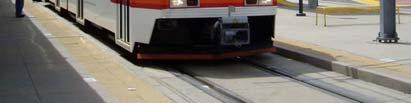
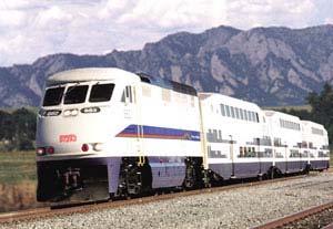


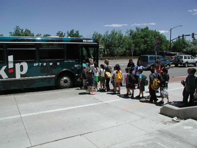

5 Denver Built for Boulder travel Built for Flagstaff circulation Redmond Portland Built for Boulder circulation


6 Built for Winter Park, Fl access Minneapolis Over-Emphasis on Capacity 1. Travel-biased programs 2. Facility-oriented planning 3. Congestion management Travel-Biased Programs build only in support of travel and fail to provide for circulation and access


7 Facility-Oriented Planning is focused on facilities rather than networks


8 Congestion Management the fruitless attempt to reduce peak hour congestion or build our way past congested arterial corridors

9 Credit: Dan Burden Def. Induced Traffic The additional traffic that results directly and indirectly from transportation capacity or travel time improvements traffic that would not otherwise have occurred at that location. Types of Induced Traffic Changes in travel route Immediate Changes in mode of travel. < 6 months Changes in time of travel. < 6 months Changes in amount of travel.... < 6 months Changes in origins & destinations < 10 years


10 % of new capacity consumed by induced traffic 100% Long Term: five to 10 years 80% 60% Short Term: less than five years 40% 20% If you build it they will come If you build it they will come

11 Credit: Kulash How did traffic flow, congestion relief and road capacity get to be more important than other community objectives? Common Community Objectives Community character Green environment Family-oriented place Sustainability Pedestrian friendly Economic vitality Great streets Healthy neighborhoods
12 Common Community Objectives Community character Green environment Family-oriented place Sustainability Pedestrian friendly Economic vitality Great streets Healthy neighborhoods Common Community Objectives Community character Green environment Level Family-oriented of service place objectives Sustainability Traffic capacity Pedestrian friendly Congestion Economic vitality relief Great streets Healthy neighborhoods Things You May Have Wondered About Traffic Models

13 Things You May Have Wondered About What is a traffic model? What is included and not included? How are they used? How accurate are they? How good are models at what they are designed to do? What is a Traffic Model? Things You May Have Wondered About What is a Traffic Model? Data In Trip Generation Trip Distribution Mode Choice Route Assignment Traffic Model Data Out
14 What is a Traffic Model? Data In Trip Generation Trip Distribution Mode Choice Route Assignment Black Box Data Out What Is Included and Not Included? Things You May Have Wondered About Not All Streets are Included in Model Networks
15 No Local Streets or Internal Drive Aisles Are Modeled No Collectors Only Arterials are Modeled Multimodal Travel, Circulation and Access Bike 14.0% Transit 4.6% Ped 18.6% Other 0.3% MOV 23.5% SOV 39.0% Boulder Residents Mode Share 2003
16 How Are Models Used? Things You May Have Wondered About Common Uses of Models Plan & prioritize street networks (TIPs, etc) Evaluate proposed rail projects (AA/EIS) Basis for traffic impact studies (TIRs, EIRs) Growth management systems Impact fees Concurrency management systems (LOS) Air quality management (mobile sources) Environmental impact analysis (EIS, etc.) Provide data for detailed intersection and corridor planning Common Uses of Models Plan & Prioritize Street Networks


17 Common Uses of Models Evaluate Rail Projects (AA/EIS) Common Uses of Models Basis for Traffic Impact Studies Common Uses of Models Growth Management Systems Roadway Level of Service Screenline # 1 volume/capacity Criteria Report year actual Arterial Intersections Across Screenline


18 Common Uses of Models Air Quality Management Common Uses of Models Environmental Impact Analysis Common Uses of Models Intersection & Corridor Studies
19 How Accurate are Models? Things You May Have Wondered About Modeling Process Build Model Calibrate to Today s Traffic Forecast Future Traffic Acceptable Error - Calibration Traditional: + or - one lane Common: 5% - 10% error in key corridors Note: calibration measures how well the model output matches actual traffic levels today
20 Modeling Process - Accuracy Build Model Within 5 10% in major corridors Calibrate to Today s Traffic????? Forecast Future Traffic How Good Are Models At What They Are Designed To Do? Things You May Have Wondered About How Good Are They? Iterative relationships between transportation investment & land use Understanding dense networks Leading causes of congestion Missing independent variables
21 Iterative Relationships Land development Transportation demand Transportation systems and projects Iterative Relationships Land development Transportation demand Transportation systems and projects Models & Induced Travel How well do models predict: Changes in travel route.. well Changes in mode of travel. fairly well Changes in time of travel... no Changes in amount of travel.. no Changes in origins & destinations no


22 Understanding Dense Networks Understanding Dense Networks Leading Causes of Congestion Peak Period Travel Weather Accidents/Incidents

23 Missing Independent Variables Fuel prices Development pattern mixed use, etc. Perceptions driver behavior Social factors, trends Review Traffic models do some things well within the constraints of input data Traffic models do not give accurate forecasts of conditions in 25 years Traffic models ignore many important community objectives Concluding Questions
24 Concluding Questions How did traffic congestion/capacity become pre-eminent anyway? What are some alternative criteria for planning transportation systems? Selective Focus The Doctrine of Apparent Precision Criterion Definition Data #1 fuzzy none #2 vague weak #3 specific lots #4 vague none #5 fuzzy none #6 none weak Selective Focus The Doctrine of Apparent Precision Criterion Definition Data #1 fuzzy none #2 vague weak #3 specific lots #4 vague none #5 fuzzy none #6 none weak
25 Traffic Forecasting Planning Predict Growth Widen Streets Forecast Traffic 1. What do we want? 2. How much traffic will result? 3. What should we do?

26 1. What do we want? 2. How much traffic will there be? 3. What should we do? 1. How much traffic will there be? 2. What should we do? 3. What do we get?

27 Redmond, WA Technical Alternatives Starring: Scott McCarey Two Types of Improvements Modify existing 4-step modeling process Include more variables Use GIS-based visualization software
28 URBEMIS Approach Uses traditional 4-step model as a baseline for traffic forecasts Adjusts traffic forecasts by incorporating additional variables: Density, mix of uses, transit service, TDM programs Trip reductions can be as high as 90% residential and 35% non-residential URBEMIS effectiveness Advised by Trip Generation: At specific sites, the user may wish to modify trip generation rates presented in this document to reflect the presence of public transportation, ridesharing or other TDM measures or other special characteristics of the site or surrounding area. However, adjusting a potentially seriously flawed baseline forecast INDEX 5D Model Uses regional transportation demand models for baseline travel inputs Evaluates change in VT and VMT based on: Density, Diversity, Design, Destinations and Distance (to rail transit)
29 INDEX limitations Forecasts are not absolute- relative to base case provided by regional model Accuracy dependent upon the regional model s baseline data Analysis must be performed at the TAZ level Reference Class Forecasting Empirical inventory of hundreds of past projects Each project recoded dozens of characteristics: density, proximity to transit, cost of parking, current congestion levels, mode shares Reference projects with similar attributes to current study Empirical Case Studies? Essentially what ITE Trip Generation does - with one variable Consider enough projects to be 1. statistically meaningful, but 2. similar to current project
30 GIS based software Programs now provide the ability to visualize and evaluate development scenarios Input Projected growth (Population, jobs) + Input Existing conditions (Land use, roads) Output Where growth will occur Output Evaluation (VMT, mode split, LOS) Input Projected growth (Population, jobs) + Input Existing conditions (Land use, roads) + Input Directed growth New Output Evaluation (VMT, (VT, VMT, mode mode split, split) LOS)


31 CorPlan- Renaissance Planning Group CommunityViz 2D Maps into Interactive 3D Scenes Source: CommunityViz You can walk, fly, or drive through this scene interactively Source: CommunityViz


32 Paint the Region Source: Citerion Planners SketchUp- Visual Modeling
Regional Performance Measures
 G Performance Measures Regional Performance Measures Introduction This appendix highlights the performance of the MTP/SCS for 2035. The performance of the Revenue Constrained network also is compared to
California Urban Infill Trip Generation Study. Jim Daisa, P.E.
 California Urban Infill Trip Generation Study Jim Daisa, P.E. What We Did in the Study Develop trip generation rates for land uses in urban areas of California Establish a California urban land use trip
III. FORECASTED GROWTH
 III. FORECASTED GROWTH In order to properly identify potential improvement projects that will be required for the transportation system in Milliken, it is important to first understand the nature and volume
APPENDIX IV MODELLING
 APPENDIX IV MODELLING Kingston Transportation Master Plan Final Report, July 2004 Appendix IV: Modelling i TABLE OF CONTENTS Page 1.0 INTRODUCTION... 1 2.0 OBJECTIVE... 1 3.0 URBAN TRANSPORTATION MODELLING
Data Collection. Lecture Notes in Transportation Systems Engineering. Prof. Tom V. Mathew. 1 Overview 1
 Data Collection Lecture Notes in Transportation Systems Engineering Prof. Tom V. Mathew Contents 1 Overview 1 2 Survey design 2 2.1 Information needed................................. 2 2.2 Study area.....................................
Regional Performance Measures
 G Performance Measures Regional Performance Measures Introduction This appendix highlights the performance of the MTP/SCS for 2035. The performance of the Revenue Constrained network also is compared to
3.0 ANALYSIS OF FUTURE TRANSPORTATION NEEDS
 3.0 ANALYSIS OF FUTURE TRANSPORTATION NEEDS In order to better determine future roadway expansion and connectivity needs, future population growth and land development patterns were analyzed as part of
Committee Meeting November 6, 2018
 Committee Meeting November 6, 2018 Agenda Where we are in the process Land Use Plan Transportation Element Housing & Neighborhoods Elements Next Steps Schedule November 6: Plan Elements December: Plan
CIV3703 Transport Engineering. Module 2 Transport Modelling
 CIV3703 Transport Engineering Module Transport Modelling Objectives Upon successful completion of this module you should be able to: carry out trip generation calculations using linear regression and category
The 3V Approach. Transforming the Urban Space through Transit Oriented Development. Gerald Ollivier Transport Cluster Leader World Bank Hub Singapore
 Transforming the Urban Space through Transit Oriented Development The 3V Approach Gerald Ollivier Transport Cluster Leader World Bank Hub Singapore MDTF on Sustainable Urbanization The China-World Bank
Typical information required from the data collection can be grouped into four categories, enumerated as below.
 Chapter 6 Data Collection 6.1 Overview The four-stage modeling, an important tool for forecasting future demand and performance of a transportation system, was developed for evaluating large-scale infrastructure
Density and Walkable Communities
 Density and Walkable Communities Reid Ewing Professor & Chair City and Metropolitan Planning University of Utah ewing@arch.utah.edu Department of City & Metropolitan Planning, University of Utah MRC Research
An Integrated Approach to Statewide Travel Modeling Applications in Delaware
 TRB 88 th Annual Meeting Washington, D.C. January 14 th, 29 An Integrated Approach to Statewide Travel Modeling Applications in Delaware The Context: Challenges for Today s Modelers: Personnel: Vacant
Appendixx C Travel Demand Model Development and Forecasting Lubbock Outer Route Study June 2014
 Appendix C Travel Demand Model Development and Forecasting Lubbock Outer Route Study June 2014 CONTENTS List of Figures-... 3 List of Tables... 4 Introduction... 1 Application of the Lubbock Travel Demand
HORIZON 2030: Land Use & Transportation November 2005
 PROJECTS Land Use An important component of the Horizon transportation planning process involved reviewing the area s comprehensive land use plans to ensure consistency between them and the longrange transportation
Figure 8.2a Variation of suburban character, transit access and pedestrian accessibility by TAZ label in the study area
 Figure 8.2a Variation of suburban character, transit access and pedestrian accessibility by TAZ label in the study area Figure 8.2b Variation of suburban character, commercial residential balance and mix
6 th Line Municipal Class Environmental Assessment
 6 th Line Municipal Class Environmental Assessment County Road 27 to St John s Road Town of Innisfil, ON September 6, 2016 APPENDIX L: TRAVEL DEMAND FORECASTING MEMORANDUM Accessible formats are available
NATHAN HALE HIGH SCHOOL PARKING AND TRAFFIC ANALYSIS. Table of Contents
 Parking and Traffic Analysis Seattle, WA Prepared for: URS Corporation 1501 4th Avenue, Suite 1400 Seattle, WA 98101-1616 Prepared by: Mirai Transportation Planning & Engineering 11410 NE 122nd Way, Suite
Knowledge claims in planning documents on land use and transport infrastructure impacts
 Knowledge claims in planning documents on land use and transport infrastructure impacts Presentation at the Final Workshop of the research project "Innovations for sustainable public transport in Nordic
Urban Planning Word Search Level 1
 Urban Planning Word Search Level 1 B C P U E C O S Y S T E M P A R E U O E U R B A N P L A N N E R T N S T D H E C O U N T Y G E R E R D W R E N I C I T Y C O U N C I L A A A S U G G C I L A G P R I R
2040 MTP and CTP Socioeconomic Data
 SE Data 6-1 24 MTP and CTP Socioeconomic Data Purpose of Socioeconomic Data The socioeconomic data (SE Data) shows the location of the population and employment, median household income and other demographic
April 18, Accessibility and Smart Scale: Using Access Scores to Prioritize Projects
 Accessibility and Smart Scale: Using Access Scores to Prioritize Projects April 18, 2017 Accessibility and Smart Scale: Using Access Scores to Prioritize Projects State Smart Transportation Initiative
Managing Growth: Integrating Land Use & Transportation Planning
 Managing Growth: Integrating Land Use & Transportation Planning Metro Vancouver Sustainability Community Breakfast Andrew Curran Manager, Strategy June 12, 2013 2 Integrating Land Use & Transportation
Traffic Demand Forecast
 Chapter 5 Traffic Demand Forecast One of the important objectives of traffic demand forecast in a transportation master plan study is to examine the concepts and policies in proposed plans by numerically
Changes in the Spatial Distribution of Mobile Source Emissions due to the Interactions between Land-use and Regional Transportation Systems
 Changes in the Spatial Distribution of Mobile Source Emissions due to the Interactions between Land-use and Regional Transportation Systems A Framework for Analysis Urban Transportation Center University
Transit Time Shed Analyzing Accessibility to Employment and Services
 Transit Time Shed Analyzing Accessibility to Employment and Services presented by Ammar Naji, Liz Thompson and Abdulnaser Arafat Shimberg Center for Housing Studies at the University of Florida www.shimberg.ufl.edu
StanCOG Transportation Model Program. General Summary
 StanCOG Transportation Model Program Adopted By the StanCOG Policy Board March 17, 2010 What are Transportation Models? General Summary Transportation Models are technical planning and decision support
2014 Certification Review Regional Data & Modeling
 2014 Certification Review Regional Data & Modeling July 22, 2014 Regional Data Census Program Coordination PAG works with and for member agencies to ensure full participation in all Census Bureau programs
Guidelines on Using California Land Use/Transportation Planning Tools
 Guidelines on Using California Land Use/Transportation Planning Tools 1. Selecting Ds Analysis Modules Appropriate to a Region In almost all cases, the appropriate Ds Analysis Module to use for analysis
King City URA 6D Concept Plan
 King City URA 6D Concept Plan King City s Evolution Among the fastest growing cities 2000 Census 1,949 2010 Census 3,111 60% increase 2016 Census estimate 3,817 23% increase Average annual rate 4.3% Surpassing
STAFF REPORT. MEETING DATE: July 3, 2008 AGENDA ITEM: 7
 STAFF REPORT SUBJECT: Travel Models MEETING DATE: July 3, 2008 AGENDA ITEM: 7 RECOMMENDATION: Receive information on status of travel model development in Santa Barbara County and review factors to achieve
PlaceTypes. How the built environment is measured. Variables Measures Levels. AREA TYPE + DEVELOPMENT TYPE = PlaceType
 PlaceTypes In order to better understand land use and transportation interactions and to make more informed policy decisions, neighborhood characteristics can be analyzed by the role that they play in
GIS for the Non-Expert
 GIS for the Non-Expert Ann Forsyth University of Minnesota February 2006 GIS for the Non-Expert 1. Definitions and problems 2. Measures being tested in Twin Cities Walking Study Basic approach, data, variables
Advancing Transportation Performance Management and Metrics with Census Data
 Advancing Transportation Performance Management and Metrics with Census Data Authors: Ivana Tasic, University of Utah, Department of Civil and Environmental Engineering, 110 Central Campus Drive, Salt
CVS Derwood. Local Area Transportation Review
 CVS Derwood Montgomery County, Maryland May 27, 2016 Local Area Transportation Review Prepared for: JC Bar Properties, Inc. Steve Fleming, PE 415 Fallowfield Road, Suite 301 Camp Hill, Pennsylvania 17011
Alternatives Analysis
 Alternatives Analysis Prepared for: Metropolitan Atlanta Rapid Transit Authority Prepared by: AECOM/Jacobs-JJG Joint Venture Atlanta, GA November 2012 Page Left Intentionally Blank ii TABLE OF CONTENTS
2015 Grand Forks East Grand Forks TDM
 GRAND FORKS EAST GRAND FORKS 2015 TRAVEL DEMAND MODEL UPDATE DRAFT REPORT To the Grand Forks East Grand Forks MPO October 2017 Diomo Motuba, PhD & Muhammad Asif Khan (PhD Candidate) Advanced Traffic Analysis
APPENDIX I: Traffic Forecasting Model and Assumptions
 APPENDIX I: Traffic Forecasting Model and Assumptions Appendix I reports on the assumptions and traffic model specifications that were developed to support the Reaffirmation of the 2040 Long Range Plan.
Thompson-Graves, S., DuRoss, M., Subhani, R., Sundquist, E., Holloway, B. 1. Corresponding Author: Scott Thompson-Graves, PE
 Thompson-Graves, S., DuRoss, M., Subhani, R., Sundquist, E., Holloway, B. 1 Development of the State Smart Transportation Initiative s DelDOT 3-D Micro Model Process - A scenario planning tool to evaluate
APPENDIX C-6 - TRAFFIC MODELING REPORT, SRF CONSULTING GROUP
 APPENDIX C-6 - TRAFFIC MODELING REPORT, SRF CONSULTING GROUP Scott County 2030 Comprehensive Plan Update Appendix C Scott County Traffic Model Final Report and Documentation March 2008 Prepared for: Scott
Economic and Social Urban Indicators: A Spatial Decision Support System for Chicago Area Transportation Planning
 Economic and Social Urban Indicators: A Spatial Decision Support System for Chicago Area Transportation Planning Piyushimita Thakuriah (Vonu), P.S. Sriraj, Paul Metaxatos, Inshu Minocha & Tanushri Swarup
MANAGING TRANSPORTATION & LAND USE INTERACTIONS (PL-58)
") MANAGING TRANSPORTATION & LAND USE INTERACTIONS (PL-58) COURSE OUTLINE DAY ONE 1:30 2:00 p.m. MODULE 1: History and Context Understand history and foundation for transportation and land use planning today
MANAGING TRANSPORTATION & LAND USE INTERACTIONS (PL-58) COURSE OUTLINE DAY ONE 1:30 2:00 p.m. MODULE 1: History and Context Understand history and foundation for transportation and land use planning today
URBAN TRANSPORTATION SYSTEM (ASSIGNMENT)
") BRANCH : CIVIL ENGINEERING SEMESTER : 6th Assignment-1 CHAPTER-1 URBANIZATION 1. What is Urbanization? Explain by drawing Urbanization cycle. 2. What is urban agglomeration? 3. Explain Urban Class Groups.
BRANCH : CIVIL ENGINEERING SEMESTER : 6th Assignment-1 CHAPTER-1 URBANIZATION 1. What is Urbanization? Explain by drawing Urbanization cycle. 2. What is urban agglomeration? 3. Explain Urban Class Groups.
The Tyndall Cities Integrated Assessment Framework
 The Tyndall Cities Integrated Assessment Framework Alistair Ford 1, Stuart Barr 1, Richard Dawson 1, Jim Hall 2, Michael Batty 3 1 School of Civil Engineering & Geosciences and Centre for Earth Systems
Appendix B.1 EMME Model Calibration Memo
 Appendix B.1 EMME Model Calibration Memo itrans 144 Front Street West, Suite 655 Toronto, ON M5J 2L7 Tel: (416) 847-0005 Fax: (905) 882-1557 www.hdrinc.com www.itransconsulting.com File: 2.0 Memorandum
FHWA Peer Exchange Meeting on Transportation Systems Management during Inclement Weather
 Travel Demand Modeling & Simulation at GBNRTC Matt Grabau Kimberly Smith Mike Davis Why Model? Travel modeling is a tool for transportation planners and policy makers, to observe impacts of a transportation
Prepared for: San Diego Association Of Governments 401 B Street, Suite 800 San Diego, California 92101
 Activity-Based Travel Model Validation for 2012 Using Series 13 Data: Coordinated Travel Regional Activity Based Modeling Platform (CT-RAMP) for San Diego County Prepared for: San Diego Association Of
Appendix B. Durham Region Travel Demand Model Calibration
 Appendix B Durham Region Travel Demand Model Calibration AECOM 300 Water Street 905 668 9363 tel Whitby, ON, Canada L1N 9J2 905 668 0221 fax www.aecom.com To Ron Albright, Municipality of Clarington Page
Traffic Impact Study
 Traffic Impact Study Statham DRI One University Parkway Prepared for: Barrow County Prepared by: October 2012 Table of Contents Executive Summary i Section 1. Introduction 1 Project Description 1 Methodology
GIS Analysis of Crenshaw/LAX Line
 PDD 631 Geographic Information Systems for Public Policy, Planning & Development GIS Analysis of Crenshaw/LAX Line Biying Zhao 6679361256 Professor Barry Waite and Bonnie Shrewsbury May 12 th, 2015 Introduction
Understanding Land Use and Walk Behavior in Utah
 Understanding Land Use and Walk Behavior in Utah 15 th TRB National Transportation Planning Applications Conference Callie New GIS Analyst + Planner STUDY AREA STUDY AREA 11 statistical areas (2010 census)
Final City of Colusa STREETS & ROADWAYS MASTER PLAN. October J Street Suite 390 Sacramento, CA 95814
 Final City of Colusa STREETS & ROADWAYS MASTER PLAN October 2009 660 J Street Suite 390 Sacramento, CA 95814 TABLE OF CONTENTS I. INTRODUCTION... 1 Report Organization...1 II. ANALYSIS METHODOLOGY... 2
Checklist: Deposing the Driver in an Auto Accident
 Checklist: Deposing the Driver in an Auto Accident 1. PERSONAL BACKGROUND All names ever used Present and past residences for 10 years If the deponent has rented a residence, get the name and address of
transportation research in policy making for addressing mobility problems, infrastructure and functionality issues in urban areas. This study explored
 ABSTRACT: Demand supply system are the three core clusters of transportation research in policy making for addressing mobility problems, infrastructure and functionality issues in urban areas. This study
From transport to accessibility: the new lease of life of an old concept
 Paris 07 /01/ 2015 From transport to accessibility: the new lease of life of an old concept Pr. Yves Crozet Laboratory of Transport Economics (LET) University of Lyon (IEP) - France yves.crozet@let.ish-lyon.cnrs.fr
CUSTER COUNTY SNOW REMOVAL PROCEDURES
 CUSER COUNY SNOW REMOVAL PROCEDURES Prioritization of Plow Routes County-maintained roads are plowed based upon the following prioritization criteria: 1. Arterial Roadways and School Bus routes: Arterial
Case Study: Orange County, California. Overview. Context
 Case Study: Orange County, California Overview The Orange County Transportation Authority (OCTA) provides transit service in a generally automobile-oriented part of southern California. Consequently, OCTA
MOR CO Analysis of future residential and mobility costs for private households in Munich Region
 MOR CO Analysis of future residential and mobility costs for private households in Munich Region The amount of the household budget spent on mobility is rising dramatically. While residential costs can
East Bay BRT. Planning for Bus Rapid Transit
 East Bay BRT Planning for Bus Rapid Transit Regional Vision Draper Prison The Bottleneck is a State-Level issue, Salt Lake County 2050 Population: 1.5M Draper Prison hopefully with some State-Level funding!
The effects of impact fees on urban form and congestion in Florida
 The effects of impact fees on urban form and congestion in Florida Principal Investigators: Andres G. Blanco Ruth Steiner Presenters: Hyungchul Chung Jeongseob Kim Urban and Regional Planning Contents
Existing road transport network of the National Capital Region was examined for the existing connectivity, mobility and accessibility in the study.
 2 Road Network 2.1 Existing Road Network The existing transport network in National Capital Region is radial in nature. It comprises of expressways, national highways, state highways, major district and
3. THE TRANSPORTATION AND TRANSIT MASTER PLAN
 The Master Plan Report Page 3-1 3. THE TRANSPORTATION AND TRANSIT MASTER PLAN 3.1 The Strategy Through the technical and consultation processes "A Balanced Road and Transit System" has been defined as
CORRIDORS OF FREEDOM Access Management (Ability) Herman Pienaar: Director City Transformation and Spatial Planning
 Herman Pienaar: Director City Transformation and Spatial Planning") CORRIDORS OF FREEDOM Access Management (Ability) 2016 Herman Pienaar: Director City Transformation and Spatial Planning PLANNING DEVELOPMENT PROCESS RATHER THAN A PLAN CAPITAL INVESTMENT DEVELOPMENT FACILITATION
CORRIDORS OF FREEDOM Access Management (Ability) 2016 Herman Pienaar: Director City Transformation and Spatial Planning PLANNING DEVELOPMENT PROCESS RATHER THAN A PLAN CAPITAL INVESTMENT DEVELOPMENT FACILITATION
Uses of Travel Demand Models Beyond the MTP. Janie Temple Transportation Planning and Programming Division
 Uses of Travel Demand Models Beyond the MTP Janie Temple Transportation Planning and Programming Division October 12, 2011 Presentation Outline What is a Travel Demand Model? Cautionary notes on using
Spatial multicriteria analysis for home buyers
 Spatial multicriteria analysis for home buyers Xavier Albacete University of Eastern Finland, Department of Environmental Science, Research Group of Environmental Informatics, Yliopistoranta 1 E, P.O.
A Land Use Transport Model for Greater London:
 Spatio-Temporal Analysis of Network Data and Road Developments Launch Event Workshop UCL Monday 18 May 2009 A Land Use Transport Model for Greater London: With Applications to an Integrated Assessment
DOWNTOWN SUB-AREA. Final Parking Study. Prepared for: City of Bellingham. March Prepared by:
 Final Parking Study DOWNTOWN SUB-AREA Prepared for: City of Bellingham March 2013 Prepared by: 11730 118 th Avenue NE, Suite 600 Kirkland, WA 98034-7120 Phone: 425-821-3665 Fax: 425-825-8434 www.transpogroup.com
Gravity-Based Accessibility Measures for Integrated Transport-Land Use Planning (GraBAM)
") Gravity-Based Accessibility Measures for Integrated Transport-Land Use Planning (GraBAM) Enrica Papa, Pierluigi Coppola To cite this report: Enrica Papa and Pierluigi Coppola (2012) Gravity-Based Accessibility
Gravity-Based Accessibility Measures for Integrated Transport-Land Use Planning (GraBAM) Enrica Papa, Pierluigi Coppola To cite this report: Enrica Papa and Pierluigi Coppola (2012) Gravity-Based Accessibility
Lecture 19: Common property resources
 Lecture 19: Common property resources Economics 336 Economics 336 (Toronto) Lecture 19: Common property resources 1 / 19 Introduction Common property resource: A resource for which no agent has full property
VHD Daily Totals. Population 14.5% change. VMT Daily Totals Suffolk 24-hour VMT. 49.3% change. 14.4% change VMT
 6.9 Suffolk 6-54 VMT Population and Travel Characteristics Population 14.5% change 2014 1,529,202 VHD Daily Totals 2014 251,060 49.3% change 2040 1,788,175 2040 374,850 VMT Daily Totals 2014 39,731,990
Susan Clark NRS 509 Nov. 29, 2005
 Susan Clark NRS 509 Nov. 29, 2005 The original intent of this project was to look at the role of GIS in the inventory of bicycle and pedestrian facilities. The research, however, indicates a different
Network Analysis with ArcGIS Online. Deelesh Mandloi Dmitry Kudinov
 Deelesh Mandloi Dmitry Kudinov Introductions Who are we? - Network Analyst Product Engineers Who are you? - Network Analyst users? - ArcGIS Online users? - Trying to figure out what is ArcGIS Online? Slides
Summary Description Municipality of Anchorage. Anchorage Coastal Resource Atlas Project
 Summary Description Municipality of Anchorage Anchorage Coastal Resource Atlas Project By: Thede Tobish, MOA Planner; and Charlie Barnwell, MOA GIS Manager Introduction Local governments often struggle
Note on Transportation and Urban Spatial Structure
 Note on Transportation and Urban Spatial Structure 1 By Alain Bertaud, Washington, ABCDE conference, April 2002 Email: duatreb@msn.com Web site: http://alain-bertaud.com/ http://alainbertaud.com/ The physical
Varying Influences of the Built Environment on Household Travel in Fifteen Diverse Regions of the United states
 Varying Influences of the Built Environment on Household Travel in Fifteen Diverse Regions of the United states Ewing, R., G. Tian, J.P. Goates, M. Zhang, M. Greenwald, Lane Council of Governments, A.
Cipra D. Revised Submittal 1
 Cipra D. Revised Submittal 1 Enhancing MPO Travel Models with Statewide Model Inputs: An Application from Wisconsin David Cipra, PhD * Wisconsin Department of Transportation PO Box 7913 Madison, Wisconsin
Transit-Oriented Development. Christoffer Weckström
 Transit-Oriented Development Christoffer Weckström 31.10.2017 Outline Context of Transit-oriented Development Elements of Transit-oriented Development A short history of land use and transit integration
TRAFFIC FORECAST METHODOLOGY
 CHAPTER 5 TRAFFIC FORECAST METHODOLOGY Introduction Need for County-Level Traffic Forecasting 2030 HC-TSP Model Methodology Model Calibration Future Traffic Forecasts Hennepin County Transportation Systems
Varying Influences of the Built Environment on Household Travel in Fifteen Diverse Regions of the United states
 Varying Influences of the Built Environment on Household Travel in Fifteen Diverse Regions of the United states Ewing, R., G. Tian, J.P. Goates, M. Zhang, M. Greenwald, Lane Council of Governments, A.
Developing Built Environment Indicators for Urban Oregon. Dan Rubado, MPH EPHT Epidemiologist Oregon Public Health Division
 Developing Built Environment Indicators for Urban Oregon Dan Rubado, MPH EPHT Epidemiologist Oregon Public Health Division What is the built environment? The built environment encompasses spaces and places
The Elusive Connection between Density and Transit Use
 The Elusive Connection between Density and Transit Use Abstract: The connection between density and transportation is heralded by planners, yet results are often elusive. This paper analyzes two regions,
COUNCIL POLICY BACKGROUND
 COUNCIL POLICY Policy Title: Snow and Ice Control Policy Policy Number: TP004 Report Number: TTP2003-39, C2007-44, LPT2011-57 Approved by: City Council Effective Date: Interim policy approved 2009 December
TRAFFIC IMPACT STUDY. Platte Canyon Villas Arapahoe County, Colorado (Arapahoe County Case Number: Z16-001) For
 For") TRAFFIC IMPACT STUDY For Platte Canyon Villas Arapahoe County, Colorado (Arapahoe County Case Number: Z16-001) February 2015 Revised: August 2015 April 2016 July 2016 September 2016 Prepared for: KB Home
TRAFFIC IMPACT STUDY For Platte Canyon Villas Arapahoe County, Colorado (Arapahoe County Case Number: Z16-001) February 2015 Revised: August 2015 April 2016 July 2016 September 2016 Prepared for: KB Home
WEBER ROAD RESIDENTIAL DEVELOPMENT Single Family Residential Project
 WEBER ROAD RESIDENTIAL DEVELOPMENT Single Family Residential Project WEBER ROAD RESIDENTIAL DEVELOPMENT TRAFFIC IMPACT STUDY TABLE OF CONTENTS 1.0 Executive Summary Page 2.0 Introduction 2.1 DEVELOPMENT
Encapsulating Urban Traffic Rhythms into Road Networks
 Encapsulating Urban Traffic Rhythms into Road Networks Junjie Wang +, Dong Wei +, Kun He, Hang Gong, Pu Wang * School of Traffic and Transportation Engineering, Central South University, Changsha, Hunan,
Optimizing Urban Modeling based on Road Network and Land Use/Cover Changes by Using Agent Base Cellular Automata Model
 Optimizing Urban Modeling based on Road Network and Land Use/Cover Changes by Using Agent Base Cellular Automata Model Yousef Khajavigodellou 1, A. A. Alesheikh 2, Farshad Hakimpour 3, Kamra Chapi 4 1
CERTIFIED RESOLUTION. introduction: and dated May 29, 2017, as attached, as appropriate
 15322 Buena Vista Avenue, White Rock BC, Canada V4B 1Y6 www.whiterockcity.ca City of White Rock P: 604.541.22121 F: 604.541.9348 /2tC% City Clerk s Office IT E ROC K June 13,2017 Stephanie Lam, Deputy
Network Equilibrium Models: Varied and Ambitious
 Network Equilibrium Models: Varied and Ambitious Michael Florian Center for Research on Transportation University of Montreal INFORMS, November 2005 1 The applications of network equilibrium models are
TRAVEL DEMAND MODEL. Chapter 6
 Chapter 6 TRAVEL DEMAND MODEL As a component of the Teller County Transportation Plan development, a computerized travel demand model was developed. The model was utilized for development of the Transportation
Market Street PDP. Nassau County, Florida. Transportation Impact Analysis. VHB/Vanasse Hangen Brustlin, Inc. Nassau County Growth Management
 Transportation Impact Analysis Market Street PDP Nassau County, Florida Submitted to Nassau County Growth Management Prepared for TerraPointe Services, Inc. Prepared by VHB/Vanasse Hangen Brustlin, Inc.
COUNCIL POLICY MANUAL
 COUNCIL POLICY MANUAL SECTION: PUBLIC WORKS SUBJECT: SNOW & ICE CONTROL POLICY 2012/2013 GOAL: Pages: 1 of 10 Approval Date: Dec. 3, 2012 Res. # 1001/2012 To annually identify the winter maintenance costs
I. M. Schoeman North West University, South Africa. Abstract
 Urban Transport XX 607 Land use and transportation integration within the greater area of the North West University (Potchefstroom Campus), South Africa: problems, prospects and solutions I. M. Schoeman
Transport Planning in Large Scale Housing Developments. David Knight
 Transport Planning in Large Scale Housing Developments David Knight Large Scale Housing Developments No longer creating great urban spaces in the UK (Hall 2014) Transport Planning Transport planning processes
First-Best Dynamic Assignment of Commuters with Endogenous Heterogeneities in a Corridor Network
 First-Best Dynamic Assignment of Commuters with Endogenous Heterogeneities in a Corridor Network ISTTT 22@Northwestern University Minoru Osawa, Haoran Fu, Takashi Akamatsu Tohoku University July 24, 2017
Metrolinx Transit Accessibility/Connectivity Toolkit
 Metrolinx Transit Accessibility/Connectivity Toolkit Christopher Livett, MSc Transportation Planning Analyst Research and Planning Analytics Tweet about this presentation #TransitGIS OUTLINE 1. Who is
Study Overview. the nassau hub study. The Nassau Hub
 Livable Communities through Sustainable Transportation the nassau hub study AlternativeS analysis / environmental impact statement The Nassau Hub Study Overview Nassau County has initiated the preparation
Snow and Ice Control POLICY NO. P-01/2015. CITY OF AIRDRIE Snow and Ice Control Policy
 Page 1 CITY OF AIRDRIE Snow and Ice Control Effective Date: Approved By: Approved On: March 17, 2015 City Council March 16, 2015 Revision Date: Resolution #: ------ PURPOSE: The City of Airdrie is responsible
3D - Boulder Valley Comprehensive Plan. Lesli Ellis Comprehensive Planning Manager City of Boulder
 3D - Boulder Valley Comprehensive Plan Lesli Ellis Comprehensive Planning Manager City of Boulder Presentation Boulder s use of 3D GIS and other tools in Comprehensive Planning (e.g., story maps, CityEngine,
Technical Memorandum #2 Future Conditions
 Technical Memorandum #2 Future Conditions To: Dan Farnsworth Transportation Planner Fargo-Moorhead Metro Council of Governments From: Rick Gunderson, PE Josh Hinds PE, PTOE Houston Engineering, Inc. Subject:
Internal Capture in Mixed-Use Developments (MXDs) and Vehicle Trip and Parking Reductions in Transit-Oriented Developments (TODs)
 and Vehicle Trip and Parking Reductions in Transit-Oriented Developments (TODs)") Internal Capture in Mixed-Use Developments (MXDs) and Vehicle Trip and Parking Reductions in Transit-Oriented Developments (TODs) Reid Ewing City and Metropolitan Planning University of Utah ewing@arch.utah.edu
Internal Capture in Mixed-Use Developments (MXDs) and Vehicle Trip and Parking Reductions in Transit-Oriented Developments (TODs) Reid Ewing City and Metropolitan Planning University of Utah ewing@arch.utah.edu