PPT Slide. Slide 1 of 32. Notes:
|
|
|
- Eugene Sullivan
- 6 years ago
- Views:
Transcription

1 Slide 1 of 32 This presentaion will describe the background of establishing an agricultural district in Westchester County and how GIS was used to map the district. file:///volumes/web/www/ce/conferences/gis%20present/testfarm/sld001.htm[4/6/11 9:39:52 AM]
 in Croton Watershed New GIS coverage allows for analysis with other county")
2 Slide 32 of 32 Adoption of District by County BOL November 2000 Preparation of an Agriculture & Farmland Protection Plan Develop a program to preserve productive farmland through the Purchase of Development Rights Apply for state and federal funding for Farmland Protection Agriculture Environmental Management (AEM) in Croton Watershed New GIS coverage allows for analysis with other county data New source of information for Westchester County and the public to assist in decision making and problem solving file:///volumes/web/www/ce/conferences/gis%20present/testfarm/sld032.htm[4/6/11 9:40:01 AM]

3 Slide 31 of 32 Here, farms are displayed based on farm type file:///volumes/web/www/ce/conferences/gis%20present/testfarm/sld031.htm[4/6/11 9:40:01 AM]

4 Slide 30 of 32 Provide Directions and a view of the property file:///volumes/web/www/ce/conferences/gis%20present/testfarm/sld030.htm[4/6/11 9:40:01 AM]

5 Slide 29 of 32 The property is identified and the view extent is set to the selection Functionality added to allow to obtain information on property acreage file:///volumes/web/www/ce/conferences/gis%20present/testfarm/sld029.htm[4/6/11 9:40:01 AM]
6 Slide 28 of 32 file:///volumes/web/www/ce/conferences/gis%20present/testfarm/sld028.htm[4/6/11 9:40:00 AM]

7 Slide 27 of 32 Displaying farm parcels for the Town of Bedford file:///volumes/web/www/ce/conferences/gis%20present/testfarm/sld027.htm[4/6/11 9:40:00 AM]

8 Slide 26 of 32 Application created to allow users to make selections, display and get data on farms file:///volumes/web/www/ce/conferences/gis%20present/testfarm/sld026.htm[4/6/11 9:40:00 AM]

9 Slide 25 of 32 Map showing individual farms in North Salem Farm Enterprises occupy nearly half of the towns land area file:///volumes/web/www/ce/conferences/gis%20present/testfarm/sld025.htm[4/6/11 9:39:59 AM]

10 Slide 24 of 32 Digitized data was then joined with previously created data to form one final dataset. file:///volumes/web/www/ce/conferences/gis%20present/testfarm/sld024.htm[4/6/11 9:39:59 AM]

11 Slide 23 of 32 Data cleanup after digitizing from scanned tax map images file:///volumes/web/www/ce/conferences/gis%20present/testfarm/sld023.htm[4/6/11 9:39:59 AM]

12 Slide 22 of 32 map sheets can be registered when properties span additional sheets file:///volumes/web/www/ce/conferences/gis%20present/testfarm/sld022.htm[4/6/11 9:39:58 AM]

13 Slide 21 of 32 Parcel Boundaries are then digitized from a geo-referenced GRID file:///volumes/web/www/ce/conferences/gis%20present/testfarm/sld021.htm[4/6/11 9:39:58 AM]

14 Slide 20 of 32 Using Arcview you can create a GRID from the tax map image which is than registered and projected with an in house extension file:///volumes/web/www/ce/conferences/gis%20present/testfarm/sld020.htm[4/6/11 9:39:58 AM]

15 Slide 19 of 32 The image is opened in ArcEdit and ready for digitzing file:///volumes/web/www/ce/conferences/gis%20present/testfarm/sld019.htm[4/6/11 9:39:58 AM]

16 Slide 18 of 32 This slide illustrates our approach to digitizing where no digital parcel data is available. Using Pre-scanned digital tax map images from WINData, we were able to register the image so it the boundaries could be digitized in Arc/Info. Clicking on X Y registration and entering X Y coordinates. file:///volumes/web/www/ce/conferences/gis%20present/testfarm/sld018.htm[4/6/11 9:39:57 AM]
 file:///volumes/web/www/ce/conferences/gis%20present/testfarm/sld017.")
17 Slide 17 of 32 An attribute editor used to edit the database. In this case, the Parcel ID was added so the Ag and Farm data could be joined. Also useful for other database editing. (Easily create and change attributes easily in a view, instead of working with cumbersome tables.) file:///volumes/web/www/ce/conferences/gis%20present/testfarm/sld017.htm[4/6/11 9:39:57 AM]

18 Slide 16 of 32 For areas where only digital tax parcels were available without attribute data (or with bad SBL Data), scanned tax map images were used to visually identify tax lots, and the parcels were than taken from the digital coverage. 3-4 municipalities file:///volumes/web/www/ce/conferences/gis%20present/testfarm/sld016.htm[4/6/11 9:39:57 AM]

19 Slide 15 of 32 Farm Parcels were selected and saved to a separate data set. This process was repeated for all towns where parcel attribute data was available and could be linked to the original Farm database. file:///volumes/web/www/ce/conferences/gis%20present/testfarm/sld015.htm[4/6/11 9:39:56 AM]

20 Slide 14 of 32 We started by joining the Farm database with tax databases for municipalities that provided digital tax parcels having attributes to the parcel data enabled us to select parcels having a farm name? file:///volumes/web/www/ce/conferences/gis%20present/testfarm/sld014.htm[4/6/11 9:39:56 AM]

21 Slide 13 of 32 Our main challenge was to reconcile the differences of source data for municipal tax parcels. Unlike most NYS counties, tax mapping in Westchester is done at the municipal, not county, level resulting in disparate data sets. Each municipality had different tax parcel issues. This slide speaks to the dysfunctional disparity of digital data For some communities we were able to work with complete tax parcel coverage with attribute data, Others provided only digital linework with no attribute (tax ID) data. Some watershed communites only provided digital coverage of areas in their towns within the NYC watershed only. Yet others had no digital data available. Ag and Farmland Board database with Parcel ID and other attributes Tax map (parcel) data for some communities we could link database to by SBL Some parcel data with out attributes(geometry only) Prescanned images of parcel data (not georeferenced) that could be used for areas with no parcel data Methodology: file:///volumes/web/www/ce/conferences/gis%20present/testfarm/sld013.htm[4/6/11 9:39:56 AM]
22 Acquire parcels and attributes from existing Digital files by joining Ag database with Parcel data Acquire parcel geometry from Digital files, create attributes Create parcel boundaries by digitizing from existing images, then create attributes file:///volumes/web/www/ce/conferences/gis%20present/testfarm/sld013.htm[4/6/11 9:39:56 AM]

23 Slide 12 of 32 County Executive Spano establishes Agricultural and Farmland Protection Board in 1999 and County Board of Legislators appoints 11 members from Westchester s farming community, including one member from the Planning Department. The board in cooperation with the planning dept. identified and compiled a database of numerous and varied properties (listed by SBL) defined as agricultural enterprises which was the basis for compiling the map. file:///volumes/web/www/ce/conferences/gis%20present/testfarm/sld012.htm[4/6/11 9:39:56 AM]
24 Slide 11 of 32 file:///volumes/web/www/ce/conferences/gis%20present/testfarm/sld011.htm[4/6/11 9:39:55 AM]
25 Slide 10 of 32 file:///volumes/web/www/ce/conferences/gis%20present/testfarm/sld010.htm[4/6/11 9:39:55 AM]
26 Slide 9 of 32 file:///volumes/web/www/ce/conferences/gis%20present/testfarm/sld009.htm[4/6/11 9:39:55 AM]

27 Slide 8 of 32 The reasons for protecting farmland in Westchester are many and varied and go beyond the obvious ones of simply food production. Among the top reasons being preservation of open space and rural character, protection of watershed lands and agritourism - $108 million net economic benefit to county file:///volumes/web/www/ce/conferences/gis%20present/testfarm/sld008.htm[4/6/11 9:39:54 AM]

28 Slide 7 of 32 McMansions of mammoth sizes have become a major cash crop and are sprouting up on developable land. Farms make very attractive development sites file:///volumes/web/www/ce/conferences/gis%20present/testfarm/sld007.htm[4/6/11 9:39:54 AM]

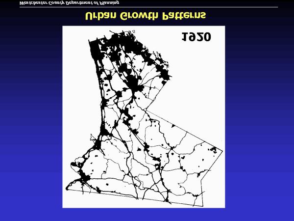
29 Slide 6 of 32 Population has steadily grown and is creeping towards 1 million, making it larger than eight states. A corresponding decrease in Farm acreage has also occurred with Westchester losing nearly 4000 acres, or 36% of farmland in the eleven years between 1983 and file:///volumes/web/www/ce/conferences/gis%20present/testfarm/sld006.htm[4/6/11 9:39:54 AM]
30 Slide 5 of 32 file:///volumes/web/www/ce/conferences/gis%20present/testfarm/sld005.htm[4/6/11 9:39:54 AM]
31 Slide 4 of 32 Density is kept low by zoning, lack of sewer and water infrastructure and NYC regs in the croton watershed area, which encompasses over a third of the counties area. Most of the counties farms are in this area. file:///volumes/web/www/ce/conferences/gis%20present/testfarm/sld004.htm[4/6/11 9:39:53 AM]
32 Slide 3 of 32 The County is made up of 45 separate municipalities Most of the counties population of 874,000 is concentrated in cities and villages in the counties south, central and western portions. The Northern area is primarily of low density/semi-rural primarily due to the fact that it encompasses NYC Watershed lands of the Croton Reservoir System. file:///volumes/web/www/ce/conferences/gis%20present/testfarm/sld003.htm[4/6/11 9:39:53 AM]

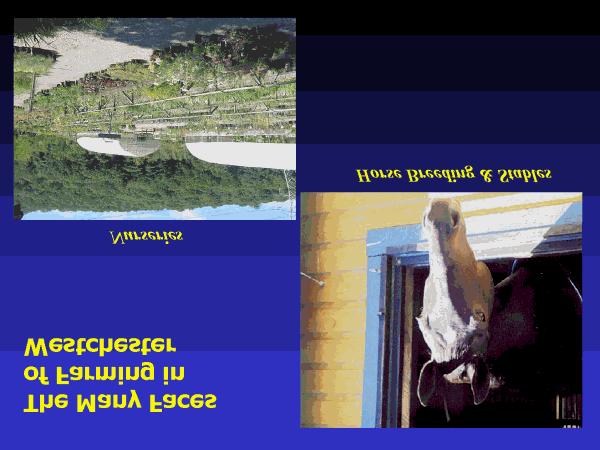
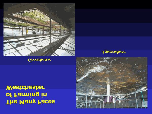
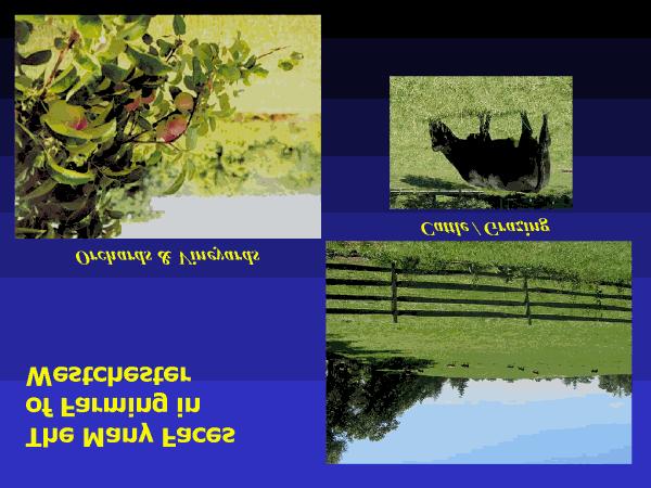
33 Slide 2 of 32 Westchester is located immediately north of New York City The County covers an area of 450 Square miles. Westchester is one of the last counties outside of NYC to undertake adoption of an Ag District. file:///volumes/web/www/ce/conferences/gis%20present/testfarm/sld002.htm[4/6/11 9:39:53 AM]
Introduction. Project Summary In 2014 multiple local Otsego county agencies, Otsego County Soil and Water
 Introduction Project Summary In 2014 multiple local Otsego county agencies, Otsego County Soil and Water Conservation District (SWCD), the Otsego County Planning Department (OPD), and the Otsego County
GIS Monroe Geographic Information System March 14, 2018
 GIS Monroe Geographic Information System March 14, 2018 Goals Maintain Enterprise/County-wide geo-database Increase spatial accuracy of data Build and acquire more data layers Increase use of GIS; as another
Abstract. Keywords: Geographic information systems and digital data model. 1. Introduction
 Abstract GISMO - A Geographical Information System for a Municipality Office Ramzi A. Haraty and Youssef O. Kaddoura Lebanese American University P.O. Box 13-5053 Chouran Beirut, Lebanon 1102 2801 Email:
The Use of Geographic Information Systems (GIS) by Local Governments. Giving municipal decision-makers the power to make better decisions
 by Local Governments. Giving municipal decision-makers the power to make better decisions") The Use of Geographic Information Systems (GIS) by Local Governments Giving municipal decision-makers the power to make better decisions Case Study: Examples of GIS Usage by Local Governments in North
The Use of Geographic Information Systems (GIS) by Local Governments Giving municipal decision-makers the power to make better decisions Case Study: Examples of GIS Usage by Local Governments in North
Schuyler County Idle Farmland Analysis. Conducted by Cornell Cooperative Extension of Schuyler County
 Schuyler County Idle Farmland Analysis Conducted by Cornell Cooperative Extension of Schuyler County June 15, 2010 Schuyler County Idle Farmland Analysis Purpose: The purpose of this analysis is to approximate
An Internet-Based Integrated Resource Management System (IRMS)
") An Internet-Based Integrated Resource Management System (IRMS) Third Quarter Report, Year II 4/1/2000 6/30/2000 Prepared for Missouri Department of Natural Resources Missouri Department of Conservation
An Internet-Based Integrated Resource Management System (IRMS) Third Quarter Report, Year II 4/1/2000 6/30/2000 Prepared for Missouri Department of Natural Resources Missouri Department of Conservation
Public Transportation Infrastructure Study (PTIS) - 2 nd Technical Advisory Committee Meeting
 - 2 nd Technical Advisory Committee Meeting") Public Transportation Infrastructure Study (PTIS) - 2 nd Technical Advisory Committee Meeting Presentation to: Technical Advisory Committee (TAC) Presented by: and Team July 8th, 2009 Public Transportation
Public Transportation Infrastructure Study (PTIS) - 2 nd Technical Advisory Committee Meeting Presentation to: Technical Advisory Committee (TAC) Presented by: and Team July 8th, 2009 Public Transportation
John Laznik 273 Delaplane Ave Newark, DE (302)
") Office Address: John Laznik 273 Delaplane Ave Newark, DE 19711 (302) 831-0479 Center for Applied Demography and Survey Research College of Human Services, Education and Public Policy University of Delaware
Office Address: John Laznik 273 Delaplane Ave Newark, DE 19711 (302) 831-0479 Center for Applied Demography and Survey Research College of Human Services, Education and Public Policy University of Delaware
GEO-INFORMATICS AND SPACE TECHNOLOGY FOR PROPERTIES DIGITAL TAX MAP : CASE STUDY ON LOCAL ADMINISTRATIVE WONG KONG MUNICIPALITY, PHITSANULOK, THAILAND
 GEO-INFORMATICS AND SPACE TECHNOLOGY FOR PROPERTIES DIGITAL TAX MAP : CASE STUDY ON LOCAL ADMINISTRATIVE WONG KONG MUNICIPALITY, PHITSANULOK, THAILAND Vicharn Amarakul Regional Center of Geo-Informatics
GIS in Community & Regional Planning
 GIS in Community & Regional Planning The The role role of of GIS GIS in in Re-writing the the Zoning Bylaw for for the the City City of of Vernon LandInfo Technologies Presentation Overview The GIS Initiative
Chesapeake Bay Remote Sensing Pilot Executive Briefing
 Chesapeake Bay Remote Sensing Pilot Executive Briefing Introduction In his Executive Order 13506 in May 2009, President Obama stated The Chesapeake Bay is a national treasure constituting the largest estuary
LAND INFORMATION SYSTEM A TOOL TO KEEP THE REGISTRY OF PLANNING PERMISSION. CASE STUDY OF THE SZCZUTOWO COMMUNE
 INFRASTRUKTURA I EKOLOGIA TERENÓW WIEJSKICH INFRASTRUCTURE AND ECOLOGY OF RURAL AREAS Nr 2/IV/2013, POLSKA AKADEMIA NAUK, Oddział w Krakowie, s. 15 27 Komisja Technicznej Infrastruktury Wsi LAND INFORMATION
Photographs to Maps Using Aerial Photographs to Create Land Cover Maps
 Aerial photographs are an important source of information for maps, especially land cover and land use maps. Using ArcView, a map composed of points, lines, and areas (vector data) can be constructed from
Jake Diebolt, GIS Technician/Coordinator
 Jake Diebolt, GIS Technician/Coordinator Population: 13 090 (2006 Census) 7 Organized Municipalities, two Incorporated Towns and two unorganized Townships. Population doubles during the summer tourist
OREGON POPULATION FORECAST PROGRAM
 OREGON POPULATION FORECAST PROGRAM PROGRAM OVERVIEW BACKGROUND Beginning in 1973 with the passage of Senate Bill (SB) 100, Oregon s growth management system has relied on population forecasts as the primary
Applications of Map Book Software for Local Government Agencies. Melisa Bowman Lincoln Parish GIS
 Applications of Map Book Software for Local Government Agencies Melisa Bowman Lincoln Parish GIS North Central Louisiana Parish 472 Square Miles Population: 42,000 Ruston: Largest Municipality Home to
MPOs SB 375 LAFCOs SCAG Practices/Experiences And Future Collaborations with LAFCOs
 Connecting LAFCOs and COGs for Mutual Benefits MPOs SB 375 LAFCOs SCAG Practices/Experiences And Future Collaborations with LAFCOs Frank Wen, Manager Research & Analysis Land Use & Environmental Planning
The Governance of Land Use
 The planning system Levels of government and their responsibilities The Governance of Land Use COUNTRY FACT SHEET NORWAY Norway is a unitary state with three levels of government; the national level, 19
Frequently Asked Questions about MnDOT s Railroad Map Conversion Project
 Frequently Asked Questions about MnDOT s Railroad Map Conversion Project What were the main objectives of the project? What are the results and end products? What can these railroad maps be used for? Who
Utilizing GIS Technology for Rockland County. Rockland County Planning Department Douglas Schuetz & Scott Lounsbury
 Utilizing GIS Technology for Rockland County Rockland County Planning Department Douglas Schuetz & Scott Lounsbury Presentation Agenda Introduction What is GIS What can GIS do GIS Efforts for BOE Resources
Manitoba s Elevation (LiDAR) & Imagery Datasets. Acquisition Plans & Opportunities for Collaboration
 & Imagery Datasets. Acquisition Plans & Opportunities for Collaboration") Manitoba s Elevation (LiDAR) & Imagery Datasets Acquisition Plans & Opportunities for Collaboration Manitoba Planning Conference May 2017 Presentation Outline Manitoba s Elevation (LiDAR) and Imagery Datasets
Manitoba s Elevation (LiDAR) & Imagery Datasets Acquisition Plans & Opportunities for Collaboration Manitoba Planning Conference May 2017 Presentation Outline Manitoba s Elevation (LiDAR) and Imagery Datasets
Brazil Paper for the. Second Preparatory Meeting of the Proposed United Nations Committee of Experts on Global Geographic Information Management
 Brazil Paper for the Second Preparatory Meeting of the Proposed United Nations Committee of Experts on Global Geographic Information Management on Data Integration Introduction The quick development of
Vector Analysis: Farm Land Suitability Analysis in Groton, MA
 Vector Analysis: Farm Land Suitability Analysis in Groton, MA Written by Adrienne Goldsberry, revised by Carolyn Talmadge 10/9/2018 Introduction In this assignment, you will help to identify potentially
An Internet-based Agricultural Land Use Trends Visualization System (AgLuT)
") An Internet-based Agricultural Land Use Trends Visualization System (AgLuT) Prepared for Missouri Department of Natural Resources Missouri Department of Conservation 07-01-2000-12-31-2001 Submitted by
An Internet-based Agricultural Land Use Trends Visualization System (AgLuT) Prepared for Missouri Department of Natural Resources Missouri Department of Conservation 07-01-2000-12-31-2001 Submitted by
Analyzing Suitability of Land for Affordable Housing
 Analyzing Suitability of Land for Affordable Housing Vern C. Svatos Jarrod S. Doucette Abstract: This paper explains the use of a geographic information system (GIS) to distinguish areas that might have
STATE GEOGRAPHIC INFORMATION DATABASE
 STATE GEOGRAPHIC INFORMATION DATABASE Data Information and Knowledge Management STATE GEOGRAPHIC INFORMATION DATABASE EXECUTIVE SUMMARY Utah has developed one of the most comprehensive statewide GIS resources
GIS Lecture 4: Data. GIS Tutorial, Third Edition GIS 1
 GIS Lecture 4: Data GIS 1 Outline Data Types, Tables, and Formats Geodatabase Tabular Joins Spatial Joins Field Calculator ArcCatalog Functions GIS 2 Data Types, Tables, Formats GIS 3 Directly Loadable
WELCOME & INTRODUCTIONS
 GIS Monroe Geographic Information System January 31, 2018 WELCOME & INTRODUCTIONS Chip Thomas, Ritter GIS Sarah Schrader, Acct. Mgr., ESRI Chris Beyett, Solutions Engineer, ESRI Colleen Hinzmann, IT Director,
2011 Land Use/Land Cover Delineation. Meghan Jenkins, GIS Analyst, GISP Jennifer Kinzer, GIS Coordinator, GISP
 2011 Land Use/Land Cover Delineation Meghan Jenkins, GIS Analyst, GISP Jennifer Kinzer, GIS Coordinator, GISP History O Key Points O Based on Anderson s Land Use and Land Cover Classification System O
4. GIS Implementation of the TxDOT Hydrology Extensions
 4. GIS Implementation of the TxDOT Hydrology Extensions A Geographic Information System (GIS) is a computer-assisted system for the capture, storage, retrieval, analysis and display of spatial data. It
Geographic Information Systems. Introduction to Data and Data Sources
 Geographic Information Systems Introduction to Data and Data Sources Presented by John Showler, NJDA-SSCC NJ SCD GIS Training Session December 10, 209 The Objectives of this session are 3-fold: 1. Introduce
Urban Tree Canopy Assessment Purcellville, Virginia
 GLOBAL ECOSYSTEM CENTER www.systemecology.org Urban Tree Canopy Assessment Purcellville, Virginia Table of Contents 1. Project Background 2. Project Goal 3. Assessment Procedure 4. Economic Benefits 5.
GIS and Web Technologies to Improve Irrigation Districts
 GIS and Web Technologies to Improve Irrigation Districts Presented To: Montana Association of Dam and Canal Systems Workshop Presented By: Brian Fischer, CFM GIS Manager October 07, 2010 What you won t
Presented by: Bryan Bloch GIS Specialist DNREC Division of Watershed Stewardship
 Presented by: Bryan Bloch GIS Specialist DNREC Division of Watershed Stewardship Bryan Hall, AICP Sussex County Circuit Rider Planner, Office of State Planning Coordination, OMB November 19, 2012 UD Sustainable
Summary Description Municipality of Anchorage. Anchorage Coastal Resource Atlas Project
 Summary Description Municipality of Anchorage Anchorage Coastal Resource Atlas Project By: Thede Tobish, MOA Planner; and Charlie Barnwell, MOA GIS Manager Introduction Local governments often struggle
Land Survey Research Tools
 Land Survey Research Tools Adrian Foster, GIS Technician March 3, 2011 Santa Barbara County Surveyor s Office GIS Santa Barbara County History 1542 1600's and earlier 12/4/1602 8/14/1769 4/21/1782 12/4/1786
Proposed Scope of Work Village of Farmingdale Downtown Farmingdale BOA Step 2 BOA Nomination Study / Draft Generic Environmental Impact Statement
 Proposed Scope of Work Village of Farmingdale Downtown Farmingdale BOA Step 2 BOA Nomination Study / Draft Generic Environmental Impact Statement The scope of work that follows incorporates and covers
The Dance Hall Goes in What School District?
 The Dance Hall Goes in What School District? Vern C. Svatos Jarrod S. Doucette Abstract This paper presents the results of a GIS mapping effort created for the Delaware State Department of Education using
APPLICATION OF GIS IN COMPULSORY LAND ACQUISITION PROCESS. CASE STUDY: PARTS OF KAJIADO COUNTY SECTION OF THE STANDARD GAUGE RAILWAY
 APPLICATION OF GIS IN COMPULSORY LAND ACQUISITION PROCESS. CASE STUDY: PARTS OF KAJIADO COUNTY SECTION OF THE STANDARD GAUGE RAILWAY MUSYOKA SOLOMON NTHAMA F19/1456/2010 PROJECT SUPERVISOR : J.N. MWENDA
GIS. in the City of Lewiston Maine
 GIS in the City of Lewiston Maine The purpose of this slideshow is to provide an overview of the city GIS and how it is used, maintained and accessed in-house as well as by the public. Please simply hit
UTAH S STATEWIDE GEOGRAPHIC INFORMATION DATABASE
 UTAH S STATEWIDE GEOGRAPHIC INFORMATION DATABASE Data Information and Knowledge Management NASCIO Awards 2009 STATE GEOGRAPHIC INFORMATION DATABASE B. EXECUTIVE SUMMARY Utah has developed one of the most
McHenry County Property Search Sources of Information
 Disclaimer: The information in this system may contain inaccuracies or typographical errors. The information in this system is a digital representation of information derived from original documents; as
GEOGRAPHIC INFORMATION SYSTEMS
 GEOGRAPHIC INFORMATION SYSTEMS 4-H Round-Up Community Transitions Workshop Daniel Hanselka June 14, 2011 Goals of the Workshop Answer the question: What is GIS? Uses of GIS. Some of the Common Terminology
NEW YORK AND CONNECTICUT SUSTAINABLE COMMUNITIES. Fair Housing & Equity Assessment & Regional Planning Enhancement
 NEW YORK AND CONNECTICUT SUSTAINABLE COMMUNITIES Fair Housing & Equity Assessment & Regional Planning Enhancement November 19, 2013 White Plains Public Library Federal grant to improve regional planning
The Road to Data in Baltimore
 Creating a parcel level database from high resolution imagery By Austin Troy and Weiqi Zhou University of Vermont, Rubenstein School of Natural Resources State and local planning agencies are increasingly
SRJC Applied Technology 54A Introduction to GIS
 SRJC Applied Technology 54A Introduction to GIS Overview Lecture of Geographic Information Systems Fall 2004 Santa Rosa Junior College Presented By: Tim Pudoff, GIS Coordinator, County of Sonoma, Information
Bridging the Gap between Engineering and GIS
 Bridging the Gap between Engineering and GIS Presented by: Karen Stewart, B.Tech, GISP Manager of Geomatics Township of Langley February 13, 2006 Agenda Introduction History Goals Implementation Benefits
2013 Esri International User Conference July 8 12, 2013 San Diego, California. Unleashing the POWER of GIS at Questa Mine
 2013 Esri International User Conference July 8 12, 2013 San Diego, California Unleashing the POWER of GIS at Questa Mine July 11th, 2013 Jeff Schoenbacher, Senior Environmental Engineer Chevron Mining,
McHenry County Property Search Sources of Information
 Disclaimer: The information in this system may contain inaccuracies or typographical errors. The information in this system is a digital representation of information derived from original documents; as
Introduction-Overview. Why use a GIS? What can a GIS do? Spatial (coordinate) data model Relational (tabular) data model
 data model Relational (tabular) data model") Introduction-Overview Why use a GIS? What can a GIS do? How does a GIS work? GIS definitions Spatial (coordinate) data model Relational (tabular) data model intro_gis.ppt 1 Why use a GIS? An extension
Introduction-Overview Why use a GIS? What can a GIS do? How does a GIS work? GIS definitions Spatial (coordinate) data model Relational (tabular) data model intro_gis.ppt 1 Why use a GIS? An extension
Introduction to GIS I
 Introduction to GIS Introduction How to answer geographical questions such as follows: What is the population of a particular city? What are the characteristics of the soils in a particular land parcel?
Geocoding of Statistics Portugal Business Register and it s integration with the INSPIRE s Annex III Buildings theme
 Geocoding of Statistics Portugal Business Register and it s integration with the INSPIRE s Annex III Buildings theme Barcelona, 26th September2016 INE/DMSI-GEO» 1 The summary Business Register (BR) Enterprise
WHEREAS, the City of Eunice hereinafter referred to as the Municipality, is a
 RESOLUTION NO. 31 S WHEREAS, the City of Eunice hereinafter referred to as the Municipality, is a member of and desires the services of the Southeastern New Mexico Economic Development District/COG, and
Flood Hazard Zone Modeling for Regulation Development
 Flood Hazard Zone Modeling for Regulation Development By Greg Lang and Jared Erickson Pierce County GIS June 2003 Abstract The desire to blend current digital information with government permitting procedures,
BASE MAPPING. Technical Approachs
 BASE MAPPING Technical Approachs STATEMENT OF THE PROBLEM A major stumbling block to the integration of remotely sensed data into existing GIS data base structures is the issue of positional accuracy of
Towards Reliable Spatial Database of Informal Areas in Greater Cairo Region
 KEYWORDS informal areas, unreliable spatial data, spatial data collecting, capacity building SUMMARY The uncontrolled and rapid increase of Egypt s cities is a major problem of the country. More than the
Linear Referencing in Boulder County, CO. Getting Started
 Linear Referencing in Boulder County, CO Getting Started 1 Authors Janie Pierre GIS Technician, Boulder County Road centerline and storm sewer geodatabases & maps John Mosher GIS Specialist, Boulder County
Section 2. Indiana Geographic Information Council: Strategic Plan
 Section 2. Indiana Geographic Information Council: Strategic Plan Introduction A geographic information system (GIS) is an automated tool that allows the collection, modification, storage, analysis, and
Pequabuck River Flooding Study and Flood Mitigation Plan The City of Bristol and Towns of Plainville and Plymouth, CT
 Pequabuck River Flooding Study and Flood Mitigation Plan The City of Bristol and Towns of Plainville and Plymouth, CT Raymond Rogozinski and Maged Aboelata The City of Bristol and Towns of Plainville and
GIS for the Beginner on a Budget
 GIS for the Beginner on a Budget Andre C. Bally, RLA, GIS Coordinator, Harris County Public Infrastructure Department Engineering Division This presentation, GIS for Beginners on a Budget. will briefly
Evaluating e-government : implementing GIS services in Municipality
 Evaluating e-government : implementing GIS services in Municipality Municipality of Thessaloniki - G.I.S. Unit Misirloglou Symeon Head of the GIS Unit ESRI UC - 2016 The GIS Section - subset of the department
Preparation of Database for Urban Development
 Preparation of Database for Urban Development By PunyaP OLI, 1. Chairman, ERMC (P) Ltd., Kathmandu, Nepal. Email: punyaoli@ermcnepal.com 2. Coordinator, Himalayan College of Geomatic Engineering and Land
Decision Support System for Oil Spill Financial Responsibility
 Decision Support System for Oil Spill Financial Responsibility Patrick R. Thorsell 1,2 1 Department of Resource Analysis, St. Mary s University of Minnesota, Winona, MN 55987, U.S.A.; 2 ACS Government
CLICK HERE TO KNOW MORE
 CLICK HERE TO KNOW MORE Geoinformatics Applications in Land Resources Management G.P. Obi Reddy National Bureau of Soil Survey & Land Use Planning Indian Council of Agricultural Research Amravati Road,
GEOSPATIAL ONLINE WEB-TOOLS CapeFarmMapper & CAMIS
 GEOSPATIAL ONLINE WEB-TOOLS CapeFarmMapper & CAMIS F.C. Basson 14 March 2017 Overview Spatial information and technology has become more important and relevant Applications Mapping of Agricultural footprint
Houston Plat Tracker puts the GIS in Land Development
 Houston Plat Tracker puts the GIS in Land Development Abstract: The Plat Tracker supports Houston's land development approval process. This home grown web-based system includes GIS research tools and a
Python Scripting for Regional Land Use Data Management and QC Workflow
 Python Scripting for Regional Land Use Data Management and QC Workflow 2015 ESRI User Conference July 21, 2015 San Diego, CA Jung Seo, Frank Wen, Simon Choi and Tom Vo Research & Analysis Southern California
DATA SOURCES AND INPUT IN GIS. By Prof. A. Balasubramanian Centre for Advanced Studies in Earth Science, University of Mysore, Mysore
 DATA SOURCES AND INPUT IN GIS By Prof. A. Balasubramanian Centre for Advanced Studies in Earth Science, University of Mysore, Mysore 1 1. GIS stands for 'Geographic Information System'. It is a computer-based
NR402 GIS Applications in Natural Resources
 NR402 GIS Applications in Natural Resources Lesson 1 Introduction to GIS Eva Strand, University of Idaho Map of the Pacific Northwest from http://www.or.blm.gov/gis/ Welcome to NR402 GIS Applications in
IMPERIAL COUNTY PLANNING AND DEVELOPMENT
 IMPERIAL COUNTY PLANNING AND DEVELOPMENT GEODATABASE USER MANUAL FOR COUNTY BUSINESS DEVELOPMENT GIS June 2010 Prepared for: Prepared by: County of Imperial Planning and Development 801 Main Street El
MARYLAND S LAND USE/LAND COVER MAP AND ASSOCIATED ANALYSIS
 MARYLAND S LAND USE/LAND COVER MAP AND ASSOCIATED ANALYSIS Maryland Department of Planning Daniel Baldwin Stephanie Martins November 19, 2012 http://www.planning.maryland.gov/ PURPOSE The primary purpose
Yaneev Golombek, GISP. Merrick/McLaughlin. ESRI International User. July 9, Engineering Architecture Design-Build Surveying GeoSpatial Solutions
 Yaneev Golombek, GISP GIS July Presentation 9, 2013 for Merrick/McLaughlin Conference Water ESRI International User July 9, 2013 Engineering Architecture Design-Build Surveying GeoSpatial Solutions Purpose
USING GIS AND AHP TECHNIQUE FOR LAND-USE SUITABILITY ANALYSIS
 USING GIS AND AHP TECHNIQUE FOR LAND-USE SUITABILITY ANALYSIS Tran Trong Duc Department of Geomatics Polytechnic University of Hochiminh city, Vietnam E-mail: ttduc@hcmut.edu.vn ABSTRACT Nowadays, analysis
High resolution population grid for the entire United States
 High resolution population grid for the entire United States A. Dmowska, T. F. Stepinski Space Informatics Lab, Department of Geography, University of Cincinnati, Cincinnati, OH 45221-0131, USA Telephone:
Global Geospatial Information Management Country Report Finland. Submitted by Director General Jarmo Ratia, National Land Survey
 Global Geospatial Information Management Country Report Finland Submitted by Director General Jarmo Ratia, National Land Survey Global Geospatial Information Management Country Report Finland Background
Geospatial SDI Portal for effective Governance of Pune METROPOLIS region
 Geospatial SDI Portal for effective Governance of Pune METROPOLIS region Mr. Praveen Gautam Senior Manager 19 th January 2018 PMRDA Overview Provide a Spatial Framework for the entire region with various
An online data and consulting resource of THE UNIVERSITY OF TOLEDO THE JACK FORD URBAN AFFAIRS CENTER
 An online data and consulting resource of THE JACK FORD URBAN AFFAIRS CENTER THE CENTER FOR GEOGRAPHIC INFORMATION SCIENCE AND APPLIED GEOGRAPHICS DEPARTMENT OF GEOGRAPHY AND PLANNING THE UNIVERSITY OF
Digital Tax Maps Westport Island Project Summary
 Digital Tax Maps Westport Island Project Summary Presented to the: Mid-Coast Regional Planning Commission Creating GIS-Based Digital Tax Maps And Linked Assessment Records For Small Towns on a Budget Dennis
FLOOD HAZARD MAPPING OF DHAKA-NARAYANGANJ-DEMRA (DND) PROJECT USING GEO-INFORMATICS TOOLS
 PROJECT USING GEO-INFORMATICS TOOLS") FLOOD HAZARD MAPPING OF DHAKA-NARAYANGANJ-DEMRA (DND) PROJECT USING GEO-INFORMATICS TOOLS Md. Aminul Islam MEE07178 Supervisor: Prof. Kuniyoshi TAKEUCHI ABSTRACT Dhaka-Narayanganj-Demra (DND) Project is
FLOOD HAZARD MAPPING OF DHAKA-NARAYANGANJ-DEMRA (DND) PROJECT USING GEO-INFORMATICS TOOLS Md. Aminul Islam MEE07178 Supervisor: Prof. Kuniyoshi TAKEUCHI ABSTRACT Dhaka-Narayanganj-Demra (DND) Project is
Building GIS for Fairfax County Wastewater Management. Gilbert Osei-Kwadwo
 Abstract: Building GIS for Fairfax County Wastewater Management Gilbert Osei-Kwadwo Wastewater Management Agency (WWM) of Fairfax County in Virginia has put a lot of efforts into building an effective
Transactions on Information and Communications Technologies vol 18, 1998 WIT Press, ISSN
 STREAM, spatial tools for river basins, environment and analysis of management options Menno Schepel Resource Analysis, Zuiderstraat 110, 2611 SJDelft, the Netherlands; e-mail: menno.schepel@resource.nl
City of Lockport Historic Resources Survey - Section METHODOLOGY
 2.0 METHODOLOGY Clinton Brown Company PN 07-008 2-1 April 2011 2.0 METHODOLOGY This methodology statement is prepared as part of the project tasks. It outlines the research sources identified, field strategies,
Compact guides GISCO. Geographic information system of the Commission
 Compact guides GISCO Geographic information system of the Commission What is GISCO? GISCO, the Geographic Information System of the COmmission, is a permanent service of Eurostat that fulfils the requirements
Land Accounts - The Canadian Experience
 Land Accounts - The Canadian Experience Development of a Geospatial database to measure the effect of human activity on the environment Who is doing Land Accounts Statistics Canada (national) Component
INSPIRE in Sweden.
 INSPIRE in Sweden Swedish National Data Service Established 2008. SND is a service organisation for Swedish research within the Humanities, Social Sciences and Medicine. SND is the Swedish node in an international
ISSUES AND APPROACHES TO COUPLING GIS TO AN IRRIGATION DISTRIBUTION NETWORK AND SEEPAGE LOSS MODELS ABSTRACT
 ISSUES AND APPROACHES TO COUPLING GIS TO AN IRRIGATION DISTRIBUTION NETWORK AND SEEPAGE LOSS MODELS Yanbo Huang 1, Milton Henry 2, David Flahive 3, Guy Fipps 4 ABSTRACT Geographic Information Systems (GIS)
Analysis of Regional Fundamental Datasets Questionnaire
 Permanent Committee on GIS Infrastructure for Asia and the Pacific Working Group 2 Regional Fundamental Data Summary Report on Analysis of Regional Fundamental Datasets Questionnaire ABBAS RAJABIFARD and
Emerging Trends in Institutional Arrangements Europe - Finland
 Emerging Trends in Institutional Arrangements Europe - Finland Arvo Kokkonen Deputy Director General National Land Survey of Finland 1 Contents Facts about Finland National Land Survey of Finland European
Determining the Location of the Simav Fault
 Lindsey German May 3, 2012 Determining the Location of the Simav Fault 1. Introduction and Problem Formulation: The issue I will be focusing on involves interpreting the location of the Simav fault in
Introduction and Project Overview
 Greater New Orleans Regional Land Use Modeling GIS Techniques in a P olitical C ontext Louisiana Remote Sensing and GIS Workshop Wednesday, April 24, 2013 Working Towards a Shared Regional Vision Introduction
GIS ADMINISTRATOR / WEB DEVELOPER EVANSVILLE-VANDERBURGH COUNTY AREA PLAN COMMISSION
 GIS ADMINISTRATOR / WEB DEVELOPER EVANSVILLE-VANDERBURGH COUNTY AREA PLAN COMMISSION SALARY RANGE INITIATION $43,277 SIX MONTHS $45,367 POSITION GRADE PAT VI The Evansville-Vanderburgh County Area Plan
UNITED NATIONS E/CONF.96/CRP. 5
 UNITED NATIONS E/CONF.96/CRP. 5 ECONOMIC AND SOCIAL COUNCIL Eighth United Nations Regional Cartographic Conference for the Americas New York, 27 June -1 July 2005 Item 5 of the provisional agenda* COUNTRY
Chapter 5 LiDAR Survey and Analysis in
 Chapter 5 LiDAR Survey and Analysis in 2010-2011 Christopher Fennell A surveyor s plat and town plan filed in 1836 set out an intended grid of blocks, lots, alleys, and streets for New Philadelphia. Geophysical,
VILLAGE INFORMATION SYSTEM (V.I.S) FOR WATERSHED MANAGEMENT IN THE NORTH AHMADNAGAR DISTRICT, MAHARASHTRA
 FOR WATERSHED MANAGEMENT IN THE NORTH AHMADNAGAR DISTRICT, MAHARASHTRA") VILLAGE INFORMATION SYSTEM (V.I.S) FOR WATERSHED MANAGEMENT IN THE NORTH AHMADNAGAR DISTRICT, MAHARASHTRA Abstract: The drought prone zone in the Western Maharashtra is not in position to achieve the agricultural
VILLAGE INFORMATION SYSTEM (V.I.S) FOR WATERSHED MANAGEMENT IN THE NORTH AHMADNAGAR DISTRICT, MAHARASHTRA Abstract: The drought prone zone in the Western Maharashtra is not in position to achieve the agricultural
GIS = Geographic Information Systems;
 What is GIS GIS = Geographic Information Systems; What Information are we talking about? Information about anything that has a place (e.g. locations of features, address of people) on Earth s surface,
Preparing the GEOGRAPHY for the 2011 Population Census of South Africa
 Preparing the GEOGRAPHY for the 2011 Population Census of South Africa Sharthi Laldaparsad Statistics South Africa; E-mail: sharthil@statssa.gov.za Abstract: Statistics South Africa (Stats SA) s Geography
Bentley Map Advancing GIS for the World s Infrastructure
 Bentley Map Advancing GIS for the World s Infrastructure Presentation Overview Why would you need Bentley Map? What is Bentley Map? Where is Bentley Map Used? Red text signifies new things in Bentley Map
Digital EIA - The Increasing Use of GIS
 Digital EIA - The Increasing Use of GIS The Benefits of Using GIS Tools in the EIA Process Gary Benson GIS Consultant, AECOM Environment Topics to be considered: 1. What is GIS? 2. What can GIS do/what
Statistical-geospatial integration - The example of Sweden. Marie Haldorson Director, Statistics Sweden
 Statistical-geospatial integration - The example of Sweden Marie Haldorson Director, Statistics Sweden Spatial data and geospatial applications at Statistics Sweden Long tradition GI integrated in production
Creating A-16 Compliant National Data Theme for Cultural Resources
 Creating A-16 Compliant National Data Theme for Cultural Resources Cultural Resource GIS Facility National Park Service John J. Knoerl Deidre McCarthy Paper 169 Abstract OMB Circular A-16 defines a set