Lesson Topic: Maps of New England
|
|
|
- Damian Jefferson
- 6 years ago
- Views:
Transcription
1 1 Lesson Topic: Maps of New England Essential Question: How and why have maps of New England changed over time? Grade: 3 Standard/s: Common Core State Standards CCSS.ELA-LITERACY.RI.3.9 Compare and contrast the most important points and key details presented in two texts on the same topic. Massachusetts History & Social Studies Standards Concepts and Skills- History and Geography 5. Describe the difference between a contemporary map of their city or town and the map of their city or town in the 18th, 19th, or early 20th century. (H, G) Learning Standards- New England and Massachusetts 3.1 On a map of the United States, locate the New England states (Connecticut, Rhode Island, Massachusetts, Vermont, New Hampshire, Maine) and the Atlantic Ocean. On a map of Massachusetts, locate major cities and towns, Cape Ann, Cape Cod, the Connecticut River, the Merrimack River, the Charles River, and the Berkshire Hills. (G) Content Objective/s: Students will be able to identify key similarities and differences between two historic maps and a contemporary map of New England. Language Objective/s: Students will be able to compare and contrast using key vocabulary and phrases to explain similarities and differences. Materials: 1616 Map of New England by John Smith 1675 Map of New England by John Seller Contemporary Map of New England Graphic Organizer: Box Chart Compare and Contrast Vocabulary & Phrases Chart (Provided by Readworks) Computers (recommended) Vocabulary: Historic Contemporary Similarities Differences Cartographer Graphic Elements Ocean Coastline Bay
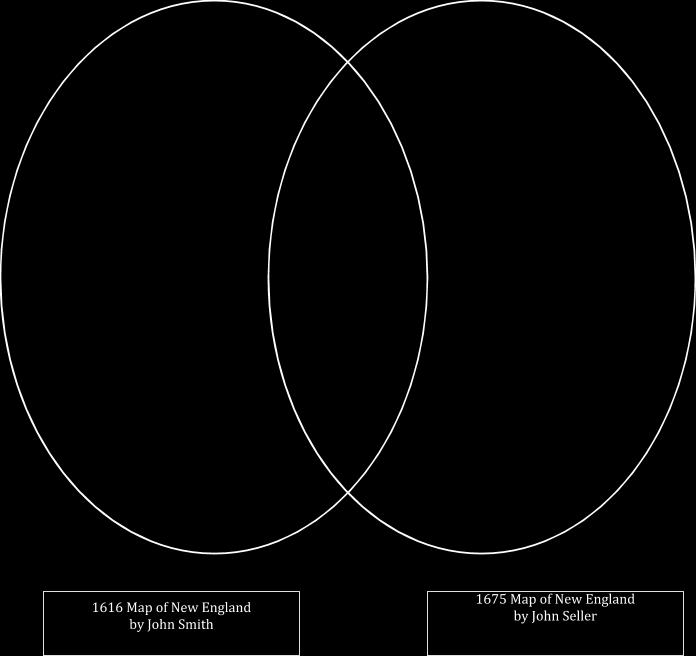
2 2 Procedures: 1. Preview a. Students will complete the preview activity at their seats before coming to the rug for the mini-lesson or discuss the preview question prior to delving into the minilesson. i. Preview Question: How do you think maps are created? 2. Mini-lesson/Note-making Activity: a. Connection: The teacher will review information regarding general geography and the map of New England. i. Guiding Questions: What continent do we live on? What region do we live in? What state do we live in? What city do we live in? What other states are located in New England? What ocean borders New England? b. Turn & Talk: Students will turn to a partner and share their response to the preview question: How do you think maps are created? c. Teach: The teacher will introduce the new concept that Maps tell stories. They are constantly changing as we have new information or need to look at the world in a new way. i. The whole class will have an oral discussion describing a contemporary map of New England. 1. Guiding Questions: What do you notice about the map? What places does the map show? What information would the cartographer have to know to make this map? ii. The teacher will then introduce the two historic maps of New England: 1616 created by John Smith and 1675 created by John Seller. After introducing the maps, the teacher will review and define the key vocabulary for the students iii. The teacher will then introduce the box chart and explain how it will help the students collect information to compare and contrast the two maps. d. Independent Work: Students will work with a partner to complete the graphic organizer to identify the similarities and differences between the 1616 and 1675 maps of New England. i. Note: Students may use either the box chart or the Venn Diagram depending on their level of comprehension. Please be sure to use the appropriate box chart for computer or paper maps. e. Share: Students will report the information from the box chart and identify similarities and differences between the two historic maps. Teacher will record the observations on an anchor chart.
3 3 3. Processing Activity: Students will pretend they are John Seller, the 1675 mapmaker, and will write a letter explaining the changes they made from the 1616 map of New England. Students need to include at least 3 changes and explain reasons for those changes. 4. Extension: After completing the assignment, students may compare both historic maps to a contemporary map of New England.

4 4

5 5 Contemporary Map of New England Image Provided By
6 6 New England : the most remarqueable parts thus named by the high and mighty Prince Charles, Prince of great Britaine Author: Smith, John Date: 1616 Location: New England Dimensions: 29 x 34 cm. Scale: Scale [ca. 1:1,020,000] Call Number: G S65x 1919b Map Link: (map can be opened in zoomify online)
7 7
8 8 A mapp of New England Author: Seller, John Publisher: Hills, John Date: 1675 Location: New England Dimensions: 43.0 x 54.0 cm. Scale: [ca. 1:1,170,000] Call Number: MAPPING BOSTON COLLECTION Map Link: (map can be opened in zoomify online) DESCRIPTION A foundation in the early history of the mapping of New England, this map is the first printed version of William Reeds original survey of The survey was commissioned by Massachusetts authorities to support the colonial boundaries as described in the first Massachusetts Charter of As originally proposed, the northern boundary was located thirty miles north of the Merrimack River, assuming the river followed an east-west course. When it was later discovered that inland the Merrimack River turned north, Massachusetts colonists aggressively claimed lands thirty miles north of the rivers source, an area also claimed by New Hampshire. The survey is the earliest to depict the relative position of the Hudson, Connecticut and Merrimack rivers. Also identified on the map are several towns that had been destroyed by Indians during the early months of King Philip's War.
9 9
10 10
11 11 Who was the cartographer that made this map? 1616 Map of New England 1675 Map of New England Why do you think it is similar or different between the two maps? What graphic elements do you see on the map? What symbols does the cartographer use to represent towns? What towns are shown on the map? What rivers are shown on the map? What islands (isles) are shown on the map? What is the name of the bay located in the hook of Massachusetts? Locate the town of Sandwich. Describe where it is located along the New England coast. Why do you think this map was made?
12 12 Box Chart (For Use w/ Paper Maps) Who was the cartographer that made this map? 1616 Map of New England 1675 Map of New England Why do you think it is similar or different between the two maps? What graphic elements do you see on the map? How much of the Atlantic Ocean is displayed on the map? What is the name of the bay located in the hook of Massachusetts? How do the images around the cartographer s name connect to the map? Why do you think this map was made?
13 13 Extension: Contemporary Map of New England Contemporary Map of New England Who was the cartographer that made this map? What graphic elements do you see on the map? What symbols does the cartographer use to represent towns? What towns are shown on the map? What islands (isles) are shown on the map? What is the name of the bay located in the hook of Massachusetts? How much of the Atlantic Ocean is displayed on the map? Why do you think this map was made?
North American Geography. Lesson 2: My Country tis of Thee
 North American Geography Lesson 2: My Country tis of Thee Unit Overview: As students work through the activities in this unit they will be introduced to the United States in general, different regions
Milford Public Schools Curriculum
 Milford Public Schools Curriculum Department: Social Studies Grade 3 Course Name: Communities Course Description In third grade, students will engage in a yearlong study of communities and specifically
PBL: Colonial Life. Create a Brochure Attracting People to Come to your Region
 PBL: Colonial Life Create a Brochure Attracting People to Come to your Region Project Idea: Brochure Working in partners, students will create a brochure attracting people to one of the three regions:
Canadian Mapping Big Book
 Canadian Mapping Big Book Grades 4-6 Written by Lynda Golletz Illustrated by S&S Learning Materials About the Author: Lynda Golletz was an elementary school teacher for thirty-three years. She is the author
A. Geography Students know the location of places, geographic features, and patterns of the environment.
 Learning Targets Elementary Social Studies Grade 5 2014-2015 A. Geography Students know the location of places, geographic features, and patterns of the environment. A.5.1. A.5.2. A.5.3. A.5.4. Label North
Map Skills Lesson 1. Materials: maps, pencils, Lesson 1 Worksheet, strips of paper, grid paper
 Map Skills Lesson 1 Use cardinal directions, map grids, scales, and titles to locate places on a map. Interpret a map using information from its title, compass rose, scale, and legend. Vocabulary: map,
Section. 1 Our Planet, Earth. Prepare to Read
 1 Section Step-by-Step Instruction Objectives Social Studies 1. Learn about Earth s movement in relation to the sun. 2. Explore seasons and latitude. Reading/Language Arts Use context clues from surrounding
Changing Communities: Regions of the United States. Social Studies Fairfield Public Schools
 4 Changing Communities: Regions of the United States Social Studies Fairfield Public Schools 4 Grade 4-Communities Across The United States (9/08/2015) DRAFT Description: In Grade 4, students engage in
Warmup. geography compass rose culture longitude
 Warmup geography compass rose culture longitude ecosystem latitude 1. study of the special physical and human characteristics of a place or region 2. learned system of shared beliefs, traits, and values
European Migration to Tilting, Newfoundland
 European Migration to Tilting, Newfoundland Lesson Overview In this lesson, students will learn about historical connections between Tilting, Newfoundland and Labrador, and Ireland. Using the Canadian
Fifth Grade Social Studies
 AASD SOCIAL STUDIES CURRICULUM Fifth Grade Social Studies Description The fifth grade survey of American History course provides a general overview of our nation from colonization into the Twenty-First
Crossing the Atlantic: Then and Now
 Your web browser (Safari 7) is out of date. For more security, comfort and Activitydevelop the best experience on this site: Update your browser Ignore Crossing the Atlantic: Then and Now How has the amount
South America: A Map Mystery Completed By:
 South America: A Map Mystery Completed By: Historians who study old maps have to be detectives. Even though the people of the past can t directly tell us what they thought or believed, they left clues
Ancient Egypt and the Near East
 UNIT2 Ancient Egypt and the Near East Lesson 7 Lesson 8 Lesson 9 Lesson 10 Lesson 11 Lesson 12 Geography and the Early Settlement of Egypt, Kush, and Canaan The Ancient Egyptian Pharaohs Daily Life in
SUBJECT: History and Social Studies Grade Level: 3 Massachusetts and its Cities and Towns: Geography and History. Unit: Map Skills
 Unit: Map Skills Learning Standards / Essential Knowledge Concepts and Skills Essential New England and Massachusetts 3.1 On a map of the United States, locate the New England states (Connecticut, Rhode
The Northeast United States: Big Cities to Mountain Ranges. Natural Resources Food Transportation Industry X Lumber/trees
 The Northeast United States: Big Cities to Mountain Ranges Classifying / Categorizing Information Natural Resources Food Transportation Industry Lumber/trees Maple Syrup Historic and Cultural Landmarks
What on Earth is Geography? Using the Five Themes of Geography to Study the Continent of Asia.
 What on Earth is Geography? Using the Five Themes of Geography to Study the Continent of Asia. Name Date Essential questions: 1. How can we study the geography of our Earth? a. What are the five themes
Sample file. Teacher Guide ... Before You Teach. Our resource has been created for ease of use by both TEACHERS and STUDENTS alike.
 8 7 9 10 12 13 14 11 Introduction T his resource provides ready-to-use information and activities for remedial students in grades five to eight. Written to grade and using simplified language and vocabulary,
St. Helens: Out of the Ash Learning Resource Guide
 St. Helens: Out of the Ash Learning Resource Guide Overview: In May of 1980 Mount St. Helens grabbed the world s attention by putting on a volcanic display never before witnessed in modern times. Today,
LET S GO ON A ROAD TRIP
 Partner School News June 2016 In this issue: Education Children Around the World www.opportunityeducation.org Road Trip Start Writing Right Now Teaching Tip of the Month Focus on Schools LET S GO ON A
Many Ways to Name a Place
 Your web browser (Safari 7) is out of date. For more security, comfort and Activityapply the best experience on this site: Update your browser Ignore Many Ways to Name a Place What are the names for the
Your web browser (Safari 7) is out of date. For more security, comfort and. the best experience on this site: Update your browser Ignore
 is out of date. For more security, comfort and. the best experience on this site: Update your browser Ignore") Your web browser (Safari 7) is out of date. For more security, comfort and Activityengage the best experience on this site: Update your browser Ignore Comparing Historical Maps How can historical maps
Your web browser (Safari 7) is out of date. For more security, comfort and Activityengage the best experience on this site: Update your browser Ignore Comparing Historical Maps How can historical maps
Standard Indicator That s the Latitude! Students will use latitude and longitude to locate places in Indiana and other parts of the world.
 Standard Indicator 4.3.1 That s the Latitude! Purpose Students will use latitude and longitude to locate places in Indiana and other parts of the world. Materials For the teacher: graph paper, globe showing
MAP SET. BrITAIN S & EXCERPTS. Norman B. Leventhal Map Center Digital Collections leventhalmap.org
 MAP SET BrITAIN S NORTH AMERICAN EMPIRE 1607 1764 Worksheets & EXCERPTS Norman B. Leventhal Map Center Digital Collections leventhalmap.org MAP 1 New england 1675 MAP Inquiry WORKSHEET Circle which of
Texas Geography. Understanding the physical and human characteristics of our state
 Texas Geography Understanding the physical and human characteristics of our state To understand Texas you must first learn about its Geography. Geography- The study of the world, its people, and the interaction
Social Studies (4) Social Science
 Social Science") Scope And Sequence Timeframe Unit Instructional Topics 8 Day(s) Course Overview Students will learn about the regions of the United States with emphasis on local and state history, geography, government,
Scope And Sequence Timeframe Unit Instructional Topics 8 Day(s) Course Overview Students will learn about the regions of the United States with emphasis on local and state history, geography, government,
Grade Four Content Overview
 Grade Four Content Overview Physical features Regions Contributions of the states Our Country: Geography and Regions Coastal and inland communities Famous landmarks Physical and human characteristics Local,
4th Grade Social Studies First Nine Weeks
 4th Grade Social Studies First Nine Weeks Multiple Choice Identify the choice that best completes the statement or answers the question. 1 Name the mountains that are located in the eastern United States.
Unit 9.2 Introduction to Geography
 Unit 9.2 Introduction to Geography Name: Period: This activity has been modified from the Stanford History Education Group from the original found here. 1 What does it mean to think like a geographer?
United States of America Geography
 United States of America Geography Part I by Sonja E. Schild LearnSmart Publishing Co. Vancouver, BC, Canada Phone: (604) 433-1347 ISBN 0-9694445-3-9 Notice! All rights reserved. Permission to reproduce
UNIT PLAN. Big Idea/Theme: In the seventeenth and eighteenth centuries, European expansion impacted societies worldwide.
 UNIT PLAN Grade Level: Unit # 1 Unit Name: Colonial Expansion 7 th Big Idea/Theme: In the seventeenth and eighteenth centuries, European expansion impacted societies worldwide. Culminating Assessment:
Historical Fisheries off the Grand Banks (Wet and Dry Fisheries)
") Lesson Overview Historical Fisheries off the Grand Banks (Wet and Dry Fisheries) The French conducted the earliest trans-atlantic fishery with the Portuguese fishermen, soon joined by Basques, who took
Lesson Overview Historical Fisheries off the Grand Banks (Wet and Dry Fisheries) The French conducted the earliest trans-atlantic fishery with the Portuguese fishermen, soon joined by Basques, who took
Learning Target : Describe the purposes and uses of different types of maps.
 Learning Target : Describe the purposes and uses of different types of maps. Directions: 1. Below, place a where you think you are located. 2. In which continent are you located? 3. In which country are
Warm up: (8 min) Use the Map, On the Prom (Color) Paper (Blk/White) and answer the questions on your paper
 Use the Map, On the Prom (Color) Paper (Blk/White) and answer the questions on your paper") Warm up: (8 min) Use the Map, On the Prom (Color) Paper (Blk/White) and answer the questions on your paper TX History: Mapping and Geography of Texas: We will discuss some slides and write notes on others
Warm up: (8 min) Use the Map, On the Prom (Color) Paper (Blk/White) and answer the questions on your paper TX History: Mapping and Geography of Texas: We will discuss some slides and write notes on others
EMPOWERING TEACHERS. Day 1 Read and record the details from The Earth on a large chart. LA , LA
 LA.3.1.7.5, LA.3.1.7.7 EMPOWERING TEACHERS Comprehension Instructional Routine: Compare and Contrast the Topics in Two Texts Preparation/Materials: two large texts for the teacher of The Earth and Mercury,
Your web browser (Safari 7) is out of date. For more security, comfort and. the best experience on this site: Update your browser Ignore
 is out of date. For more security, comfort and. the best experience on this site: Update your browser Ignore") Your web browser (Safari 7) is out of date. For more security, comfort and lesson the best experience on this site: Update your browser Ignore Political Borders Why are the borders of countries located
Your web browser (Safari 7) is out of date. For more security, comfort and lesson the best experience on this site: Update your browser Ignore Political Borders Why are the borders of countries located
Lesson Title: Then and Now: How Society Alters Topography and Vegetation
 Lesson Title: Then and Now: How Society Alters Topography and Vegetation Lesson Author: Rodney Collins (rwcollins@lf.k12.de.us) Lesson Description: This lesson is a comparative study in which students
The Five Themes of Geography
 The Five Themes of Geography The Five Themes of Geography Main Idea: Geographers use the Five Themes of Geography to help them study the Earth. The Five Themes of Geography Geography and You: Suppose a
About places and/or important events Landmarks Maps How the land is, hills or flat or mountain range Connected to maps World Different countries
 What do you think you know about geography? About places and/or important events Landmarks Maps How the land is, hills or flat or mountain range Connected to maps World Different countries What do you
Geography and World Cultures
 Core Geography and World Cultures Geography and World Cultures offers a tightly focused and scaffolded curriculum that enables students to explore how geographic features, human relationships, political
Office of Curriculum, Instruction, and Technology. Social Studies. Grade 4 ABSTRACT
 Office of Curriculum, Instruction, and Technology Social Studies Grade 4 ABSTRACT At the fourth grade level, students learn about the state of New. Various aspects of the state are investigated including
News English.com Ready-to-use ESL / EFL Lessons
 www.breaking News English.com Ready-to-use ESL / EFL Lessons The Breaking News English.com Resource Book 1,000 Ideas & Activities For Language Teachers http://www.breakingnewsenglish.com/book.html Map
middle-atlantic States 1-3. Storm King of the Hudson
 middle-atlantic States 1-3. Storm King of the Hudson Imagine a place without cars, housing additions, or even a McDonald s, where nature s beauty surrounds you and few people have traveled. What would
Sculpted by Floods Learning Resource Guide
 Sculpted by Floods Learning Resource Guide Overview: KSPS s Sculpted by Floods tells the story of the ice age floods in the Pacific Northwest. It is a story of the earth's power, scientific discovery and
2011, 1998, 1987 Copyright by Remedia Publications, Inc. All Rights Reserved. Printed in the U.S.A.
 See the world REM 129A A Teaching Resource From 2011, 1998, 1987 Copyright by Remedia Publications, Inc. All Rights Reserved. Printed in the U.S.A. The purchase of this product entitles the individual
WHICH STORES HEAT ENERGY BETTER RECORD SHEET
 Activity Four, Currents and Heat Transfer Name: WHICH STORES HEAT ENERGY BETTER RECORD SHEET Exploration Questions Which stores heat energy better, water or sand? How does warm water affect the air temperature
An Introduction to the South Carolina Atlas
 An Introduction to the South Carolina Atlas Daniel E. Stone Pinewood Preparatory School dstone@pinewoodprep.com Overview This lesson is designed to serve as an introduction to the new South Carolina Atlas.
Hurricanes and Their Tracks
 LESSON PLAN 1 Hurricanes 3 5 Hurricanes and Their Tracks Children will know better what to expect of an approaching hurricane if they understand what a hurricane is and the weather associated with it.
How Irrigation Affected the Geography of Northeast Oregon
 Delia Wallis How Irrigation Affected the Geography of Northeast Oregon Grade Levels: 4 (with ability to move up or down) Time: two x 45-minute sessions Overview: Students are going to study topographical
Using Geography to Plan Civil War Campsites
 Jake Gordon Civil War Campsite Mapping Lesson Plan pg1 Using Geography to Plan Civil War Campsites Overview: This lesson is designed for an 8 th grade social studies class during the Civil War unit. Students
Beginning Orienteering Post visit
 Beginning Orienteering Post visit Classroom Activities Brief Synopsis The post activities are designed to reinforce what the students learned at Eagle Bluff and practice the skill of map reading. Students
Witchampton CofE First School Geography Curriculum Map
 2016-2017 Autumn People and : 30-50 Show interest in the lives of people who are familiar to them. Shows interest in different occupations. Remembers and talks significant events in their own experience.
World Geography. Teacher s Guide
 World Geography Teacher s Guide WALCH PUBLISHING Table of Contents To the Teacher.......................................................... vi Classroom Management.................................................
1. Study the following Vocabulary Words to be defined: Prehistory, History, Geography, 5 Themes of Geography, Legacy
 Social Studies Mr. Poirier Introduction Test - Study Guide Study Guide given in class on Monday September 18, 2017 Introduction Unit Test - Thursday September 21, 2017 1. Study the following Vocabulary
Saskatchewan s Early Trade Routes: The Impact of Geography on Trade
 Saskatchewan s Early Trade Routes: The Impact of Geography on Trade Lesson Overview In this lesson, students will compare and contrast prehistoric First Nations trade routes and trade goods with the routes
Delta RV Sixth Grade Social Studies Curriculum Revised 2010
 Delta RV Sixth Grade Social Studies Curriculum Revised 2010 Social Studies: 6 th Grade Principles of Constitutional Democracy Content Standard 1: Knowledge of the principles expressed in documents shaping
Preparing for STAAR Success in Social Studies
 Preparing for STAAR Success in Social Studies Century- a period of 100 years (ex. 1900-2000) Decade- a period of 10 years (ex. 1570-1580) Era-a period of time Millennium-a period of 1,000 years (ex. 1000-2000)
Your web browser (Safari 7) is out of date. For more security, comfort and the best experience on this site: Update your browser Ignore
 is out of date. For more security, comfort and the best experience on this site: Update your browser Ignore") Your web browser (Safari 7) is out of date. For more security, comfort and the best experience on this site: Update your browser Ignore Activitydevelop TRADE IN THE 1600S What did Native Americans and
Your web browser (Safari 7) is out of date. For more security, comfort and the best experience on this site: Update your browser Ignore Activitydevelop TRADE IN THE 1600S What did Native Americans and
At the Edge of the Continent
 Islands in the Stream 2002: Exploring Underwater Oases At the Edge of the Continent FOCUS Bathymetry of the South Atlantic Bight continental shelf and upper shelf-edge GRADE LEVEL 9-12 (Earth Science)
Essential Questions What are the major physical components of the world, and how are they represented on a map? 3.4
 Third Grade Social Studies Unit One Six Weeks GEOGRAPHY Originally compiled by Russellville In order for students to understand that geography influences the development of a region as well as the interactions
Map Skills Scavenger Hunt
 Map Skills Scavenger Hunt Introduction to: Continents Cardinal Directions Relative Location Equator and Prime Meridian Hemispheres Reading a Political Map Reading a Physical Map Idea: This product includes
Making a Climograph: GLOBE Data Explorations
 Making a Climograph: A GLOBE Data Exploration Purpose Students learn how to construct and interpret climographs and understand how climate differs from weather. Overview Students calculate and graph maximum
Explore! Fossils Original Air Date: January 28, 2015 Grade Levels: 3-6 Archived Program URL: Program Materials Page URL: Program Description:
 Explore! Fossils Original Air Date: January 28, 2015 Grade Levels: 3-6 Archived Program URL: http://www.hectv.org/video/16389/explore-fossils-january-2015/ Program Materials Page URL: http://www.hectv.org/teachers/curriculum/hec-tv-live/explorefossils/
MEADOWS PRIMARY SCHOOL and NURSERY GEOGRAPHY POLICY
 MEADOWS PRIMARY SCHOOL and NURSERY GEOGRAPHY POLICY Purpose of study The teaching of Geography at Meadows is done by following the 2014 National Curriculum. The planning and teaching of the subject aims
Tracking the Salt Front
 Tracking the Salt Front Students will use Hudson River salinity data to practice math skills as they track movements of the salt front in response to storms and other weather events. Objectives: Students
WEEK ONE. Lesson Objectives & Demonstrations of Learning. Assessment Plan and Resources. Frame
 Teacher: Montellano/Harris/Pando/ Mendoza Subject: Social Studies Grade Level: grade 3rd Six Week: 4TH WEEK ONE TEKS List 3.1 B Identify individuals including Benjamin Banneker, Pierre Charles L Enfant
MASSACHUSETTS HISTORY & SOCIAL SCIENCE LEARNING STANDARDS Grade 6 HISTORY AND GEOGRAPHY
 Massachusetts History and Social Science Curriculum Framework Learning Standards, World Geography (Grade 6) Grade 6 HISTORY AND GEOGRAPHY 1. Use map and globe skills learned in prekindergarten to grade
Your web browser (Safari 7) is out of date. For more security, comfort and the best experience on this site: Update your browser Ignore
 is out of date. For more security, comfort and the best experience on this site: Update your browser Ignore") Your web browser (Safari 7) is out of date. For more security, comfort and the best experience on this site: Update your browser Ignore Activityengage O CEAN AND SEA BO RDERS Who has the rights to valuable
Your web browser (Safari 7) is out of date. For more security, comfort and the best experience on this site: Update your browser Ignore Activityengage O CEAN AND SEA BO RDERS Who has the rights to valuable
a division of Teacher Created Materials
 Sample Pages from a division of Teacher Created Materials Thanks for checking us out. Please call us at 877-777-3450 with questions or feedback, or to order this product. You can also order this product
Subject: Geography Scheme of Work: B1 to B6 Mastery tiles. Term: Autumn/Spring/Summer
 Subject: Geography Scheme of Work: B1 to B6 Mastery tiles Term: Autumn/Spring/Summer Topic / Unit(s) Overview / Context Introduction to geography. An introduction to geography including basic map skills
Maryland Council on Economic Education 1
 How to Make an Apple Pie and See the World by Marjorie Priceman (Dragonfly Books, New York, 1994) ISBN 0-679-88083-6 Literature Annotation: This beautifully illustrated story is about a girl baker who
What Is a Globe? Hemispheres. Main Idea Globes and maps provide different ways of showing features of the earth. Terms to Know
 r Main Idea Globes and maps provide different ways of showing features of the earth. Terms to Know hemisphere latitude longitude scale bar scale relief elevation contour line What Is a Globe? A globe is
Revive, Contemplate, and Integrate Lesson Plan. Your Name: Amanda Pellerin, Amanda Kodeck, and Pat Cruz Grade: 7
 Revive, Contemplate, and Integrate Lesson Plan Your Name: Amanda Pellerin, Amanda Kodeck, and Pat Cruz Grade: 7 Unit of Study: Social Studies/ Visual Arts Lesson Title: Modern Day Maps Goal/Purpose: Students
Landmarks Paula Owens 5 7 years
 Landmarks Paula Owens Geography teaching resource 5 7 years This is one of a series of teaching resources for use with Digimap for Schools. For more details about this service, visit http://digimapforschools.edina.ac.uk
Touring Around the Islands of Atlantic Canada
 Lesson Overview Touring Around the Islands of Atlantic Canada In this lesson, students will examine the history and heritage of the islands of Atlantic Canada and examine their similarities and differences.
CHANGING LANDFORMS Earth s Changing Face
 Written by Celeste Fraser INTRODUCTION Earth s Changing Face This book is available at three reading levels, as indicated by the one, two, or three dots beside the Science A Z logo on the front cover.
South America: A Map Mystery Completed By:
 South America: A Map Mystery Completed By: Historians who study old maps have to be detectives. Even though the people of the past can t directly tell us what they thought or believed, they left clues
Geography Long Term Plan 2018
 Geography Long Term Plan 2018 Geography Co-ordinator: Megan Frost A high-quality geography education should inspire in pupils a curiosity and fascination about the world and its people that will remain
name and locate the world s seven continents and five oceans
 Subject: Geography Activities National Curriculum Objectives One Progression of Skills Name the 7 continents and 5 oceans 3D Jigsaw task to locate continents and seas name and locate the world s seven
Why Do We Live Here? : A Historical Geographical Study of La Tabatiere, Quebec North Shore
 Why Do We Live Here? : A Historical Geographical Study of La Tabatiere, Quebec North Shore Lesson Overview Many communities and their occupants have historical connections to exploration routes and traditional
HADDONFIELD PUBLIC SCHOOLS Curriculum Map for Social Studies 7 th Geography Study Skills, Geography & the Five Themes
 Curriculum Map for Social Studies 7 th Geography Study, Geography & the Five Themes NJCCCS 6.1 - Social Studies SEPTEMBER Essential Questions: What are the traits of a student? What study skills maximize
Your web browser (Safari 7) is out of date. For more security, comfort and the best experience on this site: Update your browser Ignore
 is out of date. For more security, comfort and the best experience on this site: Update your browser Ignore") Your web browser (Safari 7) is out of date. For more security, comfort and the best experience on this site: Update your browser Ignore Activitydevelop RESEARCH EXAMPL ES O F PHYSICAL GEO GRAPHY How do
Your web browser (Safari 7) is out of date. For more security, comfort and the best experience on this site: Update your browser Ignore Activitydevelop RESEARCH EXAMPL ES O F PHYSICAL GEO GRAPHY How do
YEAR 7 REVISION BOOKLET
 YEAR 7 REVISION BOOKLET Assessment checklist 1. To be able to define Geography. 2. Give examples of what we study in geography 3. Group what we study into the three major areas of geography 4. To be able
Chapter 1 Study Guide
 Chapter 1 Study Guide Reminders: Vocabulary quiz and test will be on Tuesday, September 6th. Complete study guide and bring completed to school Friday, September 2nd. You are NOT required to print the
2 Georgia: Its Heritage and Its Promise
 TERMS region, erosion, fault, elevation, Fall Line, aquifer, marsh, climate, weather, precipitation, drought, tornado, hurricane, wetland, estuary, barrier island, swamp PLACES Appalachian Mountains, Appalachian
LOUISIANA STUDENT STANDARDS FOR SOCIAL STUDIES THAT CORRELATE WITH A FIELD TRIP TO DESTREHAN PLANTATION KINDERGARTEN
 LOUISIANA STUDENT STANDARDS FOR SOCIAL STUDIES THAT CORRELATE WITH A FIELD TRIP TO DESTREHAN PLANTATION KINDERGARTEN Standard 2 Historical Thinking Skills Students distinguish between events, people, and
Alliance Created State Giant Traveling Map Lesson
 Title: Comparing Arizona s Temperatures Recommended Grades: 4 th 5 th Time Needed: 30 minutes Objectives: Students will: Compare and contrast the geographic features of Arizona by researching seasonal
3 rd Grade Social Studies Pacing Guide Arkansas Frameworks
 3 rd Grade Social Studies Pacing Guide Arkansas Frameworks 1st Nine Weeks Strand1: Geography Standard 1: Physical and Spatial Students shall develop an understanding of the physical and spatial characteristics
Module 2 Educator s Guide Overview
 Module 2 Educator s Guide Overview Water, water almost everywhere? Module Overview The presence of water in solid, liquid, and gaseous forms is one of the primary factors that distinguishes Earth from
Nebraska s Place in the World
 Geographic Educators of Nebraska Advocating geographic education for all Nebraskans Nebraska s Place in the World Students will use lines of latitude and longitude to locate cities within the state and
NAME: DATE: Leaving Certificate GEOGRAPHY: Maps and aerial photographs. Maps and Aerial Photographs
 NAME: DATE: Leaving Certificate Geography Maps and Aerial Photographs Please see Teachers Notes for explanations, additional activities, and tips and suggestions. Learning Support Vocabulary, key terms
This nonfiction book
 This nonfiction book explains how islands are born from underwater volcanoes. The challenging content is made accessible with simple text, captions, photographs, labels, and diagrams. 16 pages, 231 words
Preview: Making a Mental Map of the Region
 Preview: Making a Mental Map of the Region Draw an outline map of Canada and the United States on the next page or on a separate sheet of paper. Add a compass rose to your map, showing where north, south,
Unit 1 Continents And Geo Skills Lesson 1 Getting To
 We have made it easy for you to find a PDF Ebooks without any digging. And by having access to our ebooks online or by storing it on your computer, you have convenient answers with unit 1 continents and
Map Skills Unit. Note taking unit
 Map Skills Unit Note taking unit Introduction To learn about the Earth, we are going to learn about two geographic tools you can use.globes and maps. Globe A globe is a round model of the planet Earth
GEOGRAPHY. Map Skills. Mrs. Pere ~ 2013
 GEOGRAPHY Map Skills Mrs. Pere ~ 2013 WHAT IS A GLOBE? A globe is a model of the Earth. North Pole Equator South Pole WHAT IS A MAP? A map is a flat drawing of a place. THE IMPORTANT PARTS OF A MAP 1.
Unit 1: Geography. For additional information, refer to this website: 1 G e o g r a p h y
 Unit 1: Geography For additional information, refer to this website: http://mryoungtms.weebly.com/ 1 G e o g r a p h y Continents and Oceans SOL USI. 2a Essential Understanding: Continents are large land
Finding a Good Location!
 Finding a Good Location! Standards Addressed: Social Studies 4-1: The student will demonstrate an understanding of the exploration of the New World. 4-2: The student will demonstrate an understanding of
Grade 6 Social Studies
 Unit Title: Africa : Movement Location Place Human Region : Subject/Course: 6 th Grade Social Studies Essential Questions: peoples, cultures and ideas of the world? How is a location identified using map
Grade 3 California Treasures Correlation
 *This document was created for the purpose of helping teachers align the science and social studies programs with California. These are only suggestions; feel free to use your professional judgment. 3.1