Rapid Intervention Program (RIP) to Improve Operational Management and Efficiencies in Irrigation Districts in Iraq
|
|
|
- Marybeth Jennings
- 5 years ago
- Views:
Transcription
1 Rapid Intervention Program (RIP) to Improve Operational Management and Efficiencies in Irrigation Districts in Iraq USCID Water Management Conference Phoenix, Arizona April 17, 2013
2 Gabriele Bonaiti Extension Program Specialist Guy Fipps Professor and Extension Specialist Irrigation Technology Program Texas A&M AgriLife Extension Service Department of Biological and Agricultural Engineering College Station, Texas
3 Rapid Intervention Program (RIP) RIP is a structured and systematic approach for 1. analyzing the distribution network and on-farm irrigation of irrigation schemes, and 2. developing recommendations on improved management strategies
4 Rapid Intervention Program RIP is designed as (RIP) 1. a low-cost, user-friendly and versatile approach 2. that takes advantage of the knowledge and experience of the scheme operators and managers
5 RIP Components Include 1. Inventory of basic data needed to estimate water supply, flows and on-farm irrigation needs 2. Distribution Network Hydraulic Head Survey and Analysis Tool (Head Survey) 3. Distribution Network Condition Rating Tool (Canal Evaluation) 4. On-farm Head Survey and Analysis Tool (On-Farm Survey) 5. Spreadsheets for storage and analysis of data and GIS map of the command area
6 RIP Components Include 6. Re-formatted spreadsheets for organizing and analysis of data 7. Proposed organization structure for GIS shape files 8. Standardized GIS maps of the WUA 9. Training curriculums for persons implementing the RIP in flow measurement, and in skills needed in GIS and Excel related to the RIP
7 Project Activities 1. Adapt the Rapid Intervention Program (RIP) to WUAs in Iraq 2. Apply the RIP to the Al Shehamiyah Water User Association and the Thraima Project 3. Developed training curriculum on GIS, spreadsheets, flow measurement 4. Develop a Manual 5. Project activities began in February 2012, completed November 2012
8 RIP Manual This manual is organized to serve as both a training program and a reference guide to all the steps required in order to successfully apply the RIP The manual also includes four Appendixes A copy of all forms in English and Arabic Training curriculum A case study of the application of the RIP to the Al Shehamiyah Agriculture Association in Iraq
9 We applied the surveys as follows: 1) Obtain map (scale 1:25,000 or larger) of the distribution network and irrigated areas 2) Working with the operators, complete survey forms and modify forms as needed 3) Encourage operators to conduct ground truth, and carry out measurements of actual flow rates for all canals and at on-farm turnouts 4) Enter data into spreadsheet, and train collaborators on data entry 5) Analyze data and create maps showing results (include also data quality control, link data to GIS, review of results with operators) 6) Create reports (include tables of results, GIS maps with results of rating)
10 We applied the surveys as follows (cont): RIP assumes that the persons implementing the program have already had training and basic skills on use of GIS and Excel. However, implementers need training to review basic concepts, and on how to apply these tools to the RIP Persons who will conduct the flow measurements need at least some understanding of open channel flow principle. Ideally, they will also have had experience with field instrumentation. Training is usually required on use of portable velocity meters
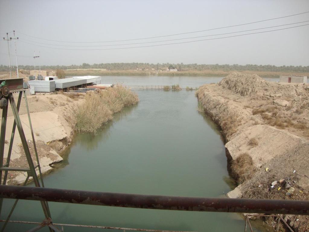
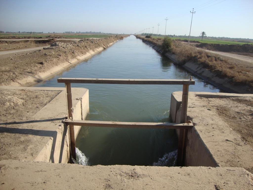
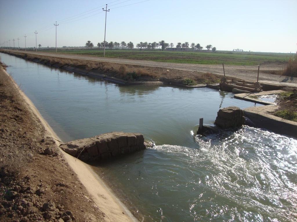
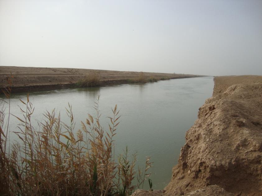
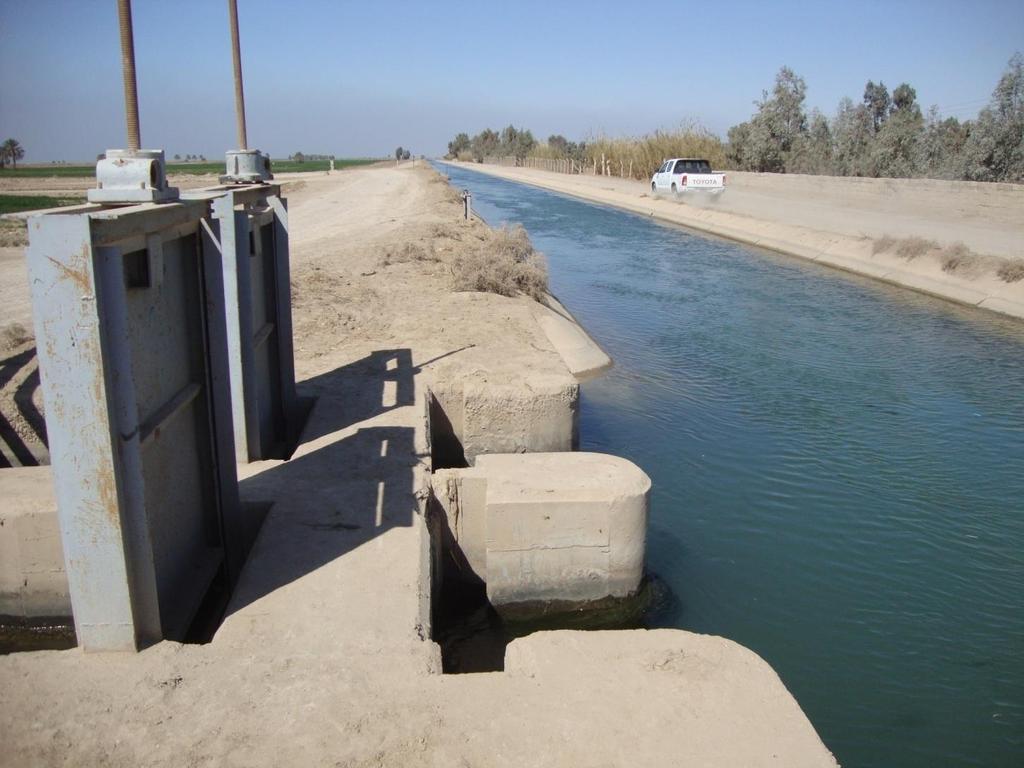
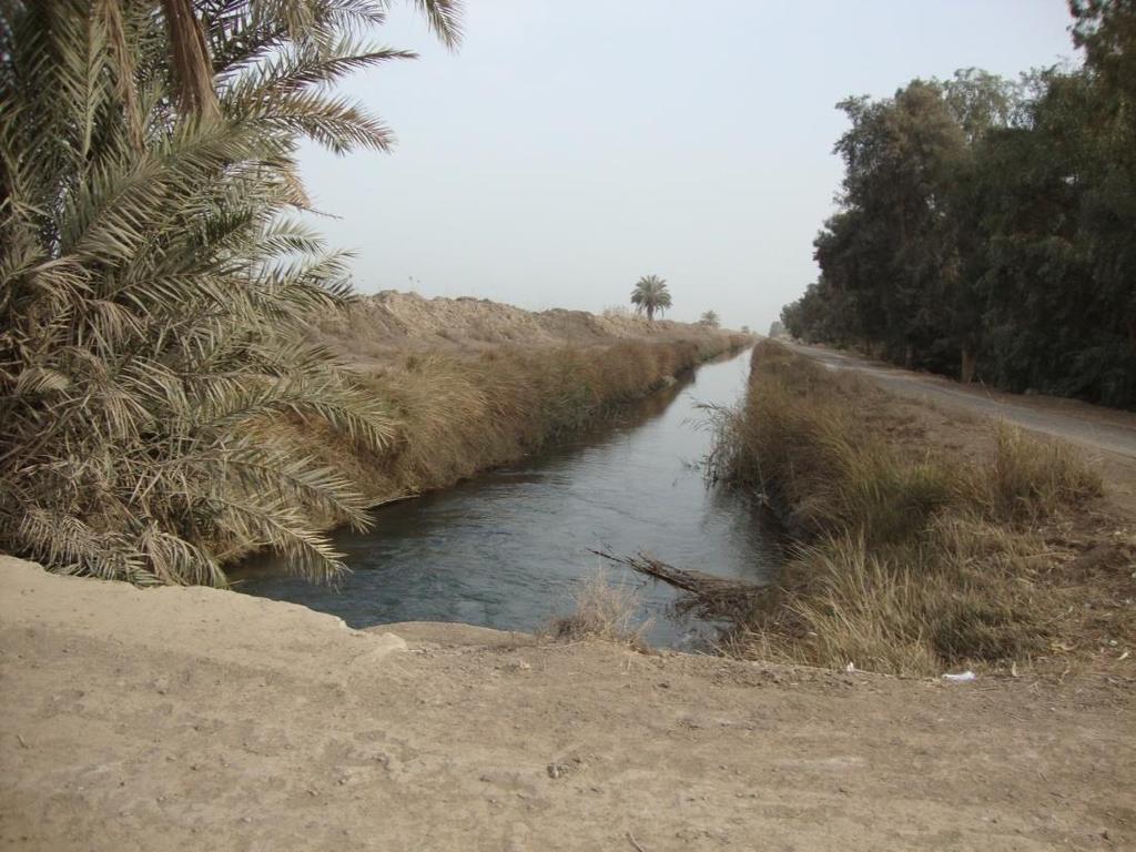
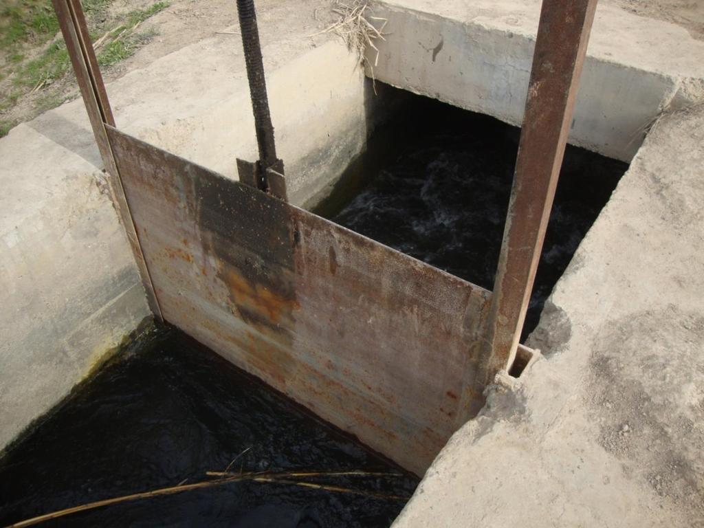
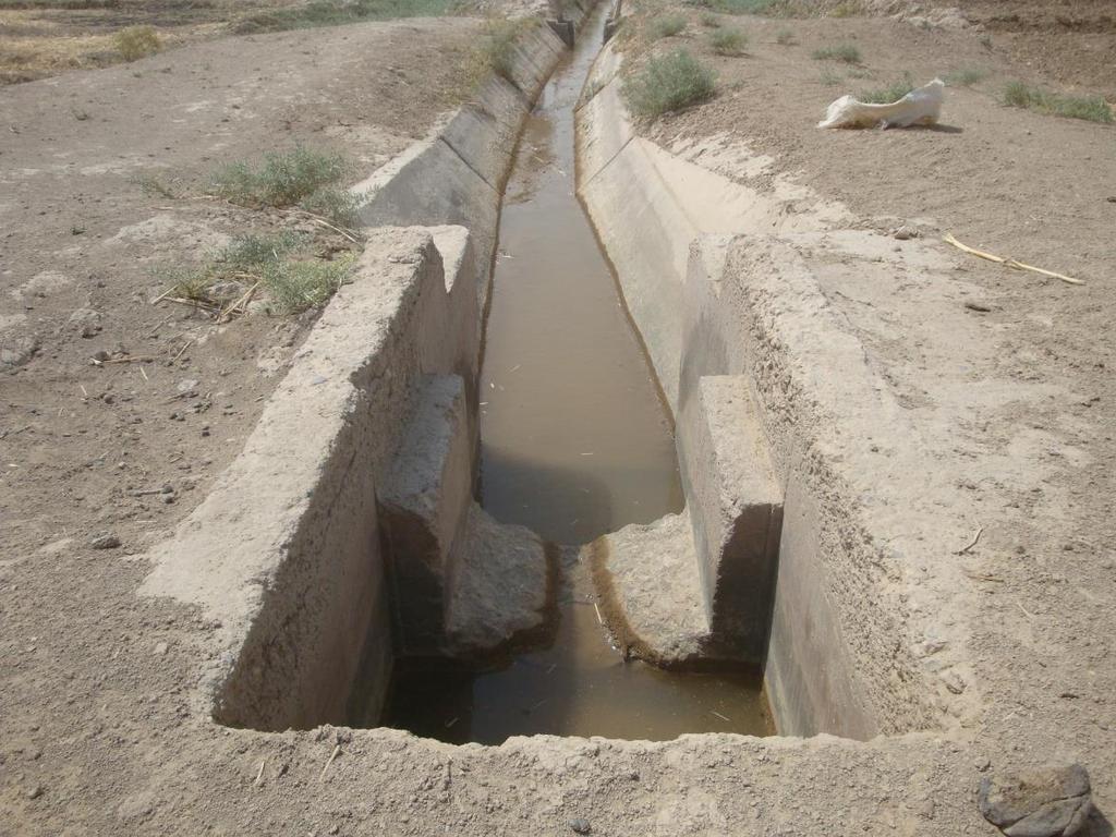
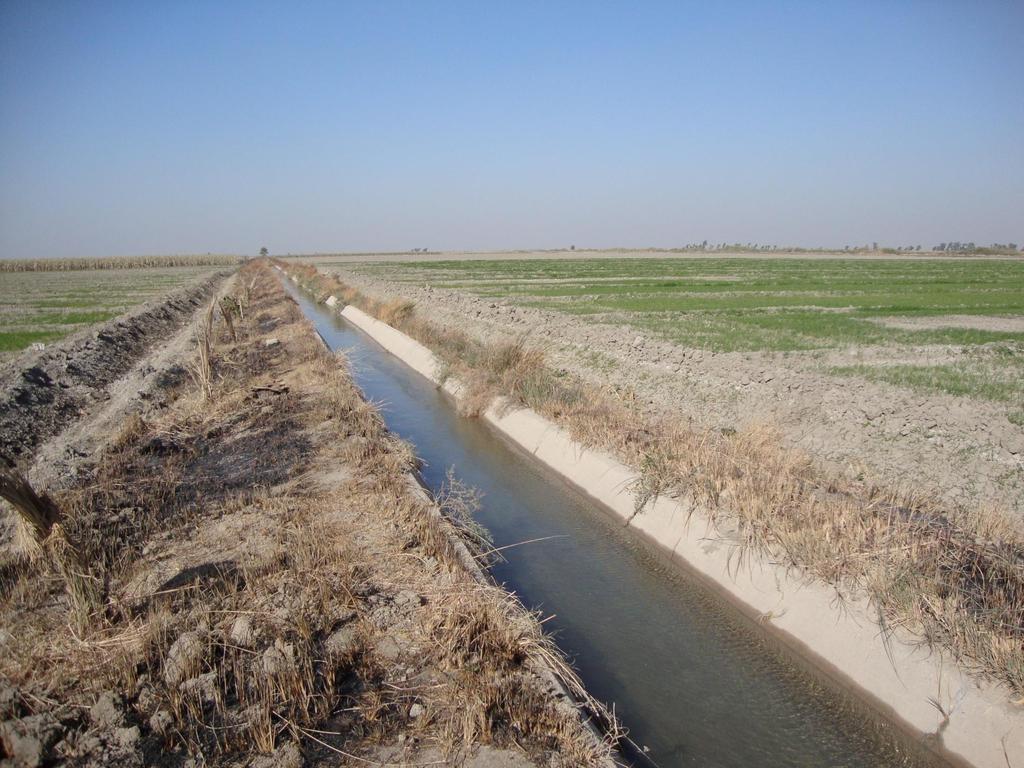
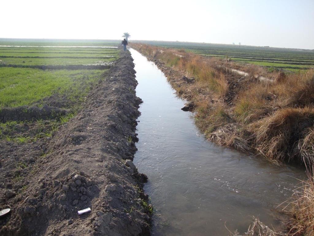
11 Head Survey Purpose: Identification of canals and areas that currently have continuous or intermittent water supply problems Identification of the potential causes of these problems
12 Head Survey Two components 1. Head Survey Canals Affected areas 2. Drainage survey Areas with drainage problems
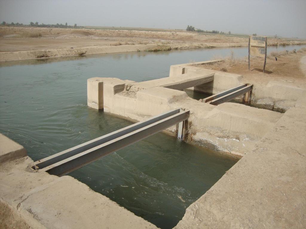
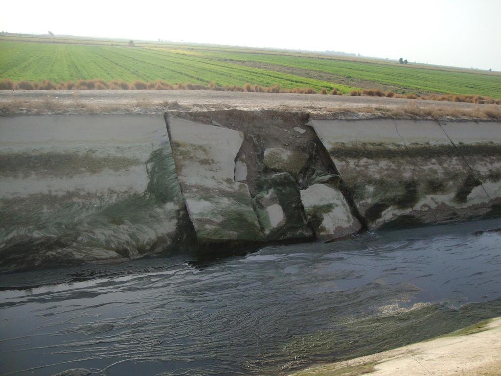
13 Canal Evaluation Purpose: Assess general condition of the irrigation distribution network through a visual rating system to identify segments which need rehabilitation
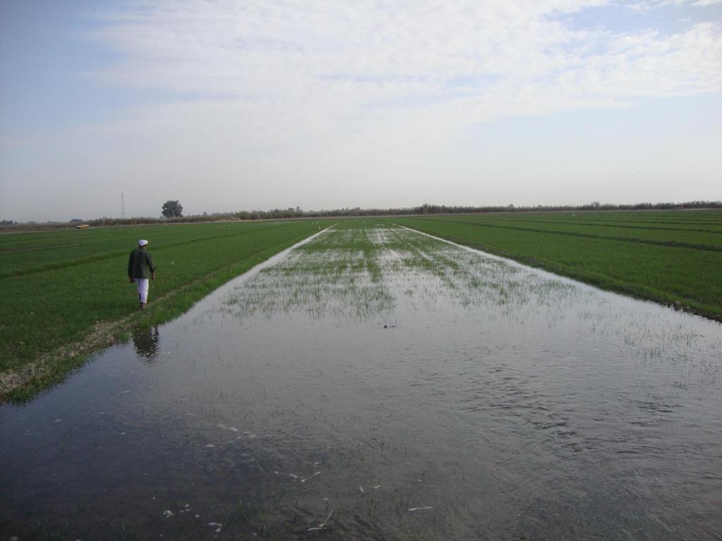
14 On-Farm Survey Purpose: information needed to determine if the current flow at the farm turn-out is sufficient to allow for efficient on-farm irrigation For a representative field in each command area during peak irrigation
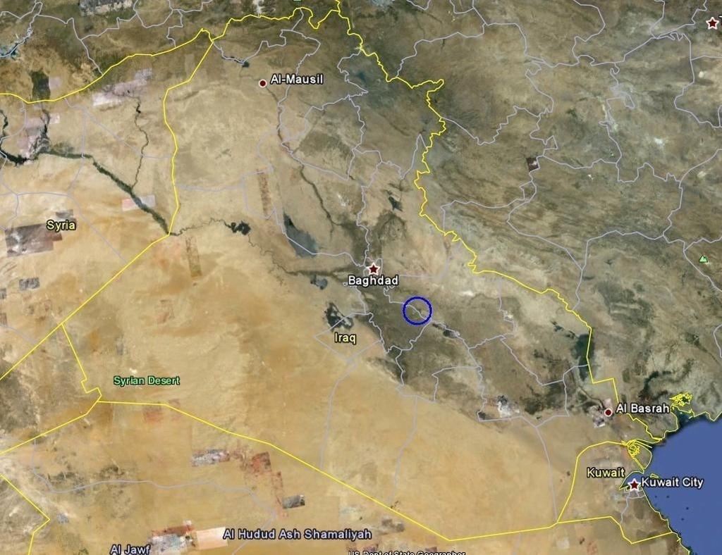
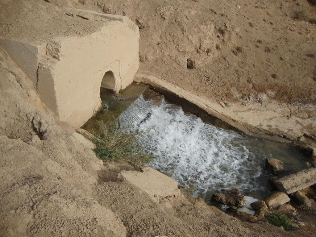
15 Application of the RIP to the Al Shehamiyah Water User Association

16 Head Survey (Al Shehamiyah Project) Frequency of head problem during peak period
17 Head Survey (Al Shehamiyah Project) Severity of head problem
 Rating IDs are shown for the Main Canal and the Branch Canal")
18 Canal Evaluation (Al Shehamiyah Project) General conditions (concrete canal) Rating IDs are shown for the Main Canal and the Branch Canal only
 Water")
19 On-Farm Survey (Al Shehamiyah Project) Water Table depth
20

21 Pumping Station
22
23

24 End of Main Canal
25
26
27
28
29
30

31
32
33 Recommendation for On-Farm Water Delivery Not completed for Al Shehamiyah (flow measurements not available) Provides recommendations for o Optimal flow at the farm turnout o Frequency and volume of irrigation at peak demand o Number of fields that can be irrigated at the same time o Maximum flow in each canal segment
34 Benefit of applying the RIP Organized structure of data that can be further developed in more complex analysis Identification of priorities to be addressed to improve water delivery efficiency
35 Benefit of applying the RIP (cont) All data are interconnected and easily modifiable by a trained person, and results can be automatically updated with new data Several projects can be combined in the same GIS structure Water delivery scheduling can be recalculated when detailed flow rate measurements or other field data become available, and variables can be changed too (ex. diversion and irrigation efficiency, time and interval of application, number of borders irrigated at the same time)
36 For more information: Irrigation District Engineering and Assistance Program Irrigation Technology Program Guy Fipps Gabriele Bonaiti
METHODOLOGIES FOR ANALYZING IMPACT OF URBANIZATION ON IRRIGATION DISTRICTS
 METHODOLOGIES FOR ANALYZING IMPACT OF URBANIZATION ON IRRIGATION DISTRICTS USCID Water Management Conference Irrigated Agriculture Responds to Water Use Challenges Strategies for Success Austin, Texas
Development of a Web-Based GIS Management System for Agricultural Authorities in Iraq
 Development of a Web-Based GIS Management System for Agricultural Authorities in Iraq USCID Water Management Conference Phoenix, Arizona April 18, 2013 Gabriele Bonaiti Extension Program Specialist David
The TexasET Network and Website User s Manual
 The TexasET Network and Website http://texaset.tamu.edu User s Manual By Charles Swanson and Guy Fipps 1 September 2013 Texas AgriLIFE Extension Service Texas A&M System 1 Extension Program Specialist;
ISSUES AND APPROACHES TO COUPLING GIS TO AN IRRIGATION DISTRIBUTION NETWORK AND SEEPAGE LOSS MODELS ABSTRACT
 ISSUES AND APPROACHES TO COUPLING GIS TO AN IRRIGATION DISTRIBUTION NETWORK AND SEEPAGE LOSS MODELS Yanbo Huang 1, Milton Henry 2, David Flahive 3, Guy Fipps 4 ABSTRACT Geographic Information Systems (GIS)
ISSUES AND APPROACHES TO COUPLING GIS TO IRRIGATION DISTRIBUTION NETWORK AND SEEPAGE LOSS MODELS
 ISSUES AND APPROACHES TO COUPLING GIS TO IRRIGATION DISTRIBUTION NETWORK AND SEEPAGE LOSS MODELS Yanbo Huang 1 Milton Henry 2 David Flahive 3 Guy Fipps 4 ABSTRACT There are several possible approaches
Selection and Ranking of Canals in the Gulf Coast Irrigation Division by Expected Seepage and/or Other Types of Losses APPENDIXES
 Selection and Ranking of Canals in the Gulf Coast Irrigation Division by Expected Seepage and/or Other Types of Losses APPENDIXES Final Report Submitted to the Lower Colorado River Authority September
Enabling Success in Enterprise Asset Management: Case Study for Developing and Integrating GIS with CMMS for a Large WWTP
 Enabling Success in Enterprise Asset Management: Case Study for Developing and Integrating GIS with CMMS for a Large WWTP Allison Blake, P.E. 1*, Matthew Jalbert, P.E. 2, Julia J. Hunt, P.E. 2, Mazen Kawasmi,
Demand Forecasting. for. Microsoft Dynamics 365 for Operations. User Guide. Release 7.1. April 2018
 Demand Forecasting for Microsoft Dynamics 365 for Operations User Guide Release 7.1 April 2018 2018 Farsight Solutions Limited All Rights Reserved. Portions copyright Business Forecast Systems, Inc. This
Canal Velocity Indexing at Colorado River Indian Tribes (CRIT) Irrigation Project in Parker, Arizona using the SonTek Argonaut SL
 Irrigation Project in Parker, Arizona using the SonTek Argonaut SL") Canal Velocity Indexing at Colorado River Indian Tribes (CRIT) Irrigation Project in Parker, Arizona using the SonTek Argonaut SL Authors: Dr. Stuart Styles P.E., Mark Niblack, Beau Freeman Abstract An
Canal Velocity Indexing at Colorado River Indian Tribes (CRIT) Irrigation Project in Parker, Arizona using the SonTek Argonaut SL Authors: Dr. Stuart Styles P.E., Mark Niblack, Beau Freeman Abstract An
GIS and Web Technologies to Improve Irrigation Districts
 GIS and Web Technologies to Improve Irrigation Districts Presented To: Montana Association of Dam and Canal Systems Workshop Presented By: Brian Fischer, CFM GIS Manager October 07, 2010 What you won t
INTRODUCTION TO GEOGRAPHIC INFORMATION SYSTEM By Reshma H. Patil
 INTRODUCTION TO GEOGRAPHIC INFORMATION SYSTEM By Reshma H. Patil ABSTRACT:- The geographical information system (GIS) is Computer system for capturing, storing, querying analyzing, and displaying geospatial
Methodologies for Analyzing Impact of Urbanization on Irrigation Districts Rio Grande Basin Initiative
 COLLEGE OF AGRICULTURE AND LIFE SCIENCES TR-419 2011 Methodologies for Analyzing Impact of Urbanization on Irrigation Districts Rio Grande Basin Initiative By Gabriele Bonaiti, Guy Fipps, P.E. Texas AgriLife
Applying GIS to Hydraulic Analysis
 Texas A&M University Department of Civil Engineering CVEN689 Applications of GIS to Civil Engineering Instructor: Francisco Olivera, Ph.D., P.E. Applying GIS to Hydraulic Analysis Lim, Chae Kwan April
ON SITE SYSTEMS Chemical Safety Assistant
 ON SITE SYSTEMS Chemical Safety Assistant CS ASSISTANT WEB USERS MANUAL On Site Systems 23 N. Gore Ave. Suite 200 St. Louis, MO 63119 Phone 314-963-9934 Fax 314-963-9281 Table of Contents INTRODUCTION
Continental Divide National Scenic Trail GIS Program
 CDNST Vision Statement: Provide the most accurate geospatial locational information of the Continental Divide Trail and nearby resources to the public as well as help provide internal management information
Template for Sediment and Erosion Control Plan General Instructions. Section Instructions
 Template for Sediment and Erosion Control Plan General Instructions Introduction: Soil erosion and sediment deposition from farmlands can contribute to degraded surface water quality. Sediment delivery
Oakland County Parks and Recreation GIS Implementation Plan
 Oakland County Parks and Recreation GIS Implementation Plan TABLE OF CONTENTS 1.0 Introduction... 3 1.1 What is GIS? 1.2 Purpose 1.3 Background 2.0 Software... 4 2.1 ArcGIS Desktop 2.2 ArcGIS Explorer
Ministry of Health and Long-Term Care Geographic Information System (GIS) Strategy An Overview of the Strategy Implementation Plan November 2009
 Strategy An Overview of the Strategy Implementation Plan November 2009") Ministry of Health and Long-Term Care Geographic Information System (GIS) Strategy An Overview of the Strategy Implementation Plan November 2009 John Hill, Health Analytics Branch Health System Information
Ministry of Health and Long-Term Care Geographic Information System (GIS) Strategy An Overview of the Strategy Implementation Plan November 2009 John Hill, Health Analytics Branch Health System Information
The University of Akron. William Troyer The Dr. Gary B. and Pamela S. Williams Honors College
 The University of Akron IdeaExchange@UAkron Honors Research Projects The Dr. Gary B. and Pamela S. Williams Honors College Spring 2018 Applying Control Logic to the End of the Ohio Canal Interceptor Tunnel
Public Disclosure Copy
 EUROPE AND CENTRAL ASIA Uzbekistan Water Global Practice IBRD/IDA Investment Project Financing FY 2017 Seq No: 2 ARCHIVED on 12-Jan-2018 ISR30728 Implementing Agencies: Ministry of Agriculture and Water
Mass Asset Additions. Overview. Effective mm/dd/yy Page 1 of 47 Rev 1. Copyright Oracle, All rights reserved.
 Overview Effective mm/dd/yy Page 1 of 47 Rev 1 System References None Distribution Oracle Assets Job Title * Ownership The Job Title [list@yourcompany.com?subject=eduxxxxx] is responsible for ensuring
GEOGRAPHIC INFORMATION SYSTEM ANALYST I GEOGRAPHIC INFORMATION SYSTEM ANALYST II
 CITY OF ROSEVILLE GEOGRAPHIC INFORMATION SYSTEM ANALYST I GEOGRAPHIC INFORMATION SYSTEM ANALYST II DEFINITION To perform professional level work in Geographic Information Systems (GIS) management and analysis;
DESIGN AND IMPLEMENTATION OF OBJECT-ORIENTED COMPUTER SOFTWARE TO SOLVE SECOND ORDER ORDINARY DIFFERENTIAL EQUATIONS WITH CONSTANT COEFFICIENTS
 DESIGN AND IMPLEMENTATION OF OBJECT-ORIENTED COMPUTER SOFTWARE TO SOLVE SECOND ORDER ORDINARY DIFFERENTIAL EQUATIONS WITH CONSTANT COEFFICIENTS Atsa am, D. D., Department of Mathematics/Statistics/Computer
GIS Visualization: A Library s Pursuit Towards Creative and Innovative Research
 GIS Visualization: A Library s Pursuit Towards Creative and Innovative Research Justin B. Sorensen J. Willard Marriott Library University of Utah justin.sorensen@utah.edu Abstract As emerging technologies
Oregon Department of Transportation. Geographic Information Systems. Implementation Plan. Adopted November, 2000 By the GIS Steering Committee
 Oregon Department of Transportation Geographic Information Systems Implementation Plan Adopted November, 2000 By the GIS Steering Committee Introduction The Oregon Department of Transportation (ODOT) GIS
Open Source Geo-Spatial Tools and Mobile Device for Canal Network Digitization
 1 Open Source Geo-Spatial Tools and Mobile Device for Canal Network Digitization Paavan Kumar Reddy Gollapalli Young Professional, ICID(WG-SDTA) Agricultural Engineer, AMIE PGD in RS & GIS (ISRO) 2 Introduction
Chesapeake Bay Remote Sensing Pilot Executive Briefing
 Chesapeake Bay Remote Sensing Pilot Executive Briefing Introduction In his Executive Order 13506 in May 2009, President Obama stated The Chesapeake Bay is a national treasure constituting the largest estuary
Field Observations and One-Dimensional Flow Modeling of Summit Creek in Mack Park, Smithfield, Utah
 Intermountain Center for River Rehabilitation and Restoration, Utah State University 31 July 2018 Field Observations and One-Dimensional Flow Modeling of Summit Creek in Mack Park, Smithfield, Utah I.
Conservation Planning evaluate land management alternatives to reduce soil erosion to acceptable levels. Resource Inventories estimate current and
 Conservation Planning evaluate land management alternatives to reduce soil erosion to acceptable levels. Resource Inventories estimate current and projected erosion levels and their impact on natural resource
Creating A-16 Compliant National Data Theme for Cultural Resources
 Creating A-16 Compliant National Data Theme for Cultural Resources Cultural Resource GIS Facility National Park Service John J. Knoerl Deidre McCarthy Paper 169 Abstract OMB Circular A-16 defines a set
Geographical Information System in Managing Mega Infrastructure Projects
 Geographical Information System in Managing Mega Infrastructure Projects Ankita Adhikary, M.Sc. Geomatics and Space Application, CEPT University Ahmedabad G eographic Information System (GIS) is a computer
Thoughts toward autonomous land development. Introduction
 Thoughts toward autonomous land development Spatial Transformation of Regular grid Irrigation Frameworks Bangkok and Cairo A Work in Progress Information based on student workshop June 2009 and earlier
National Survey on the Natural Environment of Japan. Hajime Hirosawa Biodiversity Center of Japan Ministry of the Environment (MOE)
") National Survey on the Natural Environment of Japan Hajime Hirosawa Biodiversity Center of Japan Ministry of the Environment (MOE) Biodiversity Center of Japan, MOE Establishment: 1998 Purpose: to encourage
National Survey on the Natural Environment of Japan Hajime Hirosawa Biodiversity Center of Japan Ministry of the Environment (MOE) Biodiversity Center of Japan, MOE Establishment: 1998 Purpose: to encourage
Yanbo Huang and Guy Fipps, P.E. 2. August 25, 2006
 Landsat Satellite Multi-Spectral Image Classification of Land Cover Change for GIS-Based Urbanization Analysis in Irrigation Districts: Evaluation in Low Rio Grande Valley 1 by Yanbo Huang and Guy Fipps,
34 School Science Lab Assistant
 34 School Science Lab Assistant Position Description Qualifications POSITION OVERVIEW Reporting to the Principal and under the direction of the School Science Department Head, the School Science Lab Assistant
The World Bank EGYPT-Farm-level Irrigation Modernization (P117745)
") Public Disclosure Authorized MIDDLE EAST AND NORTH AFRICA Egypt, Arab Republic of Water Global Practice IBRD/IDA Specific Investment Loan FY 2011 Seq No: 15 ARCHIVED on 24-Jul-2017 ISR28917 Implementing
Public Disclosure Authorized MIDDLE EAST AND NORTH AFRICA Egypt, Arab Republic of Water Global Practice IBRD/IDA Specific Investment Loan FY 2011 Seq No: 15 ARCHIVED on 24-Jul-2017 ISR28917 Implementing
LRS Task Force June 13, REVISION HISTORY
 North Carolina Department of Transportation Geographic Information Systems (GIS) Unit LINEAR REFERENCING SYSTEM (LRS) PROJECT DEFINITION Version 1.0 REVISION HISTORY Date Document Manager Revision Purpose
Advanced Forecast. For MAX TM. Users Manual
 Advanced Forecast For MAX TM Users Manual www.maxtoolkit.com Revised: June 24, 2014 Contents Purpose:... 3 Installation... 3 Requirements:... 3 Installer:... 3 Setup: spreadsheet... 4 Setup: External Forecast
University of Lusaka
 University of Lusaka BSPH 315 Health Mapping & GIS Topic: Background of GIS Content: 1. Aim of the course 2. What do you know about GIS? 3. Difference between geographic data and geographic information
CHEMICAL INVENTORY ENTRY GUIDE
 CHEMICAL INVENTORY ENTRY GUIDE Version Date Comments 1 October 2013 Initial A. SUMMARY All chemicals located in research and instructional laboratories at George Mason University are required to be input
Digital Wetlands. Bringing the Field into the Office Through GIS
 Digital Wetlands Bringing the Field into the Office Through GIS Maryland Department of the Environment Wetlands and Waterways Program MDE's Wetlands and Waterways Program seeks to conserve valuable aquatic
Bryco Machine Welcomes SME and AME. October 1, 2008
 Bryco Machine Welcomes SME and AME October 1, 2008 2008 Type of Shop Leading precision machining contract manufacturer Manufacturer of complex parts that require state-of-the-art equipment and high level
HAZARD COMMUNICATION and GHS. Environmental Health and Safety
 HAZARD COMMUNICATION and GHS Environmental Health and Safety RIGHT-TO-KNOW LAW OSHA created the Hazard Communication Standard in 1983. Applies to all places of employment where employees are exposed to
John Laznik 273 Delaplane Ave Newark, DE (302)
") Office Address: John Laznik 273 Delaplane Ave Newark, DE 19711 (302) 831-0479 Center for Applied Demography and Survey Research College of Human Services, Education and Public Policy University of Delaware
Office Address: John Laznik 273 Delaplane Ave Newark, DE 19711 (302) 831-0479 Center for Applied Demography and Survey Research College of Human Services, Education and Public Policy University of Delaware
Internal Audit Report
 Internal Audit Report Right of Way Mapping TxDOT Internal Audit Division Objective To determine the efficiency and effectiveness of district mapping procedures. Opinion Based on the audit scope areas reviewed,
LAKE SURVEY REPORT. Fisheries Management. DOW Number: Survey ID Date: 07/31/2017. Lake Identification. Lake Location. Legal Descriptions
 Fisheries Management LAKE SURVEY REPORT Lake Name: Kroon Survey Type: Targeted Survey DOW Number: 13-0013-00 Survey ID Date: 07/31/2017 Lake Identification Alternate Lake Name: N/A Primary Lake Class ID:
Enhancing Computer-Based Problem Solving Skills with a Combination of Software Packages
 3420 Enhancing Computer-Based Problem Solving Sills with a Combination of Software Pacages Mordechai Shacham Dept. of Chemical Engineering, Ben Gurion University of the Negev Beer-Sheva 84105, Israel e-mail:
The World Bank Second Irrigation and Drainage Improvement Project (P086592)
") Public Disclosure Authorized EUROPE AND CENTRAL ASIA Kazakhstan Water Global Practice IBRD/IDA Investment Project Financing FY 2013 Seq No: 8 ARCHIVED on 07-Jun-2017 ISR28508 Implementing Agencies: Ministry
Public Disclosure Authorized EUROPE AND CENTRAL ASIA Kazakhstan Water Global Practice IBRD/IDA Investment Project Financing FY 2013 Seq No: 8 ARCHIVED on 07-Jun-2017 ISR28508 Implementing Agencies: Ministry
Implementation Status & Results China CN Integrated Economic Development of Small Towns (P118597)
") losure Authorized Public Disclosure Authorized Public Disclosure Authorized Public Disclosure Authorized The World Bank Implementation Status & Results China CN Integrated Economic Development of Small
losure Authorized Public Disclosure Authorized Public Disclosure Authorized Public Disclosure Authorized The World Bank Implementation Status & Results China CN Integrated Economic Development of Small
4. GIS Implementation of the TxDOT Hydrology Extensions
 4. GIS Implementation of the TxDOT Hydrology Extensions A Geographic Information System (GIS) is a computer-assisted system for the capture, storage, retrieval, analysis and display of spatial data. It
Florida Department of Transportation s
 Controls Conference - Hyatt Regency Savannah, Georgia - April 14-18, 2013 Florida Department of Transportation s 1) Virtual R/W Application Development 2) 3D Utility Mapping for 3D Design Update John Krause,
STORMWATER ASSET MANAGEMENT:
 STORMWATER ASSET MANAGEMENT: THE ROLE OF GIS IN ASSET MANAGEMENT Janice Lerg, Hubbell, Roth & Clark, Inc. Brian McElroy, Hubbell, Roth & Clark, Inc. Kevin Fowler, Hubbell, Roth & Clark, Inc. IMAGIN CONFERENCE
Merced Groundwater Sustainability Plan. Public Meeting August 2, 2018
 Merced Groundwater Sustainability Plan Public Meeting August 2, 2018 Agenda Welcome and Introductions Sustainable Groundwater Management Act Purpose and Requirements Groundwater Sustainability Plan Timeline
Leveraging GIS data and tools for maintaining hydraulic sewer models
 Leveraging GIS data and tools for maintaining hydraulic sewer models Ben Gamble & Joseph Koran Metropolitan Sewer District of Greater Cincinnati Carl C. Chan & Michael York CDM Smith Ben Gamble Senior
A Remote Sensing and GIS approach to trace the Densification in Residential Areas
 A Remote Sensing and GIS approach to trace the Densification in Residential Areas Valliappan AL Assistant Professor, School of Planning and Architecture, Vijayawada, India. Date:11/03/2015 What is Densification?
MODERNIZATION OF THE MUNICIPAL MAPPING USING HIGH END GNSS SYSTEM AND GIS SOFTWARE
 MODERNIZATION OF THE MUNICIPAL MAPPING USING HIGH END GNSS SYSTEM AND GIS SOFTWARE Mr. R. A. R. Khan Assistant Engineer, Sewerage Utility Management Centre (SUMC) Municipal Corporation Of Greater Mumbai
EAS 535 Laboratory Exercise Weather Station Setup and Verification
 EAS 535 Laboratory Exercise Weather Station Setup and Verification Lab Objectives: In this lab exercise, you are going to examine and describe the error characteristics of several instruments, all purportedly
ENHANCING ROAD SAFETY MANAGEMENT WITH GIS MAPPING AND GEOSPATIAL DATABASE
 Abstract ENHANCING ROAD SAFETY MANAGEMENT WITH GIS MAPPING AND GEOSPATIAL DATABASE Dr Wei Liu GHD Reliable and accurate data are needed in each stage of road safety management in order to correctly identify
WMS 9.0 Tutorial GSSHA Modeling Basics Infiltration Learn how to add infiltration to your GSSHA model
 v. 9.0 WMS 9.0 Tutorial GSSHA Modeling Basics Infiltration Learn how to add infiltration to your GSSHA model Objectives This workshop builds on the model developed in the previous workshop and shows you
Hydrologic Modelling of the Upper Malaprabha Catchment using ArcView SWAT
 Hydrologic Modelling of the Upper Malaprabha Catchment using ArcView SWAT Technical briefs are short summaries of the models used in the project aimed at nontechnical readers. The aim of the PES India
Committee Meeting November 6, 2018
 Committee Meeting November 6, 2018 Agenda Where we are in the process Land Use Plan Transportation Element Housing & Neighborhoods Elements Next Steps Schedule November 6: Plan Elements December: Plan
St. Pölten University of Applied Sciences. Strategy St. Pölten University of Applied Sciences. fhstp.ac.at
 St. Pölten University of Applied Sciences Strategy 2021 St. Pölten University of Applied Sciences fhstp.ac.at St. Pölten UAS: My best place Our vision St. Pölten University of Applied Sciences (St. Pölten
W. Douglas Wewer 1,2 *, Michael J. Jenkins 1
 A PRACTITIONER S PERSPECTIVE: PROVIDING TIMELY AND RELEVANT MOUNTAIN WEATHER INFORMATION TO AVALANCHE WORKERS AT SNOWBASIN, A SUN VALLEY RESORT AND THE FOREST SERVICE UTAH AVALANCHE CENTER W. Douglas Wewer
Assessment of Physical status and Irrigation potential of Canals using ArcPy
 Assessment of Physical status and Irrigation potential of Canals using ArcPy Ekta Gupta 1, R.N. Sankhua 2 1 JRF, CES, Indian Institute of Science, Bangalore 2 Director, National Water Academy, Pune Abstract:
DI 3500 Discrete Aoalvzer
 DI 3500 Discrete Aoalvzer Automated Chemistry and Ion Analysis ':t O+Analytical:!, A World ofsolutions. - Discrete Analysis Efficient Microscale Chemistry Increasingly laboratories are being challenged
Template for Sediment and Erosion Control Plan General Instructions
 Template for Sediment and Erosion Control Plan General Instructions Introduction: Soil erosion and sediment deposition from farmlands can contribute to degraded surface water quality. Sediment delivery
P1.3 EVALUATION OF WINTER WEATHER CONDITIONS FROM THE WINTER ROAD MAINTENANCE POINT OF VIEW PRINCIPLES AND EXPERIENCES
 P1.3 EVALUATION OF WINTER WEATHER CONDITIONS FROM THE WINTER ROAD MAINTENANCE POINT OF VIEW PRINCIPLES AND EXPERIENCES Vít Květoň 1, Michal Žák Czech Hydrometeorological Institute, Praha, Czech Republic.
CLICK HERE TO KNOW MORE
 CLICK HERE TO KNOW MORE Integrating GIS data for Water Distribution Modeling Case Study: General Directorate of Water Eng. Atif Karrani - GIS Manager karrani@sewa.gov.ae Agenda Introduction Enterprise
INCREASING THE INTENSITY OF REHABILITATION FOR PATIENTS ON A SUB-ACUTE INPATIENT STROKE REHABILITATION UNIT:
 INCREASING THE INTENSITY OF REHABILITATION FOR PATIENTS ON A SUB-ACUTE INPATIENT STROKE REHABILITATION UNIT: Seeking Efficiencies in Scheduling of Rehabilitation Esmé French frenche@tbh.net September 26,
Barnabas Chipindu, Department of Physics, University of Zimbabwe
 DEFICIENCIES IN THE OPERATIONAL APPLICATIONS OF LONG - RANGE WEATHER PREDICTIONS FOR AGRICULTURE - RECOMMENDATIONS FOR IMPROVING THE TECHNOLOGY FOR THE BENEFIT OF AGRICULTURE AT THE NATIONAL AND REGIONAL
GeoSpatial Water Distribution, Sanitary Sewer and Stormwater Network Modeling
 2009 Bentley Systems, Incorporated GeoSpatial Water Distribution, Sanitary Sewer and Stormwater Network Modeling Angela Battisti, Gary Griffiths Bentley Systems Inc Presenter Profile Angela Battisti, CE,
MUDMAP TM. Software Description
 ASA Applied Science Associates, Inc. 70 Dean Knauss Drive Narragansett, RI 02882-1143 U.S.A. Tel: 401-789-6224 Fax: 401-789-1932 asa@asascience.com www.asascience.com MUDMAP TM Software Description MUDMAP
POSITION DESCRIPTION. Position Title: Geographic Information Systems (GIS) Coordinator Department: Engineering
 Coordinator Department: Engineering") POSITION DESCRIPTION Position Title: Geographic Information Systems (GIS) Coordinator Department: Engineering Reports To: Engineering Supervisor FLSA Status: Exempt Date: April 2018 PRIMARY OBJECTIVE OF
POSITION DESCRIPTION Position Title: Geographic Information Systems (GIS) Coordinator Department: Engineering Reports To: Engineering Supervisor FLSA Status: Exempt Date: April 2018 PRIMARY OBJECTIVE OF
NATIONAL HYDROGRAPHY DATASET (NHD) UPDATE PROJECT FOR US FOREST SERVICE REGION 3
 UPDATE PROJECT FOR US FOREST SERVICE REGION 3") NATIONAL HYDROGRAPHY DATASET (NHD) UPDATE PROJECT FOR US FOREST SERVICE REGION 3 Allison Moncada California State University, Northridge February 2018 July 2018 Advisor: Joel Osuna Center for Geospatial
NATIONAL HYDROGRAPHY DATASET (NHD) UPDATE PROJECT FOR US FOREST SERVICE REGION 3 Allison Moncada California State University, Northridge February 2018 July 2018 Advisor: Joel Osuna Center for Geospatial
MT-CLIM for Excel. William M. Jolly Numerical Terradynamic Simulation Group College of Forestry and Conservation University of Montana c 2003
 MT-CLIM for Excel William M. Jolly Numerical Terradynamic Simulation Group College of Forestry and Conservation University of Montana c 2003 1 Contents 1 INTRODUCTION 3 2 MTCLIM for Excel (MTCLIM-XL) 3
Introduction. Elevation Data Strategy. Status and Next Steps
 1 2 Introduction Elevation Data Strategy Status and Next Steps 3 Canada is the 2nd largest country in the world - 9.9 million sq km Surrounded by 3 oceans with 202 000 km of coastline Population over 35
VILLAGE INFORMATION SYSTEM (V.I.S) FOR WATERSHED MANAGEMENT IN THE NORTH AHMADNAGAR DISTRICT, MAHARASHTRA
 FOR WATERSHED MANAGEMENT IN THE NORTH AHMADNAGAR DISTRICT, MAHARASHTRA") VILLAGE INFORMATION SYSTEM (V.I.S) FOR WATERSHED MANAGEMENT IN THE NORTH AHMADNAGAR DISTRICT, MAHARASHTRA Abstract: The drought prone zone in the Western Maharashtra is not in position to achieve the agricultural
VILLAGE INFORMATION SYSTEM (V.I.S) FOR WATERSHED MANAGEMENT IN THE NORTH AHMADNAGAR DISTRICT, MAHARASHTRA Abstract: The drought prone zone in the Western Maharashtra is not in position to achieve the agricultural
A GIS Tool for Modelling and Visualizing Sustainability Indicators Across Three Regions of Ireland
 International Conference on Whole Life Urban Sustainability and its Assessment M. Horner, C. Hardcastle, A. Price, J. Bebbington (Eds) Glasgow, 2007 A GIS Tool for Modelling and Visualizing Sustainability
SOUTH DAKOTA BOARD OF REGENTS. Academic and Student Affairs ******************************************************************************
 SOUTH DAKOTA BOARD OF REGENTS Academic and Student Affairs AGENDA ITEM: 7 C (4) DATE: June 28-30, 2016 ****************************************************************************** SUBJECT: New Minor:
The Vaisala AUTOSONDE AS41 OPERATIONAL EFFICIENCY AND RELIABILITY TO A TOTALLY NEW LEVEL.
 The Vaisala AUTOSONDE AS41 OPERATIONAL EFFICIENCY AND RELIABILITY TO A TOTALLY NEW LEVEL. Weather Data Benefit For Society The four most important things about weather prediction are quality, reliability,
GASB 34. Basic Financial Statements M D & A
 GASB 34 Basic Financial Statements M D & A In June 1999, the Governmental Accounting Standards Board issued Statement No. 34 (GASB 34) which fundamentally changed the financial reporting model for state
Forecast User Manual FORECAST. User Manual. Version P a g e
 FORECAST Version 1.0 1 P a g e Version Created By Created On Verified By Verified On Description No Draft Mr. Jayendrasinh 22/04/2016 Gohil 1.0 Mr. Jayendrasinh Gohil 23/04/2016 Mr. Hemal Patel 2 P a g
spatial water demand (population density) spatial junctions distribution (building density) digital elevation map
 spatial junctions distribution (building density) digital elevation map") SYSTEM ID: WDS-Designer NARRATIVE DESCRIPTION With the WDS Designer a tool for the algorithmic generation of synthetic water distribution systems (swds) based on GIS data was presented (Sitzenfrei et al.,
SYSTEM ID: WDS-Designer NARRATIVE DESCRIPTION With the WDS Designer a tool for the algorithmic generation of synthetic water distribution systems (swds) based on GIS data was presented (Sitzenfrei et al.,
Use of ArcPy Library for Validating GIS Networks
 Use of ArcPy Library for Validating GIS Networks Derek Sutton, Derek Elliott Citizens Energy Group Mehmet Ercan, Joel Kaatz Arcadis ESRI User Conference June 27-July 1, 2016 San Diego, CA 25 July 2016
A GIS-based Approach to Watershed Analysis in Texas Author: Allison Guettner
 Texas A&M University Zachry Department of Civil Engineering CVEN 658 Civil Engineering Applications of GIS Instructor: Dr. Francisco Olivera A GIS-based Approach to Watershed Analysis in Texas Author:
PAID INVOICE TAX REPORT
 PAID INVOICE TAX REPORT The documentation in this publication is provided pursuant to a Sales and Licensing Contract for the Prophet 21 System entered into by and between Prophet 21 and the Purchaser to
Improvement of the National Hydrography Dataset for US Forest Service Region 3 in Cooperation with the National Forest Service
 Improvement of the National Hydrography Dataset for US Forest Service Region 3 in Cooperation with the National Forest Service Christian L. DeCasas California State University, Northridge November 7 th,
Finding Common Ground Through GIS
 Finding Common Ground Through GIS Matthew Stone, MPH Special Unit for Technical Assistance Chronic Disease and Injury Control California Department of Public Health ESRI Health GIS Conference Scottsdale,
Creating a Pavement Management System Using GIS
 Christopher Castruita PPD 631 Prof. Barry Waite & Prof. Bonnie Shrewsbury Creating a Pavement Management System Using GIS Problem Definition As is the case with many cities, the city of La Cañada Flintridge
GPS and GIS use in Soil Mapping of The Sugarcane Industry. Lancelot H. White. Sugar Industry Research Institute
 73 rd Annual Jamaican Association of Sugar Technologists Conference 1 GPS and GIS use in Soil Mapping of The Sugarcane Industry By Lancelot H. White Sugar Industry Research Institute Presentation Outline
Benefits of GIS-Based Computer Inventories On the Texas A & M University Corpus Christi Campus. Cynthia and Christine Calamug
 Benefits of GIS-Based Computer Inventories On the Texas A & M University Corpus Christi Campus Cynthia and Christine Calamug ABSTRACT Texas A & M University Corpus Christi is located on an island with
StreamStats: Delivering Streamflow Information to the Public. By Kernell Ries
 StreamStats: Delivering Streamflow Information to the Public By Kernell Ries U.S. Department of the Interior U.S. Geological Survey MD-DE-DC District 410-238-4317 kries@usgs.gov StreamStats Web Application
Request for Empanelment
 Request for Empanelment (Empanelment is method/procedure/way to seek technical & financial or financial quotation from eligible firm/organization/academic institute to short list eligible contender for
REMOTE SENSING AND GEOSPATIAL APPLICATIONS FOR WATERSHED DELINEATION
 REMOTE SENSING AND GEOSPATIAL APPLICATIONS FOR WATERSHED DELINEATION Gaurav Savant (gaurav@engr.msstate.edu) Research Assistant, Department of Civil Engineering, Lei Wang (lw4@ra.msstate.edu) Research
GeoWEPP Tutorial Appendix
 GeoWEPP Tutorial Appendix Chris S. Renschler University at Buffalo - The State University of New York Department of Geography, 116 Wilkeson Quad Buffalo, New York 14261, USA Prepared for use at the WEPP/GeoWEPP
![)UDQFR54XHQWLQ(DQG'tD]'HOJDGR&](/thumbs/95/125846872.jpg ")UDQFR54XHQWLQ(DQG'tD]'HOJDGR&") &21&(37,21$1',03/(0(17$7,212)$1+
&21&(37,21$1',03/(0(17$7,212)$1+ GIS Needs Assessment. for. The City of East Lansing
 GIS Needs Assessment for The City of East Lansing Prepared by: Jessica Moy and Richard Groop Center for Remote Sensing and GIS, Michigan State University February 24, 2000 Executive Summary At the request
Teresa Santerre Hobby Manager
 Teresa Santerre Hobby Manager Sarita Hedgepeth Assistant Manager Charles Hill GIS Analyst Scott Lindsay Webmaster Work Completed BGS began by collecting historic well data in the Texas Hill Country from
Core Curriculum Supplement
 Core Curriculum Supplement Academic Unit / Office EAS Catalog Year of Implementation 2018-2019 Course (Prefix / Number) GEOL / 1370 Core Proposal Request Add to Core Curriculum Course Title Natural Disasters
Estimating of Manning s Roughness Coefficient for Hilla River through Calibration Using HEC-RAS Model
 Estimating of Manning s Roughness Coefficient for Hilla River through Calibration Using HEC-RAS Model Luay Kadhim Hameed 1) and Salah Tawfeek Ali 2) 1) University of Kufa, Kufa, Iraq 2) University of Babylon,