Getting Biodiversity Data
|
|
|
- Aldous Bruce
- 5 years ago
- Views:
Transcription

1 Getting Biodiversity Data NatureServe Canada Douglas Hyde Executive Director
2 Value of biodiversity data to business? Reasons vary depending on the business Reduce development uncertainty Integrated views of data help communicate priorities; Businesses can avoid or minimize planning risks Increase operational efficiency Ties to permitting, EA, monitoring, performance audits Enhance mitigation, adaptation Enhance/protect market access Avoid pest import/export, product life cycle assessment Ensure consumer acceptance Communicate performance, support effective CSR, environmental reporting CBBC Completing Business Data Needs Assessment (why, what, how)
; Environment Canada (migratory birds, MBS, NWA); Parks Canada; Federal (North - AAND (DIAND)) Role: Other")
 NatureServe Canada supports international vegetation classification standards.")
3 Responsibility for biodiversity Primary mandate: Provincial and territorial governments (lead); Indigenous peoples (land claims) Fisheries and Oceans Canada (marine, fish habitat); Environment Canada (migratory birds, MBS, NWA); Parks Canada; Federal (North - AAND (DIAND)) Role: Other federal agencies (e.g., Agriculture and Agri-food Canada; NRCan, CFIA, PHAC), municipalities, non-profit organizations (e.g., NCC, DU, CBI, land trusts), business (e.g., mining, oil and gas, electricity, forestry, etc.) NatureServe Canada supports international vegetation classification standards.
4 About NatureServe Canada
5 Data overview About 50,000 species elements and 1,500 community elements in our system nationally; 80 experts Of these, 12,000 elements are actively tracked (spatially) Approximately 125,000 EOs nationally Each EO can represent one to thousands of specimen/observation records Data for most elements is incomplete

6 NatureServe Canada Network Nine conservation data centres (CDCs) Atlantic Canada CDC (PEI, NS, NB and Newfoundland and Labrador) Centre de données sur le patrimoine naturel du Québec Ontario Natural Heritage Information Centre Manitoba CDC Saskatchewan CDC Alberta CIMS British Columbia CDC Yukon CDC NWT CDC Standards and consistent methods Data aggregated on a national basis Membership expanding

7 CDCs as aggregators: Data sharing fundamental
8 NatureServe s Business Process and Tools

9 NatureServe s Business Process and Tools

10 Consistent, Quality Data Product: Network-based Spatial Methodology
11 Understanding an Element Occurrence An EO is a locational record representing one or more populations of a species Developed through a process which defines/ refines the meaning of an observation or observations Assess locational uncertainty (what exactly was the observation - telemetry, passive survey, active survey) Explore separation distance (what does the observation mean - a distinct population?) Requires documented source for the observation (as a source feature - only need information about the survey, nothing else)
12 EO Refinement 1. Historical record 2. EO - locational uncertainty high, no consideration of separation distance (single record) 3. New observations - locational uncertainty lower, no consideration of separation distance 4. New observations, locational uncertainty lower, consideration of separation distance (based on EO specifications) 5. Documentation of source features 6. Biodiversity in flux - Ongoing refinement
13 EO Refinement 1. Historical record 2. EO - locational uncertainty high, no consideration of separation distance (single record) 3. New observations - locational uncertainty lower, no consideration of separation distance 4. New observations, locational uncertainty lower, consideration of separation distance (based on EO specifications) 5. Documentation of source features 6. Biodiversity in flux - Ongoing refinement
14 EO Refinement 1. Historical record 2. EO - locational uncertainty high, no consideration of separation distance (single record) 3. New observations - locational uncertainty lower, no consideration of separation distance 4. New observations, locational uncertainty lower, consideration of separation distance (based on EO specifications) 5. Documentation of source features 6. Biodiversity in flux - Ongoing refinement
15 EO Refinement 1. Historical record 2. EO - locational uncertainty high, no consideration of separation distance (single record) 3. New observations - locational uncertainty lower, no consideration of separation distance 4. New observations, locational uncertainty lower, consideration of separation distance (based on EO specifications) 5. Documentation of source features 6. Biodiversity in flux - Ongoing refinement
16 EO Refinement 1. Historical record 2. EO - locational uncertainty high, no consideration of separation distance (single record) 3. New observations - locational uncertainty lower, no consideration of separation distance 4. New observations, locational uncertainty lower, consideration of separation distance (based on EO specifications) 5. Documentation of source features 6. Biodiversity in flux - Ongoing refinement
17 EO Refinement 1. Historical record 2. EO - locational uncertainty high, no consideration of separation distance (single record) 3. New observations - locational uncertainty lower, no consideration of separation distance 4. New observations, locational uncertainty lower, consideration of separation distance (based on EO specifications) 5. Documentation of source features 6. Biodiversity in flux - Ongoing refinement

18 EO Refinement 1. Historical record 2. EO - locational uncertainty high, no consideration of separation distance (single record) 3. New observations - locational uncertainty lower, no consideration of separation distance 4. New observations, locational uncertainty lower, consideration of separation distance (based on EO specifications) 5. Documentation of source features 6. Biodiversity in flux - Ongoing refinement

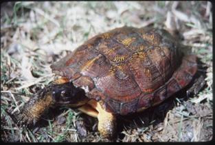
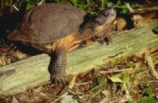
19 Prairie White-fringed Orchid
20


 Assist in")

21 Ecological Community Mapping Apply international vegetation classification standards in Canada Completed mapping and ranking of ecological communities at fine scales in Alberta (est. ~$10 million nation-wide) Assist in management, modelling applications (fire, pest, range, habitat, ecosystem service evaluation) and in priority setting

22 How is biodiversity data used?


23 Types&of&data&requests*& Site%Management% Conserva0on%Program%Planning% Land%Use%Planning% Environmental%Assessment% Status%assessments% Other% * Estimated, based on 2009 request data


24 Fine Scale: Property Management and Project EA Screening: Simple questions can focus effort What federal or provincially listed species at the site? What other species? Where are they? What threatens them? Beyond screening Engage proper experts Trigger for additional study

25 Coarse Level Decision Making: Species at Risk by EcoDistrict

26 Demand for data? NatureServe Data can be accessed through NatureServe Explorer, Web Services, or through custom data requests Individual CDC s have their own tools tailored to provincial legislation or planning requirements Ontario Explorer CDC Internet Mapping Service BC Species and Ecosystems Explorer Others Currently estimate more than 500 thousands queries per month Custom requests for some data: Must respect data sensitivity

27 Who is asking for data? Total Data Requests Consultants Government Academic ENGO Public Industry Press USA CAN Int Unknown Requests: Consultant Breakdown Consultant - Industry Consultant - Gov't Consultant - ENGO Consultant - unknown Consultant - Gov't Federal Consultant - First Nations Consultant - Gov't Local Consultant - Gov't Provincial Requests: Government Breakdown Gov't Local Gov't Provincial Gov't Federal First Nations BC CDC tracks client requests ~ 900 per year (2009) Response time from 6.5 to 2.7 days since 2004 Time to process requests from 0.5 hours in 2004 to 0.25 hours in 2008
28 What is the status of biodiversity data?
29 Data Highly Fragmented; Data Incomplete Welcome/Bienvenue

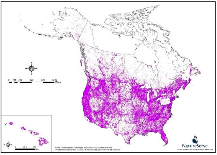
30 Spatial Limitations: Element Occurrences in eastern Canada Network data coverage for some species in some areas is high; artifact of where species of conservation risk occur Need more survey work for priority species to enhance coverage Data quality affected by age of supporting observational data - need ongoing investments in surveys and inventories
31

32 Taxonomic Gaps
 Canadensys (primarily from universities; plants, insects) Canadian Biodiversity Information Facility (primarily from federal")
33 Data is highly fragmented Several primary focal points for accessing data (each with limitations) NatureServe Canada (provinces, territories with focus on rare species) Canadensys (primarily from universities; plants, insects) Canadian Biodiversity Information Facility (primarily from federal sources)
 Canadian Museum of")
 Agriculture and Agri-food Canada")
34 Other data sources Bird Studies Canada (bird species) Canadian Museum of Nature (north?) Agriculture and Agri-food Canada (CNC) GBIF (not quality reviewed)

35 Implications The costs of obtaining data generally outweigh the benefits to decision making. Business adaptation? Sufficing Aggregate the data you can in the time available - hit known focal points Do it yourself data Solves short term problem, introduces new issues Reinforces fragmentation Get help (following standards? competent observer? Sharing results? CDC, other)

36 Can we improve access to biodiversity data?

37 Work together Overcome barriers to data sharing Develop technology tools to facilitate defragmentation, digitization and sharing Mine and apply standards to existing data Be proactive about ties to decision making, insist on relevance Reduce cost of developing and accessing data, ensure tied to priorities Adopt new technologies, approaches that increase data (bar coding, directed citizen science) Enhance coordination Create a national repository for data Business has an important voice

 an understanding of demand, (2) a synthesis of")

38 A Vision A Canadian Institute for Biodiversity Information - outside government, joins fragmented communities, a network - funded by federal, provincial agencies; cost recovery mandate; supports business decision making - promotes a Canadian observational data standard (based on DwC), creates spatial data products - sets priorities every 3 years for a national biological survey, based on (1) an understanding of demand, (2) a synthesis of existing data (identification of gaps); offers funding - ensures data is gathered and made available to researchers, CDCs - gathers data and produces reports based on expert input to address issues of the day (policy relevance)


39 Bar Coding Cost of processing and gathering data diminishing Target at lesser studied taxonomic groups? Tie to citizen science - enable accurate identification Build strong corporate sector support - tie to monitoring requirements


40 Naturally Connected: Expanding Canadian Biodiversity Citizen Science

41 Thank you! Questions? What data does business need?
Geospatial Policy Development and Institutional Arrangements *
 HIGH LEVEL FORUM ON GLOBAL GEOSPATIAL MANAGEMENT INFORMATION WORKING PAPER No. 13 First Forum Seoul, Republic of Korea, 24-26 October 2011 Geospatial Policy Development and Institutional Arrangements *
Observation (EO) & Geomatics in Canada
 & Geomatics in Canada") Innovating to Increase the Impact of Earth Observation (EO) & Geomatics in Canada Natural Resources Canada February 25, 2014 Prashant Shukle, Director General Canada Centre for Mapping and Earth Observation
Innovating to Increase the Impact of Earth Observation (EO) & Geomatics in Canada Natural Resources Canada February 25, 2014 Prashant Shukle, Director General Canada Centre for Mapping and Earth Observation
EBA Engineering Consultants Ltd. Creating and Delivering Better Solutions
 EBA Engineering Consultants Ltd. Creating and Delivering Better Solutions ENHANCING THE CAPABILITY OF ECOSYSTEM MAPPING TO SUPPORT ADAPTIVE FOREST MANAGEMENT Prepared by: EBA ENGINEERING CONSULTANTS LTD.
An Introduction to NatureServe Linking Conservation and Transportation Planning Phoenix, Arizona November 8 & 9, 2006
 An Introduction to NatureServe Linking Conservation and Transportation Planning Phoenix, Arizona November 8 & 9, 2006 1 NatureServe in Brief An independent, non-profit conservation organization Provides
An Introduction to Day Two. Linking Conservation and Transportation Planning Lakewood, Colorado August 15-16, 16, 2006
 An Introduction to Day Two Linking Conservation and Transportation Planning Lakewood, Colorado August 15-16, 16, 2006 1 Agenda Day One Transportation Planning Heritage Program State Wildlife Action Plan
Aboriginal communities strengthen governance with location-based tools in the 21st century
 Aboriginal communities strengthen governance with location-based tools in the 21st century Today, Aboriginal communities are taking advantage of the geomatics technologies that underpin popular online
SPLAN-Natura Towards an integrated spatial planning approach for Natura th January, 2017 Brussels. Commissioned by DG Environment
 SPLAN-Natura 2000 Towards an integrated spatial planning approach for Natura 2000 Commissioned by DG Environment 17 th January, 2017 Brussels V. Simeonova (Ph.D.) Drivers towards integrating Biodiversity
Impact Policies Enabling Value Enhancement of Geospatial Information in Canadian Economy and Society
 1 Impact Policies Enabling Value Enhancement of Geospatial Information in Canadian Economy and Society May 26, 2015 Prashant Shukle, Director General Canada Centre for Mapping and Earth Observation Increased
Arctic ecosystem services: TEEB Arctic Scoping study. Alexander Shestakov WWF Global Arctic Programme 3 December Arctic Biodiversity Congress
 Arctic ecosystem services: TEEB Arctic Scoping study Alexander Shestakov WWF Global Arctic Programme 3 December 20143 Arctic Biodiversity Congress Content 1. Project design 2. Approach 3. Challenges and
DFO Maritimes Region Update. Gulf of Maine Council - Coastal and Marine Spatial Planning (CMSP) Committee Web-Ex May 16, 2017
 Committee Web-Ex May 16, 2017") DFO Maritimes Region Update Gulf of Maine Council - Coastal and Marine Spatial Planning (CMSP) Committee Web-Ex May 16, 2017 1 National Oceans Priorities Marine Conservation Targets Oceans Protection Plan
DFO Maritimes Region Update Gulf of Maine Council - Coastal and Marine Spatial Planning (CMSP) Committee Web-Ex May 16, 2017 1 National Oceans Priorities Marine Conservation Targets Oceans Protection Plan
The Canadian Ceoscience Knowledge Network. - A Collaborative Effort for Unified Access to Ceoscience Data
 The Canadian Ceoscience Knowledge Network - A Collaborative Effort for Unified Access to Ceoscience Data The Canadian Geoscience Knowledge Network A Collaborative Effort for Unified Access to Geoscience
Land Accounts - The Canadian Experience
 Land Accounts - The Canadian Experience Development of a Geospatial database to measure the effect of human activity on the environment Who is doing Land Accounts Statistics Canada (national) Component
Measuring ecosystems and biodiversity and related goods and services
 Measuring ecosystems and biodiversity and related goods and services World Bank, WAVES Partnership Meeting Michael Bordt, EASD Statistics Canada March 30, 2011 Outline What exists already in Canada and
Designing Networks of Marine Protected Areas in DFO s Three Atlantic Bioregions
 Designing Networks of Marine Protected Areas in DFO s Three Atlantic Bioregions Presentation for Indigenous Protected Areas Workshop Max Westhead, DFO and Adrian Gerhartz-Abraham, Dalhousie March 29, 2017
Terms of Reference for the Comparative Environmental Review (CER) of. Options for the Mactaquac Project, Mactaquac, New Brunswick
 of. Options for the Mactaquac Project, Mactaquac, New Brunswick") Terms of Reference for the Comparative Environmental Review (CER) of Options for the Mactaquac Project, Mactaquac, New Brunswick Preamble The New Brunswick Power Corporation ( NB Power ) operates the Mactaquac
Terms of Reference for the Comparative Environmental Review (CER) of Options for the Mactaquac Project, Mactaquac, New Brunswick Preamble The New Brunswick Power Corporation ( NB Power ) operates the Mactaquac
Resolution XIII.23. Wetlands in the Arctic and sub-arctic
 13th Meeting of the Conference of the Contracting Parties to the Ramsar Convention on Wetlands Wetlands for a Sustainable Urban Future Dubai, United Arab Emirates, 21-29 October 2018 Resolution XIII.23
THE NATURESERVE NETWORK
 THE NATURESERVE NETWORK Access to NatureServe's best available data on the locations of endangered species September 1, 2011 A Network Connecting Science with Conservation Mexico Guatemala El Salvador
Exploring GIS Potential for Northwestern Ontario Land Information Ontario
 Exploring GIS Potential for Northwestern Ontario Land Information Ontario May 13, 2015 The LIO Vision LIO Vision: That all geographic information about Ontario is fully integrated and accessible LIO Goal:
Natura 2000 and spatial planning. Executive summary
 Natura 2000 and spatial planning Executive summary DISCLAIMER The information and views set out in this study are those of the author(s) and do not necessarily reflect the official opinion of the Commission.
Outline National legislative & policy context Regional history with ESSIM ESSIM Evaluation Phase Government Integration via RCCOM Regional ICOM Framew
 What MSP Implementation could change in the Maritimes Region Tim Hall, Regional Manager Oceans and Coastal Management Division Ecosystem Management Branch Fisheries and Oceans Canada Maritimes Region BIO
The GIS Path Forward Saskatchewan s Geomatics Strategic Plan
 The GIS Path Forward Saskatchewan s Geomatics Strategic Plan John Potter, SK Ministry of Central Services Office of Geomatics Coordination Sept.17/13 Table of Contents 1. 2011-2016, Geomatics Strategic
A TOOLKIT FOR MARINE SPATIAL PLANNING Version: 17 July, 2009
 A TOOLKIT FOR MARINE SPATIAL PLANNING Version: 17 July, 2009 NEED FOR MARINE SPATIAL PLANNING The health of marine ecosystems is declining, and use conflicts in the marine environment are increasing, in
Update to the Association of Ontario Land Surveyors February 27, 2015 Deerhurst, Ontario
 1 Update to the Association of Ontario Land Surveyors February 27, 2015 Deerhurst, Ontario Peter Sullivan CLS, ALS, MBA Director General, Surveyor General Branch Earth Sciences Sector, Natural Resources
Standards in Action: The Canadian Geospatial Data Infrastructure (CGDI)
") Standards in Action: The Canadian Geospatial Data Infrastructure (CGDI) Craig Stewart ISO/TC211 Standards in Action Workshop, September 14, 2005 Presentation Outline Overview of SDIs Overview of Canada
Standards in Action: The Canadian Geospatial Data Infrastructure (CGDI) Craig Stewart ISO/TC211 Standards in Action Workshop, September 14, 2005 Presentation Outline Overview of SDIs Overview of Canada
Marine Spatial Planning: A Tool for Implementing Ecosystem-Based Management
 Marine Spatial Planning: A Tool for Implementing Ecosystem-Based Management Steven Murawski, Ph.D., Ecosystem Goal Team Lead National Oceanic and Atmospheric Administration NOAA November 16, 2009 1 To
Economic Benefit Study on Value of Spatial Information Australian Experience
 Economic Benefit Study on Value of Spatial Information Australian Experience Dr Zaffar Sadiq Mohamed-Ghouse Director, International Relations Cooperative Research Centre for Spatial Information zsadiq@crcsi.com.au
PROMOTING NATURE CONSERVATION AND SUSTAINABLE AGRICULTURAL DEVELOPMENT IN THE RURAL AREAS OF HONG KONG
 1 PROMOTING NATURE CONSERVATION AND SUSTAINABLE AGRICULTURAL DEVELOPMENT IN THE RURAL AREAS OF HONG KONG Director of Agriculture, Fisheries and Conservation Dr. LEUNG Siu-fai A STONE S THROW AWAY FROM
The North American Drought Monitor - The Canadian Perspective -
 The North American Drought Monitor - The Canadian Perspective - Trevor Hadwen National Agroclimate Information Service AAFC-PFRA, Regina Canmore, Alberta March 16-18, 2008 Background The NADM is a cooperative
the map Redrawing Donald Hobern takes a look at the challenges of managing biodiversity data [ Feature ]
![the map Redrawing Donald Hobern takes a look at the challenges of managing biodiversity data [ Feature ]](/thumbs/82/86628837.jpg "the map Redrawing Donald Hobern takes a look at the challenges of managing biodiversity data [ Feature ]") Redrawing the map Donald Hobern takes a look at the challenges of managing biodiversity data 46 Volume 12 > Number 9 > 2008 www.asiabiotech.com Cicadetta sp., Canberra, Australia, December 2007 Photograph
Redrawing the map Donald Hobern takes a look at the challenges of managing biodiversity data 46 Volume 12 > Number 9 > 2008 www.asiabiotech.com Cicadetta sp., Canberra, Australia, December 2007 Photograph
What s the problem? A Modern Odyssey in Search of Relevance. The search for relevance. Some current drivers for new services. Some Major Applications
 A Modern Odyssey in Search of Relevance FIG Working Week, Athens, 24 May 2004 Paul Kelly ANZLIC Executive Director The search for relevance 1. New expectations for spatial services 2. Are we ready to meet
Proposed Scope of Work Village of Farmingdale Downtown Farmingdale BOA Step 2 BOA Nomination Study / Draft Generic Environmental Impact Statement
 Proposed Scope of Work Village of Farmingdale Downtown Farmingdale BOA Step 2 BOA Nomination Study / Draft Generic Environmental Impact Statement The scope of work that follows incorporates and covers
Building capacity to support decisionmaking for protection and management of marine areas
 Credit_Deep Atlantic Stepping Stones Science Team_IFE_URI_NOAA_no3 Credit: John Weller, john@lastocean.com Credit: John Weller, john@lastocean.com Credit: John Weller, john@lastocean.com Credit: Sarah
16540/14 EE/cm 1 DG E 1A
 Council of the European Union Brussels, 5 December 2014 (OR. en) 16540/14 ENV 965 CULT 139 NOTE From: To: Subject: General Secretariat of the Council Delegations Charter of Rome on Natural and Cultural
Marine Spatial Planning Leslie-Ann McGee Battelle Memorial Institute
 Marine Spatial Planning Leslie-Ann McGee Battelle Memorial Institute Rev061708 1 Marine Spatial Planning What is it? Why is it different? Where is it currently being employed? What is happening in the
Robert V. Maher Nova Scotia Land Survey Institute Box 10, Lawrencetown, N. S., Canada BOS 1MO
 DATA TRANSFER BETWEEN CIS IN CANADA: A REVIEW OF THE PROBLEM AND EXAMPLES OF CURRENT SOLUTIONS FROM ATLANTIC CANADA Robert V. Maher Nova Scotia Land Survey Institute Box 10, Lawrencetown, N. S., Canada
Realizing benefits of Spatial Data Infrastructure A user s perspective from Environment Agency - Abu Dhabi
 Realizing benefits of Spatial Data Infrastructure A user s perspective from Environment Agency - Abu Dhabi Anil Kumar Director, Environment Information Management 26 April 2012 Geospatial World Forum,
Canada s Experience with Chemicals Assessment and Management and its Application to Nanomaterials
 Canada s Experience with Chemicals Assessment and Management and its Application to Nanomaterials European Chemicals Agency (ECHA) Topical Scientific Workshop: Regulatory Challenges in Risk Assessment
Global Geospatial Information Management Country Report Finland. Submitted by Director General Jarmo Ratia, National Land Survey
 Global Geospatial Information Management Country Report Finland Submitted by Director General Jarmo Ratia, National Land Survey Global Geospatial Information Management Country Report Finland Background
Advancing Geoscientific Capability. Geological Survey of Finland
 Advancing Geoscientific Capability Geological Survey of Finland GTK in brief The Geological Survey of Finland (GTK) is one of the largest European centres of excellence in assessment, research and the
Project Primary Contact: Gregg Servheen, Idaho Department of Fish and Game, PO Box 25 Boise, ID ,
 Project Title: Idaho Montana Divide Project Objective: Pilot the conceptualization and coordination of a transboundary Decision Support System(DSS) for fish, wildlife, and habitats along the Idaho Montana
Geographic Locations Survey of Clinical Psychologists in Canada
 Geographic Locations Survey of Clinical Psychologists in Canada A publication of the Canadian Psychological Association. 1999 To order print copies, click here! Print copies of this CPA document are available
GIS Changing the World GIS Day November 15, 2017
 + GIS Changing the World GIS Day November 15, 2017 + Growing Up On The Farm 3 Geographic Information in DNR A 75 year history of mapping and GIS. Forest type map from 1944. State of Washington - Division
Community and Infrastructure Services Committee
 REPORT TO: DATE OF MEETING: November 7, 2016 Community and Infrastructure Services Committee SUBMITTED BY: Cynthia Fletcher, Interim Executive Director INS 519-741- PREPARED BY: WARD(S) INVOLVED: 2600
Natural Resource Management. Northern Tasmania. Strategy. Appendix 2
 Natural Resource Management Strategy Northern Tasmania 2015 2020 Appendix 2 Appendix 2 Appendix 2. Carbon Planting Spatial Prioritisation In support of this Strategy s development and implementation, work
Opportunities and Priorities in a New Era for Weather and Climate Services
 Opportunities and Priorities in a New Era for Weather and Climate Services John A. Dutton The Pennsylvania State University 1. Progress in Weather and Climate Services Rapid changes are sweeping through
NOAA S2S Planning. Dave DeWitt Fred Toepfer
 NOAA S2S Planning Dave DeWitt Fred Toepfer 1 Agenda 1. Brief synopsis of The Weather Research and Forecasting Act of 2017 2. Report to Congress a. Timeline b. Process c. Document Outline 3. Some Preliminary
Understanding DWAs in First Nations Systems A Data Mining Approach
 Understanding DWAs in First Nations Systems A Data Mining Approach Emma Thompson E. McBean, Y. Post 65 percent of First Nations experienced a Drinking Water Advisory (DWA) between 2004 2014. The federal
Climate Trends and Variations Bulletin Winter
 Climate Trends and Variations Bulletin Winter 2014 2015 This bulletin summarizes recent climate data and presents it in a historical context. It first examines the national average temperature for the
ISO Canadian Drought Monitor Data Product Specifications
 ISO 19131 Canadian Drought Monitor Data Product Specifications Revision: A Page 1 of 14 Data product specifications: Canadian Drought Monitor - Table of Contents- 1. Overview... 3 1.1. Informal description...
On the Feasibility of Quantitative Population Viability Analysis in Recovery Planning: Efforts to Bridge the Gap Between Theory and Practice
 On the Feasibility of Quantitative Population Viability Analysis in Recovery Planning: Efforts to Bridge the Gap Between Theory and Practice LUTZ TISCHENDORF 1 AND KATHRYN LINDSAY 2 1 ELUTIS Modeling and
Pre-Calculus 12. Resource Exam B. Exam Booklet I. Multiple-Choice and Written-Response Questions Calculator Permitted.
 Pre-Calculus 12 Resource Exam B Exam Booklet I Multiple-Choice and Written-Response Questions Calculator Permitted 1. When answering questions in Booklet I: Instructions calculators are permitted for the
THE SEVILLE STRATEGY ON BIOSPHERE RESERVES
 THE SEVILLE STRATEGY ON BIOSPHERE RESERVES 1 VISION FOR BIOSPHERE RESERVES IN THE 21 ST CENTURY The international Seville Conference on Biosphere Reserves, organised by UNESCO, adopted a two-pronged approach,
Data Sources and Methods for the Protected Areas Indicators. August 2014
 Data Sources and Methods for the Protected Areas Indicators August 2014 Suggested citation for this document: Environment Canada (2014) Canadian Environmental Sustainability Indicators: Data Sources and
Pinchin Ltd. Asbestos Laboratory Certificate of Analysis
 M. Adams / B. Ficko Date Received: March 24, 2017 Lab Reference No.: b167122 Date Analyzed: March 25, 2017 Analyst(s): C. Luong / T. Ly # Samples submitted: 9 # Phases analyzed: 18 Method of Analysis:
Landscape Planning and Habitat Metrics
 Landscape Planning and Habitat Metrics Frank W. Davis National Center for Ecological Analysis and Synthesis UC Santa Barbara (Tools for Landscape Biodiversity Planning) Jimmy Kagan Institute for Natural
The Periphery in the Knowledge Economy
 REGIONS IN THE KNOWLEDGE ECONOMY REGIONS ET ECONOMIE DU SAVOIR Mario Polese Richard Shearmur, in collaboration with Pierre-Marcel Desjardins Marc Johnson The Periphery in the Knowledge Economy The Spatial
ESTIMATING THE SOCIAL & ENVIRONMENTAL EFFECTS OF ADVENTURE TOURISM AND RECREATION ON CROWN LAND IN BRITISH COLUMBIA
 ESTIMATING THE SOCIAL & ENVIRONMENTAL EFFECTS OF ADVENTURE TOURISM AND RECREATION ON CROWN LAND IN BRITISH COLUMBIA Wolfgang Haider School of Resource and Environmental Mgt. Simon Fraser University Burnaby,
A Regional Database Tracking Fire Footprint Each Year within the South Atlantic Region: Current Database Description and Future Directions
 A Regional Database Tracking Fire Footprint Each Year within the South Atlantic Region: Current Database Description and Future Directions Last Updated on September 30, 2018 Contributors: NatureServe,
Spatial Data Availability Energizes Florida s Citizens
 NASCIO 2016 Recognition Awards Nomination Spatial Data Availability Energizes Florida s Citizens State of Florida Agency for State Technology & Department of Environmental Protection Category: ICT Innovations
Introduction. Elevation Data Strategy. Status and Next Steps
 1 2 Introduction Elevation Data Strategy Status and Next Steps 3 Canada is the 2nd largest country in the world - 9.9 million sq km Surrounded by 3 oceans with 202 000 km of coastline Population over 35
Plenary Session 2, part 2 A European shared information system
 3 rd GMES Forum 5 6 June 2003 Athens Plenary Session 2, part 2 A European shared information system Gordon McInnes Deputy Director European Environment Agency 1 I keep six honest serving men. They taught
USGS National Geospatial Program Understanding User Needs. Dick Vraga National Map Liaison for Federal Agencies July 2015
 + USGS National Geospatial Program Understanding User Needs Dick Vraga National Map Liaison for Federal Agencies July 2015 + Topics 2 Background Communities of Use User Surveys National Map Liaisons Partnerships
The 18th Annual CFES Council Meeting and General Meeting
 Canadian Federation of Earth Sciences (CFES) Executive Summary on The 18th Annual CFES Council Meeting and General Meeting April 21 st and 22 nd, 2017 A Question ; What does CFES do for us for the money
EASTERN SCOTIAN SHELF INTEGRATED OCEAN MANAGEMENT PLAN
 Government of Canada Gouvernement du Canada EASTERN SCOTIAN SHELF INTEGRATED OCEAN MANAGEMENT PLAN SUMMARY Photo Credits: Bedford Institute of Oceanography Published by: Oceans and Habitat Branch Fisheries
NatureServe s Federally Listed Species Location Data Play an Important Role in EPA s FIFRA Risk Assessments
 NatureServe s Federally Listed Species Location Data Play an Important Role in EPA s FIFRA Risk Assessments 1 ASHLEA FRANK COMPLIANCE SERVICES INTERNATIONAL FIFRA ENDANGERED SPECIES TASK FORCE BIODIVERSITY
Geologic Management. Contents
 Geologic Management Contents Introduction... GM-3 Definitions... GM-3 Legislation and Other Guidance... GM-3 Policy Management for Representation... GM-5... GM-5 Inventory of Significant Geologic Features
Answers to British Columbia Quizzes
 Answers to British Columbia Quizzes p. 1 Test Your Knowledge What do you remember from your review of the British Columbia section of the E-atlas? 1. What percentage of Canada's total area does British
FINDINGS OF THE ARCTIC METEOROLOGY SUMMIT
 FINDINGS OF THE ARCTIC METEOROLOGY SUMMIT 2018 WWW.FMI.FI CHAIR S SUMMARY: 1 2 3 We need to be curious to explore the known unknowns. Meteorology is an elemental part of international collaboration in
DEPARTMENT OF GEOLOGY AND MINERAL INDUSTRIES WAYS & MEANS SUBCOMMITTEE ON NATURAL RESOURCES MARCH 2, 2017
 DEPARTMENT OF GEOLOGY AND MINERAL INDUSTRIES WAYS & MEANS SUBCOMMITTEE ON NATURAL RESOURCES MARCH 2, 2017 1 ABOUT DOGAMI AGENCY MISSION, VISION & GOALS 2 Lidar image of a stream network along the Umpqua
The Agriculture Investment and Market Development Project (P143417)
") Public Disclosure Authorized AFRICA Cameroon Agriculture Global Practice IBRD/IDA Investment Project Financing FY 2015 Seq No: 10 ARCHIVED on 21-Dec-2018 ISR35368 Implementing Agencies: THE REPUBLIC OF
Public Disclosure Authorized AFRICA Cameroon Agriculture Global Practice IBRD/IDA Investment Project Financing FY 2015 Seq No: 10 ARCHIVED on 21-Dec-2018 ISR35368 Implementing Agencies: THE REPUBLIC OF
Climate Services in Practice UK Perspective
 Climate Services in Practice UK Perspective Chris Hewitt ICCS, Columbia University, October 2011 Overview Perspectives on: Why have a climate service? What is a climate service? UK activities Examples
THE DIGITAL TERRAIN MAP LIBRARY: AN EXPLORATIONIST S RESOURCE
 THE DIGITAL TERRAIN MAP LIBRARY: AN EXPLORATIONIST S RESOURCE By I.C.L. Webster, P.J. Desjardins and W.E. Kilby KEYWORDS: digital terrain maps, digital terrain stability maps, surficial geology, GIS, raster
Unit 1 Physical Setting
 Unit 1 Physical Setting Chapter 1: Finding Your Way Chapter 2: Our Natural Environment Chapter 3: The Changing Weather Chapter 4: A Place To Live Chapter 1: Finding Our Way Key Terms Lines of Latitude
Background. North Cascades Ecosystem Grizzly Bear Restoration Plan/ Environmental Impact Statement. Steve Rochetta
 Grizzly Bear Restoration Plan/ Environmental Impact Statement Steve Rochetta Background Situated in the core of the North Cascades ecosystem (NCE), the North Cascades National Park Complex is surrounded
International Guidelines for Ecosystem-based, Marine Spatial Management
 International Guidelines for Ecosystem-based, Marine Spatial Management Charles Ehler and Fanny Douvere, Consultants Intergovernmental Oceanographic Commission and Man and the Biosphere Programme UNESCO
Urban Climate Resilience
 Urban Climate Resilience in Southeast Asia Partnership Project Introduction Planning for climate change is a daunting challenge for governments in the Mekong Region. Limited capacity at the municipal level,
GIS Capability Maturity Assessment: How is Your Organization Doing?
 GIS Capability Maturity Assessment: How is Your Organization Doing? Presented by: Bill Johnstone Principal Consultant Spatial Vision Group November 8, 2018 1. Motivation for Capability Maturity Models
Oregon Department of Transportation. Geographic Information Systems Strategic Plan
 Oregon Department of Transportation Geographic Information Systems Strategic Plan Adopted May, 2000 By the GIS Steering Committee Last printed 10/2/2012 4:20:00 PM Page Geographic Information Systems Strategic
The National Spatial Strategy
 Purpose of this Consultation Paper This paper seeks the views of a wide range of bodies, interests and members of the public on the issues which the National Spatial Strategy should address. These views
PROPOSED UNESCO FUNDY BIOSPHERE RESERVE
 OVERVIEW PROPOSED UNESCO FUNDY BIOSPHERE RESERVE NEW BRUNSWICK, CANADA NOMINATION DOCUMENT April 10, 2007 The United Nations Educational, Scientific and Cultural Organization (UNESCO) Man and the Biosphere
Fire Season Prediction for Canada, Kerry Anderson Canadian Forest Service
 Fire Season Prediction for Canada, 2014 Kerry Anderson Canadian Forest Service 1 Introduction The Canadian Forest Service is now presenting monthly and seasonal forecast maps through the Canadian Wildland
National Land Use Policy and National Integrated Planning Framework for Land Resource Development
 Title National Land Use Policy and National Integrated Planning Framework for Land Resource Development Duration: 32 Weeks Objective: Adoption of appropriate land use planning approaches to: Maintain the
Spatial Graph Theory for Cross-scale Connectivity Analysis
 Spatial Graph Theory for Cross-scale Connectivity Analysis Andrew Fall School of Resource and Environmental Management, SFU and Gowlland Technologies Ltd., Victoria, BC Acknowledgements Marie-Josée Fortin,
BOEM Marine Minerals Program
 BOEM Marine Minerals Program Restoring and Protecting Our Nation s Coasts through Stewardship of OCS Sand Resources SECOORA 2018 Annual Meeting May 22-24 Doug Piatkowski Douglas.piatkowski@boem.gov 703-787-1833
Progress Report (Since February, 2014)
") CONTENT Progress Report (Since February, 2014) Results Achieved Methods Used Questions Asked/ Issues Encountered Drafted detailed matrix on Trial Accounts with identified ecosystem pressure, services and
CONTENT Progress Report (Since February, 2014) Results Achieved Methods Used Questions Asked/ Issues Encountered Drafted detailed matrix on Trial Accounts with identified ecosystem pressure, services and
ACRONYMS AREAS COUNTRIES MARINE TERMS
 Natura 2000 ACRONYMS AREAS COUNTRIES MARINE TERMS DEFINITION A European network of protected sites under the European Habitats and Birds Directives, aiming to protect the most valuable and threatened European
Data Dictionary for Observation Data Transcription Reports from the Colorado Natural Heritage Program
 Data Dictionary for Observation Data Transcription Reports from the Colorado Natural Heritage Program This Data Dictionary defines terms used in Observation Data Reports exported by the Colorado Natural
Through their research, geographers gather a great deal of data about Canada.
 Ecozones What is an Ecozone? Through their research, geographers gather a great deal of data about Canada. To make sense of this information, they often organize and group areas with similar features.
Multi-sector biodiversity surveys: integrating federal, territorial and community-based surveys. Kevin J. Hedges
 Multi-sector biodiversity surveys: integrating federal, territorial and community-based surveys Kevin J. Hedges Outline Study area Research/stakeholder groups Recent integration Eastern Canadian Arctic
1 Complementary Access Tools
 ENERGY IHS AccuMap Shaped by industry and powered by IHS Markit information, AccuMap is a powerful and intuitive interpretation solution for the Canadian Energy Industry. 1 Complementary Access Tools AccuLogs
EU collaborations with NASA LCLUC Program & Current Priorities
 & Current Priorities ioannis Manakos, Dr. Centre for Research and Technology Hellas Information Technologies Institute Visual Analytics, Virtual & Augmented Reality Laboratory European Association of Remote
SOCIO-DEMOGRAPHIC AND ECONOMIC SECTOR ANALYSIS
 SOCIO-DEMOGRAPHIC AND ECONOMIC SECTOR ANALYSIS FINAL GEODATABASE DOCUMENTATION AUGUST 15, 2008 SUBMITTED TO: NUNAVUT PLANNING COMMISSION SUBMITTED BY: Executive Summary Terriplan Consultants (Terriplan)
The World Bank Sri Lanka Agriculture Sector Modernization Project (P156019)
") Public Disclosure Authorized SOUTH ASIA Sri Lanka Agriculture Global Practice IBRD/IDA Investment Project Financing FY 2016 Seq No: 4 ARCHIVED on 09-Jan-2018 ISR31203 Implementing Agencies: Ministry of
Public Disclosure Authorized SOUTH ASIA Sri Lanka Agriculture Global Practice IBRD/IDA Investment Project Financing FY 2016 Seq No: 4 ARCHIVED on 09-Jan-2018 ISR31203 Implementing Agencies: Ministry of
Climate Change: Why Worry?
 Climate Change: Why Worry? Lesson Overview Students will explore the meaning of Climate Change, with an emphasis on the impact expected on future human life, the adaptations which will be required, and
Natura 2000 in the marine environment: state of implementation and next steps
 Life on the blue planet: biodiversity research and the new European marine policies EPBRS European Platform on Biodiversity Research Strategy Porto, Portugal 7-9 November 2007 Natura 2000 in the marine
Empowered lives. Resilient nations. Data for People and Planet. powered by
 Empowered lives. Resilient nations. Data for People and Planet powered by Overview As we enter the fourth industrial revolution, technology is revolutionizing our ability to map nature. Satellite data
Spatial Decision-Support for National Marine Conservation Areas in the Southern Strait of Georgia and Gwaii Haanas
 Spatial Decision-Support for National Marine Conservation Areas in the Southern Strait of Georgia and Gwaii Haanas Lindsay McBlane Krista Royle Greg MacMillan Photo: Mark Hiebert Western and Northern Service
Summary Description Municipality of Anchorage. Anchorage Coastal Resource Atlas Project
 Summary Description Municipality of Anchorage Anchorage Coastal Resource Atlas Project By: Thede Tobish, MOA Planner; and Charlie Barnwell, MOA GIS Manager Introduction Local governments often struggle
Marine Protected Area Network Planning in the Bay of Fundy and Scotian Shelf. Progress to date and next steps
 Marine Protected Area Network Planning in the Bay of Fundy and Scotian Shelf Progress to date and next steps Max(ine) Westhead, M.Sc. Section Head, Protected Areas and Conservation Planning Fisheries and
State GIS Officer/GIS Data
 State GIS Officer/GIS Data This Act creates the position of state Geographic Information Systems (GIS) officer. The Act: requires the state GIS officer to adopt or veto the GIS data standards and a statewide