8.1.2 Climate Projections
|
|
|
- Jocelin James
- 5 years ago
- Views:
Transcription

1 Chapter 8 Nauru 167
2 8.1 Climate Summary Current Climate Over the past half century it is likely that there has been a warming air temperature trend at Nauru which is partly associated with warming ocean temperatures. Annual and half-year rainfall trends from 1927 show little change at Nauru. Variability of wind-waves at Nauru is characterised by trade winds seasonally, and the El Niño Southern Oscillation (ENSO) interannually. Available data are not suitable for assessing long-term trends (see Section 1.3) Climate Projections For the period to 2100, the latest global climate model (GCM) projections and climate science findings indicate: El Niño and La Niña events will continue to occur in the future (very high confidence), but there is little consensus on whether these events will change in intensity or frequency; Annual mean temperatures and extremely high daily temperatures will continue to rise (very high confidence); Mean rainfall is projected to increase (medium confidence), along with more extreme rain events (high confidence); Droughts are projected to decline in frequency (medium confidence); Ocean acidification is expected to continue (very high confidence); The risk of coral bleaching will increase in the future (very high confidence); Sea level will continue to rise (very high confidence); and Wave height and period are projected to decrease in December March (low confidence). No significant changes are projected in June September (low confidence). 8.2 Data Availability Currently, meteorological observations are taken by two automatic weather stations (AWS; data from the Bureau of Meteorology ARC-2 AWS are available from July 2003) and a manual rain gauge near Yaren. There is also a sub-daily rain gauge near the centre of the island which has been operational since October Nauru data are available from 1893 to present for rainfall and 1951 to present for air temperature; however there are significant gaps in both records. Monthly rainfall data, homogeneous from 1927 has been used in this report. There are insufficient air temperature data for trend analyses. The search for historical hard copy and digitised climate data for Nauru is ongoing. Wind-wave data from buoys are particularly sparse in the Pacific region, with very short records. Model and reanalysis data are therefore required to detail the wind-wave climate of the region. Reanalysis surface wind data have been used to drive a wave model over the period to generate a hindcast of the historical wind-wave climate. 168 Climate Variability, Extremes and Change in the Western Tropical Pacific: New Science and Updated Country Reports

3 8.3 Seasonal Cycles Information on temperature and rainfall seasonal cycles can be found in Australian Bureau of Meteorology and CSIRO (2011) Wind-driven Waves Surface wind-wave driven processes can impact on many aspects of Pacific Island coastal environments, including: coastal flooding during storm wave events; coastal erosion, both during episodic storm events and due to long-term changes in integrated wave climate; characterisation of reef morphology and marine habitat/ species distribution; flushing and circulation of lagoons; and potential shipping and renewable wave energy solutions. The surface offshore windwave climate can be described by characteristic wave heights, lengths or periods, and directions. The wind-wave climate of Nauru is strongly characterised by the seasonal trade winds. On the west coast of Nauru, waves are directed from the south-east during June September, and are directed from the north-east, and are slightly larger and longer than in the dry months, during December March (Table 8.1, Figure 8.1). In June September, swell waves are incident from the south resulting from extratropical storms, while in December March waves are also observed from the west due to monsoon systems and from the north due to North Pacific extra-tropical storms. Waves larger than 2.3 m (99th percentile) occur predominantly during the wet season, generated by North Pacific extra-tropical storms and are observed as long, northerly and north-westerly swell. Some large westerly waves, thought to be generated by Philippine typhoons based on their wavelength and direction, have been observed in other months (August and November). The height of a 1-in-50 year wave event on the west coast is calculated to be 5.0 m. No suitable dataset is available to assess long-term historical trends in the Nauru wave climate. However, interannual variability may be assessed in the hindcast record. The wind-wave climate displays strong interannual variability at Nauru, varying strongly with the El Niño Southern Oscillation (ENSO). During La Niña years, wave power is approximately 30% greater than during El Niño years in June September, and waves are more strongly directed from the east year round, associated with increased trade wind speeds. Table 8.1: Mean wave height, period and direction from which the waves are travelling near Nauru in December March and June September. Observation (hindcast) and climate model simulation mean values are given with the 5 95th percentile range (in brackets). Historical model simulation values are given for comparison with projections (see Section Wind-driven waves, and Tables 8.5). A compass relating number of degrees to cardinal points (direction) is shown. Hindcast Reference Data ( ) Climate Model Simulations ( ) Wave Height (metres) Wave Period (seconds) Wave Direction (degrees clockwise from North) December March 1.5 ( ) 1.7 ( ) June September 1.2 ( ) 1.2 ( ) December March 9.3 ( ) 8.4 ( ) June September 8.6 ( ) 7.9 ( ) December March 30 (320 70) 40 (20 60) June September 130 ( ) 120 ( ) Chapter 8: Nauru 169

4 Figure 8.1: Mean annual cycle of wave height (grey) and mean wave direction (blue) at Nauru in hindcast data ( ). To give an indication of interannual variability of the monthly means of the hindcast data, shaded boxes show 1 standard deviation around the monthly means, and error bars show the 5 95% range. The direction from which the waves are travelling is shown (not the direction towards which they are travelling). 8.4 Observed Trends Air Temperature Annual, Half-year and Extreme Air Temperature Due to incomplete historical air temperature records, observed mean and extreme air temperature trends for Nauru have not been calculated. Over the past half century it is likely that there has been a warming air temperature trend at Nauru partly due to the warming ocean temperatures (See Section in the Nauru Country Report) Rainfall Annual and Half-year Total Rainfall Notable interannual variability associated with the ENSO is evident in the Nauru observed rainfall record since 1927 (Figure 8.2). Trends in annual and half-year rainfall presented in Figure 8.2 and Table 8.2 are not statistically significant at the 5% level. In other words, annual and half-yearly rainfall trends show little change for Nauru. Daily Rainfall Due to incomplete historical daily rainfall records, observed extreme rainfall trends have not been calculated Tropical Cyclones Tropical cyclone formation within the Nauru Exclusive Economic Zone (EEZ) is highly unlikely due to the islands proximity to the equator. There are no events on record, based on tropical cyclone data available from 1969/70 for the Southern Hemisphere and from 1977 for the Northern Hemisphere. 170 Climate Variability, Extremes and Change in the Western Tropical Pacific: New Science and Updated Country Reports

5 Figure 8.2: Observed time series of annual total rainfall for Nauru. Light blue, dark blue and grey bars denote El Niño, La Niña and neutral years respectively. Solid black trend lines indicate least squares fit. Table 8.2: Annual and half-year trends in rainfall at Nauru for the period The 95% confidence intervals are shown in parentheses. None of the trends are significant at the 5% level. Nauru Total Rain (mm/10yrs) Annual (-136.9, ) Nov Apr (-130.2, +45.6) May Oct +6.6 (-34.1, +59.9) Chapter 8: Nauru 171
6 8.5 Climate Projections The performance of the available Coupled Model Intercomparison Project (Phase 5) (CMIP5) climate models over the Pacific has been rigorously assessed (Brown et al., 2013a, b; Grose et al., 2014; Widlansky et al., 2013). The simulation of the key processes and features for the Nauru region is similar to the previous generation of CMIP3 models, with all the same strengths and many of the same weaknesses. The best-performing CMIP5 models used here have lower biases (differences between the simulated and observed climate data) than the best CMIP3 models, and there are fewer poorlyperforming models. For Nauru, the most important model bias is that the models have an ocean that is too cold along the equator of the Pacific, known as the cold-tongue bias (Chapter 1). This issue means that the models underestimate the temperature and rainfall in the present day and this affects the confidence in the model projections. Out of 27 models assessed, three models were rejected for use in these projections due to biases in the mean climate and in the simulation of the SPCZ. Climate projections have been derived from up to 24 new global climate models (GCMs) in the CMIP5 database (the exact number is different for each scenario, Appendix A), compared with up to 18 models in the CMIP3 database reported in Australian Bureau of Meteorology and CSIRO (2011). It is important to realise that the models used give different projections under the same scenario. This means there is not a single projected future for Nauru, but rather a range of possible futures for each emission scenario. This range is described below Temperature Further warming is expected over Nauru (Figure 8.3, Table 8.4). Under all RCPs, the warming is up to 1.2 C by 2030, relative to 1995, but after 2030 there is a growing difference in warming between each RCP. For example, in Nauru by 2090, a warming of 2.0 to 4.5 C is projected for RCP8.5 (very high emissions) while a warming of 0.6 to 1.5 C is projected for RCP2.6 (very low emissions). This range is broader than that presented in Australian Bureau of Meteorology and CSIRO (2011) because a wider range of emissions scenarios is considered. While relatively warm and cool years and decades will still occur due to natural variability, there is projected to be more warm years and decades on average in a warmer climate. Figure 8.3: Historical and simulated surface air temperature time series for the region surrounding Nauru. The graph shows the anomaly (from the base period ) in surface air temperature from observations (the GISS dataset, in purple), and for the CMIP5 models under the very high (RCP8.5, in red) and very low (RCP2.6, in blue) emissions scenarios. The solid red and blue lines show the smoothed (20-year running average) multi-model mean anomaly in surface air temperature, while shading represents the spread of model values (5 95th percentile). The dashed lines show the 5 95th percentile of the observed interannual variability for the observed period (in black) and added to the projections as a visual guide (in red and blue). This indicates that future surface air temperature could be above or below the projected long-term averages due to interannual variability. The ranges of projections for a 20-year period centred on 2090 are shown by the bars on the right for RCP8.5, 6.0, 4.5 and Climate Variability, Extremes and Change in the Western Tropical Pacific: New Science and Updated Country Reports
7 There is very high confidence that temperatures will rise because: It is known from theory and observations that an increase in greenhouse gases will lead to a warming of the atmosphere; and Climate models agree that the long term average temperature will rise. There is medium confidence in the model average temperature change shown in Table 8.4 because: The new models simulate the rate of temperature change of the recent past with reasonable accuracy; and Sea-surface temperatures near Nauru are too cold in most CMIP5 climate models in the current climate, and this affects the confidence in the projection into the future Rainfall An increase in long-term average rainfall is projected by almost all models for Nauru. The increase is greater for the higher emissions scenarios, especially towards the end of the century (Figure 8.4, Table 8.4). More than two thirds of models project an increase in both dry season and wet season rainfall. The year-to-year rainfall variability over Nauru is much larger than the projected change, except in the upper range of model in the highest emission scenario by There will still be wet and dry years and decades due to natural variability, but most models show that the long-term average is expected to be wetter. The effect of climate change on average rainfall may not be obvious in the short or medium term due to natural variability. These projections are similar to those in Australian Bureau of Meteorology and CSIRO (2011), except the confidence rating on direction of change in mean rainfall has been changed from high confidence to medium confidence. The effect of the cold-tongue bias in models (Chapter 1) is particularly strong in this region and the confidence in projections is strongly affected. There is general agreement between models that rainfall will increase. However, biases in the models in the current climate lower the confidence of the projected changes, and makes the amount difficult to determine. The 5 95th percentile range of projected values from CMIP5 climate models is large, e.g. for RCP8.5 (very high emissions) the range is 1 to 52% by 2030 and 6 to 168% by Figure 8.4: Historical and simulated annual average rainfall time series for the region surrounding Nauru. The graph shows the anomaly (from the base period ) in rainfall from observations (the GPCP dataset, in purple), and for the CMIP5 models under the very high (RCP8.5, in red) and very low (RCP2.6, in blue) emissions scenarios. The solid red and blue lines show the smoothed (20-year running average) multi-model mean anomaly in rainfall, while shading represents the spread of model values (5 95th percentile). The dashed lines show the 5 95th percentile of the observed interannual variability for the observed period (in black) and added to the projections as a visual guide (in red and blue). This indicates that future rainfall could be above or below the projected long-term averages due to interannual variability. The ranges of projections for a 20-year period centred on 2090 are shown by the bars on the right for RCP8.5, 6.0, 4.5 and 2.6. Chapter 8: Nauru 173
8 There is medium confidence that the long-term rainfall over Nauru will increase because: The majority of CMIP3 and CMIP5 models agree that the rainfall along the equator and in the ITCZ will increase under a warmer climate; and Changes in SPCZ rainfall are uncertain. The majority of CMIP5 models simulate increased rainfall in the western part of the SPCZ (Brown et al., 2013a), however rainfall changes are sensitive to sea-surface temperature gradients, which are not well simulated in many models (Widlansky et al., 2013). See Box in Chapter 1 for more details. There is low confidence in the model average rainfall change shown in Table 8.4 because: The complex set of processes involved in tropical rainfall is challenging to simulate in models. This means that the confidence in the projection of rainfall is generally lower than for other variables such as temperature; The CMIP5 models are underestimate the present average rainfall of Nauru due to the coldtongue bias (Chapter 1), similar to the previous CMIP3 models; and The future behaviour of the ENSO is unclear, and the ENSO strongly influences year-to-year rainfall variability Extremes Extreme Temperature The temperature on extremely hot days is projected to increase by about the same amount as average temperature. This conclusion is based on analysis of daily temperature data from a subset of CMIP5 models (Chapter 1). The frequency of extremely hot days is also expected to increase. The temperature of the 1-in-20-year hot day is projected to increase by approximately 0.6 C by 2030 under the RCP2.6 (very low) scenario and by 0.9 C under the RCP8.5 (very high) scenario. By 2090 the projected increase is 0.8 C for RCP2.6 (very low) and 3 C for RCP8.5 (very high). There is very high confidence that the temperature of extremely hot days and the temperature of extremely cool days will increase, because: A change in the range of temperatures, including the extremes, is physically consistent with rising greenhouse gas concentrations; This is consistent with observed changes in extreme temperatures around the world over recent decades; and All the CMIP5 models agree on an increase in the frequency and intensity of extremely hot days and a decrease in the frequency and intensity of cool days. There is low confidence in the magnitude of projected change in extreme temperature because models generally underestimate the current intensity and frequency of extreme events, especially in this area, due to the cold-tongue bias (Chapter 1). Changes to the particular driver of extreme temperatures affect whether the change to extremes is more or less than the change in the average temperature, and the changes to the drivers of extreme temperatures in Nauru are currently unclear. Also, while all models project the same direction of change there is a wide range in the projected magnitude of change among the models. Extreme Rainfall The frequency and intensity of extreme rainfall events are projected to increase. This conclusion is based on analysis of daily rainfall data from a subset of CMIP5 models using a similar method to that in Australian Bureau of Meteorology and CSIRO (2011) with some improvements (Chapter 1), so the results are slightly different to those in Australian Bureau of Meteorology and CSIRO (2011). The current 1-in-20-year daily rainfall amount is projected to increase by approximately 4 mm by 2030 for RCP2.6 and by 10 mm by 2030 for RCP8.5 (very high emissions). By 2090, it is projected to increase by approximately 16 mm for RCP2.6 and by 29 mm for RCP8.5 (very high emissions).the majority of models project the current 1-in-20-year daily rainfall event will become, on average, a 1-in-10-year event for RCP2.6 and a 1-in-5-year event for RCP8.5 (very high emissions) by These results are different to those found in Australian Bureau of Meteorology and CSIRO (2011) because of different methods used (Chapter 1). 174 Climate Variability, Extremes and Change in the Western Tropical Pacific: New Science and Updated Country Reports
9 There is high confidence that the frequency and intensity of extreme rainfall events will increase because: A warmer atmosphere can hold more moisture, so there is greater potential for extreme rainfall (IPCC, 2012); and Increases in extreme rainfall in the Pacific are projected in all available climate models. There is low confidence in the magnitude of projected change in extreme rainfall because: Models generally underestimate the current intensity of local extreme events, especially in this area due to the cold-tongue bias (Chapter 1); Changes in extreme rainfall projected by models may be underestimated because models seem to underestimate the observed increase in heavy rainfall with warming (Min et al., 2011); GCMs have a coarse spatial resolution, so they do not adequately capture some of the processes involved in extreme rainfall events; and The Conformal Cubic Atmospheric Model (CCAM) downscaling model has finer spatial resolution and the CCAM results presented in Australian Bureau of Meteorology and CSIRO (2011) indicates a smaller increase in the number of extreme rainfall days, and there is no clear reason to accept one set of models over another. Drought Drought projections (defined in Chapter 1) are described in terms of changes in proportion of time in drought, frequency and duration by 2090 for very low and very high emissions (RCP2.6 and 8.5). For Nauru the overall proportion of time spent in drought is expected to decrease under all scenarios. Under RCP8.5 the frequency of drought in all categories is projected to decrease and the duration of events in all drought categories is projected to stay approximately the same (Figure 8.5). Under RCP2.6 (very low emissions) the frequency of mild drought is projected to increase slightly while the frequency of moderate, severe and extreme drought is projected to remain stable. The duration of events in all categories is projected to decrease slightly under RCP2.6 (very low emissions). There is medium confidence in this direction of change because: There is only medium confidence in the direction of mean rainfall change; These drought projections are based upon a subset of models; and Like the CMIP3 models, the majority of the CMIP5 models agree on this direction of change. There is low confidence in the projections of drought frequency and duration because there is low confidence in the magnitude of rainfall projections, and no consensus about projected changes in the ENSO, which directly influence the projection of drought. Figure 8.5: Box-plots showing percent of time in moderate, severe or extreme drought (left hand side), and average drought duration and frequency for the different categories of drought (mild, moderate, severe and extreme) for Nauru. These are shown for 20-year periods centred on 1995, 2030, 2050, 2070 and 2090 for the RCP8.5 (very high emissions) scenario. The thick dark lines show the median of all models, the box shows the interquartile (25 75%) range, the dashed lines show 1.5 times the interquartile range and circles show outlier results. Chapter 8: Nauru 175
10 8.5.4 Coral Reefs and Ocean Acidification As atmospheric CO 2 concentrations continue to rise, oceans will warm and continue to acidify. These changes will impact the health and viability of marine ecosystems, including coral reefs that provide many key ecosystem services (high confidence). These impacts are also likely to be compounded by other stressors such as storm damage, fishing pressure and other human impacts. The projections for future ocean acidification and coral bleaching use three RCPs (2.6, 4.5, and 8.5). Ocean Acidification In Nauru the aragonite saturation state has declined from about 4.5 in the late 18th century to an observed value of about 3.9±0.1 by 2000 (Kuchinke et al., 2014). All models show that the aragonite saturation state, a proxy for coral reef growth rate, will continue to decrease as atmospheric CO 2 concentrations increase (very high confidence). Projections from CMIP5 models indicate that under RCPs 8.5 (very high emissions) and 4.5 (low emissions) the median aragonite saturation state will transition to marginal conditions (3.5) around In RCP8.5 (very high emissions) the aragonite saturation state continues to strongly decline thereafter to values where coral reefs have not historically been found (< 3.0). Under RCP4.5 (low emissions) the aragonite saturation plateaus around 3.2 i.e. marginal conditions for healthy coral reefs. While under RCP2.6 (very low emissions) the median aragonite saturation state never falls below 3.5, and increases slightly toward the end of the century (Figure 8.6) suggesting that the conditions remains adequate for healthy corals reefs. There is medium confidence in this range and distribution of possible futures because the projections are based on climate models that do not resolve the reef scale that can play a role in modulating large-scale changes. The impacts of ocean acidification are also likely to affect the entire marine ecosystem impacting the key ecosystem services provided by reefs. Figure 8.6: Projected decreases in aragonite saturation state in Nauru from CMIP5 models under RCP2.6, 4.5 and 8.5. Shown are the median values (solid lines), the interquartile range (dashed lines), and 5% and 95% percentiles (light shading). The horizontal line represents the transition to marginal conditions for coral reef health (from Guinotte et al., 2003). 176 Climate Variability, Extremes and Change in the Western Tropical Pacific: New Science and Updated Country Reports
11 Coral Bleaching Risk As the ocean warms, the risk of coral bleaching increases (very high confidence). There is medium confidence in the projected rate of change for Nauru because there is medium confidence in the rate of change of sea-surface temperature (SST), and the changes at the reef scale (which can play a role in modulating large-scale changes) are not adequately resolved. Importantly, the coral bleaching risk calculation does not account the impact of other potential stressors (Chapter 1). Corals can bleach when they are exposed to elevated temperatures over extended periods. The changes in the frequency (or recurrence) and duration of severe bleaching risk are quantified for different projected SST changes (Table 8.3). Overall there is a decrease in the time between two periods of elevated risk and an increase in the duration of the elevated risk. For example, under a long-term mean increase of 1 C (relative to period), the average period of severe bleaching risk (referred to as a risk event) will last 10.2 weeks (with a minimum duration of 1.4 weeks and a maximum duration of 6.6 months) and the average time between two risks will be 2.4 years (with the minimum recurrence of 2.9 months and a maximum recurrence of 8.1 years). If severe bleaching events occur more often than once every five years, the long-term viability of coral reef ecosystems becomes threatened Sea Level Mean sea level is projected to continue to rise over the course of the 21st century. There is very high confidence in the direction of change. The CMIP5 models simulate a rise of between approximately 7 18 cm by 2030 (very similar values for different RCPs), with increases of cm by 2090 under the RCP8.5 (Figure 8.7 and Table 8.4). There is medium confidence in the range mainly because there is still uncertainty associated with projections of the Antarctic ice sheet contribution. Interannual variability of sea level will lead to periods of lower and higher regional sea levels. In the past, this interannual variability has been about 23 cm (5 95% range, after removal of the seasonal signal, see dashed lines in Figure 8.7a) and it is likely that a similar range will continue through the 21st century. Table 8.3: Projected changes in severe coral bleaching risk for the Nauru Exclusive Economic Zone (EEZ) for increases in SST relative to Temperature change 1 Recurrence interval 2 Duration of the risk event 3 Change in observed mean 30 years 3.0 weeks C 6.2 years (3.7 months 13.8 years) 6.7 weeks (2.8 weeks 3 months) +0.5 C 2.4 years (2.9 months 8.1 years) 10.2 weeks (1.4 weeks 6.6 months) C 1.1 years (0.8 months 4.5 years) 12.8 weeks (1.3 weeks 12.5 months) +1 C 9.9 months (0.8 months 3.9 years) 4.1 months (1.5 weeks 2.8 years) +1.5 C 6.4 months (0.8 months 2.5 years) 6.9 months (5.2 weeks 4.7 years) +2 C 4.7 months (1.1 months 9.9 months) 13.6 months (5.8 weeks 6.8 years) 1 This refers to projected SST anomalies above the mean for Recurrence is the mean time between severe coral bleaching risk events. Range (min max) shown in brackets. 3 Duration refers to the period of time where coral are exposed to the risk of severe bleaching. Range (min max) shown in brackets. Chapter 8: Nauru 177
, accompanied by a decrease in wave period and a possible small anticlockwise rotation (more northerly waves) (low confidence) (Table 8.5).")
12 8.5.6 Wind-driven Waves During December March at Nauru (in the wet season), projected changes in wave properties include a decrease in wave height (Figure 8.8), accompanied by a decrease in wave period and a possible small anticlockwise rotation (more northerly waves) (low confidence) (Table 8.5). These features are characteristic of a decrease in strength of the north-easterly trade winds. This change is only statistically significant by the end of the century in a high emission scenario and only in March, with a projected decrease in wave height of approximately 15 cm. In June September (the dry season), there are no statistically significant projected changes in wave properties (low confidence) (Table 8.5). Non significant changes include a possible increase in wave height, a small decrease in period, and a clockwise rotation of direction (more southerly waves). A projected decrease in the height of larger waves is suggested (low confidence). Figure 8.7: (a) The observed tide-gauge records of relative sea-level (since the late 1970s) are indicated in purple, and the satellite record (since 1993) in green. The gridded (reconstructed) sea level data at Nauru (since 1950) is shown in black. Multi-model mean projections from are given for the RCP8.5 (red solid line) and RCP2.6 emissions scenarios (blue solid line), with the 5 95% uncertainty range shown by the red and blue shaded regions. The ranges of projections for four emission scenarios (RCPs 2.6, 4.5, 6.0 and 8.5) by 2100 are also shown by the bars on the right. The dashed lines are an estimate of interannual variability in sea level (5 95% uncertainty range about the projections) and indicate that individual monthly averages of sea level can be above or below longer-term averages. There is low confidence in projected changes in the Nauru wind-wave climate because: Projected changes in wave climate are dependent on confidence in projected changes in ENSO, which is low; and The differences between simulated and observed (hindcast) wave data can be larger than the projected wave changes, which further reduces our confidence in projections. (b) The regional distribution of projected sea level rise under the RCP4.5 emissions scenario for relative to Mean projected changes are indicated by the shading, and the estimated uncertainty in the projections is indicated by the contours (in cm). 178 Climate Variability, Extremes and Change in the Western Tropical Pacific: New Science and Updated Country Reports
13 Figure 8.8: Mean annual cycle of change in wave height between projection scenarios and historical models in Nauru. This figure shows a decrease in wave heights in December March (significant in February and March under RCP8.5, very high emissions, and some RCP4.5 scenarios), and no change in June September. Shaded boxes show 1 standard deviation of models means around the ensemble means, and error bars show the 5 95% range inferred from the standard deviation. Colours represent RCP scenarios and time periods: blue 2035 RCP4.5 (low emissions), red 2035 RCP8.5 (very high emissions), green 2090 RCP4.5 (low emissions), purple 2090 RCP8.5 (very high emissions) Projections Summary There is very high confidence in the direction of long-term change in a number of key climate variables, namely an increase in mean and extremely high temperatures, sea level and ocean acidification. There is high confidence that the frequency and intensity of extreme rainfall will increase. There is medium confidence that mean rainfall will increase, and medium confidence in a decrease in drought frequency. Tables 8.4 and 8.5 quantify the mean changes and ranges of uncertainty for a number of variables, years and emissions scenarios. A number of factors are considered in assessing confidence, i.e. the type, amount, quality and consistency of evidence (e.g. mechanistic understanding, theory, data, models, expert judgment) and the degree of agreement, following the IPCC guidelines (Mastrandrea et al., 2010). Confidence ratings in the projected magnitude of mean change are generally lower than those for the direction of change (see paragraph above) because magnitude of change is more difficult to assess. For example, there is very high confidence that temperature will increase, but medium confidence in the magnitude of mean change. Chapter 8: Nauru 179
14 Table 8.4: Projected changes in the annual and seasonal mean climate for Nauru under four emissions scenarios; RCP2.6 (very low emissions, in dark blue), RCP4.5 (low emissions, in light blue), RCP6 (medium emissions, in orange) and RCP8.5 (very high emissions, in red). Projected changes are given for four 20-year periods centred on 2030, 2050, 2070 and 2090, relative to a 20-year period centred on Values represent the multi-model mean change, with the 5 95% range of uncertainty in brackets. Confidence in the magnitude of change is expressed as high, medium or low. Surface air temperatures in the Pacific are closely related to sea-surface temperatures (SST), so the projected changes to air temperature given in this table can be used as a guide to the expected changes to SST. (See also Section 1.5.2). NA indicates where data are not available. Variable Season Surface air temperature ( C) Maximum temperature ( C) Minimum temperature ( C) Confidence (magnitude of change) Annual 0.7 (0.4 to 1) 0.9 (0.6 to 1.4) 0.9 (0.5 to 1.4) 0.9 (0.6 to 1.5) Medium 1-in-20 year event 1-in-20 year event 0.7 (0.4 to 1.2) 1.1 (0.6 to 1.5) 1.4 (0.8 to 2.1) 1.5 (1.1 to 2.5) 0.7 (0.4 to 1) 1 (0.7 to 1.6) 1.5 (0.9 to 2.3) 1.9 (1.1 to 3) 0.9 (0.5 to 1.2) 1.5 (1 to 2.2) 2.3 (1.5 to 3.5) 3 (2 to 4.5) 0.6 (0.1 to 1.1) 0.7 (0.2 to 1.2) 0.8 (0.4 to 1.4) 0.8 (0.4 to 1.3) Medium 0.6 (0.2 to 0.9) 0.9 (0.5 to 1.3) 1.2 (0.6 to 1.8) 1.4 (0.8 to 2.2) NA (NA to NA) NA (NA to NA) NA (NA to NA) NA (NA to NA) 0.9 (0.4 to 1.2) 1.5 (0.8 to 2.4) 2.3 (1.4 to 3.5) 3 (1.9 to 4.4) 0.7 (0.3 to 1) 0.8 (0 to 1.6) 0.8 (0.2 to 1.6) 0.8 (0.4 to 1.2) Medium 0.6 (0.2 to 0.9) 1 (0.6 to 1.3) 1.2 (0.6 to 1.6) 1.4 (0.8 to 2.1) NA (NA to NA) NA (NA to NA) NA (NA to NA) NA (NA to NA) 0.8 (0.4 to 1.3) 1.5 (0.8 to 2.8) 2.4 (1.5 to 3.6) 3 (2 to 4.3) Total rainfall (%) Annual 11 (-7 to 27) 19 (-9 to 56) 25 (5 to 72) 30 (-4 to 60) Low 18 (2 to 40) 24 (1 to 61) 33 (0 to 84) 37 (-1 to 105) 18 (-1 to 38) 26 (2 to 49) 29 (4 to 65) 40 (6 to 79) 21 (1 to 52) 32 (-3 to 69) 52 (-2 to 142) 63 (6 to 168) Total rainfall (%) Nov-Apr 7 (-16 to 27) 16 (-17 to 47) 21 (-8 to 59) 28 (-9 to 60) Low 15 (-4 to 41) 19 (-7 to 50) 26 (-3 to 65) 27 (-7 to 90) 18 (-3 to 46) 24 (-11 to 50) 25 (-11 to 57) 34 (-12 to 83) 13 (-4 to 32) 26 (-12 to 74) 35 (-12 to 105) 45 (-7 to 139) Total rainfall (%) May-Oct 16 (-1 to 51) 24 (-4 to 63) 31 (-3 to 93) 31 (-2 to 76) Low Aragonite saturation state (Ωar) 22 (-1 to 50) 32 (3 to 108) 43 (0 to 128) 48 (10 to 143) 17 (-8 to 43) 28 (-7 to 73) 33 (-4 to 80) 48 (8 to 100) 32 (5 to 90) 41 (7 to 107) 73 (2 to 212) 86 (3 to 202) Annual -0.3 (-0.6 to -0.1) -0.4 (-0.7 to -0.1) -0.4 (-0.6 to -0.1) -0.3 (-0.6 to -0.1) Medium -0.3 (-0.6 to 0.0) -0.5 (-0.8 to -0.2) -0.6 (-0.9 to -0.4) -0.7 (-1.0 to -0.4) NA (NA to NA) NA (NA to NA) NA (NA to NA) NA (NA to NA) -0.3 (-0.6 to -0.1) -0.6 (-0.9 to -0.4) -1.0 (-1.3 to -0.7) -1.4 (-1.6 to -1.1) Mean sea level (cm) Annual 12 (8 17) 22 (14 30) 32 (19 45) 42 (24 60) Medium 12 (7 17) 22 (14 31) 35 (22 48) 48 (29 68) 12 (7 16) 22 (14 30) 34 (21 48) 49 (30 69) 13 (8 18) 25 (17 34) 42 (28 58) 63 (41 89) 180 Climate Variability, Extremes and Change in the Western Tropical Pacific: New Science and Updated Country Reports
15 Waves Projections Summary Table 8.5: Projected average changes in wave height, period and direction at Nauru for December March and June September for RCP4.5 (low emissions, in blue) and RCP8.5 (very high emissions, in red), for two 20-year periods ( and ), relative to a historical period. The values in brackets represent the 5th to 95th percentile range of uncertainty. Variable Season Confidence (range) Wave height change (m) December March -0.0 (-0.2 to 0.2) -0.1 (-0.3 to 0.1) June September +0.0 (-0.1 to 0.1) +0.0 (-0.1 to 0.1) Wave period change (s) December March -0.0(-1.1 to 1.0) -0.1 (-1.1 to 1.0) June September +0.0 (-0.6 to 0.7) 0.0 (-0.6 to 0.6) Wave direction change ( clockwise) December March 0 (-10 to 10) 0 (-10 to 10) June September +0 (-10 to 20) +0 (-10 to 20) -0.1 (-0.2 to 0.1) -0.2 (-0.3 to -0.1) 0.0 (-0.1 to 0.1) +0.0 (-0.1 to 0.1) -0.1 (-1.2 to 1.1) -0.2 (-1.3 to 1.0) 0.0 (-0.7 to 0.7) -0.1 (-0.8 to 0.6) 0 (-10 to 10) 0 (-10 to 10) +0 (-10 to 20) +10 (-10 to 30) Low Low Low Low Low Low Wind-wave variables parameters are calculated for a 20-year period centred on Chapter 8: Nauru 181
Chapter 3 East Timor (Timor-Leste)
") Chapter 3 East Timor (Timor-Leste) 49 3.1 Climate Summary 3.1.1 Current Climate Despite missing temperature records for Dili Airport, it is probable that over the past half century there has been a warming
Chapter 3 East Timor (Timor-Leste) 49 3.1 Climate Summary 3.1.1 Current Climate Despite missing temperature records for Dili Airport, it is probable that over the past half century there has been a warming
Jill Key. Chapter 6 Kiribati
 Jill Key Chapter 6 Kiribati 113 6.1 Climate Summary 6.1.1 Current Climate Warming trends are evident in both annual and half-year mean air temperatures at Tarawa from 1950. At Kiritmati, in eastern Kiribati,
9.1.2 Climate Projections
 Chapter 9 Niue 183 9.1 Climate Summary 9.1.1 Current Climate Annual and half-year mean temperatures have warmed at Alofi- Hanan Airport since 1940. The frequency of Warm Days and Warm Nights has significantly
Jill Key. Chapter 11 Papua New Guinea
 Jill Key Chapter 11 Papua New Guinea 219 11.1 Climate Summary 11.1.1 Current Climate Annual and half-year air temperatures at Port Moresby and Kavieng have been warming since 1943 and 1962 respectively.
Chapter 2 Cook Islands
 Chapter 2 Cook Islands 21 2.1 Climate Summary 2.1.1 Current Climate Warming trends are evident in annual and half-year maximum and minimum air temperatures at Rarotonga (Southern Cook Islands) for the
SPREP. Chapter 5 Fiji Islands
 SPREP Chapter 5 Fiji Islands 93 5.1 Climate Summary 5.1.1 Current Climate Annual and half-year maximum and minimum temperatures have been increasing at both Suva and Nadi Airport since 1942 with trends
Current and future climate of the Cook Islands. Pacific-Australia Climate Change Science and Adaptation Planning Program
 Pacific-Australia Climate Change Science and Adaptation Planning Program Penrhyn Pukapuka Nassau Suwarrow Rakahanga Manihiki N o r t h e r n C o o k I s l a nds S o u t h e Palmerston r n C o o k I s l
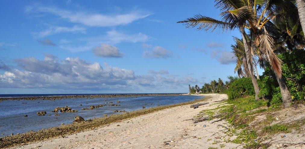
Anibare Bay. Chapter 8 Nauru
 Anibare Bay Chapter 8 Nauru The contributions of Andrew Kaierua, Russ Kun, Franklin Teimitsi and Douglas Audoa from the Department of Commerce, Industry and Environment are gratefully acknowledged 129
Current and future climate of Vanuatu. Pacific-Australia Climate Change Science and Adaptation Planning Program
 Pacific-Australia Climate Change Science and Adaptation Planning Program Hiu Torres Islands Vanua Lava Gaua Banks Islands Espiritu Santo Malekula Ambae Épi Maéwo Pentecost Ambrym Shepherd Islands Éfate
Current and future climate of the Marshall Islands. Pacific-Australia Climate Change Science and Adaptation Planning Program
 Pacific-Australia Climate Change Science and Adaptation Planning Program North Pacific Ocean Bikini Enewetak Ailinginae Rongelap Rongrik Utrik Taka R a Bikar t a Ujelang R a l i k Wotto Ujae C h a Lae
Current and future climate of the Solomon Islands. Pacific-Australia Climate Change Science and Adaptation Planning Program
 Pacific-Australia Climate Change Science and Adaptation Planning Program Ontong Java Atoll Shortland Islands Choiseul South Pacific Ocean Vella Lavella Ranongga New Georgia Islands Rendova Kolombangara
Chapter 3 East Timor (Timor-Leste)
") Coastline, Dili district Chapter 3 East Timor (Timor-Leste) The contributions of Terencio Fernandes Moniz and Sebastião da Silva from the National Directorate of Meteorology and Geophysics are gratefully
Coastline, Dili district Chapter 3 East Timor (Timor-Leste) The contributions of Terencio Fernandes Moniz and Sebastião da Silva from the National Directorate of Meteorology and Geophysics are gratefully
Will a warmer world change Queensland s rainfall?
 Will a warmer world change Queensland s rainfall? Nicholas P. Klingaman National Centre for Atmospheric Science-Climate Walker Institute for Climate System Research University of Reading The Walker-QCCCE
Tarawa Atoll. Chapter 6 Kiribati
 Tarawa Atoll Chapter 6 Kiribati The contributions of Ueneta Toorua, Tebwaau Tetabo and Tareti Kireua from the Kiribati Meteorology Service and Riibeta Abeta and Nakibae Teuatabo from the Environment and
Nuku alofa. Chapter 14 Tonga. The contributions of Ofa Fa anunu and Mele Lakai from the Tonga Meteorological Service are gratefully acknowledged
 Nuku alofa Chapter 14 Tonga The contributions of Ofa Fa anunu and Mele Lakai from the Tonga Meteorological Service are gratefully acknowledged 215 Introduction This chapter provides a brief description
Chapter 7 Marshall Islands
 Islet, Majuro Atoll Chapter 7 Marshall Islands The contributions of Reginald White and Lee Z. Jacklick from the Marshall Islands National Weather Service Office and Ned Lobwij from the Office of Environmental
Nuku alofa. Chapter 14 Tonga. The contributions of Ofa Fa anunu and Mele Lakai from the Tonga Meteorological Service are gratefully acknowledged
 Nuku alofa Chapter 14 Tonga The contributions of Ofa Fa anunu and Mele Lakai from the Tonga Meteorological Service are gratefully acknowledged 215 Introduction This chapter provides a brief description
Current and future climate of Tuvalu
 Nanumea Fualefeke Amatuku Nanumaga Niutao Tepuka Tepuka Savilivili Fualopa Fuafatu Funafuti Fogafale VAIAKU Fuakea Tefala Vasafua Falaigo Teafuafou Fatato Papa Elise Funamanu Falefatu Mateika Funafala
Chapter 2 Cook Islands
 Rarotonga Chapter 2 Cook Islands The contributions of Arona Ngari, Maarametua Vaiimene, David Maihia and Nitoro Bates from the Cook Islands Meteorological Service and Pasha Carruthers from the National
Mozambique. General Climate. UNDP Climate Change Country Profiles. C. McSweeney 1, M. New 1,2 and G. Lizcano 1
 UNDP Climate Change Country Profiles Mozambique C. McSweeney 1, M. New 1,2 and G. Lizcano 1 1. School of Geography and Environment, University of Oxford. 2.Tyndall Centre for Climate Change Research http://country-profiles.geog.ox.ac.uk
Current and future climate of Vanuatu
 Hiu Torres Islands Vanua Lava Gaua Banks Islands Espiritu Santo Malekula Ambae Épi Maéwo Pentecost Ambrym Shepherd Islands Éfate PORT VILA South Pacific Ocean Erromango Tanna Aneityum Current and future
Zambia. General Climate. Recent Climate Trends. UNDP Climate Change Country Profiles. Temperature. C. McSweeney 1, M. New 1,2 and G.
 UNDP Climate Change Country Profiles Zambia C. McSweeney 1, M. New 1,2 and G. Lizcano 1 1. School of Geography and Environment, University of Oxford. 2. Tyndall Centre for Climate Change Research http://country-profiles.geog.ox.ac.uk
Coastline, Alofi. Chapter 9 Niue
 Coastline, Alofi Chapter 9 Niue The contributions of Rossylynn Pulehetoa-Mitiepo, Adorra Misikea and Felicia Pihigia Talagi from the Niue Department of Meteorology and Climate Change are gratefully acknowledged
Current and future climate of Kiribati
 Washington Tarawa Butaritari BAIRIKI North Pacific Ocean Fanning Kiritmati (Christmas Island) Abemama Nonouti Tabiteuea Nikunau Gilbert Islands Arorae Winslow Nikumaroro Phoenix Is. Carondelet Malden Starbuck
Antigua and Barbuda. General Climate. Recent Climate Trends. UNDP Climate Change Country Profiles. Temperature
 UNDP Climate Change Country Profiles Antigua and Barbuda C. McSweeney 1, M. New 1,2 and G. Lizcano 1 1. School of Geography and Environment, University of Oxford. 2. Tyndall Centre for Climate Change Research
Climate Risk Profile for Samoa
 Climate Risk Profile for Samoa Report Prepared by Wairarapa J. Young Samoa Meteorology Division March, 27 Summary The likelihood (i.e. probability) components of climate-related risks in Samoa are evaluated
Grenada. General Climate. Recent Climate Trends. UNDP Climate Change Country Profiles. Temperature. Precipitation
 UNDP Climate Change Country Profiles C. McSweeney 1, M. New 1,2 and G. Lizcano 1 1. School of Geography and Environment, University of Oxford. 2. Tyndall Centre for Climate Change Research http://country-profiles.geog.ox.ac.uk
Chapter 4 Federated States of Micronesia
 Kolonia Harbour, Pohnpei Chapter 4 Federated States of Micronesia The contributions of David Aranug, Johannes Berdon and Eden Skilling from the Federated States of Micronesia National Weather Service Office
Chapter 5 Fiji Islands
 Suva Chapter 5 Fiji Islands The contributions of Alipate Waqaicelua, Varanisese Vuniyayawa, Ravind Kumar, Arieta Daphne and Bipendra Prakash from the Fiji Meteorological Service are gratefully acknowledged
Tarawa Atoll. Chapter 6 Kiribati
 Tarawa Atoll Chapter 6 Kiribati The contributions of Ueneta Toorua, Tebwaau Tetabo and Tareti Kireua from the Kiribati Meteorology Service and Riibeta Abeta and Nakibae Teuatabo from the Environment and
Cuba. General Climate. Recent Climate Trends. UNDP Climate Change Country Profiles. Temperature. C. McSweeney 1, M. New 1,2 and G.
 UNDP Climate Change Country Profiles Cuba C. McSweeney 1, M. New 1,2 and G. Lizcano 1 1. School of Geography and Environment, University of Oxford. 2. Tyndall Centre for Climate Change Research http://country-profiles.geog.ox.ac.uk
Abbreviations. Conformal Cubic Atmospheric Model CCAM. CMIP5 Coupled Model Intercomparison Project (Phase 5)
") Abbreviations CCAM Conformal Cubic Atmospheric Model CMIP5 Coupled Model Intercomparison Project (Phase 5) CSIRO EEZ ENSO GCM GPCP IPCC ITCZ PACCSAP PCCSP RCP SAM SPCZ SST WPM Commonwealth Scientific and
Abbreviations CCAM Conformal Cubic Atmospheric Model CMIP5 Coupled Model Intercomparison Project (Phase 5) CSIRO EEZ ENSO GCM GPCP IPCC ITCZ PACCSAP PCCSP RCP SAM SPCZ SST WPM Commonwealth Scientific and
St Lucia. General Climate. Recent Climate Trends. UNDP Climate Change Country Profiles. Temperature. Precipitation
 UNDP Climate Change Country Profiles St Lucia C. McSweeney 1, M. New 1,2 and G. Lizcano 1 1. School of Geography and Environment, University of Oxford. 2. Tyndall Centre for Climate Change Research http://country-profiles.geog.ox.ac.uk
Suriname. General Climate. Recent Climate Trends. UNDP Climate Change Country Profiles. Temperature. C. McSweeney 1, M. New 1,2 and G.
 UNDP Climate Change Country Profiles Suriname C. McSweeney 1, M. New 1,2 and G. Lizcano 1 1. School of Geography and Environment, University of Oxford. 2. Tyndall Centre for Climate Change Research http://country-profiles.geog.ox.ac.uk
Cape Verde. General Climate. Recent Climate. UNDP Climate Change Country Profiles. Temperature. Precipitation
 UNDP Climate Change Country Profiles C. McSweeney 1, M. New 1,2 and G. Lizcano 1 1. School of Geography and Environment, University of Oxford. 2. Tyndall Centre for Climate Change Research http://country-profiles.geog.ox.ac.uk
New Zealand Climate Update No 222, November 2017 Current climate November 2017
 New Zealand Climate Update No 222, November 2017 Current climate November 2017 November 2017 was characterised by higher than normal sea level pressure over New Zealand and the surrounding seas, particularly
Malawi. General Climate. UNDP Climate Change Country Profiles. C. McSweeney 1, M. New 1,2 and G. Lizcano 1
 UNDP Climate Change Country Profiles Malawi C. McSweeney 1, M. New 1,2 and G. Lizcano 1 1. School of Geography and Environment, University of Oxford. 2. Tyndall Centre for Climate Change Research http://country-profiles.geog.ox.ac.uk
New Zealand Climate Update No 223, January 2018 Current climate December 2017
 New Zealand Climate Update No 223, January 2018 Current climate December 2017 December 2017 was characterised by higher than normal sea level pressure over New Zealand and the surrounding seas. This pressure
Fire Weather Drivers, Seasonal Outlook and Climate Change. Steven McGibbony, Severe Weather Manager Victoria Region Friday 9 October 2015
 Fire Weather Drivers, Seasonal Outlook and Climate Change Steven McGibbony, Severe Weather Manager Victoria Region Friday 9 October 2015 Outline Weather and Fire Risk Environmental conditions leading to
UPDATE OF REGIONAL WEATHER AND SMOKE HAZE (December 2017)
") UPDATE OF REGIONAL WEATHER AND SMOKE HAZE (December 2017) 1. Review of Regional Weather Conditions for November 2017 1.1 In November 2017, Southeast Asia experienced inter-monsoon conditions in the first
UPDATE OF REGIONAL WEATHER AND SMOKE HAZE (December 2017) 1. Review of Regional Weather Conditions for November 2017 1.1 In November 2017, Southeast Asia experienced inter-monsoon conditions in the first
Tuvalu, PACC, SPREP. Chapter 1 Introduction to the Country Reports
 Tuvalu, PACC, SPREP Chapter 1 Introduction to the Country Reports 7 1.1 Climate Summary A climate summary is presented at the beginning of each country chapter which gives an overview of the observations
Climate Outlook through 2100 South Florida Ecological Services Office Vero Beach, FL September 9, 2014
 Climate Outlook through 2100 South Florida Ecological Services Office Vero Beach, FL September 9, 2014 Short Term Drought Map: Short-term (
Climate outlook, longer term assessment and regional implications. What s Ahead for Agriculture: How to Keep One of Our Key Industries Sustainable
 Climate outlook, longer term assessment and regional implications What s Ahead for Agriculture: How to Keep One of Our Key Industries Sustainable Bureau of Meteorology presented by Dr Jeff Sabburg Business
KUALA LUMPUR MONSOON ACTIVITY CENT
 T KUALA LUMPUR MONSOON ACTIVITY CENT 2 ALAYSIAN METEOROLOGICAL http://www.met.gov.my DEPARTMENT MINISTRY OF SCIENCE. TECHNOLOGY AND INNOVATIO Introduction Atmospheric and oceanic conditions over the tropical
Climate Outlook through 2100 South Florida Ecological Services Office Vero Beach, FL January 13, 2015
 Climate Outlook through 2100 South Florida Ecological Services Office Vero Beach, FL January 13, 2015 Short Term Drought Map: Short-term (
Percentage of normal rainfall for August 2017 Departure from average air temperature for August 2017
 New Zealand Climate Update No 219, August 2017 Current climate August 2017 Overall, mean sea level pressure was lower than normal over and to the west of New Zealand during August while higher than normal
Chapter 7 Projections Based on Downscaling
 Damage caused by Tropical Cyclone Pat, Cook Islands, February 2010. Photo: National Environment Service, Government of the Cook Islands Chapter 7 Projections Based on Downscaling 181 Summary Downscaled
2013 ATLANTIC HURRICANE SEASON OUTLOOK. June RMS Cat Response
 2013 ATLANTIC HURRICANE SEASON OUTLOOK June 2013 - RMS Cat Response Season Outlook At the start of the 2013 Atlantic hurricane season, which officially runs from June 1 to November 30, seasonal forecasts
PRMS WHITE PAPER 2014 NORTH ATLANTIC HURRICANE SEASON OUTLOOK. June RMS Event Response
 PRMS WHITE PAPER 2014 NORTH ATLANTIC HURRICANE SEASON OUTLOOK June 2014 - RMS Event Response 2014 SEASON OUTLOOK The 2013 North Atlantic hurricane season saw the fewest hurricanes in the Atlantic Basin
Forum on Climate Change Noosa, July 2015 Exposing the myths of climate change
 Forum on Climate Change Noosa, July 2015 Exposing the myths of climate change Des Moore My thesis today is that there is minimal risk that temperatures will become dangerously high if there is continued
Chapter 7 Marshall Islands
 Islet, Majuro Atoll Chapter 7 Marshall Islands The contributions of Reginald White and Lee Z. Jacklick from the Marshall Islands National Weather Service Office and Ned Lobwij from the Office of Environmental
Climate modeling: 1) Why? 2) How? 3) What?
 Why? 2) How? 3) What?") Climate modeling: 1) Why? 2) How? 3) What? Matthew Widlansky mwidlans@hawaii.edu 1) Why model the climate? Hawaii Fiji Sachs and Myhrvold: A Shifting Band of Rain 1 Evidence of Past Climate Change? Mean
Climate modeling: 1) Why? 2) How? 3) What? Matthew Widlansky mwidlans@hawaii.edu 1) Why model the climate? Hawaii Fiji Sachs and Myhrvold: A Shifting Band of Rain 1 Evidence of Past Climate Change? Mean
Climate Change in the Pacific: Scientific Assessment and New Research Volume 1: Regional Overview
 Climate Change in the Pacific: Scientific Assessment and New Research Volume 1: Regional Overview Australian Bureau of Meteorology and Commonwealth Scientific and Industrial Research Organisation (CSIRO)
A Ngari Director Cook Islands Meteorological Service
 WORLD METEOROLOGICAL ORGANIZATION REGIONAL SEMINAR ON CLIMATE SERVICES IN REGIONAL ASSOCIATION V (SOUTH-WEST PACIFIC) Honiara, Solomon Islands, 1-4 November 2011 A Ngari Director Cook Islands Meteorological
Climate briefing. Wellington region, May Alex Pezza and Mike Thompson Environmental Science Department
 Climate briefing Wellington region, May 2016 Alex Pezza and Mike Thompson Environmental Science Department For more information, contact the Greater Wellington Regional Council: Wellington PO Box 11646
 Page 1 of 5 Home research global climate enso effects Research Effects of El Niño on world weather Precipitation Temperature Tropical Cyclones El Niño affects the weather in large parts of the world. The
The South Eastern Australian Climate Initiative
 The South Eastern Australian Climate Initiative Phase 2 of the South Eastern Australian Climate Initiative (SEACI) is a three-year (2009 2012), $9 million research program investigating the causes and
El Niño 2015/2016 Impact Analysis Monthly Outlook February 2016
 El Niño 2015/2016 Impact Analysis Monthly Outlook February 2016 Linda Hirons, Nicolas Klingaman This report has been produced by University of Reading for Evidence on Demand with the assistance of the
Seasonal Climate Watch September 2018 to January 2019
 Seasonal Climate Watch September 2018 to January 2019 Date issued: Aug 31, 2018 1. Overview The El Niño-Southern Oscillation (ENSO) is still in a neutral phase and is still expected to rise towards an
Activity 2.2: Recognizing Change (Observation vs. Inference)
") Activity 2.2: Recognizing Change (Observation vs. Inference) Teacher Notes: Evidence for Climate Change PowerPoint Slide 1 Slide 2 Introduction Image 1 (Namib Desert, Namibia) The sun is on the horizon
Activity 2.2: Recognizing Change (Observation vs. Inference) Teacher Notes: Evidence for Climate Change PowerPoint Slide 1 Slide 2 Introduction Image 1 (Namib Desert, Namibia) The sun is on the horizon
UPDATE OF REGIONAL WEATHER AND SMOKE HAZE (February 2018)
") UPDATE OF REGIONAL WEATHER AND SMOKE HAZE (February 2018) 1. Review of Regional Weather Conditions for January 2018 1.1 The prevailing Northeast monsoon conditions over Southeast Asia strengthened in January
UPDATE OF REGIONAL WEATHER AND SMOKE HAZE (February 2018) 1. Review of Regional Weather Conditions for January 2018 1.1 The prevailing Northeast monsoon conditions over Southeast Asia strengthened in January
Part I: Introduction. Chapter 2. Climate and climate change on the Great Barrier Reef. Janice Lough
 Chapter 2 Climate and climate change on the Great Barrier Reef Janice Lough Few of those familiar with the natural heat exchanges of the atmosphere, which go into the making of our climates and weather,
Water Stress, Droughts under Changing Climate
 Water Stress, Droughts under Changing Climate Professor A.K.M. Saiful Islam Institute of Water and Flood Management Bangladesh University of Engineering and Technology (BUET) Outline of the presentation
Chapter outline. Reference 12/13/2016
 Chapter 2. observation CC EST 5103 Climate Change Science Rezaul Karim Environmental Science & Technology Jessore University of science & Technology Chapter outline Temperature in the instrumental record
UPDATE OF REGIONAL WEATHER AND SMOKE HAZE (September 2017)
") UPDATE OF REGIONAL WEATHER AND SMOKE HAZE (September 2017) 1. Review of Regional Weather Conditions in August 2017 1.1 Southwest Monsoon conditions continued to prevail in the region in August 2017. The
UPDATE OF REGIONAL WEATHER AND SMOKE HAZE (September 2017) 1. Review of Regional Weather Conditions in August 2017 1.1 Southwest Monsoon conditions continued to prevail in the region in August 2017. The
WMO Statement on the State of the Global Climate Preliminary conclusions for 2018 and WMO Greenhouse Bulletin
 WMO Statement on the State of the Global Climate Preliminary conclusions for 2018 and WMO Greenhouse Bulletin Dr Elena Manaenkova Deputy Secretary General World Meteorological Organisation Statement on
UPDATE OF REGIONAL WEATHER AND SMOKE HAZE (May 2017)
") UPDATE OF REGIONAL WEATHER AND SMOKE HAZE (May 2017) 1. Review of Regional Weather Conditions in April 2017 1.1 Inter monsoon conditions, characterised by afternoon showers and winds that are generally
UPDATE OF REGIONAL WEATHER AND SMOKE HAZE (May 2017) 1. Review of Regional Weather Conditions in April 2017 1.1 Inter monsoon conditions, characterised by afternoon showers and winds that are generally
By: J Malherbe, R Kuschke
 2015-10-27 By: J Malherbe, R Kuschke Contents Summary...2 Overview of expected conditions over South Africa during the next few days...3 Significant weather events (27 October 2 November)...3 Conditions
NIWA Outlook: March-May 2015
 March May 2015 Issued: 27 February 2015 Hold mouse over links and press ctrl + left click to jump to the information you require: Overview Regional predictions for the next three months: Northland, Auckland,
ANNUAL CLIMATE REPORT 2016 SRI LANKA
 ANNUAL CLIMATE REPORT 2016 SRI LANKA Foundation for Environment, Climate and Technology C/o Mahaweli Authority of Sri Lanka, Digana Village, Rajawella, Kandy, KY 20180, Sri Lanka Citation Lokuhetti, R.,
New Zealand Climate Update No 221, October 2017 Current climate October 2017
 New Zealand Climate Update No 221, October 2017 Current climate October 2017 October 2017 was characterised by higher than normal sea level pressure over New Zealand and the surrounding seas. This consistent
Percentage of normal rainfall for April 2018 Departure from average air temperature for April 2018
 New Zealand Climate Update No 227, May 2018 Current climate April 2018 Overall, April 2018 was characterised by lower pressure than normal over and to the southeast of New Zealand. Unlike the first three
New Zealand Climate Update No 226, April 2018 Current climate March 2018
 New Zealand Climate Update No 226, April 2018 Current climate March 2018 March 2018 was characterised by significantly higher pressure than normal to the east of New Zealand. This pressure pattern, in
Issued by the: Climate Services Division Fiji Meteorological Service Nadi Airport. 27 October 2010 GENERAL STATEMENT
 Fiji Meteorological Service (FMS) Tropical Cyclone Guidance for Season 2010/11 for the Fiji and the Southwest Pacific RSMC Region 160E to 120W Equator to 25 South Issued by the: Climate Services Division
ATMOSPHERIC MODELLING. GEOG/ENST 3331 Lecture 9 Ahrens: Chapter 13; A&B: Chapters 12 and 13
 ATMOSPHERIC MODELLING GEOG/ENST 3331 Lecture 9 Ahrens: Chapter 13; A&B: Chapters 12 and 13 Agenda for February 3 Assignment 3: Due on Friday Lecture Outline Numerical modelling Long-range forecasts Oscillations
The North Atlantic Oscillation: Climatic Significance and Environmental Impact
 1 The North Atlantic Oscillation: Climatic Significance and Environmental Impact James W. Hurrell National Center for Atmospheric Research Climate and Global Dynamics Division, Climate Analysis Section
Weather & Ocean Currents
 Weather & Ocean Currents Earth is heated unevenly Causes: Earth is round Earth is tilted on an axis Earth s orbit is eliptical Effects: Convection = vertical circular currents caused by temperature differences
First-Order Draft Chapter 3 IPCC WG1 Fourth Assessment Report
 0 Figure... Estimates of linear trends in significant wave height (cm decade - ) for the regions along the major ship routes for the global ocean for the period 0 00. Trends are shown only for the locations
The Australian Summer Monsoon
 The Australian Summer Monsoon Aurel Moise, Josephine Brown, Huqiang Zhang, Matt Wheeler and Rob Colman Australian Bureau of Meteorology Presentation to WMO IWM-IV, Singapore, November 2017 Outline Australian
2015: A YEAR IN REVIEW F.S. ANSLOW
 2015: A YEAR IN REVIEW F.S. ANSLOW 1 INTRODUCTION Recently, three of the major centres for global climate monitoring determined with high confidence that 2015 was the warmest year on record, globally.
Mid-season Storm Surge Update: December, 2013
 December 17, 2012 Ambleside Beach (Photograph by: Mark van Manen, PNG) Mid-season Storm Surge Update: December, 2013 Mid-season discussion of tidal and climate conditions affecting extreme water levels
ENSO Cycle: Recent Evolution, Current Status and Predictions. Update prepared by Climate Prediction Center / NCEP 11 November 2013
 ENSO Cycle: Recent Evolution, Current Status and Predictions Update prepared by Climate Prediction Center / NCEP 11 November 2013 Outline Overview Recent Evolution and Current Conditions Oceanic Niño Index
ENSO Cycle: Recent Evolution, Current Status and Predictions. Update prepared by Climate Prediction Center / NCEP 23 April 2012
 ENSO Cycle: Recent Evolution, Current Status and Predictions Update prepared by Climate Prediction Center / NCEP 23 April 2012 Outline Overview Recent Evolution and Current Conditions Oceanic Niño Index
Global Climate Change and the Implications for Oklahoma. Gary McManus Associate State Climatologist Oklahoma Climatological Survey
 Global Climate Change and the Implications for Oklahoma Gary McManus Associate State Climatologist Oklahoma Climatological Survey OCS LEGISLATIVE MANDATES Conduct and report on studies of climate and weather
SEASONAL CLIMATE PREDICTION
 SEASONAL CLIMATE PREDICTION David Walland Australian Bureau of Meteorology WMO RA-V Seminar on Climate Services Honiara, Solomon Islands, 1-4 November 2011 Overview Major climate Drivers in the region
NIWA Outlook: April June 2019
 April June 2019 Issued: 28 March 2019 Hold mouse over links and press ctrl + left click to jump to the information you require: Outlook Summary Regional predictions for the next three months Northland,
El Niño 2015/2016: Impact Analysis
 El Niño /26: Impact Analysis March 26 Dr Linda Hirons, Dr Nicholas Klingaman This work was funded by the Department for International Development (DFID) 2 Table of Contents. Introduction 4. Update of current
Weather Atmospheric condition in one place during a limited period of time Climate Weather patterns that an area typically experiences over a long
 Weather Atmospheric condition in one place during a limited period of time Climate Weather patterns that an area typically experiences over a long period of time Many factors influence weather & climate
NIWA Outlook: October - December 2015
 October December 2015 Issued: 1 October 2015 Hold mouse over links and press ctrl + left click to jump to the information you require: Overview Regional predictions for the next three months: Northland,
Australian Meteorological and Oceanographic Society (AMOS) Statement on Climate Change
 Statement on Climate Change") Australian Meteorological and Oceanographic Society (AMOS) Statement on Climate Change This statement provides a summary of some aspects of climate change and its uncertainties, with particular focus on
Australian Meteorological and Oceanographic Society (AMOS) Statement on Climate Change This statement provides a summary of some aspects of climate change and its uncertainties, with particular focus on
Climate Change Impacts, Adaptation and Vulnerability: Small Islands - South West Pacific
 Climate Change Impacts, Adaptation and Vulnerability: Small Islands - South West Pacific Penehuro F. Lefale Lead Author (LA), Chapter 16 Manager, International Cooperation & Development NZ Meteorological
GPC Exeter forecast for winter Crown copyright Met Office
 GPC Exeter forecast for winter 2015-2016 Global Seasonal Forecast System version 5 (GloSea5) ensemble prediction system the source for Met Office monthly and seasonal forecasts uses a coupled model (atmosphere
Chiang Rai Province CC Threat overview AAS1109 Mekong ARCC
 Chiang Rai Province CC Threat overview AAS1109 Mekong ARCC This threat overview relies on projections of future climate change in the Mekong Basin for the period 2045-2069 compared to a baseline of 1980-2005.
Seasonal Climate Watch January to May 2016
 Seasonal Climate Watch January to May 2016 Date: Dec 17, 2015 1. Advisory Most models are showing the continuation of a strong El-Niño episode towards the latesummer season with the expectation to start
Karonga Climate Profile: Full Technical Version
 Karonga Climate Profile: Full Technical Version Prepared by: University of Cape Town November 2017 For enquiries regarding this Climate Profile, please contact Lisa van Aardenne (lisa@csag.uct.ac.za) or
ENSO: Recent Evolution, Current Status and Predictions. Update prepared by: Climate Prediction Center / NCEP 30 October 2017
 ENSO: Recent Evolution, Current Status and Predictions Update prepared by: Climate Prediction Center / NCEP 30 October 2017 Outline Summary Recent Evolution and Current Conditions Oceanic Niño Index (ONI)
Seasonal Climate Watch July to November 2018
 Seasonal Climate Watch July to November 2018 Date issued: Jun 25, 2018 1. Overview The El Niño-Southern Oscillation (ENSO) is now in a neutral phase and is expected to rise towards an El Niño phase through
Current Climate Science and Climate Scenarios for Florida
 Current Climate Science and Climate Scenarios for Florida Daniel Bader and Vivien Gornitz Water Utilities and Climate Change Workshop Palm Beach County Water Utilities/ Water Research Foundation June 10,
Weather Atmospheric condition in one place during a limited period of time Climate Weather patterns that an area typically experiences over a long
 Weather Atmospheric condition in one place during a limited period of time Climate Weather patterns that an area typically experiences over a long period of time Many factors influence weather & climate
Projected Impacts of Climate Change in Southern California and the Western U.S.
 Projected Impacts of Climate Change in Southern California and the Western U.S. Sam Iacobellis and Dan Cayan Scripps Institution of Oceanography University of California, San Diego Sponsors: NOAA RISA