Advances in Flood Hazard Forecasting Using the International Community to Accelerate Innovation. Karel Heynert Deltares
|
|
|
- Hilary Williamson
- 5 years ago
- Views:
Transcription


1 Advances in Flood Hazard Forecasting Using the International Community to Accelerate Innovation Karel Heynert Deltares

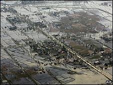
2 May 2008 in Myanmar

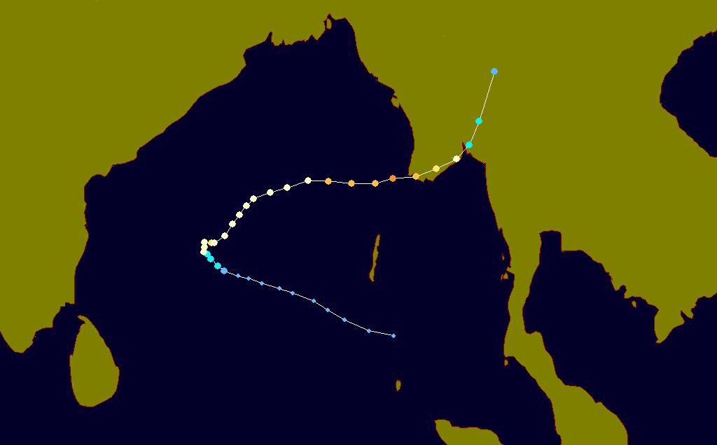
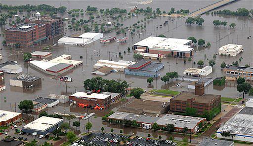
3 May 2008 in Myanmar
4 Properties at Risk?!?
5 Response

6 Forecasting, Warning & Response Detection Warning Response Forecasting Key Questions From data to information Simulation Could flood levels be predicted with more lead time? Could the predictions be more accurate? What is the risk of flooding under the prevailing and predicted hydraulic conditions?

users Platform for operational research Short cycle from research")

7 Delft FEWS Open Shell Forecasting System System for operational forecasting (resilience!) Flood, surge, water quality, structure stability Fully configurable by (super)users Platform for operational research Short cycle from research to operations Java, Delft PostgreSQL/Oracle, FEWS User Days Jboss, 2009: XML 4-5 November 09 in Delft Operating system independent, very scalable Software free of charge central role for user community
8 Sharing Tools > 50 models of different nature DELFT-FEWS Model Type Supplier/Owner Country ISIS 1D Hydrodynamic HR/Halcrow UK Flux 1D Hydrodynamics Scietec Austria DELFT3D 2/3D Hydrodynamics/ Water quality Deltares Netherlands TWAM 2D Hydrodynamics PlanB UK DELFT-3D 2D-3D Hydrodynamics Deltares Netherlands Modflow96/VKD 3D groundwater Deltares/Adam Taylor Netherlands/UK BASEFLOW Baseflow Simulation NWS USA CHANLOSS Channel loss Simulation NWS USA CONSUSE Consumptive use of River Simulation NWS USA Grid2Grid Distributed Hydrologic Model CEH UK REW Distributed Rainfall-Runoff Deltares Netherlands Vflo Distributed Rainfall-Runoff Vieux & Assiciates USA PCRASTER Dynamic Modelling Software University Utrecht Netherlands ARMA Error Correction CEH UK PRTF Event Based RR PlanB UK GLACIER Glacier simulation NWS USA HEC-RAS Hydrodynamic USACE USA SynHP Hydrodynamics BfG Germany Mike11 Hydrodynamics DHI Denmark SOBEK Hydrodynamics, Water Quality, RR Deltares Netherlands SOBEK-2d Linked 1d/2d inundation modelling Deltares Netherlands RSNELEV Rain Snow Elevation Simulation NWS USA PDM Rainfall-Runoff CEH UK TCM Rainfall-Runoff CEH UK Sacramento Rainfall-Runoff Deltares Netherlands NAM Rainfall-Runoff DHI Denmark MCRM Rainfall-Runoff EA UK Wageningen model Rainfall-Runoff Haskoning Netherlands SAC-SMA Rainfall-Runoff NWS USA API-CONT Rainfall-Runoff NWS USA SACSMATH Rainfall-Runoff NWS USA TOPKAPI Rainfall-Runoff Univ. of Bologna Italy PRMS Rainfall-Runoff Univ. of Karlsruhre Germany HBV Rainfall-Runoff (inc snowmelt) SHMI Sweden URBS Rainfall-runoff and hydrological routing Don Caroll Australia rtcmodule Reservoir Simulation Deltares Netherlands SSARRESV Reservoir Simulation NWS USA RESSNGL Reservoir Simulation NWS USA HEC-ResSim Reservoir Simulation USACE USA LAG/K Routing (hydrological) NWS USA SARROUTE Routing (hydrological) NWS USA KW Routing (kinematic wave) CEH UK DODO Routing (layered Muskingum) EA UK LAYCOEF Routing Model NWS USA MUSKROUT Routing Model NWS USA LAYCOEF Routing model NWS USA TATUM Routing Model NWS USA PACK Snow Melt CEH UK Snow17 Snow Melt NWS USA TRITON Surge propagation/overtopping PlanB UK STF Transfer functions EA UK Unit-HG Unit-Hydrograph NWS USA SWMM Urban Rainfall-Runoff USGS USA RIBASIM Water distribution + Reservoir Deltares Netherlands Model Generic Module Type Supplier/Owner Country ISIS Adapter 1D Hydrodynamic HR/Halcrow UK Flux 1D Hydrodynamics Scietec Austria DELFT3D 2/3D Hydrodynamics/ Water quality Deltares Netherlands TWAM XML2D Hydrodynamics PlanB UK DELFT-3D 2D-3D Hydrodynamics Deltares Netherlands Modflow96/VKD 3D groundwater Deltares/Adam Taylor Netherlands/UK BASEFLOW Baseflow Simulation NWS USA CHANLOSS Channel loss Simulation NWS USA Model CONSUSE Consumptive use of River Simulation NWS USA Grid2Grid Adapter Distributed Hydrologic Model CEH UK REW Distributed Rainfall-Runoff Deltares Netherlands Native Vflo Distributed Rainfall-Runoff Native Vieux & Assiciates USA format PCRASTER Model Dynamic Modelling format Software University Utrecht Netherlands ARMA Error Correction CEH UK PRTF Event Based RR PlanB UK GLACIER Glacier simulation NWS USA HEC-RAS Hydrodynamic USACE USA SynHP public.deltares.nl/display/fewsdoc/models+linked+to+delft-fews Hydrodynamics BfG Germany Mike11 Hydrodynamics DHI Denmark SOBEK Hydrodynamics, Water Quality, RR Deltares Netherlands
 Process configuration - Workflows HD Model Model 1 Flood Forecasting System Model")
9 Open System Open to many data formats (XML, Grib, NetCDF etc.) Process configuration - Workflows HD Model Model 1 Flood Forecasting System Model Current 2 University Model 3
 Forecast verification Training for dealing with extreme events (Serious")
10 Sharing Science Generic topics Probabilistic forecasting Data model integration ( data assimilation) Forecast verification Training for dealing with extreme events (Serious Gaming)
 Forecast verification Training for dealing with extreme events (Serious")
")
11 Sharing Science Generic topics Probabilistic forecasting Data model integration ( data assimilation) Forecast verification Training for dealing with extreme events (Serious Gaming) Fields of work Drought forecasting & reservoir management Coastal and estuary forecasting Inundation forecasting Tsunami s Water quality forecasting (e.g. harmful algae bloom)


12 Data Poor Environments Using Delft FEWS Real-time use of hybrid approaches fall-back options Quantification of and dealing with uncertainties Error correction & data assimilation Combining different data sources in-situ monitoring accurate but limited areal extent models good areal spread but limited accuarcy remote sensing data accurate & good areal spread but availability issues (place & time)


13 Waterlevels at Sea using Satellite based Laser Altimetry Model calibration Surges & sea level anomalies Accuarcy: order of centimeters (after reanalysis) Future? use over remote sensing data for real-time (surge) forecasting

14 Delft FEWS User Community


15 Delft FEWS User Community #1 Environment Agency for England & Wales National Flood Forecasting System (NFFS) Rijkswaterstaat & waterboards in The Netherlands Mekong River Commission National & smaller regional applications

")


16 Delft FEWS User Community #2 Environment Agency for England & Wales National Flood Forecasting System (NFFS) Rijkswaterstaat & waterboards in The Netherlands National Weather Service (NWS/NOAA) in United States Community Hydrologic Prediction System (CHPS)

17 Thank you for your attention!
Extending the use of Flood Modeller Pro towards operational forecasting with Delft-FEWS
 Extending the use of Flood Modeller Pro towards operational forecasting with Delft-FEWS Simone van Schijndel, Department Head Operational Water Management and Early Warning Intentionally blank The world
Delft FEWS User Days & 19 October 2007
 Delft FEWS User Days 2007 18 & 19 October 2007 Welcome & Introduction Karel Heynert Delft Hydraulics Theme Extending functionality and scope of Delft FEWS Aim of Delft FEWS User Days exchange experience
Visualising and communicating probabilistic flow forecasts in The Netherlands
 Visualising and communicating probabilistic flow forecasts in The Netherlands Eric Sprokkereef Centre for Water Management Division Crisis Management & Information Supply 2-2-2009 Content The basins Forecasting
Workshop on MCCOE Radar Meteorology /Climatology in Indonesia. Segel Ginting Wanny K. Adidarma
 Workshop on MCCOE Radar Meteorology /Climatology in Indonesia BPPT, 28 Februari 2013 JAKARTA FLOOD EARLY WARNING SYSTEM (J-FEWS) Segel Ginting Wanny K. Adidarma JCP (Joint Cooperation Program) Indonesia
Operational Perspectives on Hydrologic Model Data Assimilation
 Operational Perspectives on Hydrologic Model Data Assimilation Rob Hartman Hydrologist in Charge NOAA / National Weather Service California-Nevada River Forecast Center Sacramento, CA USA Outline Operational
Delft-FEWS User Days 2 nd & 3 rd November 2011
 Delft-FEWS User Days 2 nd & 3 rd November 2011 Recent developments in EA Midlands Flood Forecasting using FEWS NFFS Ian Clayton Flood Forecasting Technical Specialist Environment Agency Midlands Flood
Towards a probabilistic hydrological forecasting and data assimilation system. Henrik Madsen DHI, Denmark
 Towards a probabilistic hydrological forecasting and data assimilation system Henrik Madsen DHI, Denmark Outline Hydrological forecasting Data assimilation framework Data assimilation experiments Concluding
An Overview of Operations at the West Gulf River Forecast Center Gregory Waller Service Coordination Hydrologist NWS - West Gulf River Forecast Center
 National Weather Service West Gulf River Forecast Center An Overview of Operations at the West Gulf River Forecast Center Gregory Waller Service Coordination Hydrologist NWS - West Gulf River Forecast
Florida Commission on Hurricane Loss Projection Methodology Flood Standards Development Committee. October 30, 2014
 Florida Commission on Hurricane Loss Projection Methodology Flood Standards Development Committee October 30, 2014 KatRisk LLC 752 Gilman St. Berkeley, CA 94710 510-984-0056 www.katrisk.com About KatRisk
Leveraging new models and data to improve flood stage forecast. Improving Flood Stage Forecasting in the Feather River Watershed. September 11 th 2015
 Leveraging new models and data to improve flood stage forecast Improving Flood Stage Forecasting in the Feather River Watershed September 11 th 2015 Mitch Russo, P.E. (DWR) Ashok Bathulla, P.E., CFM (GEI)
DEVELOPMENT OF A FORECAST EARLY WARNING SYSTEM ethekwini Municipality, Durban, RSA. Clint Chrystal, Natasha Ramdass, Mlondi Hlongwae
 DEVELOPMENT OF A FORECAST EARLY WARNING SYSTEM ethekwini Municipality, Durban, RSA Clint Chrystal, Natasha Ramdass, Mlondi Hlongwae LOCATION DETAILS AND BOUNDARIES ethekwini Municipal Area = 2297 km 2
12/07/2017. Flash Flood Warning Service, an advanced approach towards flood resilient cities Floodplain Management Association Conference, Newcastle
 12/07/2017 Worldwide problem: Flash Floods Flash Floods are a Global Problem Flash Flood Warning Service, an advanced approach towards flood resilient cities Floodplain Management Association Conference,
Merced Irrigation District Hydrologic and Hydraulic Operations (MIDH2O) Model
 Model") Merced Irrigation District Hydrologic and Hydraulic Operations (MIDH2O) Model September 05, 2018 Marco Bell, Merced Irrigation District Bibek Joshi, Dewberry Objective Introduce HEC-RTS Benefits of MIDH2O
Merced Irrigation District Hydrologic and Hydraulic Operations (MIDH2O) Model September 05, 2018 Marco Bell, Merced Irrigation District Bibek Joshi, Dewberry Objective Introduce HEC-RTS Benefits of MIDH2O
CWMS Modeling for Real-Time Water Management
 Hydrologic Engineering Center Training Course on CWMS Modeling for Real-Time Water Management August 2018 Davis, California The Corps Water Management System (CWMS) is a software and hardware system to
Real-Time Meteorological Gridded Data: What s New With HEC-RAS
 Real-Time Meteorological Gridded Data: What s New With HEC-RAS Acquisition and Application of Gridded Meteorological Data in Support of the USACE s Real-Time Water Management Mission Fauwaz Hanbali, Tom
Improving global coastal inundation forecasting WMO Panel, UR2014, London, 2 July 2014
 Improving global coastal inundation forecasting WMO Panel, UR2014, London, 2 July 2014 Cyclone Sidr, November 2007 Hurricane Katrina, 2005 Prof. Kevin Horsburgh Head of marine physics, UK National Oceanography
National Weather Service. Harold H. Opitz Hydrologist in Charge
 National Weather Service Harold H. Opitz Hydrologist in Charge Goals Organization Role of the River Forecast Center Describe Forecast System & Tools Other Details NWS River Forecast Centers Northwest River
Bridging the gap in operational hydrologic data assimilation - Challenges and a way forward
 Bridging the gap in operational hydrologic data assimilation - Challenges and a way forward D.-J. Seo 1, Yuqiong Liu 2,3, Haksu Lee 2,4, Victor Koren 2, Jiarui Dong 5,6, Michael Ek 5, Pedro Restrepo 2
Speakers: NWS Buffalo Dan Kelly and Sarah Jamison, NERFC Jeane Wallace. NWS Flood Services for the Black River Basin
 Speakers: NWS Buffalo Dan Kelly and Sarah Jamison, NERFC Jeane Wallace NWS Flood Services for the Black River Basin National Weather Service Who We Are The National Oceanic and Atmospheric Administration
SNOW AND GLACIER HYDROLOGY
 SNOW AND GLACIER HYDROLOGY by PRATAP SINGH National Institute of Hydrology, Roorkee, India and VIJAY P. SINGH Department of Civil and Environmental Engineering, Louisiana State University, Baton Rouge,
Texas A & M University and U.S. Bureau of Reclamation Hydrologic Modeling Inventory Model Description Form
 Texas A & M University and U.S. Bureau of Reclamation Hydrologic Modeling Inventory Model Description Form JUNE, 1999 Name of Model: Two-Dimensional Alluvial River and Floodplain Model (MIKE21 CHD & CST)
Folsom Dam Water Control Manual Update
 Folsom Dam Water Control Manual Update Public Workshop April 3, 2014 Location: Sterling Hotel Ballroom 1300 H Street, Sacramento US Army Corps of Engineers BUILDING STRONG WELCOME & INTRODUCTIONS 2 BUILDING
Hydraulic Modelling for Real Time Flood Forecast Applications
 BHS/CIWEM SW Branch Meeting Hydraulic Modelling for Real Time Flood Forecast Applications Yiping Chen 20 June 2007 Introduction Hydraulic River Modelling: Washland (Floodplain) Modelling Techniques Integrated
Coastal forecasting and training in the Netherlands
 Coastal forecasting and training in the Netherlands Annette Zijderveld, Firmijn Zijl, Martin Verlaan, Saskia Vermeer, Micheline Hounjet, Casper Hartefeld Outline Coastal forecasting Operational forecasters
Advances in Flood Forecasting with (and without) Delft-FEWS
 Delft-FEWS") Advances in Flood Forecasting with (and without) Delft-FEWS Martin Ebel Advances in Flood Forecasting and the Implication for Risk Management International CHR Workshop Alkmaar, 25-26 May 2010 with the
Advances in Flood Forecasting with (and without) Delft-FEWS Martin Ebel Advances in Flood Forecasting and the Implication for Risk Management International CHR Workshop Alkmaar, 25-26 May 2010 with the
Real-Time Flood Forecasting Modeling in Nashville, TN utilizing HEC-RTS
 Real-Time Flood Forecasting Modeling in Nashville, TN utilizing HEC-RTS Brantley Thames, P.E. Hydraulic Engineer, Water Resources Section Nashville District, USACE August 24, 2017 US Army Corps of Engineers
INTRODUCTION TO HEC-HMS
 INTRODUCTION TO HEC-HMS Hydrologic Engineering Center- Hydrologic Modeling System US Army Corps of Engineers Hydrologic Engineering Center HEC-HMS Uses Schematics Enter properties: watershed, rivers (reaches),
IMPROVING ACCURACY, LEAD TIME AND CONTINGENCY IN FLUVIAL FLOOD FORECASTS TO ENHANCE EMERGENCY MANAGEMENT
 IMPROVING ACCURACY, LEAD TIME AND CONTINGENCY IN FLUVIAL FLOOD FORECASTS TO ENHANCE EMERGENCY MANAGEMENT Federico Groppa 1, Jon Wicks 2, Andy Barnes 3 1 Halcrow Group, Brisbane, QLD, groppaf@halcrow.com
Flash Flood Guidance System On-going Enhancements
 Flash Flood Guidance System On-going Enhancements Hydrologic Research Center, USA Technical Developer SAOFFG Steering Committee Meeting 1 10-12 July 2017 Jakarta, INDONESIA Theresa M. Modrick Hansen, PhD
7B.3 INTRODUCTION OF NOAA S COMMUNITY HYDROLOGIC PREDICTION SYSTEM
 7B.3 INTRODUCTION OF NOAA S COMMUNITY HYDROLOGIC PREDICTION SYSTEM Jon Roe * NOAA/NWS Office of Hydrologic Development, Silver Spring, Maryland Christine Dietz NOAA/NWS Office of Hydrologic Development,
Coupling of Wave and Hydrodynamic Models for Predicting Coastal Inundation: A case study in Jakarta and Semarang
 Coupling of Wave and Hydrodynamic Models for Predicting Coastal Inundation: A case study in Jakarta and Semarang http://peta-maritim.bmkg.go.id/cifdp/maps Nelly Florida Riama,Andri Ramdhani, Andi Eka Sakya,,
Forecasting Flood Risk at the Flood Forecasting Centre, UK. Delft-FEWS User Days David Price
 Forecasting Flood Risk at the Flood Forecasting Centre, UK Delft-FEWS User Days 2012 David Price Overview of the Flood Forecasting Centre (FFC) What is the FFC? Partnership between the Met Office and Environment
Towards operationalizing ensemble DA in hydrologic forecasting
 Towards operationalizing ensemble DA in hydrologic forecasting Albrecht Weerts DAFOH Ensemble Kalman Filter Rhine assimilation water levels 14 locations Operational since 1-1-2008 with 48 members See also
TRWD Upper Trinity River Flood Operations Decision Support System
 TRWD Upper Trinity River Flood Operations Decision Support System TFMA 2012 Fall Conference Rockwall, Texas September 20, 2012 Presented by: Andrew Ickert, PE, CFM & Craig Ottman, PE, CFM (Halff Associates,
PS4a: Real-time modelling platforms during SOP/EOP
 PS4a: Real-time modelling platforms during SOP/EOP Mistral Tramontane Bora Etesian Major sites of dense water formation Major sites of deep water formation influence of coastal waters Chairs: G. Boni,
Rainfall-River Forecasting: Overview of NOAA s Role, Responsibilities, and Services
 Dr. Thomas Graziano Chief Hydrologic Services Division NWS Headquarters Steve Buan Service Coordination Hydrologist NWS North Central River Forecast Center Rainfall-River Forecasting: Overview of NOAA
FEWS-WATERWAYS: TOOL FOR SHARING DATA BETWEEN INLAND STAKEHOLDERS by Caroline F. van der Mark 1, Juzer Dhondia 2, Henk Verheij 3
 FEWS-WATERWAYS: TOOL FOR SHARING DATA BETWEEN INLAND STAKEHOLDERS by Caroline F. van der Mark 1, Juzer Dhondia 2, Henk Verheij 3 ABSTRACT This paper describes the FEWS-Waterways system for navigation that
D. MATHEMATICAL MODEL AND SIMULATION
 D. MATHEMATICAL MODEL AND SIMULATION D - i TABLE OF CONTENTS D.1 Objective of Model Development... D - 1 D.2 Selection of Software... D - 1 D.3 General Steps of Simulation by MOUSE... D - 1 D.4 Cases of
HYDRAULIC MODELLING OF NENJIANG RIVER FLOODPLAIN IN NORTHEAST CHINA
 HYDRAULIC MODELLING OF NENJIANG RIVER FLOODPLAIN IN NORTHEAST CHINA Xiao Fei MEE08181 Supervisor: A.W. Jayawardena ABSTRACT In 1998, the worst flood recorded for over 200 years hit the Songhua River Basin
FFGS Additional Functionalities and Products. Konstantine P. Georgakakos, Sc.D. HYDROLOGIC RESEARCH CENTER 23 May 2018
 FFGS Additional Functionalities and Products Konstantine P. Georgakakos, Sc.D. HYDROLOGIC RESEARCH CENTER 23 May 2018 Advanced Functionalities 0. Multi-Model QPF A. Urban Flash Flood Warning B. Riverine
C o p e r n i c u s E m e r g e n c y M a n a g e m e n t S e r v i c e f o r e c a s t i n g f l o o d s
 C o p e r n i c u s E m e r g e n c y M a n a g e m e n t S e r v i c e f o r e c a s t i n g f l o o d s Copernicus & Copernicus Services Copernicus EU Copernicus EU Copernicus EU www.copernicus.eu W
Flood Risk Forecasts for England and Wales: Production and Communication
 Staines Surrey Flood Risk Forecasts for England and Wales: Production and Communication Jon Millard UEF 2015 : Quantifying and Communicating Uncertainty FFC What is the FFC? Successful partnership between
Preliminary Viability Assessment (PVA) for Lake Mendocino Forecast Informed Reservoir Operations (FIRO)
 for Lake Mendocino Forecast Informed Reservoir Operations (FIRO)") Preliminary Viability Assessment (PVA) for Lake Mendocino Forecast Informed Reservoir Operations (FIRO) Rob Hartman Consultant to SCWA and CW3E May 30, 2017 Why Conduct a PVA? Key Questions for the PVA
Preliminary Viability Assessment (PVA) for Lake Mendocino Forecast Informed Reservoir Operations (FIRO) Rob Hartman Consultant to SCWA and CW3E May 30, 2017 Why Conduct a PVA? Key Questions for the PVA
Overview and purposes of the meeting
 Overview and purposes of the meeting 1 Flash Floods vs. River Floods Riverine Flooding: is caused by heavy rainfall (and/or snow melt) over long periods e.g., days, leading to rising water levels and flooding
Integrating Hydrologic and Storm Surge Models for Improved Flood Warning
 Integ Hydrologic and Storm Surge Models for Improved Flood Warning Leahy, C.P, Entel, M, Sooriyakumaran, S, and Warren, G Flood Warning Program Office, Bureau of Meteorology, Docklands, Victoria National
USA National Weather Service Community Hydrologic Prediction System
 USA National Weather Service Community Hydrologic Prediction System Rob Hartman Hydrologist in Charge NOAA / National Weather Service California-Nevada River Forecast Center Sacramento, CA Background Outline
The history of HEPEX a community of practice in hydrologic prediction
 The history of HEPEX a community of practice in hydrologic prediction Maria-Helena Ramos (1) Florian Pappenberger (2), Andy Wood (3), Fredrik Wetterhall (2), Qj Wang (4), Jan Verkade (5), Ilias Pechlivanidis
Combining sensor and forecast information to aid decision making: real-time determination of hydrological peat fire risk in Kalimantan
 Combining sensor and forecast information to aid decision making: real-time determination of hydrological peat fire risk in Kalimantan Jaap Schellekens Based on work by: Aljosja Hooijer, Ronald Vernimmen,
RIVER FLOW MODELLING AND FORECASTING
 RIVER FLOW MODELLING AND FORECASTING Edited by D. A.KRAIJENHOFF Department of Hydraulics and Catchment Hydrology Agricultural University of Wageningen The Netherlands and J. R. MOLL Delft Hydraulics Laboratory
Next Generation Flood Forecasting and Warning System Evaluation and Work Plan Development
 Next Generation Flood Forecasting and Warning System Evaluation and Work Plan Development March 8, 2018 Nick Lorrain, CET Manager, Capital Projects Toronto and Region Conservation Authority nlorrain@trca.on.ca
6/9/2014. Software Overview. System Overview
 Future Rainfall 6/9/2014 Curtis Beitel, PE, CFM, Anthony Henry and Wayne Tschirhart, PE, CFM, PMP TFMA Spring 2014 Conference Software Overview 2 Processes Hydrometric DB Event Manager Automatic Low =
The MRC Mekong Flood Forecasting and MRC Flash Flood Guidance Systems
 MEKONG RIVER COMMISSION The MRC Mekong Flood Forecasting and MRC Flash Flood Guidance Systems NGUYEN TIEN KIEN Regional Flood Management and Mitigation Centre Phnom Penh, Cambodia Outline 1. Operational
The National Operational Hydrologic Remote Sensing Center Operational Snow Analysis
 The National Operational Hydrologic Remote Sensing Center Operational Snow Analysis World Meteorological Organization Global Cryosphere Watch Snow-Watch Workshop Session 3: Snow Analysis Products Andrew
Operational Hydrologic Ensemble Forecasting. Rob Hartman Hydrologist in Charge NWS / California-Nevada River Forecast Center
 Operational Hydrologic Ensemble Forecasting Rob Hartman Hydrologist in Charge NWS / California-Nevada River Forecast Center Mission of NWS Hydrologic Services Program Provide river and flood forecasts
FFGS Advances. Initial planning meeting, Nay Pyi Taw, Myanmar February, Eylon Shamir, Ph.D,
 FFGS Advances Initial planning meeting, Nay Pyi Taw, Myanmar 26-28 February, 2018 Eylon Shamir, Ph.D, EShamir@hrcwater.org Hydrologic Research Center San Diego, California FFG System Enhancements The following
Analysis of the Sacramento Soil Moisture Accounting Model Using Variations in Precipitation Input
 Meteorology Senior Theses Undergraduate Theses and Capstone Projects 12-216 Analysis of the Sacramento Soil Moisture Accounting Model Using Variations in Precipitation Input Tyler Morrison Iowa State University,
2016 HEPEX Workshop Université Laval, Quebec, Canada
 2016 HEPEX Workshop Université Laval, Quebec, Canada Evaluating the Usefulness of the US NWS Hydrologic Ensemble Forecast Service (HEFS) in the Middle Atlantic Region for Flood and Drought Applications
Texas A & M University and U.S. Bureau of Reclamation Hydrologic Modeling Inventory Model description Form. September 2008
 Texas A & M University and U.S. Bureau of Reclamation Hydrologic Modeling Inventory Model description Form September 2008 Name of Model: National Weather Service River Forecast System (NWSRFS) Model Type:
USGS Flood Inundation Mapping of the Suncook River in Chichester, Epsom, Pembroke and Allenstown, New Hampshire
 USGS Flood Inundation Mapping of the Suncook River in Chichester, Epsom, Pembroke and Allenstown, New Hampshire NH Water & Watershed Conference Robert Flynn, USGS NH-VT Water Science Center March 23, 2012
CARFFG System Development and Theoretical Background
 CARFFG Steering Committee Meeting 15 SEPTEMBER 2015 Astana, KAZAKHSTAN CARFFG System Development and Theoretical Background Theresa M. Modrick, PhD Hydrologic Research Center Key Technical Components -
Robert Shedd Northeast River Forecast Center National Weather Service Taunton, Massachusetts, USA
 Robert Shedd Northeast River Forecast Center National Weather Service Taunton, Massachusetts, USA Outline River Forecast Centers FEWS Implementation Status Forcing Data Ensemble Forecasting The Northeast
Flood Hazard Inundation Mapping. Presentation. Flood Hazard Mapping
 Flood Hazard Inundation Mapping Verne Schneider, James Verdin, and JeradBales U.S. Geological Survey Reston, VA Presentation Flood Hazard Mapping Requirements Practice in the United States Real Time Inundation
Advanced /Surface Hydrology Dr. Jagadish Torlapati Fall 2017 MODULE 2 - ROUTING METHODS
 Routing MODULE - ROUTING METHODS Routing is the process of find the distribution of flow rate and depth in space and time along a river or storm sewer. Routing is also called Flow routing or flood routing.
Data assimilation in the MIKE 11 Flood Forecasting system using Kalman filtering
 Water Resources Systems Hydrological Risk, Management and Development (Proceedings of symposium IlS02b held during IUGG2003 al Sapporo. July 2003). IAHS Publ. no. 281. 2003. 75 Data assimilation in the
Study 16.5 Probable Maximum Flood (PMF)
") Initial Study Report Meeting Study 16.5 Probable Maximum Flood (PMF) March 30, 2016 Prepared by 3/30/2016 1 Study 16.5 Status ISR documents (ISR Part D Overview): Status: Initial Study Report: Parts A,
Initial Study Report Meeting Study 16.5 Probable Maximum Flood (PMF) March 30, 2016 Prepared by 3/30/2016 1 Study 16.5 Status ISR documents (ISR Part D Overview): Status: Initial Study Report: Parts A,
Arkansas-Red Basin River Forecast Center Operations. RRVA Conference Durant, OK 8/22/2013 Jeff McMurphy Sr. Hydrologist - ABRFC
 Arkansas-Red Basin River Forecast Center Operations RRVA Conference Durant, OK 8/22/2013 Jeff McMurphy Sr. Hydrologist - ABRFC NWS River Forecast Centers NWS Weather Forecast Offices Operations Staffing
Study 16.5 Probable Maximum Flood (PMF)
") Initial Study Report Meeting Study 16.5 Probable Maximum Flood (PMF) October 22, 2014 Prepared by 10/22/2014 1 Study 16.5 Objectives Develop a site-specific PMP to be used for the derivation of the PMF
Initial Study Report Meeting Study 16.5 Probable Maximum Flood (PMF) October 22, 2014 Prepared by 10/22/2014 1 Study 16.5 Objectives Develop a site-specific PMP to be used for the derivation of the PMF
Dieter Kranzlmüller LMU & LRZ Munich. Coordinating person: Eng. Antonio Parodi, PhD.
 Dieter Kranzlmüller LMU & LRZ Munich Coordinating person: Eng. Antonio Parodi, PhD www.drihm.eu 1 DRIHM Objectives To support the development and deployment of a HMR e-science environment To promote the
NWS Mission 5/25/2017. Innovations in Flood Forecasting at the National Weather Service West Gulf River Forecast Center
 Innovations in Flood Forecasting at the National Weather Service West Gulf River Forecast Center Kris Lander, PE, CFM Gregory Waller NWS West Gulf River Forecast Center NWS Mission To provide weather,
National Flood Interoperability Experiment
 National Flood Interoperability Experiment David R. Maidment, University of Texas at Austin Catchment-based Hydrological Data Assimilation (CAHMDA) VI Conference 8 September 2014 Located on Tuscaloosa
United States Multi-Hazard Early Warning System
 United States Multi-Hazard Early Warning System Saving Lives Through Partnership Lynn Maximuk National Weather Service Director, Central Region Kansas City, Missouri America s s Weather Enterprise: Protecting
NOAA Spring Flood Outlook for Iowa
 NOAA Spring Flood Outlook for Iowa Safeguard Iowa Partnership March 10, 2015 1 Agenda Orientation Maps Current Conditions Weather Outlook Spring Flood Outlook 2 1 Orientation Maps 3 4 2 5 Current Conditions
Incorporation of SMOS Soil Moisture Data on Gridded Flash Flood Guidance for Arkansas Red River Basin
 Incorporation of SMOS Soil Moisture Data on Gridded Flash Flood Guidance for Arkansas Red River Basin Department of Civil and Environmental Engineering, The City College of New York, NOAA CREST Dugwon
The Importance of Snowmelt Runoff Modeling for Sustainable Development and Disaster Prevention
 The Importance of Snowmelt Runoff Modeling for Sustainable Development and Disaster Prevention Muzafar Malikov Space Research Centre Academy of Sciences Republic of Uzbekistan Water H 2 O Gas - Water Vapor
Haiti and Dominican Republic Flash Flood Initial Planning Meeting
 Dr Rochelle Graham Climate Scientist Haiti and Dominican Republic Flash Flood Initial Planning Meeting September 7 th to 9 th, 2016 Hydrologic Research Center http://www.hrcwater.org Haiti and Dominican
Recent development of the National Hydro-Meteorological Service (NHMS) of Viet Nam for disaster risk reduction
 of Viet Nam for disaster risk reduction") Ministry of Natural Resources and Environment National Hydro-Meteorological Service Recent development of the National Hydro-Meteorological Service (NHMS) of Viet Nam for disaster risk reduction Tran Van
Ministry of Natural Resources and Environment National Hydro-Meteorological Service Recent development of the National Hydro-Meteorological Service (NHMS) of Viet Nam for disaster risk reduction Tran Van
17 th Session of RA IV
 17 th Session of RA IV Agenda Item 4.1: Disaster Risk Reduction, Resilience and Prevention, Focusing on Impact-Based Decision Support Services Doc 4.1.(6):Coastal Inundation Forecasting Demonstration Project
High Resolution Integrated Weather- Flood Modelling Framework
 High Resolution Integrated Weather- Flood Modelling Framework IBM Research Team : Ulisses Mello, Lucas Villa Real, Vaibhav Saxena, Thomas George, Rashmi Mittal, Yogish Sabharwal Intern @ IBM Research :
Post flood analysis. Demands of the Storm Surge Warning Service (SVSD) of the Netherlands. Annette Zijderveld/ Martin Verlaan
 of the Netherlands. Annette Zijderveld/ Martin Verlaan") Post flood analysis Demands of the Storm Surge Warning Service (SVSD) of the Netherlands Annette Zijderveld/ Martin Verlaan Objective Bringing in coastal issues to the FEWS user days (second attempt) Demonstrating
Post flood analysis Demands of the Storm Surge Warning Service (SVSD) of the Netherlands Annette Zijderveld/ Martin Verlaan Objective Bringing in coastal issues to the FEWS user days (second attempt) Demonstrating
Flood and Sea Level Rise Mapping Methodologies: The Way Forward
 Flood and Sea Level Rise Mapping Methodologies: The Way Forward Malcolm L. Spaulding Professor Emeritus, Ocean Engineering University of Rhode Island spaulding@egr.uri.edu Interagency Coordination Meeting
The RMS US inland flood model
 The RMS US inland flood model Sonja Jankowfsky 1,2,a, Arno Hilberts 2, Christian Mortgat 1, Shuangcai Li 1, Na Xu 1, Yi Mei 1, Stephan Tillmanns 3, Ye Tian 1, Yang Yang 1 1 Risk Management Solutions, Inc.,
Wales real time forecasting for fast responding rivers. Andy Wall Flood Forecasting Team Leader Environment Agency Wales
 Wales real time forecasting for fast responding rivers Andy Wall Flood Forecasting Team Leader Environment Agency Wales Flood risk & forecasting in Wales Fast responding rivers 220,000 properties at
Flood Forecasting Tools for Ungauged Streams in Alberta: Status and Lessons from the Flood of 2013
 Flood Forecasting Tools for Ungauged Streams in Alberta: Status and Lessons from the Flood of 2013 John Pomeroy, Xing Fang, Kevin Shook, Tom Brown Centre for Hydrology, University of Saskatchewan, Saskatoon
MODERN TECHNOLOGIES IN HYDRO-METEOROLOGICAL INFORMATION SYSTEMS
 MODERN TECHNOLOGIES IN HYDRO-METEOROLOGICAL INFORMATION SYSTEMS MARK HEGGLI, INNOVATIVE HYDROLOGY CONSULTING METEOROLOGIST/HYDROLOGIST TO THE WORLD BANK AREAS OF TECHNOLOGY ADVANCEMENT RECENT TECHNOLOGY
Use of Geospatial data for disaster managements
 Use of Geospatial data for disaster managements Source: http://alertsystemsgroup.com Instructor : Professor Dr. Yuji Murayama Teaching Assistant : Manjula Ranagalage What is GIS? A powerful set of tools
Prototyping a Data Sharing System for Flood Forecasting: A Case Study on Sri Lanka
 Prototyping a Data Sharing System for Flood Forecasting: A Case Study on Sri Lanka Masaki Yasukawa 1, Eiji Ikoma 1, Toshihiro Nemoto 1, Mohamed Rasmy 2, Morimasa Tsuda 2, Tomoki Ushiyama 2, Katsunori Tamakawa
Tropical Cyclones Modelling For Natural Disaster Risk Management
 Tropical Cyclones Modelling For Natural Disaster Risk Management Juan Savioli a, M. Britton b, S. Szylkarski a and Claus Pederson a a DHI Water and Environment, 2 Elliott Street, Suite 1a, QLD 4217 Surfers
Forecast Challenges for the Colorado Basin River Forecast Center
 Forecast Challenges for the Colorado Basin River Forecast Center John Lhotak, Development and Operations Hydrologist Improving Sub-Seasonal to Seasonal (S2S) Workshop May 16th, 2018 1 River Forecast Centers
Hands On Applications of the Latin American and Caribbean Flood and Drought Monitor (LACFDM)
") Hands On Applications of the Latin American and Caribbean Flood and Drought Monitor (LACFDM) Colby Fisher, Eric F Wood, Justin Sheffield, Nate Chaney Princeton University International Training: Application
Hands On Applications of the Latin American and Caribbean Flood and Drought Monitor (LACFDM) Colby Fisher, Eric F Wood, Justin Sheffield, Nate Chaney Princeton University International Training: Application
Ms. Latoya Regis. Meteorologist Hydrometeorological Service, Guyana
 Ms. Latoya Regis Meteorologist Hydrometeorological Service, Guyana Background Ninety percent (90%) of Guyana s population resides along the (Atlantic) Coast, which is below mean sea level and accounts
The Documentation of Extreme Hydrometeorlogical Events: Two Case Studies in Utah, Water Year 2005
 The Documentation of Extreme Hydrometeorlogical Events: Two Case Studies in Utah, Water Year 2005 Tim Bardsley1*, Mark Losleben2, Randy Julander1 1. USDA, NRCS, Snow Survey Program, Salt Lake City, Utah.
SHORT TERM SCIENTIFIC MISSION (STSM) COST ACTION ES1404
 COST ACTION ES1404") SHORT TERM SCIENTIFIC MISSION (STSM) COST ACTION ES1404 SCIENTIFIC REPORT COST Office Science Officer: Dr Deniz Karaca, deniz.karaca@cost.eu COST MC Chair: Dr Ali Nadir Arslan, ali.nadir.arslan@fmi.fi
SHORT TERM SCIENTIFIC MISSION (STSM) COST ACTION ES1404 SCIENTIFIC REPORT COST Office Science Officer: Dr Deniz Karaca, deniz.karaca@cost.eu COST MC Chair: Dr Ali Nadir Arslan, ali.nadir.arslan@fmi.fi
Development of the Hydrologic Model
 Kick-off meeting on enhancing hydrological data management and exchange procedures Water and Climate Adaptation Plan (WATCAP) for Sava River Basin Development of the Hydrologic Model David Heywood Team
Drought Monitoring with Hydrological Modelling
 st Joint EARS/JRC International Drought Workshop, Ljubljana,.-5. September 009 Drought Monitoring with Hydrological Modelling Stefan Niemeyer IES - Institute for Environment and Sustainability Ispra -
Riverine Modeling Proof of Concept
 Technical Team Meeting Riverine Modeling Proof of Concept Version 2 HEC-RAS Open-water Flow Routing Model April 15-17, 2014 Prepared by R2 Resource Consultants, Brailey Hydrologic, Geovera, Tetra Tech,
World Meteorological Organization
 World Meteorological Organization Opportunities and Challenges for Development of Weather-based Insurance and Derivatives Markets in Developing Countries By Maryam Golnaraghi, Ph.D. Head of WMO Disaster
Improving Sub-Seasonal to Seasonal Prediction at NOAA
 Improving Sub-Seasonal to Seasonal Prediction at NOAA Dr. Louis W. Uccellini Director, National Weather Service NOAA Assistant Administrator for Weather Services July 13, 2016 Congressional Briefing Value
ENGINEERING HYDROLOGY
 ENGINEERING HYDROLOGY Prof. Rajesh Bhagat Asst. Professor Civil Engineering Department Yeshwantrao Chavan College Of Engineering Nagpur B. E. (Civil Engg.) M. Tech. (Enviro. Engg.) GCOE, Amravati VNIT,
GIS Techniques for Floodplain Delineation. Dean Djokic
 GIS Techniques for Floodplain Delineation Dean Djokic (ddjokic@esri.com) Content What is a floodplain? How to get a floodplain? What can GIS do for floodplain modeling? Simple GIS techniques for floodplain
NOAA s National Weather Service. National Weather Service
 NOAA s National Weather Service Serving the Nation s Environmental Forecasting Needs Lynn Maximuk Regional Director National Weather Service Central Region Headquarters Kansas City, Missouri America s