Climate Change Impacts and Adaptation for Coastal Transport Infrastructure in the Caribbean
|
|
|
- Amos Rodgers
- 5 years ago
- Views:
Transcription
1 UNCTAD Regional Workshop 5 7 December 2017, Bridgetown, Barbados Climate Change Impacts and Adaptation for Coastal Transport Infrastructure in the Caribbean Climate change projections for the Caribbean and Implications for Air and Sea Ports By Leonard Nurse University of the West Indies, Barbados This expert paper is reproduced by the UNCTAD secretariat in the form and language in which it has been received. The views expressed are those of the author and do not necessarily reflect the views of the UNCTAD.
2 Climate Change Projections for the Caribbean and Implications for Air and Sea Ports Leonard A. Nurse Faculty of Science and Technology University of The West Indies, Cave Hill, Barbados UNCTAD Regional Workshop Climate Change Impacts & Adaptation for Coastal Transport Infrastructure in Caribbean SIDS Bridgetown, Barbados December 5-7, 2017 Key Climate Risk Factors for Seaports and Airports in SIDS Increasing air 0 T and SST (i) thermal expansion of ocean surface (ii) greater convection potentialover ocean Rising sea level and surge (a) raise H 2 O levels (b) high amplitude wavesand increased potential for damage Higher wind speeds increased storminess (IPCC AR5) No clear trend in total projected storm numbers BUT tropical cyclone intensity projected to increase Frequency of the most intense stormslikely to increase substantially in some basins Likely increase in both global mean tropical cyclone maximum wind speed and rainfall intensity 1

3 Representative Concentration Pathways Scenarios The 4 RCPs are defined by the IPCC as follows: One highpathway radiative forcing exceeds 8.5 W/m 2 by 2100 and continues to rise for some period thereafter; Two intermediate stabilizationpathways radiative forcing is stabilized at around 6.0 W/m 2 and 4.5 W/m 2 after 2100; One lowpathway -where radiative forcing peaks at about 3 W/m 2 before 2100 and declines thereafter. RCP RCP 2.6 RCP 4.5 RCP 6.0 RCP8.5 Description Peak in radiative forcing at ~3W/m 2 (~490ppm CO 2 e) before 2100 and then decline (the selected pathway declines to 2.6W/m 2 by 2100). Stabilization without overshoot pathway to 4.5W/m 2 (~650ppm CO 2 e) at stabilization after 2100 Stabilization without overshoot pathway to 6W/m 2 (~850ppm CO 2 e) at stabilization after Rising radiative forcing pathway leading to 8.5W/m 2 (~1370ppm CO 2 e) by Projected Wet Season Rainfall RCP 2.6 CMIP5 Multi-Models Rainfall difference Relative to Baseline ( ) 2
 Projected Wet Season Rainfall RCP 6.")
4 Projected Wet Season Rainfall RCP 4.5 CMIP5 Multi-Models Rainfall difference Relative to Baseline ( ) Projected Wet Season Rainfall RCP 6.0 CMIP5 Multi-Models Rainfall difference Relative to Baseline ( ) 3


 Rainfall")

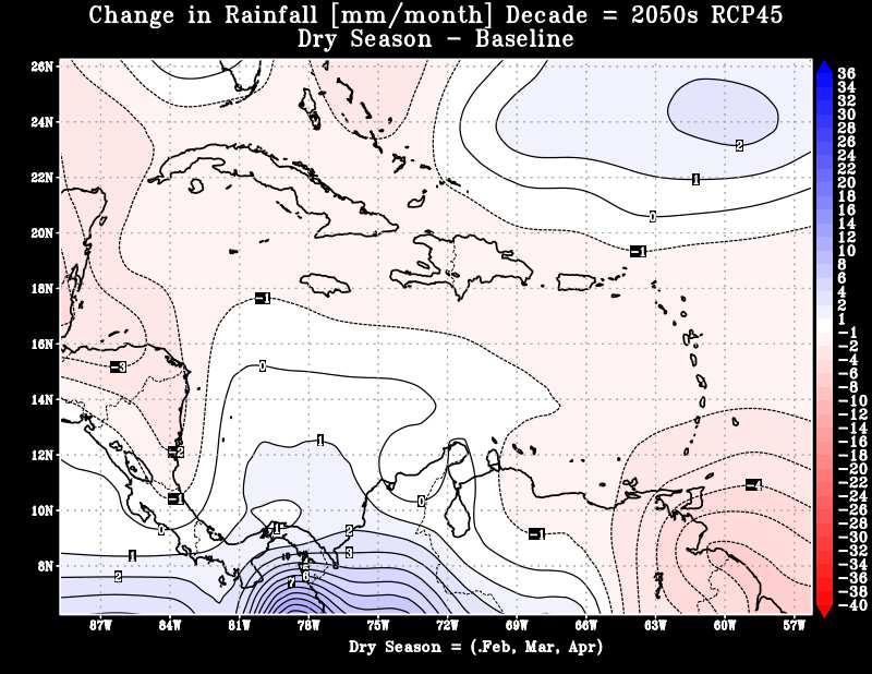
5 Projected Dry Season Rainfall RCP 2.6 CMIP5 Multi-Models Rainfall difference Relative to Baseline ( ) Projected Dry Season Rainfall RCP 4.5 CMIP5 Multi-Models Rainfall difference Relative to Baseline ( ) 4
 Projected Dry Season Rainfall RCP 8.")
6 Projected Dry Season Rainfall RCP 6.0 CMIP5 Multi-Models Rainfall difference Relative to Baseline ( ) Projected Dry Season Rainfall RCP 8.5 CMIP5 Multi-Models Rainfall difference Relative to Baseline ( ) 5

7 Projected Temperature- St. Lucia RCP CMIP5 Multi-Models Projected Temperature Kingston, Jamaica RCP CMIP5 Multi-Models 6


8 Drying trend between -25% and -30 % by end of Century. Drying far exceeds natural variability. Drier wet season likely (Taylor, 2011) Drying exceeds natural variability June-October wet season dryer! Source: Nurse and Charlery, Theoretical and Applied Climatology, December 2014, DOI: /s C 7


9 20 th Century Observed SLR in SIDS Regions Tropical Western Pacific rate of rise is almost 4 times the global average. Indian Ocean rate of SLR as much as twice global average In Caribbean rate of SLR generally higher than global average, ~ 1.8mm yr-1. Guyana is a special case - rate of SLR > twice the regional average. Why? Key Components of Water level Change: Implications for Coastal Air & Sea Ports i. Astronomical Tide ii Wave set up increase in mean water level landward of breaker zone due to flux of H 2 Oat coast iii Sea level anomaly measure of the difference between short-and long-term MSL negativeand positive anomalies iv Sea level rise v Storm Surge Note: ii., iii. iv. and v. are climatesensitive phenomena 8


10 In coastal areas, quantitatively small changes have disproportionately large effects, e.g. storm surge Storm surge is associated with a rapid fall in barometric pressure, accompanied by strong onshore winds, as hurricane passes Inverse barometer triggersarapidelevationofh 2 Olevel. Surge generates large surface waves, leading to the piling up of H 2 O at the coast. Relationship between reduction in pressure and H 2 O level is not linear: Small drop in pressure can induce a significant rise in H 2 O level. For example, a 25.4 mm (1.0 in.) fall in the barometric pressure could produce a seasurfaceriseofapprox.33cm(13.0in.). Sea Level Rise Projections Caribbean SIDS 9


11 St. Lucia Sea Level Rise Projections Data extracted for Grid Cells 13.5 N, 60.5 W (Hewanorra Airport & Port Vieux Fort) 14.5 N, 60.5 W (George F.L. Charles Airport & Port Castries) Metres Metres Kingston, Jamaica, Sea Level Rise Projections Data extracted for Grid Cell 17.5 N, 76.5 W (Norman Manley Airport & Kingston Container Terminal) Metres Metres 10


12 Montego Bay (Jamaica), Sea Level Rise Projections Data extracted for Grid Cell 18.5 N, 77.5 W (Sangster Airport & Falmouth Cruise Port Metres Metres Transport & Infrastructure Damage - Hurricane Lenny, Nov Northwestern & southern tip of the island most affected -landslides, severe beach erosion, airport flooded; 65% of Barbuda flooded, sanitary & water storage facilities overflowing; USD 51.3 M damages. Damage & interruption at both airports Pottersville to Rockway highway closed; flooding at air & seaports; Roseau severed from petroleum storage facilities; west coast sea defenses breached; USD 21 M damages. Most damage at Soufriere, waterfront, Gros Islet, Anse La Raye, Choiseul; severe erosion on NW coast, housing & tourism damage; damage to seaport, flooding at airports; hospital cut off from town; USD 6.6 M. Seawall & other coastal defenses at Airport facilities damaged; structural failure and boat damage at St. George s Port; much damage to roads linking main settlements to air-& seaport; heavy damage to tourism plant; USD 94.3 M damages. 11


13 Key Risk Factors for Port of Kingston and Norman Manley International Airport Elevation 4.0 m a.m.s.l.; Projected SLR 18 cm by 2025, cm by 2050, by Storm surge modeling - category 4/5 hurricanes H 2 O levels 3-4 m. Norman Manley Airport is located on a barrier beach 3 m a.m.s.l. Connected to the mainland via the Norman Manley highway located parallel to Palisadoes sand spit 3.0 m a.m.s.l. Major storms flood highway, severing airport from mainland, e.g. Hurricane Ivan PalisadoesHighway Protection - The Main Access to Norman Manley International Airport, Jamaica Construction Phase Post-Construction Repeated damage from the passage of storms over many decades. In 2004 Hurricane Ivan caused > 300 m of shoreline erosion complete shutdown of airport and isolation of adjacent communities. A decision was taken to raise road to 3.2 m amsl(formerly m amsl) and build a coastal revetment, at cost > USD 100 M. 12
14 Sample of Assets and operations At Risk: Air- and Seaports Climate-induced changes can cause serious damage to port infrastructure major business interruption across entire supply chain: Tarmacs/runways & aircraft, fuel storage tanks Terminal facilities & associated throughput of passengers, goods and related services UGliGes H 2 O, power supply, telecommunications Berths, bulkheads, seawalls, breakwaters Emergency response e.g. fire and ambulance services Projected impacts could overwhelm existing capacities, e.g. storm and wastewater management systems Caribbean countries, like other SIDS, will be confronted by increased exposure and related cumulative risks at air & seaports Implications for insurance, legal liability & operating costs? Examples of Effects of Two Climate Variables on Air and Sea Port Operations Variable Exposure Unit Effects Adaptation/Adjustment Air Temperature Aircraft Higher temperatures cause: Lower air density Reduced lift generated by aircraft wings; slower climbs Effect on performance & efficiency Lower take-off weights/loads Longer runways More frequent Intense rainfall events Terminals, warehouses & related facilities Greater incidence of flooding Sewerage & drainage capacities exceeded, etc. Disruptions and downtime Business losses; possible loss of market share Higher maintenance & operation costs Redesign/retrofitting of infrastructure (e.g. drainage, sewerage) for greater capacity & efficiency Increased insurance/reinsurance to cover liabilities, demurrage, etc. Redesign of logistics, business plans, operations manuals, etc. 13
 Wind pressureis a critical determinant of tie-down uplift forces acting on cranes during operation. Hurricane wind pressure based on 50-yr Mean Recurrence Interval (MRI) 3.")
15 Kingston Container Terminal: Delivery of 4 Super Post-Panamax Ship-to-Shore Gantry Cranes, 2005 (Photo: Gleaner Newspaper) Design Criteria for Port Cranes: (ASCE-7 Standard: Minimum Design Loads.) Wind pressureis a critical determinant of tie-down uplift forces acting on cranes during operation. Hurricane wind pressure based on 50-yr Mean Recurrence Interval (MRI) 3.0 ms -1 gust wind speeds, 10 m above ground Limitations: Criteria based on historical data may not reflect present conditions & not representative of future. Wind pressure varies as the square of the wind speed; errors increasewhen speed is converted to wind pressure reliable wind data critical, e.g. 10% error in wind speed results in a 21% error in wind pressure calculation; and Error of 100% (or more) in tie-down uplift force [See i. McCarthy et al, Wind damage to dockside cranes: recent failures and recommendations. In Lifeline earthquake engineering in a multi-hazard environment, 1-12; ii. Frendo, F., Gantry crane derailment and collapse induced by wind load. Engineering Failure Analysis66, ]. Building Resilience at Ports The Necessity for Adaptation in SIDS Past global GHG emissions & current trajectory guarantee that warming of atmosphere & oceans, and SLR will continue for decades ( climate inertia volume of GHGs already emioed). Notwithstanding proposed INDCs no evidence that a binding post-kyoto agreement will eventuate in Paris in December Air-and seaport operations face heightened risks. For SIDS, risks are greater almost total dependence on these facilities for imports and exports. Air-and seaport infrastructure represent major investment amorgzed over medium-to-long periods, e.g. minimum of years, in some cases as many as 50+ years fall within the timeframe of current climate change projections. 14
16 Planning Adaptation at Air and Seaports Constraints for SIDS With few exceptions, protection of existing infrastructure and accommodation are the only practical responses available to most SIDS for the following reasons: o Limited opportunities for relocation away from vulnerable areas constraint of sheer physical size o Central role of air and sea ports in these small, highly open economies o Scarce/insufficient resources to replicate such high cost facilities useful life of terminals, runways, taxiways, parking aprons etc. is on average minimum of 30 years. o As in other jurisdictions, protection and accommodation strategies will therefore have to contemplate a suite of actions involving infrastructure, technological, regulatory and change managementcomponents. Examples of Potential Response Strategies for Air & Seaports in SIDS Infrastructural /Engineering Enhance the structural integrity of critical facilities including sea defenses, berths, mooring facilities, runways, parking aprons etc, based on design criteria that reflect changing wind, sea level and wave conditions; recalculation of return periods for major events such as hurricanes and floods, so that more resilient structures can be engineered Caribbean Technological Invest in more climate-resilient technologies and equipment in expansion & upgrade programmes, e.g. solar photovoltaics to generate electricity more efficiently for both operations and administration, e.g. Airport at Oranjestad, Aruba; 451-kW PV system at St. Thomas Airport, USVI Planning & Development Management Systems Insurance Internal capacity building and re-training that recognizes the magnitude and implications of the threat; building of redundancyinto critical operations, wherever feasible; off-site warehousing and storage in less vulnerable areas, etc. Various operational systems need to mainstream climate change considerations into their procedures, e.g. shut down and start up operations; emergency protocols and evacuation; environmental management systems; occupational safety and health protocols, etc. Some risks cannot be avoided must be insured by third parties; In many Caribbean SIDS collaboration among port management, climate scientists and insurance providers will provide a basis for more reliable quantification of exposure and risks that must be covered. 15
17 Thank You 16
Climate Change Impacts and Adaptation for Coastal Transport Infrastructure in Caribbean SIDS
 UNCTAD National Workshop Jamaica 30 May 1 June 2017, Kingston, Jamaica Climate Change Impacts and Adaptation for Coastal Transport Infrastructure in Caribbean SIDS Climate Change Projections for the Caribbean
Climate Change Impacts and Risks: The Challenge for Caribbean Ports. STC-13, April Georgetown, Guyana
 Climate Change Impacts and Risks: The Challenge for Caribbean Ports STC-13, April 15-18 Georgetown, Guyana Leonard A. Nurse, PhD CERMES, Faculty of Pure and Applied Sciences University of the West Indies
Climate Change Impacts and Adaptation for Coastal Transport Infrastructure in Caribbean SIDS. Applying the thresholds method/approach
 UNCTAD National Workshop Jamaica 30 May 1 June 2017, Kingston, Jamaica Climate Change Impacts and Adaptation for Coastal Transport Infrastructure in Caribbean SIDS Applying the thresholds method/approach
Climate Change Impacts and Adaptation for Coastal Transport Infrastructure in Caribbean SIDS
 UNCTAD National Workshop Saint Lucia 24 26 May 2017, Rodney Bay, Saint Lucia Climate Change Impacts and Adaptation for Coastal Transport Infrastructure in Caribbean SIDS Applying the thresholds method/approach
Climate Change Impacts and Adaptation for Coastal Transport Infrastructure in Caribbean SIDS
 UNCTAD National Workshop Saint Lucia 24 26 May 2017, Rodney Bay, Saint Lucia Climate Change Impacts and Adaptation for Coastal Transport Infrastructure in Caribbean SIDS Impacts of Natural Hazards on the
Climate Change Impacts and Adaptation for Coastal Transport Infrastructure in Caribbean SIDS
 UNCTAD National Workshop Jamaica 30 May 1 June 2017, Kingston, Jamaica Climate Change Impacts and Adaptation for Coastal Transport Infrastructure in Caribbean SIDS Impacts of Natural Hazards on the Transport
SAINT LUCIA: A case study
 Climate Change Impacts on Coastal Transportation Infrastructure in the Caribbean: Enhancing the Adaptive Capacity of Small Island Developing States (SIDS) SAINT LUCIA: A case study EXECUTIVE SUMMARY* Prepared
CURRENT AND FUTURE TROPICAL CYCLONE RISK IN THE SOUTH PACIFIC
 CURRENT AND FUTURE TROPICAL CYCLONE RISK IN THE SOUTH PACIFIC COUNTRY RISK PROFILE: SAMOA JUNE 2013 Samoa has been affected by devastating cyclones on multiple occasions, e.g. tropical cyclones Ofa and
Disaster Risk Assessment: Opportunities for GIS and data management with Open DRI
 Disaster Risk Assessment: Opportunities for GIS and data management with Open DRI Jacob Opadeyi Department of Geomatics Engineering and Land Management, The University of the West Indies, St. Augustine,
Climate Change Impacts and Adaptation for Coastal Transport Infrastructure in Caribbean SIDS
 UNCTAD National Workshop Saint Lucia 24 26 May 2017, Rodney Bay, Saint Lucia Climate Change Impacts and Adaptation for Coastal Transport Infrastructure in Caribbean SIDS LISCoAsT Large Scale Integrated
Draft for Discussion 11/11/2016
 Coastal Risk Consulting (CRC) Climate Vulnerability Assessment for Village of Key Biscayne Deliverable 1.1 in Statement of Work. Preliminary Vulnerability Assessment Identifying Flood Hotspots Introduction...
Climate Change Adaptation for ports and navigation infrastructure
 Climate Change Adaptation for ports and navigation infrastructure The application of climate projections and observations to address climate risks in ports Iñigo Losada Research Director IHCantabria Universidad
Climate Change Impacts and Adaptation for Coastal Transport Infrastructure in Caribbean SIDS
 UNCTAD National Workshop Jamaica 30 May 1 June 2017, Kingston, Jamaica Climate Change Impacts and Adaptation for Coastal Transport Infrastructure in Caribbean SIDS LISCoAsT Large Scale Integrated Sealevel
CLIMATE READY BOSTON. Climate Projections Consensus ADAPTED FROM THE BOSTON RESEARCH ADVISORY GROUP REPORT MAY 2016
 CLIMATE READY BOSTON Sasaki Steering Committee Meeting, March 28 nd, 2016 Climate Projections Consensus ADAPTED FROM THE BOSTON RESEARCH ADVISORY GROUP REPORT MAY 2016 WHAT S IN STORE FOR BOSTON S CLIMATE?
Assessing Sea Level Rise, Storm Surge and Flooding Risks at the Ogunquit Wastewater Treatment Facility COMMITMENT & INTEGRITY DRIVE RESULTS
 Assessing Sea Level Rise, Storm Surge and Flooding Risks at the Ogunquit Wastewater Treatment Facility September 27, 2012 Presentation Outline Reasons for the Study Sea Level Rise, Storm Surge & Flooding
Rising Sea Levels: Time for Proactive Action in Florida and the Caribbean?
 Rising Sea Levels: Time for Proactive Action in Florida and the Caribbean? Dr. Alan Fyall and Dr. Thomas Wahl National Center for Integrated Coastal Research, University of Central Florida Dr. Roberta
Climate Change Impacts and Adaptation for Coastal Transport Infrastructure in Caribbean SIDS
 UNCTAD National Workshop Saint Lucia 24 26 May 2017, Rodney Bay, Saint Lucia Climate Change Impacts and Adaptation for Coastal Transport Infrastructure in Caribbean SIDS LISCoAsT Large Scale Integrated
What the Science Tells Us & How Practitioners Can Use the Science
 What the Science Tells Us & How Practitioners Can Use the Science Presented at APTA Los Angeles, CA Presented by Dr. B. Tod Delaney President, First Environment, Inc. Wed. August 3, 2011 1 Agenda 1. What
A QUICK OVERVIEW OF REGIONAL CLIMATE
 A QUICK OVERVIEW OF REGIONAL CLIMATE MODELLING EFFORTS IN THE CARIBBEAN M. A. TAYLOR 1, A. CENTELLA 2, J. CHARLERY 3, A. BENZANILLA 2,, J. CAMPBELL 1, I. BORRAJERO 2, T. STEPHENSON 1, R. NURMOHAMED 4 1
CLIMATE CHANGE A THREAT TO THE FUTURE SUSTAINABLE DEVELOPMENT IN THE CARIBBEAN. U Trotz CCCCC
 CLIMATE CHANGE A THREAT TO THE FUTURE SUSTAINABLE DEVELOPMENT IN THE CARIBBEAN 1 Key Observations from the IPCC IV Assessment Temperature trend from actual observations "Warming of the climate system is
Sea-level Rise on Cape Cod: How Vulnerable Are We? Rob Thieler U.S. Geological Survey Woods Hole, MA
 Sea-level Rise on Cape Cod: How Vulnerable Are We? Rob Thieler U.S. Geological Survey Woods Hole, MA Outline Sea-level and coastal processes Past sea-level change Predictions for the future Coastal responses
Prepared by: Ryan Ratcliffe GPH-903 December 10, 2011
 Prepared by: Ryan Ratcliffe GPH-903 December 10, 2011 Scientific studies have proven that global sea level has risen 7.1 inches in the past century and computer models have suggested that climate change
Current and future climate of Vanuatu. Pacific-Australia Climate Change Science and Adaptation Planning Program
 Pacific-Australia Climate Change Science and Adaptation Planning Program Hiu Torres Islands Vanua Lava Gaua Banks Islands Espiritu Santo Malekula Ambae Épi Maéwo Pentecost Ambrym Shepherd Islands Éfate
Climate Change in the Pacific: Scientific Assessment and New Research Volume 1: Regional Overview
 Climate Change in the Pacific: Scientific Assessment and New Research Volume 1: Regional Overview Australian Bureau of Meteorology and Commonwealth Scientific and Industrial Research Organisation (CSIRO)
Future climate change in the Antilles: Regional climate, tropical cyclones and sea states
 Future climate change in the Antilles: Regional climate, tropical cyclones and sea states Ali Belmadani Météo-France Antilles-Guiana (DIRAG), Martinique Acknowledgements: P. Palany, R. Pilon, F. Chauvin,
User s Guide to Storm Hazard Maps and Data
 Storm Hazard Assessment for St. Lucia and San Pedro/Ambergris Caye, Belize User s Guide to Storm Hazard Maps and Data Prepared For: Caribbean Development Bank Advanced technology and analysis solving problems
Miami-Dade County Overview
 Miami-Dade County Overview 2,000 square miles World s busiest cruise port 2.6 million residents Second busiest US airport for international travelers Gateway to the Caribbean and Latin America Natural
Vulnerability of Bangladesh to Cyclones in a Changing Climate
 Vulnerability of Bangladesh to Cyclones in a Changing Climate Susmita Dasgupta Kiran Pandey Mainul Huq Zahirul Huq Khan M.M. Zahid Ahmed Nandan Mukherjee Malik Fida Khan 2010 Bangladesh: Tropical Cyclone
Current and future climate of the Cook Islands. Pacific-Australia Climate Change Science and Adaptation Planning Program
 Pacific-Australia Climate Change Science and Adaptation Planning Program Penrhyn Pukapuka Nassau Suwarrow Rakahanga Manihiki N o r t h e r n C o o k I s l a nds S o u t h e Palmerston r n C o o k I s l
A process-based approach toward assessing the coastal impact of projected sea level rise and severe storms
 A process-based approach toward assessing the coastal impact of projected sea level rise and severe storms Patrick Barnard 1, Cheryl Hapke 2, Li Erikson 1, Amy Foxgrover 1, and Maarten van Ormondt 3 1
What is happening to the Jamaican climate?
 What is happening to the Jamaican climate? Climate Change and Jamaica: Why worry? Climate Studies Group, Mona (CSGM) Department of Physics University of the West Indies, Mona Part 1 RAIN A FALL, BUT DUTTY
Baldwin County, Alabama
 2015 Baldwin County, Alabama Multi-Hazard Mitigation Plan I. Comprehensive Plan A multi-jurisdiction plan City of Bay Minette City of Daphne Town of Elberta City of Fairhope City of Foley City of Gulf
1.0 Introduction 1.1 Geographic Location 1.2 Topography 1.3 Climate and Rainfall 1.4 Geology and Hydrogeology 1.5 Water Availability 1.
 1.0 1.1 Geographic Location 1.2 Topography 1.3 Climate and Rainfall 1.4 Geology and Hydrogeology 1.5 Water Availability 1.6 Demography 1.0 1.1 Geographic Location St. Lucia forms part of an archipelago
Exploring the costs of sea level rise: should we focus on means or extremes?
 Exploring the costs of sea level rise: should we focus on means or extremes? Robert Muir-Wood Chief Research Officer, RMS AAAS Chicago Feb 16 th 2009 Change Points in Cat 3-5 Hurricane Numbers (the drivers
Extreme Weather and Risks to Infrastructure. Heather Auld & Neil Comer Risk Sciences International
 Extreme Weather and Risks to Infrastructure Heather Auld & Neil Comer Risk Sciences International The Science is Valid and the Evidence grows Stronger AGREE Climate Change Disagree More Intense Rainfall
Florida Flood Risks. Heavy Rainfall. Groundwater. Tidal Flooding. Storm Surge. King Tides. Runoff/Riverine
 Florida Flood Risks Heavy Rainfall Storm Surge Groundwater Tidal Flooding Runoff/Riverine King Tides Sawgrass Mills Mall Sunrise, Florida 15 of rain in 3 days, with most in 24 hours. Mall closed for 3
FINDINGS OF THE IPCC FOURTH ASSESSMENT REPORT IMPLICATIONS FOR ADAPTATION IN SMALL VULNEARABLE COMMUNITIES
 FINDINGS OF THE IPCC FOURTH ASSESSMENT REPORT IMPLICATIONS FOR ADAPTATION IN SMALL VULNEARABLE COMMUNITIES UNFCCC Article 6 Workshop for SIDS Carlos Fuller, Deputy Director, Caribbean Community Climate
West Carroll Parish Hazard Mitigation Plan Update Public Meeting. August 25, 2015 Oak Grove, LA
 West Carroll Parish Hazard Mitigation Plan Update Public Meeting August 25, 2015 Oak Grove, LA Agenda Hazard Mitigation Planning Process SDMI Staff Risk Assessment SDMI Staff Update on Previous/Current
Sea Level Rise Study Summary Town of South Bethany
 Sea Level Rise Study Summary Town of South Bethany This presentation was prepared by Anchor QEA for the Town of South Bethany using Federal Funds under award NA14 NOS 419 0123 from the Delaware Coastal
Antigua and Barbuda. General Climate. Recent Climate Trends. UNDP Climate Change Country Profiles. Temperature
 UNDP Climate Change Country Profiles Antigua and Barbuda C. McSweeney 1, M. New 1,2 and G. Lizcano 1 1. School of Geography and Environment, University of Oxford. 2. Tyndall Centre for Climate Change Research
European Geosciences Union General Assembly Vienna, Austria 27 April - 02 May 2014
 European Geosciences Union General Assembly Vienna, Austria 27 April - 02 May 2014 Projecting the Current & Future Impact of Storm Surges on Coastal Flood Extent at Pigeon Point, South-West Tobago, through
Randall W. Parkinson, Ph.D., P.G. Institute of Water and Environment Florida International University
 An Update on Adaptation Action Activities Undertaken Since Completion of the City of Satellite Beach (FL) Vulnerability Assessment to Rising Seas (2010) Randall W. Parkinson, Ph.D., P.G. Institute of Water
After 2017 Is the Future Predictable?
 After 2017 Is the Future Predictable? Presented by: Evan Thompson Director, Meteorological Service, Jamaica At Caribbean Insurance Conference, Montego Bay, Jamaica June 4, 2018 What s Happening with the
2006 & 2007 Pre-Hurricane Scenario Analyses
 2006 & 2007 Pre-Hurricane Scenario Analyses Executive Summary May 2007 Page 1 OF X FOR OFFICIAL USE ONLY 4 Public Availability to be Determined Under 5 U.S.C. 552 NOTE: Limited Distribution. Release of
Outline of Guideline for Development and Utilization of Tsunami Disaster Management Map
 Outline of Guideline for Development and Utilization of Tsunami Disaster Management Map Port and Airport Research Institute, Japan The Overseas Coastal Area Development Institute of Japan Ports and Harbours
5/25/2017. What is projected for Coastal texas? PROTECTING CRITICAL WATER INFRASTRUCTURE FROM SEA LEVEL RISE
 PROTECTING CRITICAL WATER INFRASTRUCTURE FROM SEA LEVEL RISE What is projected for Coastal texas? Mean Sea Level has risen 3 18 to 37 above Mean Sea Level 1800-1992 1992-2015 2030 2060 2100 Mean Sea Level
Macroeconomic implications of natural disasters on small economies
 Macroeconomic implications of natural disasters on small economies Sebastian Acevedo IMF Western Hemisphere Department Central Bank of Curaçao and Sint Maarten March 22, 2018 Disclaimer: The views expressed
Projected Impacts of Climate Change in Southern California and the Western U.S.
 Projected Impacts of Climate Change in Southern California and the Western U.S. Sam Iacobellis and Dan Cayan Scripps Institution of Oceanography University of California, San Diego Sponsors: NOAA RISA
Ice Mass & Sea Level Change Unit 5: New York City vignettes
 Ice Mass & Sea Level Change Unit 5: New York City vignettes Becca Walker and Leigh Stearns Part 1: Background With a population of nearly 20 million people and 2400 km of coastline, the NYC region is susceptible
Application #: TEXT
 TOWN OF FORT MYERS BEACH 2008 PROPOSED COMPREHENSIVE PLAN AMENDMENTS Application #: 2008-13-TEXT Description: Modify the Coastal Management and Future Land Use Elements to reflect the state s new definition
Scenarios for the NI coast in the 21 st Century
 Scenarios for the NI coast in the 21 st Century Prof Julian Orford Geography, Archaeology & Palaeoecology Queen s University, Belfast Challenging perspective Living by the coast is good for your health!
Future Sea Level Rise and its Implications for SIDS and LDCs
 Future Sea Level Rise and its Implications for SIDS and LDCs Bill Hare, Michiel Schaeffer, Mahé Perrette, Matthias Mengel COP17, Durban, 2 nd December Overview Part 1: Global sea level: past and future
Climate Change in Newfoundland & Labrador
 Climate Change in Newfoundland & Labrador Impacts and Adaptation Newleef Conference 08 October 2015 Met-Ocean Services The Team 55 personnel; 24/7 operational weather forecast desk; Equipment technician
Initiative. Country Risk Profile: papua new guinea. Better Risk Information for Smarter Investments PAPUA NEW GUINEA.
 Pacific Catastrophe Risk Assessment And Financing Initiative PAPUA NEW GUINEA September 211 Country Risk Profile: papua new is expected to incur, on average, 85 million USD per year in losses due to earthquakes
Climate Change Impacts, Adaptation and Vulnerability: Small Islands - South West Pacific
 Climate Change Impacts, Adaptation and Vulnerability: Small Islands - South West Pacific Penehuro F. Lefale Lead Author (LA), Chapter 16 Manager, International Cooperation & Development NZ Meteorological
The Field Research Facility, Duck, NC Warming Ocean Observations and Forecast of Effects
 The Field Research Facility, Duck, NC Warming Ocean Observations and Forecast of Effects A potential consequence of a warming ocean is more frequent and more intense wind events (Hurricanes & Typhoons)
El Niño Update Impacts on Florida
 Current Issues in Emergency Management (CIEM) Sessions 1 &2 October 12 th and 26 th, 2006 Florida Division of Emergency Management Tallahassee, Florida El Niño Update Impacts on Florida Bart Hagemeyer
PERSPECTIVES ON FOCUSED WORKSHOP QUESTIONS
 PERSPECTIVES ON FOCUSED WORKSHOP QUESTIONS REGARDING PAST ECONOMIC IMPACTS OF STORMS OR FLOODS Tom Knutson Geophysical Fluid Dynamics Laboratory National Oceanic and Atmospheric Administration 1. According
Disaster Management and Spatial Data An Experience of Sri Lanka for Joint project team meeting 2012
 Disaster Management and Spatial Data An Experience of Sri Lanka for Joint project team meeting 2012 1 by Padma Kumara Withana Provincial Surveyor General Uva Province 2 Out line ü Introduction ü Natural
What is the IPCC? Intergovernmental Panel on Climate Change
 IPCC WG1 FAQ What is the IPCC? Intergovernmental Panel on Climate Change The IPCC is a scientific intergovernmental body set up by the World Meteorological Organization (WMO) and by the United Nations
Mozambique. General Climate. UNDP Climate Change Country Profiles. C. McSweeney 1, M. New 1,2 and G. Lizcano 1
 UNDP Climate Change Country Profiles Mozambique C. McSweeney 1, M. New 1,2 and G. Lizcano 1 1. School of Geography and Environment, University of Oxford. 2.Tyndall Centre for Climate Change Research http://country-profiles.geog.ox.ac.uk
Sea Level Rise in Connecticut A Risk-Informed Approach
 GZA GeoEnvironmental, Inc. CAFM Conference October 25, 2017 Proactive By Design. Our Company Commitment Proactive By Design. Our Company Commitment Sea Level Rise in Connecticut A Risk-Informed Approach
Improving global coastal inundation forecasting WMO Panel, UR2014, London, 2 July 2014
 Improving global coastal inundation forecasting WMO Panel, UR2014, London, 2 July 2014 Cyclone Sidr, November 2007 Hurricane Katrina, 2005 Prof. Kevin Horsburgh Head of marine physics, UK National Oceanography
Background and History
 p1 Background and History What is the Indian Ocean Climate Initiative? The Indian Ocean Climate Initiative (IOCI) is a strategic program of research and information transfer to support government decision-making.
NOAA National Centers for Environmental Information State Summaries 149-HI. Observed and Projected Temperature Change
 9-HI HAWAI I Key Messages Average annual temperature has increased by about F since 95, with a leveling off of the rate of warming in the last two decades. Under a higher emissions pathway, historically
1 City of Edmonton Quesnell Bridge, Roads and Associated Structures Assessment
 1 City of Edmonton Quesnell Bridge, Roads and Associated Structures Assessment 1.1 Background Within the First National Engineering Vulnerability Assessment, the Public Infrastructure Engineering Vulnerability
Coastal Resiliency: Planning for Natural Variability and Recovering from Extreme Events
 Coastal Resiliency: Planning for Natural Variability and Recovering from Extreme Events Stephanie Showalter, J.D., M.S.E.L. Director, National Sea Grant Law Center University of Mississippi Coastal Hazards
West Baton Rouge Parish Hazard Mitigation Plan Update Public Meeting. September 9, 2015 Port Allen, LA
 West Baton Rouge Parish Hazard Mitigation Plan Update Public Meeting September 9, 2015 Port Allen, LA Agenda Hazard Mitigation Planning Process SDMI Staff Risk Assessment SDMI Staff Update on Previous/Current
Pacific Catastrophe Risk Assessment And Financing Initiative
 Pacific Catastrophe Risk Assessment And Financing Initiative PALAU September is expected to incur, on average,.7 million USD per year in losses due to earthquakes and tropical cyclones. In the next 5 years,
Deep Thunder. Local Area Precision Forecasting for Weather-Sensitive Business Operations (e.g. Electric Utility)
") 1 Deep Thunder Local Area Precision Forecasting for Weather-Sensitive Business Operations (e.g. Electric Utility) Dipl. Ing. Helmut Ludwar Chief Technologist Wien, im Oktober 2010 Forecasts for Weather-Sensitive
1 Deep Thunder Local Area Precision Forecasting for Weather-Sensitive Business Operations (e.g. Electric Utility) Dipl. Ing. Helmut Ludwar Chief Technologist Wien, im Oktober 2010 Forecasts for Weather-Sensitive
Assumption Parish Hazard Mitigation Plan Update Public Meeting. September 1, 2015 Napoleonville, LA
 Assumption Parish Hazard Mitigation Plan Update Public Meeting September 1, 2015 Napoleonville, LA Agenda Hazard Mitigation Planning Process SDMI Staff Risk Assessment SDMI Staff Update on Previous/Current
BLUEFIELDS EMERGENCY PLATFORM:
 BLUEFIELDS EMERGENCY PLATFORM: Community Early Warning Systems for Mitigating Hydro-Meteorological Impacts in Bluefields, Jamaica T. Hyman, J. Horney, B. Carby, K. Miller, M. Taylor OUTLINE Background
Storms. 3. Storm types 4. Coastal Sectors 5. Sorm Location and Seasonality 6. Storm Severity 7. Storm Frequency and grouping 8. The design storm event
 1. Introduction Storms 2. The Impact of Storms on the coast 3. Storm types 4. Coastal Sectors 5. Sorm Location and Seasonality 6. Storm Severity 7. Storm Frequency and grouping 8. The design storm event
Pacific Catastrophe Risk Assessment And Financing Initiative
 Pacific Catastrophe Risk Assessment And Financing Initiative TIMOR-LESTE September Timor-Leste is expected to incur, on average, 5.9 million USD per year in losses due to earthquakes and tropical cyclones.
Geospatial application in Kiribati
 Geospatial application in Kiribati ICC-21 ST RESAP (9 TH TO 13 TH OCTOBER, 2017) BANGKOK, THAILAND Outline Kiribati Profile Natural disasters in Kiribati Achievements Challenges/Issues Ways forward 1 Kiribati
A methodology for impact, vulnerability and adaptation assessment in the coastal zone
 UNFCCC expert meeting on methods and tools and on data and observations under the Nairobi work programme on impacts, vulnerability and adaptation to climate change Mexico City, Mexico, 4-7 March 2008 A
James M. Shultz MS PhD 1 Zelde Espinel MD MA MPH 2 Andreas Rechkemmer MA Dr rer pol 3
 National Academy of Sciences: Data matters: ethics, data, and international research collaboration in a changing world Domain-specific examples: Disasters James M. Shultz MS PhD 1 Zelde Espinel MD MA MPH
Pacific Catastrophe Risk Assessment And Financing Initiative
 Pacific Catastrophe Risk Assessment And Financing Initiative TUVALU is expected to incur, on average,. million USD per year in losses due to earthquakes and tropical cyclones. In the next 5 years, has
Hurricane Wilma Post Storm Data Acquisition Estimated Peak Wind Analysis and Storm Tide Data. December 27, 2005
 Hurricane Wilma Post Storm Data Acquisition Estimated Peak Wind Analysis and Storm Tide Data December 27, 2005 Hurricane Wilma was the sixth major hurricane of the record-breaking 2005 Atlantic hurricane
Earth Issue: June 2018
 Earth Issue: June 2018 Cyclone Risk in The Flood Tore Apart Whole Roadways during Cyclone Mekunu in May 2018 Source: AP, abc.net.au The Sultanate of is characterized by hyper-arid (
Cuba. General Climate. Recent Climate Trends. UNDP Climate Change Country Profiles. Temperature. C. McSweeney 1, M. New 1,2 and G.
 UNDP Climate Change Country Profiles Cuba C. McSweeney 1, M. New 1,2 and G. Lizcano 1 1. School of Geography and Environment, University of Oxford. 2. Tyndall Centre for Climate Change Research http://country-profiles.geog.ox.ac.uk
St Lucia. General Climate. Recent Climate Trends. UNDP Climate Change Country Profiles. Temperature. Precipitation
 UNDP Climate Change Country Profiles St Lucia C. McSweeney 1, M. New 1,2 and G. Lizcano 1 1. School of Geography and Environment, University of Oxford. 2. Tyndall Centre for Climate Change Research http://country-profiles.geog.ox.ac.uk
Current Climate Science and Climate Scenarios for Florida
 Current Climate Science and Climate Scenarios for Florida Daniel Bader and Vivien Gornitz Water Utilities and Climate Change Workshop Palm Beach County Water Utilities/ Water Research Foundation June 10,
Sea Level Rise and Coastal Inundation Thursday 11 th October, 2012, 1.00pm, With lunch in the Legislative Council Committee Room
 The Presiding Officers invite Parliamentarians and Staff to a Science Briefing on Sea Level Rise and Coastal Inundation Thursday 11 th October, 2012, 1.00pm, With lunch in the Legislative Council Committee
Redcliffs Park Coastal inundation and coastal erosion
 48 Hereford Street Christchurch 8013 Attention: Deb Taylor Dear Deb 1 Introduction The (MoE) are looking to relocate Redcliffs School to a new school development at and are currently undertaking their
Understanding Weather and Climate Risk. Matthew Perry Sharing an Uncertain World Conference The Geological Society, 13 July 2017
 Understanding Weather and Climate Risk Matthew Perry Sharing an Uncertain World Conference The Geological Society, 13 July 2017 What is risk in a weather and climate context? Hazard: something with the
Newsletter # 2. Pilot sites in Greece. December 2018
 A HarmonizEd framework to Mitigate coastal EroSion promoting ICZM protocol implementation Newsletter # 2 December 2018 View of a beach in Ammolofi ( Paggaio Municipality ) Pilot sites in Greece 1. Name
The Coast: Beaches and Shoreline Processes
 1 2 3 4 5 6 7 8 9 The Coast: es and Shoreline Processes Trujillo & Thurman, Chapter 10 Oceanography 101 Chapter Objectives Recognize the various landforms characteristic of beaches and coastal regions.
STATUS OF HAZARD MAPS VULNERABILITY ASSESSMENTS AND DIGITAL MAPS
 JapanInternational Cooperation Agency STATUS OF HAZARD MAPS VULNERABILITY ASSESSMENTS AND DIGITAL MAPS ANGUILLA REPORT THE CARIBBEAN DISASTER EMERGENCY RESPONSE AGENCY () Table of Contents Page Preface
Adapting to Climate Change in Black River First Nation
 Adapting to Climate Change in Black River First Nation Dr. Brian G. Kotak, General Manager -Manitoba Model Forest Jack Johnson, Special Projects Black River First Nation Climate Change & Health Adaptation
The Coast: Beaches and Shoreline Processes Trujillo & Thurman, Chapter 10
 The Coast: es and Shoreline Processes Trujillo & Thurman, Chapter 10 Oceanography 101 Chapter Objectives Recognize the various landforms characteristic of beaches and coastal regions. Identify seasonal
CLIMATE-SMART AGRICULTURE: THE POTENTIAL ROLE OF MODELLING AS PART OF
 CLIMATE-SMART AGRICULTURE: THE POTENTIAL ROLE OF MODELLING AS PART OF THE SOLUTION FOR THE CARIBBEAN Michael A. Taylor Climate Studies Group, Mona University of the West Indies, Mona. IN THE CONTEXT OF
Paul Bridge Meteorologist Vaisala/UKMO Work Groups/Committees: WMO/TRB/AMS
 Paul Bridge Meteorologist Vaisala/UKMO Work Groups/Committees: WMO/TRB/AMS Introduction (a) Identify and establish, if possible, inventories of transport networks in the ECE region which are vulnerable
Coastal Storms of the New Jersey Shore
 Coastal Storms of the New Jersey Shore Dr. Steven G. Decker Dept. of Environmental Sciences School of Environmental and Biological Sciences Rutgers University May 25, 2011 Overview Threats Historical Examples
Chapter 3 East Timor (Timor-Leste)
") Chapter 3 East Timor (Timor-Leste) 49 3.1 Climate Summary 3.1.1 Current Climate Despite missing temperature records for Dili Airport, it is probable that over the past half century there has been a warming
Chapter 3 East Timor (Timor-Leste) 49 3.1 Climate Summary 3.1.1 Current Climate Despite missing temperature records for Dili Airport, it is probable that over the past half century there has been a warming
Table-Top Exercise for Emergency Preparedness Evaluation: Little Anse, Isle Madame
 Table-Top Exercise for Emergency Preparedness Evaluation: Little Anse, Isle Madame Alexander Chung, M.Sc. Candidate C-Change Student Research Associate May 2013 The Community of Little Anse Coastal community
Looking after Lyme Regis
 Looking after Lyme Regis Lyme Regis sits on one of the most unstable stretches of coastline in the country. The highly active and unstable nature of the land which Lyme Regis is built upon can easily be
Appendix C Fluvial Flood Hazards
 Appendix C Fluvial Flood Hazards Sea Level Rise Vulnerability Assessment and Adaptation Project March 2019 Contents Contents... i Figures... i Tables... i Definitions, Acronyms, & Abbreviations... ii
Exploitation of Ocean Predictions by the Oil and Gas Industry. GODAE OceanView Symposium 2013
 Exploitation of Ocean Predictions by the Oil and Gas Industry GODAE OceanView Symposium 2013 Introduction Information needs Challenges Acknowledgements IMarEST/SUT Metocean Awareness Course Colleagues
RISK ASSESSMENT COMMUNITY PROFILE NATURAL HAZARDS COMMUNITY RISK PROFILES. Page 13 of 524
 RISK ASSESSMENT COMMUNITY PROFILE NATURAL HAZARDS COMMUNITY RISK PROFILES Page 13 of 524 Introduction The Risk Assessment identifies and characterizes Tillamook County s natural hazards and describes how