AOMSUC-6 Training Event
|
|
|
- Gabriella Shields
- 6 years ago
- Views:
Transcription


1 Effective use of high temporal and spatial resolution Himawari-8 data AOMSUC-6 Training Event Bodo Zeschke Australian Bureau of Meteorology Training Centre Australian VLab Centre of Excellence
2 Content During this session the high temporal and spatial resolution Himawari-8 data will be briefly introduced. A summary will be given of feedback from Australian Bureau of Meteorology Forecasters and other stakeholders who have used high resolution satellite data operationally. This will be illustrated using a number of case studies. To give attendees a better understanding of this topic there will be some practical exercises during the session. Useful resources and references will also be presented.


3 Useful online resources that we shall explore Bureau Himawari-8 Viewer alia/satellite/ National Himawari-8 Training Campaign ning/hw-8-training/introductionresources-and-case-studies/ CIMSS Himawari-8 Satellite Blog archives/category/himawari-8


4 Comparing Himawari 8/9 with MTSAT-2 animation courtesy JMA/CIMSS MTSAT 2 Himawari 8 satellite images courtesy Japan Meteorological Agency (JMA) MTSAT-2 image courtesy JMA, Himawari-8 image courtesy NASA
5 Exercise 1 Annotate features of interest that the Himawari-8 data can show you How are the Himawari-8 images an advantage over the MTSAT-2 images MTSAT UTC Himawari UTC MTSAT UTC MTSAT UTC Himawari UTC Himawari UTC images courtesy JMA/CIMSS
 Hourly data, 4km resolution (MTSAT-2 enhanced 10.8 micron imagery) 10 minute data, 2km resolution (Himawari-8 enhanced 10.")
6 animations from the JMA / CIMSS Himawari-8 Blog site "Himawari-8 imagery of Tropical Depression 24S / Cyclone Quang northwest of Australia" Tropical Cyclone Quang (29 th April UTC) Hourly data, 4km resolution (MTSAT-2 enhanced 10.8 micron imagery) 10 minute data, 2km resolution (Himawari-8 enhanced 10.4 micron imagery) temperature

 MTSAT-2")

7 Recommended answers Annotate features of interest that the Himawari-8 data can show you How are the Himawari-8 images an advantage over the MTSAT-2 images MTSAT UTC Himawari UTC Increased resolution of stormtops Eye formation Concentric Cloud bands (centre) MTSAT UTC Himawari UTC MTSAT UTC Himawari UTC Banding in spiral arms better resolved Eye temperatures better resolved images courtesy JMA/CIMSS


8 Forecaster Feedback w-8-training/
9 Summary: Improvements to TC monitoring using rapid scan, high-resolution Himawari-8 data Higher spatial resolution Higher temporal resolution TC cloud top features resolved in more detail (convective blow-ups, gravity waves, outflow channels, midget TC's) Better brightness temperature resolution in the IR. May assist in Dvorak analysis Better monitoring the centre of a sheared system with a Central Dense Overcast (low level cloud lines) Better monitoring of rapid changes (eye development, midget TC development, eye replacement cycle, gravity waves development, convective development, development of outflow channels etc.) Better fix on the system centre. Central circulation may be tied to the RADAR signal. Mesovortices within eye monitored. Track of the TC better monitored and compared with NWP False eyes are more easily detected Better monitoring of the effects of atmospheric shear on TC development Higher density Cloud Drift Winds (CDW) associated with TC Higher density of data into NWP. Improved NWP output


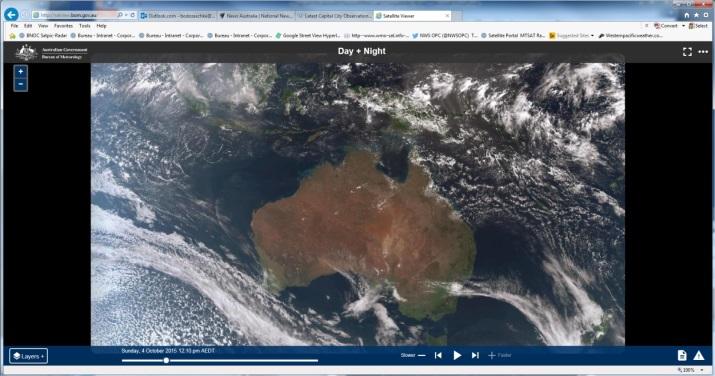
10 Exploring the Bureau's Himawari-8 Public Viewer

11 Himawari-8 Public Viewer full domain view Philippines Singapore Indonesia Fiji Australia New Zealand image courtesy BOM/JMA

12 Example: Various speeds of animation Low near Fiji, 17th October 2015 A: 2 slides per second C: 10 slides per second B: 5 slides per second D: 15 slides per second Question: which animation speed best shows the dynamics Question: what features can you recognise better under higher animation speeds?
13 Zehr enhanced IR channel 03UTC Southeast Asia smoke and storms, 19 th October 2015 Exercise 2: what does this rapid animation 10 minute data tell you about smoke evolution? True Colour RGB product 03UTC 07UTC What does it tell you about thunderstorm evolution? Images courtesy BOM/JMA 07UTC

14 Singapore, Malaysia and Indonesia smoke and storms, 19 th October 2015, 10 frames a second True Colour RGB product Animations courtesy BOM/JMA Zehr enhanced infrared channel


15 Zehr enhanced IR channel Southeast Asia smoke and storms, 19 th October some solutions Tracking of squall line True Colour RGB product 03UTC Evolution of storms Shear identified. Low level flow can be monitored 03UTC Area of smoke better defined 07UTC Smoke source and plume monitoring 07UTC Images courtesy BOM/JMA 07UTC
16 Exercise 3: Lets explore the Bureau's Himawari-8 Public Viewer "+" to zoom in click on image Start animation and speed this up "+"
 True Colour RGB (2km resolution) Temperature (C) Queensland storms 24")

17 Warrego Zehr enhanced IR (2km resolution) Roma Visible channel (0.5km resolution) True Colour RGB (2km resolution) Temperature (C) Queensland storms 24 th October minute data compared with RADAR Question: how is the satellite data an advantage over RADAR data? How is RADAR data an improvement over satellite data? animations courtesy BOM/JMA

 Reception time on")

 True")
18 Warrego Roma Queensland storms 24 th October minute data compared with RADAR Visible channel (0.5km resolution) Reception time on Forecaster screen ~0156UTC RADAR time stamp 0150UTC Himawari-8 time stamp 0140UTC. Zehr enhanced IR (2km resolution) True Colour RGB (2km resolution) Temperature (C) Images courtesy BOM/JMA


 True Colour RGB (2km")
19 Warrego Roma Queensland storms 24 th October minute data compared with RADAR Visible channel (0.5km resolution) Reception time on Forecaster screen ~0356UTC RADAR time stamp 0350UTC Himawari-8 time stamp 0340UTC. Zehr enhanced IR (2km resolution) True Colour RGB (2km resolution) Temperature (C) Images courtesy BOM/JMA
 Himawari-8")
 Himawari-8 enhanced IR (2km")


20 MTSAT-2 visible (1km resolution) MTSAT enhanced IR (4km resolution) Himawari-8 visible (0.5km resolution) Himawari-8 enhanced IR (2km resolution) Exercise 4: Northern NSW thunderstorms 28 th October 2015 Himawari-8 (0640UTC) compared to MTSAT (0632UTC) Question: how might the Himawari-8 data be an advantage here Brightness Temperature Scale images courtesy BOM/JMA
 1 2 3 4 July10th 2011 These files were provided")

21 Rapidly Developing Cumulus Areas convective cloud detection algorithm (JMA) July10th 2011 These files were provided by Himawari-6 (MTSAT-1R) Rapid Scan Observations. These were performed for the sake of aviation users. Japanese Meteorological Agency
22 Summary: Improvements to Storm monitoring using rapid scan, high-resolution Himawari-8 data Higher spatial resolution Higher temporal resolution Pre-Cb development Improved resolution of local mesoscale triggers (seabreeze fronts, local convergence lines) Cb severity identification an development Stormtop and overshooting top Brightness Temperatures (BT) can be more accurately determined with less "pixel averaging" in the high resolution satellite data. The satellite data will provide a clearer picture of storm top signatures such as overshooting tops, the "warm wake" or "enhanced V" (thermal couplet) that are often associated with severe storms. Other important implications More effective implementation of Derived Products such as the Cloud Top Cooling Product and the Automatic Overshooting Top Detection Algorithm. Pre-Cb development Permits better determination of the areas where convection may develop (eg. moist low level regions) Better detection and monitoring of Synoptic / Mesoscale triggers to convection (dry lines / seabreeze fronts, local convergence lines). It is possible to detect these features in the 10 minute satellite data before they are apparent in the radar signal. Better identification and monitoring of cumulus development that may transition into Cb (ie. clumping of cumulus and development of towering cumulus). It is possible to detect these features in the 10 minute satellite data before they are apparent in the radar signal. Rapid infrared-based cloud top cooling rates corresponding to developing Cb can be better monitored.
23 Summary: Improvements to Storm monitoring using rapid scan, high-resolution Himawari-8 data Higher temporal resolution Cb severity identification an development Easier and earlier discrimination between persisting and dissipating storms (pulse convection versus organised convection). Better monitoring of the movement and organisation of storms (eg. nearcontinuous monitoring of overshooting stormtops, splitting of supercells, organisation of storms into squall lines) Permits very short term forecasting of rapidly moving and potentially short lived convection (eg. monsoon squall lines). Better monitoring of steering flow by examining the movement of the storms in the high resolution imagery. Better monitoring of shear and its effect on the convective development. More readily able to detect rotation in Cb clouds. Better able to monitor storms associated with potentially intense rain rates (slow moving storms with persisting overshooting tops, train effect convection etc.) Secondary features Permits monitoring of the evolution of secondary features such as storm outflow boundaries and convection that may be generated by this. NWP cannot predict this yet. Other More effective implementation of Derived Products such as the Cloud Top Cooling Product and the Automatic Overshooting Top Detection Algorithm and other Cbalerting Algorithms.
24 Summary During this session the high temporal and spatial resolution Himawari-8 data has been introduced, with emphasis on Tropical Cyclones, Thunderstorms and Smoke detection and monitoring. A number of case studies and practical exercises were conducted. Findings from these exercises were related to the feedback from Australian Bureau of Meteorology Forecasters and other stakeholders who have used high resolution satellite data operationally. Useful resources and references have been presented.
RGB Experts and Developers Workshop 2017 Tokyo, Japan
 "Application of the Sandwich Product and variations to this as used by Australian Forecasters and as presented during training at the Australian VLab Centre of Excellence". RGB Experts and Developers Workshop
" The usefulness of RGB products: the perspective of the Australian Bureau of Meteorology "
 " The usefulness of RGB products: the perspective of the Australian Bureau of Meteorology " Presenter: Bodo Zeschke. Bureau of Meteorology Training Centre, Australian VLab Centre of Excellence Point of
Himawari-8 RGB product use and development amongst Australian / RAV / RAII stakeholders: the Australian VLab Centre of Excellence perspective
 Himawari-8 RGB product use and development amongst Australian / RAV / RAII stakeholders: the Australian VLab Centre of Excellence perspective EUMeTrain Event Week on MTG-I satellite 7-11 November 2016
A Review of the Australian VLab Centre of Excellence National Himawari-8 Training Campaign. AOMSUC-6 Conference Session
 A Review of the Australian VLab Centre of Excellence National Himawari-8 Training Campaign AOMSUC-6 Conference Session Bodo Zeschke Australian Bureau of Meteorology Training Centre Australian VLab Centre
RAV VLab Report Australian VLab Centre of Excellence
 RAV VLab Report Australian VLab Centre of Excellence VLMG-7 Meeting St. Petersburg, 21 25 July 2014 Bodo Zeschke Australian VLab Centre of Excellence Point of Contact Overview of Australian VLab Centre
RGB Products: an easy and practical way to display multispectral satellite data (in combination with derived products)
") RGB Products: an easy and practical way to display multispectral satellite data (in combination with derived products) Dr. Jochen Kerkmann Training Officer EUMETSAT Multi-channel GEO satellites today Him-08
RGB Products: an easy and practical way to display multispectral satellite data (in combination with derived products) Dr. Jochen Kerkmann Training Officer EUMETSAT Multi-channel GEO satellites today Him-08
Current status and plans of JMA operational wind product
 Current status and plans of JMA operational wind product Kazuki Shimoji Japan Meteorological Agency / Meteorological Satellite Center 3-235, Nakakiyoto, Kiyose, Tokyo, Japan Abstract The Meteorological
Aviation Hazards: Thunderstorms and Deep Convection
 Aviation Hazards: Thunderstorms and Deep Convection TREND Diagnosis of thunderstorm hazards using imagery Contents Satellite imagery Visible, infrared, water vapour Basic cloud identification Identifying
NOWCASTING PRODUCTS BASED ON MTSAT-1R RAPID SCAN OBSERVATION. In response to CGMS Action 38.33
 CGMS-39, JMA-WP-08 Prepared by JMA Agenda Item: G.II/8 Discussed in WG II NOWCASTING PRODUCTS BASED ON MTSAT-1R RAPID SCAN OBSERVATION In response to CGMS Action 38.33 This document reports on JMA s MTSAT-1R
Nowcasting of Severe Weather from Satellite Images (for Southern
 Nowcasting of Severe Weather from Satellite Images (for Southern Europe) Petra Mikuš Jurković Forecasting/ nowcasting of convective storms NWP models cannot well predict the exact location and intesity
Satellite-based Convection Nowcasting and Aviation Turbulence Applications
 Satellite-based Convection Nowcasting and Aviation Turbulence Applications Kristopher Bedka Cooperative Institute for Meteorological Satellite Studies (CIMSS), University of Wisconsin-Madison In collaboration
SH RI Events. Influence From Patterns Of Different Scale
 SH072014 RI Events Influence From Patterns Of Different Scale RI Explanation * Rapid intensification, approximately an increase of 2 Dvorak T-numbers or 30 knots in 24 hours, frequently occurs in JTWC
Benefits of the new-generation Himawari-8 geostationary satellite for the Asia-Pacific region. Toshihiko HASHIDA Japan Meteorological Agency (JMA)
") Benefits of the new-generation Himawari-8 geostationary satellite for the Asia-Pacific region Toshihiko HASHIDA Japan Meteorological Agency (JMA) Side Event Ensuring User Readiness to New-Generation Meteorological
Benefits of the new-generation Himawari-8 geostationary satellite for the Asia-Pacific region Toshihiko HASHIDA Japan Meteorological Agency (JMA) Side Event Ensuring User Readiness to New-Generation Meteorological
SATELLITE SIGNATURES ASSOCIATED WITH SIGNIFICANT CONVECTIVELY-INDUCED TURBULENCE EVENTS
 SATELLITE SIGNATURES ASSOCIATED WITH SIGNIFICANT CONVECTIVELY-INDUCED TURBULENCE EVENTS Kristopher Bedka 1, Wayne Feltz 1, John Mecikalski 2, Robert Sharman 3, Annelise Lenz 1, and Jordan Gerth 1 1 Cooperative
A Questionnaire on the Utilization of Satellite Data from the New Generation of Geostationary Meteorological Satellites
 3.1 User requirements for satellite data utilization, especially for new-generation satellites A Questionnaire on the Utilization of Satellite Data from the New Generation of Geostationary Meteorological
JMA s ATMOSPHERIC MOTION VECTORS In response to Action 40.22
 5 July 2013 Prepared by JMA Agenda Item: II/6 Discussed in WG II JMA s ATMOSPHERIC MOTION VECTORS In response to Action 40.22 This paper reports on the recent status of JMA's AMVs from MTSAT-2 and MTSAT-1R,
Country Report - Singapore
 Country Report - Singapore The 5th Meeting of the Coordinating Group Vladivostok city, Russky Island, Russia Far Eastern Federal University of the RA II WIGOS Satellite Project 21 October 2017 Outline
Improving real time observation and nowcasting RDT. E de Coning, M Gijben, B Maseko and L van Hemert Nowcasting and Very Short Range Forecasting
 Improving real time observation and nowcasting RDT E de Coning, M Gijben, B Maseko and L van Hemert Nowcasting and Very Short Range Forecasting Introduction Satellite Application Facilities (SAFs) are
TC intensity estimation using Satellite data at JMA
 SECOND INTERNATIONAL WORKSHOP ON SATELLITE ANALYSIS OF TROPICAL CYCLONES (IWSATC-II) TC intensity estimation using Satellite data at JMA Topics: 1) Estimation of TC central pressure using Microwave Sounder
JMA s atmospheric motion vectors
 Prepared by JMA Agenda Item: WG II/6 Discussed in WG II JMA s atmospheric motion vectors This paper reports on the recent status of JMA's Atmospheric Motion Vectors (AMVs) from MTSAT-2 and MTSAT-1R, and
UPDATE OF REGIONAL WEATHER AND SMOKE HAZE (February 2018)
") UPDATE OF REGIONAL WEATHER AND SMOKE HAZE (February 2018) 1. Review of Regional Weather Conditions for January 2018 1.1 The prevailing Northeast monsoon conditions over Southeast Asia strengthened in January
UPDATE OF REGIONAL WEATHER AND SMOKE HAZE (February 2018) 1. Review of Regional Weather Conditions for January 2018 1.1 The prevailing Northeast monsoon conditions over Southeast Asia strengthened in January
Using McIDAS-V for Satellite-Based Thunderstorm Research and Product Development
 Using McIDAS-V for Satellite-Based Thunderstorm Research and Product Development Kristopher Bedka UW-Madison, SSEC/CIMSS In Collaboration With: Tom Rink, Jessica Staude, Tom Whittaker, Wayne Feltz, and
4.1 New Generation Satellite Data and Nowcasting Products: Himawari
 4.1 New Generation Satellite Data and Nowcasting Products: Himawari SCOPE-Nowcasting-EP 18-20 September 2017 Koji Yamashita kobo.yamashita@met.kishou.go.jp Meteorological Satellite Center (MSC) Japan Meteorological
Rapidly Developing Cumulus Area RDCA detection using Himawari-8 data
 AOMSUC-7@Incheon Rapidly Developing Cumulus Area RDCA detection using Himawari-8 data Hiroshi SUZUE and Yasuhiko SUMIDA Meteorological Satellite Center Japan Meteorological Agency Contents Ø Outline of
The Relationship Between Cloud And Rain Cells And The Role Of The Environment In Convective Processes During CHUVA-GoAmazon2014/5
 The Relationship Between Cloud And Rain Cells And The Role Of The Environment In Convective Processes During CHUVA-GoAmazon2014/5 Cristiano W. Eichholz 1, Courtney Schumacher 2, Luiz A. T. Machado 1 1.
Tropical Cyclones. Objectives
 Tropical Cyclones FIU Undergraduate Hurricane Internship Lecture 2 8/8/2012 Objectives From this lecture you should understand: Global tracks of TCs and the seasons when they are most common General circulation
ESTIMATION OF THE SEA SURFACE WIND IN THE VICINITY OF TYPHOON USING HIMAWARI-8 LOW-LEVEL AMVS
 Proceedings for the 13 th International Winds Workshop 27 June - 1 July 2016, Monterey, California, USA ESTIMATION OF THE SEA SURFACE WIND IN THE VICINITY OF TYPHOON USING HIMAWARI-8 LOW-LEVEL AMVS Kenichi
1. History and Current Status
 Contents 1. History and Current Status History and Mission Image acquisition and Dissemination Products 2. Future Plan Schedule Mission of Himawari 8/9 Development of Products Data Dissemination 0 1. History
May 17, earthsciencechapter24.notebook. Apr 8 10:54 AM Review. Grade:9th. Subject:Earth Science. Date:4/8.
 Apr 8 10:54 AM 24.1 Review Grade:9th Subject:Earth Science Date:4/8 Apr 8 9:29 AM 1 1 As lower layers of air are warmed... A the air rises B winds form C the air dries D the air sinks Apr 8 9:49 AM 2 What
Detailed Cloud Motions from Satellite Imagery Taken at Thirty Second One and Three Minute Intervals
 Detailed Cloud Motions from Satellite Imagery Taken at Thirty Second One and Three Minute Intervals James F.W. Purdom NOAA/NESDIS/RAMM Branch CIRA Colorado State University W. Laporte Avenue Fort Collins,
Atmospheric Motions Derived From Space Based Measurements: A Look To The Near Future. James F.W. Purdom
 Atmospheric Motions Derived From Space Based Measurements: A Look To The Near Future James F.W. Purdom Director, Office of Research and Applications NOAA/NESDIS 1. Introduction This short note addresses
1. Open IDV. There is a desktop link, choose version 3.0u1 or 3.0u2. It can take a few minutes to open.
 Page 1 Objectives: Become familiar with using a software package (IDV) to view satellite images Understand the differences between Visible, IR, and Microwave Imagery Observe the influence of dry air and
SATELLITE MONITORING OF THE CONVECTIVE STORMS
 SATELLITE MONITORING OF THE CONVECTIVE STORMS FORECASTERS POINT OF VIEW Michaela Valachová, EUMETSAT Workshop at ECMWF User Meeting Reading, 13 June 2017 Central Forecasting Office, Prague michaela.valachova@chmi.cz
The development and evolution of deep convection and heavy rainfall
 The development and evolution of deep convection and heavy rainfall Unique in spectra, space and time The spatial and temporal domains of the phenomena being investigated drive the satellite s spectral
Day Microphysics RGB Nephanalysis in daytime. Meteorological Satellite Center, JMA
 Day Microphysics RGB Nephanalysis in daytime Meteorological Satellite Center, JMA What s Day Microphysics RGB? R : B04 (N1 0.86) Range : 0~100 [%] Gamma : 1.0 G : B07(I4 3.9) (Solar component) Range :
How to display RGB imagery by SATAID
 How to display RGB imagery by SATAID Akihiro SHIMIZU Meteorological Satellite Center (MSC), Japan Meteorological Agency (JMA) Ver. 2015110500 RGB imagery on SATAID SATAID software has a function of overlapping
Scale Interactions during the Formation of Typhoon Irving 边建谱 ELIZABETH A. RITCHIE GREG J. HOLLAND
 Scale Interactions during the Formation of Typhoon Irving 边建谱 ELIZABETH A. RITCHIE GREG J. HOLLAND Pre-research Fujiwhara: laboratory experiments in water (1921, 1923, 1931). Cloud clusters are a well-known
MSGVIEW: AN OPERATIONAL AND TRAINING TOOL TO PROCESS, ANALYZE AND VISUALIZATION OF MSG SEVIRI DATA
 MSGVIEW: AN OPERATIONAL AND TRAINING TOOL TO PROCESS, ANALYZE AND VISUALIZATION OF MSG SEVIRI DATA Aydın Gürol Ertürk Turkish State Meteorological Service, Remote Sensing Division, CC 401, Kalaba Ankara,
(April 7, 2010, Wednesday) Tropical Storms & Hurricanes Part 2
 Tropical Storms & Hurricanes Part 2") Lecture #17 (April 7, 2010, Wednesday) Tropical Storms & Hurricanes Part 2 Hurricane Katrina August 2005 All tropical cyclone tracks (1945-2006). Hurricane Formation While moving westward, tropical disturbances
Lecture #17 (April 7, 2010, Wednesday) Tropical Storms & Hurricanes Part 2 Hurricane Katrina August 2005 All tropical cyclone tracks (1945-2006). Hurricane Formation While moving westward, tropical disturbances
RECENT ADVANCES IN THE GENERATION AND ASSIMILATION OF HIGH SPATIAL AND TEMPORAL RESOLUTION SATELLITE WINDS
 RECENT ADVANCES IN THE GENERATION AND ASSIMILATION OF HIGH SPATIAL AND TEMPORAL RESOLUTION SATELLITE WINDS J. Le Marshall 1, N. Pescod 1, R. Seecamp 1, A. Rea 2, C. Tingwell 1, G. Ellis 2 and Hao Shi 3
UPDATE OF REGIONAL WEATHER AND SMOKE HAZE (December 2017)
") UPDATE OF REGIONAL WEATHER AND SMOKE HAZE (December 2017) 1. Review of Regional Weather Conditions for November 2017 1.1 In November 2017, Southeast Asia experienced inter-monsoon conditions in the first
UPDATE OF REGIONAL WEATHER AND SMOKE HAZE (December 2017) 1. Review of Regional Weather Conditions for November 2017 1.1 In November 2017, Southeast Asia experienced inter-monsoon conditions in the first
NOAA/NESDIS Tropical Web Page with LEO Satellite Products and Applications for Forecasters
 NOAA/NESDIS Tropical Web Page with LEO Satellite Products and Applications for Forecasters Sheldon Kusselson National Oceanic and Atmospheric Administration (NOAA) National Environmental Satellite Data
Remote Sensing Seminar 8 June 2007 Benevento, Italy. Lab 5 SEVIRI and MODIS Clouds and Fires
 Remote Sensing Seminar 8 June 2007 Benevento, Italy Lab 5 SEVIRI and MODIS Clouds and Fires Table: SEVIRI Channel Number, Wavelength (µm), and Primary Application Reflective Bands 1,2 0.635, 0.81 land/cld
Rapidly Developing Thunderstorm (RDT)
") Rapidly Developing Thunderstorm (RDT) Jean-Marc Moisselin, Frédéric Autones Météo-France Nowcasting Department 42, av. Gaspard Coriolis 31057 Toulouse France jean-marc.moisselin@meteo.fr EUMETRAIN Convection
Rapidly Developing Thunderstorm (RDT) Jean-Marc Moisselin, Frédéric Autones Météo-France Nowcasting Department 42, av. Gaspard Coriolis 31057 Toulouse France jean-marc.moisselin@meteo.fr EUMETRAIN Convection
Strategic Radar Enhancement Project (SREP) Forecast Demonstration Project (FDP) The future is here and now
 Forecast Demonstration Project (FDP) The future is here and now") Strategic Radar Enhancement Project (SREP) Forecast Demonstration Project (FDP) The future is here and now Michael Berechree National Manager Aviation Weather Services Australian Bureau of Meteorology
Strategic Radar Enhancement Project (SREP) Forecast Demonstration Project (FDP) The future is here and now Michael Berechree National Manager Aviation Weather Services Australian Bureau of Meteorology
CURRENT STATUS OF OPERATIONAL WIND PRODUCT IN JMA/MSC
 Proceedings for the 13 th International Winds Workshop 27 June - 1 July 2016, Monterey, California, USA CURRENT STATUS OF OPERATIONAL WIND PRODUCT IN JMA/MSC Kazuki Shimoji and Kenichi Nonaka JMA/MSC,
Recommendations from RA III/RA IV SDR -2 Training Task Team (SDR-TTT)
") WORLD METEOROLOGICAL ORGANIZATION COORDINATION GROUP ON SATELLITE DATA REQUIREMENTS FOR REGION III AND IV Recommendations from RA III/RA IV SDR -2 Training Task Team (SDR-TTT) KATHY-ANN CAESAR CARIBBEAN
WORLD METEOROLOGICAL ORGANIZATION COORDINATION GROUP ON SATELLITE DATA REQUIREMENTS FOR REGION III AND IV Recommendations from RA III/RA IV SDR -2 Training Task Team (SDR-TTT) KATHY-ANN CAESAR CARIBBEAN
Recent Advances in the Processing, Targeting and Data Assimilation Applications of Satellite-Derived Atmospheric Motion Vectors (AMVs)
") Recent Advances in the Processing, Targeting and Data Assimilation Applications of Satellite-Derived Atmospheric Motion Vectors (AMVs) Howard Berger and Chris Velden Cooperative Institute for Meteorological
Recent Advances in the Processing, Targeting and Data Assimilation Applications of Satellite-Derived Atmospheric Motion Vectors (AMVs) Howard Berger and Chris Velden Cooperative Institute for Meteorological
Observing system experiments of MTSAT-2 Rapid Scan Atmospheric Motion Vector for T-PARC 2008 using the JMA operational NWP system
 Tenth International Winds Workshop 1 Observing system experiments of MTSAT-2 Rapid Scan Atmospheric Motion Vector for T-PARC 2008 using the JMA operational NWP system Koji Yamashita Japan Meteorological
Assimilation of Himawari-8 data into JMA s NWP systems
 Assimilation of Himawari-8 data into JMA s NWP systems Masahiro Kazumori, Koji Yamashita and Yuki Honda Numerical Prediction Division, Japan Meteorological Agency 1. Introduction The new-generation Himawari-8
Remote Sensing in Meteorology: Satellites and Radar. AT 351 Lab 10 April 2, Remote Sensing
 Remote Sensing in Meteorology: Satellites and Radar AT 351 Lab 10 April 2, 2008 Remote Sensing Remote sensing is gathering information about something without being in physical contact with it typically
Weather and Climate Basics
 Weather and Climate Basics Laura Boekel Forecaster at Bureau of Meteorology Aims of this presentation To describe what I do as a forecaster at the Bureau of Meteorology To provide an interesting introduction
RECENT ADVANCES TO EXPERIMENTAL GMS ATMOSPHERIC MOTION VECTOR PROCESSING SYSTEM AT MSC/JMA
 RECENT ADVANCES TO EXPERIMENTAL GMS ATMOSPHERIC MOTION VECTOR PROCESSING SYSTEM AT MSC/JMA Ryoji Kumabe 1, Yoshiki Kajino 1 and Masami Tokuno 2 1 Meteorological Satellite Center, Japan Meteorological Agency
An overview of Wet Season Forecasting in the Northern Territory
 TWP-ICE Meeting November 2004 An overview of Wet Season Forecasting in the Northern Territory Lori Chappel Northern Territory Regional Forecasting Centre Australian Government Bureau of Meteorology Day
For the operational forecaster one important precondition for the diagnosis and prediction of
 Initiation of Deep Moist Convection at WV-Boundaries Vienna, Austria For the operational forecaster one important precondition for the diagnosis and prediction of convective activity is the availability
MSG FOR NOWCASTING - EXPERIENCES OVER SOUTHERN AFRICA
 MSG FOR NOWCASTING - EXPERIENCES OVER SOUTHERN AFRICA Estelle de Coning and Marianne König South African Weather Service, Private Bag X097, Pretoria 0001, South Africa EUMETSAT, Am Kavalleriesand 31, D-64295
Application of Satellite analysis in tropical cyclone of CMA
 2 nd International Workshop On Satellite Analysis of Tropical Cyclones (IWSATC-2) Satellite TC Analysis in Operations: Changes since IWSATC-1 17 February 2016 Honolulu, Hawaii, USA Application of Satellite
STATUS OF JAPANESE METEOROLOGICAL SATELLITES AND RECENT ACTIVITIES OF MSC
 STATUS OF JAPANESE METEOROLOGICAL SATELLITES AND RECENT ACTIVITIES OF MSC Daisaku Uesawa Meteorological Satellite Center, Japan Meteorological Agency Abstract MTSAT-1R is the current operational Japanese
FUTURE PLAN AND RECENT ACTIVITIES FOR THE JAPANESE FOLLOW-ON GEOSTATIONARY METEOROLOGICAL SATELLITE HIMAWARI-8/9
 FUTURE PLAN AND RECENT ACTIVITIES FOR THE JAPANESE FOLLOW-ON GEOSTATIONARY METEOROLOGICAL SATELLITE HIMAWARI-8/9 Toshiyuki Kurino Japan Meteorological Agency, 1-3-4 Otemachi Chiyodaku, Tokyo 100-8122,
BMKG UPDATES ON SATELLITE-RELATED ACTIVITIES IN RA V
 UPDATES ON SATELLITE-RELATED ACTIVITIES IN RA V Riris Adriyanto (BMKG Indonesia / Member RA V TT-SU) With inputs from : Agnes Lane (Australian BoM / Leader RA V TT-SU) 1 Introduction Throughout these years,
UPDATE OF REGIONAL WEATHER AND SMOKE HAZE (May 2017)
") UPDATE OF REGIONAL WEATHER AND SMOKE HAZE (May 2017) 1. Review of Regional Weather Conditions in April 2017 1.1 Inter monsoon conditions, characterised by afternoon showers and winds that are generally
UPDATE OF REGIONAL WEATHER AND SMOKE HAZE (May 2017) 1. Review of Regional Weather Conditions in April 2017 1.1 Inter monsoon conditions, characterised by afternoon showers and winds that are generally
Introduction to Meteorology & Climate. Climate & Earth System Science. Atmosphere Ocean Interactions. A: Structure of the Ocean.
 Climate & Earth System Science Introduction to Meteorology & Climate MAPH 10050 Peter Lynch Peter Lynch Meteorology & Climate Centre School of Mathematical Sciences University College Dublin Meteorology
FORMATION OF AIR MASSES
 Chapter 24: Weather (air mass, fronts, Weather instruments, and forecasting the weather) Name: Period: Due Date: Air Mass Use the terms from the following list to complete the sentences below. Each term
Ash RGB Detection of Volcanic Ash
 Copyright, JMA RGB Detection of Volcanic Meteorological Satellite Center, JMA Ver. 20150424 Volcanic Detection by Infrared and Difference Image, and Basis Himawari-8 B15-B13 2015-02-16 06:35 UTC Himawari-8
The October 2015 Supercell Storm in Israel
 The October 2015 Supercell Storm in Israel Alissa Razy, Elyakom Vadislavsky, Anat Baharad, Noam Halfon, Itsik Carmona, Yoav Levi, Amit Savir Introduction A high-impact weather event associated with severe
Weather and Climate Basics
 Aims of this presentation Weather and Climate Basics To describe what I do as a forecaster at the Bureau of Meteorology Laura Boekel Forecaster at Bureau of Meteorology To provide an interesting introduction
Operational Generation And Assimilation Of Himawari-8. Atmospheric Motion Vectors
 Operational Generation And Assimilation Of Himawari-8 Atmospheric Motion Vectors John Le Marshall 1, David Howard 1, Xingbao Wang 1, Yi Xiao 1, Jim Jung 2, Jaime Daniels 4,Steve Wanzong 2, Joan Fernon
McIDAS Activities Within The NASA Langley Research Center Clouds And Radiation Group
 McIDAS Activities Within The NASA Langley Research Center Clouds And Radiation Group Kristopher Bedka Science Systems and Applications Inc @ NASA LaRC In Collaboration With (in alphabetical order) J. K.
Joint RA II/V Workshop on WIGOS for DRR - The Jakarta Declaration - (12-14 October, Jakarta, Indonesia) NMSC/KMA
 NMSC/KMA") Joint RA II/V Workshop on WIGOS for DRR - The Jakarta Declaration - (12-14 October, Jakarta, Indonesia) /KMA dolong@korea.kr Background Enhancement of Member s capabilities for weather forecasts and warnings
Joint RA II/V Workshop on WIGOS for DRR - The Jakarta Declaration - (12-14 October, Jakarta, Indonesia) /KMA dolong@korea.kr Background Enhancement of Member s capabilities for weather forecasts and warnings
Inter-comparison MTSAT-2 & Himawari-8
 Inter-comparison MTSAT-2 & Himawari-8 WMO Volcanic Ash Advisory Centre Best Practice Workshop 2017 Tokyo Volcanic Ash Advisory Centre Japan Meteorological Agency Outline Introduction Method Case study
Comparative Study of Dvorak Analysis in the western North Pacific. Naohisa Koide and Shuji Nishimura Forecast Division, Japan Meteorological Agency
 Comparative Study of Dvorak Analysis in the western North Pacific Naohisa Koide and Shuji Nishimura Forecast Division, Japan Meteorological Agency 1. Introduction The United Nations Economic and Social
Air Mass Thunderstorms. Air Mass Thunderstorms. Air Mass Thunderstorms. Lecture 26 Air Mass Thunderstorms and Lightning
 Lecture 26 and Lightning Life Cycle Environment Climatology Lightning 1 2 Short-lived, isolated thunderstorms that are not severe are often called air-mass thunderstorms. There are three stages describing
Aviation Hazards: Thunderstorms and Deep Convection
 Aviation Hazards: Thunderstorms and Deep Convection TREND Empirical thunderstorm forecasting techniques Contents Necessary conditions for convection: Instability Low-level moisture Trigger mechanism Forecasting
Tool for Storm Analysis Using Multiple Data Sets
 Tool for Storm Analysis Using Multiple Data Sets Robert M. Rabin 1,2 and Tom Whittaker 2 1 NOAA/National Severe Storms Laboratory, Norman OK 73069, USA 2 Cooperative Institute for Meteorological Satellite
AVIATION APPLICATIONS OF A NEW GENERATION OF MESOSCALE NUMERICAL WEATHER PREDICTION SYSTEM OF THE HONG KONG OBSERVATORY
 P452 AVIATION APPLICATIONS OF A NEW GENERATION OF MESOSCALE NUMERICAL WEATHER PREDICTION SYSTEM OF THE HONG KONG OBSERVATORY Wai-Kin WONG *1, P.W. Chan 1 and Ivan C.K. Ng 2 1 Hong Kong Observatory, Hong
PAGASA s Expectations of New-generation Satellites for Hazard Monitoring
 Country Report Philippines PAGASA s Expectations of New-generation Satellites for Hazard Monitoring VICENTE P. PALCON, JR. (Assistant Weather Services Chief) Weather Division- PAGASA DOST Email: vppalconjr@pagasa.dost.gov.ph
Atmospheric Motion Vectors (AMVs) and their forecasting significance
 and their forecasting significance") Atmospheric Motion Vectors (AMVs) and their forecasting significance Vijay Garg M.M. College, Modi Nagar, Ghaziabad, Uttar Pradesh R.K. Giri Meteorological Center India Meteorological Department, Patna-14
Atmospheric Motion Vectors (AMVs) and their forecasting significance Vijay Garg M.M. College, Modi Nagar, Ghaziabad, Uttar Pradesh R.K. Giri Meteorological Center India Meteorological Department, Patna-14
UPDATE OF REGIONAL WEATHER AND SMOKE HAZE (September 2017)
") UPDATE OF REGIONAL WEATHER AND SMOKE HAZE (September 2017) 1. Review of Regional Weather Conditions in August 2017 1.1 Southwest Monsoon conditions continued to prevail in the region in August 2017. The
UPDATE OF REGIONAL WEATHER AND SMOKE HAZE (September 2017) 1. Review of Regional Weather Conditions in August 2017 1.1 Southwest Monsoon conditions continued to prevail in the region in August 2017. The
Current Details from the Joint Typhoon Warning Center
 Current Details from the Joint Warning Center COORDINATES: 19.6 north, 125.5 east (previous location: 17.9 north, 130.3 east) LOCATION: 737 kilometers (458 miles) southeast of Taipei, Taiwan MOVEMENT:
Himawari-8 True Color RGB
 Himawari-8 True Color RGB Meteorological Satellite Center, JMA Ver. 20150519 What s True Color RGB? R : B03(VS 0.64) G : B02(V2 0.51) 2015-03-17 00UTC B : B01(V1 0.46) Components of True Color RGB Channel
b. The boundary between two different air masses is called a.
 NAME Earth Science Weather WebQuest Part 1. Air Masses 1. Find out what an air mass is. http://okfirst.mesonet.org/train/meteorology/airmasses.html a. What is an air mass? An air mass is b. The boundary
A Tropical Cyclone with a Very Large Eye
 JANUARY 1999 PICTURES OF THE MONTH 137 A Tropical Cyclone with a Very Large Eye MARK A. LANDER University of Guam, Mangilao, Guam 9 September 1997 and 2 March 1998 1. Introduction The well-defined eye
AN OBSERVING SYSTEM EXPERIMENT OF MTSAT RAPID SCAN AMV USING JMA MESO-SCALE OPERATIONAL NWP SYSTEM
 AN OBSERVING SYSTEM EXPERIMENT OF MTSAT RAPID SCAN AMV USING JMA MESO-SCALE OPERATIONAL NWP SYSTEM Koji Yamashita Japan Meteorological Agency / Numerical Prediction Division 1-3-4, Otemachi, Chiyoda-ku,
Tornadogenesis in Supercells: The Three Main Ingredients. Ted Funk
 Tornadogenesis in Supercells: The Three Main Ingredients Ted Funk NWS Louisville, KY Spring 2002 Environmental Parameters Supercells occur within environments exhibiting several wellknown characteristics
Introduction of JMA VLab Support Site on RGB Composite Imagery and tentative RGBs
 The Sixth Asia/Oceania Meteorological Satellite Users' Conference 9 13 November 2015, Tokyo/Japan J M A Introduction of JMA VLab Support Site on RGB Composite Imagery and tentative RGBs Akihiro SHIMIZU
Preparation for Himawari 8
 Preparation for Himawari 8 Japan Meteorological Agency Meteorological Satellite Center Hidehiko MURATA ET SUP 8, WMO HQ, Geneva, 14 17 April 2014 1/18 Introduction Background The Japan Meteorological Agency
STATISTICAL ANALYSIS ON SEVERE CONVECTIVE WEATHER COMBINING SATELLITE, CONVENTIONAL OBSERVATION AND NCEP DATA
 12.12 STATISTICAL ANALYSIS ON SEVERE CONVECTIVE WEATHER COMBINING SATELLITE, CONVENTIONAL OBSERVATION AND NCEP DATA Zhu Yaping, Cheng Zhoujie, Liu Jianwen, Li Yaodong Institute of Aviation Meteorology
Overview of Himawari-8/9
 Overview of Himawari-8/9 Toshiyuki SAKURAI Meteorological Satellite Center (MSC) Japan Meteorological Agency (JMA) EUMeTrain Event Week on MTG-I Satellite 2016 Session2 - Himawari-8 and Data Applications
Science Olympiad Meteorology Quiz #1 Page 1 of 7
 1) What is generally true about the stratosphere: a) Has turbulent updrafts and downdrafts. b) Has either a stable or increasing temperature profile with altitude. c) Where the auroras occur. d) Both a)
Current Status of COMS AMV in NMSC/KMA
 Current Status of COMS AMV in NMSC/KMA Eunha Sohn, Sung-Rae Chung, Jong-Seo Park Satellite Analysis Division, NMSC/KMA soneh0431@korea.kr COMS AMV of KMA/NMSC has been produced hourly since April 1, 2011.
REPORT ON THE ACTIVITIES OF THE EUMETSAT-ESSL CONVECTION WORKING GROUP
 REPORT ON THE ACTIVITIES OF THE EUMETSAT-ESSL CONVECTION WORKING GROUP Marianne König EUMETSAT, Eumetsat Allee 1, 64295 Darmstadt, Germany Abstract The focus of the Convection Working Group is to have
STATUS AND DEVELOPMENT OF SATELLITE WIND MONITORING BY THE NWP SAF
 STATUS AND DEVELOPMENT OF SATELLITE WIND MONITORING BY THE NWP SAF Mary Forsythe (1), Antonio Garcia-Mendez (2), Howard Berger (1,3), Bryan Conway (4), Sarah Watkin (1) (1) Met Office, Fitzroy Road, Exeter,
Microwave-TC intensity estimation. Ryo Oyama Meteorological Research Institute Japan Meteorological Agency
 Microwave-TC intensity estimation Ryo Oyama Meteorological Research Institute Japan Meteorological Agency Contents 1. Introduction 2. Estimation of TC Maximum Sustained Wind (MSW) using TRMM Microwave
A new look at statistical evaluations of cloud seeding experiments WMA Meeting 9-12 April 2013 San Antonio, Texas
 A new look at statistical evaluations of cloud seeding experiments WMA Meeting 9-12 April 2013 San Antonio, Texas Roelof Bruintjes, Dan Breed, Mike Dixon, Sarah Tessendorf, Courtney Weeks, DuncanAxisa,
Module 11: Meteorology Topic 5 Content: Weather Maps Notes
 Introduction A variety of weather maps are produced by the National Weather Service and National Oceanographic Atmospheric Administration. These maps are used to help meteorologists accurately predict
P3.17 THE DEVELOPMENT OF MULTIPLE LOW-LEVEL MESOCYCLONES WITHIN A SUPERCELL. Joshua M. Boustead *1 NOAA/NWS Weather Forecast Office, Topeka, KS
 P3.17 THE DEVELOPMENT OF MULTIPLE LOW-LEVEL MESOCYCLONES WITHIN A SUPERCELL Joshua M. Boustead *1 NOAA/NWS Weather Forecast Office, Topeka, KS Philip N. Schumacher NOAA/NWS Weather Forecaster Office, Sioux
Figure 1. Idealized global atmospheric circulation (C = surface convergence, D = surface divergence).
.") page - Laboratory Exercise #8 - Introduction to Atmospheric Science: Global Circulation and Weather Makers Section A - Global Atmospheric Circulation: To understand weather you need to understand how the
page - Laboratory Exercise #8 - Introduction to Atmospheric Science: Global Circulation and Weather Makers Section A - Global Atmospheric Circulation: To understand weather you need to understand how the
1 of 7 Thunderstorm Notes by Paul Sirvatka College of DuPage Meteorology. Thunderstorms
 1 of 7 Thunderstorm Notes by Paul Sirvatka College of DuPage Meteorology Thunderstorms There are three types of thunderstorms: single-cell (or air mass) multicell (cluster or squall line) supercell Although
JMA Contribution to SWFDDP in RA-V
 JMA Contribution to SWFDDP in RA-V Yoshihiko TAHARA (Mr.) Japan Meteorological Agency (JMA) y-tahara@met.kishou.go.jp Meeting of the Regional Subproject Management Team (RSMT) of the Severe Weather Forecasting
Ki-Hong Min 1*, Seonhee Choo 2, and Gyuwon Lee 1, and Kyung-Eak Kim 1,3
 Ki-Hong Min 1*, Seonhee Choo 2, and Gyuwon Lee 1, and Kyung-Eak Kim 1,3 1 School of Earth System Sciences, Major in Atmospheric Science, Kyungpook National University, Daegu, South Korea 2 Forecast Technology