PHYSICAL GEOGRAPHY. By Brett Lucas
|
|
|
- Erika Douglas
- 6 years ago
- Views:
Transcription


1 PHYSICAL GEOGRAPHY By Brett Lucas
2 CLIMATIC ZONES AND TYPES
3 Climatic Zones and Types Climatic Classification & Climographs Tropical Humid Climates (Zone A) Dry Climates (Zone B) Mild Midlatitude Climates (Zone C) Severe Midlatitude Climates (Zone D) Polar Climates (Zone E) Highland Climate (Zone H)
4 Climate Classification Classification Schemes Ancient Greek System Köppen System / Modified Köppen System Climographs


5 Ancient Greek Classification 5 Basic Climate Zones

6 Climate Regions

7 Modified Köppen System Wladimir Koppen ( ) was a Russian born German who came up with this system in He was a climatologist and amateur botanist. That is why his classification follows vegetation types, in addition to temperatures and precipitation. There are 5 major classes which are broken down further. This modified version shows an H group, added later by an American climatologist.
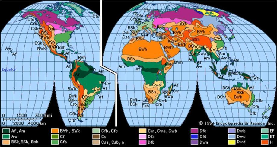
8 Köppen Categories

9 Hypothetical Koppen What the Koppen classification would look like if there was only one super continent

10 Climographs A simple graph showing average monthly temp and precipitation for a specific weather station / location (usually a city). It is also used to classify climate, as you will see in the labs. It consists of a line graph for temp and bar graphs for precipitation (one for each month).
11 Tropical Climates (A)

12 Tropical Climates (A)

13 Tropical Climates (A)
14 Tropical Humid Climates (Zone A) Zone A is the wettest, found around the equator, and close to the ITCZ. The only truly winterless region of the world. These areas are always warm, however, they are not the hottest places on earth. They are classified into 3, based on annual rainfall. Tropical Wet (Af) rain averages over 2.5 per month; 80 degrees F, average temp. Seasonless; smallest annual temp range.
15 Tropical Humid Climates (Zone A) Tropical Monsoon (Am) distinct dry season; monthly rain is below 2.5, but very rainy wet season, when it s much higher (e.g. India). Tropical Savanna (Aw) longer dry season of 3-6 months, and prominent (but not extraordinary) wet season. E.g. large part of Africa, including Nigeria

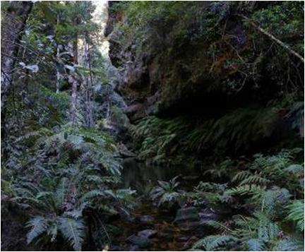
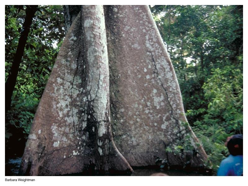
16 Tropical Rainforest (Af) High rainfall all year (>2 / month) Warm every month Precipitation exceeds evaporation. Straddles Equator by 5 o - 10 o

17 Tropical Rainforest (Af)
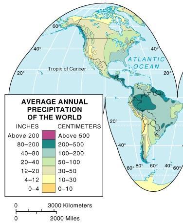
18 PRECIPITATION

19 Tropical Monsoon
 has an extended dry season during")
20 Savanna (Aw) Tropical Grassland Climates The tropical wet and dry or savanna (Aw) has an extended dry season during winter

21 Tropical Savanna
22 Savanna (Aw) Region/Distribution Subequatorial Africa, and South America, Southern India (25 N and S Latitude) Vegetation Continuous cover of grasses, scattered trees or shrubs Other Susceptible to desertification


23 Savanna (Aw) Acacia and Wildebeest Serengeti Plain, Tanzania Masai Reserve, Kenya

24 Tropical Savanna and the ITC The ITCZ moves during the year based on the seasons. And the AW climate in particular coincides with these 2 boundaries.
25 Dry/Semiarid Climates (B)
")
26 Dry/Semiarid Climates (B)
")
27 Dry/Semiarid Climates (B)
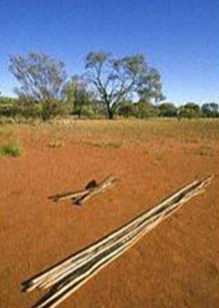
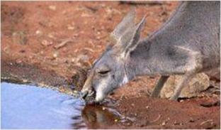
28 Dry Climates (Zone B) Zone B is the driest, and covers 30% of the planet, more area than any other zone. They are caused by the STHs (see next slide), which produce high pressure, persistent stability, forcing air to stay close to the ground.
29 Dry Climates (Zone B) The main difference btw deserts and steppes is that deserts are arid (dry); less than 10 per year, while steppes are semi-arid, i.e., receiving btw per yr (see climographs on next slides). So most deserts are surrounded by steppes. The diurnal difference in temps can be VERY large in the B zone. Subtropical Desert (BWh) Subtropical Steppe (BSh) boundary Midlatitude Desert (BWk) Midlatitude Steppe (BSk) boundary
30 Influence of Subtropical Highs STHs coincide with all the world s major deserts. Although some deserts (like the U.S.) are caused by the orographic effect.

31 Influence of Subtropical Highs There are even marine deserts, close to the oceans! The ocean s moisture has no effect, the high pressure anticyclonic activity overrides it. And most of those are cool currents anyway. The Sahara and Arabian Desert cover more than all deserts combined.

32 Dry Climates (Zone B)
33 Deserts (BW) Temperature: Widest range: up to 100 o F/day! Hot at low latitudes, wide variation at higher latitudes
34 Deserts (BW) Precipitation: Scarce: <10 inches/year Unreliable: wide variation from average Intense: convective downpours Desert Causation: High Pressure Cells and resultant stability Rainshadows
: dry")
35 Deserts (BW): dry

36 Steppe (BS): temperate grasslands More precipitation than BW Narrower temperature ranges Grasslands
37
 It rains here")
.")
38 Subtropical Desert and Steppe (BW) It rains here occasionally. Above is a desert (Namib). Picture on right is steppe.
 It rains or snows here")
.")
39 Midlatitude Desert and Steppe (BS) It rains or snows here occasionally. Above is a desert (Arizona). Right is steppe (Montana).
40 Mild Mid-latitude Climates (C)

41 Mild Mid-latitude Climates (C)

42 Mild Mid-latitude Climates (C) Mediterranean Coastal Sage Scrubland Channel Islands N.P., California
43 Mild Midlatitude Climates (Zone C) Found 30 to 60 degrees N & S. Here, winters are short and mild, summer are hot and long. Divided into 3 based on precipitation and summer temps Mediterranean (Csa, Csb) Humid Subtropical (Cfa, Cwa, Cwb) Marine West Coast (Cfb, Cfc)

44 Mediterranean (Csa, Csb) They have much milder summers and winters than other sub-categories in Zone C. Found on the western side of continents. Av. annual precip is 15 (close to equator) and 25 (close to poles).
45
. Av.")
46 Humid Subtropical (Cfa, Cwa, Cwb) Found on the eastern side of continents, and more extensive. Humidity is higher, so the temps feel higher (e.g. Kentucky). Esp. in the Cfa, days are sultry, with little or no relief at night. Mild winters, but occasional cold waves causing severe conditions (e.g. ice). Av. annual precip is or more.

47 Marine West Coast (Cfb, Cfc) Mostly on the west side of continents; influenced by westerlies year round. They don t have extreme temps, but have high humidity & precip.
48 Microthermal Climates (D)
 Only found in Northern")
49 Severe Midlatitude Climates (Zone D) Only found in Northern Hemisphere

50 Severe Midlatitude Climates (Zone D)
51 Severe Midlatitude Climates (Zone D) Occurs mainly in the northern hemisphere, because s/hemisphere has limited land masses at those same latitudes (i.e. btw 40 to 70 degrees S). In this region, continentality is the key word. It means being remote from the oceans. Land masses here are broader than anywhere else. As a result, there are broad annual temp fluctuations, i.e. ranges Divided into 2 based on temps: Humid Continental (Dfa, Dfb, Dwa, Dwb) Subarctic (Dfc, Dfd, Dwc, Dwd)
52 Humid Continental Long, warm summers. E.g. Nebraska, New York, and many New England states. Annual precip is btw (highest on the coast and decrease inland). Dominated by westerly winds, so the east coasts are still cold (blows wind from overland).


53 Humid Continental Usually 1 to 5 months below freezing. Winter temps rapidly decrease northward. Snow can cover the ground for 2-3 weeks in the southern margin, and up to 8 months in the northern margin!
54 Subarctic Found btw 50 and 70 degrees North; none in the southern hemisphere. The Needle leaf forest is called the Boreal region in Canada and Taiga in Russia.

55 Subarctic Winters are long, dark and bitterly cold. For 6 to 7 months, the average temp is below freezing. Coldest months have averages below -36 degrees F. Records are - 90 degrees F in Siberia and -82 degrees F in Alaska. Only Antarctica & Greenland are colder than the Subarctic.
56 Subarctic Av. Summer temps are upper 50s and 60s, but occasional frosts can occur in any month. Summer is short; winter is dominant. Note the extreme height of temp graph; this area has the highest annual temp ranges in the world. You can have a diff of 80 degrees btw highest & lowest, and sometimes even 100 degrees.

57 Subarctic Low precip 5 to 20 per yr (highest in coastal areas). A lot of anticyclonic activity. Still enough to support a Taiga forest. Only 2-3 feet of snow in the winter, but if it snows in October, it could be on the ground until May! This creates a continuous layer of snow on the ground, even though not much is received.
58 Polar Climates (E)

59 Polar Climates (E) - all months < 50 o F


60 Polar Climates (E) - all months < 50 o F
61 Polar Climates (Zone E) Caused by low insolation and oblique solar angle. No month has an av. higher than 50 degrees F. Areas of everlasting cold, and extraordinarily dry (high pressure, no uplift). See pg 239, Fig Distinguished based on summer temps: Tundra (ET) Ice Cap (EF)

 and the E (Polar) climates.")
62 Tundra Tundra has at least one month when av. temp is above freezing; the ice cap does not. The treeline is found at the equatorward boundary of the Tundra, where the av. Summer temp is 50 degrees F. It is also the boundary btw the D (Severe Mid-Lat) and the E (Polar) climates. This is the poleward limit of trees the last time you see trees, and Koppen noticed that.
63 Tundra Interestingly, even though winters are bitterly cold, they are not as severe as they are in the subarctic, even though Tundras are higher up in latitude. This is because of continentality in the subarctic. The temp ranges are also not as high as in the subarctic (D climate). Long, dark cold winters and brief cool summers. 1-4 months yr, av. temps are above freezing. Tundra receives little precip, when parts of it are located by the ocean (air is too cold to hold moisture, absolute humidity always low). Anticyclonic activity; no uplift. Annual precip total is less than 10.

64 Ice Cap Note the scales of the temp graphs! mostly negative #s. That station in Greenland is actually colder! Ice cap is the most severe of earth s climates. Restricted to Greenland & Antarctica, comprising 9% of the earth s land. All months are below freezing. Perpetual frost; absolutely no vegetation. Permanent cover of snow/ice.
65 Ice Cap The cold is even worse because Greenland & Antarctica are both located on plateaus. In some locations, the warmest months are 0 degrees F. Winter is usually btw -30 degrees F and -60 degrees F degrees F have been recorded in the interior Antarctic stations. They are Polar Deserts receiving less than 5 per year (previous graphs). Also, strong surface temp inversions exist most of the time because the air above the ice is very chilled. So it cannot lift. In addition, heavy, cold katabatic winds flow downslope in an anticyclonic fashion, creating strong winds and blowing snow that you see on TV (e.g. March of the Penguins).
, pressure (decreases with height), precipitation (increases with height, and the orographic effect), etc.")
66 Highland Climate Koppen did not recognize this as a separate category, but other climatologists have. Elements affected by highlands include temperature (av. lapse rate), pressure (decreases with height), precipitation (increases with height, and the orographic effect), etc. In highland areas, altitude is more impt than latitude.
Climate Classification Chapter 7
 Climate Classification Chapter 7 Climate Systems Earth is extremely diverse No two places exactly the same Similarities between places allow grouping into regions Climates influence ecosystems Why do we
Earth s Climates. Understanding Weather and Climate. Chapter 15 Lecture. Seventh Edition
 Chapter 15 Lecture Understanding Weather and Climate Seventh Edition Earth s Climates Frode Stordal, University of Oslo Redina L. Herman Western Illinois University Climate and Controlling Factors Climate
Climate Classification
 Chapter 15: World Climates The Atmosphere: An Introduction to Meteorology, 12 th Lutgens Tarbuck Lectures by: Heather Gallacher, Cleveland State University Climate Classification Köppen classification:
Mediterranean Climates (Csa, Csb)
") Climatic Zones & Types Part II I've lived in good climate, and it bores the hell out of me. I like weather rather than climate. 1 John Steinbeck Mediterranean Climates (Csa, Csb) Main locations Western
Climatic Zones & Types Part II I've lived in good climate, and it bores the hell out of me. I like weather rather than climate. 1 John Steinbeck Mediterranean Climates (Csa, Csb) Main locations Western
Our climate system is based on the location of hot and cold air mass regions and the atmospheric circulation created by trade winds and westerlies.
 CLIMATE REGIONS Have you ever wondered why one area of the world is a desert, another a grassland, and another a rainforest? Or have you wondered why are there different types of forests and deserts with
Tropical Moist Rainforest
 Tropical or Lowlatitude Climates: Controlled by equatorial tropical air masses Tropical Moist Rainforest Rainfall is heavy in all months - more than 250 cm. (100 in.). Common temperatures of 27 C (80 F)
Elements of weather and climate Temperature Range of temperature Seasonal temperature pattern Rainfall
 Climate Earth Science Chapter 20 Pages 560-573 Elements of weather and climate Temperature Range of temperature Seasonal temperature pattern Rainfall Overall rainfall Seasonal distribution of rainfall
WHAT CAN MAPS TELL US ABOUT THE GEOGRAPHY OF ANCIENT GREECE? MAP TYPE 1: CLIMATE MAPS
 WHAT CAN MAPS TELL US ABOUT THE GEOGRAPHY OF ANCIENT GREECE? MAP TYPE 1: CLIMATE MAPS MAP TYPE 2: PHYSICAL AND/OR TOPOGRAPHICAL MAPS MAP TYPE 3: POLITICAL MAPS TYPE 4: RESOURCE & TRADE MAPS Descriptions
Keys to Climate Climate Classification Low Latitude Climates Midlatitude Climates High Latitude Climates Highland Climates Our Changing Climate
 Climate Global Climates Keys to Climate Climate Classification Low Latitude Climates Midlatitude Climates High Latitude Climates Highland Climates Our Changing Climate Keys to Climate Climate the average
Climate Chapter 19. Earth Science, 10e. Stan Hatfield and Ken Pinzke Southwestern Illinois College
 Climate Chapter 19 Earth Science, 10e Stan Hatfield and Ken Pinzke Southwestern Illinois College The climate system A. Climate is an aggregate of weather B. Involves the exchanges of energy and moisture
GEOGRAPHY 1114 LABORATORY EXAM Points possible LAB TIME/DAY 2 points per question CHOOSE THE BEST ANSWER IT SHOULD BE BEST BY FAR
 GEOGRAPHY 1114 LABORATORY EXAM 1 Spring 2011 NAME TEACHING ASSISTANT 50 Points possible LAB TIME/DAY 2 points per question CHOOSE THE BEST ANSWER IT SHOULD BE BEST BY FAR ANSWER ALL QUESTIONS IN PENCIL
Energy Systems, Structures and Processes Essential Standard: Analyze patterns of global climate change over time Learning Objective: Differentiate
 Energy Systems, Structures and Processes Essential Standard: Analyze patterns of global climate change over time Learning Objective: Differentiate between weather and climate Global Climate Focus Question
Climate. Earth Science Chapter 20 Pages
 Academic Excellence Showcase Thursday, May 27 Two points credit for each talk you attend in Earth science 8:30 to 10:30 AM, in NS 101 General Science video productions: Energy 9:00 to 11:00 AM, in NS 218
The Global Scope of Climate. The Global Scope of Climate. Keys to Climate. Chapter 8
 The Global Scope of Climate Chapter 8 The Global Scope of Climate In its most general sense, climate is the average weather of a region, but except where conditions change very little during the course
ENVIRONMENTAL STRUCTURE AND FUNCTION: CLIMATE SYSTEM Vol. I - Objective Empiric Classifications of Earth s Climate - E.I.
 OBJECTIVE EMPIRIC CLASSIFICATIONS OF EARTH S CLIMATE E.I.Khlebnikova Main Geophysical Observatory, St.Petersburg, Russia Keywords: actual evapotranspiration, aridity index, evapotranspiration, humidity
Prentice Hall EARTH SCIENCE
 Prentice Hall EARTH SCIENCE Tarbuck Lutgens Chapter 21 Climate 21.1 Factors That Affect Climate Factors That Affect Climate Latitude As latitude increases, the intensity of solar energy decreases. The
GLOBAL CLIMATES FOCUS
 which you will learn more about in Chapter 6. Refer to the climate map and chart on pages 28-29 as you read the rest of this chapter. FOCUS GLOBAL CLIMATES What are the major influences on climate? Where
Lecture Outlines PowerPoint. Chapter 20 Earth Science 11e Tarbuck/Lutgens
 Lecture Outlines PowerPoint Chapter 20 Earth Science 11e Tarbuck/Lutgens 2006 Pearson Prentice Hall This work is protected by United States copyright laws and is provided solely for the use of instructors
World Geography Chapter 3
 World Geography Chapter 3 Section 1 A. Introduction a. Weather b. Climate c. Both weather and climate are influenced by i. direct sunlight. ii. iii. iv. the features of the earth s surface. B. The Greenhouse
forest tropical jungle swamp marsh prairie savanna pampas Different Ecosystems (rainforest)
") Different Ecosystems forest A region of land that is covered with many trees and shrubs. tropical jungle (rainforest) swamp A region with dense trees and a variety of plant life. It has a tropical climate.
Different Ecosystems forest A region of land that is covered with many trees and shrubs. tropical jungle (rainforest) swamp A region with dense trees and a variety of plant life. It has a tropical climate.
16 Global Climate. Learning Goals. Summary. After studying this chapter, students should be able to:
 16 Global Climate Learning Goals After studying this chapter, students should be able to: 1. associate the world s six major vegetation biomes to climate (pp. 406 408); 2. describe methods for classifying
Prentice Hall EARTH SCIENCE
 Prentice Hall EARTH SCIENCE Tarbuck Lutgens Chapter 21 Climate 21.1 Factors That Affect Climate Factors That Affect Climate Latitude As latitude increases, the intensity of solar energy decreases. The
All objects emit radiation. Radiation Energy that travels in the form of waves Waves release energy when absorbed by an object. Earth s energy budget
 Radiation Energy that travels in the form of waves Waves release energy when absorbed by an object Example: Sunlight warms your face without necessarily heating the air Shorter waves carry more energy
Factors That Affect Climate
 Factors That Affect Climate Factors That Affect Climate Latitude As latitude (horizontal lines) increases, the intensity of solar energy decreases. The tropical zone is between the tropic of Cancer and
Physical Geography Lab Activity #16
 Physical Geography Lab Activity #16 Due date Name California Climate Classification COR Objective 6, SLO 3 16.1. Introduction One of the most important factors in the physical geography of a place is its
Chapter 3 Section 3 World Climate Regions In-Depth Resources: Unit 1
 Guided Reading A. Determining Cause and Effect Use the organizer below to show the two most important causes of climate. 1. 2. Climate B. Making Comparisons Use the chart below to compare the different
CLIMATE DEFINED CLIMATE INFLUENCES STUDYING CLIMATE R E M I N D E R S. PART II: People and their 10/19/2018
 R E M I N D E R S Two required essays are due by Oct. 30, 2018. (A third may be used for extra credit in place of a Think Geographically essay.) ESSAY TOPIS (choose any two): ontributions of a noted geographer,
Bell Work. REVIEW: Our Planet Earth Page 29 Document A & B Questions
 9.12.16 Bell Work REVIEW: Our Planet Earth Page 29 Document A & B Questions Intro to Climate & Weather https://www.youtube.com/watch?v=vhgyoa70q7y Weather vs. Climate Video Climate & Weather 3.1 Weather
PART II. Physical Landscape Chapters 2 5 CLIMATE CLIMATE STUDYING CLIMATE R E M I N D E R S. PART II: People and their Physical Environment 10/26/2017
 R E M I N D E R S Two required essays are due by Nov. 13, 2017. (A third may be used for extra credit in place of a Think Geographically essay.) ESSAY TOPIS (choose any two): ontributions of a noted geographer,
CLIMATE CLIMATE STUDYING CLIMATE. PART II: People and their 3/20/2018. GEOG 101 Part II People and their Physical Environment R E M I N D E R S
 Two required essays are due by March 27, 2018. (A third may be used for extra credit in place of a Think Geographically essay.) ESSAY TOPIS (choose any two): ontributions of a noted geographer, earth scientist
Module 11: Meteorology Topic 3 Content: Climate Zones Notes
 Introduction Latitude is such an important climate factor that you can make generalizations about a location's climate based on its latitude. Areas near the equator or the low latitudes are generally hot
LAB J - WORLD CLIMATE ZONES
 Introduction LAB J - WORLD CLIMATE ZONES The objective of this lab is to familiarize the student with the various climates around the world and the climate controls that influence these climates. Students
Climate Classification Coded within Last 100 years developed by Vladimir Koppen
 Part II Climates: Climate is the average of weather over a twenty to thirty year period, - 1.Temperature: by month/year and threshold temperature -2.Rainfall: by month/year and threshold amounts -3.Soil-environmentitenverature/moisture
World geography 3200/3202 Unit 2 review
 World geography 3200/3202 Unit 2 review 1. Does this statement use the terms revolve & rotate correctly? "Saturn revolves on its axis while several moons rotate around it." 2. Does this statement use the
World Climates. Say Thanks to the Authors Click (No sign in required)
") World Climates Say Thanks to the Authors Click http://www.ck12.org/saythanks (No sign in required) To access a customizable version of this book, as well as other interactive content, visit www.ck12.org
World Climates Say Thanks to the Authors Click http://www.ck12.org/saythanks (No sign in required) To access a customizable version of this book, as well as other interactive content, visit www.ck12.org
Regional Climatology. Lab Number Two (10pts) Climatic Classification and Polar Climates
 Climatic Classification and Polar Climates") Name: Time of Class: Due Date: Regional Climatology Lab Number Two (10pts) Climatic Classification and Polar Climates Part I: Group Discussion and Answer Directions: Arrange a group of three individuals.
Name: Time of Class: Due Date: Regional Climatology Lab Number Two (10pts) Climatic Classification and Polar Climates Part I: Group Discussion and Answer Directions: Arrange a group of three individuals.
The following terms are some of the vocabulary that students should be familiar with in order to fully master this lesson.
 Lesson 501: LIMATE A location's climate is determined by the long-term pattern of temperature and precipitation. limate affects many aspects of our lives and cultures. Fundamental Questions Attempting
Meteorology. Chapter 15 Worksheet 1
 Chapter 15 Worksheet 1 Meteorology Name: Circle the letter that corresponds to the correct answer 1) The Tropic of Cancer and the Arctic Circle are examples of locations determined by: a) measuring systems.
Biosphere Organization
 Biosphere Organization What is a biome? Biomes refer to a large region or area characterized by the following: 1. A particular climate pattern of the annual temperature and precipitation distribution,
Average temperature ( F) World Climate Zones. very cold all year with permanent ice and snow. very cold winters, cold summers, and little rain or snow
 World Climate Zones. very cold all year with permanent ice and snow. very cold winters, cold summers, and little rain or snow") P r e v i e w Look carefully at the climagraph of Mumbai, India. What is the wettest month (or months) in Mumbai? What is the driest month (or months) in Mumbai? What effects might this city s climate
P r e v i e w Look carefully at the climagraph of Mumbai, India. What is the wettest month (or months) in Mumbai? What is the driest month (or months) in Mumbai? What effects might this city s climate
CH. 3: Climate and Vegetation
 CH. 3: Climate and Vegetation GROUP WORK RUBRIC Score of 50 (5): Superior - 100% A 5 is superior work, and has completed all requirements of the assignments, it is in order and its presentation is almost
What is Climate? Understanding and predicting climatic changes are the basic goals of climatology.
 What is Climate? Understanding and predicting climatic changes are the basic goals of climatology. Climatology is the study of Earth s climate and the factors that affect past, present, and future climatic
CLIMATE DEFINED. PART II: People and their Physical Environment R E M I N D E R S 3/12/19
 R E M I N D E R S v Two required essays are due by April 9, 2019. Ø A third may be used for extra credit in place of a Think Geographically essay. ESSAY TOPICS (choose any two): Contributions of a noted
Biomes There are 2 types: Terrestrial Biomes (on land) Aquatic Biomes (in the water)
 Aquatic Biomes (in the water)") Biomes There are 2 types: Terrestrial Biomes (on land) Aquatic Biomes (in the water) Terrestrial Biomes Grassland, Desert, and Tundra Biomes: Savanna Temperate grassland Chaparral Desert Tundra Chapter
Biomes There are 2 types: Terrestrial Biomes (on land) Aquatic Biomes (in the water) Terrestrial Biomes Grassland, Desert, and Tundra Biomes: Savanna Temperate grassland Chaparral Desert Tundra Chapter
1 What Is Climate? TAKE A LOOK 2. Explain Why do areas near the equator tend to have high temperatures?
 CHAPTER 17 1 What Is Climate? SECTION Climate BEFORE YOU READ After you read this section, you should be able to answer these questions: What is climate? What factors affect climate? How do climates differ
Climate: long term average weather. Use climograph to display climate data. Climograph
 March 27, 2014: Introduction to climate. If you have not yet taken Exam 1 or Exam 2, please email me to set up a time to take a makeup. All makeup exams should be completed before taking Exam 3. Climate:
Physical Features of Monsoon Asia. 192 Unit 7 Teachers Curriculum Institute 60 N 130 E 140 E 150 E 60 E 50 N 160 E 40 N 30 N 150 E.
 50 N 60 E 70 E 80 E 90 E 100 E 60 N 110 E 120 E 130 E 140 E 150 E 50 N 160 E 40 N 40 N 30 N 60 E 30 N 150 E Tropic of Cancer 20 N Tropic of Cancer 20 N 10 N 10 N 0 Equator 0 Equator 10 S 10 S 0 500 1,000
Name Period Date. Analyzing Climographs
 Name Period Date Analyzing Climographs Climographs: It is often helpful to plot two different types of data on the same graph. For example, a climograph is a single graph that charts both the average temperature
Thursday, November 3, 2016.
 Hunter College-CUNY GEOG 101 Atlas Extra Credit for Exam II The extra credit exercises associated with each third of the course are worth a maximum of 5 points added to your exam score at the end of each
Tropical Climates Zone
 Tropical Climates Zone RAIN FOREST CENTRAL AFRICA, SOUTH AMERICA (AMAZON), CENTRAL AMERICA, S.E. ASIA HUMID/WARM ANNUAL RAINFALL 200 CM TYPE #1: TROPICAL DESERT N. AFRICA (SAHARA) & S.W. ASIA < 25 CM
1 What Is Climate? TAKE A LOOK 2. Explain Why do areas near the equator tend to have high temperatures?
 CHAPTER 17 1 What Is Climate? SECTION Climate BEFORE YOU READ After you read this section, you should be able to answer these questions: What is climate? What factors affect climate? How do climates differ
Adopt a Drifter Lesson Plan by Mary Cook, Middle School Science Teacher, Ahlf Jr. High School, Searcy, Arkansas
 Adopt a Drifter Lesson Plan by Mary Cook, Middle School Science Teacher, Ahlf Jr. High School, Searcy, Arkansas Do Ocean Surface Currents Influence Climate? Objectives Students will construct climographs
ATMO 436a. The General Circulation. Redacted version from my NATS lectures because Wallace and Hobbs virtually ignores it
 ATMO 436a The General Circulation Redacted version from my NATS lectures because Wallace and Hobbs virtually ignores it Scales of Atmospheric Motion vs. Lifespan The general circulation Atmospheric oscillations
1 What Is Climate? TAKE A LOOK 2. Explain Why do areas near the equator tend to have high temperatures?
 CHAPTER 3 1 What Is Climate? SECTION Climate BEFORE YOU READ After you read this section, you should be able to answer these questions: What is climate? What factors affect climate? How do climates differ
Objectives. Vocabulary. Describe different types of climate data. Recognize limits associated with the use of normals. Explain why climates vary.
 Climate Objectives Describe different types of climate data. Recognize limits associated with the use of normals. Explain why climates vary. Vocabulary climatology climate normal tropics temperate zone
Weather and Climate Power Point
 Weather and Climate Power Point Atmospheric Composition Our air is made up of: 78% Nitrogen 21% Oxygen 0-4% Water Vapor 0.93% Argon.038% Carbon Dioxide 0.01% Trace Gases (Carbon dioxide has increased from
Name Date Class. well as the inland, found near the Tropics. 4. In the, or the regions near the Equator, you may find a lush
 WATER, CLIMATE, AND VEGETATION Vocabulary Activity DIRECTIONS: Fill in the Blanks Select a term from below to complete each of the following sentences. CHAPTER 1. The constant movement of water, a process
What is a Biome? An Overview of Biomes. The Holdridge Life Zones. Tundra 9/14/2010. In the following slides, you ll
 An Overview of Biomes What is a Biome? A biome describes a habitat type Biomes are primarily described by average temperature, annual precipitation, length of growing season, and dominant vegetation type
Köppen Climate Classification
 Köppen Climate Classification Introduction The Köppen Climate Classification System is the most widely used system for classifying the world's climates. Its categories are based on the annual and monthly
Earth s Climate Patterns
 Earth s Climate Patterns Reading: Chapter 17, GSF 10/2/09 Also Jackson (linked on course web site) 1 What aspects of climate affect plant distributions? Climate: long-term distribution of weather in an
WORLD CLIMATE AND CLIMATE CHANGE
 CHAPTER WORLD CLIMATE AND CLIMATE CHANGE T he world climate can be studied by organising information and data on climate and synthesising them in smaller units for easy understanding, description and analysis.
Unit 2 Outcome Notes. Nightly cloud cover reduces the range of temperature from day to night.
 1 Unit 2 Outcome Notes C.O. 2.1 2.6 Cloud Cover Affects Daily & Nightly Temperatures Nightly cloud cover reduces the range of temperature from day to night. o Clouds reflect heat waves; o heat below clouds
Climate and Biomes. Adapted by T.Brunetto from: Developed by Steven Taylor Wichmanowski based in part on Pearson Environmental Science by Jay Withgott
 Climate and Biomes Adapted by T.Brunetto from: Developed by Steven Taylor Wichmanowski based in part on Pearson Environmental Science by Jay Withgott Remember that an ecosystem consists of all the biotic
Wind: Global Systems Chapter 10
 Wind: Global Systems Chapter 10 General Circulation of the Atmosphere General circulation of the atmosphere describes average wind patterns and is useful for understanding climate Over the earth, incoming
Agronomy 406 World Climates
 Agronomy 406 World Climates March 1, 2018 A world tour of climates, including extremes (finish). Team 1 Climate News next Thursday, March 8 Review: Kottek et al. (2006): World map of the Köppen-Geiger
Overview. 1 - Previous Eras 2 - Africa's current climate
 Marine Science Lesson Enhancements based on Grade 11 & 12 curriculum in Physics, Chemistry & Biology Climate African climate Ocean Explorer Module 6 Copyright 2017 Climate part 2 Page! 1 of! 13 Overview
Climate Regions. Combining Climate Graphs and Köppen s Classification
 Lab 15 Climate Regions Combining knowledge of the global patterns behind the major climatic controls, this lab will teach students how to construct climate graphs and then allow them to explore patterns
3 Temperate and Polar Zones
 CHAPTER 3 3 Temperate and Polar Zones SECTION Climate BEFORE YOU READ After you read this section, you should be able to answer these questions: What biomes are found in the temperate zone? What biomes
Unit 2. United States Physical Geography
 Unit 2 United States Physical Geography Physical Geography U.S. extends from the Atlantic to Pacific U.S. is the 3rd largest country U.S. has fertile soils, vast forests, and variety of minerals All major
Thursday, November 2, 2017.
 Hunter College-CUNY GEOG 101 Atlas Extra Credit for Exam II The extra credit exercises associated with each third of the course are worth a maximum of 5 points added to your exam score at the end of each
Climate. Fact sheet 16 World climates. National Meteorological Library and Archive
 Climate Fact sheet 16 World climates National Meteorological Library and Archive The National Meteorological Library and Archive Many people have an interest in the weather and the processes that cause
Lesson 3 Latitude is Everything
 Latitude is Everything Essential Question: How does latitude affect the Amount of Solar Energy an Area Receives and that Area s Climate? Objective: Students will be able to explain how the sun s energy
CORE CONCEPTS WEATHER AND CLIMATE
 CORE CONCEPTS WEATHER AND CLIMATE Key Prior Knowledge (from the 5 th Grade Matter and Energy Units) Thermal energy can be transported through radiation, conduction, and convection. The transfer of enough
What factors affect climate? Dr. Michael J Passow
 What factors affect climate? Dr. Michael J Passow Energy from the Sun (mostly light and heat) radiates to Earth SUN 150 x 10 6 km (92 x 10 6 mi) EARTH Challenge: If the speed of light is 300,000 km/sec,
Seasons, Global Wind and Climate Study Guide
 Seasons, Global Wind and Climate Study Guide Seasons 1. Know what is responsible for the change in seasons on Earth. 2. Be able to determine seasons in the northern and southern hemispheres given the position
Desertification : loss of productive potential due to human activity. Can happen in A climates as well as in arid climates
 W, S,, m, 60 m 30 0 30 60 What do these all have in common? Small group question: What leaf shape/shedding habit do you expect to find in each of these and why? Tropical Monsoon (m) Found primarily along
L.O Students will learn about factors that influences the environment
 Name L.O Students will learn about factors that influences the environment Date 1. At the present time, glaciers occur mostly in areas of A) high latitude or high altitude B) low latitude or low altitude
IR-20: Weather/Climate Venn Diagram. Weather Climate Region 4 Education Service Center Geography by Design, Volume 1
 IR-20: Weather/Climate Venn Diagram Weather Climate 2013 Region 4 Education Service Center Geography by Design, Volume 1 IR-21: Climate Scenario Cards Scenario 1: You are on vacation at a location on the
Global Biogeography. Natural Vegetation. Structure and Life-Forms of Plants. Terrestrial Ecosystems-The Biomes
 Global Biogeography Natural Vegetation Structure and Life-Forms of Plants Terrestrial Ecosystems-The Biomes Natural Vegetation natural vegetation is the plant cover that develops with little or no human
Climates of NYS. Definitions. Climate Regions of NYS. Storm Tracks. Climate Controls 10/13/2011. Characteristics of NYS s Climates
 Definitions Climates of NYS Prof. Anthony Grande 2011 Weather and Climate Weather the state of the atmosphere at one point in time. The elements of weather are temperature, air pressure, wind and moisture.
Weather Atmospheric condition in one place during a limited period of time Climate Weather patterns that an area typically experiences over a long
 Weather Atmospheric condition in one place during a limited period of time Climate Weather patterns that an area typically experiences over a long period of time Many factors influence weather & climate
UNIT 3. World Ecosystems
 UNIT 3 World Ecosystems Description and Review World Geography 3202 World Ecosystems Climax Vegetation Climax Vegetation is the natural vegetation in the last possible stage of vegetation development.
EKOLOGI BIOMA (BIOME) TEMA 10. Program Studi Tadris Biologi Fakultas Tarbiyah dan Ilmu Keguruan Institut Agama Islam Negeri Jember
 TEMA 10. Program Studi Tadris Biologi Fakultas Tarbiyah dan Ilmu Keguruan Institut Agama Islam Negeri Jember") EKOLOGI TEMA 10 BIOMA (BIOME) Program Studi Tadris Biologi Fakultas Tarbiyah dan Ilmu Keguruan Institut Agama Islam Negeri Jember What is difference of this picture????? Why are they different????? Have
EKOLOGI TEMA 10 BIOMA (BIOME) Program Studi Tadris Biologi Fakultas Tarbiyah dan Ilmu Keguruan Institut Agama Islam Negeri Jember What is difference of this picture????? Why are they different????? Have
Understanding Weather and Climate
 Understanding Weather and Climate Edward Aguado San Diego State University James E. Burt University of Wisconsin-Madison Prentice Hall Upper Saddle River, NJ 07458 Contents Preface xiv Parti Energy and
Weather Atmospheric condition in one place during a limited period of time Climate Weather patterns that an area typically experiences over a long
 Weather Atmospheric condition in one place during a limited period of time Climate Weather patterns that an area typically experiences over a long period of time Many factors influence weather & climate
Defining Climate. Section
 Section 1 1.1 SC.9.E.7.1: Analyze the movement of matter and energy through the different biogeochemical cycles, including water and carbon. SC.9.E.7.3: Differentiate and describe the various interactions
How does the physical environment influence communities and ecosystems? Hoodoos in Cappadocia, Turkey
 Biomes of the World How does the physical environment influence communities and ecosystems? Hoodoos in Cappadocia, Turkey ecosystems are shaped by: abiotic factors climate/weather space Rainfall Soil air
Lecture #14 March 29, 2010, Monday. Air Masses & Fronts
 Lecture #14 March 29, 2010, Monday Air Masses & Fronts General definitions air masses source regions fronts Air masses formation types Fronts formation types Air Masses General Definitions a large body
Social Studies. Chapter 2 Canada s Physical Landscape
 Social Studies Chapter 2 Canada s Physical Landscape Introduction Canada s geography its landforms and climate - has a great impact on Canadians sense of identity. Planet Earth The earth is divided into
remain on the trees all year long) Example: Beaverlodge, Alberta, Canada
 Example: Beaverlodge, Alberta, Canada") Coniferous Forest Temperature: -40 C to 20 C, average summer temperature is 10 C Precipitation: 300 to 900 millimeters of rain per year Vegetation: Coniferous-evergreen trees (trees that produce cones
Coniferous Forest Temperature: -40 C to 20 C, average summer temperature is 10 C Precipitation: 300 to 900 millimeters of rain per year Vegetation: Coniferous-evergreen trees (trees that produce cones
Tuesday, April 26, Chapters 9, 10 & 15 Weather & Climate
 Tuesday, April 26, 2011 Chapters 9, 10 & 15 Weather & Climate Chapter 9: Weather Patterns Polar Front Theory (1800s) Mid-latitude Cyclone Low pressure system Mid-latitudes 600+ miles in size Fronts Boundary
General Circulation. Nili Harnik DEES, Lamont-Doherty Earth Observatory
 General Circulation Nili Harnik DEES, Lamont-Doherty Earth Observatory nili@ldeo.columbia.edu Latitudinal Radiation Imbalance The annual mean, averaged around latitude circles, of the balance between the
Chapter 7: Circulation of the Atmosphere
 Weather & Climate Spring 2011 Study Guide for Exam 3 Page 1 of 9 Chapter 7: Circulation of the Atmosphere Scales of Atmospheric Motion Large and Small Scale Circulation, All winds are highly integrated
WEATHER AND CLIMATE MODULE - 4. Weather and Climate. Notes
 13 WEATHER AND CLIMATE In the preceding three lessons, we have discussed about the temperature, atmospheric pressure, winds and precipitation. These elements of weather have an important effect on our
BIOMES. Definition of a Biome. Terrestrial referring to land. Climatically controlled sets of ecosystems. Characterized by distinct vegetation
 BIOMES An Introduction to the Biomes of the World Definition of a Biome Terrestrial referring to land Climatically controlled sets of ecosystems Characterized by distinct vegetation 1 In a Biome There
Definitions Weather and Climate Climates of NYS Weather Climate 2012 Characteristics of Climate Regions of NYS NYS s Climates 1.
 Definitions Climates of NYS Prof. Anthony Grande 2012 Weather and Climate Weather the state of the atmosphere at one point in time. The elements of weather are temperature, t air pressure, wind and moisture.
Population, Landscape And Climate Estimates (PLACE)
") National Aggregates of Geospatial Data Collection: Population, Landscape And Climate Estimates (PLACE) June, 2003 Socioeconomic Data and Applications Center (SEDAC) Center for International Earth Science
National Aggregates of Geospatial Data Collection: Population, Landscape And Climate Estimates (PLACE) June, 2003 Socioeconomic Data and Applications Center (SEDAC) Center for International Earth Science
General Atmospheric Circulation
 General Atmospheric Circulation Take away Concepts and Ideas Global circulation: The mean meridional (N-S) circulation Trade winds and westerlies The Jet Stream Earth s climate zones Monsoonal climate
Chapter 3: Study Guide
 Chapter 3: Study Guide Multiple Choice 1. Places located in high latitudes have a. a very warm climate. b. the same weather as places in other latitudes. c. a mix of extremely hot and extremely cold weather.
Climates of Earth. Lesson Outline LESSON 1. A. What is climate? 1. is the long-term average weather conditions that occur in a particular region.
 Lesson Outline LESSON 1 A. What is climate? 1. is the long-term average weather conditions that occur in a particular region. 2. Climate depends on how average weather conditions throughout the year. B.