Displayed with permission The American Surveyor July/August Copyright 2007 Cheves Media
|
|
|
- Amberlynn Arnold
- 6 years ago
- Views:
Transcription
1
2

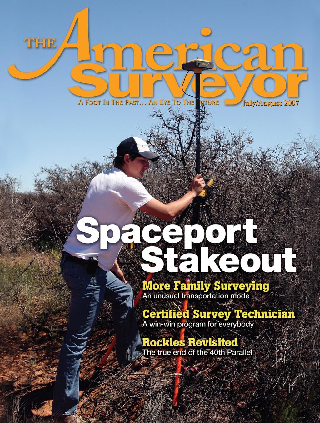
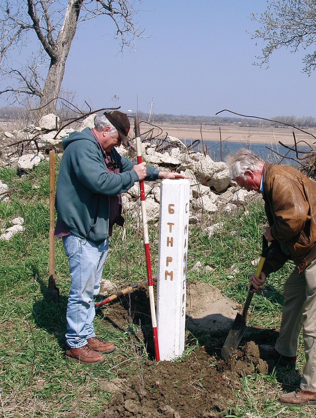
3 Nebraska Deputy State Surveyor Gene A. Thomsen (left) and Cedar County Surveyor LaVern Schroeder finish setting the terminus monument into place, while Nebraska NGS Advisor Jim Richardson looks on. End of the Line Monumenting the Northern Terminus of the Sixth Principal Meridian he northern terminus of one of the most important north-south survey lines in the central part of the United States had remained unmonumented for 150 years. Since the establishment of a temporary wood post in a mound on July 22, 1857, by U. S. Deputy Surveyor Charles A. Manners, the end point of the meridian has been changing daily. Manners instructions, issued by Surveyor General John Calhoun, were to intersect the Sixth Principal Meridian with the existing water s edge of the Missouri River a position that could be marked by a one-time distance on paper, but one that could not be legally held as a fixed boundary point. From the Initial Point on the Base Line at 40 North Latitude between the territories of Kansas and Nebraska, Manners traveled 197 miles, 19 chains, and 20 links to where he reached the water s edge of the southerly shore of the Missouri River and duly recorded in his notes: Water s edge on the right shore of the Missouri River bearing east and west. As no meander corner of a permanent character could be established at this point or nearer it than the witness corner to sections 1, 6, 7, and 12, I set a Post in Mound (regarding it as temporary) to mark said intersection >> Jerry Penry, LS


4 On top of the new monument is a Berntsen brass disk bearing the date that the original terminus was established. The shifting south bank has taken its toll on the once mighty cottonwood trees that now lay in the water north of the terminus monument. Yankton, South Dakota is seen in the background. Manners monument was a symbolic reference preserved by a measurement that was likely soon washed away after he turned his back to return south. The Missouri in the late 1850s was still in control of its own daily schedule, often meandering from place to place without interference or confinement. Early travelers often mused that the unruly river could never be tamed and generally slept in a different bed every night. During his approach to the river, Manners noted that the historic south high bluffs were 2.15 miles south of the water s edge. It was evident that the river channel locations varied since the land from the foot of the bluffs to the monument he placed on the water s edge was described as being a low, marshy bottom prairie, interspersed with young willows, barren sand bars, subject to inundation, and being wholly unfit for cultivation. A 10" diameter cottonwood tree on the meridian was marked by Manners in 1857 for a witness tree ' south of a post on a river sand bar that he set for the NE Corner of Section 12, T33N, R1E. This same tree was 50' south of the recorded high water bank or 2,043' south of the edge of water. The following year Manners returned to survey the subdivisions in the area and noted the cottonwood tree as now being a meander corner and did not note anything further north on the meridian toward the river. County Surveyor Andrew McNeal located a 20" cottonwood tree both in 1875 and 1877 which he described as the original witness corner and used it for the northern end of the east line of Section 12. Twenty years later in 1895, McNeal defined the location of the bank when he meandered the Nebraska side of the Missouri River. The witness tree originally established by Manners was now noted as just being evident by the remaining roots, and the river bank was located 1,072.5' north of where Manners had noted its location in The physical nature of the river bank was likely a low shelf that consisted of loose sand easily moved to a new area when yearly floods shifted it to a new location. Many travelers had already come through the area including the expedition of Lewis & Clark 53 years earlier, so it was certainly not a foreign area to the Native Americans or to the white man.

5 Once a swampy low area subject to river inundation, the area south of the river is now prime agricultural land. The 6th Principal Meridian is at right. (GLO Plat of 1857). Manners establishment of the Sixth Principal Meridian would, however, hasten the development of the land that could then be legally bought and sold. The nearest establishment, Yankton, soon emerged as a prominent river city just one mile upstream from the meridian along the north shore and became the Dakota Territorial Capital in River boats from St. Louis made the arduous travel upstream despite having to traverse around sunken trees known as snags that could disable or sink the vessel of an unsuspecting driver/sailor in a matter of minutes. The ever-changing landscape along the Missouri River has made the northern end of the Sixth Principal Meridian one of continued change due to accretion, avulsion, and reliction. The early decisions of the Court in Nebraska have been quite clear and consistent that the riparian owners own to the center of the stream in all rivers, without regard to navigability. Nebraska has, however, since entered into separate legal agreements with its eastern neighboring states of Iowa and Missouri defining an agreed upon centerline of the Missouri River. The defined boundary with Iowa is based upon alluvial maps from the U. S. Corps of Engineers. The boundary with Missouri is a compact agreement based upon a mathematical coordinate listing. The historic case laws of accretion still pertain to Nebraska s northern boundary with South Dakota, making the end of the 6th Principal Meridian a point of continual change irrespective of the fact that the land across the river in South Dakota is actually governed by the Fifth Principal Meridian. Despite the end point of the meridian being in constant change, Manners was thorough in 1857 when he recorded the physical location of the existing outer high bank of the river in addition to the historic location of the high bluffs. Even though the high water bank at the time of the 1857 survey was 1,993.2' south of the river s south edge of water, it established a reference point from which the legal accretion or reliction could be measured. To South Dakota s advantage the river has now shifted south with the present high bank being 477.5' south of where it was first located in The completion of the Gavins Point Dam in 1957, six miles upstream from the Sixth Principal Meridian, raised hopes of enhancing navigation and minimizing erosion in addition to flood control, but both the bed and the shore of the river have continued to erode. Comparing recent aerial photography to the USGS 7.5-minute quad sheet (1968) shows approximately 150' of bank movement on the Nebraska side in just the past 40 years. The present high water bank is now approximately 15' above the surface of the water indicating a degrading bed that is apparently going down since the water can no longer spread out. In an effort to slow the southward erosion, the Corps of Engineers has placed piles of bank stabilization material along the Nebraska side of the river, but the erosion is likely a situation caused by man that may not be reversible.
6 Despite efforts to stabilize the river, it continues to move southward. The edge of water is now approximately 2,508' south of where it was located in Nebraska Deputy State Surveyor Gene A. Thomsen had long envisioned establishing a monument to mark the northern end of the important meridian to act as a meander corner similar to the cottonwood tree marked by Manners in While surveying for a highway project that would involve a new bridge across the Missouri River at Yankton, as well as knowing the approaching 150th anniversary of Manners survey would arrive in 2007, Thomsen s interest was piqued, and he began making plans to establish a permanent monument on the meridian near the present high bank. The landowner on the Nebraska side of the river was not opposed to the establishment of a monument as long as it did not interfere with farming operations. The once swampy area noted by Manners in 1857 north of the high bluffs is now prime agricultural land on both sides of the Sixth Principal Meridian. Access to the area near the river is seasonal and limited to when crops are not present. Erecting a monument on the July 22 anniversary date would have been nearly impossible due to crops, so the spring day of April 20, 2007, was chosen for its placement. To establish the meridian, Thomsen first located the NE Corner of Section 24, T33N, R1E, which was 462' south of the historic high bluffs of the Missouri River. He then found the E ¼ Corner of Section 13 in the bottomland 2,100' north of the foot of the high bluffs, the NE Corner of Section 13 in a presentday east-west gravel road, and also the E ¼ Corner of Section 12 in a cultivated field. A line was extended north by using the two monuments found in Section 12 which intersected the present high bank of the Missouri River 4,076.5' north of the SE Corner of Section 12. A suitable location 38' south of the high bank was chosen, making the terminus monument 196 miles, 61 chains, and 19 links north of the Initial Point. The established point consisted of a 7-inch square white Portland cement monument with chamfered edges, measuring 7-feet, weighing 350 pounds and having a custom-made Berntsen 3½" diameter brass disk in the top. The south face is lettered with 6TH PM, the east face with C MANNERS, and the west face with TERMINUS. The monument was placed three feet into the ground with the faces oriented in the cardinal directions. When Thomsen built the form for the marker he made wooden letters that would be indented into the concrete, plus he added four threeeighths-inch rebars each six-feet in length for strength. Assisting Thomsen in the placement of the monument was Nebraska NGS advisor Jim Richardson, Cedar County, Nebraska County Surveyor LaVern Schroeder, and myself. The Sixth Principal Meridian controls all of the surveys in Kansas and Nebraska, most of Colorado and Wyoming, and a western portion of South Dakota. The location of the cottonwood tree on the meridian that Manners marked and noted as being 50' from the south bank in 1857 is now 427' into the river. Will the monument that has now been established 150 years later someday meet the same fate? Only time will tell as the river continues to have its way. Jerry Penry is a Nebraska licensed land surveyor and a frequent contributor to The American Surveyor.
WEST FROM WASHINGTON
 SEPTEMBER 2018 WEST FROM WASHINGTON Hemisphere GNSS A visit to headquarters Thought Leader Bloomberg out of touch Flood Info Ensure it s correct West from Washington Establishing the 25th and 27th Meridians
Early Trigonometry. Calculations. used to. Determine Distances Across Impassable Obstacles. during the early. Government Land Surveys
 Early Trigonometry Calculations used to Determine Distances Across Impassable Obstacles during the early Government Land Surveys 1858 Jerold F. Penry, LS During the early government land surveys in Nebraska,
Red River: The northern Border of Texas!
 From Palo Duro Canyon outside Amarillo Texas The prairie dog town fork of the Red River flows Headed cross the plains along the coast of Oklahoma To the Mississippi River and the Gulf of Mexico Red River
JULY 2017 DRONES! Tale of Two Townships. Sixth Principal Meridian. Decided Guidance Cast Iron Monument. Part 3: Dissent. Boundary principles
 JULY 2017 DRONES! Sixth Principal Meridian Tale of Two Townships Decided Guidance Cast Iron Monument Boundary principles Part 3: Dissent CAST IRON MONUMENT of the 6 th P.M. Hidden from view among the trees
Map of the Northern Boundary of Iowa Astronomic Stations. Jackson, Monroe, Madison, Jefferson, Adams, Washington, Lee
 Map of the Northern Boundary of Iowa Astronomic Stations Jackson, Monroe, Madison, Jefferson, Adams, Washington, Lee Lee s Letter to Colonel Abert Deflections from a Given course Offsets from a Given Course
DISCUSSION PURPOSES ONLY C A L I F O R N I A S T A T E L A N D S C O M M I S S I O N
 C A L I F O R N I A S T A T E L A N D S C O M M I S S I O N SAN JOAQUIN RIVER REACH 2B OVERVIEW OF THE CALIFORNIA STATE LANDS COMMISSION ADMINISTRATIVE MAPS PRESENTATION Water Boundary Principles Best
MILLS COUNTY, IOWA FARMLAND FOR SALE PRICE REDUCED
 MILLS COUNTY, IOWA FARMLAND FOR SALE PRICE REDUCED Owners: Riverdale Farm Corp. Acres: 302.59 Legal Description: Location: Description: See Attached From I-29/Highway 370 exit, 1 ¾ Miles west on Highway
10/25/2017. Overview of the issue What is meandering What is an island Research and Analysis Conclusion
 Preston Dowell Deputy County Surveyor St Louis County MN dowellp@stlouiscountymn.gov Overview of the issue What is meandering What is an island Research and Analysis Conclusion 1 The county needed to represent
APPENDIX A M&T/Llano Seco Long-Term Water Reliability Study These photos are examples of rock spurs in use throughout the United States
 APPENDIX A M&T/Llano Seco Long-Term Water Reliability Study These photos are examples of rock spurs in use throughout the United States Glenn Colusa Irrigation District completed a Sacramento River project
TSEGI WASH 50% DESIGN REPORT
 TSEGI WASH 50% DESIGN REPORT 2/28/2014 Daniel Larson, Leticia Delgado, Jessica Carnes I Table of Contents Acknowledgements... IV 1.0 Project Description... 1 1.1 Purpose... 1 Figure 1. Erosion of a Headcut...
Summary of Legal Descriptions
 Perimeter Descriptions Bounds Descriptions - perimeter descriptions without a direction of travel. Metes Descriptions - perimeter descriptions with a direction of travel described by a series of measurements.
U.S. ARMY CORPS OF ENGINEERS
 CORPS FACTS Regulating Mississippi River Navigation Pools U.S. ARMY CORPS OF ENGINEERS BUILDING STRONG Historical Background Federal improvements in the interest of navigation on the Mississippi River
SEARCHING FOR SEDIMENT SOURCES IN SPRING CREEK
 SEARCHING FOR SEDIMENT SOURCES IN SPRING CREEK Christopher Frederick, Department of Earth Sciences, University of South Alabama, Mobile, AL 36688. E-mail: cjf702@jaguar1.usouthal.edu. Sediment deposition
Latitude and Longitude Pre Test
 Name Date Latitude and Longitude Pre Test Multiple Choice Directions: For questions, 1 10 circle the answer that letter that best answers the question. Each question is worth 1 point each. 1. To locate
CITY OF PAPILLION PLANNING COMMISSION STAFF REPORT MAY 27, 2015 AGENDA 2015 ANNEXATION MISC
 PLANNING COMMISSION STAFF REPORT MAY 27, 2015 AGENDA 2015 ANNEXATION MISC-15-0005 I. GENERAL INFORMATION A. APPLICANT: City of Papillion 122 East Third St. Papillion, NE 68046 B. LEGAL DESCRIPTION: See
Bank Erosion and Morphology of the Kaskaskia River
 Bank Erosion and Morphology of the Kaskaskia River US Army Corps Of Engineers St. Louis District Fayette County Soil and Water Conservation District Team Partners : Carlyle Lake Ecosystem Partnership Vicinity
What is a map? A Map is a two or three-dimensional model or representation of the Earth s surface. 2-Dimensional map
 What is a map? A Map is a two or three-dimensional model or representation of the Earth s surface. 2-Dimensional map What is a Map Projection? Planar Projection Projection A Projection is a mathematical
Long Valley Meadow Restoration Project
 Long Valley Meadow Restoration Project USDA Forest Service Mogollon Rim Ranger District Coconino National Forest Coconino County, Arizona T13N, R9E, Section 12 and T13N, R10E, Sections 6 and 7 Gila and
APPLICATION FOR CONDITIONAL ABSOLUTE WATER STORAGE RIGHT
 District Court, Water Division, Colorado Court Address: CONCERNING THE APPLICATION FOR WATER RIGHTS OF Applicant: In the River or its Tributaries In COUNTY Attorney or Party Without Attorney (Name and
Information Paper. Kansas City District. Missouri River Fish and Wildlife Mitigation Project Jim and Olivia Hare Wildlife Area, MO
 City District Information Paper River Fish and Wildlife Mitigation Project Jim and Olivia Hare Wildlife Area, MO Riverine habitat created in 2004/2005 by modifying existing river structures along the banks,
Sedimentation Rate Change in the Winooski River Delta
 Sedimentation Rate Change in the Winooski River Delta Chris Ricker and Brian Connelly Abstract Historical air photographs, from 1937 show the Winooski River Delta extended much farther into Lake Champlain
REDWOOD VALLEY SUBAREA
 Independent Science Review Panel Conceptual Model of Watershed Hydrology, Surface Water and Groundwater Interactions and Stream Ecology for the Russian River Watershed Appendices A-1 APPENDIX A A-2 REDWOOD
Map Reading & Compass Use
 Spring 2013 Kestrel Land Trust Page 2 / 10 Contents Map Basics... 3 Map Types... 3 Terrain Association... 4 Estimating Distance: Pacing... 4 Contour Lines... 5 Navigating with a Compass... 6 Compass Types...
Chapter 3 Erosion in the Las Vegas Wash
 Chapter 3 Erosion in the Las Vegas Wash Introduction As described in Chapter 1, the Las Vegas Wash (Wash) has experienced considerable change as a result of development of the Las Vegas Valley (Valley).
FIND PLACES ON GLOBES USING LATITUDE
 GLOBES, MAPS & GRAPHS FIND PLACES ON GLOBES USING LATITUDE AND LONGITUDE LINES FIND PLACES ON MAPS USING A GRID SYSTEM NAME SEVERAL TYPES OF MAP PROJECTIONS AND EXPLAIN THEIR BENEFITS AND SHORTCOMINGS
Tenmile Lakes Delta Building Study
 Tenmile Lakes Delta Building Study Since the late 1940 s, Tenmile Lakes has seen a sharp increase in sediment accumulation at the mouths of the tributaries that feed the lake. To monitor this sediment
Promoting Resilience to Changing Weather
 Promoting Resilience to Changing Weather Harpswell Neck Harpswell Sound Orr s Island Basin Cove Pott s Point Harpswell Conservation Commission March 30, 2017 What Does This Mean for Harpswell? Topography
Lab Topographic Maps. Name: Partner: Purpose. Background Information
 Lab Topographic Maps Name: Partner: Purpose The purpose of this lab is to familiarize you with graphic representations of the Earth s surface primarily maps. Simple line maps show the spatial relationship
Hydrologic and Water Quality Modeling for the Missouri River Basin (MORB)
") 2016 International SWAT Conference in Beijing, China Hydrologic and Water Quality Modeling for the Missouri River Basin (MORB) Zhonglong Zhang, PhD, PE, May Wu, PhD Courtesy of USACE Outline Missouri River
2016 International SWAT Conference in Beijing, China Hydrologic and Water Quality Modeling for the Missouri River Basin (MORB) Zhonglong Zhang, PhD, PE, May Wu, PhD Courtesy of USACE Outline Missouri River
Standard Indicator That s the Latitude! Students will use latitude and longitude to locate places in Indiana and other parts of the world.
 Standard Indicator 4.3.1 That s the Latitude! Purpose Students will use latitude and longitude to locate places in Indiana and other parts of the world. Materials For the teacher: graph paper, globe showing
PENNSYLVANIA DEPARTMENT OF TRANSPORTATION ENGINEERING DISTRICT 3-0
 PENNSYLVANIA DEPARTMENT OF TRANSPORTATION ENGINEERING DISTRICT 3-0 LYCOMING COUNTY S.R.15, SECTION C41 FINAL HYDROLOGIC AND HYDRAULIC REPORT STEAM VALLEY RUN STREAM RELOCATION DATE: June, 2006 REVISED:
Science EOG Review: Landforms
 Mathematician Science EOG Review: Landforms Vocabulary Definition Term canyon deep, large, V- shaped valley formed by a river over millions of years of erosion; sometimes called gorges (example: Linville
Name of Applicant Mailing Address address Telephone Number
 District Court, Water Division, Colorado Court Address: CONCERNING THE APPLICATION FOR WATER RIGHTS OF Applicant: In the River or its Tributaries In COUNTY Attorney or Party Without Attorney (Name and
B. Topographic maps are also called. contour maps
 Topographic Maps Introduction A. Topographic maps are essential tools in geologic and engineering studies because they show the configuration of Earth's surface in remarkable detail and permit one to measure
LOMR SUBMITTAL LOWER NESTUCCA RIVER TILLAMOOK COUNTY, OREGON
 LOMR SUBMITTAL LOWER NESTUCCA RIVER TILLAMOOK COUNTY, OREGON Prepared for: TILLAMOOK COUNTY DEPARTMENT OF COMMUNITY DEVELOPMENT 1510-B THIRD STREET TILLAMOOK, OR 97141 Prepared by: 10300 SW GREENBURG ROAD,
Field Trip Number One. By: Pat Dryer. Geography 360
 Field Trip Number One By: Pat Dryer Geography 360 Table of Contents Introduction. Page 1 Stop One... Page 2 Stop Two... Page 4 Stop Three... Page 5 Stop Four... Page 7 Bibliography Page 8 Campus Map Source:
Road Scholar. Williamette Valley Invitational Practice Tournament
 Road Scholar Williamette Valley Invitational Practice Tournament Rules for this Event As you complete this event, enter your answers on the online data sheet. You may click "submit" when done and quietly
Using Map and Compass Together
 Using Map and Compass Together In situations where you foresee a potential evacuation on foot, where there are no roads, and no indication as to the direction of travel (i.e., road signs), it is recommended
The map document opens, and you see a physical map of the world with the Saudi Arabian Peninsula outlined in red.
 Module 5, Lesson 2 A line in the sand The ever-changing map of the world reflects the forces of conflict and cooperation among nations and peoples of the world. In this activity, you will explore one of
APPROVED JURISDICTIONAL DETERMINATION FORM U.S. Army Corps of Engineers
 APPROVED JURISDICTIONAL DETERMINATION FORM U.S. Army Corps of Engineers This form should be completed by following the instructions provided in Section IV of the JD Form Instructional Guidebook. SECTION
Graphic Attachment 2 Photo-simulations PROPOSED DAIRY PLANT EXPANSION - STUDHOLME
 Graphic Attachment 2 Photo-simulations PROPOSED DAIRY PLANT EXPANSION - STUDHOLME 1 Methodology for Preparation of Photo Simulations 1 The main objective of a photo simulation is to provide an image that,
Maps and Globes. By Kennedy s Korner
 Maps and Globes By Kennedy s Korner Map Key or Symbols Maps use symbols to show places and things on Earth. Symbols are drawings that stand for something real. A map key tells you what each symbol stands
Map Skills Unit. Note taking unit
 Map Skills Unit Note taking unit Introduction To learn about the Earth, we are going to learn about two geographic tools you can use.globes and maps. Globe A globe is a round model of the planet Earth
APPENDIX E. GEOMORPHOLOGICAL MONTORING REPORT Prepared by Steve Vrooman, Keystone Restoration Ecology September 2013
 APPENDIX E GEOMORPHOLOGICAL MONTORING REPORT Prepared by Steve Vrooman, Keystone Restoration Ecology September 2 Introduction Keystone Restoration Ecology (KRE) conducted geomorphological monitoring in
Cattaraugus Creek: A Story of Flowing Water and the Geology of the Channel It Flows Through Presentation to West Valley Citizen Task Force 4/27/16
 Cattaraugus Creek: A Story of Flowing Water and the Geology of the Channel It Flows Through Presentation to West Valley Citizen Task Force 4/27/16 Raymond C. Vaughan, Ph.D. What happens if you drop a
Enclosure 27. Memorandum for Record Gulf Sturgeon Spawning Habitat Survey and Mapping October 2002
 Enclosure 27 Memorandum for Record Gulf Sturgeon Spawning Habitat Survey and Mapping 23-23 October 2002 CESAM-PD-EI 31 October 2002 MEMORANDUM FOR RECORD SUBJECT: Gulf Sturgeon Spawning Habitat on the
GEOMORPHIC CHANGES IN LOWER CACHE CREEK 2012
 GEOMORPHIC CHANGES IN LOWER CACHE CREEK 2012 Eric W. Larsen Technical Memorandum Prepared for Cache Creek Technical Advisory Committee Natural Resources Program Yolo County Board of Supervisors 2012 Prepared
KEY CONTROLS ON SEDIMENT BUDGETING IN THE MISSISSIPPI RIVER FROM SOURCE TO SINK
 KEY CONTROLS ON SEDIMENT BUDGETING IN THE MISSISSIPPI RIVER FROM SOURCE TO SINK Mead Allison The Water Institute of the Gulf & Tulane University What Controls the Availability of Sediment in the Restoration
APPLICATION FOR SIMPLE CHANGE IN SURFACE POINT OF DIVERSION PURSUANT TO (3.5), C.R.S.
, C.R.S.") District Court, Water Division, Colorado Court Address: CONCERNING THE APPLICATION FOR WATER RIGHTS OF Applicant: In the River or its Tributaries In COUNTY COURT USE ONLY Attorney or Party Without Attorney
District Court, Water Division, Colorado Court Address: CONCERNING THE APPLICATION FOR WATER RIGHTS OF Applicant: In the River or its Tributaries In COUNTY COURT USE ONLY Attorney or Party Without Attorney
MVP WMS, George Schorr
 APPROVED JURISDICTIONAL DETERMINATION FORM U.S. Army Corps of Engineers This form should be completed by following the instructions provided in Section IV of the JD Form Instructional Guidebook. SECTION
Assessing Spatial and Temporal Distribution of Sediment, Nitrogen and Phosphorous Loading in the Missouri River Basin (MORB)
") Assessing Spatial and Temporal Distribution of Sediment, Nitrogen and Phosphorous Loading in the Missouri River Basin (MORB) Zhonglong Zhang, PhD, PE, May Wu, PhD LimnoTech, Environmental Laboratory, ERDC,
Assessing Spatial and Temporal Distribution of Sediment, Nitrogen and Phosphorous Loading in the Missouri River Basin (MORB) Zhonglong Zhang, PhD, PE, May Wu, PhD LimnoTech, Environmental Laboratory, ERDC,
Field Observations and One-Dimensional Flow Modeling of Summit Creek in Mack Park, Smithfield, Utah
 Intermountain Center for River Rehabilitation and Restoration, Utah State University 31 July 2018 Field Observations and One-Dimensional Flow Modeling of Summit Creek in Mack Park, Smithfield, Utah I.
UPPER COSUMNES RIVER FLOOD MAPPING
 UPPER COSUMNES RIVER FLOOD MAPPING DRAFT BASIC DATA NARRATIVE FLOOD INSURANCE STUDY SACRAMENTO COUTY, CALIFORNIA Community No. 060262 November 2008 Prepared By: CIVIL ENGINEERING SOLUTIONS, INC. 1325 Howe
Black Gore Creek 2013 Sediment Source Monitoring and TMDL Sediment Budget
 Black Gore Creek 2013 Sediment Source Monitoring and TMDL Sediment Budget Prepared for: Prepared By: - I. Introduction The Black Gore Creek Total Maximum Daily Load (TMDL) was developed in collaboration
Chapter 3 Geographic Location Systems
 Chapter 3 Geographic Location Systems In this chapter you will learn about: Latitude and longitude Universal Transverse Mercator (UTM) U.S. Public Land Survey Other geographic location systems Geographic
MEMORANDUM FOR SWG
 MEMORANDUM FOR SWG-2007-1623 Subject: Jurisdictional Determination (JD) for SWG-2007-1623 on Interdunal Wetlands Adjacent to Traditional Navigable Waters (TNWs) Summary The U.S. Environmental Protection
YELLOWSTONE RIVER FLOOD STUDY REPORT TEXT
 YELLOWSTONE RIVER FLOOD STUDY REPORT TEXT TECHNICAL REPORT Prepared for: City of Livingston 411 East Callender Livingston, MT 59047 Prepared by: Clear Creek Hydrology, Inc. 1627 West Main Street, #294
David Moore, PacifiCorp Cultural Resources Coordinator Denise DeJoseph, Project Archaeologist
 References DeJoseph, Denise 2011 Lewis River HPMP: Swift Camp FSC Survey Negative Results. Memo report submitted by Historical Research Associates to PacifiCorp, Portland, Oregon. Copies available at PacifiCorp,
Effects of input DEM data spatial resolution on Upstream Flood modeling result A case study in Willamette river downtown Portland
 Effects of input DEM data spatial resolution on Upstream Flood modeling result A case study in Willamette river downtown Portland By Hue Duong GEOG 593 Fall 2015 Digital Terrain Analysis Photo: Anh Duc
1. Identify the Earth motion that provides the basis for our system of local time and time zones.
 Base your answers to questions 1 through 4 on the map below and on your knowledge of Earth science. The map shows the four time zones and some latitude and longitude lines across the continental United
Carrick Road $798,000
 1955-2020 Carrick Road 165.76± acres Fayette/Scott Counties $798,000 Offered Exclusively By: Zach Davis Principal Broker +1.859.576.8195 www.kirkfarms.com zach@kirkfarms.com Measuring an appx. 165+/- acres,
Section 5. Low-Gradient Streams. What Do You See? Think About It. Investigate. Learning Outcomes
 Chapter 4 Surface Processes Section 5 Low-Gradient Streams What Do You See? Learning Outcomes In this section, you will Use models and real-time streamflow data to understand the characteristics of lowgradient
APPLICATION FOR CHANGE OF WATER RIGHT
 District Court, Water Division, Colorado Court Address: CONCERNING THE APPLICATION FOR WATER RIGHTS OF Applicant: In the River or its Tributaries In COUNTY COURT USE ONLY Attorney or Party Without Attorney
NCEES FS Practice Exam
 NCEES FS Practice Exam Terrametra Resources Lynn Patten 1. One corner of a 60-ft. 120-ft. lot, otherwise rectangular, is a curve with a radius of 20 ft. and a central angle of 90. The area (ft. 2 ) of
Highland Lake Bathymetric Survey
 Highland Lake Bathymetric Survey Final Report, Prepared For: The Town of Highland Lake 612 Lakeshore Drive Oneonta, AL 35121 Prepared By: Tetra Tech 2110 Powers Ferry Road SE Suite 202 Atlanta, GA 30339
Do you think sediment transport is a concern?
 STREAM RESTORATION FRAMEWORK AND SEDIMENT TRANSPORT BASICS Pete Klingeman 1 What is Your Restoration Project Like? k? Do you think sediment transport is a concern? East Fork Lewis River, WA Tidal creek,
Fluvial Features of the Arkansas River and Floodplain near Dardanelle, Arkansas
 Fluvial Features of the Arkansas River and Floodplain near Dardanelle, Arkansas Master Naturalist Field Trip: April 16, 2010 Trip Leader: Cathy Baker, Ph. D. Arkansas Tech University A. Objectives of Field
TOWN OF SEVERANCE, COLORADO. NOTICE OF PUBLIC HEARINGS FOR A PROJECT Hunters Crossing Annexation & Zoning
 TOWN OF SEVERANCE, COLORADO NOTICE OF PUBLIC HEARINGS FOR A PROJECT Hunters Crossing Annexation & Zoning NOTICE IS HEREBY GIVEN that the Public Hearing required by C.R.S. 31-12-108 before the Severance
Changes in Texas Ecoregions Copy the questions and answers
 Changes in Texas Ecoregions Copy the questions and answers 1. What are some kinds of damage that hurricanes cause? Roads and bridges might be washed away. Trees and power lines can be knocked down. Area
Navigating for Scouts A Self-teaching Guide to Navigation with Map and Compass
 Don Burgess, November 2003 Materials topographic maps Navigating for Scouts A Self-teaching Guide to Navigation with Map and Compass metric ruler orienteering compass 30 M/5 Hamilton-Burlington 41 I/13
USING THE MILITARY LENSATIC COMPASS
 USING THE MILITARY LENSATIC COMPASS WARNING This presentation is intended as a quick summary, and not a comprehensive resource. If you want to learn Land Navigation in detail, either buy a book; or get
The Great USA Flood of 1993
 Destructive Water: Water-Caused Natural Disasters, their Abatement and Control (Proceedings of the Conference held at Anaheim, California, June 1996). IAHS Publ. no, 239, 1997. 13 The Great USA Flood of
 Red River Flooding June 2015 Caddo and Bossier Parishes Presented by: Flood Technical Committee Where the Rain Falls Matters I-30 versus I-20 I-20 Backwater and Tributary Floods (Localized) 2016 Flood
Carmel River Bank Stabilization at Rancho San Carlos Road Project Description and Work Plan March 2018
 Carmel River Bank Stabilization at Rancho San Carlos Road Project Description and Work Plan March 2018 EXISTING CONDITION The proposed Carmel River Bank Stabilization at Rancho San Carlos Road Project
R.M.HARW & ASSOCIATES LTD. GEOTECHNICAL INVESTIGATION PROPOSED BRIDGE SITE. HELAVA CREEKl MILE MACKENZIE HIGHWAY E-2510 OCTOBER 16, 1973
 El R.M.HARW & ASSOCIATES LTD. GEOTECHNICAL INVESTIGATION PROPOSED BRIDGE SITE HELAVA CREEKl MILE 616.4 MACKENZIE HIGHWAY E-2510 OCTOBER 16, 1973 R,M,HARDV & ASSOCIATES LTD. CONSULTING ENGINEERING & TESTING
APPROVED JURISDICTIONAL DETERMINATION FORM U.S. Army Corps of Engineers
 APPROVED JURISDICTIONAL DETERMINATION FORM U.S. Army Corps of Engineers This form should be completed by following the instructions provided in Section IV of the JD Form Instructional Guidebook. SECTION
Public Land Survey System Knowledge Remains an Important Skill
 By Douglas S. Helmke, P.G., Water Rights / Source Water Specialist Public Land Survey System Knowledge Remains an Important Skill In our new world of global positioning system (GPS) navigation, with digital
TOWNSHIP OF SCHUYUULL COUNTY OF SCRUYLMLL RESOLUTIONS ADOPTED 7.9 RESOLUTION
 TOWNSHIP OF SCHUYUULL COUNTY OF SCRUYLMLL RESOLUTIONS ADOPTED 7.9, 1999 RESOLUTION C/9.3, DECLARING ThE INTENT OF THE TOWNSHIP OF SCHUYLKILL THAT THE PORTION OF UMON STREET ADJACENT TO THE PROPERTY OF
LOMR SUBMITTAL LOWER NEHALEM RIVER TILLAMOOK COUNTY, OREGON
 LOMR SUBMITTAL LOWER NEHALEM RIVER TILLAMOOK COUNTY, OREGON Prepared for: TILLAMOOK COUNTY DEPARTMENT OF COMMUNITY DEVELOPMENT 1510-B THIRD STREET TILLAMOOK, OR 97141 Prepared by: 10300 SW GREENBURG ROAD,
Water flowing in the stream can move sediments along the stream channel because of an exchange of energy from the
 1. Base your answer(s) to the following question(s) on the Earth Science Reference Tables, the diagram below, and your knowledge of Earth science. The diagram represents a laboratory stream table. Water
Parts of a Map. Map Skills. The Title. There are 4 main parts of a map: The Title The Compass Rose The Map Key The Scale
 Map Skills Parts of a Map There are 4 main parts of a map: The Title The Compass Rose The Map Key The Scale The Title The title of the map is usually at the top and describes the topic of the map Example:
City of Six Project. Gold Mining Property in Downieville, CA. 60 Acres of Claims. Estimated Resource of over 8,800 ounces of Gold
 City of Six Project Gold Mining Property in Downieville, CA 60 Acres of Claims Estimated Resource of over 8,800 ounces of Gold Adjoining the famous Ruby Mine Property Located on a Rich Tertiary Channel
Basic Map Skills for the Outdoors
 Geography 80-20 80% of what there is to know, for 20% of the sweat Basic Map Skills for the Outdoors Map Scale Map source: US Geological Survey Four ways to indicate map scale: Representative fraction
APPENDIX A GLOSSARY. Appendix A.1
 APPENDIX A GLOSSARY Appendix A.1 Appendix A.2 Back Bearing A back bearing is measured from the object to your position. It is the exact opposite of a direct bearing. Base Line An imaginary line on the
Minimum Standards for Wetland Delineations
 Minimum Standards for Wetland Delineations Jason Gipson Chief, Utah/Nevada Regulatory Branch Sacramento District Regulatory Program Workshop 16 Mar 2016 US Army Corps of Engineers Delineation Report Minimum
Erosion Surface Water. moving, transporting, and depositing sediment.
 + Erosion Surface Water moving, transporting, and depositing sediment. + Surface Water 2 Water from rainfall can hit Earth s surface and do a number of things: Slowly soak into the ground: Infiltration
The following is an excerpt taken from the history section of the City of New Salem Website (
 The following is an excerpt taken from the history section of the City of New Salem Website (http://www.newsalem-nd.com/ THE SAGA OF NEW SALEM On an April day in 1883, a westbound freight train pulled
3rd Grade Social Studies Practice Test
 3rd Grade Social Studies Practice Name: Instructions: Copyright 2000-2002 Measured Progress, All Rights Reserved : 1. Citizens have both rights and privileges. Which of the following is a right? A. voting
Laboratory Exercise #4 Geologic Surface Processes in Dry Lands
 Page - 1 Laboratory Exercise #4 Geologic Surface Processes in Dry Lands Section A Overview of Lands with Dry Climates The definition of a dry climate is tied to an understanding of the hydrologic cycle
What Do You See? FOR 274: Forest Measurements and Inventory. Area Determination: Frequency and Cover
 What Do You See? Message of the Day: Many options exist to determine the size, area, or extent of a feature on a landscape FOR 274: Forest Measurements and Inventory Lecture 7: Measures of Land Area Frequency
Project (Project No. US-CA-62-2) Maintenance Inspection and Reports (Subtask 14.1) Inspection Report No.2
 Maintenance Inspection and Reports (Subtask 14.1) Inspection Report No.2") MEMORANDUM TO: FROM: Jim Well, Ducks Unlimited Mike Harvey, PhD, PG SUBJECT: M&T/ Llano Seco Fish Screen Project (Project No. US-CA-62-2) Maintenance Inspection and Reports (Subtask 14.1) Inspection Report
MEMORANDUM TO: FROM: Jim Well, Ducks Unlimited Mike Harvey, PhD, PG SUBJECT: M&T/ Llano Seco Fish Screen Project (Project No. US-CA-62-2) Maintenance Inspection and Reports (Subtask 14.1) Inspection Report
FUTURE MEANDER BEND MIGRATION AND FLOODPLAIN DEVELOPMENT PATTERNS NEAR RIVER MILES 200 TO 191 OF THE SACRAMENTO RIVER PHASE III REPORT
 FUTURE MEANDER BEND MIGRATION AND FLOODPLAIN DEVELOPMENT PATTERNS NEAR RIVER MILES 200 TO 191 OF THE SACRAMENTO RIVER PHASE III REPORT Eric W. Larsen REPORT FOR DUCKS UNLIMITED March 31, 2006-1 - Contents
GOING WITH THE FLOW (1 Hour)
") GOING WITH THE FLOW (1 Hour) Addresses NGSS Level of Difficulty: 3 Grade Range: 3-5 OVERVIEW In this activity, students use a stream table to model the processes of erosion and streambed formation. The
GOING WITH THE FLOW (1 Hour) Addresses NGSS Level of Difficulty: 3 Grade Range: 3-5 OVERVIEW In this activity, students use a stream table to model the processes of erosion and streambed formation. The
DETAILED DESCRIPTION OF STREAM CONDITIONS AND HABITAT TYPES IN REACH 4, REACH 5 AND REACH 6.
 DETAILED DESCRIPTION OF STREAM CONDITIONS AND HABITAT TYPES IN REACH 4, REACH 5 AND REACH 6. The Eklutna River was divided into study reaches (figure 1) prior to this site visit. Prominent geologic or
Elevation (ft) Slope ( ) County CONDITION CATEGORY. Parameter Natural Condition Slightly impacted Moderately Impacted Heavily Impacted
 Slope ( ) County CONDITION CATEGORY. Parameter Natural Condition Slightly impacted Moderately Impacted Heavily Impacted") Version: 8/25/14 Meadow Name Date : / / MM DD YYYY GPS Location:. N. W GPS Datum (e.g., WGS 84, NAD 27) Elevation (ft) Slope ( ) County Watershed (HUC8) Landowner USGS Quad Name Observers: 7.5 or 15 (circle
Version: 8/25/14 Meadow Name Date : / / MM DD YYYY GPS Location:. N. W GPS Datum (e.g., WGS 84, NAD 27) Elevation (ft) Slope ( ) County Watershed (HUC8) Landowner USGS Quad Name Observers: 7.5 or 15 (circle
APPROVED JURISDICTIONAL DETERMINATION FORM U.S. Army Corps of Engineers
 APPROVED JURISDICTIONAL DETERMINATION FORM U.S. Army Corps of Engineers This form should be completed by following the instructions provided in Section IV of the JD Form Instructional Guidebook. SECTION
Earth Science Regents Reading Topographic Maps
 Earth Science Regents Reading Topographic Maps Name Period Quick Tutorial on Degrees, Minutes, and Seconds of Latitude and Longitude A degree of latitude on the surface of the earth is about 70 miles long.
PR206 NARRATIVE Updated 16 June 2015
 PR206 NARRATIVE Updated 16 June 2015 Cross section PR206 was established in 1977 in a fairly straight reach of Powder River about a kilometer downriver of the Highway 212 bridge at Broadus. The section
of the street when facing south and all even numbers south of Railroad Avenue shall be on the righthand side of the street when facing south.
 Page 312 of the street when facing south and all even numbers south of Railroad Avenue shall be on the righthand side of the street when facing south. (Code 1980, 26-133; Code 2003, 22-267) Secs. 46-310
Waterbury Dam Disturbance Mike Fitzgerald Devin Rowland
 Waterbury Dam Disturbance Mike Fitzgerald Devin Rowland Abstract The Waterbury Dam was completed in October 1938 as a method of flood control in the Winooski Valley. The construction began in April1935