The Effect of the North Atlantic Oscillation On Atlantic Hurricanes Michael Barak-NYAS-Mentors: Dr. Yochanan Kushnir, Jennifer Miller
|
|
|
- Bethany Pope
- 6 years ago
- Views:
Transcription
1 The Effect of the North Atlantic Oscillation On Atlantic Hurricanes Michael Barak-NYAS-Mentors: Dr. Yochanan Kushnir, Jennifer Miller Abstract Tropical cyclone behavior in the Gulf of Mexico (GM) and East Coast (ECB) was analyzed with respect to the North Atlantic Oscillation (NAO). Significant behavioral differences were found in the region off the East Coast of the United States and in the Gulf of Mexico following a High NAO winter. The NAO did not appear to significantly alter Cape Verde or GM births. Analysis showed that Cape Verde storms (those developing off the African Coast) were less likely to enter region ECB following a High NAO winter than in a Low NAO winter. Dating back to 1944 when hurricane records are relatively accurate, the mean number of storms to enter ECB that originated east of 81W was 2.57, 3.63, and 3.73, following High, Neutral and Low NAO winters respectively. A t-test calculates significant results to around 3 percent. Original data analysis of activity in region GM dating back to 1886 showed significant results for storms that were either born or traveled through the region. However, an analysis of only births revealed virtually zero difference in region GM following High or Low NAO winters. Consequently, an analysis of only storms that traveled through the region GM was completed and revealed highly significant results. Following Low NAO winters, tropical storms were twice as likely to enter region GM than after a High NAO winter. Results were significant to around 3 percent. Also of interest was an extreme difference in variance for the same test. There are several possible mechanisms responsible for decreased tropical activity near the United States following High NAO winters. First, an analysis of northerly steering winds shows an anomalous decrease of northerly winds off the East Coast and an anomalous increase of northerly winds in the far East Atlantic. This is indicative of the breakdown of the Bermuda high, which would allow for a more zonal flow across the Atlantic Ocean, thus carrying any tropical activity away. Moreover, SST over much of the tropical Atlantic is unusually cold following High NAO winters. Introduction Past studies of hurricanes in the Atlantic basin have concentrated on such factors as the El Nino- Southern Oscillation (ENSO) and rainfall in Africa. Gray (1984) attributes decreased hurricane activity in the Atlantic basin to processes that are caused by El Nino. Although much is known about factors that contribute to the frequency of hurricanes, little research has been done to predict the behavior of tropical systems once they develop. Climatologically, tropical systems are known to embark on general paths depending on the region in which they develop. For example, systems that form near the Cape Verde islands will travel west towards the Caribbean Islands and coastal United States. Forecasters can predict with relative certainty the tracks of hurricanes on a day to day basis by analyzing steering currents, but little is known why during some seasons the systems follow different general paths than during other seasons. The mechanism controlling much of the weather patterns encompassing the Atlantic Ocean must be responsible for seasonal variations of hurricane paths. The North Atlantic Oscillation (NAO) is the most dominant determinant of climate variability in the Northern Atlantic. For centuries, scientists have been aware of the impact of the NAO, but only in recent years has there been increased attention given to the NAO.
 phase, there exists a substantial difference in SLP between Iceland and the Portugal. During the negative (Low) phase, the difference in SLP is much less noticeable.")
 Because the NAO index is largest in the winter, scientists use a December to March average for assigning a value. Each winter, the NAO has a different index.")
2 The NAO seesaws between two distinct phases and is measured by sea-level pressure (SLP). During the positive (High) phase, there exists a substantial difference in SLP between Iceland and the Portugal. During the negative (Low) phase, the difference in SLP is much less noticeable. The NAO is therefore measured by taking the anomalous difference in SLP between Iceland and the Portugal. (Stephenson, David, 1999) Because the NAO index is largest in the winter, scientists use a December to March average for assigning a value. Each winter, the NAO has a different index. Each phase is accompanied by distinct weather patterns. During the positive phase, northern Europe is more susceptible to strong storms while the eastern half of the United States experiences a mild, but wet winter. During the negative phase, storms follow a more linear path because of the breakdown of the subtropical high. The result is more rain in the region of Portugal and Spain and colder, snowier winters on the East Coast (Stevenson, David, 1999). Although the major affect of the NAO occurs during winter, the NAO affects the location of hurricanes in the following summer (Kushnir, Rajagopalan et. al, In preparation). For example, during the winter of 1996, the NAO index was strongly negative. During the following hurricane season, tropical systems tended to track very close to the coast of the United States. On the other hand, the winter of 1995 experienced a strongly positive NAO, and as a result, tropical systems during the 1995 hurricane season tracked at much safer distance from the East Coast of the United States. The following graphs depict this well.

3
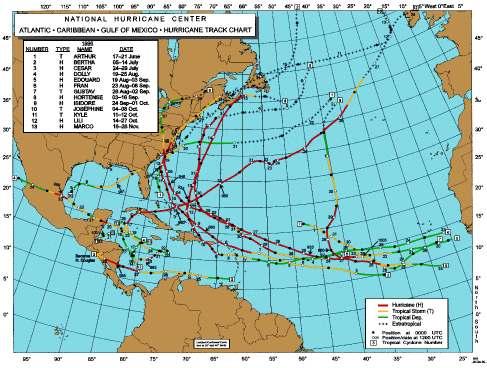
4 Clearly, the 1996 hurricane season experienced many more hurricanes that either entered or hugged the East Coast than did This paper will focus on the regions of the Atlantic Basin in which tropical systems are affected by the NAO. Data/Methodology All tropical storm data is taken from the National Hurricane Center's Atlantic Tracks File. For a tropical storm to be counted, maximum sustained winds within the center of circulation must be at least 17ms -1. Position, latitude, longitude, wind-speed, and minimum pressure are given every 6 hours. Statistical tests use data after 1944 but analysis is made for all years since 1886 to show continuous trends. The rationale for not relying on data before 1944 is that prior to 1944 reconnaissance aircraft were not sent to investigate tropical systems, thus making the data less accurate. The index for the NAO is provided by Jim Hurrell. His method calculates the anomalous difference in SLP between Lisbon, Portugal and Stykkisholmur, Iceland during the winter months (DJFB). The index is ascribed to the year of January. Regions in the Atlantic Basin where analysis was made were the Gulf of Mexico (GM) and the region off the East Coast of the United States (ECB). These areas were selected based on their proximity to the United States. For purposes of this research, the coordinates 15-30N and W bound the GM region. In addition, the coordinates bounding the ECB region were 25-40N and 81-70W. Using the MATLAB (version 5.3) software package, restrictions were placed on how tropical storm data was recorded in each region using specific coding. One restriction remained constant for all trials: if a storm was plotted through the same region more than once, it was counted only once. This could occur if a storm made landfall and then tracked through the same region again. Data was recorded one hurricane season at a time. All trials recorded data from 1886 to In the first trial, all named storms to have positions within the ECB region were recorded. In a second trial for the ECB region, all named storms that developed east of 81W and traveled through ECB were recorded. This last experiment was performed to isolate Cape Verde and Bahamas originating storms. For the GM region, several trials were run with different restrictions. In the first experiment, all storms that had positions in the GM region were recorded. In the second trial, only storms that appeared in the GM box during the months of August and September were recorded. In the third trial, storms that were
5 born in GM were recorded. In the final experiment, all storms that originated east of 81W and traveled into GM were recorded. In addition to the suite of experiments with the two boxes, all storms originating east of 81W were also recorded to see if the NAO caused any significant change on Cape Verde or Bahamas births. As stated above, because data is not reliable before 1944, statistical evidence in each experiment was only used for years between 1944 and 2000, but analysis was conducted for years since 1886 on the assumption that the data was sufficiently accurate. In order to divide the NAO into three phases (High, Low, and Neutral), all years from were divided into thirds based upon their NAO index value. A High NAO year is defined as any year where the value of the NAO index is greater than based on Jim Hurrell's scale. A Neutral NAO year is defined as any year where the NAO index is between and A Low NAO year is defined as any year where the NAO index is less than For each experiment, that data was placed into Excel version Column one was the MATLAB output of the individual experiment, column two the corresponding year, and column 3 the NAO index for the winter before the hurricane season. All the data was then sorted with ascending NAO index values. The following diagram displays this method for one of the experiments.
6 Two sample t-tests assuming unequal variance were then performed for each experiment. For each experiment, three statistical tests were performed. One test was done for High years vs. Low years, another for High years vs. Neutral years, and a final for Low years vs. Neutral years. All significant and nonsignificant results were recorded. Results Several of the experiments revealed significant results. For all named since 1944, the mean number in ECB following a High, Neutral, and Low NAO winter was 3.42, 4.57, and 4.52 respectively. The resulting t-tests when comparing High vs. Low and High vs. Neutral years revealed p-values near 5 percent. Statistical evidence became even stronger when data since 1886 was included. For the experiment in which storms originated east of 81W and traveled through ECB, significant results were once again found for High vs. Low and High vs. Neutral years. The mean number of storms to enter ECB that originated east of 81W since 1944 was 2.57, 3.63, and 3.73 for High, Neutral and Low NAO years respectively. In total, 94, 134, and 130 storms entered ECB from east of 81W since 1886 following High, Neutral, and Low NAO winters. P-values for this experiment were more significant as they were closer to 3 percent. Once again, the statistical evidence became stronger when data since 1886 was included.
7 Gulf of Mexico results were only significant for storms entering GM that originated east of 81W. Since 1944, the mean number of storms to enter GM during a High NAO year was 0.894, while during a Low NAO year, the mean was The resulting p-value for this t-test was near 3 percent. There was little difference for the same trial after High NAO and Neutral NAO winters. Significant results were found for births in GM between Low and Neutral years. However, the data did not hold true for analysis that included all years since Also, borderline significant statistical evidence was found for storms that were recorded in region GM during the months of August and September. In the last trial for storms that were born east of 81W, results did not fluctuate significantly with the changing NAO phases.

8 Discussion The analysis of the data shows that regardless of the winter s NAO phase, the hurricane season s number of births in any region is not significantly impacted. Therefore, the significant results found for ECB and GM can be attributed to the general change in tracks of the storms once they develop. There is decreased tropical storm activity in the region off the East Coast of the United States following High NAO winters. Even more significant results were found for storms that originated east of 81W. Most of these storms were formed off the coast of Africa near the Cape Verde Islands. Because analysis of the data revealed that the NAO has no effect on Cape Verde or Bahamas births, it is reasonable to say that there are significant behavioral differences with these storms once they develop. Their behavior is dictated by physical factors that accompany the different phases of the NAO.

9 Following a High NAO phase, there is a dramatic drop in SST over much of the Atlantic Basin (Kushnir, Rajagopalan et. al, In preparation). However, because there appears to be no effect on births, the drop in SST must cause the storms to either become weakened and die when they encounter the colder water, or they may take a more northerly track which. If tropical systems were following more northerly tracks, they would become more susceptible to the upper level westerlies. The colder than normal SST is not nearly as strong during a Neutral NAO year. This can explain why the ECB region experiences approximately the same number of storms following Neutral and Low phases, as opposed to High phases. Region GM also experiences a significant drop in the number of storms entering from east of 81W after a High NAO winter. Once again, the drop in SST over much of the tropical Atlantic is probably responsible for this. The question as to why following Neutral NAO winters, Gulf traveling storms behave similarly to a High NAO winter, it may be that the time scale is to short. When including data from 1886, this trend dissipates. However, the drop in the number of storms following High NAO winters continues.

10 Another more important factor that may explain decreased tropical cyclone activity in ECB and GM is due to a significant variation in the steering currents following a High NAO winter. These changes show an anomalous decrease in northerly winds near the East Coast, and an anomalous increase of northerly winds in the Far East Atlantic. Because high-pressure systems spin clockwise, this change in steering currents indicates a breakdown of the Bermuda High pressure system. Without the dominant pattern created by the Bermuda High, weather patterns crossing the Atlantic would follow a more east to west path. Consequently, tropical systems would experience a much more difficult task making landfall on the US. Kushnir and Rajagopalan have found that there is a significant decrease in landfalls on the East Coast and Gulf of Mexico following a High NAO winter. Figure C depicts a combination of the Bermuda High shifting and strengthening following a Low NAO winter and is most likely responsible for the increase in storms entering GM after a Low NAO winter. As for storms in the Gulf of Mexico during the months of August and September, borderline significant results were found probably because although those are the months of the Cape Verde season, births were also included.
11 Conclusions The NAO affects the behavior of Atlantic hurricanes. The winter NAO appears to impact the following summer hurricane season. Fewer storms can be expected in the region off the East Coast and Gulf of Mexico following High NAO winters. Subsequently, more storms can be expected near the East Coast following High and Neutral NAO winters, and more storms can be expected to enter the Gulf of Mexico following Low NAO winters. Although the correlations are not completely definitive, the trends undeniably exist. Also, this research uses boxes to bound specific regions, but hurricanes do not behave in a linear fashion. In addition, hurricanes are rare events that will never be predicted with certainty. The distribution of storms was normal for some experiments and not normal for others. This could potentially impact the significance of some of the tests. Hopefully this research will spawn new studies on how the NAO during winter or perhaps other seasons impacts the hurricane season. Also, it may be interesting to look not only at tropical storms, but also their predecessors, tropical waves. Because this study analyzes the effect of the winter months, appropriate predictions can be made for the following summer season. The ability to forecast the destructive forces of nature over the long term is beneficial to every segment of society, and is especially useful to insurers, urban planners, land developers, and government organizations that must properly allocate limited resources. It is my belief that it is of significant value to not only predict the number of storms that will develop each year, but also to predict where those storms will go once they are born.
12 References Bell, Ian, North Atlantic Oscillation Web Page, Lamont Doherty Earth Observatory of Columbia University, Palisades, New York (Site name: Gray, W. M., 1984; Atlantic seasonal hurricane frequency. Part I; El Nino and 30mb quasi-biennial oscillation influences. Mon. Wea. Rev., 112, Hurrell, J. W., 1995 Decadal trends in the North Atlantic Oscillation: regional temperatures and precipitation. Science, 269, National Hurricane Center Web Page (Site name: Stephenson, David B., 1999 The North Atlantic Oscillation Thematic Web Site University of Reading, Early Gate, PO Box 243, Reading RG6 6BB UK Yochanan Kushnir, Balaji Rajagopalan, Relationships Between Large Scale Climate Indices and Named Storm Frequency in the Atlantic Basin In Preparation
2013 ATLANTIC HURRICANE SEASON OUTLOOK. June RMS Cat Response
 2013 ATLANTIC HURRICANE SEASON OUTLOOK June 2013 - RMS Cat Response Season Outlook At the start of the 2013 Atlantic hurricane season, which officially runs from June 1 to November 30, seasonal forecasts
PRMS WHITE PAPER 2014 NORTH ATLANTIC HURRICANE SEASON OUTLOOK. June RMS Event Response
 PRMS WHITE PAPER 2014 NORTH ATLANTIC HURRICANE SEASON OUTLOOK June 2014 - RMS Event Response 2014 SEASON OUTLOOK The 2013 North Atlantic hurricane season saw the fewest hurricanes in the Atlantic Basin
Why the Atlantic was surprisingly quiet in 2013
 1 Why the Atlantic was surprisingly quiet in 2013 by William Gray and Phil Klotzbach Preliminary Draft - March 2014 (Final draft by early June) ABSTRACT This paper discusses the causes of the unusual dearth
 Page 1 of 5 Home research global climate enso effects Research Effects of El Niño on world weather Precipitation Temperature Tropical Cyclones El Niño affects the weather in large parts of the world. The
August Forecast Update for Atlantic Hurricane Activity in 2012
 August Forecast Update for Atlantic Hurricane Activity in 2012 Issued: 6 th August 2012 by Professor Mark Saunders and Dr Adam Lea Dept. of Space and Climate Physics, UCL (University College London), UK
Weather Outlook for Spring and Summer in Central TX. Aaron Treadway Meteorologist National Weather Service Austin/San Antonio
 Weather Outlook for Spring and Summer in Central TX Aaron Treadway Meteorologist National Weather Service Austin/San Antonio Outline A Look Back At 2014 Spring 2015 So Far El Niño Update Climate Prediction
April Forecast Update for North Atlantic Hurricane Activity in 2019
 April Forecast Update for North Atlantic Hurricane Activity in 2019 Issued: 5 th April 2019 by Professor Mark Saunders and Dr Adam Lea Dept. of Space and Climate Physics, UCL (University College London),
The North Atlantic Oscillation: Climatic Significance and Environmental Impact
 1 The North Atlantic Oscillation: Climatic Significance and Environmental Impact James W. Hurrell National Center for Atmospheric Research Climate and Global Dynamics Division, Climate Analysis Section
July Forecast Update for North Atlantic Hurricane Activity in 2018
 July Forecast Update for North Atlantic Hurricane Activity in 2018 Issued: 5 th July 2018 by Professor Mark Saunders and Dr Adam Lea Dept. of Space and Climate Physics, UCL (University College London),
TROPICAL-EXTRATROPICAL INTERACTIONS
 Notes of the tutorial lectures for the Natural Sciences part by Alice Grimm Fourth lecture TROPICAL-EXTRATROPICAL INTERACTIONS Anomalous tropical SST Anomalous convection Anomalous latent heat source Anomalous
NOTES AND CORRESPONDENCE. El Niño Southern Oscillation and North Atlantic Oscillation Control of Climate in Puerto Rico
 2713 NOTES AND CORRESPONDENCE El Niño Southern Oscillation and North Atlantic Oscillation Control of Climate in Puerto Rico BJÖRN A. MALMGREN Department of Earth Sciences, University of Göteborg, Goteborg,
2013 Summer Weather Outlook. Temperatures, Precipitation, Drought, Hurricanes and why we care
 2013 Summer Weather Outlook Temperatures, Precipitation, Drought, Hurricanes and why we care Role of the ERCOT Meteorologist Forecasts Develop temperature input for hourly load forecasts (next day, days
North Pacific Climate Overview N. Bond (UW/JISAO), J. Overland (NOAA/PMEL) Contact: Last updated: September 2008
, J. Overland (NOAA/PMEL) Contact: Last updated: September 2008") North Pacific Climate Overview N. Bond (UW/JISAO), J. Overland (NOAA/PMEL) Contact: Nicholas.Bond@noaa.gov Last updated: September 2008 Summary. The North Pacific atmosphere-ocean system from fall 2007
North Pacific Climate Overview N. Bond (UW/JISAO), J. Overland (NOAA/PMEL) Contact: Nicholas.Bond@noaa.gov Last updated: September 2008 Summary. The North Pacific atmosphere-ocean system from fall 2007
North Pacific Climate Overview N. Bond (UW/JISAO), J. Overland (NOAA/PMEL) Contact: Last updated: August 2009
, J. Overland (NOAA/PMEL) Contact: Last updated: August 2009") North Pacific Climate Overview N. Bond (UW/JISAO), J. Overland (NOAA/PMEL) Contact: Nicholas.Bond@noaa.gov Last updated: August 2009 Summary. The North Pacific atmosphere-ocean system from fall 2008 through
North Pacific Climate Overview N. Bond (UW/JISAO), J. Overland (NOAA/PMEL) Contact: Nicholas.Bond@noaa.gov Last updated: August 2009 Summary. The North Pacific atmosphere-ocean system from fall 2008 through
Pre-Season Forecast for North Atlantic Hurricane Activity in 2018
 Pre-Season Forecast for North Atlantic Hurricane Activity in 2018 Issued: 30 th May 2018 by Professor Mark Saunders and Dr Adam Lea Dept. of Space and Climate Physics, UCL (University College London),
AnuMS 2018 Atlantic Hurricane Season Forecast
 AnuMS 2018 Atlantic Hurricane Season Forecast Issued: May 10, 2018 by Dale C. S. Destin (follow @anumetservice) Director (Ag), Antigua and Barbuda Meteorological Service (ABMS) The *AnuMS (Antigua Met
Wind: Global Systems Chapter 10
 Wind: Global Systems Chapter 10 General Circulation of the Atmosphere General circulation of the atmosphere describes average wind patterns and is useful for understanding climate Over the earth, incoming
AnuMS 2018 Atlantic Hurricane Season Forecast
 AnuMS 2018 Atlantic Hurricane Season Forecast : June 11, 2018 by Dale C. S. Destin (follow @anumetservice) Director (Ag), Antigua and Barbuda Meteorological Service (ABMS) The *AnuMS (Antigua Met Service)
April Forecast Update for Atlantic Hurricane Activity in 2016
 April Forecast Update for Atlantic Hurricane Activity in 2016 Issued: 5 th April 2016 by Professor Mark Saunders and Dr Adam Lea Dept. of Space and Climate Physics, UCL (University College London), UK
August Forecast Update for Atlantic Hurricane Activity in 2015
 August Forecast Update for Atlantic Hurricane Activity in 2015 Issued: 5 th August 2015 by Professor Mark Saunders and Dr Adam Lea Dept. of Space and Climate Physics, UCL (University College London), UK
At the Midpoint of the 2008
 At the Midpoint of the 2008 Atlantic Hurricane Season Editor s note: It has been an anxious couple of weeks for those with financial interests in either on- or offshore assets in the Gulf of Mexico and
El Niño / Southern Oscillation
 El Niño / Southern Oscillation Student Packet 2 Use contents of this packet as you feel appropriate. You are free to copy and use any of the material in this lesson plan. Packet Contents Introduction on
Global Climate Patterns and Their Impacts on North American Weather
 Global Climate Patterns and Their Impacts on North American Weather By Julie Malmberg and Jessica Lowrey, Western Water Assessment Introduction This article provides a broad overview of various climate
Global Weather Trade Winds etc.notebook February 17, 2017
 Global Weather 1 north pole northern hemisphere equator southern hemisphere south pole 2 We have seasons because of the Earth's tilt The seasons are opposite in the northern and southern hemispheres winter
Climate Outlook through 2100 South Florida Ecological Services Office Vero Beach, FL September 9, 2014
 Climate Outlook through 2100 South Florida Ecological Services Office Vero Beach, FL September 9, 2014 Short Term Drought Map: Short-term (
Name: Date: Hour: Comparing the Effects of El Nino & La Nina on the Midwest (E4.2c)
") Purpose: Comparing the Effects of El Nino & La Nina on the Midwest (E4.2c) To compare the effects of El Nino and La Nina on the Midwest United States. Background Knowledge: The El Nino-Southern Oscillation
Purpose: Comparing the Effects of El Nino & La Nina on the Midwest (E4.2c) To compare the effects of El Nino and La Nina on the Midwest United States. Background Knowledge: The El Nino-Southern Oscillation
Weather and Climate Summary and Forecast Summer 2017
 Weather and Climate Summary and Forecast Summer 2017 Gregory V. Jones Southern Oregon University August 4, 2017 July largely held true to forecast, although it ended with the start of one of the most extreme
AnuMS 2018 Atlantic Hurricane Season Forecast
 AnuMS 2018 Atlantic Hurricane Season : August 12, 2018 by Dale C. S. Destin (follow @anumetservice) Director (Ag), Antigua and Barbuda Meteorological Service (ABMS) The *AnuMS (Antigua Met Service) is
El Niño Update Impacts on Florida
 Current Issues in Emergency Management (CIEM) Sessions 1 &2 October 12 th and 26 th, 2006 Florida Division of Emergency Management Tallahassee, Florida El Niño Update Impacts on Florida Bart Hagemeyer
April Forecast Update for Atlantic Hurricane Activity in 2018
 April Forecast Update for Atlantic Hurricane Activity in 2018 Issued: 5 th April 2018 by Professor Mark Saunders and Dr Adam Lea Dept. of Space and Climate Physics, UCL (University College London), UK
Winter. Here s what a weak La Nina usually brings to the nation with tempseraures:
 2017-2018 Winter Time again for my annual Winter Weather Outlook. Here's just a small part of the items I considered this year and how I think they will play out with our winter of 2017-2018. El Nino /
Hurricane Risk: Importance of Climate Time Scale and Uncertainty
 Hurricane Risk: Importance of Climate Time Scale and Uncertainty FCHLPM Workshop Peter S. Dailey, Ph.D. July 23-24, 2009 2009 AIR WORLDWIDE CORPORATION 1 Agenda Importance of Understanding Climate Change,
Hurricanes and Tropical Weather Systems:
 Hurricanes and Tropical Weather Systems: An influence on weather in parts of the USA Meteorology 411 Iowa State University Week 2 Bill Gallus Classification/Terminology Tropical Disturbance enhanced convection
KUALA LUMPUR MONSOON ACTIVITY CENT
 T KUALA LUMPUR MONSOON ACTIVITY CENT 2 ALAYSIAN METEOROLOGICAL http://www.met.gov.my DEPARTMENT MINISTRY OF SCIENCE. TECHNOLOGY AND INNOVATIO Introduction Atmospheric and oceanic conditions over the tropical
Summer 2018 Southern Company Temperature/Precipitation Forecast
 Scott A. Yuknis High impact weather forecasts, climate assessment and prediction. 14 Boatwright s Loop Plymouth, MA 02360 Phone/Fax 508.927.4610 Cell: 508.813.3499 ClimateImpact@comcast.net Climate Impact
Weather Atmospheric condition in one place during a limited period of time Climate Weather patterns that an area typically experiences over a long
 Weather Atmospheric condition in one place during a limited period of time Climate Weather patterns that an area typically experiences over a long period of time Many factors influence weather & climate
THE INFLUENCE OF CLIMATE TELECONNECTIONS ON WINTER TEMPERATURES IN WESTERN NEW YORK INTRODUCTION
 Middle States Geographer, 2014, 47: 60-67 THE INFLUENCE OF CLIMATE TELECONNECTIONS ON WINTER TEMPERATURES IN WESTERN NEW YORK Frederick J. Bloom and Stephen J. Vermette Department of Geography and Planning
ATMOSPHERIC MODELLING. GEOG/ENST 3331 Lecture 9 Ahrens: Chapter 13; A&B: Chapters 12 and 13
 ATMOSPHERIC MODELLING GEOG/ENST 3331 Lecture 9 Ahrens: Chapter 13; A&B: Chapters 12 and 13 Agenda for February 3 Assignment 3: Due on Friday Lecture Outline Numerical modelling Long-range forecasts Oscillations
An upper to mid level circulation (Low) in the NW Caribbean is
 in the NW Caribbean is") WEEKLY WEATHER OUTLOOK BELIZE, CENTRAL AMERICA PERIOD: Monday-Monday, Oct. 1 October 8, 2012 DATE ISSUED: Monday, Oct 1, 2012 6:00 am RFrutos EcoSolutions & Services SYNOPSIS: An upper to mid level circulation
WEEKLY WEATHER OUTLOOK BELIZE, CENTRAL AMERICA PERIOD: Monday-Monday, Oct. 1 October 8, 2012 DATE ISSUED: Monday, Oct 1, 2012 6:00 am RFrutos EcoSolutions & Services SYNOPSIS: An upper to mid level circulation
THE ATMOSPHERE IN MOTION
 Funding provided by NOAA Sectoral Applications Research Project THE ATMOSPHERE IN MOTION Basic Climatology Oklahoma Climatological Survey Factor 1: Our Energy Source Hi, I m the Sun! I provide 99.9999+
Global Atmospheric Circulation
 Global Atmospheric Circulation Polar Climatology & Climate Variability Lecture 11 Nov. 22, 2010 Global Atmospheric Circulation Global Atmospheric Circulation Global Atmospheric Circulation The Polar Vortex
The Planetary Circulation System
 12 The Planetary Circulation System Learning Goals After studying this chapter, students should be able to: 1. describe and account for the global patterns of pressure, wind patterns and ocean currents
Cape Verde. General Climate. Recent Climate. UNDP Climate Change Country Profiles. Temperature. Precipitation
 UNDP Climate Change Country Profiles C. McSweeney 1, M. New 1,2 and G. Lizcano 1 1. School of Geography and Environment, University of Oxford. 2. Tyndall Centre for Climate Change Research http://country-profiles.geog.ox.ac.uk
Seasonal Climate Watch January to May 2016
 Seasonal Climate Watch January to May 2016 Date: Dec 17, 2015 1. Advisory Most models are showing the continuation of a strong El-Niño episode towards the latesummer season with the expectation to start
AnuMS 2018 Atlantic Hurricane Season Forecast
 AnuMS 2018 Atlantic Hurricane Season Forecast Issued: April 10, 2018 by Dale C. S. Destin (follow @anumetservice) Director (Ag), Antigua and Barbuda Meteorological Service (ABMS) The *AnuMS (Antigua Met
Weather Atmospheric condition in one place during a limited period of time Climate Weather patterns that an area typically experiences over a long
 Weather Atmospheric condition in one place during a limited period of time Climate Weather patterns that an area typically experiences over a long period of time Many factors influence weather & climate
SHORT COMMUNICATION EXPLORING THE RELATIONSHIP BETWEEN THE NORTH ATLANTIC OSCILLATION AND RAINFALL PATTERNS IN BARBADOS
 INTERNATIONAL JOURNAL OF CLIMATOLOGY Int. J. Climatol. 6: 89 87 (6) Published online in Wiley InterScience (www.interscience.wiley.com). DOI:./joc. SHORT COMMUNICATION EXPLORING THE RELATIONSHIP BETWEEN
Observed Climate Variability and Change: Evidence and Issues Related to Uncertainty
 Observed Climate Variability and Change: Evidence and Issues Related to Uncertainty David R. Easterling National Climatic Data Center Asheville, North Carolina Overview Some examples of observed climate
The 2009 Hurricane Season Overview
 The 2009 Hurricane Season Overview Jae-Kyung Schemm Gerry Bell Climate Prediction Center NOAA/ NWS/ NCEP 1 Overview outline 1. Current status for the Atlantic, Eastern Pacific and Western Pacific basins
Careful, Cyclones Can Blow You Away!
 Title: Careful, Cyclones Can Blow You Away! (Meteorology) Grade(s): 6-8 Introduction: Most people associate twisters with tornadoes, but in fact tropical twisters come from hurricanes. Hurricanes are what
How Patterns Far Away Can Influence Our Weather. Mark Shafer University of Oklahoma Norman, OK
 Teleconnections How Patterns Far Away Can Influence Our Weather Mark Shafer University of Oklahoma Norman, OK Teleconnections Connectedness of large-scale weather patterns across the world If you poke
Chapter 1 Climate in 2016
 Chapter 1 Climate in 2016 1.1 Global climate summary Extremely high temperatures were frequently observed in many regions of the world, and in particular continued for most of the year in various places
FORECAST OF ATLANTIC SEASONAL HURRICANE ACTIVITY AND LANDFALL STRIKE PROBABILITY FOR 2018
 FORECAST OF ATLANTIC SEASONAL HURRICANE ACTIVITY AND LANDFALL STRIKE PROBABILITY FOR 2018 We have decreased our forecast and now believe that 2018 will have below-average activity. The tropical and subtropical
July Forecast Update for Atlantic Hurricane Activity in 2017
 July Forecast Update for Atlantic Hurricane Activity in 2017 Issued: 4 th July 2017 by Professor Mark Saunders and Dr Adam Lea Dept. of Space and Climate Physics, UCL (University College London), UK Forecast
Climate Forecast Applications Network (CFAN)
") Forecast of 2018 Atlantic Hurricane Activity April 5, 2018 Summary CFAN s inaugural April seasonal forecast for Atlantic tropical cyclone activity is based on systematic interactions among ENSO, stratospheric
Forecast of 2018 Atlantic Hurricane Activity April 5, 2018 Summary CFAN s inaugural April seasonal forecast for Atlantic tropical cyclone activity is based on systematic interactions among ENSO, stratospheric
The role of teleconnections in extreme (high and low) precipitation events: The case of the Mediterranean region
 precipitation events: The case of the Mediterranean region") European Geosciences Union General Assembly 2013 Vienna, Austria, 7 12 April 2013 Session HS7.5/NP8.4: Hydroclimatic Stochastics The role of teleconnections in extreme (high and low) events: The case of
European Geosciences Union General Assembly 2013 Vienna, Austria, 7 12 April 2013 Session HS7.5/NP8.4: Hydroclimatic Stochastics The role of teleconnections in extreme (high and low) events: The case of
Chapter outline. Reference 12/13/2016
 Chapter 2. observation CC EST 5103 Climate Change Science Rezaul Karim Environmental Science & Technology Jessore University of science & Technology Chapter outline Temperature in the instrumental record
NIWA Outlook: October - December 2015
 October December 2015 Issued: 1 October 2015 Hold mouse over links and press ctrl + left click to jump to the information you require: Overview Regional predictions for the next three months: Northland,
July Forecast Update for Atlantic Hurricane Activity in 2016
 July Forecast Update for Atlantic Hurricane Activity in 2016 Issued: 5 th July 2016 by Professor Mark Saunders and Dr Adam Lea Dept. of Space and Climate Physics, UCL (University College London), UK Forecast
The Pennsylvania Observer
 The Pennsylvania Observer April 2, 2010 March 2010 Pennsylvania Weather Recap Prepared by: Katelyn Johnson March did come in as a lion cub this year. The 1 st proved to be a calm day; however most of Pennsylvania
CHAPTER 12 TROPICAL WEATHER SYSTEMS MULTIPLE CHOICE QUESTIONS
 CHAPTER 12 TROPICAL WEATHER SYSTEMS MULTIPLE CHOICE QUESTIONS 1. A hurricane differs from an extra-tropical cyclone in that a hurricane a. has no fronts. b. develops within a uniform warm and humid air
Thai Meteorological Department, Ministry of Digital Economy and Society
 Thai Meteorological Department, Ministry of Digital Economy and Society Three-month Climate Outlook For November 2017 January 2018 Issued on 31 October 2017 -----------------------------------------------------------------------------------------------------------------------------
Supplementary information of Weather types across the Caribbean basin and their relationship with rainfall and sea surface temperature
 Climate Dynamics manuscript No. (will be inserted by the editor) Supplementary information of Weather types across the Caribbean basin and their relationship with rainfall and sea surface temperature Vincent
Weather and Climate Summary and Forecast Fall/Winter 2016
 Weather and Climate Summary and Forecast Fall/Winter 2016 Gregory V. Jones Southern Oregon University November 5, 2016 After a year where we were seemingly off by a month in terms of temperatures (March
Navigating the Hurricane Highway Understanding Hurricanes With Google Earth
 Navigating the Hurricane Highway Understanding Hurricanes With Google Earth 2008 Amato Evan, Kelda Hutson, Steve Kluge, Lindsey Kropuenke, Margaret Mooney, and Joe Turk Images and data courtesy hurricanetracking.com,
August Forecast Update for Atlantic Hurricane Activity in 2016
 August Forecast Update for Atlantic Hurricane Activity in 2016 Issued: 5 th August 2016 by Professor Mark Saunders and Dr Adam Lea Dept. of Space and Climate Physics, UCL (University College London), UK
NOAA 2015 Updated Atlantic Hurricane Season Outlook
 NOAA 2015 Updated Atlantic Hurricane Season Outlook Dr. Gerry Bell Lead Seasonal Forecaster Climate Prediction Center/ NOAA/ NWS Collaboration With National Hurricane Center/ NOAA/ NWS Hurricane Research
Percentage of normal rainfall for August 2017 Departure from average air temperature for August 2017
 New Zealand Climate Update No 219, August 2017 Current climate August 2017 Overall, mean sea level pressure was lower than normal over and to the west of New Zealand during August while higher than normal
Pacific Decadal Oscillation ( PDO ):
:") Time again for my annual Winter Weather Outlook. Here's just a small part of the items I considered this year and how I think they will play out with our winter of 2015-2016. El Nino / La Nina: When looking
Time again for my annual Winter Weather Outlook. Here's just a small part of the items I considered this year and how I think they will play out with our winter of 2015-2016. El Nino / La Nina: When looking
Tropical Cyclone Genesis: What we know, and what we don t!
 Tropical Cyclone Genesis: What we know, and what we don t! Allison Wing! NSF Postdoctoral Research Fellow! Lamont-Doherty Earth Observatory! Columbia University! Overview! Climatology! What We Know! Theories!
Residents of the Southeastern United
 Summary of 2004 Atlantic Basin Tropical Cyclone Activity and Verification of Seasonal Forecasts By Philip Klotzbach Department of Atmospheric Science Colorado State University Fort Collins, CO 80523 philk@atmos.colostate.edu
Name Date Class. growth rings of trees, fossilized pollen, and ocean. in the northern hemisphere.
 Lesson Outline LESSON 2 A. Long-Term Cycles 1. A(n) climate cycle takes much longer than a lifetime to complete. a. To learn about long-term climate cycles, scientists study natural records, such as growth
WINTER FORECAST NY Metro
 2015-2016 WINTER FORECAST NY Metro Weather @NY_WX DISCLAIMER: Seasonal forecasting is difficult and this is my first attempt at a Winter Forecast. I ve looked at all factors and put them together to create
Here s what a weak El Nino usually brings to the nation with temperatures:
 Time again for my annual Winter Weather Outlook. Here's just a small part of the items I considered this year and how I think they will play out with our winter of 2018-2019. El Nino / La Nina: When looking
Global Wind Patterns
 Name: Earth Science: Date: Period: Global Wind Patterns 1. Which factor causes global wind patterns? a. changes in the distance between Earth and the Moon b. unequal heating of Earth s surface by the Sun
Mozambique. General Climate. UNDP Climate Change Country Profiles. C. McSweeney 1, M. New 1,2 and G. Lizcano 1
 UNDP Climate Change Country Profiles Mozambique C. McSweeney 1, M. New 1,2 and G. Lizcano 1 1. School of Geography and Environment, University of Oxford. 2.Tyndall Centre for Climate Change Research http://country-profiles.geog.ox.ac.uk
ARUBA CLIMATOLOGICAL SUMMARY 2017 PRECIPITATION
 ARUBA CLIMATOLOGICAL SUMMARY 2017 PRECIPITATION The total amount of rainfall recorded at Reina Beatrix International Airport for the year 2017 was 391.0 mm. This is 17.1 % below normal ( Figure 1 ). During
MAURITIUS METEOROLOGICAL SERVICES
 MAURITIUS METEOROLOGICAL SERVICES CLIMATE NOVEMBER 2018 Introduction Climatologically speaking, November is a relatively dry month for Mauritius with a long term monthly mean rainfall of 78 mm. However,
Homework 9: Hurricane Forecasts (adapted from Pipkin et al.)
") November 2010 MAR 110 HW9 Hurricane Forecasts 1 Homework 9: Hurricane Forecasts (adapted from Pipkin et al.) Movement of Hurricanes The advance of a tropical storm or hurricane is controlled by the prevailing
November 2010 MAR 110 HW9 Hurricane Forecasts 1 Homework 9: Hurricane Forecasts (adapted from Pipkin et al.) Movement of Hurricanes The advance of a tropical storm or hurricane is controlled by the prevailing
Weathernews Looks Back at 2015: A Year of Storms. Powerful Typhoons Occurred with Changing Patterns in El Niño Years
 NEWS RELEASE January 27th, 2016 Weathernews Looks Back at 2015: A Year of Storms Powerful Typhoons Occurred with Changing Patterns in El Niño Years Weathernews Inc. (Chiba, Japan; Chihito Kusabiraki/CEO)
Introduction of climate monitoring and analysis products for one-month forecast
 Introduction of climate monitoring and analysis products for one-month forecast TCC Training Seminar on One-month Forecast on 13 November 2018 10:30 11:00 1 Typical flow of making one-month forecast Observed
COLORADO STATE UNIVERSITY FORECAST OF ATLANTIC HURRICANE ACTIVITY FROM SEPTEMBER 1 SEPTEMBER 14, 2015
 COLORADO STATE UNIVERSITY FORECAST OF ATLANTIC HURRICANE ACTIVITY FROM SEPTEMBER 1 SEPTEMBER 14, 2015 We expect that the next two weeks will be characterized by below-average amounts (
Weather and Climate Summary and Forecast March 2019 Report
 Weather and Climate Summary and Forecast March 2019 Report Gregory V. Jones Linfield College March 2, 2019 Summary: Dramatic flip from a mild winter to a top five coldest February on record in many locations
Ocean cycles and climate ENSO, PDO, AMO, AO
 Ocean cycles and climate ENSO, PDO, AMO, AO 3 2.5 2 enso-index 1.5 1 0.5 0-0.5-1 enso 3.4 -index - 1996 to 1999-1.5 1996 1997 1998 1999 Bob Tisdale Bob Tisdale Bob Tisdale ENSO mechanisms animation http://esminfo.prenhall.com/science/geoanimations/animations/26_ninonina.html
Agricultural Outlook Forum Presented: February 17, 2006 THE SCIENCE BEHIND THE ATLANTIC HURRICANES AND SEASONAL PREDICTIONS
 Agricultural Outlook Forum Presented: February 17, 2006 THE SCIENCE BEHIND THE ATLANTIC HURRICANES AND SEASONAL PREDICTIONS Gerald Bell Meteorologist, National Centers for Environmental Prediction NOAA,
THEME: Seasonal forecast: Climate Service for better management of risks and opportunities
 CENTRE AFRICAIN POUR LES APPLICATIONS DE LA METEOROLOGIE AU DEVELOPPEMENT AFRICAN CENTRE OF METEOROLOGICAL APPLICATIONS FOR DEVELOPMENT Institution Africaine parrainée par la CEA et l OMM African Institution
and Weather extremes Tropical cyclones Today and in the Future Greg Holland c3we.ucar.edu
 Tropical cyclones and Weather extremes Today and in the Future c3we.ucar.edu Greg Holland (gholland@ucar.edu) Supported by NSF, Willis Re, IAG, and Zurich Insurance 1 Topics State of the Climate and its
Comments by William M. Gray (Colorado State University) on the recently published paper in Science by Webster, et al
 on the recently published paper in Science by Webster, et al") Comments by William M. Gray (Colorado State University) on the recently published paper in Science by Webster, et al., titled Changes in tropical cyclone number, duration, and intensity in a warming environment
Comments by William M. Gray (Colorado State University) on the recently published paper in Science by Webster, et al., titled Changes in tropical cyclone number, duration, and intensity in a warming environment
UPDATE OF REGIONAL WEATHER AND SMOKE HAZE (December 2017)
") UPDATE OF REGIONAL WEATHER AND SMOKE HAZE (December 2017) 1. Review of Regional Weather Conditions for November 2017 1.1 In November 2017, Southeast Asia experienced inter-monsoon conditions in the first
UPDATE OF REGIONAL WEATHER AND SMOKE HAZE (December 2017) 1. Review of Regional Weather Conditions for November 2017 1.1 In November 2017, Southeast Asia experienced inter-monsoon conditions in the first
Hurricanes. April 14, 2009
 Tropical Weather & Hurricanes Chapter 15 April 14, 2009 Tropical meteorology Tropics characterized by seasonal wet and drier periods- wet when sun is nearly overhead at noon and inter-tropical convergence
UPDATE OF REGIONAL WEATHER AND SMOKE HAZE (February 2018)
") UPDATE OF REGIONAL WEATHER AND SMOKE HAZE (February 2018) 1. Review of Regional Weather Conditions for January 2018 1.1 The prevailing Northeast monsoon conditions over Southeast Asia strengthened in January
UPDATE OF REGIONAL WEATHER AND SMOKE HAZE (February 2018) 1. Review of Regional Weather Conditions for January 2018 1.1 The prevailing Northeast monsoon conditions over Southeast Asia strengthened in January
UPDATE OF REGIONAL WEATHER AND SMOKE HAZE (September 2017)
") UPDATE OF REGIONAL WEATHER AND SMOKE HAZE (September 2017) 1. Review of Regional Weather Conditions in August 2017 1.1 Southwest Monsoon conditions continued to prevail in the region in August 2017. The
UPDATE OF REGIONAL WEATHER AND SMOKE HAZE (September 2017) 1. Review of Regional Weather Conditions in August 2017 1.1 Southwest Monsoon conditions continued to prevail in the region in August 2017. The
The 2005 North Atlantic Hurricane Season A Climate Perspective
 The 2005 North Atlantic Hurricane Season A Climate Perspective Gerald Bell 1, Eric Blake 2, Chris Landsea 2, Kingtse Mo 1, Richard Pasch 2, Muthuvel Chelliah 1, Stanley Goldenberg 3 1 Climate Prediction
A Preliminary Climatology of Extratropical Transitions in the Southwest Indian Ocean
 A Preliminary Climatology of Extratropical Transitions in the Southwest Indian Ocean Kyle S. Griffin Department of Atmospheric and Environmental Sciences, University at Albany, State University of New
Ocean in Motion 7: El Nino and Hurricanes!
 Ocean in Motion 7: El Nino and Hurricanes! A. Overview 1. Ocean in Motion -- El Nino and hurricanes We will look at the ocean-atmosphere interactions that cause El Nino and hurricanes. Using vocabulary
Will a warmer world change Queensland s rainfall?
 Will a warmer world change Queensland s rainfall? Nicholas P. Klingaman National Centre for Atmospheric Science-Climate Walker Institute for Climate System Research University of Reading The Walker-QCCCE
COLORADO STATE UNIVERSITY FORECAST OF ATLANTIC HURRICANE ACTIVITY FROM SEPTEMBER 15 SEPTEMBER 28, 2015
 COLORADO STATE UNIVERSITY FORECAST OF ATLANTIC HURRICANE ACTIVITY FROM SEPTEMBER 15 SEPTEMBER 28, 2015 We expect that the next two weeks will be characterized by below-average amounts (
Possible Roles of Atlantic Circulations on the Weakening Indian Monsoon Rainfall ENSO Relationship
 2376 JOURNAL OF CLIMATE Possible Roles of Atlantic Circulations on the Weakening Indian Monsoon Rainfall ENSO Relationship C.-P. CHANG, PATRICK HARR, AND JIANHUA JU Department of Meteorology, Naval Postgraduate
The Outlook for the 2016 North Atlantic Hurricane Season Hurricane Genesis & Outlook (HUGO) Project (April 15, 2016)
 Project (April 15, 2016)") Tingzhuang Yan, Len Pietrafesa, Shaowu Bao and Paul Gayes School of Coastal & Marine Systems Science Coastal Carolina University (CCU) Conway, SC 29528-6054 Summary The 2015 Hurricane Season ended with
Tingzhuang Yan, Len Pietrafesa, Shaowu Bao and Paul Gayes School of Coastal & Marine Systems Science Coastal Carolina University (CCU) Conway, SC 29528-6054 Summary The 2015 Hurricane Season ended with
Seasonal Climate Outlook for South Asia (June to September) Issued in May 2014
 Issued in May 2014") Ministry of Earth Sciences Earth System Science Organization India Meteorological Department WMO Regional Climate Centre (Demonstration Phase) Pune, India Seasonal Climate Outlook for South Asia (June
Ministry of Earth Sciences Earth System Science Organization India Meteorological Department WMO Regional Climate Centre (Demonstration Phase) Pune, India Seasonal Climate Outlook for South Asia (June