MISSOURI RIVER BASIN WATER MANAGEMENT SPRING 2019 PUBLIC MEETINGS
|
|
|
- Jocelyn Walters
- 5 years ago
- Views:
Transcription


1 MISSOURI RIVER BASIN WATER MANAGEMENT SPRING 2019 PUBLIC MEETINGS April 9 11:00 a.m. Fort Peck, MT April 9 6:00 p.m. Bismarck, ND April 10 10:00 a.m. Pierre, SD April 10 4:00 p.m. Sioux City, IA April 11 11:00 a.m. Smithville, MO April 11 5:00 p.m. Nebraska City, NE
2 NATIONAL WEATHER SERVICE SPRING FLOOD OUTLOOKS National Weather Service Issues two Spring Flood Outlooks every year 21 February March 2019 Outlooks consists of a text product, as well as graphics. Two associated webinar briefings are provided to State and Local officials, congressional staff, FEMA, Coast Guard, USACE, USGS, Bureau of Reclamation, and the National Guard. (22 Feb and 07 March). Covers entire Mississippi River drainage North Central River Forecast Center Missouri Basin River Forecast Center Ohio River Forecast Center Arkansas-Red River Forecast Center Lower Mississippi River Forecast Center 21 February 2019 outlook indicated enhanced risk over eastern portion of Missouri River basin, and highlighted potential major flooding along the James, Vermillion, Little and Big Sioux Rivers. Model runs indicated risk for major at Brownville, St. Joseph, and Glasgow on the Missouri. 06 March 2019 outlook indicated greatly enhanced risk over eastern portion of Missouri River basin, and highlighted potential major flooding along James, Vermillion, Little and Big Sioux, North Fork Elkhorn, Wood, Floyd, and Tarkio Rivers. Model runs indicated risk for major at Brownville, Rulo, St. Joseph, Atchison, Leavenworth, Sibley, Miami, and Glasgow on the Missouri River. 2 Building a Weather-Ready Nation

3 NATIONAL WEATHER SERVICE Rain-on-Snow Event of March 12 th -14 th 2019 Rain-Snow line 3 Building a Weather-Ready Nation

4 NATIONAL WEATHER SERVICE Mid-March 2019 Event 4 Building a Weather-Ready Nation
5 National Weather Service Estimated Tributary Peak Flows Gavin s Point James 16,000 3/16 Yankton Vermillion 16,000 3/17 Big Sioux 60,000 3/17 Sioux City Soldier 27,000 3/14 Decatur Floyd 30,000 3/15 Boyer 35,000 3/14 Platte 170,000 3/17 Blair Little Sioux 60,000 3/15 Omaha Nebraska City Nishnabotna 45,000 3/16 Brownville Tarkio 10,000 3/14 Over 100K cfs Over 50K cfs Over 30K cfs Rulo Nodaway 30,000 3/15 5 Weeping Water 15,000 3/14 Little Nemaha 27,000 3/14 Nemaha 37,000 3/14 Building a Weather-Ready Nation St. Joseph
6 NATIONAL WEATHER SERVICE Mid-March 2019 Event The Missouri Basin River Forecast Center issues daily forecasts for 22 locations on the Missouri and Kansas Rivers. Another 400 locations are monitored each day, with forecasts issued when flood conditions are expected or are occurring. The River Forecast Center is also capable of providing inflow forecasts for 81 reservoirs. Short-term river and reservoir inflow forecasts utilize 48-hours of anticipated precipitation Oct 1- March 31. (From April 1- September hours of anticipated precipitation is used). Mid-March rain-on-snow event began overnight hours of Tuesday-Wednesday, March 12 th -13 th. Initial forecasts: Missouri River (Nebraska City Atchison) issued Saturday 9:56 AM Nishnabotna River issued Saturday 7:22 PM Platte River issued Sunday 12:04 PM Gavins Point inflow issued Tuesday 10:33 AM Niobrara River issued Wednesday 9:33 AM River forecasts are updated at least twice per day during flooding. Gavins Point inflow forecasts issued 2X day beginning Tuesday, March 12th Oahe, Big Bend, and Ft. Randall inflow forecasts began Tuesday, March 19 th MBRFC in daily communications with USACE Missouri Basin Water Management regarding reservoir plans, and the 2 USACE Districts regarding levee status. USACE engineer embed March. 6 Building a Weather-Ready Nation


7 NATIONAL WEATHER SERVICE Outlooks April April 20-May 3 April Apr-May-June RIVER OUTLOOKS Mountain snowpack nearing accumulating peak; significant flooding due to snowmelt not likely. Plains snowpack all but gone. River ice conditions improving. Missouri River Basin above Ft. Peck cresting early June. Yellowstone River Basin cresting early June. Milk River Basin has already experienced its seasonal crest. James River: North Dakota cresting now; South Dakota crest mid-tolate April. Mouth will remain steady-to-falling. Little and Big Sioux have already experienced seasonal crest. Lower Big Sioux now experiencing second, much lower crest. Platte River system cresting mid June. Plains soils are wet; plains are vulnerable to renewed flooding. Eastern portion of basin remains at enhanced risk for flooding next 3 months, including the Missouri River below Nebraska City. 7 Building a Weather-Ready Nation


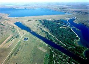

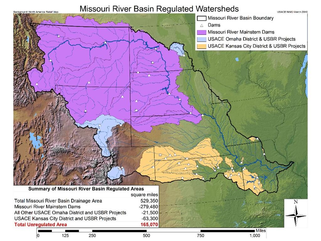
8 MISSOURI RIVER MAINSTEM RESERVOIR SYSTEM FORT PECK GARRISON OAHE BIG BEND FORT RANDALL GAVINS POINT 8


9 OUR MISSION Regulate Missouri River Mainstem Reservoirs to Support Congressionally Authorized Purposes FLOOD CONTROL NAVIGATION HYDROPOWER WATER SUPPLY FISH & WILDLIFE (T&E) IRRIGATION WATER QUALITY CONTROL RECREATION Flood Control Navigation Hydropower Water Supply Fish & Wildlife including Threatened & Endangered Species Irrigation Water Quality Control Recreation 9
10 10

11 MAINSTEM PROJECTS - STORAGE 11
12 MISSOURI RIVER MAINSTEM SYSTEM STORAGE ZONES AND ALLOCATIONS Historic max EXCLUSIVE FLOOD CONTROL 7% ANNUAL FLOOD CONTROL & MULTIPLE USE 16% CARRYOVER MULTIPLE USE 53% WE ARE HERE April 8, Historic min STORAGE IN MILLION ACRE FEET (MAF) PERMANENT POOL 24%


13 CURRENT RESERVOIR LEVELS APRIL 8, FORT PECK 4.6 feet above base of Annual Flood Control Zone. GARRISON 7.1 feet above base of Annual Flood Control Zone OAHE 8.8 feet above base of Annual Flood Control Zone. FORT RANDALL 0.7 foot above the base of Exclusive Flood Control Zone. 13

 *APRIL 1 FORECAST 151%")
14 RUNOFF COMPONENTS PLAINS SNOWPACK MOUNTAIN SNOWPACK RAINFALL MARCH and APRIL MAY, JUNE, and JULY THROUGHOUT THE YEAR 2019 FORECAST* = 38.2 MILLION ACRE FEET (MAF) *APRIL 1 FORECAST 151% OF AVERAGE 14


15 PLAINS SNOWPACK March 10, 2019 Seasonal Maximum Heavy to very heavy snowpack All plains snow melted as of April 7 15 Source: NWS National Operational Hydrologic Remote Sensing Center (NOHRSC)

16 MOUNTAIN SNOWPACK - APRIL 8, 2019 The Missouri River basin mountain snowpack normally peaks near April % 148 % 93% 136% Source: USDA, Natural Resources Conservation Service 16


17 OBSERVED PRECIPITATION Previous 90 Days Previous 30 Days Source: National Weather Service - Advanced Hydrologic Prediction Service 17

18 PRECIPITATION OUTLOOKS Jul Aug Sep Apr May Jun Source: NOAA Climate Prediction Center Jul Aug - Sep 18


19 BASIN SOIL CONDITIONS Source: National Drought Mitigation Center Source: NOAA Climate Prediction Center 19
20 ANNUAL RUNOFF ABOVE SIOUX CITY, IA Actual Drought Periods Current Forecast MED Historic Drought Periods 2019 MILLION ACRE FEET (MAF) Median YEARS 20
21 MONTHLY RUNOFF ABOVE SIOUX CITY, IA 2019 CALENDAR YEAR FORECAST 38.2 MAF 12 Forecast Average Observed 10 MILLION ACRE FEET (MAF) Jan Feb Mar Apr May Jun Jul Aug Sep Oct Nov Dec MONTHS 21
22 MARCH RUNOFF Largest March runoff volume (11.0 MAF) since recordkeeping began in Previous record was 7.3 MAF in Nearly 4 times the average monthly runoff. Record highest volume in the Oahe to Fort Randall reach. More than the average annual runoff for this reach. Record highest volume in the Fort Randall to Gavins Point reach. More than doubled the previous record. Record highest volume in the Gavins Point to Sioux City reach. More than the average annual runoff for this reach. 22
23 MARCH GAVINS POINT OPERATIONS Peak of feet Top of Exclusive FC Zone Base of Exclusive FC Zone Base of Annual FC and Multiple Use Zone Max Inflow = 182,000 cfs Max Release = 100,000 cfs 23
24 SYSTEM STORAGE - APRIL 1 FORECAST 75 System Storage Check 70 Median Upper Basic and Lower Basic Top of Exclusive Flood Control 72.4 MAF SYSTEM STORAGE (MAF) Base of Annual Flood Control 56.1 MAF Base of Exclusive Flood Control 67.7 MAF J F M A M J J A S O N D J F M A M J J A S O N D J F YEARS 24
25 FORT PECK - APRIL 1 FORECAST 2250 Top of Exclusive Flood Control 2250 feet ELEVATION IN FEET Median Upper Basic and Lower Basic Base of Annual Flood Control 2234 feet Base of Exclusive Flood Control 2246 feet J F M A M J J A S O N D J F M A M J J A S O N D J F YEARS 25
26 GARRISON - APRIL 1 FORECAST ELEVATION IN FEET Median Upper Basic and Lower Basic Base of Annual Flood Control feet Top of Exclusive Flood Control 1854 feet Base of Exclusive Flood Control 1850 feet J F M A M J J A S O N D J F M A M J J A S O N D J F YEARS 26
27 OAHE - APRIL 1 FORECAST 1620 Top of Exclusive Flood Control 1620 feet ELEVATION IN FEET Median Upper Basic and Lower Basic Base of Annual Flood Control feet Base of Exclusive Flood Control 1617 feet J F M A M J J A S O N D J F M A M J J A S O N D J F YEARS 27
28 FLOOD CONTROL All 2018 flood water evacuated from reservoir system by mid-january Releases increased to evacuate water from Exclusive Flood Control Zones Higher-than-average releases to restore flexibility to respond to spring and summer rainfall events Storage space available in Fort Peck and Garrison to capture mountain snowmelt Flooding can still occur our ability to reduce downstream stages diminishes the farther downstream due to increased travel times and uncontrolled drainage area 28
29 HYDROPOWER 16 Gavins Point Fort Randall Big Bend Oahe Garrison Fort Peck Forecast BILLION kwh YEARS 29
30 NAVIGATION Flow support from April 1 July 1 15,000 cfs above full service (expanded service level) April 1 service level check Additional adjustments may be made during spring and summer Revised target flows Sioux City = 46,000 cfs Omaha = 46,000 cfs Nebraska City = 52,000 cfs Kansas City = 56,000 cfs Flow support from July 1 December 1 July 1 storage check Expanded service level likely 10-day flow support extension likely 30
31 WATER SUPPLY WATER QUALITY IRRIGATION RECREATION Above average elevations and releases No impacts expected to irrigation and recreation Water supply (April 1 Forecast) Gavins Point winter releases - 20,000 cfs and 22,000 cfs for basic and upper basic, respectively Winter releases - 15,500 cfs for lower basic runoff No access issues expected 31
32 2019 FISH AND WILDLIFE Goal: steady-to-rising pool levels at upper three reservoirs during forage fish spawn (April-May) Rising reservoirs likely at Fort Peck and Garrison Oahe Not likely, we need to evacuate storage to restore flexibility in spring and summer Minimize periods of zero releases at Fort Randall, to the extent reasonably possible 32
33 THREATENED AND ENDANGERED SPECIES PIPING PLOVER AND LEAST TERN Gavins Point releases Steady release flow to target Daily release cycle Expanded service level will drive releases Intra-day peaking patterns Garrison Measures to minimize take 33
34 THREATENED AND ENDANGERED SPECIES BI-MODAL SPRING PULSE PALLID STURGEON Missouri River Recovery Management Plan and EIS completed in November 2018 Analyzed impacts of deleting current spring pulse criteria Following the MRRMP-EIS Record of Decision the Gavins Point bi-modal spring pulse was removed from the revised Master Manual Reservoir unbalancing removed from revised Master Manual 34
35 SUMMARY Above average runoff forecast Reservoir levels higher than average Reservoir releases higher than average 35
36 THANK YOU! John Remus, P.E Kevin Grode, P.E Mike Swenson, P.E Website: nwd.usace.army.mil/mrwm Search: Corps Missouri River on Google Social Media: Facebook: nwdusace Twitter: nwdusace #MORiver 36
Missouri River Basin Water Management
 Missouri River Basin Water Management US Army Corps of Engineers Missouri River Navigator s Meeting February 12, 2014 Bill Doan, P.E. Missouri River Basin Water Management US Army Corps of Engineers BUILDING
Missouri River Basin Water Management Monthly Update
 Missouri River Basin Water Management Monthly Update Participating Agencies 255 255 255 237 237 237 0 0 0 217 217 217 163 163 163 200 200 200 131 132 122 239 65 53 80 119 27 National Oceanic and Atmospheric
Missouri River Basin Water Management Monthly Update
 Missouri River Basin Water Management Monthly Update Participating Agencies 255 255 255 237 237 237 0 0 0 217 217 217 163 163 163 200 200 200 131 132 122 239 65 53 80 119 27 National Oceanic and Atmospheric
Missouri River Basin Water Management Monthly Update
 Missouri River Basin Water Management Monthly Update Participating Agencies 255 255 255 237 237 237 0 0 0 217 217 217 163 163 163 200 200 200 131 132 122 239 65 53 80 119 27 National Oceanic and Atmospheric
Missouri River Basin Water Management Monthly Update
 Missouri River Basin Water Management Monthly Update Participating Agencies 255 255 255 237 237 237 0 0 0 217 217 217 163 163 163 200 200 200 131 132 122 239 65 53 80 119 27 National Oceanic and Atmospheric
Upper Missouri River Basin December 2017 Calendar Year Runoff Forecast December 5, 2017
 Upper Missouri River Basin December 2017 Calendar Year Runoff Forecast December 5, 2017 Calendar Year Runoff Forecast Explanation and Purpose of Forecast U.S. Army Corps of Engineers, Northwestern Division
Missouri River Flood Task Force River Management Working Group Improving Accuracy of Runoff Forecasts
 Missouri River Flood Task Force River Management Working Group Improving Accuracy of Runoff Forecasts Kevin Grode, P.E. Reservoir Regulation Team Lead Missouri River Basin Water Management Northwestern
Missouri River Basin Climate Outlook 1 May Dr. Dennis Todey State Climatologist South Dakota State Univ.
 Missouri River Basin Climate Outlook 1 May 2014 Dr. Dennis Todey State Climatologist South Dakota State Univ. dennis.todey@sdstate.edu 605-688-5141 Photo taken Feb 19, 2013 General Information Providing
Upper Missouri River Basin February 2018 Calendar Year Runoff Forecast February 6, 2018
 Upper Missouri River Basin February 2018 Calendar Year Runoff Forecast February 6, 2018 Calendar Year Runoff Forecast Explanation and Purpose of Forecast U.S. Army Corps of Engineers, Northwestern Division
Upper Missouri River Basin January 2018 Calendar Year Runoff Forecast January 3, 2018
 Calendar Year Runoff Forecast Upper Missouri River Basin January 2018 Calendar Year Runoff Forecast January 3, 2018 Explanation and Purpose of Forecast U.S. Army Corps of Engineers, Northwestern Division
January 2011 Calendar Year Runoff Forecast
 January 2011 Calendar Year Runoff Forecast 2010 Runoff Year Calendar Year 2010 was the third highest year of runoff in the Missouri River Basin above Sioux City with 38.8 MAF, behind 1978 and 1997 which
Upper Missouri River Basin May 2018 Calendar Year Runoff Forecast May 4, 2018
 Calendar Year Runoff Forecast Explanation and Purpose of Forecast Upper Missouri River Basin May 2018 Calendar Year Runoff Forecast May 4, 2018 U.S. Army Corps of Engineers, Northwestern Division Missouri
Summary of Actual Operations
 Missouri River Region US Army Corps of Engineers Since 1953 Reservoir Control Center Northwestern Division Missouri River Region Reservoir Control Center Missouri River Basin Fort Peck Montana Garrison
Summary of Actual 2010 Regulation
 US Army Corps of Engineers Northwestern Division Missouri River Mainstem Reservoir System Summary of Actual 2010 Regulation Missouri River Basin Fort Peck Garrison Oahe Big Bend Gavins Point Fort Randall
NOAA Spring Flood Outlook for Iowa
 NOAA Spring Flood Outlook for Iowa Safeguard Iowa Partnership March 10, 2015 1 Agenda Orientation Maps Current Conditions Weather Outlook Spring Flood Outlook 2 1 Orientation Maps 3 4 2 5 Current Conditions
PRELIMINARY DRAFT FOR DISCUSSION PURPOSES
 Memorandum To: David Thompson From: John Haapala CC: Dan McDonald Bob Montgomery Date: February 24, 2003 File #: 1003551 Re: Lake Wenatchee Historic Water Levels, Operation Model, and Flood Operation This
Doug Kluck NOAA Kansas City, MO National Center for Environmental Information (NCEI) National Integrated Drought Information System (NIDIS)
 National Integrated Drought Information System (NIDIS)") National Integrated Drought Information System (NIDIS) for the Missouri River Basin Drought Early Warning Information System (DEWS) & Runoff Trends in the Missouri Basin & Latest Flood Outlook Doug Kluck
National Integrated Drought Information System (NIDIS) for the Missouri River Basin Drought Early Warning Information System (DEWS) & Runoff Trends in the Missouri Basin & Latest Flood Outlook Doug Kluck
2015 Fall Conditions Report
 2015 Fall Conditions Report Prepared by: Hydrologic Forecast Centre Date: December 21 st, 2015 Table of Contents Table of Figures... ii EXECUTIVE SUMMARY... 1 BACKGROUND... 2 SUMMER AND FALL PRECIPITATION...
Assessing Spatial and Temporal Distribution of Sediment, Nitrogen and Phosphorous Loading in the Missouri River Basin (MORB)
") Assessing Spatial and Temporal Distribution of Sediment, Nitrogen and Phosphorous Loading in the Missouri River Basin (MORB) Zhonglong Zhang, PhD, PE, May Wu, PhD LimnoTech, Environmental Laboratory, ERDC,
Assessing Spatial and Temporal Distribution of Sediment, Nitrogen and Phosphorous Loading in the Missouri River Basin (MORB) Zhonglong Zhang, PhD, PE, May Wu, PhD LimnoTech, Environmental Laboratory, ERDC,
A Review of the 2007 Water Year in Colorado
 A Review of the 2007 Water Year in Colorado Nolan Doesken Colorado Climate Center, CSU Mike Gillespie Snow Survey Division, USDA, NRCS Presented at the 28 th Annual AGU Hydrology Days, March 26, 2008,
Midwest and Great Plains Drought and Climate Summary 20 February 2014
 Midwest and Great Plains Drought and Climate Summary 20 February 2014 Wendy Ryan Assistant State Climatologist Colorado Climate Center Colorado State University wendy.ryan@colostate.edu 970-491-8506 General
FORECAST-BASED OPERATIONS AT FOLSOM DAM AND LAKE
 FORECAST-BASED OPERATIONS AT FOLSOM DAM AND LAKE 255 237 237 237 217 217 217 200 200 200 0 163 131 Bridging the Gap163Conference 255 0 132 255 0 163 122 The Dana on Mission Bay San Diego, CA January 28,
Missouri Basin Climate Outlook. 4 April 2014
 Missouri Basin Climate Outlook Dr. Dennis Todey South Dakota State Climatologist South Dakota State University 4 April, 2014 Dennis.todey@sdstate.edu 605-688-5141 4 April 2014 Gavins Point Dam July 2011
3.0 TECHNICAL FEASIBILITY
 3.0 TECHNICAL FEASIBILITY 3.1 INTRODUCTION To enable seasonal storage and release of water from Lake Wenatchee, an impoundment structure would need to be constructed on the lake outlet channel. The structure
Reservoir Control Center U. S Army Corps of Engineers Northwestern Division - Missouri River Basin Omaha, Nebraska
 US Army Corps of Engineers Fort Peck Garrison Oahe Big Bend Gavins Point Ft. Randall Reservoir Control Center U. S Army Corps of Engineers Northwestern Division - Missouri River Basin Omaha, Nebraska April
Central Region Climate Outlook March20, 2014
 Central Region Climate Outlook March20, 2014 Dr. Jim Angel State Climatologist IL State Water Survey University of Illinois jimangel@illinois.edu 217-333-0729 Happy Spring Equinox! General Information
Modeling of peak inflow dates for a snowmelt dominated basin Evan Heisman. CVEN 6833: Advanced Data Analysis Fall 2012 Prof. Balaji Rajagopalan
 Modeling of peak inflow dates for a snowmelt dominated basin Evan Heisman CVEN 6833: Advanced Data Analysis Fall 2012 Prof. Balaji Rajagopalan The Dworshak reservoir, a project operated by the Army Corps
Oregon Water Conditions Report May 1, 2017
 Oregon Water Conditions Report May 1, 2017 Mountain snowpack in the higher elevations has continued to increase over the last two weeks. Statewide, most low and mid elevation snow has melted so the basin
Midwest/Great Plains Climate-Drought Outlook September 20, 2018
 Midwest/Great Plains Climate-Drought Outlook September 20, 2018 Brian Fuchs National Drought Mitigation Center University of Nebraska-Lincoln School of Natural Resources September 20, 2018 General Information
January 25, Summary
 January 25, 2013 Summary Precipitation since the December 17, 2012, Drought Update has been slightly below average in parts of central and northern Illinois and above average in southern Illinois. Soil
Central Region Climate Outlook May 15, 2014
 Central Region Climate Outlook May 15, 2014 Dr. Jim Angel State Climatologist IL State Water Survey University of Illinois jimangel@illinois.edu 217-333-0729 Chicago-area flooding General Information Providing
North Central U.S. Climate Summary & Outlook May 19, 2016
 North Central U.S. Climate Summary & Outlook May 19, 2016 Golf course Lincoln, NE Image courtesy Terry Sohl Hailstones Lincoln, NE Image courtesy Andrew Ozaki EF1 tornado Lincoln, NE May 9 Photo by Bill
Review of the Regulation of the Missouri River Mainstem Reservoir System During the Flood of 2011
 Review of the Regulation of the Missouri River Mainstem Reservoir System During the Flood of 2011 i Review Panel Members Neil Grigg, PhD, Professor, Colorado State University, Fort Collins, Colorado Cara
National Integrated Drought Information System. Southeast US Pilot for Apalachicola- Flint-Chattahoochee River Basin 20-March-2012
 National Integrated Drought Information System Southeast US Pilot for Apalachicola- Flint-Chattahoochee River Basin 20-March-2012 Current drought status from Drought Monitor http://www.drought.unl.edu/dm/monitor.html
Folsom Dam Water Control Manual Update Joint Federal Project, Folsom Dam
 Folsom Dam Water Control Manual Update Joint Federal Project, Folsom Dam Public Workshop May 28, 2015 Library Galleria 828 I Street, Sacramento, CA US Army Corps of Engineers BUILDING STRONG WELCOME &
Midwest and Great Plains Climate- Drought Outlook 17 April 2014
 Midwest and Great Plains Climate- Drought Outlook 17 April 2014 Dr. Dennis Todey State Climatologist South Dakota State Univ. dennis.todey@sdstate.edu 605-688-5141 Photo taken Feb 19, 2013 Tornado-Trenton,
Great Lakes Update. Volume 199: 2017 Annual Summary. Background
 Great Lakes Update Volume 199: 2017 Annual Summary Background The U.S. Army Corps of Engineers (USACE) tracks and forecasts the water levels of each of the Great Lakes. This report is primarily focused
Webinar and Weekly Summary February 15th, 2011
 Webinar and Weekly Summary February 15th, 2011 -Assessment of current water conditions - Precipitation Forecast - Recommendations for Drought Monitor Upper Colorado Normal Precipitation Upper Colorado
Summary of Actual 2008 Regulation
 US Army Corps of Engineers Northwestern Division Missouri River Mainstem Reservoir System Summary of Actual 2008 Regulation Missouri River Basin Fort Peck Garrison Oahe Big Bend Gavins Point Ft. Randall
San Francisco Public Utilities Commission Hydrological Conditions Report For March 2016
 San Francisco Public Utilities Commission Hydrological Conditions Report For March 2016 J. Chester, C. Graham, A. Mazurkiewicz, & M. Tsang, April 7, 2016 Snow Surveyor Chris Graham crossing Huckleberry
Folsom Dam Water Control Manual Update Joint Federal Project, Folsom Dam
 Folsom Dam Water Control Manual Update Joint Federal Project, Folsom Dam Public Workshop May 25, 2016 Sacramento Library Galleria 828 I Street, Sacramento, CA US Army Corps of Engineers BUILDING STRONG
Changing Hydrology under a Changing Climate for a Coastal Plain Watershed
 Changing Hydrology under a Changing Climate for a Coastal Plain Watershed David Bosch USDA-ARS, Tifton, GA Jeff Arnold ARS Temple, TX and Peter Allen Baylor University, TX SEWRU Objectives 1. Project changes
Great Lakes Update. Volume 194: 2015 Annual Summary
 Great Lakes Update Volume 194: 2015 Annual Summary Background The U.S. Army Corps of Engineers (USACE) tracks and forecasts the water levels of each of the Great Lakes. This report summarizes the hydrologic
Hydrologic Conditions in the Delaware River Basin
 2017 Hydrologic Conditions in the Delaware River Basin Prepared by Operations Staff June 2018 Hydrologic Highlights Hydrologic Conditions in the Delaware River Basin Annual Report 2017 At the start of
Hydrologic and Water Quality Modeling for the Missouri River Basin (MORB)
") 2016 International SWAT Conference in Beijing, China Hydrologic and Water Quality Modeling for the Missouri River Basin (MORB) Zhonglong Zhang, PhD, PE, May Wu, PhD Courtesy of USACE Outline Missouri River
2016 International SWAT Conference in Beijing, China Hydrologic and Water Quality Modeling for the Missouri River Basin (MORB) Zhonglong Zhang, PhD, PE, May Wu, PhD Courtesy of USACE Outline Missouri River
Lake Winnebago Regulation Meeting
 Lake Winnebago Regulation Meeting USACE Detroit District October 9, 2014 US Army Corps of Engineers Agenda Basin Overview Major Stakeholders Maintenance a and Repair Work Weather Conditions 2013-20142014
Water Supply Conditions and Outlook June 4, 2018
 Water Supply Conditions and Outlook June 4, 2018 Flow Forecasting & Operations Planning Water Security Agency Overview Water supply conditions across Saskatchewan are generally good with most reservoir
Midwest and Great Plains Climate and Drought Update
 Midwest and Great Plains Climate and Drought Update June 20,2013 Laura Edwards Climate Field Specialist Laura.edwards@sdstate.edu 605-626-2870 2012 Board of Regents, South Dakota State University General
The Colorado Drought : 2003: A Growing Concern. Roger Pielke, Sr. Colorado Climate Center.
 The Colorado Drought 2001-2003: 2003: A Growing Concern Roger Pielke, Sr. Colorado Climate Center Prepared by Tara Green and Odie Bliss http://climate.atmos.colostate.edu 2 2002 Drought History in Colorado
2003 Moisture Outlook
 2003 Moisture Outlook Nolan Doesken and Roger Pielke, Sr. Colorado Climate Center Prepared by Tara Green and Odie Bliss http://climate.atmos.colostate.edu Through 1999 Through 1999 Fort Collins Total Water
Drought in Southeast Colorado
 Drought in Southeast Colorado Nolan Doesken and Roger Pielke, Sr. Colorado Climate Center Prepared by Tara Green and Odie Bliss http://climate.atmos.colostate.edu 1 Historical Perspective on Drought Tourism
Preliminary Runoff Outlook February 2018
 Preliminary Runoff Outlook February 2018 Prepared by: Flow Forecasting & Operations Planning Water Security Agency General Overview The Water Security Agency (WSA) is preparing for 2018 spring runoff including
Flood Risk Assessment
 Flood Risk Assessment February 14, 2008 Larry Schick Army Corps of Engineers Seattle District Meteorologist General Assessment As promised, La Nina caused an active winter with above to much above normal
Colorado s 2003 Moisture Outlook
 Colorado s 2003 Moisture Outlook Nolan Doesken and Roger Pielke, Sr. Colorado Climate Center Prepared by Tara Green and Odie Bliss http://climate.atmos.colostate.edu How we got into this drought! Fort
Great Lakes Update. Background
 Great Lakes Update Background The U.S. Army Corps of Engineers, Detroit District, monitors and forecasts the water levels of the Great Lakes. This report summarizes the hydrologic conditions of the Great
2012 USACE Drought Actions
 2012 USACE Drought Actions for Inland Waterway Users Board 68 Jim Walker Navigation Branch Chief 19 December 2012 US US Army Corps of of Engineers US Drought Monitor 1 2 3 4 6 5 Impacts: 1. The area in
DK DM M EMORANDUM D ECEMBER 28, 2018 SUBJECT:
 TO: CC: FROM: SUBJECT: BOARD OF DIRECTORS M EMORANDUM D ECEMBER 28, 2018 ANDY MUELLER, GENERAL MANAGER DAVE DK KANZER, P.E. & DON MEYER, P.E. DK DM COLORADO RIVER BASIN WATER SUPPLY CONDITIONS UPDATE AND
Upper Mississippi River System Flow Frequency Study. Hydrology and Hydraulics Appendix F Missouri River. U.S. Army Corps of Engineers Omaha District
 Upper Mississippi River System Flow Frequency Study Hydrology and Hydraulics Appendix F Missouri River U.S. Army Corps of Engineers Omaha District November 2003 UPPER MISSISSIPPI RIVER SYSTEM FLOW FREQUENCY
Monthly Long Range Weather Commentary Issued: APRIL 1, 2015 Steven A. Root, CCM, President/CEO
 Monthly Long Range Weather Commentary Issued: APRIL 1, 2015 Steven A. Root, CCM, President/CEO sroot@weatherbank.com FEBRUARY 2015 Climate Highlights The Month in Review The February contiguous U.S. temperature
Evapo-transpiration Losses Produced by Irrigation in the Snake River Basin, Idaho
 Nov 7, 2007 DRAFT Evapo-transpiration Losses Produced by Irrigation in the Snake River Basin, Idaho Wendell Tangborn and Birbal Rana HyMet Inc. Vashon Island, WA Abstract An estimated 8 MAF (million acre-feet)
Summary of Actual 2007 Regulation
 US Army Corps of Engineers Northwestern Division Missouri River Mainstem Reservoir System Summary of Actual 2007 Regulation Missouri River Basin Fort Peck Garrison Oahe Big Bend Gavins Point Ft. Randall
Montana Drought & Climate
 Montana Drought & Climate MARCH 219 MONITORING AND FORECASTING FOR AGRICULTURE PRODUCERS A SERVICE OF THE MONTANA CLIMATE OFFICE IN THIS ISSUE IN BRIEF PAGE 2 REFERENCE In a Word PAGE 3 REVIEW Winter 219:
The Colorado Drought of 2002 in Perspective
 The Colorado Drought of 2002 in Perspective Colorado Climate Center Nolan Doesken and Roger Pielke, Sr. Prepared by Tara Green and Odie Bliss http://climate.atmos.colostate.edu Known Characteristics of
Monthly Long Range Weather Commentary Issued: APRIL 18, 2017 Steven A. Root, CCM, Chief Analytics Officer, Sr. VP,
 Monthly Long Range Weather Commentary Issued: APRIL 18, 2017 Steven A. Root, CCM, Chief Analytics Officer, Sr. VP, sroot@weatherbank.com MARCH 2017 Climate Highlights The Month in Review The average contiguous
Great Plains and Midwest Drought Impacts and Outlook May 16, 2013
 Great Plains and Midwest Drought Impacts and Outlook May 16, 2013 Dr. Martha Shulski Director, High Plains Regional Climate Center University of Nebraska - Lincoln mshulski3@unl.edu 402-472-6711 May snow
Drought and Future Water for Southern New Mexico
 Drought and Future Water for Southern New Mexico David S. Gutzler University of New Mexico gutzler@unm.edu * The big drought of 2018 * Longer term challenges for water supply * Forecasting streamflow Elephant
Lower Tuolumne River Accretion (La Grange to Modesto) Estimated daily flows ( ) for the Operations Model Don Pedro Project Relicensing
 Estimated daily flows ( ) for the Operations Model Don Pedro Project Relicensing") Lower Tuolumne River Accretion (La Grange to Modesto) Estimated daily flows (1970-2010) for the Operations Model Don Pedro Project Relicensing 1.0 Objective Using available data, develop a daily time series
Lower Tuolumne River Accretion (La Grange to Modesto) Estimated daily flows (1970-2010) for the Operations Model Don Pedro Project Relicensing 1.0 Objective Using available data, develop a daily time series
2016 Fall Conditions Report
 2016 Fall Conditions Report Prepared by: Hydrologic Forecast Centre Date: December 13, 2016 Table of Contents TABLE OF FIGURES... ii EXECUTIVE SUMMARY... 1 BACKGROUND... 5 SUMMER AND FALL PRECIPITATION...
9. PROBABLE MAXIMUM PRECIPITATION AND PROBABLE MAXIMUM FLOOD
 9. PROBABLE MAXIMUM PRECIPITATION AND PROBABLE MAXIMUM FLOOD 9.1. Introduction Due to the size of Watana Dam and the economic importance of the Project to the Railbelt, the Probable Maximum Flood (PMF)
Summary of Actual 2006 Regulation
 US Army Corps of Engineers Northwestern Division Missouri River Mainstem Reservoir System Summary of Actual 2006 Regulation Missouri River Basin Fort Peck Garrison Oahe Big Bend Gavins Point Ft. Randall
Monthly Long Range Weather Commentary Issued: February 15, 2015 Steven A. Root, CCM, President/CEO
 Monthly Long Range Weather Commentary Issued: February 15, 2015 Steven A. Root, CCM, President/CEO sroot@weatherbank.com JANUARY 2015 Climate Highlights The Month in Review During January, the average
The Great USA Flood of 1993
 Destructive Water: Water-Caused Natural Disasters, their Abatement and Control (Proceedings of the Conference held at Anaheim, California, June 1996). IAHS Publ. no, 239, 1997. 13 The Great USA Flood of
Great Plains & Midwest Climate Outlook June 18, 2015
 Great Plains & Midwest Climate Outlook June 18, 2015 Pat Guinan Extension/State Climatologist University of Missouri guinanp@missouri.edu 573-882-5908 Saturated Soybeans, Monroe County, MO Yellow Corn,
Wyoming Pre-Workshop Survey Results August 27, 2015 Lander Wyoming
 Wyoming Pre-Workshop Survey Results August 27, 2015 Lander Wyoming WHAT AREA(S) DO YOU WORK IN?! PLANNING, MGT, OPS! DROUGHT! RESEARCH! PUBLIC LANDS MGT! AG OR RANCHING! RECREATION! ENERGY! 0! 3.5! 7!
Hydrologic Conditions in the Delaware River Basin
 Hydrologic Conditions in the Delaware River Basin April : Flooding in Lambertville, New Jersey Aerial photo used with permission of www.elevated-images.com Annual Report Prepared by Operations Staff June
Souris River Basin Spring Runoff Outlook As of March 15, 2018
 Souris River Basin Spring Runoff Outlook As of March 15, 2018 Prepared by: Flow Forecasting & Operations Planning Water Security Agency Basin Conditions Summer rainfall in 2017 in the Saskatchewan portion
Monthly Long Range Weather Commentary Issued: SEPTEMBER 19, 2016 Steven A. Root, CCM, Chief Analytics Officer, Sr. VP,
 Monthly Long Range Weather Commentary Issued: SEPTEMBER 19, 2016 Steven A. Root, CCM, Chief Analytics Officer, Sr. VP, sroot@weatherbank.com SEPTEMBER 2016 Climate Highlights The Month in Review The contiguous
What Does It Take to Get Out of Drought?
 What Does It Take to Get Out of Drought? Nolan J. Doesken Colorado Climate Center Colorado State University http://ccc.atmos.colostate.edu Presented at the Insects, Diseases and Drought Workshop, May 19,
SEPTEMBER 2013 REVIEW
 Monthly Long Range Weather Commentary Issued: October 21, 2013 Steven A. Root, CCM, President/CEO sroot@weatherbank.com SEPTEMBER 2013 REVIEW Climate Highlights The Month in Review The average temperature
2003 Water Year Wrap-Up and Look Ahead
 2003 Water Year Wrap-Up and Look Ahead Nolan Doesken Colorado Climate Center Prepared by Odie Bliss http://ccc.atmos.colostate.edu Colorado Average Annual Precipitation Map South Platte Average Precipitation
U.S. Outlook For October and Winter Thursday, September 19, 2013
 About This report coincides with today s release of the monthly temperature and precipitation outlooks for the U.S. from the Climate Prediction Center (CPC). U.S. CPC October and Winter Outlook The CPC
Chiang Rai Province CC Threat overview AAS1109 Mekong ARCC
 Chiang Rai Province CC Threat overview AAS1109 Mekong ARCC This threat overview relies on projections of future climate change in the Mekong Basin for the period 2045-2069 compared to a baseline of 1980-2005.
FEMA Hazards Loss Modeling Task Force (MOTF) Situation Report #14. Colorado Spring Flood Risk ***FINAL REPORT***
 Situation Report #14. Colorado Spring Flood Risk ***FINAL REPORT***") FEMA Hazards Loss Modeling Task Force (MOTF) Situation Report #14 Colorado Spring Flood Risk FEMA Modeling Task Force (MOTF) Denver Federal Center, Building 710A Denver, Colorado 80225 Email: FEMA-MOTF@fema.dhs.gov
FEMA Hazards Loss Modeling Task Force (MOTF) Situation Report #14 Colorado Spring Flood Risk FEMA Modeling Task Force (MOTF) Denver Federal Center, Building 710A Denver, Colorado 80225 Email: FEMA-MOTF@fema.dhs.gov
U.S. Army Corps of Engineers Omaha District Monthly Drought Report, February 2006
 University of Nebraska - Lincoln DigitalCommons@University of Nebraska - Lincoln US Army Corps of Engineers U.S. Department of Defense 2006 U.S. Army Corps of Engineers Omaha District Monthly Drought Report,
Highlights of the 2006 Water Year in Colorado
 Highlights of the 2006 Water Year in Colorado Nolan Doesken, State Climatologist Atmospheric Science Department Colorado State University http://ccc.atmos.colostate.edu Presented to 61 st Annual Meeting
Climate also has a large influence on how local ecosystems have evolved and how we interact with them.
 The Mississippi River in a Changing Climate By Paul Lehman, P.Eng., General Manager Mississippi Valley Conservation (This article originally appeared in the Mississippi Lakes Association s 212 Mississippi
NIDIS Intermountain West Regional Drought Early Warning System February 7, 2017
 NIDIS Drought and Water Assessment NIDIS Intermountain West Regional Drought Early Warning System February 7, 2017 Precipitation The images above use daily precipitation statistics from NWS COOP, CoCoRaHS,
Midwest and Great Plains Climate- Drought Outlook 19 November 2015
 Midwest and Great Plains Climate- Drought Outlook 19 November 2015 Dr. Dennis Todey State Climatologist South Dakota State Univ. dennis.todey@sdstate.edu 605-688-5678 Photo taken Feb 19, 2013 SDSU Campus
MINNESOTA POWER ST LOUIS RIVER PROJECT FERC 2360 ISLAND LAKE RESERVOIR TECHNICAL COMMITTEE MEETING SUMMARY
 5/14/18 Spring Refill Meeting held via email Late spring snowmelt resulted in late start to refill. Spring runoff was not enhanced by rain on snow on frozen ground. Near record dry spring. Refill will
A Report on a Statistical Model to Forecast Seasonal Inflows to Cowichan Lake
 A Report on a Statistical Model to Forecast Seasonal Inflows to Cowichan Lake Prepared by: Allan Chapman, MSc, PGeo Hydrologist, Chapman Geoscience Ltd., and Former Head, BC River Forecast Centre Victoria
National Integrated Drought Information System Southeast US Pilot for Apalachicola- Flint-Chattahoochee River Basin. 22 May 2012
 National Integrated Drought Information System Southeast US Pilot for Apalachicola- Flint-Chattahoochee River Basin 22 May 2012 Outline Welcome Keith Ingram, UF, Southeast Climate Consortium Current drought
Great Lakes Update. Great Lakes Winter and Spring Summary January June Vol. 187 Great Lakes Update August 2012
 Great Lakes Update Great Lakes Winter and Spring Summary January June 2012 The US Army Corps of Engineers (USACE) Detroit District monitors hydraulic and hydrologic conditions of the Great Lakes. This
REDWOOD VALLEY SUBAREA
 Independent Science Review Panel Conceptual Model of Watershed Hydrology, Surface Water and Groundwater Interactions and Stream Ecology for the Russian River Watershed Appendices A-1 APPENDIX A A-2 REDWOOD
Midwest/Great Plains Climate-Drought Outlook August 17, 2017
 Midwest/Great Plains Climate-Drought Outlook August 17, 2017 Brian Fuchs National Drought Mitigation Center University of Nebraska-Lincoln School of Natural Resources General Information Providing climate
 Water Supply Forecast - THE DALLES http://www.nwrfc.noaa.gov/water_supply/ws_forecasts.php?id=tdao3 Page 1 of 1 3/7/2013 Close Archive Data/Normals Rankings Adjustments Verification Verify All Years Help
Oregon Water Conditions Report April 17, 2017
 Oregon Water Conditions Report April 17, 2017 Mountain snowpack continues to maintain significant levels for mid-april. By late March, statewide snowpack had declined to 118 percent of normal after starting
2017 Fall Conditions Report
 2017 Fall Conditions Report Prepared by: Hydrologic Forecast Centre Date: November 15, 2017 Table of Contents TABLE OF FIGURES... ii EXECUTIVE SUMMARY... 1 BACKGROUND... 4 SUMMER AND FALL PRECIPITATION...
Monthly Long Range Weather Commentary Issued: APRIL 25, 2016 Steven A. Root, CCM, Chief Analytics Officer, Sr. VP, sales
 Monthly Long Range Weather Commentary Issued: APRIL 25, 2016 Steven A. Root, CCM, Chief Analytics Officer, Sr. VP, sales sroot@weatherbank.com MARCH 2016 Climate Highlights The Month in Review The March
Variability of Reference Evapotranspiration Across Nebraska
 Know how. Know now. EC733 Variability of Reference Evapotranspiration Across Nebraska Suat Irmak, Extension Soil and Water Resources and Irrigation Specialist Kari E. Skaggs, Research Associate, Biological
Great Lakes Update. Volume 191: 2014 January through June Summary. Vol. 191 Great Lakes Update August 2014
 Great Lakes Update Volume 191: 2014 January through June Summary The U.S. Army Corps of Engineers (USACE) monitors the water levels of each of the Great Lakes. This report provides a summary of the Great