Following the Civil War, many Americans and Europeans continued to move into the WEST
|
|
|
- Roxanne Freeman
- 5 years ago
- Views:
Transcription

1

2 Following the Civil War, many Americans and Europeans continued to move into the WEST

3

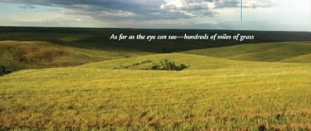
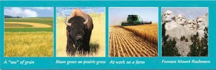
4 as far as the eye can see millions of acres of treeless grassland. Between the Mississippi River and the Rocky Mountains

5

6 Flatlands that rise gradually from east to west Land eroded by wind and water Low rainfall Frequent dust storms


7 Only 20 inches of rain per year Home to the buffalo can survive in dry climate (sacred to the Native Americans) High winds stir up dust and create dust storms
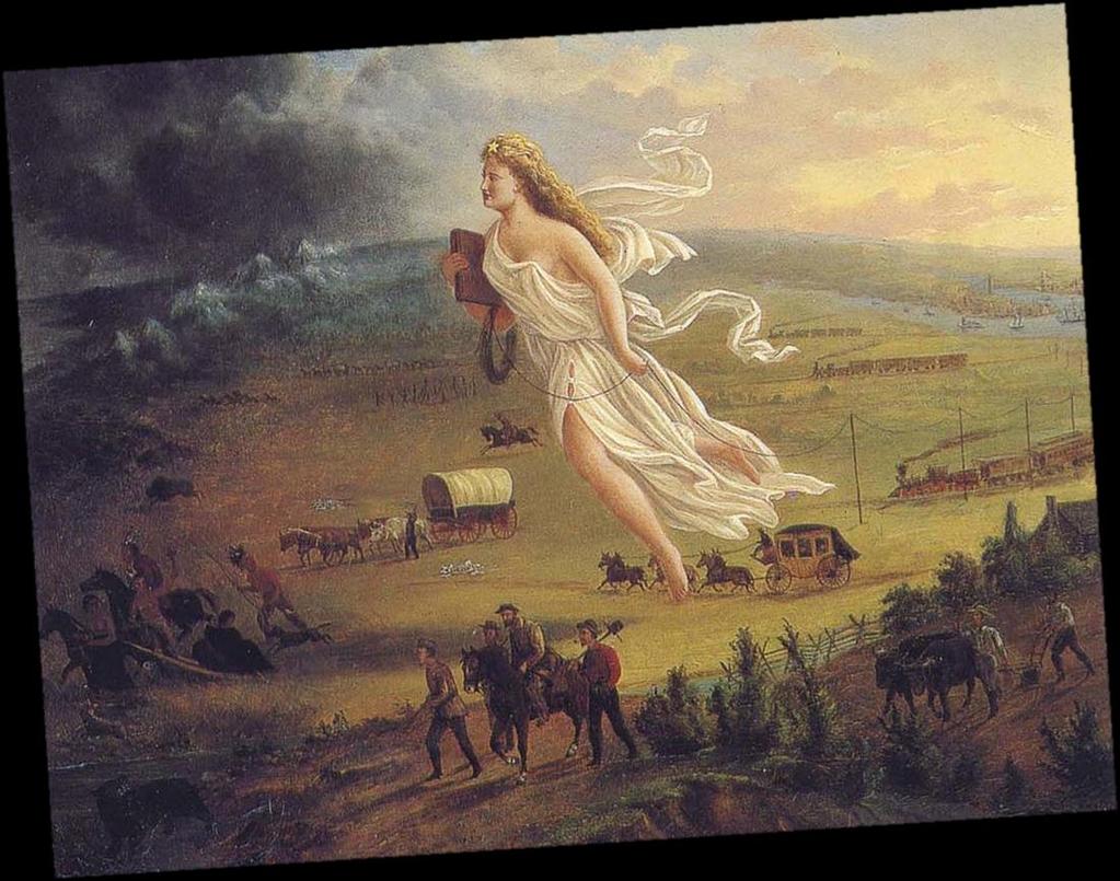
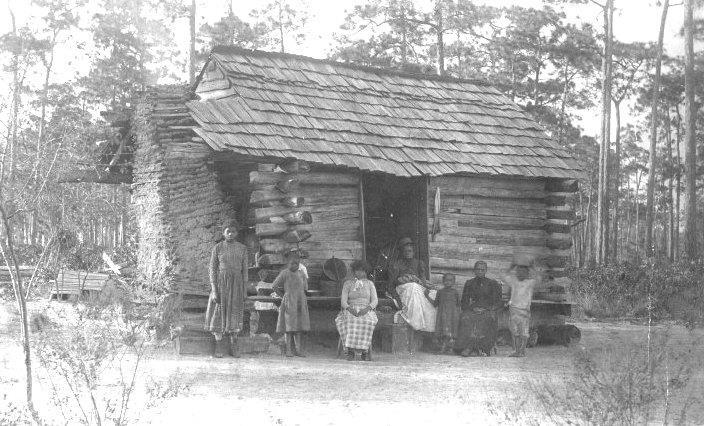
8 1. New beginning for freedmen 2. Opportunities to own land 3. Treasure discovery of gold and silver 4. Desire for adventure 5. New Technology people could live in challenging environments
9

10 Opportunities for Land Homestead Act (1862) government incentive that gave 160 acres (1/4 sq. mi.) if met certain requirements: years old, or head of family 2. US citizens or filing for 3. Build a certain size home and live for 6 months 4. Farm the land for five consecutive years


11 BOOM!! Towns called BOOMTOWNS grew over night Miners came from all over Town life was expensive Violence was part of BOOMTOWN life


12 BUST!! No more gold!! A lot of people moved to new sites or back home Now called ghost towns
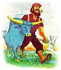
13 Who likes adventure??? The West was exciting and new - People flocked to the West for adventure
14
15 Because of new inventions, people saw the Great Plains not as a treeless wasteland but as a vast area to be settled. 1.Dry Farming 6. Beef Cattle Raising 2. Wheat Farming 7. Barbed Wire 3. Steel Plow 8. Railroads 4. Windmills 9. Sod Houses 5. Mechanical Reaper


16 Type of farming that allows farmers to farm without much water. Plant the seeds deeper to get more water Popular crops = wheat, corn, and watermelon


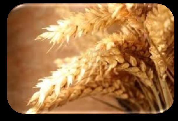
17 Wheat doesn t need much water Wheat can be made into flour which is nonperishable and can be used to make bread and cereal


18 Great Plain soil was rocky Wooden plows weren t strong enough Harder steel made the plow work


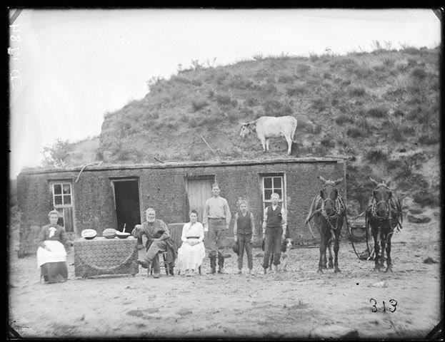
19 Water-pumping Windmills: Provided water for people and animals due to little rainfall 1. Wind turns the blades of the windmill 2. A long rod that runs down the tower moves the handle of a pump up and down 3. The water flows into an open wooden box called a trough


20 Mechanical Reaper (mower) reduced farm labor needs and increased production
21

")


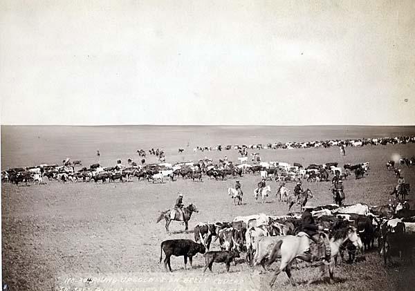
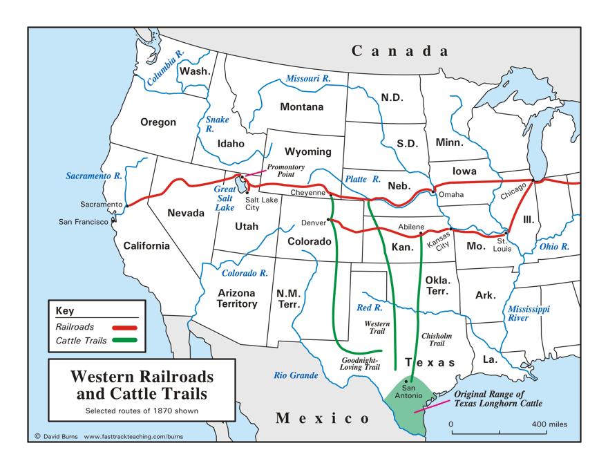
22 Some areas good for cow (cattle) Texas became the center of cattle ranching People in the East wanted to eat beef
23


24 Barbed wire was used for fencing large ranches and farms Built quickly and was cheap Wood fences were expensive and hard to get (few trees for wood)
25


26 Sod = the top layer of soil and grass Houses made out of sod (dirt) Sod was used on the walls and roof (placed over wood beams)
27


 Transported")

28 Made it easier to go west Farmers could ship their crop to the east Transcontinental Railroad linked the East to the West (from the Atlantic to Pacific Ocean) Transported people and goods Made trade easier Started building factories in the West
29
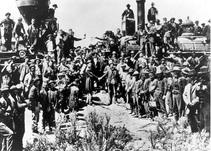
 - Meet me in the Middle May 10, 1869: UP and CP met at Promontory Point, Utah Leland Stanford, gov.")
30 Two Railroads: Union Pacific and Central Pacific -Union Pacific: began in Omaha, Nebraska (blue) - Central Pacific: began in Sacramento, California (red) - Meet me in the Middle May 10, 1869: UP and CP met at Promontory Point, Utah Leland Stanford, gov. of California, drove the last spike.


31 WHO BUILT THE TRANSCONTINENTAL RAILROAD? Union Pacific 8,000 Irish and African Americans Central Pacific 10,000 Chinese


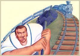
32 Invented by Samuel Morse THINK MORSE CODE 1. Allowed people to communicate across long distances. 2. Messages could travel across the country in a matter of minutes.
Name period date assigned date due date returned. Texas Ecoregions
 Name period date assigned date due date returned Directions: Go to the following website: https://www-k6.thinkcentral.com/epc/start.do Use the log in that is taped to the top of your laptop. If you are
5th social studies geography (5thsocstud_geography)
") Name: Date: 1. Many of the Native Americans who lived on the Great Plains were nomadic people. Why did they move from place to place? A. They were finding new areas to mine. B. They were looking for fertile
Name: Date: 1. Many of the Native Americans who lived on the Great Plains were nomadic people. Why did they move from place to place? A. They were finding new areas to mine. B. They were looking for fertile
Name period date assigned date due date returned. Texas Ecoregions
 Name period date assigned date due date returned Directions: Go to the following website: https://www-k6.thinkcentral.com/epc/start.do Use the log in that is taped to the top of your laptop. If you are
Changes in Texas Ecoregions Copy the questions and answers
 Changes in Texas Ecoregions Copy the questions and answers 1. What are some kinds of damage that hurricanes cause? Roads and bridges might be washed away. Trees and power lines can be knocked down. Area
Table of Contents. Introduction...3 How to Use This Book...4 Standards Information...6 The World in Spatial Terms
 Table of Contents Introduction...................................................................3 How to Use This Book..........................................................4 Standards Information...........................................................6
Explain the impact of location, climate, natural resources, and population distribution on Europe. a. Compare how the location, climate, and natural
 SS6G10 Explain the impact of location, climate, natural resources, and population distribution on Europe. a. Compare how the location, climate, and natural resources of Germany, the United Kingdom and
The Wedding of the Rails
 The Wedding of the Rails Anne Burkhalter Gilbert Elementary School aburkhalter@lexington1.net Overview Students will learn about the Transcontinental Railroad its importance in settling the west, as well
After school one day, Chris s great-grandfather asked him what he
 8 The Dust Bowl R O L E P L A Y After school one day, Chris s great-grandfather asked him what he was studying in his science class. Chris began to tell him about the garden. When he described the problems
Grade Five Social Studies Assessment Regions/Native Americans
 Name Grade Five Social Studies Assessment Regions/Native Americans Use the map below to answer questions 1 and 2 1. (Geo 1) For this location give the name of the city found there. 38 N, 100 W a. Scottsbluff
UNIT III-WESTWARD EXPANSION SOL: USII2a, 4a
 UNI III-WESWARD EXPANSION SOL: USII2a, 4a What is Western Expansion? Westward Expansion is the the 22 states that are west of the Mississippi River of Developing of the states means Page1 Western Expansion
THE GREAT DEPRESSION T H E D U S T B O W L
 THE GREAT DEPRESSION THE DUST BOWL DAY 1 & 2 THE DUST BOWL Direct instruction students will participate in lecture though active listening, note-taking and by watching short videos. Students will periodically
Indian Territory. What Next? 2/25/2016. Antebellum I.T. (Indian Territory Before the Civil War) Postbellum I.T. (Indian Territory After the Civil War)
 Postbellum I.T. (Indian Territory After the Civil War)") Indian Territory After the Civil War What Next? www.bluecerealeducation.com Antebellum I.T. (Indian Territory Before the Civil War) Postbellum I.T. (Indian Territory After the Civil War) 1 Post-Civil War
Indian Territory After the Civil War What Next? www.bluecerealeducation.com Antebellum I.T. (Indian Territory Before the Civil War) Postbellum I.T. (Indian Territory After the Civil War) 1 Post-Civil War
Name period date assigned date due date returned. Texas Ecoregions
 Name period date assigned date due date returned Directions: Go to the following website: https://www-k6.thinkcentral.com/epc/start.do Use the log in that is taped to the top of your laptop. If you are
The Physical Geographical Change of the Great Plains during the Dust Bowl (1930 s)
") The Physical Geographical Change of the Great Plains during the Dust Bowl (1930 s) Overview: This lesson shows how the Dust Bowl climate changed the physical geography of the Great Plains and forced the
The Physical Geographical Change of the Great Plains during the Dust Bowl (1930 s) Overview: This lesson shows how the Dust Bowl climate changed the physical geography of the Great Plains and forced the
THE GRID SYSTEM. System of imaginary lines that give the exact position of a place on Earth
 WORLD GEOGRAPHY THE GRID SYSTEM System of imaginary lines that give the exact position of a place on Earth LATITUDE Imaginary lines that travel horizontally around the earth measuring North and South Latitude
Weathering and Soil Formation. Chapter 10
 Weathering and Soil Formation Chapter 10 Old and New Mountains The Appalachian Mountains appear very different from the Sierra Mountains. The Appalachians are smaller, rounded, gently sloping, and covered
Factors Affecting Human Settlement
 Factors Affecting Human Settlement Physical Factors One of the most basic factors affecting settlement patterns is the physical geography of the land. Climate is key, because if a place is too dry, too
MARS AREA SCHOOL DISTRICT CURRICULUM GRADE: Grade 4
 MARS AREA SCHOOL DISTRICT CURRICULUM GRADE: Grade 4 Course Title: Social Studies Brief Description Overview: Students will explore the history, geography, government, and economy of the United States with
Sec$on 1: Geography and Early China. How does China s geography affect the culture?
 Sec$on 1: Geography and Early China How does China s geography affect the culture? Con$nents of the World Label the continents. Where is China located? Where is China located? In your groups, begin filling
Grade 5. Practice Test. Dust Bowl Disaster
 Name Date Grade 5 Dust Bowl Disaster Today you will read the following passage. Read this passage carefully to gather information to answer questions and write an essay. Excerpt from Dust Bowl Disaster
4th Grade Social Studies First Nine Weeks
 4th Grade Social Studies First Nine Weeks Multiple Choice Identify the choice that best completes the statement or answers the question. 1 Name the mountains that are located in the eastern United States.
Post Test Trimester 1 US & Canada 6th Grade-Study Guide
 Post Test Trimester 1 US & Canada 6th Grade-Study Guide Matching Fill in the blank by writing the letter of the correct term below. a. dominion f. indigenous b. Industrial Revolution g. interdependent
The Dust Bowl By Jessica McBirney 2018
 Name: Class: The Dust Bowl By Jessica McBirney 2018 The Dust Bowl was a time of harsh dust storms in the central United States during the 1930s. In this informational text, Jessica McBirney discusses the
EQ: Discuss main geographic landforms of the U.S. & Canada and examine varied landforms in relation to their lifestyles.
 EQ: Discuss main geographic landforms of the U.S. & Canada and examine varied landforms in relation to their lifestyles. Places & Terms for Discussion Appalachian Mountains Great Plains Canadian Shield
Natural Texas. Regions and Climates
 Natural Texas Regions and Climates Two Kinds: Physical geography Climate, vegetation, rivers, lakes, oceans, plateaus, plains, and mountain ranges Human geography Economic activities How we earn a living
North America ATLANTIC OCEAN PACIFIC OCEAN. The First Americans. Labrador Sea. Caribbean Sea. USI_ISN_U01_01.eps. Second Proof TCI19 65.
 G e o g r a p h y C h a l l e n g e North America 70 N 180 N 60 170 W 30 W 160 W 40 W Labrador Sea 150 W 50 N 50 W Hud s on B ay 140 W 40 N 60 W ATLANTIC OCEAN 30 N PACIFIC OCEAN Gulf of Mexico 20 N 130
What Causes Erosion? 3.2 Case Studies
 3.2 Case Studies What Causes Erosion? Looking at evidence of erosion has helped you identify some of the causes of erosion. It has also helped you raise questions about what causes erosion. Other people
Learning Target: Describe how to compost and why it is important. Vocabulary: Dust Bowl, soil, dirt, degradation, conservation
 Lesson 4 Extension: Soil Learning Target: Describe how to compost and why it is important. Vocabulary: Dust Bowl, soil, dirt, degradation, conservation Warm Up: Copy the lesson heading. Teaching: Review
THE INDIAN COMMUNITY SCHOOL, KUWAIT
 THE INDIAN COMMUNITY SCHOOL, KUWAIT SERIES : I TERM /AN/ 2018-2019 CODE : H 087 TIME ALLOWED : 3 HOURS NAME OF STUDENT : MAX. MARKS : 80 ROLL NO. :.. CLASS/SEC :.. NO. OF PAGES : 2 + 1 MAP SOCIAL SCIENCE
Changes to Land 5.7B. landforms: features on the surface of Earth such as mountains, hills, dunes, oceans and rivers
 All the landforms on Earth have changed over time and continue to change. Many of the changes were caused by wind, moving water, and moving ice. Mountains have grown and shrunk. Rivers have cut away land
Think about the landforms where you live. How do you think they have changed over time? How do you think they will change in the future?
 reflect All the landforms on Earth have changed over time and continue to change. Many of the changes were caused by wind, moving water, and moving ice. Mountains have grown and shrunk. Rivers have cut
STUDENT NAME DATE ID GRADE 5 SCIENCE
 STUDENT NAME DATE ID GRADE 5 SCIENCE Administered October 2007 DIRECTIONS Read each question and choose the best answer. Be sure to mark your answers. SAMPLE A Objects That Conduct Heat Silver spoon Copper
e Southeast Region of the United Statesg
 e Southeast of the United Statesg - relative location: the location of a place in relation to another place (i.e. south, near, bordering, next to) - barrier islands: located off the southeast coast of
GCSE 4242/02 GEOGRAPHY (Specification B) FOUNDATION TIER UNIT 2 SECTION B
 FOUNDATION TIER UNIT 2 SECTION B") Surname Centre Number Candidate Number Other Names 0 GCSE 4242/02 GEOGRAPHY (Specification B) FOUNDATION TIER UNIT 2 SECTION B S15-4242-02 P.M. WEDNESDAY, 3 June 2015 1 hour 30 minutes For s use Part Maximum
Surname Centre Number Candidate Number Other Names 0 GCSE 4242/02 GEOGRAPHY (Specification B) FOUNDATION TIER UNIT 2 SECTION B S15-4242-02 P.M. WEDNESDAY, 3 June 2015 1 hour 30 minutes For s use Part Maximum
!! The Rio Grande River starts at the Rocky Mountains in Colorado. This River is 1,885 miles long!
 The Southwest Region By Taylor Noble and Kaiya Leismer Land and water The southwest region covers a lot of land but the Southwest region has lowest amount of states in any other region. In the Southwest
Cold-Read Task. b. The author emphasizes how the drought caused people to be afraid to shake hands.
 Cold-Read Task Read Legacy from The Dust Bowl. Then answer the questions. 1. Part A Read paragraph 3 of Legacy. Then the drought began. It would last eight straight years. Dust storms, at first considered
Chapter 6, Part Colonizers arriving in North America found extremely landscapes. It looked different to region showing great.
 Social Studies 9 Unit 1 Worksheet Chapter 6, Part 1. 1. Colonizers arriving in North America found extremely landscapes. It looked different to region showing great. 2. The Earth is years old and is composed
Weathering and Erosion
 Have you ever looked at the land around you and wondered how it was shaped? The geologic features that help define the world are still being shaped by the natural processes of weathering, erosion, and
Name Date Class. well as the inland, found near the Tropics. 4. In the, or the regions near the Equator, you may find a lush
 WATER, CLIMATE, AND VEGETATION Vocabulary Activity DIRECTIONS: Fill in the Blanks Select a term from below to complete each of the following sentences. CHAPTER 1. The constant movement of water, a process
Unit 1: Geography. For additional information, refer to this website: 1 G e o g r a p h y
 Unit 1: Geography For additional information, refer to this website: http://mryoungtms.weebly.com/ 1 G e o g r a p h y Continents and Oceans SOL USI. 2a Essential Understanding: Continents are large land
Chapter 24 Southern Africa
 Chapter 24 Southern Africa Section 1 - Physical Geography of Southern Africa Landforms Southern Africa consists of ten mainland countries and four island countries. Most of Southern Africa sits at a high
GUIDED READING CHAPTER 1: THE LAY OF THE LAND (Page 1)
") CHAPTER 1: THE LAY OF THE LAND (Page 1) Section 1 The Tidewater Region Directions: Use the information from pages 6-11 to complete the following statements. 1. In the southern part of the coast, the Tidewater
CHAPTER 1: THE LAY OF THE LAND (Page 1) Section 1 The Tidewater Region Directions: Use the information from pages 6-11 to complete the following statements. 1. In the southern part of the coast, the Tidewater
* We will go as a class to the bathroom at 8:18!
 Unpack/ Write down homework Turn in ANY papers from home Get computer & book boxes Work on Government Shortcut--DUE THURSDAY! Work on ANY unfinished work- DUE THURSDAY * We will go as a class to the bathroom
Controlling Processes That Change Land
 1 Name Date Controlling Processes That Change Land People try to control some of the processes that change land. To do this, people apply technology- the use of science to solve problems in everyday life.
Five Themes of Geography
 There are five themes of geography: location, place, region, movement, and humanenvironment interaction. These themes are important to geographers. The themes help them describe places. They help geographers
Physical Geography of the United States and Canada Chapter 5 A Land of Contrasts
 Physical Geography of the United States and Canada Chapter 5 A Land of Contrasts Land Area Together the U.S. and Canada cover more than 7 million square miles. In total area, Canada ranks 2 nd and the
Your web browser (Safari 7) is out of date. For more security, comfort and the best experience on this site: Update your browser Ignore
 is out of date. For more security, comfort and the best experience on this site: Update your browser Ignore") Your web browser (Safari 7) is out of date. For more security, comfort and the best experience on this site: Update your browser Ignore Educator Version TRACKING GRO W TH IN THE U.S. Late 19th century
Your web browser (Safari 7) is out of date. For more security, comfort and the best experience on this site: Update your browser Ignore Educator Version TRACKING GRO W TH IN THE U.S. Late 19th century
How does erosion happen?
 How does erosion happen? By National Geographic, adapted by Newsela staff on 10.03.17 Word Count 682 Level 830L These rock formations, in Bryce Canyon National Park, Utah, are called hoodoos. Although
Where is the tropical zone? What are three biomes found in the tropical zone?
 Name CHAPTER 17 Class Date SECTION 2 The Tropics BEFORE YOU READ After you read this section, you should be able to answer these questions: Where is the tropical zone? What are three biomes found in the
Scope & Sequence Grade: Four Subject: Social Studies Revised 3/30/ st Quarter (44 Days)
") 1 st Quarter (44 Days) Describe some of the major landforms and waterways in. Describe 4.7 B, 4.9 B, 4.6 A, 4.6 B, 4.22 B, Week 1 Chapter1: The geography of the ways people collect water from the Earth.
1 st Quarter (44 Days) Describe some of the major landforms and waterways in. Describe 4.7 B, 4.9 B, 4.6 A, 4.6 B, 4.22 B, Week 1 Chapter1: The geography of the ways people collect water from the Earth.
4 th Grade Virginia Studies SOL Review Packet Geography of Virginia. 1. The Algonquian language group of Indians lived in what region of Virginia?
 4 th Grade Virginia Studies SOL Review Packet Geography of Virginia 1. The Algonquian language group of Indians lived in what region of Virginia? A. Allegheny B. Piedmont C. Ridge and Valley D. Tidewater
Dangerous Weather: Hurricanes and Tornadoes
 Dangerous Weather: Hurricanes and Tornadoes Look outside. What do you see? Are there dark clouds in the sky? Does it look like it might rain? Do you need a jacket? An umbrella? When you check the weather
May 20, Tornado Flattens Oklahoma Suburb
 In News Focus #34, we visit Tornado Alley, Oklahoma City. This area of the States is often hit by violent, powerful tornados. A tornado is a rotating column of air that touches both the earth and the clouds.
Social Studies Final Exam Review Packet Exam Date: a. movement b. human-environment interaction c. region d. location e. place
 Name Date Per Social Studies Final Exam Review Packet Exam Date: Part 1: Five Themes of Geography Fill in the correct letter for each theme. a. movement b. human-environment interaction c. region d. location
Scope & Sequence Grade:4 Subject:Social Studies
 1 st Quarter (43 Days) 1 st : Aug 10-14 2 nd : Aug 17-21 3 rd : Aug 24-28 4 th : Aug 31- Sep 4 5 th : Sept 8-11 6 th : Sept 14-18 7 th : Sept 28- Oct 2 8 th : Oct 5-9 Chapter1: The geography of the Lesson
Dark Days on the Prairie
 Objective Students will read about the Dust Bowl, create time lines of the events leading up the the Dust Bowl, identify cause and effect and use dominos to demonstrate. Students will view photos from
Travelers usually left in May and hoped to reach Oregon by October. It took them 6 months to make the 2200-mile journey. Each wagon train headed west
 Oregon or Bust The Oregon Trail The Oregon Trail opened in 1841 with 35 men, 5 women, and 10 children using it to make the trek from Independence, Missouri, to Oregon City, Oregon. In 1842, 100 emigrants
Unit 2. United States Physical Geography
 Unit 2 United States Physical Geography Physical Geography U.S. extends from the Atlantic to Pacific U.S. is the 3rd largest country U.S. has fertile soils, vast forests, and variety of minerals All major
1 Earthquakes in the United States
 1 Earthquakes in the United States Pre-Reading Discussion/Reading Before you read the passage, work with one or two other students to answer these questions. Where do earthquakes occur? What kinds of things
Your web browser (Safari 7) is out of date. For more security, comfort and the best experience on this site: Update your browser Ignore
 is out of date. For more security, comfort and the best experience on this site: Update your browser Ignore") Your web browser (Safari 7) is out of date. For more security, comfort and the best experience on this site: Update your browser Ignore urban area For the complete encyclopedic entry with media resources,
Your web browser (Safari 7) is out of date. For more security, comfort and the best experience on this site: Update your browser Ignore urban area For the complete encyclopedic entry with media resources,
LATITUDE. Latitude lines run to, but are measured & The 0 of latitude that circles the earth is called the?
 LATITUDE Latitude lines run to, but are measured & The 0 of latitude that circles the earth is called the? LATITUDE 0 0 Latitude lines run east to west, but are measured north & south The 0 of latitude
Disasters in Northeastern Colorado in the 1800s and 1900s
 Disasters in Northeastern Colorado in the 1800s and 1900s By Jessica A. Martin Driving through northeastern Colorado, the view is full of crops such as wheat, corn, and sorghum fields. Pastures are filled
Chapter 1: America s Land Lesson 1: Land and Climate
 Chapter 1: America s Land Lesson 1: Land and Climate Geography: Describe landforms and other physical features of the United States. Geography: Explain how and why climate varies throughout the United
3rd Grade Social Studies Practice Test
 3rd Grade Social Studies Practice Name: Instructions: Copyright 2000-2002 Measured Progress, All Rights Reserved : 1. Citizens have both rights and privileges. Which of the following is a right? A. voting
CHAPTER 1: EXPLORING GEOGRAPHY
 CHAPTER 1: EXPLORING GEOGRAPHY Please Do Now: In your PDN section of your binder answer the following with one or two sentences: What is Geography? What is Geography? The study of where people, places,
Earth processes are dynamic actions that occur both on
 29 Weathering, Erosion, and Deposition R EA D I N G Earth processes are dynamic actions that occur both on the earth s surface and inside the earth. Any process that breaks down earth material, such as
Weathering, Erosion, and Deposition
 Weathering, Erosion, and Deposition E Q : H O W I S T H E E A R T H A F F E C T E D B Y C O N S T R U C T I V E A N D D E S T R U C T I V E F O R C E S? http://player.discoveryeducation.com/index.cfm?guidassetid=6b1e329e-5a77-4b36-bfa9-1d307f75441c&blnfromsearch=1&productcode=us
(version 3) I. HumAN -Environment Interaction
 I. HumAN -Environment Interaction") (version 3) I. HumAN -Environment Interaction A. Landforms 1. Earth s topography is made up of many different types of landforms. 2. While the planet is covered primarily with water, the four major types
(version 3) I. HumAN -Environment Interaction A. Landforms 1. Earth s topography is made up of many different types of landforms. 2. While the planet is covered primarily with water, the four major types
Guided Reading Activity
 Guided Reading Activity Lesson 1 Physical Features Essential Question: How does geography influence the way people live? A Vast Land Directions: Read the lesson and use your text to decide whether each
4th Grade U.S. Regional Geography
 4th Grade U.S. Regional Geography Multiple Choice Identify the choice that best completes the statement or answers the question. What does the term mainland mean in the sentence above? A the continent
Drought lesson plan ITEMS. Teachers lesson plan. Student assignments. About droughts. Real life stories. Droughts: Be prepared.
 Drought lesson plan The drought lesson plan provides teachers and students with an opportunity to investigate the Australian climate, water table and the impacts of drought through individual or classroom
Written by Vowery Dodd Carlile and Traci Burnett Illustrated by Karen Birchak
 Written by Vowery Dodd Carlile and Traci Burnett Illustrated by Karen Birchak Table of Contents INTRODUCTION...5 TO THE TEACHER...6 STORIES ABOUT TEXAS: Background, Vocabulary Activities, Discussion Questions,
Social Studies (4) Social Science
 Social Science") Scope And Sequence Timeframe Unit Instructional Topics 8 Day(s) Course Overview Students will learn about the regions of the United States with emphasis on local and state history, geography, government,
Scope And Sequence Timeframe Unit Instructional Topics 8 Day(s) Course Overview Students will learn about the regions of the United States with emphasis on local and state history, geography, government,
4 Changes in Climate. TAKE A LOOK 2. Explain Why is more land exposed during glacial periods than at other times?
 Name Class CHAPTER 3 Date Climate 4 Changes in Climate SECTION National Science Education Standards BEFORE YOU READ After you read this section, you should be able to answer these questions: ES 1k, 2a
INVISIBLE WATER COSTS
 Every Drop Every Counts... Drop Counts... INVISIBLE WATER COSTS Corn - 108.1 gallons per pound How much water it takes to produce... Apple - 18.5 gallons to grow Beef - 1,581 gallons per pound Oats - 122.7
6.E E Rock Cycle/Weathering/Soil
 Name: Date: 1. A lake is surrounded by hills covered with trees and shrubs. Which statement correctly describes how a change to the plants in this area will affect this environment? A. Adding plants to
About places and/or important events Landmarks Maps How the land is, hills or flat or mountain range Connected to maps World Different countries
 What do you think you know about geography? About places and/or important events Landmarks Maps How the land is, hills or flat or mountain range Connected to maps World Different countries What do you
world s grasslands temperate region tropical regions THE PRAIRIES Word Origin Fig. 9.1:
 Just as a forest can be defined as the place where trees are the main type of vegetation, grassland can be defined as a region where grasses form the dominant type of plant life. Grasslands make up almost
Where is the tropical zone? What are three biomes found in the tropical zone?
 Name CHAPTER 3 Class Date Climate 2 The Tropics SECTION BEFORE YOU READ After you read this section, you should be able to answer these questions: Where is the tropical zone? What are three biomes found
Chapter 1 The Nature Of Science. Scientists are much like detectives trying to solve a mystery. Problem: What caused the huge ocean waves?
 Chapter 1 The Nature Of Science Section 1 Science All Around Mysteries and Problems Scientists are much like detectives trying to solve a mystery. 1996- While looking through historical data, scientists
Physical Geography. Ariel view of the Amazon Rainforest. A Look at the Seven Continents
 Physical Geography In this unit you will learn about general physical geography. The study of the Earth s surface features provides the setting for the human-environmental interactions and for the human
Chapter 21 Southwest Asia: Harsh & Arid Lands
 Name Hour Chapter 21 Southwest Asia: Harsh & Arid Lands Essential Question: How has the physical geography of Asia influenced the development of these regions (i.e. history, population distribution, &
Year 4 Geography Revision Pack Summer 2018 Name
 Year 4 Geography Revision Pack Summer 2018 Name Welcome to your geography revision pack for the upcoming Summer exams. Everything that we have been working on in lessons since Christmas will be covered
6. What instrument does a geologist use to record the motions produced by an earthquake?
 Name: Date: 1. Which human activity does NOT help control water runoff? A. contour plowing B. planting crops C. building flood control dams D. paving with asphalt 2. Which is NOT an effect of sewage put
Cranford Park CE Primary School. Subject Overview for Geography. Autumn 1 Autumn 2 Spring 1 Spring 2 Summer 1 Summer 2 Title of unit.
 Autumn 1 Autumn 2 Spring 1 Spring 2 Summer 1 Summer 2 Main Objectives /Skills Main Objectives /Skills Main Objectives /Skills Main Objectives /Skills Main Objectives /Skills Main Objectives /Skills Foundation
Terms. divide headwaters tributary fall line fishery
 Chapter 5 Preview Section 1 The Land Objectives Identify some key similarities and differences in the physical geography of the United States and Canada. Explain why rivers have played such an important
Chapter 1 Geography and Westward Expansion
 Chapter 1 Geography and Westward Expansion US II.1 The student will demonstrate skills for historical and geographical analysis and responsible citizenship, including the ability to a) analyze and interpret
The Ancient World. Chapter 1 The Beginnings of Human Society. What historical accomplishments is each civilization known for?
 Chapter 1 The Beginnings of Human Society Chapter 1-Guiding Questions: What historical accomplishments is each civilization known for? How did physical geography affect the growth of ancient civilizations
Passwords. Social Studies Vocabulary. Texas: Grade 7
 Passwords Social Studies Vocabulary Texas: Grade 7 To the Student What is federalism? How are independence and interdependence different? What does an anthropologist do? Passwords: Social Studies Vocabulary
The Ron Clapp Nature Trail Activity Book
 The Ron Clapp Nature Trail Activity Book By The 2008 Adventurers Ron Clapp Memorial Trail Animal Signs Scavenger Hunt As you walk through the trails look closely to see if you can find the items listed
HURRICANES AND TORNADOES
 HURRICANES AND TORNADOES The most severe weather systems are hurricanes and tornadoes. They occur in extremely low pressure systems, or cyclones, when the air spirals rapidly into the center of a low.
2nd Grade. Wind, Water and Land.
 1 2nd Grade Wind, Water and Land 2015 11 23 www.njctl.org 2 Wind, Water and Land What is Wind? Wind Erosion Preventing Wind Erosion Water Erosion Sudden Water Erosion Preventing Water Erosion Landforms
How strong does wind have to be to topple a garbage can?
 How strong does wind have to be to topple a garbage can? Imagine winds powerful enough to pick up a truck and toss it the length of a football field. Winds of this extreme sometimes happen in a tornado.
Lesson- 6 WEATHER AND CLIMATE
 Lesson- 6 WEATHER AND CLIMATE New Words 1. Heat Zones:- the division of the earth according to the climate. 2. Frigid:- the zone that is the coldest 3. Temperate:- the zone that is neither too hot nor
SAMPLE. Succeeding in Social Studies 3 4 TH IN A SERIES OF 7. Years 3 4. Written by Valerie Marett. CORONEOS PUBLICATIONS Item No 506
 AUSTRALIAN HOMESCHOOLING SERIES Succeeding in Social Studies 3 4 TH IN A SERIES OF 7 Years 3 4 Written by Valerie Marett CORONEOS PUBLICATIONS Item No 506 Contents Notes to Parents......2 Maps...... 3
The Four World Zones Become Connected
 The Four World Zones Become Connected By Cynthia Stokes Brown, Big History Project, adapted by Newsela staff on 07.30.16 Word Count 812 TOP: Asia from space. Photo: Corbis. MIDDLE: Bering Land Bridge National
How Geographers View the World: Human Geography. ESSENTIAL QUESTION: How does geography influence the way people live?
 How Geographers View the World: Human Geography ESSENTIAL QUESTION: How does geography influence the way people live? Geographers Think Spatially Gefffffdgfhfjgjp Guiding Question: What does it mean to
Our Environment Class 7 Questions on Give Reasons for quick revision for Competitive Exams
 Questions on Give reasons at the end of each Chapter Chapter 1 1. Man modifies his environment Man has tried to make life more comfortable for his own species on a continuous basis. For this he has learnt
Grade 5 Hands on Science Weathering, Erosion and Deposition
 Grade 5 Hands on Science Weathering, Erosion and Deposition Objective: To demonstrate and investigate the effect of weathering, water and wind erosion and the subsequent deposition into landforms. Background:
Objectives. Understand the different physical & human characteristics of each region
 TEXAS REGIONS Objectives Know the 4 regions of Texas Understand the different physical & human characteristics of each region Understand how physical differences affect human characteristics (way of life)