Introduction To CoCoRaHS
|
|
|
- Roxanne Small
- 5 years ago
- Views:
Transcription


1

2 Introduction To CoCoRaHS CoCoRaHS is a grassroots, non-profit, communitybased, high density precipitation network made up of volunteers of all backgrounds and ages who take daily measurements of precipitation right in their own backyards.


3 The Aim Of CoCoRaHS is to provide the highest quality data for the many users of the data by *using low-cost measurement tools *stressing training and education *utilizing an interactive website


4 Help be a part of the mission and save lives!

5 Who Uses CoCoRaHS Data? National Weather Service Meteorologists Turf and Landscape Professionals Hydrologists City Utilities -Water supply -Water conservation -Storm water Emergency Managers Insurance adjusters USDA - Crop production Ranchers and Farmers Engineers Mosquito control Outdoor & Recreation Teachers and Students Geoscience education tool Taking measurements Analyzing data Organizing results Conducting research Helping the community


6 Why CoCoRaHS? Because every drop counts! In addition to 24-hour daily precipitation reports, provides real time reports of hail and intense precipitation that aid in the issuing and verifying of life-saving warnings and advisories Increases climatological rainfall monitoring network by several hundred % Provides detail of extremely localized rainfall patterns for condition monitoring such as drought or wet conditions Helps to capture accurate measurements of localized heavy rainfall responsible for deadly flash flooding and river flooding


7 Why CoCoRaHS? Because every drop counts! Provides tremendous amounts of additional data to regional River Forecast Centers, to aid in the monitoring and prediction of river flows and flooding conditions Establishes a large database of good quality precipitation observations for local analysis and study-consistency and education Mobilizes a pool of extremely interested local weather enthusiasts who could be considered to help fill gaps in the co-op network caused by retirement or observer departure Provides additional material for school curriculum to include the measurement of precipitation and standard observing practices into science education


8 CoCoRaHS Reports Immediately Viewable Locations with CoCoRaHS Volunteers observations are viewable in map and table form within a few minutes! Observations on a specific day
9 Equipment Needed And Where To Place It OK, let s get started! What do I need?


10 -Your commitment to collect timely and accurate scientific data! -The ability to transmit your findings in a timely fashion (internet capabilities)


11 -A completed application form that is available online at -You will then receive a unique station number and a station name Station Number : OH-CN-16 Station Name : Wilmington 1.6 SSE


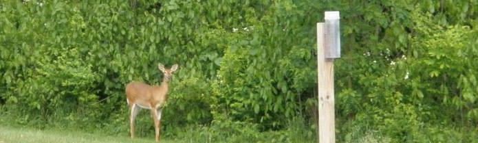
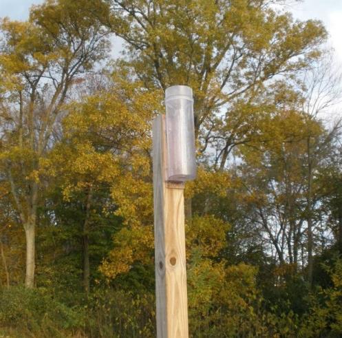
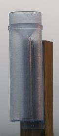
12 -A 4 inch rain gauge installed in a good place. A good location is key to good data! Available on the CoCoRaHS website or many other places online. Here looks like a good spot!


13 Places NOT To Put Your Gauge -The #1 all time worst place to have your gauge is in the box it came in -Using it to hold up your gutter downspout is not a wise choice either -Avoid placing the gauge under trees, near sprinklers, on steep slopes, or where animals can interfere with the gauge


14 Places NOT To Put Your Gauge -Avoid placing it near or under any structure -Although convenient, the deck is still too close to the house -Do not place around anything that would artificially increase or decrease your gauge catch such as a solid fence. A solid fence can cause up-drafting during strong winds which may reduce your gauge catch


15 Places TO Put Your Gauge -Place gauge equidistant between trees -In open areas strive to be twice as far from obstacles as they are high and about 2 feet off the ground to improve gauge catch by reducing wind speed -In developed areas strive to be as far from obstacles as they are high and about 5 feet off the ground to improve gauge catch by reducing the impact of nearby obstacles


16 Places TO Put Your Gauge Few people have the ideal location. Just do your best. Send site photos if you want help.


17 Bevel and Level -This helps to reduce precipitation splashing into the gauge and helps to make sure the precipitation that is falling from the sky is making it into the gauge

18 Have a question? Ask one of the coordinators! State Coordinator (Ohio) Ashley.Novak@noaa.gov or Jeffrey Rogers at rogers.21@osu.edu Local National Weather Service Regional Coordinators are also listed along with state coordinators from other states.

19 How To Measure Precipitation What do I do???


20 Reading Your Rain Gauge -Read at eye level -7:00 AM is the preferred time, however any time between 4:30am and 9:30 AM will show up on the map. Whatever time is good for you as long as it is consistent from day to day.

21 Reading Your Rain Gauge Your most common observation will be 0.00, nada, naught, nothing. It is important to know where it did not rain! Please report zeros.

22 Reading Your Rain Gauge - Trace -When only a drop or two wet the gauge, record a T for Trace.

23 Reading Your Rain Gauge Between a T and one-tenth of an inch. This gauge is showing 0.04 or four hundredths of precipitation.

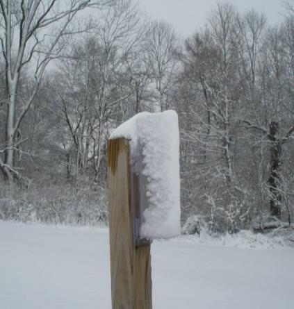
24 Reading Your Rain Gauge Half way up the inner cylinder is one half inch...not 5.00, nor 0.05, but This is kind of like 50 cents out of a dollar.

25 Reading Your Rain Gauge The inner tube holds one inch (1.00) of precipitation.


26 Reading Your Rain Gauge Over An Inch -When more than an inch of rain falls, the precipitation will overflow into the outer cylinder. The whole gauge has the capacity to hold 11 inches.


27 Reading Your Rain Gauge Over An Inch -In order to measure this amount pour out the first inch from the inner tube. -Now pour the remaining water into the funnel & measure using the inner tube.


28 Reading Your Rain Gauge Over An Inch -Continue until all of the water has been measured. Make sure you keep track of your amounts along the way! Then add up all of your measurements 1 inch inches inches inches = 3.77 inches Total = 3.77

29 Reading Your Rain Gauge A Meniscus?? -As water fills up the measuring tube, a curved surface is formed called a meniscus. This meniscus is formed by the surface tension of a liquid in contact with the sides of the tube. Always read the bottom of the meniscus, when the making your daily rain measurements.

30 How To Measure Snowfall -Snowfall measuring is typically more difficult and takes a little more time than rainfall. -Accurate and timely snowfall measurements can be extremely important to the local National Weather Service office, departments of public works, media outlets, climatologists, and other scientists.

31 Winterize Your CoCoRaHS Gauge! -Take the funnel and inner tube out *So the rain gauge won t freeze and crack. *Can t accurately catch snow in the funnel and small tube. *If it rains when you have removed the funnel and small tube, it s ok. *You can just dump the rain back into the funnel and the small tube and measure just like you would with an overflow heavy rain sample.
32 -Snow Stick Snowfall Measuring- Tools Of The Trade *Also known as a yard stick *Aluminum works the best won t warp from getting wet *Ideally, a yardstick with tenths of an inch works best, however you can use any standard yardstick and just convert the values. Measurement on ruler Measurement in tenths of an inch 3/4 th 0.8 ½ 0.5 1/4 th 0.3 1/8 th 0.1 1/16 th 0.1 Less than 1/16 th Trace

33 Snowfall Measuring- Tools Of The Trade -Snow Board *A sheet of plywood, painted white *2 x2 works nicely *1/2 to ¾ thick plywood *It s a flat, level surface that makes a great place to accurately measure snow when placed in an area that does not receive drifting

34 Snowfall Measuring- Tools Of The Trade - Snow-Swatter and spatula Helps in taking core samples
35 Snowfall Measuring- What To Measure 1) Depth of new snow measured to the nearest tenth of an inch and measured from snow board using snow stick 2) Depth of total snow (new + old) measured to the nearest half inch and measured from ground using snow stick 3) Water content of melted snow measured to the nearest hundredth and measured with gauge 4) Core sample from snow board (optional, but encouraged) measured to the nearest hundredth and measured with gauge 5) Core sample from ground (snow water equivalent, again optional, but encouraged especially on Mondays) measured to the nearest hundredth and measured with gauge
 *Slide snow stick into snow until it reaches the board surface *Read the value on the snow stick (value is always to the nearest tenth of an inch like 3.")
36 Measuring The Depth Of New Snow Goal: Measure the amount of new snow that has fallen in the past 24 hours -Tools: Snow stick and snow board *Find a nice, level place to measure where drifting or melting has not occurred (like a snowboard) *Slide snow stick into snow until it reaches the board surface *Read the value on the snow stick (value is always to the nearest tenth of an inch like 3.4 inches) *Sweep the snowboard clean *Enter the report using the CoCoRaHS website
37 Frequently Asked Questions - What if snow accumulates, melts, and accumulates again? - The snowfall is the sum of each accumulation before melting. - For example: Three separate snowfalls occur during the day. You go out and measure the snow after each has ended. The first snowfall is 2.0 inches, the second is 1.5 inches, and the third is 1.0 inch. The snow melts after each snowfall and therefore there is nothing on the snowboard at observation time the next morning. The snowfall for the 24-hour period should be recorded as the sum of the individual events or 4.5 inches. - What if you see snow flurries, but there is nothing in the gauge? - Snowfall would be reported as a trace. If this is the only precipitation, the 24hr precipitation value would also be a trace.
 *Read value on snow stick and record the value (values are to the nearest ½ like 4.5 or 5.")
38 Measuring The Depth Of Total Snow Goal: Measure the total amount of snow on the ground at your location, including both new snow and snow that was already there -Tools: Snow stick *Find a level spot, not drifted over, blown clear, or melted *Slide snow stick through all layers of snow (new and old) *Read value on snow stick and record the value (values are to the nearest ½ like 4.5 or 5.0) *Report the value using the CoCoRaHS website. REMEMBER: Report total snow depth every day there is any snow on the ground!
 - You will report 1.")
39 Frequently Asked Questions - It s done snowing, the sun is coming out, and the snow will melt. Should I measure it now instead of waiting until 7 AM? - Yes! If you know the snow will melt, you should measure the amount now. - This is the 24 hour new snowfall on your next report (2.4 inches) - You will report 1.0 for the snow depth, since that measurement means snow on the ground at the time of observation (to the nearest half inch)!

40 Frequently Asked Questions - There has been drifting and some areas have more snow than overs. How do I accurately measure this? - Never measure in a drift! - Take several measurements from the least drifted areas around the yard. Average the amounts out to come out with a representative value.

41 Frequently Asked Questions - Snow only covers part of my yard. What do I report as my total snow depth? - You will want to take the average of the bare and covered areas. If there is 1 inch in the covered area and 0 in the bare area, your average would be a snow depth of 0.5 inches. - You can also report a T for a trace of snow depth if it is less than half an inch. - You shouldn t count artificially made piles of snow as snow depth (from snowplows or shoveling, etc.)


42 Measuring The Water Content Of The Melted Snow In The Gauge Goal: Determine how much liquid is in the new snow -Tools: 4 inch CoCoRaHS rain gauge, possible snow swatter *Remove your gauge from its mounting bracket *Bring the gauge inside

43 Measuring The Water Content Of The Melted Snow In The Gauge Goal: Determine how much liquid is in the new snow -Take your inner cylinder and add warm water to it. - Carefully measure and record the amount of warm water you added to the inner cylinder. -Now you have two cylinders, one with snow inside it and the other with a carefully measured amount of warm water!
. - Now the cylinder contains all water, some of it melted snow and the rest tap water.")
44 Measuring The Water Content Of The Melted Snow In The Gauge Goal: Determine how much liquid is in the new snow - Pour the carefully measured amount of warm tap water into the snowfall sample. - Allow the snow sample to completely melt (swishing it around can help). - Now the cylinder contains all water, some of it melted snow and the rest tap water.
45 Measuring The Water Content Of The Melted Snow In The Gauge Goal: Determine how much liquid is in the new snow - Pour the water back through the funnel into the smaller inner cylinder. - Be careful not to spill!


46 Measuring The Water Content Of The Melted Snow In The Gauge Goal: Determine how much liquid is in the new snow - Carefully read the amount in the cylinder. This amount represents the melted snow + the water you added. - In this case we see that the snow melted down into 0.29 of liquid. - Melted snowfall is measured in hundredths of an inch just like rainfall. Tube full Water added Final reading 0.29
 - Sometimes windy conditions might create a")


47 Measuring The Water Content Of The Snow From The Snow Board Goal: Determine how much liquid is in the new snow (past 24 hours) - Sometimes windy conditions might create a situation where an accurate amount of snow has not fallen into the gauge. If this is the case a core sample can be taken from the snow on the snow board in order to find out the liquid content of the new snow. - Core samples of new snow are not required, however you should do this when the amount of snow in the gauge is not representative of what fell on the ground.

48 Measuring The Water Content Of The Snow From The Snow Board Goal: Determine how much liquid is in the new snow - In order to obtain a core sample turn the empty outer cylinder of your gauge upside down on your snowboard. - Slide a thin, flat object under the core sample in the gauge. - Carefully lift and flip the gauge. - Now you can melt the snow the same as you normally would. This value will be to the nearest hundredth of an inch. - If your original gauge catch was not accurate, you can put your water melted from the core as the daily precipitation amount. - Please include this information in the comments section. Water melted from core is required as the daily precipitation Include amount melted from gauge in comments

49 Measuring The Water Content Of The Snow From The Ground Goal: Determine how much liquid is in the new and old snow (Snow Water Equivalent) - Core samples taken from the ground can provide valuable information for National Weather Service offices and River Forecast Centers! It provides information on how much water is on the ground that can potentially run off into rivers and streams. - SWE Mondays! Although core samples of snow on the ground would be appreciated everyday, we realize this takes time and therefore Mondays have been designated as SWE Mondays. If possible, please report SWE values on Monday if applicable.


50 Measuring The Water Content Of The Snow From The Ground Goal: Determine how much liquid is in the new and old snow (Snow Water Equivalent) - In order to take a core sample of snow on the ground find a good spot free of drifting and melting. - Push the gauge upside down in the snow to cut a core. - Slide a thin, flat object under the core sample and the gauge - Carefully lift and flip the gauge. - Now you can melt the snow the same as you normally would. This value will be to the nearest hundredth of an inch. - Record this value in your daily precipitation report under total snow and ice on the ground and melted value from core to the nearest hundredth


51 Let s Review Melting Snow Goal: Determine how much liquid is in the snow 1. Measure and add warm water. 2. Measure entire sample. 3. Math skills! Tube full Water added Final reading 0.09

52 Importance of Melting Snowfall


53 Measuring and Reporting Sleet and Freezing Rain - Sleet is measured just like snow. - In addition to reporting it as new snow and snow on the ground if applicable, also put a note in the comments sections saying that sleet occurred. - Freezing rain is measured like rain. - Melt and measure what is in the gauge and report as rain. - In the comments section note that freezing rain occurred and how much ice accretion had occurred. Measure how much ice is on the ground or branches. (Left Side + Right Side) / 2 - Report the total depth of freezing rain remaining on the ground at time of observation and enter that in the total snow on ground column. Make a note in your comments section so that we know it is freezing rain.

54 - Just do the best you can! Measuring and Reporting - Water content in the gauge is reported as the daily precipitation. - Report un-melted content on the snow board and ground the same as you would with just snow. - New snow in the past 24 hours Mixed Precipitation - Total snow on the ground at observation

55 Measuring and Reporting Hail - Use a standard ruler and measure the diameter of the hail stone. - Hail reports are extremely important to National Weather Service Meteorologists and go straight to NWS meteorologists. - Your reports can help them issue or verify warnings, helping to protect lives and property. - Report using the CoCoRaHS Website- this is just as useful as calling it in. - Don t wait until your standard reporting time, report it in as soon as you can safely do so!
56 Typical Hail References Hail is typically referenced to coins and sports equipment! 0.25 inch Pea Size 0.50 inch Mothball or Grape Size 0.75 inch Penny Size 0.88 inch Nickel Size 1.00 inch (Severe Criteria) Quarter Size 1.25 inch Half Dollar Size 1.50 inch Walnut or Ping Pong Ball Size 1.75 inch Golf Ball Size 2.00 inch Hen Egg Size 2.50 inch Tennis Ball Size 2.75 inch Baseball Size 3.00 inch Teacup Size 4.00 inch Grapefruit Size 4.50 inch Softball Size

57 Hail Safety Hail reports are very important, but no report is worth risking your safety. NEVER collect hail stones while it is still hailing. ALWAYS remember lightning safety! Use your best judgment your health and safety are number 1!

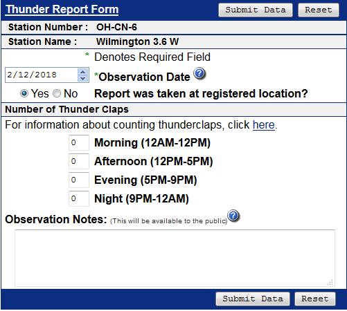
58 Report Types Daily Precipitation Report Multi-Day Precipitation Report Hail Report Significant Weather Report Monthly Zeros Condition Monitoring Report Soil Moisture FROST Reports

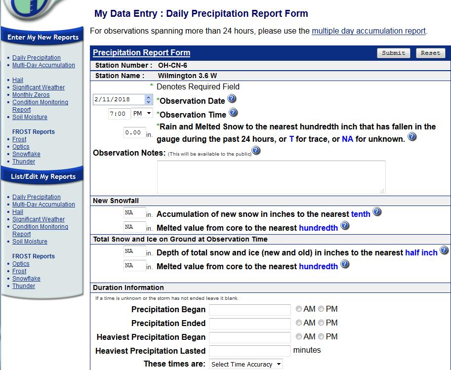
59 CoCoRaHS Website

60 Daily Precipitation Report Rain and water content of melted snow and ice that fell in the last 24 Hours Comments Depth of new snow in the last 24 hrs on snowboard. Melted core from snowboard (optional) Total depth of snow on the ground (new + old) Melted core from ground (optional) Help button

61 Multi-Day Accumulation Report Click here to access the multi-day accumulation report You can even enter information after you ve been away for several days. Use this form for the days your have been away instead of the daily precipitation form. I was away and looked at my gauge when I got back.

62 Hail Report Click here to access hail report -Goes directly to NWS forecasters real time. -Take report and submit when you can safely do so, do not wait until observation time.

63 Significant Weather Report Click here to access the significant weather report -Goes directly to NWS forecasters real time. -Take report and submit when you can safely do so, do not wait until observation time. -No strict definition, but good guidance is greater than an inch of rain in an hour or flooding is occurring. For snow, one inch or more falling in an hour and/or if your total snowfall at the end of the event is greater than four inches. You can put freezing rain of a tenth of an inch or greater in the comments section.

64 Monthly Zeros Report Click here to access the monthly zeros report You can go back in and enter days of zero precipitation on one simple to use page

 basis to share info")
65 Condition Monitoring Report Click here to access the condition monitoring report You can enter how dry/wet conditions are impacting your activities and you. Submitted on a regular (weekly, biweekly, monthly) basis to share info about the effects of local precipitation on the environment and society.


66 Soil Moisture Click here to access the condition monitoring report Main Page-Resources


67 Click here to access the FROST reports FROST Reports

68 Re-entering An Erroneous Report Editing Your Report
69 Other Frequently Asked Questions How do I handle this situation???

70 Frequently Asked Questions - Do I report morning dew that has collected in my gauge as precipitation? - No. That is not precipitation, but you may note the dew in the comments.


71 Frequently Asked Questions - I have an automated weather station with a rain gauge. Can I use that instead of the CoCoRaHS gauge? - In order to accurately compare CoCoRaHS reports, all observers MUST use the 4 inch CoCoRaHS gauge. Automated rain gauges tend to underestimate a heavy rainfall and do not accurately measure water equivalent of snow. You are welcome to place the automated gauge beside the 4 inch gauge to compare measurements, but report what falls in the 4 inch CoCoRaHS gauge.


72 Frequently Asked Questions - Can I file my observations on my mobile device? - Yes, a CoCoRaHS app is available for both iphone and Android Phone


73 Frequently Asked Questions - Where can I go for additional resources? - CoCoRaHS has a variety of resources to connect to from its homepage. There are educational YouTube videos, the CoCoRaHS blog, messages of the day, state newsletters, measuring evapotranspiration, and a climate guide for Master Gardeners just to name a few. You can also connect to CoCoRaHS via social media such as Facebook and Twitter. Resources found on left hand side of main page.
74 Where do I sign up!? So What s Next?

75 Join the CoCoRaHS Network Family Today! Sign-up using the CoCoRaHS website as soon as you can! - Click Join CoCoRaHS in the left hand menu or the button on the right hand side. - You will get an response with your info.
76
77 Questions? Ashley Novak Co-State Coordinator Ohio National Weather Service Wilmington, Ohio You are now ready to measure precipitation for the CoCoRaHS Network! Thank you for being a volunteer observer!
NJ Community Collaborative Rain, Hail and Snow Network
 NJ Community Collaborative Rain, Hail and Snow Network Mathieu Gerbush NJ Assistant State Climatologist/Climate Services Co-CoCoRaHS Coordinator NJ Agricultural Experiment Station School of Environmental
data using low-cost measurement tools 4-inch diameter high capacity rain gauges
 Utah Rain Training Rain Because every drop counts! What Is CoCoRaHS? CoCoRaHS is a grassroots, non-profit, community-based, high-density h it precipitation it ti network made up of volunteers of all backgrounds
Photo: Kristy Johnson. Training Slide Show. Because every drop counts! V10.1
 Photo: Kristy Johnson Training Slide Show Because every drop counts! V10.1 What is CoCoRaHS? CoCoRaHS is a national grassroots, non-profit, community-based, high-density precipitation network...... made
CoCoRaHS. Community Collaborative Rain, Hail, & Snow Network. Ashley Wolf Meteorologist NWS Green Bay Northeast Wisconsin CoCoRaHS Coordinator
 CoCoRaHS Community Collaborative Rain, Hail, & Snow Network Ashley Wolf Meteorologist NWS Green Bay Northeast Wisconsin CoCoRaHS Coordinator What is CoCoRaHS Who, What, Where and Whys of CoCoRaHS What?
interactive web site:
 Utah Snow Training Snow Because every drop counts! Vl Volunteers report tthi their dil daily observations on our interactive web site: http://www.cocorahs.org You will need: 1- A CoCoRaHS C 4-inch rain
Community Collaborative RAin, Hail and Snow network. CoCoRaHS.
 Community Collaborative RAin, Hail and Snow network CoCoRaHS http://ks.cocorahs.org An observer s guide to measuring and reporting precipitation data! Equipment Each volunteer participating in CoCoRaHS
AN OBSERVER S GUIDE TO MEASURING AND REPORTING PRECIPITATION DATA
 Community Collaborative Rain, Hail and Snow Network www.cocorahs.org AN OBSERVER S GUIDE TO MEASURING AND REPORTING PRECIPITATION DATA OTHER RESOURCES Additional Training Information Check the FAQ/Help
What we are trying to accomplish during the winter season
 What we are trying to accomplish during the winter season Safety first None of this is worth getting hurt over. Change your observation time if you delay your normal observation for safety reasons. Accuracy
Snow Measurement Guidelines for National Weather Service Snow Spotters
 Snow Measurement Guidelines for National Weather Service Snow Spotters National Weather Service Forecast Office Northern Indiana October 2004 Table of Contents Introduction 3 Definitions.. 3 Relaying Real
Best weekend greetings to CoCoRaHS participants, friends, and family!
 The Catch COCORAHS SNOW!! LOVE IT, HATE IT, OR MEASURE IT! FORT COLLINS, CO Saturday, December 8, 2007 Best weekend greetings to CoCoRaHS participants, friends, and family! IF YOU HATE SNOW OR LIVE IN
National Weather Service Greenville-Spartanburg, Forecast Office
 National Weather Service Greenville-Spartanburg, Forecast Office CoCoRaHS Presentation: NC CERT Conference May, 2017 Introduction- who we are. Federal Agency Within the U.S. Dept. of Commerce Introduction-
Southern New England CoCoRaHS Newsletter. Winter 2010 Because Every Drop Counts
 Southern New England CoCoRaHS Newsletter Winter 2010 Because Every Drop Counts Welcome!!! This is the third newsletter for CoCoRaHS observers in southern New England (Connecticut, Massachusetts, and Rhode
Messages of the Day November 2012
 Messages of the Day November 2012 Friday, Nov. 2, 2012 CoCoRaHS WxTalk Webinar for November 2012 take place this Thursday! Weather Optics - "There are more 'bows' in the sky than just rainbows"... register
THE COMMUNITY COLLABORATIVE RAIN, HAIL AND SNOW NETWORK (COCORAHS) A GREAT WAY TO LEARN AND TEACH ABOUT OUR CLIMATE
 A GREAT WAY TO LEARN AND TEACH ABOUT OUR CLIMATE") J2.2 THE COMMUNITY COLLABORATIVE RAIN, HAIL AND SNOW NETWORK (COCORAHS) A GREAT WAY TO LEARN AND TEACH ABOUT OUR CLIMATE Henry W. Reges*, Robert C. Cifelli, and Nolan J. Doesken. CoCoRaHS/Colorado State
J2.2 THE COMMUNITY COLLABORATIVE RAIN, HAIL AND SNOW NETWORK (COCORAHS) A GREAT WAY TO LEARN AND TEACH ABOUT OUR CLIMATE Henry W. Reges*, Robert C. Cifelli, and Nolan J. Doesken. CoCoRaHS/Colorado State
NWS Resources For Public Works
 NWS Resources For Public Works August 28th, 2016 Shawn DeVinny shawn.devinny@noaa.gov Meteorologist National Weather Service Twin Cities/Chanhassen, MN 1 APWA 2016 PWX 8/28/2016 National Weather Service
CoCoRaHS TRAINING MANUAL. Because every drop counts!
 CoCoRaHS Because every drop counts! TRAINING MANUAL www.cocorahs.org TABLE OF CONTENTS GENERAL INFORMATION ABOUT THE COCORAHS NETWORK 3 INSTRUCTIONS FOR MOUNTING YOUR RAIN GAUGE 5 INSTRUCTIONS FOR MOUNTING
National Weather Service Flood Forecast Needs: Improved Rainfall Estimates
 National Weather Service Flood Forecast Needs: Improved Rainfall Estimates Weather Forecast Offices Cleveland and Northern Indiana Ohio River Forecast Center Presenter: Sarah Jamison, Service Hydrologist
Community Collaborative Rain, Hail & Snow Network
 Community Collaborative Rain, Hail & Snow Network NWS Gray and Matt Spies September 2016 Hello Observers! This is the first edition of a newsletter that we will be sending out to our current CoCoRaHS observers.
Local Precipitation Variability
 Local Precipitation Variability Precipitation from one storm can vary from neighborhood to neighborhood. What falls in your yard may not fall in the next. The next time it rains see how the precipitation
ARKANSAS CoCoRaHS MARCH MADNESS RESULTS. Spring, 2013
 ARKANSAS CoCoRaHS Spring, 2013 Arkansas Natural Resources Commission 101 E. Capitol, Suite 350, Little Rock, Arkansas, 72201, Phone: (501) 682-3960 ARKANSAS COCORAHS COORDINATORS Michael J. Borengasser,
Complete Weather Intelligence for Public Safety from DTN
 Complete Weather Intelligence for Public Safety from DTN September 2017 White Paper www.dtn.com / 1.800.610.0777 From flooding to tornados to severe winter storms, the threats to public safety from weather-related
What Can Citizen Scientists Tell Us about Drought?
 What Can Citizen Scientists Tell Us about Drought? Using CoCoRaHS to Improve the Monitoring and Reporting of Drought Impacts Amanda Farris, Kirsten Lackstrom Carolinas Integrated Sciences & Assessments
The Hydrologic Cycle: How Do River Forecast Centers Measure the Parts?
 The Hydrologic Cycle: How Do River Forecast Centers Measure the Parts? Greg Story Meteorologist National Weather Service Fort Worth, TX Overview n Introduction What is the mission of an RFC? n The Hydrologic
CoCoRaHS Condition Monitoring. Webinar with Carolinas Observers January 25, 2017
 CoCoRaHS Condition Monitoring Webinar with Carolinas Observers January 25, 2017 Amanda Kirsten David Ellie & Meghan Project Partners CoCoRaHS Condition Monitoring Overview Regular reports describing how
NWS Resources For School Districts
 NWS Resources For School Districts January 23rd, 2017 Shawn DeVinny shawn.devinny@noaa.gov Meteorologist National Weather Service Twin Cities/Chanhassen, MN Outline Watches/Warnings/Advisories Example
Severe Thunderstorms
 Severe Thunderstorms Severe Thunderstorms Explain that, while all thunderstorms are dangerous, the National Weather Service (NWS) defines a severe thunderstorm as one that: Display Slide Th-0 Produces
What Can Citizen Scientists Tell Us about Drought?
 What Can Citizen Scientists Tell Us about Drought? Amanda Brennan, Kirstin Dow, Benjamin Haywood, Kirsten Lackstrom American Meteorological Society Annual Meeting January 13, 2016 New Orleans, LA Today
Active Winter Weather Pattern February 4th-9th
 Active Winter Weather Pattern February 4th-9th Prepared 1230 PM EST Tuesday, February 4, 2014 Gary Szatkowski NOAA s NJ Forecast office http://www.erh.noaa.gov/phi/ Purpose of Briefing Briefing #6 Promote
A Complex Weather System: Tuesday Afternoon into Thursday March 3 5, 2015
 A Complex Weather System: Tuesday Afternoon into Thursday March 3 5, 2015 Briefing #1, prepared 900 AM EST Tuesday, March 3, 2015 by Meteorologists at NWS - WFO Mount Holly, NJ To promote situational awareness
Name Date Hour Table. Chapter 12-AP Lesson One
 Name Date Hour Table 1. Chapter 12-AP Lesson One 2. 3. 4. 5. 6. 7. 8. 9. 10. 11. 12. 13. 14. 15. 16. 17. 18. 19. 20. 21. 22. Name Date Hour Table Directions: Answer each question to create your word bank.
Rainy Days. Upper Primary. Weather
 Rainy Days Weather Rainy Days Teacher Notes Key Concepts Earth s weather changes from day to day and from season to season. National Science Education Content Standards (1996) Unifying Concepts and Processes
Spatial Optimization of CoCoRAHS Network in Tennessee. Joanne Logan Department of Biosystems Engineering and Soil Science University of Tennessee
 Spatial Optimization of CoCoRAHS Network in Tennessee Joanne Logan Department of Biosystems Engineering and Soil Science University of Tennessee Abstract CoCoRaHS (Community Collaborative Rain, Hail and
ELEMENTARY SCIENCE PROGRAM MATH, SCIENCE & TECHNOLOGY EDUCATION. A Collection of Learning Experiences WEATHER Weather Student Activity Book
 ELEMENTARY SCIENCE PROGRAM MATH, SCIENCE & TECHNOLOGY EDUCATION A Collection of Learning Experiences WEATHER Weather Student Activity Book Name This learning experience activity book is yours to keep.
Citizen Science Networks
 LIVE INTERACTIVE LEARNING @ YOUR DESKTOP Citizen Science Networks Presented by: Henry Reges and James Zdrojewski October 12, 2011 CoCoRaHS Because every drop counts What is CoCoRaHS? An overview CoCoRaHS
BROWARD COLLEGE COMMUNITY & INCIDENT COMMAND TEAMS
 BROWARD COLLEGE COMMUNITY & INCIDENT COMMAND TEAMS Types of Severe Weather Communications about Severe Weather Preparedness Actions Initial Response Actions Community & Incident Command Teams Severe Thunderstorms
Day of the Last Spring Freeze?
 Messages of the Day May 2015 Saturday, May 2, 2015 Day of the Last Spring Freeze? Here is a very helpful message from the Midwestern Regional Climate Center: Just when you think winter is over Every spring,
Volume 8, Number 7, April 2018
 Volume 8, Number 7, April 2018 As we have previously noted (more than once), Alabama s tor- Let s talk about record-breaking weather. By now you might have heard that a large hailstone that fell in Cullman
Extending Learning Beyond the Classroom
 Extending Learning Beyond the Classroom School is out, but learning continues! GRADE 1 Clayton County Public Schools Department of Curriculum, Instruction, & Assessment DR. EBONY T. LEE Director of Curriculum,
CoCoRaHS WxTalk Webinar for February 2015: Agricultural Meteorology: Layer Upon Layer
 Messages of the Day February 2015 Tuesday, February 3, 2015 CoCoRaHS WxTalk Webinar for February 2015: Agricultural Meteorology: Layer Upon Layer Agricultural Meteorology will be the focus of our next
Chapter 1 The Rain Gauge
 Chapter 1 The Rain Gauge On top of a No Parking sign outside Centennial Middle School in Boulder, Colorado, there is a plastic cylinder. Inside the cylinder is a smaller cylinder with a funnel at the top.
While all thunderstorms are dangerous, the National Weather Service (NWS) defines a severe thunderstorm as one that:
 defines a severe thunderstorm as one that:") While all thunderstorms are dangerous, the National Weather Service (NWS) defines a severe thunderstorm as one that: Produces hail at least three-quarters of an inch in diameter. Has winds of 58 miles
While all thunderstorms are dangerous, the National Weather Service (NWS) defines a severe thunderstorm as one that: Produces hail at least three-quarters of an inch in diameter. Has winds of 58 miles
Village Weather, Snow, Ice, Breakup, Flooding, Fire sites
 Village Weather, Snow, Ice, Breakup, Flooding, Fire sites What is the weather like now in Villages?... 1 BREAKUP:... 2 Flooding... 3 Fires... 5 Weather Predictability, Weather and Ice Advisories and How
CoCoRaHS Condition Monitoring
 CoCoRaHS Condition Monitoring CISA Carolinas Integrated Sciences & Assessments CISA works with a variety of stakeholders across North and South Carolina to incorporate climate information into water, public
Opening. Monster Guard. Teacher s Guide
 Teacher s Guide PLEASE NOTE: Students must complete the Initiation section of the Monster Guard app before they begin this activity, in order to gain access to the Severe Winter Weather training mission.
CoCoRaHS. Citizens monitoring precipitation in their backyards... filling in the gaps
 CoCoRaHS Citizens monitoring precipitation in their backyards... filling in the gaps What Is CoCoRaHS?? CoCoRaHS is a grassroots, non-profit, community-based, high-density precipitation network made up
Weather Preparedness 2016
 Messages of the Day February 2016 Monday, February 1, 2016 Weather Preparedness 2016 As part of NOAA s Weather Ready Nation, NOAA encourages you to Be a Force of Nature when it comes to extreme weather
Weather Resources for Forensics
 Weather Resources for Forensics 23 Feb 2009 Ken Scheeringa Associate State Climatologist web: www.iclimate.org 1 Overview US Climate Services Structure The Indiana State Climate Office Weather records
GWINNETT COUNTY GEORGIA AMATEUR RADIO EMERGENCY SERVICE. Operations Plan
 GWINNETT COUNTY GEORGIA AMATEUR RADIO EMERGENCY SERVICE Operations Plan National Weather Service Support Plan 100 (Operation SKYWARN) September 21, 2002 (Revised July 14, 2003) National Weather Service
Weather Merit Badge Workbook
 Merit Badge Workbook This workbook can help you but you still need to read the merit badge pamphlet. This Workbook can help you organize your thoughts as you prepare to meet with your merit badge counselor.
Severe Weather. Copyright 2006 InstructorWeb
 Severe Weather People need to know what the weather is going to do. Sometimes severe weather can happen. Severe weather can cause property damage, injuries to people and animals, and even loss of life.
IWT Scenario 2 Integrated Warning Team Workshop National Weather Service Albany, NY October 31, 2014
 IWT Scenario 2 Integrated Warning Team Workshop National Weather Service Albany, NY October 31, 2014 09 10 11 12 13 Scenario 2 Timeline December 9-13 Tue Wed Thu Fri Sat Tue, Dec. 9 @ 5 am 2014 2014 2014
Scout s Address: City State Zip:
 WEATHER BYU Merit Badge Pow Wow Official Merit Badge Worksheet New 2014 Requirements Scout s Name: Instructor s Name: Scout s Address: City State Zip: Instructions 1. The Scout is to review the merit badge
Counselor s Name: Counselor s Ph #: 1) Define meteorology. Explain how the weather affects farmers, sailors, aviators,
 Define meteorology. Explain how the weather affects farmers, sailors, aviators,") Weather Merit Badge Workbook This workbook is not required but is designed to help you with this merit badge. No one can add or subtract from the Boy Scout Requirements #33215. Use page backs & add pages
Weather Merit Badge Workbook This workbook is not required but is designed to help you with this merit badge. No one can add or subtract from the Boy Scout Requirements #33215. Use page backs & add pages
WeatherHawk Weather Station Protocol
 WeatherHawk Weather Station Protocol Purpose To log atmosphere data using a WeatherHawk TM weather station Overview A weather station is setup to measure and record atmospheric measurements at 15 minute
Mark Fox Meteorologist NWS Fort Worth, TX
 Mark Fox Meteorologist NWS Fort Worth, TX Mark Fox Meteorologist NWS Fort Worth, TX What does severe really mean? Heavy Rain? Hail? Flooding? Wind? Lightning? What does severe really mean? Photo: Mike
Opening. Monster Guard. Teacher s Guide
 Teacher s Guide PLEASE NOTE: Students must complete the Initiation section of the Monster Guard app before they begin this activity, in order to gain access to the Thunderstorm & Lightning training mission.
Supplement B Weather vs. Climate chart
 Supplement B Weather vs. Climate chart Weather Climate Sunny Tundra Rain Tropical Tornado Artic Thunderstorm Arid, Dry, Desert Snowstorm Temperate Cloudy Glacial Period Windy Interglacial Period Hurricane
2016 EXPLANATION OF OBSERVATIONS BY REFERENCE NUMBER
 S 2016 EXPLANATION OF OBSERVATIONS BY REFERENCE NUMBER tation was moved to 10905 Virginia Forest Court Glen Allen, Virginia in Henrico County on June 10, 2008. Latitude 37 39' 18.87" (37.65537) Longitude
Preparing For Winter Weather At Home & In The Workplace. Brandon Peloquin, Warning Coordination Meteorologist NWS Wilmington OH
 Preparing For Winter Weather At Home & In The Workplace Brandon Peloquin, Warning Coordination Meteorologist NWS Wilmington OH What We Will Talk About Introduction to the National Weather Service How we
Eastern Shore Weather and Climate. Bill Sammler Warning Coordination Meteorologist National Weather Service Wakefield, VA
 Eastern Shore Weather and Climate Bill Sammler Warning Coordination Meteorologist National Weather Service Wakefield, VA About The NWS The National Weather Service is: A Federal Government Agency Part
Improving Understanding of Drought Impacts through Citizen Science
 Improving Understanding of Drought Impacts through Citizen Science Amanda Brennan, Janae Davis, Kirstin Dow, Kirsten Lackstrom, Sumi Selvaraj North Carolina Water Resources Research Institute Annual Meeting
Condition Monitoring: A New System for Drought Impacts Reporting through CoCoRaHS
 Condition Monitoring: A New System for Drought Impacts Reporting through CoCoRaHS Amanda Farris Carolinas Integrated Sciences & Assessments (CISA) University of South Carolina WERA 1012 Annual Conference
Dec 2015 & Jan Dear CoCoRaHS Observer,
 ISA & CoCoRaHS Condition Monitoring Newsletter - Dec 2015 & Jan... 1 of 12 1/25/2016 4:34 PM Click this link to open the e-mail in a browser. Click here Dec 2015 & Jan 2016 In This Issue Climate Update
NATIONAL WEATHER SERVICE
 January 2016 February 9, 2016 This was a dry month across the HSA despite one large and several smaller snowfalls. Most locations ended up 1-2 inches below normal for the month. The driest locations at
CoCoRaHS and the Drought Monitor (Help us help you!) Colorado Climate Center
 Colorado Climate Center") CoCoRaHS and the Drought Monitor (Help us help you!) Colorado Climate Center Anybody bring a rain gauge?! A sight for sore eyes The Community Collaborative Rain, Hail, and Snow (CoCoRaHS) networks is a
CoCoRaHS and the Drought Monitor (Help us help you!) Colorado Climate Center Anybody bring a rain gauge?! A sight for sore eyes The Community Collaborative Rain, Hail, and Snow (CoCoRaHS) networks is a
primary PR48 teach with space NOSE UP HIGH IN THE SKY Observing and measuring weather conditions teacher guide & student worksheets
 primary PR48 teach with space NOSE UP HIGH IN THE SKY Observing and measuring weather conditions teacher guide & student worksheets Fast facts page 3 Summary of activities page 4 Introduction page 5 Activity
Winter Weather. National Weather Service Buffalo, NY
 Winter Weather National Weather Service Buffalo, NY Average Seasonal Snowfall SNOWFALL = BIG IMPACTS School / government / business closures Airport shutdowns/delays Traffic accidents with injuries/fatalities
Snow Cover. Snow Plowing and Removal Services Best Practices Guide. l
 Snow Cover Snow Plowing and Removal Services Best Practices Guide 2015 2016 www.hortica.com l 800.851.7740 During a recent trip to upstate NY, Hortica Loss Control representatives met with several insureds
MARYLAND/DC COCORAHS Volume 2, Issue 3 MAR 2010
 MARYLAND/DC COCORAHS Volume 2, Issue 3 MAR 2010 February Weather Review One for the history books! That best describes February in a nutshell. Two major snowstorms within a week of one another in early
UDOT Weather Program Traffic Operations Center
 UDOT Weather Program Traffic Operations Center Presentation Goals You MUST account for weather in your Traffic Management program Provide you with information on proven tools and strategies You NEED a
IS YOUR BUSINESS PREPARED FOR A POWER OUTAGE?
 IS YOUR BUSINESS PREPARED FOR A POWER OUTAGE? Keeping your power on is our business Whether your business is large, small or somewhere in between, we understand that a power outage presents special challenges
IWT Scenario 1 Integrated Warning Team Workshop National Weather Service Albany, NY October 31, 2014
 Integrated Warning Team Workshop National Weather Service Albany, NY October 31, 2014 23 24 25 26 27 Scenario 1 Timeline November 23-27 Sun Mon Tue Wed Thu Thanksgiving Day Sunday, Nov. 23 @ 430 pm NWS
Severe Weather Watches, Advisories & Warnings
 Severe Weather Watches, Advisories & Warnings Tornado Watch Issued by the Storm Prediction Center when conditions are favorable for the development of severe thunderstorms and tornadoes over a larger-scale
Evaporation - Water evaporates (changes from a liquid to a gas) into water vapor due to heat from the Sun.
 into water vapor due to heat from the Sun.") Erin Kathryn 2016 Weather is the conditions of Earth s atmosphere at a certain time and place. For example, sunshine, rain, hurricanes, and storms are all examples of weather. Weather is different at different
Erin Kathryn 2016 Weather is the conditions of Earth s atmosphere at a certain time and place. For example, sunshine, rain, hurricanes, and storms are all examples of weather. Weather is different at different
Newsletter December 2009
 Newsletter December 2009 Welcome! This is the first monthly newsletter for CoCoRaHS observers in Mississippi. Each monthly newsletter will typically feature state network updates, weather summaries over
United States Multi-Hazard Early Warning System
 United States Multi-Hazard Early Warning System Saving Lives Through Partnership Lynn Maximuk National Weather Service Director, Central Region Kansas City, Missouri America s s Weather Enterprise: Protecting
Significant Flooding Expected
 Significant Flooding Expected Decision Support Briefing #5 As of: 9:00 AM September 14, 2018 What Has Changed? Flash Flood Watch now in effect for part of area, will be expanded later today 9/14/2018 9:23
Messages of the Day June 2016
 Messages of the Day June 2016 Wednesday, June 1, 2016 CoCoRaHS Welcomes the Bahamas! As the month of June begins, CoCoRaHS kicks off its expansion to the family islands of the Bahamas! Here during the
Jim Witt Long Range Calendar
 Jim Witt Long Range Calendar 2012-2013 November 2012 Toll Free 1-0-287-03 Studio Line (207) 9- Generally 20 40 50 60 70 0 Generally Cloudy, Cool Change Of Rain Or Wet Snow (Heavy) Changing To Rain 1 120
Denton County SKYWARN Guidelines
 Emergency traffic, tornadic activity or weather that is an imminent threat to life and/or property has top priority. Repeater Operations during a Skywarn Net: NOTE: When the repeater announces WEATHER
Weather and Climate 1. Elements of the weather
 Weather and Climate 1 affect = to have an effect on, influence, change altitude = the height of a place above the sea axis = the line around which an object rotates certain = special consist of = to be
Applications/Users for Improved S2S Forecasts
 Applications/Users for Improved S2S Forecasts Nolan Doesken Colorado Climate Center Colorado State University WSWC Precipitation Forecasting Workshop June 7-9, 2016 San Diego, CA First -- A short background
Supplement D Weather Instruments Review
 Supplement D Weather Instruments Review Weather: Background Information Weather is defined as the conditions of the atmosphere in terms of heat, wind, pressure, and moisture. A description of the weather
Raindrops. Precipitation Rate. Precipitation Rate. Precipitation Measurements. Methods of Precipitation Measurement. are shaped liked hamburger buns!
 Precipitation Measurements Raindrops are shaped liked hamburger buns! (Smaller drops are more spherical) Dr. Christopher M. Godfrey University of North Carolina at Asheville Methods of Precipitation Measurement
Online Weather Resources for Manure Application UW Extension Nutrient Management Team Custom Manure Applicator Subcommittee 1
 Online Weather Resources for Manure Application UW Extension Nutrient Management Team Custom Manure Applicator Subcommittee 1 One of the most common factors in manure runoff situations is precipitation.
The Catch COCORAHS A LONG WINTER SOON WILL END. FORT COLLINS, CO Monday, February 22, Monday Morning CoCoRaHS Greetings: The long winter
 The Catch COCORAHS A LONG WINTER SOON WILL END FORT COLLINS, CO Monday, February 22, 2010 Monday Morning CoCoRaHS Greetings: The long winter With one week left in February, we re waking up to the sound
Study Guide. Earth Systems 1109 Weather Dynamics. Adult Basic Education Science. Prerequisites: Credit Value: 1
 Adult Basic Education Science Weather Dynamics Study Guide Prerequisites: None Credit Value: 1 Text: Science 10 ; Ritter, Plumb, et al; Nelson, 2001. Earth Systems Concentration Earth Systems 3109A Earth
Thank you for choosing AIMS!
 Thank you for choosing AIMS! Please use this free activity in your classroom, and watch your students begin to experience the "Aha!" moments of real learning. We like hearing from you. Like us and share
Nor easter Monday Night Wednesday December 8 10, 2014
 Nor easter Monday Night Wednesday December 8 10, 2014 Prepared 400 PM EST Monday, December 8, 2014 Mitchell Gaines NOAA s Philadelphia/Mount Holly NJ Forecast Office www.weather.gov/phi/ Purpose of Briefing
Session plan: extreme weather forecasting
 Session plan: extreme weather forecasting Session overview Where do we get weather information from? How accurate are different types of prediction? Introduction to the Intel weather kit. What does weather
MARYLAND/DC COCORAHS Volume 1, Issue 3 June 2009
 MARYLAND/DC COCORAHS Volume 1, Issue 3 June 2009 More on Cleaning Your Rain Gauge One of our observers, Stan (MD-MG-52) has had success in cleaning with a 10 pct solution of bleach with water and that
Weather Watchers Part II: Mini-Meteorologists
 Weather Watchers Part II: Mini-Meteorologists Key Words: anemometer, barometer, climate, clouds, hail, meteorologist, precipitation, rain, rain gauge, sleet, snow, weather, wind vane Goals: Desired Outcomes
WEATHER WATCH. As a Student Scientist, here is how you will use the Engineering Design Cycle
 WEATHER WATCH As a Student Scientist, here is how you will use the Engineering Design Cycle Project-Based Inquiry Science WW 2 What s the Big Challenge? Develop a Plan for Responding to a Severe Weather
Appendix E SKYWARN NET CONTROL SCRIPTS WEATHER STATEMENT
 Appendix E SKYWARN NET CONTROL SCRIPTS WEATHER STATEMENT THIS IS WX1GYX, FOR SKYWARN. ARE THERE ANY STATIONS WITH EMERGENCY OR PRIOROTY TRAFFIC? THE NATIONAL WEATHER SERVICE HAS ISSUED A < READ STATEMENT
The Catch COCORAHS WHAT NOW, AND WHAT NEXT? FORT COLLINS, CO Tuesday, December 30, Good CoCoRaHS morning, sort of:
 The Catch COCORAHS WHAT NOW, AND WHAT NEXT? FORT COLLINS, CO Tuesday, December 30, 2008 Good CoCoRaHS morning, sort of: It's way too early (3:30 AM), but I gave up trying to sleep. The roar of the wind
Wind Events. Flooding Events. T-Storm Events. Awareness Alerts / Potential Alerts / Action Alerts / Immediate Action Alerts / Emergency Alerts.
 Information Updated: February of 2016 Our Alert Terms Definitions * Use exactly as seen below * Wind Events Awareness Alert - Strong Winds Potential Alert - Damaging Winds ACTION Alert - Damaging Winds
A Guideline for Training Patrol Staff Ontario Good Roads Association
 A Guideline for Training Patrol Staff Ontario Good Roads Association A Guideline for Training Patrol Staff Rationale A patroller is required to observe both weather and road conditions either in the field
SKYWARN Reporting via Ham Radio. MSUARC, April 10, 2018 Bill Call, KJ4W with assistance from Christine Wielgos, NWS
 SKYWARN Reporting via Ham Radio MSUARC, April 10, 2018 Bill Call, KJ4W with assistance from Christine Wielgos, NWS Topics What is SKYWARN? How to Select a Good Vantage Point, if Mobile What Phenomena Are
The Catch CLEAN THE DUST OUT OF YOUR RAIN GAUGE. FORT COLLINS, CO Friday, July 15, CoCo Folks
 The Catch CLEAN THE DUST OUT OF YOUR RAIN GAUGE FORT COLLINS, CO Friday, July 15, 2005 CoCo Folks Another rumbling storm toyed with us yesterday, but when all was said and done, a trace was all we had
WEATHER AND CLIMATE (K.ES.NGSS)
") TM WEATHER AND CLIMATE (K.ES.NGSS) UNIT AT A GLANCE ACTIVITY 1 - Weather Watchers: Making Observations QUESTIONS: What do we need to know about the weather, and what do we need to find out? Preparation:
TM WEATHER AND CLIMATE (K.ES.NGSS) UNIT AT A GLANCE ACTIVITY 1 - Weather Watchers: Making Observations QUESTIONS: What do we need to know about the weather, and what do we need to find out? Preparation: