Comanche Trail Ranch 48,404 Acres, Pecos County, Texas James King, Agent Office Cell
|
|
|
- Mabel Marsh
- 5 years ago
- Views:
Transcription


1 Comanche rail Ranch 48,404 Acres, Pecos County, exas James King, Agent Office Cell King Land & Water LLC P.O. Box 109, 600 State Street, Fort Davis, X Office Fax KingLandWater.com
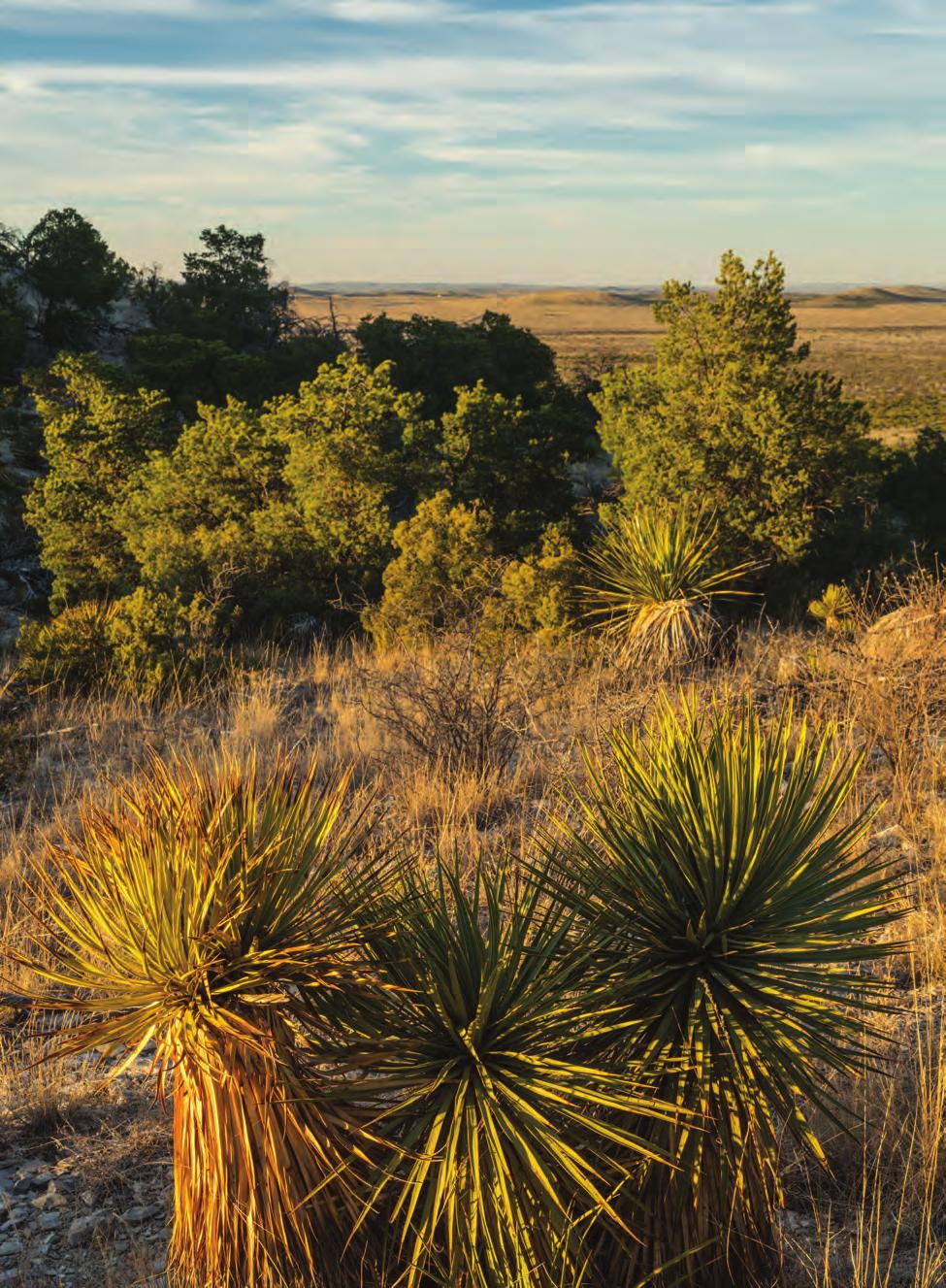
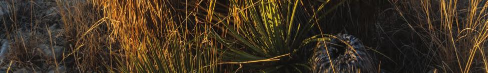
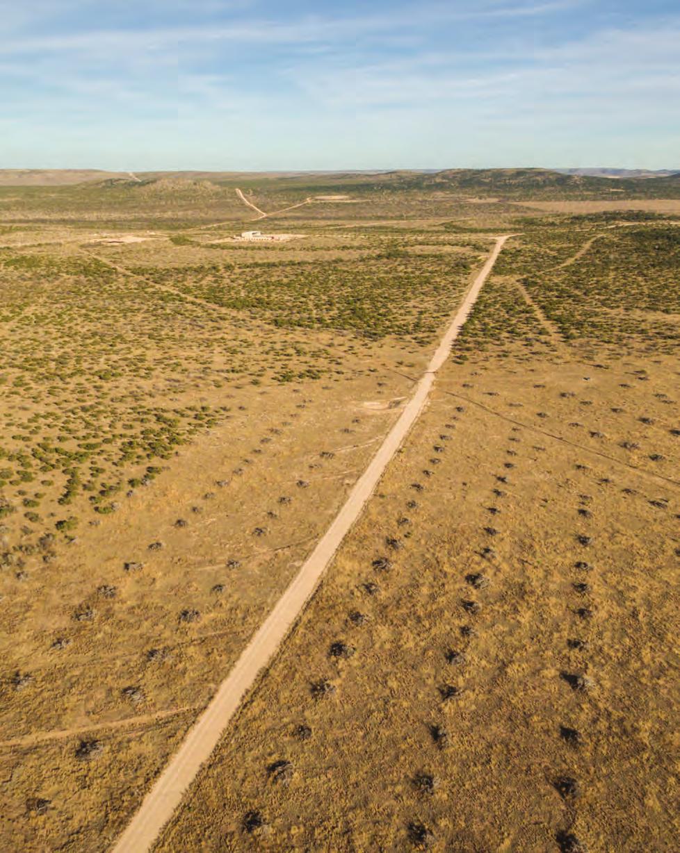
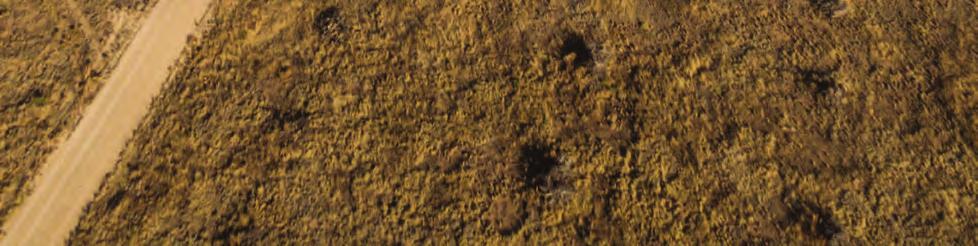
2 Comanche rail Ranch 48,404 Acres Pecos County, exas James King, Agent Office Location Comanche rail Ranch fronts on the east side of Highway 385 between Fort Stockton and Marathon, across the highway from the roadside picnic area located in the high Piñon Pine-covered hills. he legendary Comanche rail route, along which raiding bands of Comanche warriors swept from the high plains into northern Mexico, cuts through this property, creating a rich history for the ranch. his is a sprawling high Chihuahuan grassland ranch with limestone outcrop pine-covered hills, broad valleys, and incredible ranching infrastructure, creating one of the best working cattle and hunting ranches in exas. Located at the eastern edge of the rans Pecos, this property is easily accessed from Austin, San Antonio and other major exas cities. Acreage 48,404 acres in Pecos County Description Comanche rail Ranch is ideal exas cow country and represents some of the best grasslands in West exas. he ranch is in the limestone hills of Pecos County, just east and south of Madera Mountain with an average of 13 of rainfall annually. his is summer monsoon country with mild winters and wet summers, perfect for growing and curing the rich grasslands. he topography of the ranch ranges from 4,724 feet at the summit of the pine-covered mountains near the highway, to 3,321 feet along the broad rolling hills to flats to the north. Stunning views include Madera Mountain, as well as scenic beauty within the ranch he range improvements of the past 15 years are nothing short of extraordinary. here have been more than 6,000 acres of mechanical brush removal, and 10,000 acres of spike treatment throughout the ranch, creating open valleys and cleared grasslands surrounded by rolling hills of native trees and vegetation. New 3-inch poly pipe waterlines and valves distribute water over the entire ranch to elevated storage and to more than 100 water troughs designed for wildlife and livestock use. he road system is extensive, with huge caliche main arteries and smaller maintained roads providing access to the entire ranch. Fencing is mostly new or recently-improved across the ranch. A new set of pipe pens with scales make working and processing cattle a breeze. Facilities include a hunter s house, a worker s house, and a new 3 bedroom/2.5 bath foreman s home with carport, as well as several barns at the headquarters. Habitat he landscape is wide-open rolling grassland, interspersed with hills and mountains surrounded by rugged wooded mountain ranges which can be seen from anywhere on the ranch. With classic vistas of the Old West, the region has maintained much of the environment and appearance of times past. his ranch lies at an elevation that supports a mix of vegetation from the mid-high Chihuahuan Desert, including century plants, Spanish dagger, yucca and cholla with a dominant grassland of tabosa, blue gramma, sideoats gramma, and cane bluestem. Areas of brush and trees
3 like Piñon Pine, Juniper, Mesquite, and Hackberry are also present. Endless valleys, mesas, hills, flats, and mountains with creeks and drainages, create a variety of habitats. Wildlife his is quality Chihuahuan Desert grassland. he grasses, forbs, and brush provide excellent habitat for game and non-game animals and birds. Excellent herds of Mule Deer and Elk are the main game animals on Comanche rail Ranch, with coyotes, javelina, and bobcats all being present. Blue (scaled) quail and mourning dove are the game birds which, with recent rains, have exploded in numbers. Raptors include Golden Eagles and wide variety of hawks. Neotropical migratory birds such as orioles, hummingbirds, warblers, flycatchers, and many others make for a wonderful birding experience. he distribution of year-round water over virtually the entire ranch has resulted in growing populations of wildlife. Improvements and Water he ranch has tremendous infrastructure from maintained roads, fences, water systems, and working cattle pens. here is a very nice new 3 bedroom 2 ½ bath foreman s house with nearby hunting lodge and older home. Several barns and sheds round out the headquarters into an excellent working ranch. he roads are well-planned and maintained, providing the opportunity to drive for hours and not have to open a single gate. here are a few operating gas wells and pipelines on the west and south edges of the ranch but overall there are few impacts. Large water tanks are strategically located around the ranch. A new water system with 3-inch poly pipe and more than 100 troughs creates a day-one advantage and convenience for the new owner. Drought insurance over the past 10 years has provided significant ranch income as has a salt water disposal well located on the property. Minerals Seller will retain all Fee Minerals owned and there is a surface use agreement that provides excellent protection for any existing and future oil and gas activities, as well as a schedule of payments for surface damages. Price $585 per acre or $28,316, Contact James King, Agent King Land & Water, LLC Office Cell James@KingLandWater.com Disclaimer his Ranch offering is subject to prior sale, change in price, or removal from the market without notice. While the information above was provided by sources deemed reliable, it is in no way guaranteed by the broker or agent.

4 COMANCHE RAIL RANCH - 48,404 AC +/- PECOS CONY, X C u l b e r s o n Kent 2 0 Balmorhea KING LAND & WAER Pecos R e e v e s 285 Coyanosa S 18 C r a n e Imperial Baldridge 385 Crane 385 p t o n McCamey S 349 Rankin 67 Stiles R e a g a n Big Lake Valentine Chinati Mountains J e f f D a v i s Indio Ochoa Quebec P r e s i d i o S 166 Ryan Shafter S Davis Mtns. State Park 67 Marfa Nopal Plata Casa Piedra S 17 Fort Davis Alpine S Elephant Mtn. Wildlife Management Area Chancellor Marathon 385 Belding B r e w s t e r Fort Stockton!\ Long fellow Rd 285 P e c o s Longfellow Sanderson Bakersfield Fm2400 e r r e l l 190 S S C r o c k e t t Sheffield Belding Chancellor 385 Pandale Fort Stockton P e c o s Presidio Date: Data Source: ESRI!\ Property Big Bend Ranch State Park Ê Property Boundary erlingua Big Bend National Park Black Gap Wildlife Management Area Miles B r e w s t e r Marathon Long fellow Rd Longfellow Miles 285 James King 600 North State Street PO Box 109 Fort Davis, X P: (432) kinglandwater.com he information contained herein was obtained from sources deemed to be reliable. Mapright Services makes no warranties or guarantees as to the completeness or accuracy thereof


 426-2024")

5 COMANCHE RAIL RANCH - 48,404 AC +/PECOS CONY, X KING Ê LAND & WAER 285 j! 385 LON G FELL OW Barn! = j! House! = Pens Well Primary Road rough Water Storage ank Ø Ñ =! # "! j Date: Data Source: NRIS, Google # " j! Ø Ñ RD Road/rail 0 6,000 Pond/ank Property Boundary James King 600 North State Street PO Box 109 Fort Davis, X P: (432) kinglandwater.com ,000 24,000 Feet 8 Miles he information contained herein was obtained from sources deemed to be reliable. Mapright Services makes no warranties or guarantees as to the completeness or accuracy thereof
6 COMANCHE RAIL RANCH - 48,404 AC +/- PECOS CONY, X KING LAND & WAER 285 Ê!j!j 385 LONGFELLOW RD ÑØÑØ!j!j Date: Data Source: NRIS, Google "# Barn!= House!j Pens rough "#"#!j!j!=!=!=!= ÑØ Well Water Storage ank Primary Road Road/rail Pond/ank 0 6,000 12,000 24,000 Feet Property Boundary Miles James King 600 North State Street PO Box 109 Fort Davis, X P: (432) kinglandwater.com he information contained herein was obtained from sources deemed to be reliable. Mapright Services makes no warranties or guarantees as to the completeness or accuracy thereof
7
8
9
10
11
12
13
14
15
Alamito Waters Ranch 80 acres, Presidio County, Texas James King, Agent Office Cell
 Alamito Waters Ranch 80 acres, Presidio County, Texas James King, Agent Office 432-426-2024 Cell 432-386-2821 James@KingLandWater.com King Land & Water LLC P.O. Box 109, 600 State Street, Fort Davis, TX
Quebec Ranch 12,500 acres, Presidio County
 Quebec Ranch 12,500 acres, Presidio County Quebec Ranch 12,500 Acres Marfa, Presidio County, exas James King, Agent Office 432.426.2024 James@KingLandWater.com Location he Quebec Ranch is located 25 miles
Quebec Ranch 12,500Acres Presidio County, Texas
 Quebec Ranch 12,500Acres Presidio County, Texas James King, Agent Office 432.426.2024 Cell 432.386.2821 James@KingLandWater.com Quebec Ranch 12,500 Acres Marfa, Presidio County, Texas James King, Agent
South Alamito Creek Ranch
 South Alamito Creek Ranch 1500 acres, Presidio County, Texas James King, Agent Office 432-426-2024 Cell 432-386-2821 James@KingLandWater.com King Land & Water LLC P.O. Box 109, 600 State Street, Fort Davis,
Kennedy Ranch /- acres, Presidio County, Texas
 Kennedy Ranch 3187 +/- acres, Presidio County, Texas Kennedy Ranch 3,187 Acres Casa Piedra Road Marfa, Presidio County, Texas James King, Agent Office 432 426.2024 James@KingLandWater.com Location The
Aplomado Flats Ranch acres, Brewster County, Texas
 Aplomado Flats Ranch 2701.7 acres, Brewster County, Texas James King, Agent Office 432-426-2024 Cell 432-386-2821 James@KingLandWater.com King Land & Water LLC P.O. Box 109, 600 State Street, Fort Davis,
Kennedy Ranch 3,187 Acres, near Marfa, Presidio County Texas
 Kennedy Ranch 3,187 Acres, near Marfa, Presidio Texas James King, Agent Office 432-426-2024 Cell 432-386-2821 James@KingLandWater.com King Land & Water LLC P.O. Box 109, 600 State Street, Fort Davis, TX
Alamito Creek Preserve Ranches for Sale Marfa, Presidio County, Texas
 Alamito Creek Preserve Ranches for Sale Marfa, Presidio County, Texas James King, Agent Office 432 426.2024 Cell 432 386.2821 James@KingLandWater.com Alamito Creek Preserve Various size Ranch Properties,
Agua Fria Ranch +/- 23,482 Acres South of Alpine, Texas Adjacent to Big Bend Ranch State Park
 Agua Fria Ranch +/- 23,482 Acres South of Alpine, Texas Adjacent to Big Bend Ranch State Park James King, Agent Office 432.426.2024 Cell 432.386.2821 James@KingLandWater.com King Land & Water LLC P.O.
Blue Mountain Retreat Acres, Jeff Davis County, Texas
 Blue Mountain Retreat 29.33 Acres, Jeff Davis County, Texas Blue Mountain Retreat 29.33 acres Fort Davis, Jeff Davis County, Texas James King, Agent Office 432 426.2024 James@KingLandWater.com Location
Randolph Ranch 12,164 Acres Brewster and Pecos Counties, Texas
 Randolph Ranch 12,164 Acres Brewster and Pecos Counties, Texas James King, Agent Office 432.426.2024 Cell 432.386.2821 James@KingLandWater.com Randolph Ranch 12,164 Acres Brewster and Pecos Counties, Texas
carpenter real estate presents:
 carpenter real estate presents: this is one of the best trophy class desert mule deer, aoudad sheep and bird hunting ranches in west texas. Elevations range from 4,400 feet to 5,180 feet. Ideal habitat
Cherry County, Nebraska
 Cherry County, Nebraska Co-Listed with Maddux Landbanc Realty, LLC Offered Exclusively By: NORTH PLATTE OFFICE P.O. Box 1166 I-80 & US Hwy 83 North Platte, NE 69103 www.agriaffiliates.com (308) 534-9240
Coyote Creek Apache County, Arizona
 Coyote Creek Apache County, Arizona Listed for sale exclusively by: Traegen Knight Headquarters West Ltd. PO BOX 1980 St. Johns, AZ 85936 Phone: (928) 524-3740, Fax: (928) 563-7004, Cell: (602) 228-3494
Marfa House and Ranch Property 2,400 acres with premier residence, Marfa, Presidio County, Texas
 Marfa House and Ranch Property 2,400 acres with premier residence, Marfa, Presidio County, Texas James King, Agent Office 432 426.2024 Cell 432 386.2821 James@KingLandWater.com Marfa House and Ranch Property
Chapter 6. Field Trip to Sandia Mountains.
 University of New Mexico Biology 310L Principles of Ecology Lab Manual Page -40 Chapter 6. Field Trip to Sandia Mountains. Outline of activities: 1. Travel to Sandia Mountains 2. Collect forest community
Natural Texas. Regions and Climates
 Natural Texas Regions and Climates Two Kinds: Physical geography Climate, vegetation, rivers, lakes, oceans, plateaus, plains, and mountain ranges Human geography Economic activities How we earn a living
Objectives. Understand the different physical & human characteristics of each region
 TEXAS REGIONS Objectives Know the 4 regions of Texas Understand the different physical & human characteristics of each region Understand how physical differences affect human characteristics (way of life)
A little helpful hint.. PLEASE TAKE CORNELL NOTES AND THEN REWRITE YOUR NOTES AT HOME. YOU WILL NEED TO ORGANIZE YOUR NOTES USING EITHER MAIN IDEAS
 JOANNE HOWARD A little helpful hint.. PLEASE TAKE CORNELL NOTES AND THEN REWRITE YOUR NOTES AT HOME. YOU WILL NEED TO ORGANIZE YOUR NOTES USING EITHER MAIN IDEAS OR QUESTIONS Can you name the Regions of
Written by Vowery Dodd Carlile and Traci Burnett Illustrated by Karen Birchak
 Written by Vowery Dodd Carlile and Traci Burnett Illustrated by Karen Birchak Table of Contents INTRODUCTION...5 TO THE TEACHER...6 STORIES ABOUT TEXAS: Background, Vocabulary Activities, Discussion Questions,
Changes in Texas Ecoregions
 Comment On Lesson Changes in Texas Ecoregions The state of Texas can be divided into 10 distinct areas based on unique combinations of vegetation, topography, landforms, wildlife, soil, rock, climate,
The Swan House and Adobe Construction Lab Sales Presentation Presidio, Texas Big Bend Country, reachable by scenic route only.
 The Swan House and Adobe Construction Lab Sales Presentation Presidio, Texas Big Bend Country, reachable by scenic route only. 500 Acres 2,000 sq. ft. house 360º views Adjacent to Big Bend State Park Solar
Old Thomasson Range, Chico, CA
 AG-LAND INVESTMENT BROKERS 275 Sale Lane, Suite 2 / P. O. Box 896 Red Bluff, CA 96080 530.529.4400 office / 530.527.5042 fax Old Thomasson Range, Chico, CA Property: Approximately 5,270 acres bordered
APPENDIX V VALLEYWIDE REPORT
 APPENDIX V VALLEYWIDE REPORT Page Intentionally Left Blank 1.2 San Joaquin Valley Profile Geography The San Joaquin Valley is the southern portion of the Great Central Valley of California (Exhibit 1-1).
Cripps Ranch 76+/- Acres Orchard Development Opportunity Dixon, CA. Presented By:
 Cripps Ranch 76+/- Acres Orchard Development Opportunity Dixon, CA Presented By: Cripps Ranch 76+/- Acres Orchard Development Opportunity Dixon, CA Location: This property is located at 5663 Dally Road
David Gold Hiking Tours
 David Gold Hiking Tours Join us for a West Texas Active Adventure Tour February 14 21, 2017 Led by David Gold and Ulrike Porat The Big Bend area of West Texas is one of the most remote, and least visited
Name period date assigned date due date returned. Texas Ecoregions
 Name period date assigned date due date returned Directions: Go to the following website: https://www-k6.thinkcentral.com/epc/start.do Use the log in that is taped to the top of your laptop. If you are
Name period date assigned date due date returned. Texas Ecoregions
 Name period date assigned date due date returned Directions: Go to the following website: https://www-k6.thinkcentral.com/epc/start.do Use the log in that is taped to the top of your laptop. If you are
MAPS AND THEIR CLASSIFICATION
 MAPPING MAPS AND THEIR CLASSIFICATION WHAT IS A MAP? A map is representation of the Earth's surface, showing how things are related to each other by distance, direction, and size. Maps are a way of showing
Extreme Weather. Extreme weather has always been a part of Utah
 Climate Notes Extreme Weather Extreme weather has always been a part of Utah Floods Severe storms Wind 1920 Lehi hail storm killed birds and chickens 1971 Farmington wind storm Climate vs. Weather Climate:
Evaluating Wildlife Habitats
 Lesson C5 4 Evaluating Wildlife Habitats Unit C. Animal Wildlife Management Problem Area 5. Game Animals Management Lesson 4. Evaluating Wildlife Habitats New Mexico Content Standard: Pathway Strand: Natural
Producing Chandler Walnut Orchard
 AG-LAND Investment Brokers 275 Sale Lane Red Bluff, CA 96080 530-529-4400 Fax 530-527-5042 Producing Chandler Walnut Orchard West Sacramento Avenue - Chico, CA AG-LAND INVESTMENT BROKERS 275 Sale Lane
Changes in Texas Ecoregions Copy the questions and answers
 Changes in Texas Ecoregions Copy the questions and answers 1. What are some kinds of damage that hurricanes cause? Roads and bridges might be washed away. Trees and power lines can be knocked down. Area
Upper Owyhee Watershed Assessment
 * Owyhee Watershed Council and Scientific Ecological Services The upper Owyhee subbasin is located in parts of three states: the southeastern corner of Oregon, the southwestern corner of Idaho, and north
Passwords. Social Studies Vocabulary. Texas: Grade 7
 Passwords Social Studies Vocabulary Texas: Grade 7 To the Student What is federalism? How are independence and interdependence different? What does an anthropologist do? Passwords: Social Studies Vocabulary
Physical Geography of the United States and Canada Chapter 5 A Land of Contrasts
 Physical Geography of the United States and Canada Chapter 5 A Land of Contrasts Land Area Together the U.S. and Canada cover more than 7 million square miles. In total area, Canada ranks 2 nd and the
Lesson- 6 WEATHER AND CLIMATE
 Lesson- 6 WEATHER AND CLIMATE New Words 1. Heat Zones:- the division of the earth according to the climate. 2. Frigid:- the zone that is the coldest 3. Temperate:- the zone that is neither too hot nor
LANDSCAPE CHANGE IN THE SOUTHWEST: Historical changes in selected ecosystems of the southwestern United States
 LANDSCAPE CHANGE IN THE SOUTHWEST: Historical changes in selected ecosystems of the southwestern United States Robert H. Webb U.S. Geological Survey 520 N. Park Avenue Tucson, AZ 85719 rhwebb@usgs.gov
About places and/or important events Landmarks Maps How the land is, hills or flat or mountain range Connected to maps World Different countries
 What do you think you know about geography? About places and/or important events Landmarks Maps How the land is, hills or flat or mountain range Connected to maps World Different countries What do you
V E R M E J O P A R K R A N C H
 V E R M E J O P A R K R A N C H ABOUT TED TURNER EXPEDITIONS Ted Turner Expeditions is rooted in two million acres of wild, private North American landscape acquired by Ted Turner as a pioneering investment
CALIFORNIA AGRICULTURAL PR OPERTIES, IN C. GALE RANCH
 CALIFORNIA AGRICULTURAL PR OPERTIES, IN C. GALE RANCH LOCATION: The Ranch is located 6 Yi miles west of the City of Davis on the northwest corner of County Roads 29A and 92E in Yolo County. SIZE: 368.64
FOR SALE +/- 419 ACRES ¼ Mile South of Alliance Airport
 FOR SALE +/- 419 ACRES ¼ Mile South of Alliance Airport Alliance Airport Subject property +/- 419 AC Pat McDowell +1 817 334 8106 pat.mcdowell@am.jll.com JLL 201 Main Street, Suite 1440 Fort Worth, TX
Simple Solutions Social Studies Level 2. Level 2. Social Studies. Help Pages
 Level 2 Social Studies 147 148 adobe houses with bricks made of clay and straw ancestor a family member who lived before us appoint choose; leaders can appoint others barter trading one thing for another
POPULATION TRENDS FOR TULARE PSEUDOBAHIA AND STRIPED ADOBE LILY
 POPULATION TRENDS FOR TULARE PSEUDOBAHIA AND STRIPED ADOBE LILY Kern County has more endangered, threatened and rare plant species than most states. The geography and environmental conditions in the county
Reading Assignments. Texas Regional Conditions. Trees and Shrubs for Sustainable Built Environments HORT 306 Fall Regional Considerations
 Trees and Shrubs for Sustainable Built Environments HORT 306 Fall 2018 Reading Assignments Pages 54-57 Plus Corresponding Color Plates in Landscape Plants For Texas And Environs, Third Edition Regional
Ecological Context - Urban settlements are part of their surrounding ecosystem. Austin
 Ecological Context - Urban settlements are part of their surrounding ecosystem Austin Ecotone Division between West and East Flyway Uplift River Balcones Escarpment Central Texas Climate The principal
Vancouver Island and Coast
 Places in B.C. This handout package provides students with a brief overview of one of seven regions in B.C. These descriptions will help students audit the different types of energy (see the Energy Primers)
Biome- complex of terrestrial communities that cover a large area; characterized by soil, climate, plants, and animals Plants and animals vary by
 Major Land Biomes Biome- complex of terrestrial communities that cover a large area; characterized by soil, climate, plants, and animals Plants and animals vary by tolerance to temperature and precipitation
California: Land and People Lesson 1: Locating California
 California: Land and People Lesson 1: Locating California Hemisphere One half of the earth or another sphere Video on Hemispheres click here Relative location Where a place is compared to one or more other
2 Georgia: Its Heritage and Its Promise
 TERMS region, erosion, fault, elevation, Fall Line, aquifer, marsh, climate, weather, precipitation, drought, tornado, hurricane, wetland, estuary, barrier island, swamp PLACES Appalachian Mountains, Appalachian
TEXAS Regions Coastal Plains North Central Plains Great Plains Mountains & Basins
 TEXAS Regions Coastal Plains North Central Plains Great Plains Mountains & Basins To help protect your privacy, PowerPoint has blocked automatic download of this picture. Coastal Plains Most populated
Mule Shoe Bar South Ranch
 Mule Shoe Bar South Ranch All contiguous rangeland with sub irrigated range sites consisting of 11,555 total acres Mike Lashley Owner Broker Mike s Cell: 308-530-0134 Email: mike@lashleyland.com Property
Biomes of the World What is a Biome?
 Biomes of the World What is a Biome? A large, relatively distinct terrestrial region with characteristic Climate Soil Plants Animals Interacting landscapes 1 Terrestrial Biomes Using Precipitation And
Big Bend National Park Visitor Study
 Big Bend National Park Visitor Study The Visitor Services Project 2 OMB Approval 1024-0099 Expiration Date: 08-15-92 3 DIRECTIONS One adult in your group should complete the questionnaire. It should only
Natural Vegetation and Wildlife
 Natural Vegetation and Wildlife Exercise Page 51 Question 1: Choose the right answer from the four alternatives given below. (i) To which one of the following types of vegetation does rubber belong? (a)
Reading Assignments. Texas Regional Conditions. Trees and Shrubs for Sustainable Built Environments HORT 306 Fall Regional Considerations
 Trees and Shrubs for Sustainable Built Environments HORT 306 Fall 2018 Reading Assignments Pages 54-57 Plus Corresponding Color Plates in Landscape Plants For Texas And Environs, Third Edition Regional
LATITUDE. Latitude lines run to, but are measured & The 0 of latitude that circles the earth is called the?
 LATITUDE Latitude lines run to, but are measured & The 0 of latitude that circles the earth is called the? LATITUDE 0 0 Latitude lines run east to west, but are measured north & south The 0 of latitude
REQUEST FOR PROPOSALS CLOSING DATE:
 Request for Proposals 110 Westlake Drive City of West Lake Hills 110 Westlake Drive REQUEST FOR PROPOSALS CLOSING DATE: Tuesday, October 23, 2018 City of West Lake Hills Request for Proposals 1 I. INTRODUCTION
Lower Pinhook Spring Condition Assessment
 Lower Pinhook Spring Condition Assessment Location: Castle Valley Allotment, Manti-La Sal National Forest Date: September 23, 2016 Begin/End Time: 10:30am to 12:30pm Whitman College Semester in the West
Trees and Shrubs for Sustainable Built Environments HORT 306 Fall Regional Considerations
 Trees and Shrubs for Sustainable Built Environments HORT 306 Fall 2018 Regional Considerations Reading Assignments Pages 54-57 Plus Corresponding Color Plates in Landscape Plants For Texas And Environs,
Following the Civil War, many Americans and Europeans continued to move into the WEST
 1860-1900 Following the Civil War, many Americans and Europeans continued to move into the WEST as far as the eye can see millions of acres of treeless grassland. Between the Mississippi River and the
CALIFORNIA AGRICULTURAL PR OPERTIES, IN C. BOWLSBEY 320 LIBERTY ISLAND ROAD BUYER: RASSMUSSEN TRUST
 CALIFORNIA AGRICULTURAL PR OPERTIES, IN C. BOWLSBEY 320 LIBERTY ISLAND ROAD SELLER: BOWLSBEY TRUST BUYER: RASSMUSSEN TRUST LOCATION: The Bowlsbey 320 is located ten (10) miles southeast of the City of
Landform Regions of Canada
 Landform Regions of Canada The movement of the earth s plates, and the resulting folding, faulting, and volcanic activity, have combined with the forces of erosion and weathering to create a variety of
Unit 2. United States Physical Geography
 Unit 2 United States Physical Geography Physical Geography U.S. extends from the Atlantic to Pacific U.S. is the 3rd largest country U.S. has fertile soils, vast forests, and variety of minerals All major
Review of Riparian Function Riparian Management Riparian Monitoring
 Review of Riparian Function Riparian Management Riparian Monitoring Water Shed Water Catchment Water catching creek Water shedding creek Properly functioning riparian area Properly Functioning Riparian
Environmental Science: Biomes Test
 Name: Date: Pd. VERSION 1 Environmental Science: Biomes Test 1. Eland are large herbivores with loose skin under the throat and neck. This patch of skin aids in lowering the body temperature when temperatures
CITY OF PORTLAND, TEXAS SERVICE PLAN FOR ANNEXATION AREA
 CITY OF PORTLAND, TEXAS SERVICE PLAN FOR ANNEXATION AREA Location and Acreage Approximately 1,863 acres of land in San Patricio County, located in the ETJ northwest of the existing City Limits. Metes and
Chittenden Road Prune Orchard Corning, California
 AG-LAND INVESTMENT BROKERS 275 Sale Lane / P. O. Box 896 Red Bluff, CA 96080 530.529.4400 office / 530.527.5042 fax Chittenden Road Prune Orchard Corning, California Property: 40.00 acres planted to producing
Biomes There are 2 types: Terrestrial Biomes (on land) Aquatic Biomes (in the water)
 Aquatic Biomes (in the water)") Biomes There are 2 types: Terrestrial Biomes (on land) Aquatic Biomes (in the water) Terrestrial Biomes Grassland, Desert, and Tundra Biomes: Savanna Temperate grassland Chaparral Desert Tundra Chapter
Biomes There are 2 types: Terrestrial Biomes (on land) Aquatic Biomes (in the water) Terrestrial Biomes Grassland, Desert, and Tundra Biomes: Savanna Temperate grassland Chaparral Desert Tundra Chapter
Arizona Game and Fish Department s Wildlife Water Catchments Project on the Tonto National Forest
 Arizona Game and Fish Department s Wildlife Water s Project on the Tonto National Forest This project is a cooperative effort between the Tonto National Forest and Arizona Game and Fish Department. The
TRACT 7: ±252 Acres Irrigated Farmland Grassland
 TRACT 7: ±252 Acres Irrigated Farmland Grassland 1880 FM 2013, Friona, Texas 79035 ±252 acres of irrigated farmland and grassland. This farmland is currently being leased and farmed. The lease agreement
Weathering and Soil Formation. Chapter 10
 Weathering and Soil Formation Chapter 10 Old and New Mountains The Appalachian Mountains appear very different from the Sierra Mountains. The Appalachians are smaller, rounded, gently sloping, and covered
Elementary Social Studies Content Area Assessment Task. Winter 2010 EDUC 203
 1 Elementary Social Studies Content Area Assessment Task Winter 2010 EDUC 203 Students: Fourth grade class in Watsonville, CA. Approximately 90% Latino, primarily of Mexicandescent. About 80% participate
Grant Opportunity Monitoring Bi-State Sage-grouse Populations in Nevada
 Grant Opportunity Monitoring Bi-State Sage-grouse Populations in Nevada Proposals are due no later than November 13, 2015. Grant proposal and any questions should be directed to: Shawn Espinosa @ sepsinosa@ndow.org.
1.0 PURPOSE AND FORMAT OF THE FINAL EIR
 1.0 PURPOSE AND FORMAT OF THE FINAL EIR 1.1 PROJECT OVERVIEW CEMEX (RMC Pacific Materials, dba CEMEX) operates the Bonny Doon Shale and Limestone Quarries in Santa Cruz County for the production of Portland
5th social studies geography (5thsocstud_geography)
") Name: Date: 1. Many of the Native Americans who lived on the Great Plains were nomadic people. Why did they move from place to place? A. They were finding new areas to mine. B. They were looking for fertile
Name: Date: 1. Many of the Native Americans who lived on the Great Plains were nomadic people. Why did they move from place to place? A. They were finding new areas to mine. B. They were looking for fertile
Extreme Weather and Climate Change Vulnerability Assessment of Central Texas Transportation Infrastructure
 Extreme Weather and Climate Change Vulnerability Assessment of Central Texas Transportation Infrastructure Federal Highway Administration (FHWA) Pilot Project TxDOT Transportation Planning Conference June
MONITORING THE EFFECTS OF CLIMATE CHANGE ON SPRINGS, SEEPS AND OTHER WATER NATIONAL PRESERVE
 MONITORING THE EFFECTS OF CLIMATE CHANGE ON SPRINGS, SEEPS AND OTHER WATER RESOURCES IN THE MOJAVE NATIONAL PRESERVE Boris Poff and Debra Hughson Mojave National Preserve, California CLIMATE CHANGE Predictions
THE MINISTRY OF ENERGY AND ENERGY INDUSTRIES MINERALS DIVISION MINE DESIGN TEMPLATE OPERATOR NAME: OPERATOR ADDRESS: PHONE NUMBER: FACSIMILE:
 THE MINISTRY OF ENERGY AND ENERGY INDUSTRIES MINERALS DIVISION MINE DESIGN TEMPLATE 1.0 GENERAL INFORMATION OPERATOR NAME: OPERATOR ADDRESS: PHONE NUMBER: FACSIMILE: NAME OF CONTACT: CELLULAR PHONE: EMAIL
Tropical Moist Rainforest
 Tropical or Lowlatitude Climates: Controlled by equatorial tropical air masses Tropical Moist Rainforest Rainfall is heavy in all months - more than 250 cm. (100 in.). Common temperatures of 27 C (80 F)
Mule Shoe Bar Beck Ranch
 Mule Shoe Bar Beck Ranch All contiguous combination pivot irrigated and rangeland consisting of 7,908 acres Property Highlights List Price $4,927,263 Location The historic Mule Shoe Bar Ranches are located
community. A biome can be defined as a major biological community of plants and animals with similar life forms and
 Science & Math Earth's Systems: What is a biome? The major recognizable life zones of the continents are called biomes. Because vegetation is usually the dominant and most apparent feature of the landscape,
Learning Objectives: I can identify and interpret river flows and directions.
 Learning Objectives: I can identify and interpret river flows and directions. Bellringer Review: Check for Understanding Questions: 1 2 What Are The Key Parts Of A River s Anatomy? In your data notebooks
Information Paper. Kansas City District. Missouri River Fish and Wildlife Mitigation Project Jim and Olivia Hare Wildlife Area, MO
 City District Information Paper River Fish and Wildlife Mitigation Project Jim and Olivia Hare Wildlife Area, MO Riverine habitat created in 2004/2005 by modifying existing river structures along the banks,
Latest Press Release. sarah palin leg show
 corp@stantec.com Latest Press Release sarah palin leg show S The South Texas Sand Sheet, also known as the Coastal Sand Plains and the Llano Mesteño, occupies more than two million acres at the southern
Factors Affecting Human Settlement
 Factors Affecting Human Settlement Physical Factors One of the most basic factors affecting settlement patterns is the physical geography of the land. Climate is key, because if a place is too dry, too
Fall River Valley Irrigated Farmland
 AG-LAND Investment Brokers 275 Sale Lane Red Bluff, CA 96080 530-529-4400 Fax 530-527-5042 Fall River Valley Irrigated Farmland Tehama McArthur, County, California 2015 well, 16 inch casing, 150 HP, 2,000
Iceland. 1. Warm up. A. Talk about the picture and read the essay. B. Discuss the questions about the essay.
 1. Warm up A. Talk about the picture and read the essay. Iceland My country, Iceland, is one of the most beautiful countries on Earth. It is an island country. It is located in Europe, in the North Atlantic
 Plants for Sustainable Landscapes Plants for Landscape Design II HORT 308 / 609 Spring 2017 Regional Considerations Unless otherwise noted all text and images are copyrighted by: Dr. Michael A. Arnold
A First Look at Sites for the LWA
 A First Look at Sites for the LWA Greg Taylor (UNM), Pat Crane (NRL), Frazer Owen (NRAO), John Dickel (UNM) and Willie Lucero (SLO) ABSTRACT In this memo we describe the first visit to potential sites
APPENDIX B. NMFWRI Field Inventory Summary for Three L Canyon, pre-treatment (2008 and 2009) and post-treatment (2013)
 and post-treatment (2013)") SACRAMENTO MOUNTAINS WATERSHED STUDY APPENDIX B NMFWRI Field Inventory Summary for Three L Canyon, pre-treatment (2008 and 2009) and post-treatment (2013) These documents describe efforts and results from
SACRAMENTO MOUNTAINS WATERSHED STUDY APPENDIX B NMFWRI Field Inventory Summary for Three L Canyon, pre-treatment (2008 and 2009) and post-treatment (2013) These documents describe efforts and results from
Chapter 6, Part Colonizers arriving in North America found extremely landscapes. It looked different to region showing great.
 Social Studies 9 Unit 1 Worksheet Chapter 6, Part 1. 1. Colonizers arriving in North America found extremely landscapes. It looked different to region showing great. 2. The Earth is years old and is composed
GEOGRAPHY OF THE WEST
 GEOGRAPHY OF THE WEST ROCKIES TO THE PACIFIC The Rocky Mountains run through North America from north to south. They mark the end of the Midwest and the beginning of the West. MOUNTAINS AND MORE The Rocky
BUILDING AN ASSET MANAGEMENT GEODATABASE FOR RANCHING. Matt Crawford, GISP
 BUILDING AN ASSET MANAGEMENT GEODATABASE FOR RANCHING Matt Crawford, GISP Introduction East Foundation Formed in 2007 Mission Research Education Outreach Properties Six ranches ~ 215,000 acres San Antonio
A journey through the earth history of Australia s Coastal Wilderness Part 3 The backdrop - a 70 million year old plain
 A journey through the earth history of Australia s Coastal Wilderness Part 3 The backdrop - a 70 million year old plain Monaro Plain 3. The Cretaceous Plain The western horizon behind Moruya is dominated
How does the physical environment influence communities and ecosystems? Hoodoos in Cappadocia, Turkey
 Biomes of the World How does the physical environment influence communities and ecosystems? Hoodoos in Cappadocia, Turkey ecosystems are shaped by: abiotic factors climate/weather space Rainfall Soil air
Biomes. Biomes Are Life Zones
 Biomes Biomes Are Life Zones Biomes They Include All Plants Animals Other Organisms The Physical Environment In A Particular Area Biomes A Biome Is Characterized By Its Plant Life Biomes These Types Are
APPENDIX E. Photographs of Hazard Events in Broome County. DMA 2000 Hazard Mitigation Plan Broome County, New York E-1
 APPENDIX E Photographs of Hazard Events in Broome County DMA 2000 Hazard Mitigation Plan Broome County, New York E-1 Flood of June 2006 (FEMA DR 1650) Sources: Binghamton NWS Forecast Office / Press and
Unit 1: Geography. For additional information, refer to this website: 1 G e o g r a p h y
 Unit 1: Geography For additional information, refer to this website: http://mryoungtms.weebly.com/ 1 G e o g r a p h y Continents and Oceans SOL USI. 2a Essential Understanding: Continents are large land
Butte County Board of Supervisors Agenda Transmittal
 Clerk of the Board Use Only Butte County Board of Supervisors Agenda Transmittal Agenda Item: 3.03 Subject: County Service Area Service and Permanent Road Division Charges for Fiscal Year 2013-14 Department: