Fairfield Hill Road Winnsboro, South Carolina
|
|
|
- Claude Boone
- 5 years ago
- Views:
Transcription

1 Fairfield Hill Road Winnsboro, South Carolina Tom Milliken Tombo Milliken THE INFORMATION CONTAINED HEREIN HAS BEEN GIVEN TO US BY THE OWNER OF THE PROPERTY OR OTHER SOURCES WE DEEM RELIABLE. WE HAVE NO REASON TO DOUBT ITS ACCURACY, BUT WE DO NOT GUARANTEE IT. ALL INFORMATION SHOULD BE VERIFIED PRIOR TO PURCHASE OR LEASE.
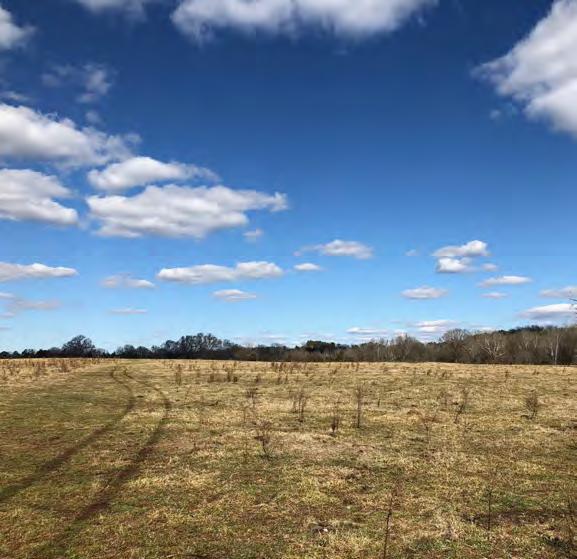
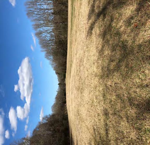
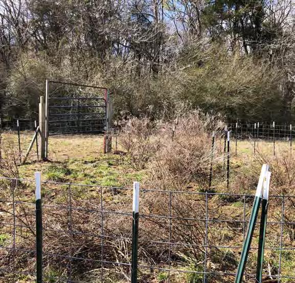
2 Executive Summary ±504 acres of pasture land and timberland Less than 40 minutes from Columbia and less than 50 minutes from south Charlotte ±1.5 miles from exit 48 on I-77 Frontage on Wateree Creek and smaller creeks ±4 acre pond with mobile home ±240 acres of pasture (includes pasture, hay fields, hedge rows, scattered small clumps of shade area, etc.) ±260 acres of timberland (4 sections: ±187 acres, ±32 acres, ±25 acres, and 15 acres) Surrounded by large private ownership Deer, turkey, hogs, and potential dove field Great road system $406,000 of timber on ±260 acres Sale price: $1,500,000 ($2,976 per acre) Shown by appointment only ***These estimates are for basic calculations and should be recalculated by any prospective purchaser for their own use. The same applies to any estimates of timber values, land values, etc. that are supplied for use to a prospective purchaser. The Owner and their Agents have no responsibility or liability for any estimates or values supplied to a third party.

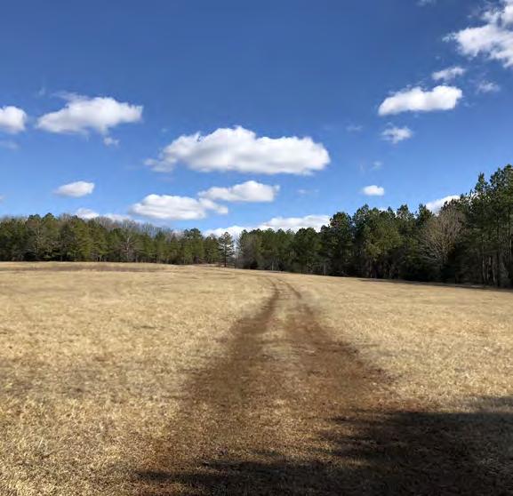
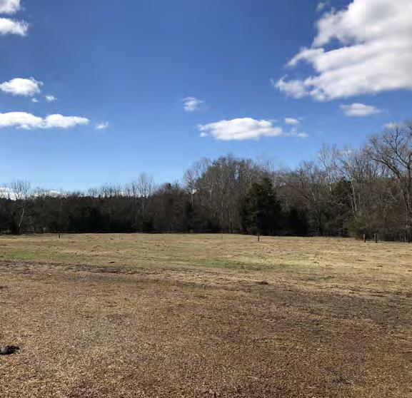
3 Property Pictures

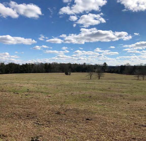
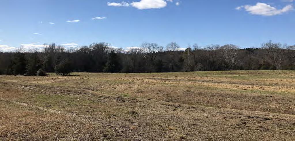
4 Property Pictures

5 Property Pictures

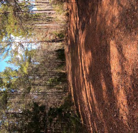

6 Property Pictures

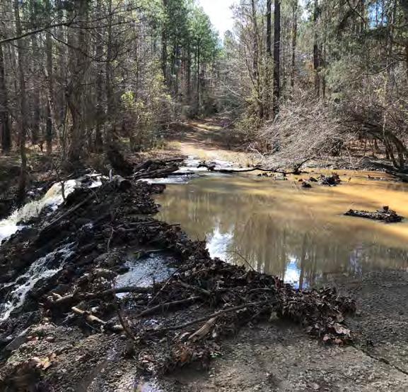
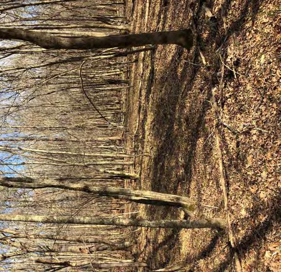
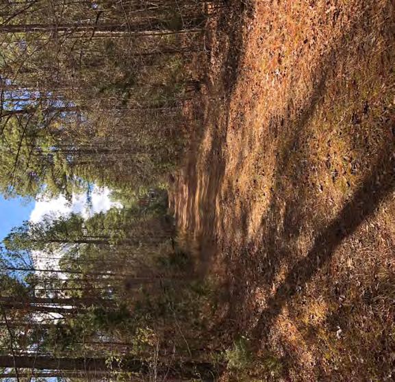
7 Property Pictures


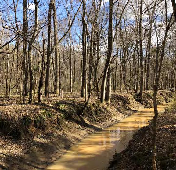
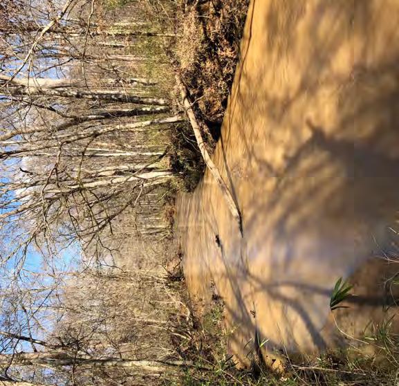
8 Property Pictures

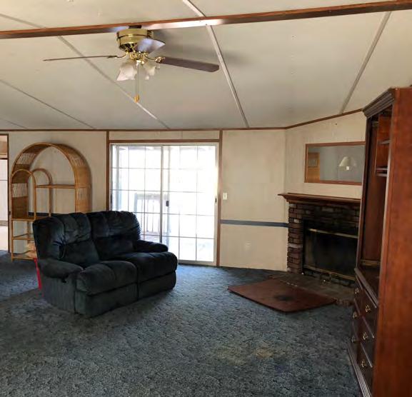
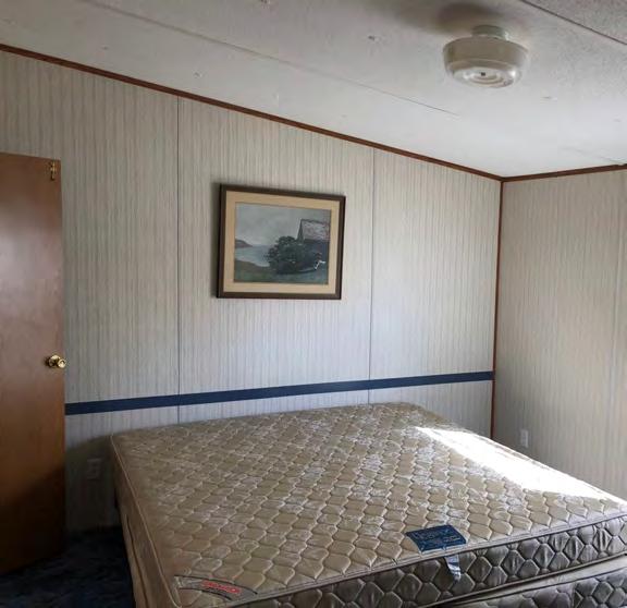
9 Property Pictures

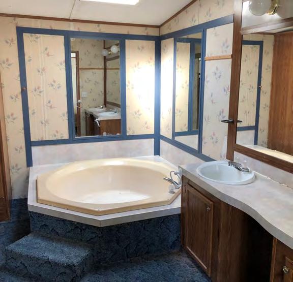
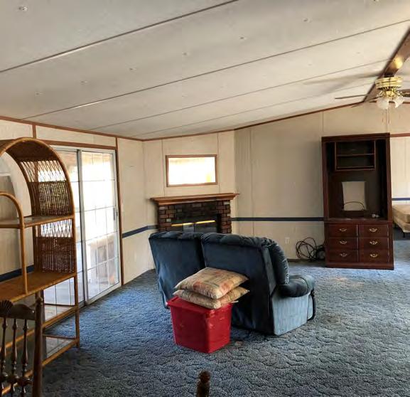

10 Property Pictures

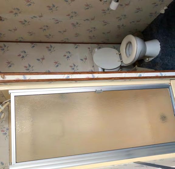
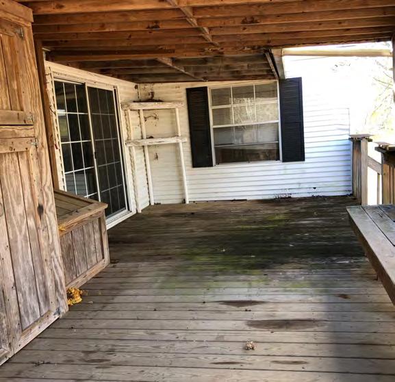
11 Property Pictures
12 Location Columbia Hwy Mount Gap Rd 77 Great Falls Chester Ave UV 901 Site 321 Camp Welfare Rd 21 Wateree Lake Camp Welfare Rd UV Map Updated: Tuesday, January 30, This information submitted is not guaranteed. Although obtained from reliable sources, all information should be confirmed prior to use or reliance upon the information. This document may not be reproduced in whole or in part without the express written consent of NAI Avant ± Acres Fairfield Hill Rd., Winnsboro, SC 29180
13 Aerial Fairfield Hill Rd UV 901 UV 200 Map Updated: Tuesday, January 30, This information submitted is not guaranteed. Although obtained from reliable sources, all information should be confirmed prior to use or reliance upon the information. This document may not be reproduced in whole or in part without the express written consent of NAI Avant ± Acres Fairfield Hill Rd., Winnsboro, SC 29180
14 2006 Infrared Fairfield Hill Rd UV 901 UV 200 Map Updated: Tuesday, January 30, This information submitted is not guaranteed. Although obtained from reliable sources, all information should be confirmed prior to use or reliance upon the information. This document may not be reproduced in whole or in part without the express written consent of NAI Avant ± Acres Fairfield Hill Rd., Winnsboro, SC 29180
15 Topographical Map Fairfield Hill Rd UV 901 UV 200 Map Updated: Tuesday, January 30, This information submitted is not guaranteed. Although obtained from reliable sources, all information should be confirmed prior to use or reliance upon the information. This document may not be reproduced in whole or in part without the express written consent of NAI Avant ± Acres Fairfield Hill Rd., Winnsboro, SC 29180

16 FEMA National Flood Hazard Layer Fairfield Hill Rd UV 901 UV 200 Map Updated: Tuesday, January 30, This information submitted is not guaranteed. Although obtained from reliable sources, all information should be confirmed prior to use or reliance upon the information. This document may not be reproduced in whole or in part without the express written consent of NAI Avant ± Acres Fairfield Hill Rd., Winnsboro, SC 29180
17 National Wetlands Inventory Fairfield Hill Rd UV 901 National Wetlands Inventory Estuarine and Marine Deepwater Estuarine and Marine Wetland Freshwater Emergent Wetland UV 200 Freshwater Forested/Shrub Wetland Freshwater Pond Lake Riverine Map Updated: Tuesday, January 30, This information submitted is not guaranteed. Although obtained from reliable sources, all information should be confirmed prior to use or reliance upon the information. This document may not be reproduced in whole or in part without the express written consent of NAI Avant ± Acres Fairfield Hill Rd., Winnsboro, SC 29180
18 Soil Survey WnB Cw WkD WkD W WkD Fairfield Hill Rd WkD UV 901 WnC WkD WnC W WnB WnB W WnC MeB WnC WnC WnB To WnB WkD WnC UV 200 WnB Map Updated: Tuesday, January 30, This information submitted is not guaranteed. Although obtained from reliable sources, all information should be confirmed prior to use or reliance upon the information. This document may not be reproduced in whole or in part without the express written consent of NAI Avant. WkD ± Acres Fairfield Hill Rd., Winnsboro, SC 29180
![Map Unit Description (Brief, Generated) Fairfield County, South Carolina Fairfield County, South Carolina [Minor map unit components are excluded from this report] [Minor map unit components are](/docs-images/87/95710459/images/19-0.jpg "excluded from this report] Map unit: Cw - Chewacla loam, 0 to 2 percent slopes, frequently flooded Map unit: WkD - Wilkes sandy loam, 6 to 15 percent slopes Component: Chewacla, frequently flooded")
19 Map Unit Description (Brief, Generated) Fairfield County, South Carolina Fairfield County, South Carolina [Minor map unit components are excluded from this report] [Minor map unit components are excluded from this report] Map unit: Cw - Chewacla loam, 0 to 2 percent slopes, frequently flooded Map unit: WkD - Wilkes sandy loam, 6 to 15 percent slopes Component: Chewacla, frequently flooded (80%) The Chewacla, frequently flooded component makes up 80 percent of the map unit. Slopes are 0 to 2 percent. This component is on flood plains on southern piedmonts. The parent material consists of alluvium. Depth to a root restrictive layer is greater than 60 inches. The natural drainage class is somewhat poorly drained. Water movement in the most restrictive layer is moderately high. Available water to a depth of 60 inches is high. Shrink-swell potential is moderate. This soil is frequently flooded. It is not ponded. A seasonal zone of water saturation is at 10 inches during January, February, March, December. Organic matter content in the surface horizon is about 2 percent. Nonirrigated land capability classification is 5w. This soil does not meet hydric criteria. Component: Wilkes (80%) The Wilkes component makes up 80 percent of the map unit. Slopes are 6 to 15 percent. This component is on hillslopes on uplands. The parent material consists of clayey residuum weathered from horneblende schist, hornblende gneiss, diorite, or gabbro. Depth to a root restrictive layer, bedrock, paralithic, is 20 to 40 inches. The natural drainage class is well drained. Water movement in the most restrictive layer is moderately high. Available water to a depth of 60 inches is low. Shrink-swell potential is moderate. This soil is not flooded. It is not ponded. There is no zone of water saturation within a depth of 72 inches. Organic matter content in the surface horizon is about 1 percent. Nonirrigated land capability classification is 6e. This soil does not meet hydric criteria. Map unit: MeB - Mecklenburg fine sandy loam, 2 to 6 percent slopes Map unit: WnB - Winnsboro sandy loam, 2 to 6 percent slopes Component: Mecklenburg (80%) Map unit: The Mecklenburg component makes up 80 percent of the map unit. Slopes are 2 to 6 percent. This component is on hillslopes on uplands. The parent material consists of clayey residuum weathered from basic metamorphic rocks. Depth to a root restrictive layer is greater than 60 inches. The natural drainage class is well drained. Water movement in the most restrictive layer is moderately low. Available water to a depth of 60 inches is moderate. Shrink-swell potential is moderate. This soil is not flooded. It is not ponded. There is no zone of water saturation within a depth of 72 inches. Organic matter content in the surface horizon is about 1 percent. Nonirrigated land capability classification is 2e. This soil does not meet hydric criteria. To - Toccoa loam Component: Toccoa (70%) Map unit: The Toccoa component makes up 70 percent of the map unit. Slopes are 0 to 2 percent. This component is on flood plains on valleys. The parent material consists of loamy alluvium. Depth to a root restrictive layer is greater than 60 inches. The natural drainage class is moderately well drained. Water movement in the most restrictive layer is high. Available water to a depth of 60 inches is moderate. Shrink-swell potential is low. This soil is occasionally flooded. It is not ponded. A seasonal zone of water saturation is at 45 inches during January, February, March, April, December. Organic matter content in the surface horizon is about 2 percent. Nonirrigated land capability classification is 2w. This soil does not meet hydric criteria. W - Water Component: Winnsboro (85%) Map unit: The Winnsboro component makes up 85 percent of the map unit. Slopes are 2 to 6 percent. This component is on hillslopes on uplands. The parent material consists of clayey residuum weathered from gneiss and schist containing intrusions of diorite, hornblende, or gabbro. Depth to a root restrictive layer, bedrock, paralithic, is 40 to 79 inches. The natural drainage class is well drained. Water movement in the most restrictive layer is moderately low. Available water to a depth of 60 inches is moderate. Shrink-swell potential is high. This soil is not flooded. It is not ponded. There is no zone of water saturation within a depth of 72 inches. Organic matter content in the surface horizon is about 1 percent. Nonirrigated land capability classification is 2e. This soil does not meet hydric criteria. WnC - Winnsboro sandy loam, 6 to 10 percent slopes Component: Winnsboro (80%) The Winnsboro component makes up 80 percent of the map unit. Slopes are 6 to 10 percent. This component is on hillslopes on uplands. The parent material consists of clayey residuum weathered from gneiss and schist containing intrusions of diorite, hornblende, or gabbro. Depth to a root restrictive layer, bedrock, paralithic, is 40 to 79 inches. The natural drainage class is well drained. Water movement in the most restrictive layer is moderately low. Available water to a depth of 60 inches is moderate. Shrink-swell potential is high. This soil is not flooded. It is not ponded. There is no zone of water saturation within a depth of 72 inches. Organic matter content in the surface horizon is about 1 percent. Nonirrigated land capability classification is 3e. This soil does not meet hydric criteria. Component: Water (100%) Generated brief soil descriptions are created for major soil components. The Water is a miscellaneous area. Survey Area Version: 8 Survey Area Version Date: 12/20/2013 Page 1
Cook Road Ridgeway, South Carolina
 For Sale or Ground Lease ±66.0 AC Industrial Land k Rd Coo Cook Road Ridgeway, South Carolina THE INFORMATION CONTAINED HEREIN HAS BEEN GIVEN TO US BY THE OWNER OF THE PROPERTY OR OTHER SOURCES WE DEEM
Cook and Peach Road. Ridgeway, South Carolina. Site. For Sale ±30.12 AC Commercial Land. Tom Milliken
 For Sale ±30.12 AC Commercial Land Site Exit 32 Peach Rd Cook and Peach Road Ridgeway, South Carolina CONTACT BROKERS FOR MORE INFORMATION: Tombo Milliken +1 803 744 9852 tombo.milliken@naiavant.com Tom
±10.89 AC. Lincreek Drive Columbia, South Carolina. Site. Property Features. For Sale. Tom Milliken
 For Sale ±10.89 AC Site ive Columbia, South Carolina Tombo Milliken +1 803 744 9852 tombo.milliken@naiavant.com Tom Milliken +1 803 744 9837 tmilliken@naiavant.com Property Features ±10.89 AC on ive near
Wessinger Road, Hilton Area Chapin, South Carolina
 779' For Sale 191' 182' 171'! A! B 858' 4.84 ± Acres 788' 4.25 ± Acres 60' 241' 321' Wessinger Road, Hilton Area Chapin, South Carolina 357' 115' 51' 294'! C! D 6.51 ± Acres 902' 8.35 ± Acres 246' 60'
±3.18 AC. 512 Rebecca Drive Leesville, South Carolina. Lakefront Lot. Property Features. For more information:
 For Sale ±3.18 AC Lakefront Lot *Lake level down 6 at time photo was taken 512 ive Leesville, South Carolina Property Features ±3.18 acre lot for sale on Lake Murray Bank owned Located on the Lexington
±35.80 AC. E/S Old Brickyard Road Irmo, South Carolina. Site. Gerald Steele Property Features.
 Site For Sale ±35.80 AC Dutch Fork Middle School Dutch Fork High School E/S Old Brickyard Road Irmo, South Carolina Gerald Steele +1 803 744 9851 gsteele@naiavant.com Property Features ±35.80 Acres for
Kennerly Road Irmo, South Carolina
 531' 420' 264' SOLD 920' 170' 254' 579' 746' Kennerly Road Irmo, South Carolina Lee Bussell, Jr. +1 803 744 9865 lbussell@naiavant.com Property Features ±12.83 AC for sale in Irmo Mostly wooded with some
±2.14 AC Broad River Road Irmo, South Carolina. Site. Property Features. Lee Bussell, Jr
 Ballentine Family YMCA Pizza Hut For Sale ±2.14 AC School District 5 Office Brakes-4-Less 10737 Broad River Road Irmo, South Carolina Lee Bussell, Jr. +1 803 744 9865 lbussell@naiavant.com Property Features
Custom Soil Resource Report Soil Map
 77 35' 22'' W Custom Soil Resource Report Soil Map 77 35' 0'' W 282170 282220 282270 282320 282370 282420 282470 282520 282570 282620 40 59' 2'' N 40 58' 52'' N 4539900 4539950 4540000 4540050 4540100
Soil Map Polk County, Florida
 Soil Map Polk County, Florida 28 9' 21'' 28 8' 23'' 3113000 3113200 3113400 3113600 3113800 3114000 3114200 3114400 3114600 81 51' 19'' 81 51' 19'' 416000 416000 ± 416200 416200 68 416400 68 416400 7 13
DEPARTMENT OF THE ARMY FORT WINGATE DEPOT ACTIVITY P.O. BOX 268 FORT WINGATE, NM January 20, 2012
 EPARTMENT OF THE ARM FORT WINGATE EPOT ACTIVIT P.O. BO 268 FORT WINGATE, NM 87316 January 20, 2012 Mr. John Kieling Chief, Hazardous Waste Bureau New Mexico Environment epartment 2905 Rodeo Park rive East,
Soil Map Boulder County Area, Colorado (Planet Blue Grass) Web Soil Survey National Cooperative Soil Survey
 Web Soil Survey National Cooperative Soil Survey") 475910 476000 476090 476180 476270 476360 105 16' 21'' W 476450 476540 476630 476720 476810 4453350 4453440 4453260 4453350 4453170 4453260 4453080 4453170 4453080 475820 475910 4452990 476000 476090 476180
475910 476000 476090 476180 476270 476360 105 16' 21'' W 476450 476540 476630 476720 476810 4453350 4453440 4453260 4453350 4453170 4453260 4453080 4453170 4453080 475820 475910 4452990 476000 476090 476180
Potential Restorable Wetlands (PRWs):
:") ASWM Webinar Sept. 17, 2014 Potential Restorable Wetlands (PRWs): Working definition: wetland hydrology and soils minus presently mapped wetlands for the re-establishment of wetlands Hydric Soil Query
ASWM Webinar Sept. 17, 2014 Potential Restorable Wetlands (PRWs): Working definition: wetland hydrology and soils minus presently mapped wetlands for the re-establishment of wetlands Hydric Soil Query
Custom Soil Resource Report for Forrest County, Mississippi
 United States Department of Agriculture Natural Resources Conservation Service A product of the National Cooperative Soil Survey, a joint effort of the United States Department of Agriculture and other
Soil Surveys. What are the most important properties to consider in a taxonomic system used for making a soil survey?
 Soil Surveys What are the most important properties to consider in a taxonomic system used for making a soil survey? What is a Soil Survey? Inventory of soil resources Delineation of spatial distribution
±0.678 AC. Site. For Sale. Tom Milliken Tombo Milliken. Chapin, South Carolina
 For Sal o l um bi a Av ±0.678 A Sit Ea gl ha s t Map Updatd: Thursday, Novmbr 1, 2018. This information submittd is not guarantd. Although obtaind from rliabl sourcs, all information should b confirmd
Alamito Creek Preserve Ranches for Sale Marfa, Presidio County, Texas
 Alamito Creek Preserve Ranches for Sale Marfa, Presidio County, Texas James King, Agent Office 432 426.2024 Cell 432 386.2821 James@KingLandWater.com Alamito Creek Preserve Various size Ranch Properties,
Appendix G. Stony Creek Project
 Appendix G Water Stony Creek Project Soil and Water Information Table F1. Descriptive Statistics of Water Quality Data for Blue Ridge Ecoregion Number of Parameter Unit Minimum Maximum Median Mean Observations
RALPH SIMMONS STATE FOREST 2016 LAND MANAGEMENT PLAN EXHIBITS
 RALPH SIMMONS STATE FOREST 2016 LAND MANAGEMENT PLAN EXHIBITS EXHIBIT A Location Map Exhibit A EXHIBIT B Management Accomplishment Summary for RSSF EXHIBIT C Proximity to Other Public Lands Exhibit C
Custom Soil Resource Report for Polk County, Oregon
 United States Department of Agriculture Natural Resources Conservation Service A product of the National Cooperative Soil Survey, a joint effort of the United States Department of Agriculture and other
Maggie Payne Jim Turenne
 Maggie Payne Jim Turenne USDA-NRCS 60 Quaker Lane, Suite 46 Warwick, RI. 02886 401-822-8832 maggie.payne@ri.usda.gov U.S. Department of Agriculture 1935: Soil Conservation Service (SCS) Natural Resources
Introduction to Soil Science and Wetlands Kids at Wilderness Camp
 Introduction to Soil Science and Wetlands Kids at Wilderness Camp Presented by: Mr. Brian Oram, PG, PASEO B.F. Environmental Consultants http://www.bfenvironmental.com and Keystone Clean Water Team http://www.pacleanwater.org
Custom Soil Resource Report for Gem County Area, Idaho
 United States Department of Agriculture Natural Resources Conservation Service A product of the National Cooperative Soil Survey, a joint effort of the United States Department of Agriculture and other
Custom Soil Resource Report Soil Map
 121 3' 56'' W Custom Soil Resource Report Soil Map 121 2' 49'' W 45 16' 39'' N 5013800 5014000 5014200 5014400 5014600 5014800 5015000 5015200 5015400 5015600 651800 652000 652200 652400 652600 652800
Custom Soil Resource Report for Clackamas County Area, Oregon
 United States Department of Agriculture Natural Resources Conservation Service A product of the National Cooperative Soil Survey, a joint effort of the United States Department of Agriculture and other
Jim Turenne. Soils on Social Media
 Jim Turenne USDA-NRCS 60 Quaker Lane, Suite 46 Warwick, RI. 02886 401-822-8832 Jim.turenne@ri.usda.gov Soils on Social Media www.twitter.com/soilsne www.fb.com/soilsne www.nesoil.com U.S. Department of
3.3 CLIMATE, GEOLOGY, TOPOGRAPHY, AND SOILS CLIMATE GEOLOGY TOPOGRAPHY
 3.3 CLIMATE, GEOLOGY, TOPOGRAPHY, AND SOILS This section describes the climate, geology, topography, and soil resource characteristics of the Yolo Bypass Wildlife Area (Wildlife Area). Agricultural soil
Custom Soil Resource Report for Polk County, Oregon
 United States Department of Agriculture Natural Resources Conservation Service A product of the National Cooperative Soil Survey, a joint effort of the United States Department of Agriculture and other
Hydrology and Hydraulics Design Report. Background Summary
 To: National Park Services Montezuma Castle National Monument Richard Goepfrich, Facility Manager From: Multicultural Technical Engineers Date: Tuesday - February 13, 2018 Subject: 30% Hydrology and Hydraulics
Custom Soil Resource Report for San Juan Area, Puerto Rico
 United States Department of Agriculture Natural Resources Conservation Service A product of the National Cooperative Soil Survey, a joint effort of the United States Department of Agriculture and other
Custom Soil Resource Report for Garfield County, Oklahoma
 United States Department of Agriculture Natural Resources Conservation Service A product of the National Cooperative Soil Survey, a joint effort of the United States Department of Agriculture and other
Custom Soil Resource Report for Clackamas County Area, Oregon
 United States Department of Agriculture Natural Resources Conservation Service A product of the National Cooperative Soil Survey, a joint effort of the United States Department of Agriculture and other
Appendix 2b. NRCS Soil Survey
 Appendix 2b NRCS Soil Survey 118 19' 25'' W Nonirrigated Capability Class Antelope Valley Area, California (Del Sur Solar Site) 118 17' 28'' W 378900 379200 379500 379800 380100 380400 380700 381000 381300
Hydric Rating by Map Unit Harrison County, Mississippi 30 27' 27'' 30 26' 57''
 Hydric Rating by Map Unit Harrison County, Mississippi 30 27' 27'' 30 26' 57'' 3370400 3370500 3370600 3370700 3370800 3370900 3371000 3371100 3371200 89 2' 40'' 89 2' 41'' 303700 303700 303800 303800
O\.OLSSON \ ASSOC I ATES
 O\.OLSSON \ ASSOC I ATES NRCS Soils Report Larry D. Knox Juniper Hills Private Landing Strip ) OAProject No. 012-1776 760 Horizon Drive, Suite 1021 Grand Junction, CO 815061 TEL 970.263.7800 I FAX 970.263.7456
Custom Soil Resource Report for Clackamas County Area, Oregon, and Marion County Area, Oregon
 United States Department of Agriculture Natural Resources Conservation Service A product of the National Cooperative Soil Survey, a joint effort of the United States Department of Agriculture and other
Producing Chandler Walnut Orchard
 AG-LAND Investment Brokers 275 Sale Lane Red Bluff, CA 96080 530-529-4400 Fax 530-527-5042 Producing Chandler Walnut Orchard West Sacramento Avenue - Chico, CA AG-LAND INVESTMENT BROKERS 275 Sale Lane
Custom Soil Resource Report for Coryell County, Texas
 United States Department of Agriculture Natural Resources Conservation Service A product of the National Cooperative Soil Survey, a joint effort of the United States Department of Agriculture and other
Custom Soil Resource Report for Franklin County, Missouri
 United States Department of Agriculture Natural Resources Conservation Service A product of the National Cooperative Soil Survey, a joint effort of the United States Department of Agriculture and other
Custom Soil Resource Report for Livingston Parish, Louisiana
 United States Department of Agriculture Natural Resources Conservation Service A product of the National Cooperative Soil Survey, a joint effort of the United States Department of Agriculture and other
Custom Soil Resource Report for Blanco and Burnet Counties, Texas
 United States Department of Agriculture Natural Resources Conservation Service A product of the National Cooperative Soil Survey, a joint effort of the United States Department of Agriculture and other
Landscapes & Hydric Soils Bruce Vasilas University of Delaware
 Landscapes & Hydric Soils Bruce Vasilas University of Delaware Hydric soils are defined as soils that formed under conditions of saturation, flooding, or ponding long enough during the growing season to
Custom Soil Resource Report for Valley County, Montana
 United States Department of Agriculture Natural Resources Conservation Service A product of the National Cooperative Soil Survey, a joint effort of the United States Department of Agriculture and other
Custom Soil Resource Report for Gillespie County, Texas
 United States Department of Agriculture Natural Resources Conservation Service A product of the National Cooperative Soil Survey, a joint effort of the United States Department of Agriculture and other
Custom Soil Resource Report for Southampton County, Virginia
 United States Department of Agriculture Natural Resources Conservation Service A product of the National Cooperative Soil Survey, a joint effort of the United States Department of Agriculture and other
Custom Soil Resource Report for Clark County, Washington
 United States Department of Agriculture Natural Resources Conservation Service A product of the National Cooperative Soil Survey, a joint effort of the United States Department of Agriculture and other
Custom Soil Resource Report for St. Lucie County, Florida
 United States Department of Agriculture Natural Resources Conservation Service A product of the National Cooperative Soil Survey, a joint effort of the United States Department of Agriculture and other
Custom Soil Resource Report for Gillespie County, Texas
 United States Department of Agriculture Natural Resources Conservation Service A product of the National Cooperative Soil Survey, a joint effort of the United States Department of Agriculture and other
 United States Department of Agriculture Natural Resources Conservation Service A product of the National Cooperative Soil Survey, a joint effort of the United States Department of Agriculture and other
Custom Soil Resource Report for Multnomah County Area, Oregon
 United States Department of Agriculture Natural Resources Conservation Service A product of the National Cooperative Soil Survey, a joint effort of the United States Department of Agriculture and other
Custom Soil Resource Report for Montgomery County, Pennsylvania
 United States Department of Agriculture Natural Resources Conservation Service A product of the National Cooperative Soil Survey, a joint effort of the United States Department of Agriculture and other
Custom Soil Resource Report for Santa Fe Area, New Mexico, Santa Fe County and Part of Rio Arriba County; and Santa Fe County Area, New Mexico
 United States Department of Agriculture Natural Resources Conservation Service A product of the National Cooperative Soil Survey, a joint effort of the United States Department of Agriculture and other
Custom Soil Resource Report for Okeechobee County, Florida
 United States Department of Agriculture Natural Resources Conservation Service A product of the National Cooperative Soil Survey, a joint effort of the United States Department of Agriculture and other
Custom Soil Resource Report for Bucks County, Pennsylvania
 United States Department of Agriculture Natural Resources Conservation Service A product of the National Cooperative Soil Survey, a joint effort of the United States Department of Agriculture and other
Custom Soil Resource Report for Washoe County, Nevada, South Part
 United States Department of Agriculture Natural Resources Conservation Service A product of the National Cooperative Soil Survey, a joint effort of the United States Department of Agriculture and other
Custom Soil Resource Report for Gillespie County, Texas
 United States Department of Agriculture Natural Resources Conservation Service A product of the National Cooperative Soil Survey, a joint effort of the United States Department of Agriculture and other
Custom Soil Resource Report for Columbus County, North Carolina
 United States Department of Agriculture Natural Resources Conservation Service A product of the National Cooperative Soil Survey, a joint effort of the United States Department of Agriculture and other
Web Soil Survey National Cooperative Soil Survey
 252500 252600 252700 252800 252900 253000 253100 83 47' 15'' W 83 47' 49'' W Nonirrigated Capability Class Jackson and Owsley Counties, Kentucky (Peggy Wilson Booneville Property - ) 253200 253300 37 25'
Big Rivers Electric Corporation Disposal of Coal Combustion Residuals (CCR) from Electric Utilities Final Rule CCR Impoundment Liner Assessment Report
 from Electric Utilities Final Rule CCR Impoundment Liner Assessment Report") Big Rivers Electric Corporation Disposal of Coal Combustion Residuals (CCR) from Electric Utilities Final Rule CCR Impoundment Liner Assessment Report CCR Surface Impoundment Information Name: Operator:
Big Rivers Electric Corporation Disposal of Coal Combustion Residuals (CCR) from Electric Utilities Final Rule CCR Impoundment Liner Assessment Report CCR Surface Impoundment Information Name: Operator:
Custom Soil Resource Report for Hamilton County, Texas
 United States Department of Agriculture Natural Resources Conservation Service A product of the National Cooperative Soil Survey, a joint effort of the United States Department of Agriculture and other
Custom Soil Resource Report for Polk County, Oregon
 United States Department of Agriculture Natural Resources Conservation Service A product of the National Cooperative Soil Survey, a joint effort of the United States Department of Agriculture and other
12- TOL MLRA Soil Survey Area Approximately 15,000,000 Acres
 !@ 12- TOL MLRA Soil Survey Area Approximately 15,000,000 Acres Office Location: Tolland, Connecticut Staff: Donald Parizek Acting Soil Survey Office Party Leader Jacob Isleib Soil Scientist Marissa Theve
Custom Soil Resource Report for Pinal County, Arizona, Western Part
 United States Department of Agriculture Natural Resources Conservation Service A product of the National Cooperative Soil Survey, a joint effort of the United States Department of Agriculture and other
TEXAS WILDLAND FIRE POTENTIAL WINTER/SPRING 2018/2019
 TEXAS WILDLAND FIRE POTENTIAL WINTER/SPRING 2018/2019 Texas A&M Forest Service Predictive Services Prepared December 12 th 2018 Brad Smith Luke Kanclerz Scott Breit Tom Spencer Mike Dunivan 2 Fire Potential
Custom Soil Resource Report for Hill County, Texas
 United States Department of Agriculture Natural Resources Conservation Service A product of the National Cooperative Soil Survey, a joint effort of the United States Department of Agriculture and other
Custom Soil Resource Report for Berkshire County, Massachusetts
 B. United States Department of Agriculture Natural Resources Conservation Service A product of the National Cooperative Soil Survey, a joint effort of the United States Department of Agriculture and other
Custom Soil Resource Report for Falls County, Texas
 United States Department of Agriculture Natural Resources Conservation Service A product of the National Cooperative Soil Survey, a joint effort of the United States Department of Agriculture and other
Custom Soil Resource Report for Hill County, Texas
 United States Department of Agriculture Natural Resources Conservation Service A product of the National Cooperative Soil Survey, a joint effort of the United States Department of Agriculture and other
CALIFORNIA AGRICULTURAL PR OPERTIES, IN C. BOWLSBEY 320 LIBERTY ISLAND ROAD BUYER: RASSMUSSEN TRUST
 CALIFORNIA AGRICULTURAL PR OPERTIES, IN C. BOWLSBEY 320 LIBERTY ISLAND ROAD SELLER: BOWLSBEY TRUST BUYER: RASSMUSSEN TRUST LOCATION: The Bowlsbey 320 is located ten (10) miles southeast of the City of
Custom Soil Resource Report for Coryell County, Texas
 United States Department of Agriculture Natural Resources Conservation Service A product of the National Cooperative Soil Survey, a joint effort of the United States Department of Agriculture and other
Appendix E: Cowardin Classification Coding System
 Appendix E: Cowardin Classification Coding System The following summarizes the Cowardin classification coding system and the letters and numbers used to define the USFWS NWI wetland types and subtypes:
Wright County, MN. Overview. Legend
 Wright County, MN Overview 461 ft Legend Roads CSAHCL CTYCL MUNICL PRIVATECL TWPCL Highways Interstate State Hwy US Hwy City/Township Limits c t Subdivisions Parcels Water 2' Contours 842; 844; 846; 848;
2017 NACTA Contest FAQs for 2-Year and 4-Year Universities
 2017 NACTA Contest FAQs for 2-Year and 4-Year Universities 1. Have you determined how many practice days there will be? a. We plan on having 10 practice sites. They will be open on Tuesday, Wednesday,
Soils of Rhode Island
 Soils of Rhode Island Jim Turenne, RI State Soil Scientist USDA-NRCS 60 Quaker Ln. Suite 46 Warwick, RI. 02886 401-822-8830 http://nesoil.com Jim.turenne@ri.usda.gov About NRCS Established as the Soil
Custom Soil Resource Report for Hutchinson County, Texas
 United States Department of Agriculture Natural Resources Conservation Service A product of the National Cooperative Soil Survey, a joint effort of the United States Department of Agriculture and other
Hydric Rating by Map Unit Harrison County, Mississippi
 89 6' 12'' W 89 5' 54'' W 30 28' 47'' N 30 28' 26'' N 3373210 3373290 3373370 3373450 3373530 3373610 3373690 3373770 3373850 298080 298160 298240 298320 298400 298480 298560 30 28' 47'' N Soil Map may
HYDRIC SOILS. Background
 Background HYDRIC SOILS Soils consist of natural bodies that occur on a landform within a landscape and have properties that result from the integrated effects of climate and living organisms, acting on
Custom Soil Resource Report for Bell County, Texas
 United States Department of Agriculture Natural Resources Conservation Service A product of the National Cooperative Soil Survey, a joint effort of the United States Department of Agriculture and other
Hydric Rating by Map Unit Harrison County, Mississippi. Web Soil Survey National Cooperative Soil Survey
 89 9' 7'' W 89 8' 38'' W 30 34' 13'' N 30 33' 57'' N 3383480 3383560 3383640 3383720 3383800 3383880 3383960 293640 293720 293800 293880 293960 294040 294120 294200 294280 294360 3383480 3383560 3383640
Custom Soil Resource Report for Clackamas County Area, Oregon
 United States Department of Agriculture Natural Resources Conservation Service A product of the National Cooperative Soil Survey, a joint effort of the United States Department of Agriculture and other
Custom Soil Resource Report for Cumberland County, New Jersey
 United States Department of Agriculture Natural Resources Conservation Service A product of the National Cooperative Soil Survey, a joint effort of the United States Department of Agriculture and other
For Sale at: $136,000.00
 We are pleased to present Rachey Hunting & Rec 80 ± Acres Medo Township, Blue Earth County SUBJECT PROPERTY For Sale at: $136,000.00 Listing Agent:Charles Wingert Office: 507-345-LAND (5263) Toll Free:
Introduction to the Hydrogeomorphic (HGM) Classification System
 Classification System") Introduction to the Hydrogeomorphic (HGM) Classification System Objectives The Student Will be Able to: Define the 7 HGM Classes List the 3 Parameters That Define HGM Classes List the Major Water Budget
Introduction to the Hydrogeomorphic (HGM) Classification System Objectives The Student Will be Able to: Define the 7 HGM Classes List the 3 Parameters That Define HGM Classes List the Major Water Budget
Chapter 2. Regional Landscapes and the Hydrologic Cycle
 Chapter 2. Regional Landscapes and the Hydrologic Cycle W. Lee Daniels Department of Crop and Soil Environmental Sciences, Virginia Tech Table of Contents Introduction... 23 Soils and landscapes of the
BROWN COUNTY FARMLAND AUCTION
 BROWN COUNTY FARMLAND AUCTION CROP - PASTURE - HUNTING - INVESTMENT 62 Acres +/- TUESDAY, NOVEMBER, 1 :30am Auction Location: The DEC (Dakota Event Center) - Lamont St. - Aberdeen, SD 5401 Mercier & Ravina
Geology and New England Landscapes
 Geology and New England Landscapes Jim Turenne, CPSS USDA-NRCS Warwick, RI. http://nesoil.com Why Geology? Provides the big picture of site conditions. Major part of soil formation (parent material and
Old Thomasson Range, Chico, CA
 AG-LAND INVESTMENT BROKERS 275 Sale Lane, Suite 2 / P. O. Box 896 Red Bluff, CA 96080 530.529.4400 office / 530.527.5042 fax Old Thomasson Range, Chico, CA Property: Approximately 5,270 acres bordered
Custom Soil Resource Report for Custer and Pennington Counties Area, Black Hills Parts, South Dakota
 United States Department of Agriculture Natural Resources Conservation Service A product of the National Cooperative Soil Survey, a joint effort of the United States Department of Agriculture and other
Critical Aquifer Recharge Area Susceptibility Index Methodology
 Prepared for 207 4th Ave. N. Kelso, WA 98626 Prepared by Parametrix 700 NE Multnomah, Suite 1000 Portland, OR 97232-4110 T. 503.233.2400 T. 360.694.5020 F. 1.855.542.6353 www.parametrix.com July 5, 2016
Custom Soil Resource Report for Missoula County Area, Montana
 United States Department of Agriculture Natural Resources Conservation Service A product of the National Cooperative Soil Survey, a joint effort of the United States Department of Agriculture and other
Custom Soil Resource Report for Chase County, Kansas
 United States Department of Agriculture Natural Resources Conservation Service A product of the National Cooperative Soil Survey, a joint effort of the United States Department of Agriculture and other
Custom Soil Resource Report for Clackamas County Area, Oregon
 United States Department of Agriculture Natural Resources Conservation Service A product of the National Cooperative Soil Survey, a joint effort of the United States Department of Agriculture and other
Custom Soil Resource Report for Kern County, California, Southwest Part
 United States Department of Agriculture Natural Resources Conservation Service A product of the National Cooperative Soil Survey, a joint effort of the United States Department of Agriculture and other
Custom Soil Resource Report for Marion County Area, Oregon
 United States Department of Agriculture Natural Resources Conservation Service A product of the National Cooperative Soil Survey, a joint effort of the United States Department of Agriculture and other
Alliance Ag Services, LLC
 United States Department of Agriculture Natural Resources Conservation Service Alliance Ag Services, LLC A product of the National Cooperative Soil Survey, a joint effort of the United States Department
Custom Soil Resource Report for Northumberland County, Pennsylvania
 United States Department of Agriculture Natural Resources Conservation Service A product of the National Cooperative Soil Survey, a joint effort of the United States Department of Agriculture and other
Custom Soil Resource Report for Coryell County, Texas
 United States Department of Agriculture Natural Resources Conservation Service A product of the National Cooperative Soil Survey, a joint effort of the United States Department of Agriculture and other
RANCHO de DOS PALMAS DAVIS, California, AC +/-
 RANCHO de DOS PALMAS DAVIS, California, 507.28 AC +/- Boundary Transmission Line Pond / Tank Well SCOTT STONE P: (530) 662-4094 sastone57@gmail.com 37874 County Road 28, Woodland, Ca. 95695 The information
2. PHYSICAL SETTING FINAL GROUNDWATER MANAGEMENT PLAN. 2.1 Topography. 2.2 Climate
 FINAL GROUNDWATER MANAGEMENT PLAN 2. PHYSICAL SETTING Lassen County is a topographically diverse area at the confluence of the Cascade Range, Modoc Plateau, Sierra Nevada and Basin and Range geologic provinces.
Description DESCRIPTION
 DESCRIPTION The location of the Upper James Watershed is located in northeastern South Dakota as well as southeastern North Dakota. It includes the following counties located in North Dakota Barnes, Dickey,