CHALLENGES ON SEDIMENT- RELATED DISASTER MITIGATION
|
|
|
- Stanley Hutchinson
- 5 years ago
- Views:
Transcription
1 CHALLENGES ON SEDIMENT- RELATED DISASTER MITIGATION Dolores M. Hipolito Project Manager II DPWH, PMO-FCSEC
2 Types of Sediment-Related Disasters A. Direct Disaster Debris flows Landslides Slope failures Pyroclastic flows B. Indirect Disaster Riverbed aggradation
3 Some Recent Major Sediment Disasters Year Disaster Damages Nov Feb debris flows >1000 people dead and missing, >113,800 houses partially/totally damaged in several municipalities of Albay province Landslide in Guinsaugon, St. Bernard, Leyte 2001 Camiguin flash flood and debris flow A portion of Mt. Kanabag slid and buried the entire community of Guinsaugon 1,132 lives lost 250 people dead and missing; damages to agriculture, infrastructure 1991 Mt. Pinatubo eruption Affected national economy; massive lahar flows damaged wide areas of agricultural lands and buried communities 1991 Flash flood and debris flow in Ormoc City About 8,000 people dead & missing, damages to houses, commercial establishments, etc.


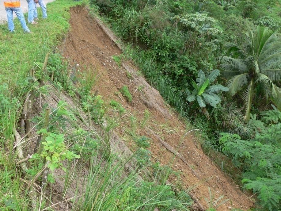
4 Debris Flows in the Towns of Albay Province (Typhoon Reming Nov. 2006) Landslide at Guinsagon, St. Bernard, Leyte (Feb 2006)


5 Features of Disasters in the Philippines Flashfloods, Debris Flows, Landslides, Slope Failures Huge sediment, driftwood and log debris Loss of lives
6 Natural Conditions: Factors of Sediment-Related Disasters a. Typhoons Geographical location along typhoon path 20 typhoons/year, with intense rainfall rain-induced landslides b. Earthquakes Induce landslides that cause massive siltation in river channels c. Volcanic eruptions/explosion of pyroclastic materials Cause rivers to meander and change course Reduce river conveyance capacity
7 Anthropogenic Factors of Sediment- Related Disasters Degradation of Forests Unregulated watershed activities(illegal logging, uncontrolled land development, tillage of sloping areas, etc.) Settlement of people in hazard areas Others e.g., impacts of land use change (change in local hydrology)


8 Anthropogenic Factors Degradation of forests Increases and accelerates surface runoff Erosion and siltation of rivers decreases the conveyance capacity of river channels and water impounding structures
9 Mechanisms of Sediment-Related Disasters insufficient discharge capacity of rivers and weak resistance of slopes against erosion insufficient mitigation measures against floods and sediment disasters insufficient guidance to people for early evacuation insufficient evacuation networks in wider areas access road problems insufficient rescue equipment
10 Main Reasons for Loss of Lives During Disaster Wrong evacuation / No safe evacuation / People do not know what to do Wrong perception of safety behind structural measures Poor knowledge regarding the present danger and hazard / No technical capability No warning / Warning was ignored


11 Low Awareness on Sediment-Related Disasters: Mis-evacuation Leyte Island December 2003 Quezon Province November 2004

12 Hazard and Disaster Damage 82% of damage from disasters is explained by population density and the density of economic activities the magnitude of hazard is responsible for only 7% of damage the effect of disasters is determined primarily by the exposure of people and assets to natural phenomena The best way to avoid disaster is to displace population and activities from disaster-prone areas According to a US study (Choi and Fisher, 2003)
13 Countermessures For Sediment-Related Disaster Mitigation Structural Measures Sabo works Natural slope failure countermeasures Bio-engineering Dredging Non-structural measures Hazard/vulnerability maps Watershed management Monitoring, forecasting and warning system Land use zoning and regulations Information, education and communication programs Evacuation plans
14 What is SABO? SABO( 砂防 ) is a Japanese word SA( 砂 ) means sediment BO( 防 ) means prevention So SABO( 砂防 ) could be translated to prevention of sediment-related disaster. Sabo works are aimed to protect lives, infrastructures, and properties arising from sediment-related disasters in hilly and mountainous terrain.


15 Sabo Dam Sabo dam in Laoag, Ilocos Norte Slit type, Ormoc, Leyte
16 Risk Management of Sediment Related Disasters along National Highways Road Closure Disaster A road closure disaster (road slope failure) is a disaster which causes closure of the whole or partial width of the road (soil collapse, rock slope collapse, landslide, road slips, debris flow, river erosion, coastal erosion) Increasing occurrences losses from reopening costs of roads, loss of lives, detour costs, and damages to electricity, communication and other infrastructures installed along the road
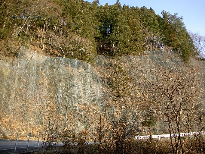
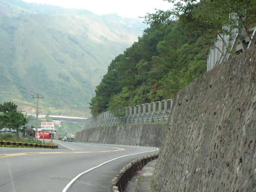
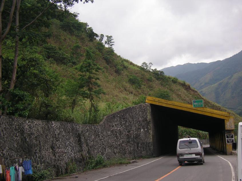
17 COUNTERMEASURES Sediment Disasters Along National Highways Rock Shed Catch Fence Catch Net
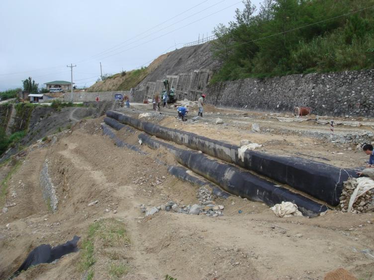
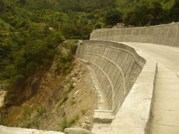
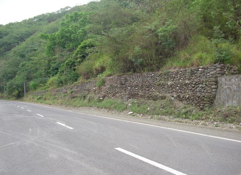
18 COUNTERMEASURES Reinforced Embankment (Geo-textile) Bio-engineering (Coco-net) Crib Wall Gabion Wall
19 Non-Structural Measures Reduce the community s vulnerability to the sediment disaster Avert the loss of life Reduce damages to properties Increase community s resilience towards sediment-related disaster Ensure the effect of structural measures to mitigate hazard condition


20 Hazard Maps Source: MGB Camiguin barangay hazard map


21 WARNING!!! Precise knowledge to understand its meaning to avoid panic Enough lead time to induce appropriate reaction Secure to inform the message to all people Warning must be conveyed in an easily understandable manner and in local language through a legally designated single authority. In the dissemination, there should be a tool which is available to poor or far flung people.
22 Public Information, Education and Communication Programs Foster a disaster-aware culture among the identified vulnerable communities. Message delivery mechanisms include primers, comics, posters, pamphlets, TV and radio ads, print ads, messages in movie houses and inclusion of disaster preparedness in school curricula.
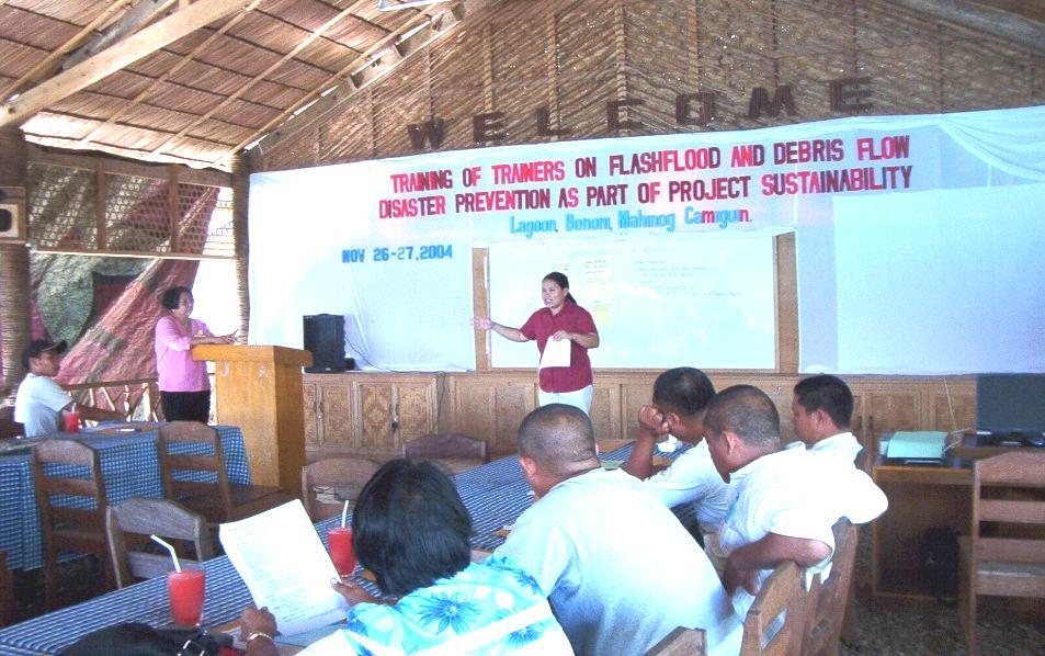
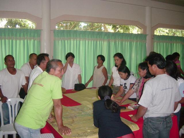
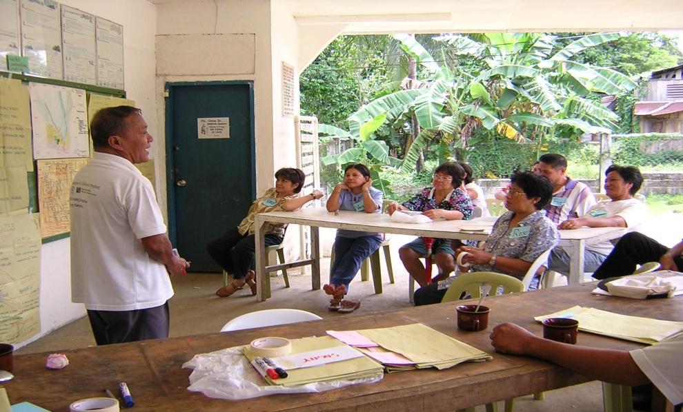
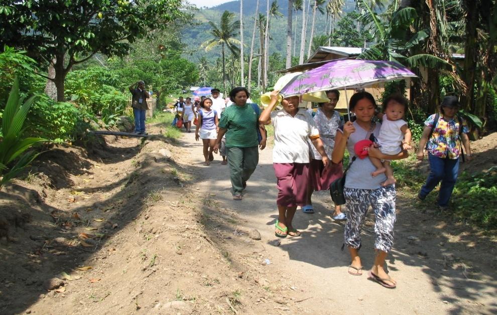
23 Public Awareness/Disaster Preparedness/IEC Training of Trainers Community Dialogues Table Top Exercise Evacuation Drill
24 Public Awareness Materials
25 Land Use Planning, Zoning and Regulations Generally determine the distribution of land and type of development for all provinces/municipalities/cities Important in regulating the use of land to prevent encroachment of waterways by illegal settlers Dissuade the settlement of communities in flood plains and in hazard prone areas Determine areas susceptible to slope collapse and sediment-related hazards
26 Overview of Disaster Management Capacity disaster management system needs to be enormously improved there is a critical insufficiency in human resources, technology, equipment, and funding need to take an integrated approach, including establishment of regulations, improvement of institutional system, acquisition of budgets, and promotion of training for professional staff and introduction of equipment
27 Challenges in Sediment Related Disaster Management Increasing protection of communities and properties under threat Improving watershed/river basin management Strengthening institutional and local capacities for flood mitigation Establishing a proper management system of data/information
28 Challenges in Sediment Related Disaster Management Increasing public and private sector awareness and participation Pursuing water and sediment related disaster management Improving enforcement of laws Addressing climate change Good governance


29 Increasing Protection of communities and properties under threat Construction of infrastructures that mitigate the sediment disasters for high risk areas Sabo Dam in Laoag River Budget for maintenance of infrastructures Debris Flow breaker along Kennon Road, Baguio City
30 Improving Watershed/River Basin Management Rehabilitation of watersheds Reforestation Practice of appropriate land cultivation technologies to prevent degradation, erosion and siltation of water bodies Land use plan and zoning considering the hazard prone areas
31 Strengthening Institutional and Local Capacities Human resources development (identification of disaster prone areas, preparation of hazard maps and in the monitoring and warning for evacuation) Introduction of new technologies (high technologies for increased accuracy in forecasting) Provision of logistics such as equipment and budget (increase rain and stream flow stations, disaster management programs)
32 Establishing a Proper Management System of Data/Information Establishing a well-structured information system (characteristics, natural, social and economic conditions, that serve as influential factors contributing to disasters) Updating of topographic maps covering the country at a scale of 1/250,000 Publication of topographic maps of 1/10,000 scale necessary for planning mitigation measures and for preparing hazard maps Increasing the number of rainfall stations and water level stations Updating and managing land use maps
33 Increasing Public and Private Sector Awareness and Participation Community awareness and recognition of dangers in living in hazard prone areas Community involvement in disaster risk management Promotion of education and awareness campaign Improvement of disaster preparedness and response
34 Addressing Climate Change Impacts Philippine Climate Change Scenario Phil. Strategy on CC Adaptation, June 2010 Rise in mean annual temperature by about C to C for 2020; C to C by 2050; Reduction in rainfall in most areas in Mindanao for all seasons by 2050; Increasing trend in the number of tropical cyclones in the Visayas; Decreasing trend in the frequency of tropical cyclones in Mindanao Storm rainfall intensity is likely to increase by 11-20% by 2050 (Cavite Lowland Study, 2008)
35 Countermeasures to Sediment-Related Disasters Combination of Structural & Non-Structural Measures DPWH Role of LGU Role of country Role of people Role of agencies To mitigation of sediment disaster Structural measures Non-structural measures


36 Thank you for your attention!!! Challenges on Sediment-Related Disaster Mitigation
GENERAL. CHAPTER 1 BACKGROUND AND PURPOSE OF THE GUIDELINES Background of the Guidelines Purpose of the Guidelines...
 GENERAL CHAPTER 1 BACKGROUND AND PURPOSE OF THE GUIDELINES... 1 1.1 Background of the Guidelines... 1 1.2 Purpose of the Guidelines... 3 CHAPTER 2 APPLICATION OF THE GUIDELINES... 3 2.1 Potential Users
GUIDELINES FOR CONSTRUCTION TECHNOLOGY TRANSFER DEVELOPMENT OF WARNING AND EVACUATION SYSTEM AGAINST SEDIMENT DISASTERS IN DEVELOPING COUNTRIES
 GUIDELINES FOR CONSTRUCTION TECHNOLOGY TRANSFER DEVELOPMENT OF WARNING AND EVACUATION SYSTEM AGAINST SEDIMENT DISASTERS IN DEVELOPING COUNTRIES MARCH 2004 Ministry of Land, Infrastructure and Transport
Assessing Hazards and Risk
 Page 1 of 6 EENS 204 Tulane University Natural Disasters Prof. Stephen A. Nelson Assessing Hazards and Risk This page last updated on 07-Jan-2004 As discussed before, natural disasters are produced by
Hazard Resilience Index (HRI) Earthquakes, Tsunamis, and Volcanoes
 Earthquakes, Tsunamis, and Volcanoes") Hazard Index (HRI) Earthquakes, Tsunamis, and Volcanoes Earthquakes Tsunamis Volcano-Ash Falls, Projectiles and Lateral Blasts, Pyroclastic Flows and Lava Flows Earthquakes, Tsunamis and Volcanoes Please
Hazard Index (HRI) Earthquakes, Tsunamis, and Volcanoes Earthquakes Tsunamis Volcano-Ash Falls, Projectiles and Lateral Blasts, Pyroclastic Flows and Lava Flows Earthquakes, Tsunamis and Volcanoes Please
The Application of Sabo Technology for Lahars Flood Mitigation and Warning System in Volcanic Area. Agus Sumaryono Bambang Sukatja F.
 The Application of Sabo Technology for Lahars Flood Mitigation and Warning System in Volcanic Area Agus Sumaryono Bambang Sukatja F. Tata Yunita BACKGROUND The Indonesia Government has constructed several
Progress Report. Flood Hazard Mapping in Thailand
 Progress Report Flood Hazard Mapping in Thailand Prepared By: Mr. PAITOON NAKTAE Chief of Safety Standard sub-beuro Disaster Prevention beuro Department of Disaster Prevention and Mitigation THAILAND E-mail:
Disaster Risk Assessment: Opportunities for GIS and data management with Open DRI
 Disaster Risk Assessment: Opportunities for GIS and data management with Open DRI Jacob Opadeyi Department of Geomatics Engineering and Land Management, The University of the West Indies, St. Augustine,
Landslide Disaster Management in Sri Lanka and Nichola Oya as a Case study. Group 16 Gamini Jayathissa Udeni Nawagamuwa
 Landslide Disaster Management in Sri Lanka and Nichola Oya as a Case study Group 16 Gamini Jayathissa Udeni Nawagamuwa Taiwan Sri lanka >2582 mm, max >5000mm NE= Nov. to Feb 1750 2500 mm >2500 mm Central
Risk Management Strategy
 Risk Management Strategy 1 Purpose To protect the component parts of the World Heritage property as well as the lives and the property of visitors and residents from disasters such as volcanic eruptions,
Overview of Philippine Geohazards Programs
 Overview of Philippine Geohazards Programs 53 rd CCOP Annual Session CCOP-IUGS Task Group on Geohazards Joint Seminar Cebu City, PHILIPPINES October 18, 2017 Renato U. Solidum, Jr. Department of Science
Use of Climate information in Disaster Risk Management in Zimbabwe
 Use of Climate information in Disaster Risk Management in Zimbabwe WMO Regional Technical Meeting & User/CONOPS Workshop, 28 th October 2015 Lameck Betera Department of Civil Protection Institutional Arrangements
DAGUPAN CITY EXPERIENCES, GOOD PRACTICES, CHALLENGES AND LESSONS LEARNED ON DISASTER RISK MANAGEMENT
 DAGUPAN CITY EXPERIENCES, GOOD PRACTICES, CHALLENGES AND LESSONS LEARNED ON DISASTER RISK MANAGEMENT Reducing Vulnerability to Climate Change Impacts and Related Natural Disasters in East Asia 12 and 13
12/05/2016. The First step in Adaptation to future climate change Reduce Vulnerability and Exposure to present Climate Variability (IPCC 2014)
") Integrating CCA, DRR and L+D to Address Emerging Challenges due to Slow Onset Processes Joy Jacqueline Pereira (Project Leader), SEADPRI-Universiti Kebangsaan Malaysia, Nguyen Van Thang (Collaborator),
Integrating CCA, DRR and L+D to Address Emerging Challenges due to Slow Onset Processes Joy Jacqueline Pereira (Project Leader), SEADPRI-Universiti Kebangsaan Malaysia, Nguyen Van Thang (Collaborator),
Use of Geospatial data for disaster managements
 Use of Geospatial data for disaster managements Source: http://alertsystemsgroup.com Instructor : Professor Dr. Yuji Murayama Teaching Assistant : Manjula Ranagalage What is GIS? A powerful set of tools
INDONESIA IMPACT BASED FORECAST PROGRAM
 INDONESIA IMPACT BASED FORECAST PROGRAM Seoul, 19-21 November 2018 The 2nd Regional Workshop on Impact-based Forecasts in Asia Indonesia Agency for Meteorology Climatology and Geophysics (BMKG) A. Fachri
DEBRIS FLOW DISASTER MITIGATION THROUGH COMMUNITY-BASED INTEGRATED SEDIMENT MANAGEMENT (BEST PRACTICE IN MT. MERAPI AREA, INDONESIA)
") Civil Engineering Forum Volume XXI/3 - September 2012 DEBRIS FLOW DISASTER MITIGATION THROUGH COMMUNITY-BASED INTEGRATED SEDIMENT MANAGEMENT (BEST PRACTICE IN MT. MERAPI AREA, INDONESIA) K. Otani Yachiyo
Civil Engineering Forum Volume XXI/3 - September 2012 DEBRIS FLOW DISASTER MITIGATION THROUGH COMMUNITY-BASED INTEGRATED SEDIMENT MANAGEMENT (BEST PRACTICE IN MT. MERAPI AREA, INDONESIA) K. Otani Yachiyo
Table G - 6. Mitigation Actions Identified for Implementation by the City of Kent ( ) (From Wilkin County Master Mitigation Action Chart)
 (From Wilkin County Master Mitigation Action Chart)") Table G - 6. Actions Identified by the () (From Master Action Chart) Multi-Hazard Plan, 2017 Action Comments 5 All-Hazards Local Planning & Regulations Update the Operations Plan on an annual basis. Work
Table G - 6. Actions Identified by the () (From Master Action Chart) Multi-Hazard Plan, 2017 Action Comments 5 All-Hazards Local Planning & Regulations Update the Operations Plan on an annual basis. Work
Landslide Hazard Assessment Methodologies in Romania
 A Scientific Network for Earthquake, Landslide and Flood Hazard Prevention SciNet NatHazPrev Landslide Hazard Assessment Methodologies in Romania In the literature the terms of susceptibility and landslide
Applying Hazard Maps to Urban Planning
 Applying Hazard Maps to Urban Planning September 10th, 2014 SAKAI Yuko Disaster Management Expert JICA Study Team for the Metro Cebu Roadmap Study on the Sustainable Urban Development 1 Contents 1. Outline
Sediment Disasters and Mass Movement (SD&M 2 ) NATIONAL DISASTER MANAGEMENT RESEARCH INSTITUTE
 NATIONAL DISASTER MANAGEMENT RESEARCH INSTITUTE") Sediment Disasters and Mass Movement (SD&M 2 ) Contents Outline of SD&M 2 Major outcomes Issues and conclusions Prologue Mass movement in Ulsan, Korea by Typhoon CHABA on Oct. 5. Outline of SD&M 2 Activities
Sediment Disasters and Mass Movement (SD&M 2 ) Contents Outline of SD&M 2 Major outcomes Issues and conclusions Prologue Mass movement in Ulsan, Korea by Typhoon CHABA on Oct. 5. Outline of SD&M 2 Activities
They include earthquakes, volcanic eruptions, floods, landslides, and other processes and occurrences. They are included in the broader concept of.
 They include earthquakes, volcanic eruptions, floods, landslides, and other processes and occurrences. They are included in the broader concept of. In general, natural processes are labeled hazardous only
Final Presentation on Disaster Risk Management in Japan. Through ADRC V. R Programme. Main Findings and Action Plan:
 Final Presentation on Disaster Risk Management in Japan Through ADRC V. R Programme Main Findings and Action Plan: Problem/Hazard and Disaster in Japan Good Practiced on Disaster Risk Management in Japan
Interpretive Map Series 24
 Oregon Department of Geology and Mineral Industries Interpretive Map Series 24 Geologic Hazards, and Hazard Maps, and Future Damage Estimates for Six Counties in the Mid/Southern Willamette Valley Including
In Issue of International Sabo News Letter
 In Issue of International Sabo News Letter I had an opportunity to make a keynote speech on March 18 2003 at the session on Sedimentrelated Issues at the 3rd World Water Forum held in (Kyoto) Japan. Chairing
Disaster Management and Spatial Data An Experience of Sri Lanka for Joint project team meeting 2012
 Disaster Management and Spatial Data An Experience of Sri Lanka for Joint project team meeting 2012 1 by Padma Kumara Withana Provincial Surveyor General Uva Province 2 Out line ü Introduction ü Natural
Debris flow: categories, characteristics, hazard assessment, mitigation measures. Hariklia D. SKILODIMOU, George D. BATHRELLOS
 Debris flow: categories, characteristics, hazard assessment, mitigation measures Hariklia D. SKILODIMOU, George D. BATHRELLOS Natural hazards: physical phenomena, active in geological time capable of producing
Report. Developing a course component on disaster management
 Report Developing a course component on disaster management By Chira Prangkio Tawee Chaipimonplin Department of Geography, Faculty of Social Sciences, Chiang Mai University Thailand Presented at Indian
Disaster RISK Management : Bhutanese Scenario
 Disaster RISK Management : Bhutanese Scenario Expert Group Meeting (EGM) on Geo-referenced Information Systems for Disaster Risk Management (Geo-DRM) and sustaining the Community of Practice (COP), Bangkok,
8 Current Issues and Research on Sediment Movement in the River Catchments of Japan
 8 Current Issues and Research on Sediment Movement in the River Catchments of Japan YUTAKA ICHIKAWA INTRODUCTION Prediction of sediment movement is one of the challenging tasks in water-related research.
Ayubowan. Management (CBDRM) Community Based Disaster Risk. Towards Disaster Resilient Community Developed by Disaster Management Centre,
 Community Based Disaster Risk. Towards Disaster Resilient Community Developed by Disaster Management Centre,") Ayubowan Community Based Disaster Risk Management (CBDRM) Towards Disaster Resilient Community 5-20 Purpose of this activity To know the risks in community to prepare for future disasters To exchange knowledge
Ayubowan Community Based Disaster Risk Management (CBDRM) Towards Disaster Resilient Community 5-20 Purpose of this activity To know the risks in community to prepare for future disasters To exchange knowledge
A Data Fusion Approach to Real-time Monitoring Systems and Information Management
 Landslide Preparedness in the ASEAN Member States A Data Fusion Approach to Real-time Monitoring Systems and Information Management Jessada Karnjana, PhD National Electronics and Computer Technology Center
West Carroll Parish Hazard Mitigation Plan Update Public Meeting. August 25, 2015 Oak Grove, LA
 West Carroll Parish Hazard Mitigation Plan Update Public Meeting August 25, 2015 Oak Grove, LA Agenda Hazard Mitigation Planning Process SDMI Staff Risk Assessment SDMI Staff Update on Previous/Current
Term Knowledge Using and applying Grade Criteria Autumn 1 Assessment window October Natural hazards pose major risks to people and property.
 Assessment Schedule Year 9 2015/6 Term Knowledge Using and applying Grade Criteria Autumn 1 Assessment window October 2015 3.1.1.2 Tectonic Natural hazards pose major risks to people and property. Definition
APPROACH TO THE SPANISH WATER ORGANISATION IMPROVING FLOOD HAZARD MAPPING, LAWS AND AUTHORITIES COORDINATION
 "Workshop On Land Use Planning And Water Management, With Focus On Flood Risk Management Oslo, Norway. Wednesday 31 January and Thursday 1 February 2007 APPROACH TO THE SPANISH WATER ORGANISATION IMPROVING
Community-Based Flood Early Warning System (CBFEWS)
") Community-Based Flood Early Warning System (CBFEWS) Prepared by: Eng r. Hilario G. Esperanza Eng r.. Socrates F. Paat,, Jr. Flood Forecasting Branch PAGASA Weather Bureau Department of Science and Technology
Community-Based Flood Early Warning System (CBFEWS) Prepared by: Eng r. Hilario G. Esperanza Eng r.. Socrates F. Paat,, Jr. Flood Forecasting Branch PAGASA Weather Bureau Department of Science and Technology
International Symposium on Natural Disaster Mitigation. Local vulnerability assessment of landslides and debris flows
 International Symposium on Natural Disaster Mitigation of landslides and debris flows Lessons learnt from Cam Pha town and Van Don district, Quang Ninh province, Vietnam Nguyen Quoc Phi Faculty of Environment
Impacts of Climate Change and Water-Related Disaster Reduction Management in the Asia-Pacific Region
 Impacts of Climate Change and Water-Related Disaster Reduction Management in the Asia-Pacific Region Katumi MUSIAKE Professor, Fukushima University Secretary General, Asia Pacific Association of Hydrology
Measuring Disaster Risk for Urban areas in Asia-Pacific
 Measuring Disaster Risk for Urban areas in Asia-Pacific Acknowledgement: Trevor Clifford, Intl Consultant 1 SDG 11 Make cities and human settlements inclusive, safe, resilient and sustainable 11.1: By
DRRM in the Philippines: DRRM Projects, Geoportals and Socio-Economic Integration
 Regional workshop on Geo-referenced information system for improving disaster risk preparedness and management in Asia and the Pacific 26-27 June 2014, UNCC, Bangkok, Thailand DRRM in the Philippines:
Natural Disasters & Assessing Hazards and Risk. Natural Hazards and Natural Disasters
 Page 1 of 9 EENS 3050 Tulane University Natural Disasters Prof. Stephen A. Nelson Natural Disasters & Assessing Hazards and Risk This page last updated on 09-Jan-2018 Natural Hazards and Natural Disasters
Enhancing Preparedness and Early Warning in Disaster Risk Reduction
 Enhancing Preparedness and Early Warning in Disaster Risk Reduction Fifth Technical Conference on Management of Meteorological and Hydrological Services in Regional Association V at PETALING JAYA, MALAYSIA
Vulnerability of Bangladesh to Cyclones in a Changing Climate
 Vulnerability of Bangladesh to Cyclones in a Changing Climate Susmita Dasgupta Kiran Pandey Mainul Huq Zahirul Huq Khan M.M. Zahid Ahmed Nandan Mukherjee Malik Fida Khan 2010 Bangladesh: Tropical Cyclone
Improvement of Hazard Assessment and Management in the Philippines
 Improvement of Hazard Assessment and Management in the Philippines (2014 Summer Training Course for Slope Land Disaster Reduction) Ian Alejandrino (Philippines) Nguyen Manh Hieu (Vietnam) Presentation
VINCENT COOPER Flood Hazard Mapping Consultant
 FLOOD HAZARD MAPPING OF GRENADA FINAL REPORT (NON-TECHNICAL) By VINCENT COOPER Flood Hazard Mapping Consultant For the Caribbean Development Bank January, 2006 TABLE OF CONTENTS INTRODUCTION 1 METHODOLOGY
Word Cards. 2 map. 1 geographic representation. a description or portrayal of the Earth or parts of the Earth. a visual representation of an area
 Name: Date: Hour: Word Cards 1 geographic representation a description or portrayal of the Earth or parts of the Earth Example: A map is a representation of an actual location or place. 2 map a visual
Debris flow hazard mapping with a random walk model in Korea
 Risk Analysis VII PI-627 Debris flow hazard mapping with a random walk model in Korea H.-J. Youn, C.-W. Lee & C.-S. Woo Korea Forest Research Institute, Korea Abstract Recently, the sediment-related disasters,
Proposal Report On Flood Hazards Mapping Project In Xebangfai River
 Proposal Report On Flood Hazards Mapping Project In Xebangfai River Prepared By Mr. Boualaythong KOUMPHONH Climate Division Department of Meteorology and Hydrology Water Resources and Environment Administration
National Public Weather and Warning Services in the Swaziland Meteorological Service Dennis S.Mkhonta /
 National Public Weather and Warning Services in the Swaziland Meteorological Service Dennis S.Mkhonta dennis.mkhonta@gmail.com / dennis@swazimet.gov.sz Introduction Swaziland s geographical position exposes
Floods 2014 a wake up call to natural hazards
 Floods 2014 a wake up call to natural hazards Floods affected 119 municipalities (out of 165) 22% of total population affected by floods More than 30 municipalities sustained extensive damage 57 lives
World Meteorological Organization
 World Meteorological Organization Opportunities and Challenges for Development of Weather-based Insurance and Derivatives Markets in Developing Countries By Maryam Golnaraghi, Ph.D. Head of WMO Disaster
SEISMIC RISK ASSESSMENT IN ARMENIA
 SEISMIC RISK ASSESSMENT IN ARMENIA Hovhannes Khangeldyan Head of National Crisis Management Center Rescue Service Ministry of Emergency Situations of the Republic of Armenia Tokyo, 2016 ARMENIA: GEOGRAPHICAL
Rebuilding Flood-Conscious Society
 A zone where strong flood flow or river bank erosion by levee breach are anticipated, which likely to occur collapsing/washing away of house. Set up the joint councils by relative stakeholders(river managers,
Disaster Risk Reduction and
 6 th ICRM Symposium 2015 Disaster Risk Reduction and 2015/04/23 Resilience in Taipei Outline Natural Disaster and Loss in Taiwan Climate Change and Geohazard Hazard Alert & App Monitoring & Modeling Land
What Are Disasters? The Rescue Kids Trio!
 The Rescue Kids Trio! What Are Disasters? This manual was made possible through funding by the Council of Local Authorities for International Relations. Disasters and emergency preparedness Emergency preparedness
The UN-GGIM: Europe core data initiative to encourage Geographic information supporting Sustainable Development Goals Dominique Laurent, France
 INSPIRE conference Strasbourg 6 September 2017 The UN-GGIM: Europe core data initiative to encourage Geographic information supporting Sustainable Development Goals Dominique Laurent, France Introduction
GIS as a tool in flood management
 GIS for the United Nations and the International Community Conference Panel: GIS and Capacity - How Territorial Planning Benefits from Geospatial Information 3-5 April 2012 Geneva, Switzerland GIS as a
Title: Concepts of Flood Risk
 Title: Concepts of Flood Risk Title Prepared by: Dr. Mohammed Abdulkadir and Dr. Micha Werner Outline of presentation Hazards Flood Event Flood losses Classification of floods Flood management Concepts
Summary of the Presentation
 CBMS & GIS Utilization in Planning for Disaster Risk Reduction & Management (DRRM) and Climate Change Adaptation (CCA) Presented by: ENGR. MARIVIC J. NIERRAS, EnP Planning Officer IV and Officer-In-Charge
Roles of NGII in successful disaster management
 The Second UN-GGIM-AP Plenary Meeting Roles of NGII in successful disaster management Republic of Korea Teheran Iran 28 October 2013 Sanghoon Lee, Ph.D. NGII Outline Type of Disasters Occur in Korea Practical
COUNTRY PRESENTATION ON MR JAYNAL ABEDIN JOINT SECRETARY ( WORKS & DEVELOPMENT ) MINISTRY OF DEFENCE
 MINISTRY OF DEFENCE") COUNTRY PRESENTATION ON By MR JAYNAL ABEDIN JOINT SECRETARY ( WORKS & DEVELOPMENT ) MINISTRY OF DEFENCE Bangladesh Geographical Location of Bangladesh Bangladesh Country at a Glance Physical Features 1,230
COUNTRY PRESENTATION ON By MR JAYNAL ABEDIN JOINT SECRETARY ( WORKS & DEVELOPMENT ) MINISTRY OF DEFENCE Bangladesh Geographical Location of Bangladesh Bangladesh Country at a Glance Physical Features 1,230
Bossier Parish Hazard Mitigation Plan Update Public Meeting. August 10, 2016 Bossier City, LA
 Bossier Parish Hazard Mitigation Plan Update Public Meeting August 10, 2016 Bossier City, LA Agenda Hazard Mitigation Planning Process SDMI Staff Risk Assessment SDMI Staff Update on Previous/Current Mitigation
Oregon APA Legal Issues Workshop December 7, Tricia Sears, DLCD With information from Bill Burns, DOGAMI
 Oregon APA Legal Issues Workshop December 7, 2018 Tricia Sears, DLCD With information from Bill Burns, DOGAMI How this Topic Arrived WE FREQUENTLY HEAR CONCERNS ABOUT LIABILITY AND TAKINGS. Current federal
United States Multi-Hazard Early Warning System
 United States Multi-Hazard Early Warning System Saving Lives Through Partnership Lynn Maximuk National Weather Service Director, Central Region Kansas City, Missouri America s s Weather Enterprise: Protecting
End-To-End Approach in Early Warning: The Hong Kong Experience
 End-To-End Approach in Early Warning: The Hong Kong Experience M.C. Wong Hong Kong Observatory Hong Kong, China A container vessel collided with the Star Ferry pier during the passage of Typhoon Hope in
Regional Flash Flood Guidance and Early Warning System
 WMO Training for Trainers Workshop on Integrated approach to flash flood and flood risk management 24-28 October 2010 Kathmandu, Nepal Regional Flash Flood Guidance and Early Warning System Dr. W. E. Grabs
3/3/2013. The hydro cycle water returns from the sea. All "toilet to tap." Introduction to Environmental Geology, 5e
 Introduction to Environmental Geology, 5e Running Water: summary in haiku form Edward A. Keller Chapter 9 Rivers and Flooding Lecture Presentation prepared by X. Mara Chen, Salisbury University The hydro
Recent development of the National Hydro-Meteorological Service (NHMS) of Viet Nam for disaster risk reduction
 of Viet Nam for disaster risk reduction") Ministry of Natural Resources and Environment National Hydro-Meteorological Service Recent development of the National Hydro-Meteorological Service (NHMS) of Viet Nam for disaster risk reduction Tran Van
Ministry of Natural Resources and Environment National Hydro-Meteorological Service Recent development of the National Hydro-Meteorological Service (NHMS) of Viet Nam for disaster risk reduction Tran Van
Caribbean Early Warning System Workshop
 Caribbean Early Warning System Workshop Hamonization in Existing EWS April 14-16, 2016 Presenter: Shawn Boyce Caribbean Institute for Meteorology and Hydrology Husbands, St. James Barbados Background Between
2013/03/26. 1.Disaster Flood, Drought, Cyclone/Typhoon, Earthquake, Tsunami, Landslide, Whirlwind, Volcanic eruption 2.
 JSCE Annual Meeting September 5-6, 01, Nagoya International Roundtable Meeting on Multilateral Cooperation/Collaboration in Developing Disaster-Resilient Infrastructures 1.Disaster Flood, Drought, Cyclone/Typhoon,
A Roundup of Recent Debris Flow Events in Taiwan
 2015 International Workshop on Typhoon and Flood APEC Experience Sharing on Hazardous Weather Events and Risk Management A Roundup of Recent Debris Flow Events in Taiwan Hsiao-Yuan(Samuel) Yin Ph.D. sammya@mail.swcb.gov.tw
Assumption Parish Hazard Mitigation Plan Update Public Meeting. September 1, 2015 Napoleonville, LA
 Assumption Parish Hazard Mitigation Plan Update Public Meeting September 1, 2015 Napoleonville, LA Agenda Hazard Mitigation Planning Process SDMI Staff Risk Assessment SDMI Staff Update on Previous/Current
This table connects the content provided by Education Perfect to the NSW Syllabus.
 Education Perfect Geography provides teachers with a wide range of quality, engaging and innovative content to drive positive student learning outcomes. Designed by teachers and written by our in-house
Paul Bridge Meteorologist Vaisala/UKMO Work Groups/Committees: WMO/TRB/AMS
 Paul Bridge Meteorologist Vaisala/UKMO Work Groups/Committees: WMO/TRB/AMS Introduction (a) Identify and establish, if possible, inventories of transport networks in the ECE region which are vulnerable
West Baton Rouge Parish Hazard Mitigation Plan Update Public Meeting. September 9, 2015 Port Allen, LA
 West Baton Rouge Parish Hazard Mitigation Plan Update Public Meeting September 9, 2015 Port Allen, LA Agenda Hazard Mitigation Planning Process SDMI Staff Risk Assessment SDMI Staff Update on Previous/Current
ENGINEERING HYDROLOGY
 ENGINEERING HYDROLOGY Prof. Rajesh Bhagat Asst. Professor Civil Engineering Department Yeshwantrao Chavan College Of Engineering Nagpur B. E. (Civil Engg.) M. Tech. (Enviro. Engg.) GCOE, Amravati VNIT,
LECTURE #11: Volcanoes: Monitoring & Mitigation
 GEOL 0820 Ramsey Natural Disasters Spring, 2018 LECTURE #11: Volcanoes: Monitoring & Mitigation Date: 15 February 2018 I. What is volcanic monitoring? the continuous collection of one or more data sources
Republic of Mozambique
 Republic of Mozambique Second Expert's Symposium on Multi-Hazard Early Warning Systems with focus on the Role of National Meteorological and Hydrological Services 5-7 May 2009, Toulouse France 1. Background
CHAPTER GEOLOGICALLY HAZARDOUS AREAS Applicability Regulations.
 CHAPTER 19.07 GEOLOGICALLY HAZARDOUS AREAS 19.07.010 Applicability. Geologically hazardous areas may pose a threat to the health and safety of citizens when incompatible development is sited in areas of
Born in Unzen The World s First Unmanned Construction of Multilayer Sediment Control Dam Using Sediment Forms Unzen Restoration Project Office
 Born in Unzen The World s First Unmanned Construction of Multilayer Sediment Control Dam Using Sediment Forms Unzen Restoration Project Office Unzen Restoration Project Office Kyushu Regional Construction
KNOWLEDGE NOTE 5-1. Risk Assessment and Hazard Mapping. CLUSTER 5: Hazard and Risk Information and Decision Making. Public Disclosure Authorized
 Public Disclosure Authorized Public Disclosure Authorized Public Disclosure Authorized Public Disclosure Authorized KNOWLEDGE NOTE 5-1 CLUSTER 5: Hazard and Risk Information and Decision Making Risk Assessment
What the. Just happened? THOMPSON WATERSHED DISASTER MITIGATION COMMUNITY FORUM FEBRUARY 14, 2018 Dwayne Meredith, P.Ag.
 What the Just happened? THOMPSON WATERSHED DISASTER MITIGATION COMMUNITY FORUM FEBRUARY 14, 2018 Dwayne Meredith, P.Ag. Agenda Historic context and recent events Policy and scientific information Why this
Role of Hydro-Met Services in Disaster Risk Management
 Role of Hydro-Met Services in Disaster Risk Management Tshewang Rigzin (Mr) National Centre for Hydrology and Meteorology, Bhutan 30 th November 2017 Outline Vision and Mission Functions related to Disaster
Subject Name: SOIL AND WATER CONSERVATION ENGINEERING 3(2+1) COURSE OUTLINE
 COURSE OUTLINE") Subject Name: SOIL AND WATER CONSERVATION ENGINEERING 3(2+1) COURSE OUTLINE (Name of Course Developer: Prof. Ashok Mishra, AgFE Department, IIT Kharagpur, Kharagpur 721 302) Module 1: Introduction and
Subject Name: SOIL AND WATER CONSERVATION ENGINEERING 3(2+1) COURSE OUTLINE (Name of Course Developer: Prof. Ashok Mishra, AgFE Department, IIT Kharagpur, Kharagpur 721 302) Module 1: Introduction and
National Disaster Management Centre (NDMC) Republic of Maldives. Location
 Republic of Maldives. Location") National Disaster Management Centre (NDMC) Republic of Maldives Location Country Profile 1,190 islands. 198 Inhabited Islands. Total land area 300 sq km Islands range b/w 0.2 5 sq km Population approx.
National Disaster Management Centre (NDMC) Republic of Maldives Location Country Profile 1,190 islands. 198 Inhabited Islands. Total land area 300 sq km Islands range b/w 0.2 5 sq km Population approx.
Copernicus EMS: Αξιολόγηση πολλαπλών φυσικών κινδύνων - Σχεδιασμός και Ανάκτηση
 Building Capacity for a Centre of Excellence for EO-based monitoring of Natural Disasters Copernicus EMS: Αξιολόγηση πολλαπλών φυσικών κινδύνων - Σχεδιασμός και Ανάκτηση Γιάννης Παπουτσής ΙΑΑΔΕΤ Εθνικό
Flash Flood Guidance System On-going Enhancements
 Flash Flood Guidance System On-going Enhancements Hydrologic Research Center, USA Technical Developer SAOFFG Steering Committee Meeting 1 10-12 July 2017 Jakarta, INDONESIA Theresa M. Modrick Hansen, PhD
DIPLOMA IN DISASTER MANAGEMENT. (Non-Semester) (With effect from the academic year )
 (With effect from the academic year )") DIPLOMA IN DISASTER MANAGEMENT (Non-Semester) (With effect from the academic year 2013-14) Eligibility for the Course Candidate should have passed the Higher Secondary Examination conducted by the Board
DIPLOMA IN DISASTER MANAGEMENT (Non-Semester) (With effect from the academic year 2013-14) Eligibility for the Course Candidate should have passed the Higher Secondary Examination conducted by the Board
Uses of The Climate and Climate-related Hazard Information in The Adaptation Strategies for Development and Spatial Planning Assessments
 Uses of The Climate and Climate-related Hazard Information in The Adaptation Strategies for Development and Spatial Planning Assessments Wilmar Salim, ST., M. Reg. Dev., Ph.D. Yogyakarta Monday, March
2014 Summer training course for slope land disaster reduction Taipei, Taiwan, Aug
 MINISTRY OF SCIENCE AND TECHNOLOGY HYDROTECH RESEARCH INSTITUTE MINISTRY OF NATURAL RESOURCES AND ENVIRONMENT VIETNAM INSTITUTE OF GEOSCIENCES AND MINERAL RESOURCES (VIGMR) 2014 Summer training course
STATUS OF HAZARD MAPS VULNERABILITY ASSESSMENTS AND DIGITAL MAPS
 JapanInternational Cooperation Agency STATUS OF HAZARD MAPS VULNERABILITY ASSESSMENTS AND DIGITAL MAPS ANGUILLA REPORT THE CARIBBEAN DISASTER EMERGENCY RESPONSE AGENCY () Table of Contents Page Preface
Understanding disaster risk ~ Lessons from 2009 Typhoon Morakot, Southern Taiwan
 Understanding disaster risk ~ Lessons from 2009 Typhoon Morakot, Southern Taiwan Wen Chi Lai, Chjeng-Lun Shieh Disaster Prevention Research Center, National Cheng-Kung University 1. Introduction 08/10
Fukien Secondary School Monthly Vocabulary/Expression List for EMI Subjects Secondary Two. Subject: Geography
 Focus: General Specific : Section Two : Unit One 1 Landslide 2 Downslope movement 3 Rock 4 Soil 5 Gravity 6 Natural hazard 7 Rainwater 8 Friction 9 Hilly relief 10 Unstable 11 Season 12 Saturated 13 Construction
Bawakaraeng Urgent Sediment Control Project
 Departmen Permukiman Umum Direktorat Jenderal Sumber Daya Air Bawakaraeng Urgent Sediment Control Project (The Most Urgent Components) August 2005 1 The Collapse On March 26, 2004, Mt. Sorongan (EL.2,541m)
Modeling Great Britain s Flood Defenses. Flood Defense in Great Britain. By Dr. Yizhong Qu
 Modeling Great Britain s Flood Defenses AIRCurrents Editor s note: AIR launched its Inland Flood Model for Great Britain in December 2008. The hazard module captures the physical processes of rainfall-runoff
Yoshinori KAWAMURA, Oriental Consultants Global Co., Ltd.
 Landslides along National Roads in Central Highland in Sri Lanka: Review on Current Situation and Suggestion for Further Development of Landslide Mitigation along Highways in Sri Lanka Yoshinori KAWAMURA,
The Third UN-GGIM-AP Plenary Meeting. Use of Geospatial Information in Disaster and Coordination among NDMA and Relevant Organizations/Stakeholders
 The Third UN-GGIM-AP Plenary Meeting Use of Geospatial Information in Disaster and Coordination among NDMA and Relevant Organizations/Stakeholders Bali Indonesia 10 November 2014 Bernardus Wisnu Widjaja
Disaster Prevention and Management in Asia: The Context of Human Security and Its Relevance to Infrastructure Planning and Management
 Disaster Prevention and Management in Asia: The Context of Human Security and Its Relevance to Infrastructure Planning and Management Rajib Shaw http://www.iedm.ges.kyoto-u.ac.jp/ Contents Background and
CLIMATE CHANGE ADAPTATION BY MEANS OF PUBLIC PRIVATE PARTNERSHIP TO ESTABLISH EARLY WARNING SYSTEM
 CLIMATE CHANGE ADAPTATION BY MEANS OF PUBLIC PRIVATE PARTNERSHIP TO ESTABLISH EARLY WARNING SYSTEM By: Dr Mamadou Lamine BAH, National Director Direction Nationale de la Meteorologie (DNM), Guinea President,
Flash flood disaster in Bayangol district, Ulaanbaatar
 Flash flood disaster in Bayangol district, Ulaanbaatar Advanced Training Workshop on Reservoir Sedimentation Management 10-16 October 2007. IRTCES, Beijing China Janchivdorj.L, Institute of Geoecology,MAS
Steering Committee on Global Flash Flood Guidance 29 November 2016, Inter-Continental Hotel, Phnom Penh. Cambodia National Weather Services
 Steering Committee on Global Flash Flood Guidance 29 November 2016, Inter-Continental Hotel, Phnom Penh Cambodia National Weather Services Activities and Responsibilities of Research and Flood Forecasting